
WWII Tunnels Hike: Monkey Hill, Smuggler's Ridge, Gin Drinkers' Line & Shing Mun Redoubt
Contents
- Essential Information
- Hike Highlights
- Google Route Map
- How to Get There
- Quick Route Summary
- Detailed Route
- Kowloon Reservoir and Monkeys
- Get to the Kam Shan Family Walk Arch
- The Kam Shan Family Walk Trail
- IMPORTANT: Don't Miss the Turn Up to Golden Hill
- Kam Shan (Golden Hill) Boundary Stones
- The Overgrown Climb Up Golden Hill
- The First Secret World War II Tunnel
- Back to Golden Hill Road
- Getting to Smuggler's Ridge
- IMPORTANT: Don't Miss the Hidden Turn to Smuggler's Ridge
- Smuggler's Ridge
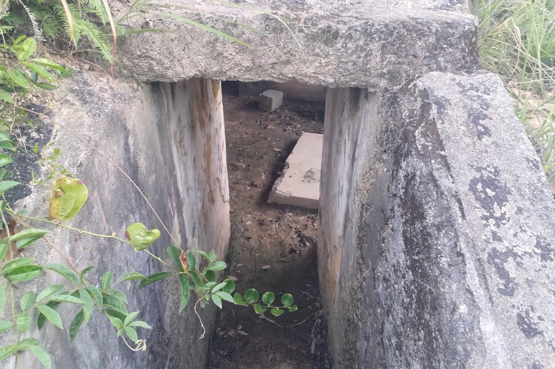
- Shing Mun Redoubt WWII War Tunnels
- The History of the Shing Mun Redoubt Tunnels
- The Eventful Route to the Bus Stop
- Getting Back
Essential WWII Tunnels Hike Details
- District: New Territories
- Duration: 3.5 hours (longer if you want to explore more)
- Distance: 8.7km (more if you explore deeper into the tunnels)
- Highest Elevation: 350ish meters
- Difficulty: 3.5/5
- Facilities: Toilets and vending machines at the Shek Lei Pui Reservoir bus stop (from Kowloon)
Why Do the WWII Tunnels Hike?
I'll start by saying if you just want to explore some cool WWII tunnels without much hiking, do this hike in reverse by taking minibus number 82 from Shui Wo Street in Tsuen Wan and get off at the last stop - Upper Shing Mun Reservoir. Follow the road toward the reservoir until you see the 'Shing Mun War Relics Trail' sign. Heed the sign and you'll get to the Shing Mun Redoubt tunnels well within an hour of being dropped off at the minibus stop.
For those who want an adventure that's pretty much impossible to find anywhere else in the world, you'll want to follow this guide to the letter.
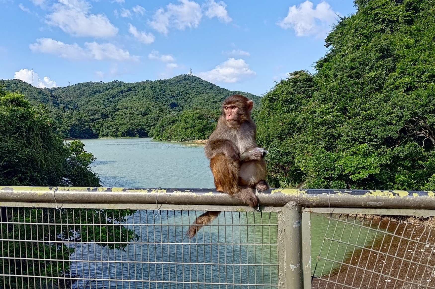
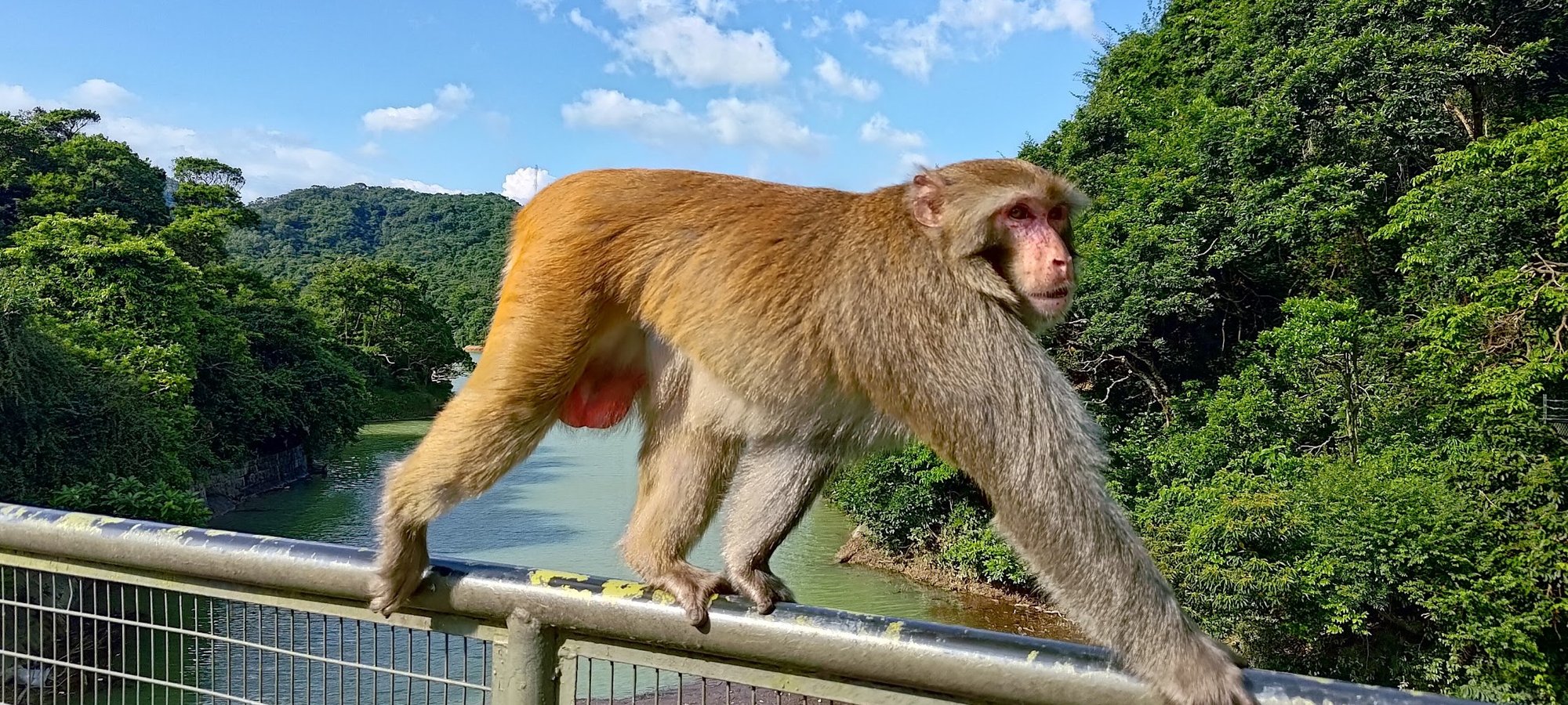
Your journey will begin at Kowloon Reservoir, where you'll come up close and personal with playful macaques. This part of Hong Kong is known as Monkey Hill for good (and obvious) reasons.
You'll then enjoy a tranquil forest path, a tough slog up Golden Hill and some bushwhacking that leads to a secret WWII tunnel that I couldn't find much information about. You're almost guaranteed to have this tunnel to yourself since it's off the beaten path and difficult to find without clear instructions, which this guide will provide (I hope).
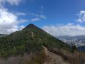
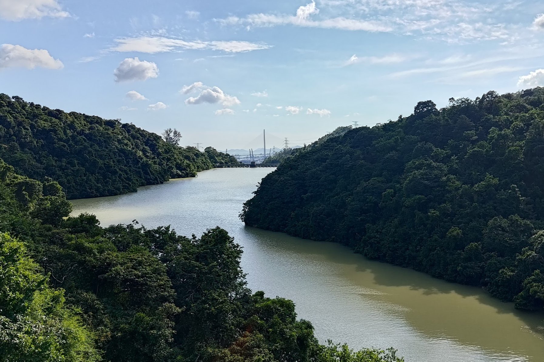
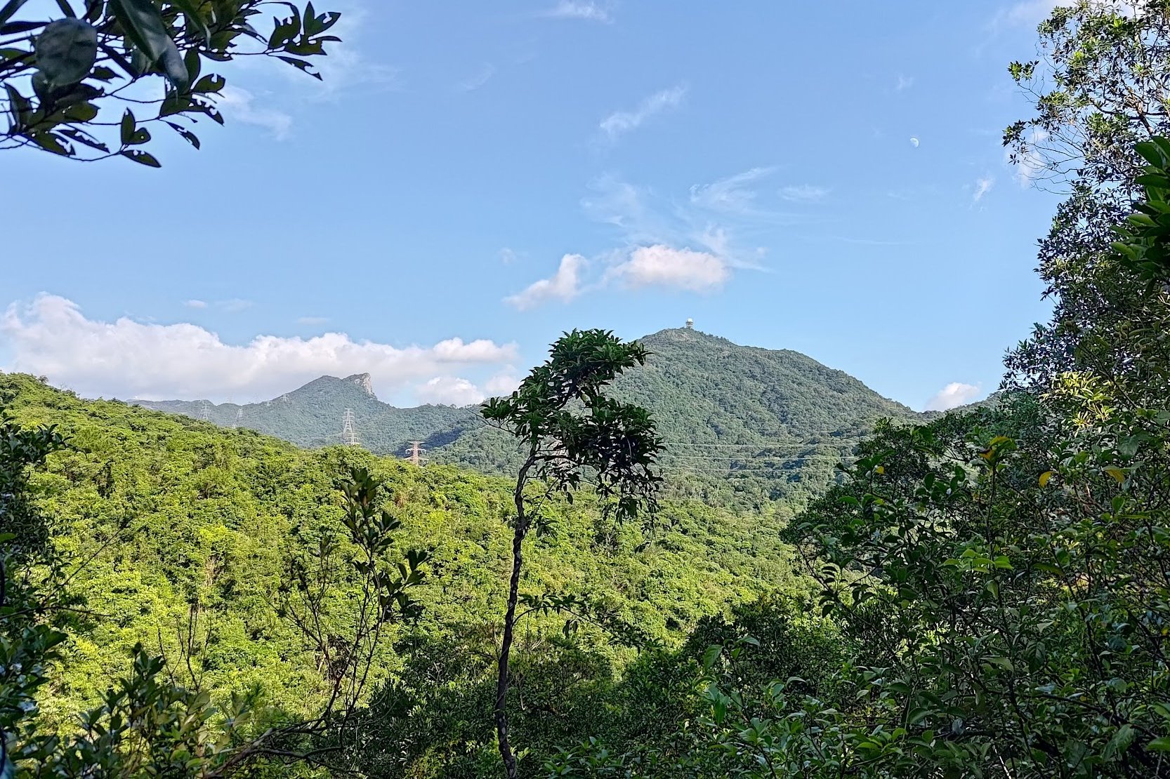
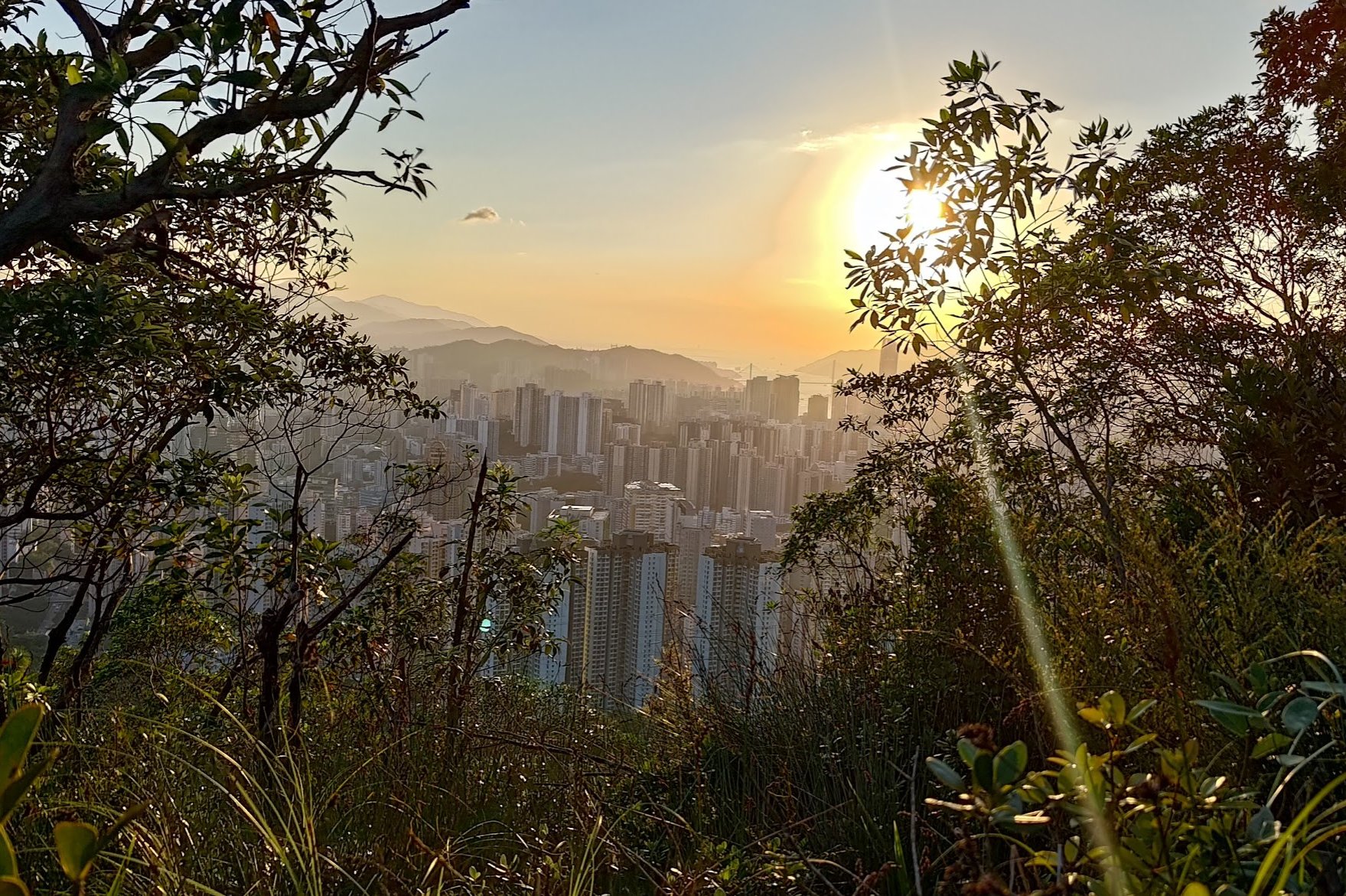
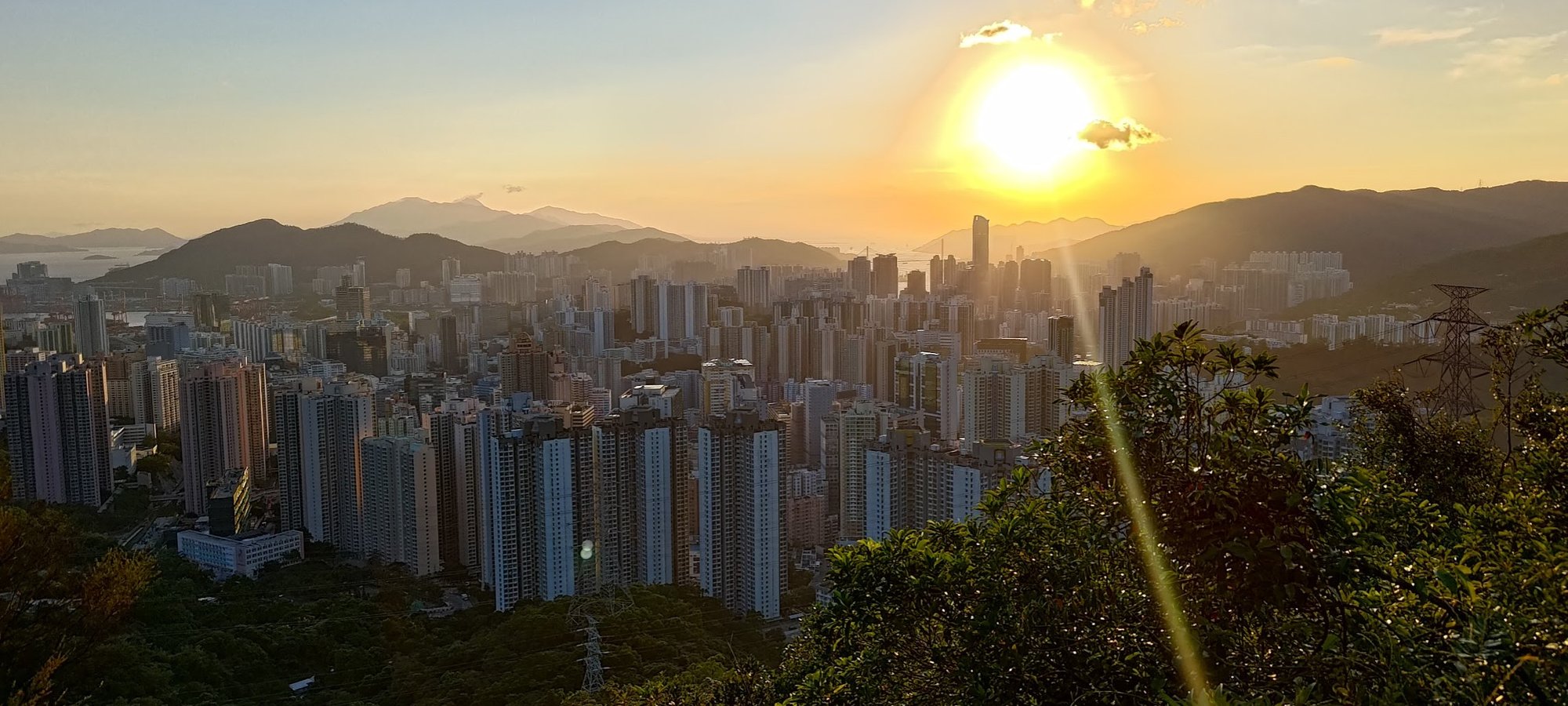
You'll then ascend up the spectacular and epically named Smuggler's Ridge, where you'll have stellar views over the concrete jungle of Kowloon along with serene vistas over the greenery and mountains of the New Territories.
Finally, you'll descend down toward Upper Shing Mun Reservoir, which is when you'll come across the Shing Mun Redoubt, which is a series of well-preserved tunnels that served as the headquarters of the historic Gin Drinkers' Line.
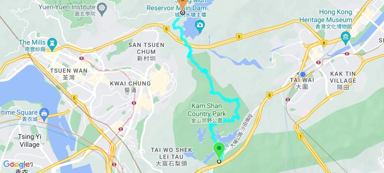
Google Route Map
How to Get to the WWII Tunnels Hike Start Point
There are 2 buses that go to the Kowloon Reservoir hike start point. Grab either of them and get off at the Shek Lei Pui Reservoir stop.
- Bus 81: (From Jordan, West Kowloon, Yau Ma Tei, Mong Kok, Prince Edward, Sham Shui Po) or (Wo Che, Shatin, Tai Wai)
- Bus 72: (From Cheung Sha Wan, Sham Shui Po) or (Tai Wo, Tai Po, Chinese University, Shatin)
By Taxi
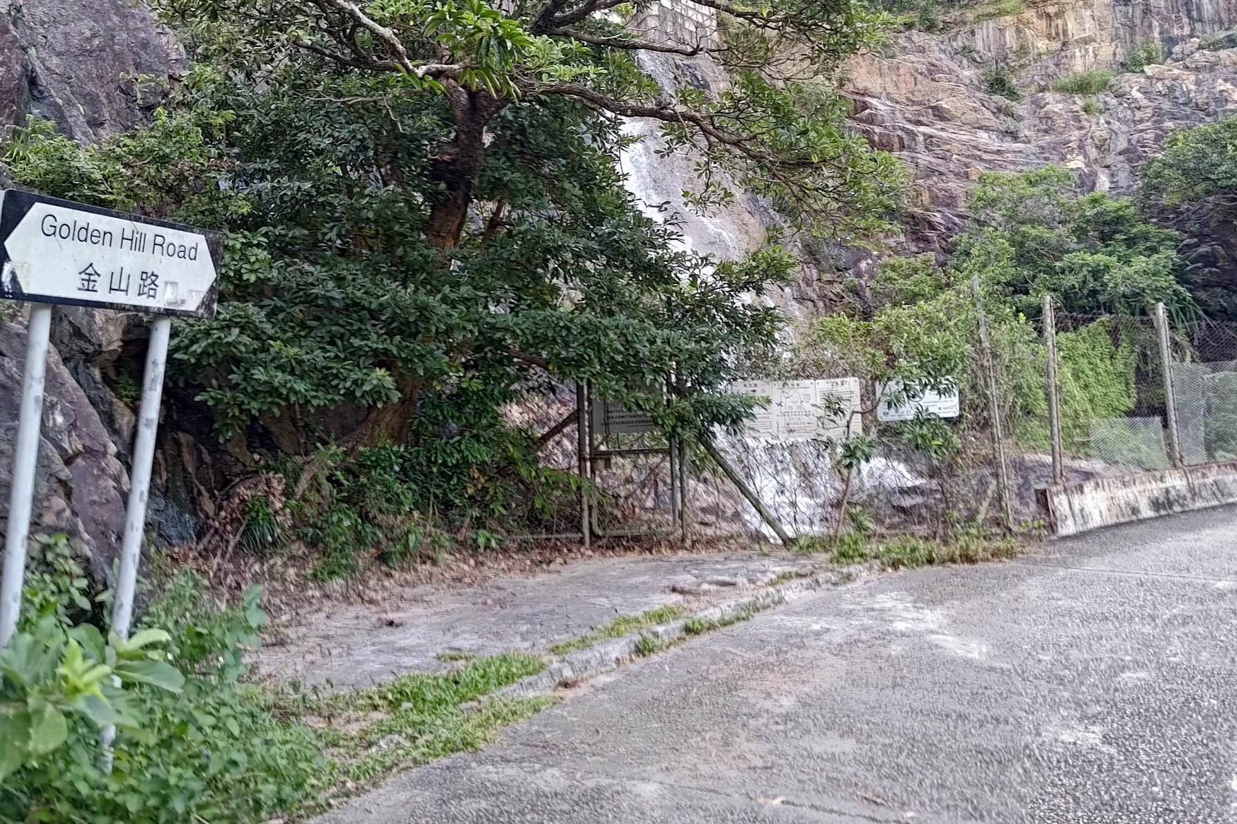
Show this address to the taxi driver to get to the hike start point: 金山路
Quick WWII Tunnels Hike Route Summary
- Get off the bus at the Shek Lei Pui Reservoir stop
- Follow Golden Hill Road down to Kowloon Reservoir (opposite side of the road to the 'Eagle's Nest Nature Trail' arch)
- Cross the bridge and follow Golden Hill Road as it starts to ascend upward
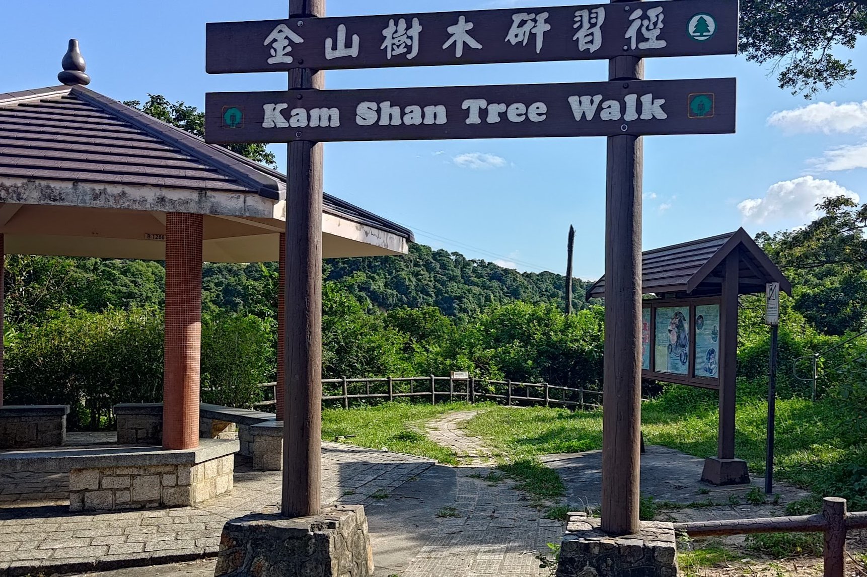
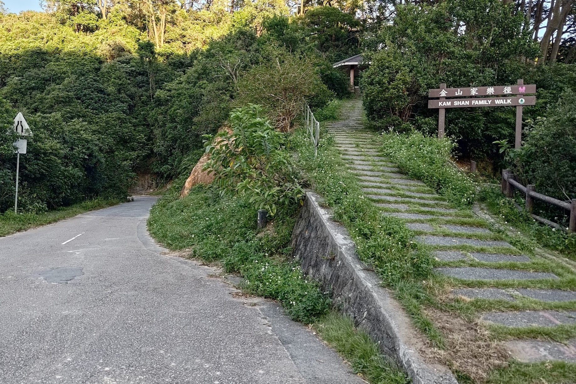
- Ignore the 'Kam Shan Tree Walk' Arch
- Take the path under the 'Kam Shan Family Walk' arch
- Follow the trail for about 25-30 mins
- Ignore the stairs heading down on the right. Take the dirt path upward to your left.
- Ascend and follow the overgrown path marked by ribbons and KWW 1902 markers
- 20-30 minutes later, you will arrive at the first WWII tunnel
- After exploring, take the path on the left (not the one heading up beside the tunnel)
- Continue along another overgrown ribbon-marked path for 15 mins until you reach a smelly bog
- Use the dry logs to cross the bog
- Ignore the concrete stairs to the left and continue straight past the black and gold sign
- On Golden Hill Road, go right (in the direction you came from)
- Climb the concrete steps near the black and gold 'The Wilson Trail' plaque
- After descending take the path on the left with the stone marker
- Begin ascending Smuggler's Ridge and enjoy the epic city views
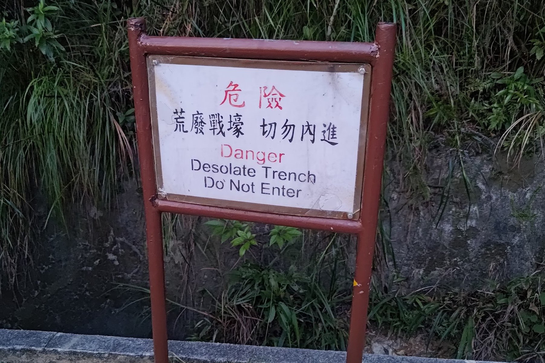
- When descending, look out for the 'Danger Desolate Trench' sign. This is the entrance to part of the Shing Mun Redoubt
- After exploring, make sure to take the concrete steps downward. You'll pass by many more explorable WWII tunnels
- Pass under the 'Maclehose Stage Trail (Section 7)' sign
- Follow the 'Maxicab' sign
- A few minutes lates, follow the 'Minibus Station' sign
- After 10-15 minutes, you will arrive atthe minibus stop
From the Bus Stop to Kowloon Reservoir
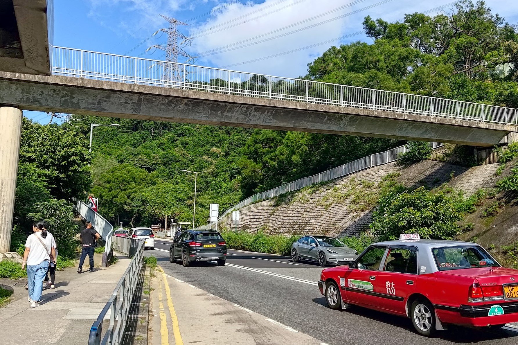
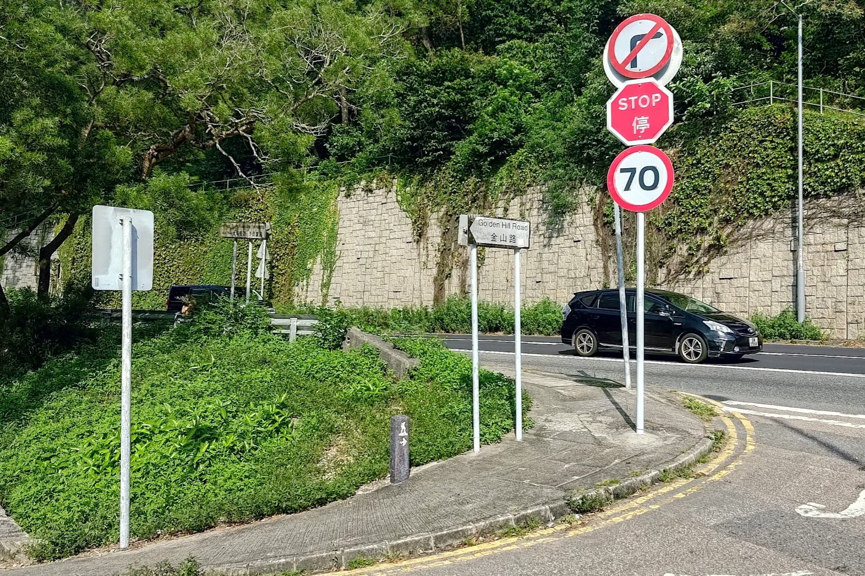
If you took a bus from Kowloon, you simply need to follow Tai Po Road under the footbridge until you see Golden Hill Road on your left.
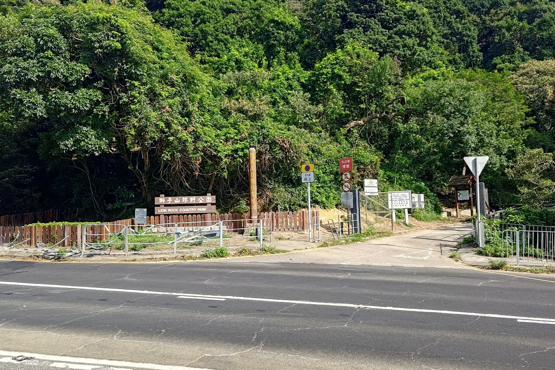
If you took a bus from the New Territories, cross Tai Po Road near the 'Lion Rock Country Park' sign and you'll see Golden Hill Road right in front of you.
Follow Golden Hill road as it gently slopes downward toward Kowloon Reservoir.
Enjoy the presence of the monkeys that'll be all around you, but please don't try to interact with them. It'll probably go pretty poorly.
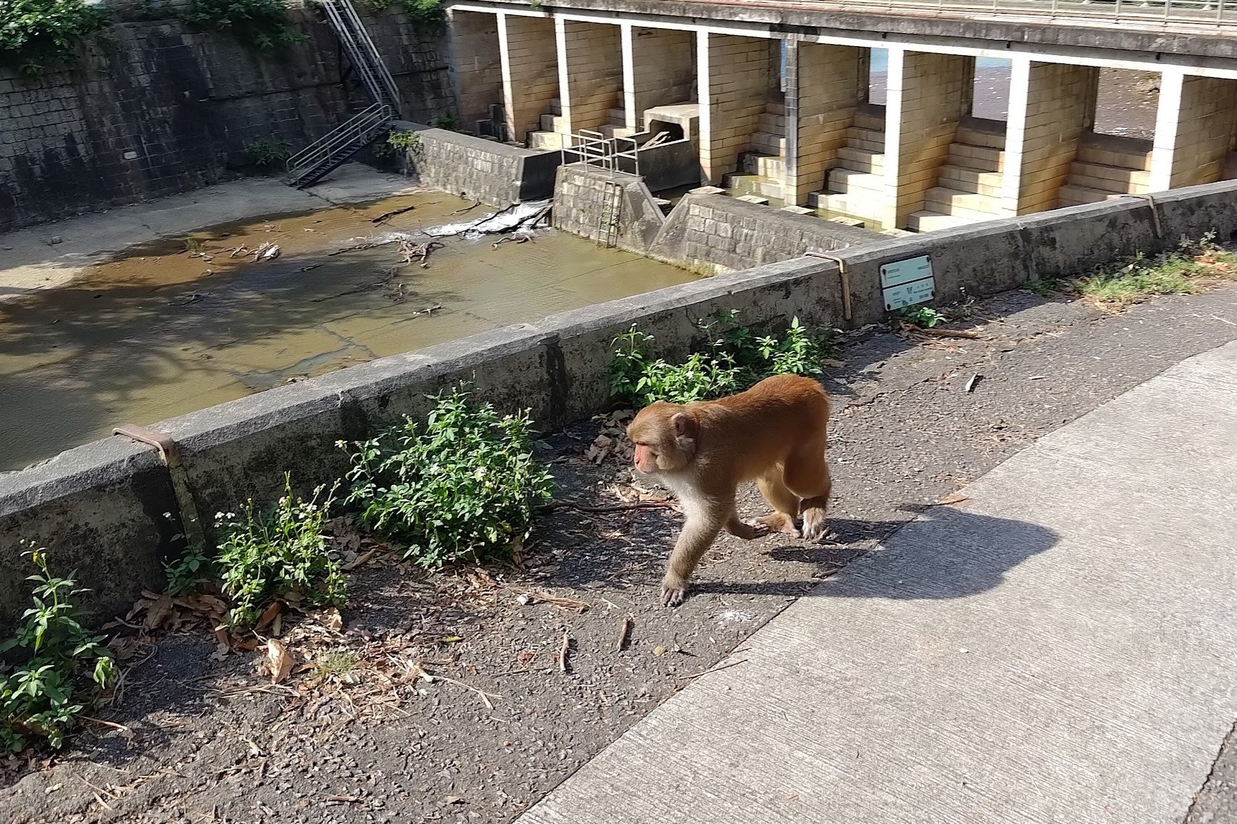
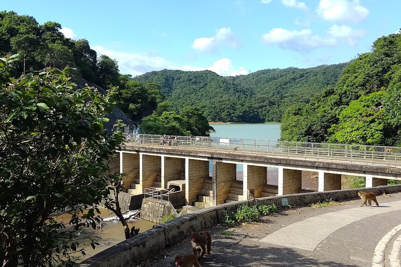
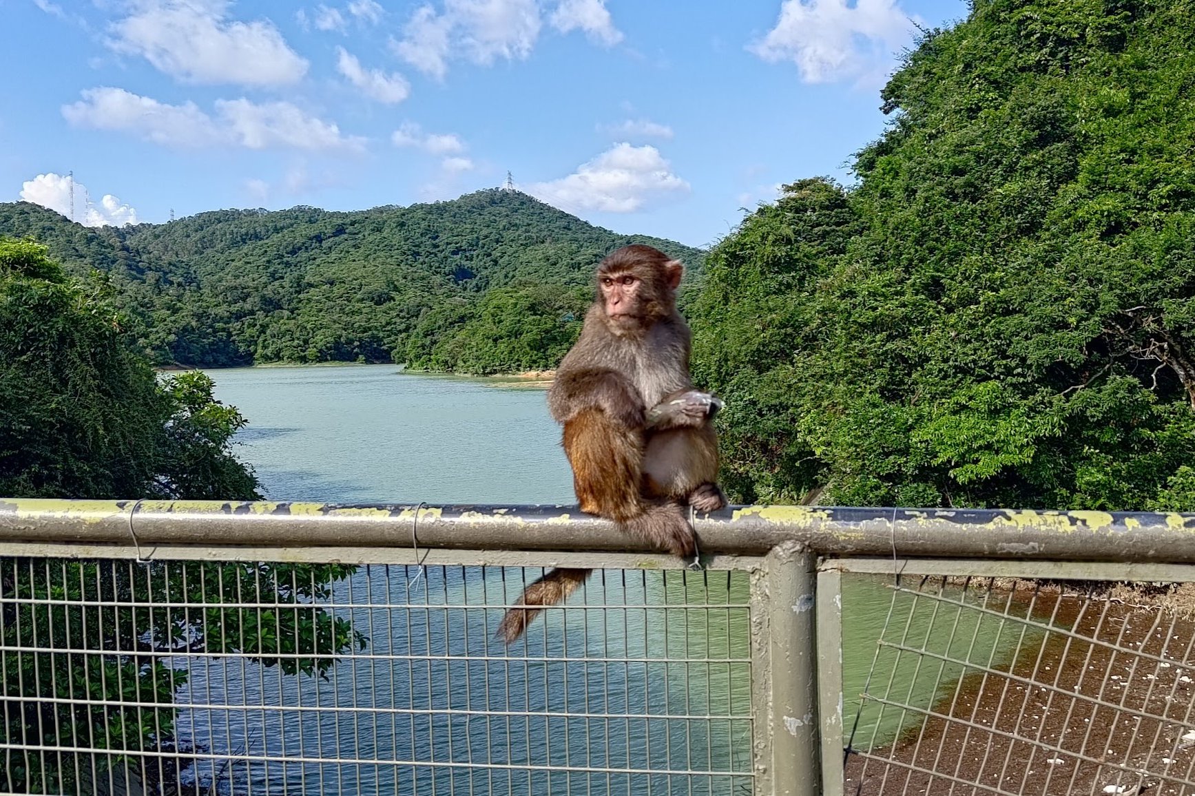
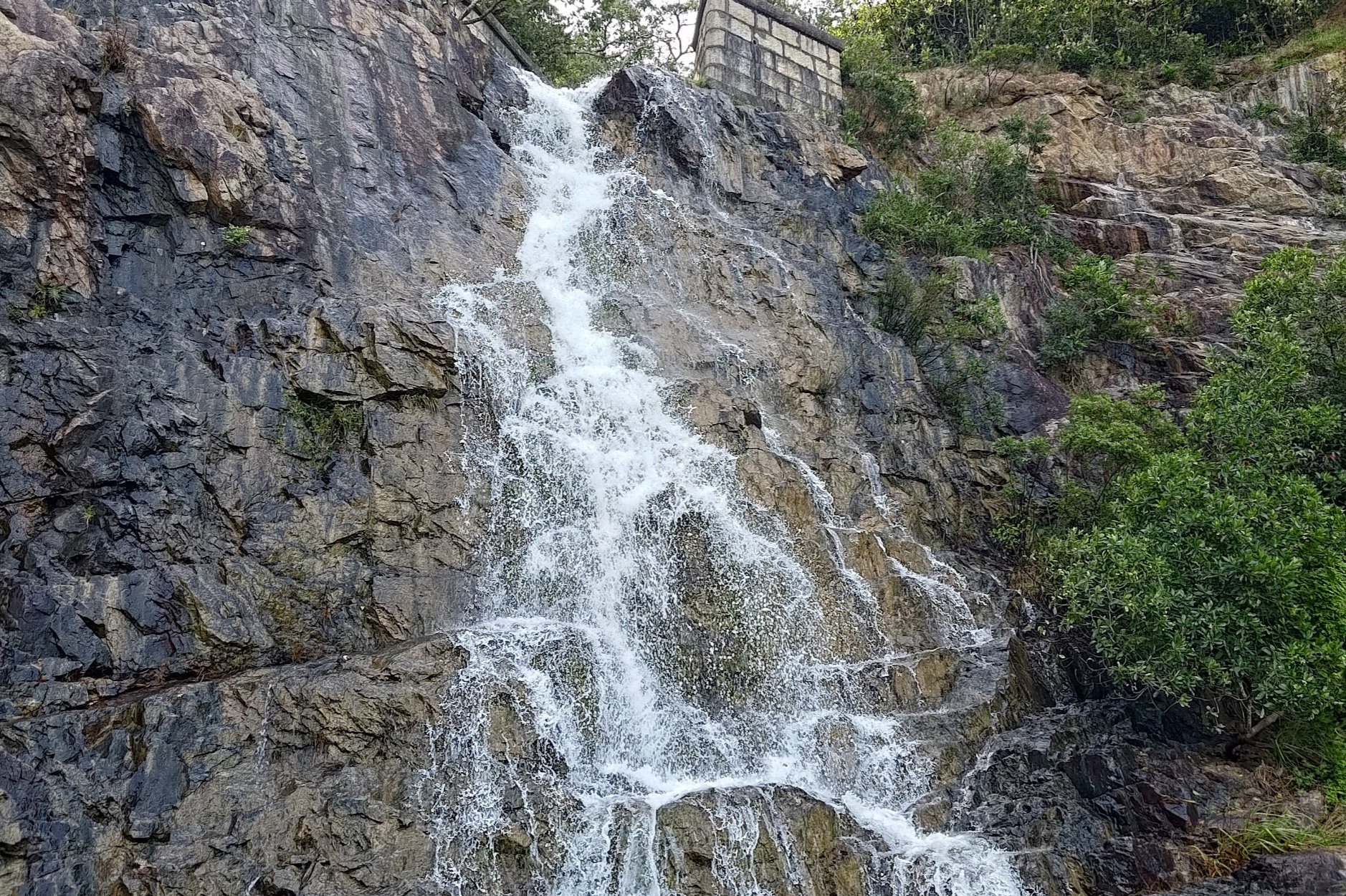
Kowloon Reservoir and Monkeys
Cross the bridge after descending down Golden Hill Road.
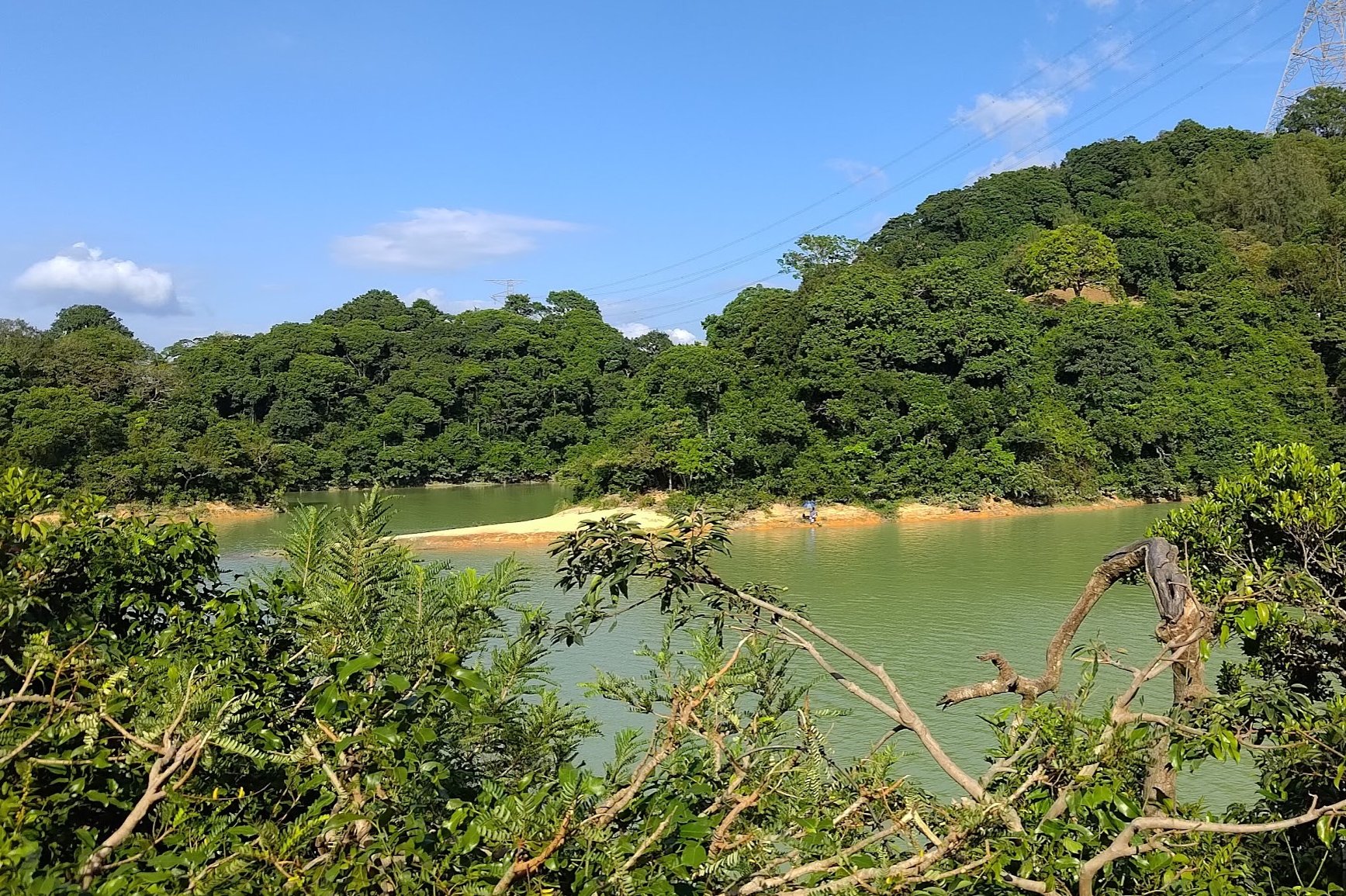
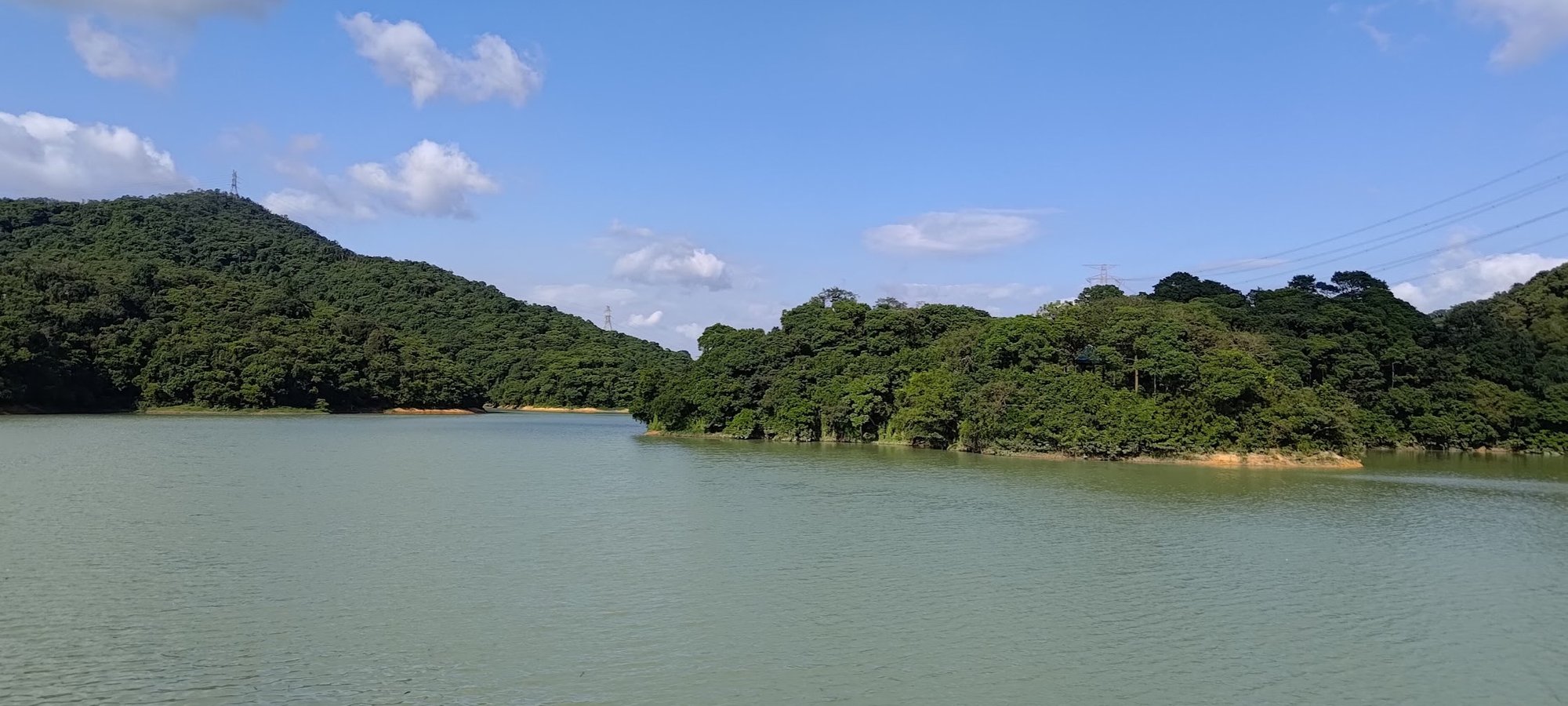
Once across, you'll simply need to follow a wide concrete road that takes you around part of the perimeter of Kowloon Reservoir. You'll also be able to see Kowloon Byewash Reservoir (which looks more like a snaking river) on the other side.
You'll likely see people feeding the macaques here. Avoid doing the same since it results in negative interactions between macaques and humans and a false ballooning of Hong Kong's monkey population.
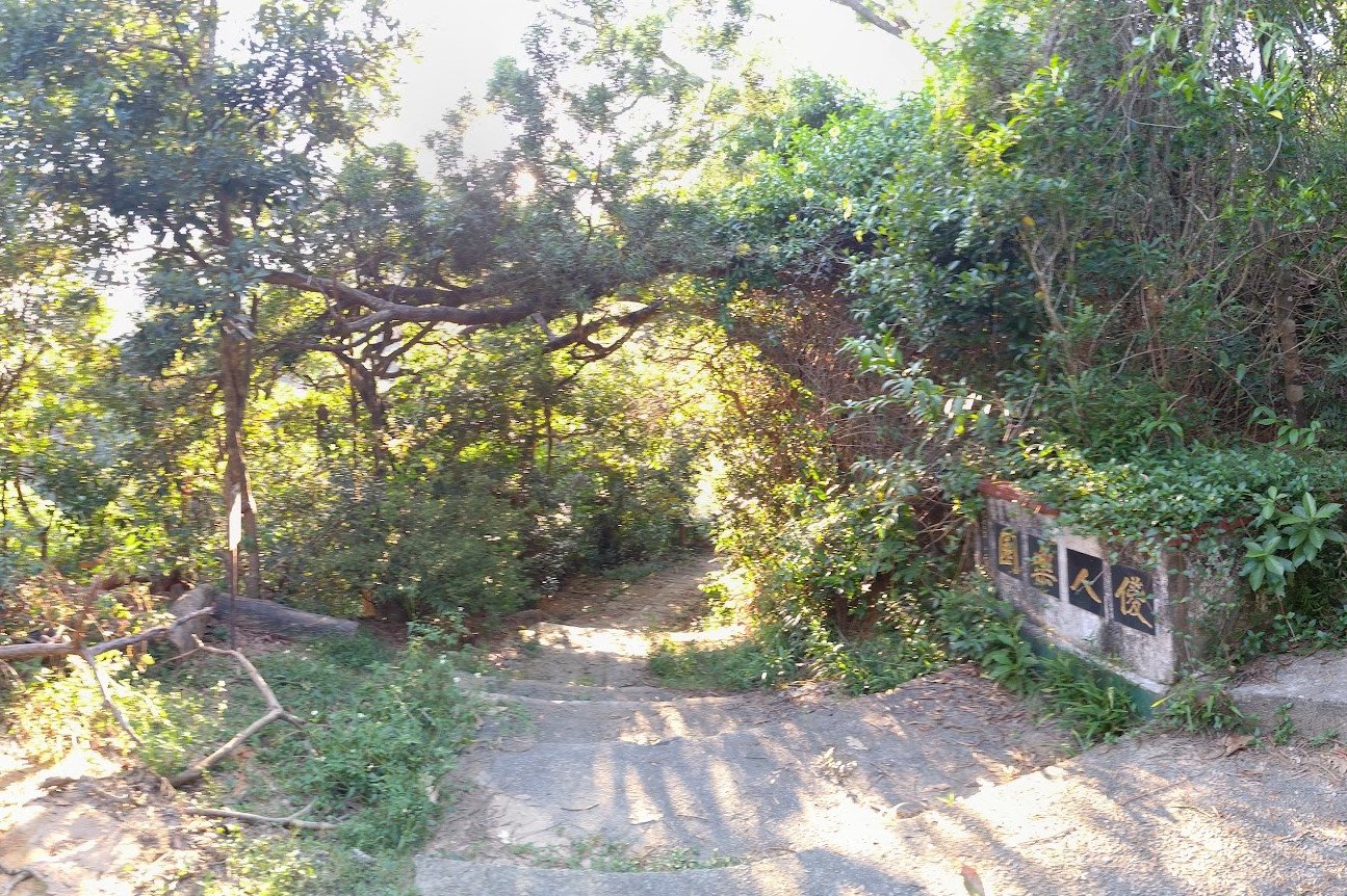
Hike Up to the Kam Shan Family Walk Arch
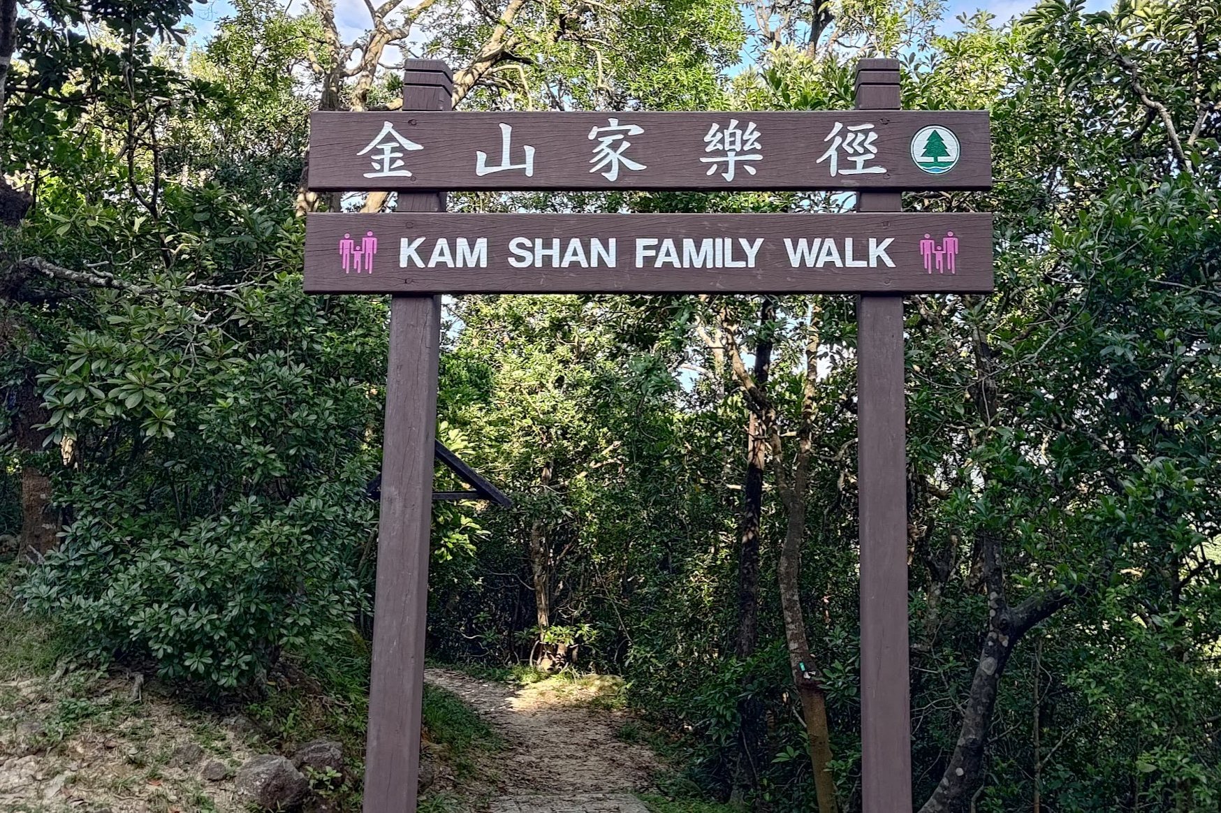
After you start heading away from Kowloon Reservoir, Golden Hill Road begins gently sloping upward.
You'll see a Kam Shan Tree Walk arch on the left, which you should ignore. Simply continue heading up the concrete road and heed the sign that points you toward the Kam Shan Family Walk arch.
It takes about 10 minutes to reach the family walk arch from the reservoir.
Try not to miss it like I did, initially.
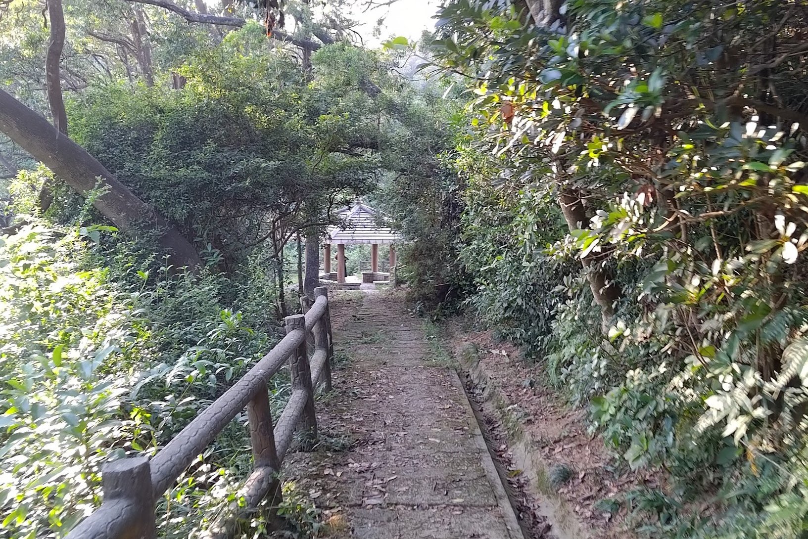
The Kam Shan Family Walk Trail
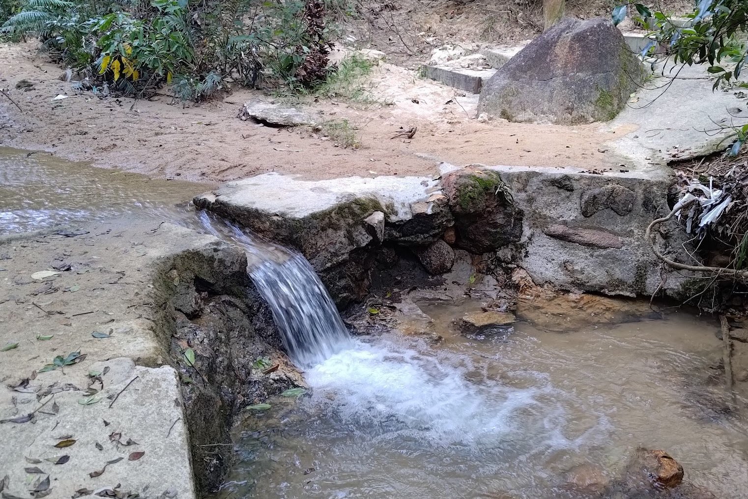
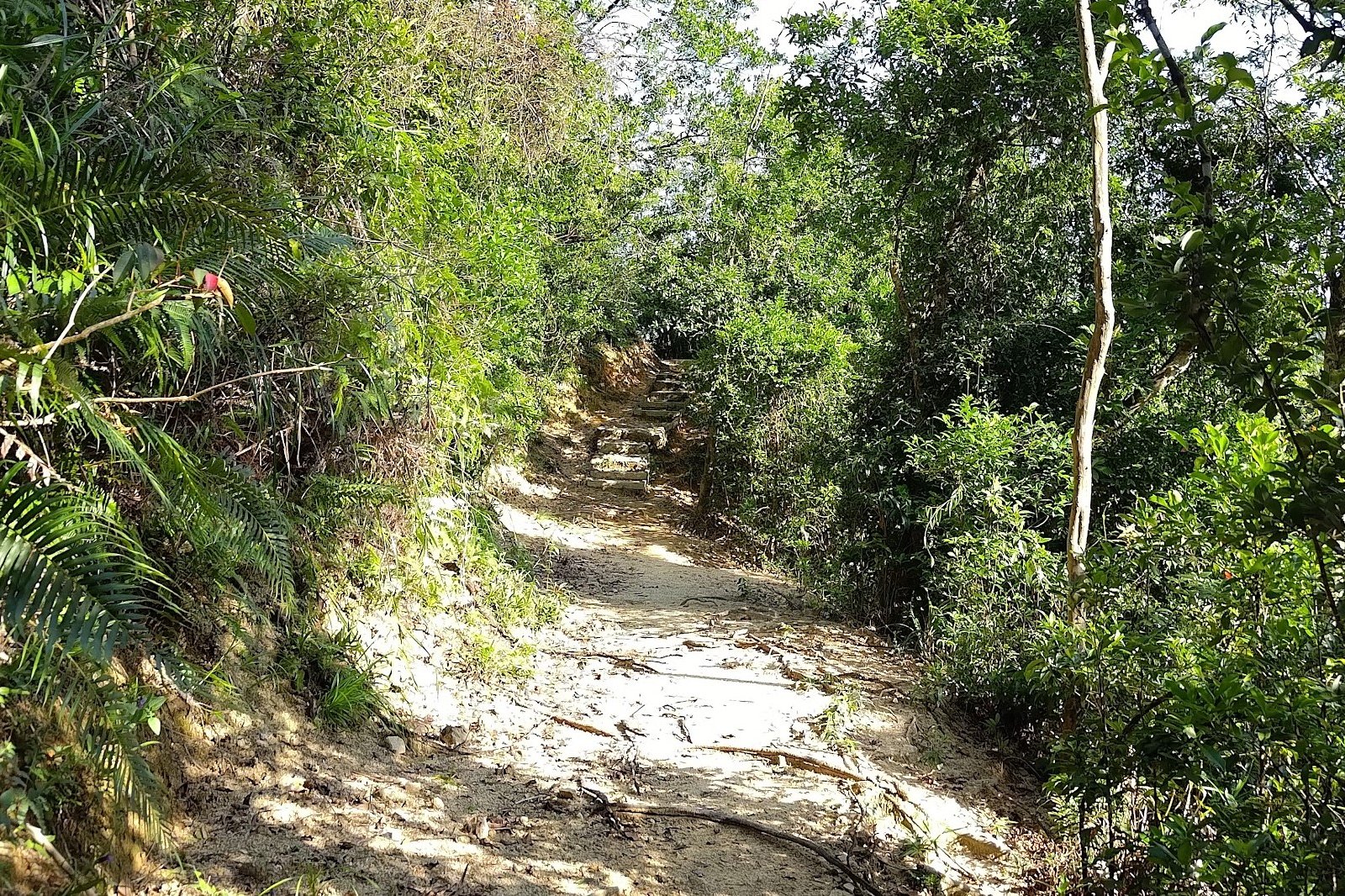
The Kam Shan Family Walk trail takes about 20-30 minutes to complete. It's composed of gentle streams, lush greenery, natural dirt paths (which seem to be getting rarer in Hong Kong) and lots of cool flora and fauna.
Enjoy the undulating nature of this trail. It's not particularly tough or overgrown and is perfect for families (as its name suggests).
About 5 minutes into the family walk, make sure to ignore the left path and continue on straight.
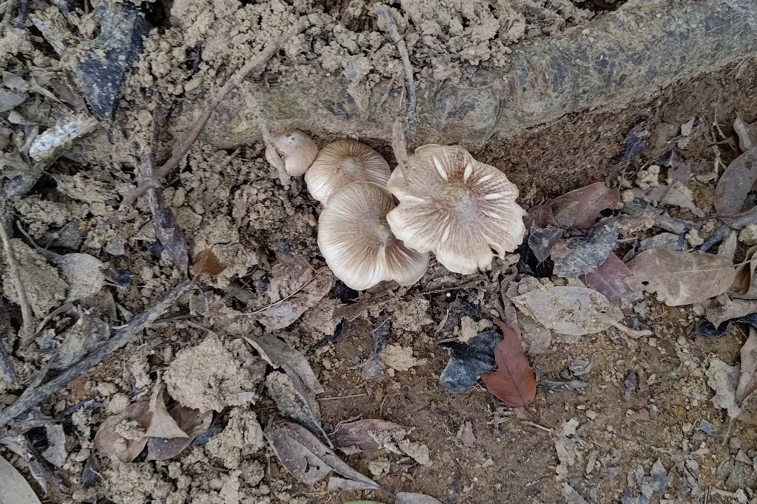
The rest of the trail is pretty straightforward, so you can spend time looking at cool things like mushrooms and tree roots!
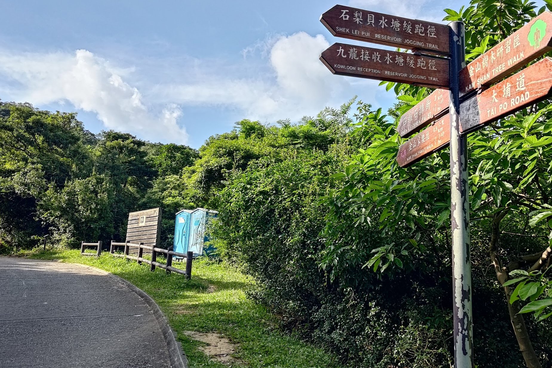
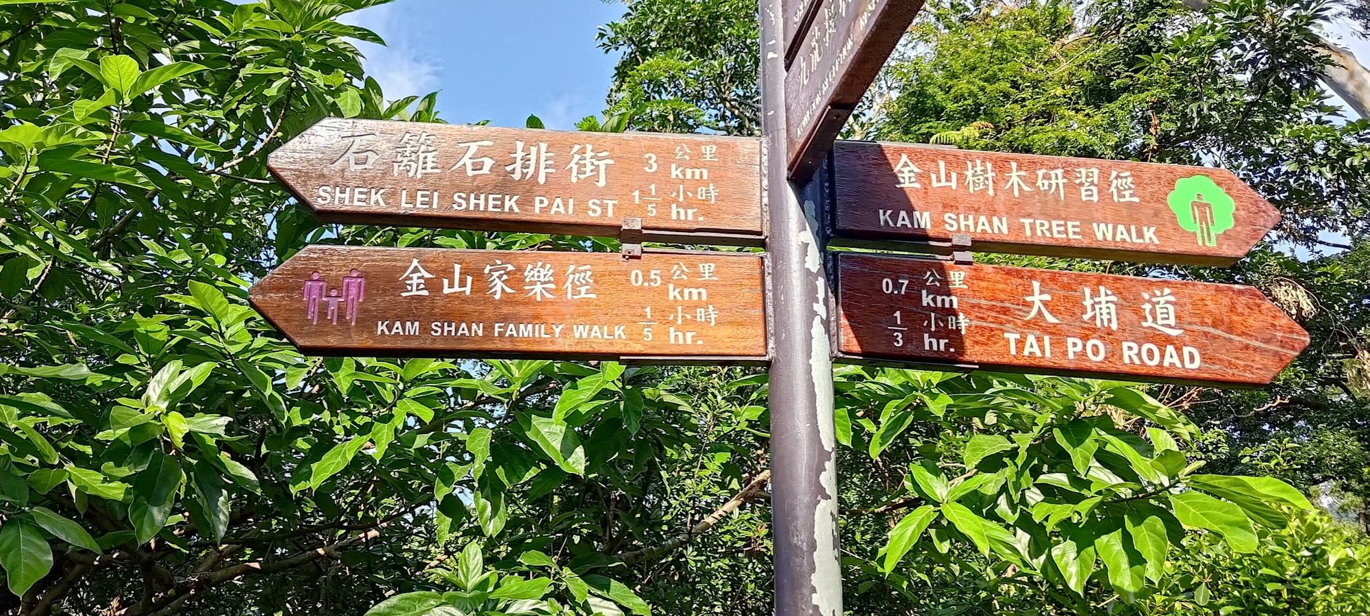
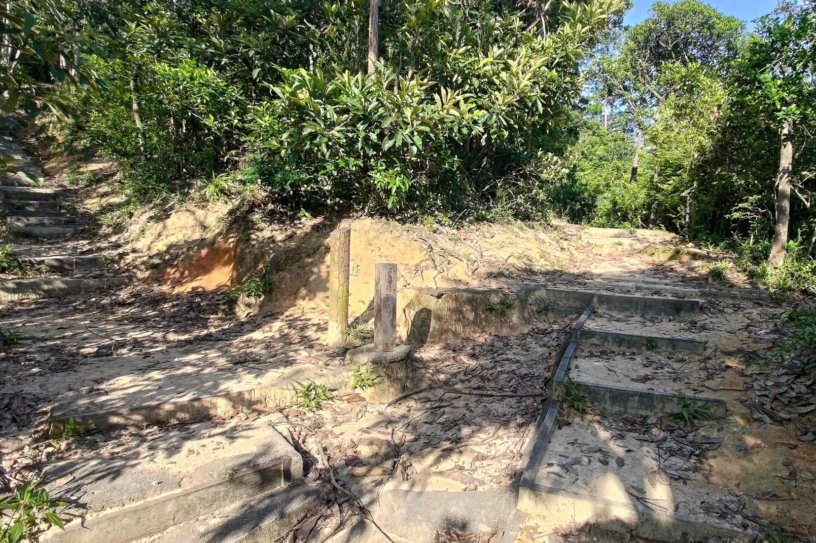
IMPORTANT: Don't Miss the Turn Up to Golden Hill
To reach the World War 2 tunnels, you'll need to take the dirt stairs up on your left. You'll see this important junction right at the end of the family walk trail about 20-30 minutes after the Kam Shan Family Walk arch you went through earlier.
If you're done hiking for the day, take the stairs down and you'll eventually end up near a bus stop serviced by the same 81 and 72 buses mentioned earlier.
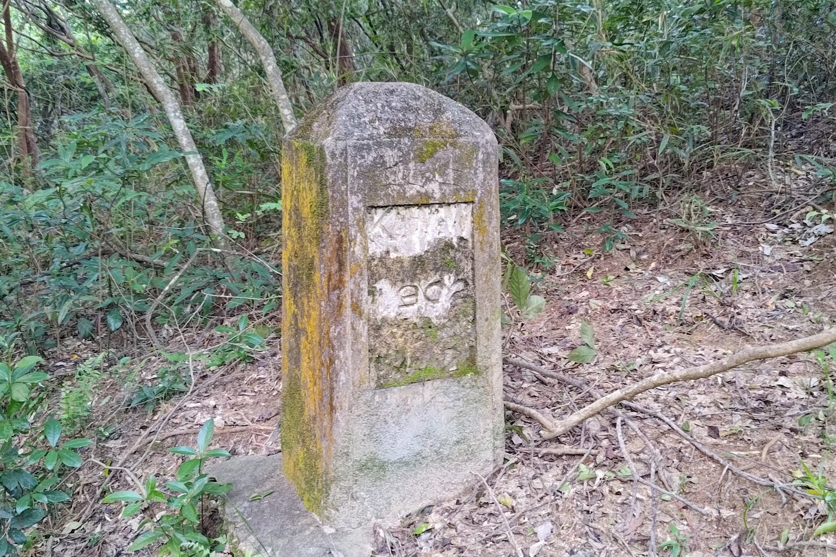
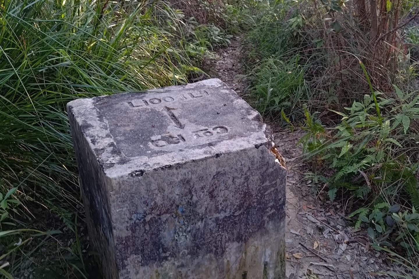
Kam Shan (Golden Hill) Boundary Stones
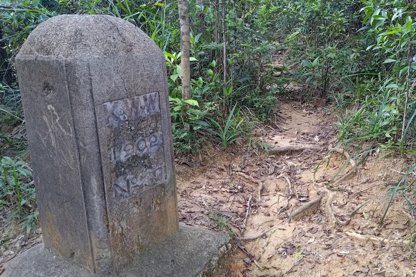
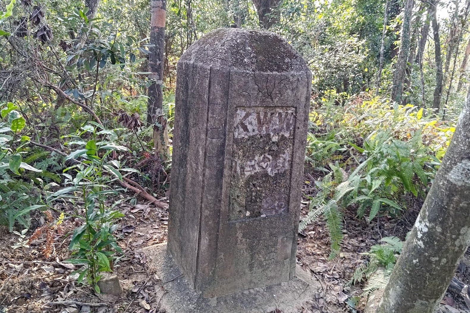
Within 10 minutes of climbing, you'll pass by a few boundary marker stones with KWW 1902 engraved on them. They were erected in 1902.
These are Kowloon Waterworks boundary stones that are the first of the hidden old-Hong Kong 'relics' that you'll find. They also have a fascinating history.
According to Mr WONG Hei-nok: a Senior Engineer in charge of Reservoir Safety at the Water Supplies Department, "The boundary stone indicates that the whole area behind the stone is the catchment area, serves as a reminder to members of the public that water in the catchment area should not be contaminated. The rainwater first falls on the ridgeline, which is the highest point of the hill, then flows downhill into the Kowloon Reservoir."
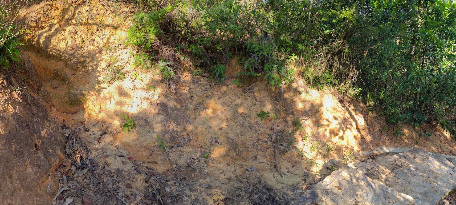
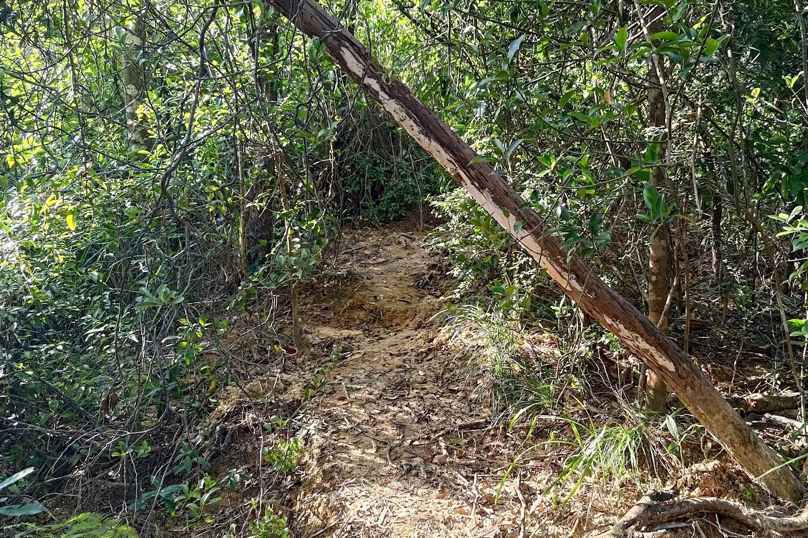
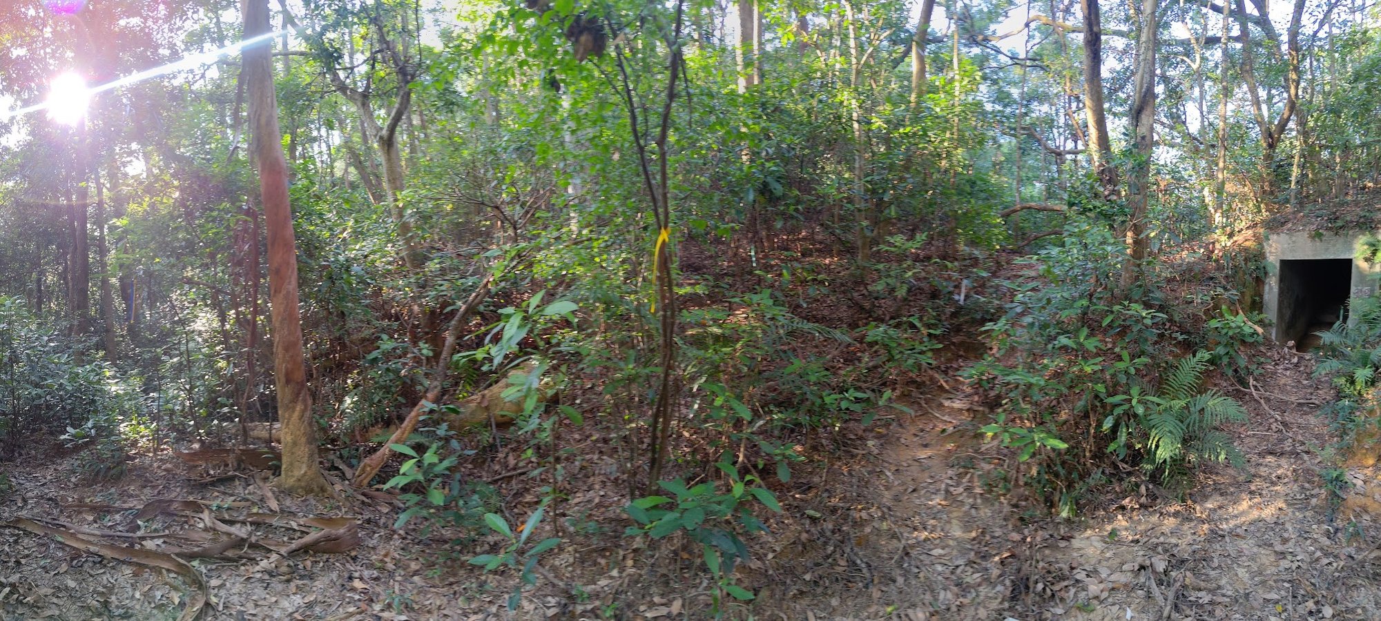
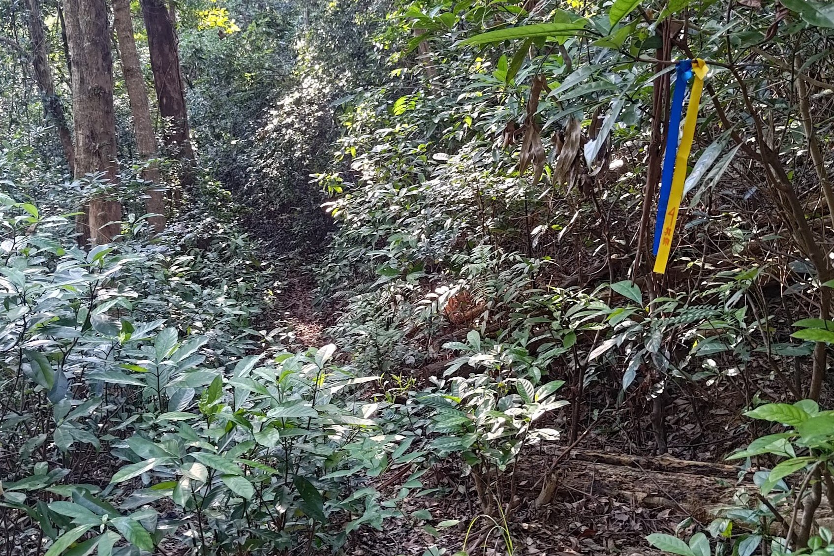
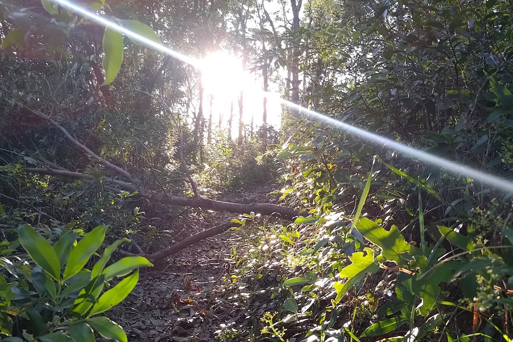
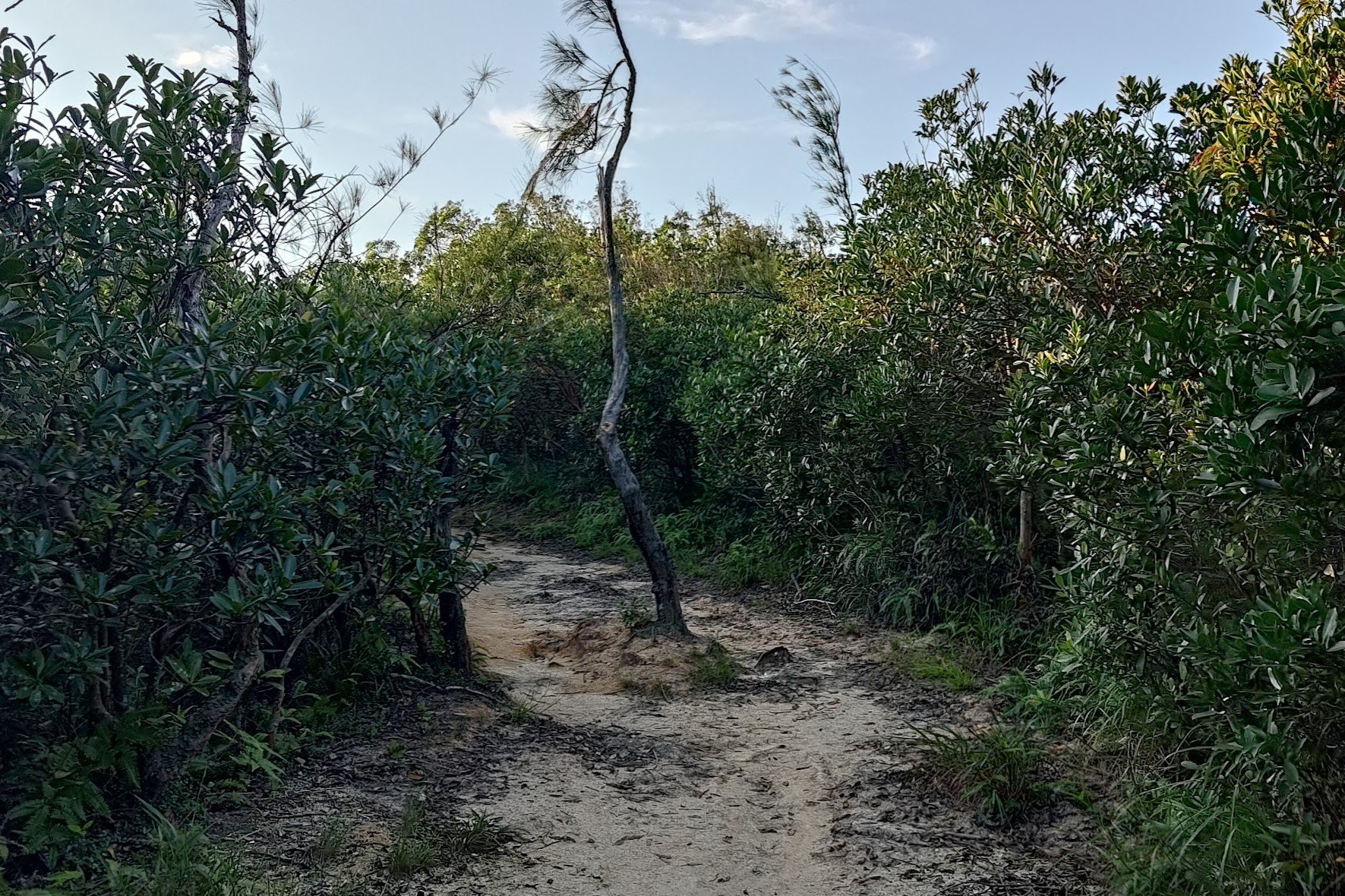
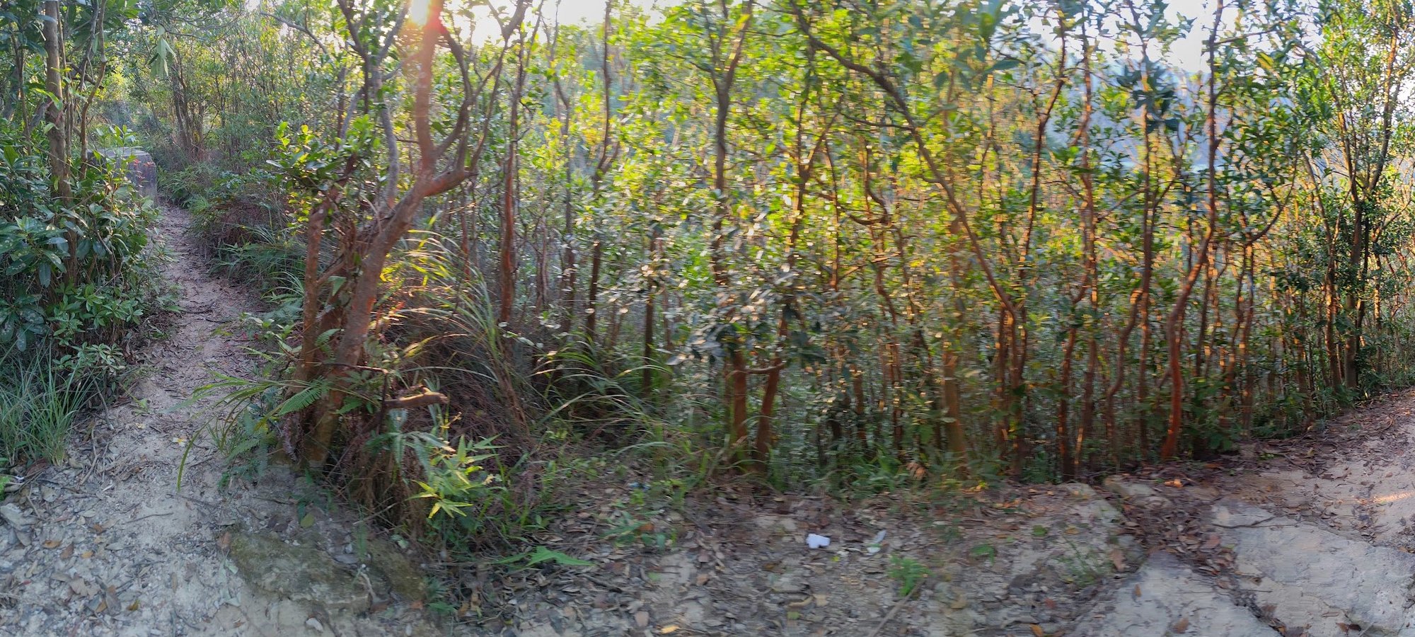
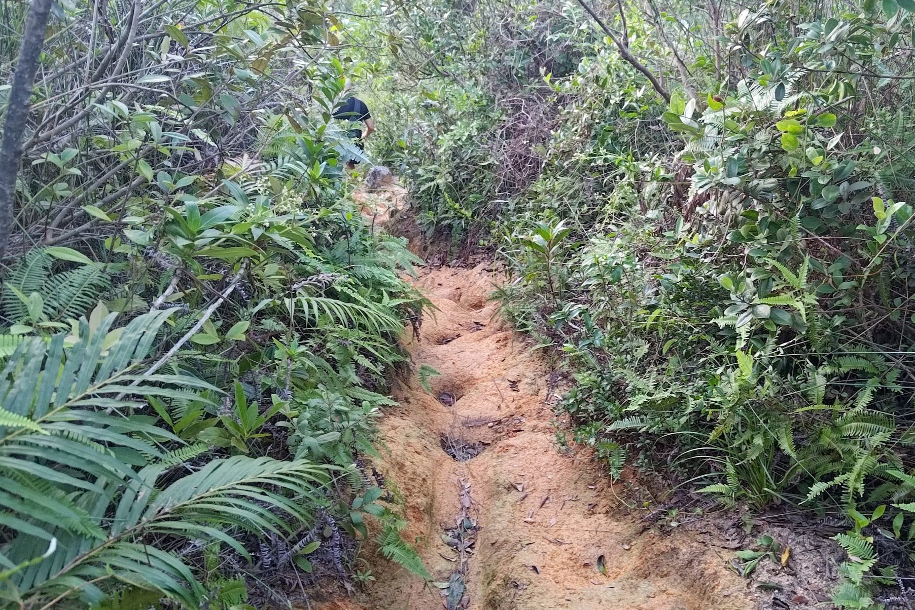
The Overgrown Climb Up Golden Hill
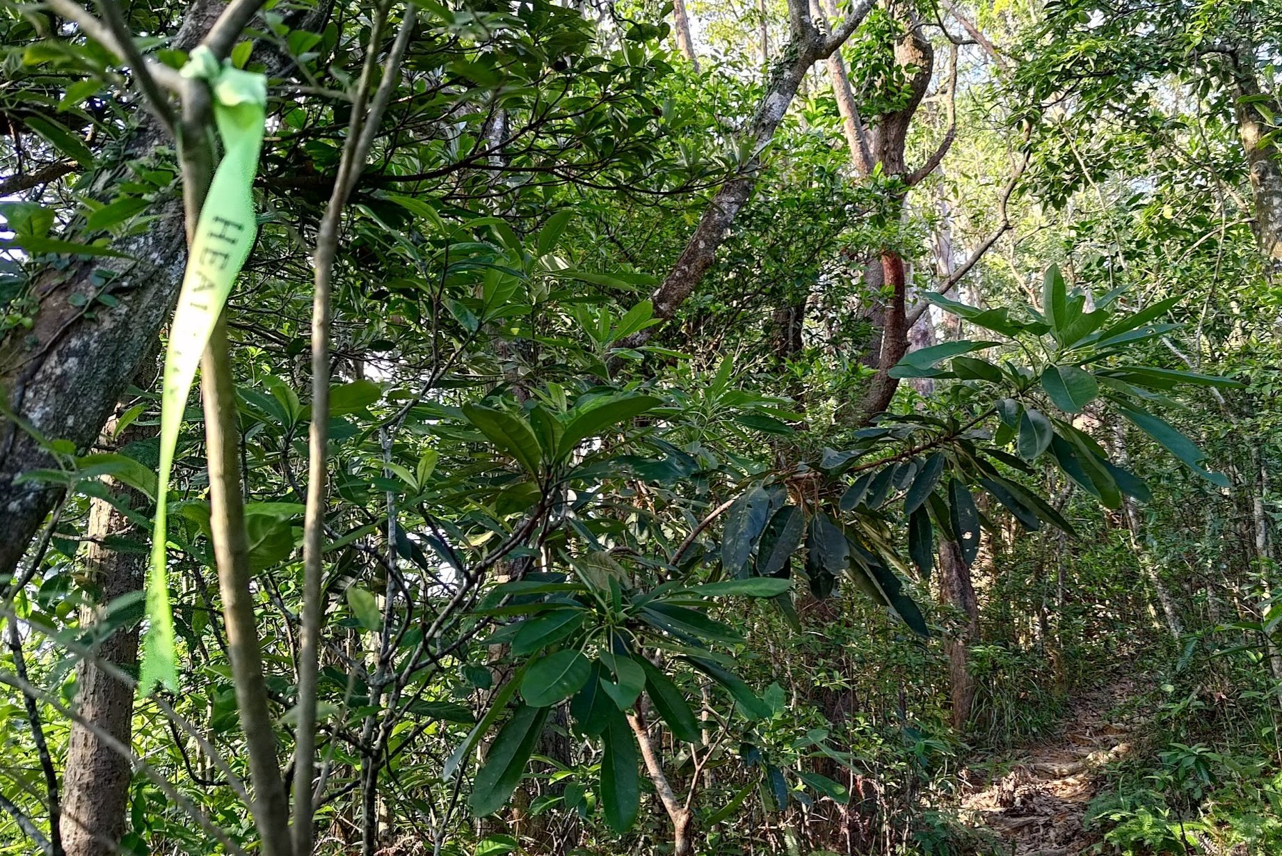
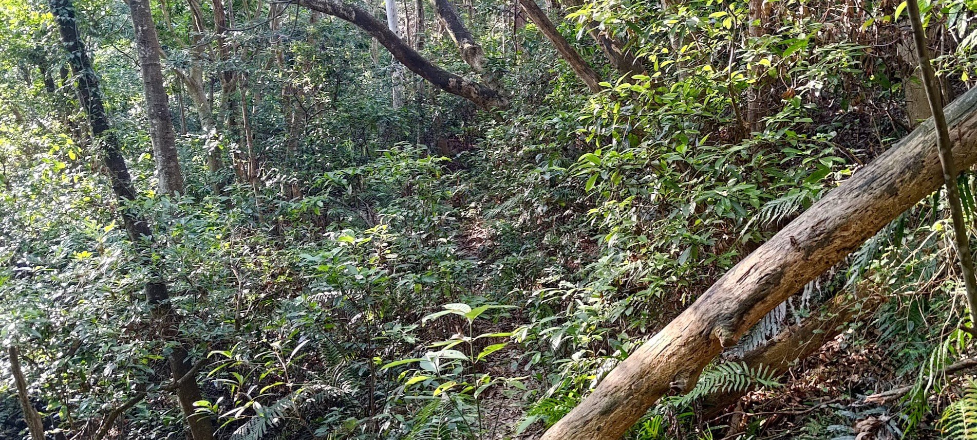
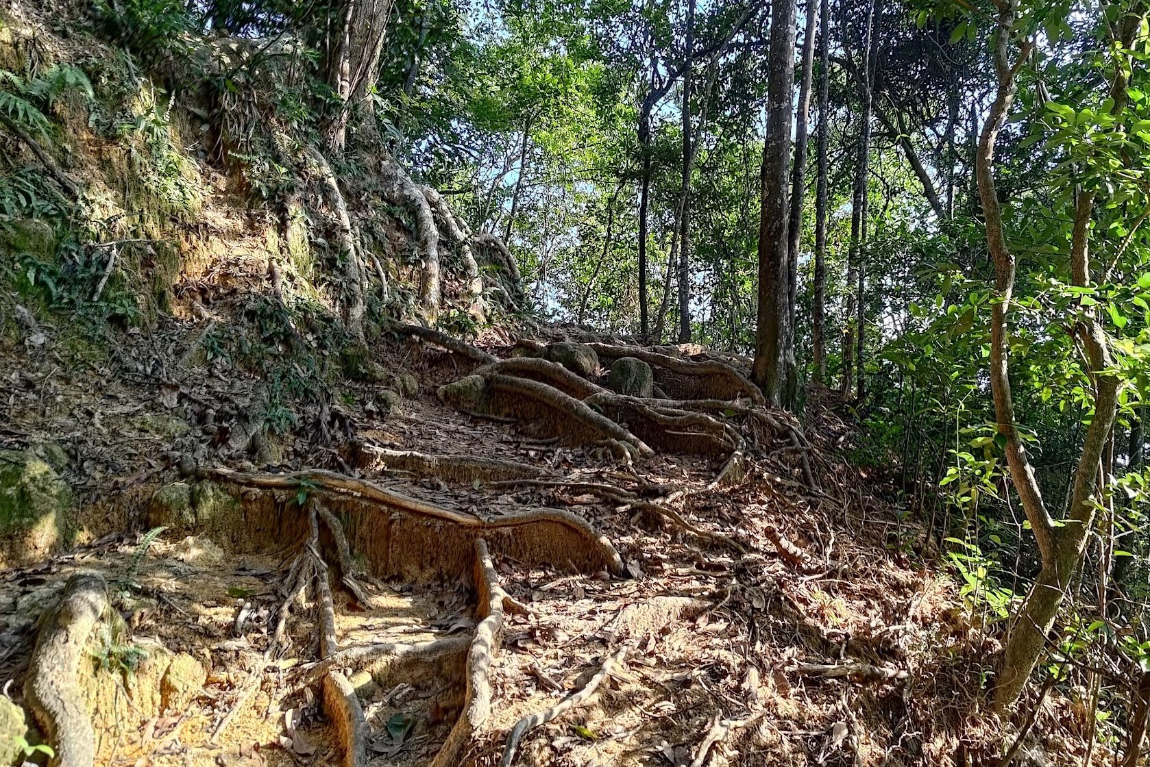
The next 10-15 minutes of climbing will take you through very overgrown sections of trail. While hiking here, it's worth going slow and making sure you don't trip on hidden tree roots and the like.
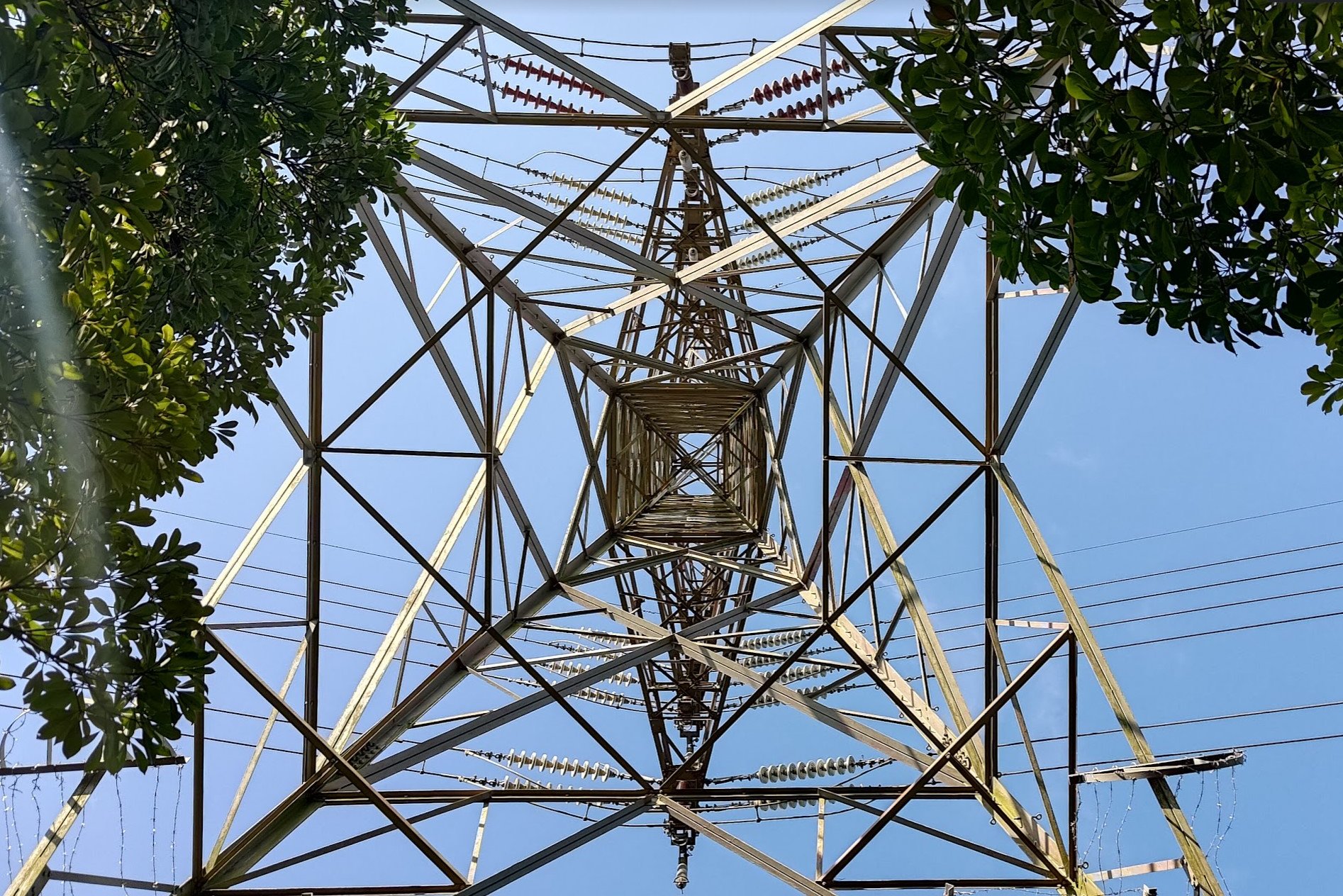
You'll later go under a large tower of some type before the path gets overrun by foliage again.
The trail will continue to be punctuated with bright ribbons to keep reminding you that you're going the right way, even when you have to circumnavigate around the odd fallen tree.
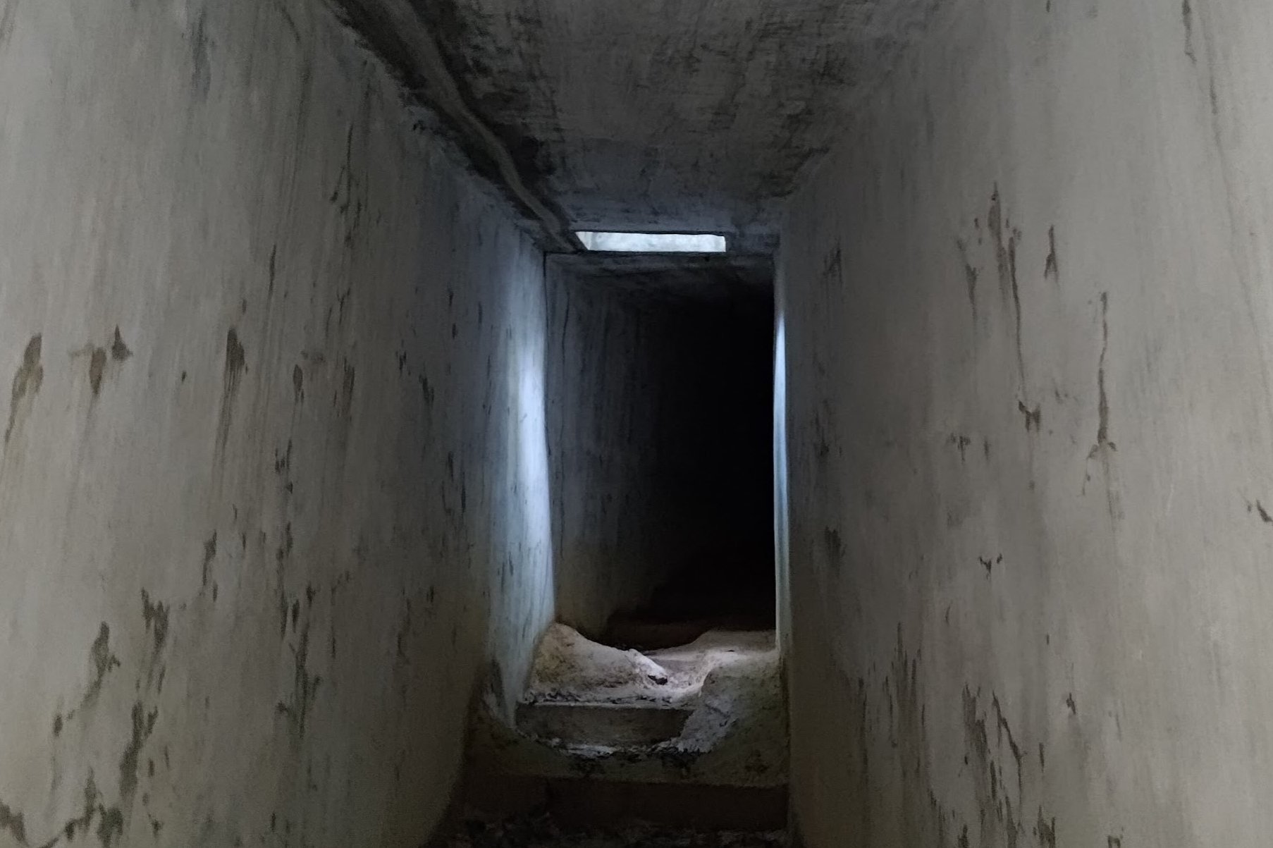
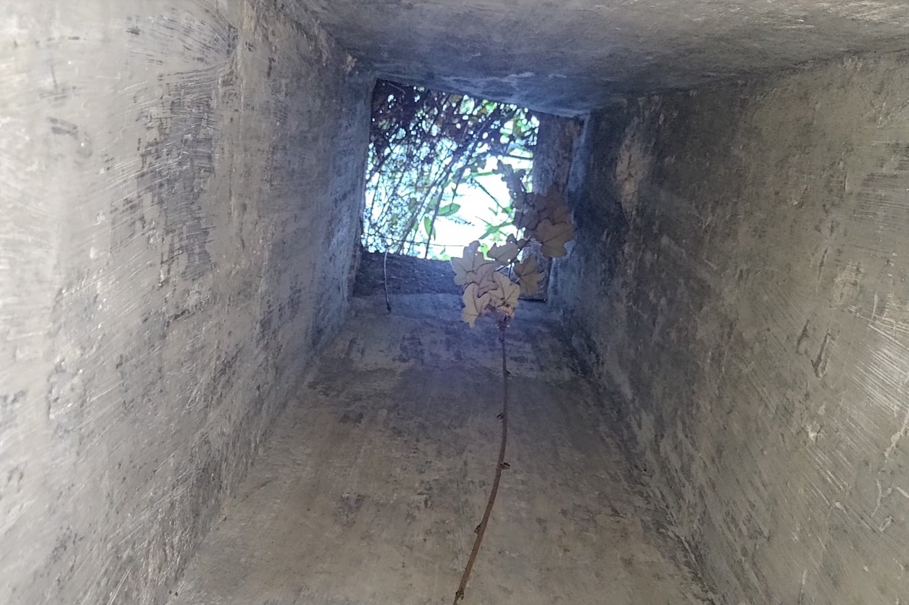
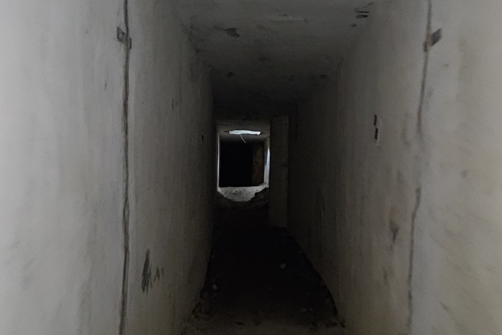
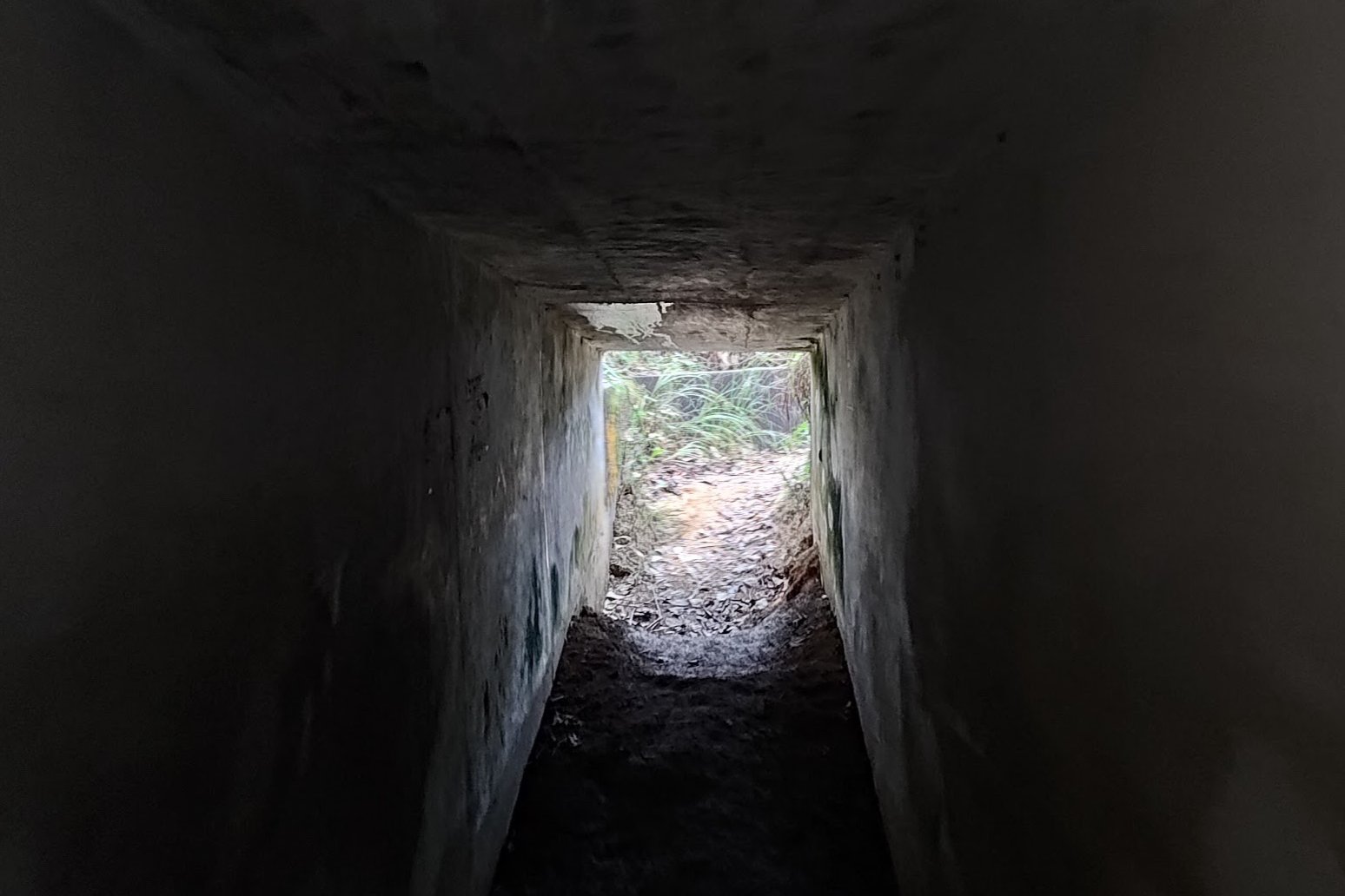
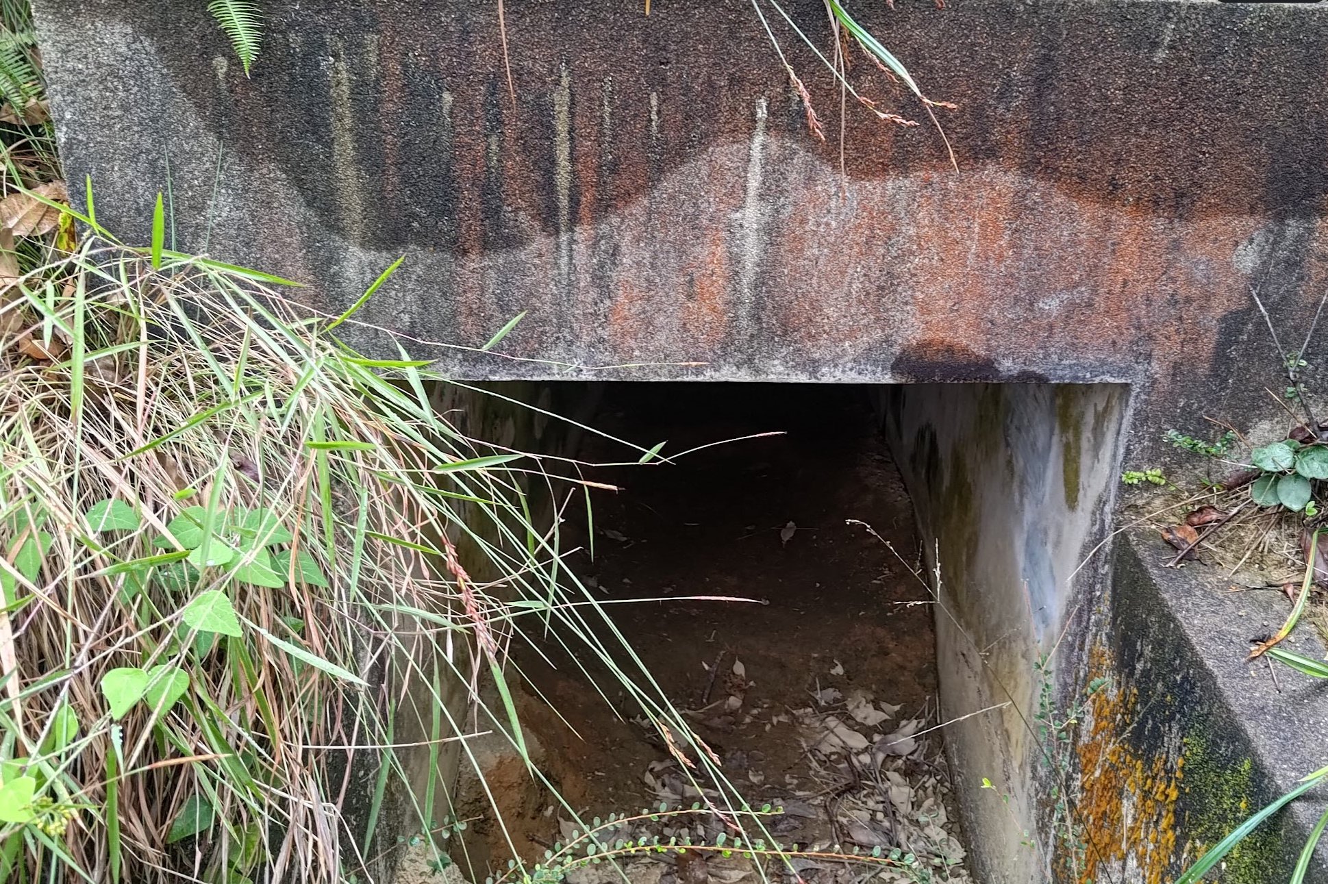
The First Secret World War II Tunnel
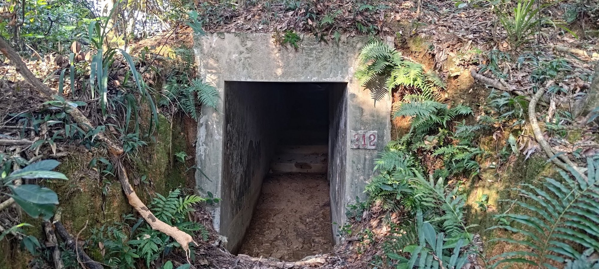
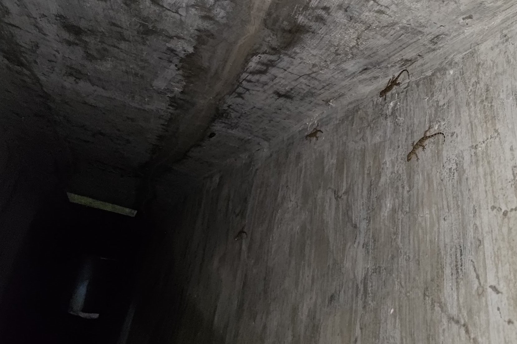
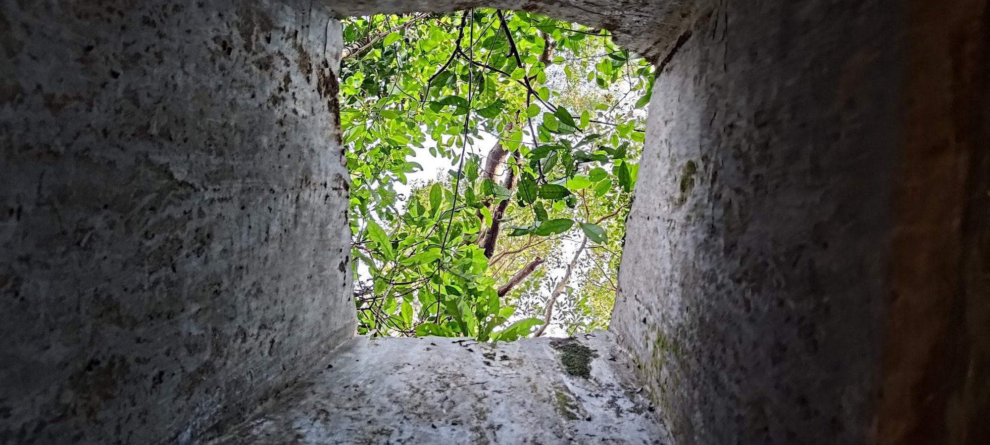
Given the remote nature of this tunnel, it's not surprising that there was not a soul in sight when it was time to explore.
It had been raining a few days prior, so the entrance to the tunnel was a bit sludgy, making it arduous to get in without slipping.
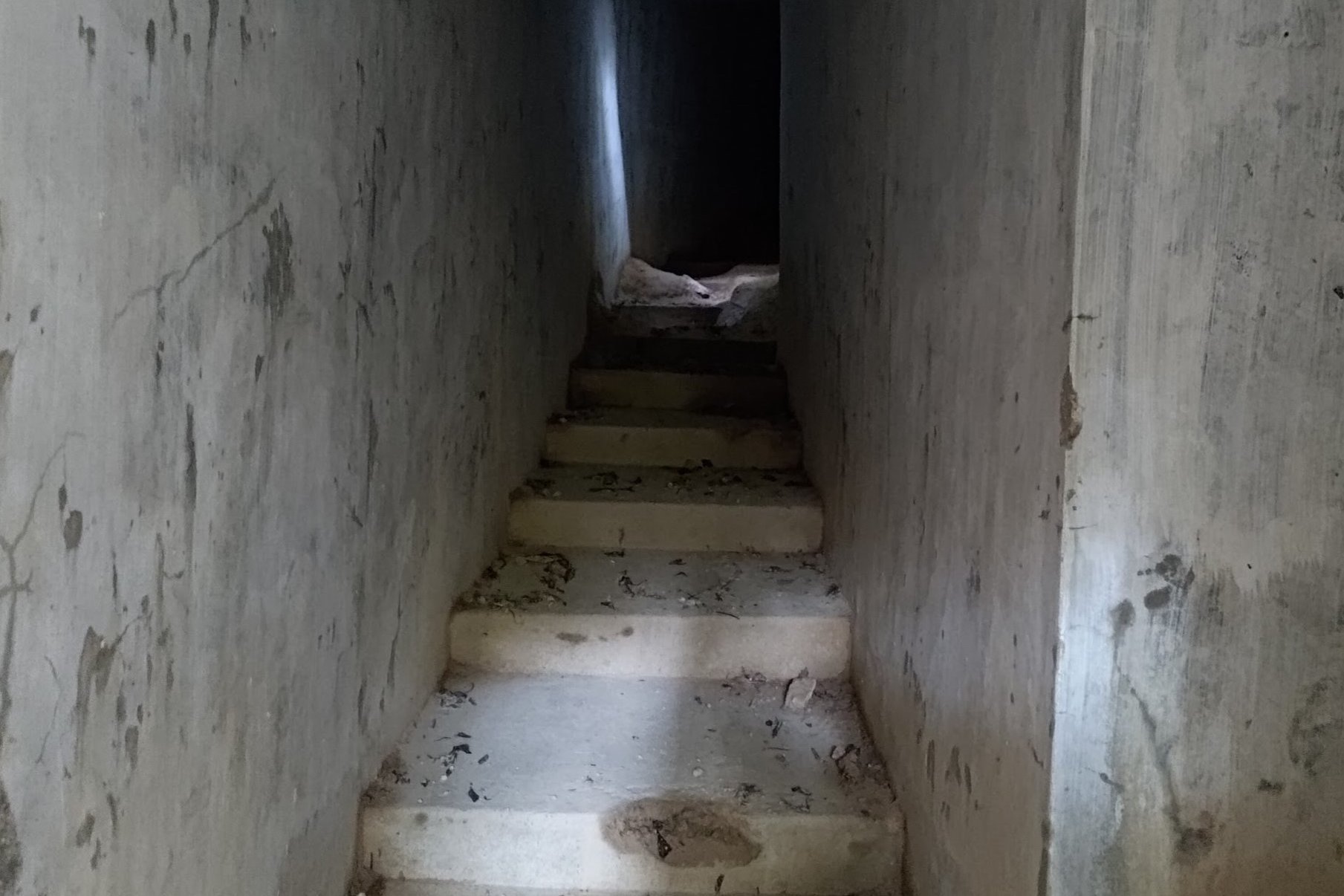
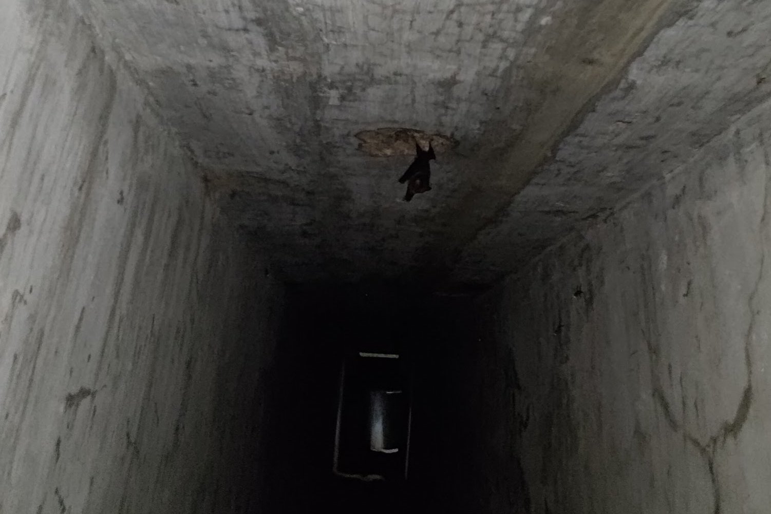
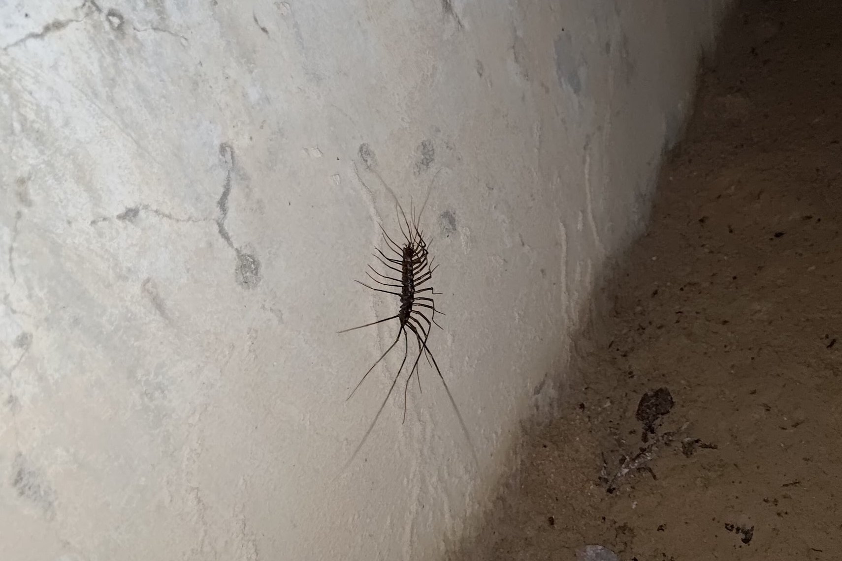
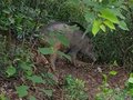
Once inside, I was surprised by how well the walls had held up. Of course, now that humans aren't present, there are some cool animals that have made this historic place their home.
I saw a cute bat, some stripy geckos and a very large house centipede. I will definitely return to explore deeper into this tunnel, but given that I had started this hike quite late, I decided to only go a short way in before heading back.
There were still more tunnels to find!
Back to Golden Hill Road
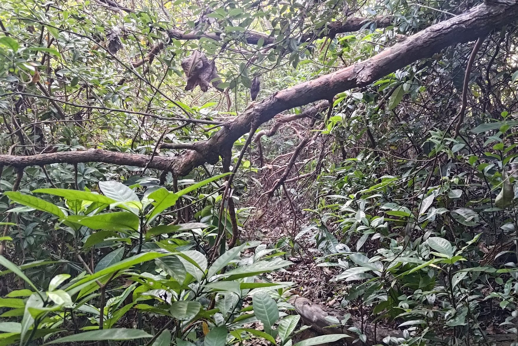
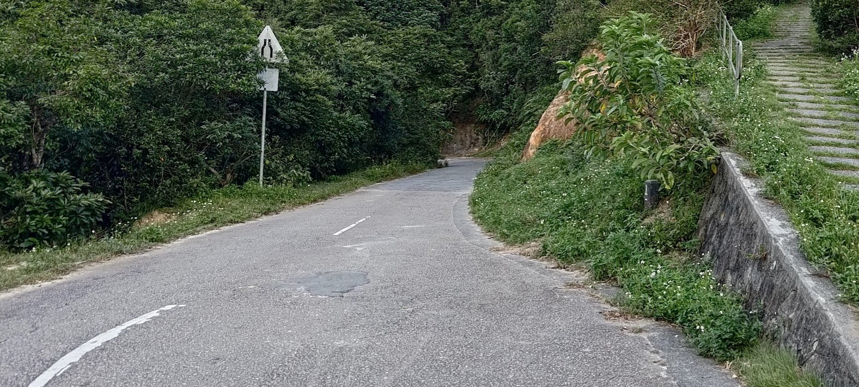
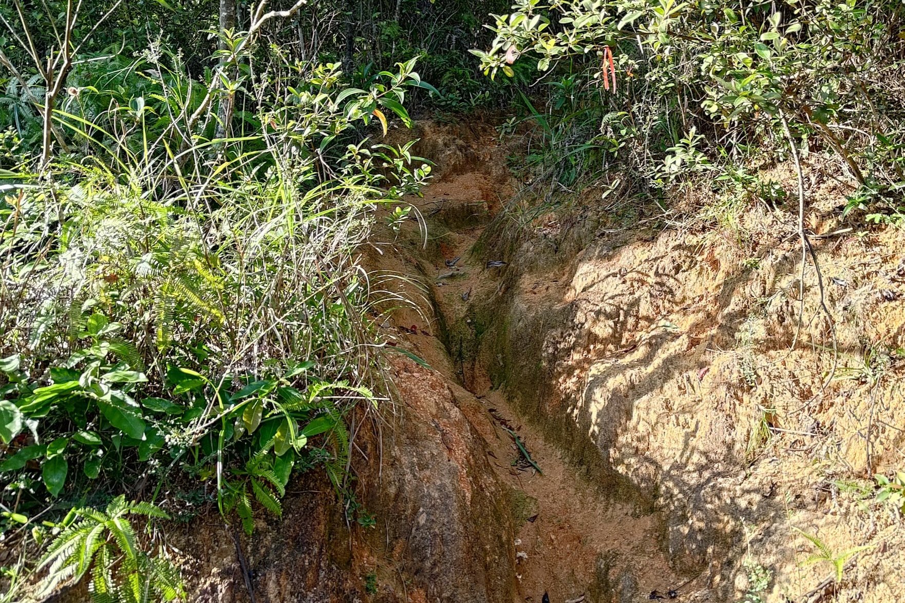
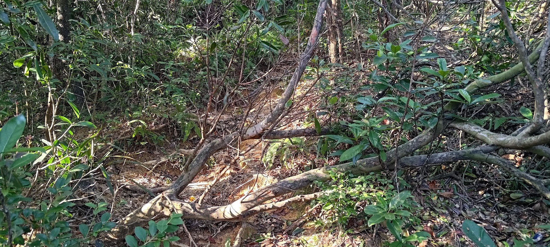
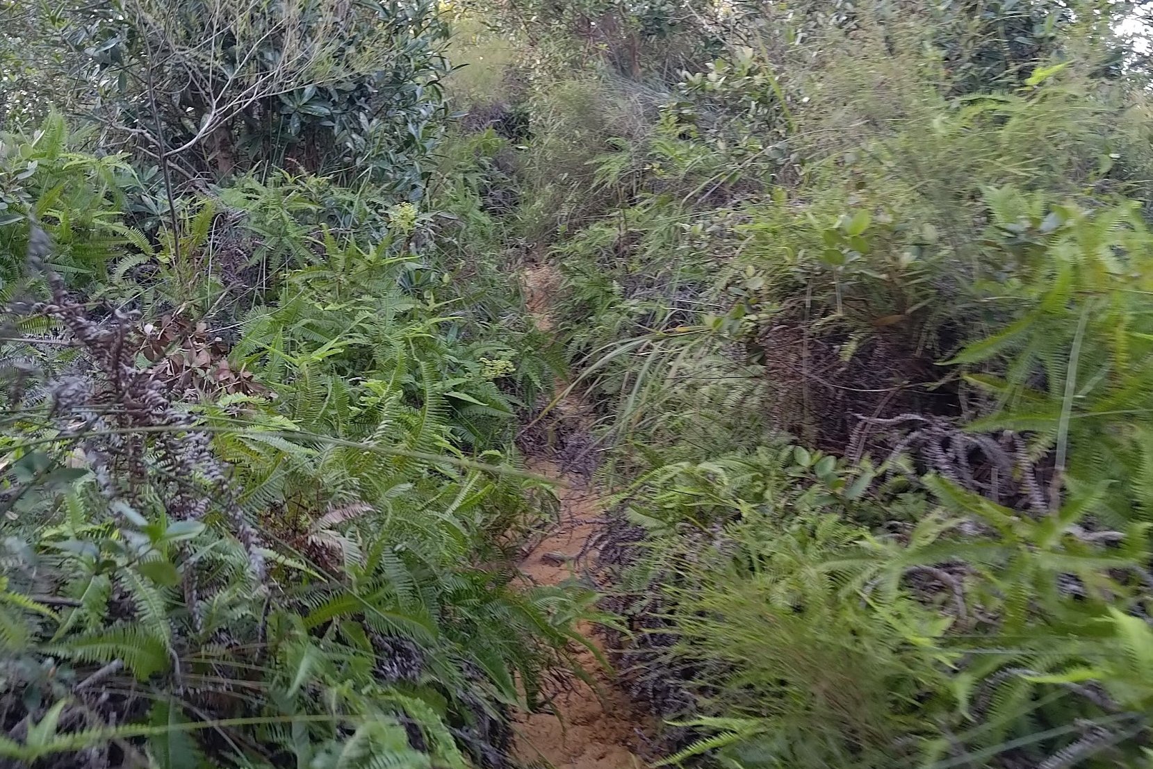
After exploring the tunnel, you'll have to hike for another 30-40 minutes to get back on Golden Hill Road.
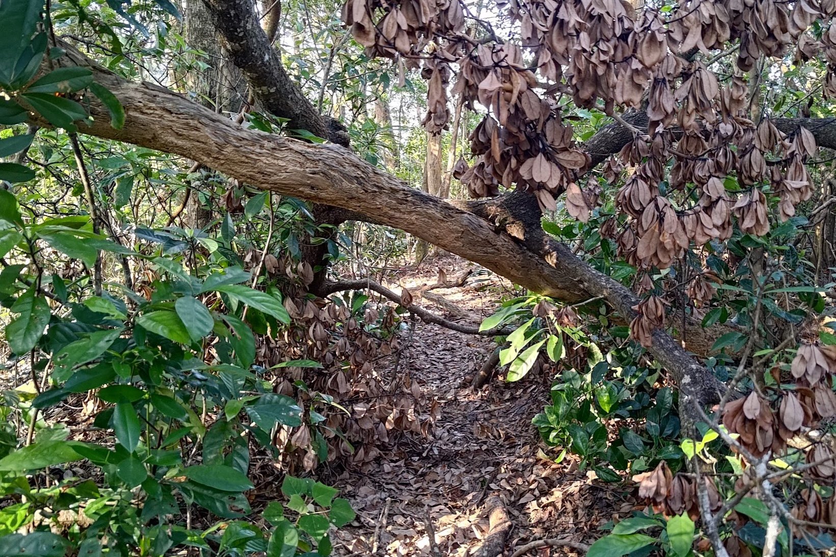
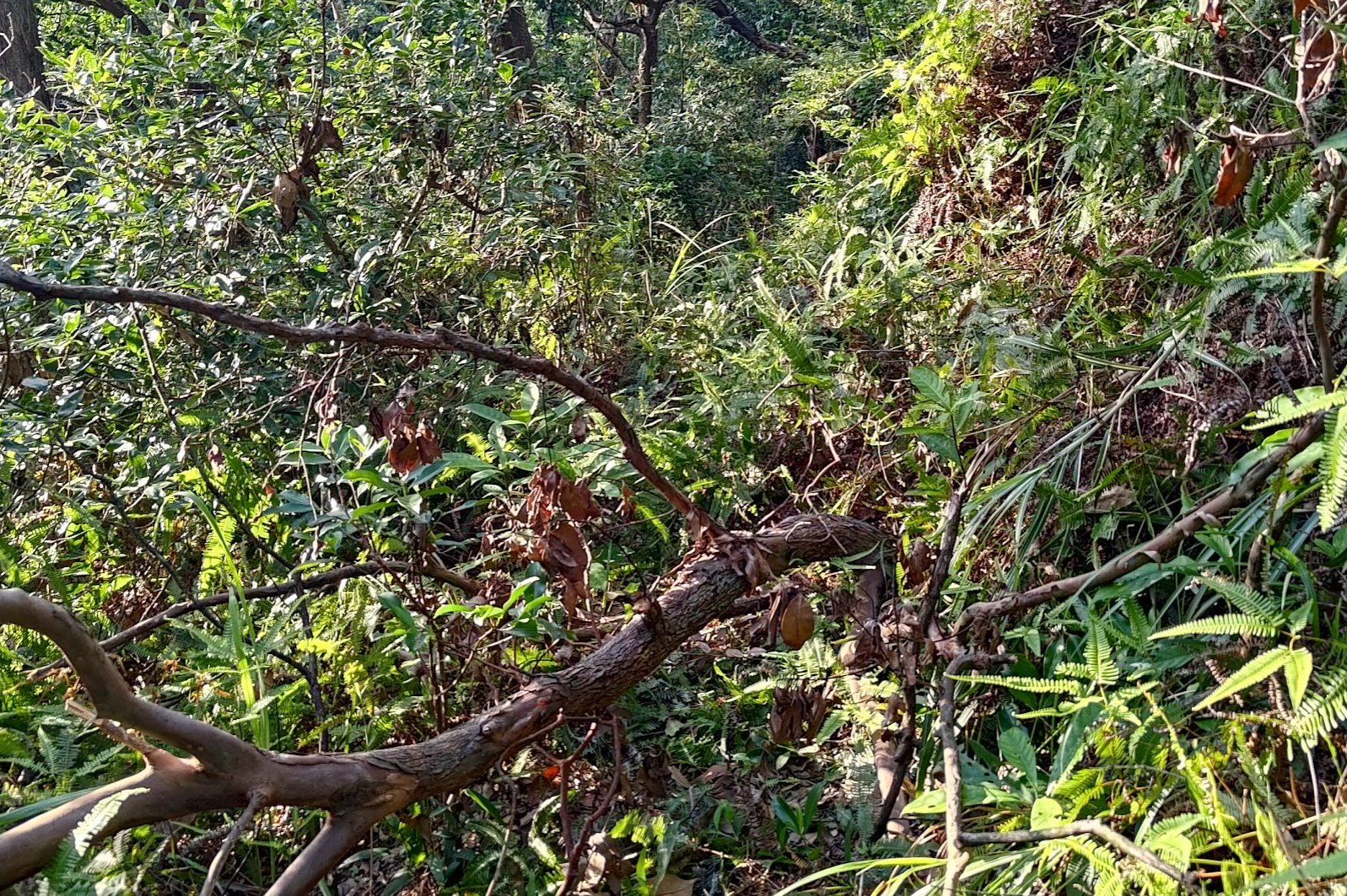
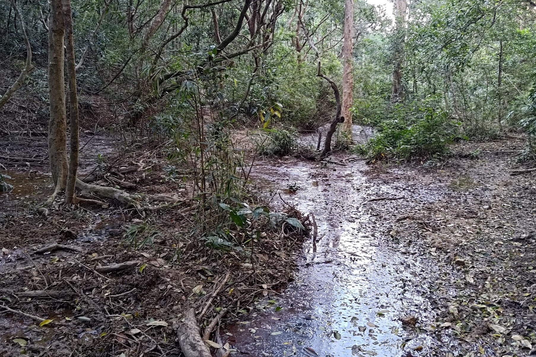
The trail at this point is likely the most overgrown section of the entire hike. At times it was actually difficult to see where the trail once used to be since underbrush has started taking over. A few fallen trees also make for fun obstacles to overcome.
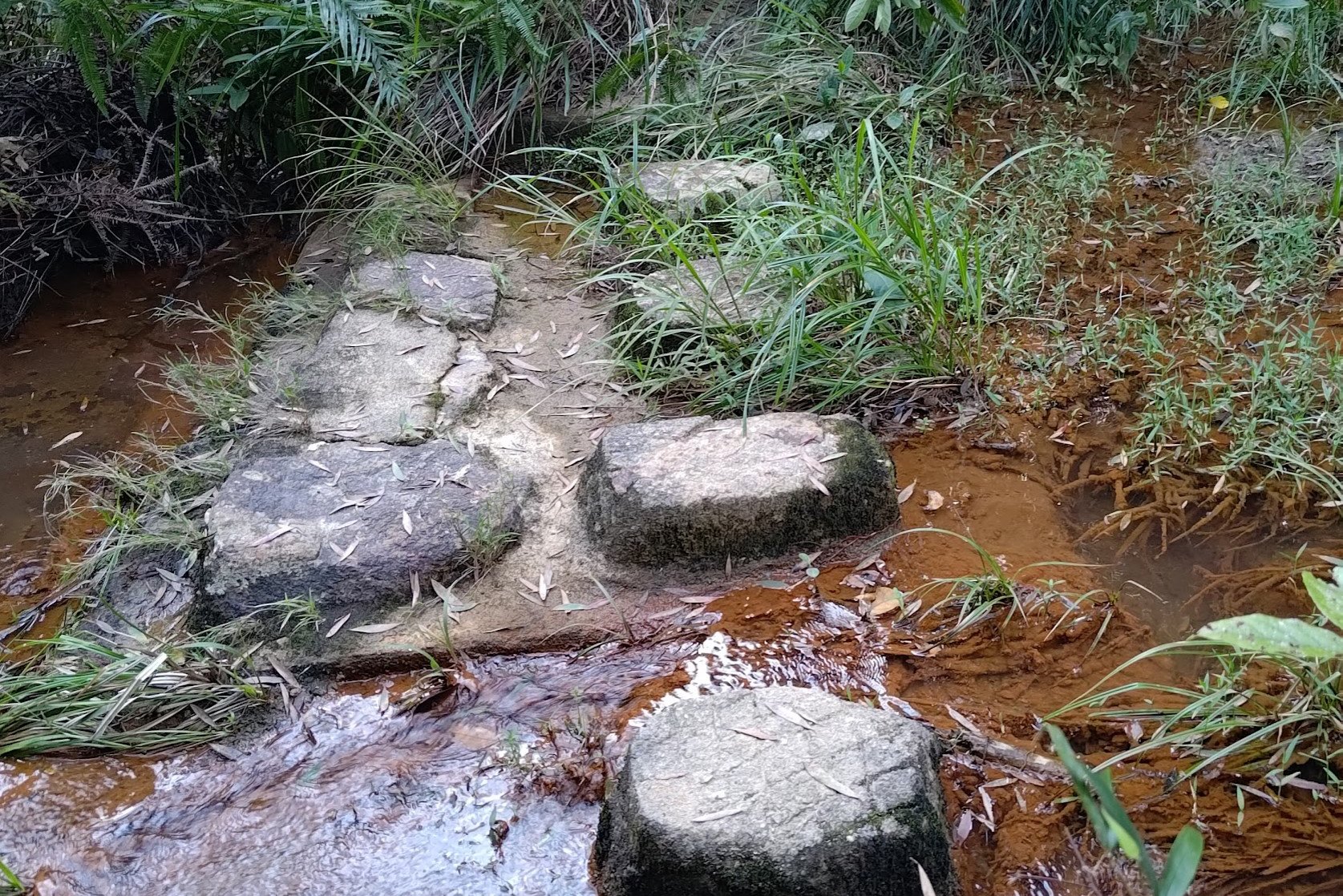
About 15 minutes in, you'll cross a little stream and then arrive at what I like to call Crookback Bog (any Witcher fans reading?). This place smelled horrid and had a constant buzzing sound in the background of flies circling overhead. At least there were no crones.
I crossed a dry log to keep the water out of my shoes and got out of there as fast as possible.
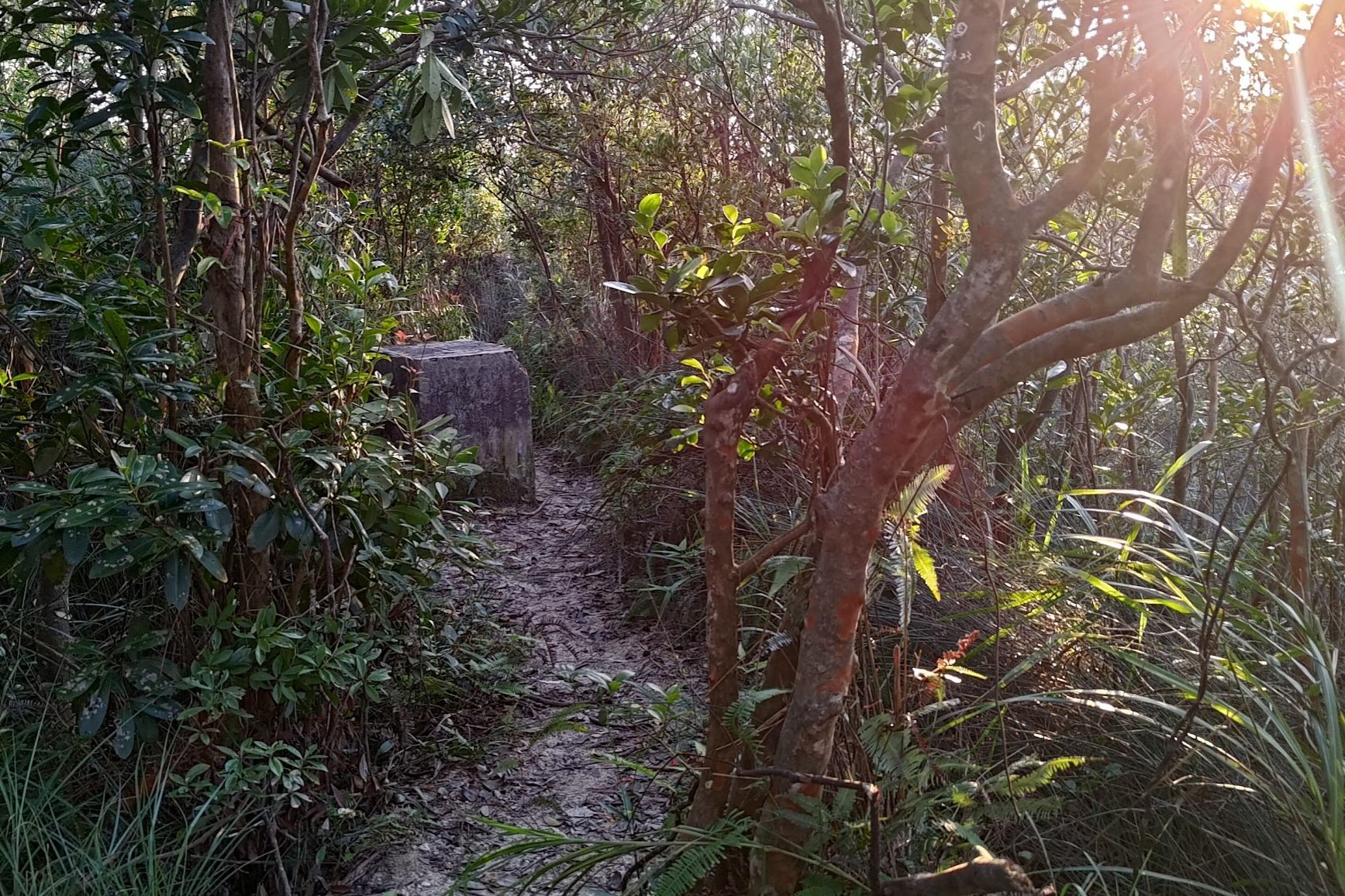
After passing another boundary stone, follow the path past the black and gold sign at the crossroads of paths.
You'll see a pavilion and Golden Hill Road just beyond. This is another optional escape point (go forward after the stairs in the opposite direction of the Golden Hill Road image above) if that was enough adventure for one day. You will reach Kowloon Reservoir and Tai Po Road in 20-30 minutes, where you can get a bus to the city.
Getting to Smuggler's Ridge
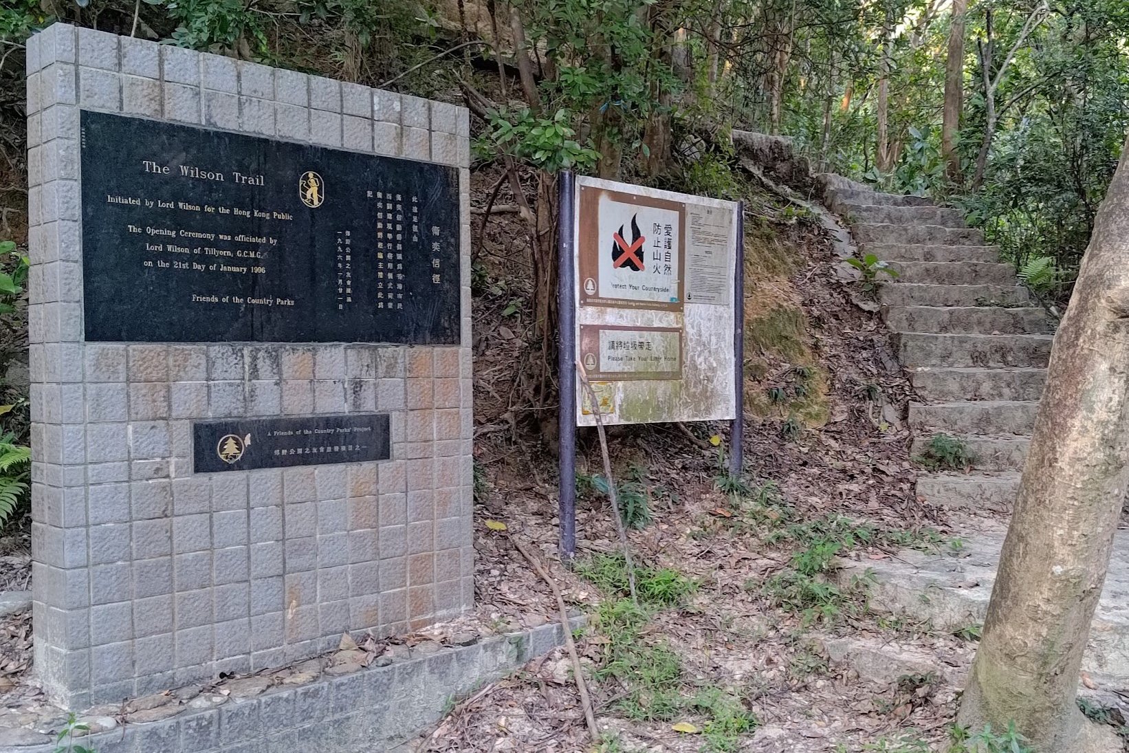
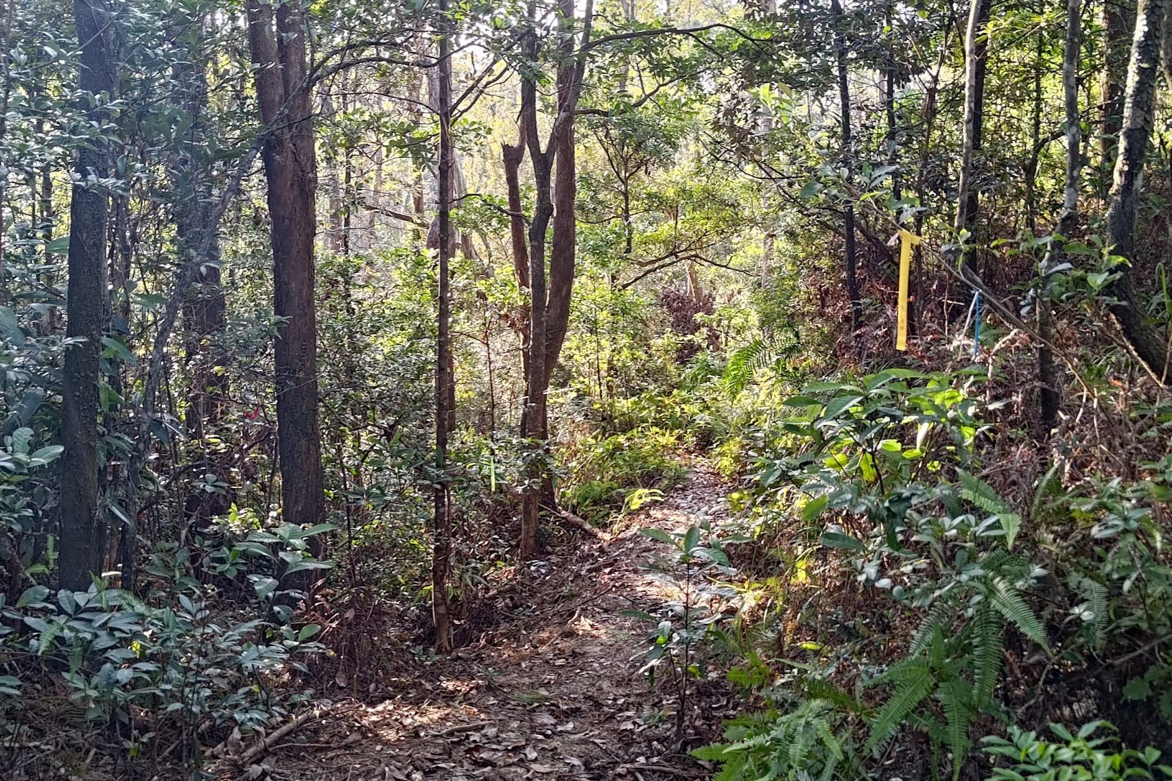
Once you arrive back at Golden Hill Road, you should follow it back toward the direction you came from rather than going ahead.
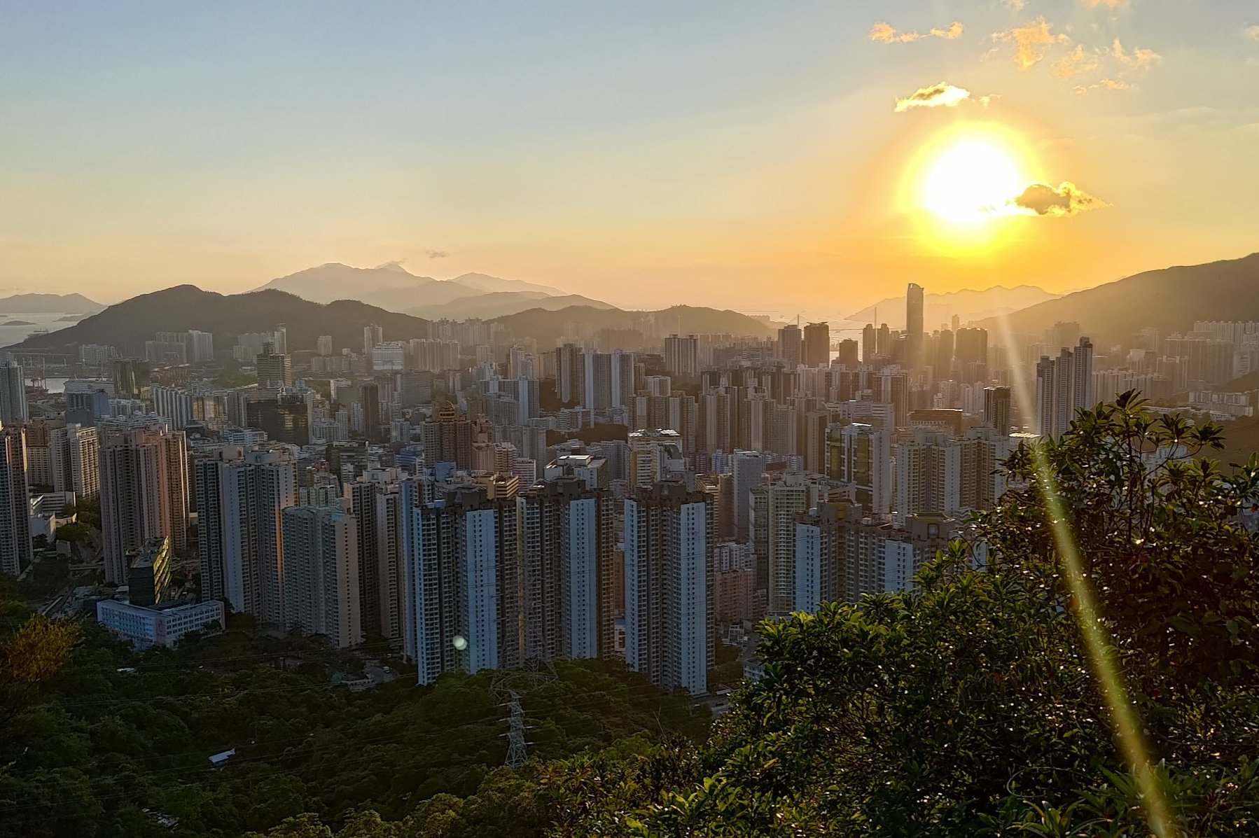
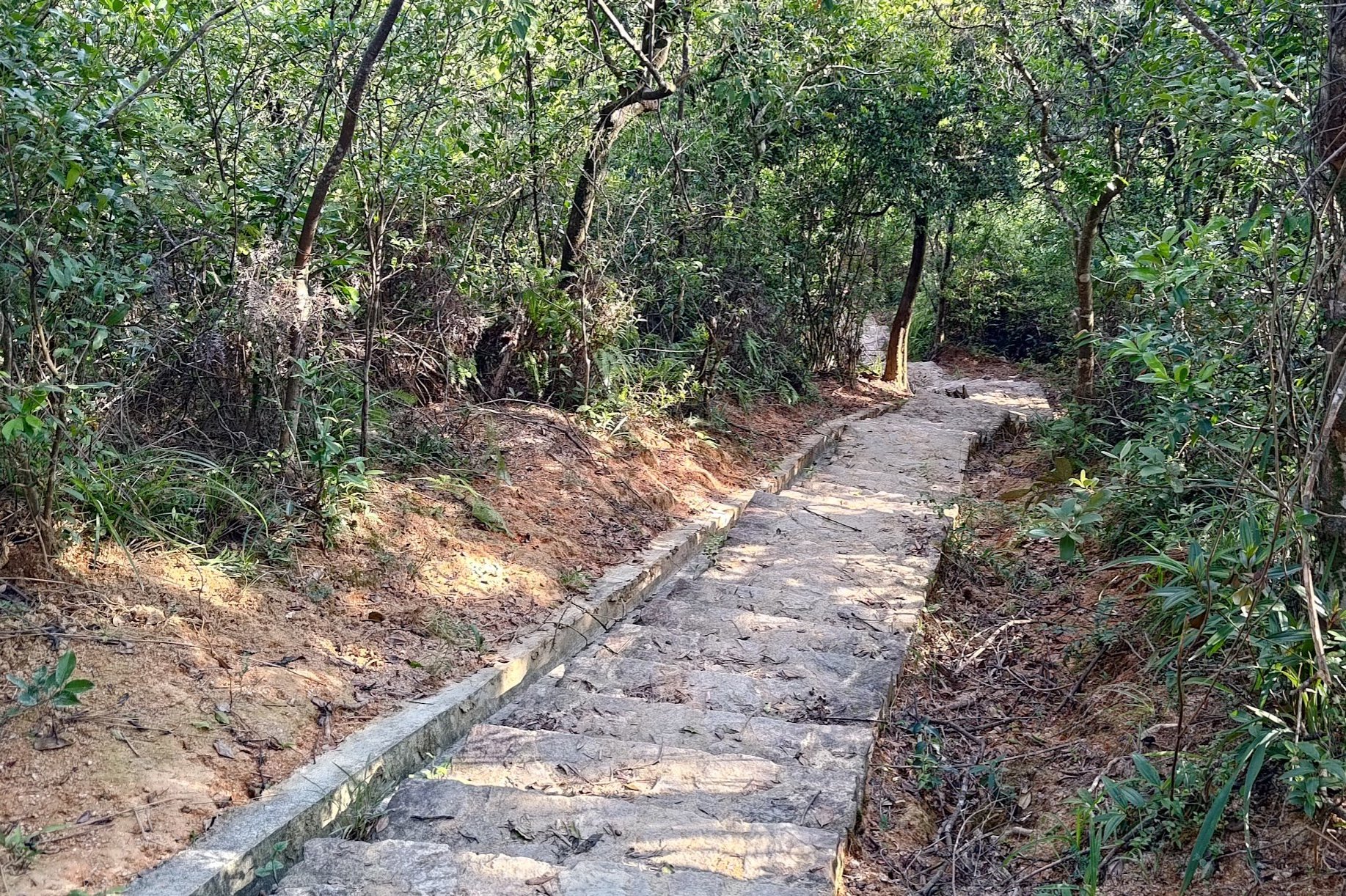
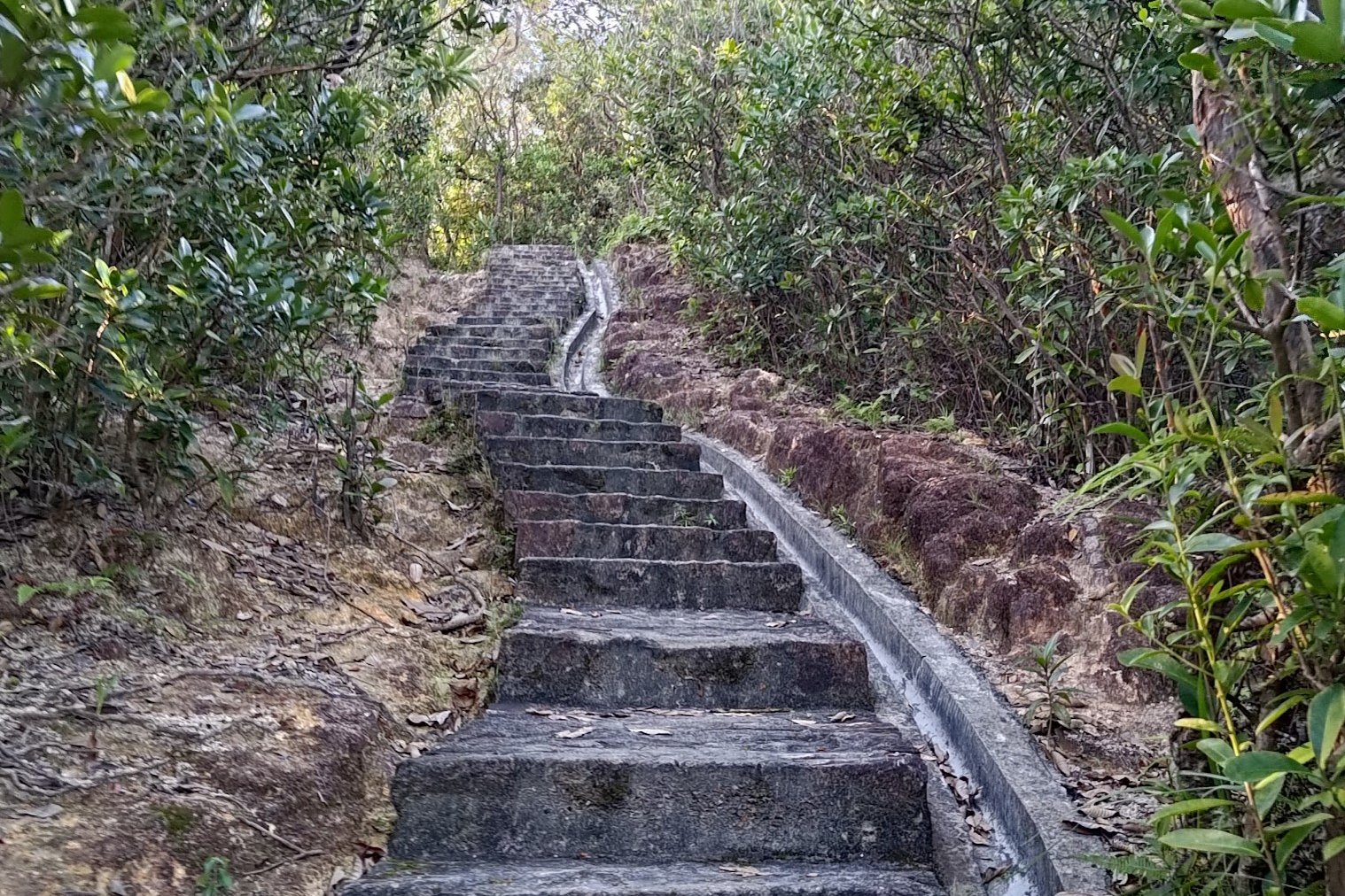
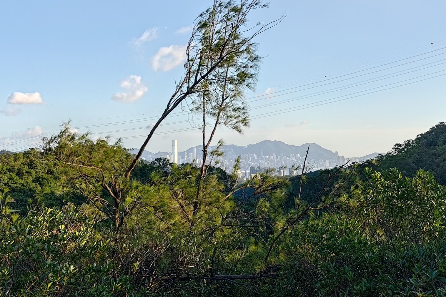
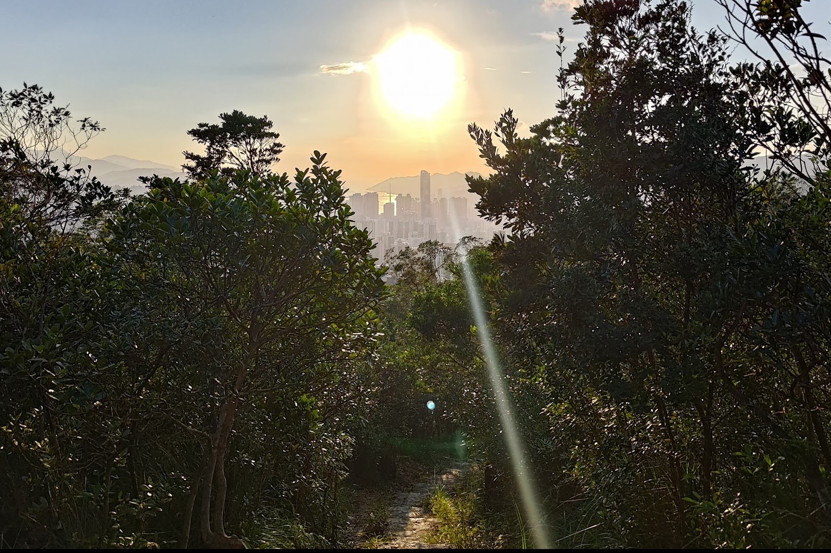
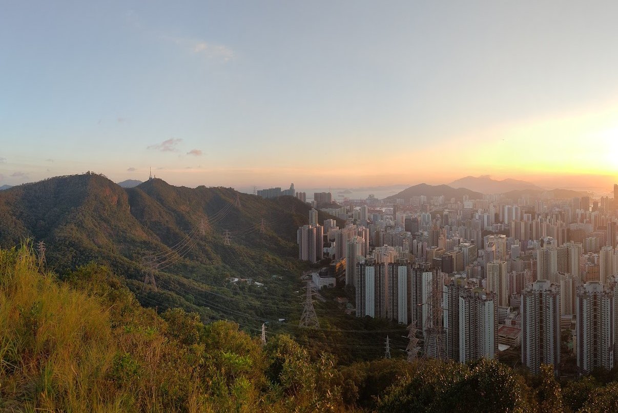
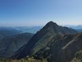
You'll see a black and gold Wilson Trail plaque with some stairs beside it a few minutes later. Begin a steep 10-15 minute climb up and enjoy some epic views as you do so. You can even see the skyscrapers of Hong Kong Island poking up through the trees, reminding you that even surrounded by nature, you're never too far from civilization in Hong Kong.
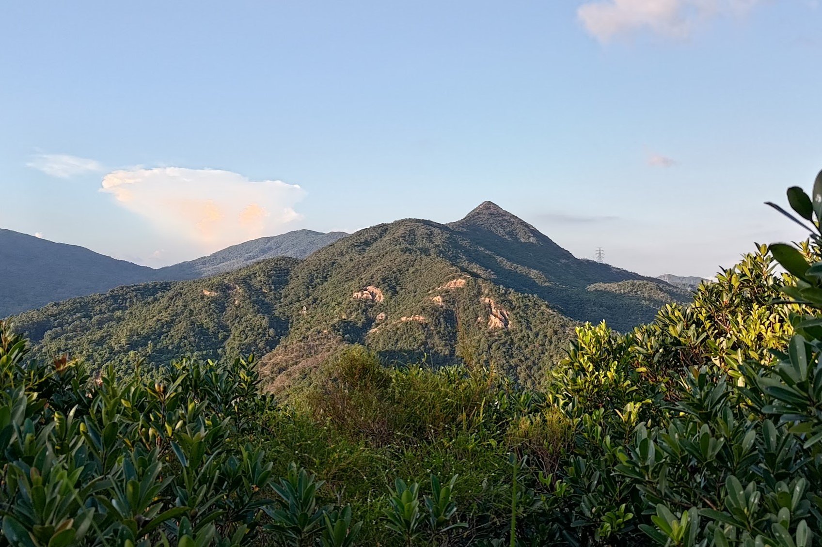
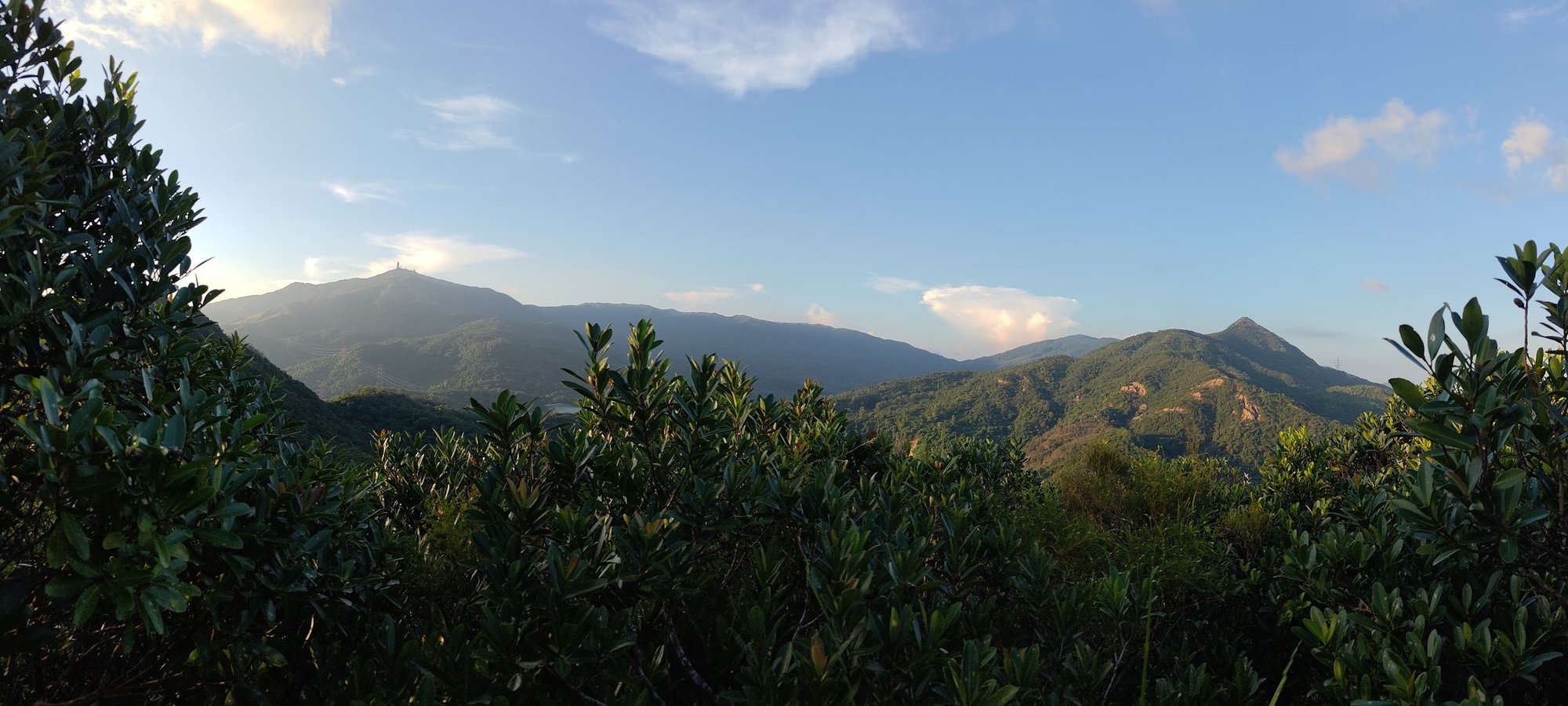
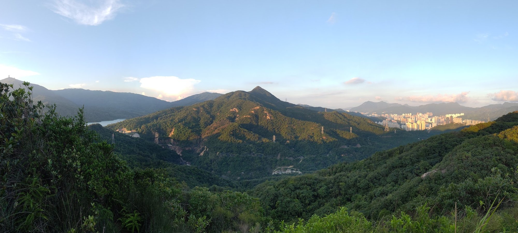
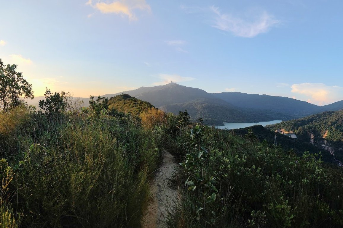
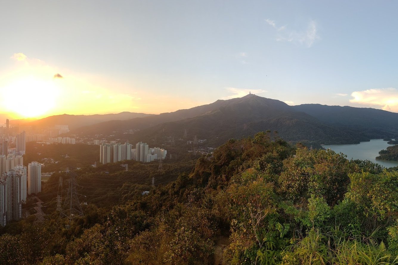
At the top, the trail flattens out before you begin to descend down some stairs. Here, you'll have gorgeous, uninterrupted views of Needle Hill and Tai Mo Shan (Hong Kong's tallest mountain).
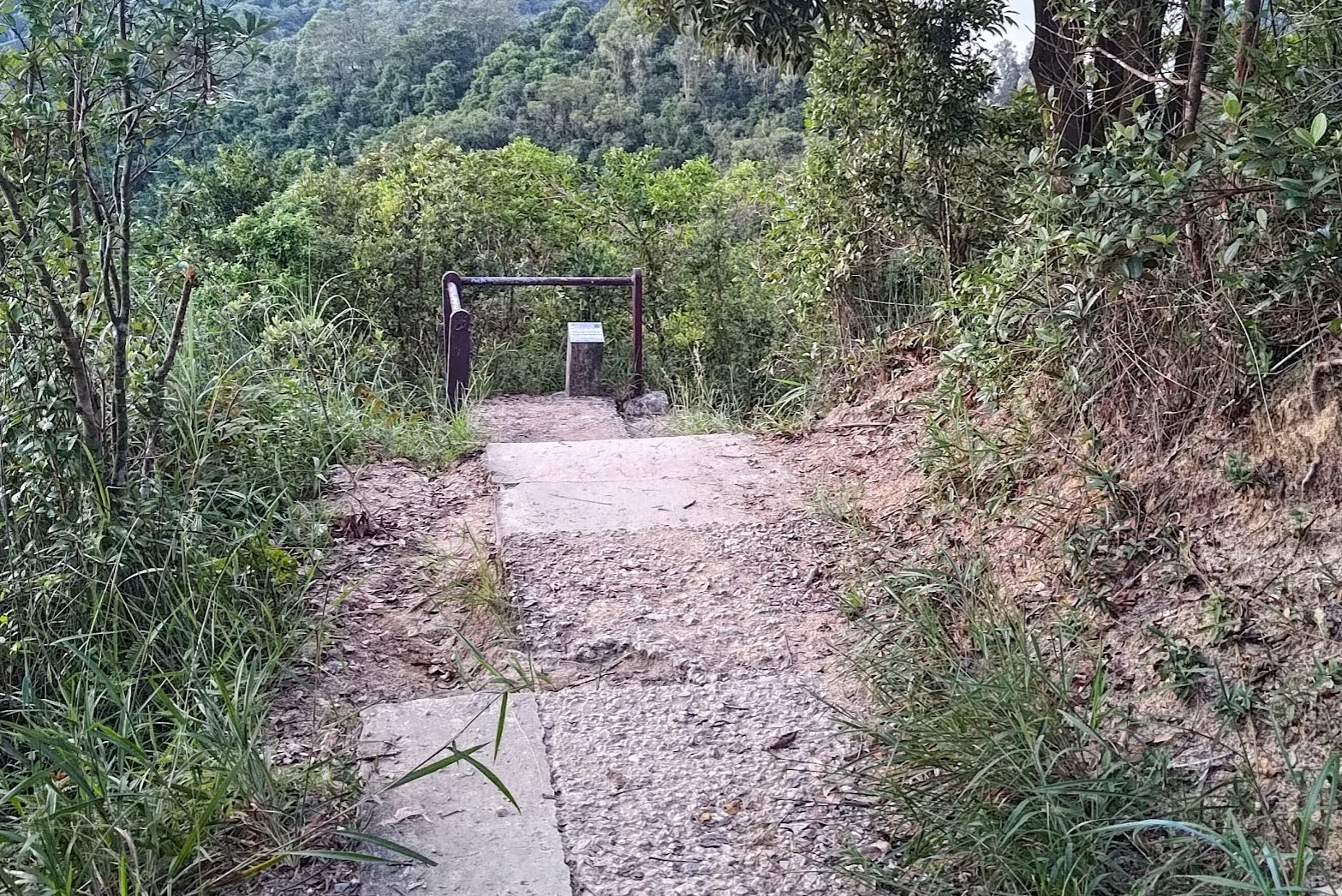
IMPORTANT: Don't Miss the Hidden Turn to Smuggler's Ridge
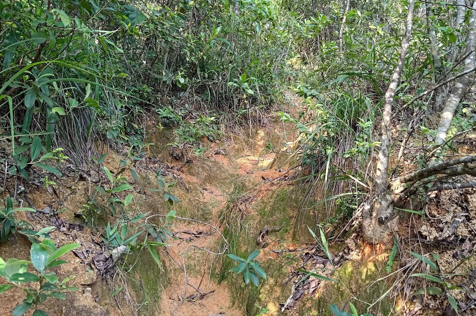
Given how epic the views are here, I initially totally missed the left turn at the bottom of the stairs. It's tucked away behind a bunch of foliage, so unless you're paying attention, you're going to go the wrong way here.
Once you see the secret stone, you know you're going the right way to Smuggler's Ridge!
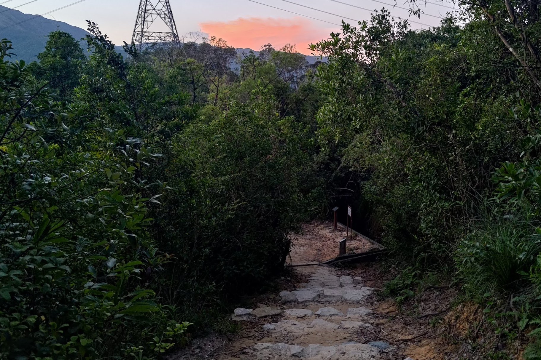
Smuggler's Ridge
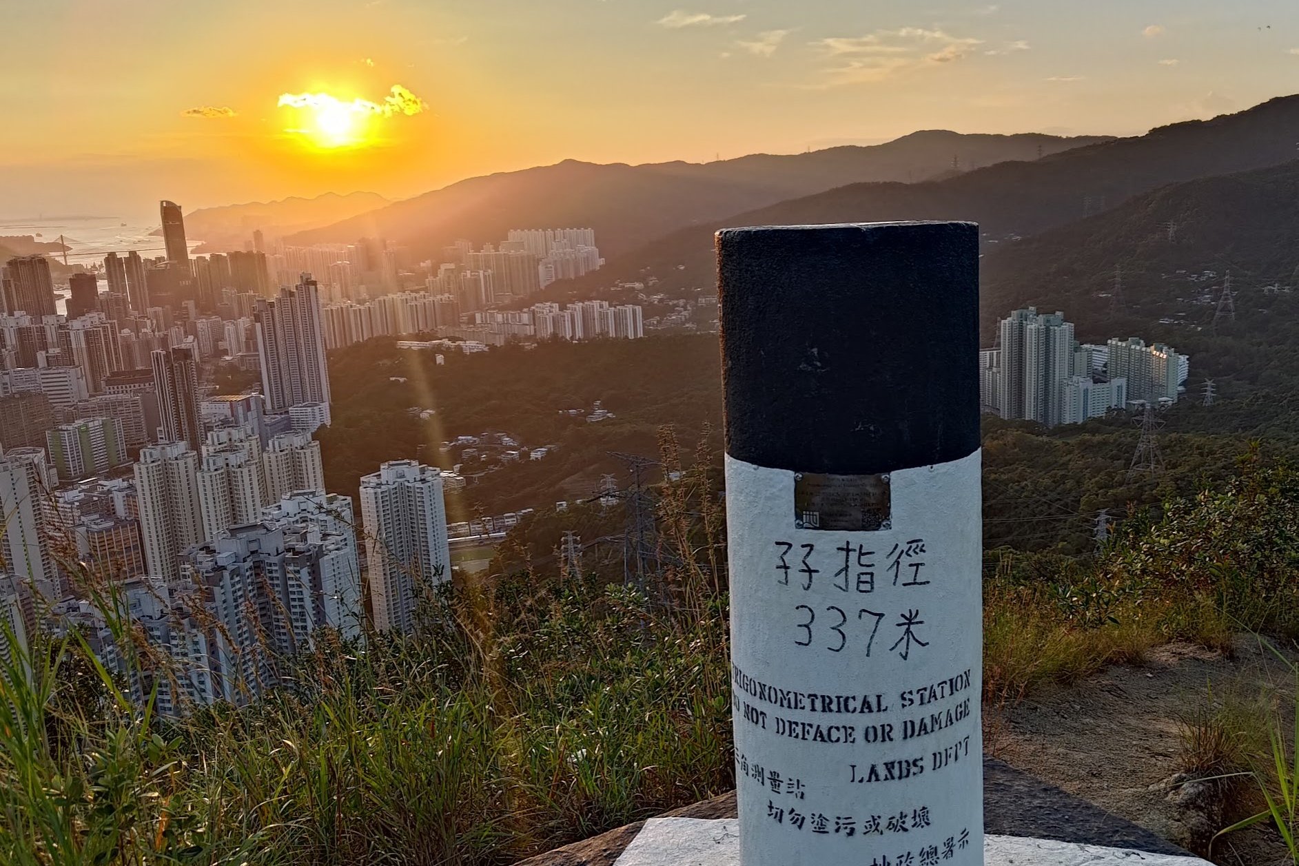
From the stone mentioned earlier, it takes about 15 minutes to climb to the top of Smuggler's Ridge ( 孖指徑 ).
There isn't much information on how this ridge got its cool name, but some sources claim that during WWII, Guomindang troops would utilize this ridge to smuggle munitions into China to resist the Japanese during their occupation of China. This is not 100% verified, so take it with a grain of salt.
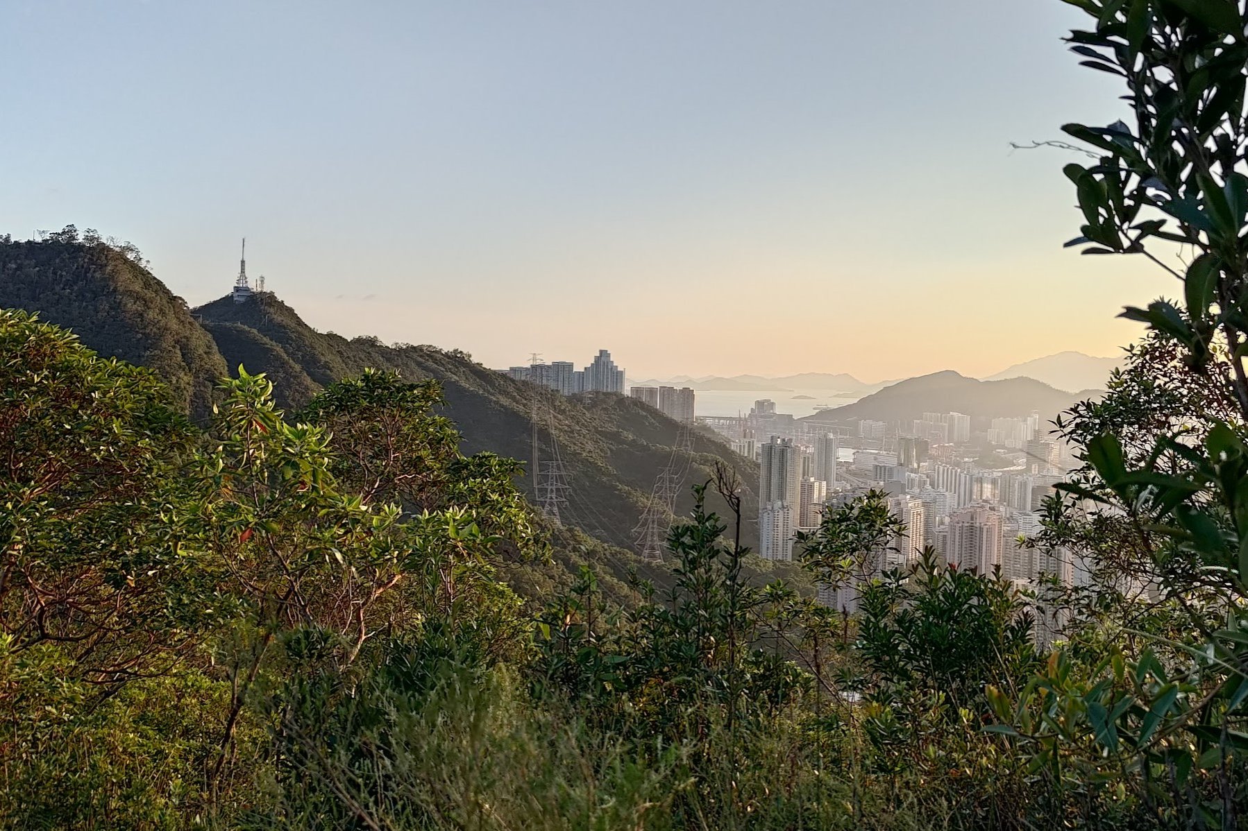
Whatever the case, the incredible city and mountain views from Smuggler's Ridge are undeniably special. You can really witness Hong Kong's dichotomy between the greenery and mountains present in the New Territories and the sprawling cityscape in Kowloon.
Once you're done admiring the scenery, start heading down toward Upper Shing Mun Reservoir.
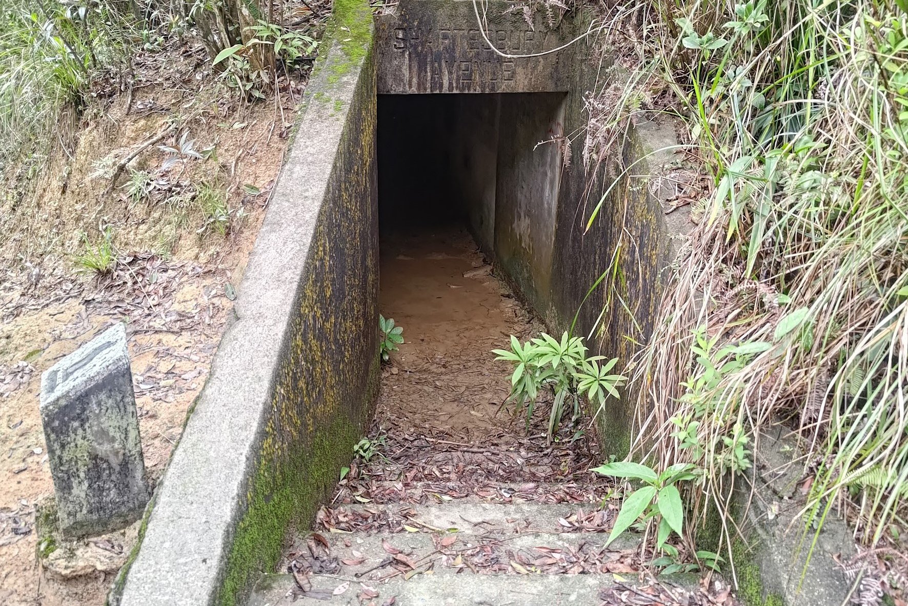
Shing Mun Redoubt WWII War Tunnels
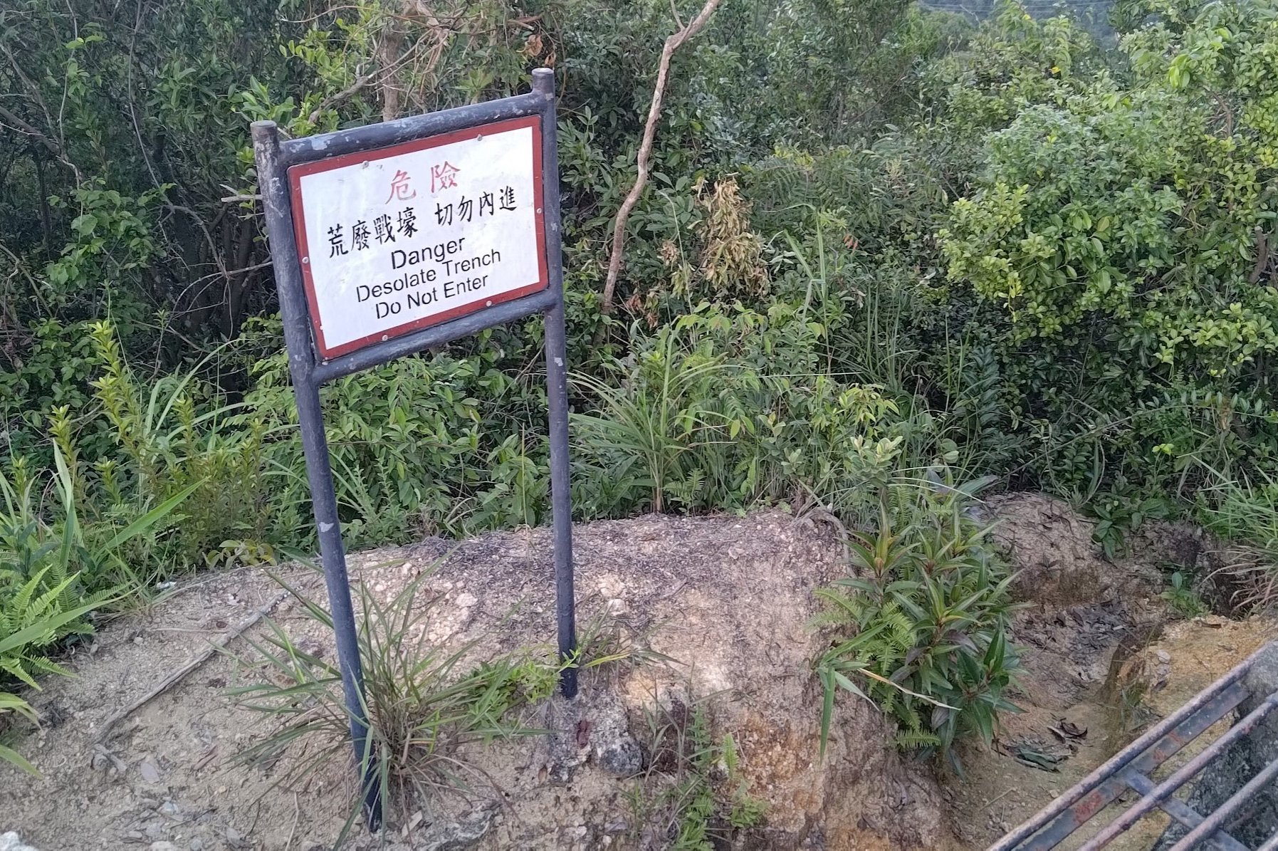
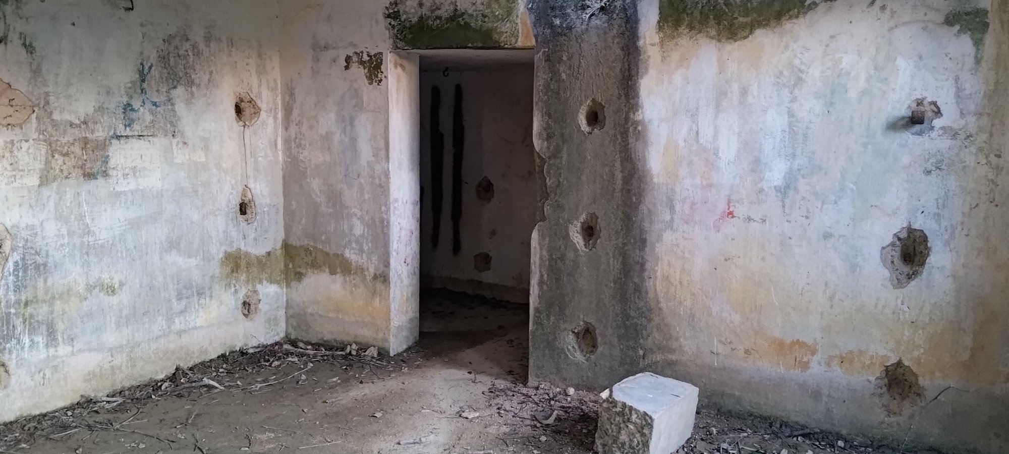
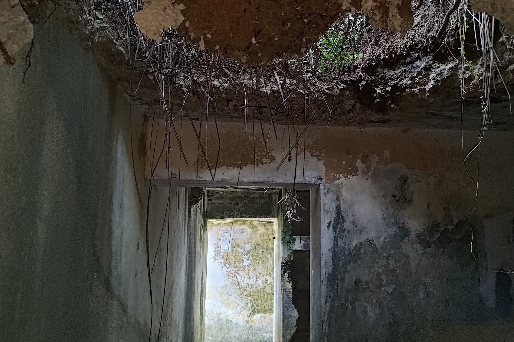
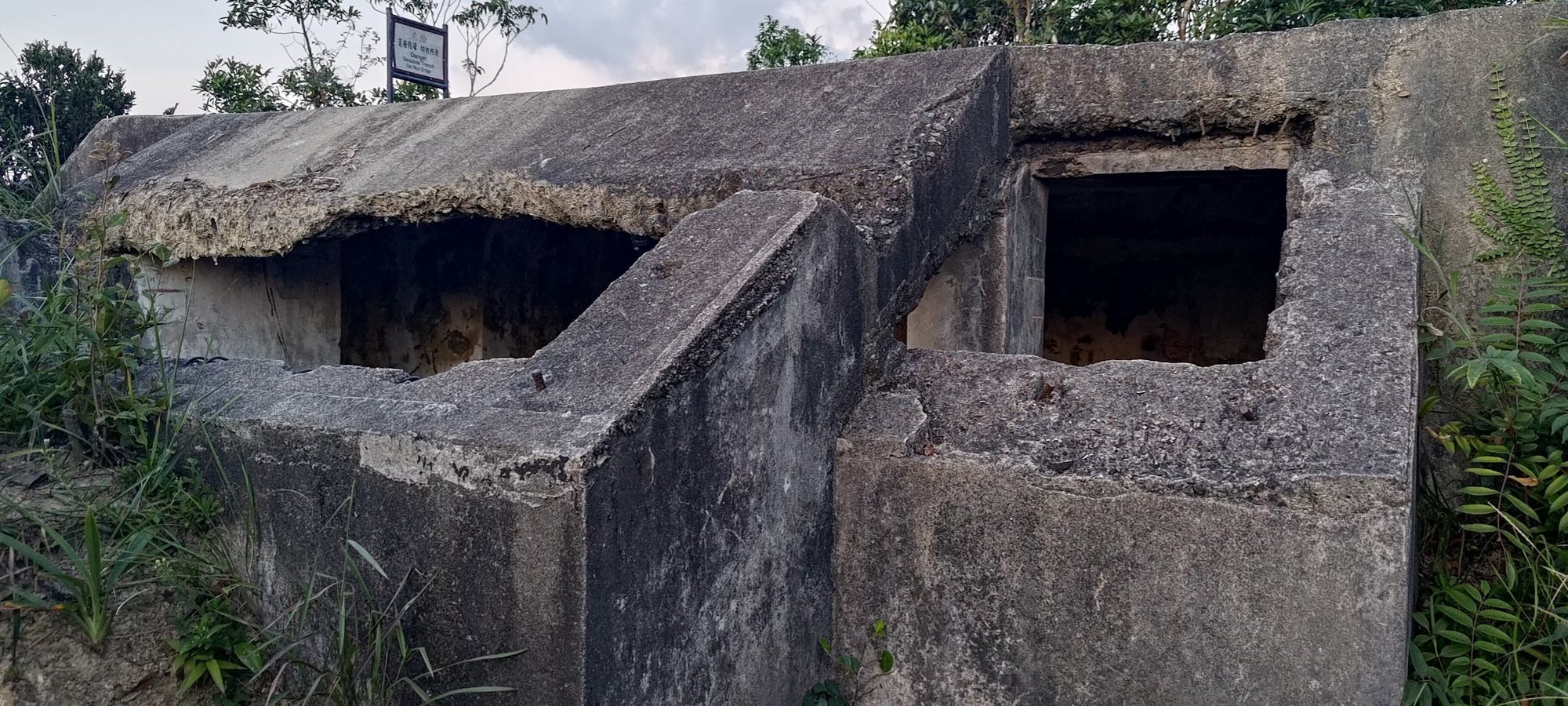
You only need to descend for about 5ish minutes from the top of Smuggler's Ridge before you'll see a danger sign that mentions you're at a 'desolate trench', whatever that means.
Anyway, said sign serves as a great marker for the first set of tunnels that make up the Shing Mun Redoubt and the Shing Mun War Relics Trail.
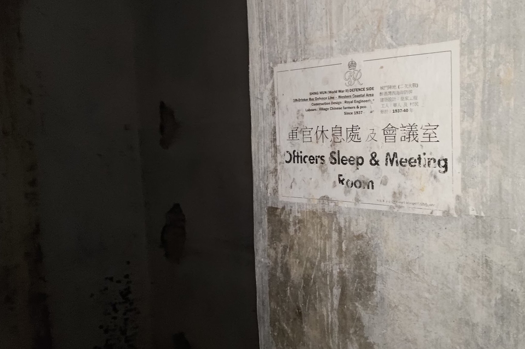
If you look behind the sign, you'll see an easy way into the tunnels, where someone has even put up information about the purpose of each room within.
The redoubt tunnel doesn't descend too far, but at the end, you'll end up at a trench that is off the beaten path. You can take the dirt trail beside it and end up emerging lower down near more tunnels, or you can retrace your steps back to the entrance of the redoubt and take the safer path down to the other tunnels.
The History of the Shing Mun Redoubt Tunnels
For historical context, the Shing Mun Redoubt (these tunnels) held significant strategic importance during World War II in the defense of Hong Kong. It served as the command headquarters for the Gin Drinkers' Line - a series of pill boxes, stretches of barbed wire, camoflaged trenches, interconnecting paths, weapons pits and minefields running east-west across the Kowloon Peninsula for some 18 kilometers.
Shing Mun Redoubt's elevated location provided advantageous views of the surrounding area, allowing defenders to theoretically observe and engage the enemy effectively. Its central command post facilitated coordination and communication between different defensive positions along the Gin Drinkers' Line.
Sadly, the Shing Mun Redoubt is thought to have been undermanned, which could be why it fell to the Japanese on December 10, 1941.
At the end, out of the 43 men stationed at the Shing Mun Redoubt, 3 were killed, 27 captured, and 13 fled.
With such deep-rooted history, this is a place that should be respected when you explore.
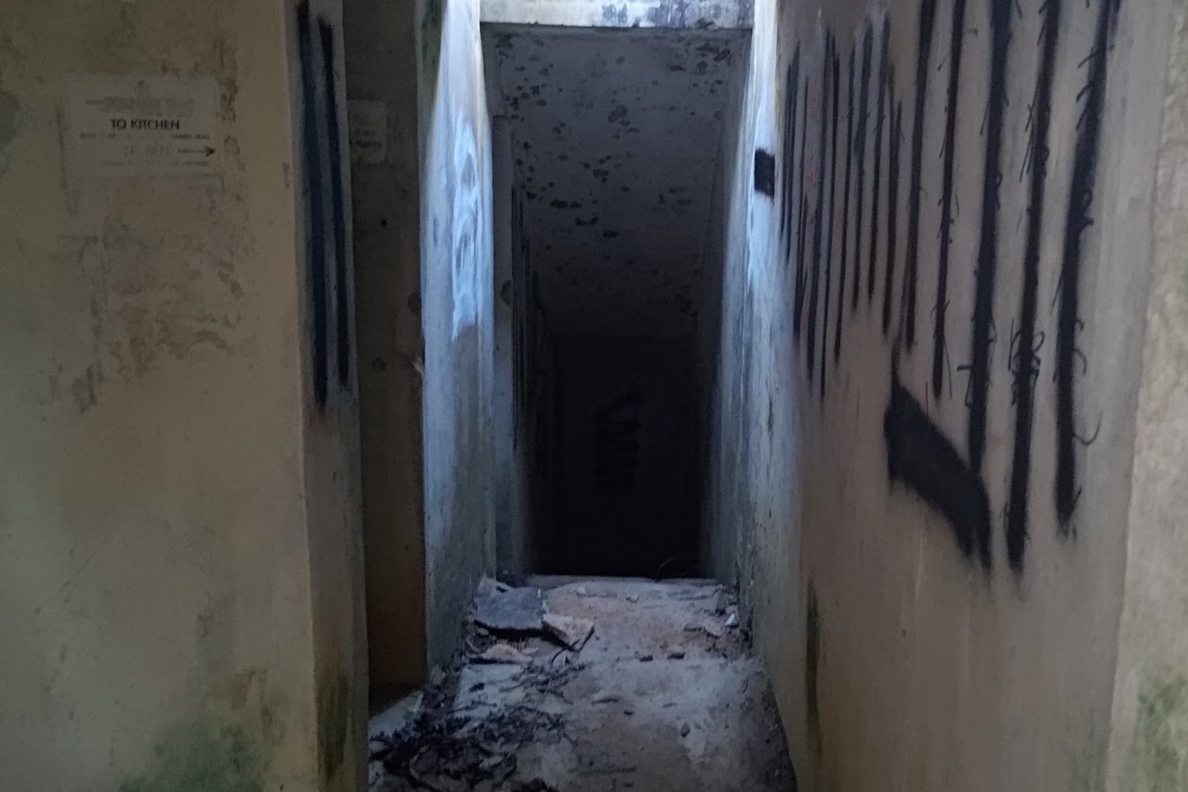
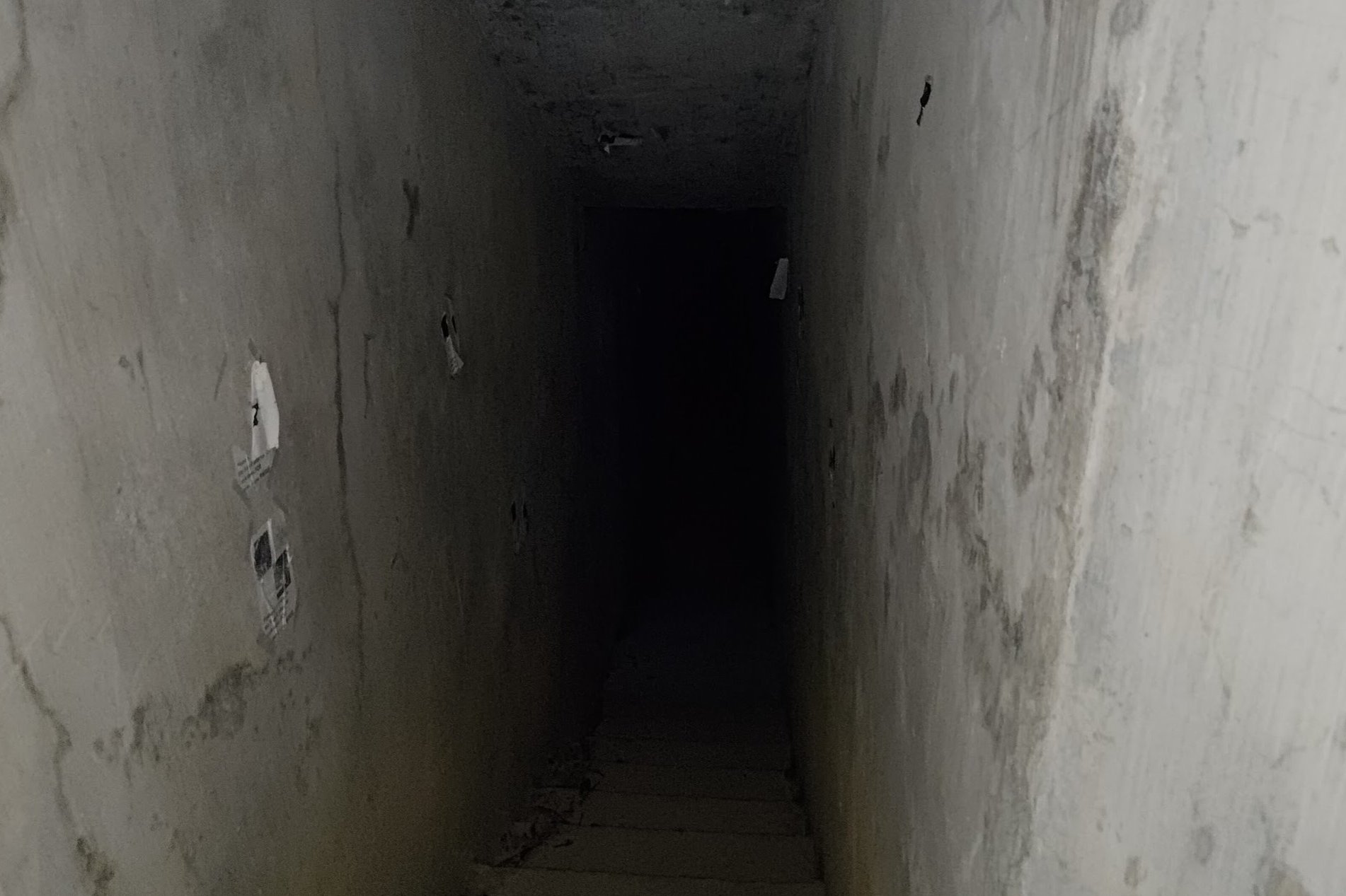
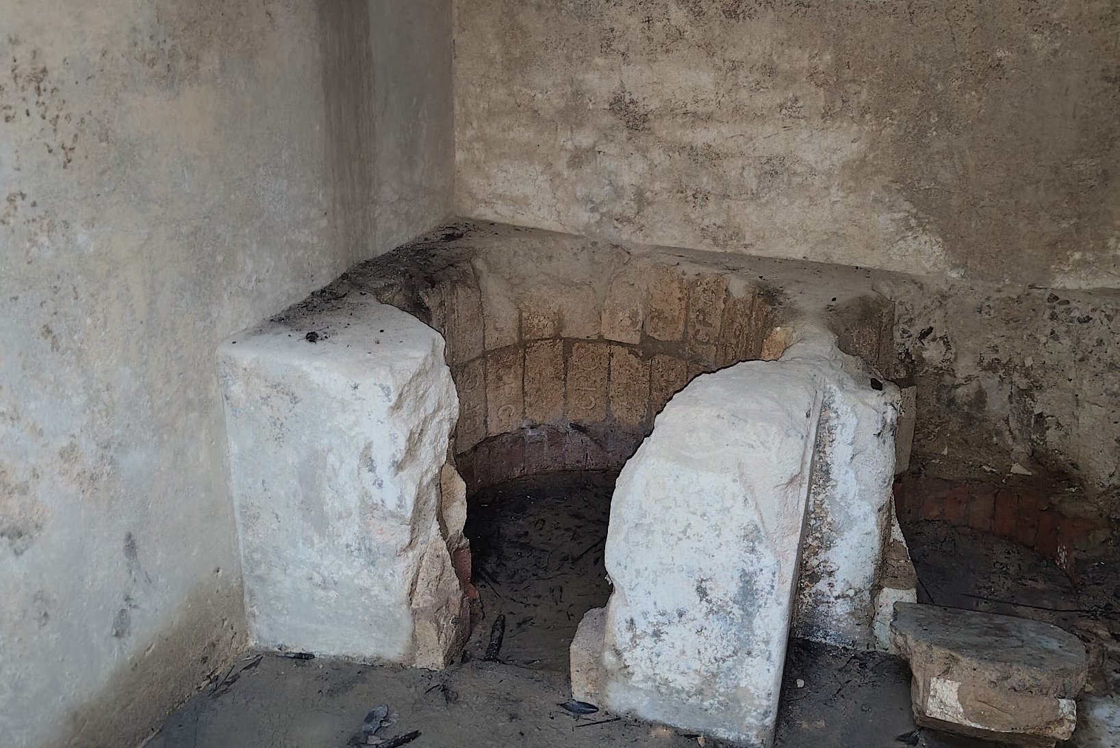
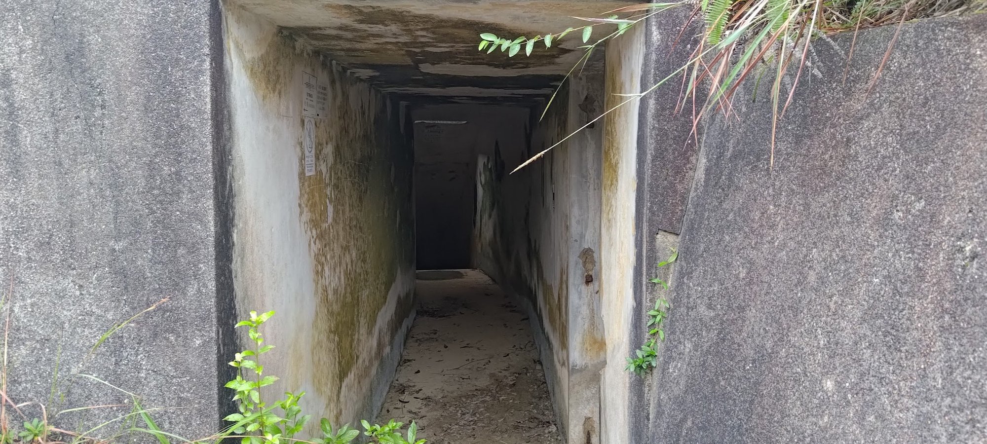
More Shing Mun Redoubt Tunnels
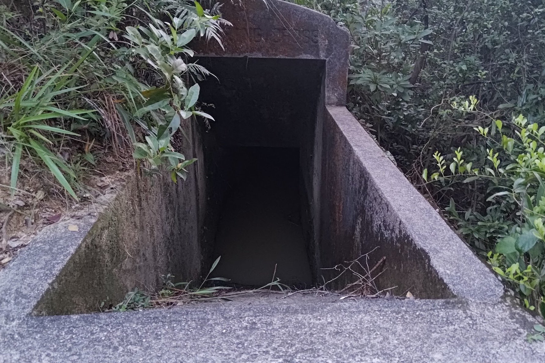
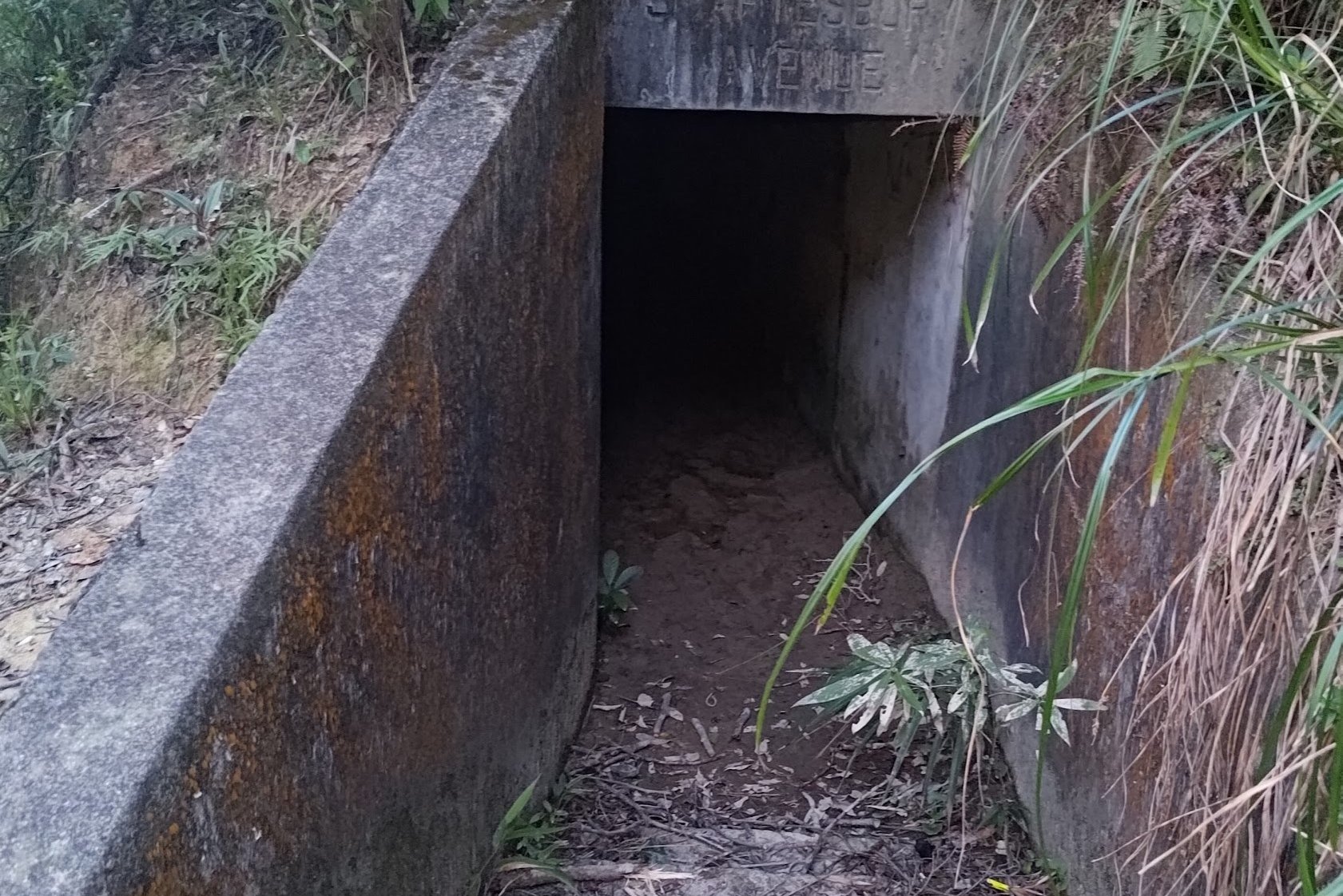
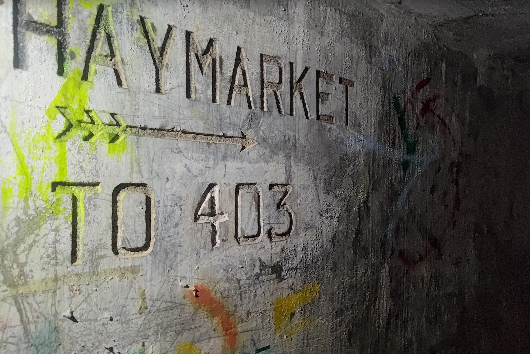
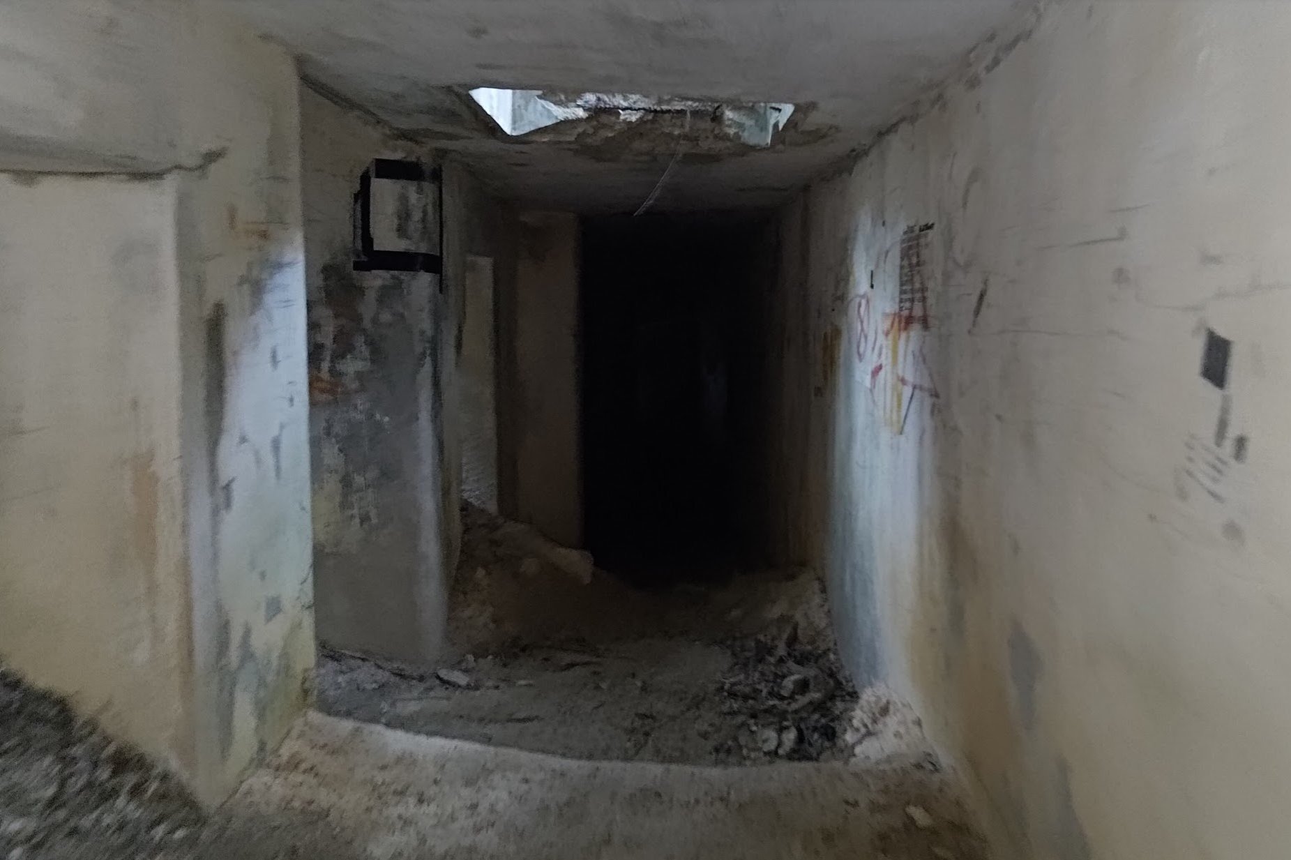
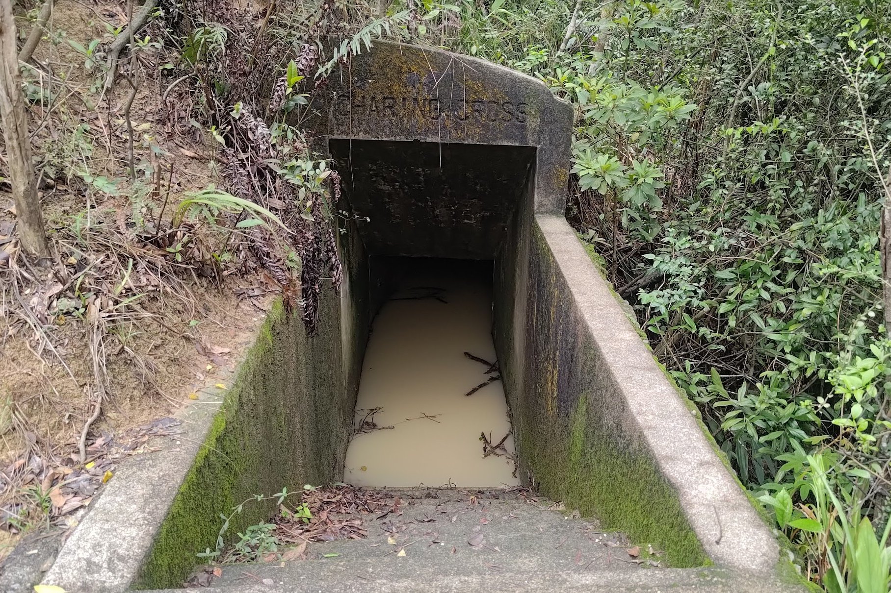
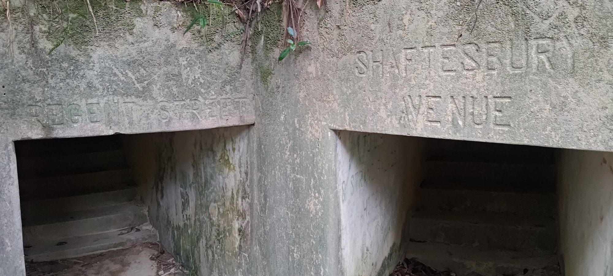
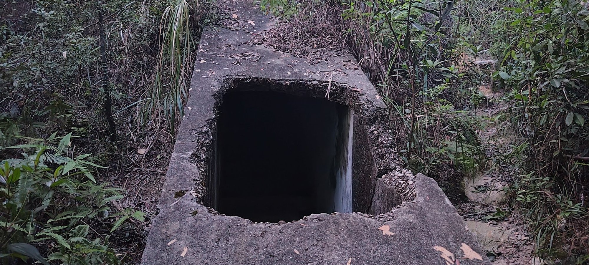
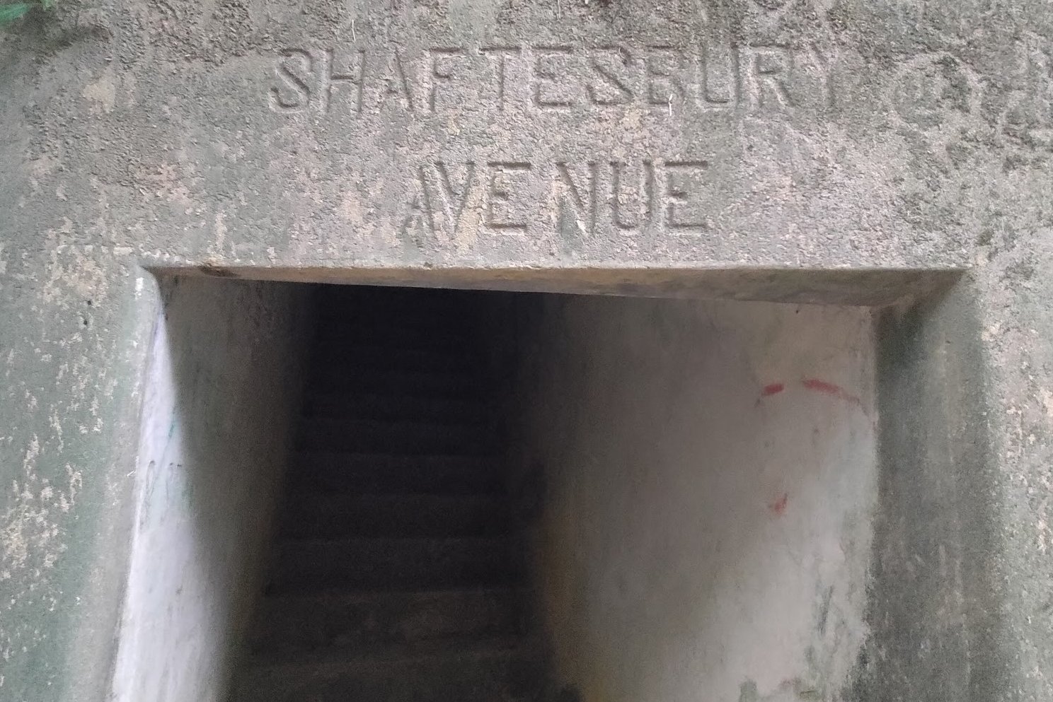
The entire descent toward Upper Shing Mun Reservoir is full of cool tunnels to explore. Sadly, it was getting dark, so I decided to just find various tunnel entrances because each one is named after famous streets in the UK.
If you don't keep your eyes peeled, you can easily miss some of the tunnel entrances. Luckily, there are signs that tell you where each tunnel entrance is.
The tunnels are all interconnected, so you could theoretically just use them to get around without using the stairs to descend at all.
The Eventful Route to the Bus Stop
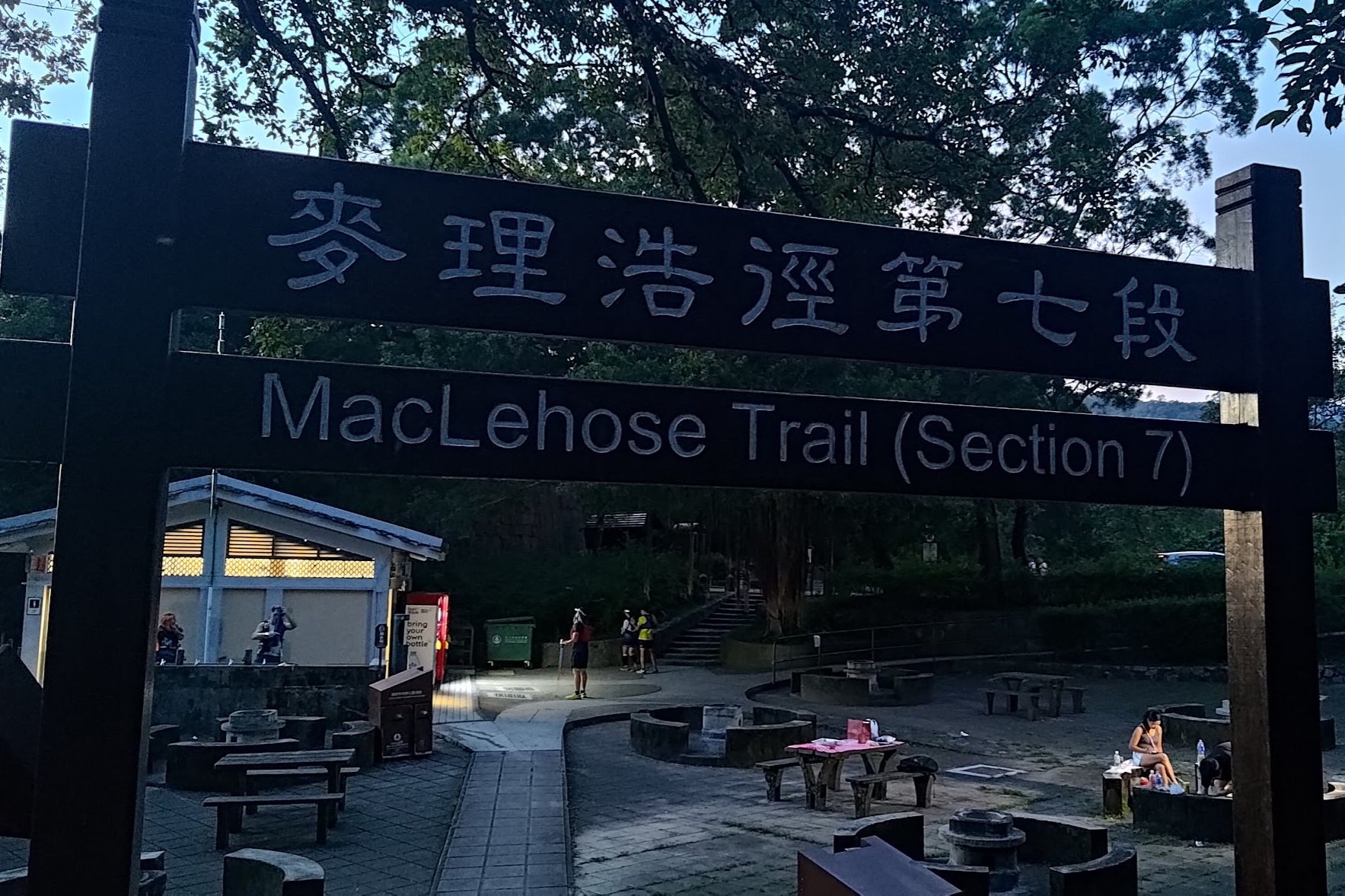
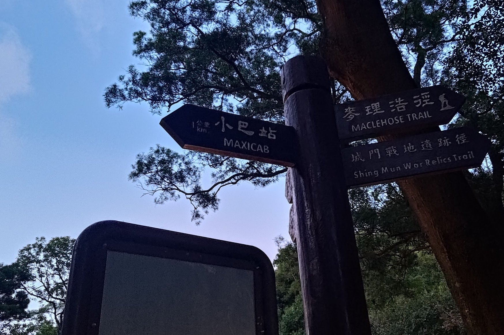
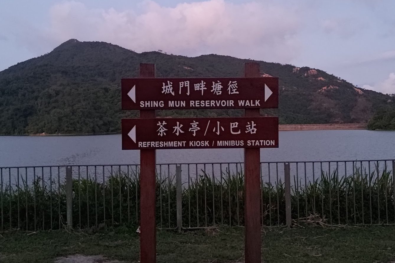
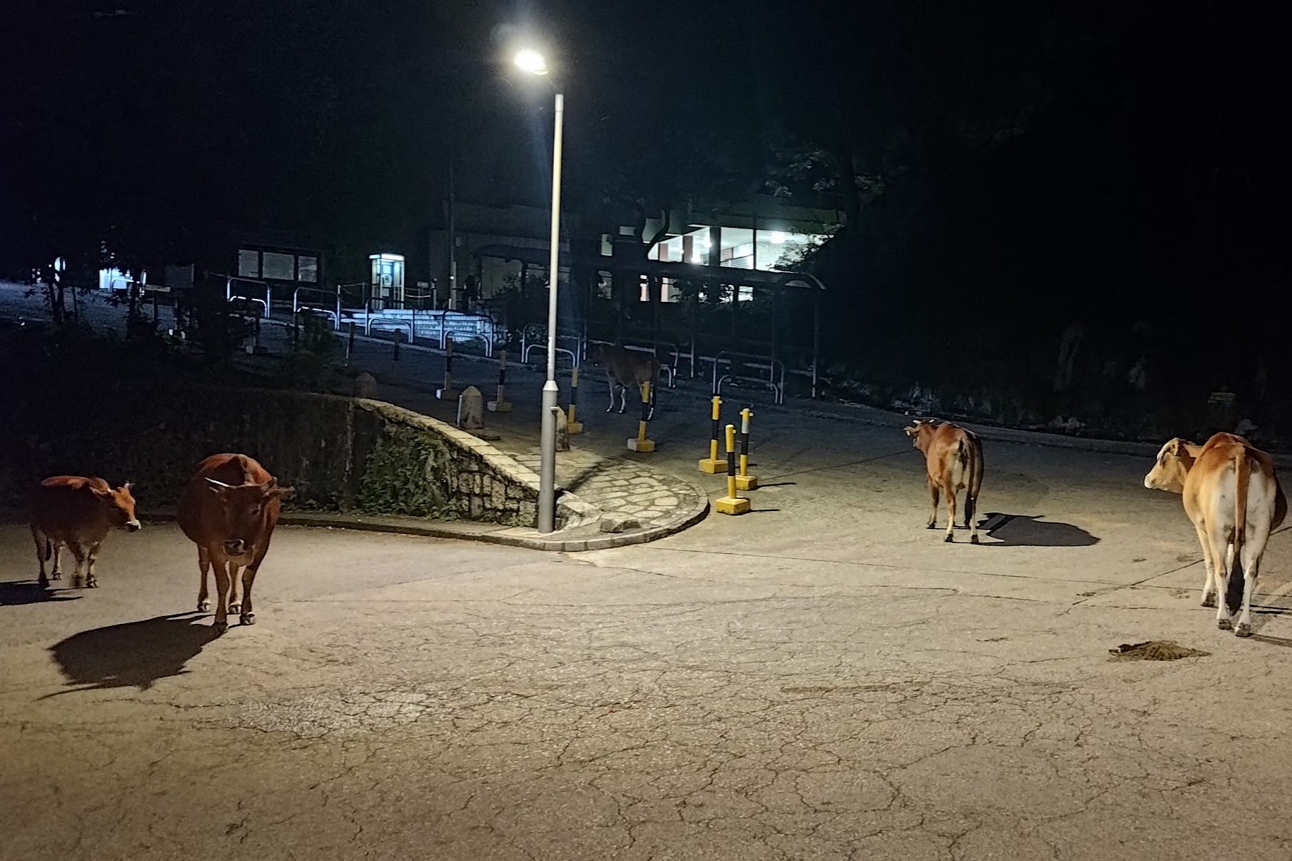
It's about a 15-minute walk from the Stage 7 MacLehose Trail arch to the minibus stop. Along the way, you should follow the 'Maxicab' sign and then the 'Minibus Station' sign a little while later.
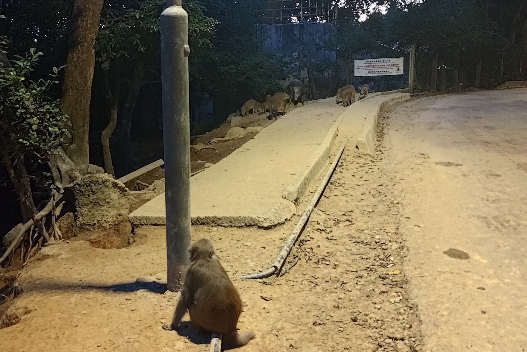
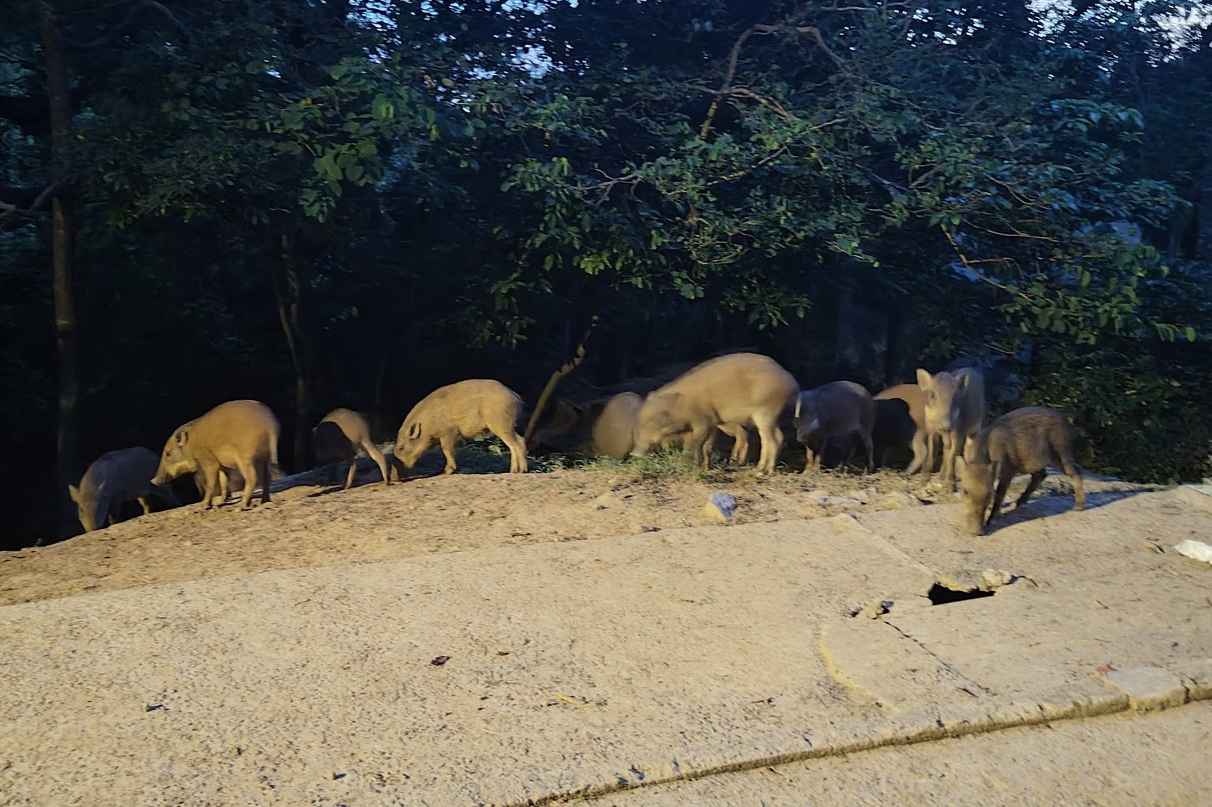
Stay on the concrete road and you should arrive at the bus stop in no time. Along the way, you're almost guaranteed to spot macaques, bringing your journey full-circle from Kowloon Reservoir.
You may also see wild boars and cows, too.
Getting Back
Take the number 82 minibus back to Tsuen Wan. It's the last stop, so you don't need to worry about telling the driver anything.
You'll be dropped off right near Tsuen Wan MTR Station. There are also a load of buses in the area that go to plenty of different districts throughout Hong Kong.

