
Ma On Shan: Hong Kong’s Best Ridge Hike
Contents
- Essential Information
- Hike Highlights
- How Dangerous is this Hike?
- Google Route Map
- How to Get There
- Quick Route Summary
- Detailed Route
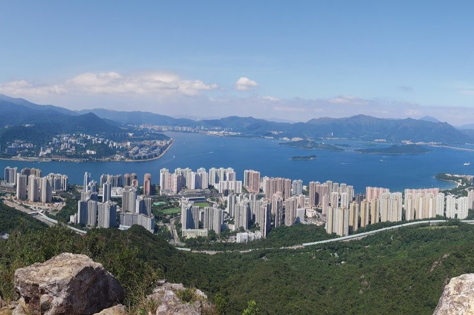
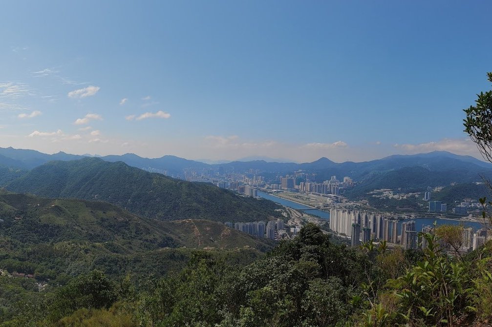
- City View
- Three Fathoms Cove Secret Viewpoint
- The Ridge Walk
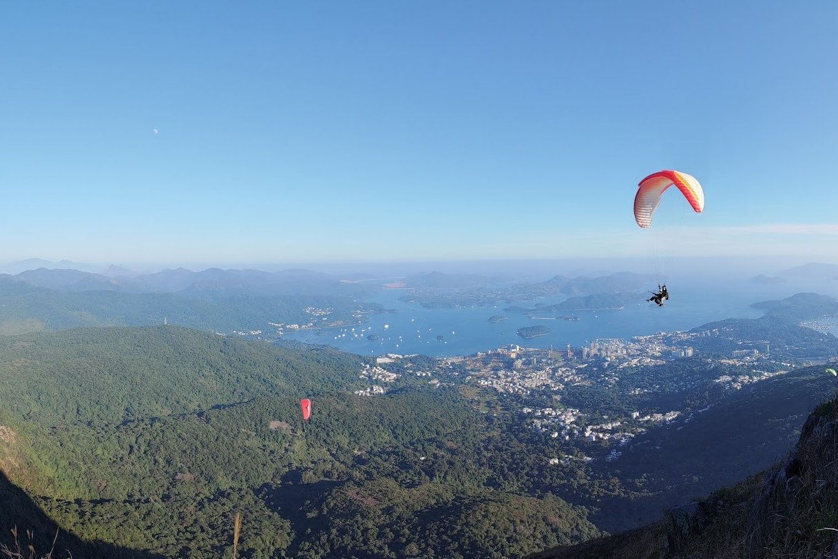
- Paragliders at Pyramid Hill
- Ngong Ping Campsite
- Getting Back
Essential Ma On Shan Hike Details
- District: New Territories
- Duration: 4.5-6 hours (depending on how you reach the start point)
- Distance: 11-12 km
- Max Elevation: 702 meters
- Difficulty: 4/5
- Facilities: public toilet at BBQ area before the real hike begins
Why Hike Ma On Shan?
Ma On Shan ( 馬鞍山 ), or Horse Saddle Mountain, is one of the most beautiful scenic hikes in all of Hong Kong. The jaw-dropping views of endless undulating mountains, shimmering turquoise waters and even a smattering of vibrant villages is the stuff of dreams. Look out for the bright parachutes of paragliders who frequent the area!
While this hike presents a fair challenge, the effort worth it! Just know from the start that you will have to use your hands to help you climb to the top since the trail is quite rocky and steep. At times, there isn’t even a ‘trail’ to follow and you just pick the route that suits you best.
As far as rewarding hikes go, this might just be the best in Hong Kong. You’ll encounter a new stunning view around every bend, meaning there’s eye candy and marvellous photo opportunities aplenty! Ending in Sai Kung guarantees you’ll be spoilt for food and drink options as a post-hike treat.
How Dangerous is the Ma On Shan Hike?
Ma On Shan is definitely one of Hong Kong's tougher hikes. However...
If you’ve been on longer hikes before and don’t mind getting your hands dirty, Ma On Shan is doable – albeit with plenty of sweat and effort. You should have a good level of fitness since this hike lasts at least four and a half hours if you take a taxi to the actual start point. It’s at least an hour longer if you walk to the start.
The initial section of upward climbing is certainly steep and is not suitable for those with vertigo or a fear of heights (apologies to a certain person who helped me discover this fact). But unless you do anything silly, you should be quite safe. You’ll need to use your hands to climb at certain steep sections, so bring gloves if your skin is sensitive.
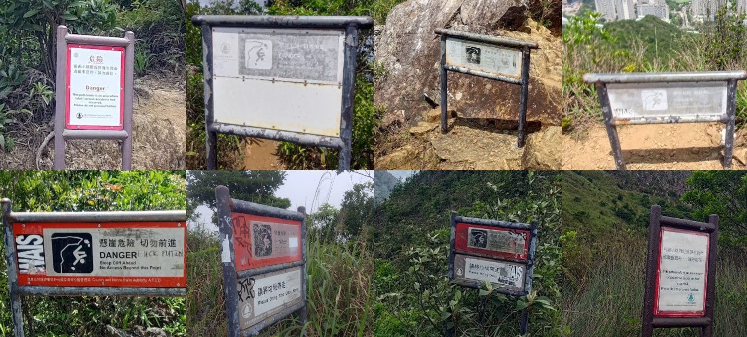
The hike terrain can be slightly tricky to navigate - as a plethora of danger signs will remind you.
At times, it feels like the authorities believe that you’re a certain pure-of-heart hobbit on a quest to Mount Doom to get rid of The One Ring!
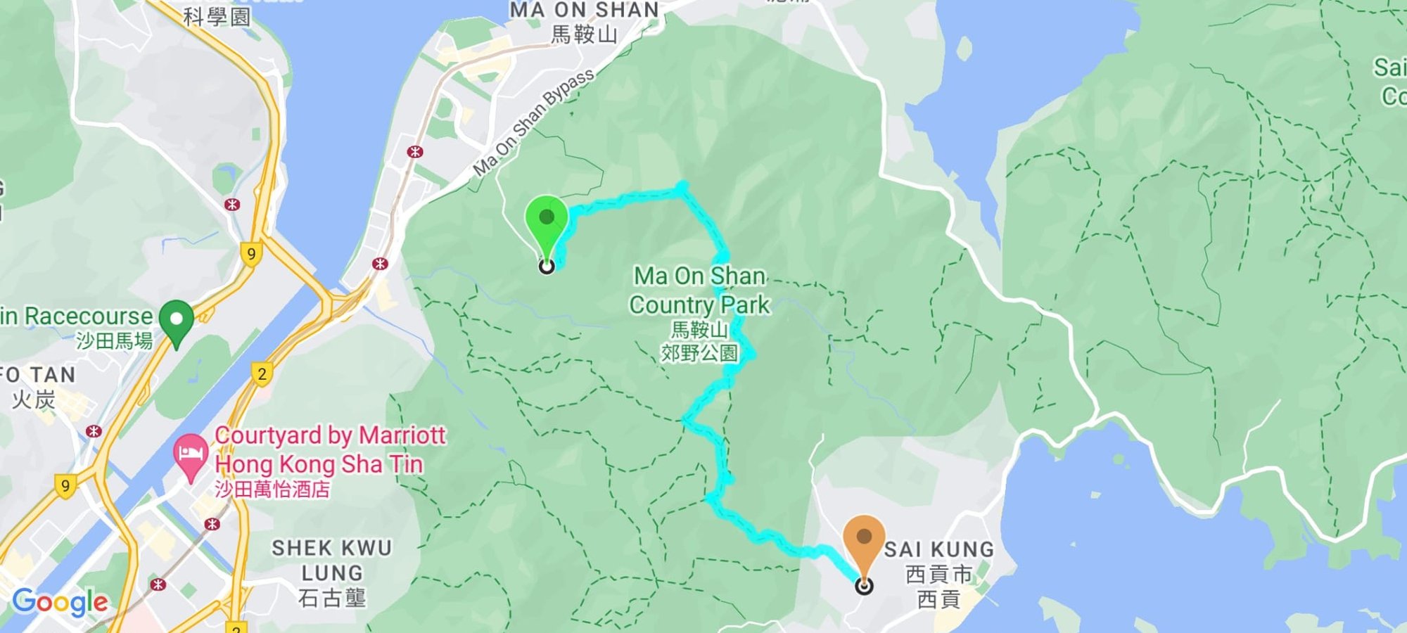
Google Route Map
How to Get to Ma On Shan MTR Station:
By Bus: Take any bus that goes near Ma On Shan Station and then walk or take a taxi to the start point.
From HK Island
- 681
From Kowloon
- 81C
- 85X
- 89C
- 286C
From the New Territories
- 81C
- 43X
*There are loads more buses that go to Ma On Shan, so find the one that’s closest to you
The start of the hike is at the Ma On Shan Country Park BBQ Site. There are a few ways you can get there from Ma On Shan MTR Station
Getting From Ma On Shan MTR Station to the Hike Start Point
By Taxi (Saves you 1 Hour)
Take a taxi from Ma On Shan station (or anywhere else) and tell the driver you want to go to Ma On Shan Country Park BBQ Site: 馬鞍山郊野公園燒烤地點
By Minibus
The NR84 village bus goes to the start point from On Luk. It's HIGHLY UNRELIABLE and will give priority to villagers, so you might not even get on.
By Walk (Adds 1 Hour)
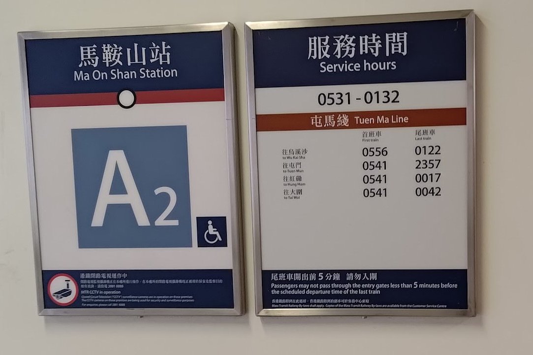
- Leave Ma On Shan Station from exit A2
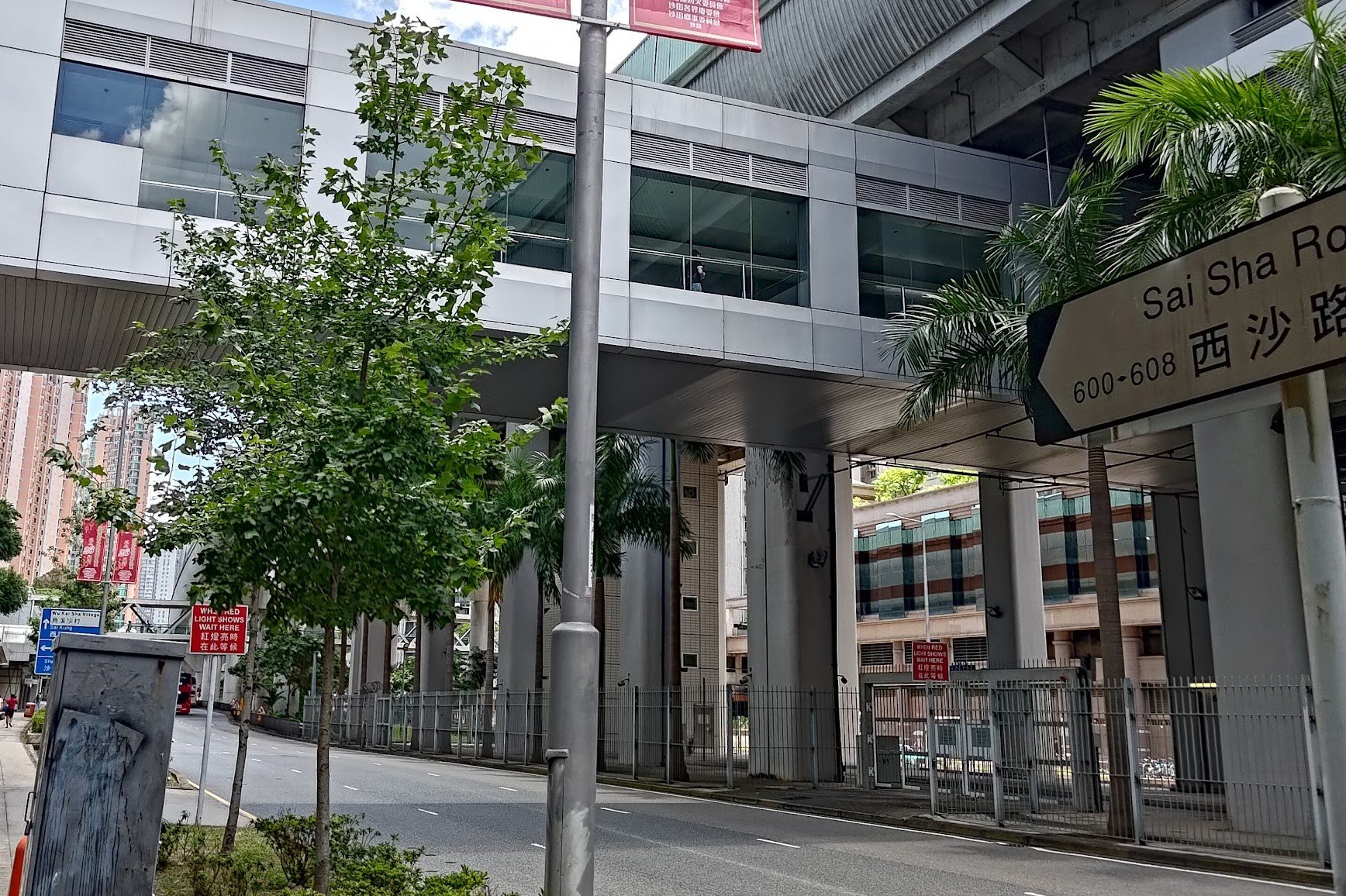
- Leave the mall and walk down Sai Sha Road toward Ma On Shan Road
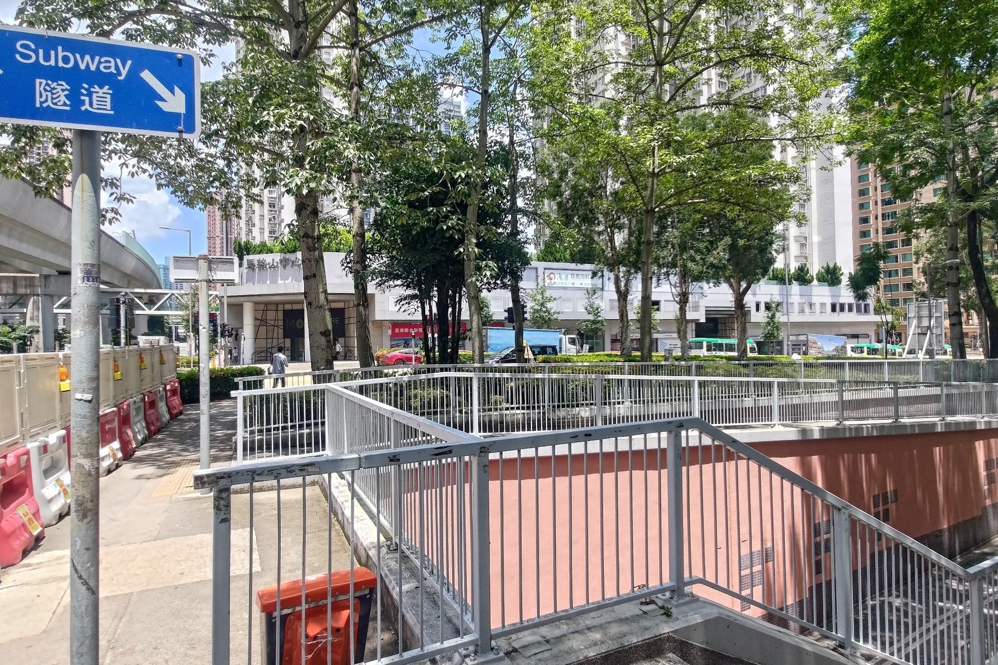
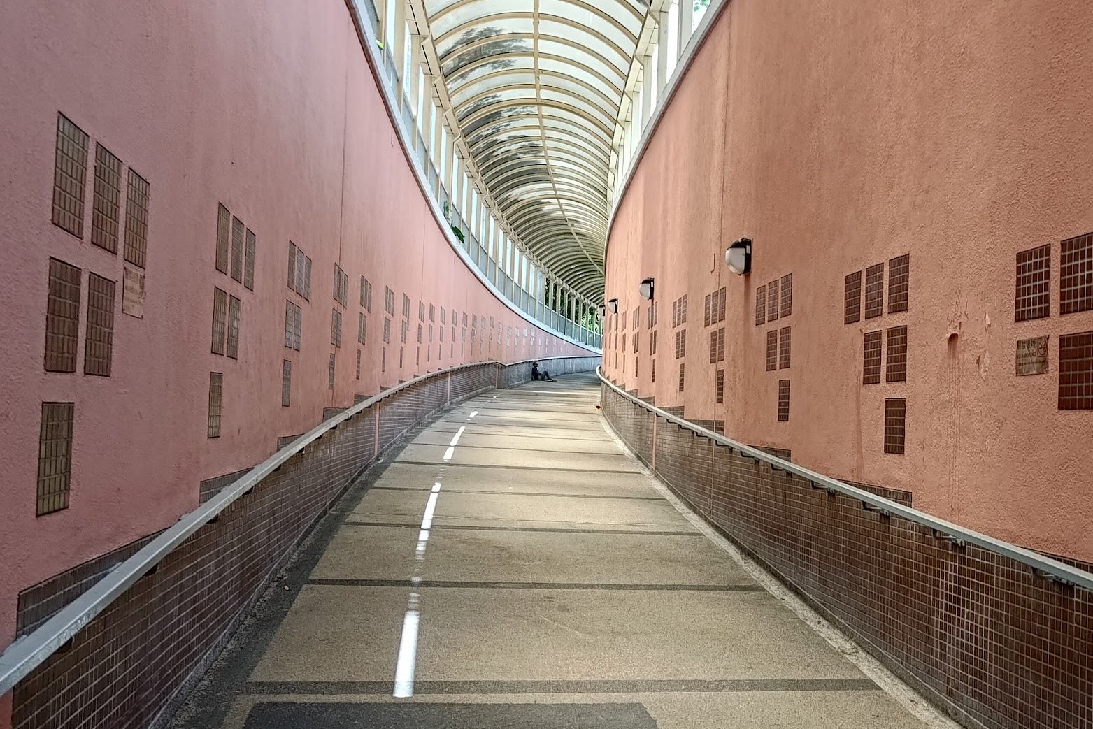
- Take the stairs into the underground walkway
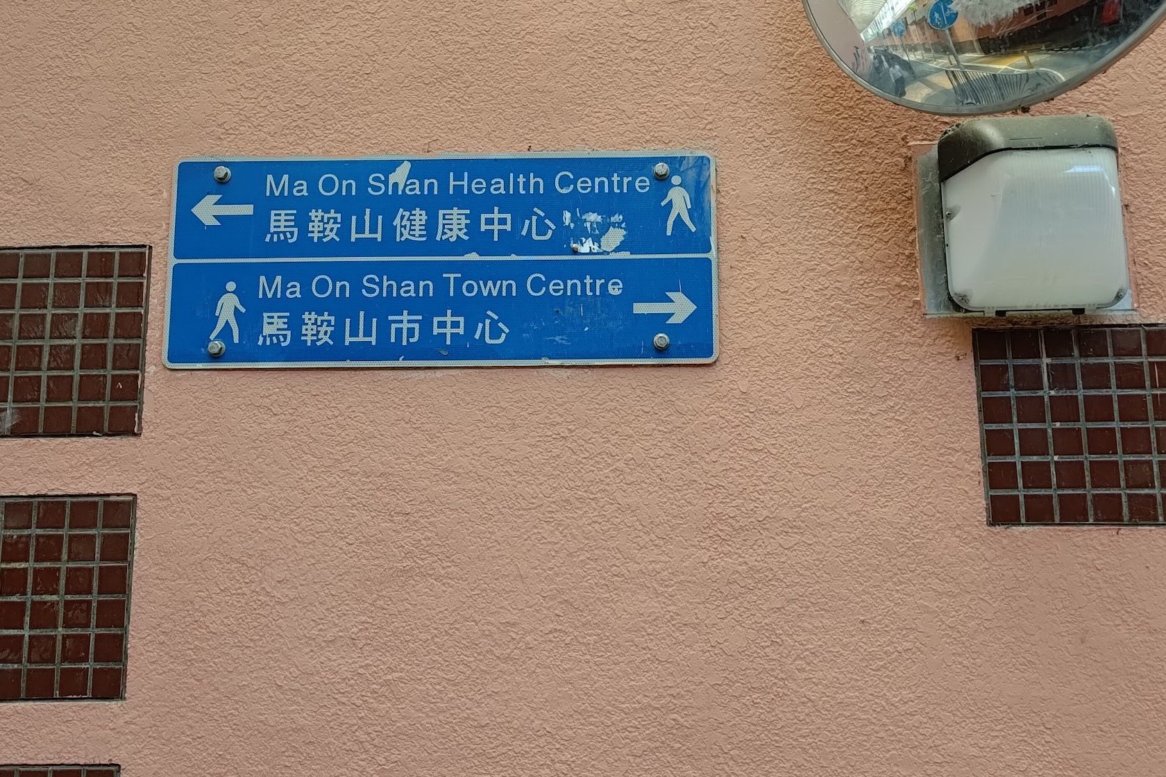
- Follow the 'Ma On Shan Town Centre' sign and take the exit to the left IMMEDIATELY after it
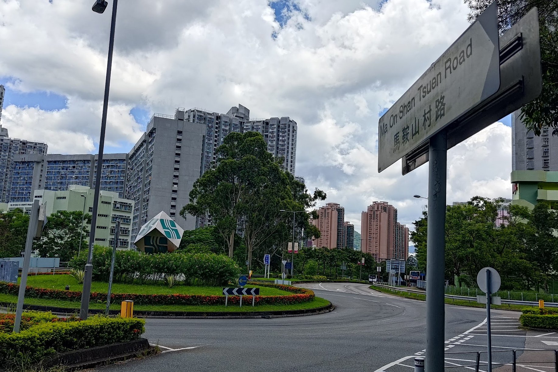
- Follow Ma On Shan Road to the roundabout
- Turn onto Ma On Shan Tsuen Road and follow it up for 30 minutes to the BBQ site
Quick Ma On Shan Hiking Guide
- At the Ma On Shan Country Park BBQ Site, look for the Ma On Shan Family Walk arch
- Follow the Family Walk trail until you arrive at the danger sign
- Ignore the danger sign and walk past it to begin your ascent up Ma On Shan
- Enjoy the stunning views on the way up and while you walk along the ridge
- Don’t miss the path heading down from the top of the second ridge (near the altitude post)
- Follow the MacLehose Section 4 sign toward Pyramid Hill
- Go up or around Pyramid Hill
- Follow the Tai Shui Tseng sign at Grand Junction Pavilion
- After passing Ngong Ping Campsite, follow the Tai Shui Tseng sign
- Take a minibus from just after the village public toilet or walk the additional 1km to Sai Kung
Ma On Shan Family Walk
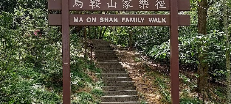
From the barbecue area, look for the archway with ‘Ma On Shan Family Walk’ written on it. There are some stairs heading up, but nothing super intense. Enjoy the greenery and shade until you reach the first danger sign of the hike.
Ignore the Danger Sign and Let the Adventure Begin!
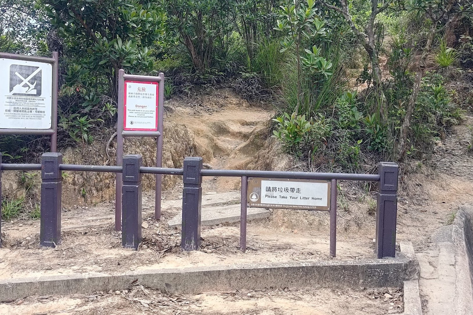
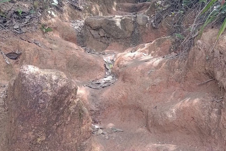
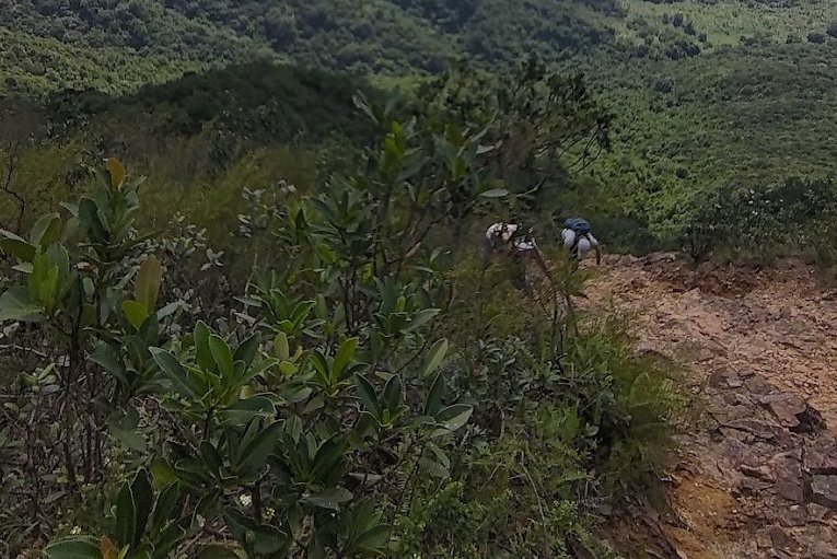
Go around the small barrier and start climbing up the dirt stairs. Soon the stairs will become much steeper and you’ll need to use your hands to help you climb. Make sure you maintain firm footing and keep an eye out for the best footholds and handholds to ensure you don’t accidentally slip on any loose pebbles or debris.
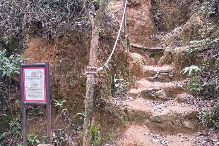
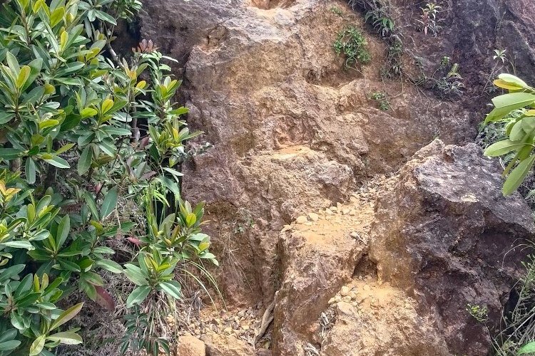
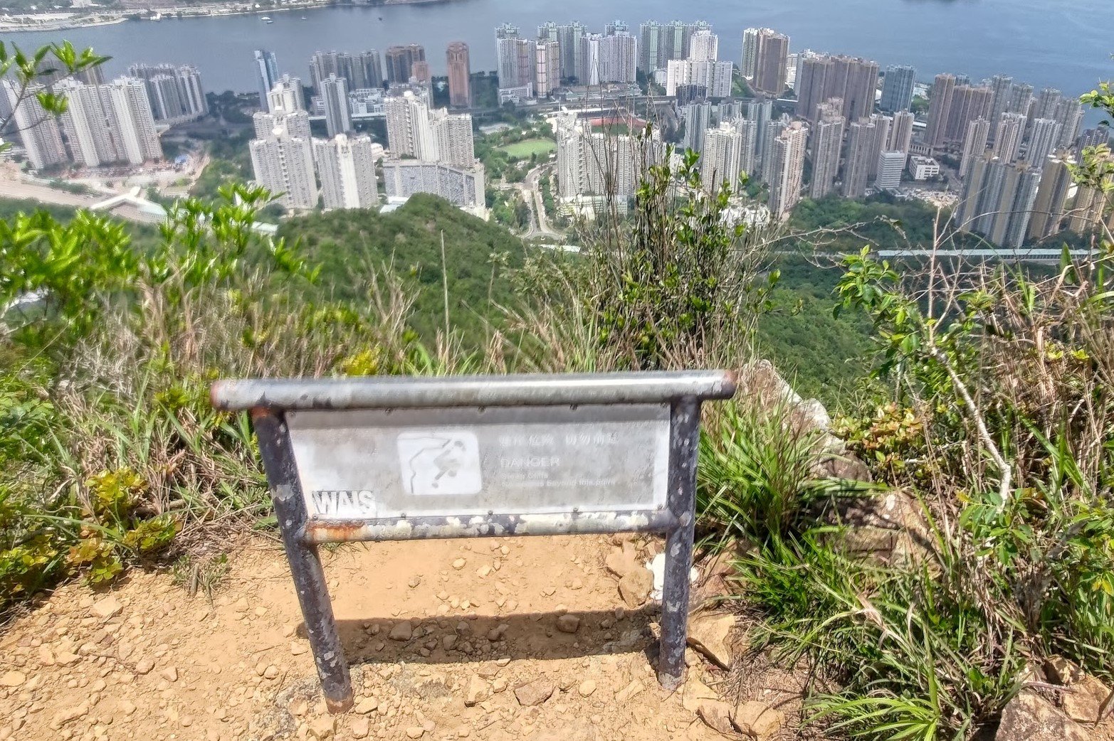
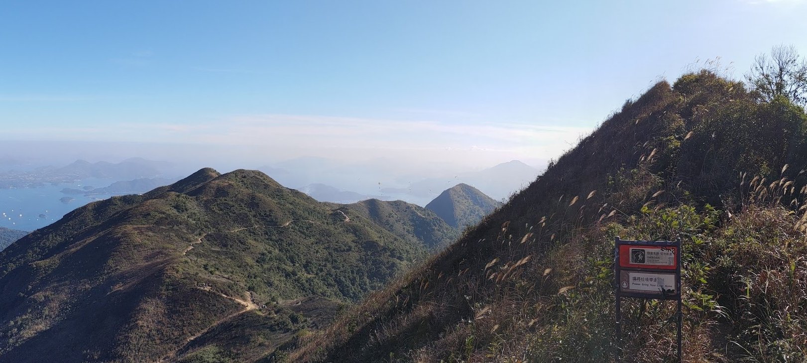
Epic Viewpoint Marked by a Danger Sign
One of the danger signs on the way up will demark a rocky outcropping. It’s stable and safe as long as you don’t act silly and pose right near the edge. Enjoy the stellar views across Plover Cove (at your own risk) where you’ll see Tai Mei Tuk Dam, Pat Sin Leng and a bunch of other cool outdoor landmarks.
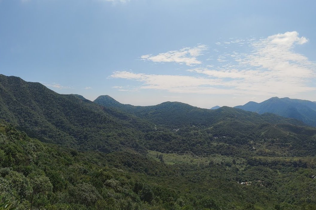
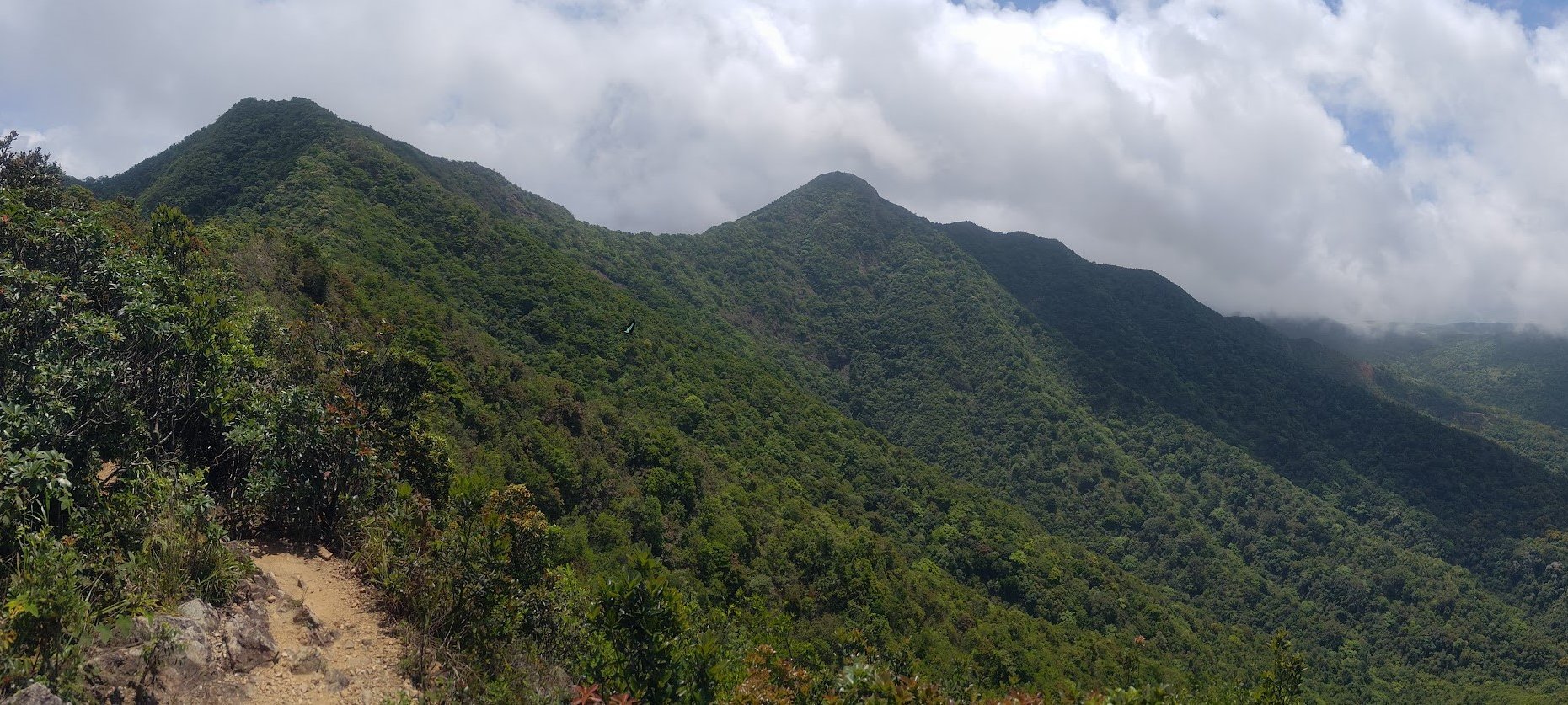
The Horse Saddle Ridge Comes into View
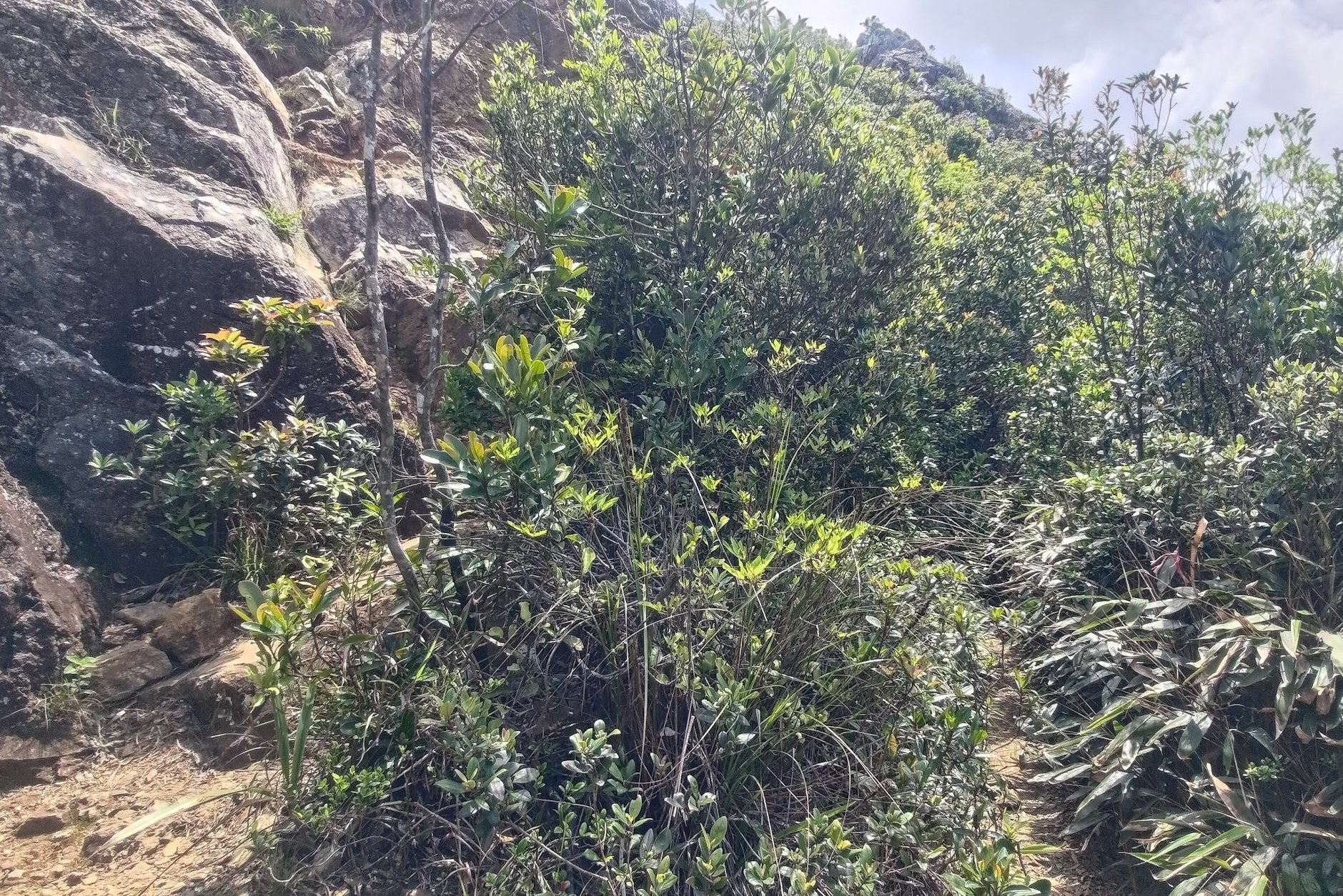
The route up will vary between steep climbing sections, additional viewpoints with danger signs in front of them and a few flat paths that offer respite.
There's one bit on your way up where you should take the grassy path instead of continuing climbing.
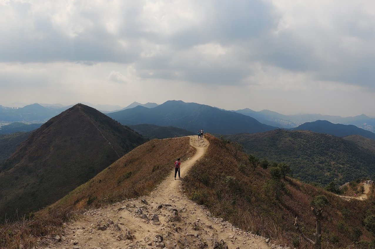
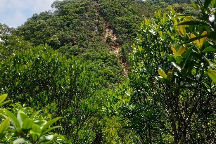
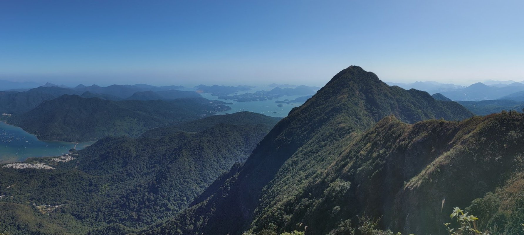
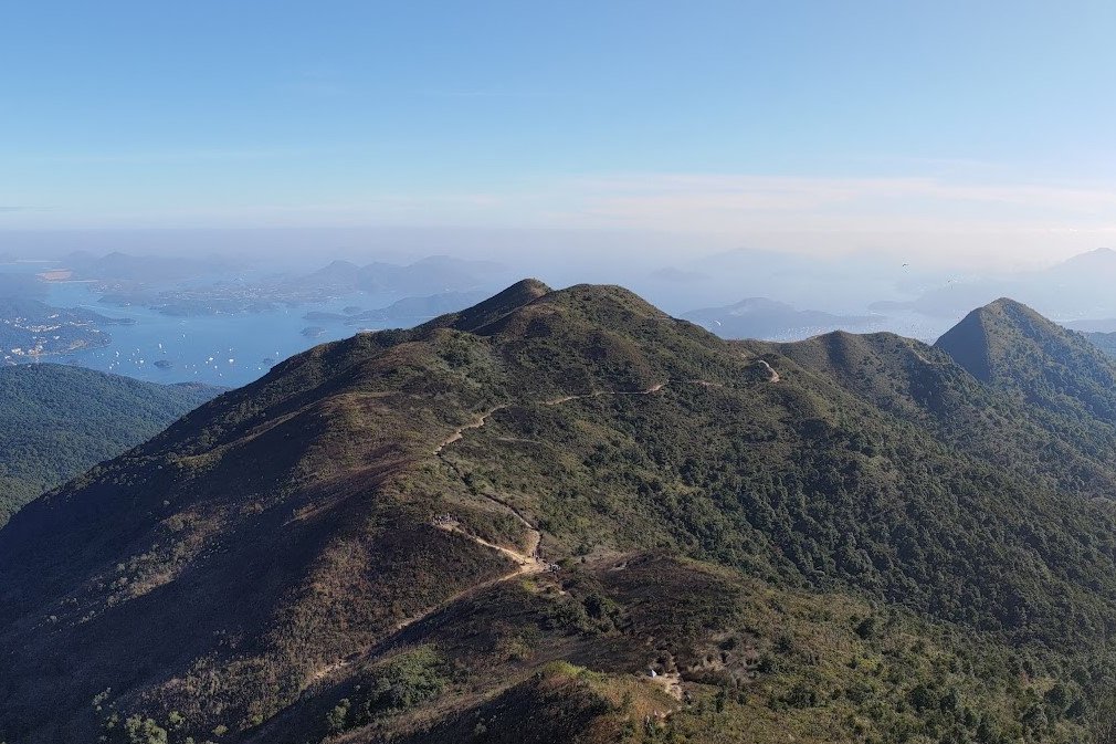
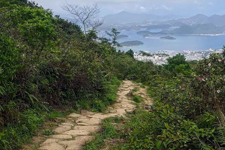
After an hour or so (depending on your pace), you’ll see the famous Ma On Shan ridge looming before you. It looks like a ‘U’ shape and will be a highlight of this hike.
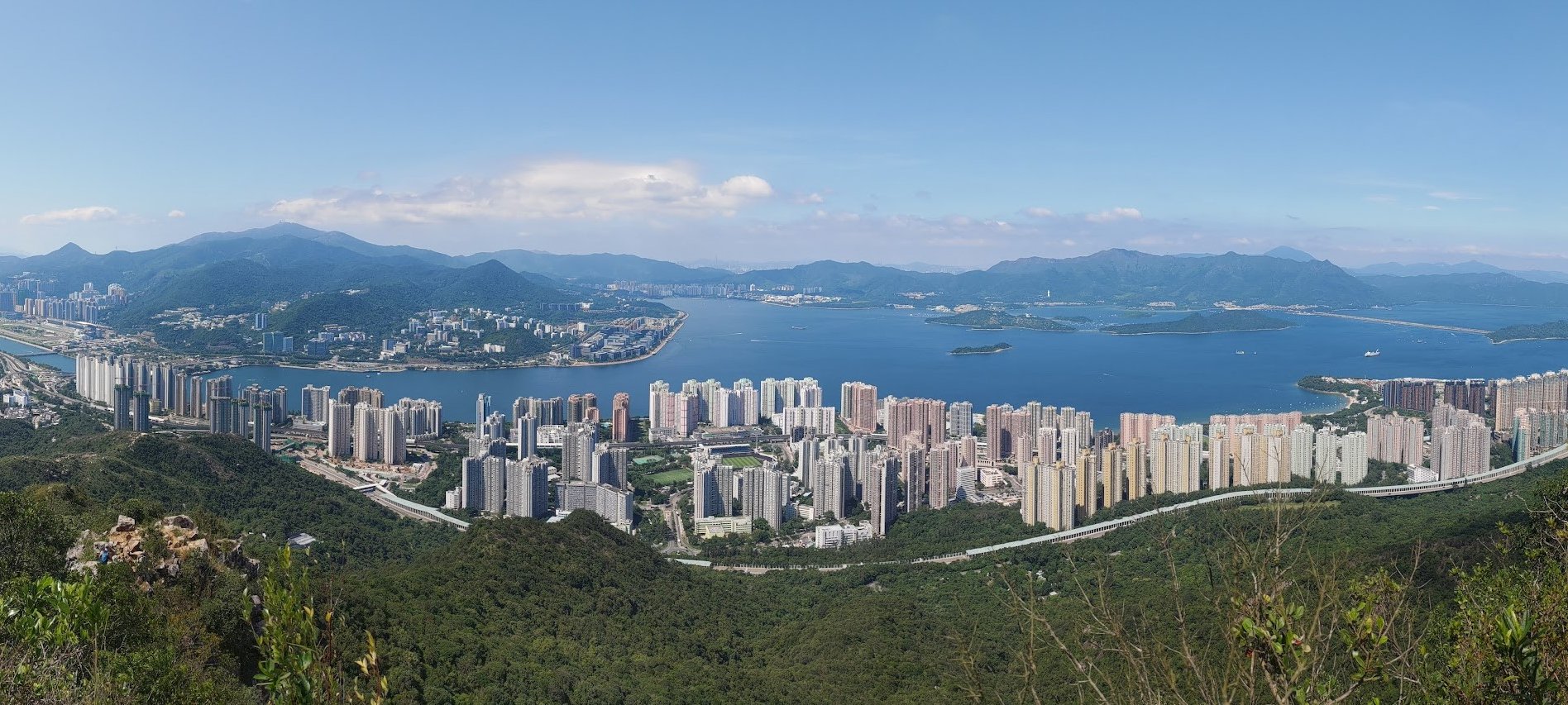
Secret Viewpoint of Three Fathoms Cove
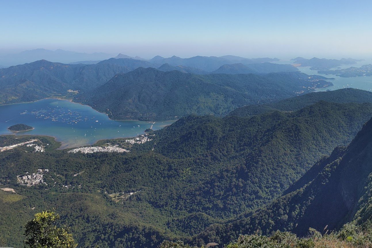

When you arrive at the first ridge, take the time to walk five minutes toward the viewing point to your left. It presents a really cool alternative angle from which to see the stunning Ma On Shan Ridge and resplendent Three Fathoms Cove below.
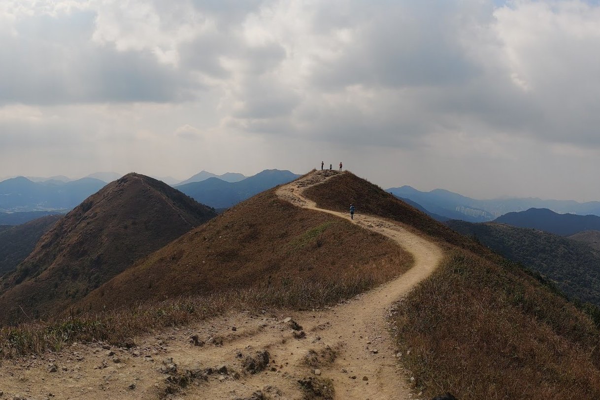
The Ma On Shan Ridge Walk
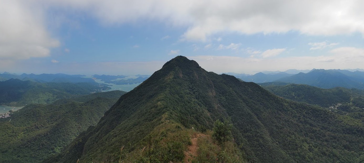
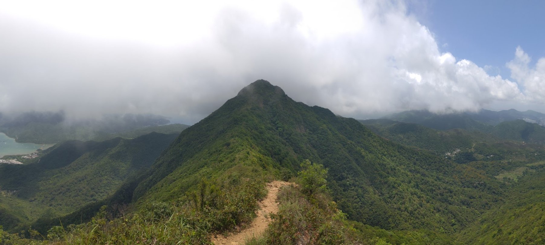
Return to the first peak of the ridge and follow the narrow trail. The ridge walk you will now embark on is legit gorgeous!
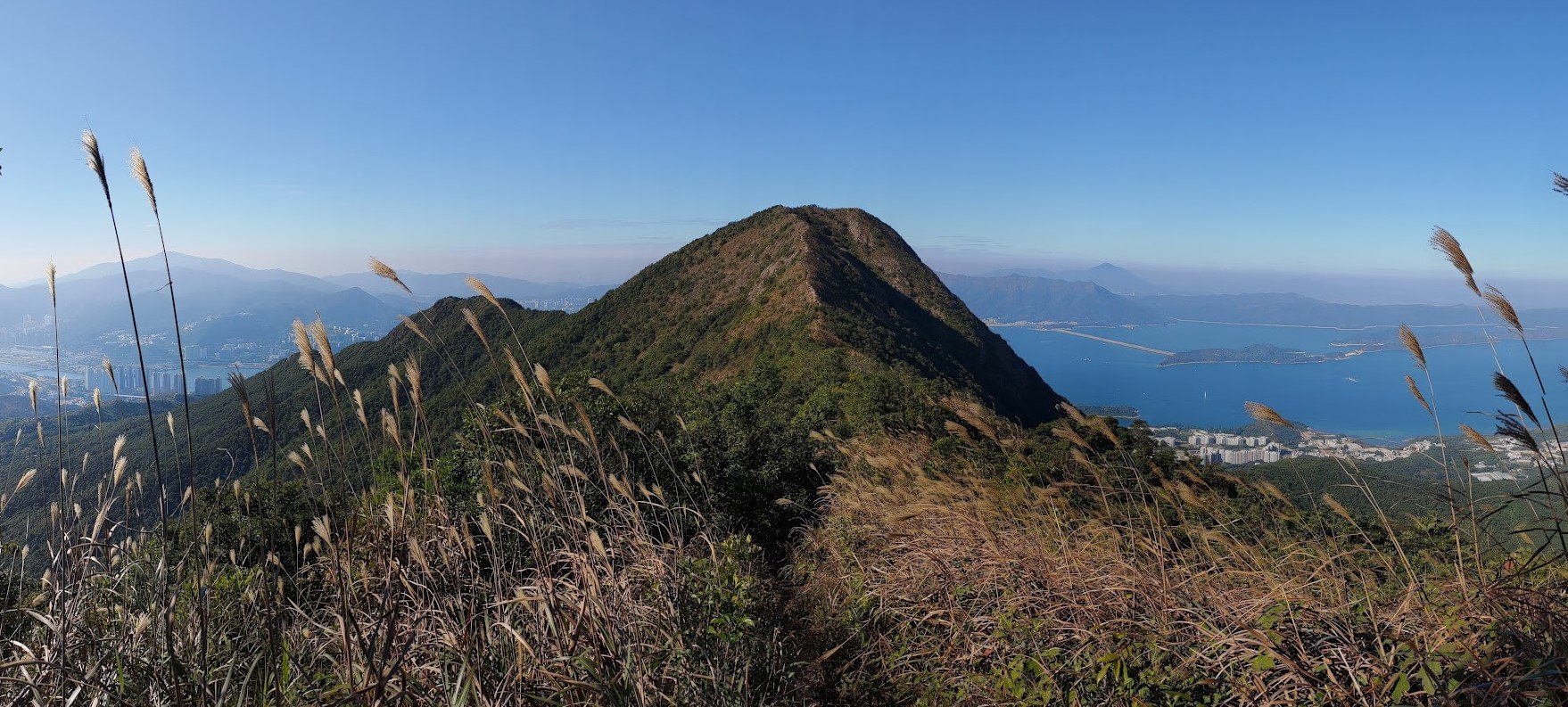
You’ll be surrounded by mountains and ocean as far as the eye can see on a clear day. Take your time, tread carefully and stop when you want to admire the views. Eventually, you’ll reach the second ridge with a marker indicating your altitude.
Ignore Another Danger Sign and Descend
Near the second ridge peak, you’ll see another danger sign. Use it as a marker to indicate where you begin your descent. It’s easy to miss the trail heading down, so just backtrack to the danger sign if you miss it the first time.
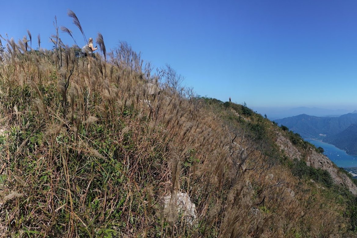
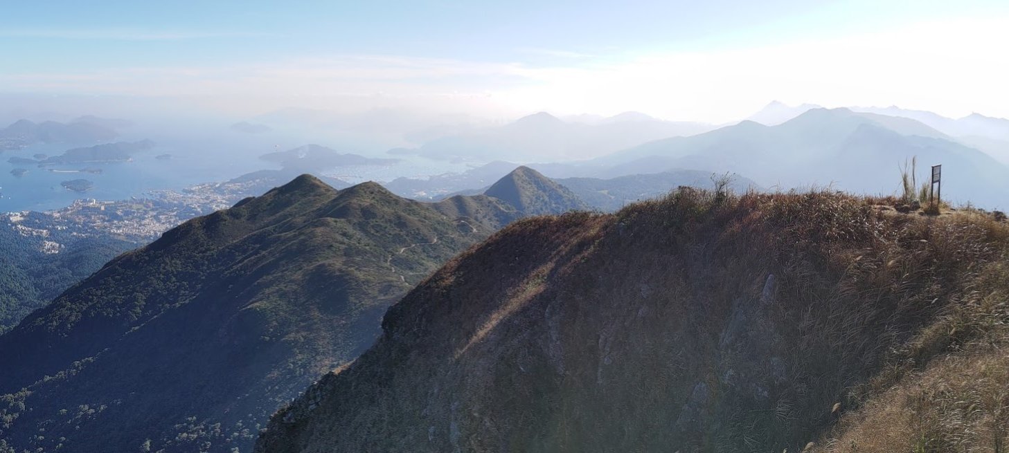
MacLehose Stage 4 and Pyramid Hill
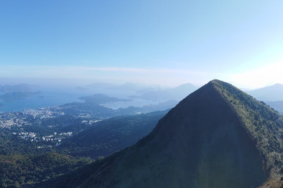
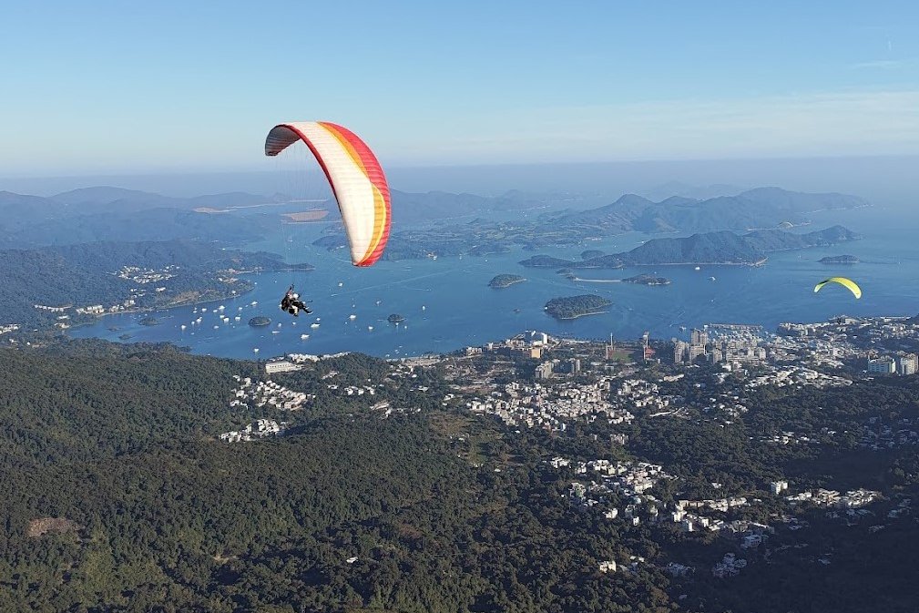
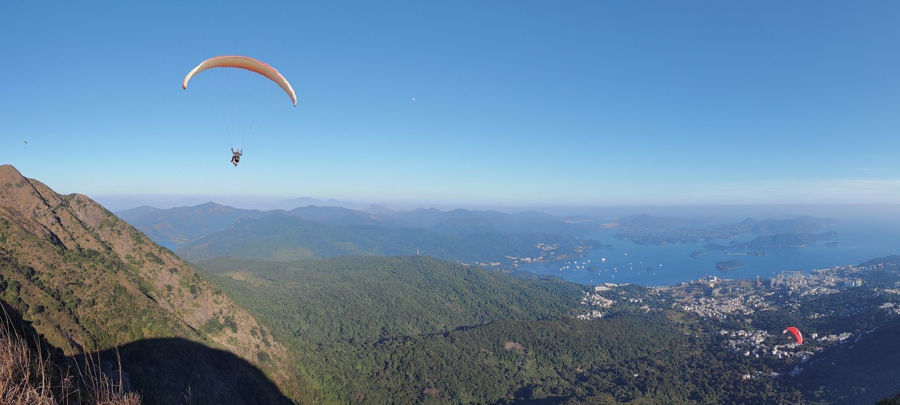
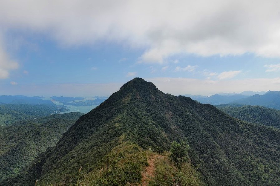
At the bottom, you’ll see a MacLehose Trail sign, which is part of Stage 4. Follow the flat, open trail toward Pyramid Hill. You can climb up the hill to get awesome views of the paragliders that frequent this spot. If your legs are feeling like jelly, you’ll be happy to know you can take a gentle path around Pyramid Hill and bypass it completely. No matter which route you take, you’ll end up at the same spot.
Just note that descending from Pyramid Hill is pretty steep. So if you don’t fancy possibly scooting on your butt on the way down, just go round rather than up.
Grand Junction Pavilion
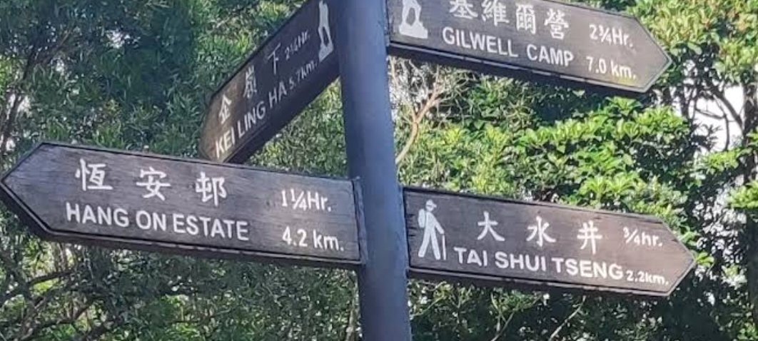
Once you’re past Pyramid Hill, follow the trail until you reach Grand Junction Pavilion, which looks like a crossroads with a bunch of signs pointing you to obscure places. You’ll want to follow the sign that says Tai Shui Tseng.
Ngong Ping Campsite
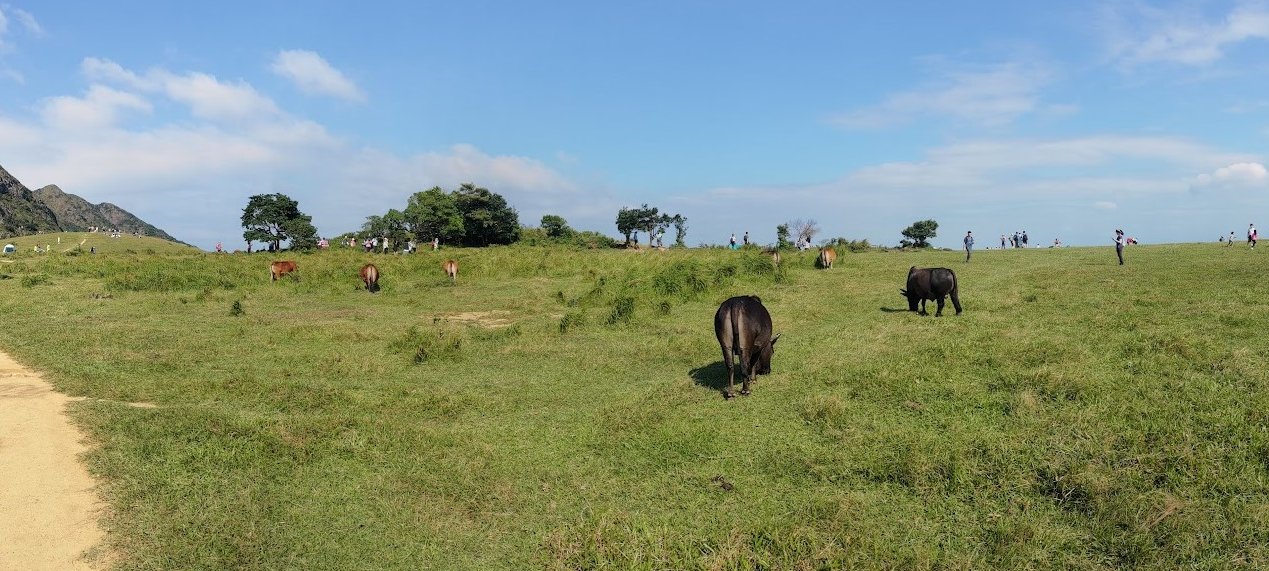
Before you reach Tai Shui Tseng, you’ll come across Ngong Ping Campsite, an easily recognizable flat pasture of green grass often used by herds of wild cows to chill and graze. This is also where paragliders take off and land, which is genuinely an amazing sight to behold. Walk to the edge of the campsite to enjoy views of Sai Kung or just to find an empty patch of grass for a picnic.
Tai Shui Tseng – The Final Stretch
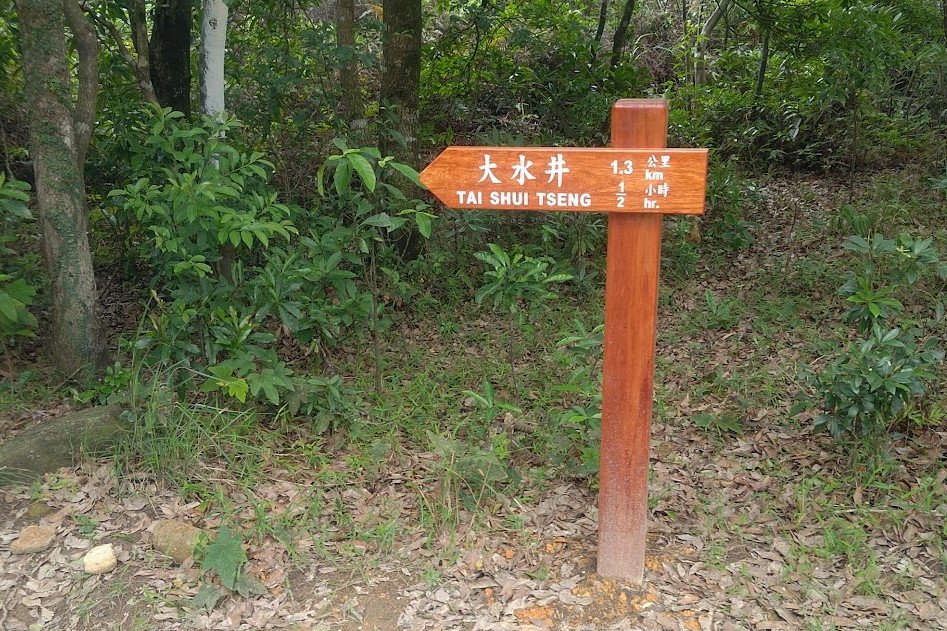
Walk past the campsite until you see a sign pointing you toward Tai Shui Tseng. Follow this trail until you see a long flight of concrete steps and emerge in a small village. This takes 45+ minutes.
Make Your Way to Sai Kung
Follow Pak Kong Au Road past the public toilet. There are minibuses from here that go to Sai Kung on weekends. If you’re hiking on a weekday, you can walk the 1km to Sai Kung or try and flag down a taxi. The walk takes about 15 minutes. Just keep going downward and you’ll reach Sai Kung proper.
Walk past the campsite until you see a sign pointing you toward Tai Shui Tseng. Follow this trail until you see a long flight of concrete steps and emerge in a small village.
Leaving Sai Kung
Take a green minibus to Hang Hau (101M) or Choi Hung (1A).
Take a red minibus to Mong Kok, Causeway Bay (only runs in the evenings) or Kwun Tong.
Take a double decker bus to Diamond Hill (96R), Heng On (99) or Shatin (299X).
You can also take a taxi back to the city. No MTR lines service Sai Kung, so taking the train is not an option.
Before you leave, check out some of the great restaurants in Sai Kung, grab a drink to cool down and reminisce on what would certainly have been a very memorable day!

