
Needle Hill Hike: A Close Look at Hong Kong’s Mountain Ranges
Contents
- Essential Information
- Needle Hill Highlights
- Google Route Map
- How to Get There
- Quick Route Summary
- Detailed Route
- Upper Shing Mun Main Dam
- First Ascent
- Second Ascent
- Final Ascent
- Summit Views
- Getting Back
Essential Beacon Hill Hike Details
- District: New Territories
- Duration: 2.5 - 3 hours
- Distance: 8.3km
- Highest Elevation: 532 meters
- Difficulty: 3.5/5
- Facilities: Snack kiosk and toilets at the start (8/9am - 4/5 pm daily, cash only)
Why Hike Needle Hill?
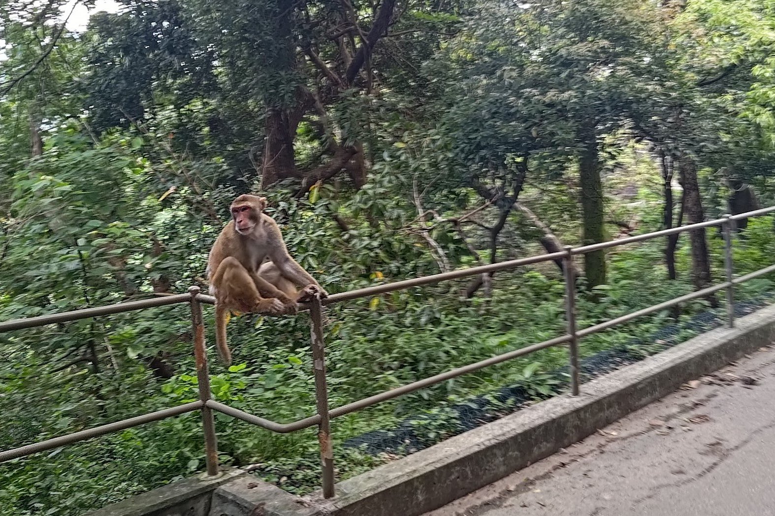
The Needle Hill (針山) hike that starts in Tsuen Wan district's scenic Upper Shing Mun Reservoir. Make sure to savor the gentle walk around the water where you're very likely to see some of Hong Kong's cheeky macaques. After that, the nonstop climbing begins.
Suitable for intermediate and advance hikers, Needle Hill is split into three distinct sections of climbing. Each section offers an epic view, so it's easy to break the hike into separate parts to make the constant ascent feel a little more manageable.
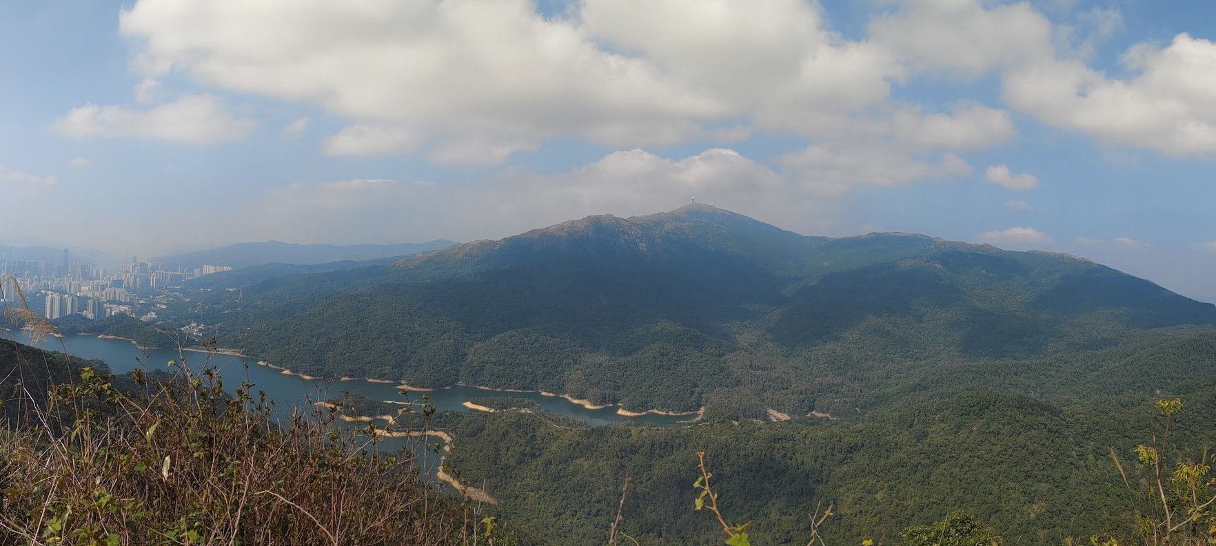
Some of the standout vistas include a top-down look at the Upper Shing Mun Reservoir, amazing views of Tai Mo Shan (Hong Kong's tallest mountain) and an unhindered panorama that spans several of Hong Kong's most famous mountains and mountain ranges.
Given that Needle Hill is a relatively short hike, the reward it totally worth the steep climb!
Google Route Map
How to Get to the Needle Hill Hike Start Point
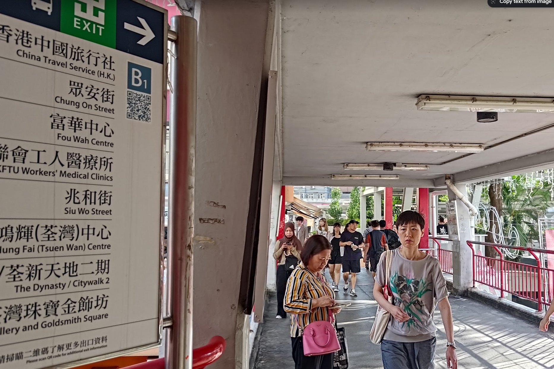

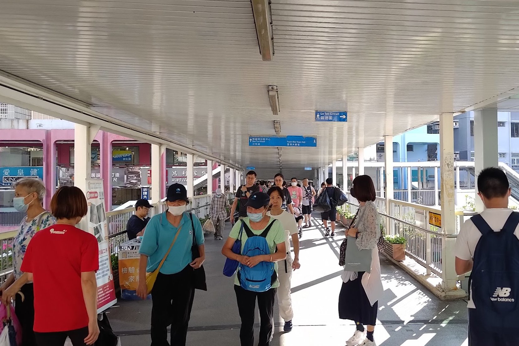
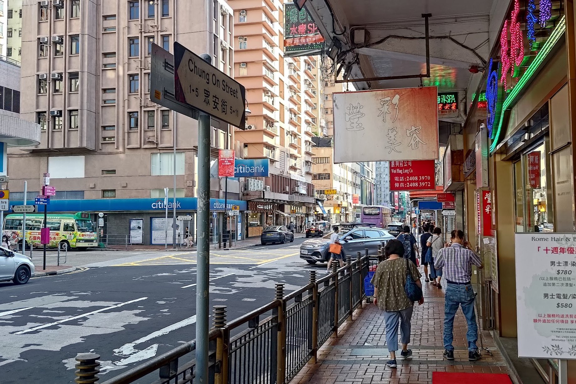

Take the MTR to Tsuen Wan Station. Leave through exit B1 and cross the footbridge.
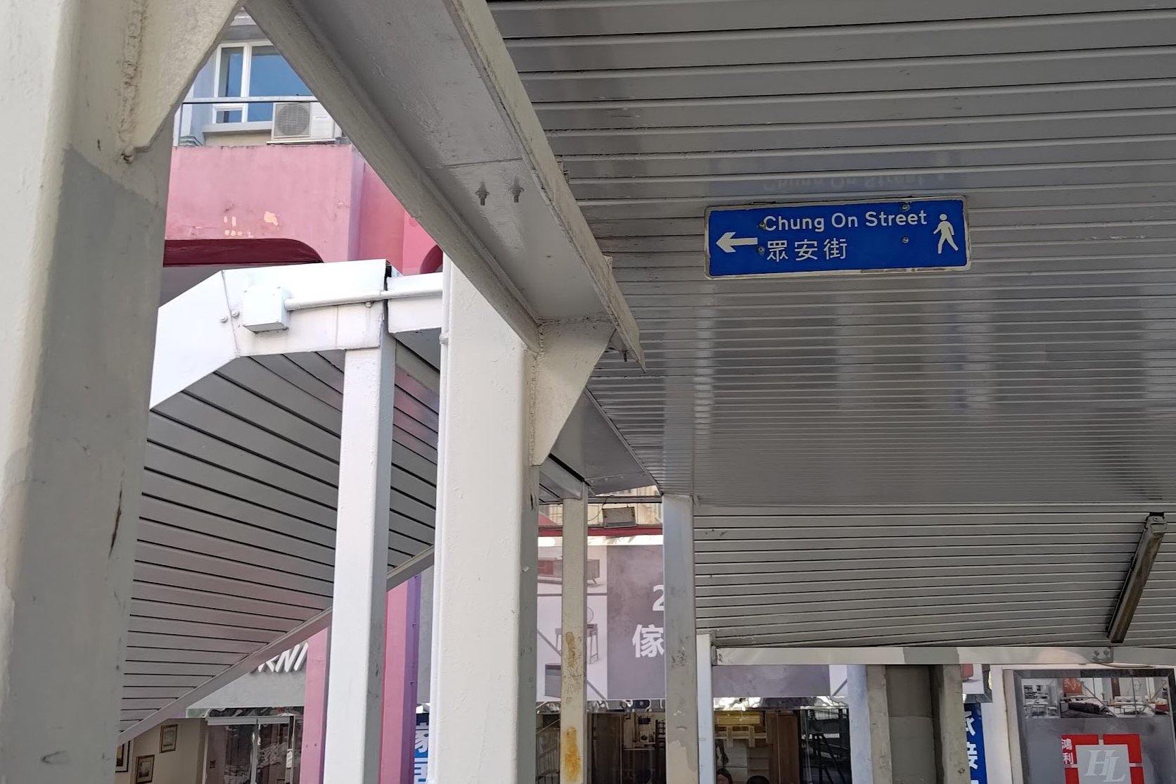
Go past the shops and connect to the second footbridge where you'll see a small blue 'Chung On' sign pointing down the stairs to your left.
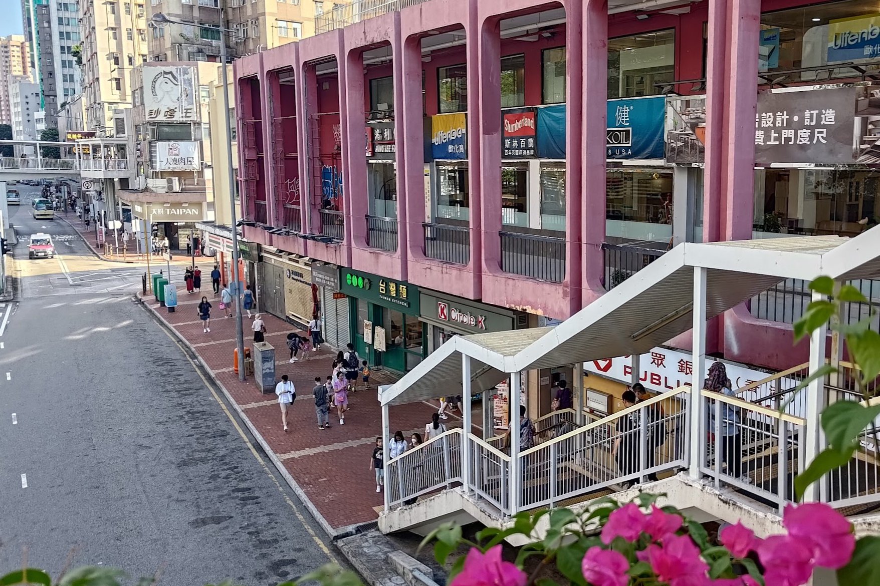
Walk down the stairs and continue straight until you see Chung On Street. Turn right to go down Chung On Street until you arrive at the intersection with Shiu Wo Street. You'll find green minibus number 82 to your right.
You can find the bus schedule here. Get off at the last stop.
Though the schedule claims the bus arrives every 8-15 minutes, I've occasionally experienced wait times around 40 minutes on weekdays. Weekends should be much better, especially during the morning.
The 82 bus will take you directly to Pineapple Dam (part of Upper Shing Mun Reservoir), which is the start point of the hike.
Quick Needle Hill Hike Route Summary
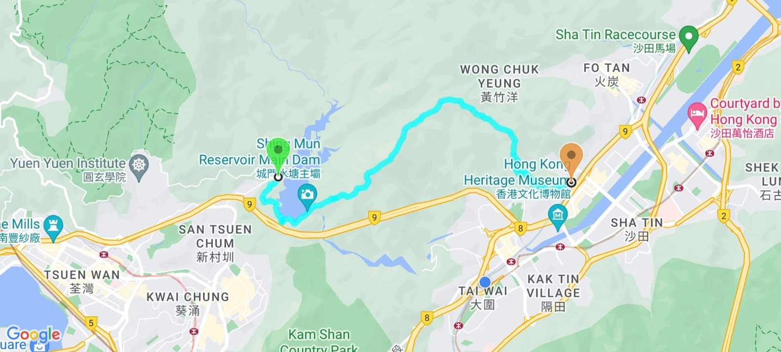
- Follow Shing Mun Road around the reservoir once you get off the bus
- Cross the Shing Mun Reservoir Main Dam
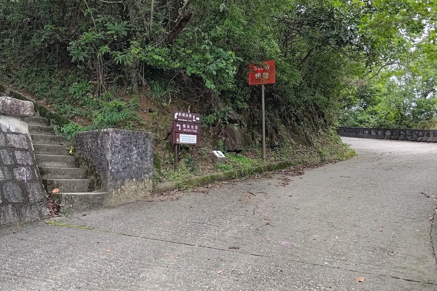
- Follow the 'MacLehose Trail' sign at the end of the dam
- Begin climbing at the 'MacLehose Trail (Stage Seven)' arch
- Views of the Shing Mun Reservoir after the first section of climbing
- Views of the summit and mountains after the second section of climbing
- 360-degree views at the summit
- Descend the stairs down to the concrete road
- Follow the concrete road and turn in at the 'To Shatin Town' arch
- Head down the stairs at the 'To Sha Tin MTR Station' sign
- At the black stone plaque, go right
- Follow the silver signs saying 'To To Fung Shan' (not a typo)
- Stay on To Fung Shan Road until the roundabout (you'll see an MTR sign)
- Take the little path on your left marked by a green railing and a fence
- Follow the path down to Shatin MTR station
Warm Up with a Relaxing Reservoir Walk
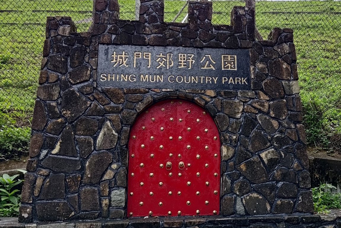
After getting of the bus, you'll be dropped off at the 'Shing Mun County Park' sign.
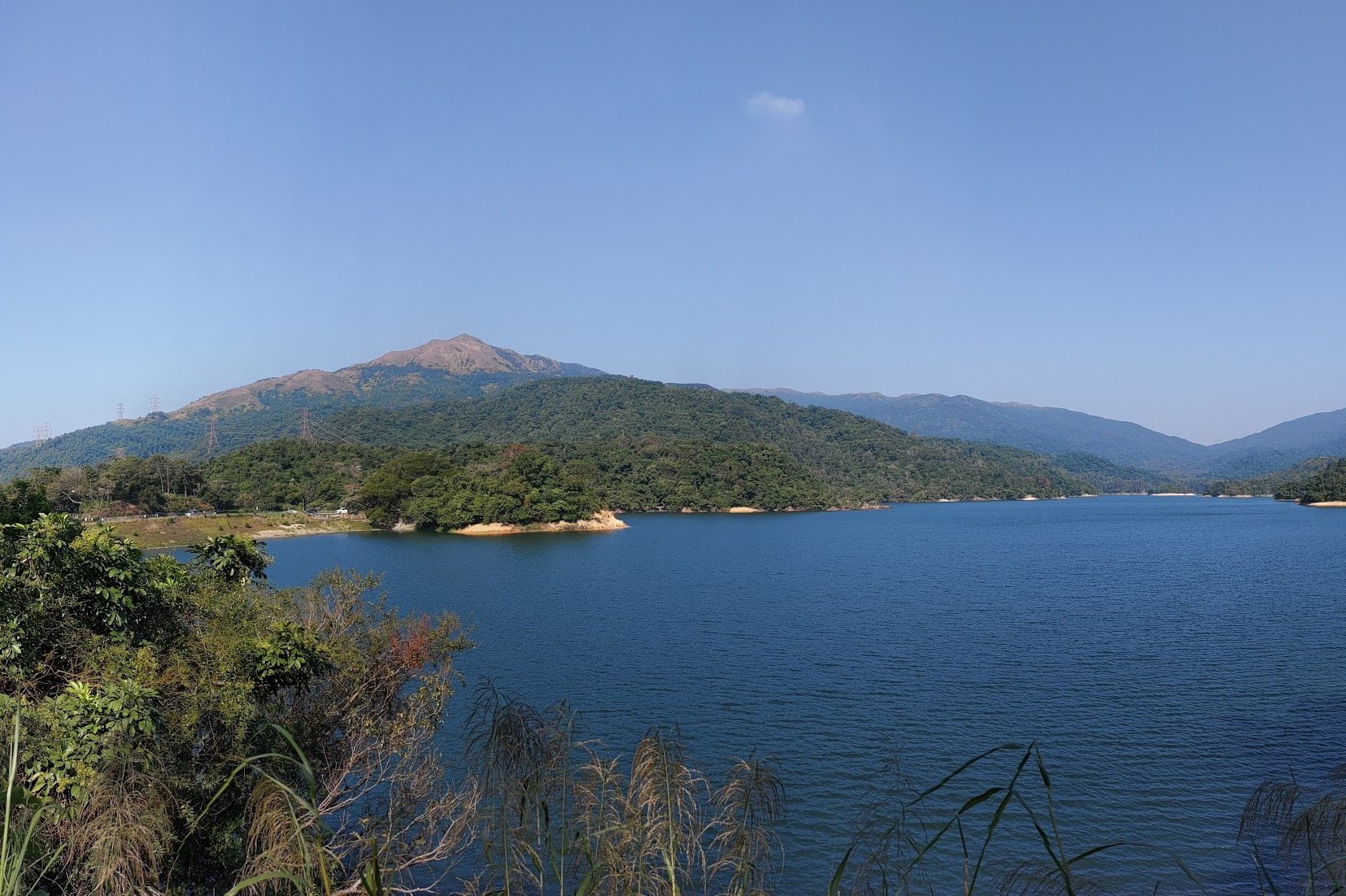
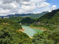
Go past the sign and stay on Shing Mun Road for the next 15-20 minutes as you circle along the perimeter of Upper Shing Mun Reservoir.
While enjoying views of the reservoir and mountains (like Tai Mo Shan) to your right, you'll come across a fork in the road. One way follows the concrete road and the other goes through a narrow little opening that leads into the trees.
Both paths intersect just a few minutes later. I prefer the little green path on the left since it passes closer to the reservoir and goes through a secret barbecue area before rejoining the main road two minutes later.
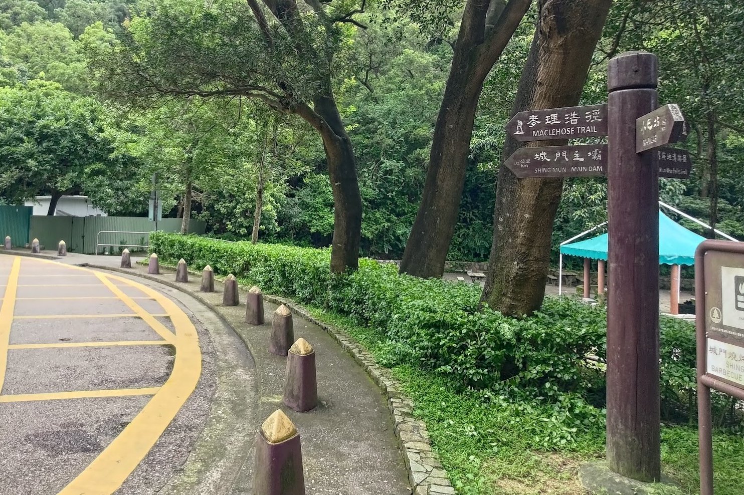
Keep an eye out for the sign pointing you toward the 'Shing Mun Main Dam'.
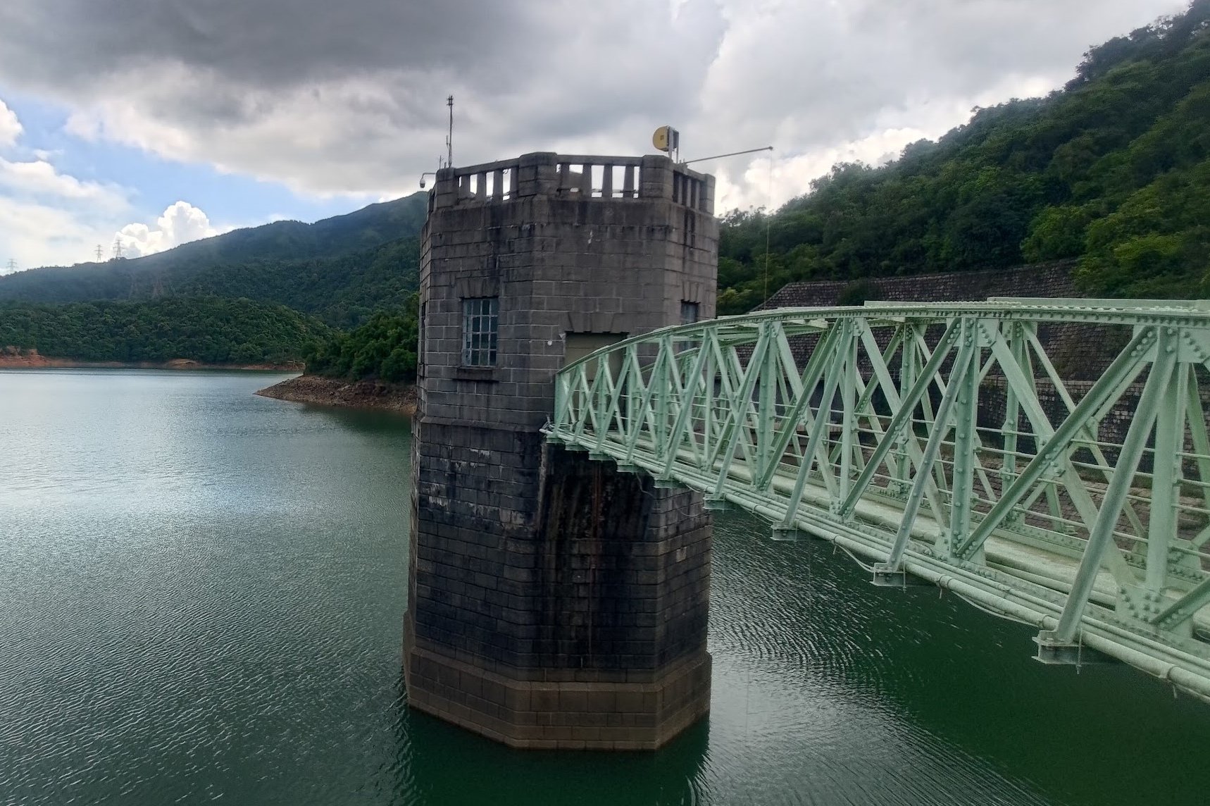
Cross The Historical Upper Shing Mun Main Dam
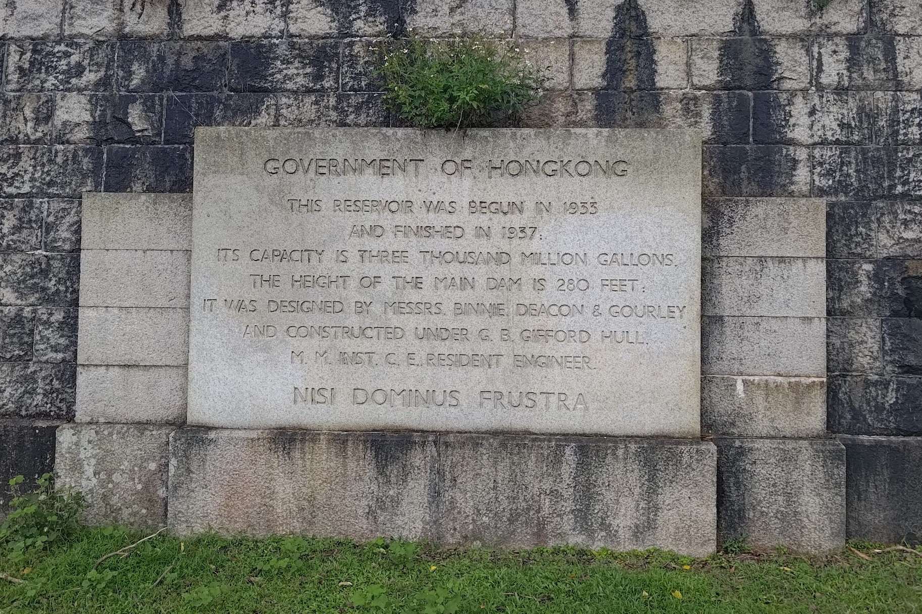
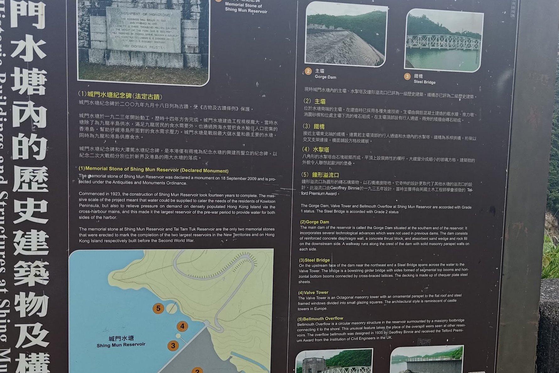
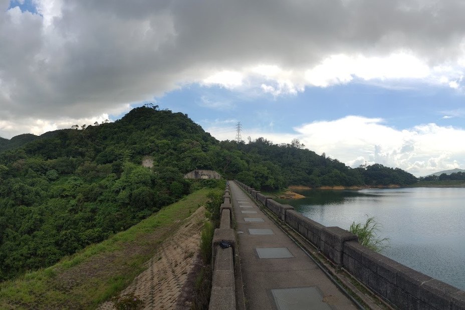
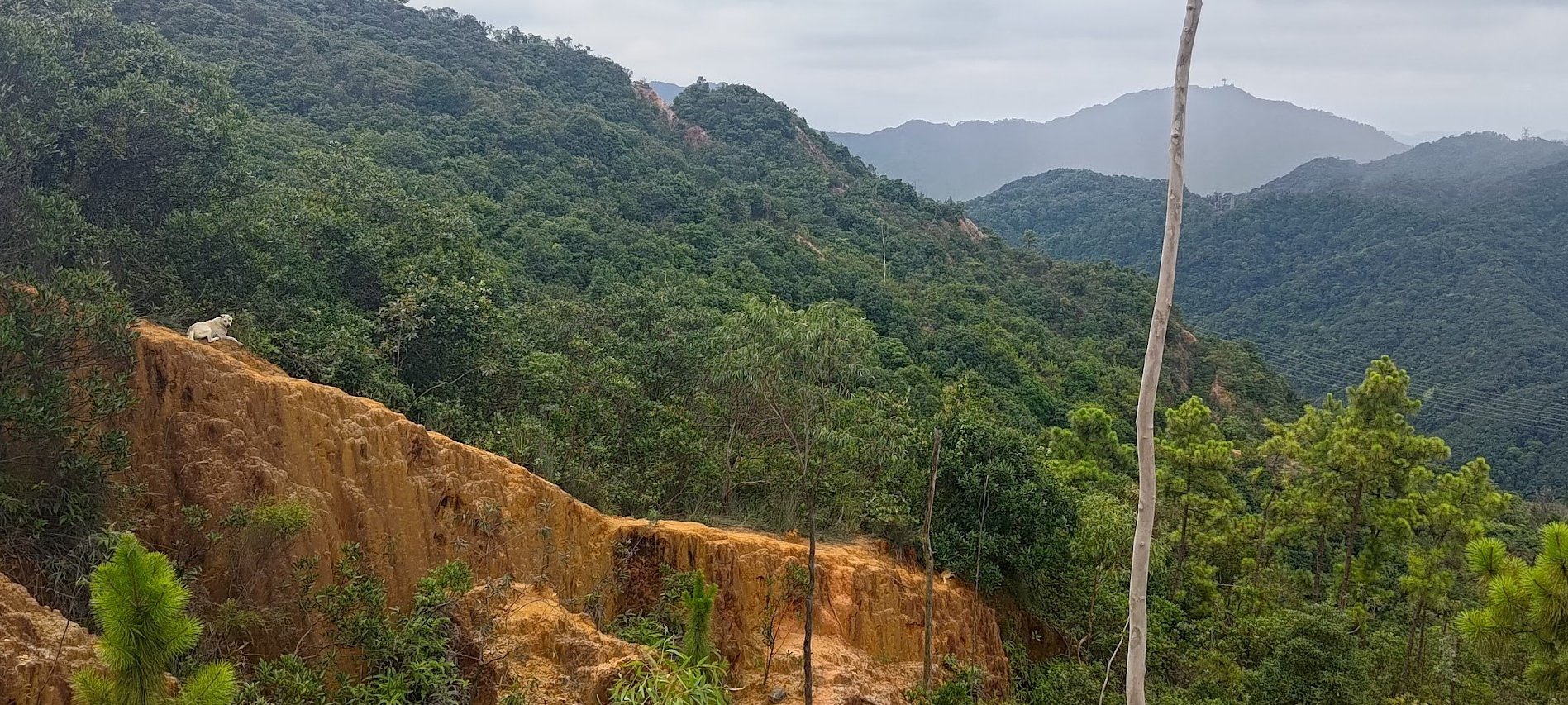
Pretty soon, the Shing Mun Reservoir Main Dam will come into view. The dam's construction began in 1923 and it was completed 14 years later in 1937. Prior to World War 2, Shing Mun Reservoir was the largest reservoir that supplied water not only to Kowloon, but to Hong Kong Island, too, through the cross-harbour mains.
Before crossing the dam, make sure to read up on its fascinating history, which is detailed on the memorial stone and educational signs nearby.
It's a very impressive sight, especially when you realize that to your left the reservoir is entirely filled with water and on the right there's a massive canyon that lead down into Tai Wai.
You can actually climb up or down the dam to or from Tai Wai!
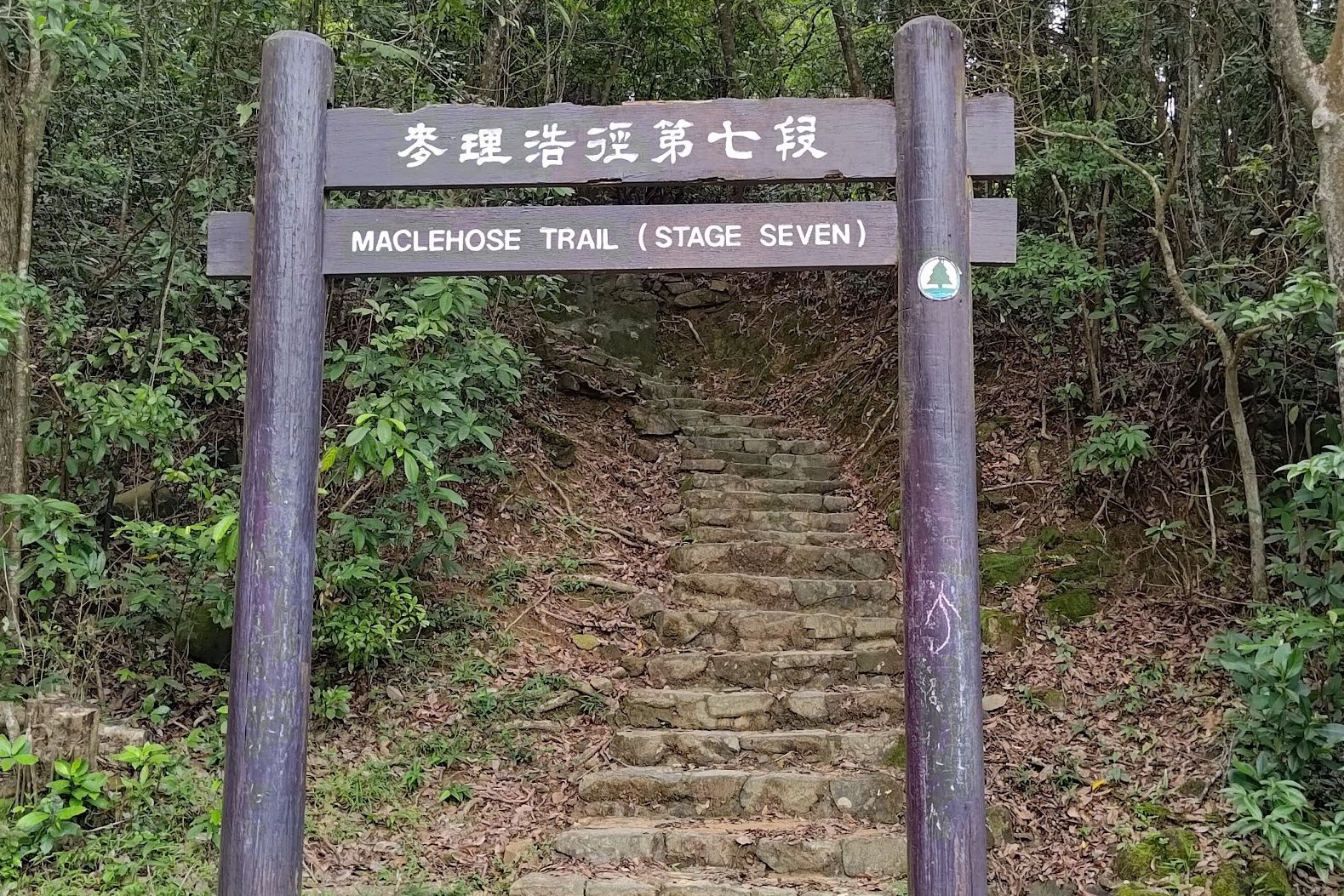
MacLehose Stage Seven
As you cross the dam, look out for cute terrapins and fish in the reservoir waters!
Once you've walked across the dam, follow the 'MacLehose Trail' sign. You can take the stairs, too. Both paths lead to the same place.
In a minute or so, you'll see the 'MacLehose Trail (Stage Seven)' arch.
This is where the stairs begin.
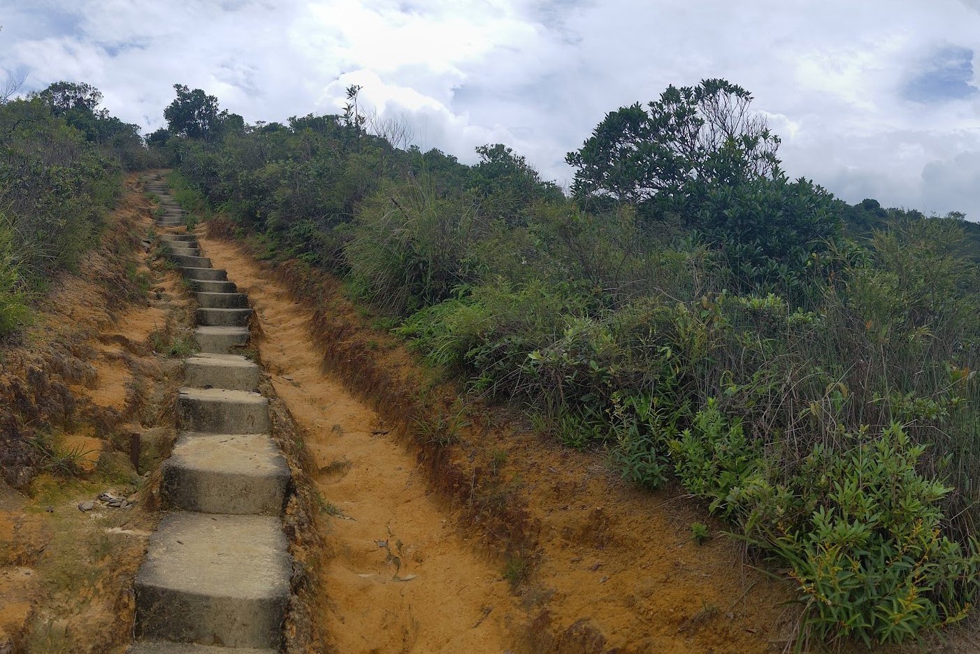
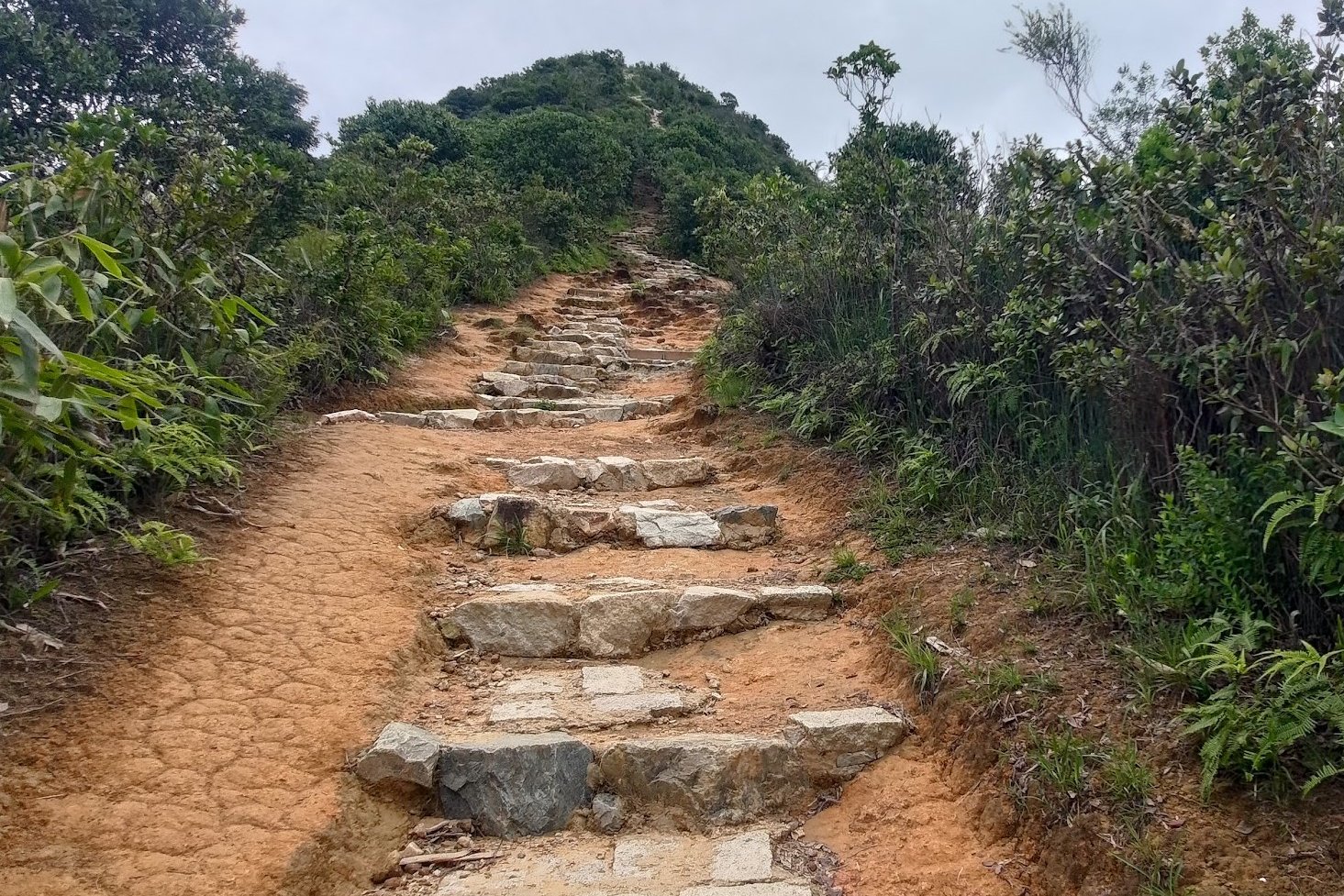
The First Ascent
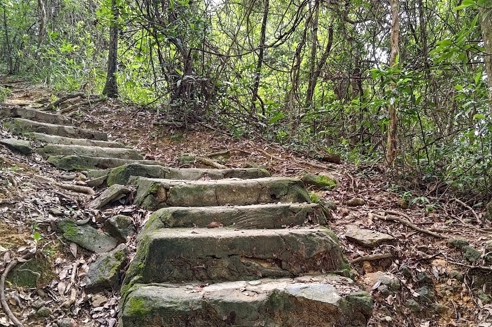
The trail, once you begin climbing, is mostly made up of stairs and the odd flat, meandering path. Since Needle Hill is split into three distinct climbing sections, you'll find that each section is highlighted by a very unique view.
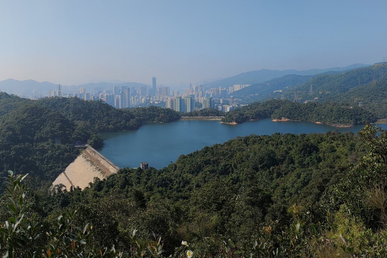
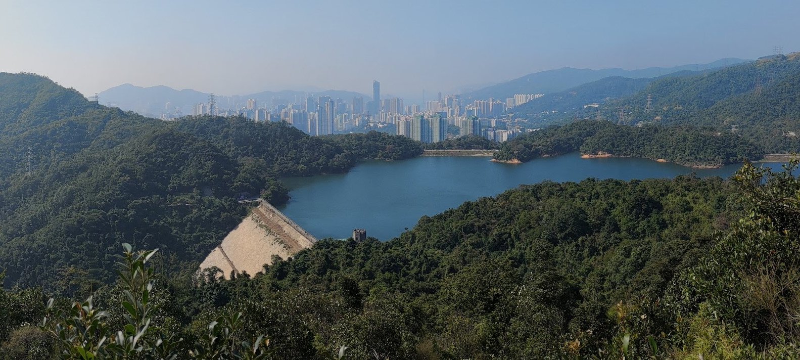
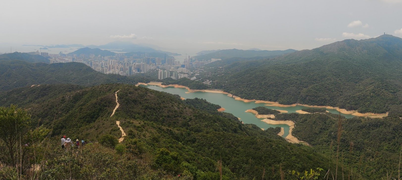
As you keep climbing the first section, you'll find that the unique view is that of the Upper Shing Mun Reservoir below with Tsuen Wan city center sticking up behind it.
After this view, you'll have another small ascent before reaching the official end of the first ascent.
The Second Ascent

The second ascent actually begins with a bit of a flat section that allows you to gather your breath again.
Don't get too comfortable, though, because the stairs get even steeper from this point onward.
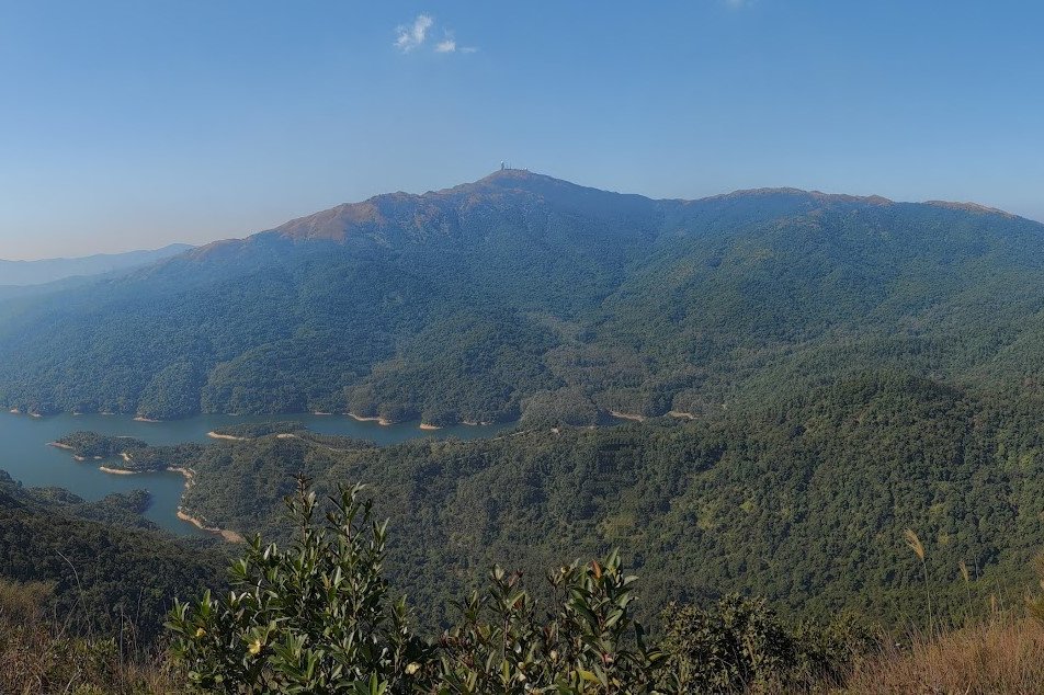
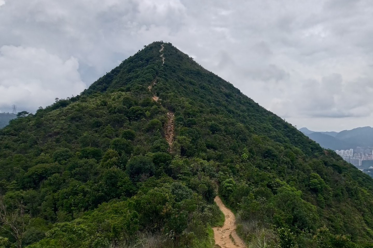
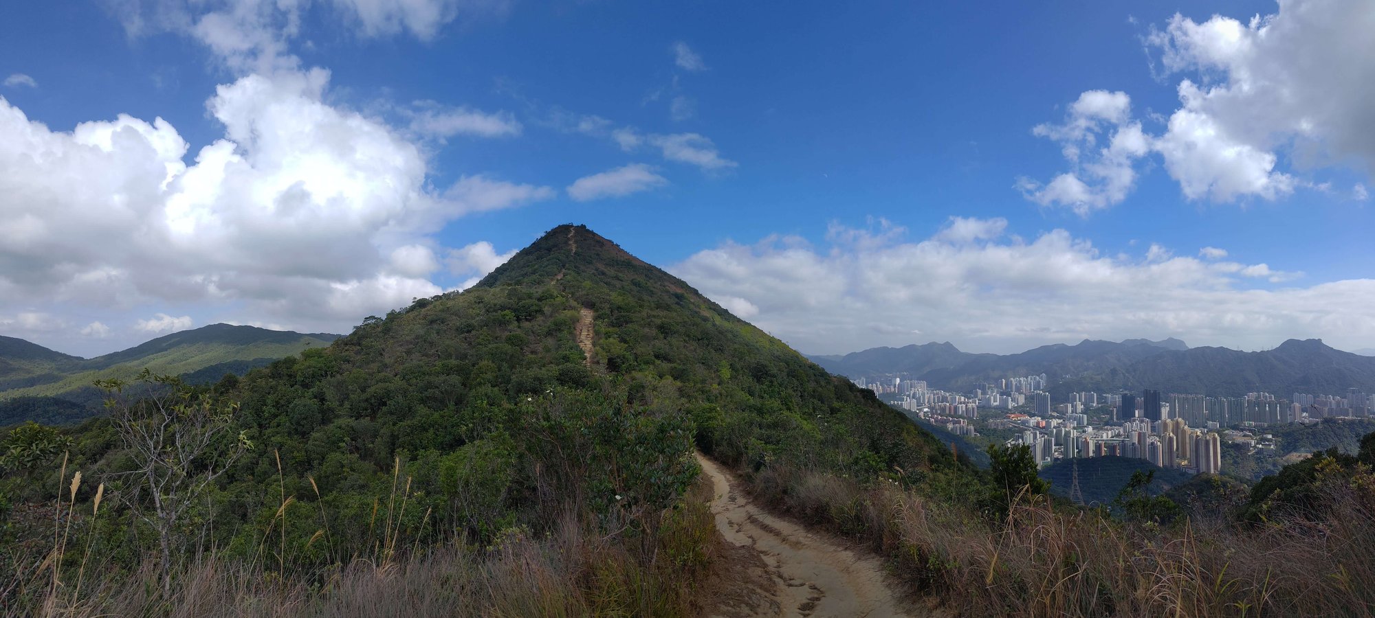
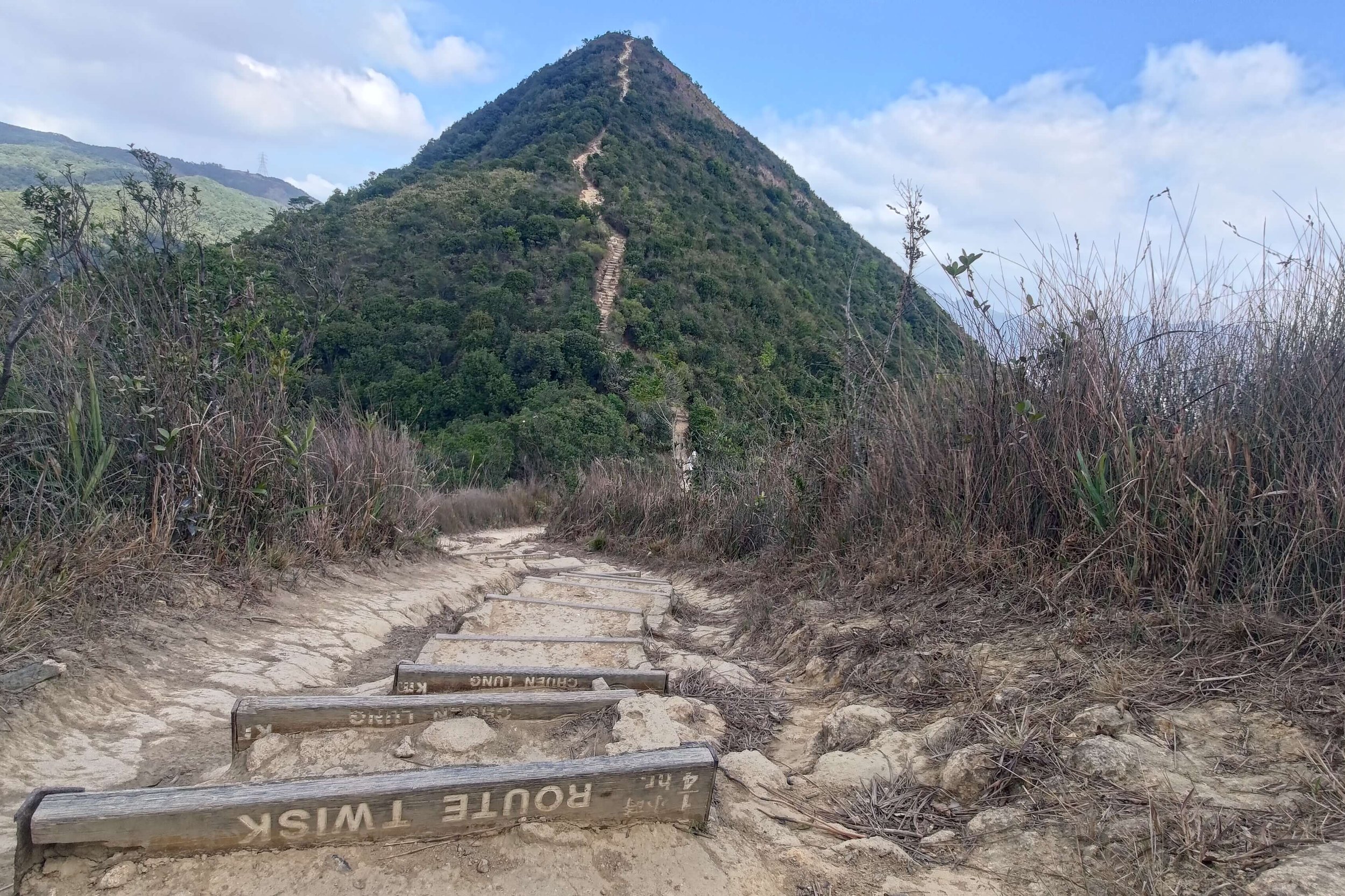
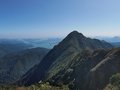
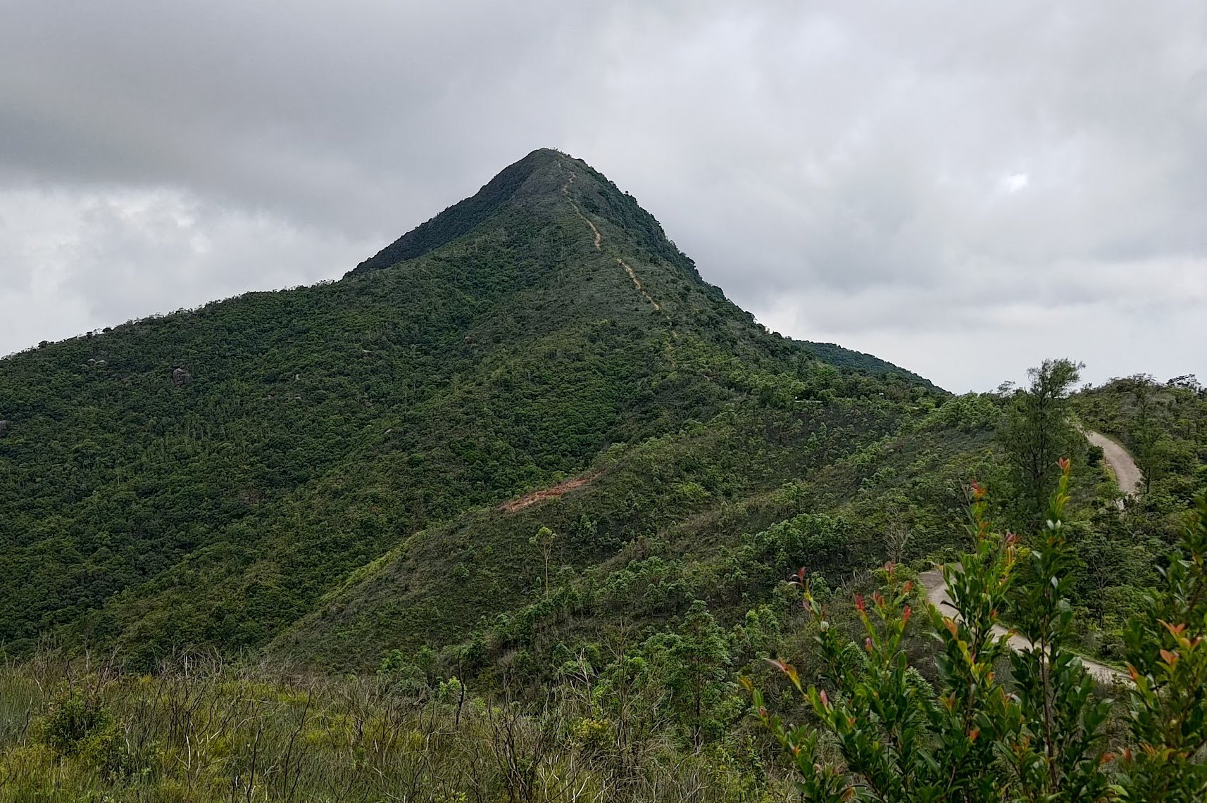
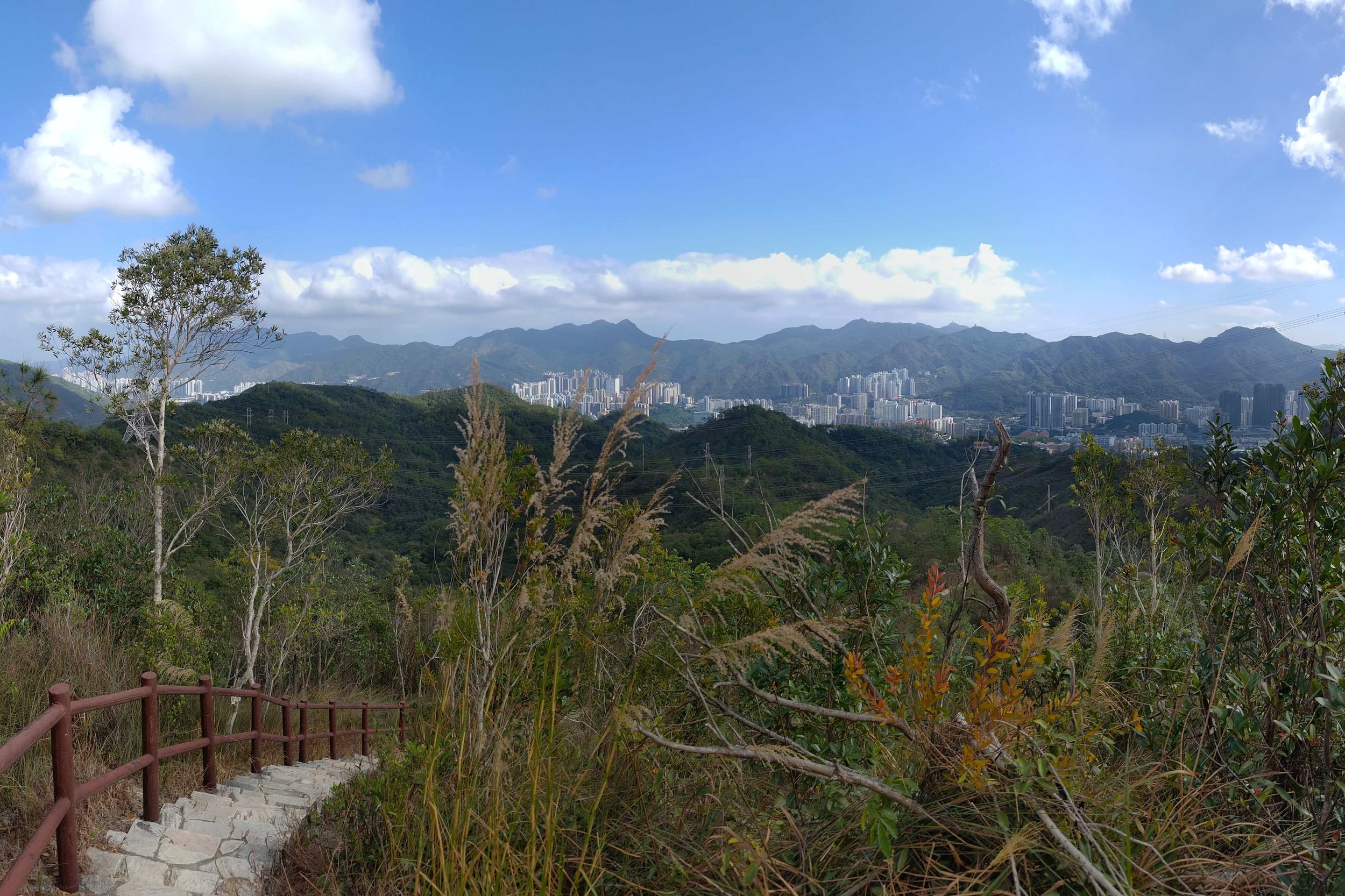
Fortunately, you'll be buoyed by views of Shatin along with some mountain ranges to your right before Needle Hill's final summit looms large before you.
The Final Ascent
Views from the Top of Needle Hill
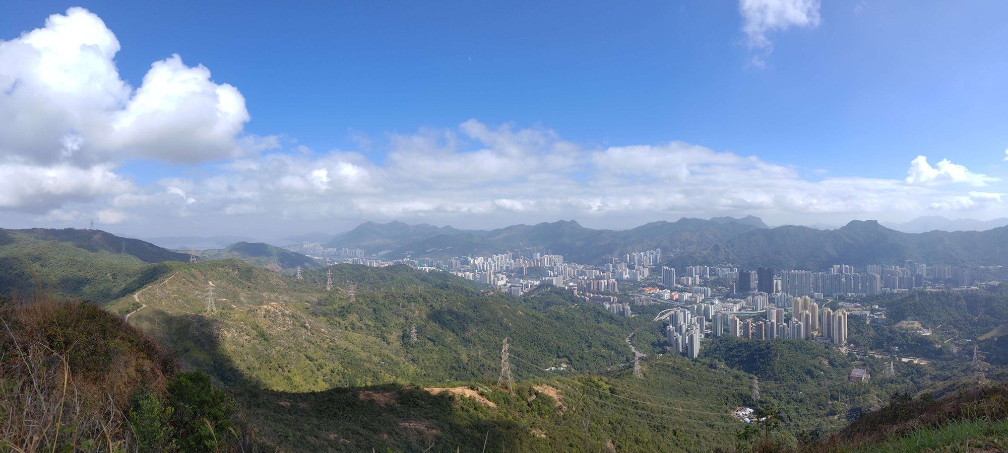
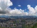
The top of Needle Hill makes all the hard work well worth it. There's a sign telling you that you've climbed up to an elevation of 532 meters, but I almost missed the sign because of the epic scenery!
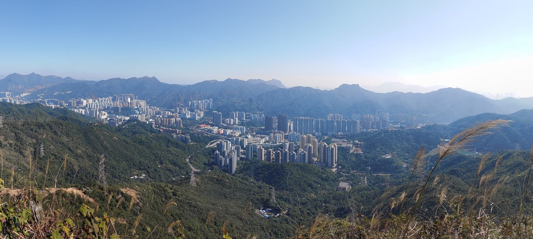
You'll have complete 360-degree views of famous mountains like Tai Mo Shan (Hong Kong's tallest mountian), Lion Rock, Ma On Shan, Beacon Hill, The Hunchbacks, Suicide Cliff and loads more!
Descend to the Concrete Road
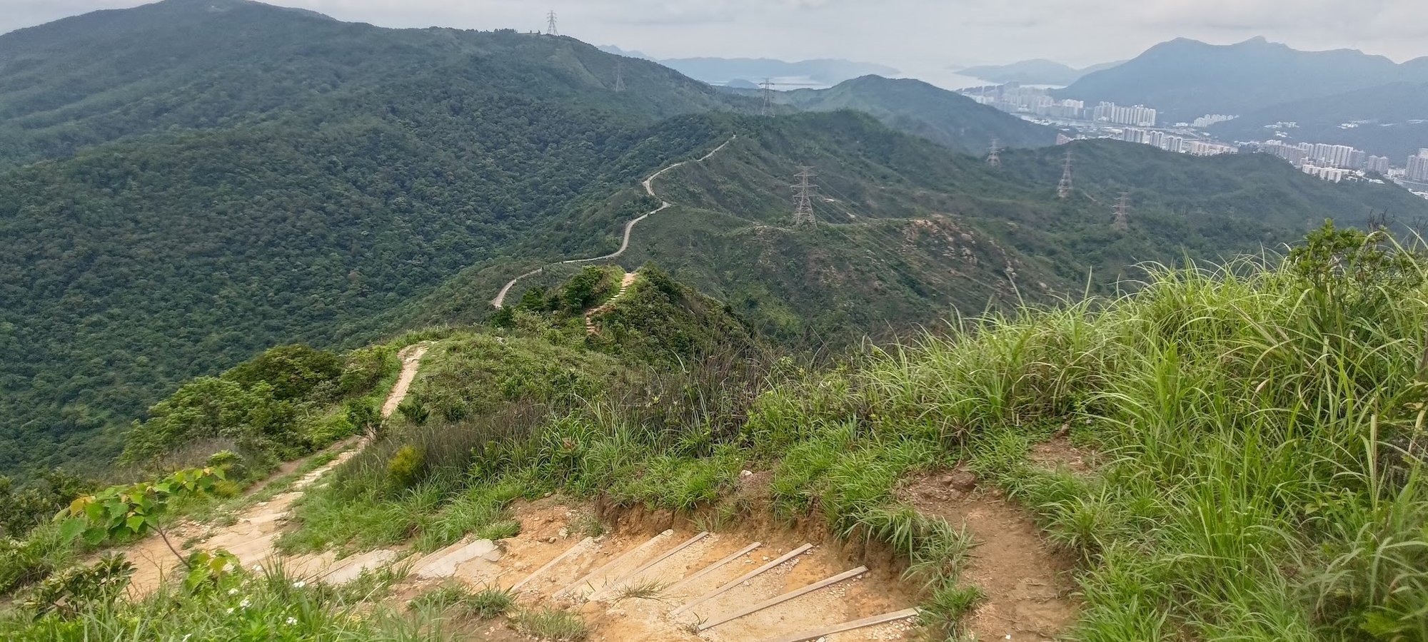
At one point in time, the descent from Needle Hill was pretty treacherous with loose rocks and dirt making up a lot of the journey.
Now, however, a set of stairs have been installed, making it far easier and safer to head down to the concrete road below.
The Annoyingly Steep Concrete Road
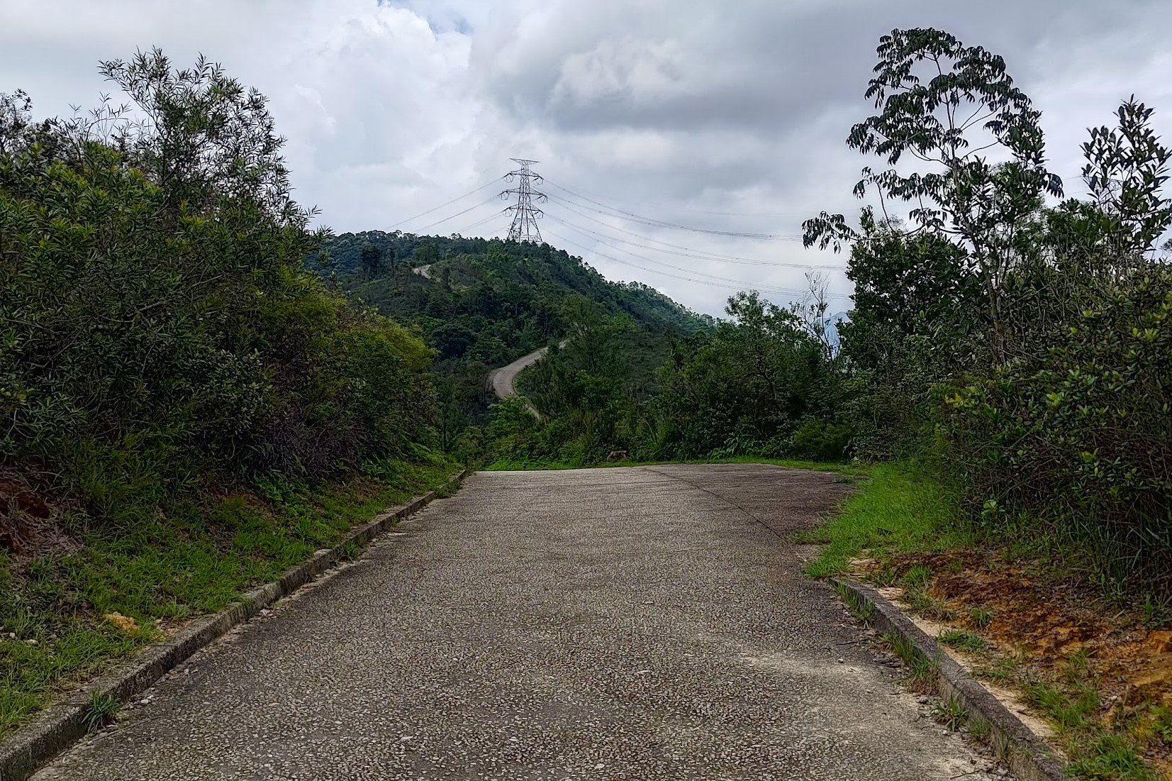
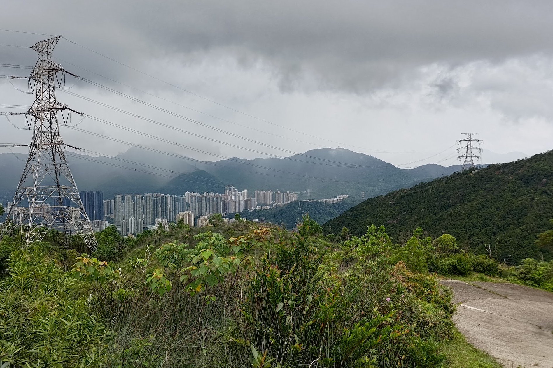
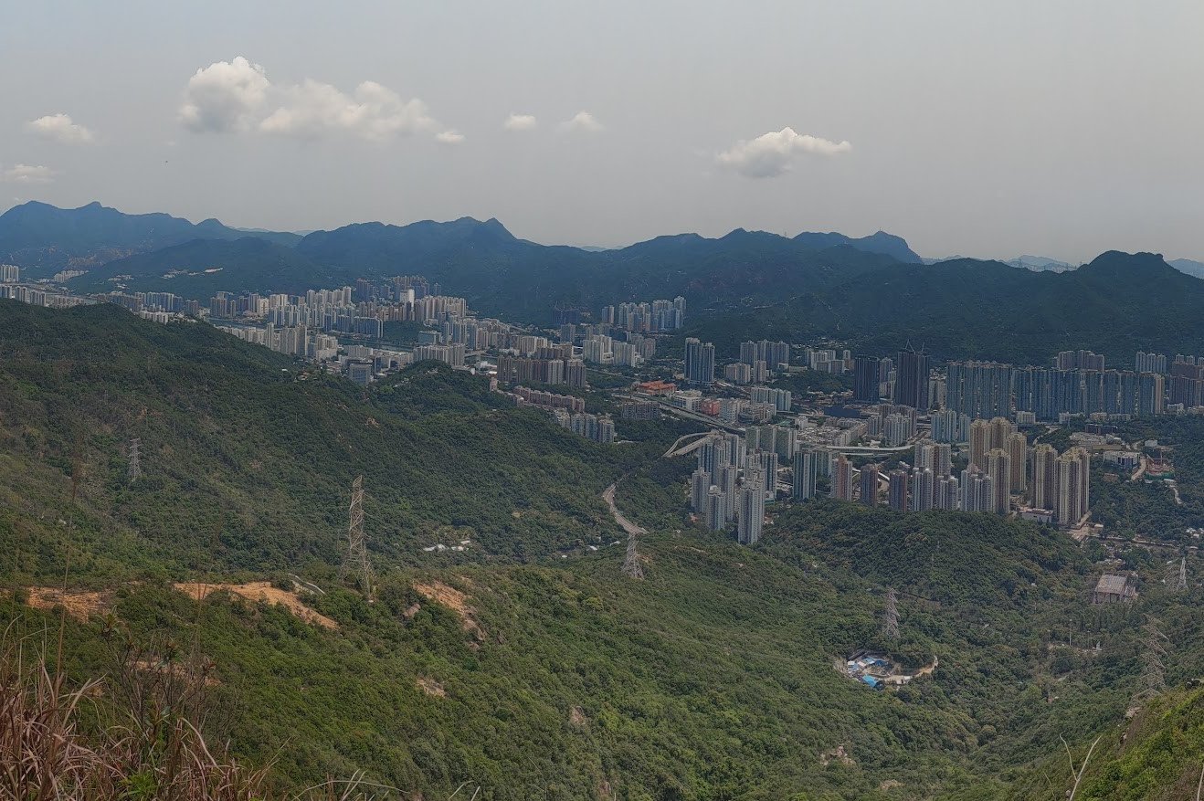
The concrete road starts off pretty flat, but quickly begins to ascend, which is pretty annoying.
Make sure to look back and check out some really cool views that show just how steep of a summit Needle Hill really is!
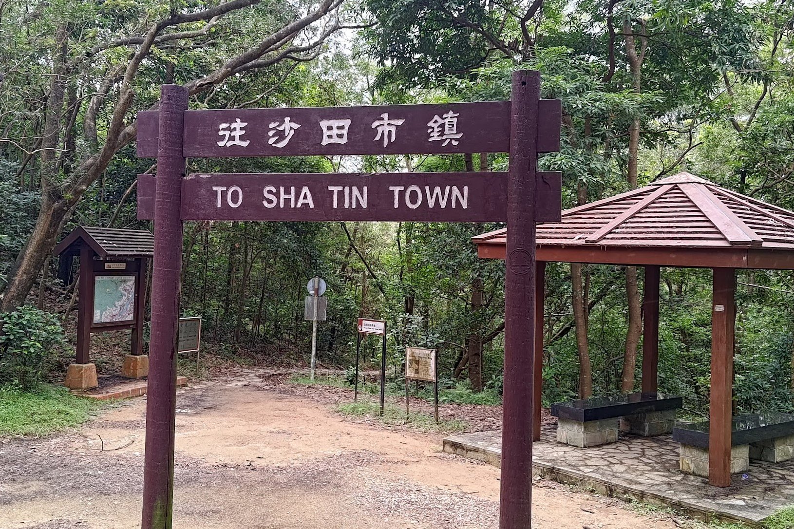
Once you go past the towers, you'll eventually arrive at an arch that points you to Shatin Town.
Follow the trail on the right once you go past the arch.
As you begin descending to Shatin MTR, stay vigilant when you go past any sign.
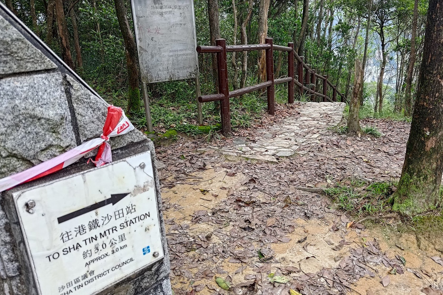
The first sign you should find is the 'To Shatin MTR Station' sign. Follow the stairs next to it.
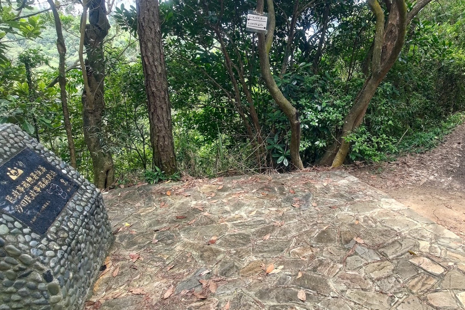
After some stellar views of Lion Rock in the distance and a lot of downhill stairs, you'll encounter the next major sign. This one is a black plaque set in stone. Head right when you see it. There's also a paper laminated sign in Chinese on a tree behind the stone. Follow the arrow pointing right if it's still there.
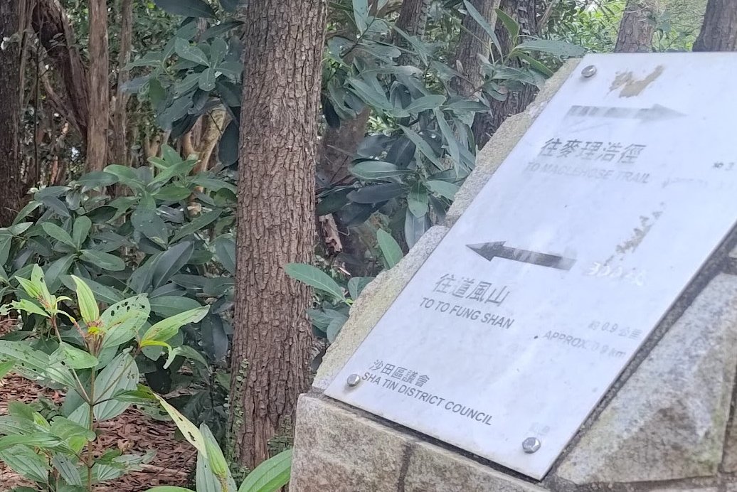
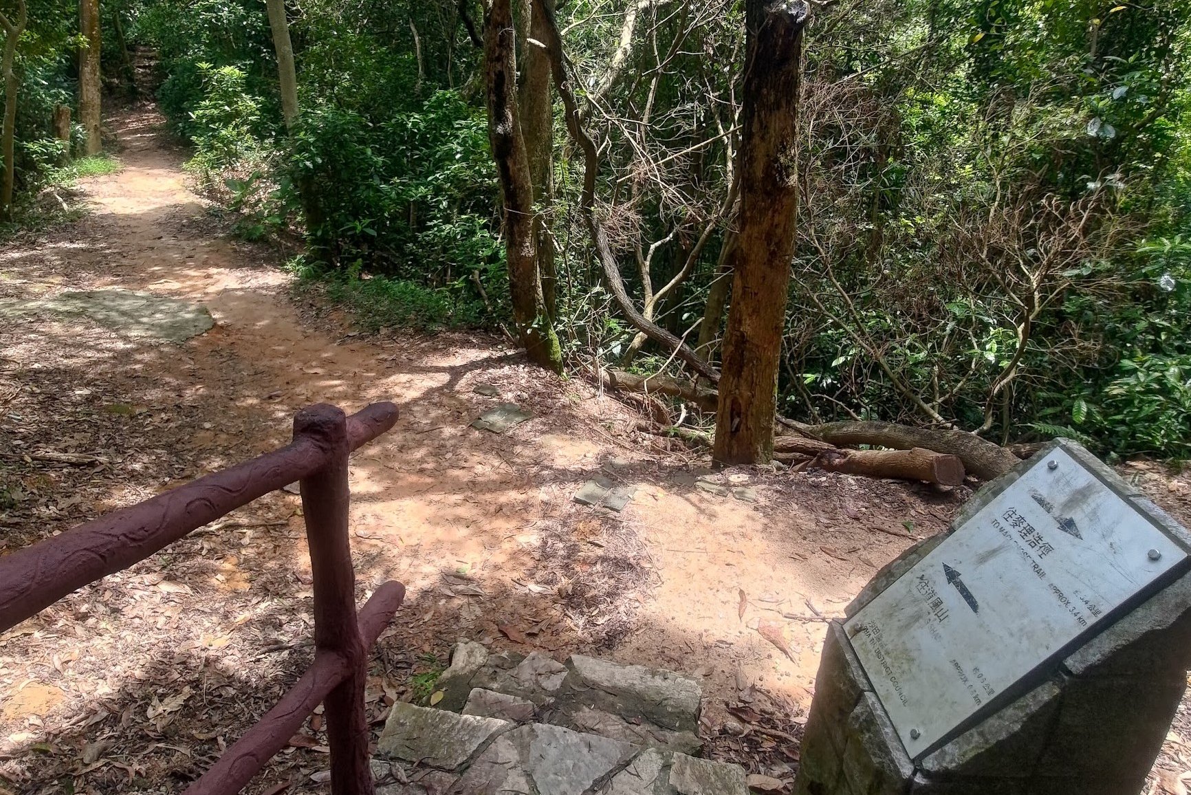
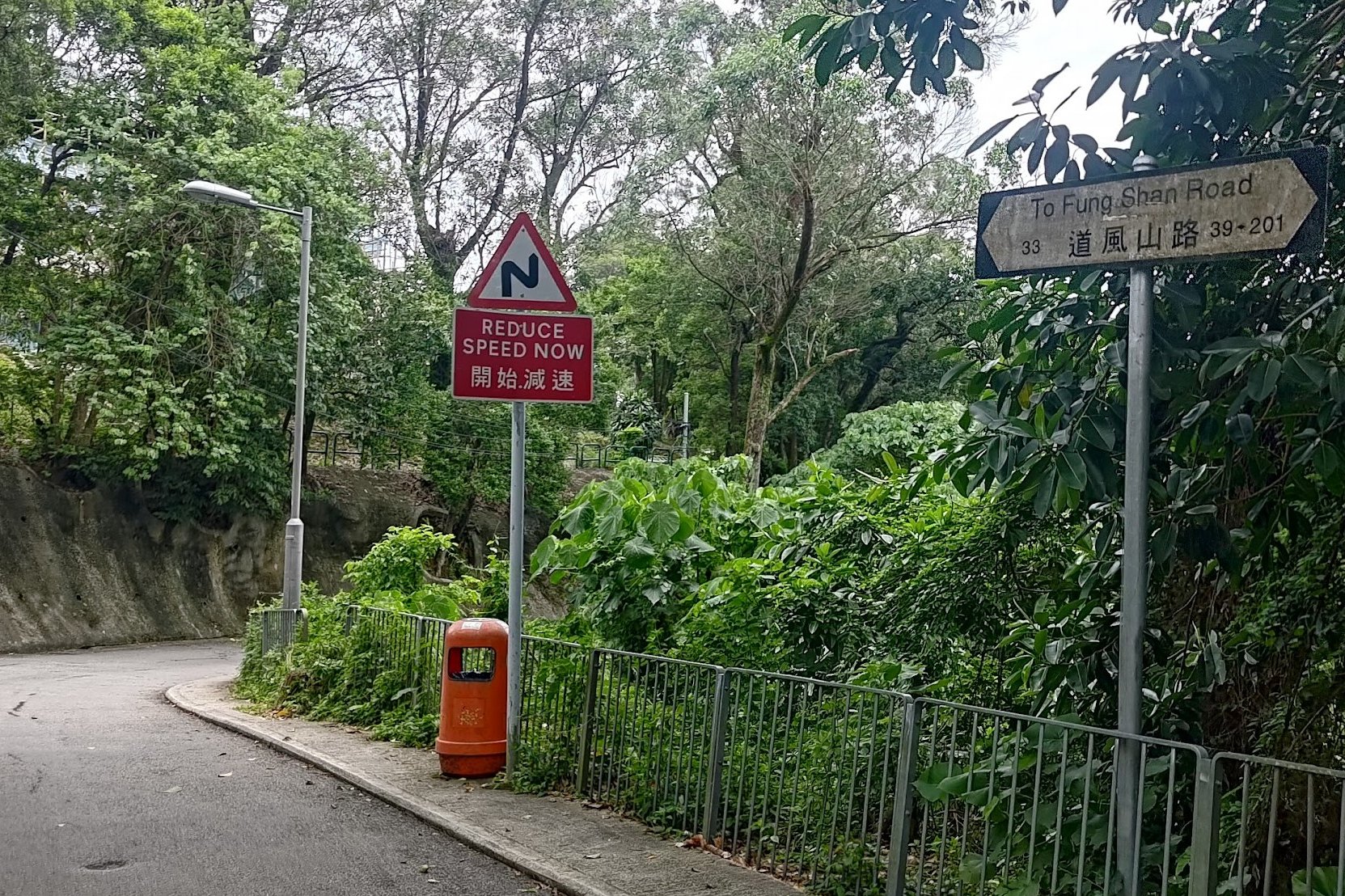
The next two signs you encounter will say 'To To Fung Shan Road' on them. Heed both silver signs and be aware that the second one's English portion is faded. Just follow the arrow that points forward.
Finally, you'll arrive at To Fung Shan Road.
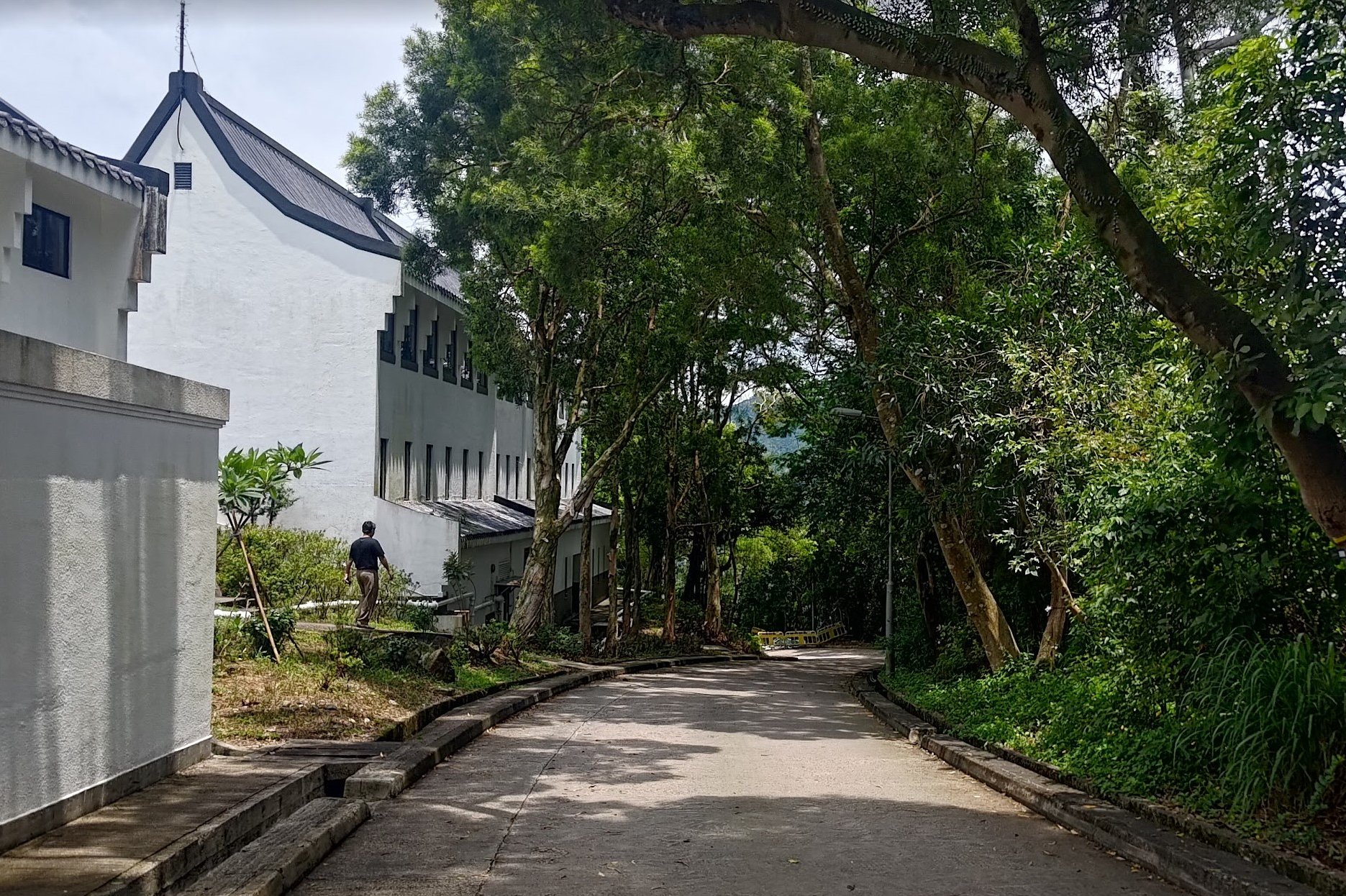
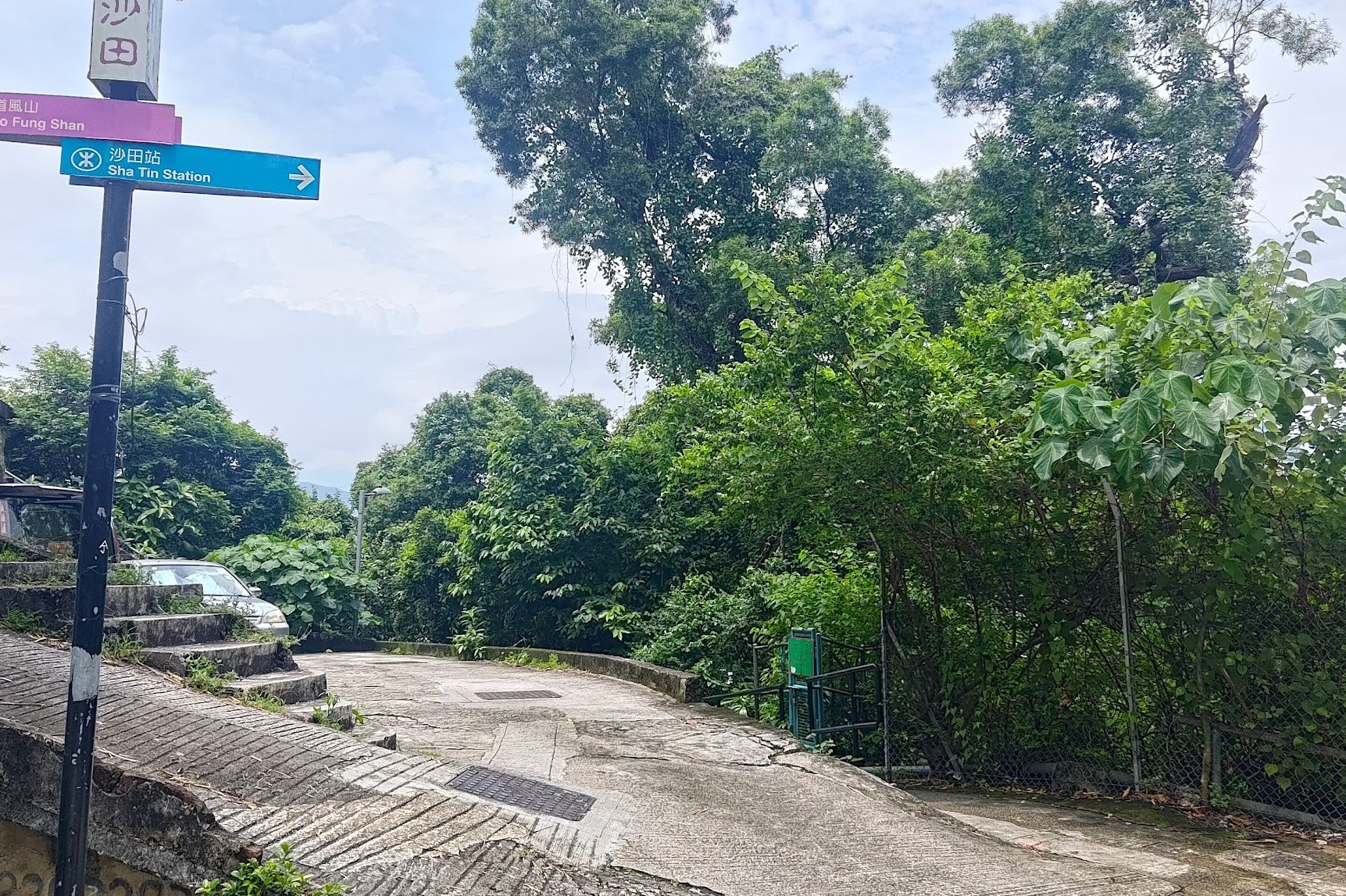
As you begin walking down To Fung Shan Road, you'll see the distinct architecture of the Lutheran Theological Seminary. Walk past it and stay on To Fung Shan Road all the way until you curve round to the roundabout.
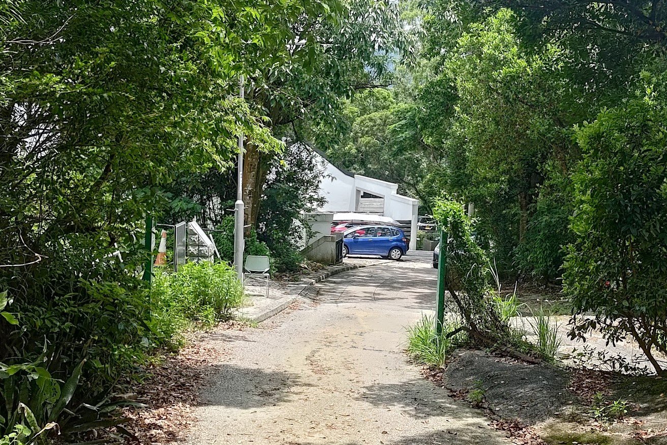
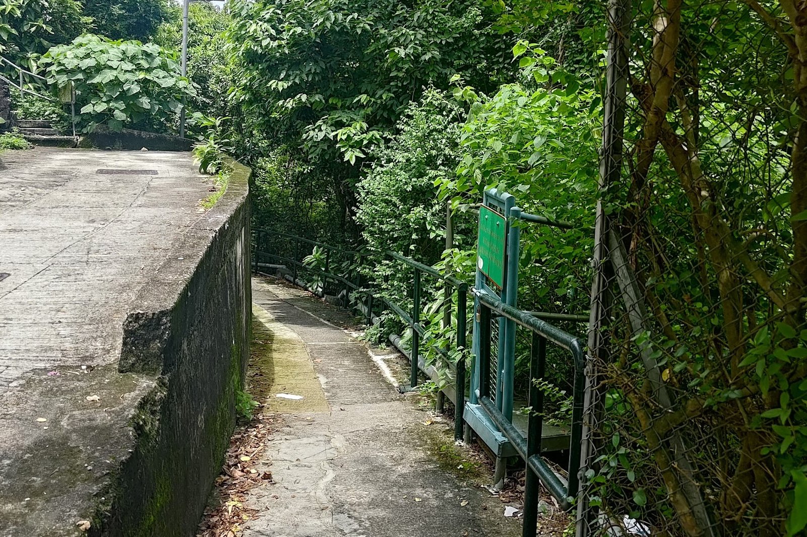
At the roundabout, you'll see an MTR sign. The fastest way to the MTR is actually just next to this sign marked by a fence and green railing.
Follow the little path for about five minutes as you go past some village houses and then end up right at the base of Shatin MTR station.
Getting Back
From Shatin MTR station, you can obviously take the train home, but there are also a plethora of buses that go to just about every point in the city, if you prefer.

