Pat Sin Leng: How to Hike Hong Kong's Legendary Eight Immortals
Contents
- Essential Information
- Hike Highlights
- Google Route Map
- How to Get There
- Quick Route Summary
- Detailed Route
- A Tough 30-Minute Uphill Slog
- The Open, Flat Rocky Section
- How to Navigate the Forks in the Trail
- Arriving at Wong Leng Peak (Highest Point)
- Getting to the Eight Immortals
- The Eight Immortals (Finally)
- Walking to Tai Mei Tuk
- Getting Back
- How to Hike Cloudy Hill and Pat Sin Leng Together
Essential Pat Sin Leng Hike Details
- District: New Territories
- Duration: Between 4 hours and 15 minutes and 5+ hours depending on fitness, hiking speed and rest stops
- Distance: 12.2km - including the walk to Tai Mei Tuk
- Highest Elevation: 639 meters
- Difficulty: 4/5
- Facilities: Toilets available at the start. Make sure to stock up on liquids and food before arriving at the start point
Why Hike Pat Sin Leng (The Eight Immortals)
Pat Sin Leng (八仙嶺), or the Eight Immortals in English, is one of those hikes in Hong Kong that's attained legendary status - and for good reason!
The initial ascent is nothing short of brutal as you take on steep stone stairs that lead you up several hundred meters. However, the reward for your hard work is something truly special.
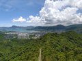
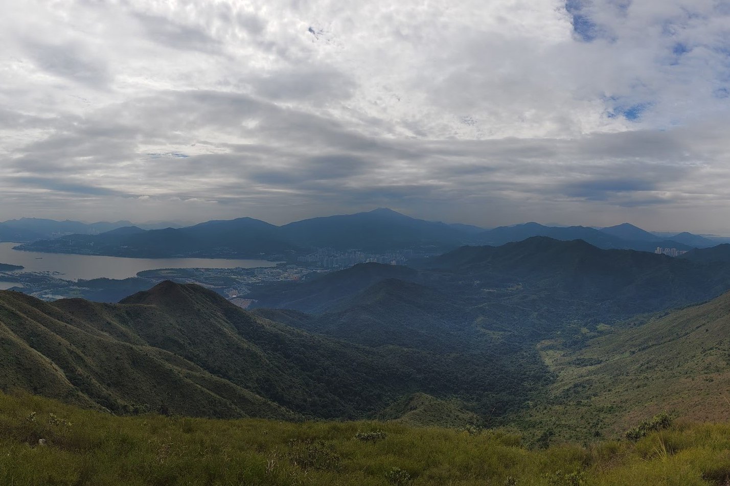
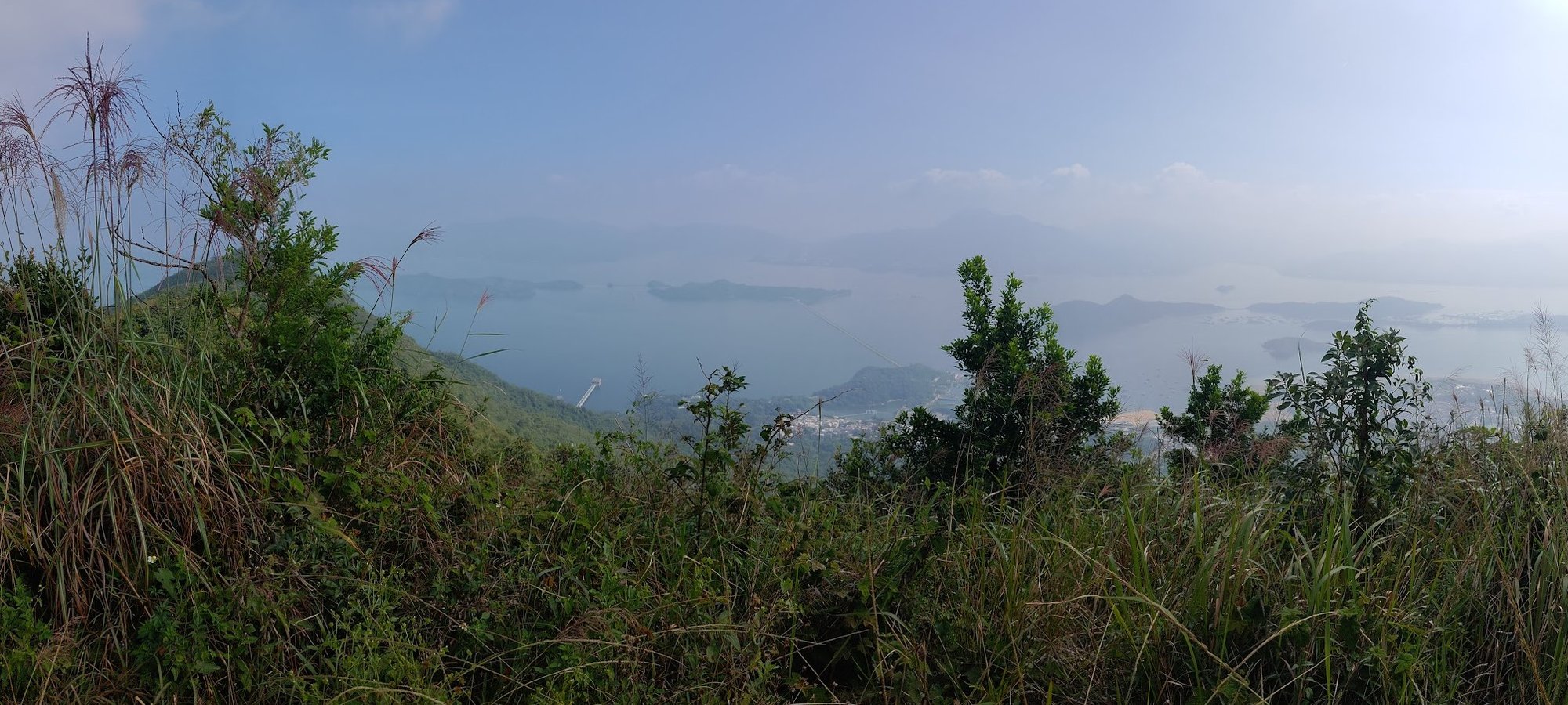
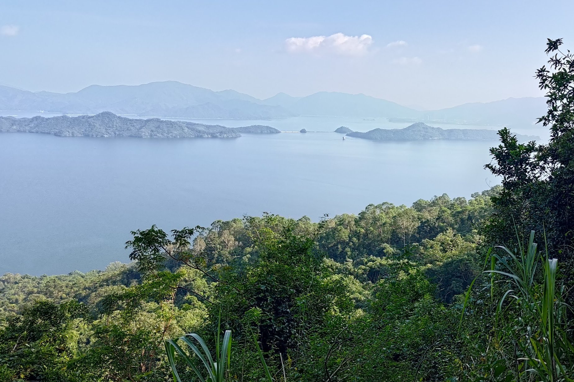
All throughout the hike you'll be presented with the type of scenery that you'd expect to find on postcards or in a Nat Geo documentary. Oftentimes, it's tough to believe you're still in Hong Kong.
From coastal vistas to undulating green mountains, and even clear views into bordering Shenzhen, it feels as if there's something new to marvel at around every corner.
If you're a seasoned hiker or even someone with decent fitness, the tough climbs and lengthy trail may feel like a daunting prospect, but with each view, it's almost as though you're energized anew and excited to see what's beyond the next mysterious crest.
Google Route Map
How to Get to the Pat Sin Leng Hike Start Point


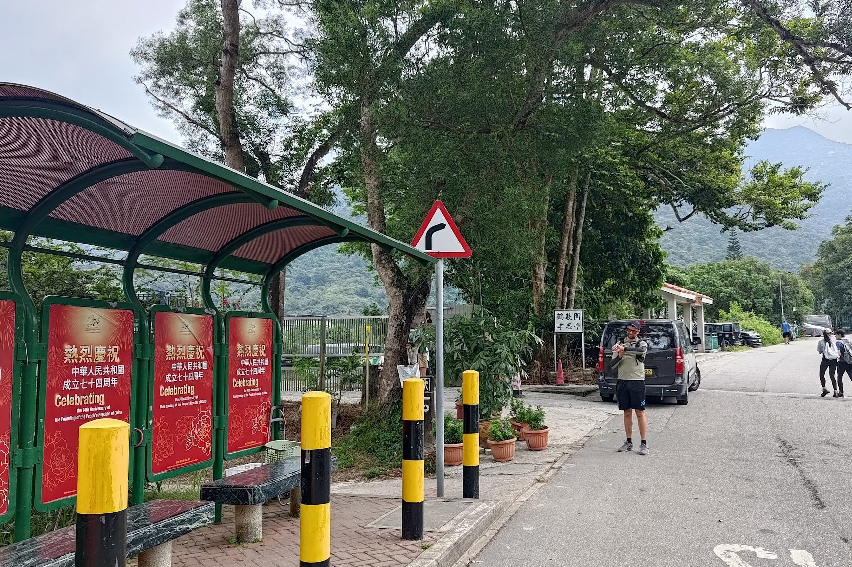
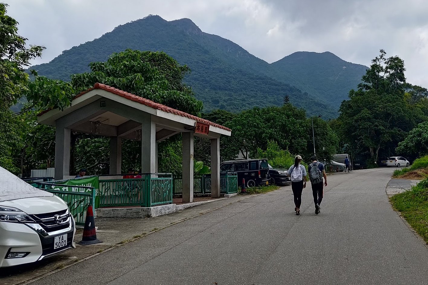
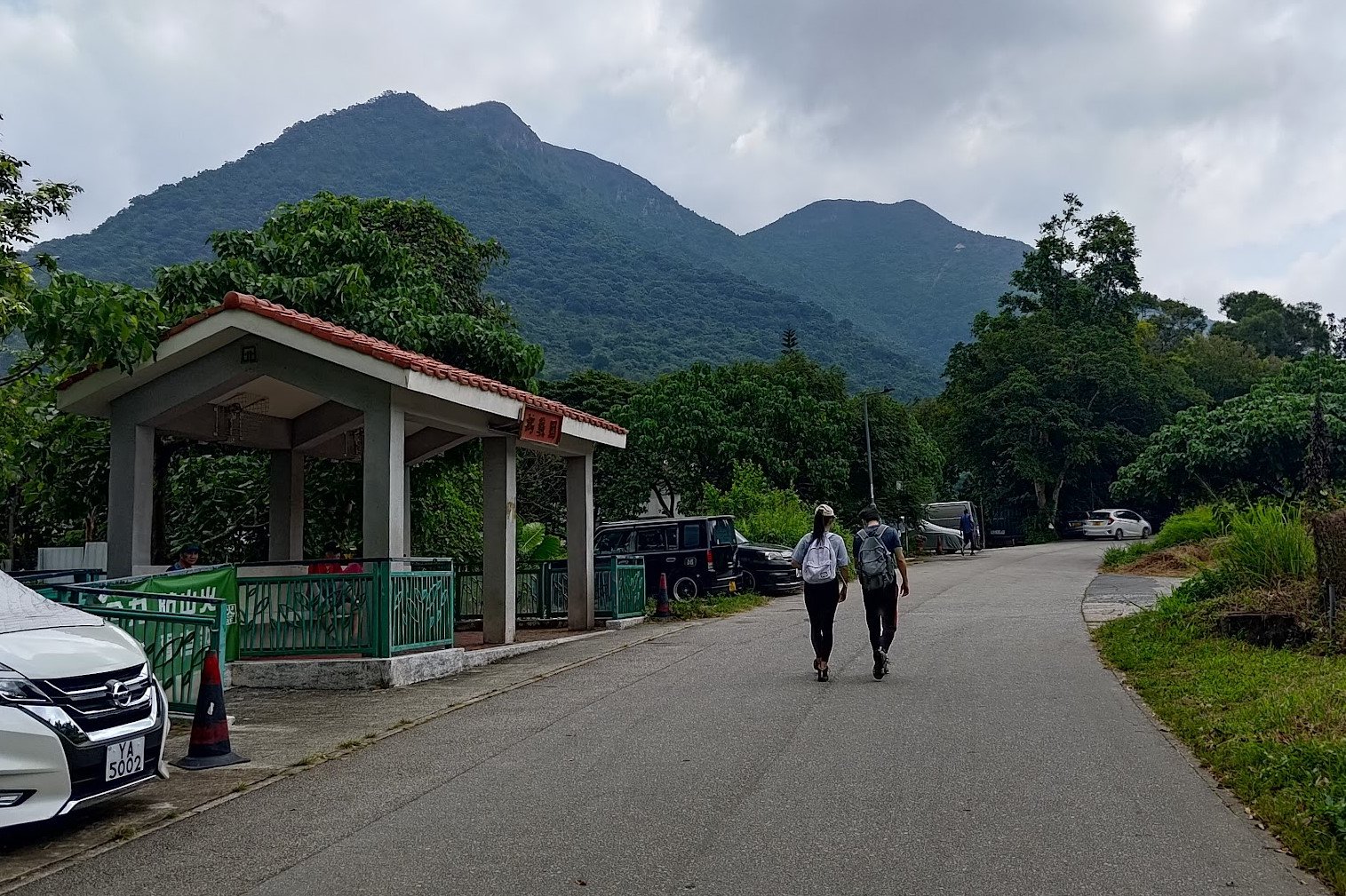
To get to the Pat Sin Leng hike start point, which is Hok Tau Wai Pavilion, take the MTR to Fanling Station.
Once there, don't forget to stock up on supplies! Then, look for exit C, which is just past Exit A and to the left. I know, it's a bit weird and confusing.
Walk straight after heading down the Exit C stairs and you'll see a green minibus stop in the distance.
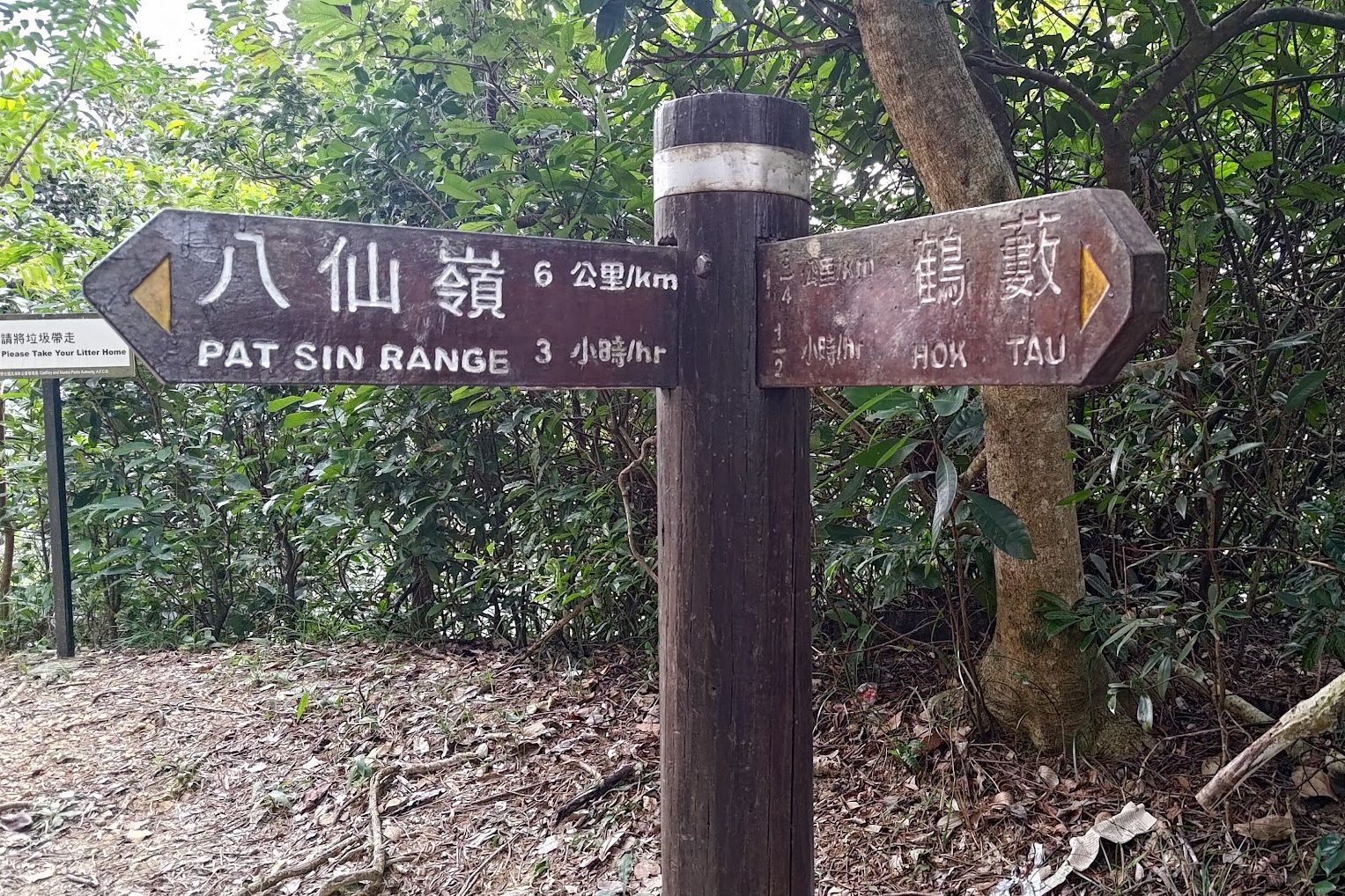
Once there, take the 52B minibus and show the driver this: 鶴藪圍涼亭 (hok tau wai ling ting)
The ride takes about 15-20 minutes and the driver should let you off at the right place, which is Hok Tau Wai Pavilion - a green bus stop with a pavilion nearby.
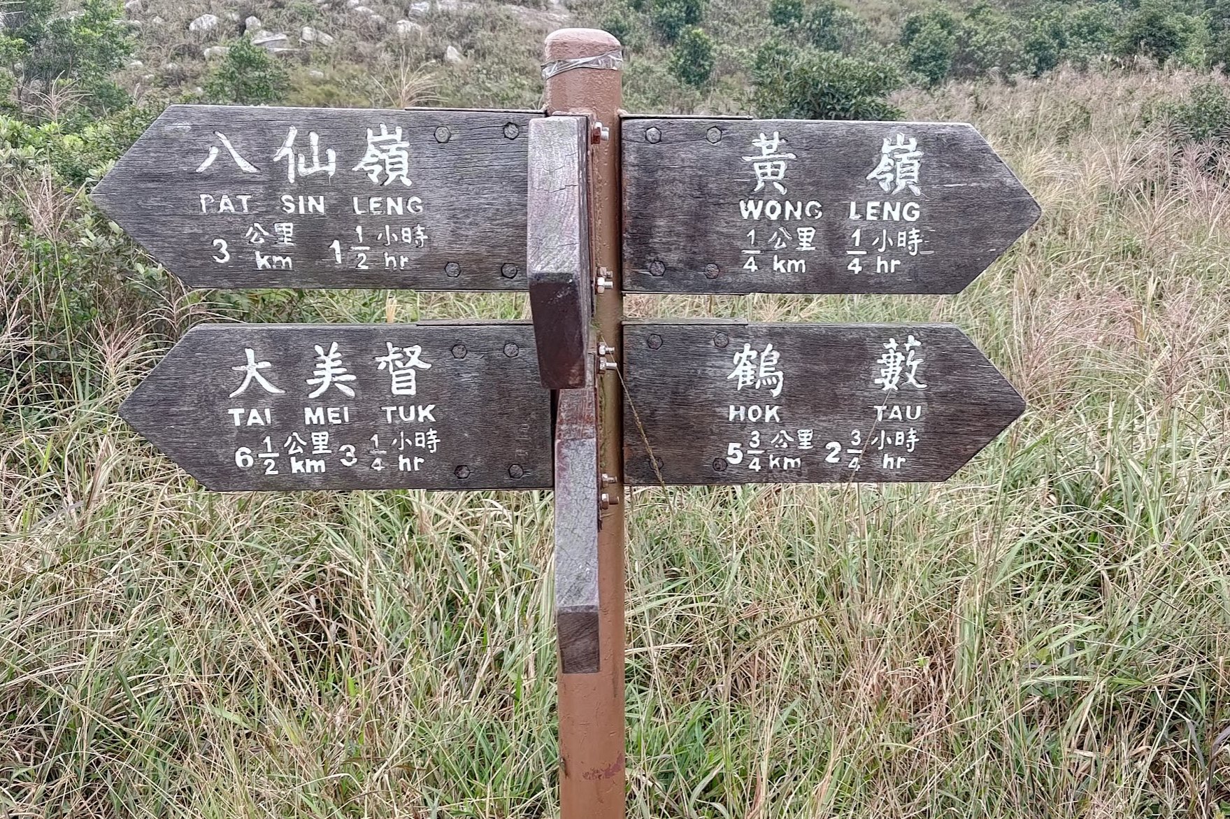
Quick Pat Sin Leng Hike Route Summary
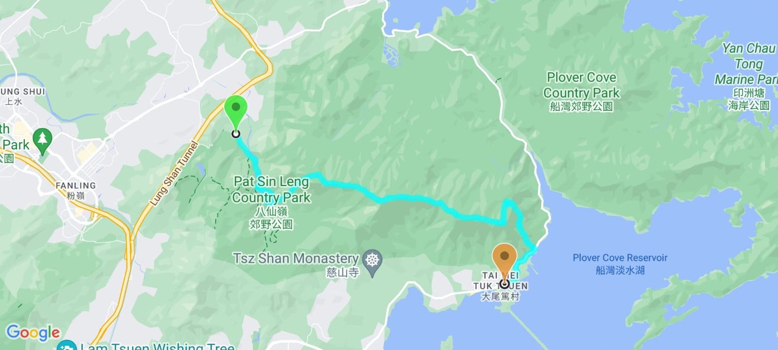
- Head to Fanling MTR Station and get the 52B minibus from exit C
- Get off at Hok Tau Wai Pavilion
- Follow Hok Tau Road until you reach Hok Tau Reservoir
- Head left and walk for a few minutes until you see a little black pavilion in some grass
- Head through the Family Walk arch behind the pavilion and take the 'Pat Sin Range' stairs up just beyond
- Climb for 30 minutes (can be longer or shorter depending on your speed) and follow the 'Pat Sin Range' signs along the way
- Arrive at open, flat section. Follow the 'Pat Sin Leng' sign
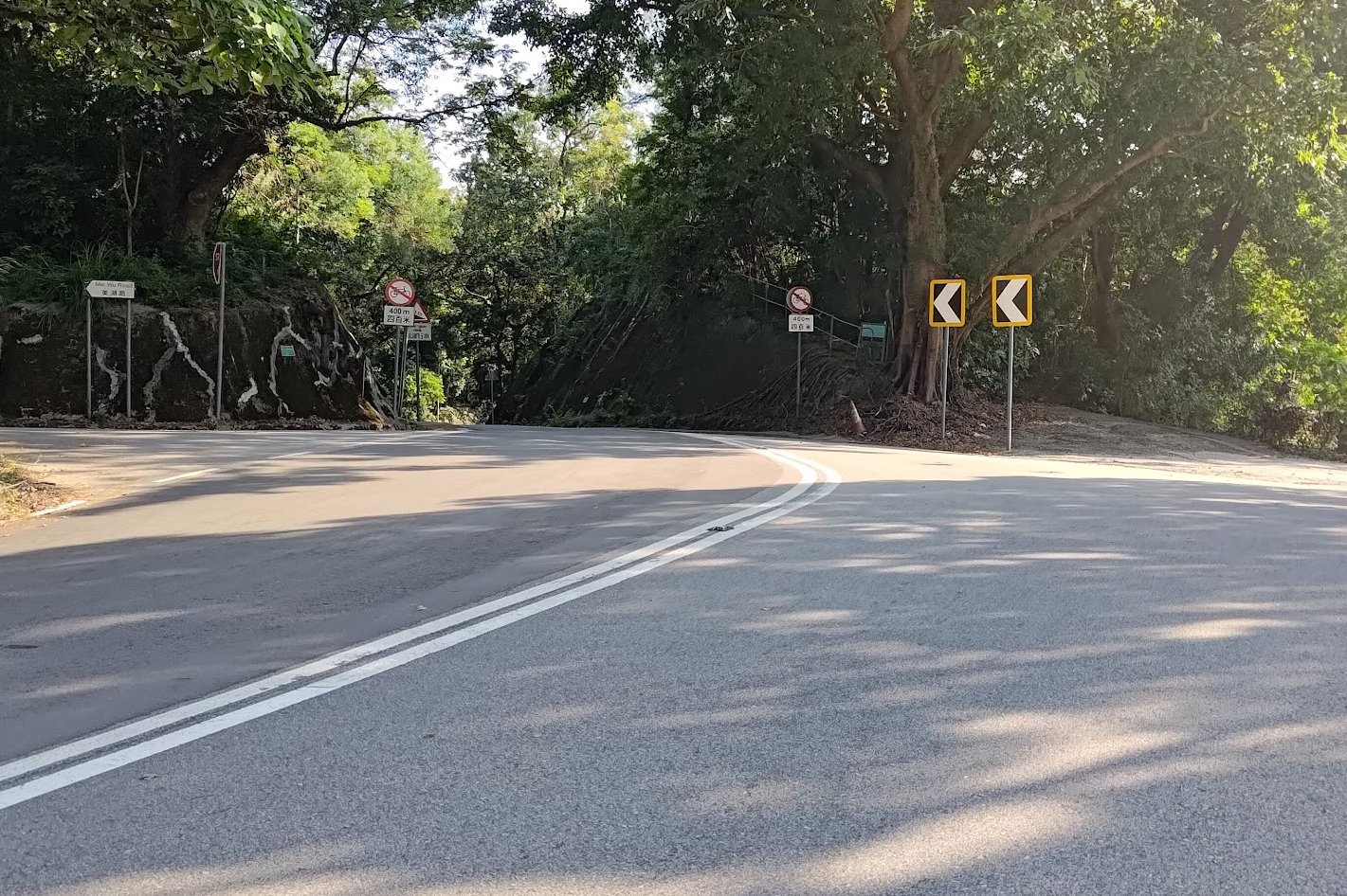
- You will encounter forks in the path after 15 mins - always go left for the safe, official routes. The right forks take you up overgrown paths but give you great views. All forking paths eventually converge.
- From the first fork, keep following the 'Pat Sin Leng' signs for 1.5 hours until you arrive at Shun Yeung Fung (the first peak of the Eight Immortals)
- Climb all the remaining peaks and begin your descent
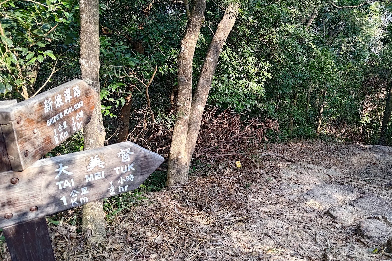
- Take the stairs down for 15-20 mins and follow the 'Tai Mei Tuk' sign to the right
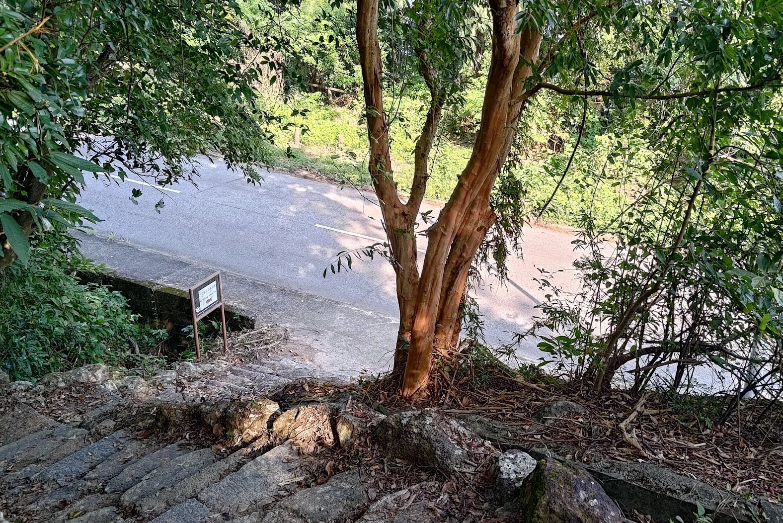
- 20 mins later, follow the sign pointing to 'Bride's Pool Road' on the left
- After reaching Bride's Pool Road, head right before following Ting Kok Road to Tai Mei Tuk where you can find food, drinks and buses back to the city
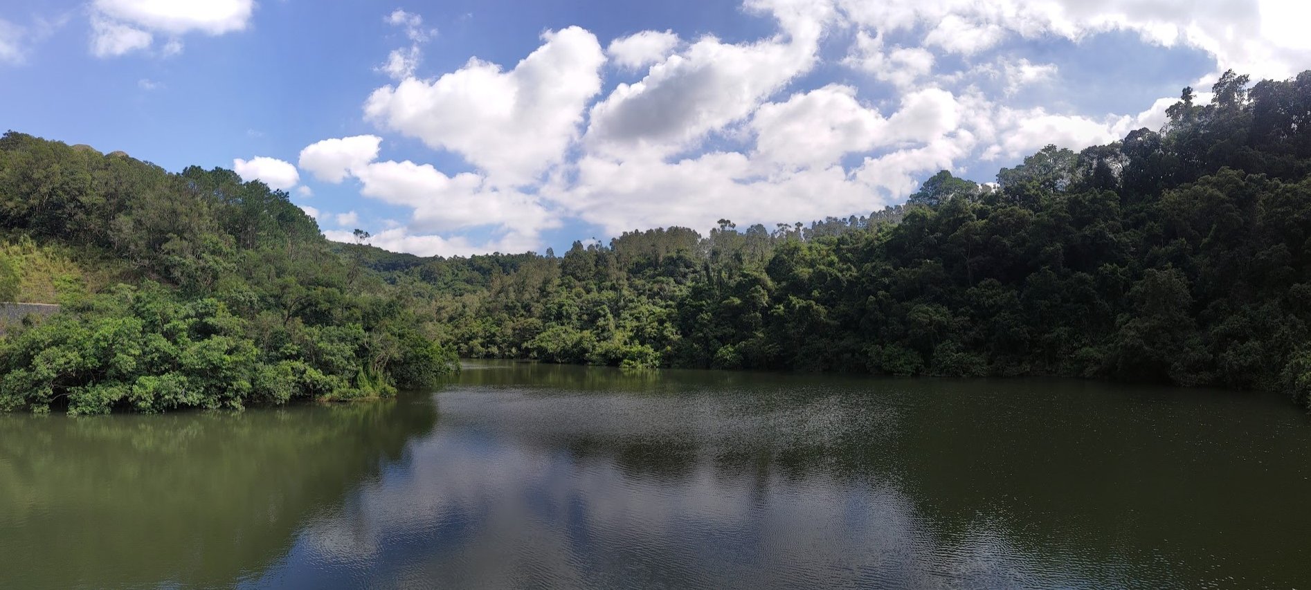
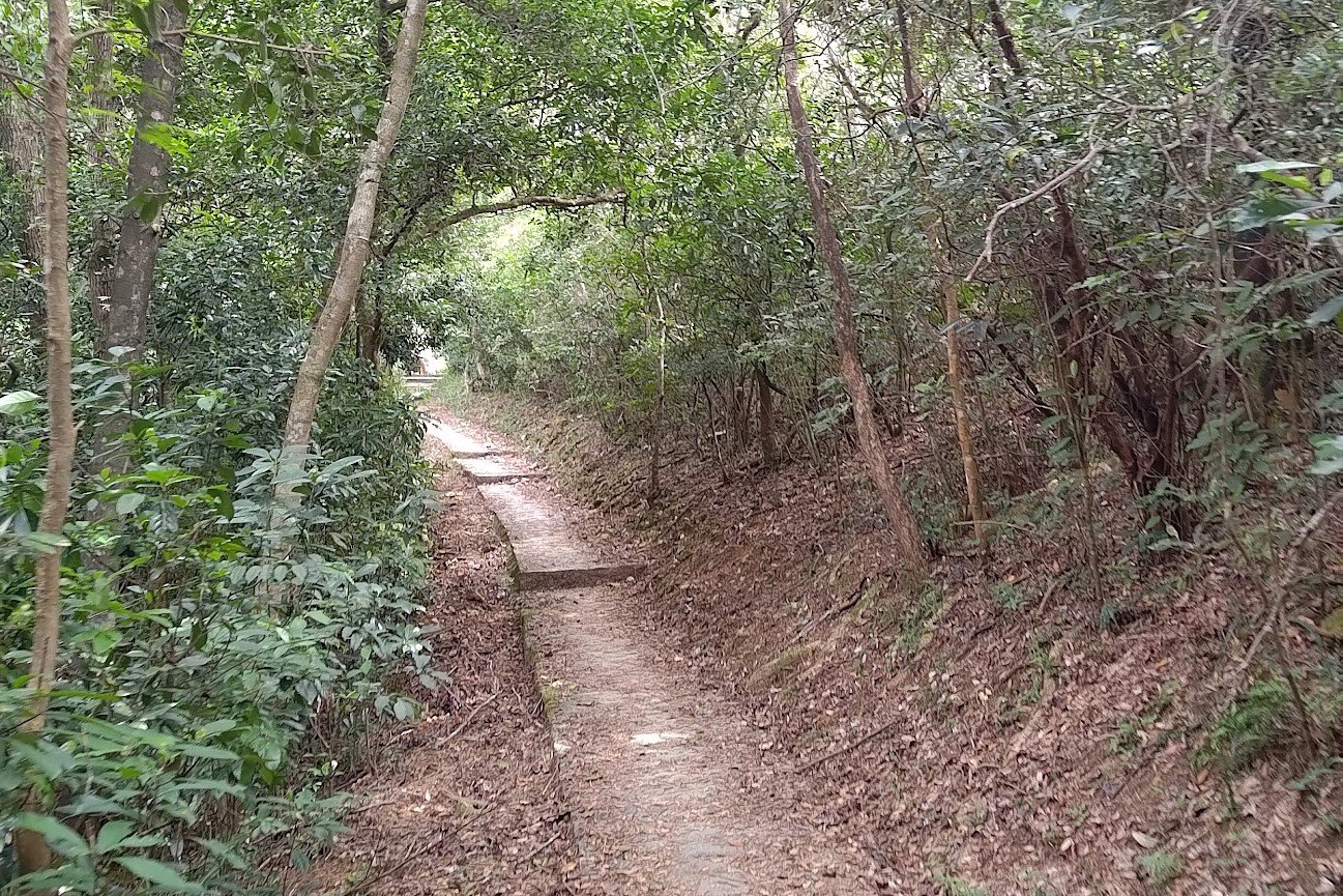
Follow Hok Tau Road to Hok Tau Reservoir
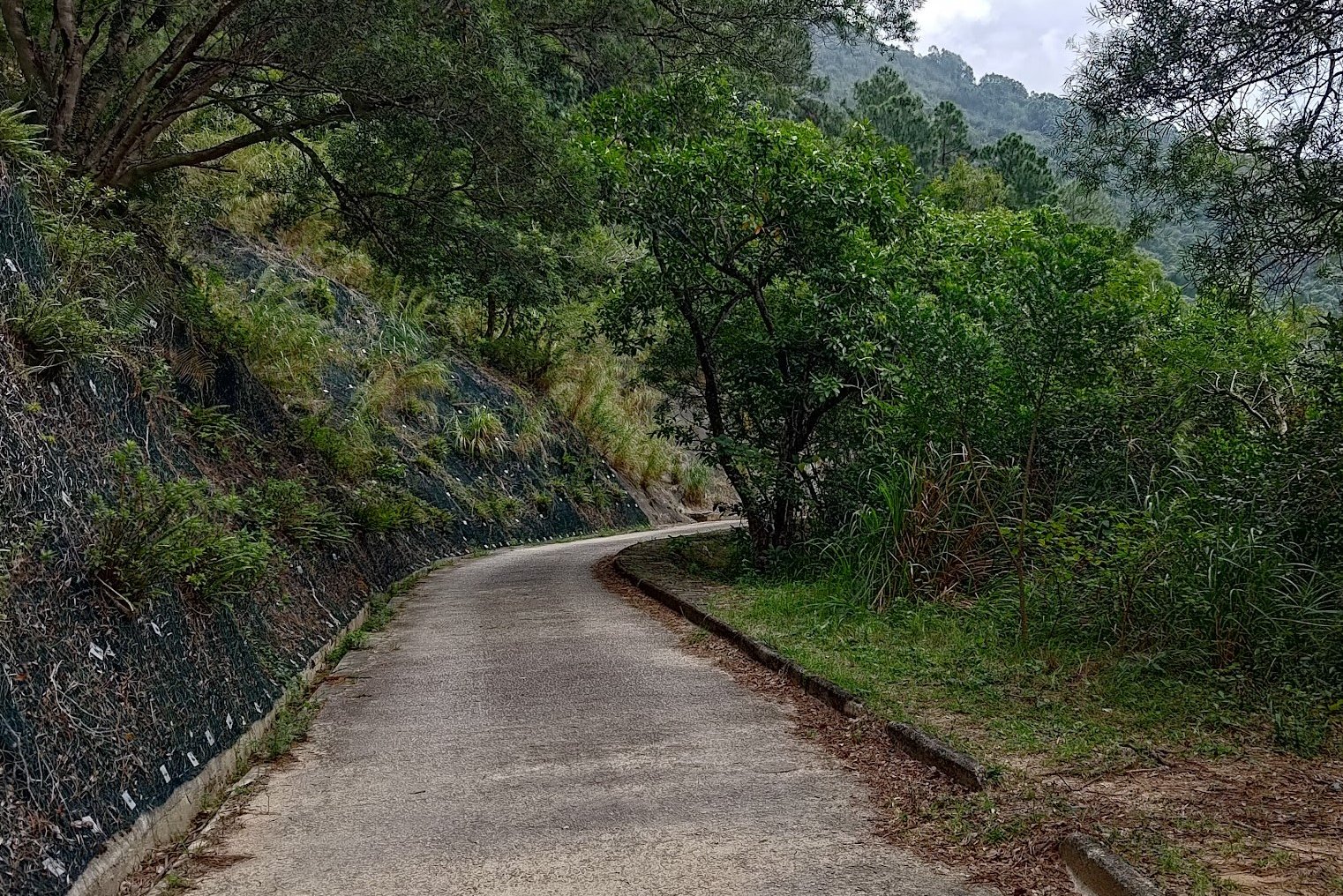
Once you get off the bus, it'll take about 25 minutes until you begin the toughest climb of the whole hike. Consider this little walk as a sort of warm up.
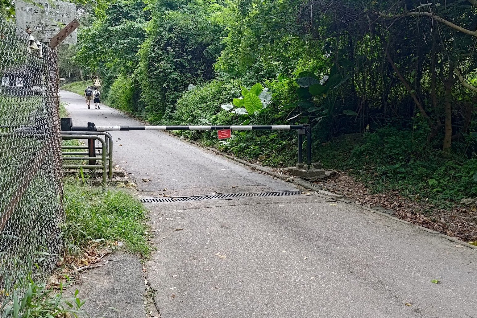
Follow Hok Tau Road for about 20 minutes, going past Hok Tau Wai Pavilion and a car barrier near the start.
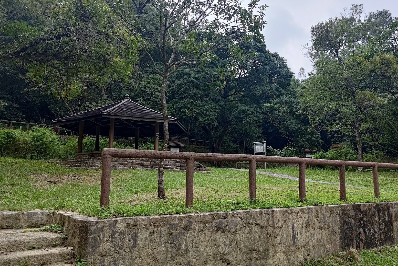
Once you arrive at Hok Tau Reservoir, be sure to turn left. Going right and taking the stairs will lead you to Cloudy Hill.
Walk along the dam (after turning left) and follow the concrete path for a few minutes until you see a black pavilion to your left.
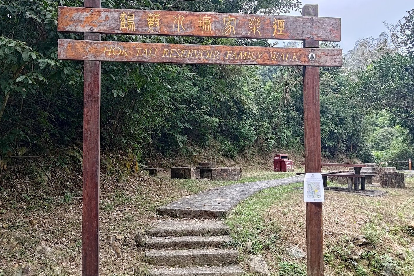
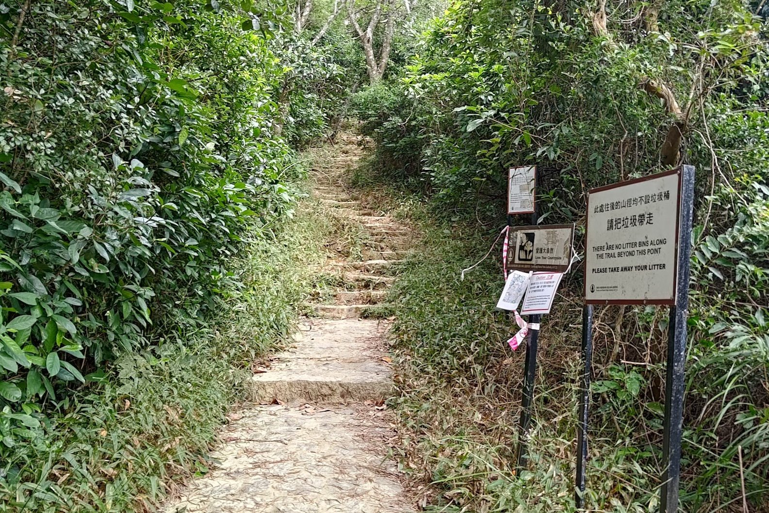
Head toward it and go under the Family Walk arch right behind it.
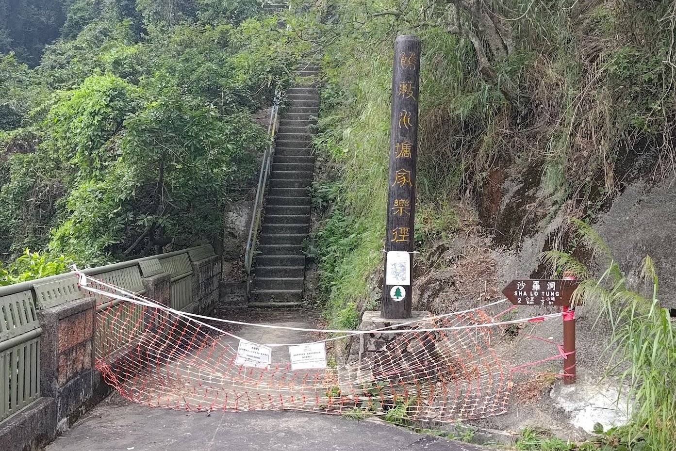
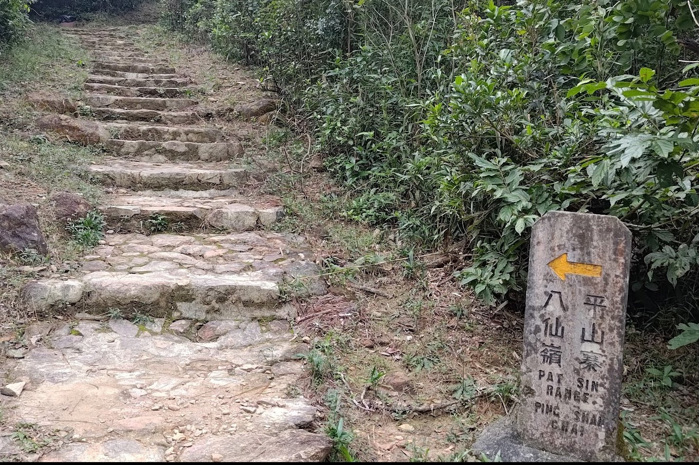
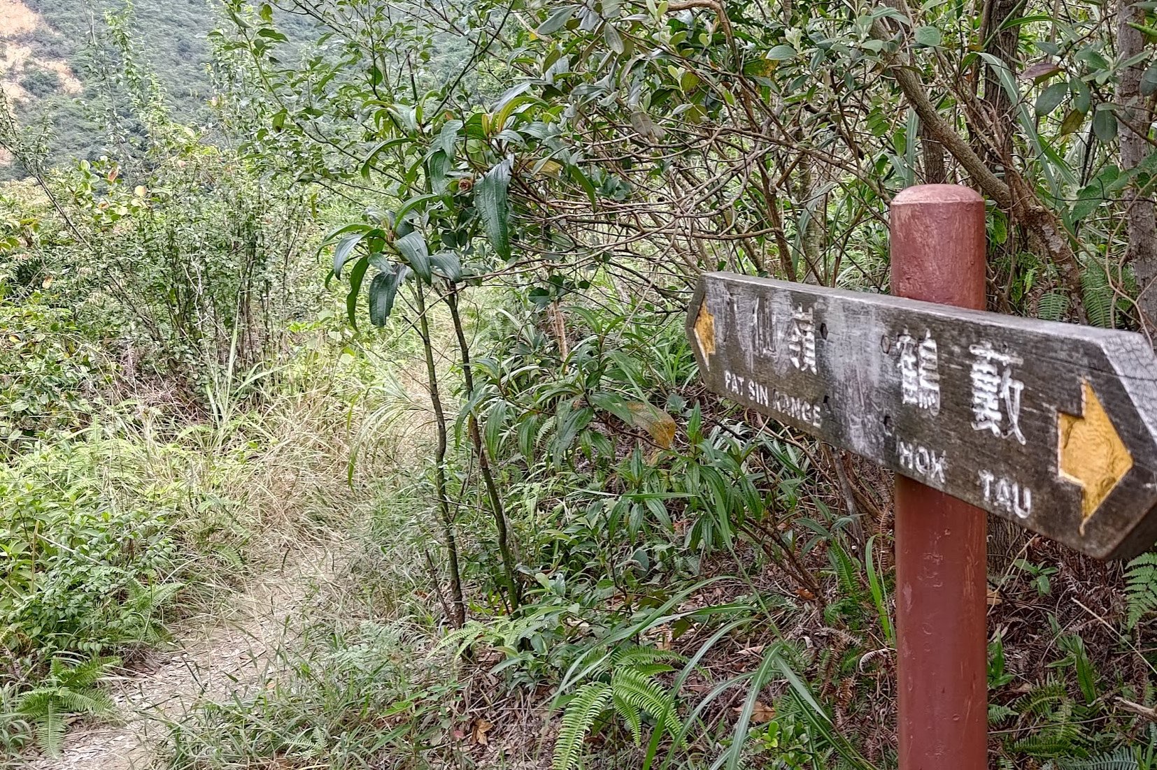
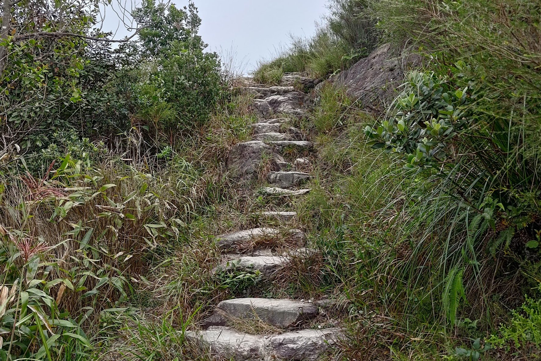
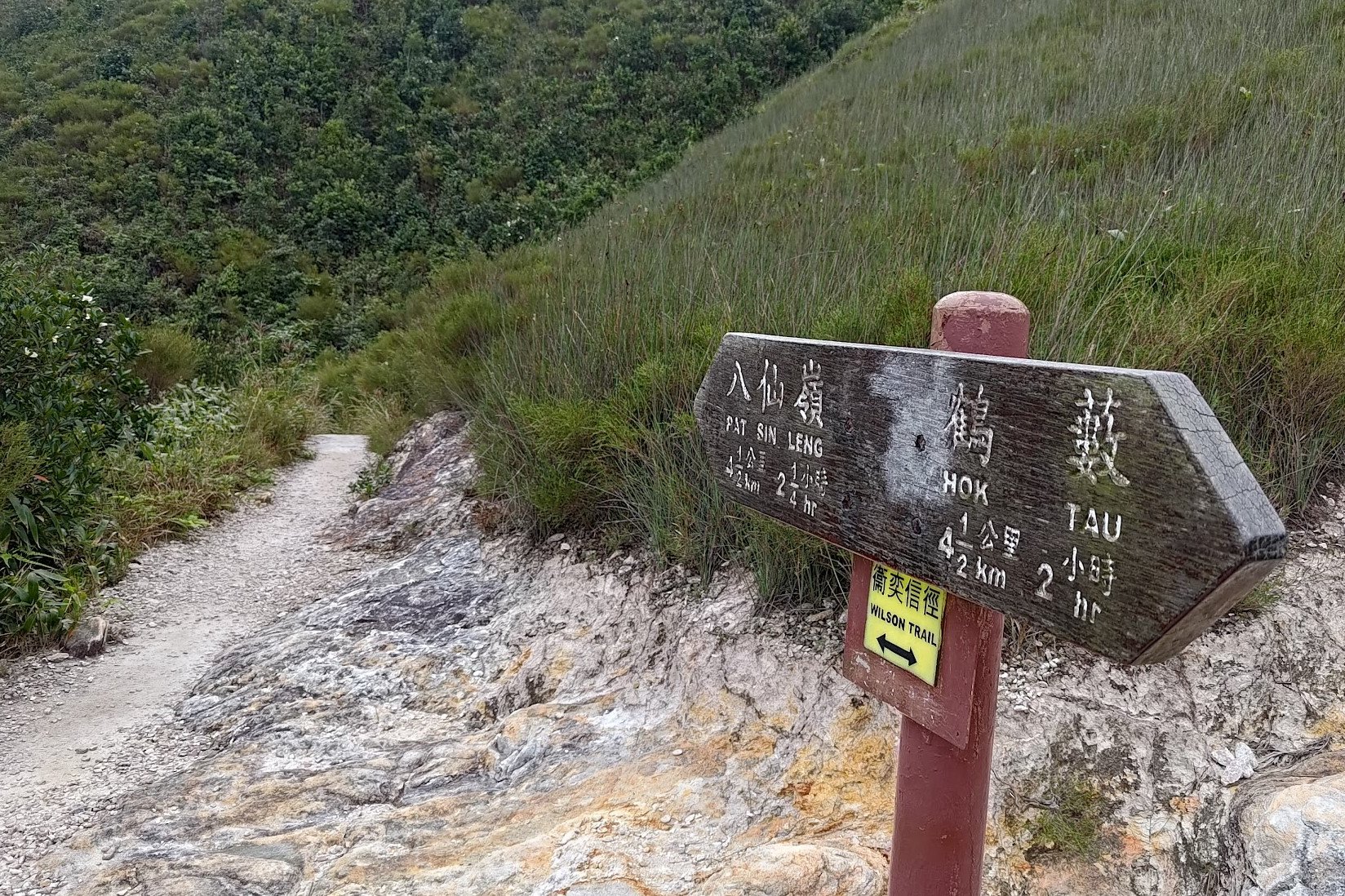
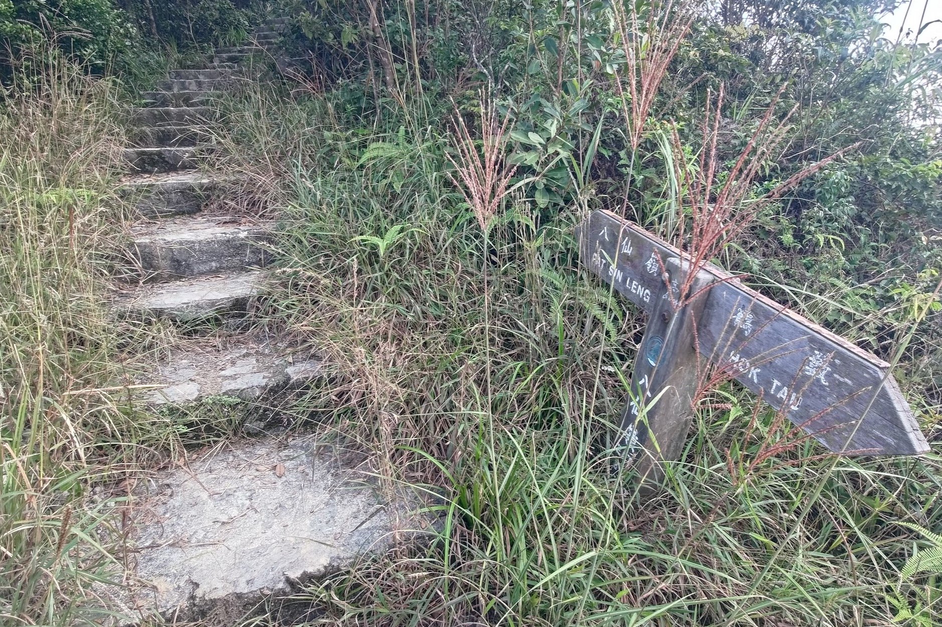
You'll turn left after the arch and see a small stone sign that points to the 'Pat Sin Range' next to a set of stone steps.
Thus marks the beginning of the steepest ascent of the entire hike.
A Tough 30-Minute Uphill Slog
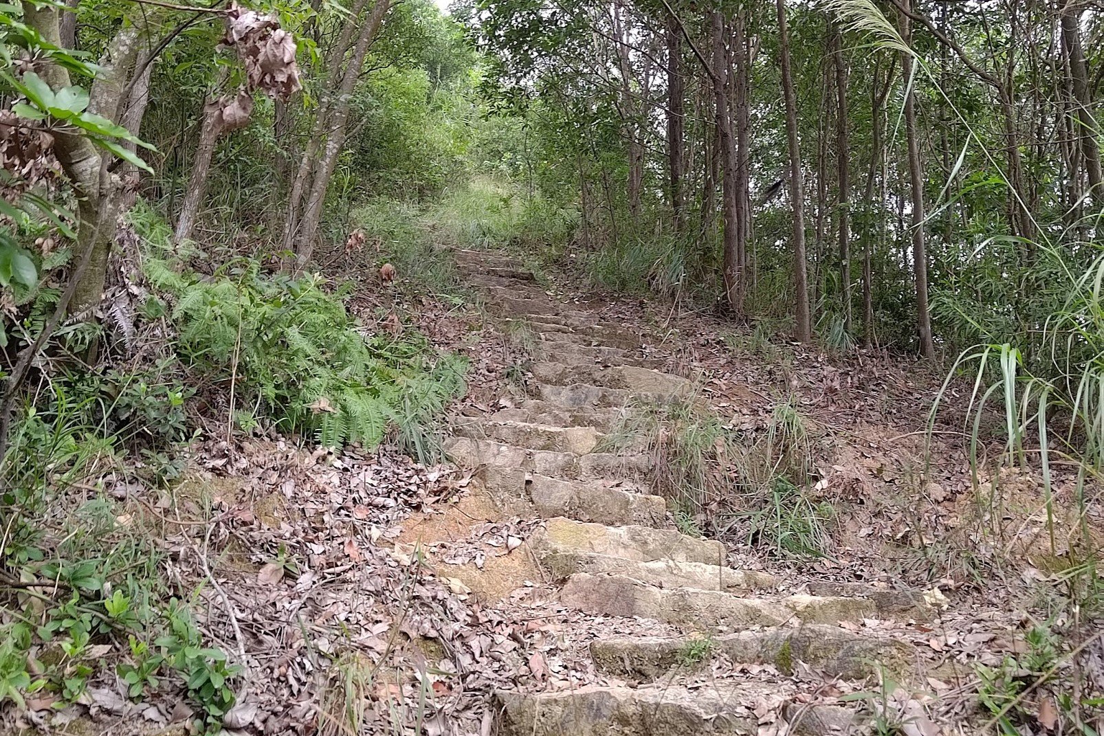
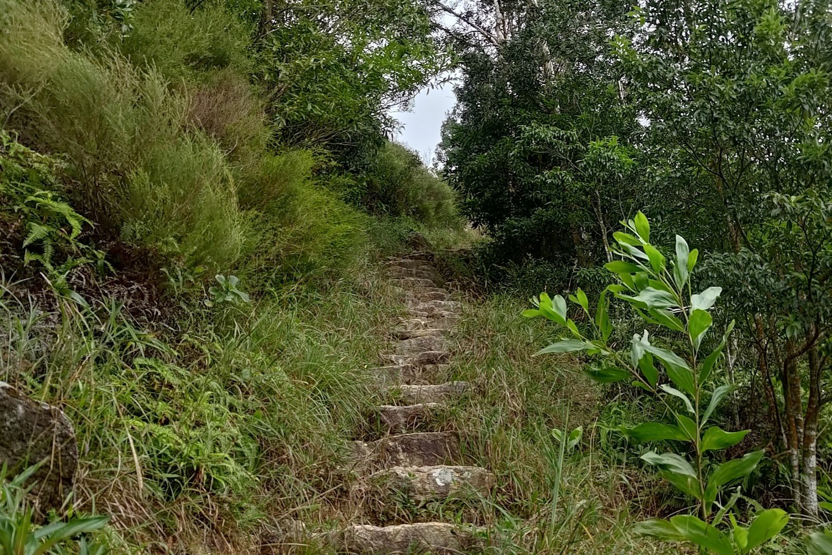
After beginning your ascent from the stone Pat Sin range sign, you'll quickly reach a fork in the trail. You'll be following the wooden Pat Sin Range sign that leads right to...you guessed it! Another really steep uphill set of stairs.
Probably the toughest part about this particular uphill section, aside from the steepness and lack of any flat portions, is that you won't get any epic views just yet.
It's just you and the trail. Consider this as a test of fitness and mental fortitude before the mountain deems you worthy to partake in its mystical secrets and magical views.
It's about 30+ minutes to the next substantial flat portion of hiking depending on your speed.
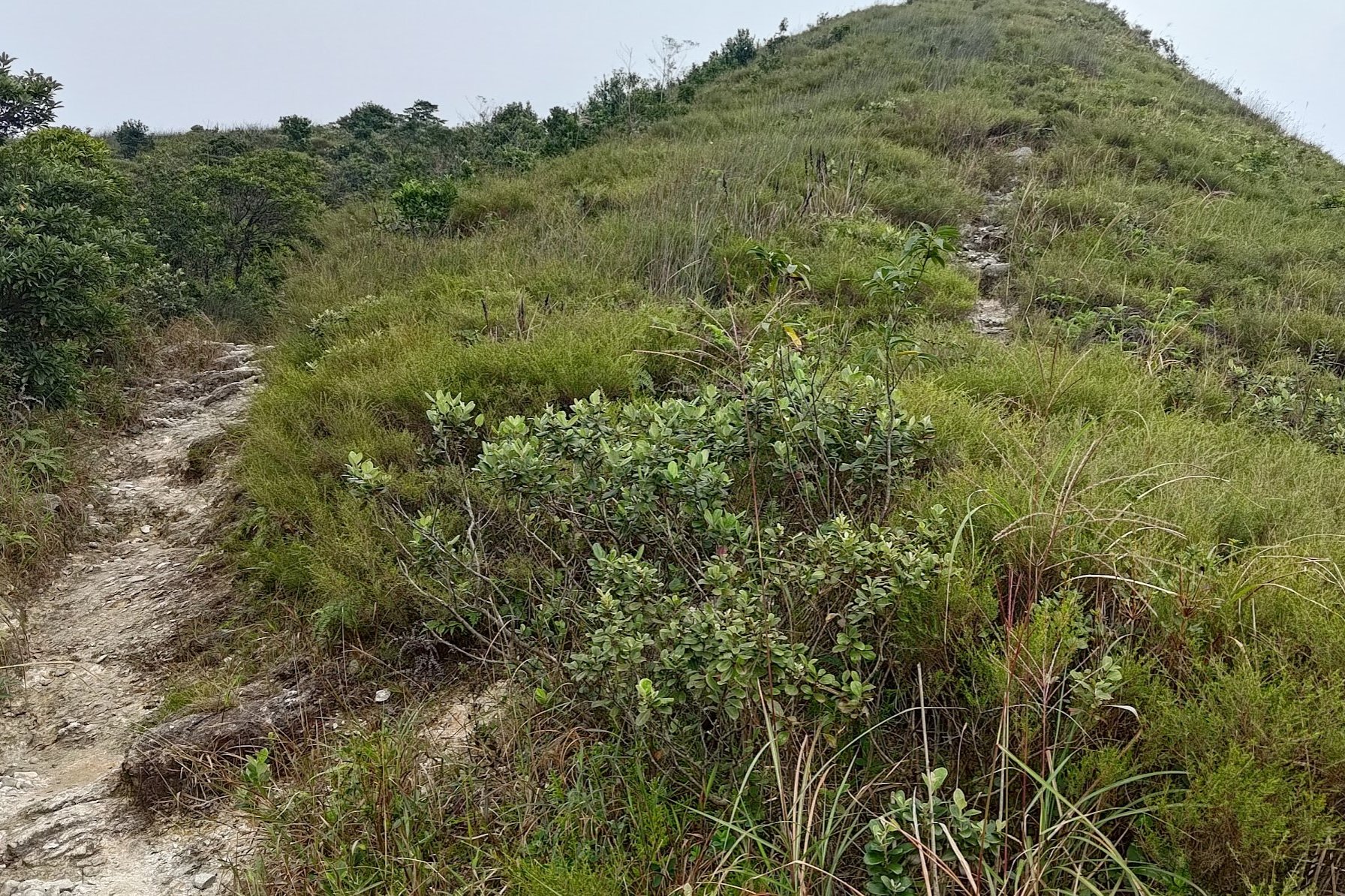
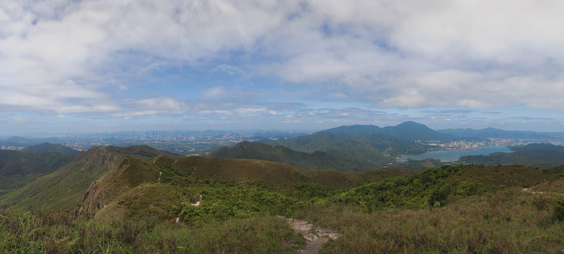
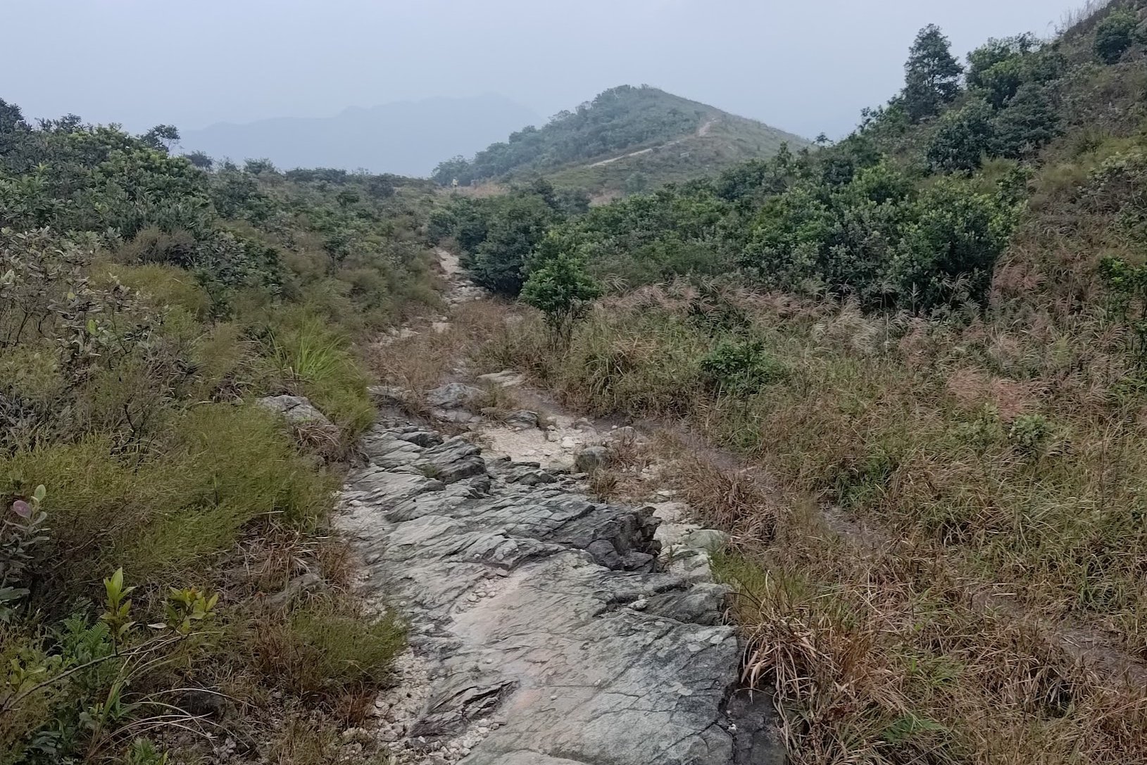
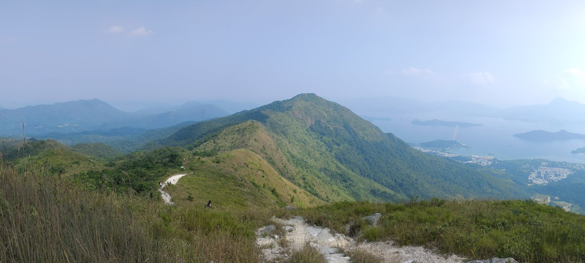
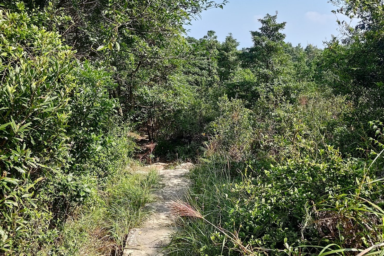
The Open, Flat Rocky Section
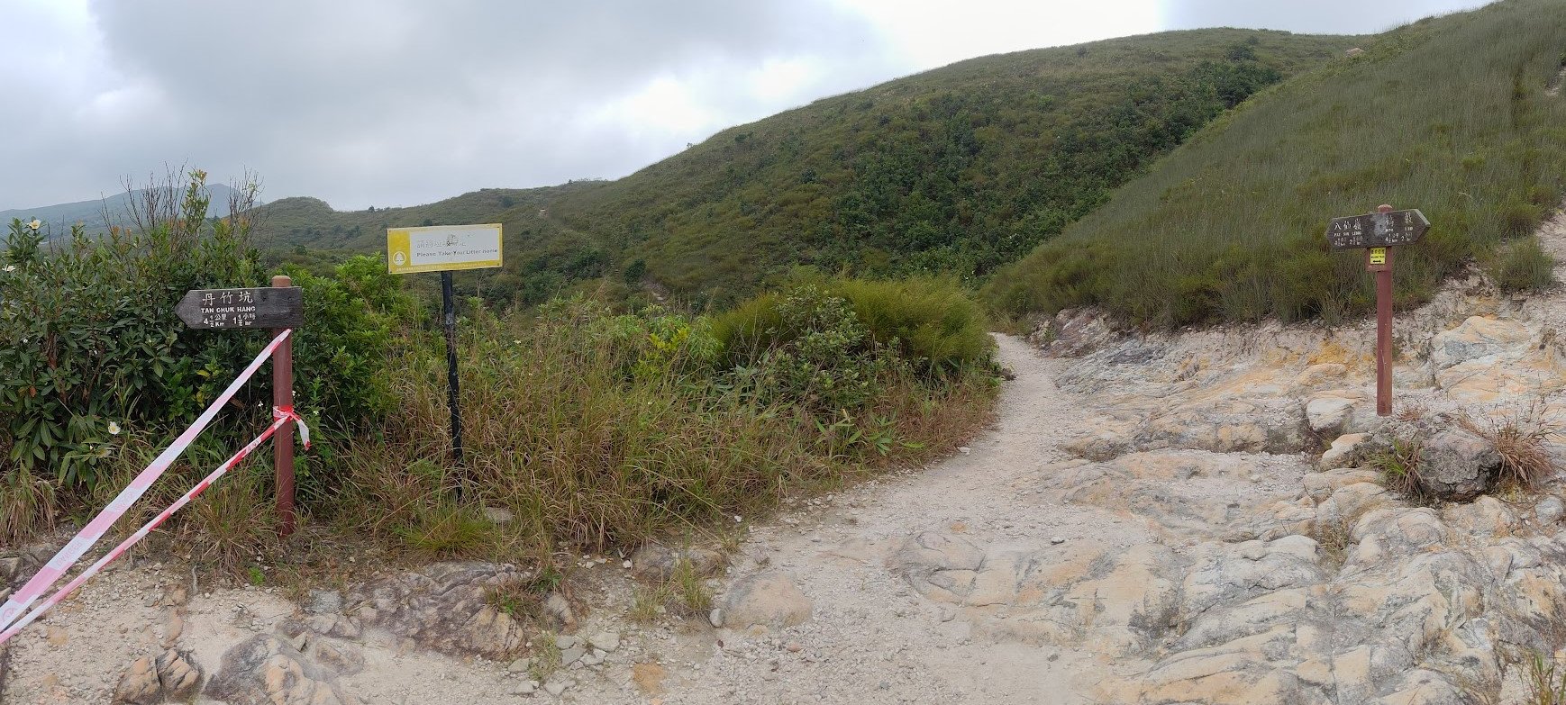
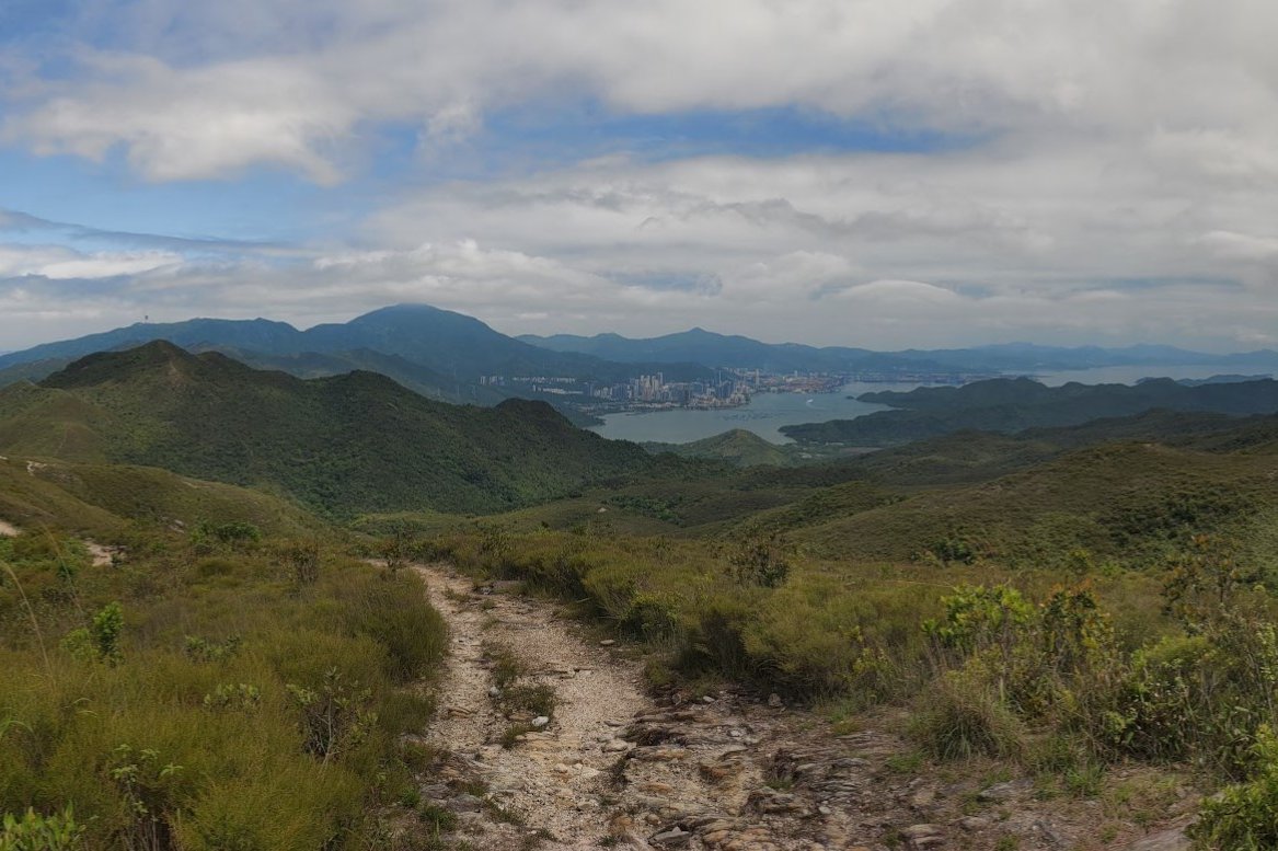
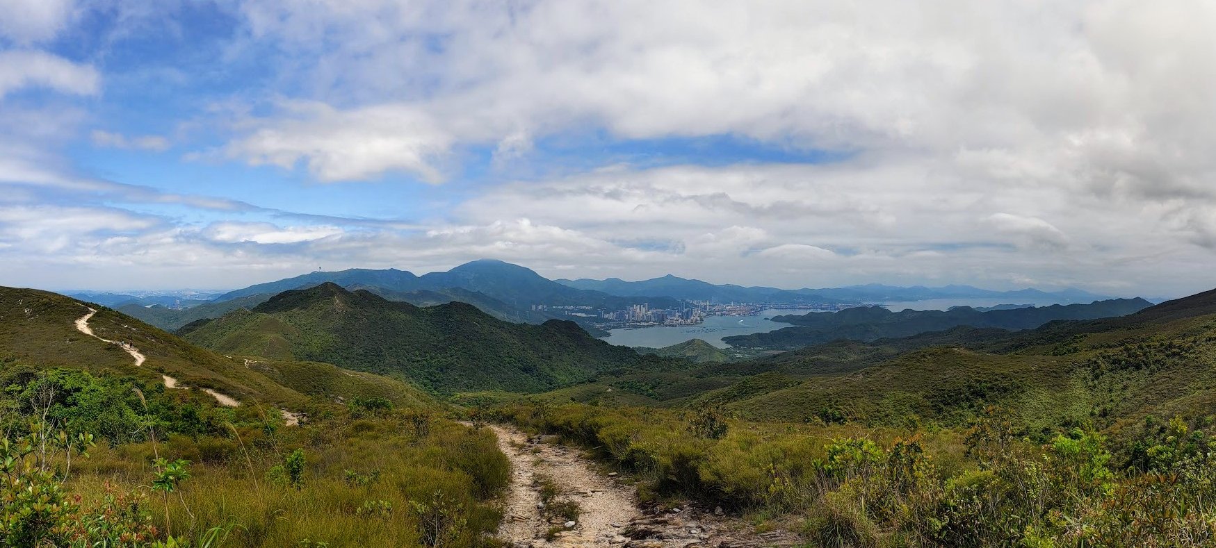
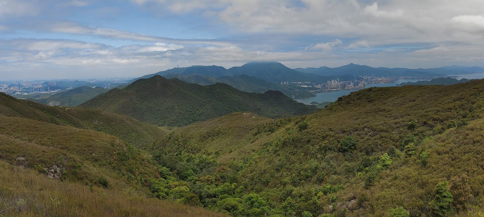
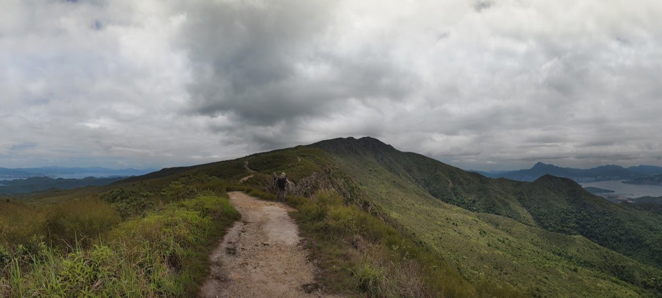
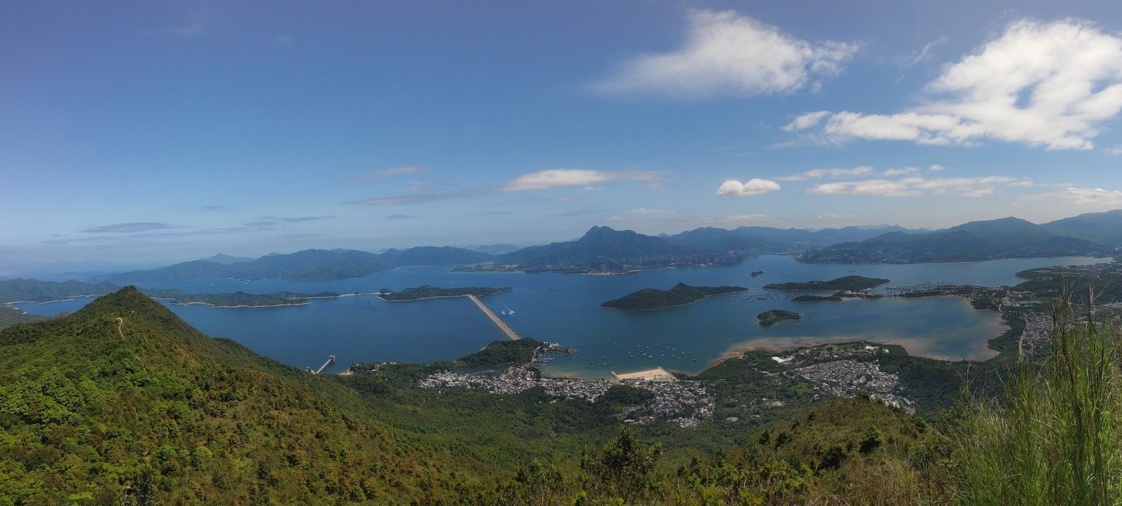
Rejoice! You can enjoy a really cool flat section of hiking where the mountains that make up the Pat Sin Range begin to reveal themselves.
You'll also be able to see all the way out to Shenzhen, China, from several points in this next section.
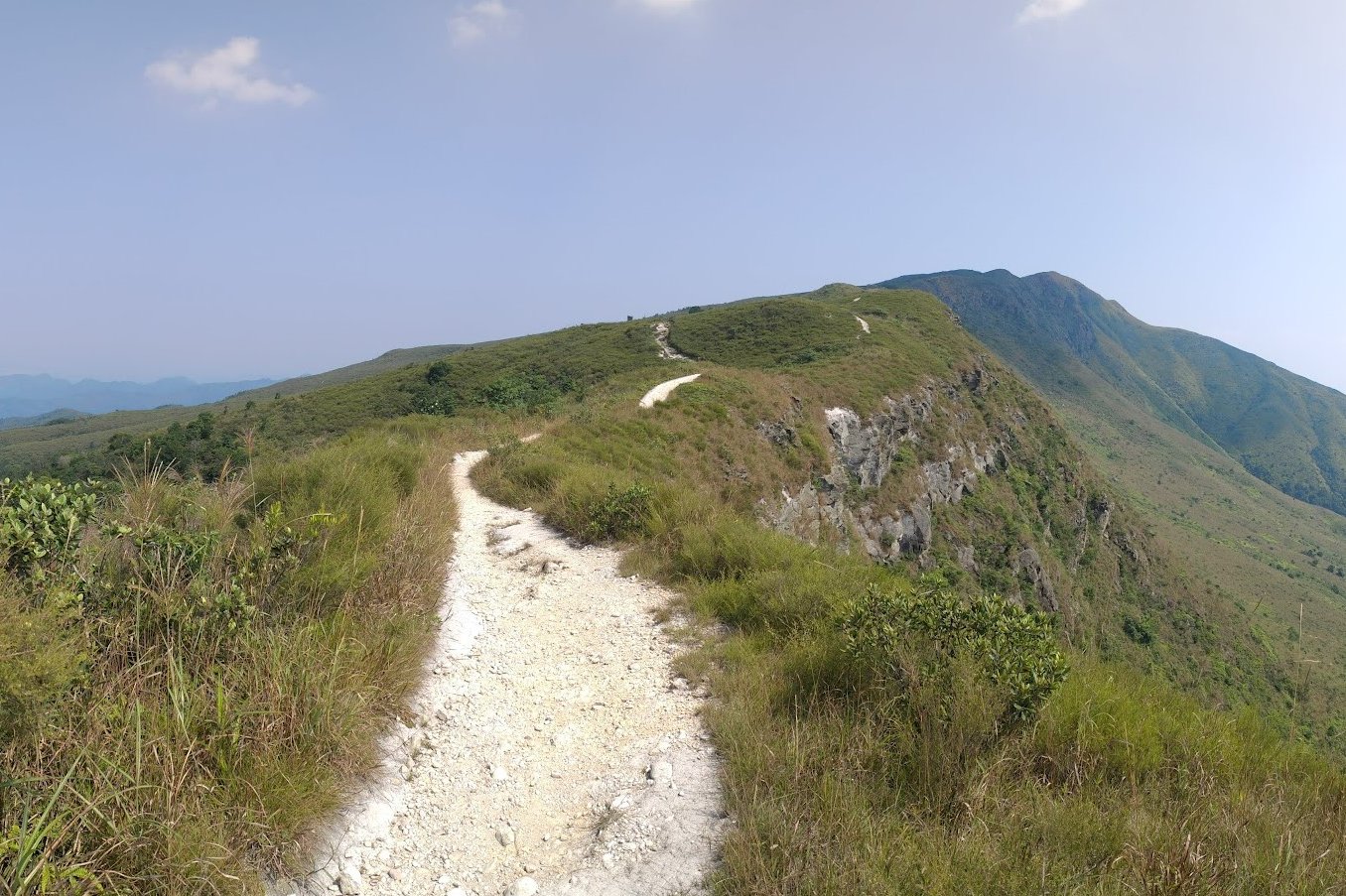
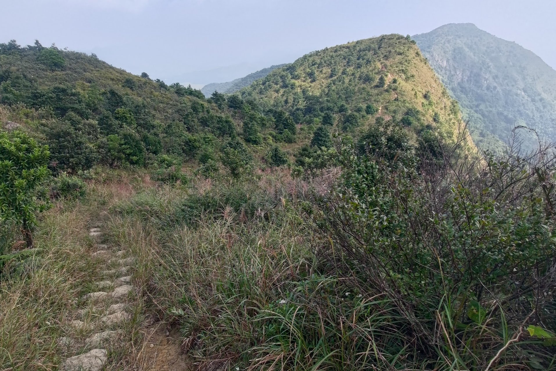
How to Navigate the Upcoming Forks in the Trail
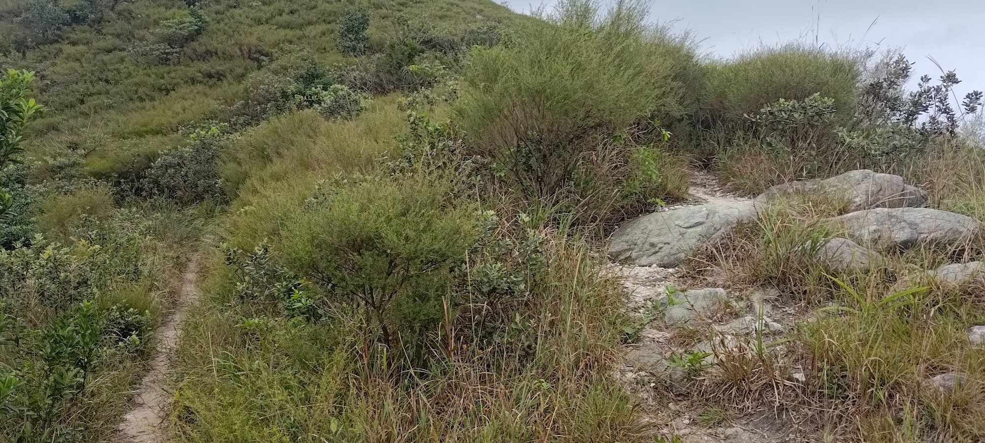
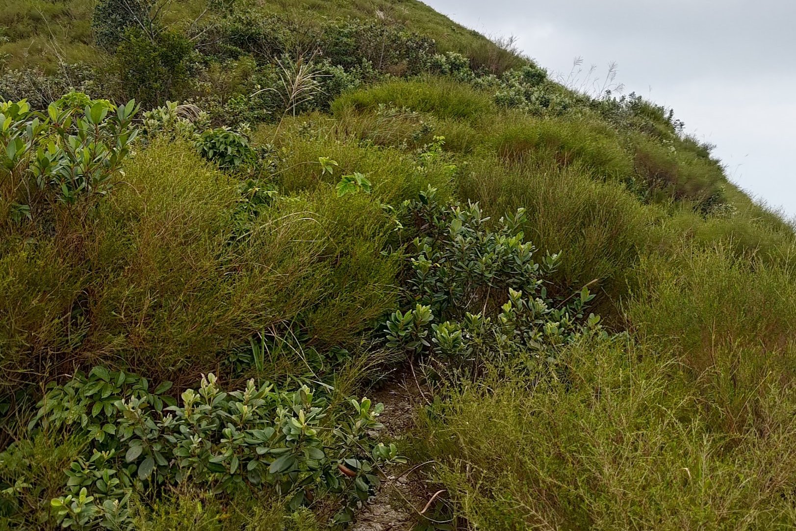
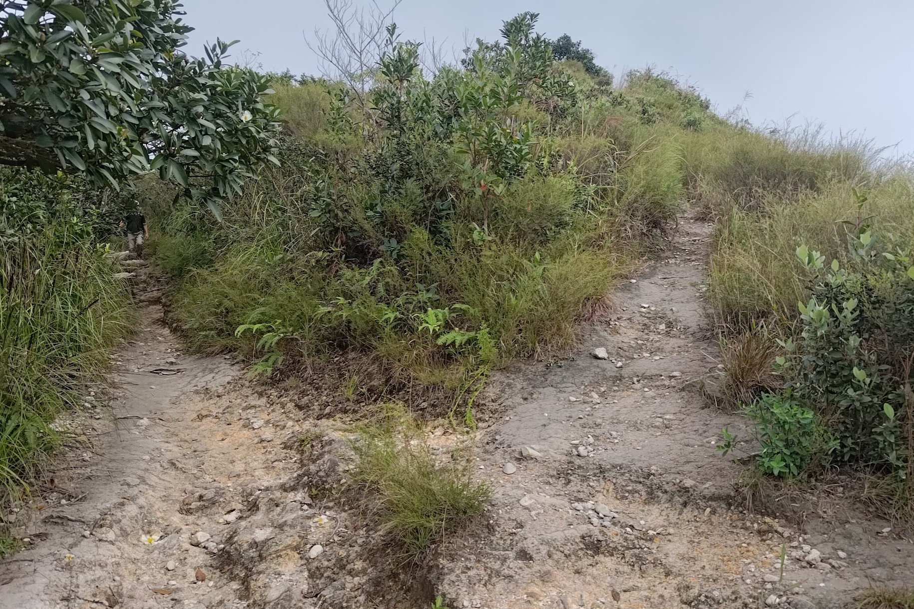
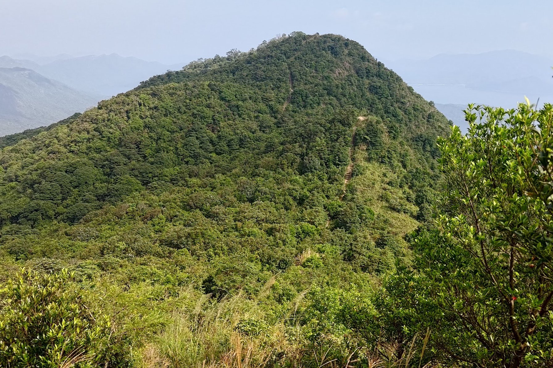
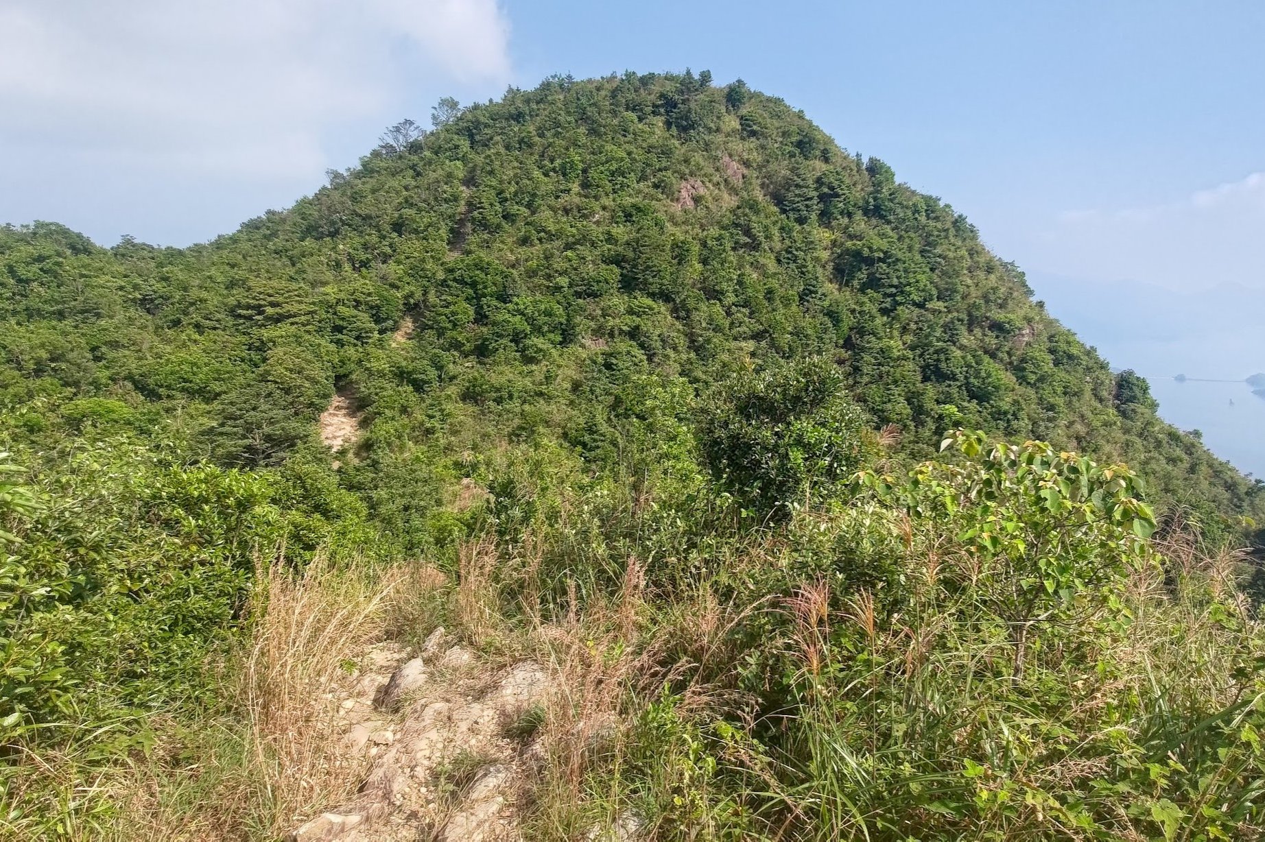
After about 10 minutes of flat, you'll come across the first of a few forks in the trail. For each of these forks, the right path will take you up to a peak before bringing you back down, where it always converges with the left path.
The right paths are often overgrown and the downhill sections can be steep at times. Unless it's a really clear day and you have your heart set on making the hike harder, taking the left path is recommended for most hikers.
The left path, in each case, is the official path and is guaranteed to be better maintained and much safer. You still get to see the best views even if you go left.
This section of the hike takes about 30 minutes with no breaks.
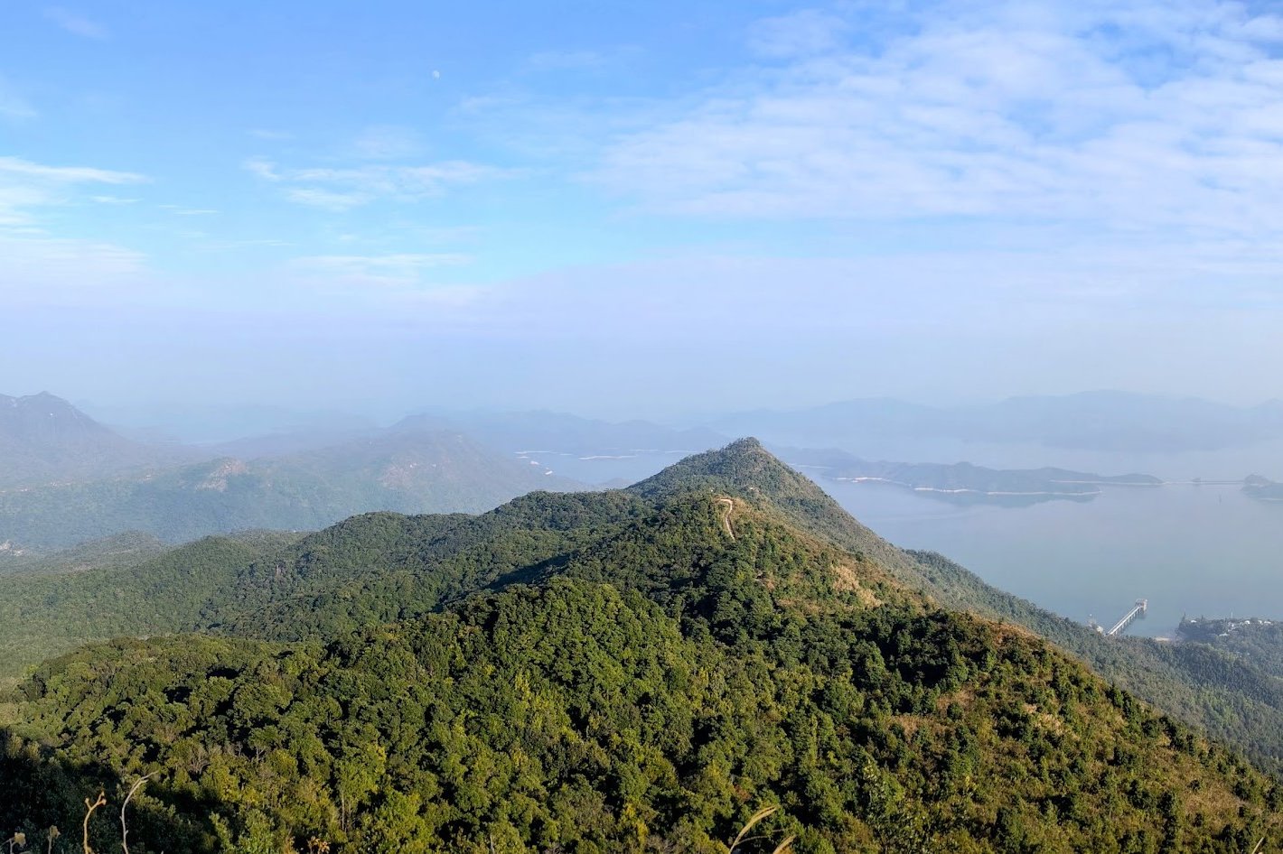
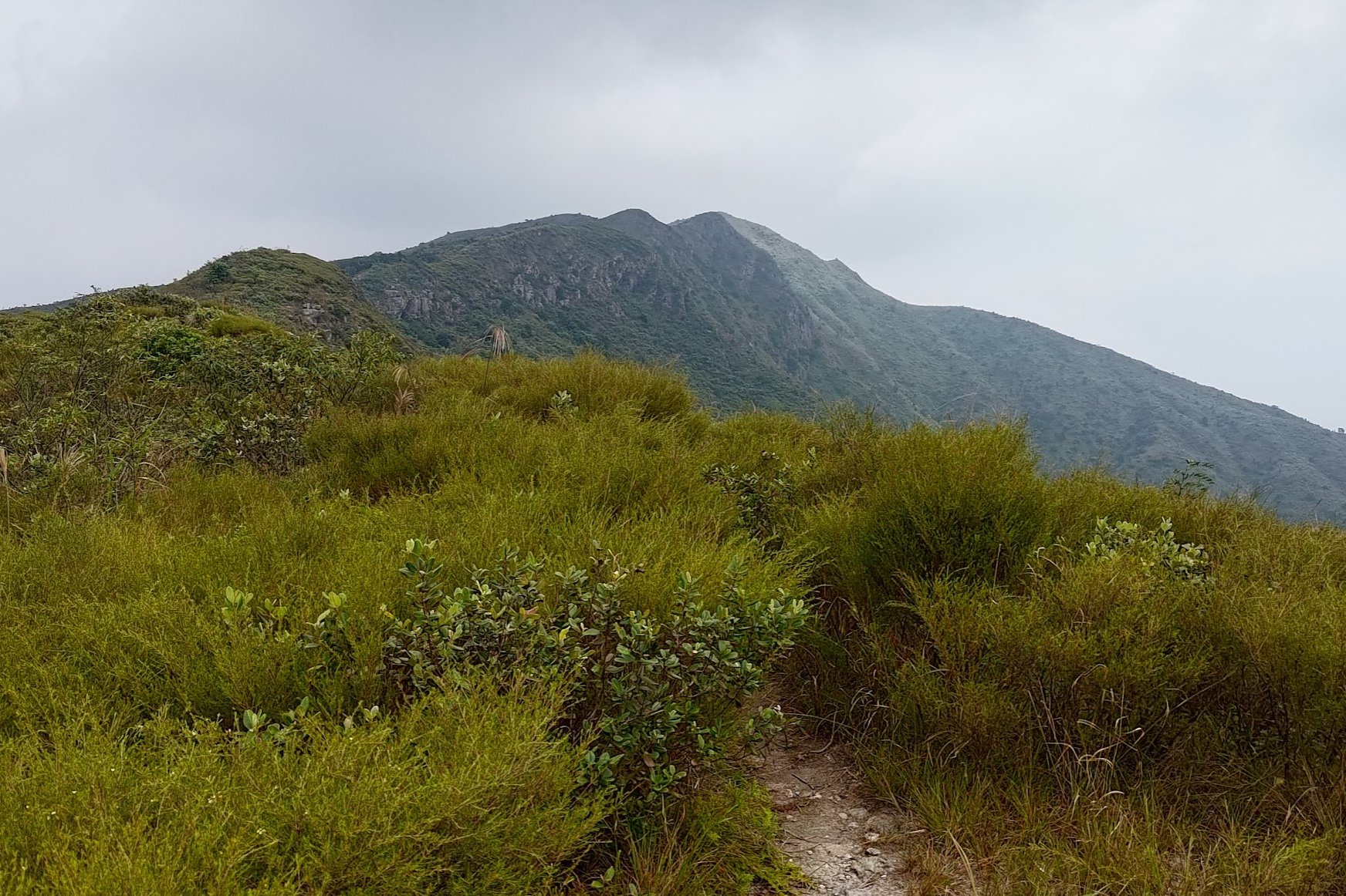
Arriving at Wong Leng Peak (Highest Point)
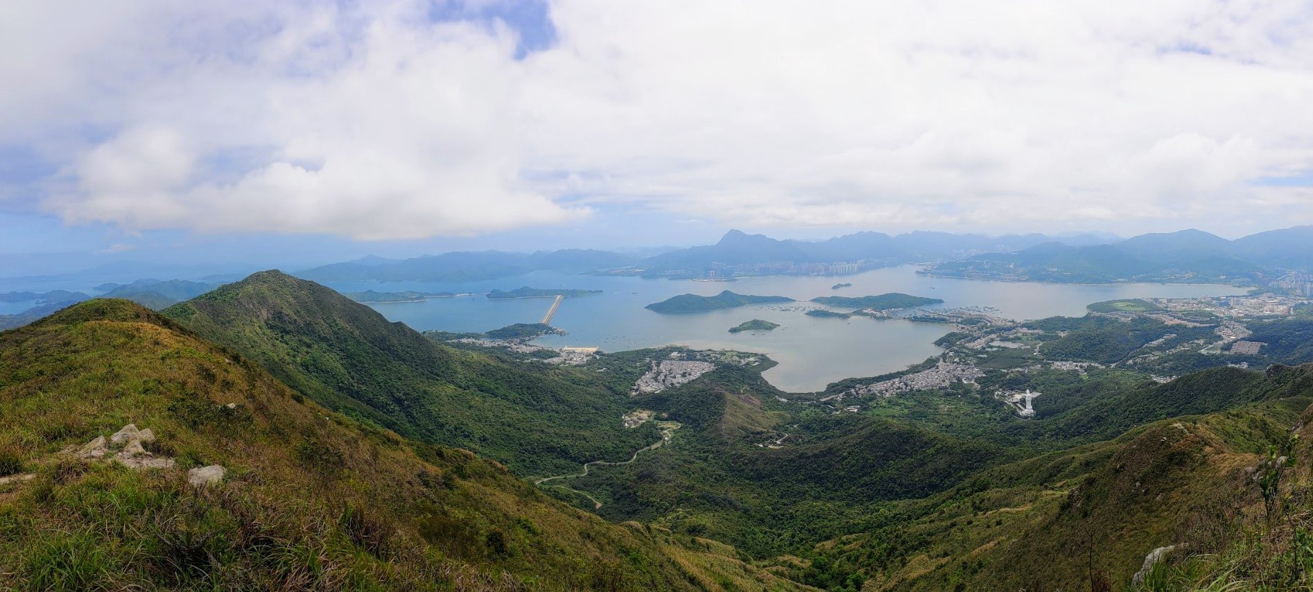
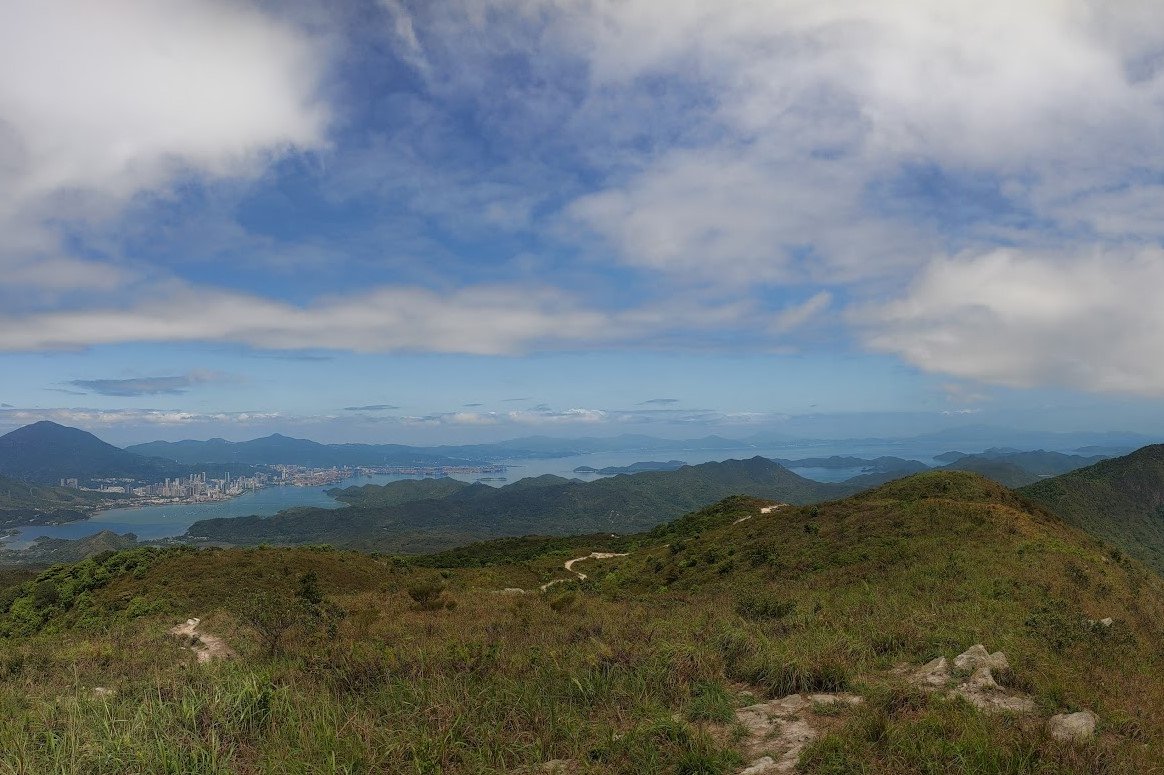
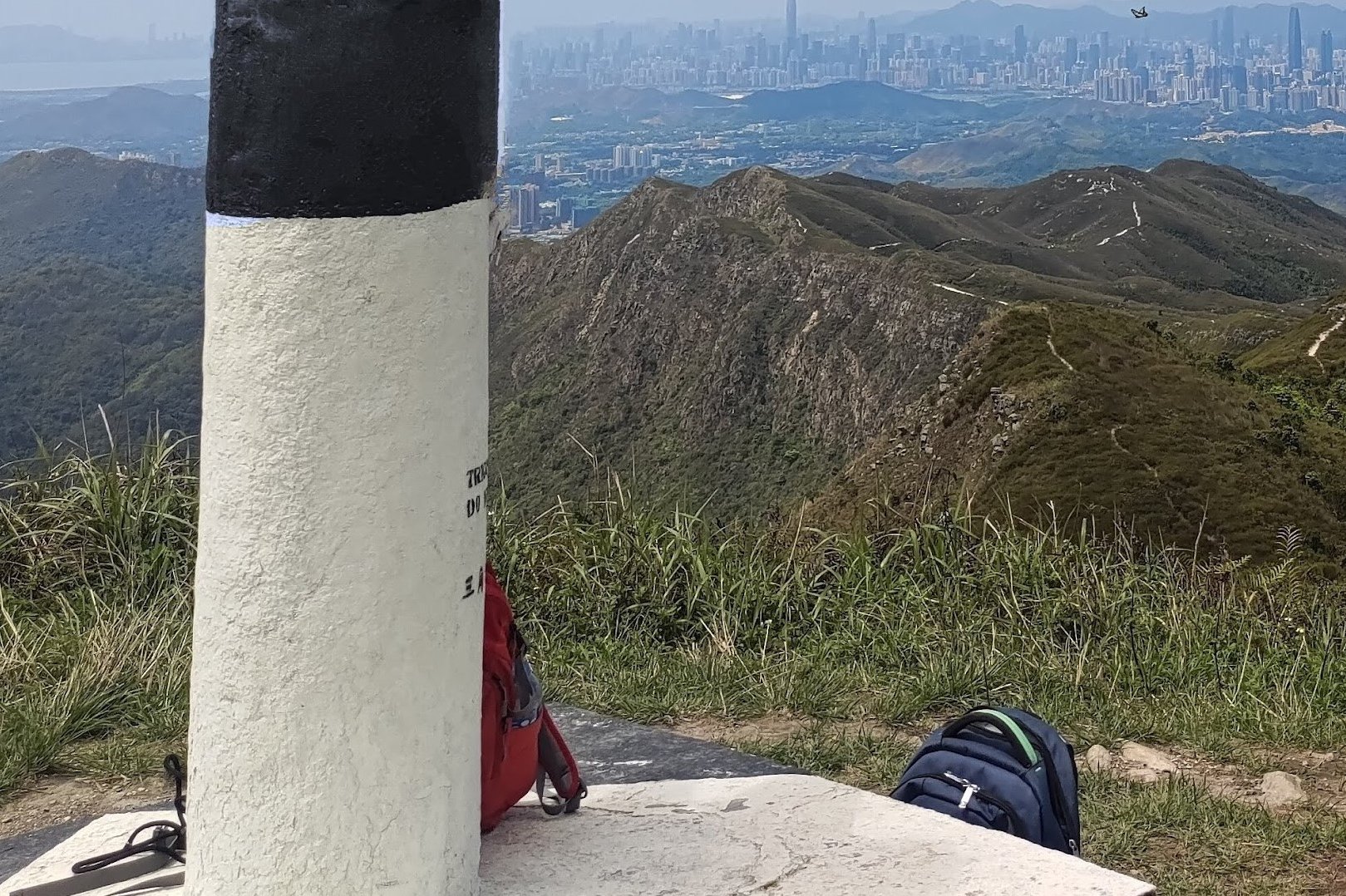
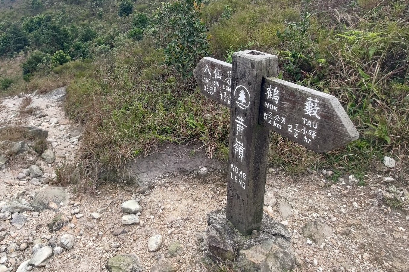
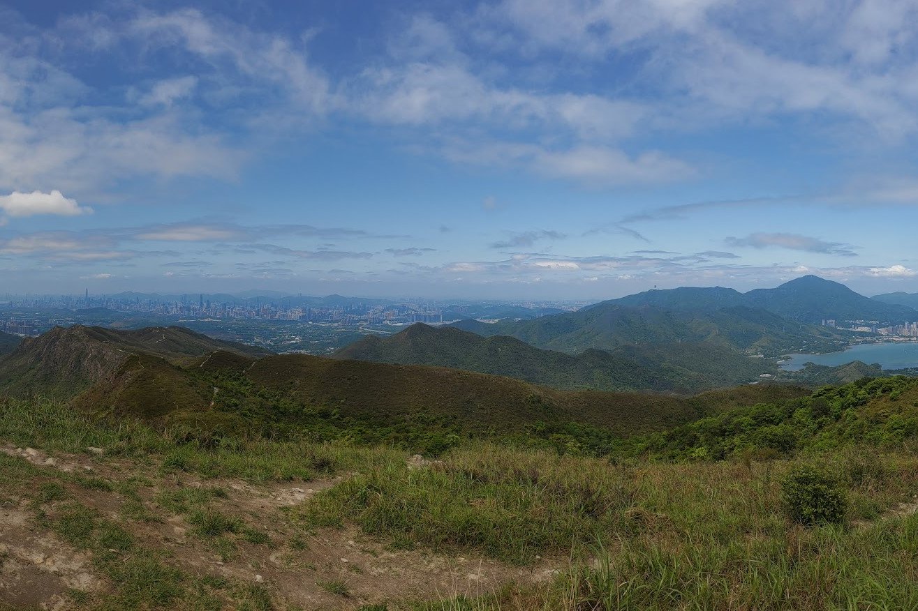
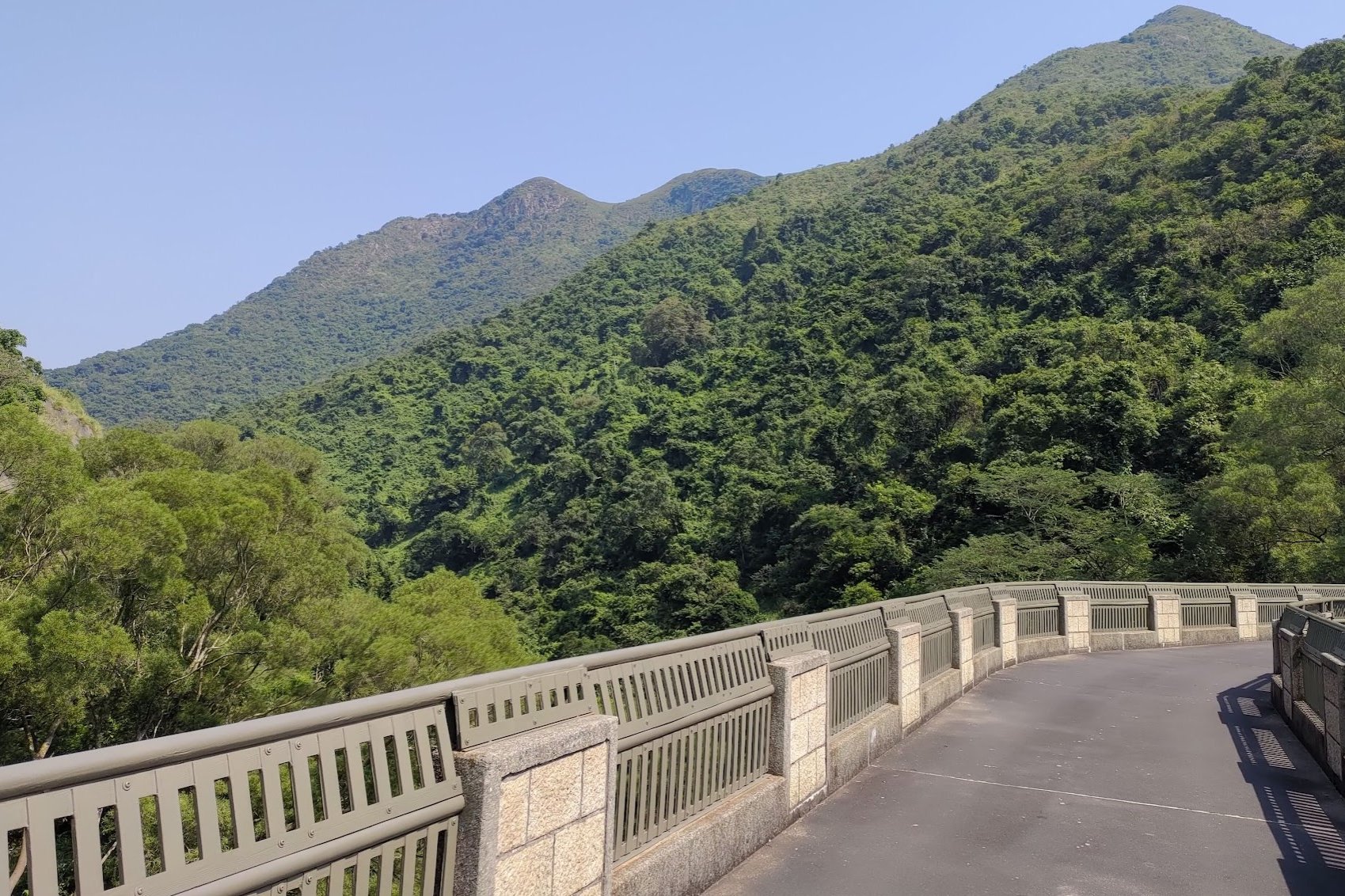
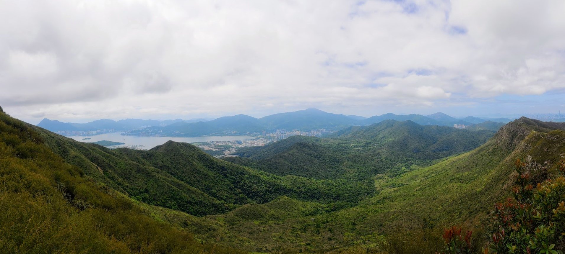
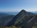
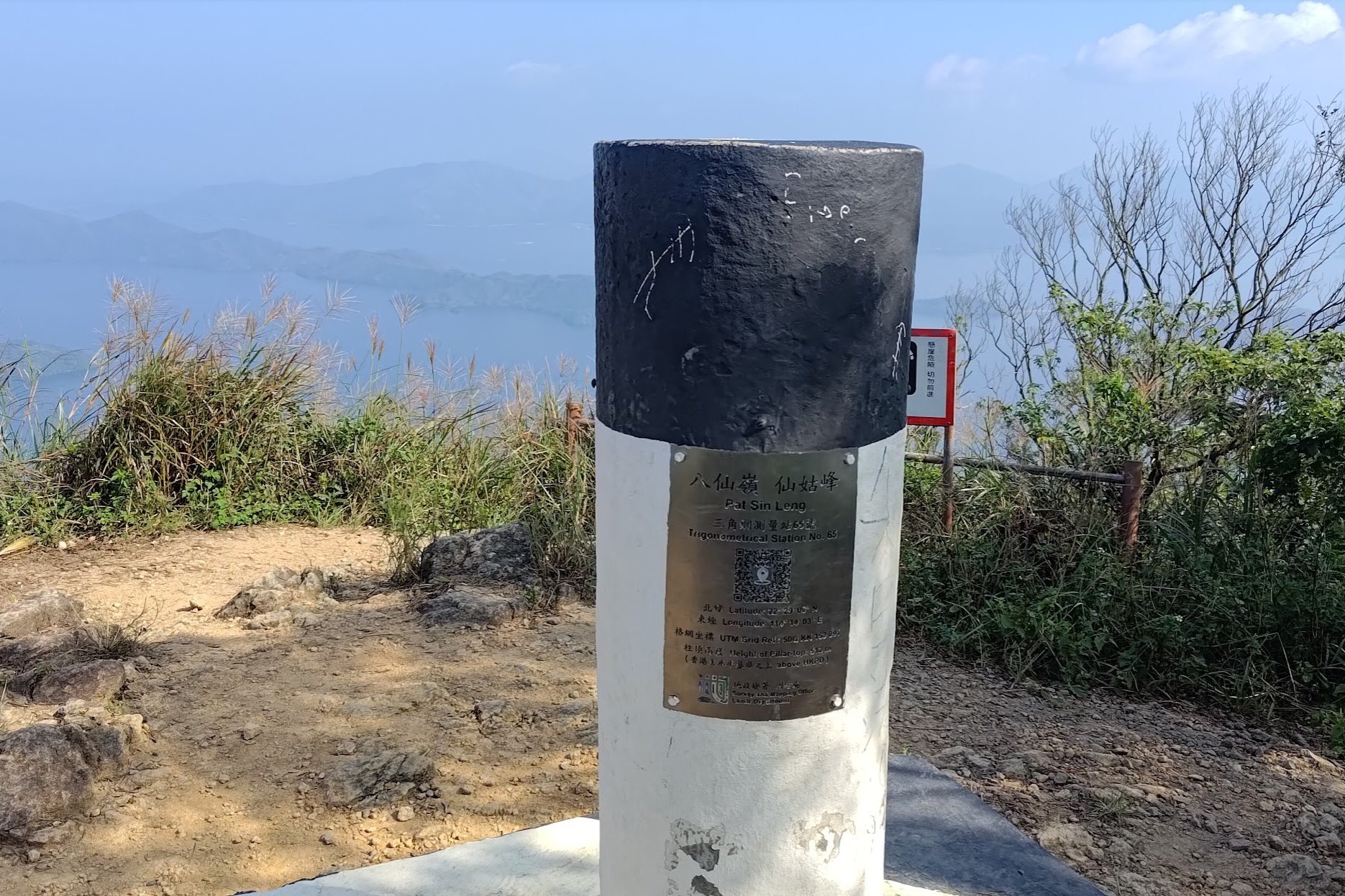
Not long after the pervious section, you'll arrive at Wong Leng, which is the tallest mountain of the whole Pat Sin Leng range at 639 meters.
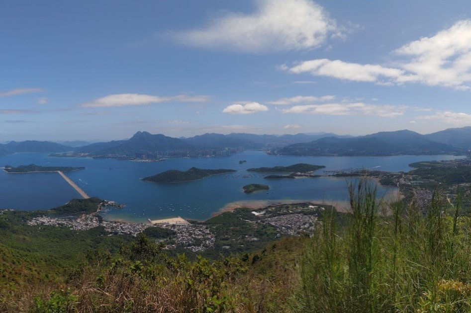
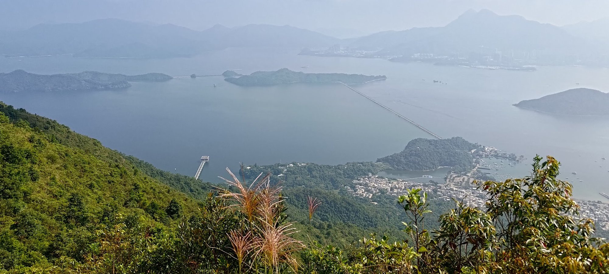
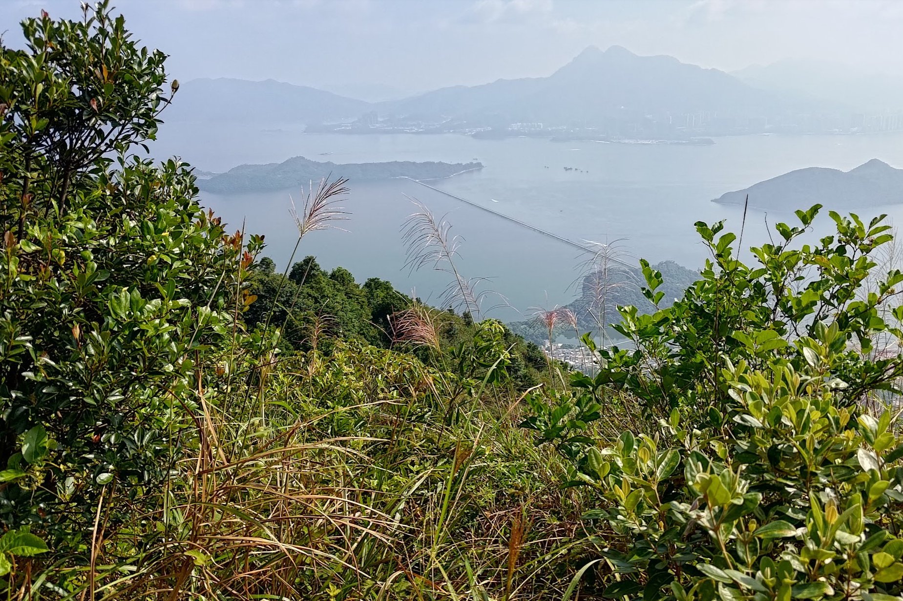
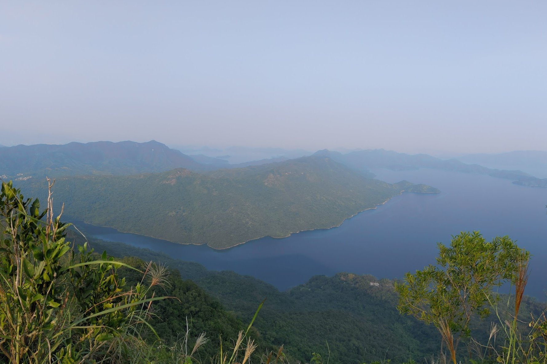
From the top of Wong Leng, which is marked by a trigonometric point, you'll find epic 360 degree views of the surrounding area. On one side, you'll be able to overlook Plover Cove and Ma On Shan.
The other direction showcases the part of the Pat Sin mountain range that you've already completed, while also offering close-up views across into Shenzhen, China.
When you're done admiring the scenery, follow the sign pointing to Pat Sin Leng.
Getting to the Eight Immortals
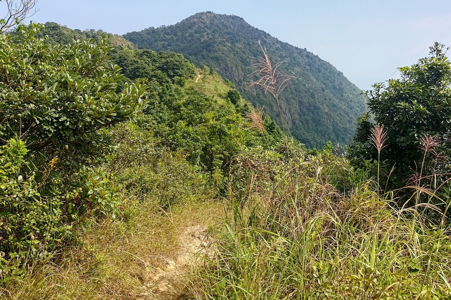
This next section takes nearly an hour to complete. You'll be descending downward from Wong Leng and then ascending to Shun Yeung Fung - the first peak of the Eight Immortals.
There's only one path to follow up to Shun Yeung Fung, so it's impossible to get lost. Still, there are a couple of signs pointing you in the direction of Pat Sin Leng, just in case.
Most of this section is quite manageable, with only the final ascent up to Shun Yeung Fung being particularly steep.
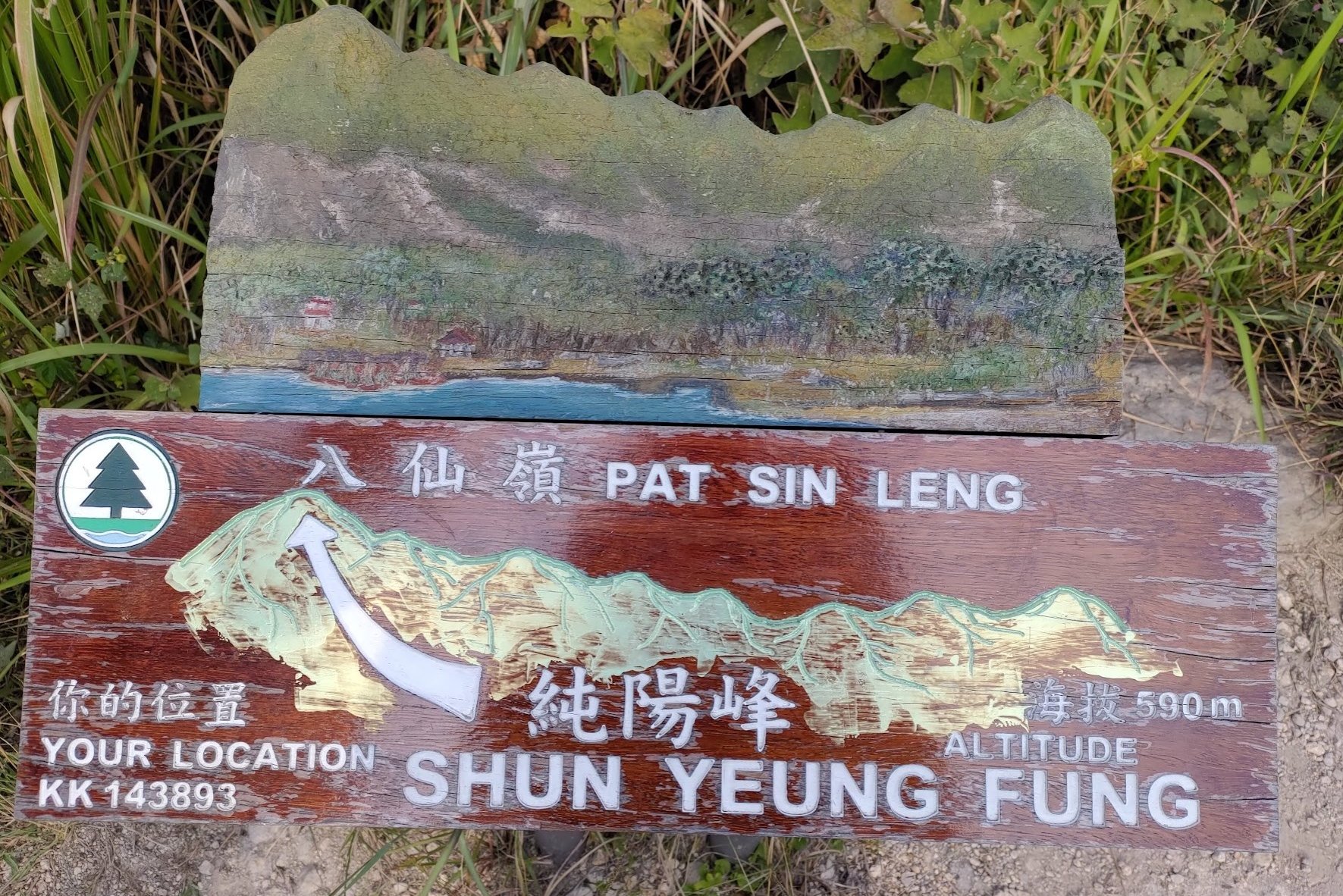
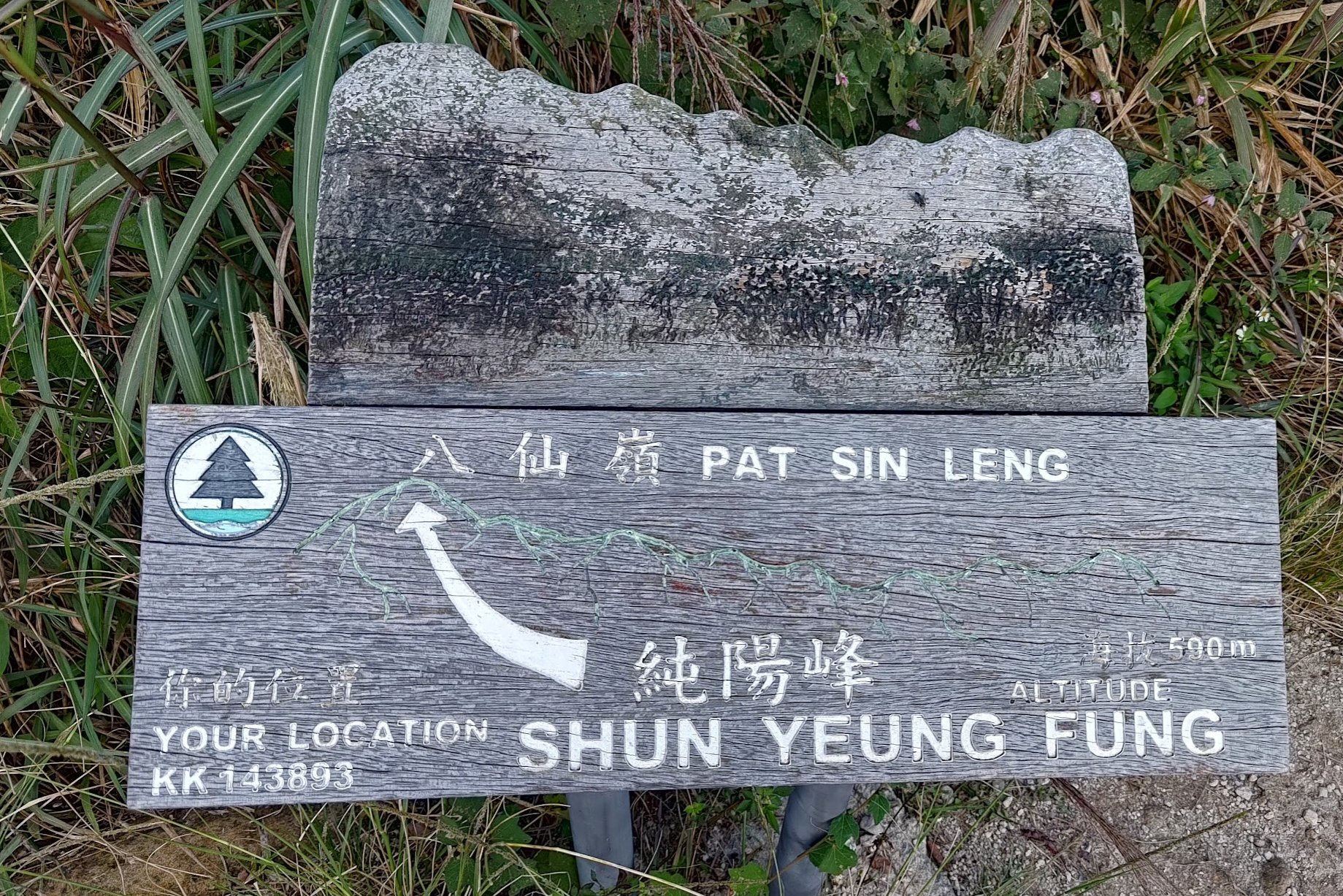
Shun Yeung Fung - The First Immortal
After 3+ hours of hiking, you've finally made it to the famous Eight Immortals!
Each peak is named after an immortal, each of which is a mythical entity that is part of the Taoist pantheon.
The first peak is called Shun Yeung Fung and is the tallest of the Eight Immortals at 590 meters.
This peak represents Lu Dongbin. He is associated with wisdom, swordsmanship, and spiritual cultivation. Lu Dongbin is often depicted as a scholar or a warrior with a sword, symbolizing his mastery of both intellectual and martial arts.
Chung Li Fung - The Second Immortal
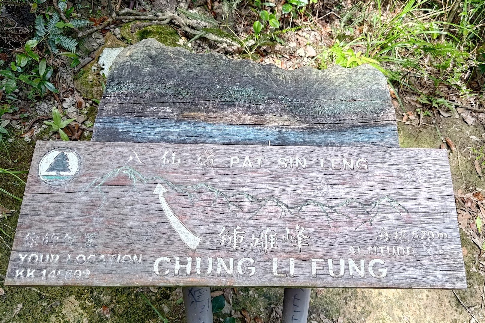
Chung Li Fung stands at 529 meters and is almost directly beneath Shun Yeung Fung.
There's not much of a view here.
This peak represents Zhongli Quan, who embodies longevity, wisdom, healing and has the power to bestow blessings. He is often depicted as an elderly man with a fan and a peach.
Kao Lao Fung - The Third Immortal
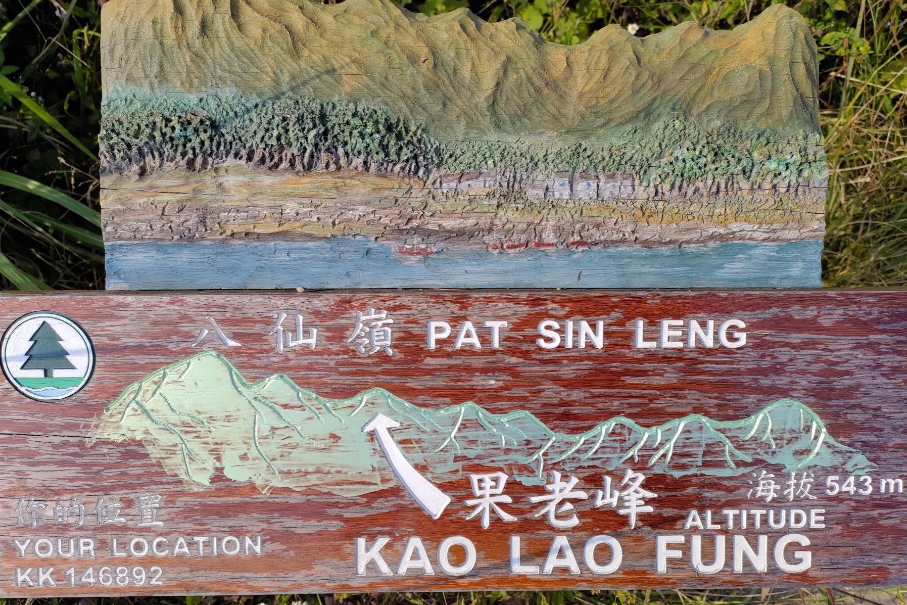
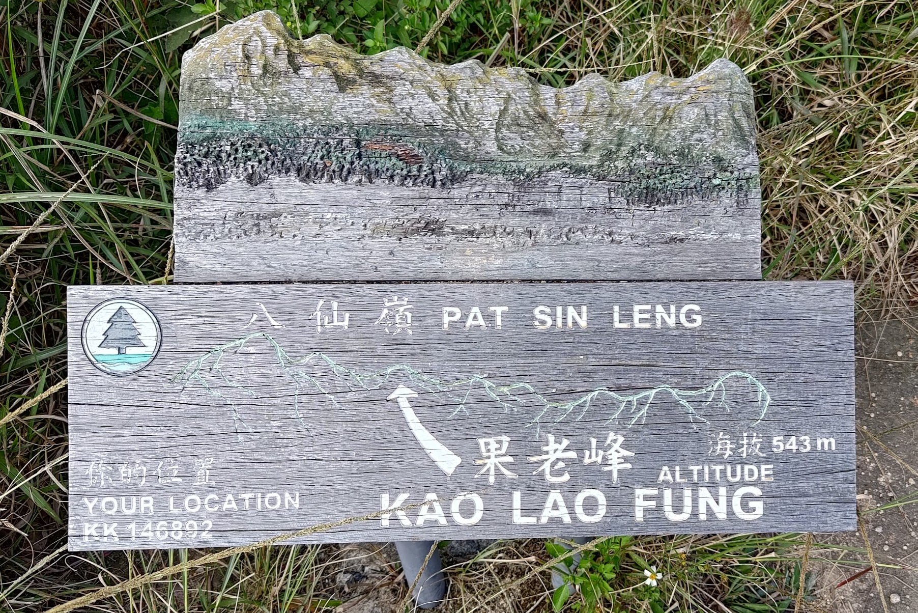
You'll have to ascend slightly to an elevation of 543 meters to reach Kao Lao Fung.
There's a partial view here, but nothing compared to previous views.
This peak represents Zhang Guo Lao, who is associated with transformation, adaptability and the pursuit of knowledge. He is often portrayed as an old man riding a donkey backward.
Kuai Li Fung - The Fourth Immortal
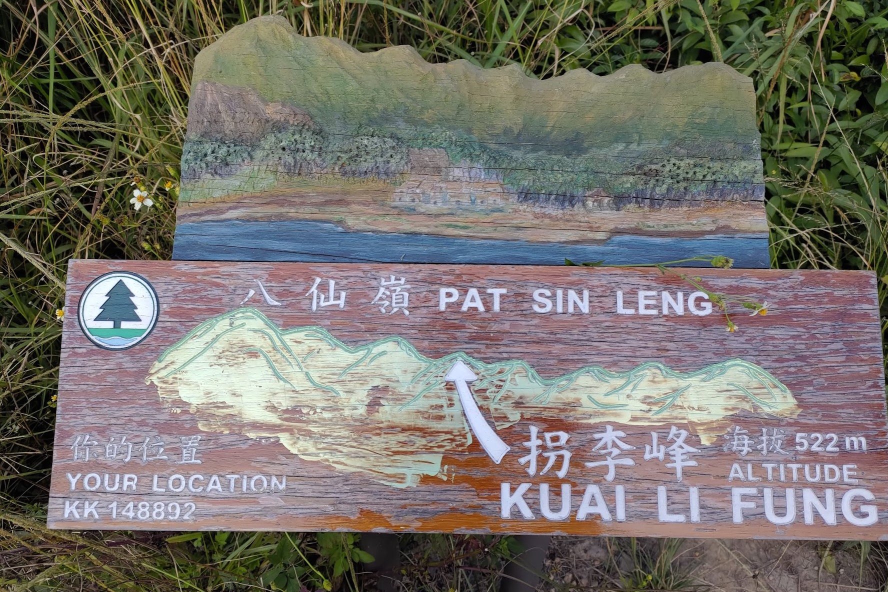
Kwai Li Fung stands at 522 meters in height. You'll descend lower than this height from Kao Lao Fung and have to climb a short, but steep set of stairs to reach the peak.
This peak represents Li Tieguai, who symbolizes resilience, endurance and the power to overcome challenges. He is often depicted as an old man with a crutch and a gourd.
Tsao Kau Fung - The Fifth Immortal
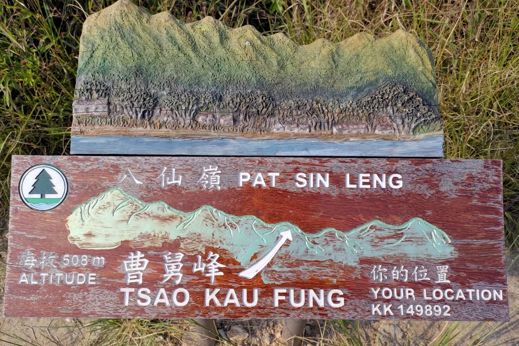
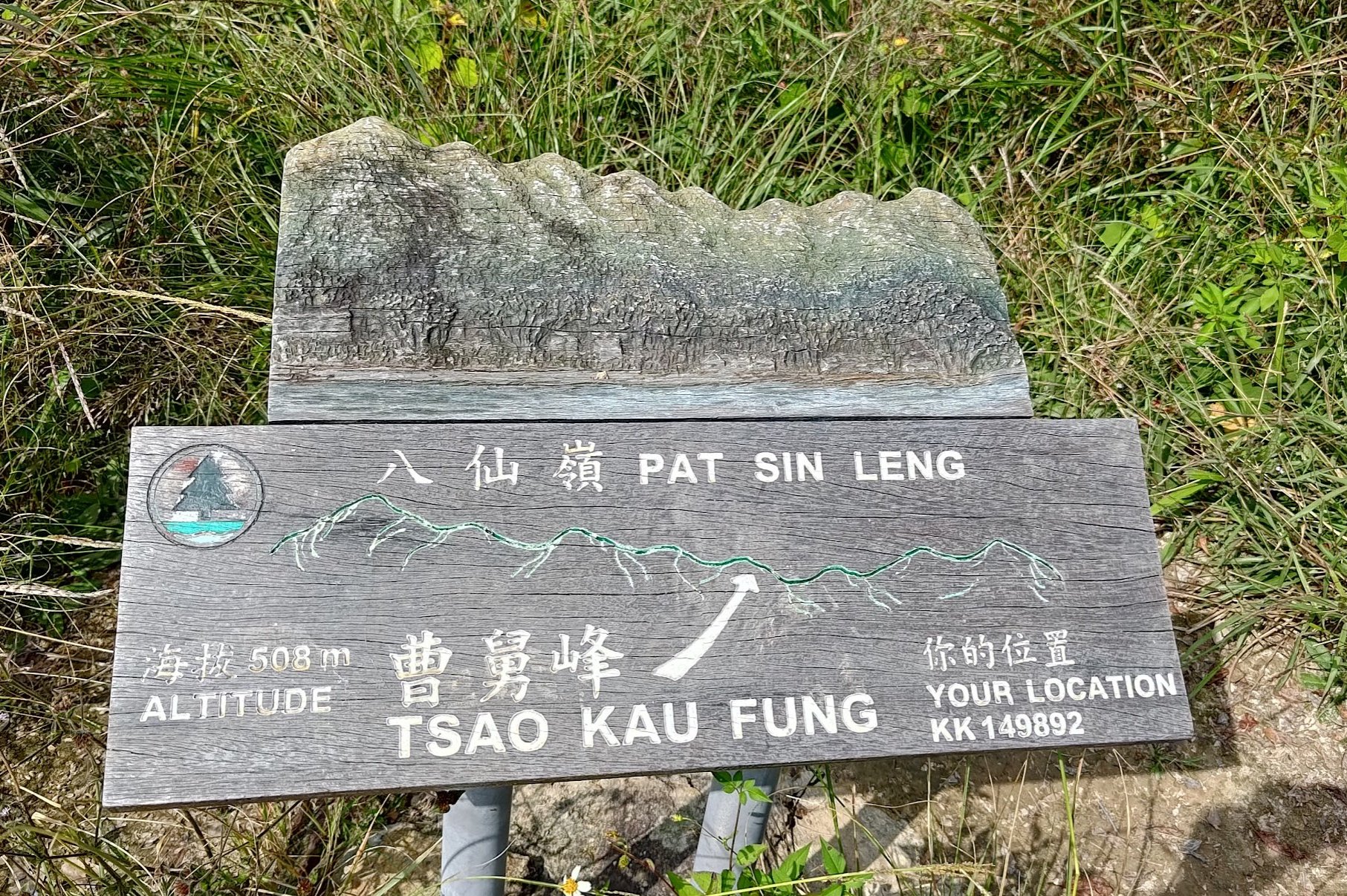
Tsao Kao Fung is 508 meters in height. The home stretch is in sight from here!
This peak represents Cao Guojiu. He is known for a strong sense of duty and adherence to moral values and is usually ortrayed as a dignified elderly man wearing official robes. Cao Guojiu embodies the virtues associated with civil service.
Choi Wo Fung - The Sixth Immortal
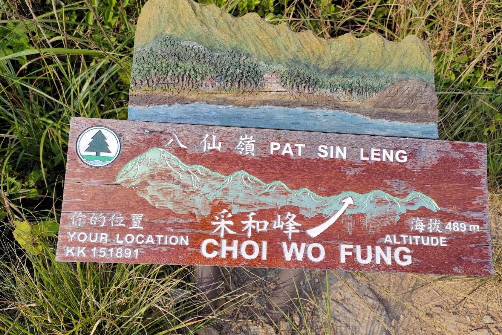
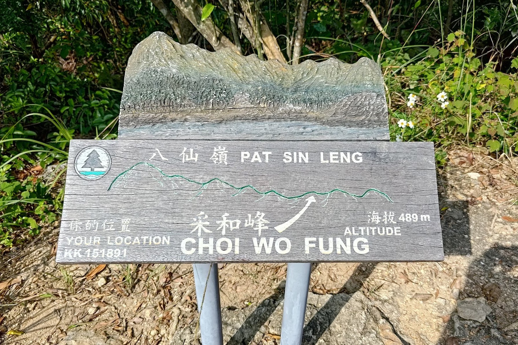
Choi Wo Fung is the shortest peak out of all the Eight Immortals at 489 meters.
Because of this, the next peak will have a particularly steep uphill climb.
This peak represents Lan Caihe, who is synonymous with spontaneity, freedom and spiritual enlightenment. The gender of Lan Caihe is often ambiguous or undefined, and they are often portrayed as a beggar carrying a flower basket.
Sheung Tsz Fung - The Seventh Immortal
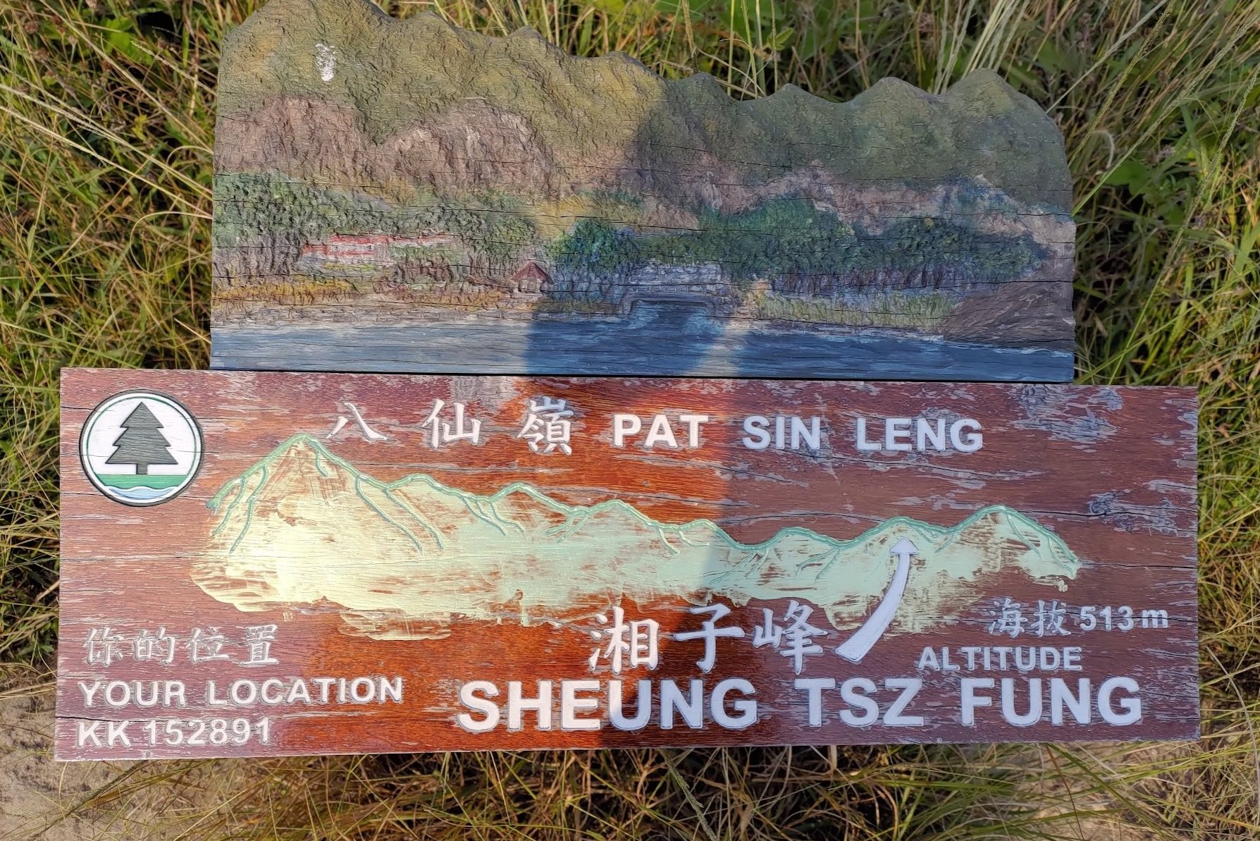
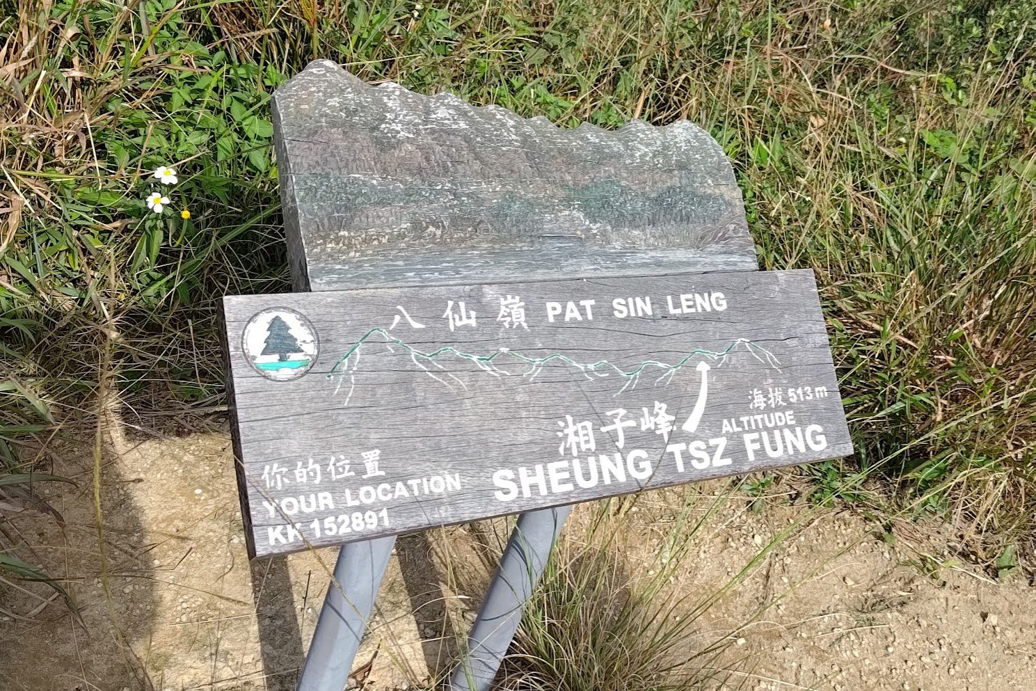
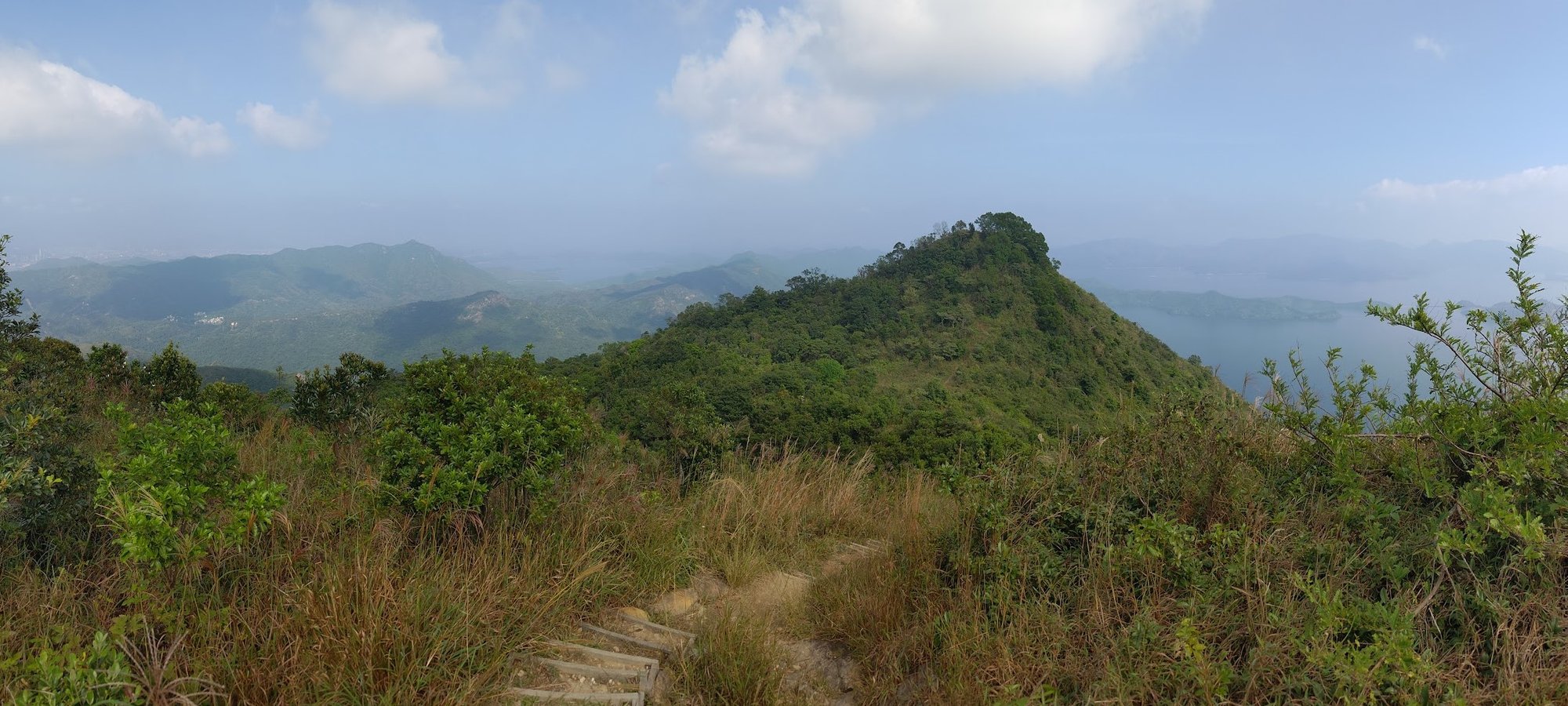
Sheung Tsz Fung is the steepest climb amongst all the Eight Immortals, even though it stands at only 513 meters tall.
From this peak, you can see the final immortal ahead, which is the last section of climbing for the entire hike.
This peak represents Han Xiangzi, who is known for music, joy and harmony. He is depicted as a young and handsome scholar playing a flute.
Hsien Ku Fung - The Eighth Immortal
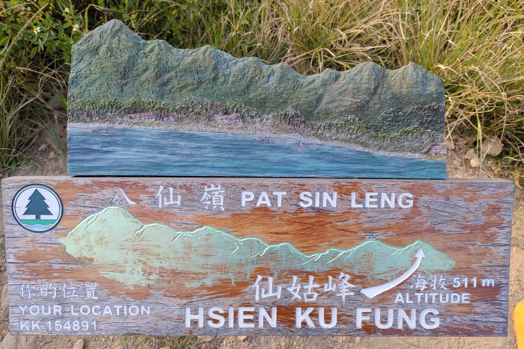
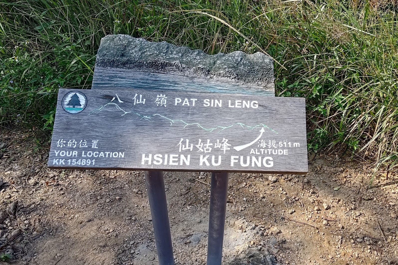
It's another short but steep climb to the last peak, which is Hsien Ku Fung - standing at 511 meters.
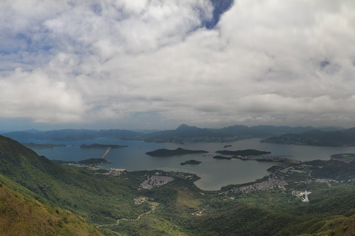
This is the final peak of the hike and you will begin your descent from this point. The views are also unique here in that you'll be able to see far into Plover Cove Country Park.
This peak represents He Xiangu, who symbolizes purity, beauty and grace. She is often depicted as a young woman holding a lotus flower.
Descending to Bride's Pool Road
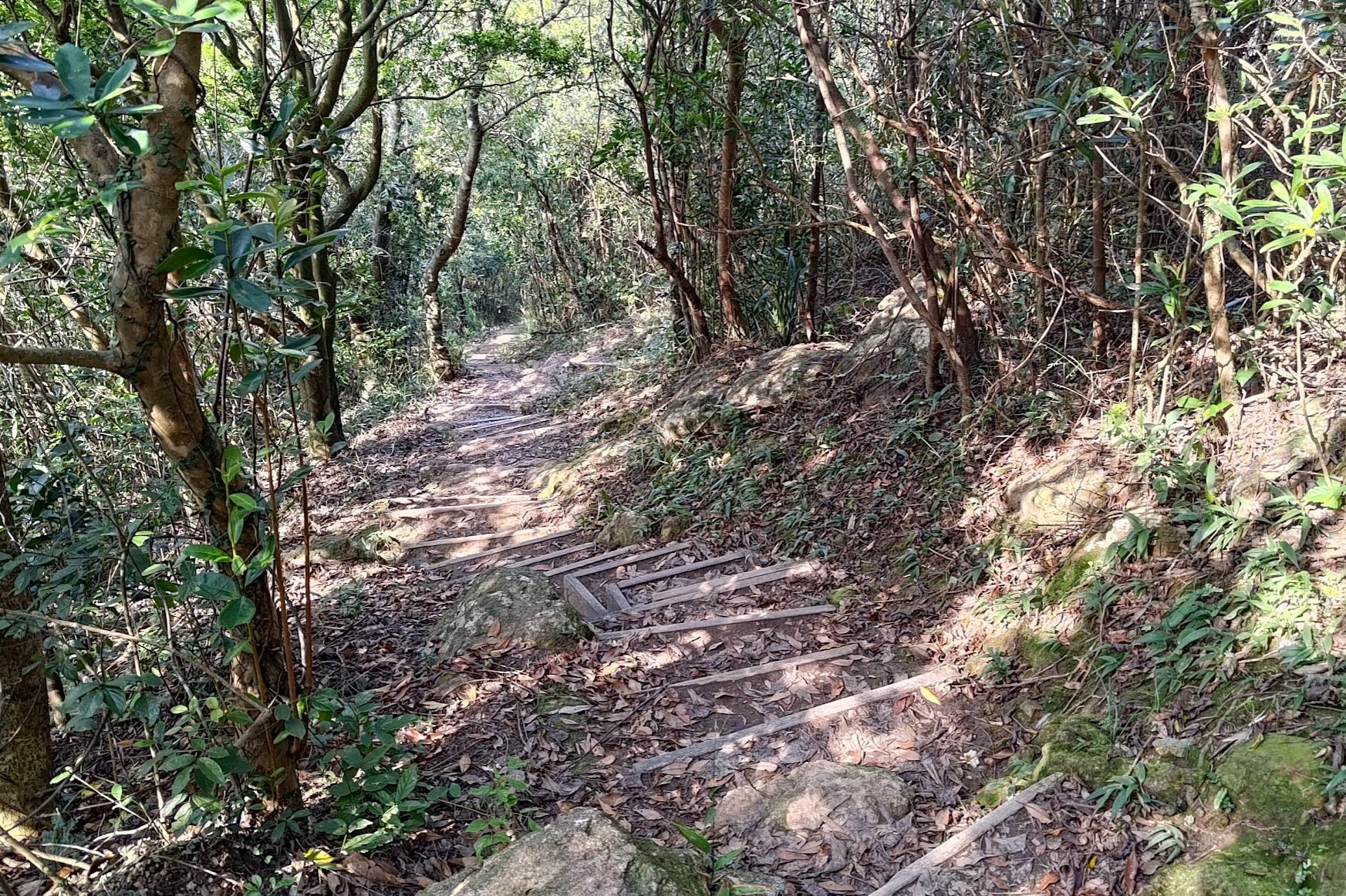
It takes about an hour from the top of Hsien Ku Fung all the way down to Bride's Pool Road. Fortunately, there are no technical sections. Unfortunately, this is one of the most tedious and boring parts of the whole hike.
The initial downhill is a set of well-defined stairs. You can switch your brain off for about 15 minutes before the stairs level out and you see a set of signs.
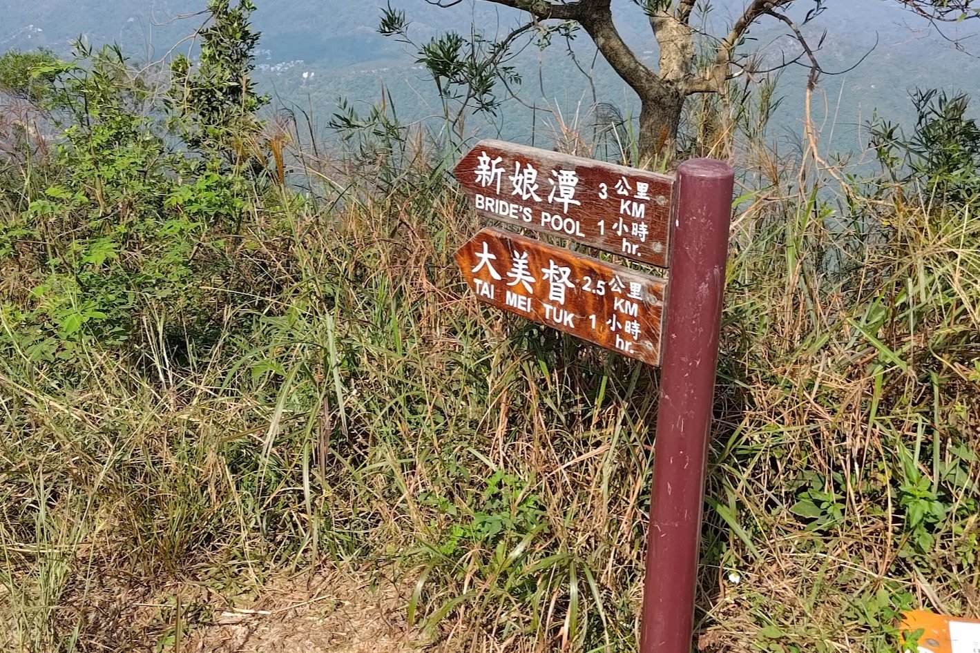
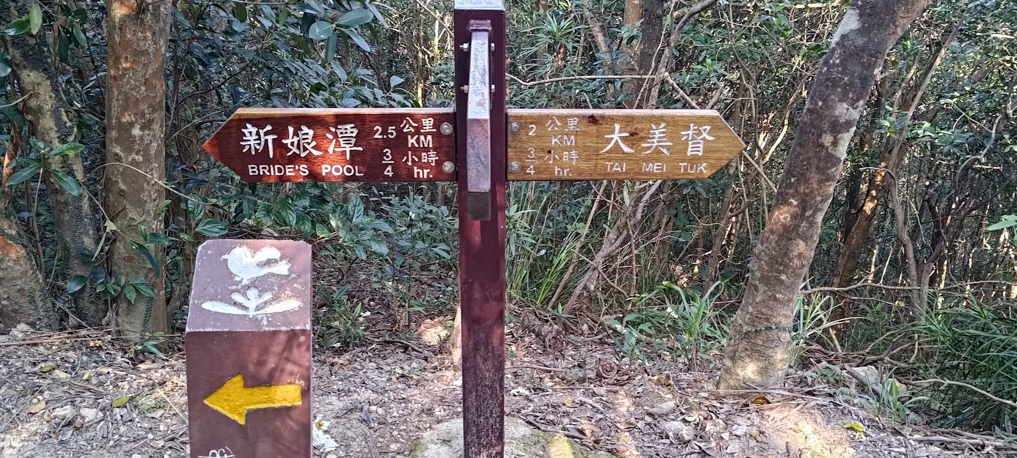
Follow the sign pointing right to Tai Mei Tuk.
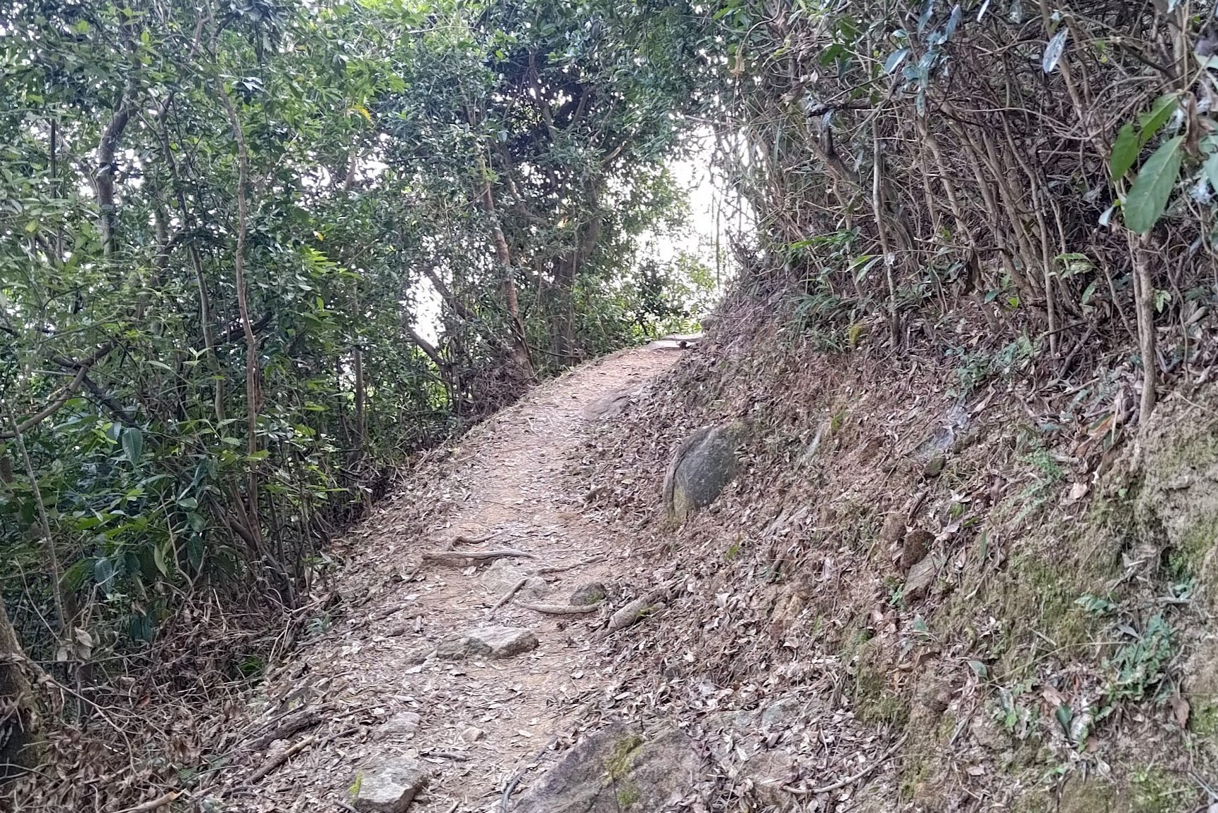
You'll be navigating a gentle downward-sloping path for the next 25ish minutes until you see a set of signs to your left.
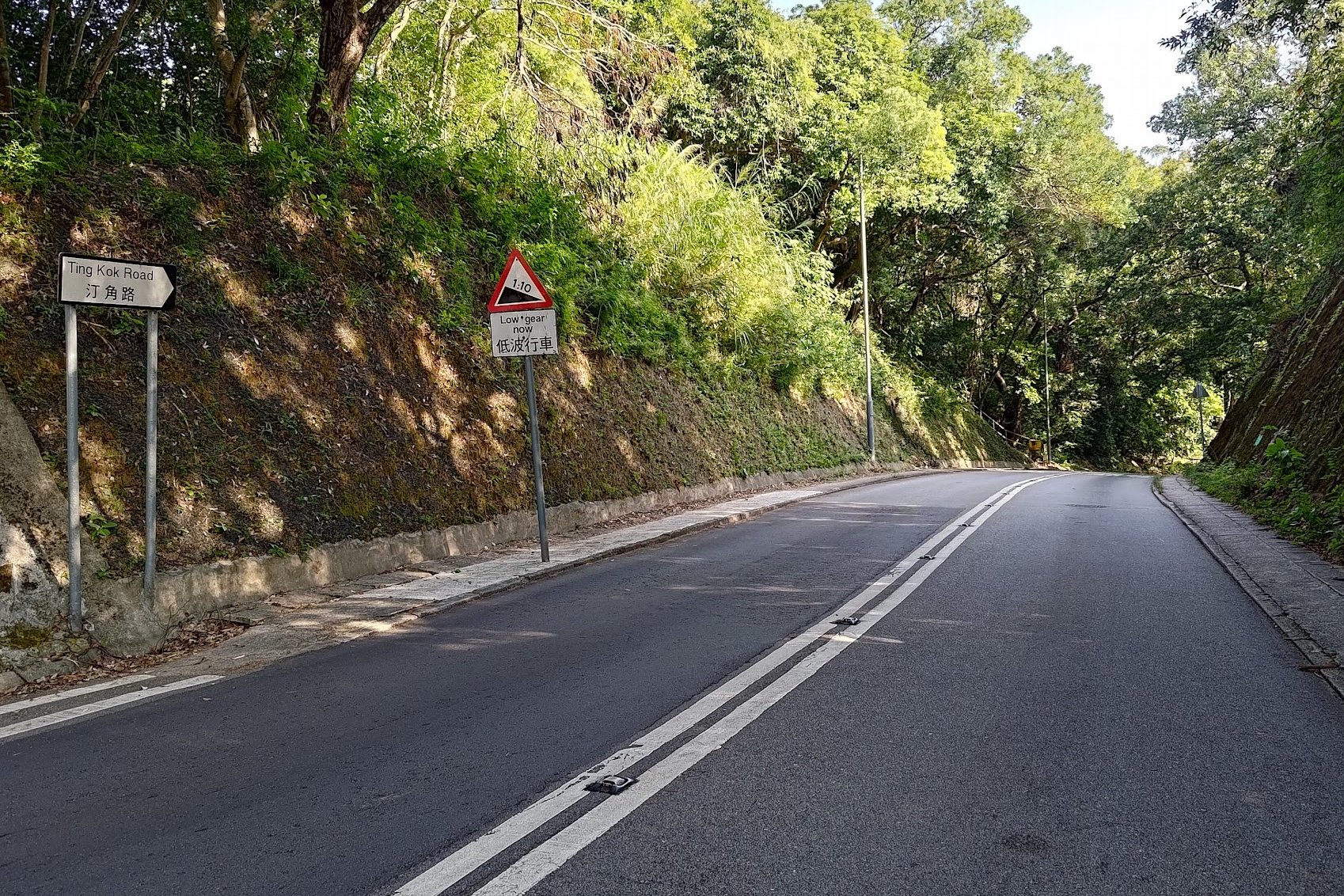
Follow the sign that points you to Bride's Pool Road. This downhill section is much steeper and takes 10-15 minutes.
Walking to Tai Mei Tuk
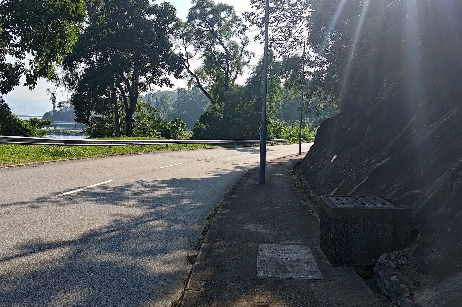
It takes about 15-20 minutes from Bride's Pool Road to Tai Mei Tuk.
Once you arrive at Bride's Pool Road, head right and follow the road until you see Bride's Pool Road split off into two directions.
Follow Ting Kok Road by continuing in the same forward direction. Perhaps five minutes later, Tai Mei Tuk will come into view.
Getting Back
There is no MTR stop at Tai Mei Tuk. Instead, grab any of the following buses from the bus depot:
- 20C Green Minibus to Tai Po MTR Station
- 75K double-decker bus to Tai Po MTR Station
Too Easy? Combine This Hike With Cloudy Hill
If you want to pair these hikes together, it's best to tackle Cloudy Hill first since that hike ends at Hok Tau Reservoir, which is the start point for the Pat Sin Leng Hike.
Find out about the epic Cloudy Hill hike below!