
West Dog's Teeth Hike: A Tough Climb Up One of Hong Kong's Steepest Ridges
Contents
- Essential Information
- West Dog's Teeth Highlights
- Google Route Map & GPX
- How to Get There
- Quick Route Summary
- Climbing to the Summit of West Dog's Teeth
- West Dog's Teeth Summit Views
- Early Escape Option: Hiking to the Big Buddha
- Hiking to Lantau Peak Summit
- Lantau Peak Views
- Descending to Pak Kung Au Bus Stop
- Getting Back
Essential West Dog's Teeth Hike Details
- District: Lantau
- Duration: 4 hours (at a fast pace with no breaks) expect to take 5 hours or longer at a gentler pace
- Distance: 9 km
- Highest Elevation: 934 meters (if you choose to climb to the top of Lantau Peak) about 150 meters less if you head down to Ngong Ping without climbing to Lantau Peak.
- Difficulty: 5/5
- Facilities: None
Why Hike West Dog's Teeth?

If you ask most Hong Kongers what the city's toughest hike is, chances are, West Dog's Teeth will at least be mentioned in the conversation. While the hike is certainly not for beginners, I wouldn't venture as far as to call it Hong Kong's toughest hike.
Pretty much the entire duration of the hike (save for a one-hour walk to the start point) features steep uphill sections that require concentration and the use of your hands to climb up. Bring a pair of gloves if you're worried about getting your hands dirty.
Even when you aren't scrambling up steep rock faces, it's best to have your hands free since some of the ridge sections are quite narrow and a little technical - especially if it's windy!
Be sure to bring plenty of water and a snack since the hike takes 4 hours at a quick pace, but can take much longer if you aren't used to this type of hiking. There are no shops or places to buy food or drinks on the way up.
When you reach the summit of West Dog's Teeth, you'll have to climb a bit further before deciding whether you want to climb down to the Ngong Ping Big Buddha or continue up to Lantau Peak (you can also climb down to the Big Buddha from Lantau Peak via a different trail).
The way down from the summit of Lantau Peak is MUCH simpler than the West Dog's Teeth climb, ending at a bus stop that will bring you back to the MTR or Mui Wo Ferry, depending on what you choose.
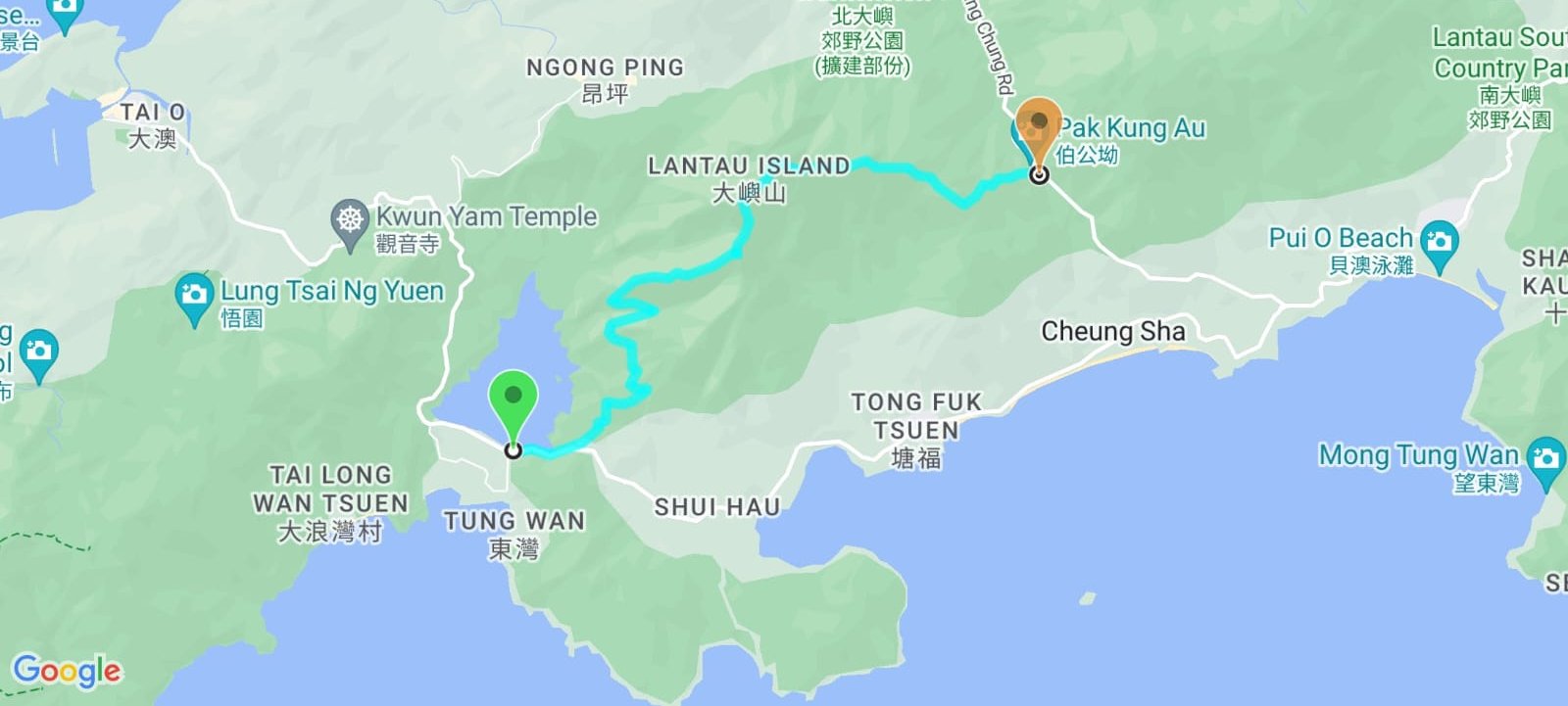
West Dog's Teeth Google Route Map and GPX File
How to Get to the West Dog's Teeth Hike Start Point
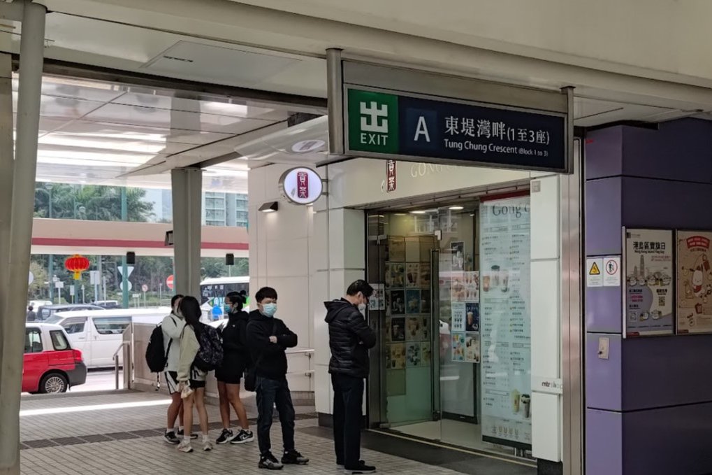
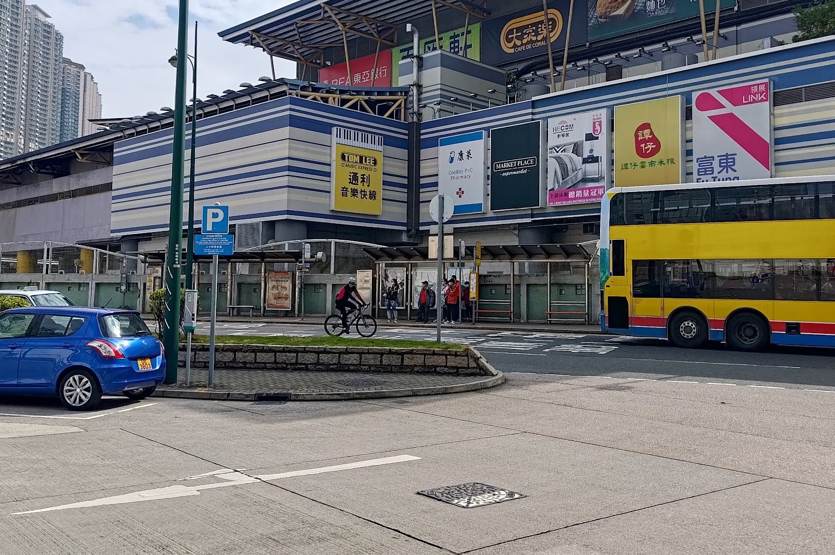
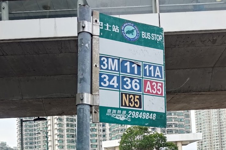
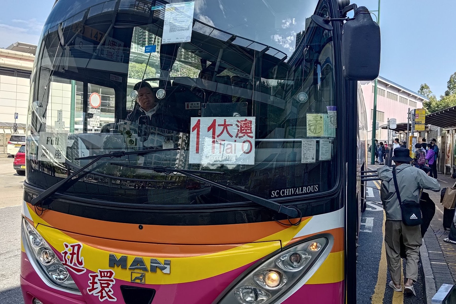
After arriving at Tung Chung MTR station, leave through Exit A and cross the street to the Fu Tung Plaza Bus Stop. You'll be looking for Lantau bus number 11.
The bus has no stop bell, so you can show the bus driver these Chinese characters when you get on so they will know to let you off at the correct stop: 石壁水塘.
If you're unsure, just look out for the reservoir and when you see it, ask the driver to be let off in English (loudly).
Quick West Dog's Teeth Hike Route Summary
- Get the number 11 bus to Shek Pik Reservoir from Fu Tung Plaza (cross the street after leaving through Exit A of Tung Chung MTR Station)
- From the reservoir, head back up the road where the bus came from and go past the car barrier when you see the brown trail sign
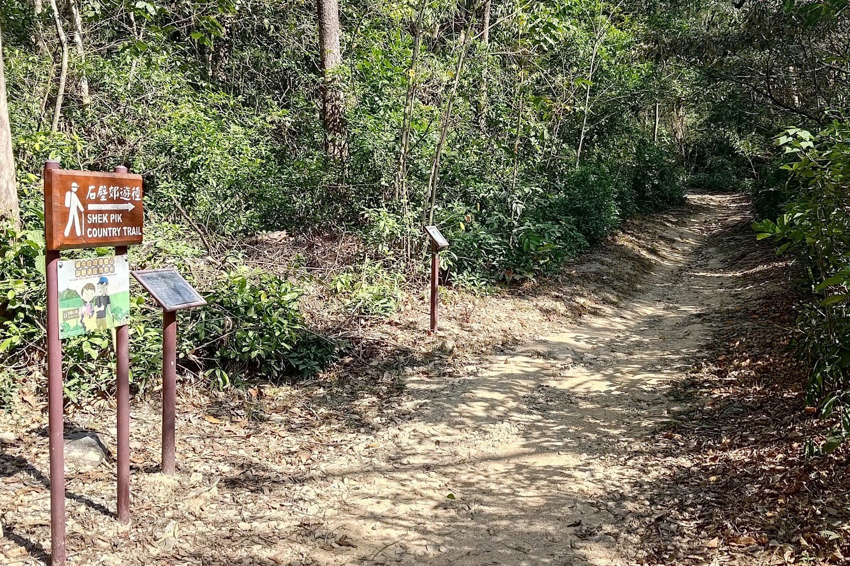
- Cross the catchwater bridge and follow the brown 'Shek Pik Country Trail' sign
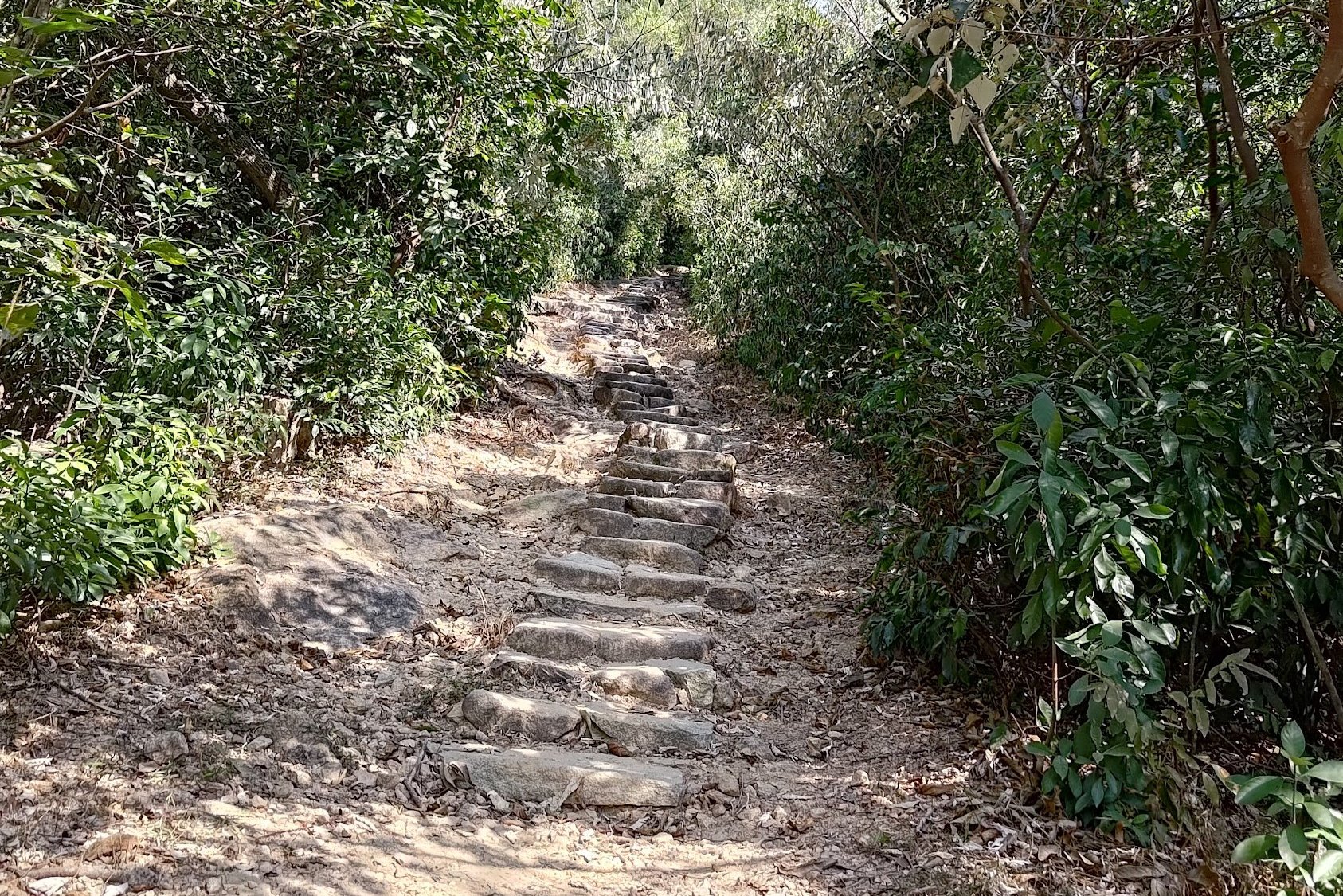
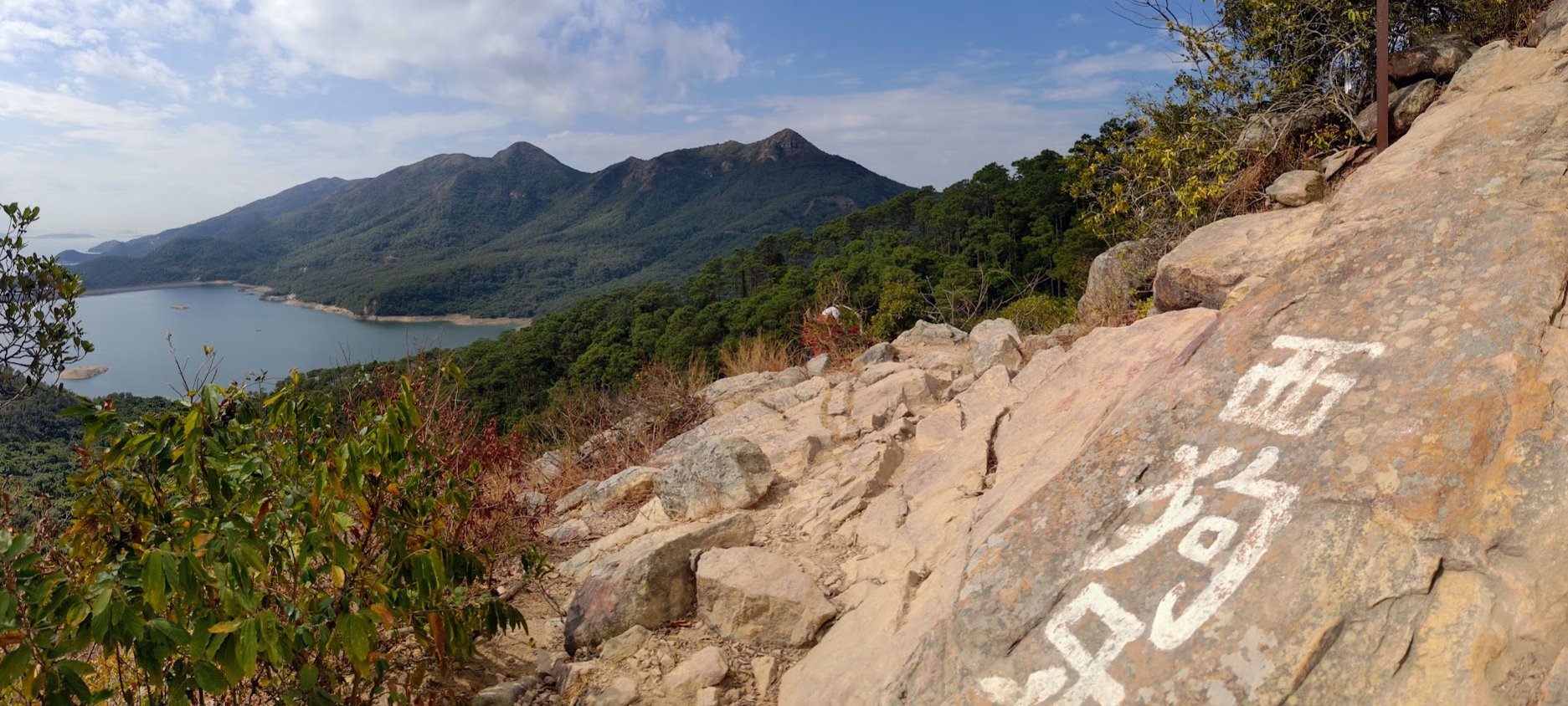
- Take the stairs up and follow the flat trail for about 30 minutes until you see the white spraypainted 西狗牙 (West Dog's Teeth) sign
- Climb to the top of the West Dog's Teeth Ridge - this takes 1 hour at a fast pace with no breaks
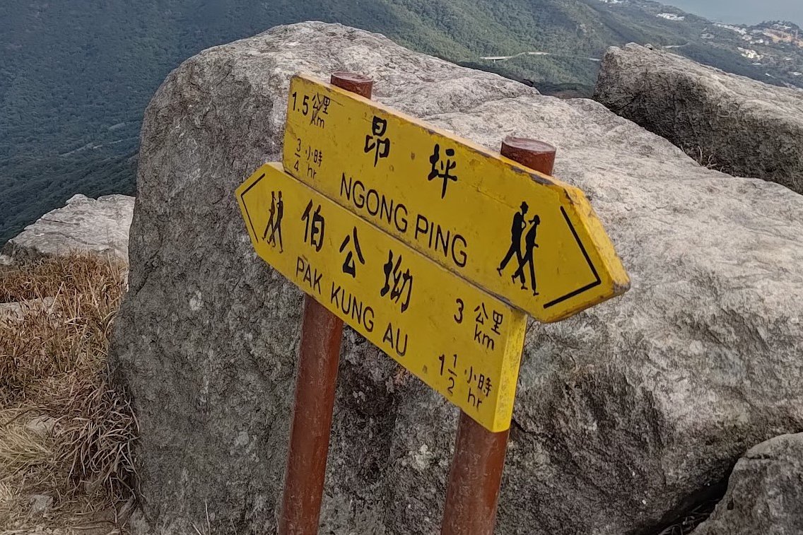
- Begin climbing up Lantau Peak - there's a yellow sign pointing to Ngong Ping (Big Buddha) if you want to end the hike earlier. You'll see the sign 30 mins after the West Dog's Teeth summit
- Summit Lantau Peak 1 hour after the West Dog's Teeth summit (30 mins after the yellow Ngong Ping sign)
- Descend down to Pak Kung Au Road bus stop- It takes about an hour at a fast pace with no breaks
Walking to the Start of the Hike
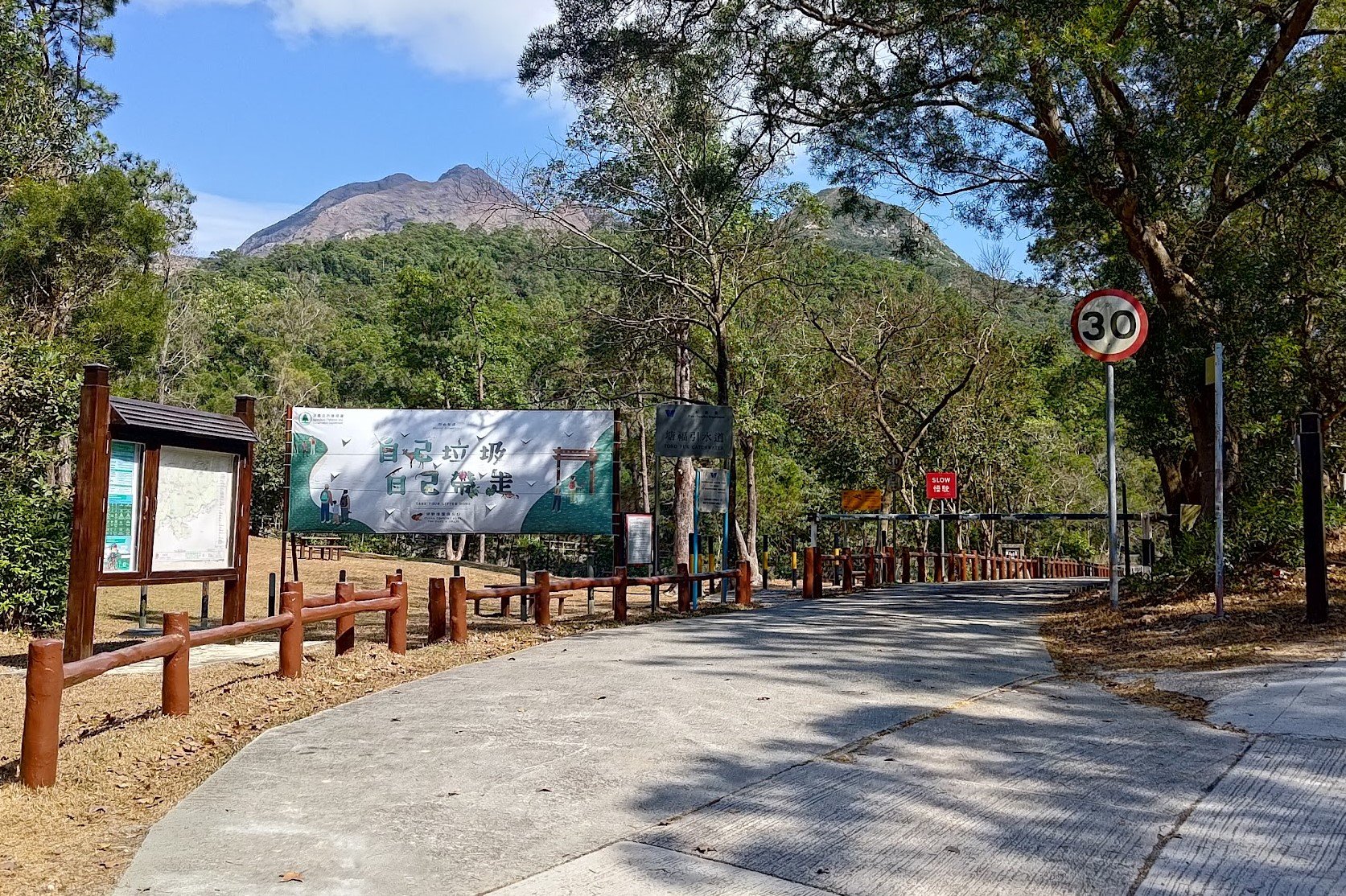
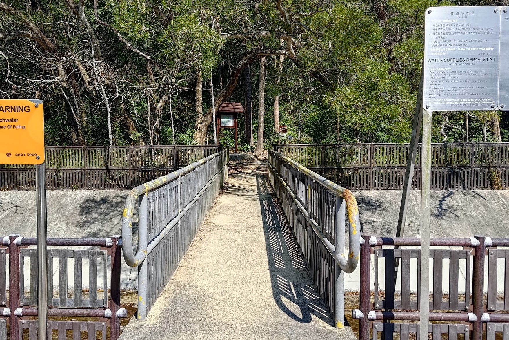
When you get off the bus, head back up the road where the bus came from. Just over 5 minutes later, you'll see a large wooden signpost and a car barrier. Head through the car barrier and walk forward until you see a little catchwater bridge with a bunch of warning signs beside it.
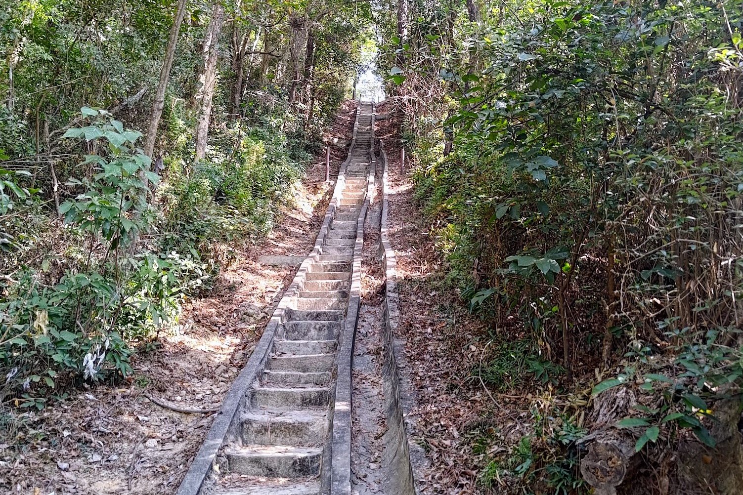
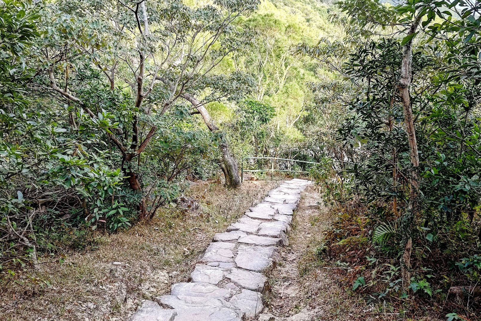
Cross the bridge and follow the brown 'Shek Pik Country Trail' sign. From there, you'll begin climbing some stone steps before arriving at a massive, concrete staircase.
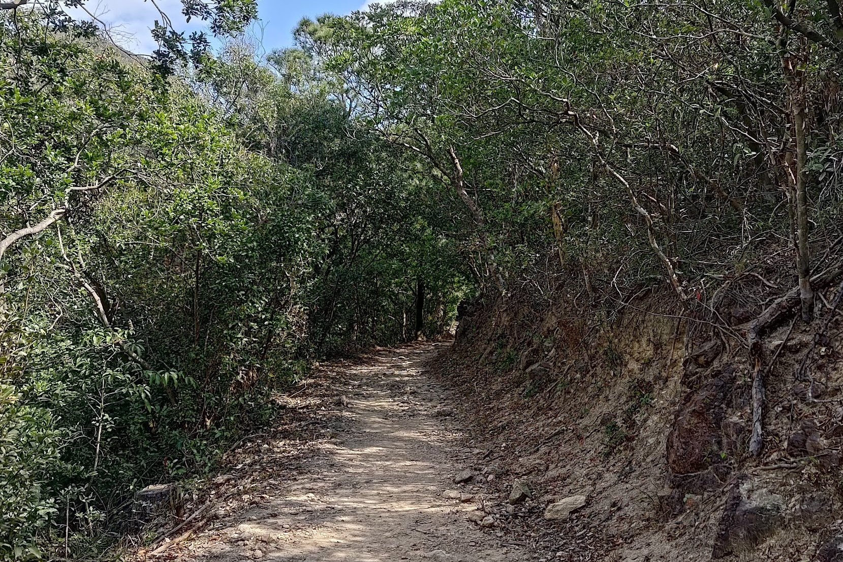
When the uphill section is over, you'll walk for another 30 minutes along a flat section that'll give you a bit of respite.
Enjoy the break because once you see the white Chinese 西狗牙 (West Dog's Teeth) spraypainted sign, you've arrived at the steep climbing section.
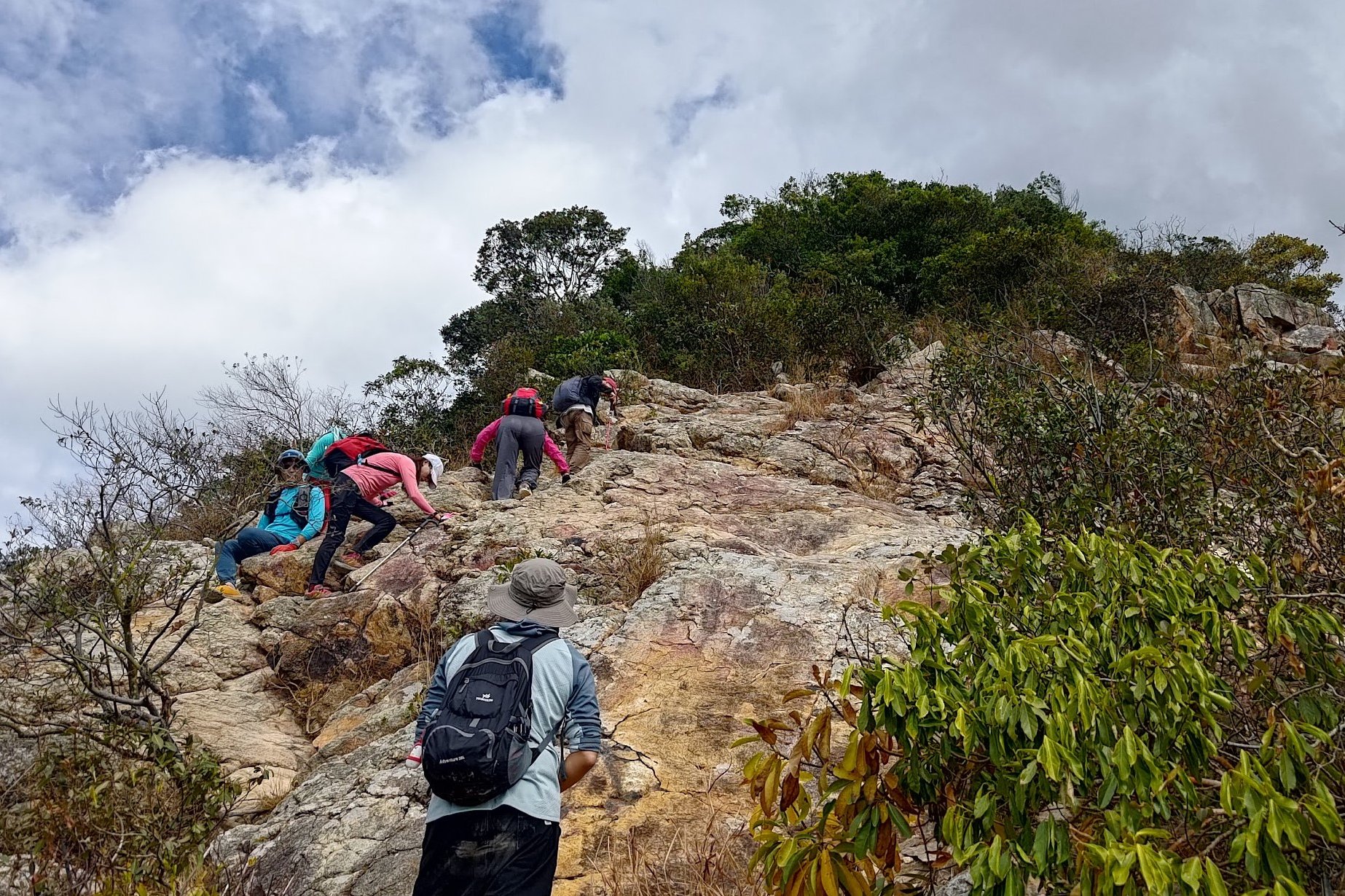
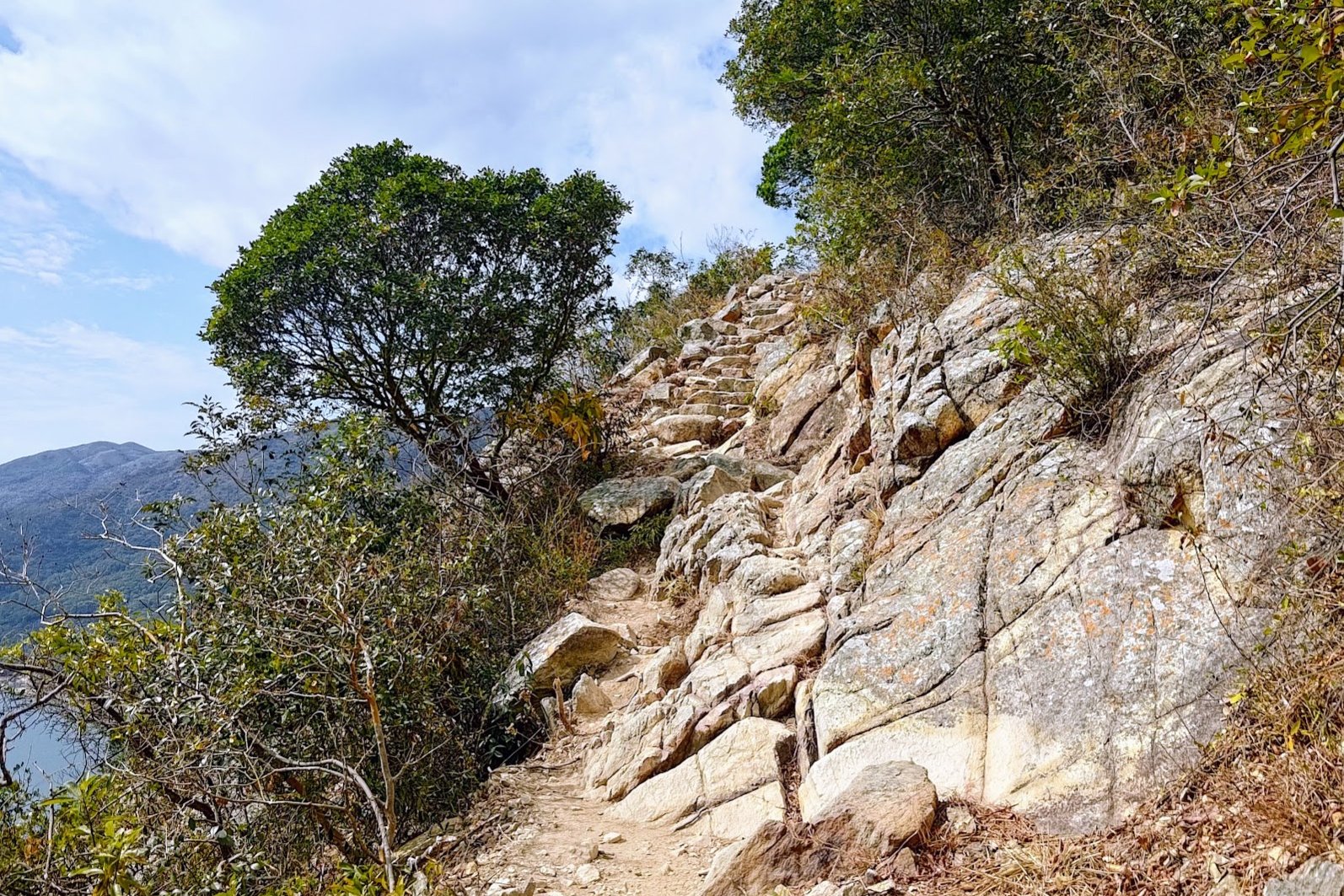
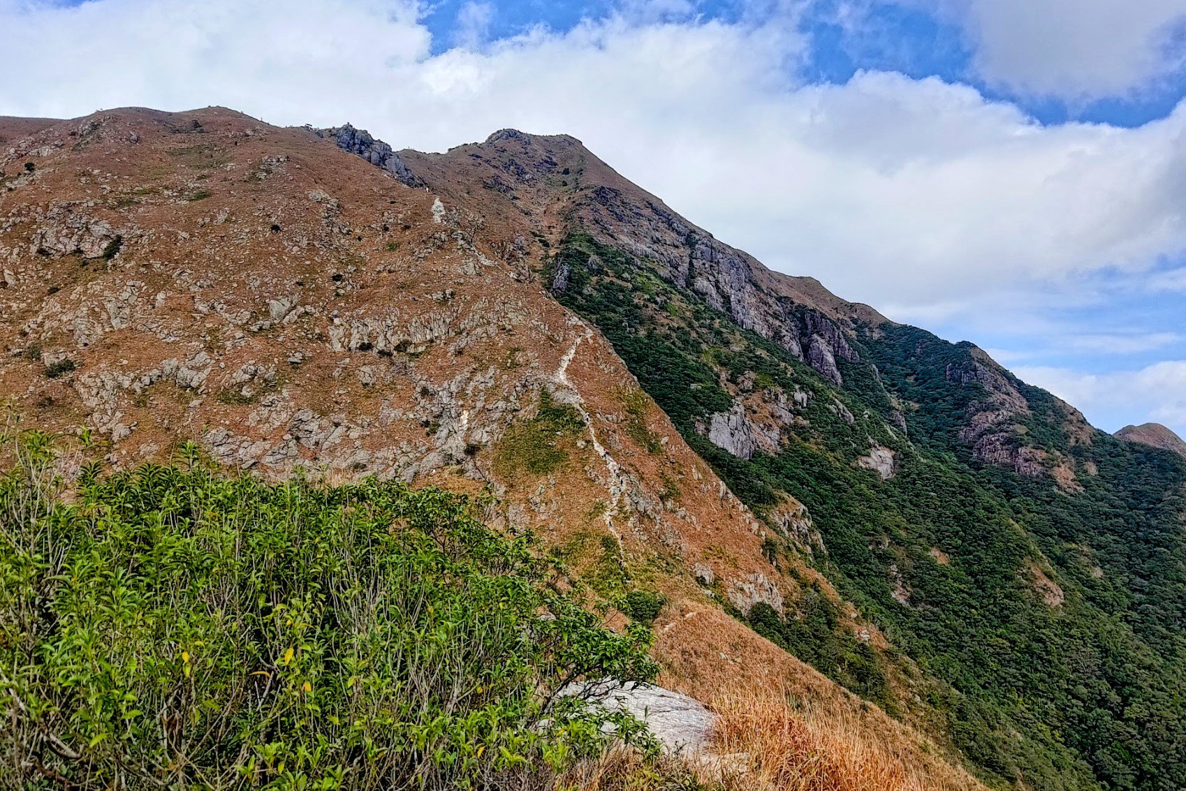
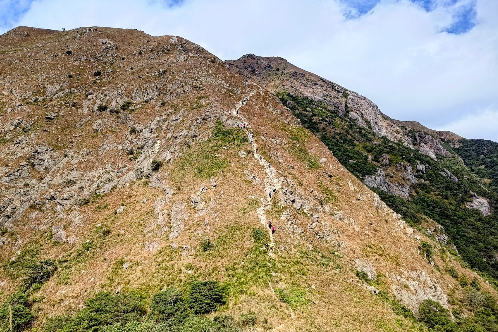
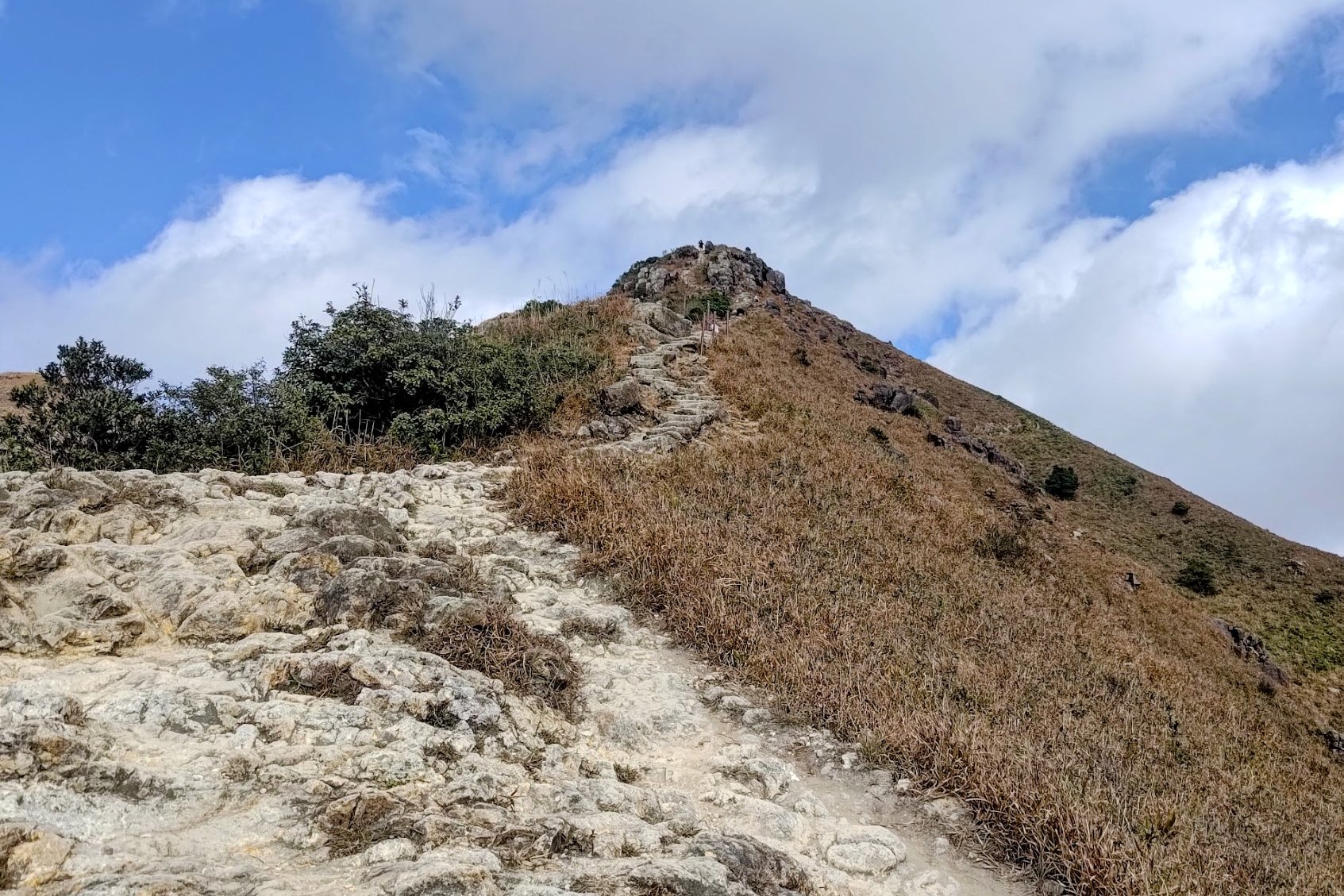
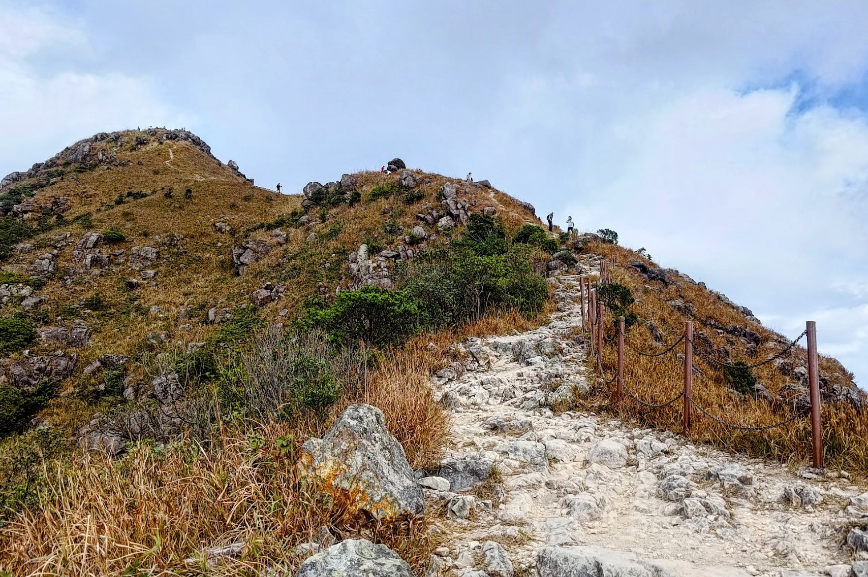
Climbing to the Summit of West Dog's Teeth
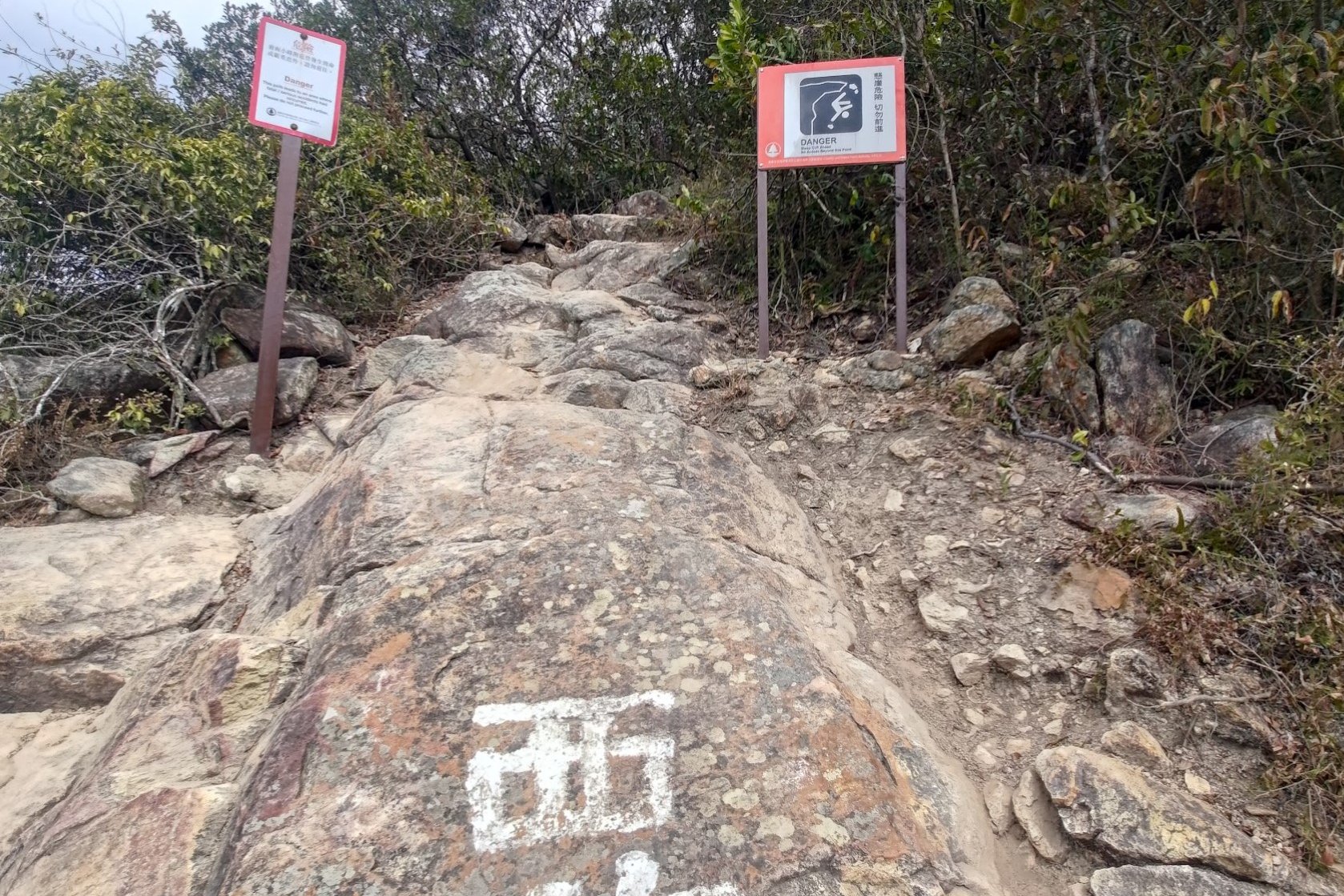
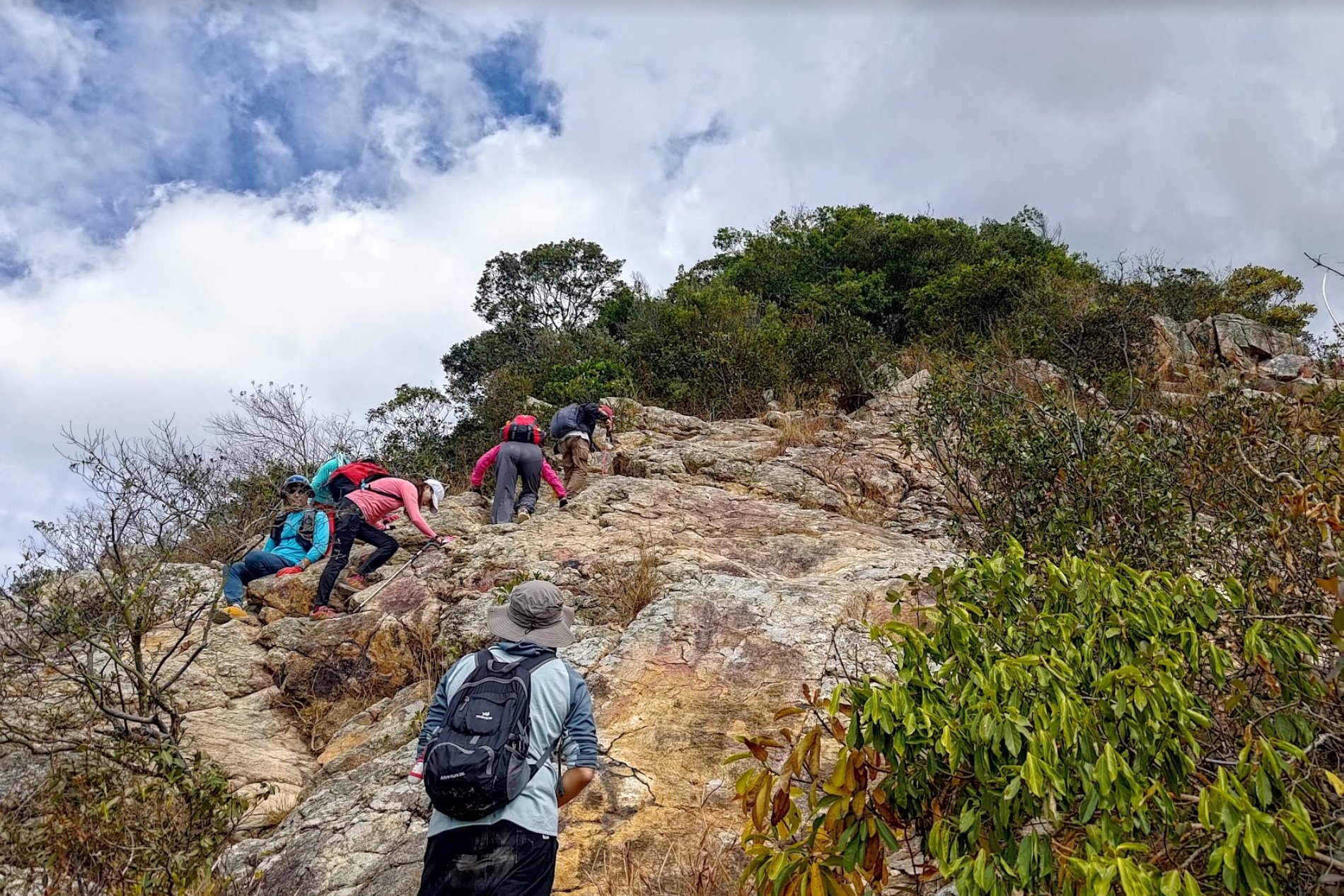
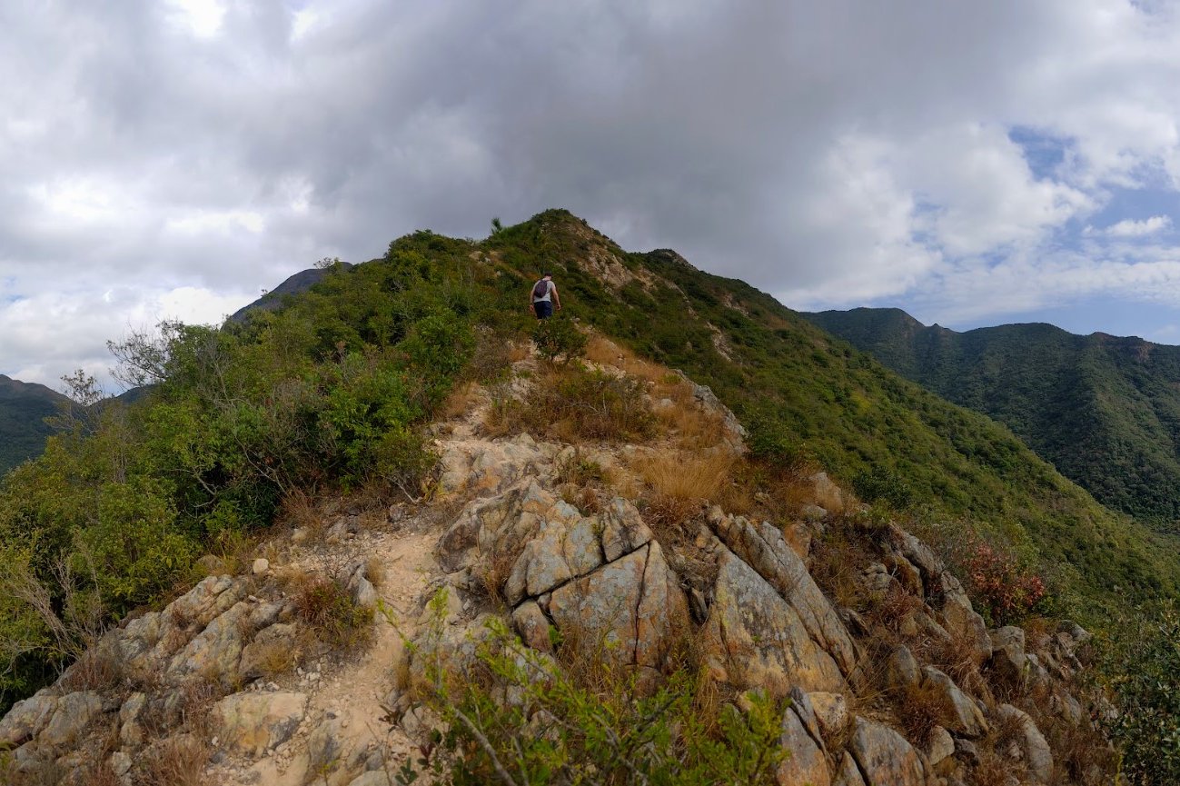
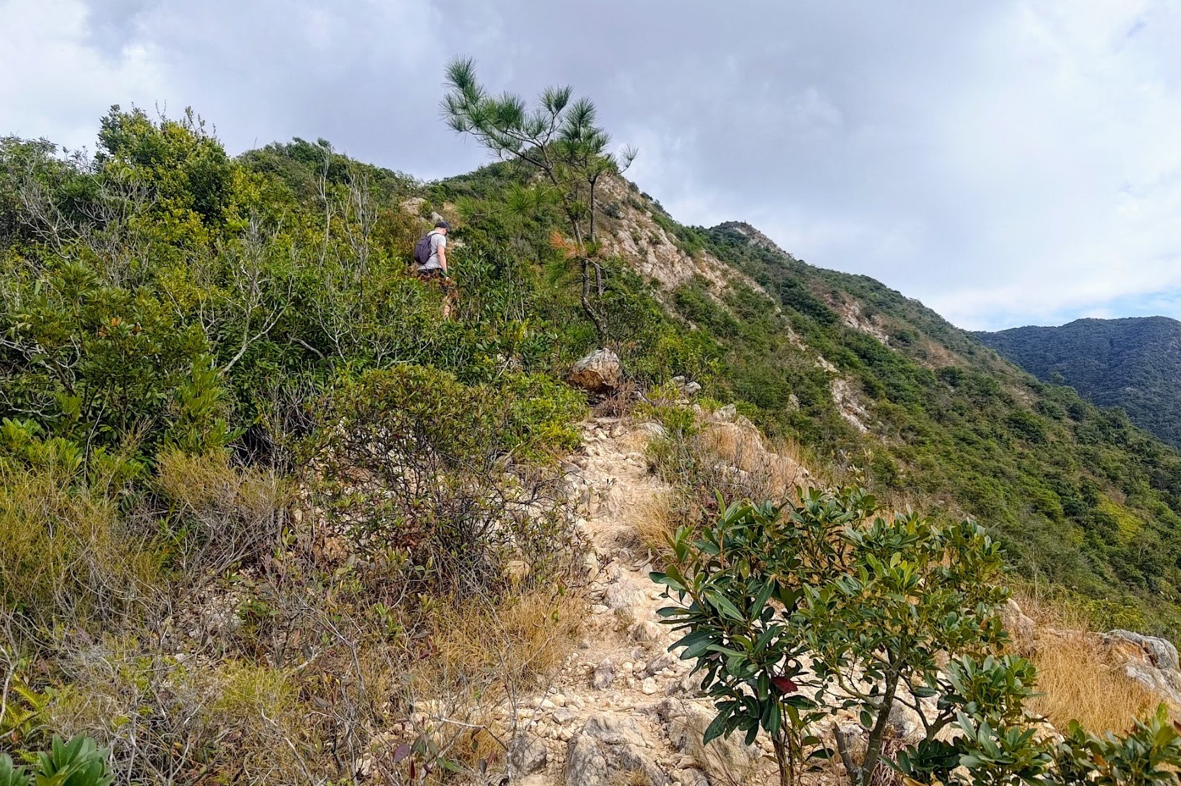
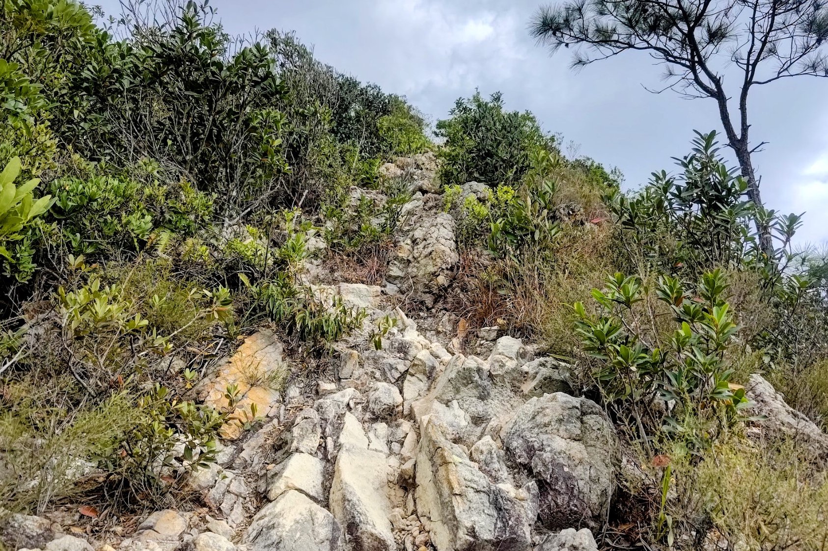
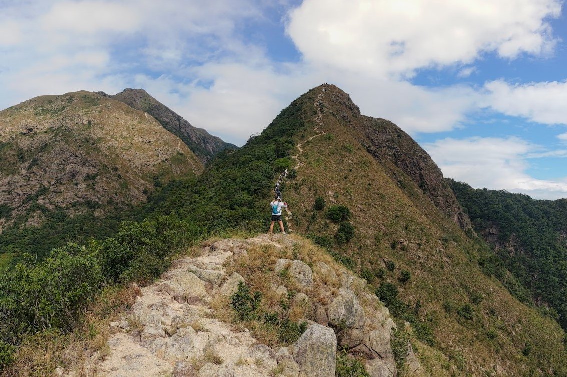
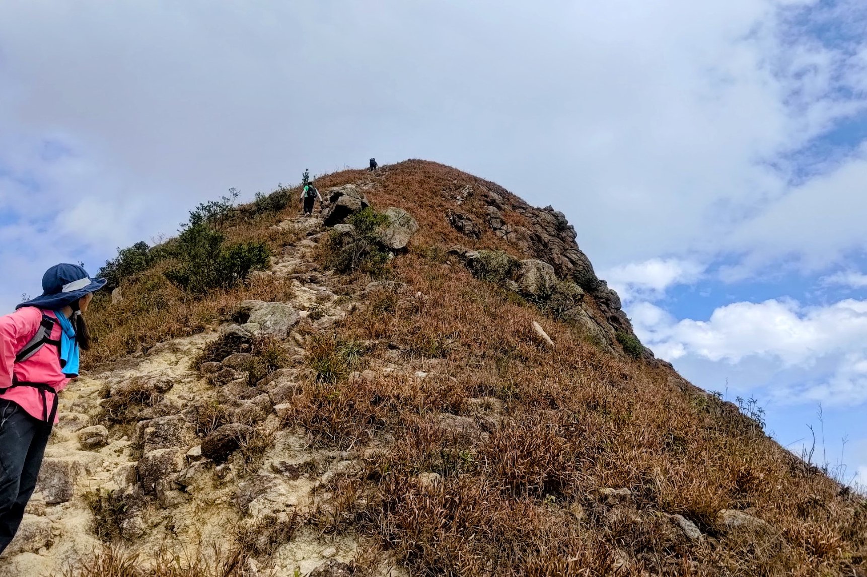
This section of the hike takes an hour to complete at a fast pace with zero breaks. Remember, your pace may be a lot slower, especially if you aren't comfortable with using your hands to climb.
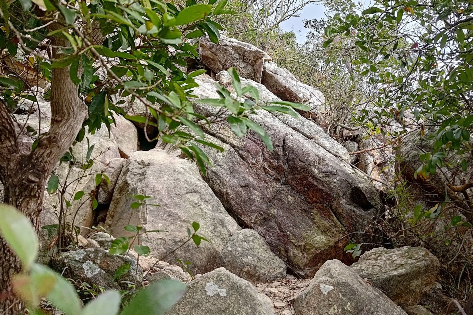
The good thing is that though the trail is rough and wild, requiring navigation over large rocks and steep mountain faces, it's almost impossible to get lost since the only way forward is upwards.
If this is your first hike in a long time, be sure to go slow, drink plenty of water and marvel at the stunning views as you get higher.
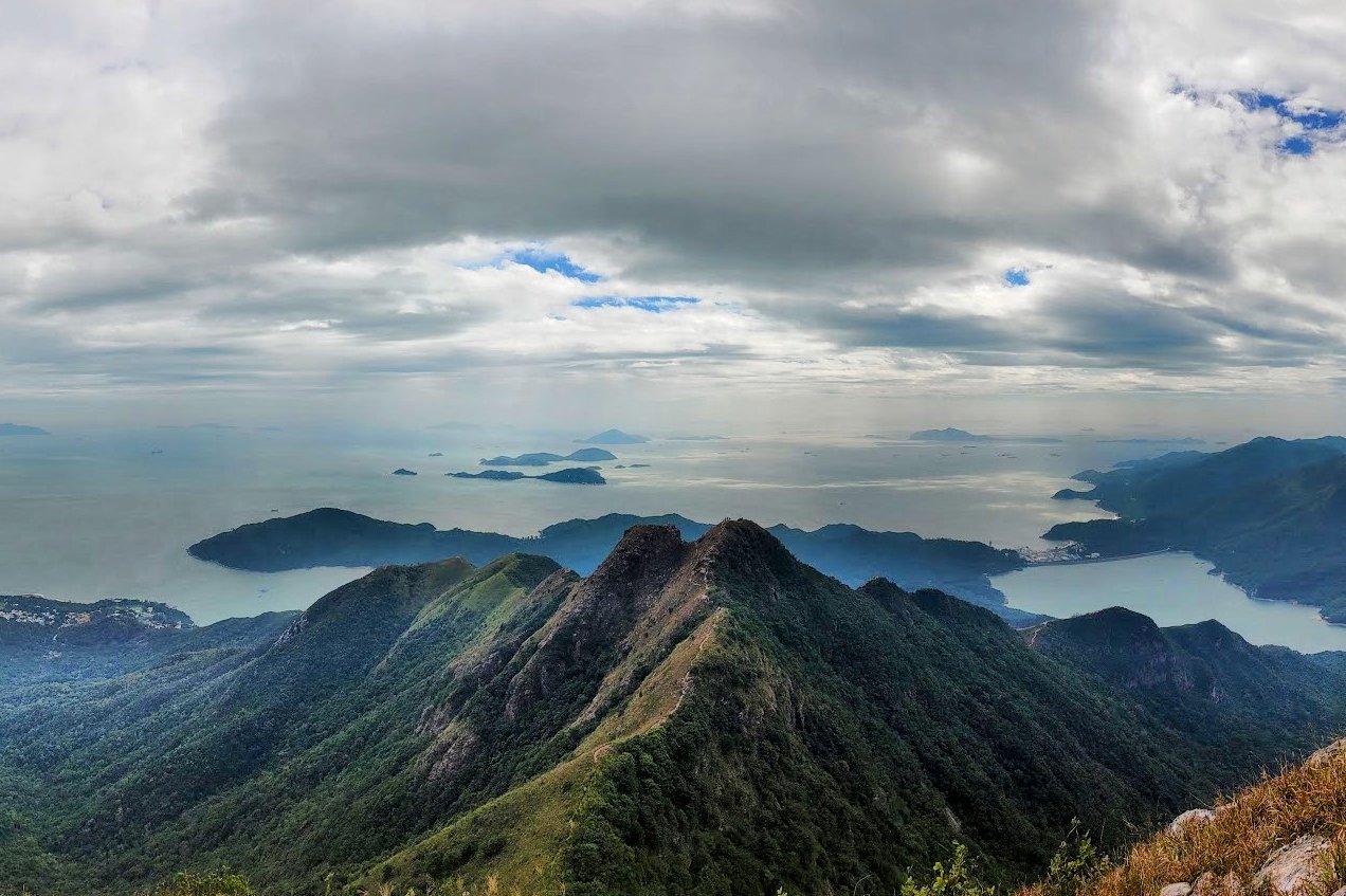
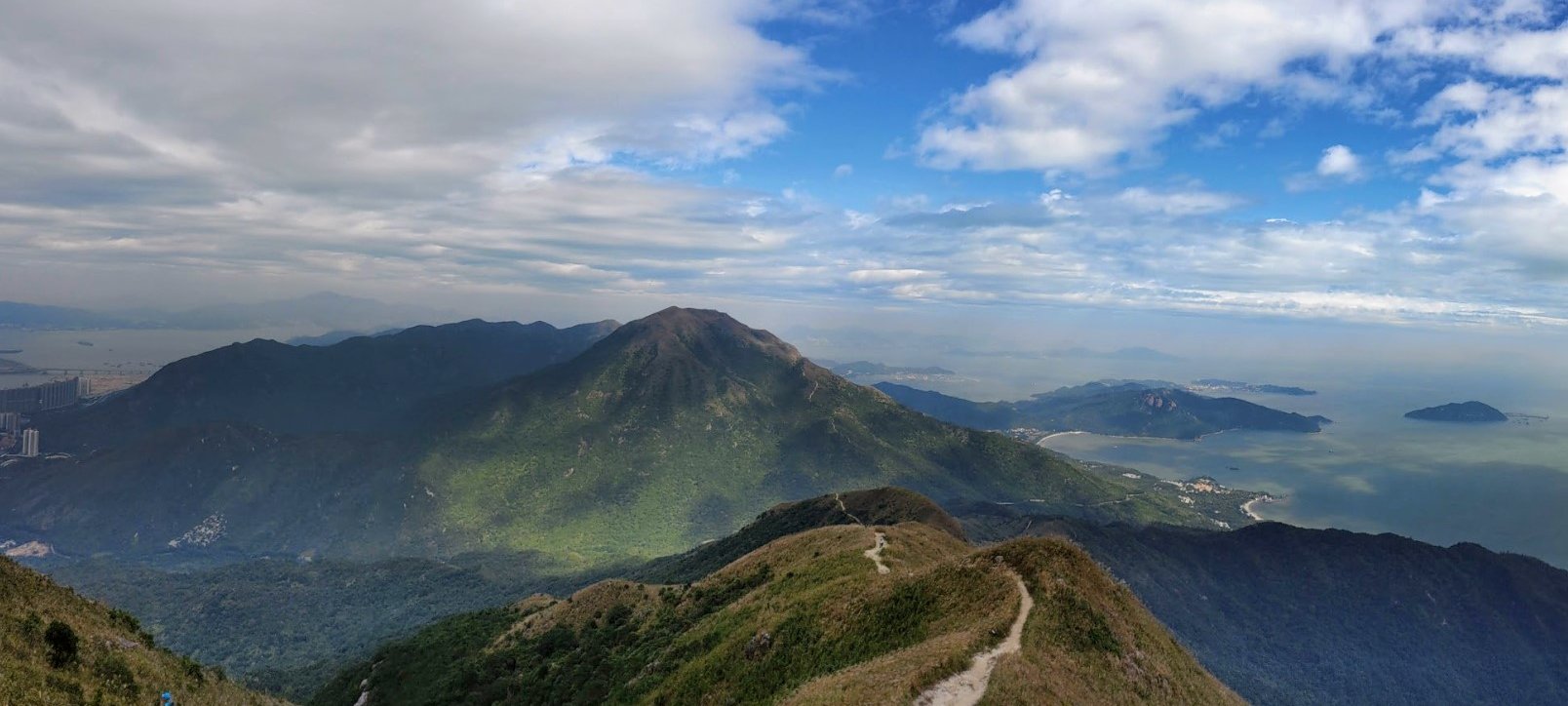
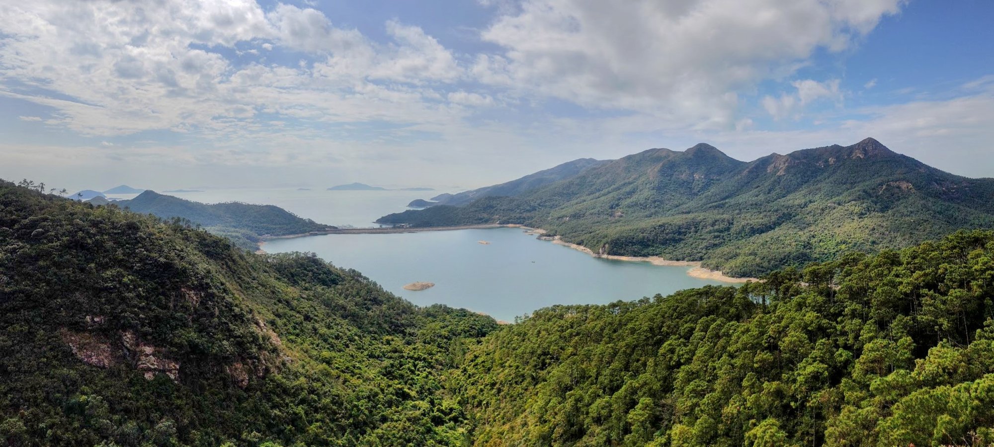
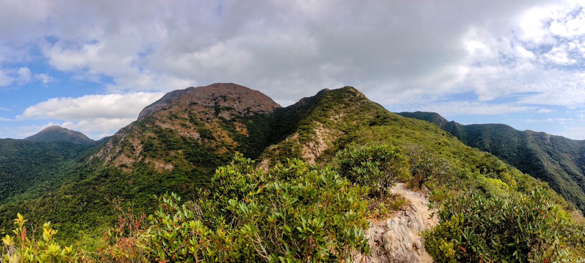
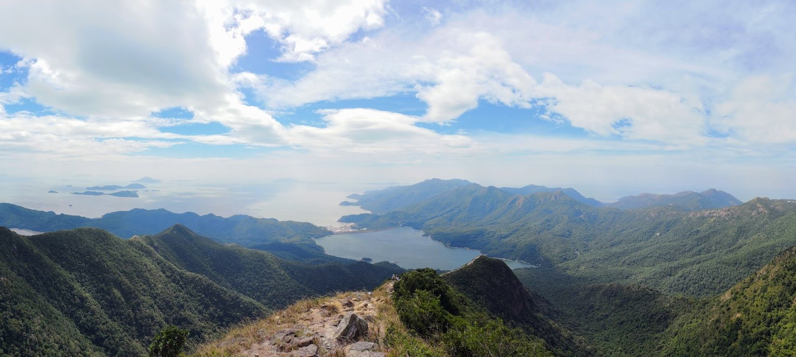
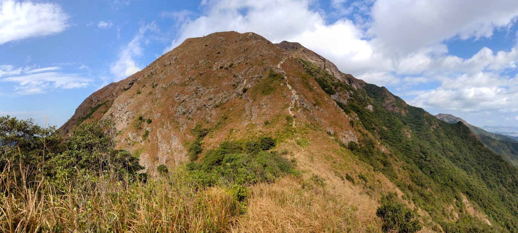
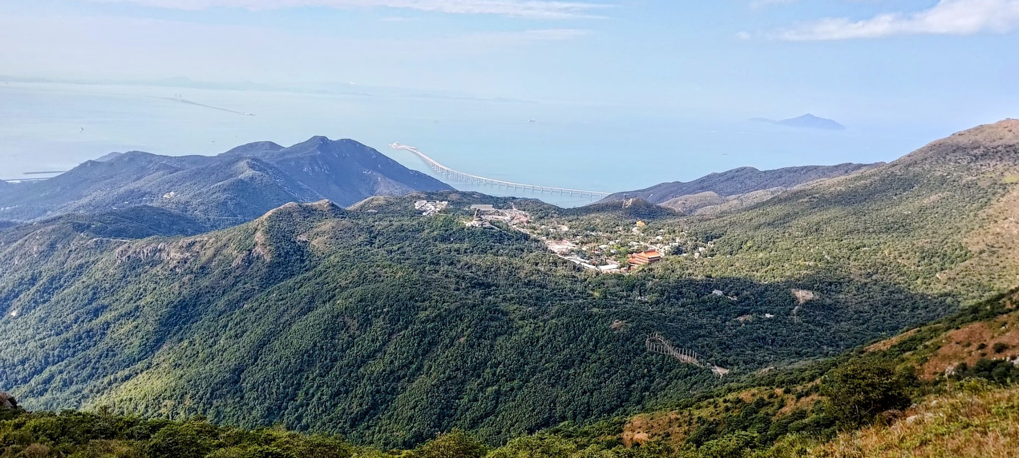
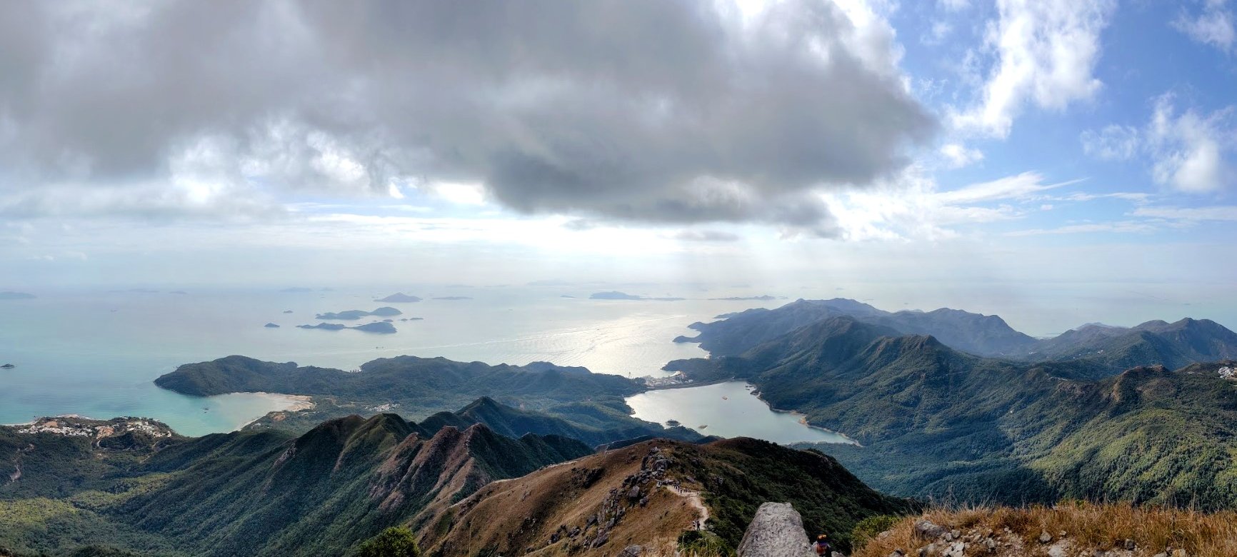
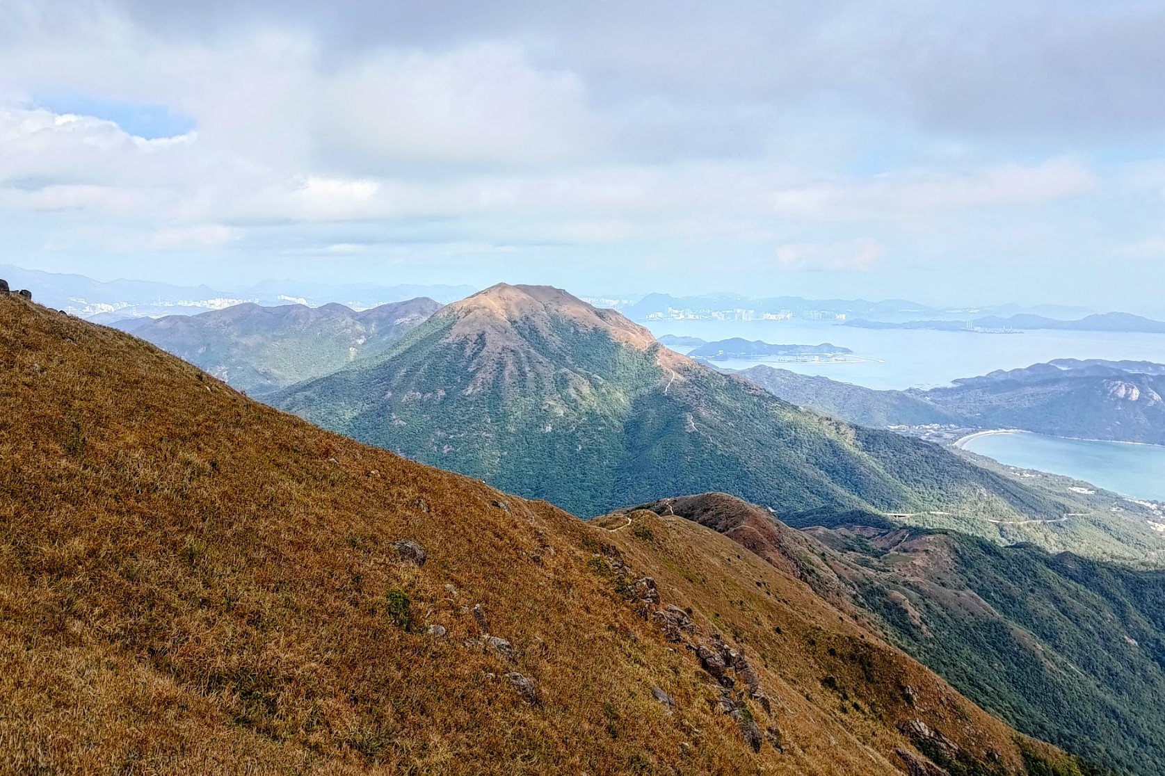
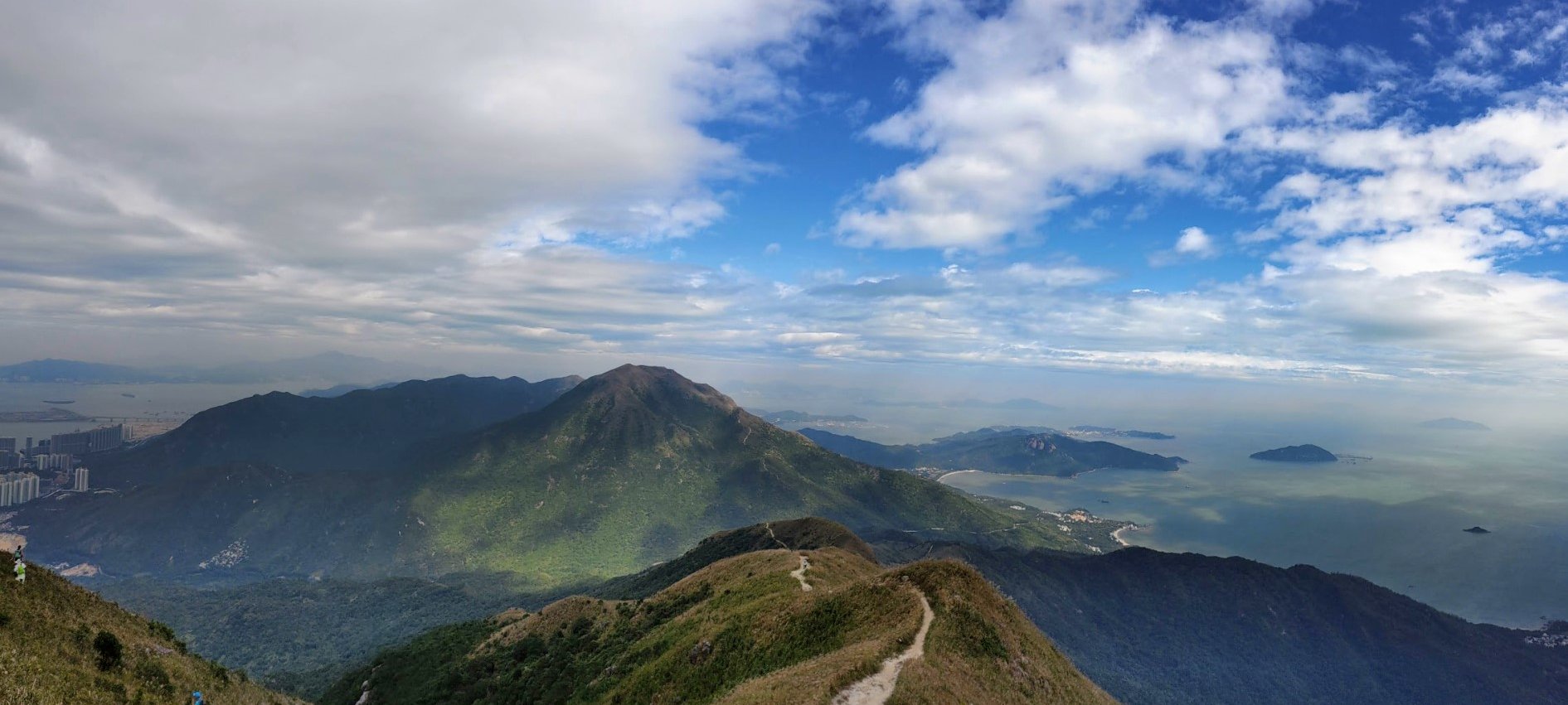
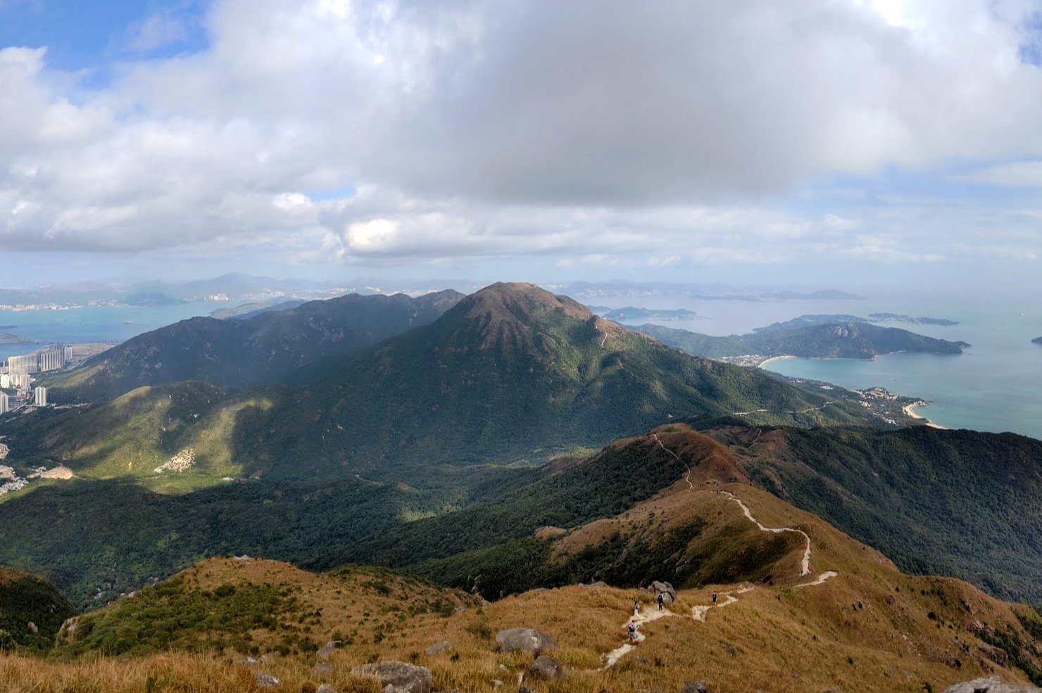
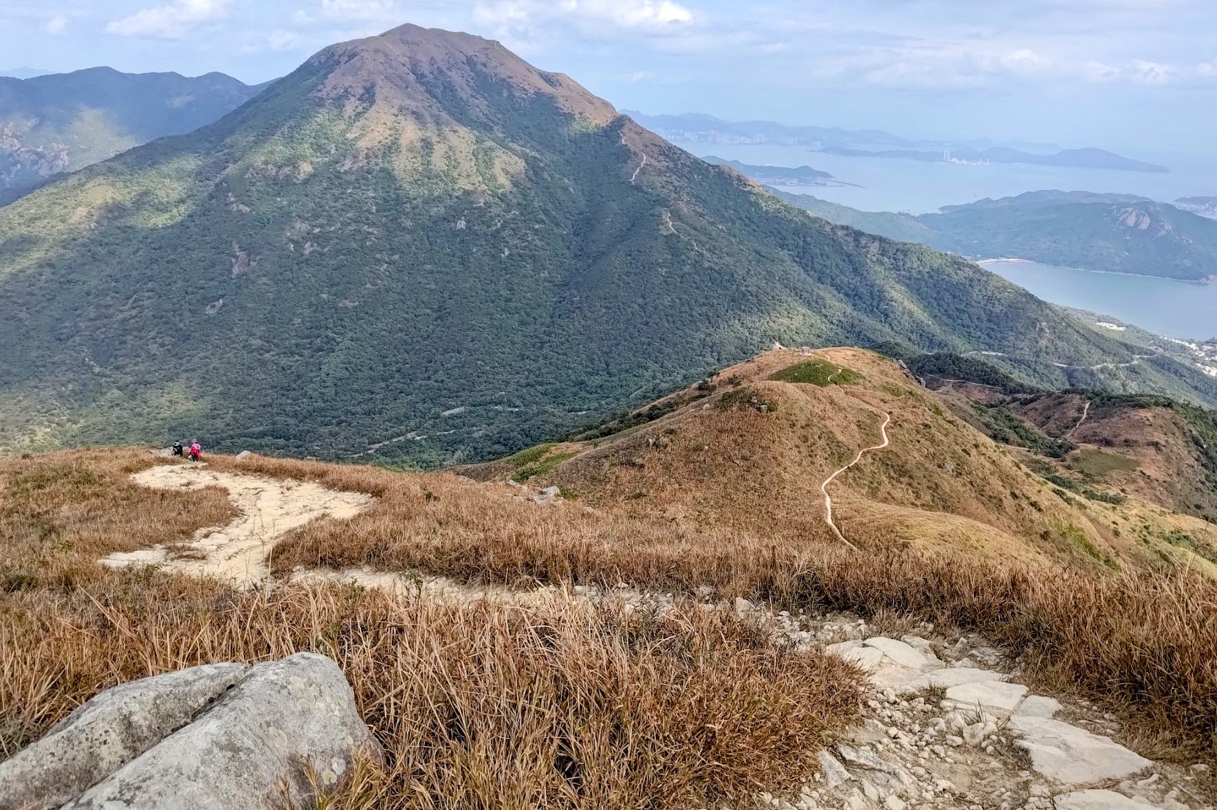
View from the Summit of West Dog's Teeth
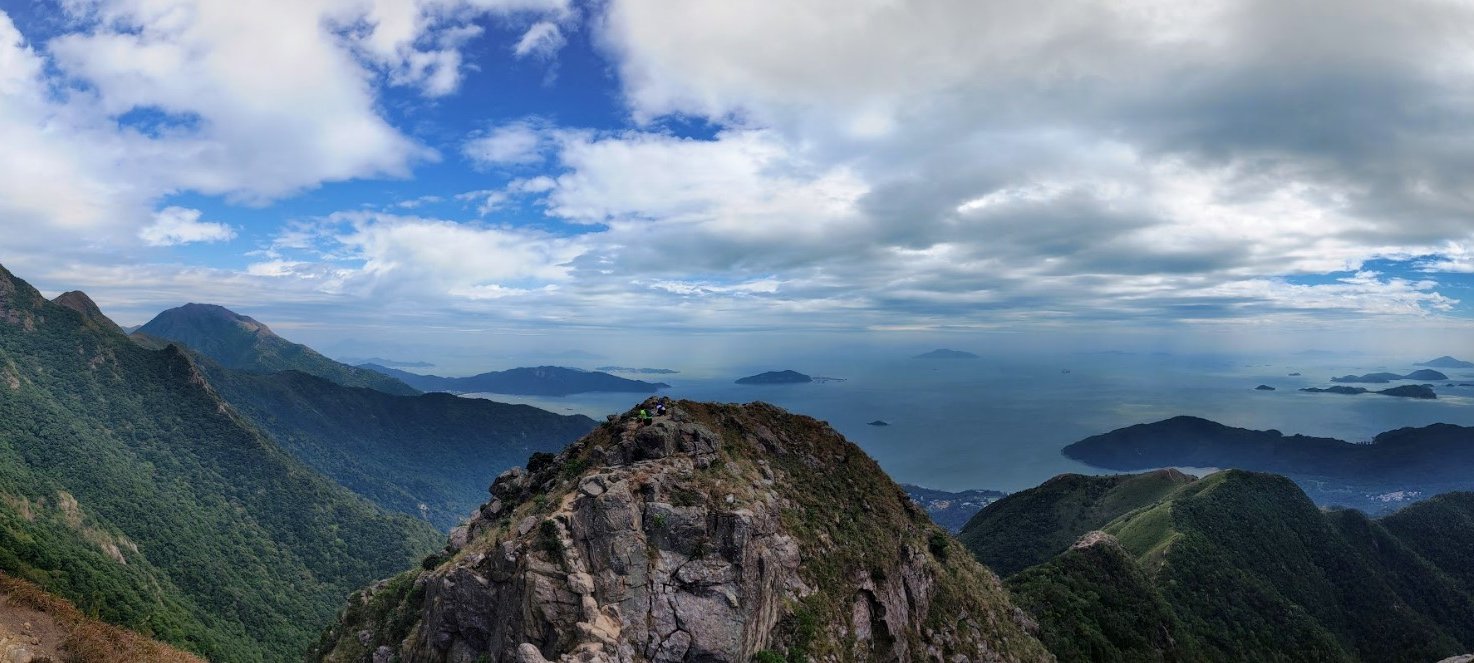
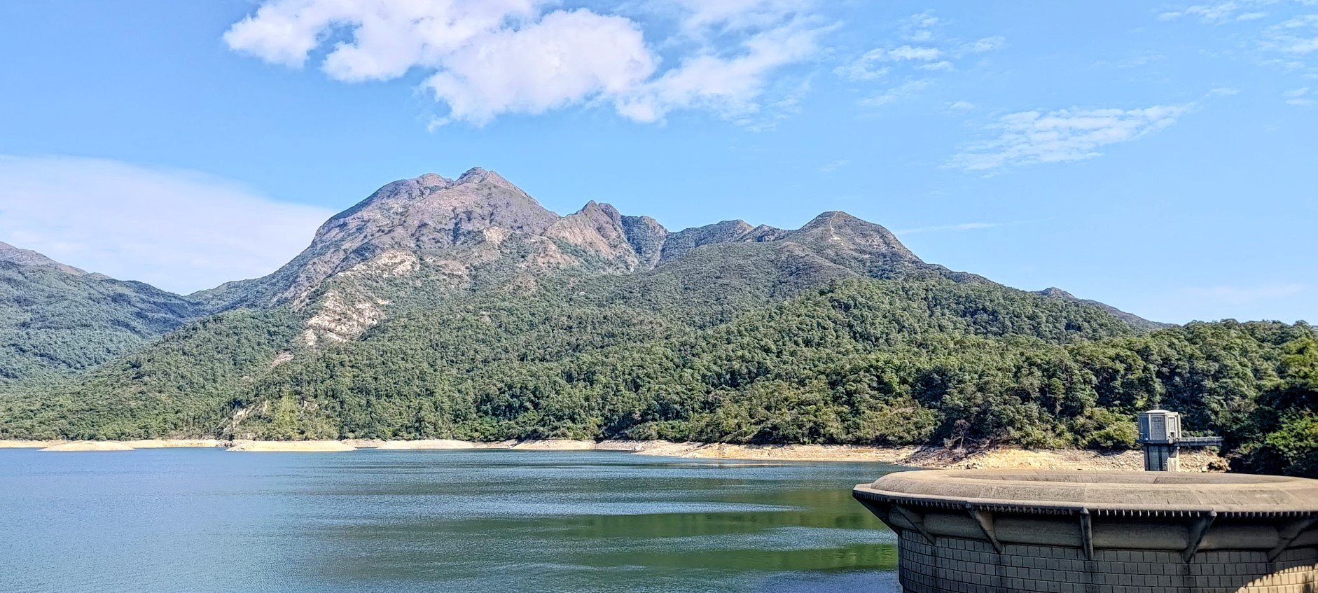
The summit of West Dog's Teeth is about 540 meters up and the view is pretty darn spectacular. Not only can you see all the way down to Ping Shek Reservoir and the South China Sea beyond, but you'll also have incredible views of Lantau Peak on the opposite side.
If you feel like you don't want to ascend another step, you can cross over and descend down East Dog's Teeth, but be warned, it's steep and very tiring to descend all the way back down.
I'd recommend hiking up a short way further (30 minutes) when you'll reach a trail leading to the Big Buddha that will end your hike much faster and with far less dangerous downhill sections.
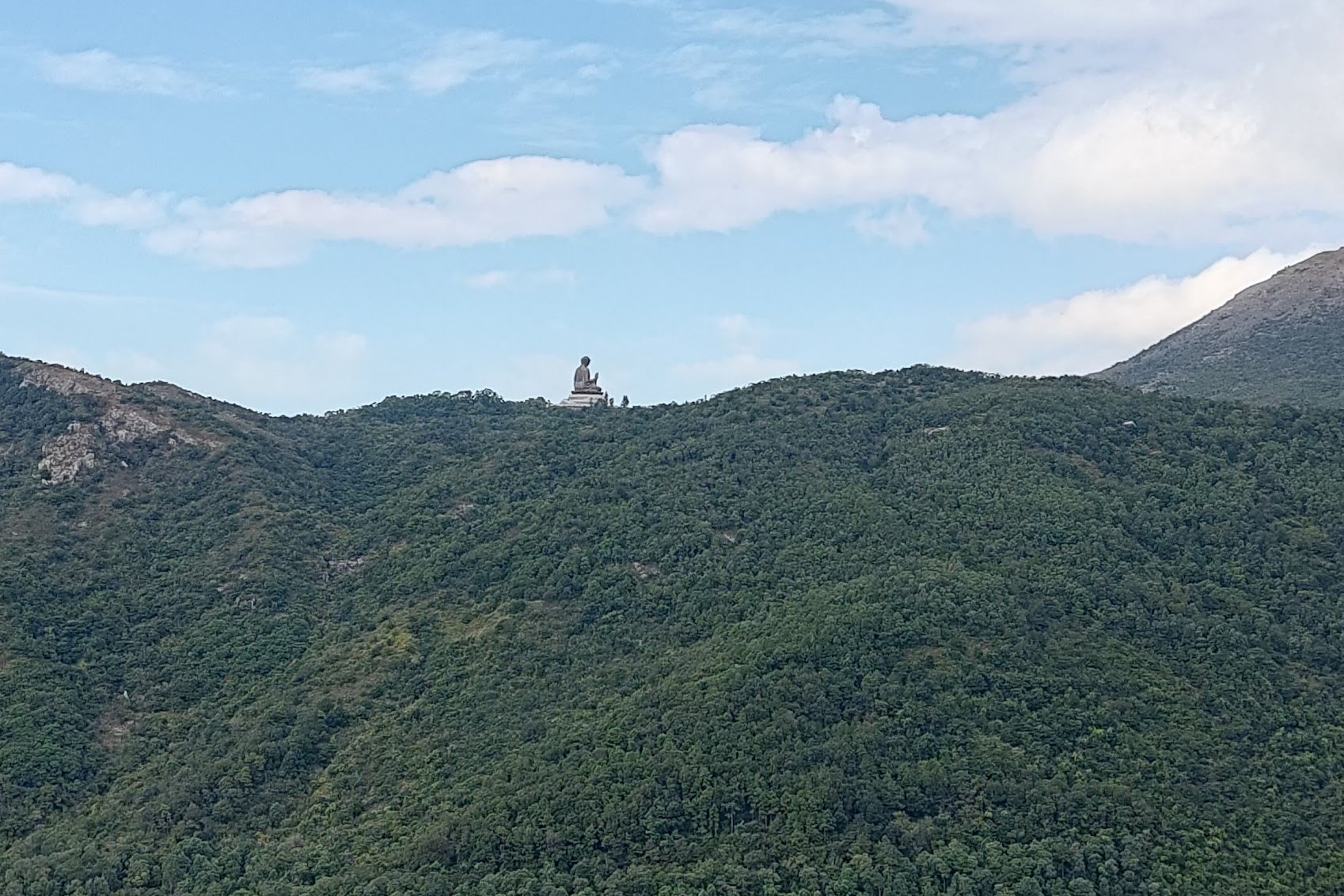
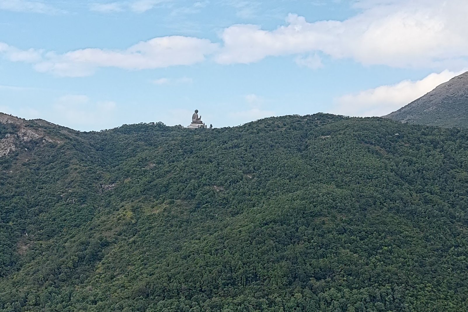
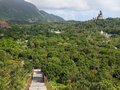
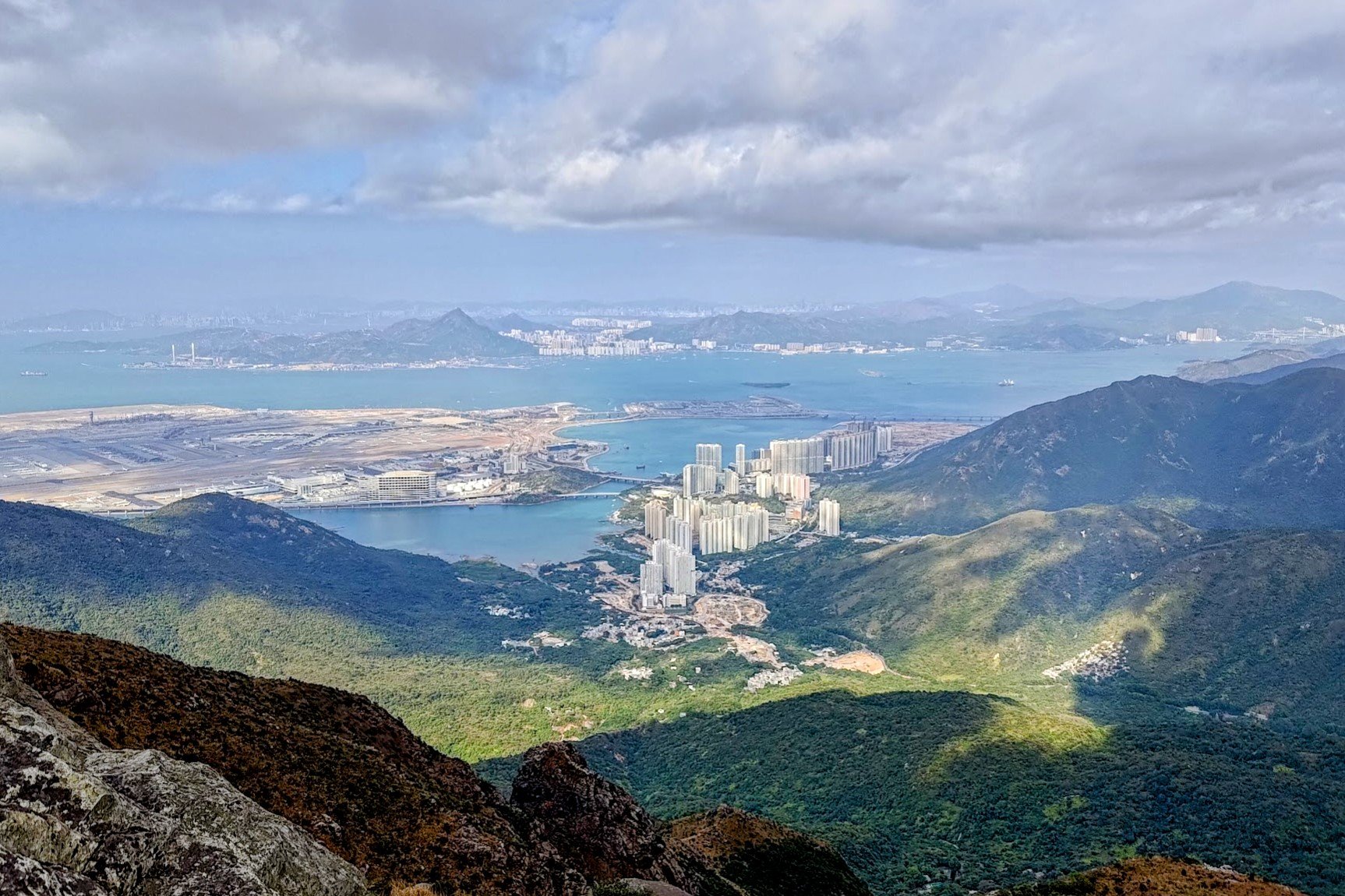
The Ngong Ping Big Buddha Escape Route Option
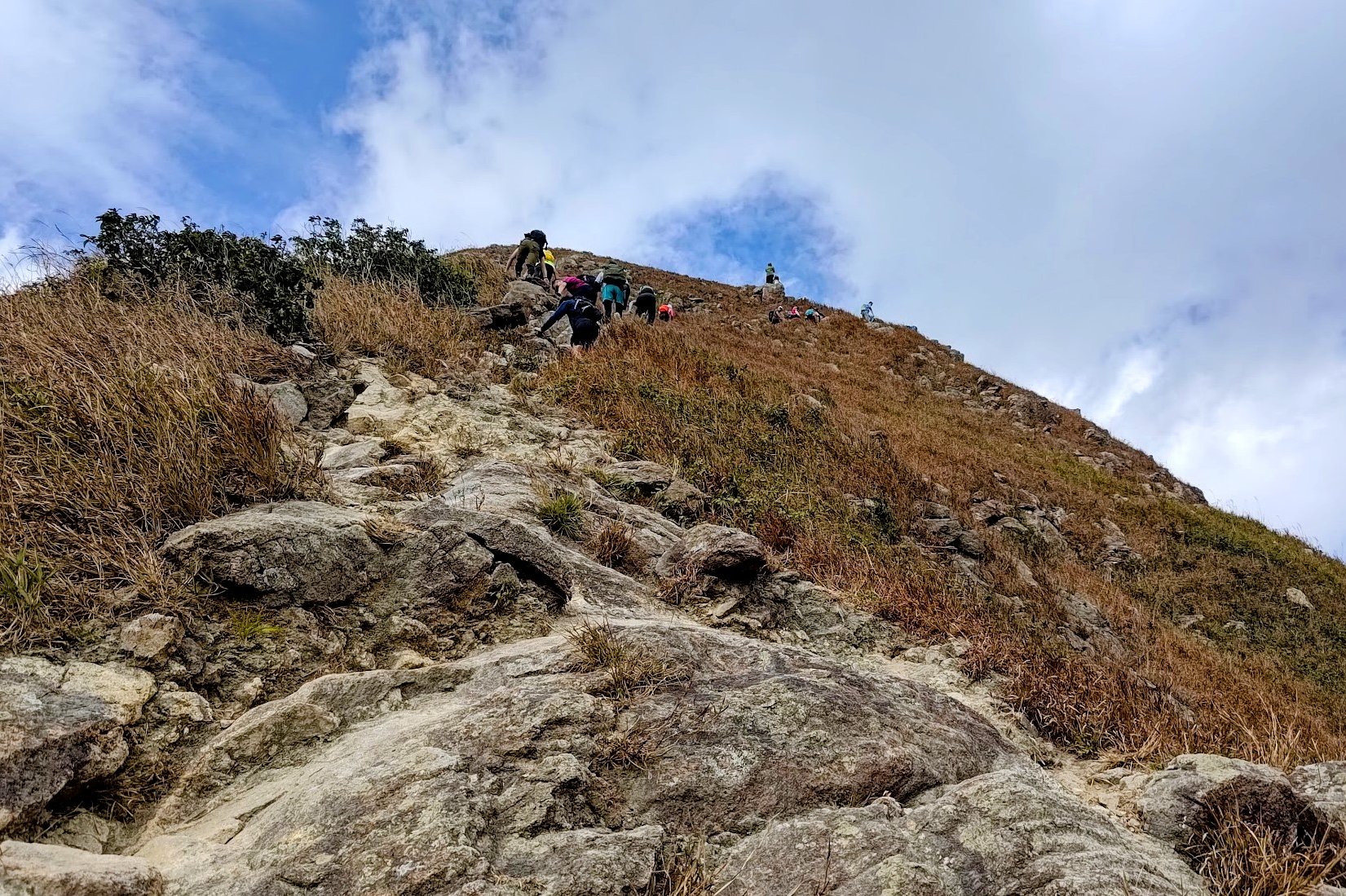
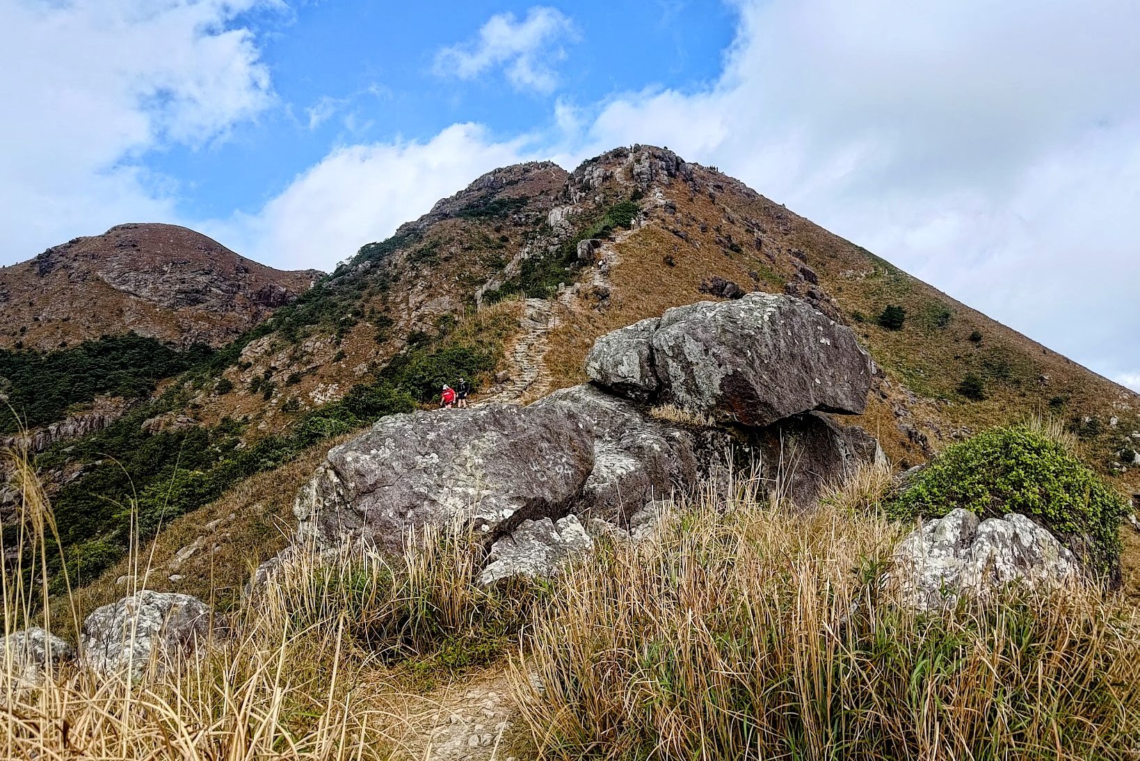
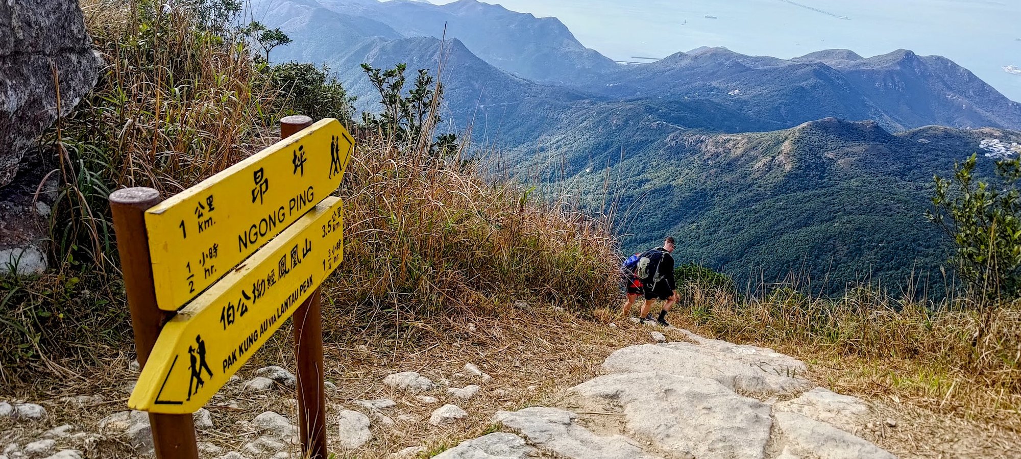
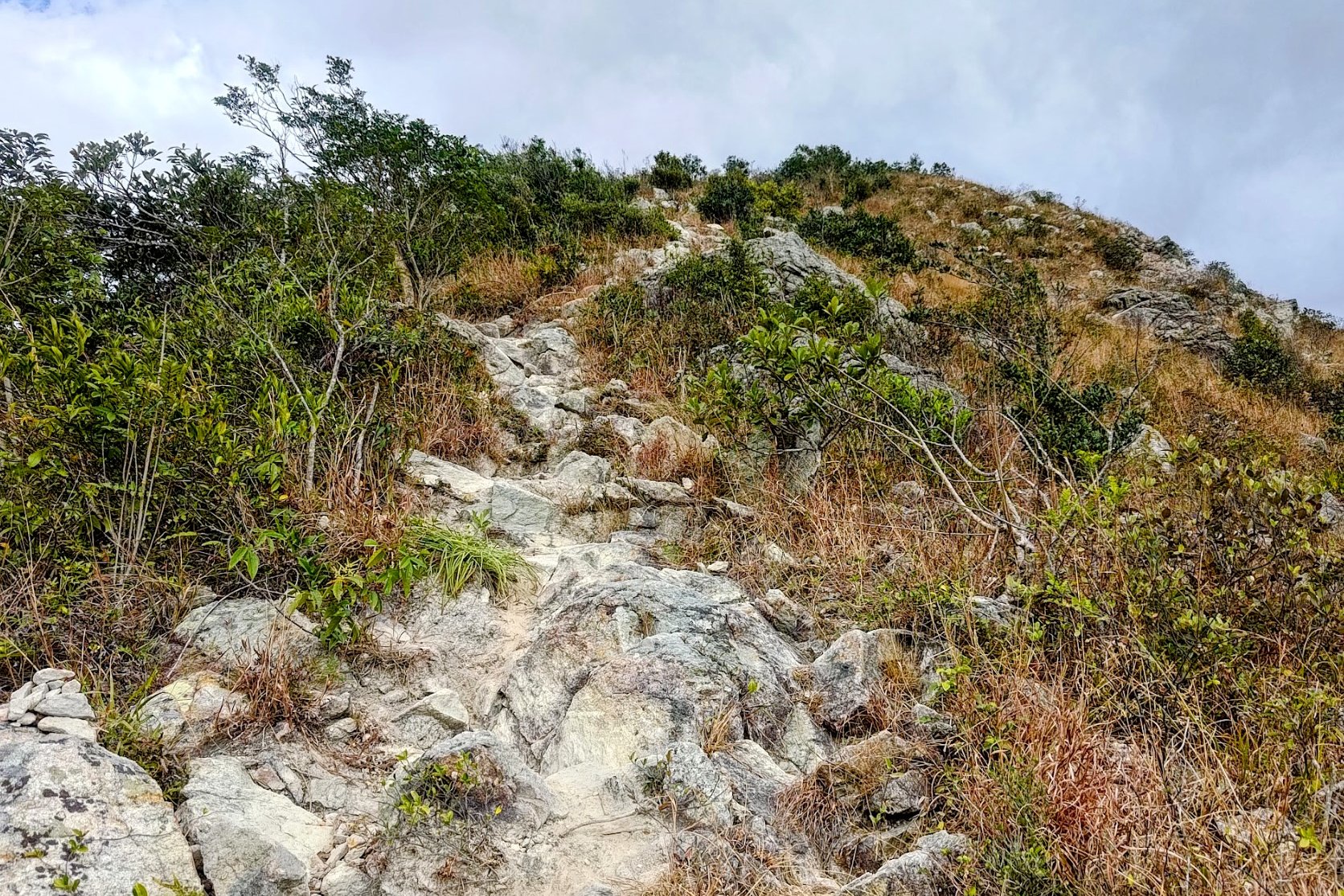
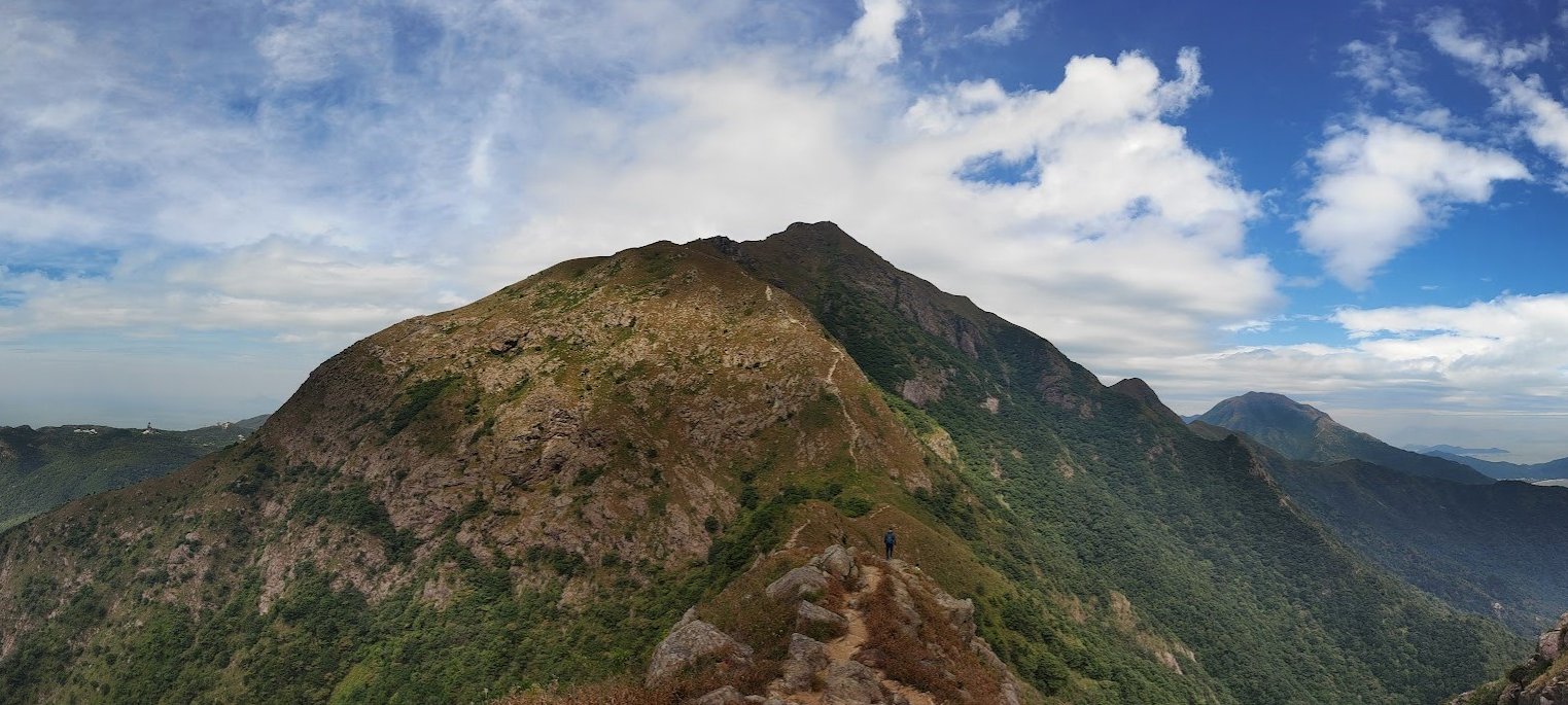
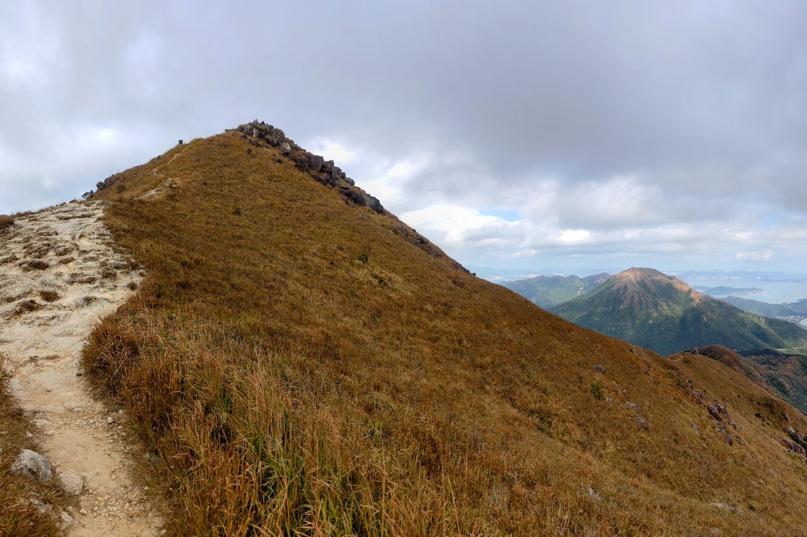
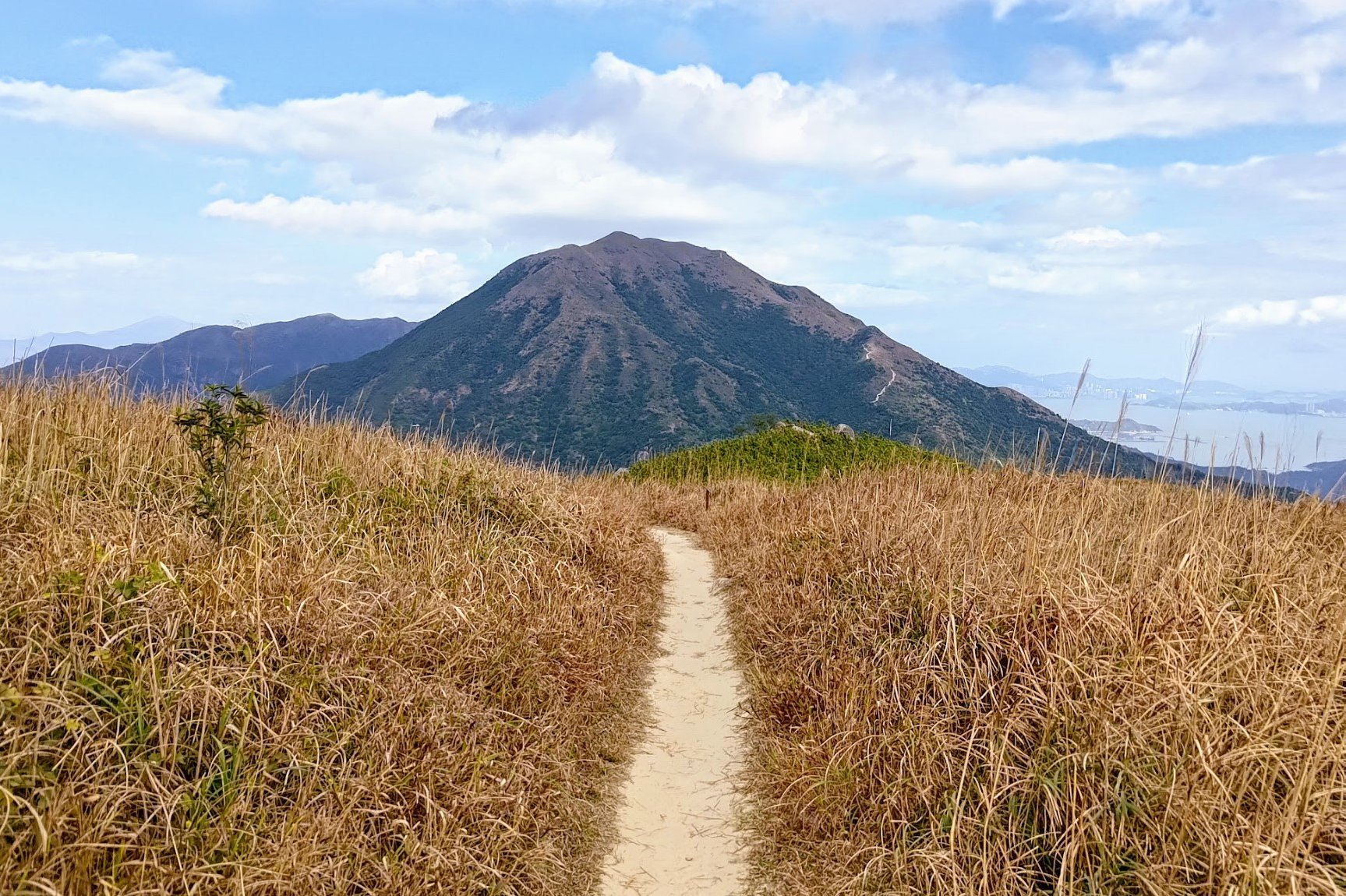
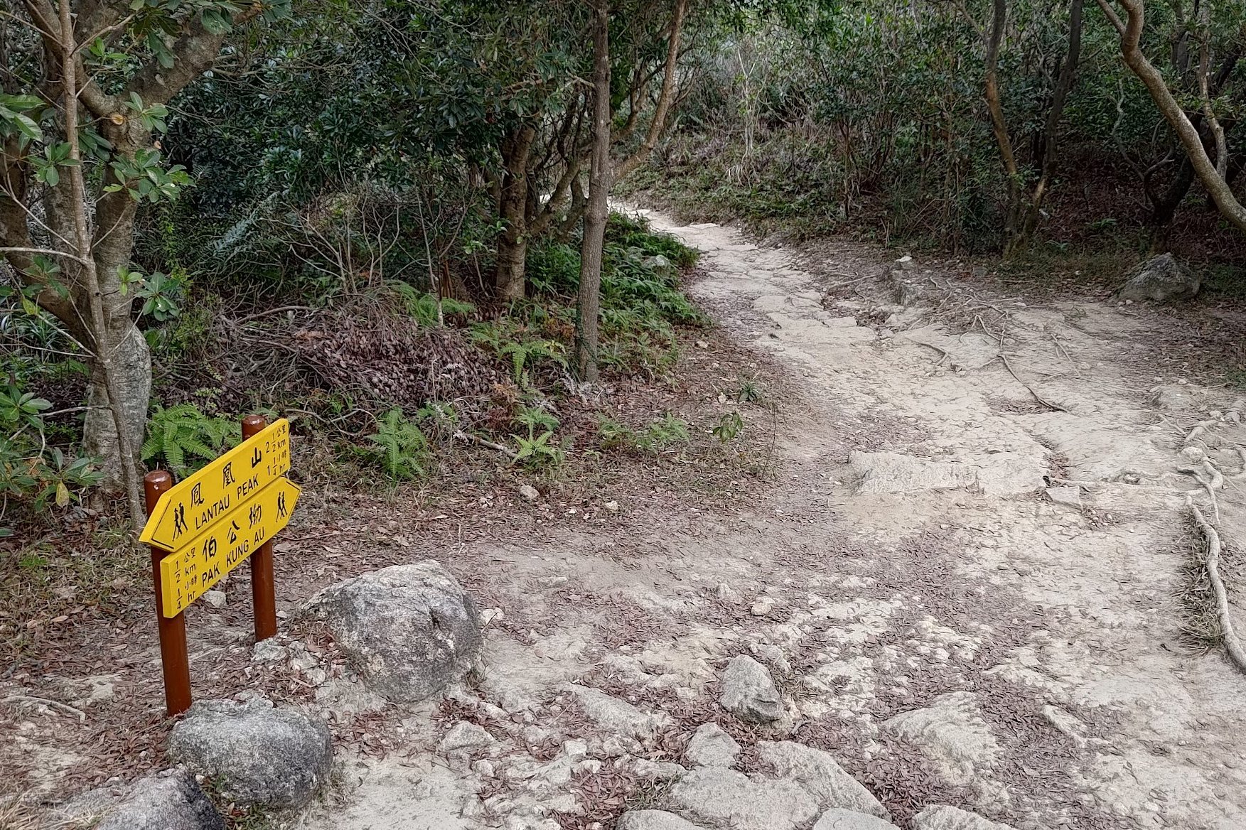
After the West Dog's Teeth summit, you'll begin climbing up Lantau Peak. The climbing here gets really steep and considering how much you've already climbed up to this point, it might feel especially tough.
But don't worry. If you're really too tired to keep going, about 30 minutes of fast climbing later (it may take you longer), you will come across a yellow sign pointing to Ngong Ping. This is where the Big Buddha is and can be a nice side excursion if you decide to end your hike early.
It should take about 30 minutes to reach the Big Buddha from this part of the trail.
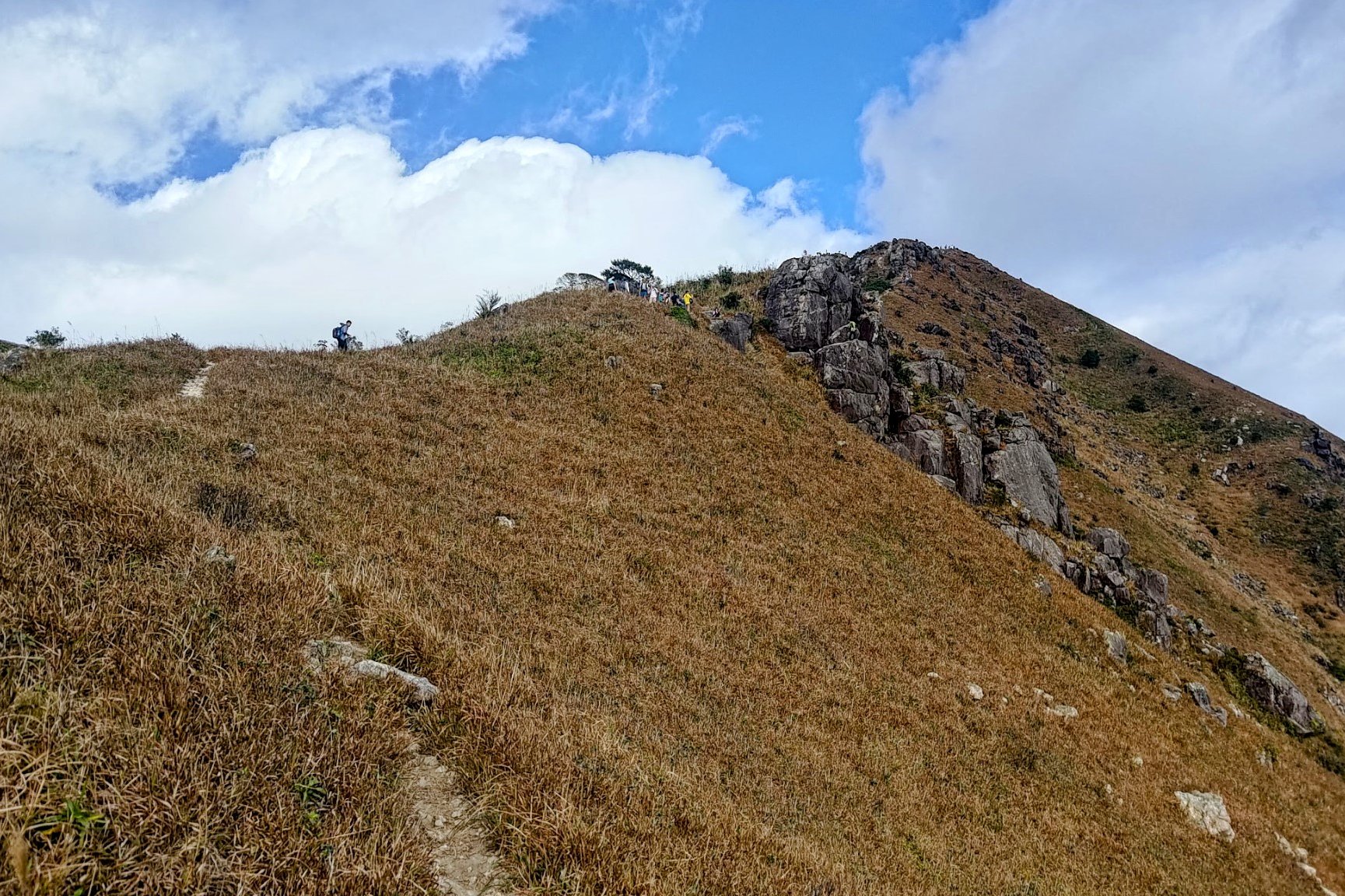
If you have the energy to keep going, it'll be another 30 minutes of tough climbing to the top of Lantau Peak.
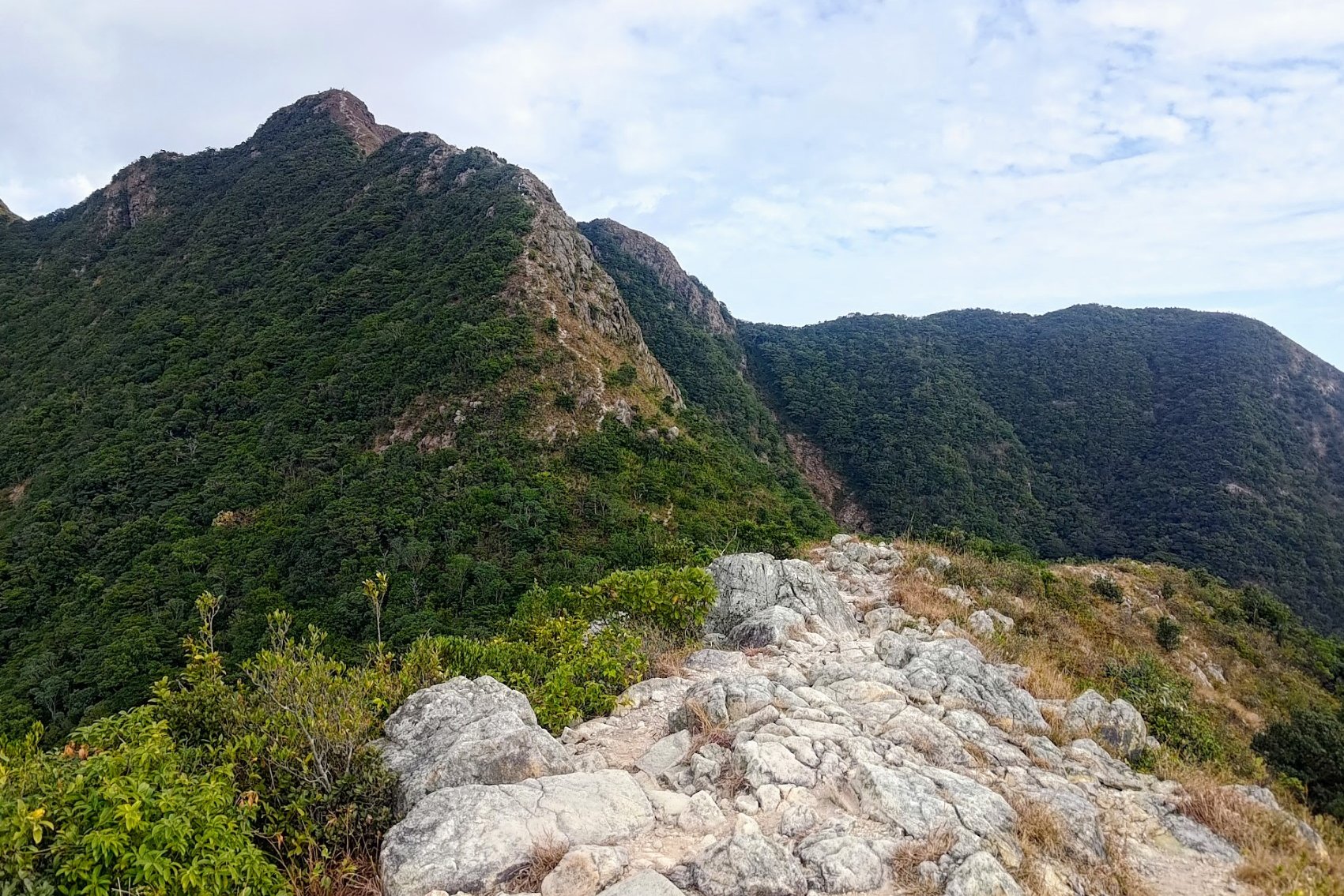
Hiking to Lantau Peak Summit
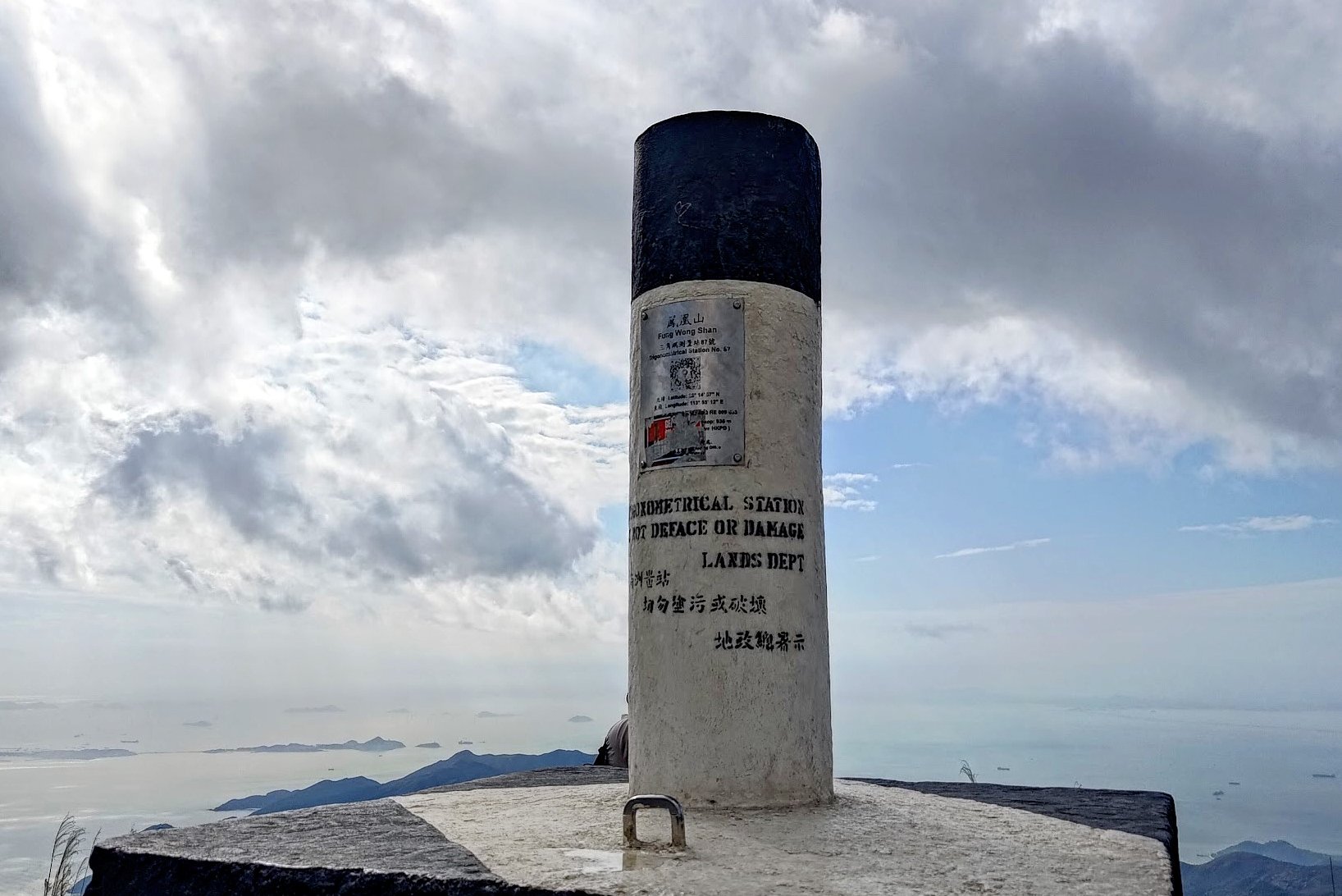
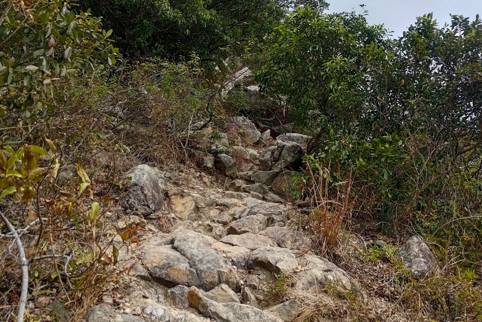
This is one of the hardest parts of the hike even though the terrain gets much easier to navigate.
Almost the entire climb takes place on stairs and really tests your endurance - especially on a hot day. Fortunately, the views just keep getting better as you begin to get glimpses of Sunset Peak in the distance.
The summit is marked by a black-and-white trigonometric point, as is typical of almost all of Hong Kong's important summits.
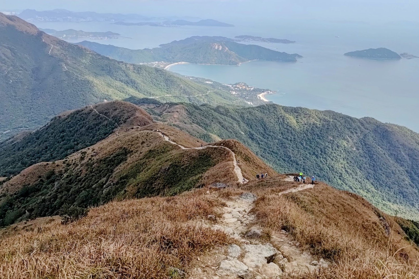
You will have the option here to either hike down to Ngong Ping (Big Buddha) or to Pak Kung Au, which is the way I picked.
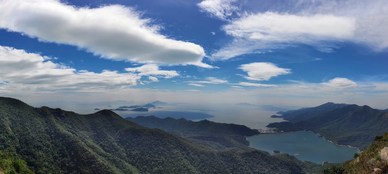
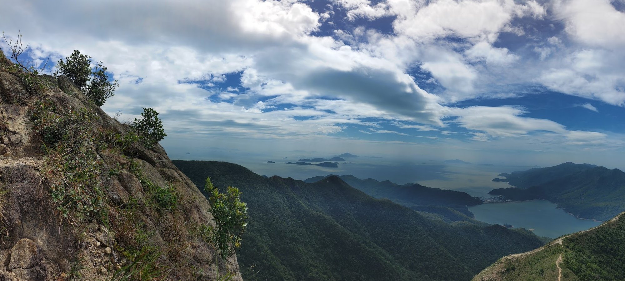
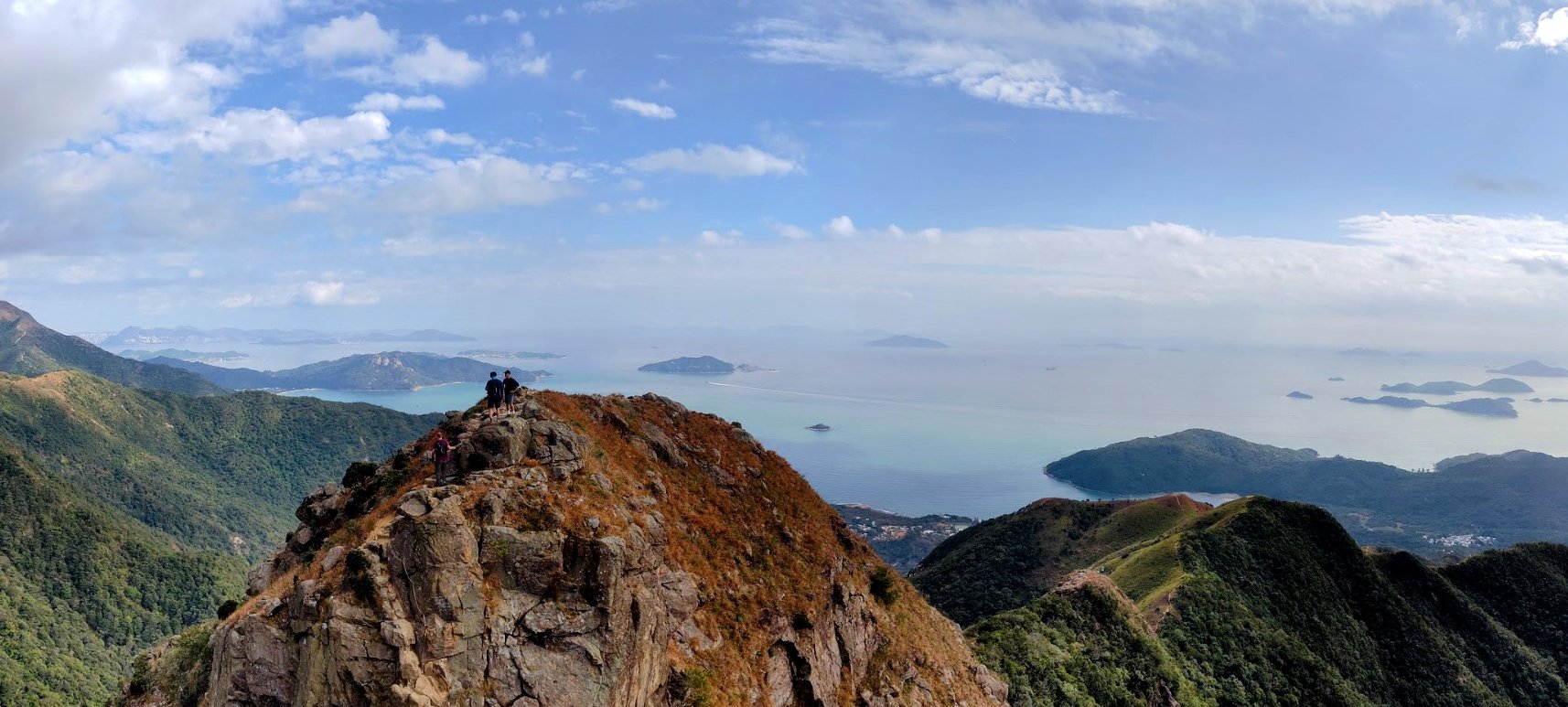
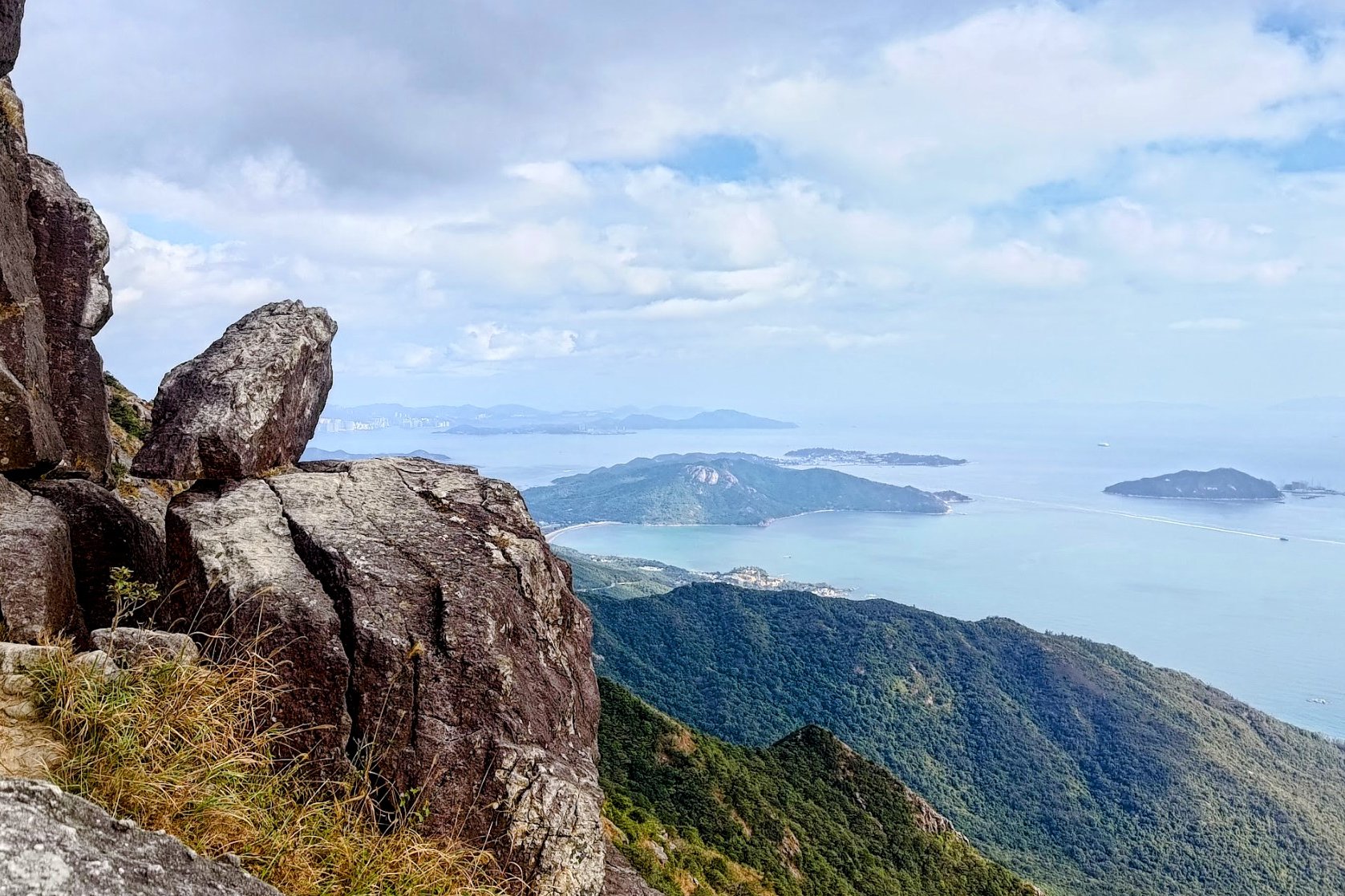
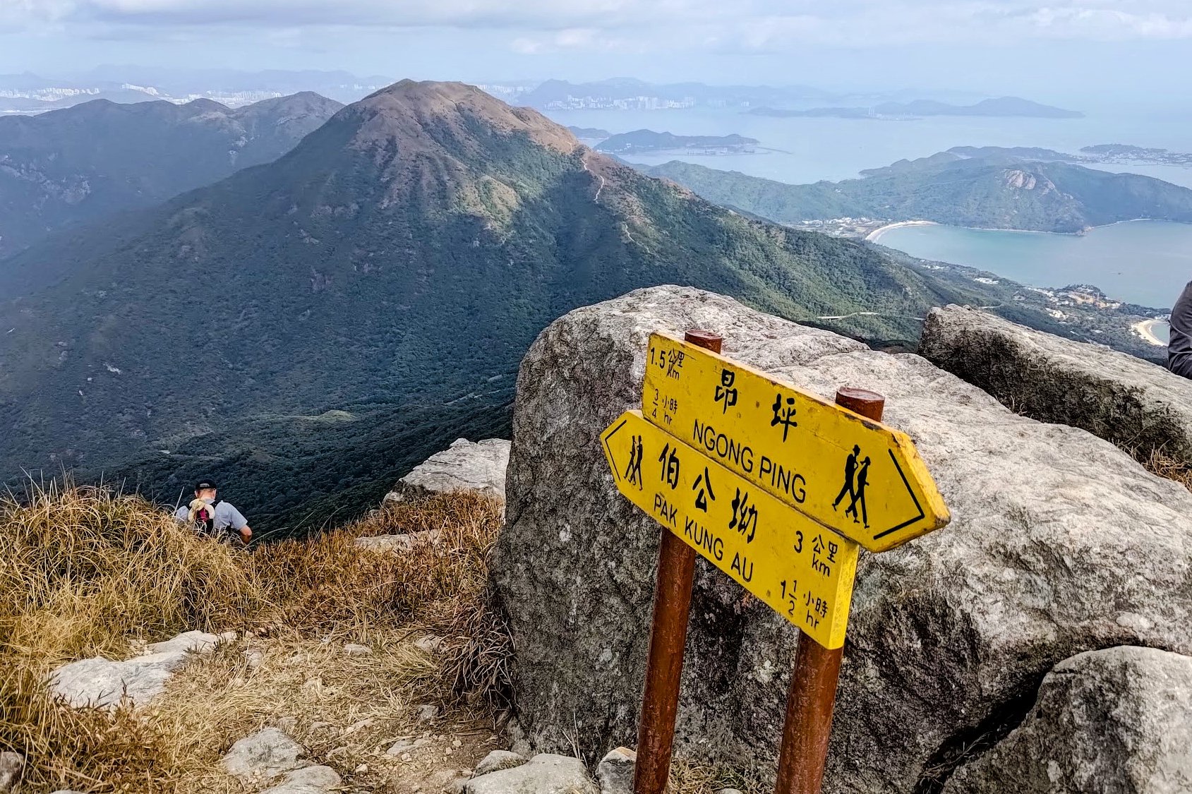
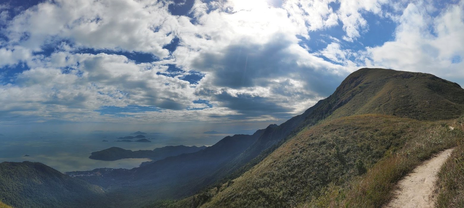
Lantau Peak Views
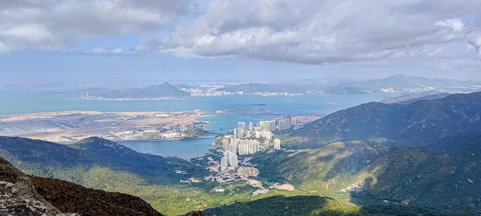
This, in my opinion, is one of the most scenic viewpoints in all of Hong Kong! Take some time to enjoy the fruits of your labor before beginning your descent, which is MUCH easier than the climb up.
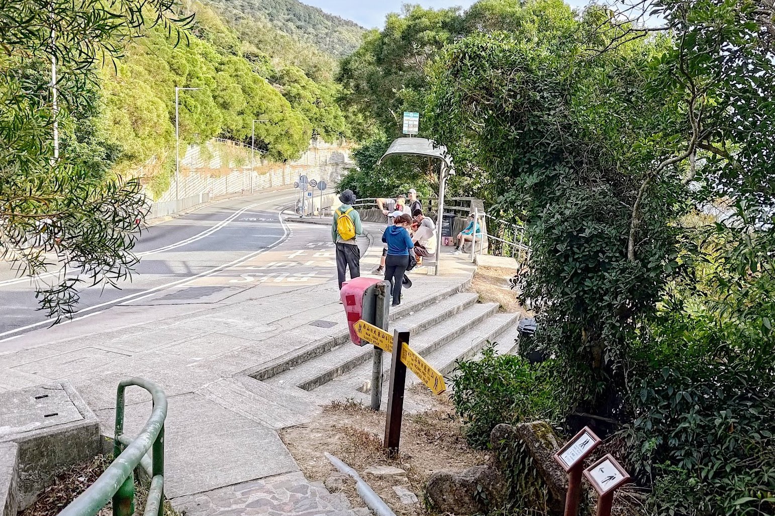
Descending to Pak Kung Au Bus Stop
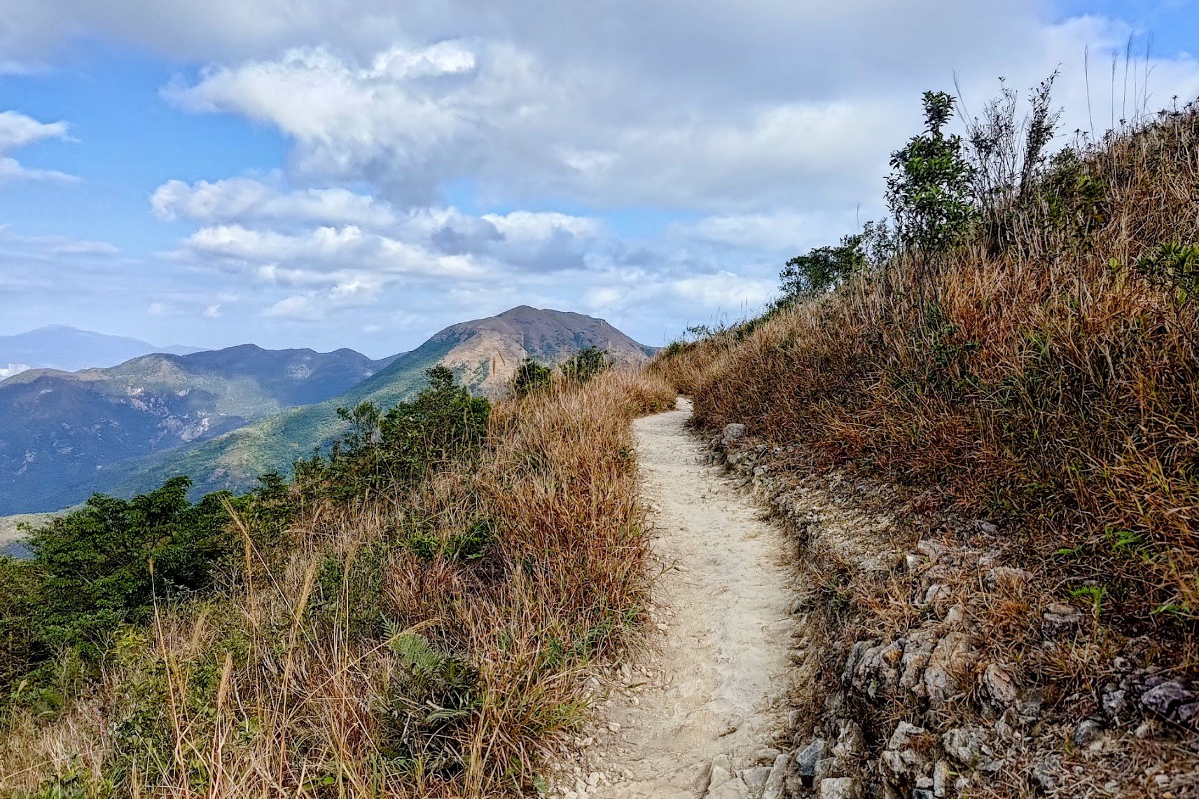
The descent down to Pak Kung Au takes at least an hour, which might seem like a long time, but it's one of the most pleasant and scenic portions of the hike.
There are a few steep downhill portions, but the path is clear and well-defined. You can literally switch off your brain and just follow the trail all the way to the bottom.
The ocean and mountain views on the way to Pak Kung Au are some of the best vistas of the whole trail, which makes the time pass much quicker since this isn't your typical boring downhill section.
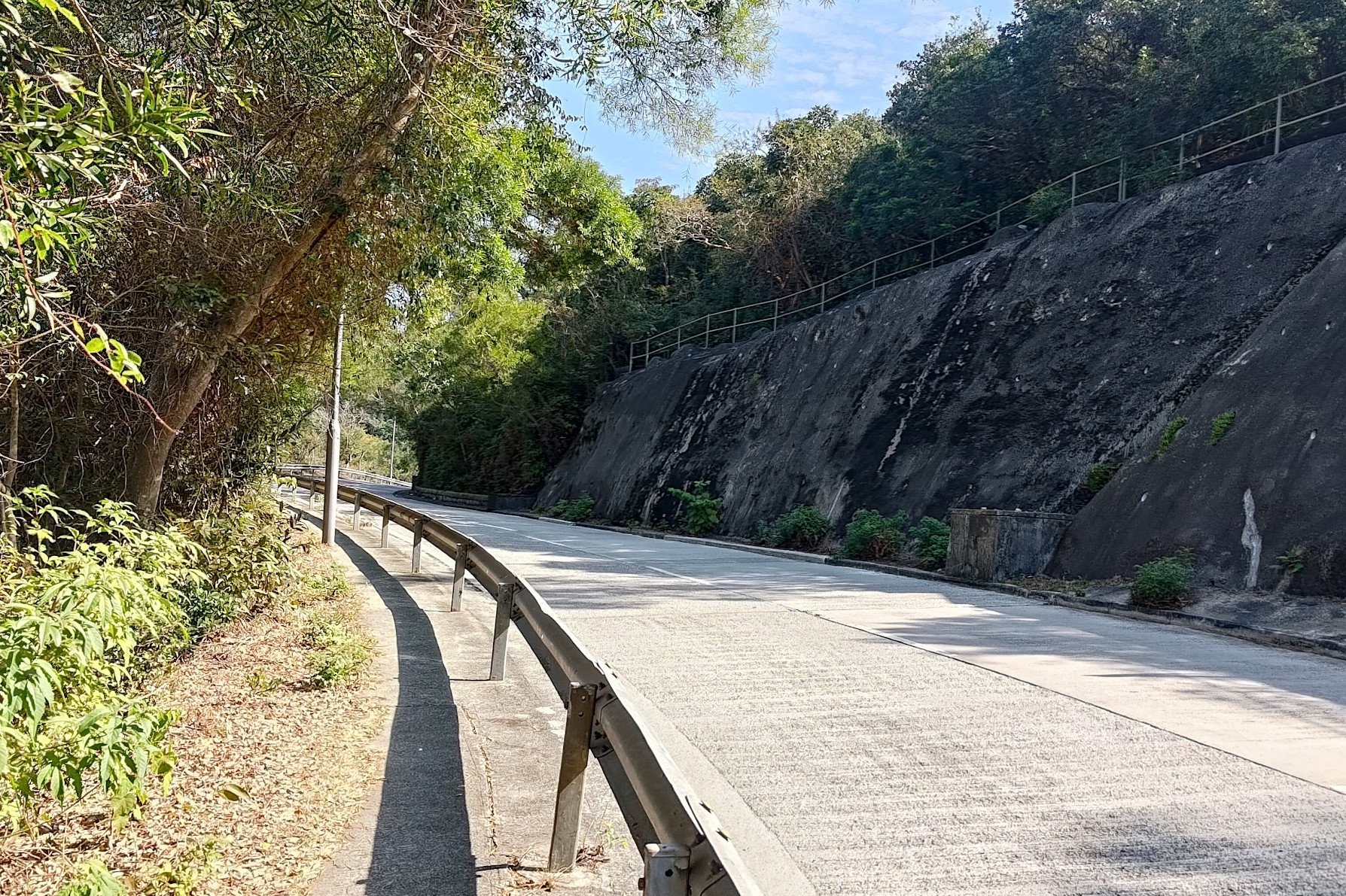
Just be sure to follow the yellow sign to Pak Kung Au once you get into the forested area. After that, you'll simply need to follow the path for another 15 minutes or so before arriving directly at the bus stop!
Getting Back
From the Pak Kung Au bus stop, you can take 3M or the 11 bus to Tung Chung Town Centre.
If you cross to the other side of the road, you can take the 3M in the opposite direction to Mui Wo Ferry Pier or the 11 bus to Tai O Fishing Village.

