Ngong Ping Rescue Trail Hike: A Pilgrimage to Lantau’s Big Buddha
Contents
- Essential Information
- Hike Highlights
- Google Route Map
- How to Get There
- Quick Route Summary
- Detailed Route
- Hau Wong Temple (Optional Detour)
- Crossing Tung Chung Bay
- Tung Chung Bay Views
- Going Above Skyrail Tower 3 (Optional Detour)
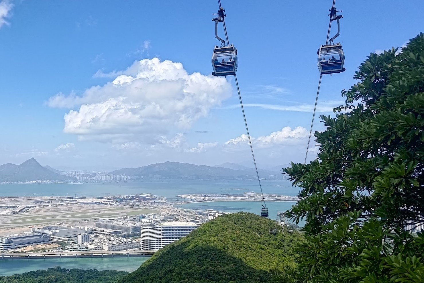
- Hong Kong Airport Views
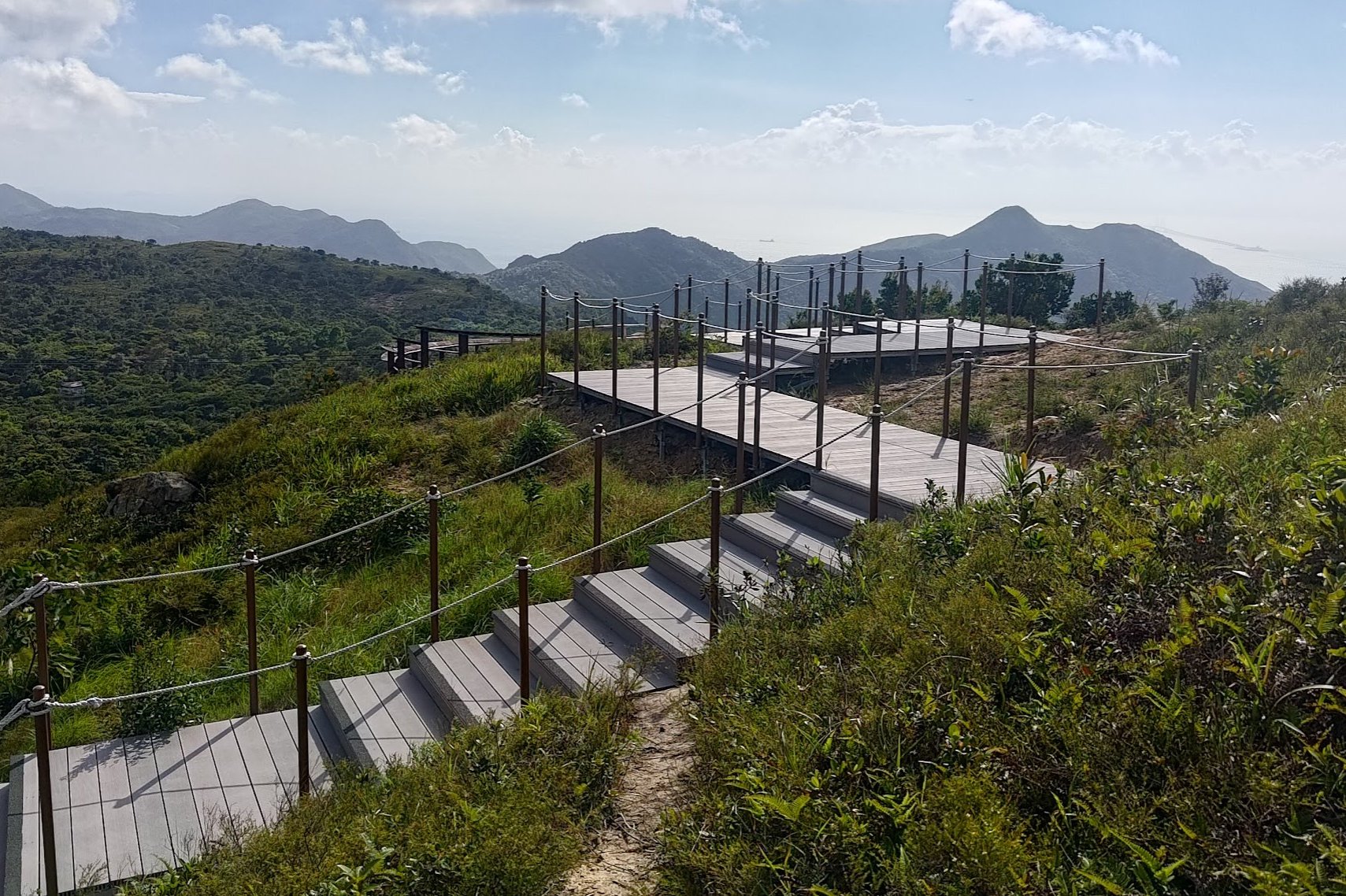
- Unique Wooden Staircase
- Ngong Ping Overlook (Optional Detour)
- First Glimpses of the Big Buddha
- Final Stretch
- Nei Lak Shan (Optional Detour)
- Getting Back
Essential Ngong Ping Rescue Trail Hike Details
- District: Lantau
- Duration: 2.5 - 3 hours (from Tung Chung Station)
- Distance: 8.5km (with a few detours)
- Highest Elevation: 600ish meters
- Difficulty: 3.5/5
- Facilities: None. Stock up on supplies and use the toilet before the hike
Why Hike the Ngong Ping Rescue Trail?
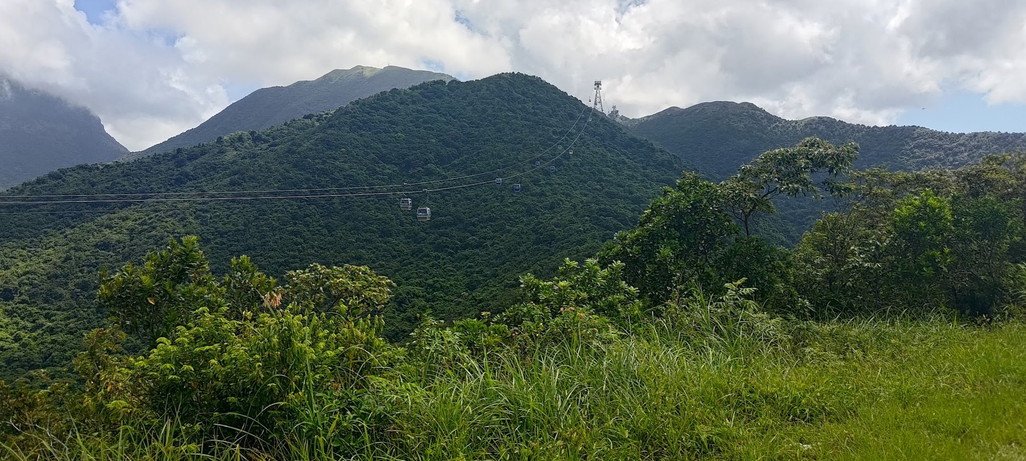
The Ngong Ping Rescue Trail (昂平360維修棧道) is a true test of cardio and one's tolerance of stairs. That being said, your efforts will be rewarded handsomely with incredible views over Tung Chung Bay, Hong Kong International Airport and a collection of mountains before the Big Buddha comes into view.
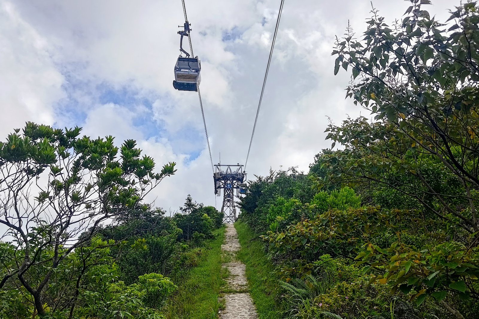
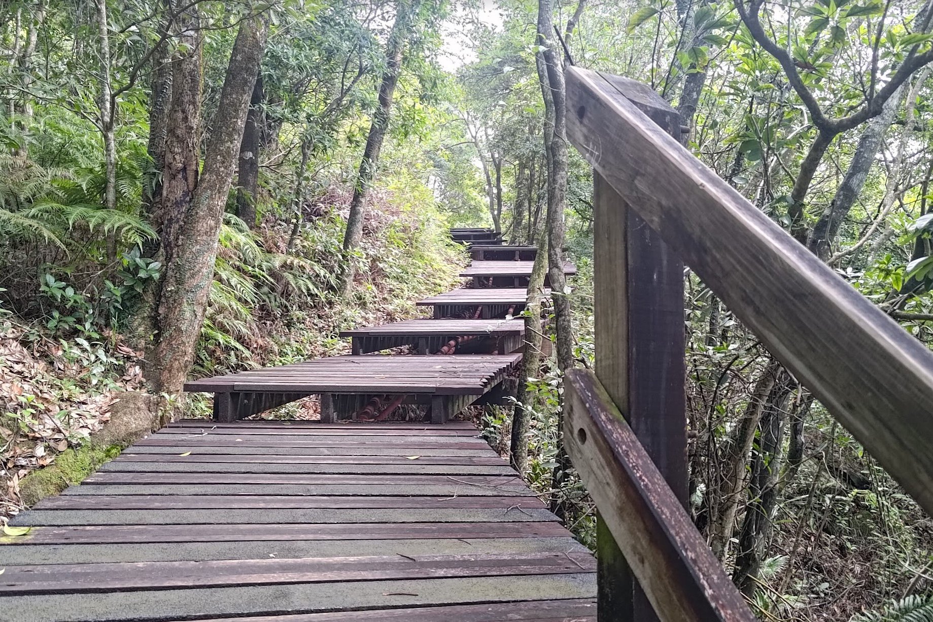
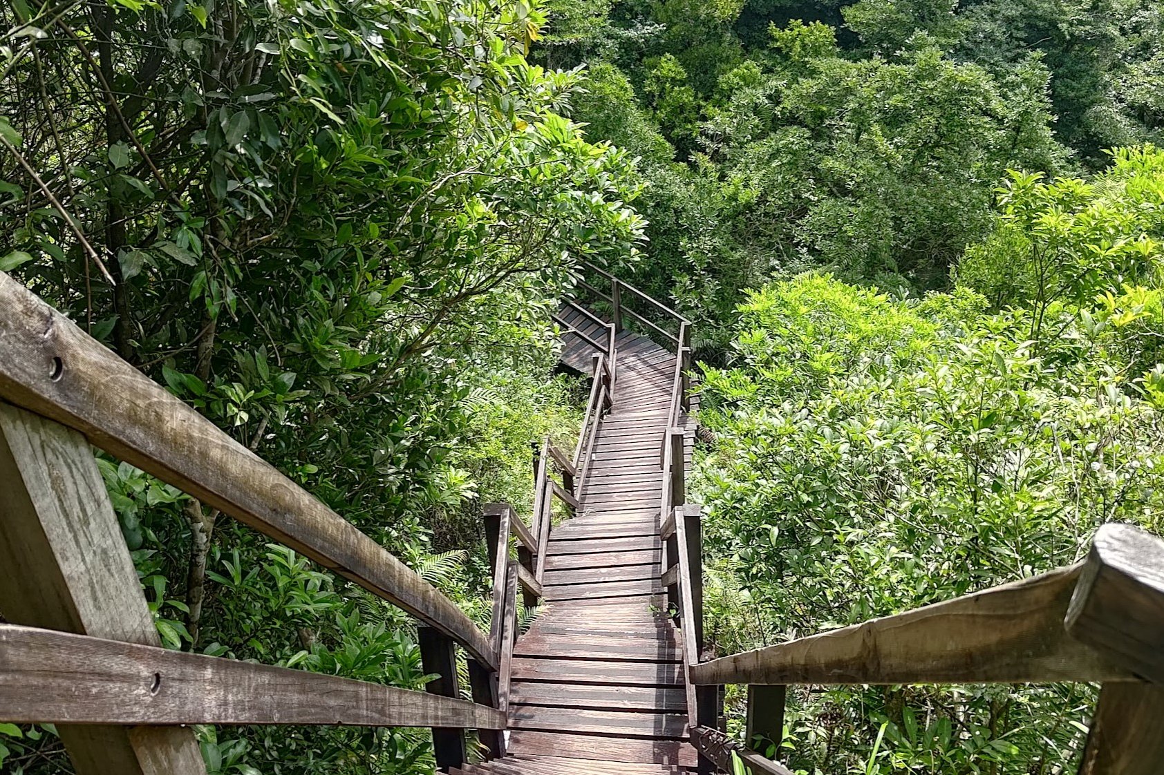
The trail is also quite unique as there are wooden walkways half way through that somehow make the experience feel more exciting.
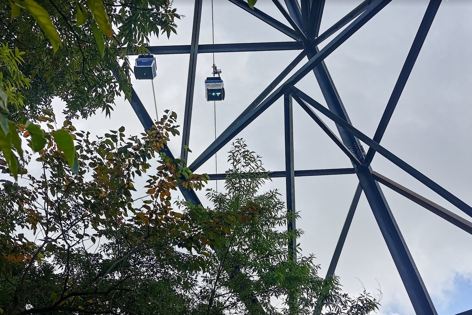
Another quirk of the trail is that you'll be walking right underneath the Ngong Ping 360 cable cars, which means if you look up, you'll often see people being transported effortlessly from the start point of the hike directly to the end point.
It's either really motivating or depressing depending if you're a glass half full or half empty kind of person.
But this wouldn't be a true pilgrimage without a bit of struggle. Who knows, maybe the Big Buddha will appreciate your toil and bless you with some good luck!
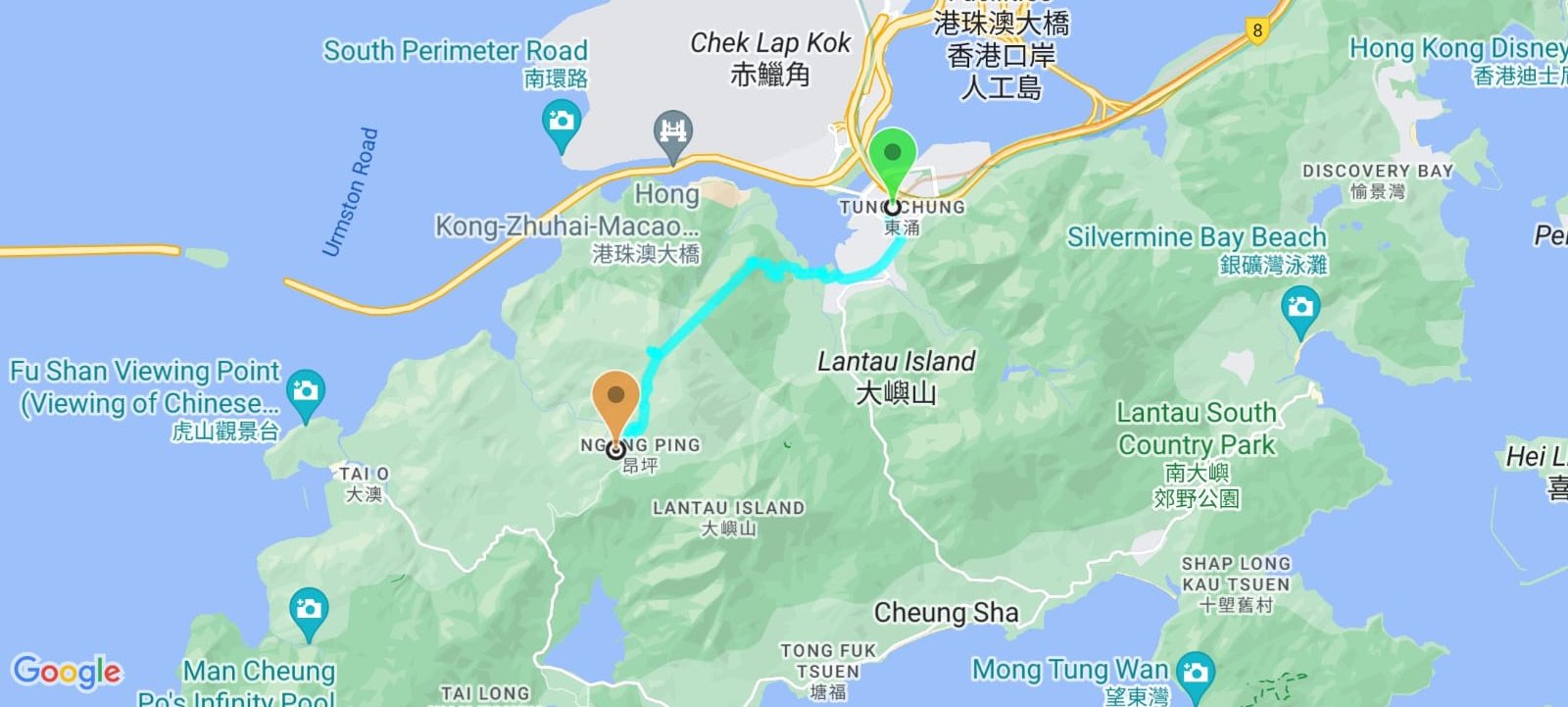
Google Route Map
How to Get to the Ngong Ping Rescue Trail Hike Start Point
By MTR
Take the train to Tung Chung MTR Station. The hike instructions begin from there.
By Bus
Should you take a bus, you can get off at Tung Chung Fire Station to save about 5 minutes of walking time.
Here are a few buses that go to Tung Chung Fire Station:
Quick Ngong Ping Rescue Trail Hike Route Summary
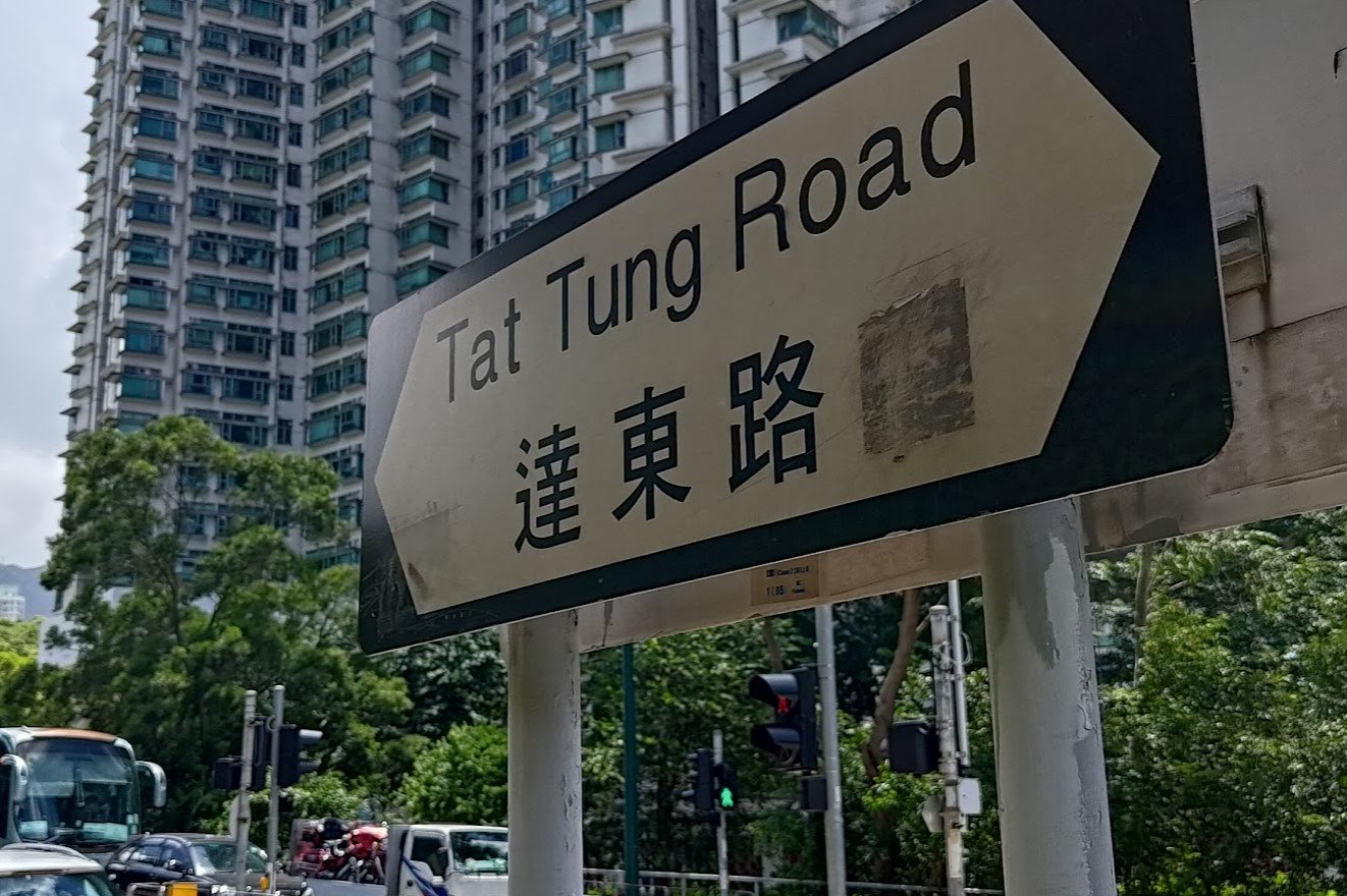
- From Tung Chung MTR Exit A, cross the street and turn right at Tat Tung Road
- When Tat Tung Road intersects Shun Tung Road, head left
- Turn right at the Lantau Police Station (Yu Tung Road)
- Follow Yu Tung Road, taking the footbridge
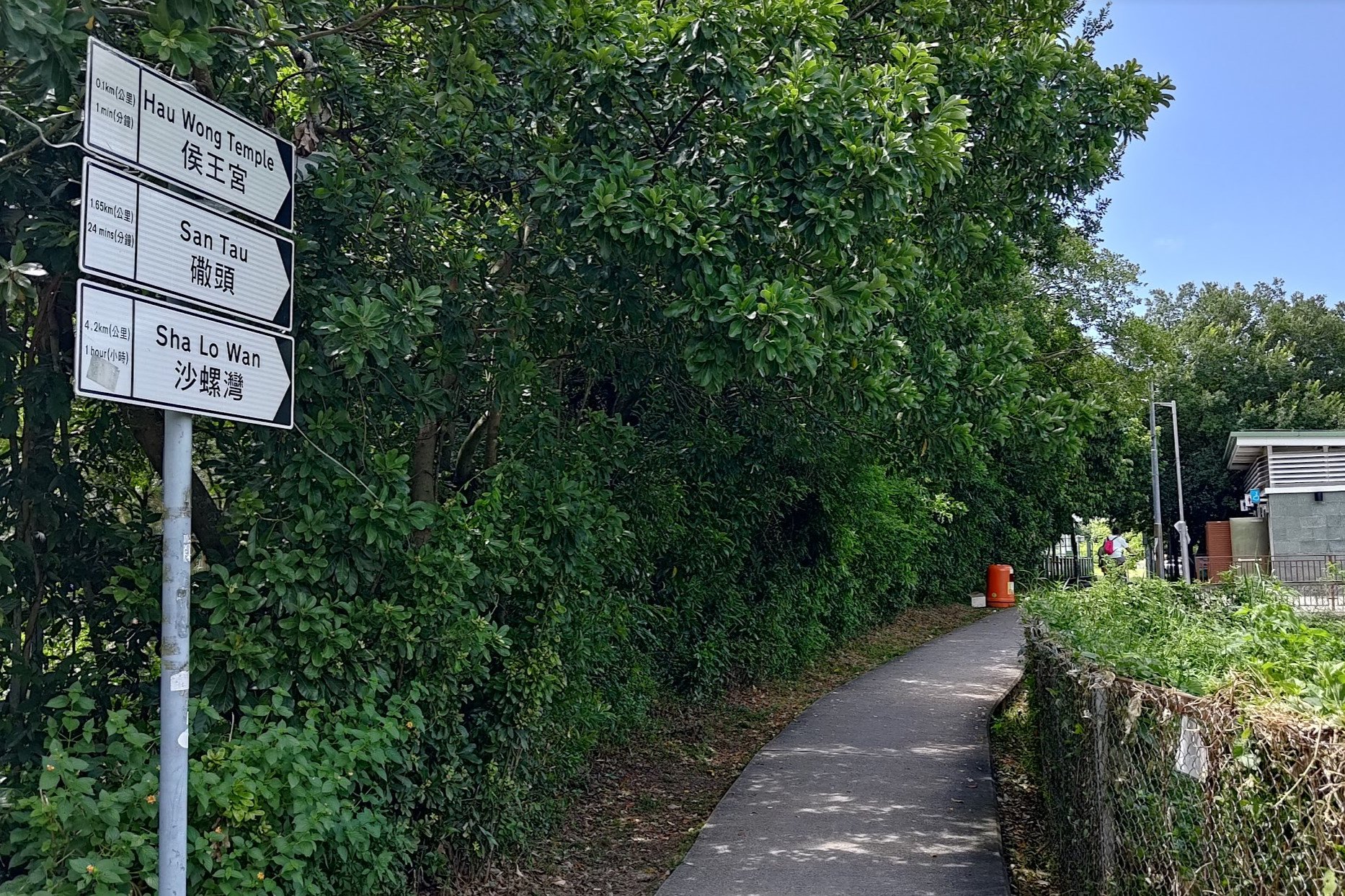
- At the second footbridge (do not climb it), head down the concrete path to your right
- Take the left fork on the concrete path and go past the 'Hau Wong Temple' sign
- Stay on the concrete path and don't enter the field area (unless you want to check out the temple)
- Cross the Tung Chung Hau Wong bridge and keep following the concrete trail
- Take the stairs to your left after going past the village fields and village houses
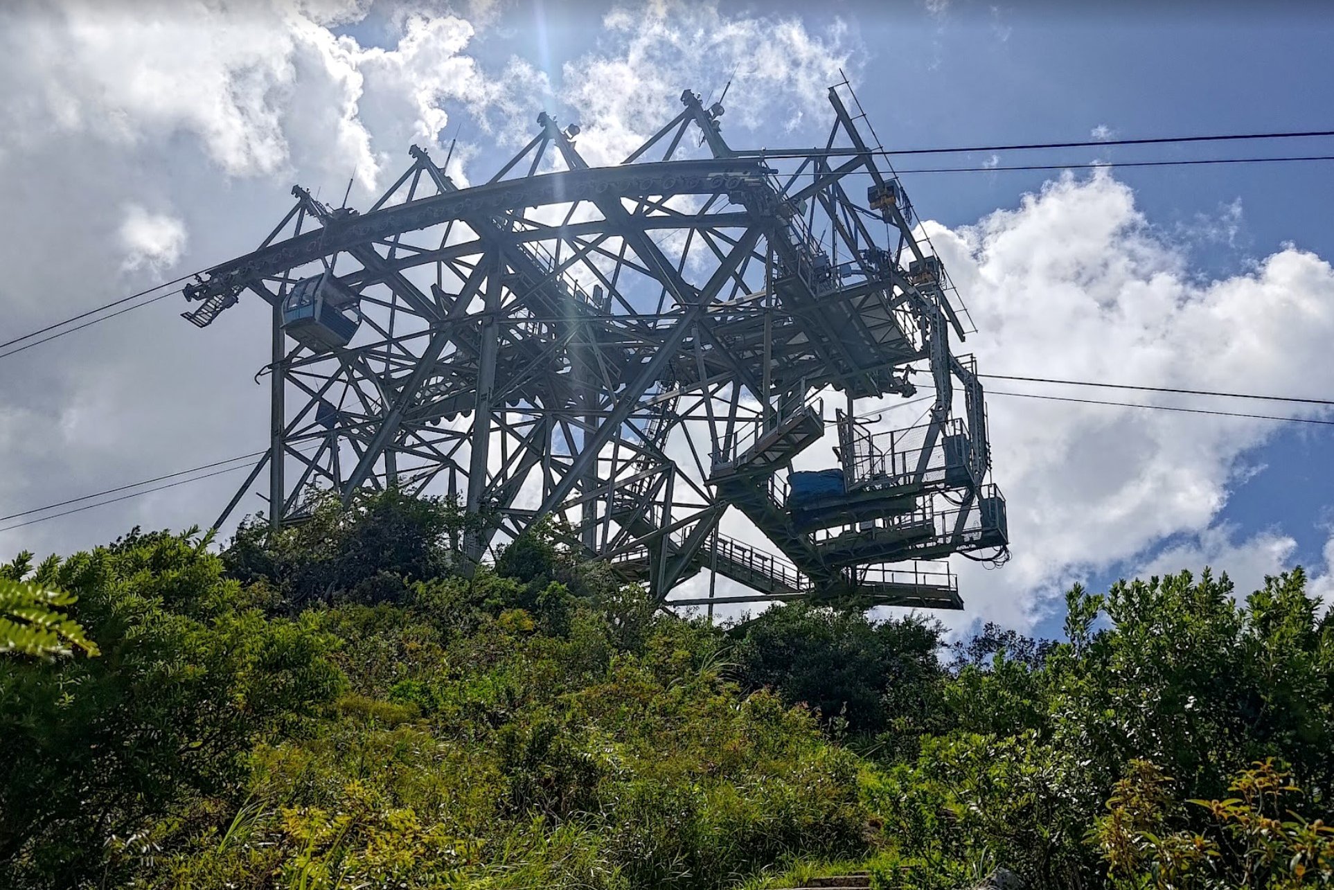
- Climb some very steep stairs to Ngong Ping Skyrail Tower 3
- Take the wooden stairs heading down
- 30 mins later, you'll pass under another cable car tower
- Climb the wooden stairs upward until you arrive at the 'Angle Station' (optional detour to Ngong Ping 360 Midpoint Overlook)
- Follow the trail downward for 20 minutes and follow the 'Ngong Ping Village' sign
- Follow the trail to Ngong Ping. There's a hidden optional detour to Nei Lak Peak, which reconnects back to the trail
From Tung Chung Station to Tung Chung Bay
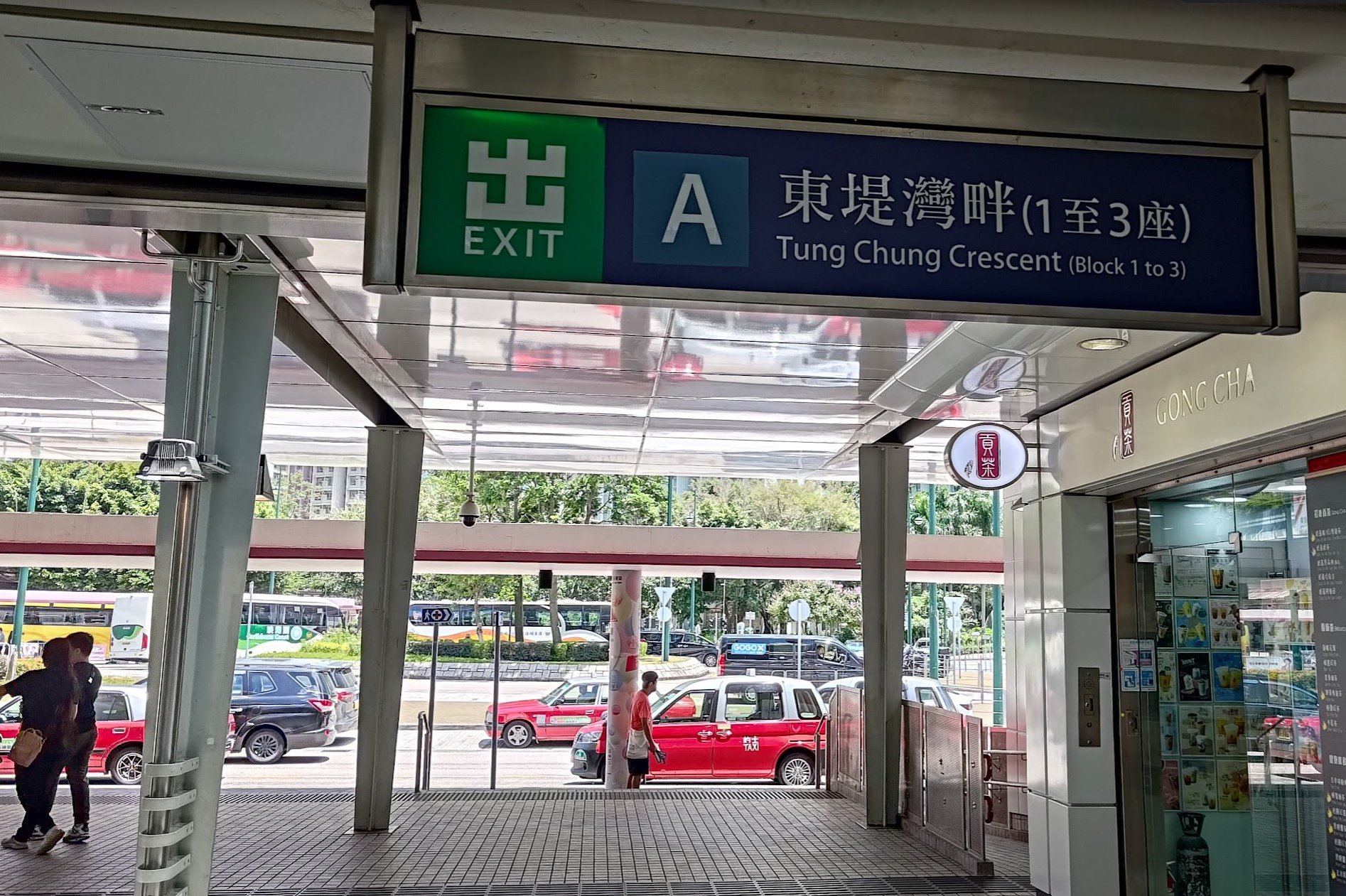
After arriving at Tung Chung MTR station, take Exit A and cross the road just outside it.
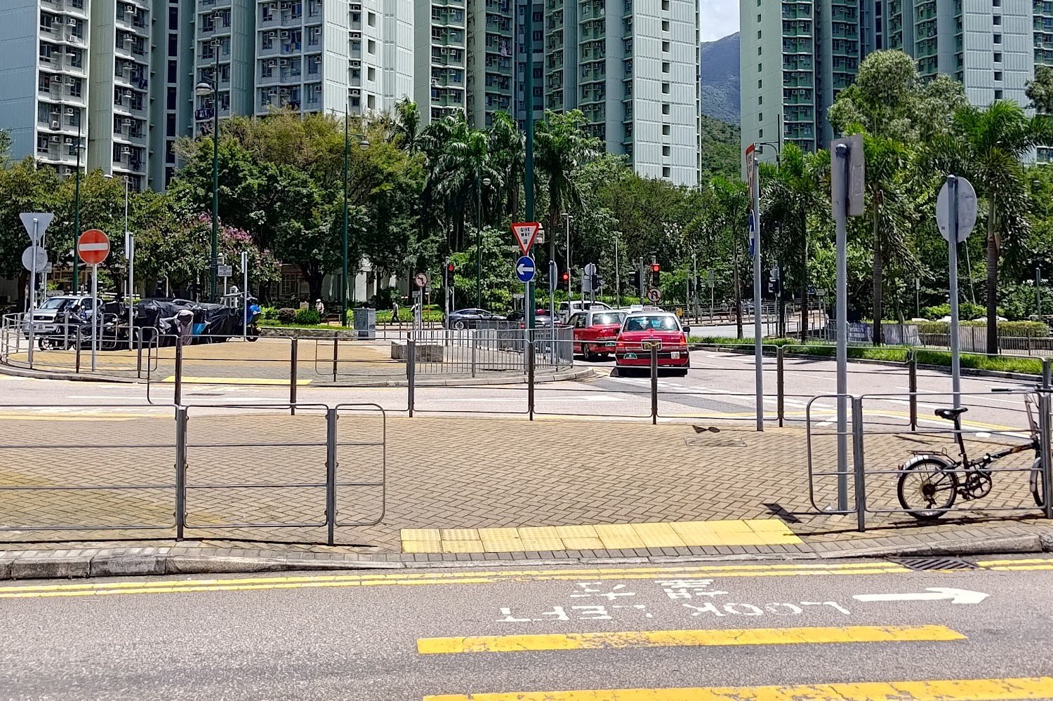
You'll soon reach Tat Tung Road, at which point you should turn right. Walk up Tat Tung Road until it intersects with Shun Tung Road.
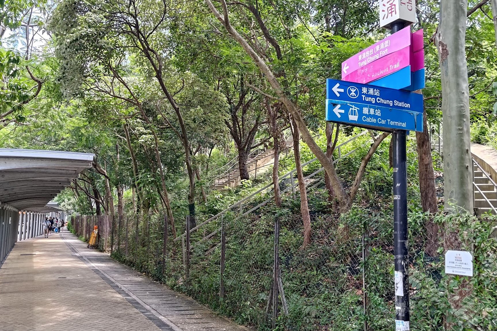
Follow the pink sign to 'Tung Chung Fort' at Shun Ting Road (This is where the Tung Chung Fire Station bus stop is).
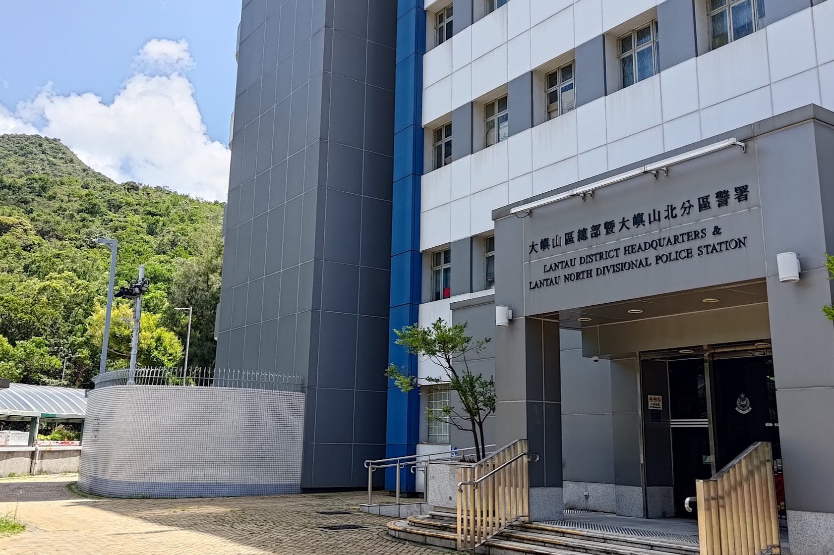
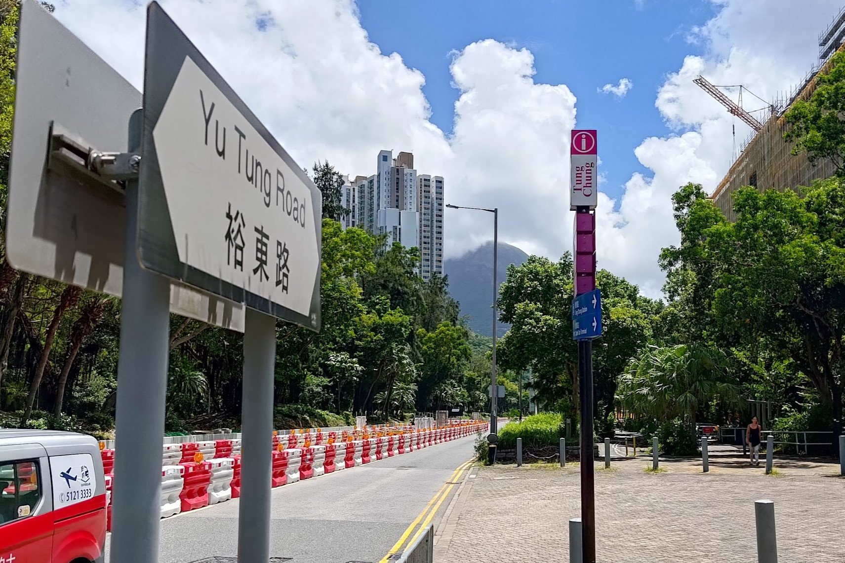
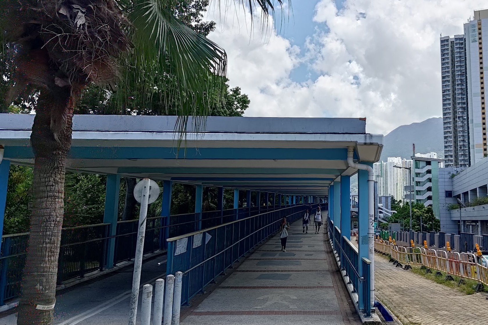
A few minutes later, you will see the Lantau North Divisional Police Station. Walk around it and follow Yu Tung Road for about 5 minutes before taking the footbridge.
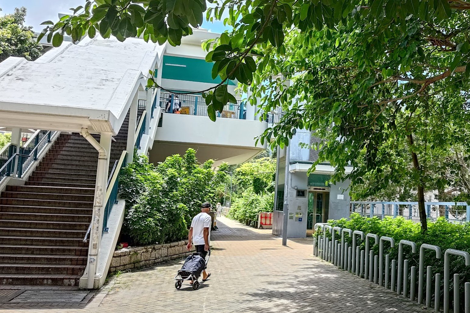
Stay on Yu Tung Road until you see a second footbridge. Don't climb that one. Instead, take the flat road past it and you'll soon see a concrete path heading down to the right that leads to Tung Chung Bay.
Shrines and Signs
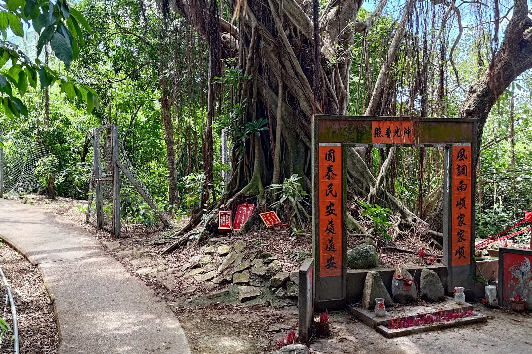
After taking the concrete path, it'll fork almost immediately. Take the path on your left and keep following it as it takes you past a sacred tree with a small shrine beside it.
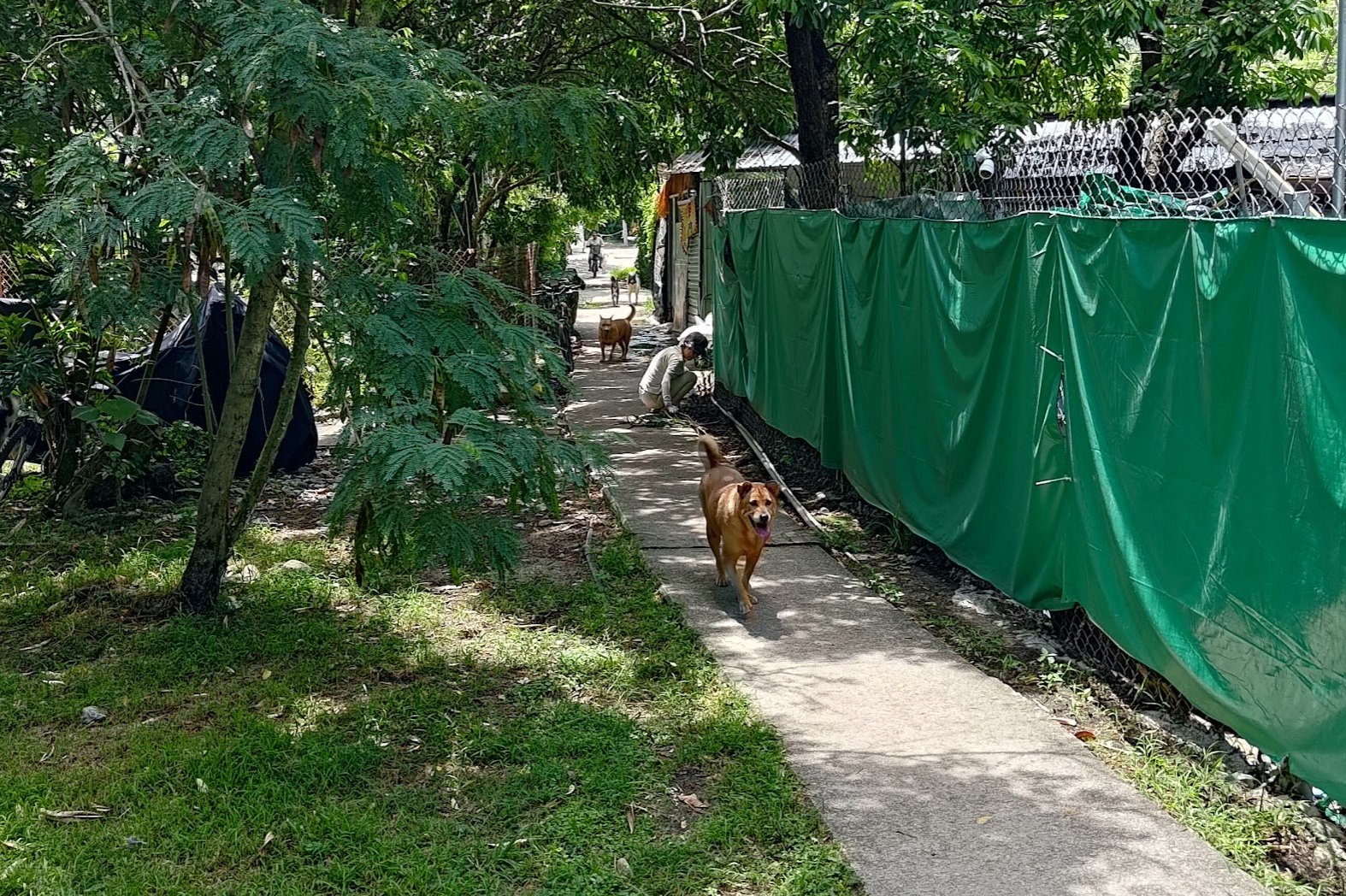
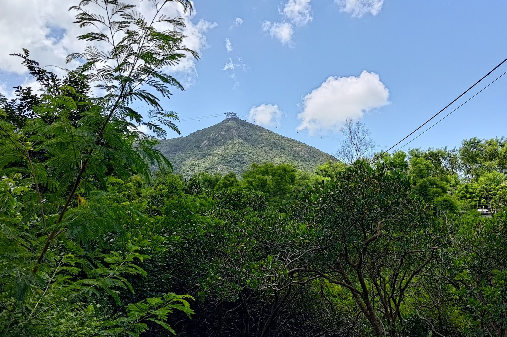
You'll soon walk through a small village before views of the cable cars high up in the mountains appear through the trees. Pretty soon, you'll be up there, as well!
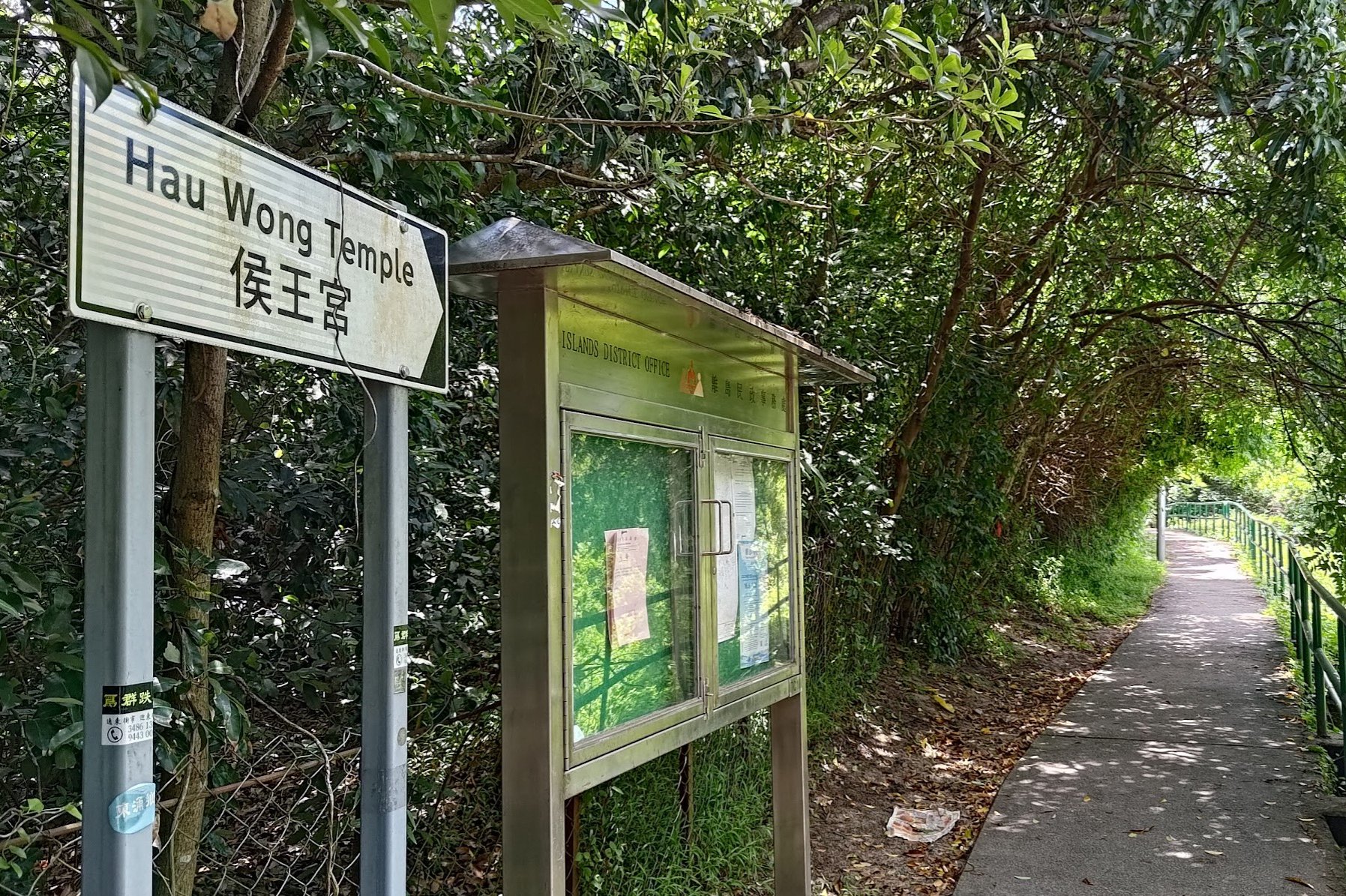
For now, though, stay on the concrete path and follow it past two signs pointing you in the direction of 'Hau Wong Temple'
Hau Wong Temple (Optional Detour)
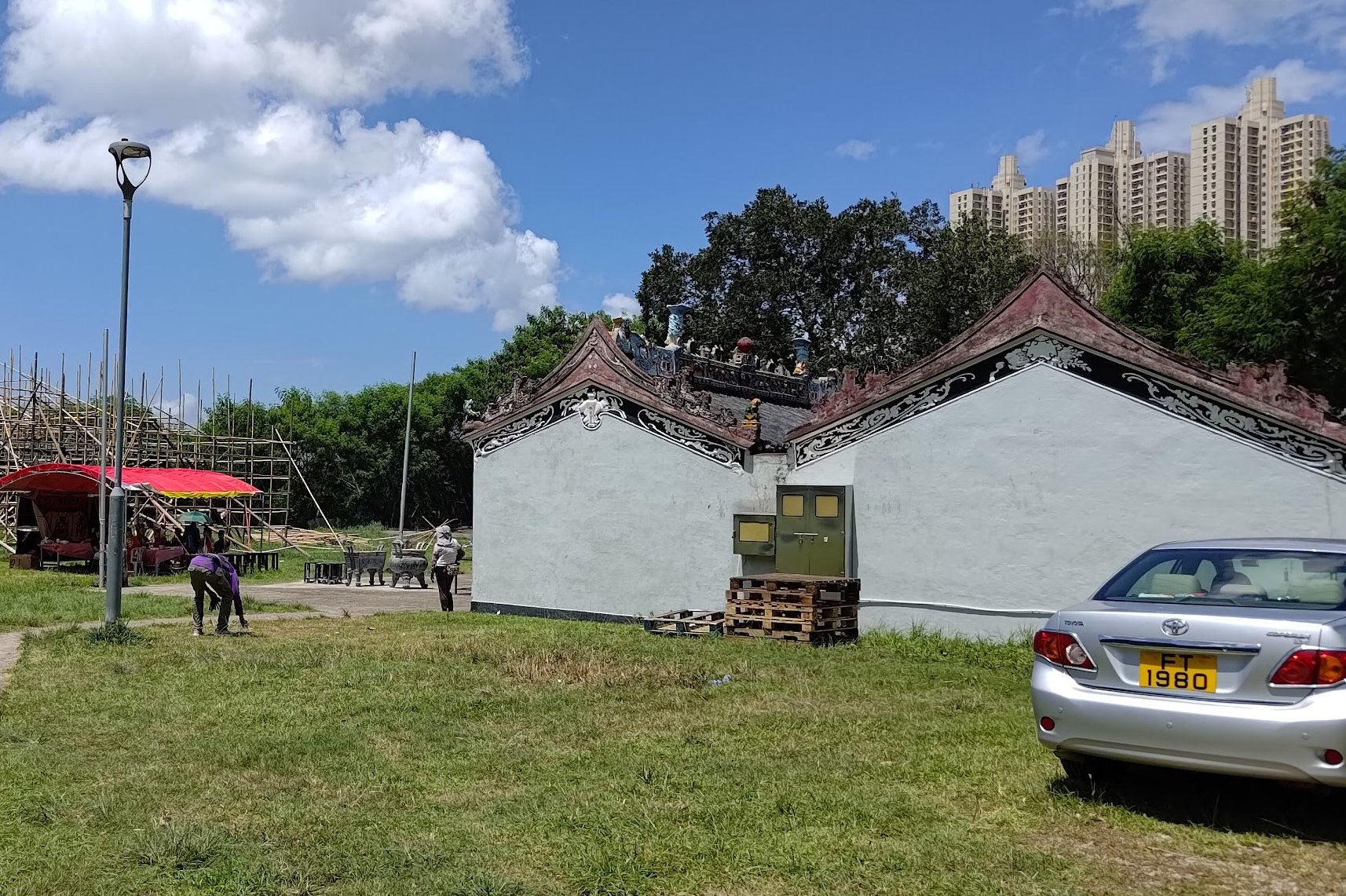
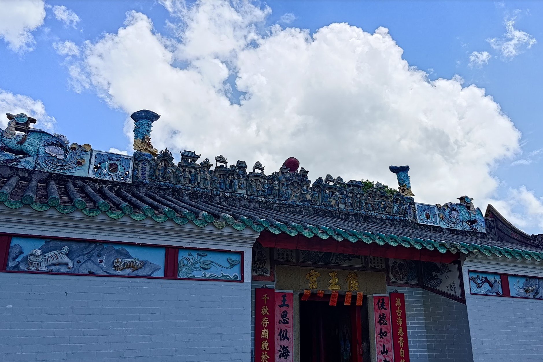
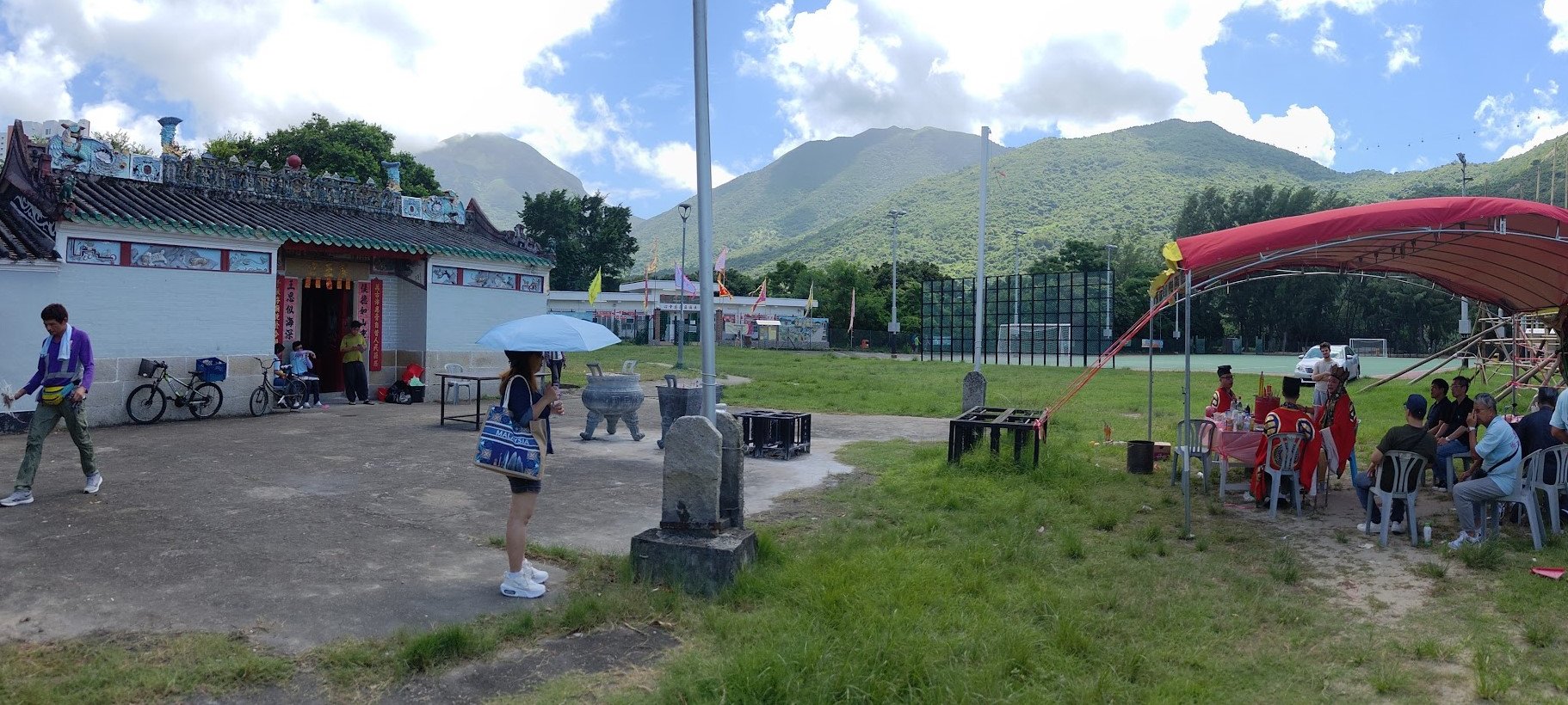
When you arrive at the field with the football pitch next to it, you can enter and check out the Hau Wong Temple.
It's a really small detour and totally worth taking a look at. While I was exploring the temple, there was a traditional ceremony going on.
Once you're done exploring, head back out and follow the trail beside the park's fence.
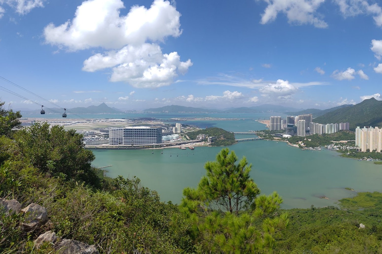
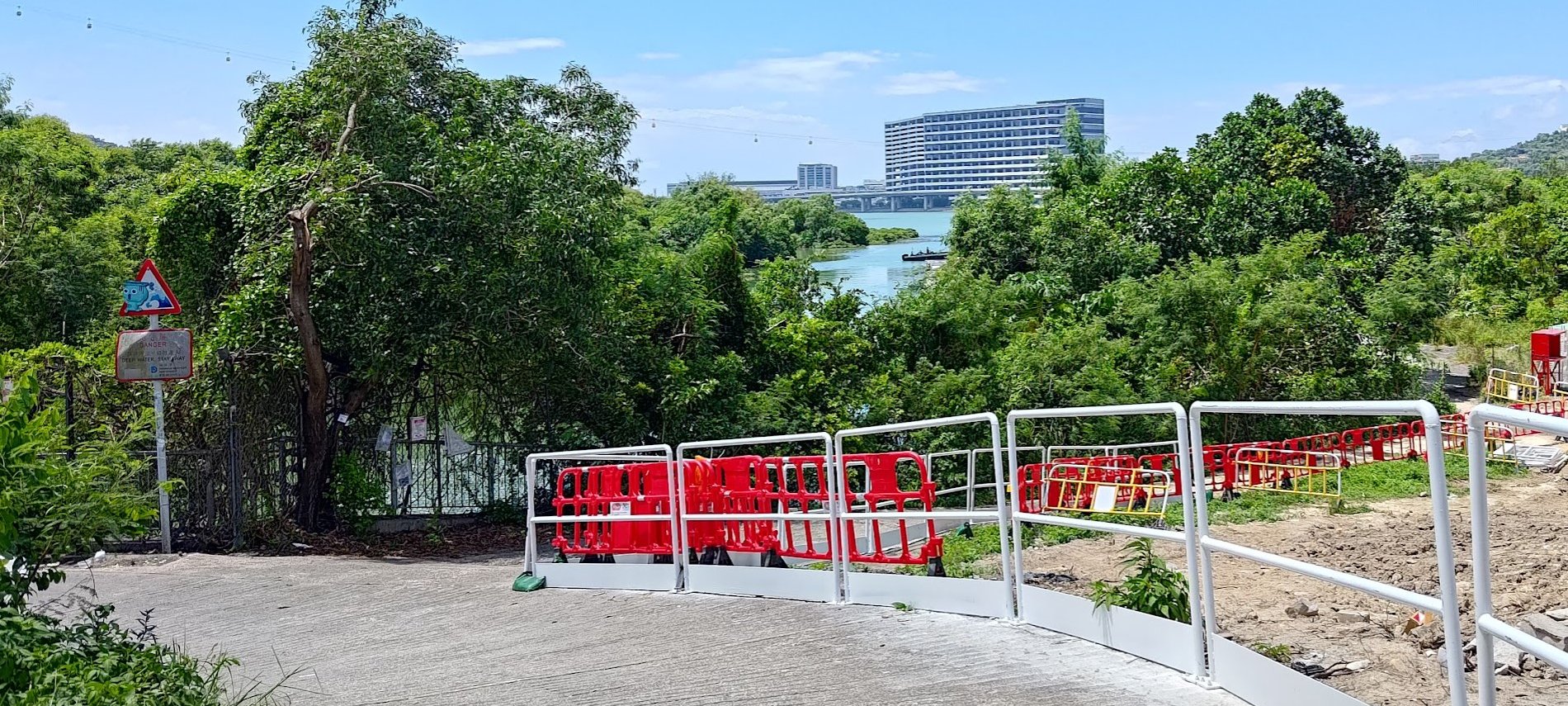
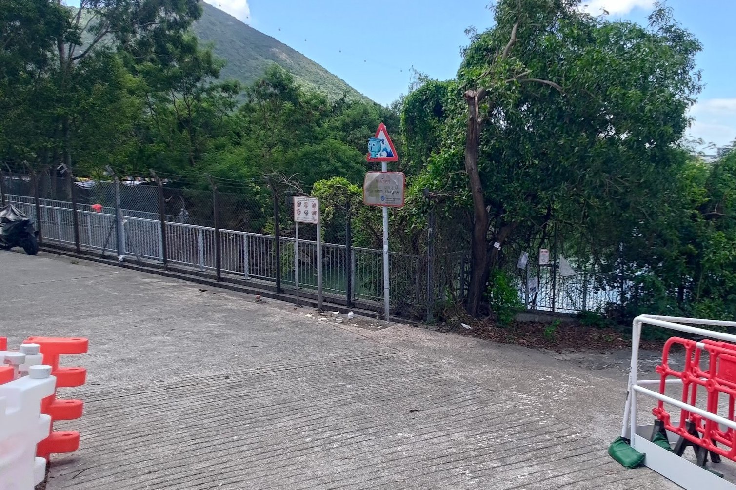
Crossing Tung Chung Bay
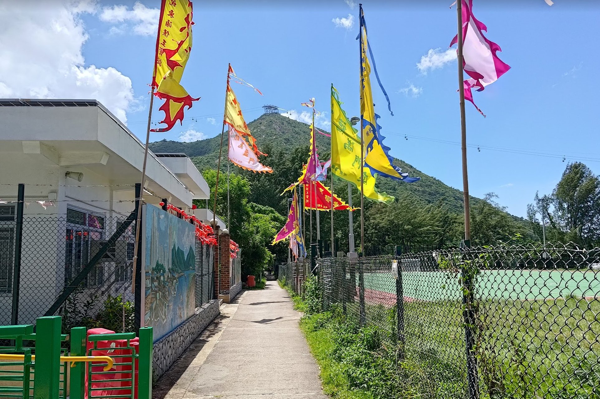
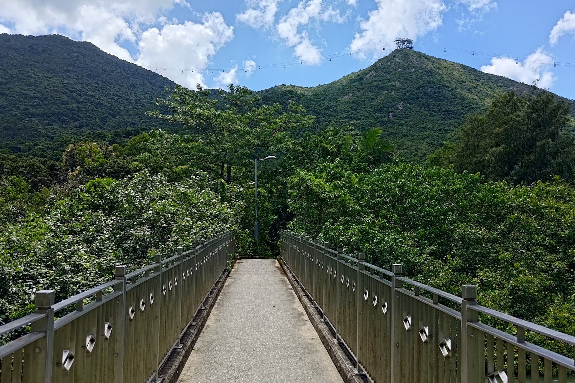
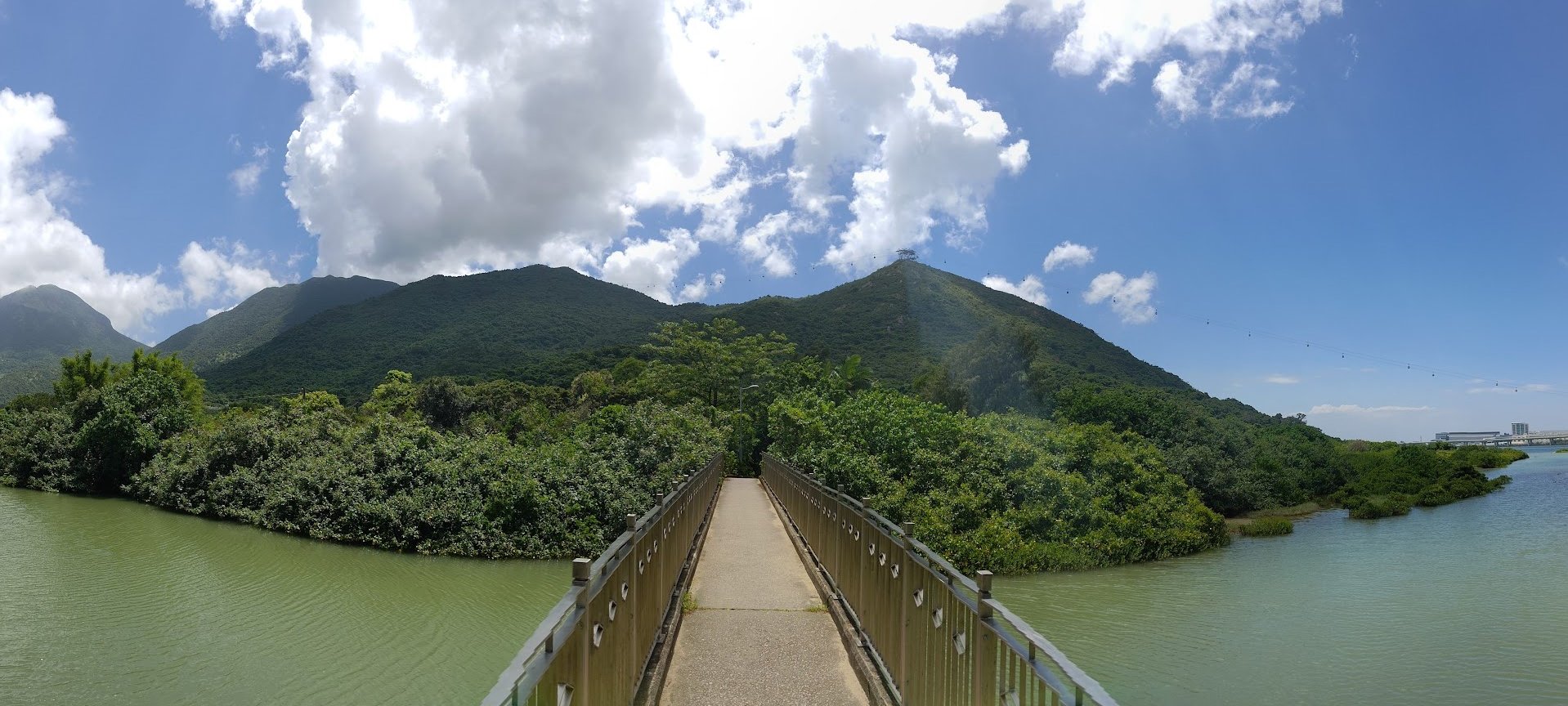
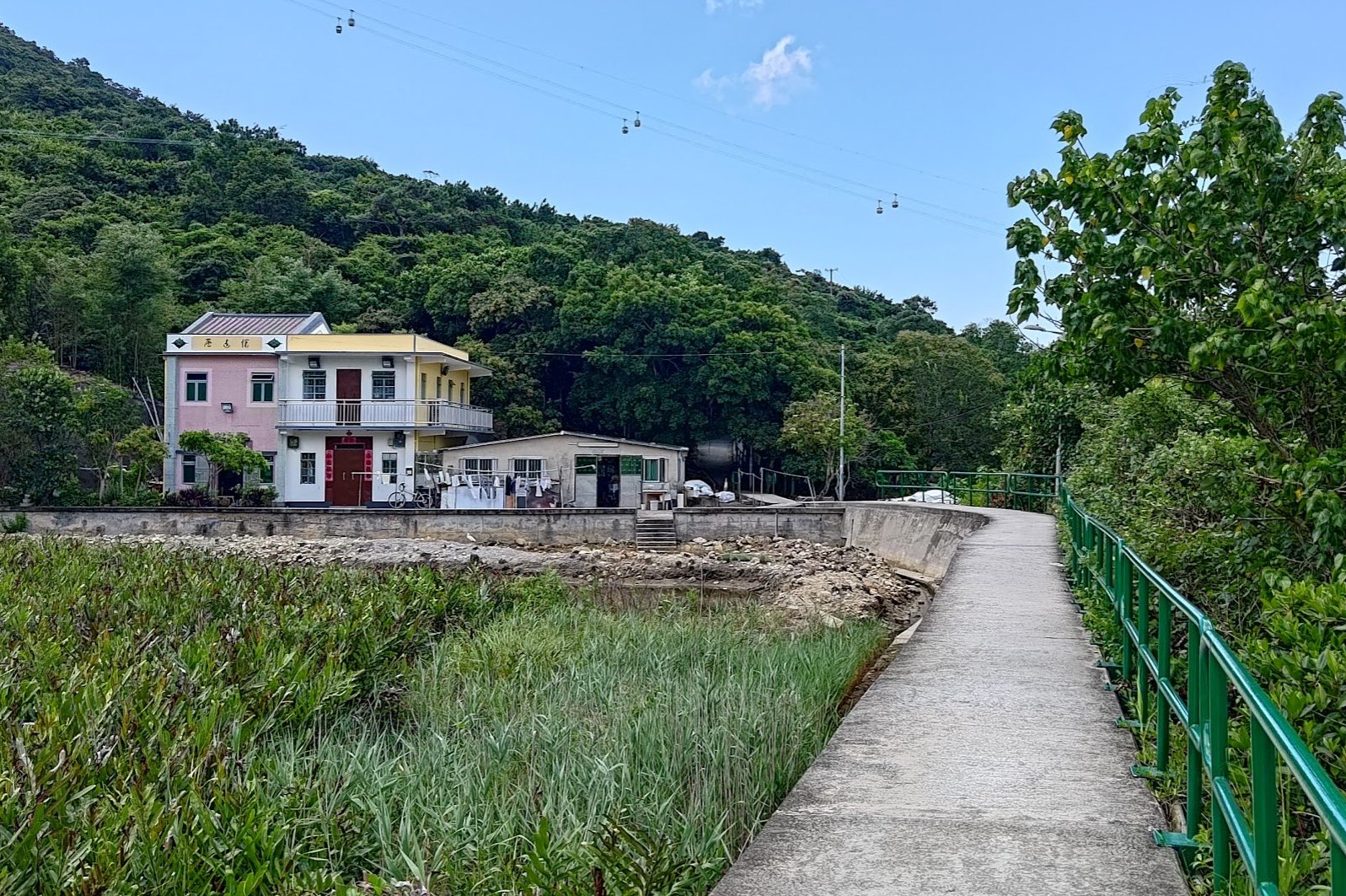
Follow the concrete path that goes beside the park's fence and between the colorful flags until you arrive at the Tung Chung Hau Wong Bridge.
With the Ngong Ping cable cars in front of you and Tung Chung Bay stretching to either side of the bridge, this has to be one of the most scenic spots in Lantau.
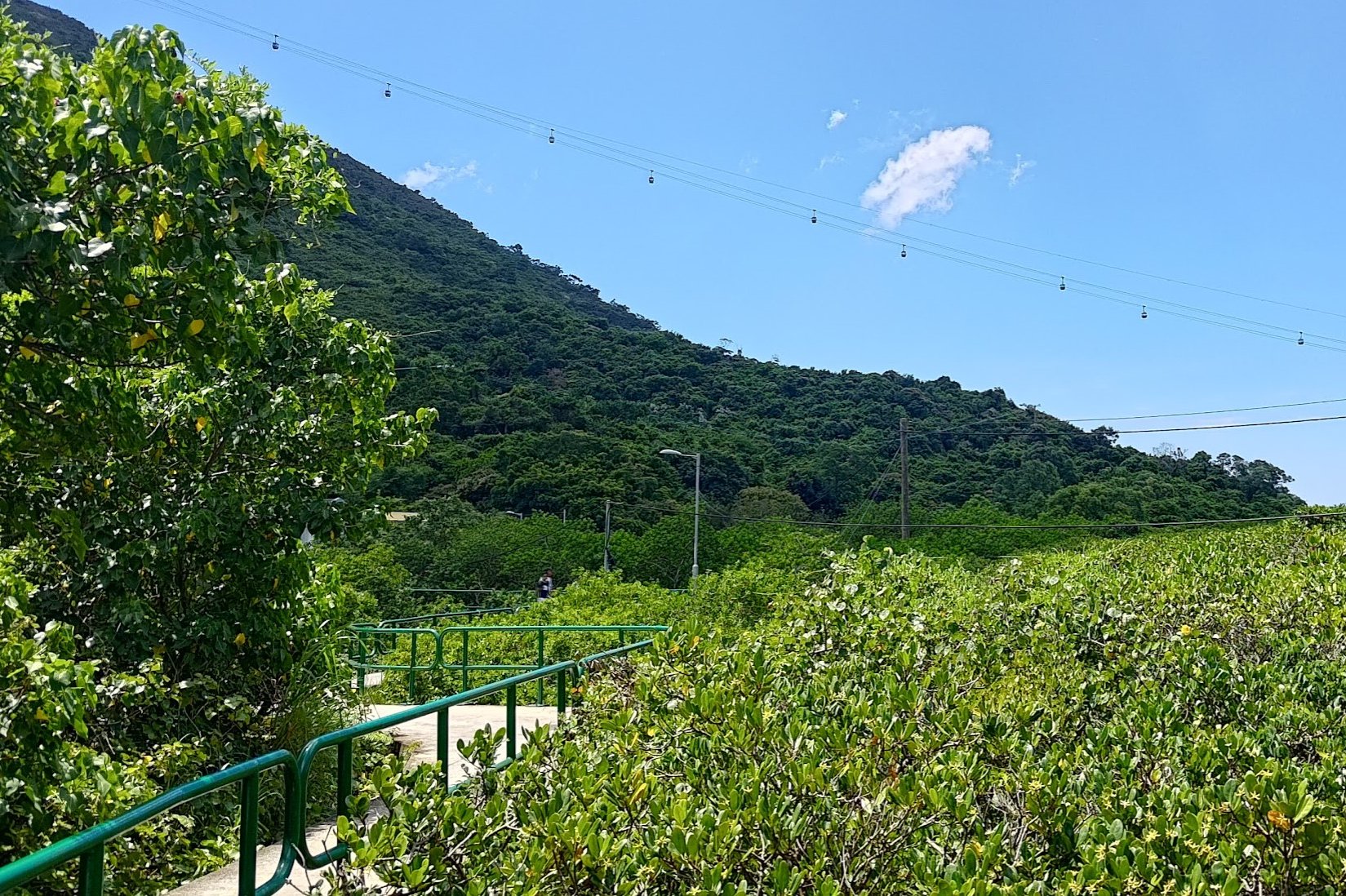
Once you cross the bridge, zigzag along the path with green railings and go past the cute pair of village homes.
It's almost time for the real hiking to begin!
Climbing to the First Tower
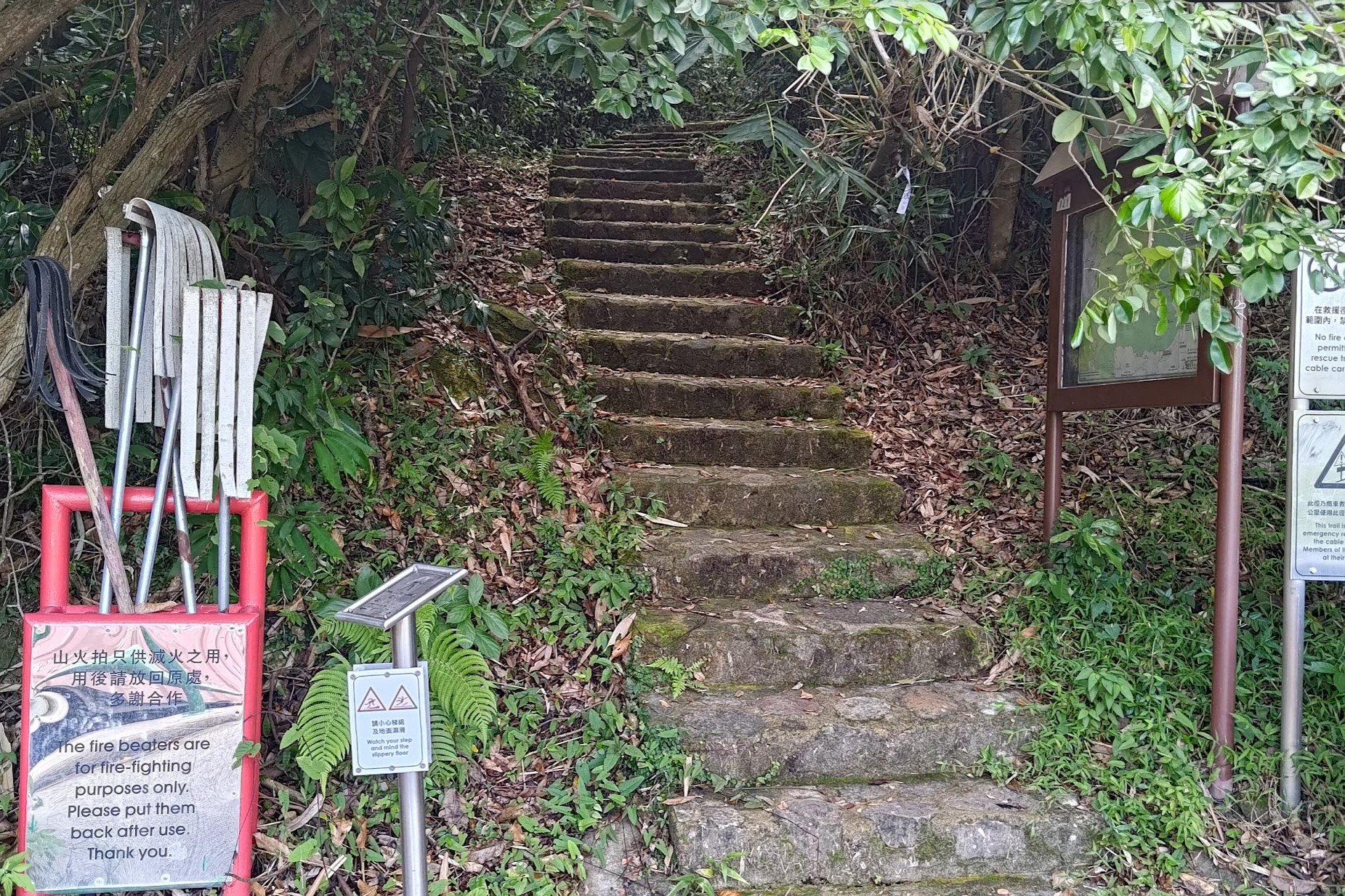
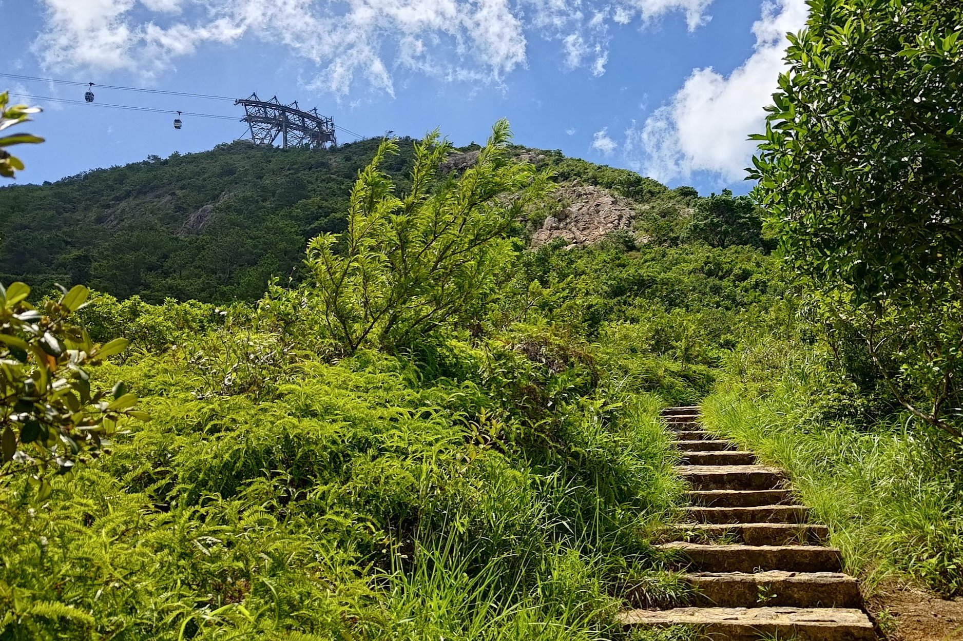
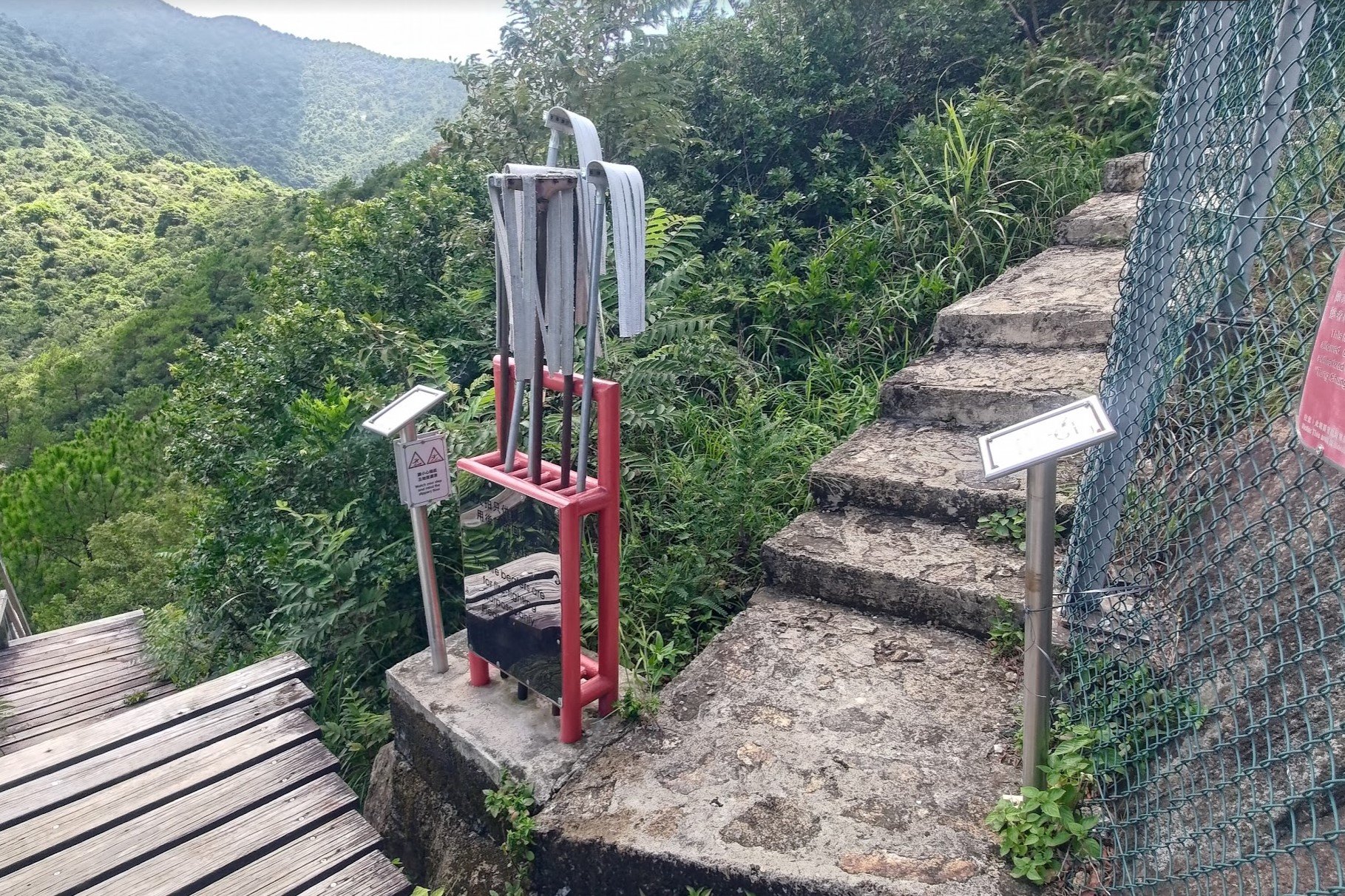
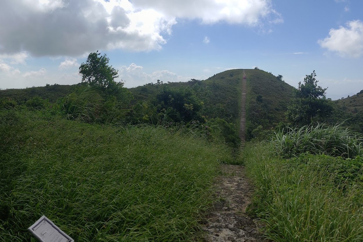
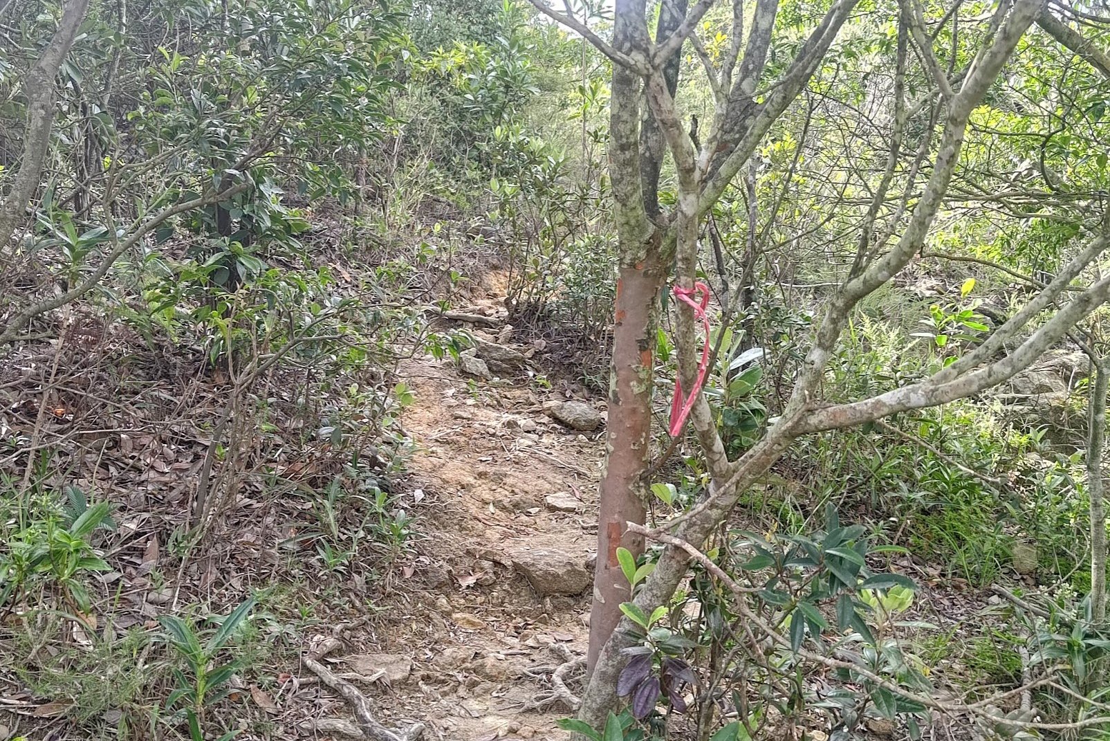
After passing by the old village houses, you'll see an innocuous looking set of stairs with some fire-beaters beside them.
There's only one path to follow until you reach Ngong Ping Skyrail Tower 3 (the first tower of the hike). From the start of the stairs to the top, it took me about 30 minutes with no breaks and a steady pace.
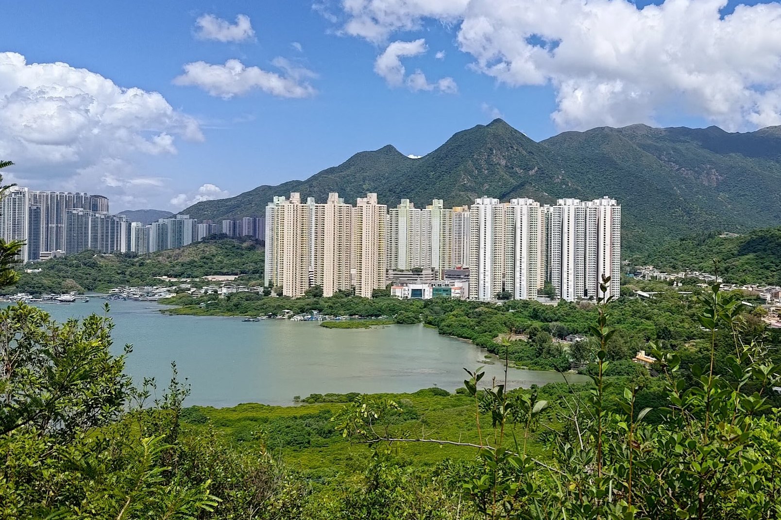
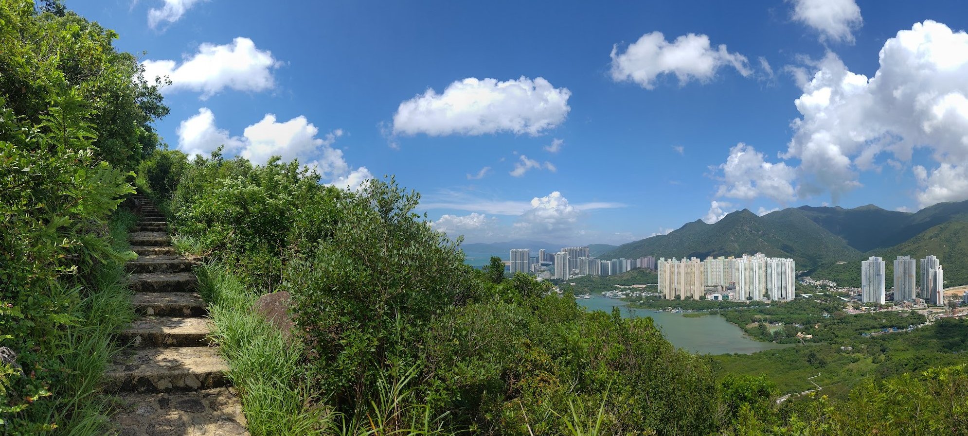
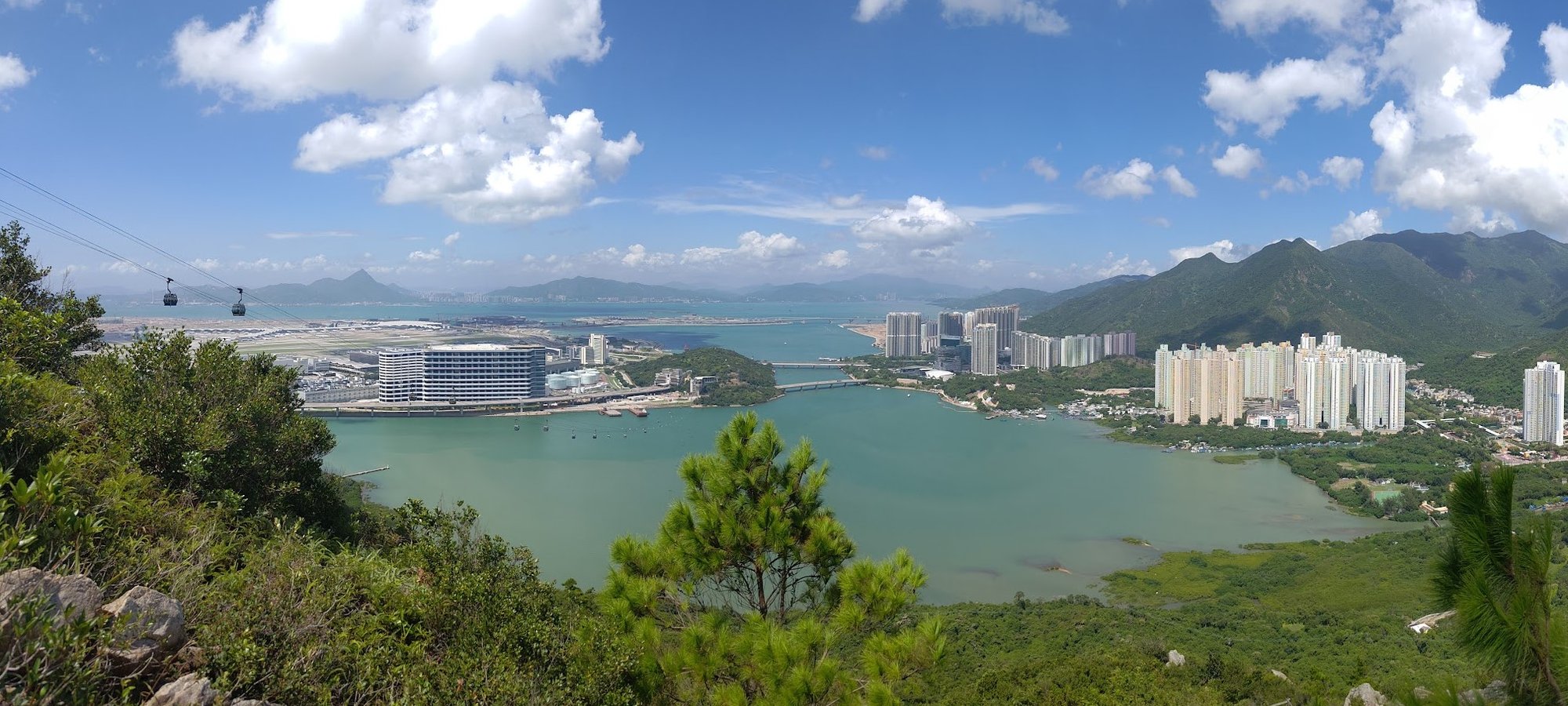
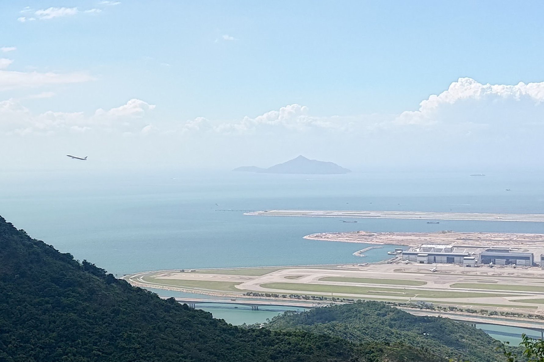
Fortunately, you'll have some really wonderful views of Tung Chung Bay below to keep you company as you climb.
Tung Chung Bay was also a hotbed of pirate activity in the 1800s, so let your imagination distract you with thoughts of epic pirate battles as your hamstrings burn from the climb!
Optional Detour Above Ngong Ping Skyrail Tower 3
At the base of the tower, you will see a set of wooden stairs heading downward and a set of stone steps heading upward.
Take the stone steps upward for the optional detour. You'll get a better view of the tower framed by Lantau Peak in the backdrop.
At the top of the detour route (which takes no more than 5 minutes), you'll arrive at a grassy field with a view of the Nging Ping cable car route through the mountains.
Head back down to continue on the trail.
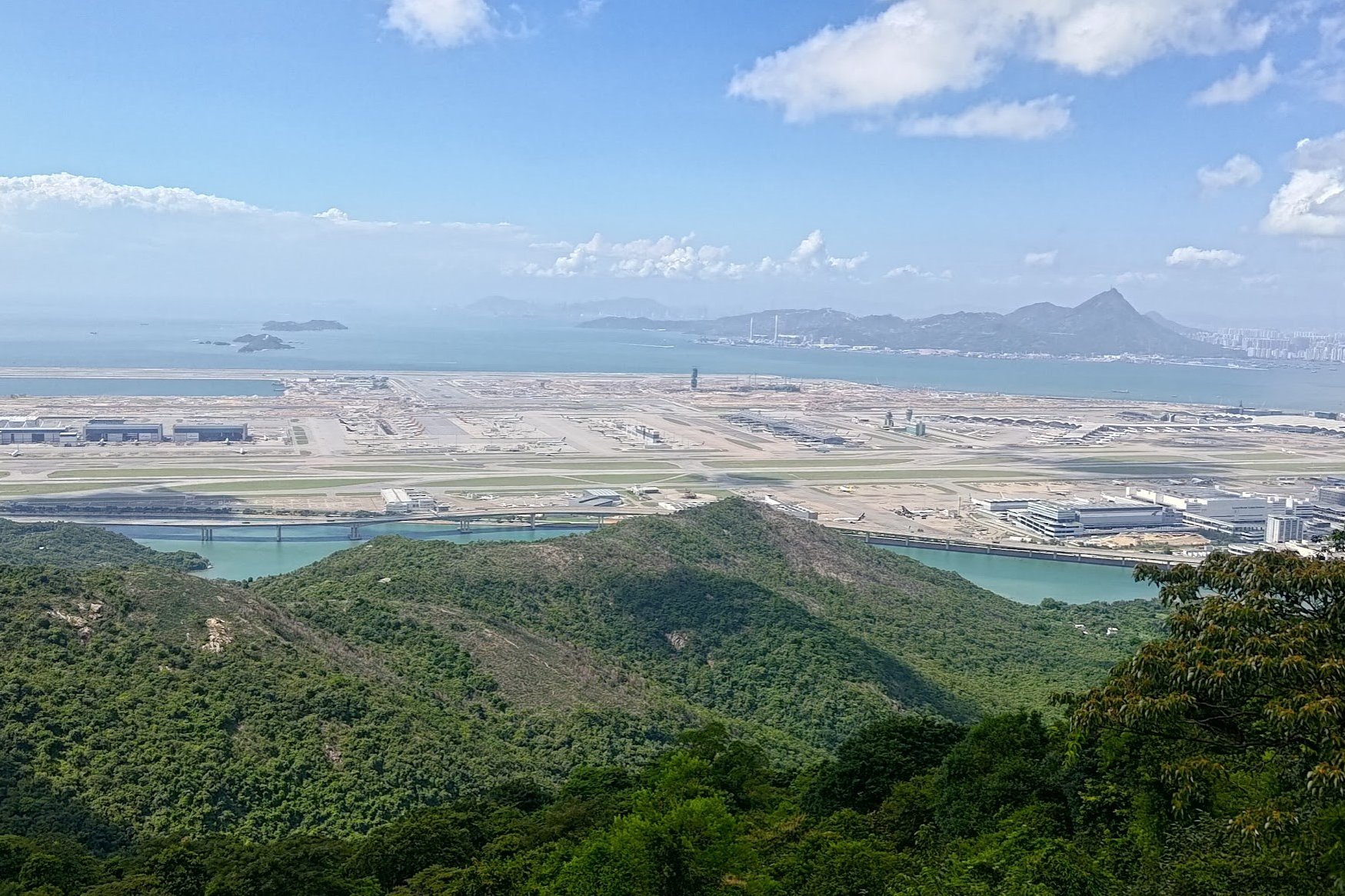
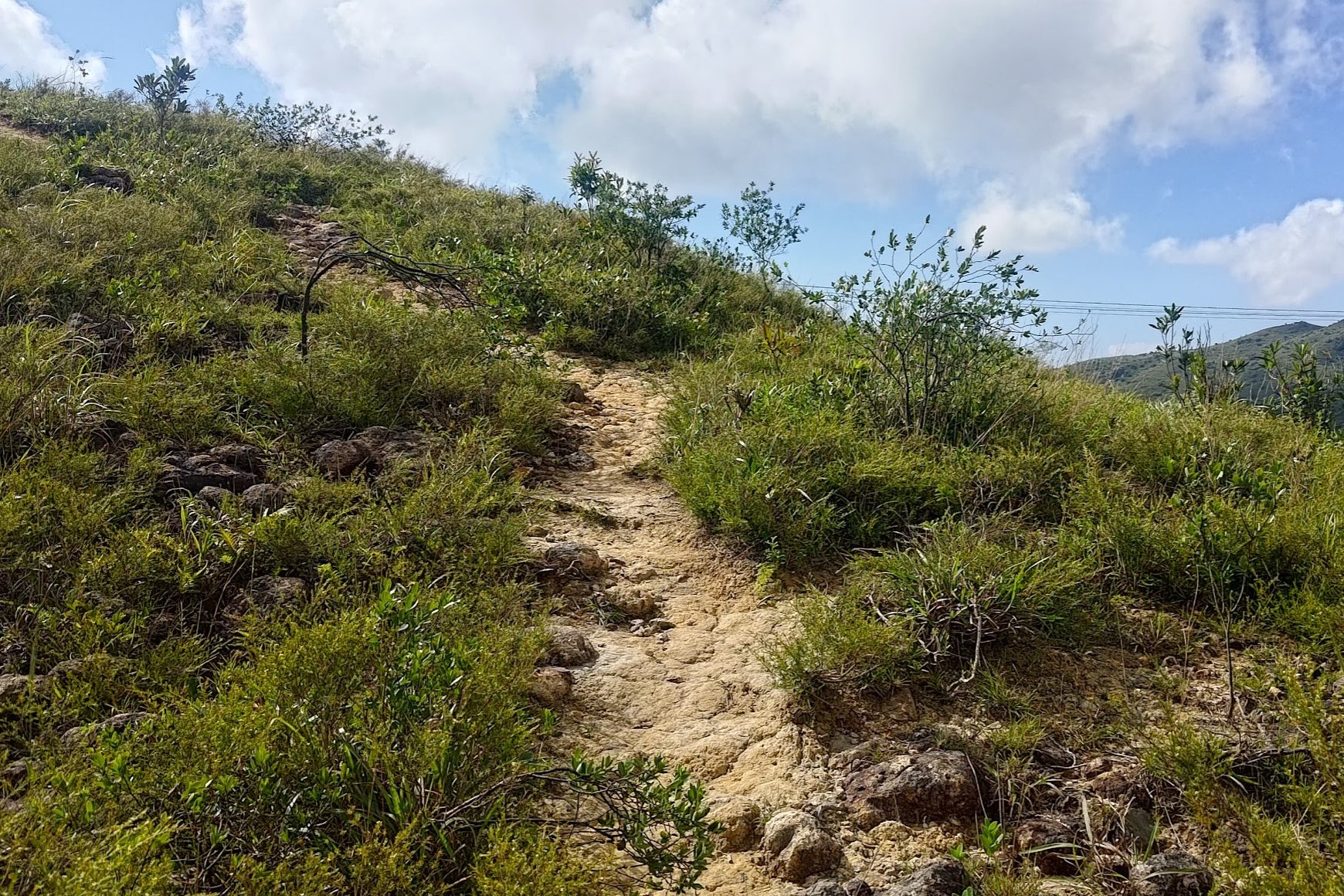
Wooden Stairs and Hong Kong Airport Views
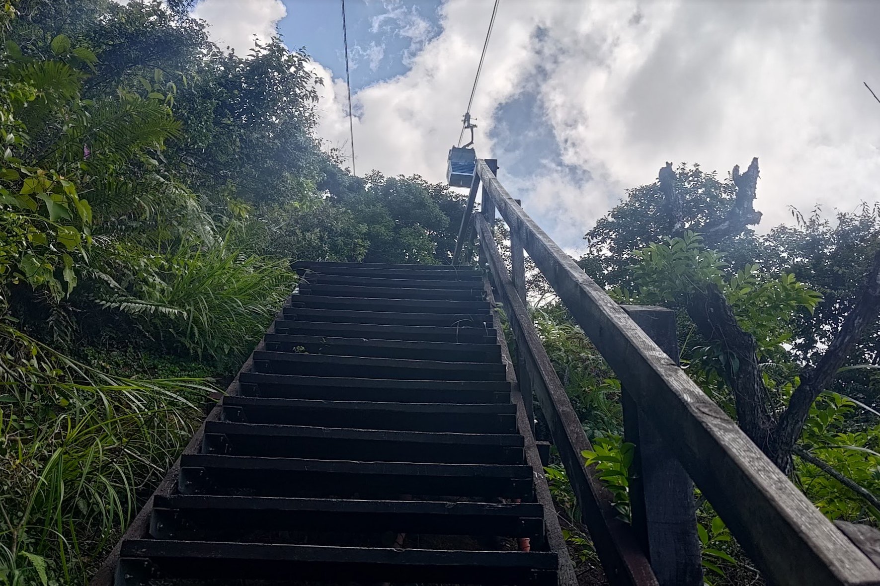
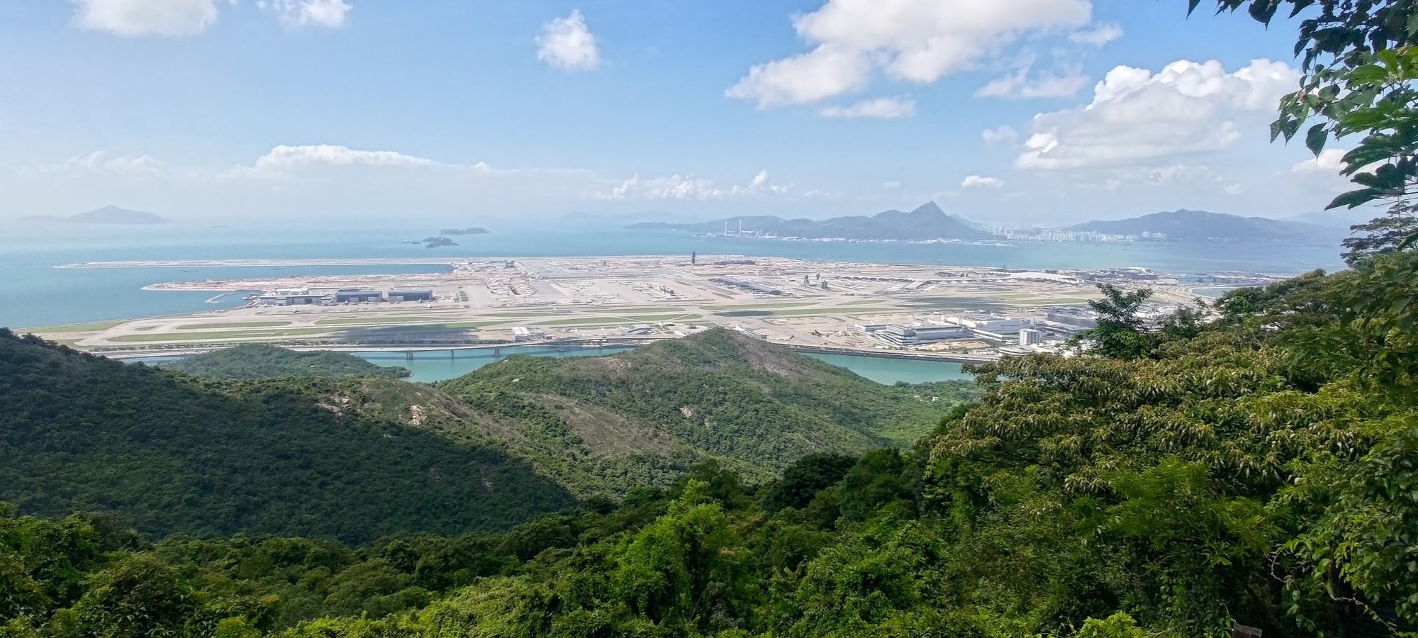
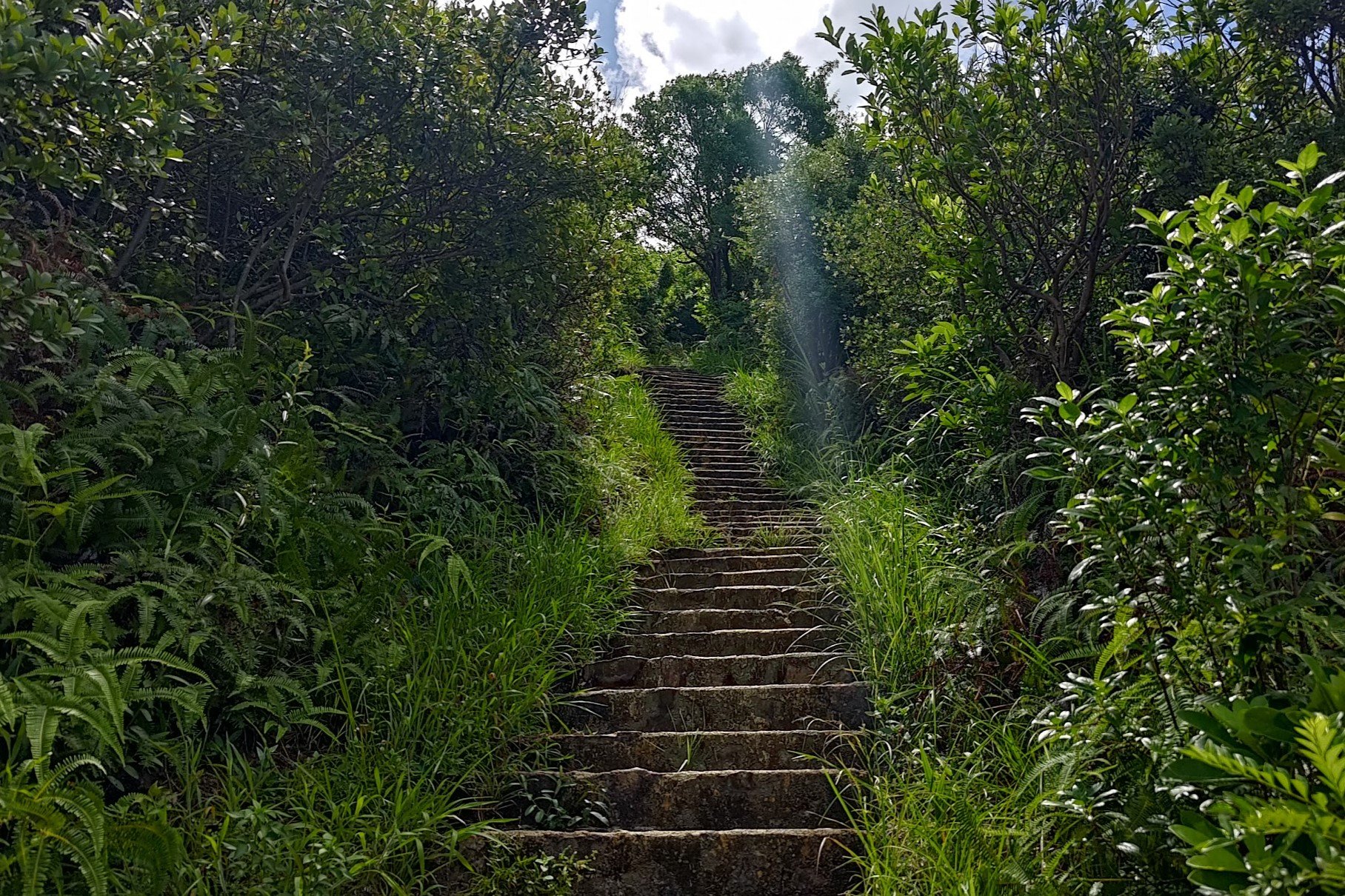
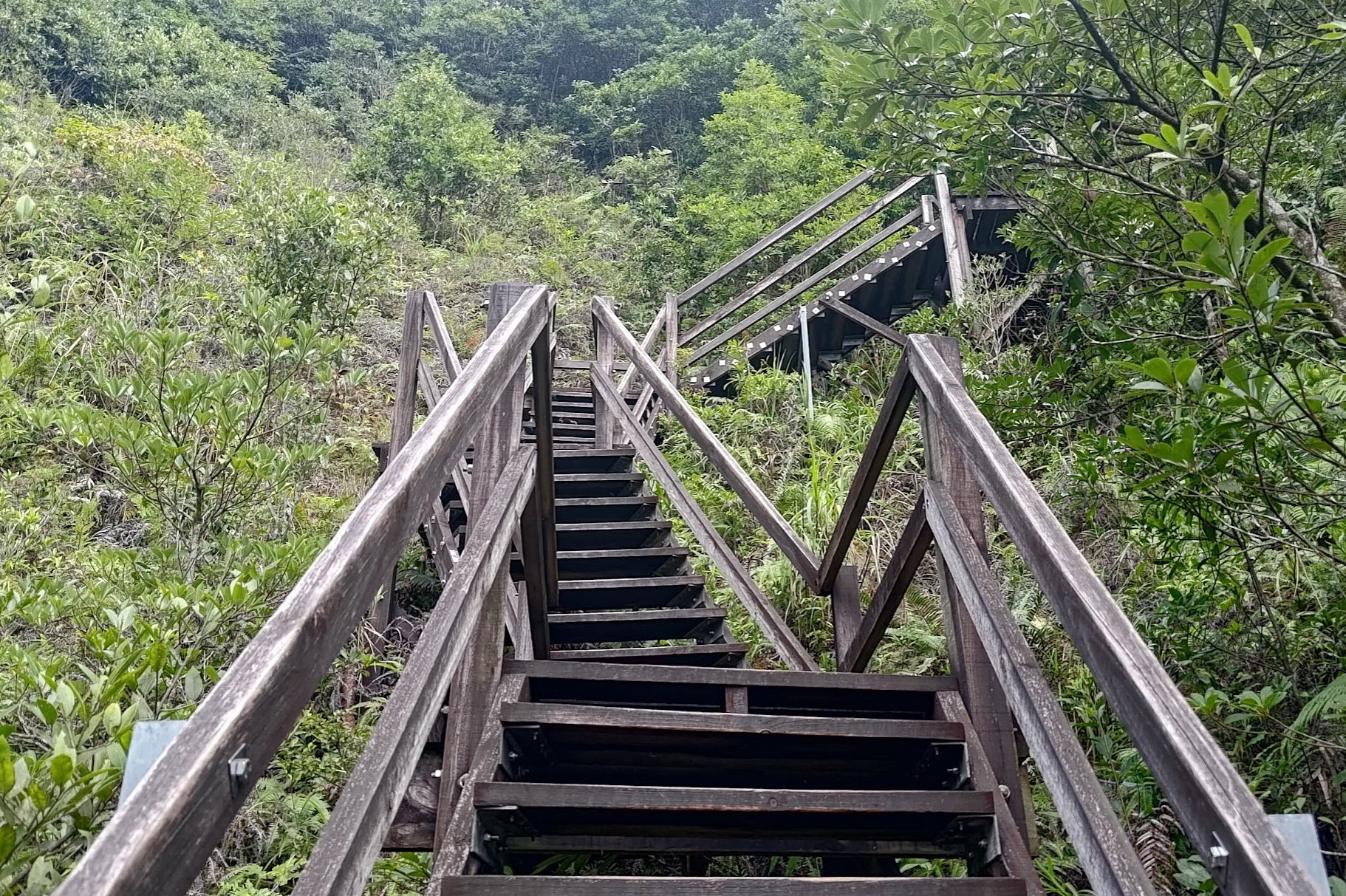
For the next portion of the hike, there are no deviations from the path. After descending the wooden stairs, there'll be some stone stairs to climb before the staircase becomes wooden again.
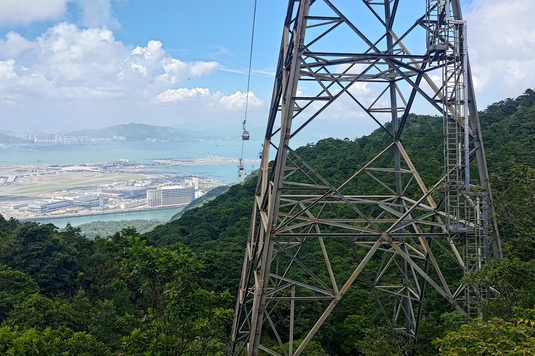
As you climb, you'll have great views over Hong Kong International Airport and will likely see at least a plane or two take off.
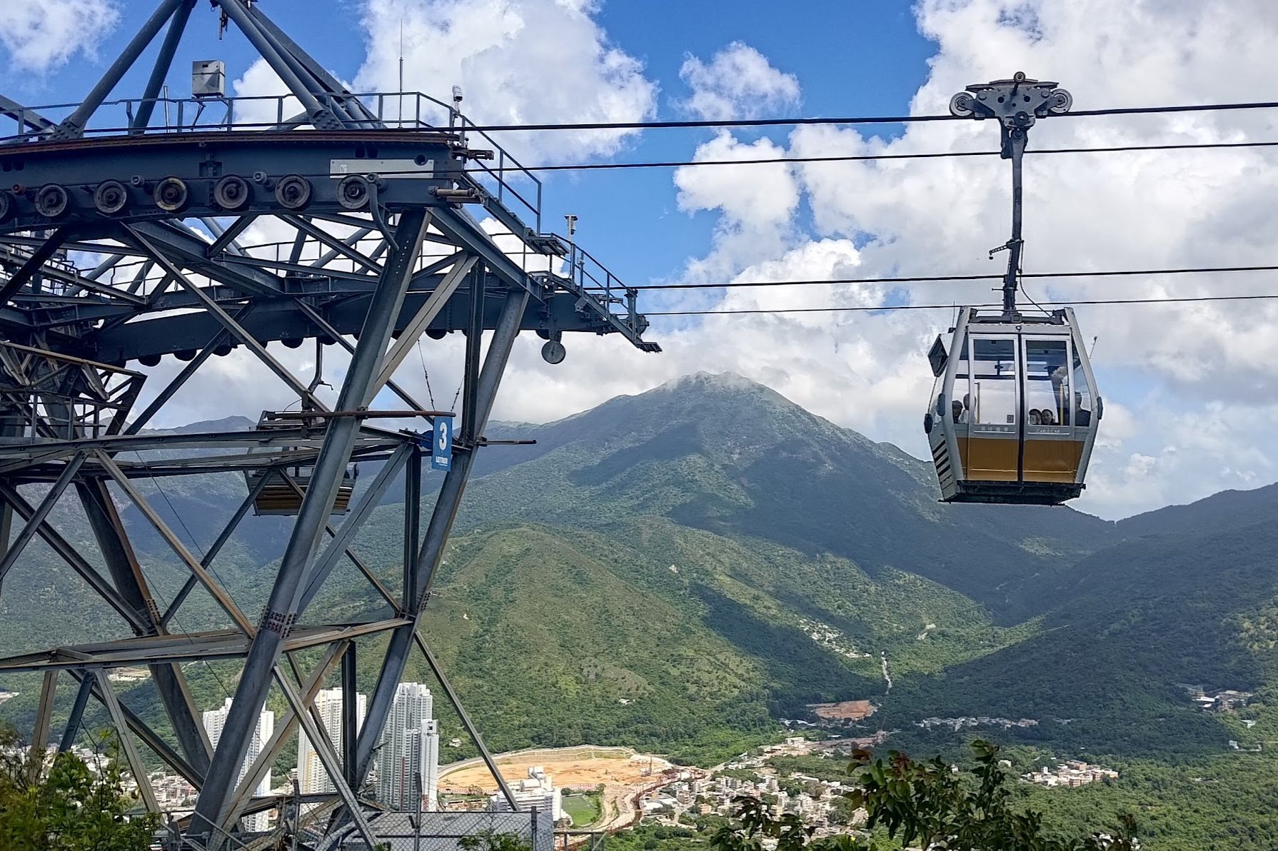
The Ngong Ping cable cars will now be directly overhead, which is pretty cool.
Two Towers in Quick Succession
This next section encompasses about 30-35 minutes of hiking at a steady pace with no breaks.
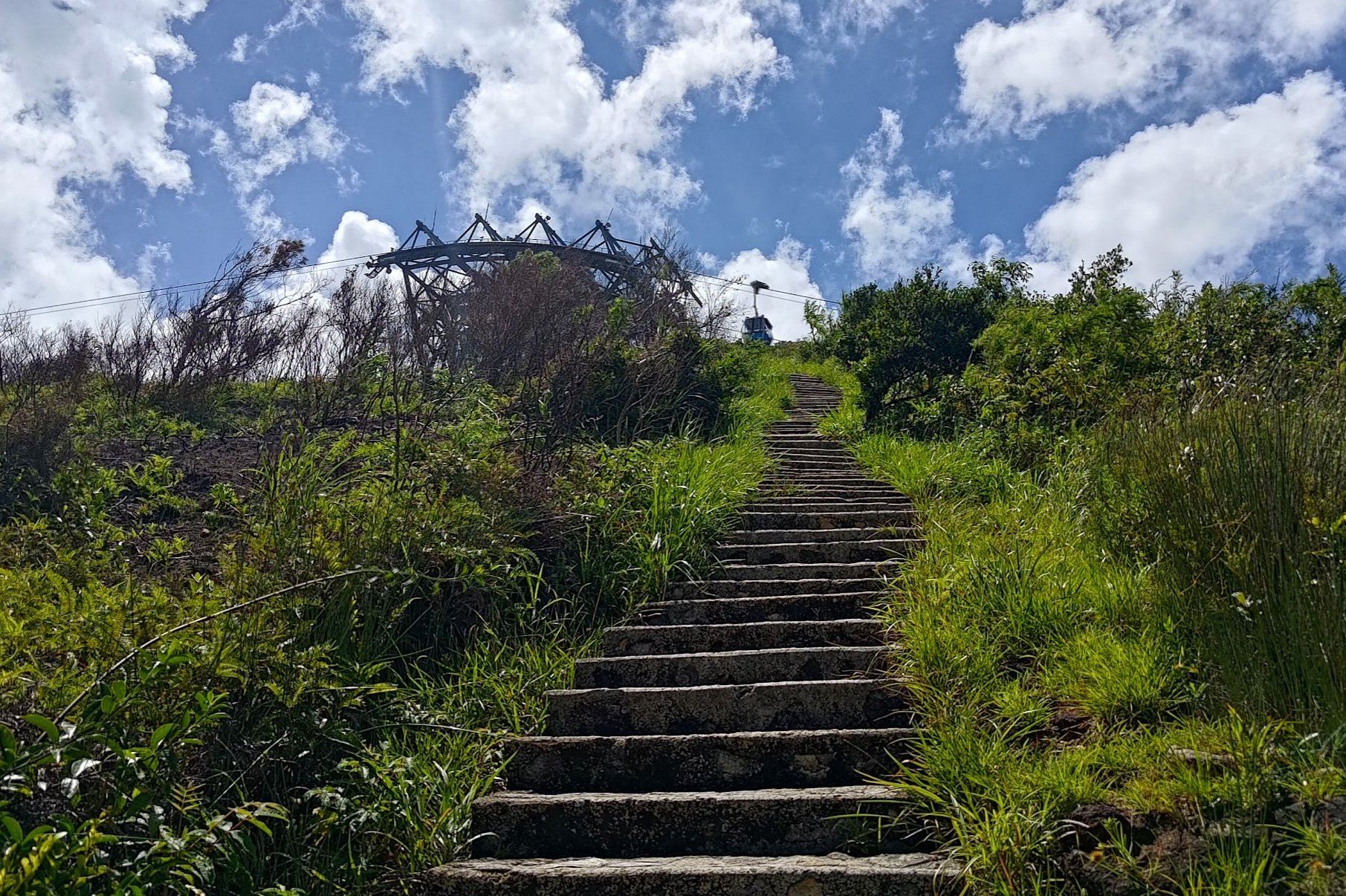
Almost immediately, you'll pass under another tower.
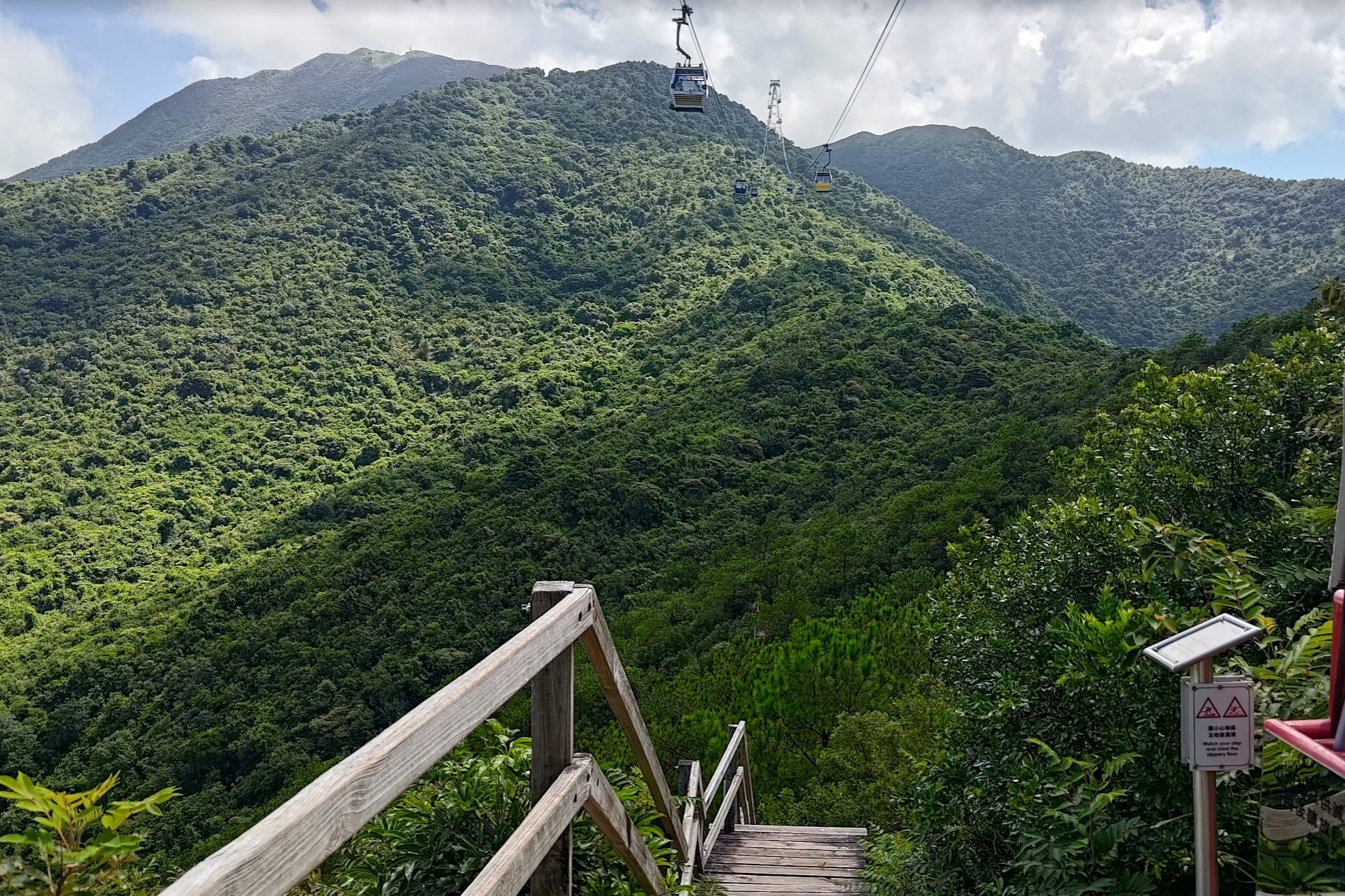
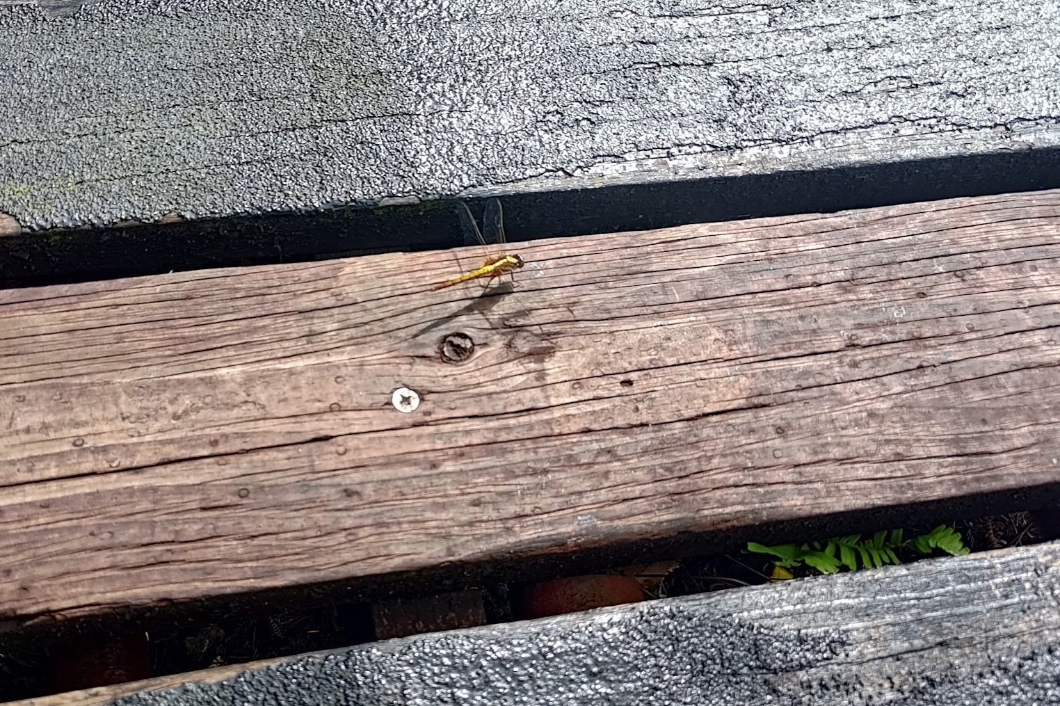
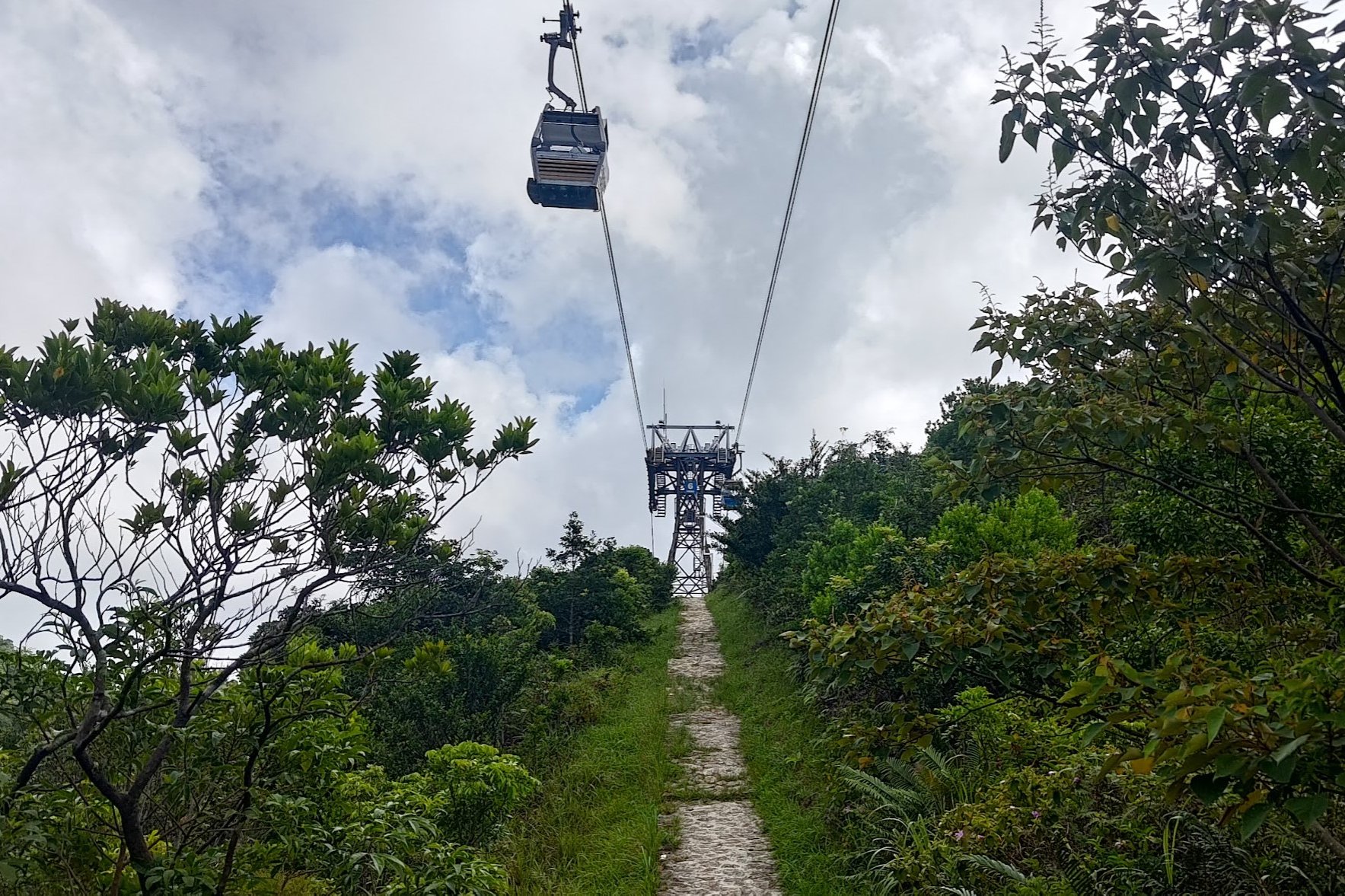
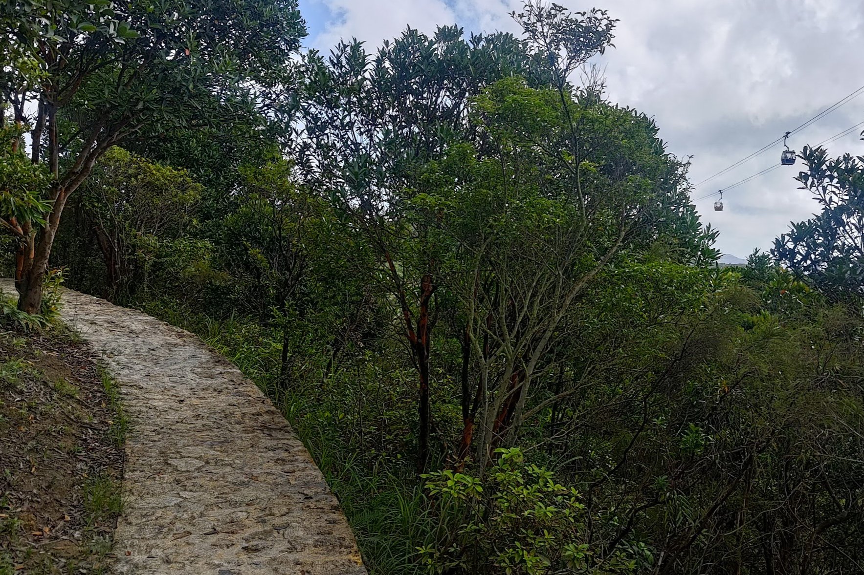
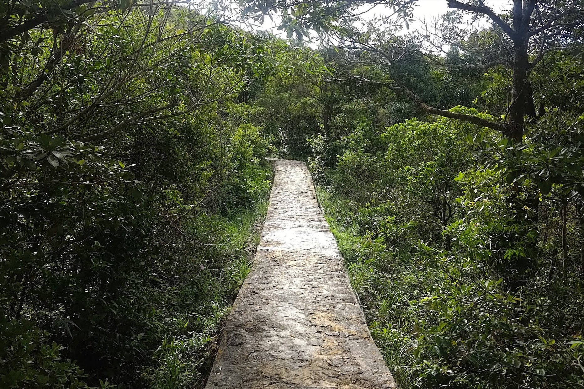
You'll then mostly be walking along a wooden walkway that might just be the only one of its kind in Hong Kong.
This part of the trail was very green and peaceful, though the climbs at certain points were incredibly steep.
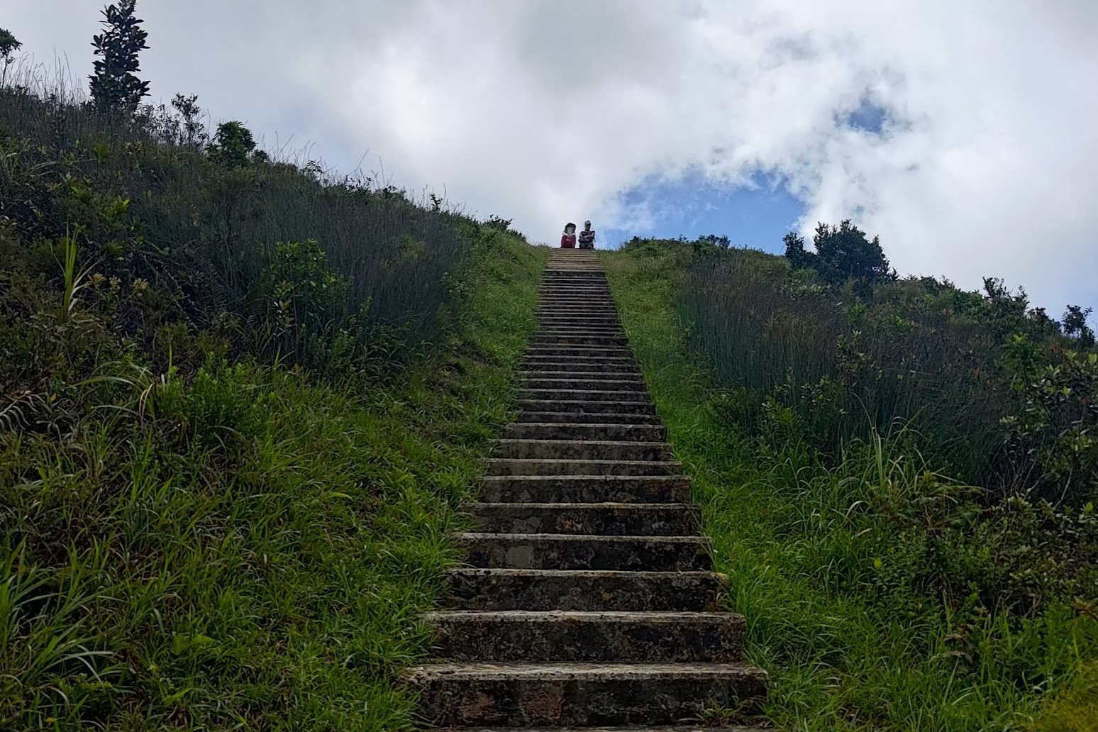
Enjoy a well-earned break when you reach the top of the next tower, which is called Nei Lak Shan Angle Station. A most wondrous and catchy name!
Optional Detour to Ngong Ping 360 Midpoint Overlook
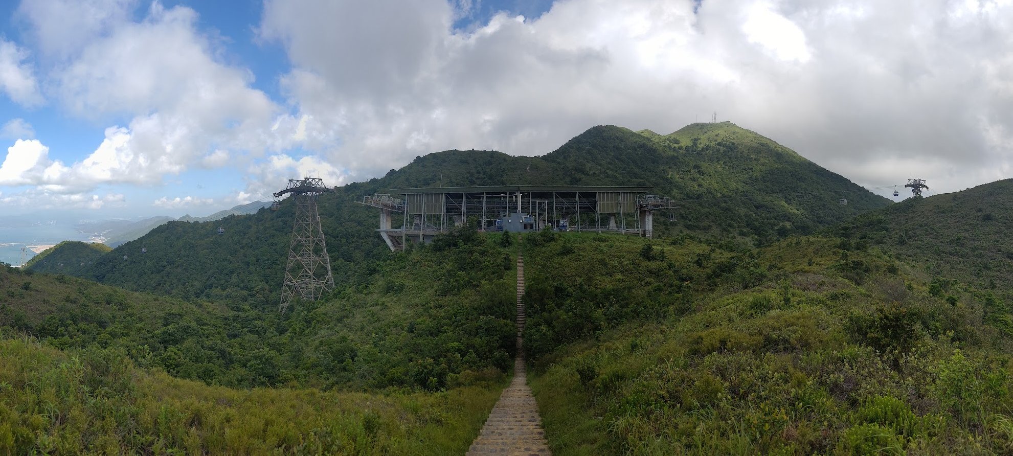
There will be 2 paths underneath the Nei Lak Shan Angle Station. Take the one to the right (with stairs going up the nearby hill) for the detour.
Though this detour increases your overall stair count, it's only a small amount of stairs for a pretty cool view!
Head back when you're done.
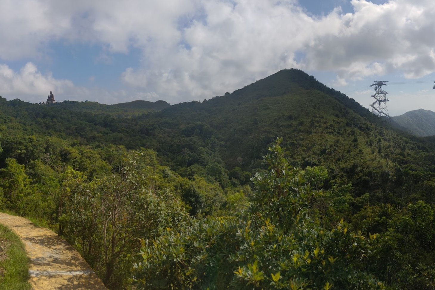
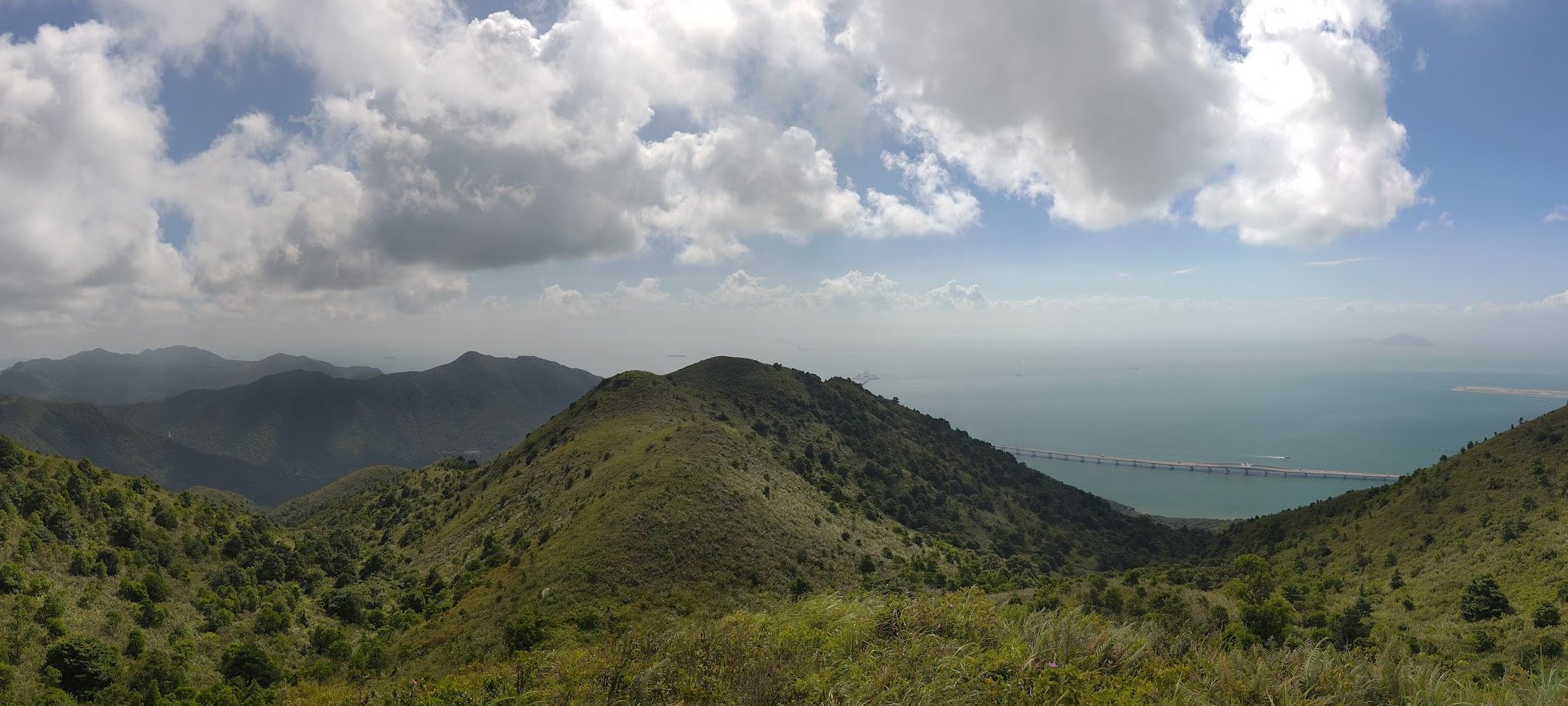
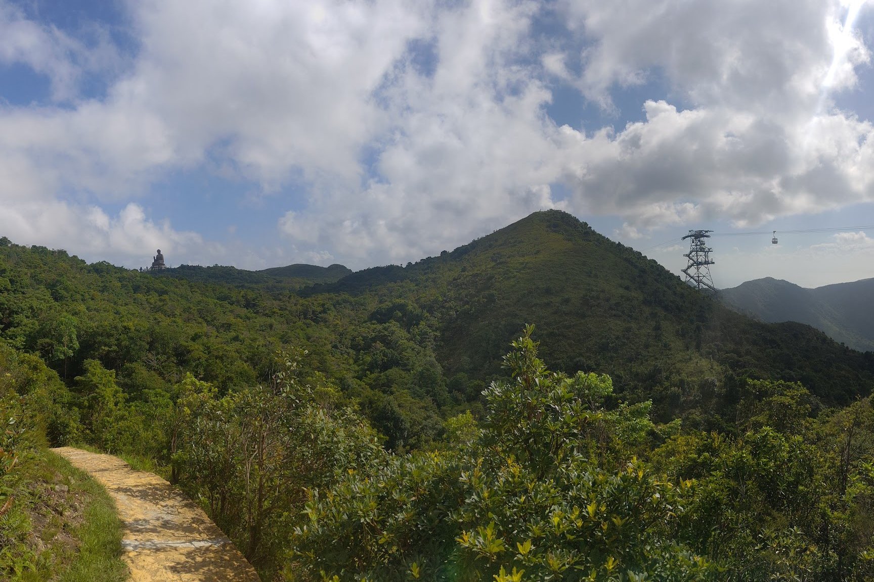
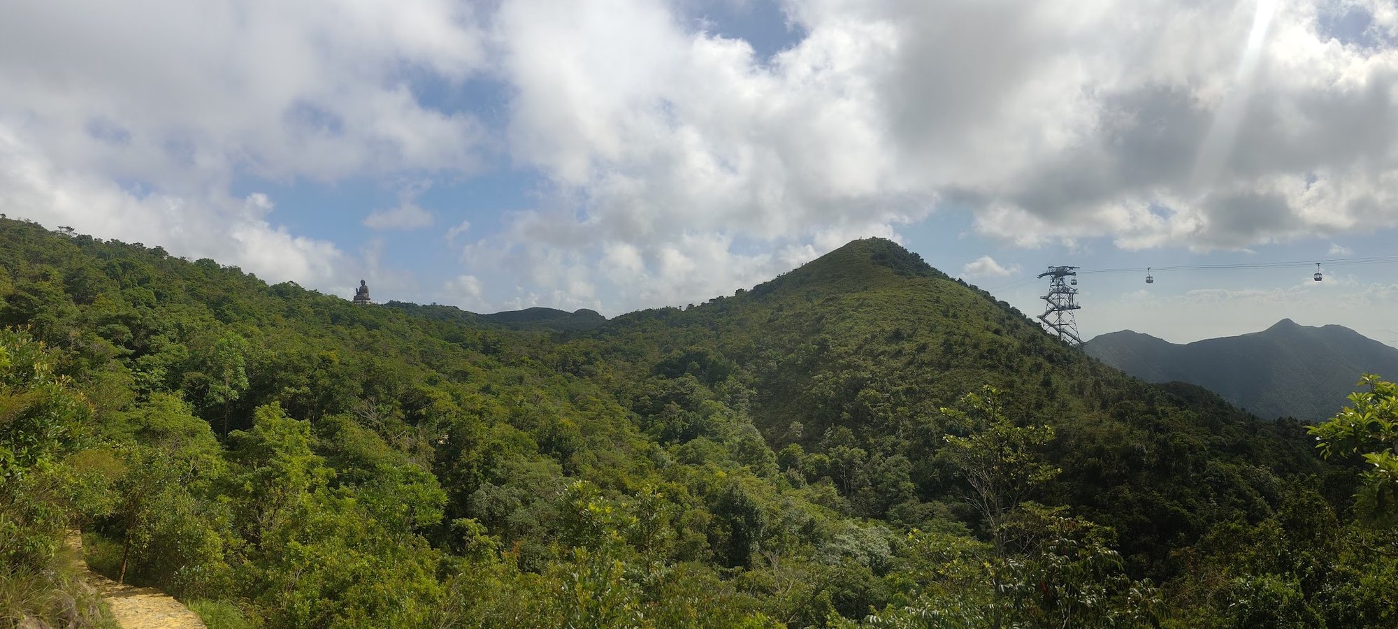
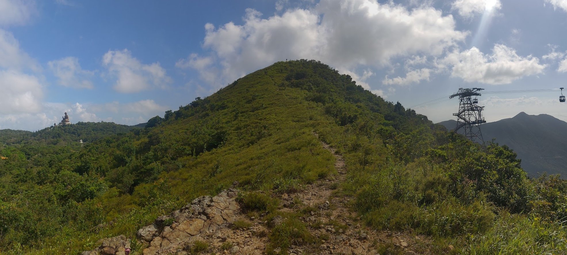
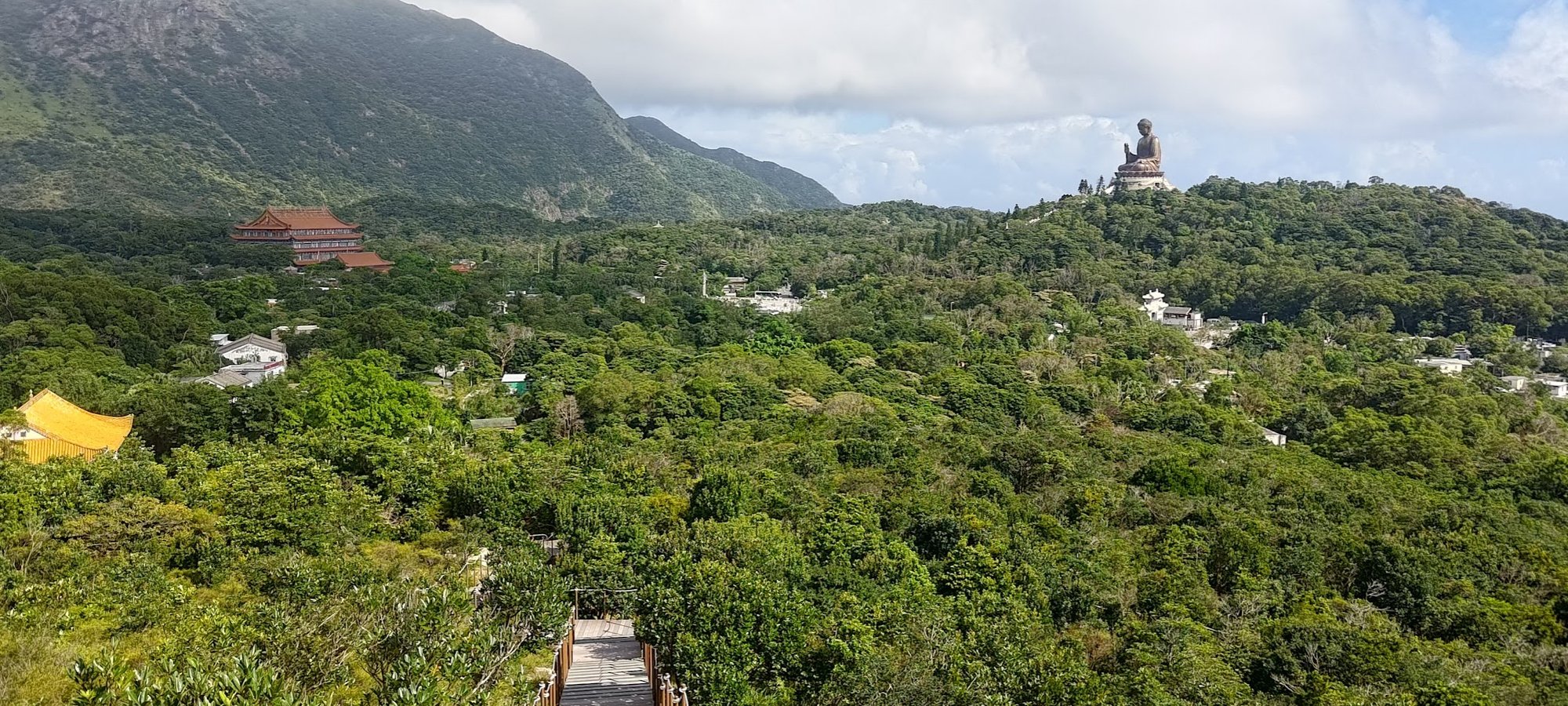
First Glimpses of the Big Buddha
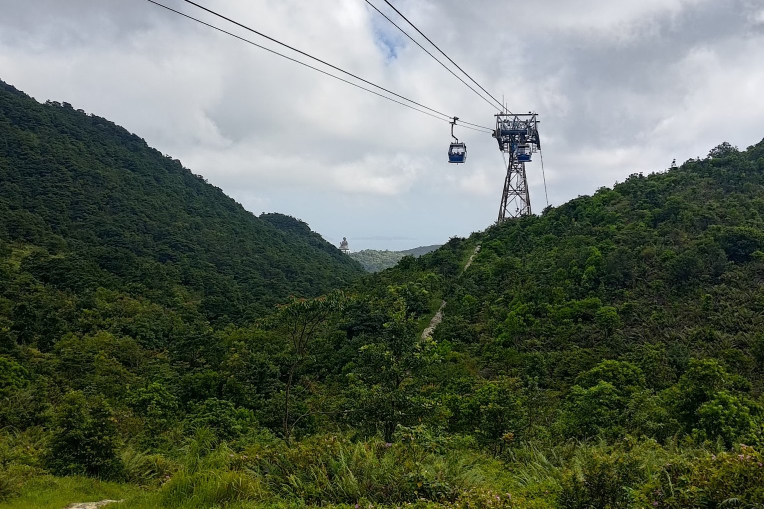
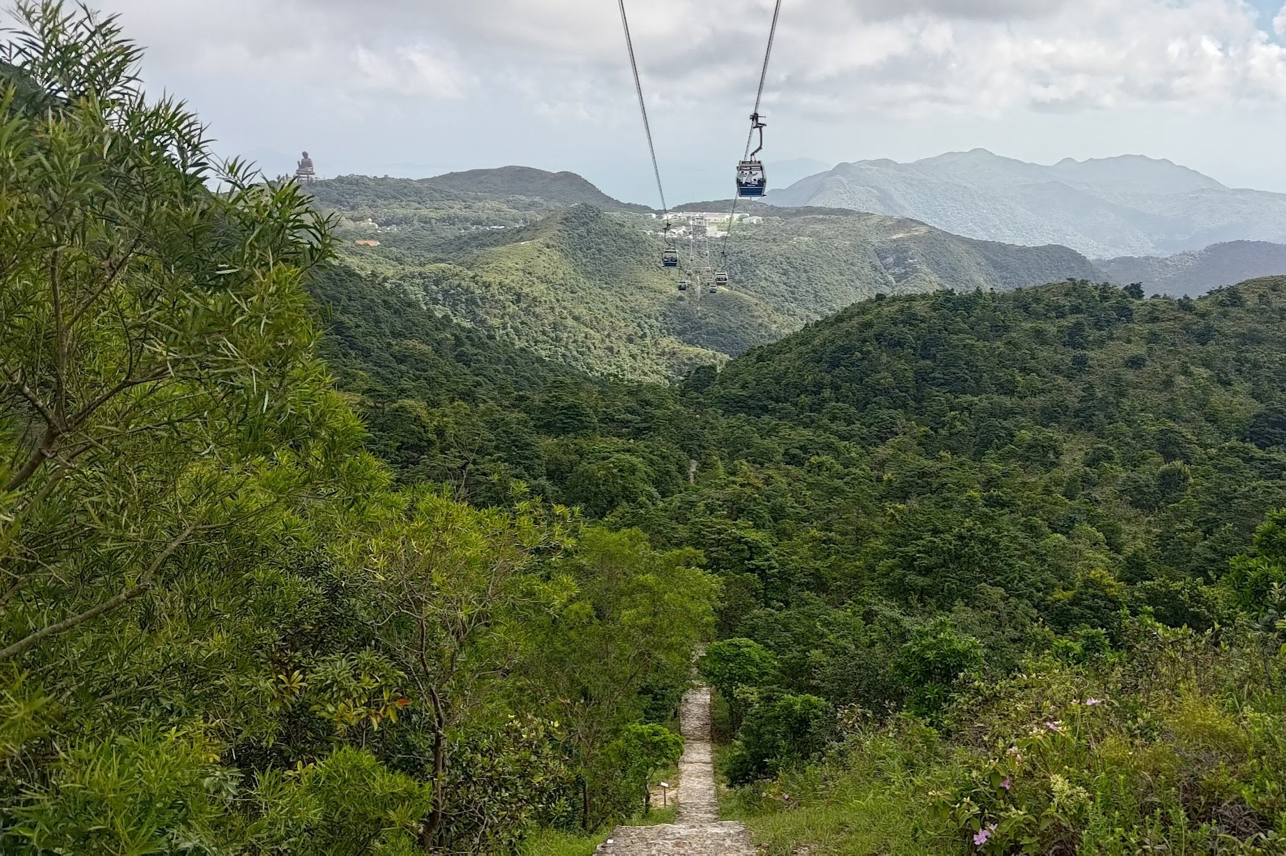
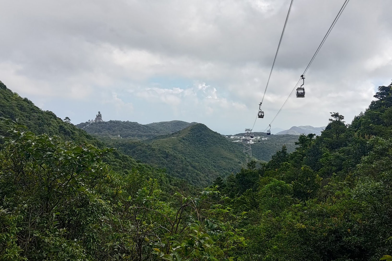
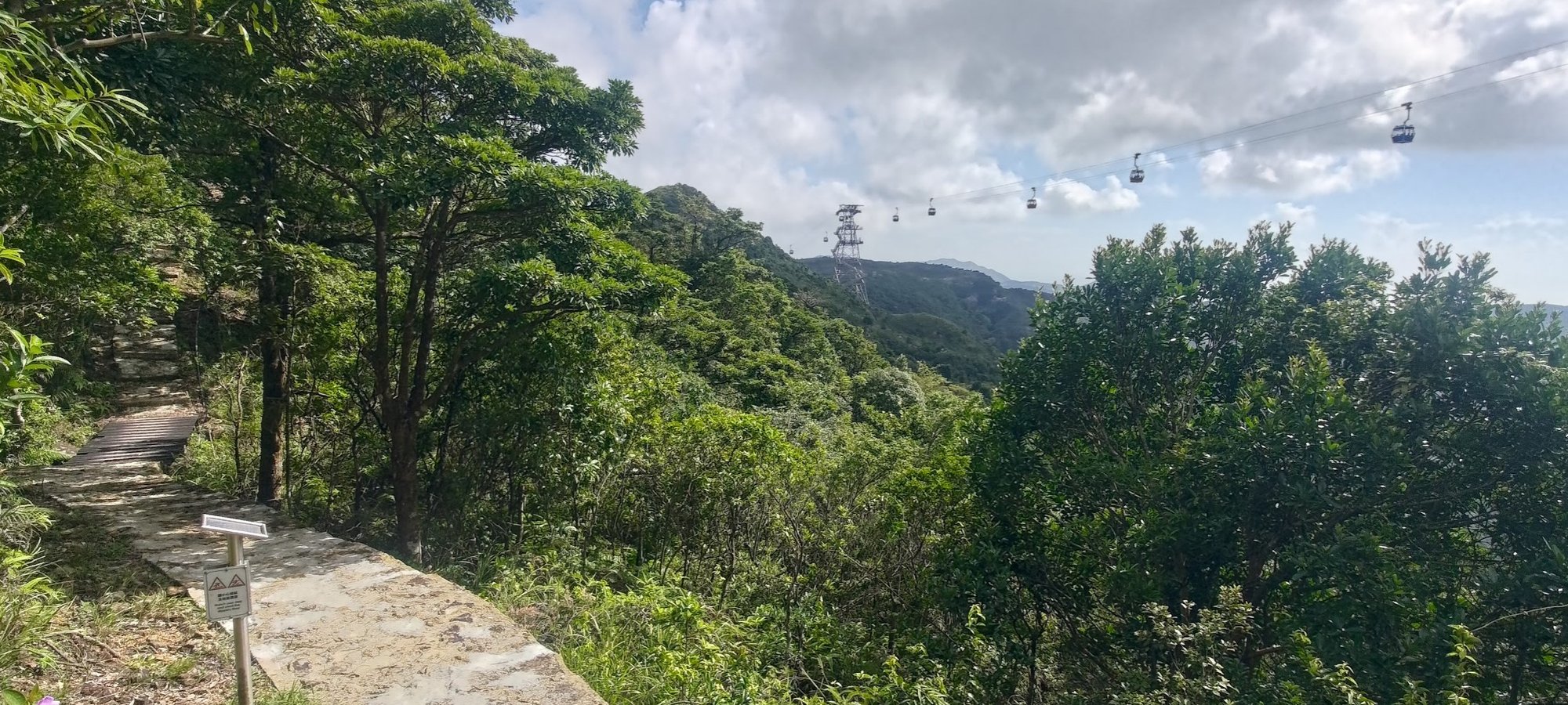
You'll actually be able to see the tower just beyond the Nei Lak Shan Angle Station. Follow the stone path toward that tower as it gently undulates.
After going through the next tower, take the steep stone stairs downward before heeding the 'Ngong Ping Village' sign and walking along a flat stone path for a little while.
You'll have awesome views of the Big Buddha in the distance along with the cable cars to your right.
Getting to Ngong Ping Village and the Big Buddha
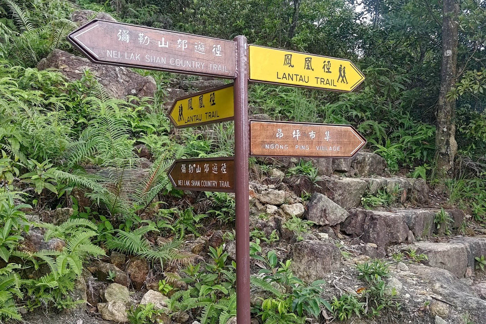
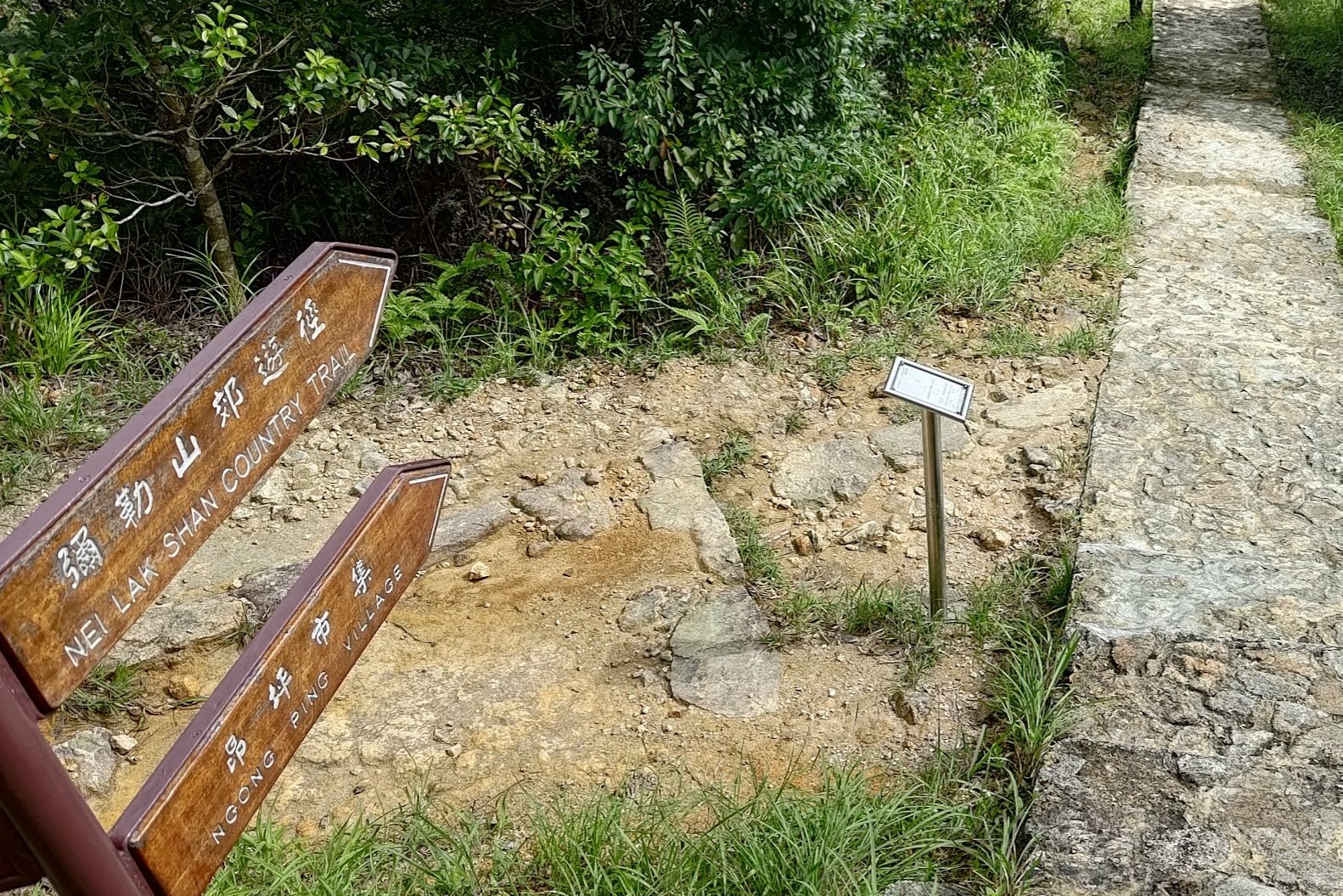
You'll soon go past another sign pointing you toward 'Ngong Ping Village'. You'll basically keep following the stone path for the entire way to Ngong Ping, which should take about another 10-15 minutes.
If you're feeling adventurous, about 5 minutes after the Ngong Ping Village sign, you'll see a hidden detour that you can take to climb up Nei Lak Shan.
Optional Detour to Nei Lak Shan
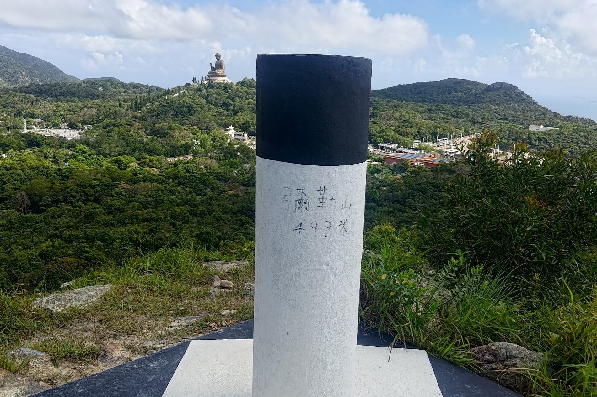
Once you find the hidden trail heading up to Nei Lak Shan, it's pretty easy to get to the top.
There may be a few branching paths along the way, but all of them go to the same place, so just take the ones you're most comfortable with.
As the path opens up and you emerge from the trees, you'll see why this little detour is so worth it. As you begin climbing, the Big Buddha sits peacefully to your left and the cable cars operate to your right.
From the top of Nei Lak Shan, there are a set of wooden stairs that'll take you back down and drop you back on the stone path even closer to Ngong Ping Village. Follow the stone path for a couple more minutes and you'll arrive at the end point.
Getting Back
From Ngong Ping Village, you can take NLB bus number 23 back to Tung Chung MTR station.
Alternatively, you can take NLB bus number 2 to Mui Wo to catch a ferry to Central (Hong Kong Island).