
Castle Peak: A Hike That Takes Your Breath Away in More Ways Than One
Contents
- Essential Information
- Why Hike Castle Peak?
- Google Route Map
- How to Get There
- Quick Route Summary
- Detailed Route
- Views from the Summit
- Transmitting Station Views
- Optional Treacherous Hike Down into the Hinterlands
- The Way Back
Essential Castle Peak Hike Details
- District: Tuen Mun (New Territories)
- Duration: 3 hours there and back
- Distance: 7-8km (assuming you return the same way)
- Highest Elevation: 583m
- Difficulty: 3.5/5
- Facilities: None. So, use the toilet and stock up on water and food beforehand.
Castle Peak Highlights
Castle Peak is one of those hikes with an iconic view, but not many people in Hong Kong know where it is. Not only is it the tallest of the city’s infamous ‘Three Sharp Peaks’, but it’s also the safest of the lot to hike. The path to the top is literally a giant staircase; so if you’re looking for a monster cardio workout, this may be the perfect hike for you.
Interestingly, Castle Peak has two Chinese names. The first is Tsing Shan (青山) and the second is Pui To Shan (杯渡山). Tsing Shan translates as verdant/green hill, while Pui To Shan pays homage to a monk named Pui To, who is said to have made a pilgrimage to Castle Peak where he set up a monastery - which is now the Tsing Shan Monastery at the base of Castle Peak.
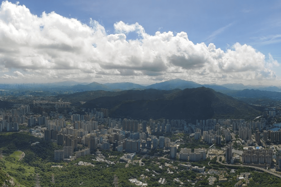
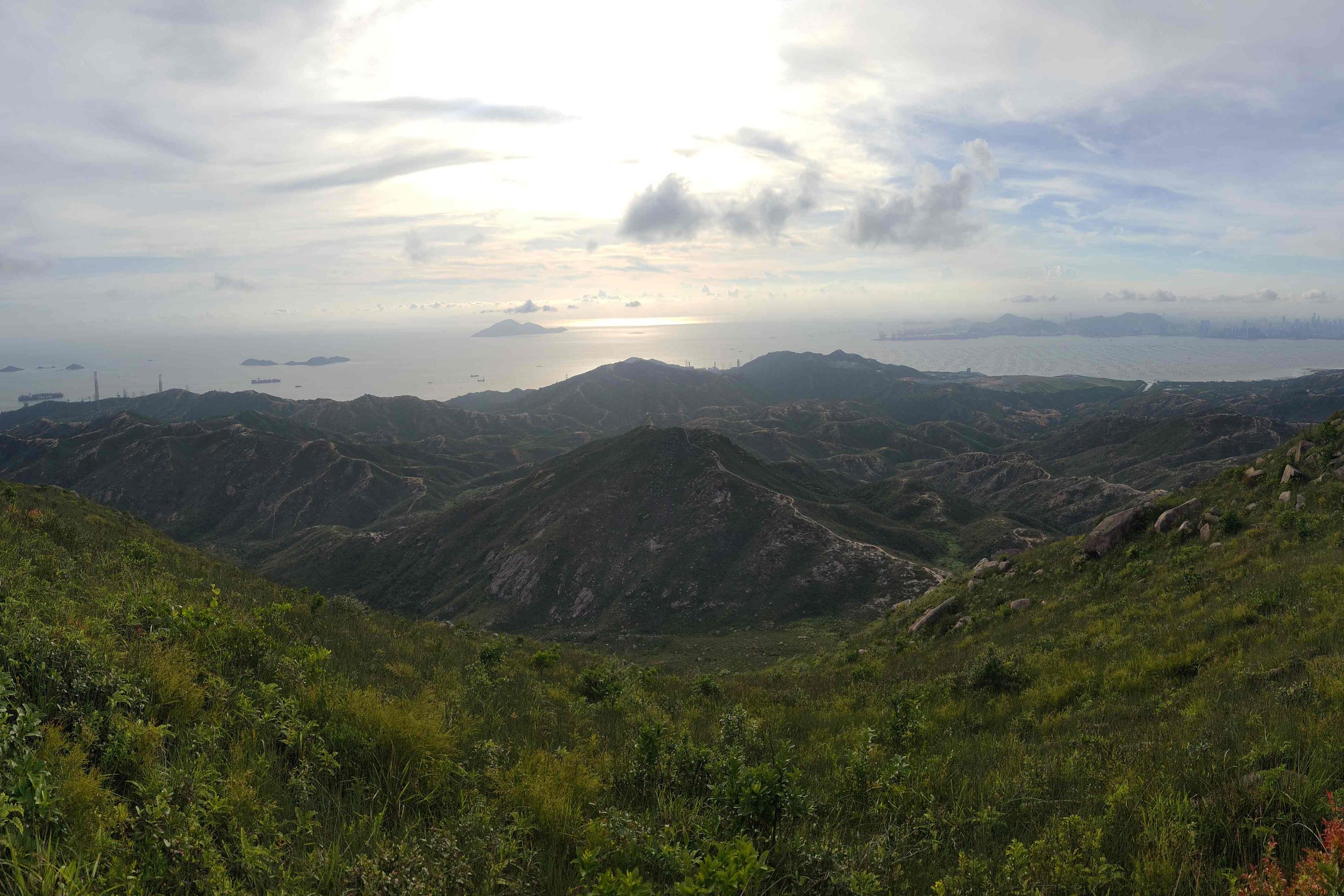
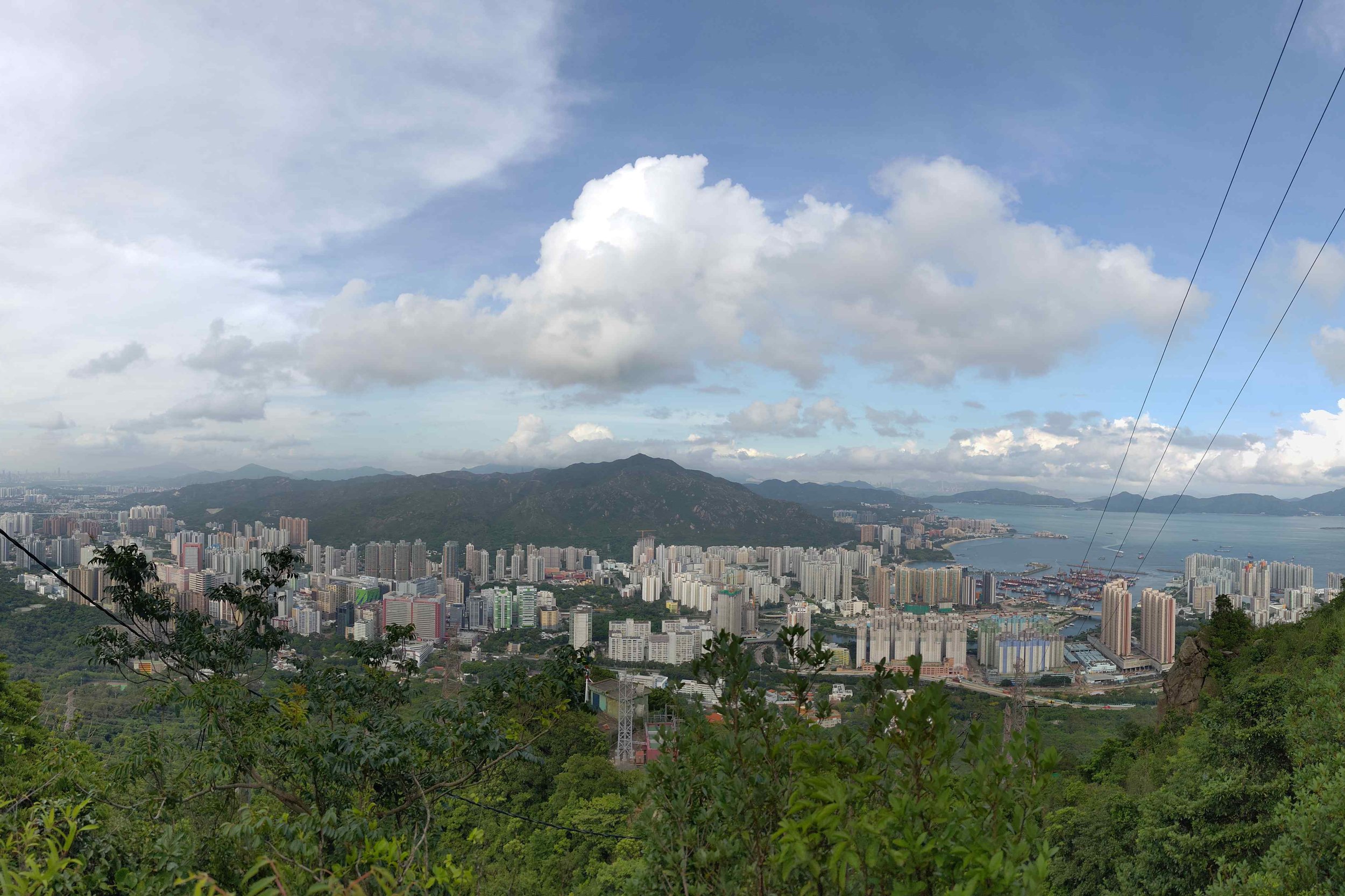
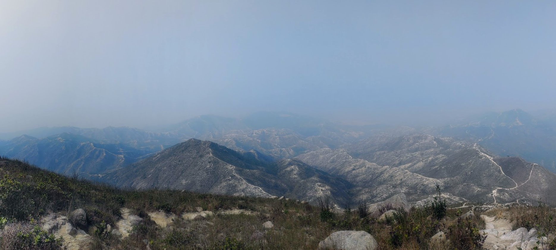
Just like Pui To’s journey, climbing to the top of Castle Peak is a pilgrimage with amazing rewards. You’ll be able to see what’s known as the 'Castle Peak Hinterlands', a barren ocean of undulating mountains that the People’s Liberation Army (PLA) use as a firing range. You’ll also have stellar views of Tuen Mun, Yuen Long, Lantau Island and Shenzhen Bay in mainland China.
Google Route Map
How to Get to Castle Peak
By MTR:
The start point of this hike is Tuen Mun station. The most convenient way to begin is to just take the MTR directly to Tuen Mun station and get out at Exit A. If you don’t fancy taking the MTR all the way to Tuen Mun, you can take any of the following buses to the start point.
By Bus:
*The below buses will take you directly to Tuen Mun MTR (the start point) unless stated otherwise.
From HK Island:
- 961 (Wan Chai, Admiralty, Central, Sheung Wan)
From Kowloon:
- 260X (Hung Hom, Tsim Sha Tsui, Jordan, Austin) – get off at Tuen Mun Town Plaza and walk forward to Pui To Road before following it left. You’ll soon be at the start point (Tuen Mun MTR Exit A).
- 62X (Yau Tong, Lei Yu Mun, Lam Tin, Kwun Tong, Ngau Tau Kok, Kowloon Bay, Diamond Hill, Wong Tai Sin)
From New Territories:
From Lantau:
- E33 (Tung Chung)
From Tuen Mun MTR to the Hike Start Point:
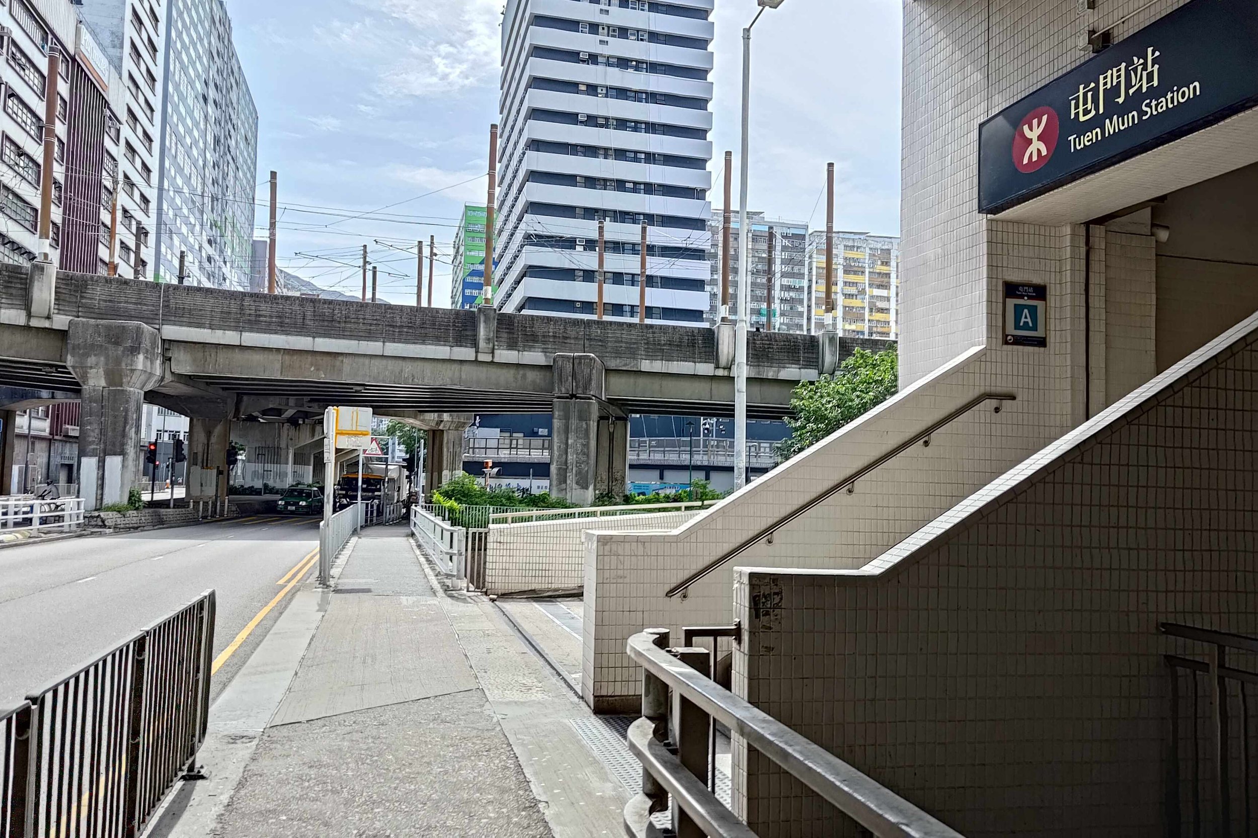
- Make your way along Pui To Road (going past the little canal and police station)
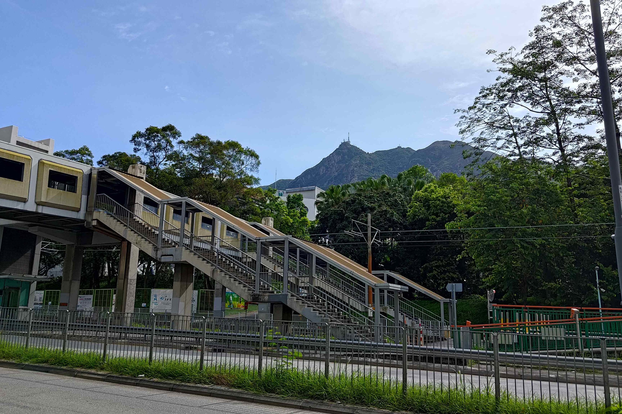
- When you arrive at Tsing Wun Road, take the footbridge
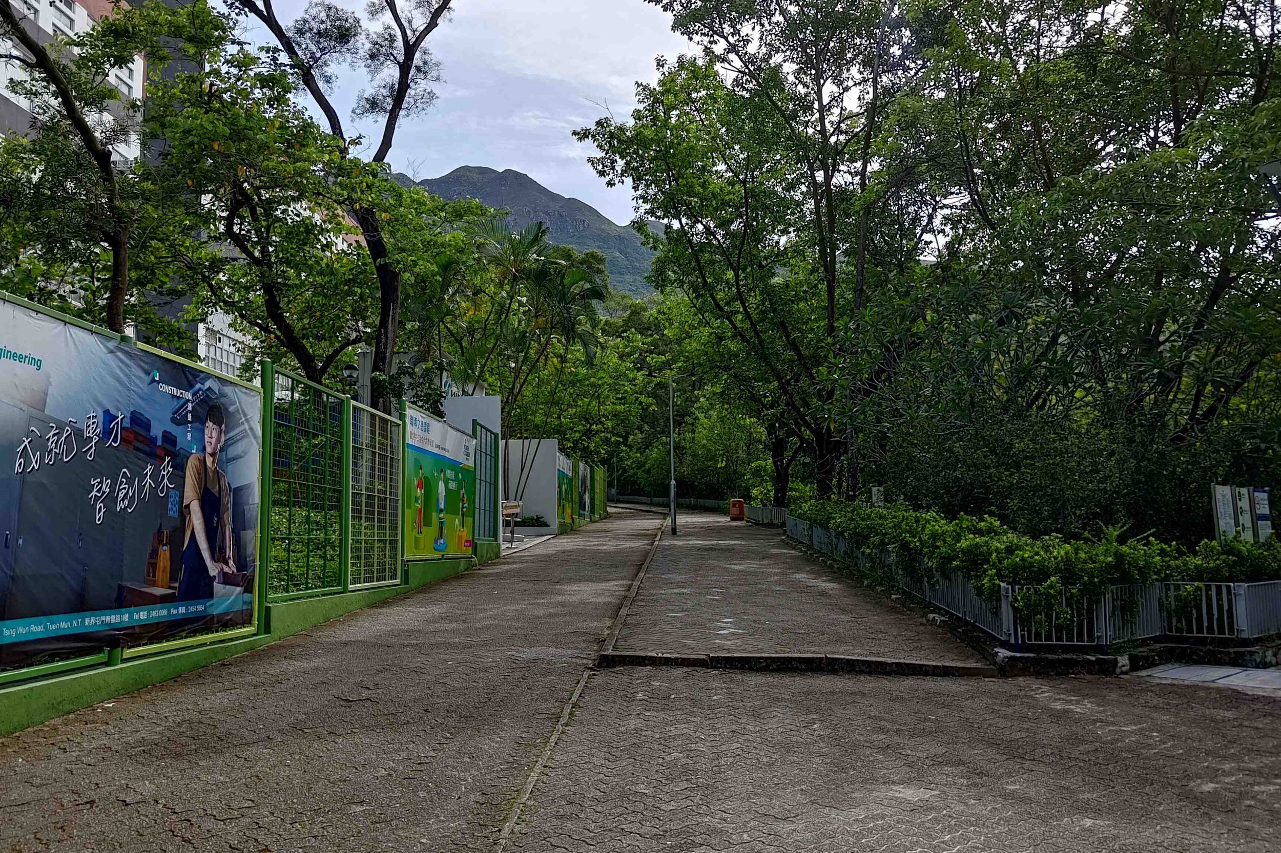
- Go straight after the footbridge past the Hong Kong Institute of Vocational Education
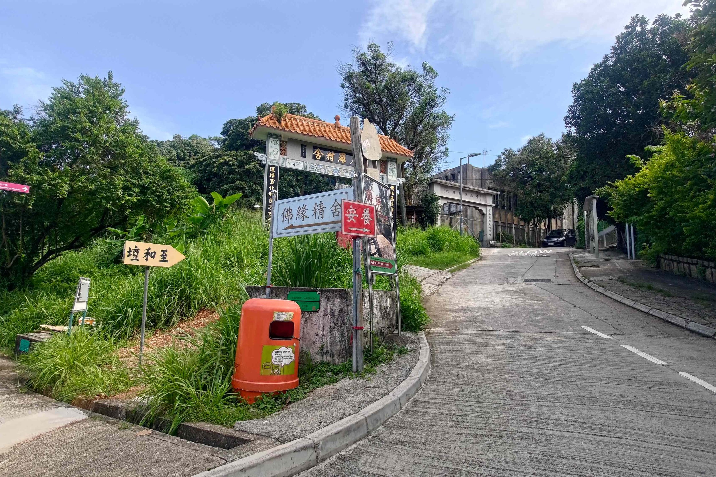
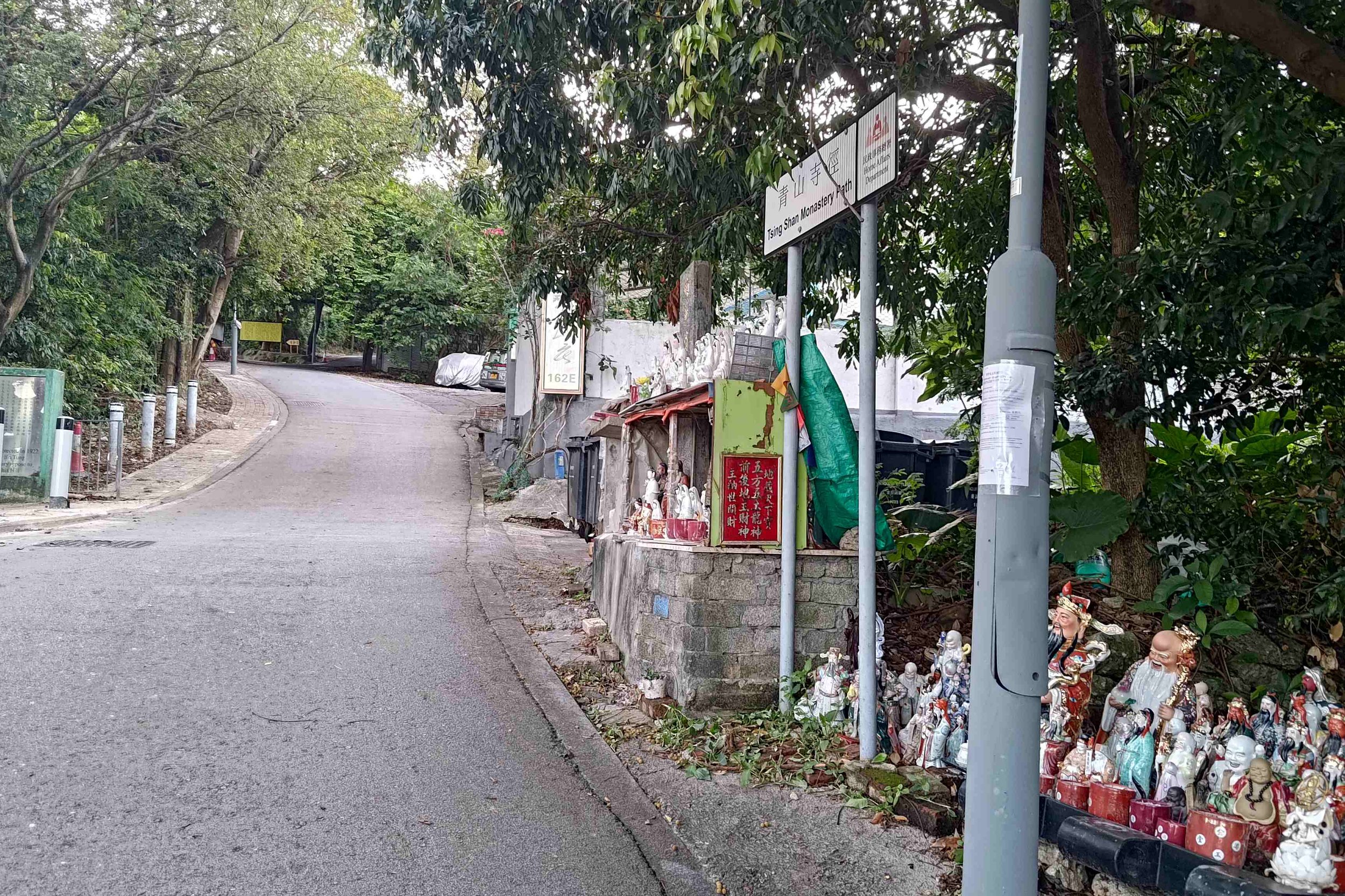
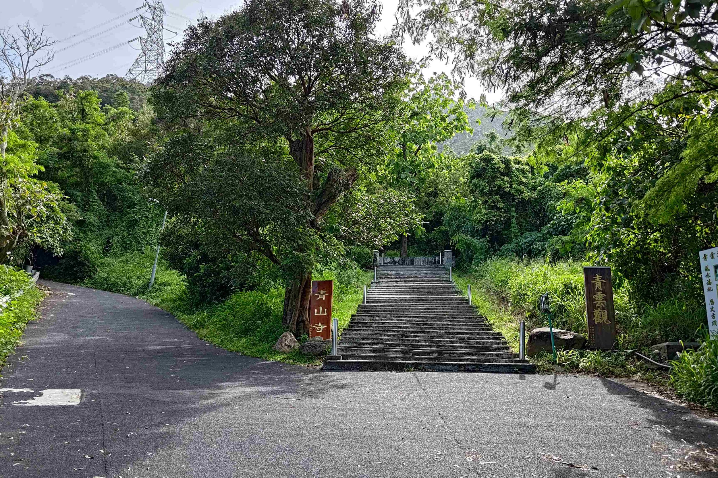
- On Yueng Tsing Road, go left until you see the pink Tsing Shan Monastery sign
Quick Castle Peak Hike Route Summary
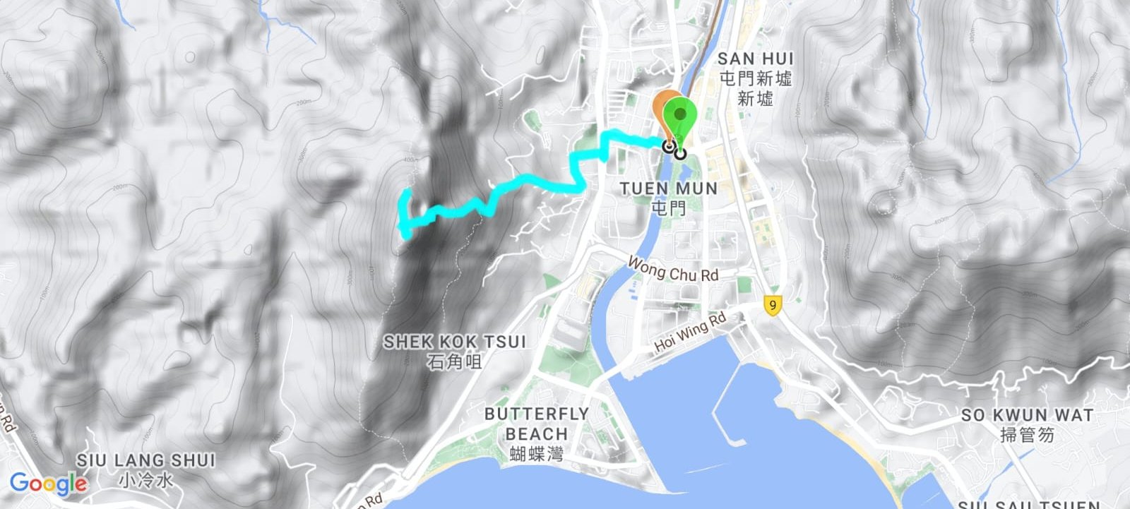
- Go up the concrete road, following the signs that point toward Tsing Shan Monastery (10ish mins)
- At the Tsing Shan Monastery stairs, keep left and continue on the concrete road
- Take the stairs with the yellow railings on either side
- At the pavilion, take the left path
- Take the stairs to the right (old metal railing)
- Keep climbing until the yellow railings switch to fake bamboo green railings. This is the halfway point
- Continue climbing and follow the fake bamboo railings until they disappear
- Follow the rocky steps all the way up until you arrive at the Han Yu Pavilion
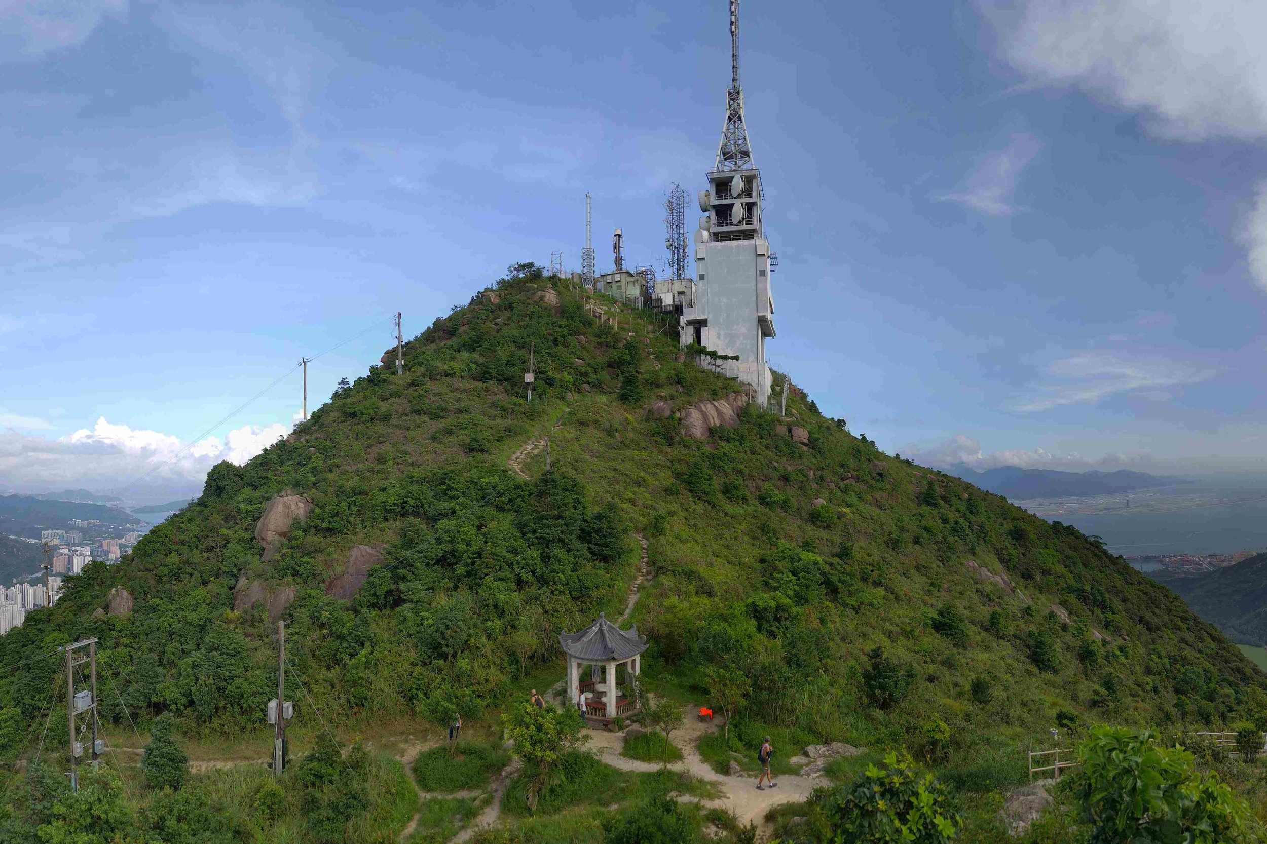
- There are five paths here. Take the one directly to your left and you can climb up to the Castle Peak Transmitting Station for amazing views!
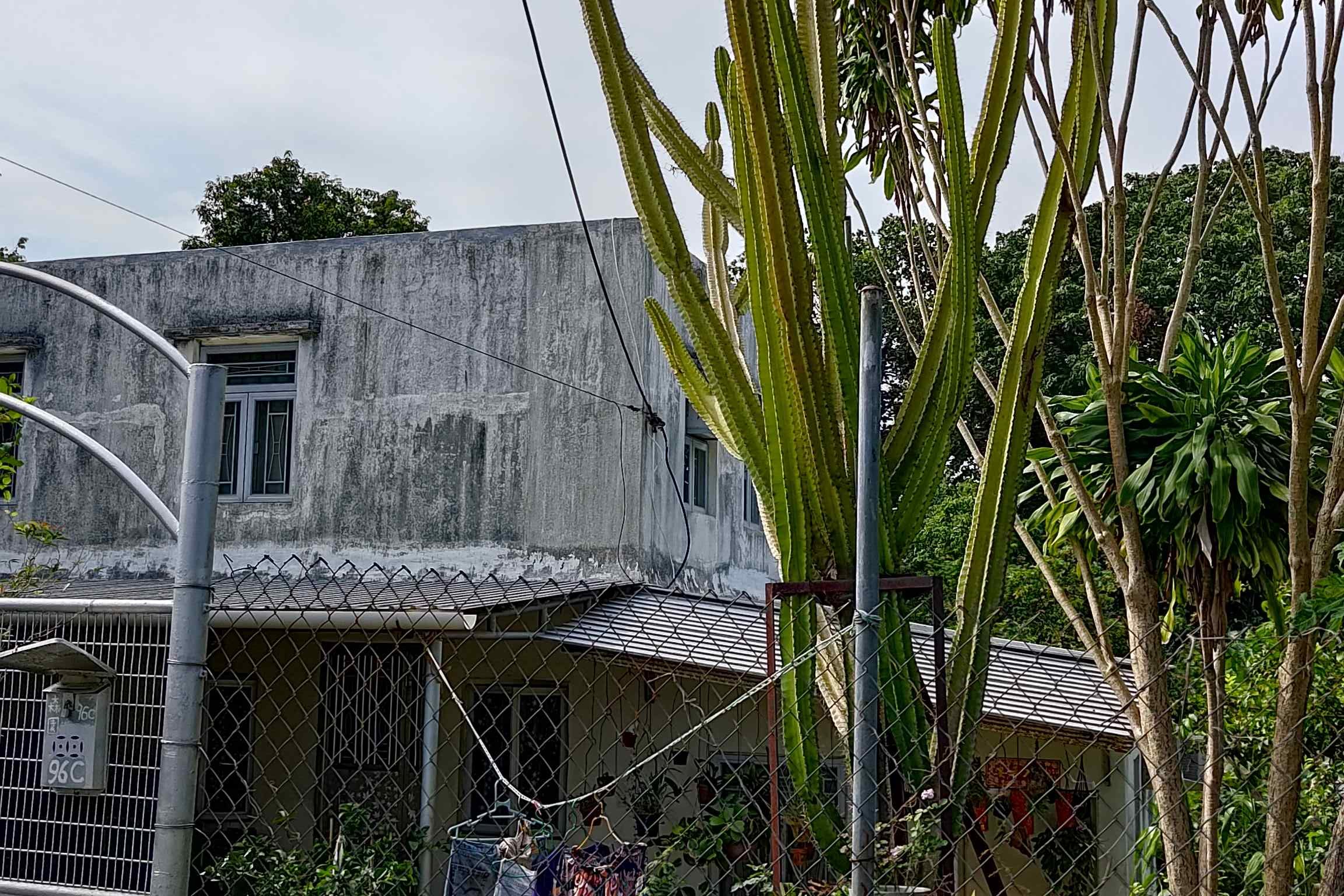
A Concrete Road with Buddhist Flair
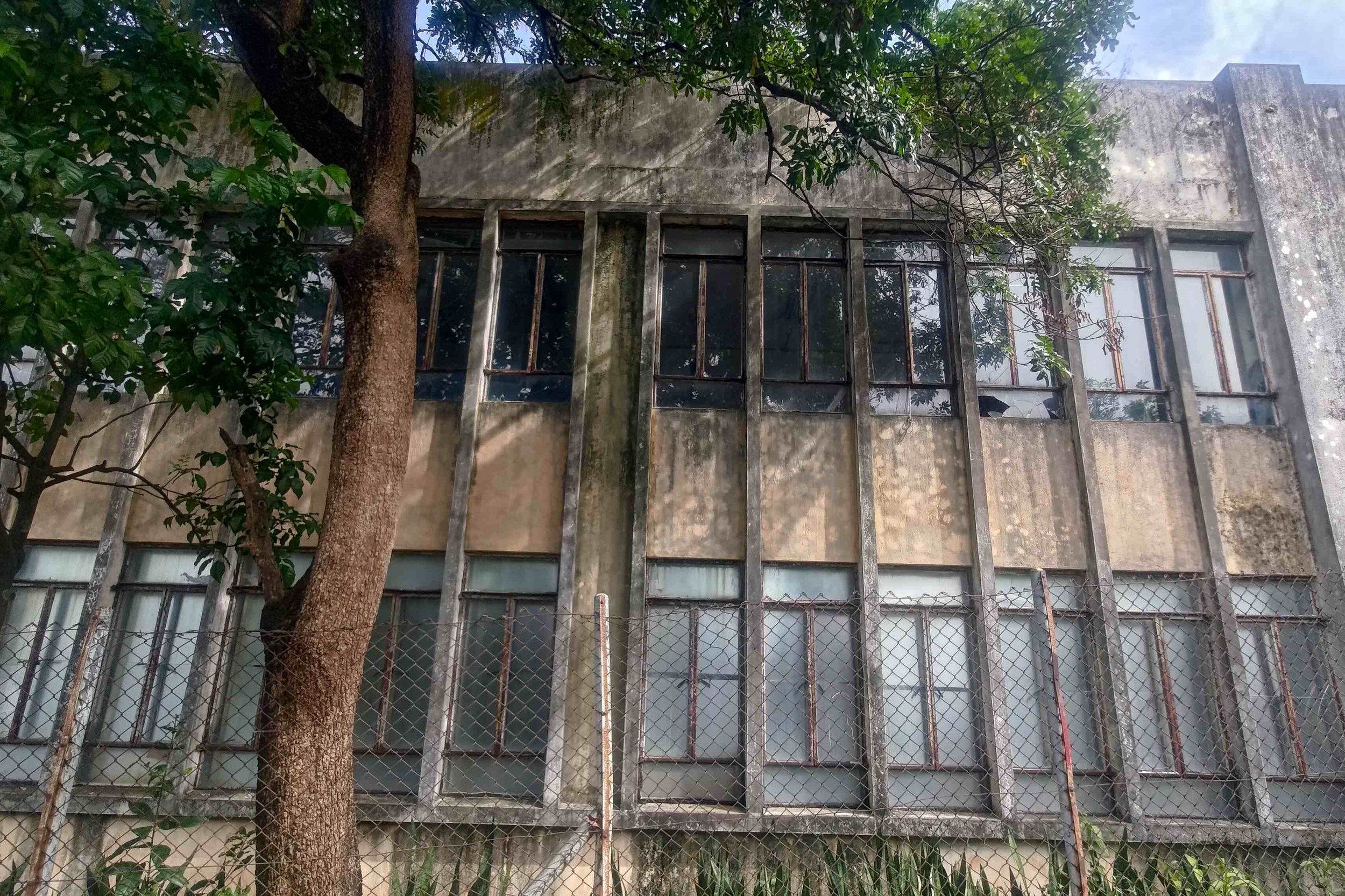
As you begin climbing up what would be another boring concrete path, you’ll find a few intriguing surprises along the way. First, an abandoned Buddhist primary school on the left with broken windows and mold growing on the walls. It looks kind of creepy, but also makes me wonder what made the school shut down.
On the opposite side of the road, you’ll see probably the tallest cactus I’ve ever laid eyes on (at least in Hong Kong).
As you keep climbing, you’ll also pass by a shrine with dozens of different statues of Chinese Buddhist deities.
The greenery on this road is a standout feature, too. I saw a congregation of stunning butterflies up in the trees that were impossible to photograph properly with my phone camera, so you’ll have to trust me on that one.
Ignore the stairs to the monastery (unless you fancy having a look before the hike) and go left.
Follow the Yellow Railings and Go Left at the Pavilion
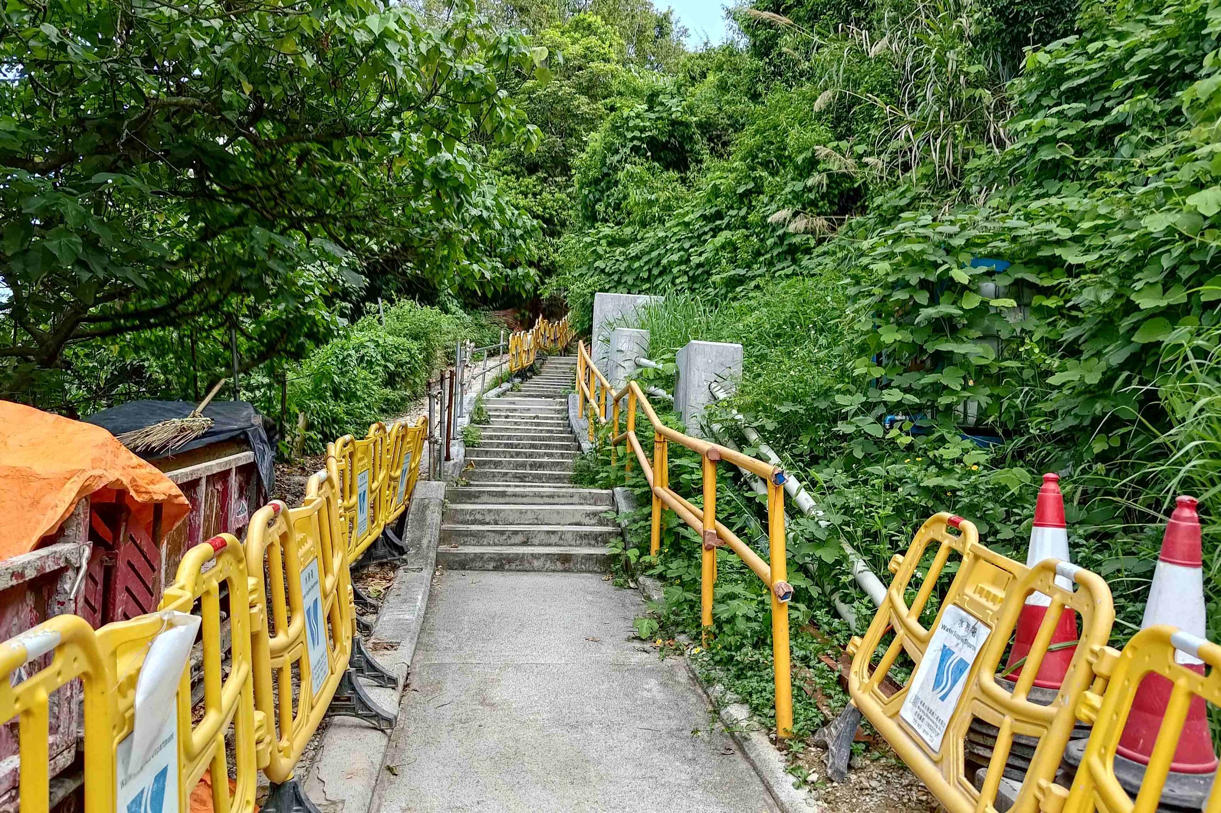
You’ll soon arrive at some stairs with yellow railings. Get ready for a relentless climb with zero respite from this point on. Follow the yellow railing stairs to the first pavilion.
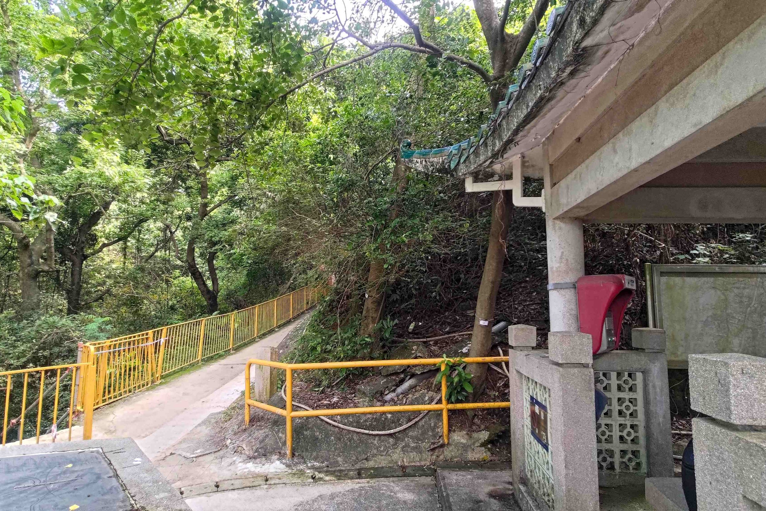
When the first pavilion comes into sight, take a left up the yellow railing slope and ignore the stairs to the right. They don’t go anywhere.
Take a Right at the Metal Railings
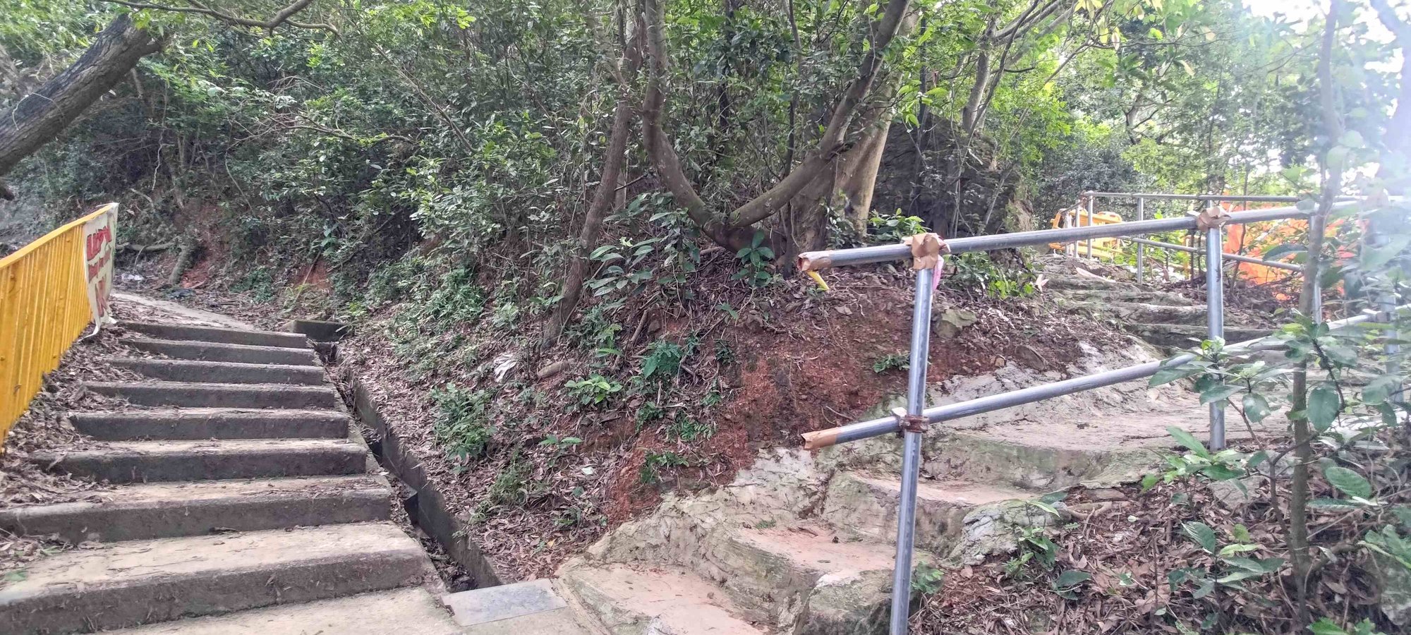
After about five minutes, you’ll see a set of stairs going right. They honestly look like they don’t lead anywhere, but these are the correct stairs. If you stay on the path you’re currently on, you’ll be led to a bunch of old tombs.
If you do end up reaching the tombs, just head back to the intersection and take the other set of stairs.
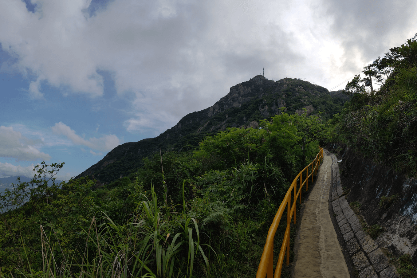
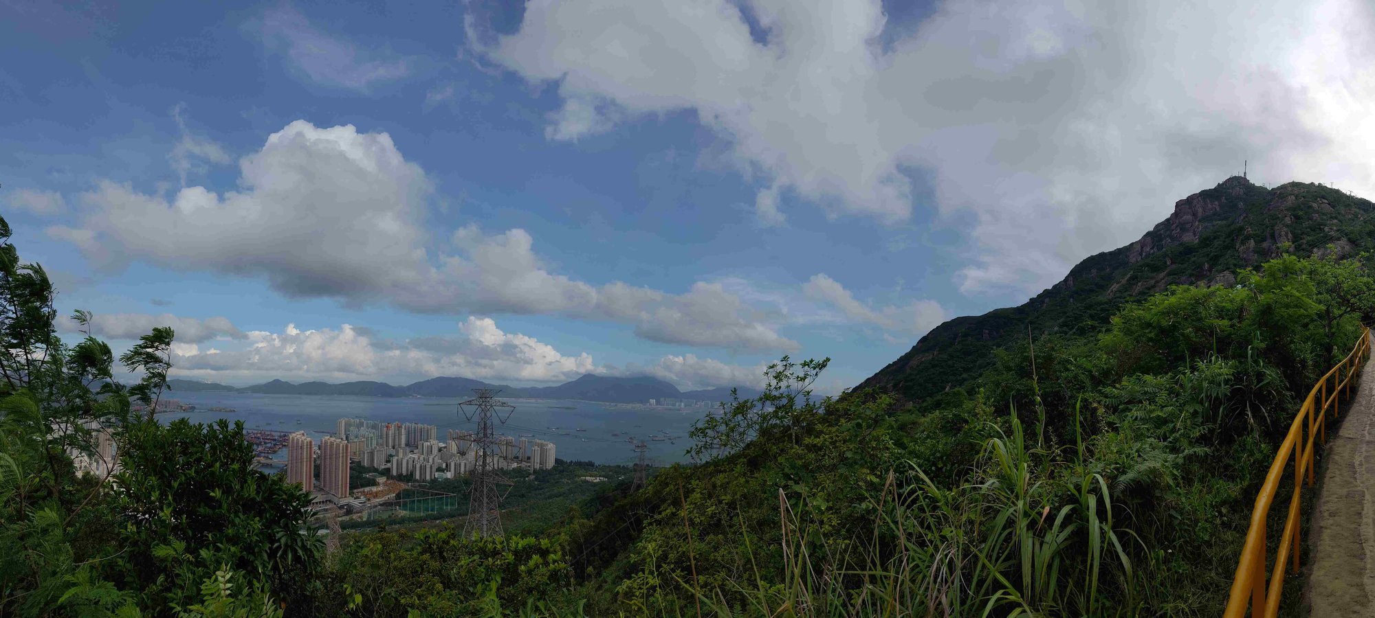
Climb upward, following the yellow railings. You’ll pass underneath a huge electrical tower before the path opens up and gives you a little reward for all your effort.
Take a short break to enjoy views of Lantau across the water and Tuen Mun right below you.
Right after the view, the yellow railings will turn into thicker green ones that have a fake wood motif. This marks the halfway point.
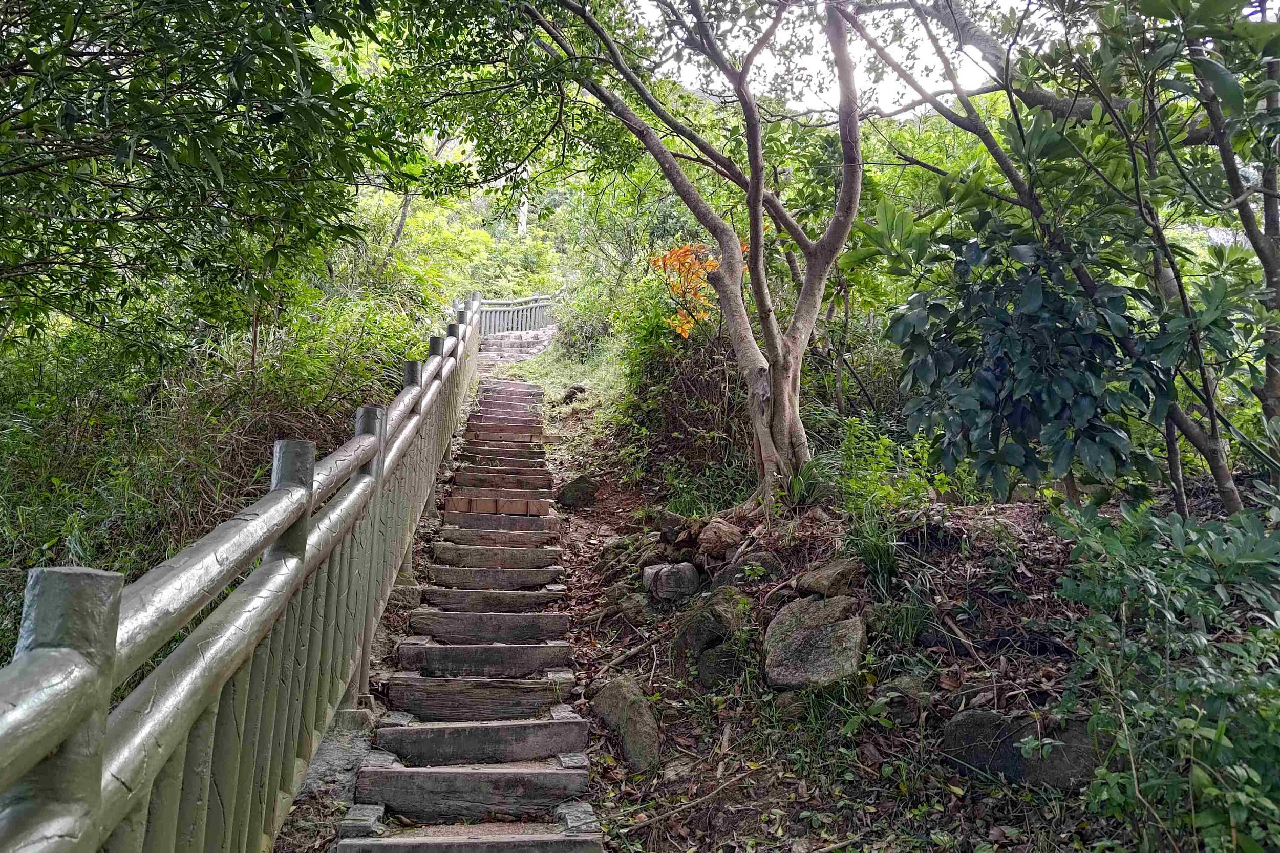
Even the Railings Give Up at the Toughest Section
Wooden steps and stone steps are the hallmarks of this section of the hike. You’ll also be treated to several awesome viewpoints, so take this section slow and be sure to take breaks since it can get pretty demanding.
The green railings disappear on the home stretch of climbing. This section takes about 10-15 minutes if you don’t take breaks and is incredibly steep. However, you can rejoice in knowing that your death by a thousand stairs is almost over.
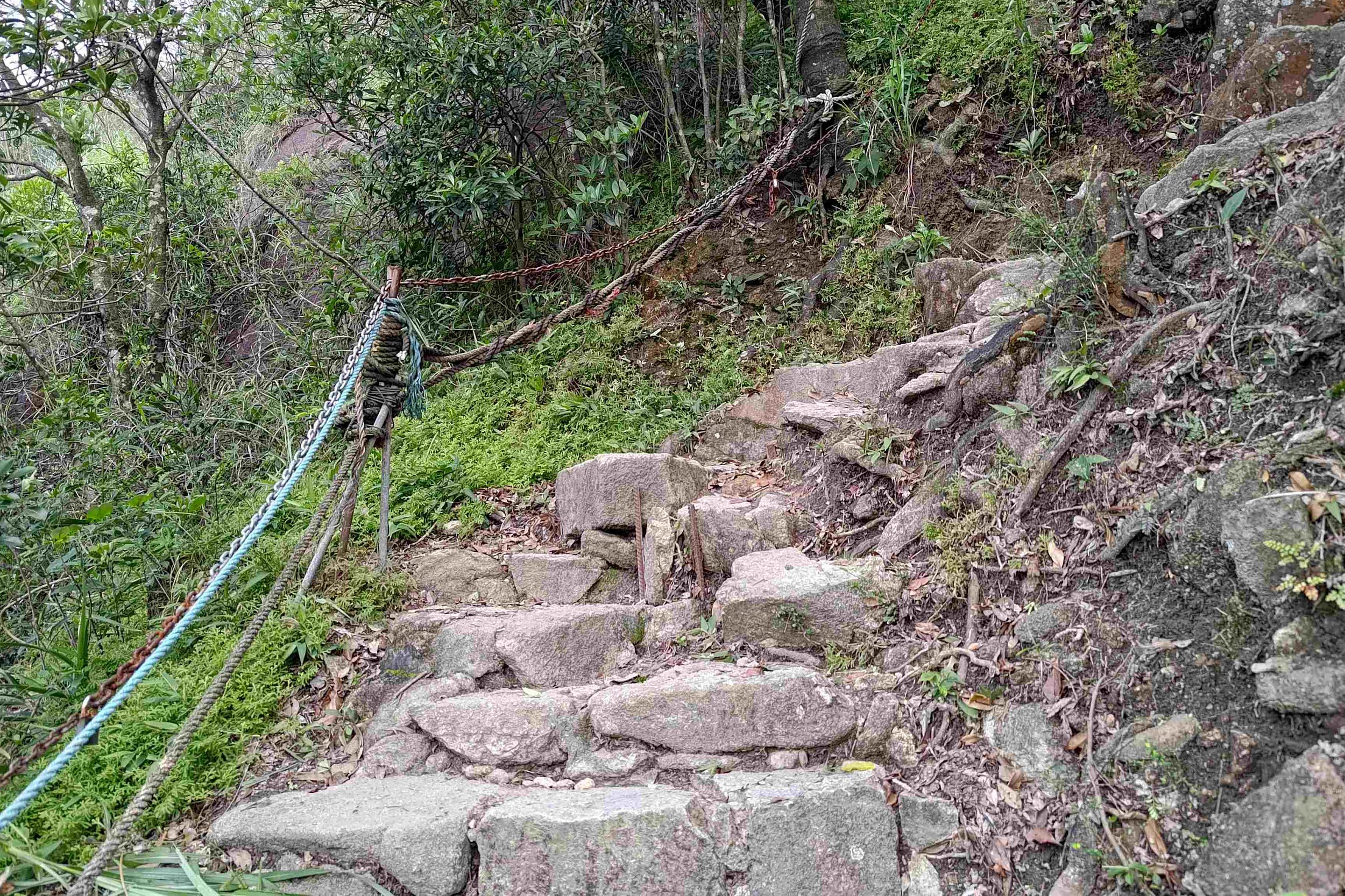
Since the railings disappear here, use the chains and ropes that take their place and keep heading up.
Han Yu Pavilion – So Many Paths!
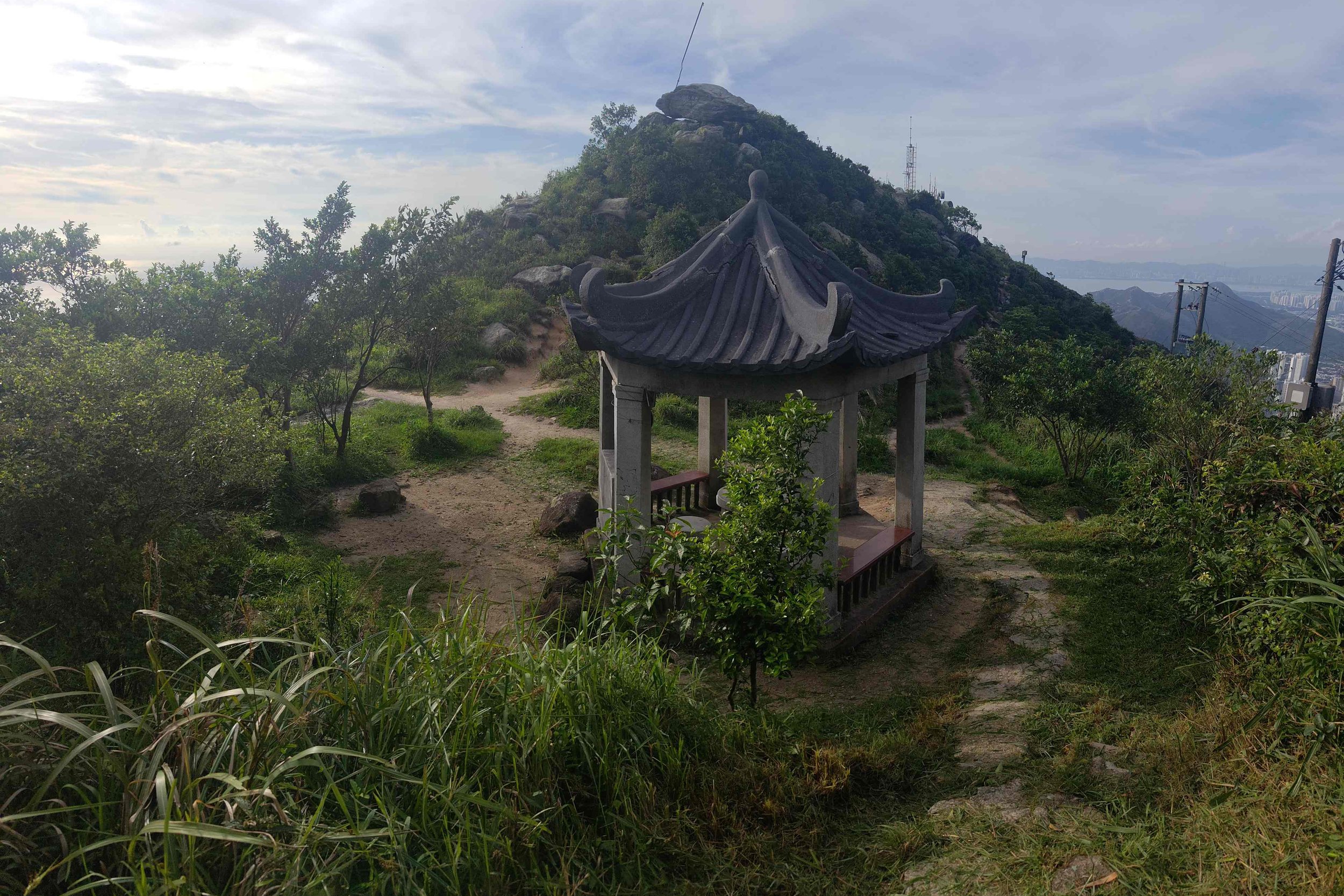
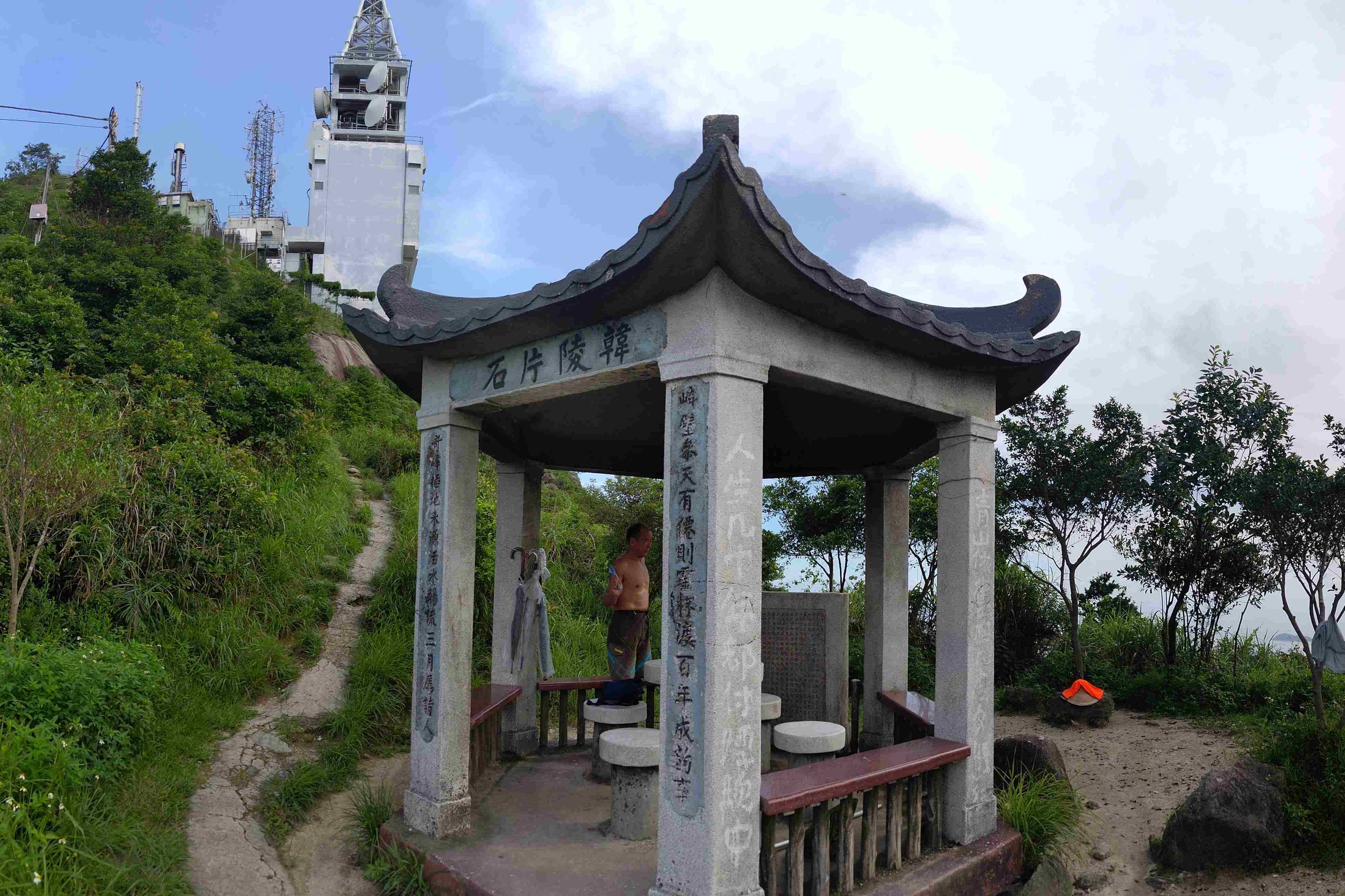
The Han Yu Pavilion has 5 paths you can take. I’ll briefly outline each one below.
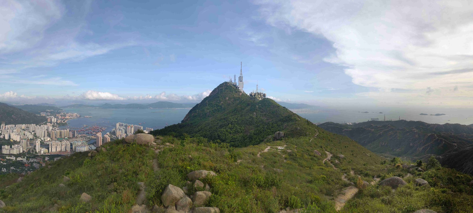
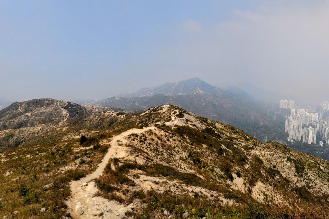
Left Path: stone steps up to Castle Peak Transmitting Station where you’ll get the best views of Tuen Mun and Lantau.
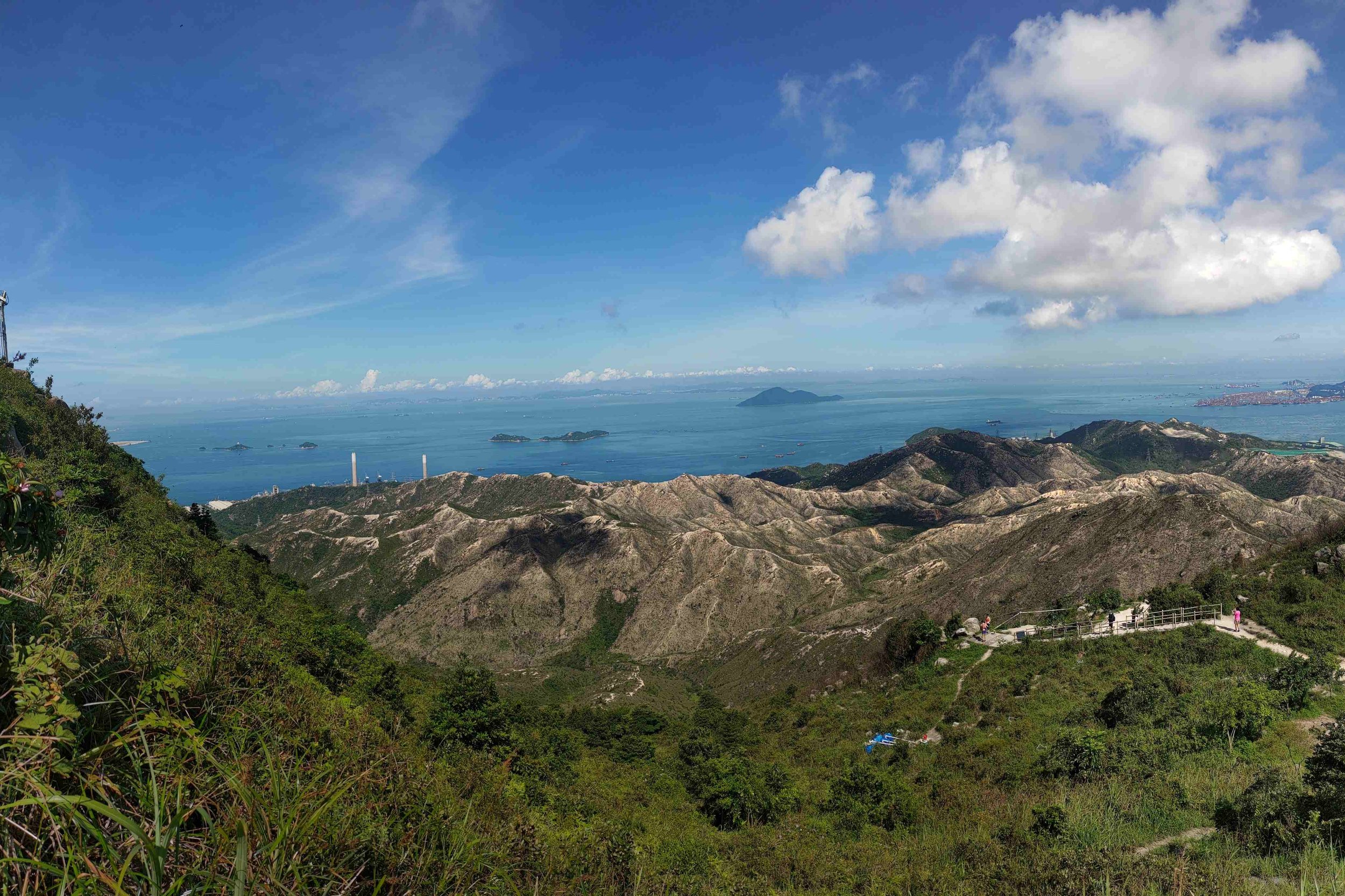
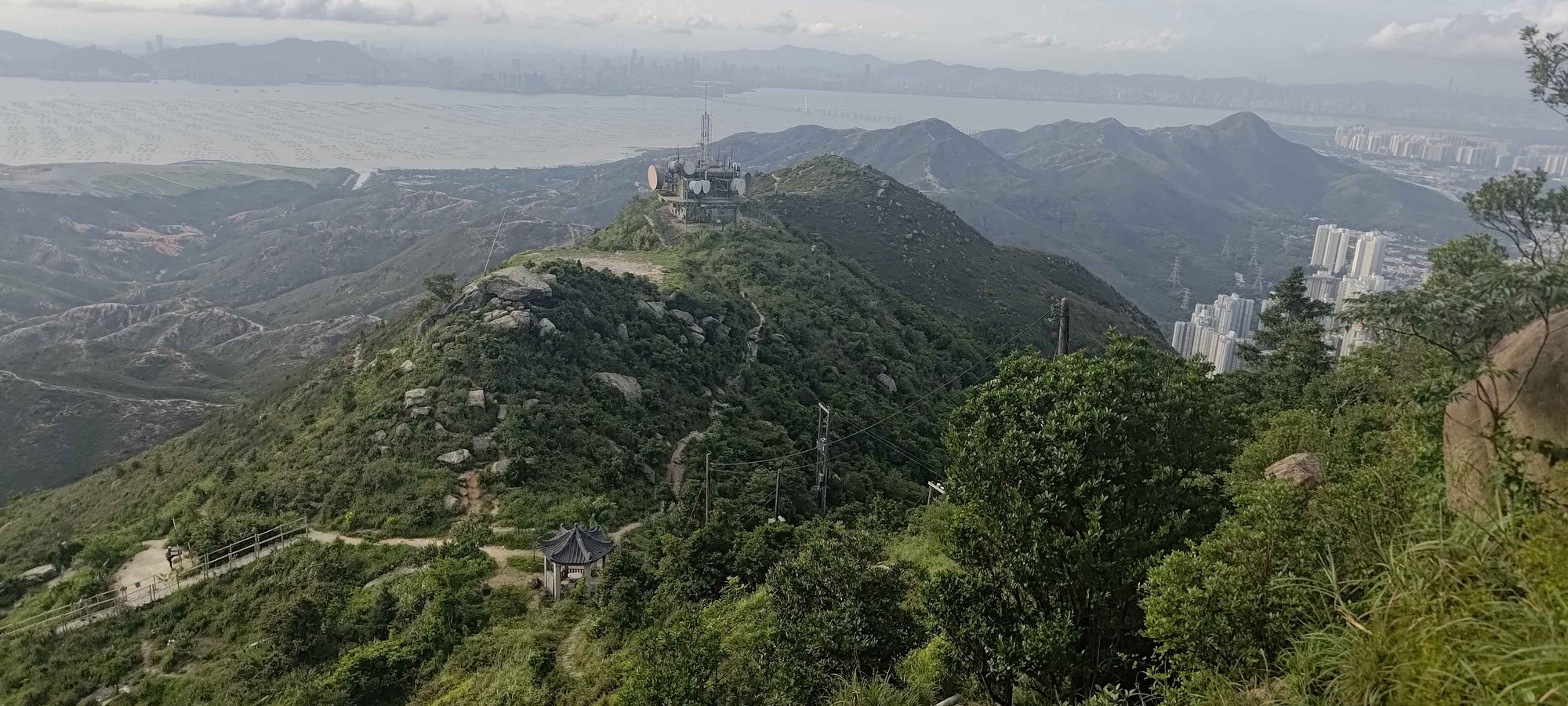
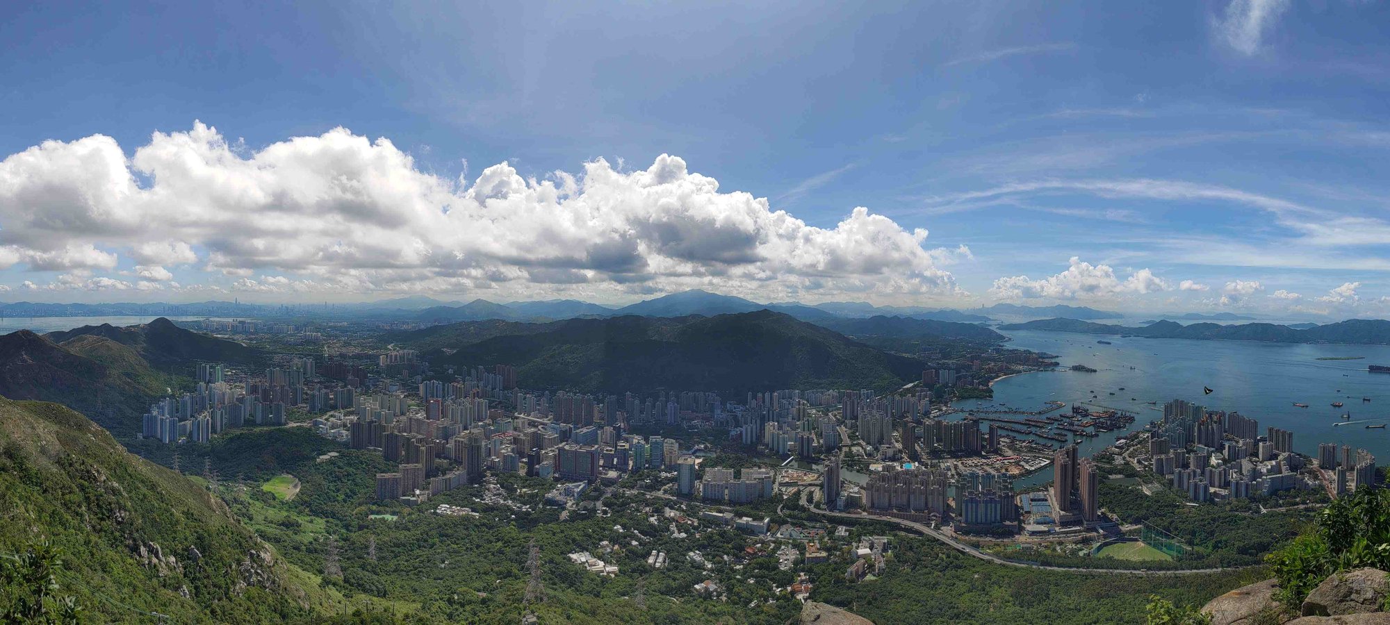
Right (flat path): gentle path to Castle Peak Radio Transmitting Station. Amazing views of Castle Peak Hinterlands below, especially if you continue past the Radio Transmitting Station to the little peak just beyond.
Right (ascending path): short climb up to where a flagpole stands with no flag. You’ll get great views from here of the Castle Peak Transmitting Station and the Castle Peak Hinterlands below.
Forward Path: You’ll head down a few steps to a viewing point and a little makeshift gym with pullup bars and even a deadlift bar with weights. You’ll get decent views of the Hinterlands here.
Backward Path: Goes back the way you came.
Castle Peak Transmitting Station – The Summit
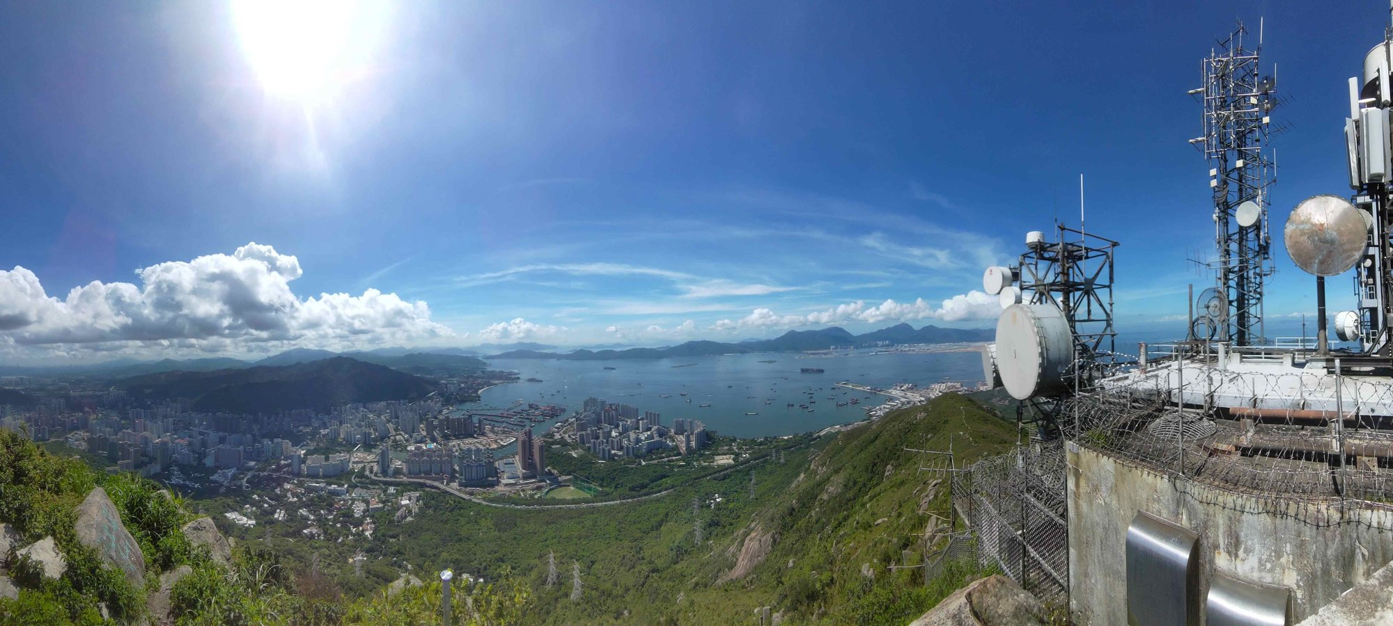
If you only have time for one view, definitely take the left path up to the Castle Peak Transmitting Station. When you reach the station, there’ll be two paths onward. Take the path forward one that leads to the top, where a trigonometric point (white pillar with a black top) informs you that you’ve reached the summit of Castle Peak!
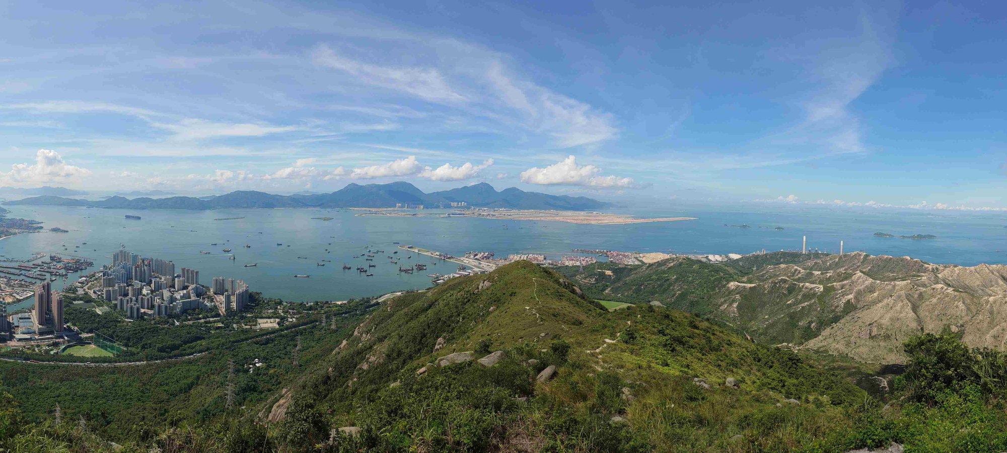
Tuen Mun, Lantau and even Shenzhen Bay are all visible on a clear day!
If you take the other path (through the transmitting station, past the fence), you’ll see some steps heading down to a path that takes you on the Tsing Dip South Ridge. I didn’t take this route, so attempt it at your own risk.

Castle Peak Radio Transmitting Station
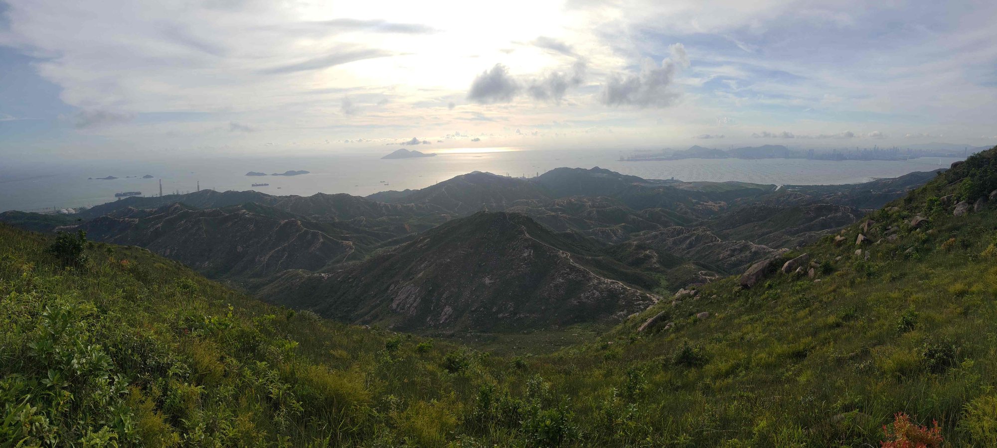
If you have time, definitely also head toward the Castle Peak Radio Transmitting Station and go past it until you reach the trigonometric point (white pillar with black top). This is where you’ll have arguably the best views out across to Shenzhen, while seeing the entire length of the hinterlands below, as well as having a great view of the Castle Peak Transmitting Station.
This is also where you can hike down into the hinterlands, though this route is not recommended unless you're a seasoned hiker.
Optional Treacherous Hike Down into the Hinterlands
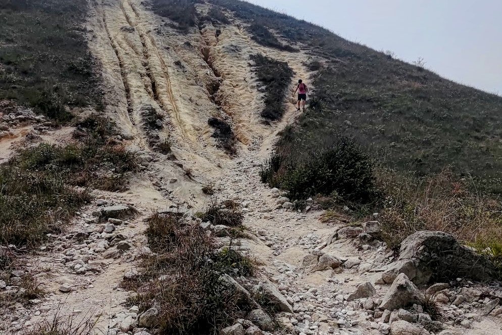
The path down to the hinterlands is extremely steep, full of loose rocks and fine silt and the perfect place to twist an ankle. Unless you're a really experienced hiker, I wouldn't recommend this route.
It's also really easy to get lost among the myriad of different trails within the hinterlands, so use the map above if you decide to take on this challenge.
Where the hinterlands end, you'll actually be at the start point for the Hong Kong Grand Canyon Hike.

The Way Back
The best route back for most people is to simply retrace your steps back to Tuen Mun MTR Station. There are other routes from the top of Castle Peak, but this option is definitely the safest and most reliable.

