
Hung Shek Mun: How to Hike to Hong Kong's 'Pink Beach'
Contents
- Essential Information
- Hike Highlights
- Google Route Map
- How to Get There
- Quick Route Summary
- Directions From 20R Last Stop
- Detailed Route
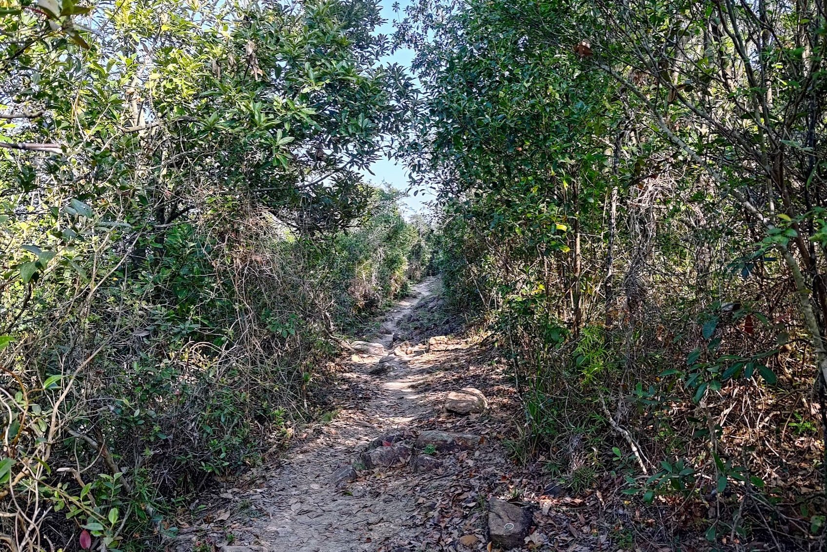
- The Trail to Kau Tam Tso
- Sheung Ha Miu Tin Abandoned Village
- Ha Miu Tin Abandoned Village
- Climbing Tai Tung
- Best Overhead Ocean Views
- The Overgrown, Horrible Downhill Section
- Hung Shek Mun - The Pink Beach
- Getting Back
Essential Hung Shek Mun Hike Details
- District: New Territories
- Duration: 5.5 hours minimum, assuming you don't get lost
- Distance: 16.5 km
- Highest Elevation: 220ish meters
- Difficulty: 4/5
- Facilities: None. Bring loads of water and food. Use the toilet beforehand.
Why Hike Hung Shek Mun?
While I'd love to say that Hung Shek Mun is the most spectacular hike I've ever been on, I seriously do not recommend that most people attempt this specific route unless you REALLY want to see the pink beach.
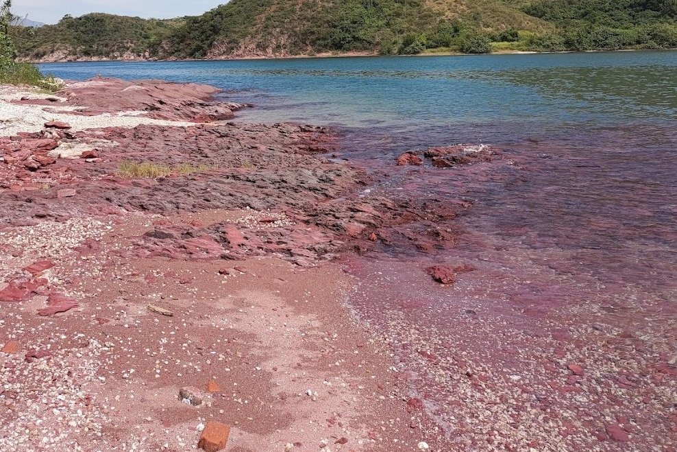
This is because most of the time Hung Shek Mun isn’t actually pink, but rather more of a brick red/brown color. However, while under perfect lighting conditions, parts of the beach do gain a pink hue.
Despite the shortcomings, it would still totally be worth hiking the 16.5 km there and back (yes, you'll be hiking back the same way you came) if not for how overgrown the trail is.
If you're a hiker who always wears shorts (like me) this trail will be painful on your legs. If you're even moderately tall, you will be hit in the head by branches at some point, too. Finally, you will have to navigate using ribbons for quite a large portion of the trail, which may be uncomfortable for unseasoned hikers.
As an alternative, if you want to see pink coastlines in the same area while sticking to a clear trail and also getting to visit loads of traditional Hakka villages, I'd suggest the Lai Chi Wo hike linked below. The start point and beginning portion of the hike is the same as Hung Shek Mun and the distance is similar, but it's easier to navigate and arguably, more scenic.
If, however, you're set on getting to Hong Kong's pink beach, then read on (you masochist).
Google Route Map
How to Get to the Hung Shek Mun Hike Start Point
To get to the Hung Shek Mun hike start point, take the MTR to Tai Po Market station and then hop on any of the two following buses:
- 275R Bus
Leave Tai Po Market Station at Exit A3 and follow the 275R laminated signs.
You can take the 275R bus on Sundays or public holidays to the last stop, which is Wu Kau Tang Bus Terminus (hike start point).
- 20R Green Minibus
Leave Tai Po Market Station at Exit A3 and turn left following the blue 'Public Light Buses' sign. The 20R bus will be immediately to your left at the minibus station.
The 20R minibus runs only once per hour on weekdays, every 40th minute of the hour (06:40, 07:40 etc), but is more frequent on weekends. Get off at the second-last stop (at the intersection of Chi Sum and Wu Kau Tang Road).
If you end up at the last stop, no worries. I'll start the hiking guide from there, anyway.
Quick Hung Shek Mun Hike Route Summary
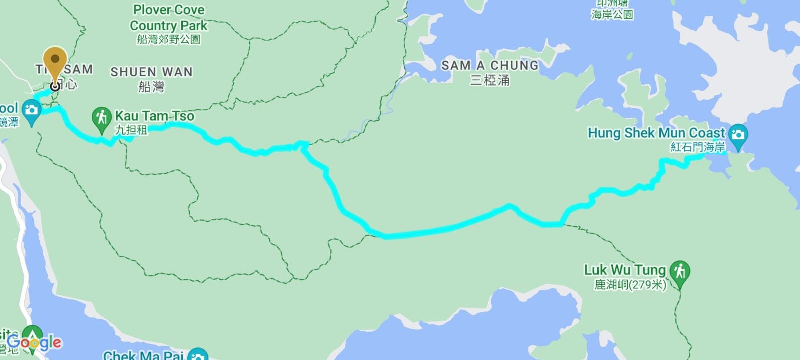
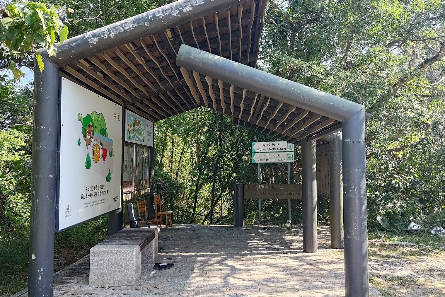
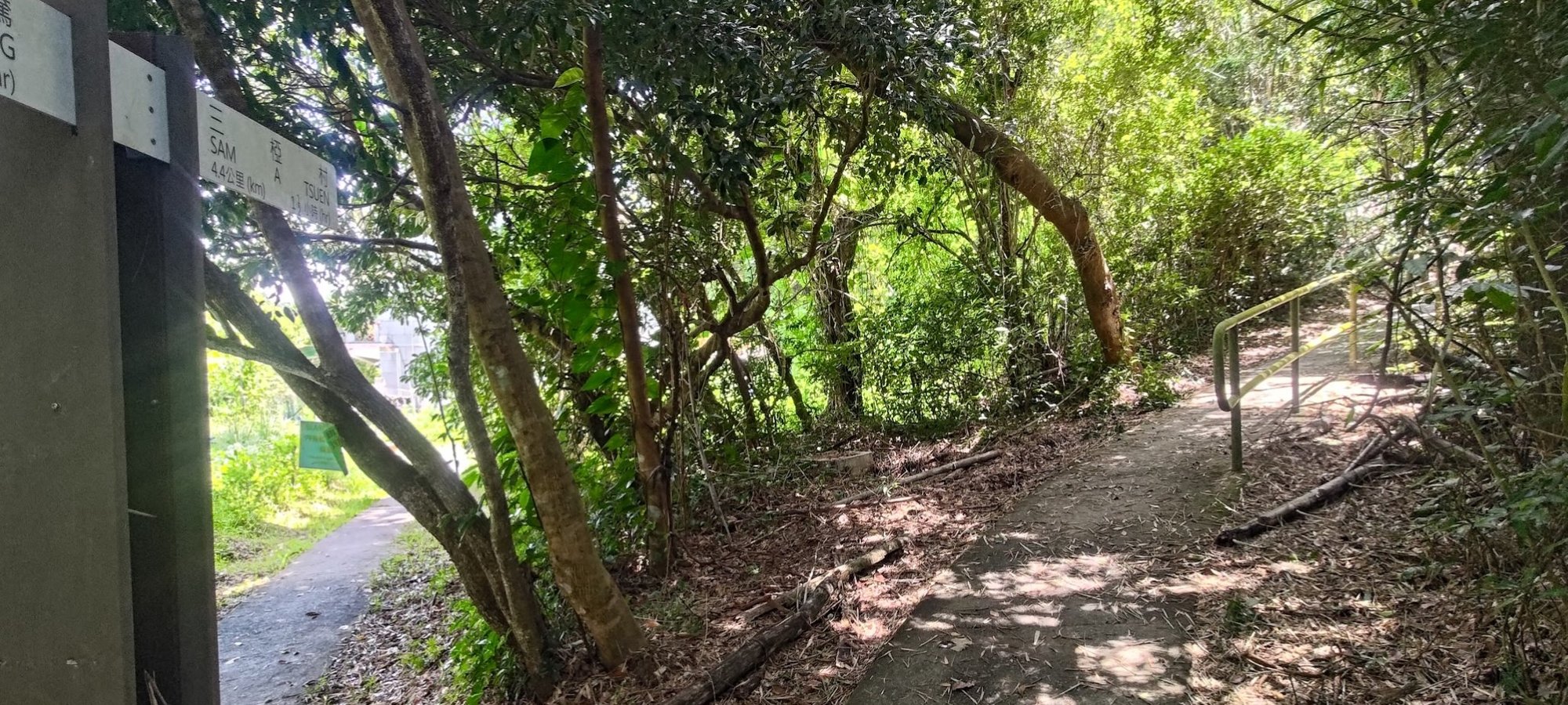
- Follow the 'Wu Kau Tang Tsuen' sign behind the Wu Kau Tang Bus Terminus shelter
- Follow the 'Sam A Tsuen' sign and cut through the bottom of Wu Kau Tang Village
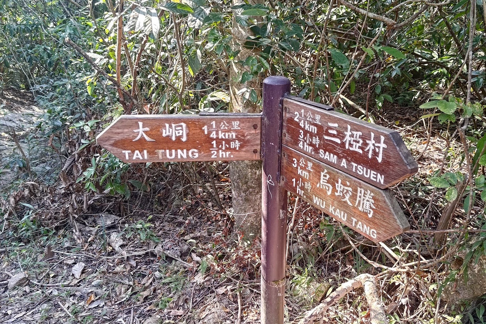
- Turn right at the 'Kau Tam Tso' sign and follow the trail for 10 mins
- At the fork in the road follow the 'Sam A Tsuen' sign up the sloping path
- 5-10 mins later, follow the path straight and avoid the stairs (near the red emergency post)
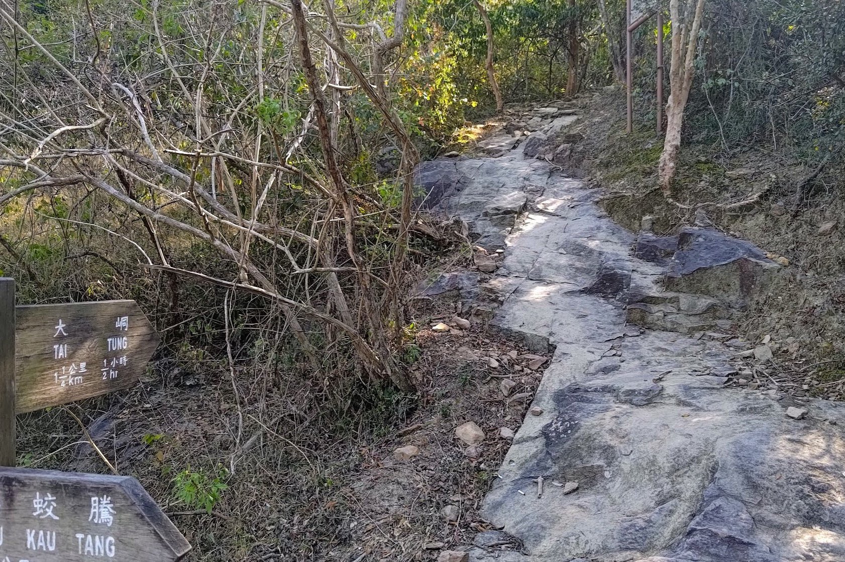
- 20 mins later, after crossing a little stream, you will arrive at a set of signs. Take the one pointing upward to 'Tai Tung'
- The climb to the top takes half an hour at a fast pace with no breaks
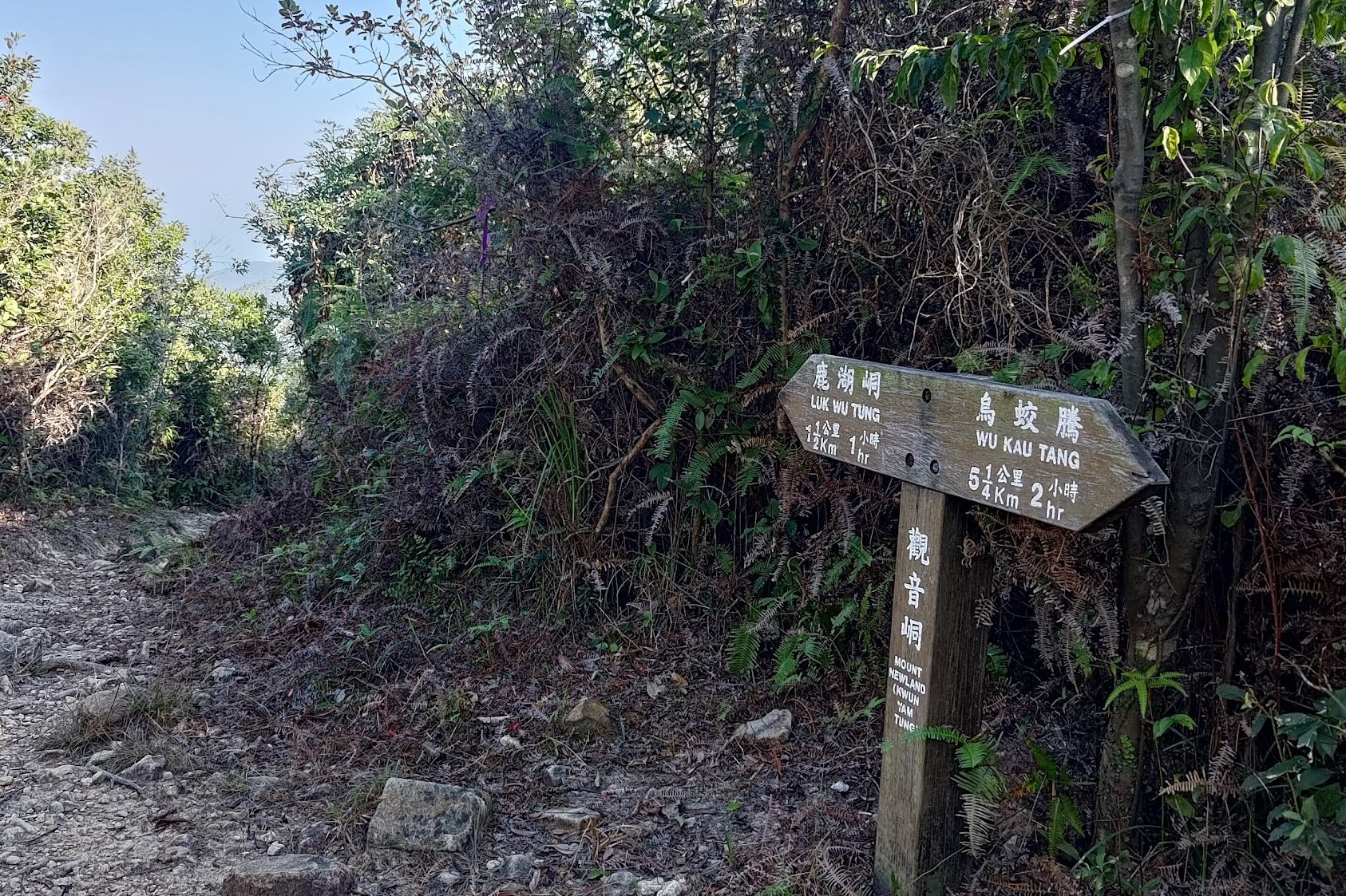
- At the top, you will see a sign pointing to 'Luk Wu Tung', follow it and continue past the next 'Luk Wu Tung' sign, too
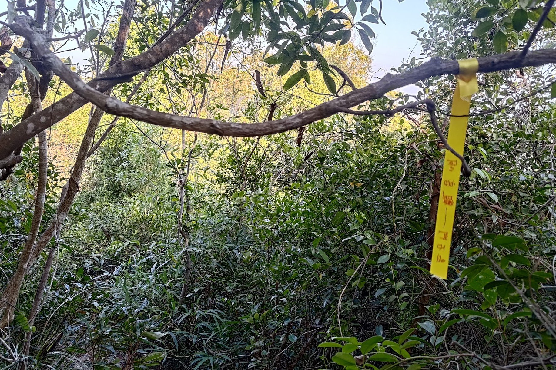
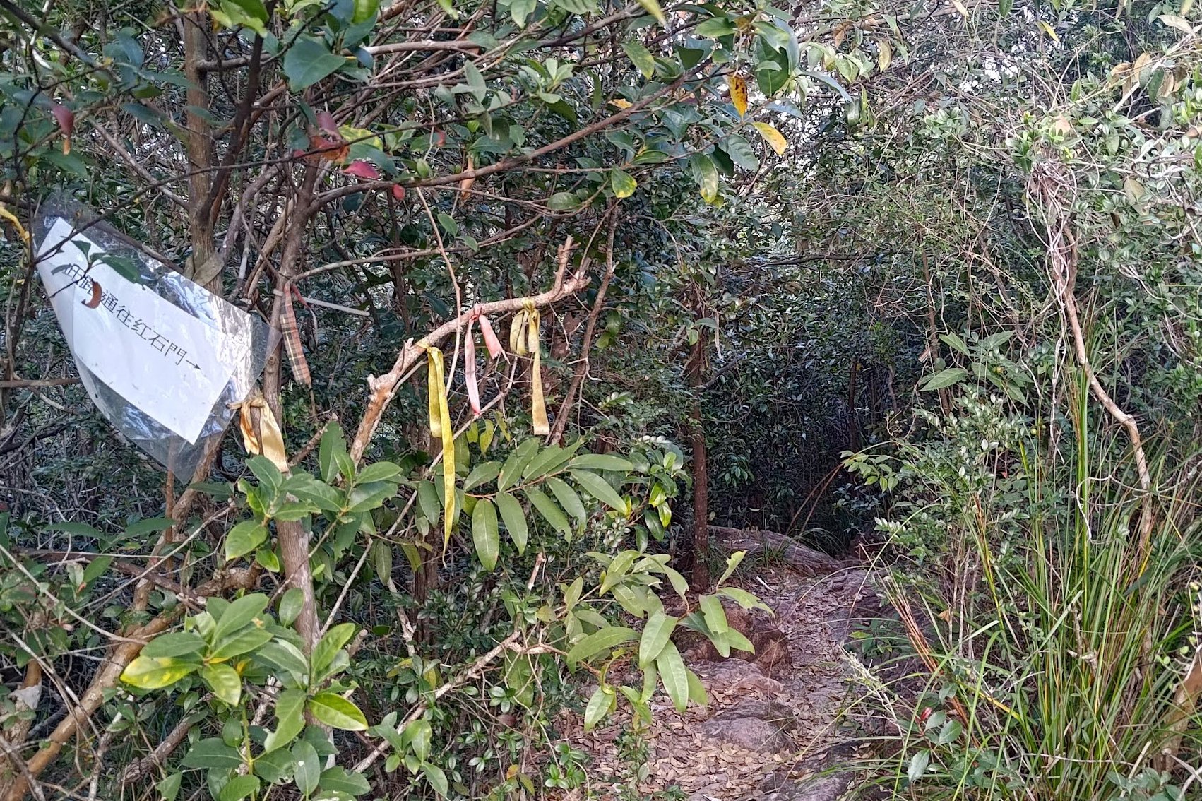
- IMPORTANT: About 10 minutes after the second 'Luk Wu Tung' sign, you'll need to keep a lookout for some ribbons on your left. There are no obvious markers beside the ribbons, so pay attention or you'll miss them
- Head into the overgrown trail and start the long, torturous descent downward
- Follow the ribbons down. For the most part, the trail should be navigable.
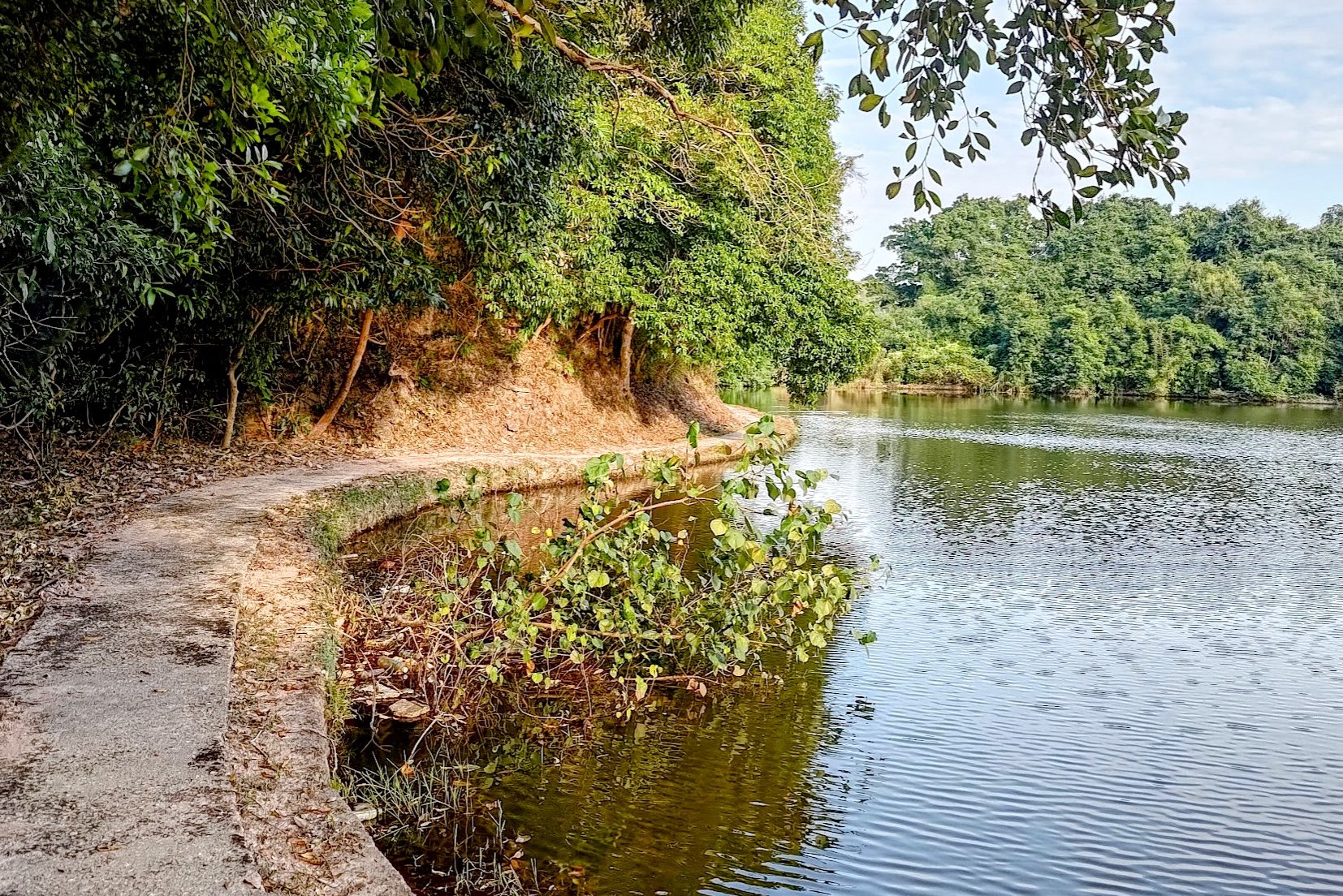
- 35-40 mins later, you will arrive at a reservoir. Cross the bridge, take the stairs to the left and head back into more overgrown bushes
- 5ish mins later, look for a laminated piece of paper tied to a tree to head down the right path. The paper may get lost soon, but as of NOV 2023, it exists.
- Just under 10 minutes later, you'll arrive at another lake.
- Follow the path around it, go past the abandoned houses and you will reach Hung Shek Mun (finally)
- Explore around and...head back the way you came. Yep. Back up the torturous overgrown path you go!
Directions From 20R Last Stop
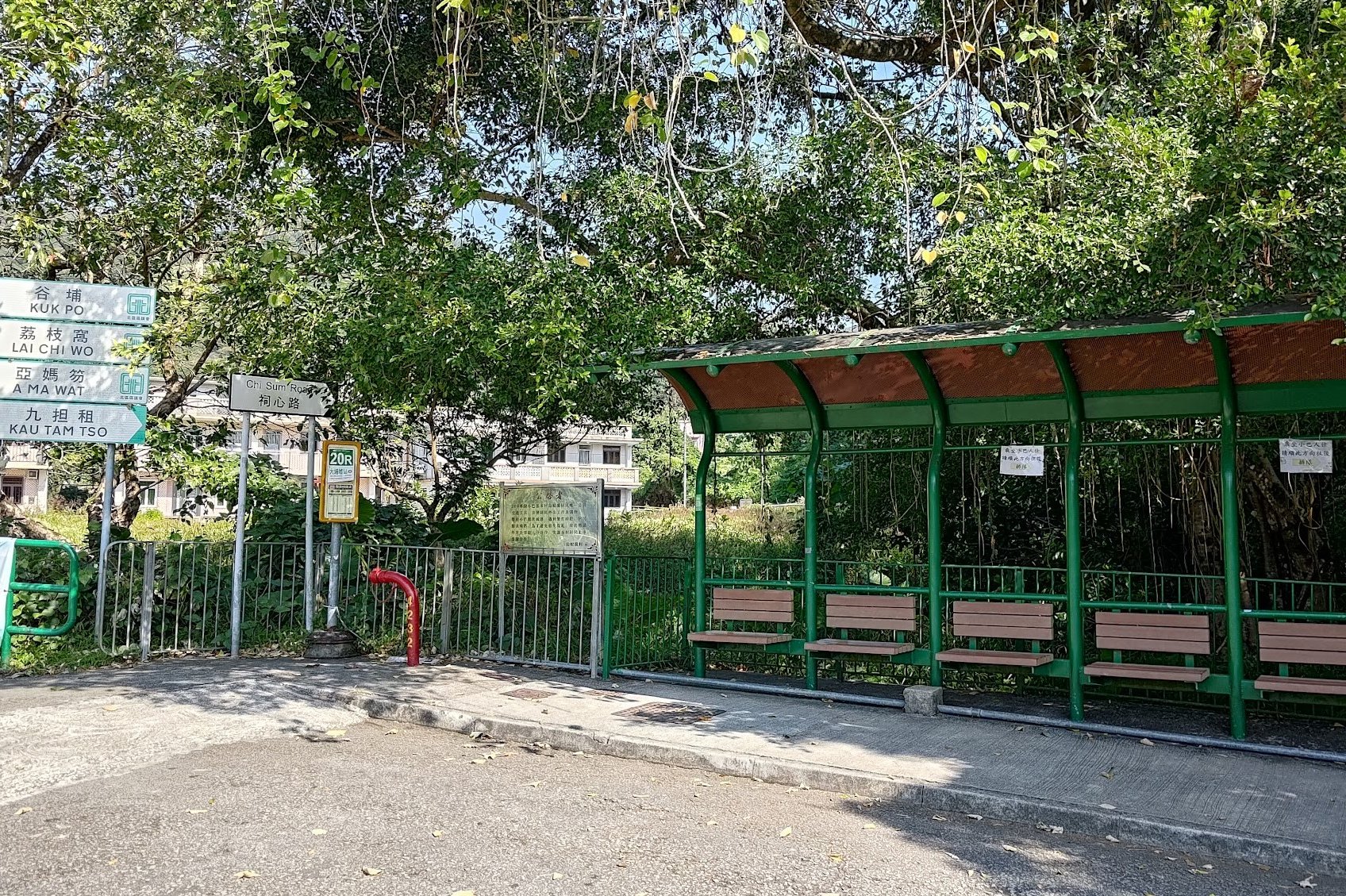
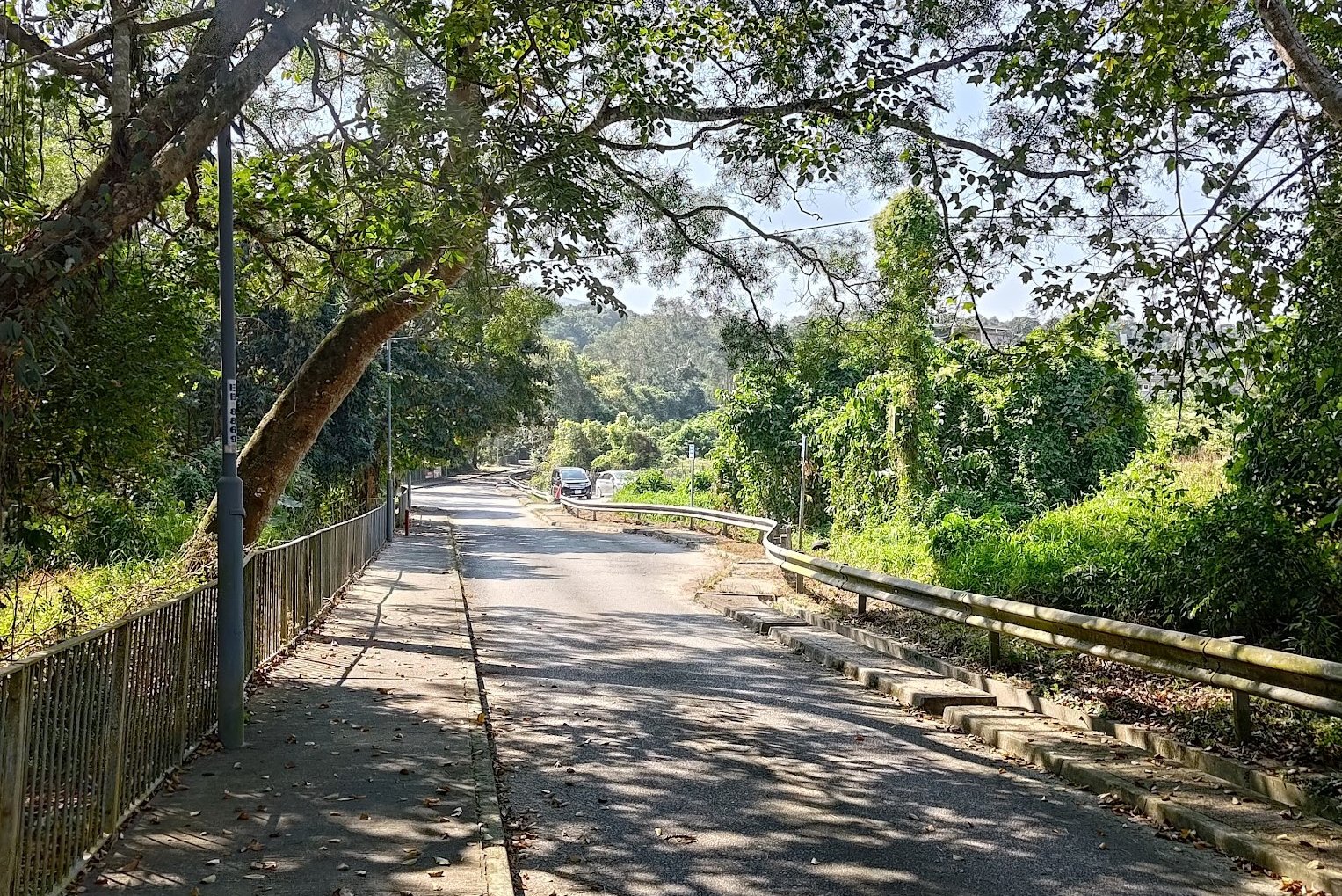
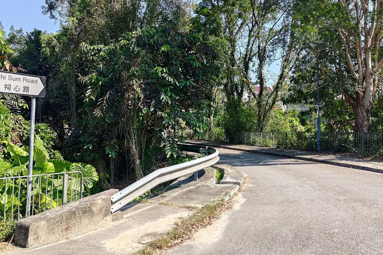
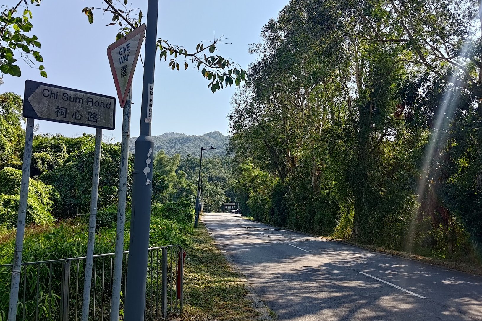
After getting off at the last stop, walk back down Chi Sum Road in the direction the minibus just came from.
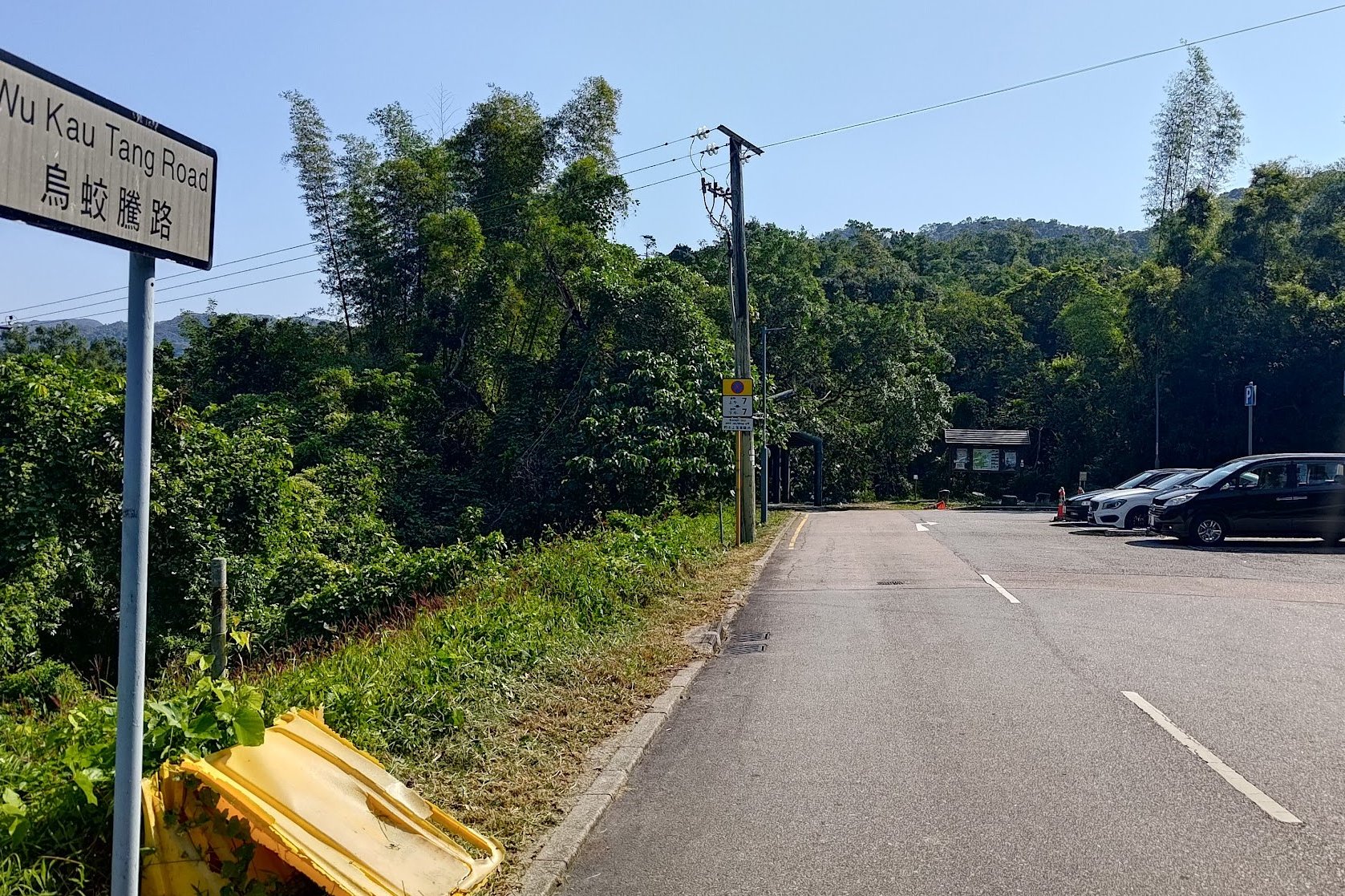
Ignore the first Chi Sum Road sign you see on your left and keep going straight. When you see a second Chi Sum Road sign that's much dirtier, turn left.
This is actually Wu Kau Tang Road (you'll see the road sign a few meters later). At the end of Wu Kau Tang Road, you'll see the start point, which is marked by a 'Double Haven Country Trail' sign.
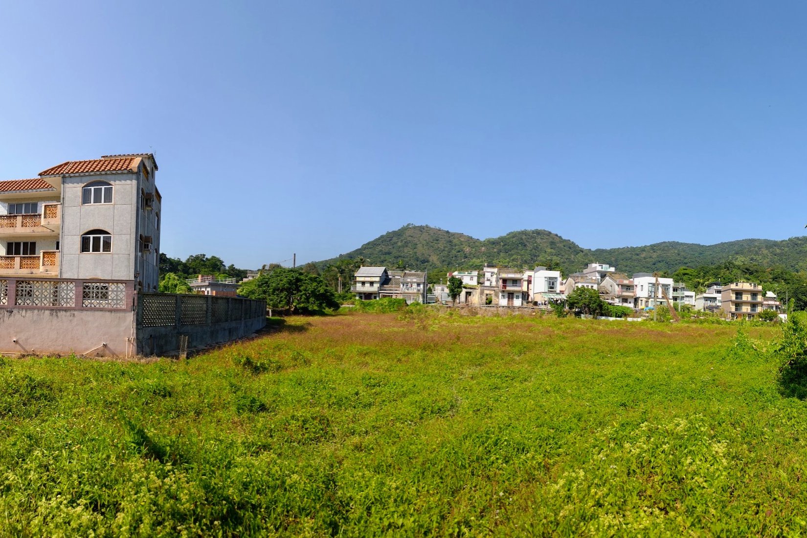
Wu Kau Tang Village
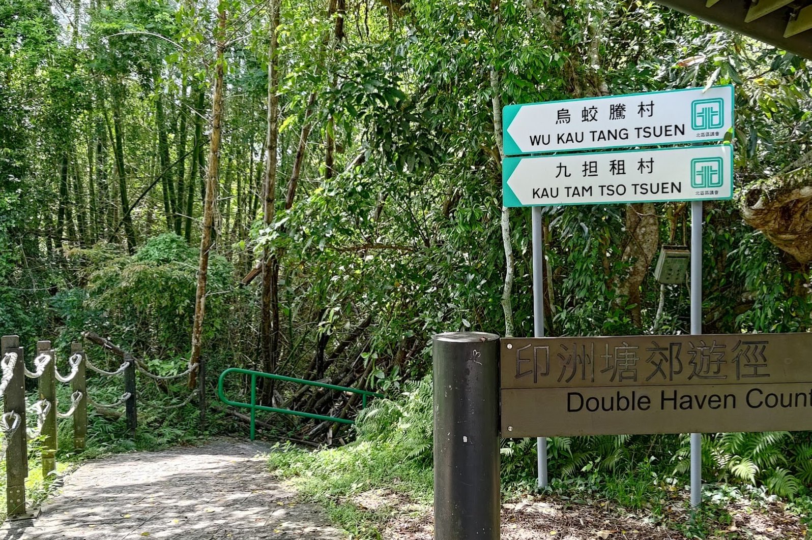
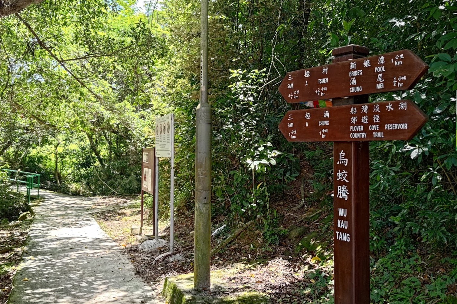
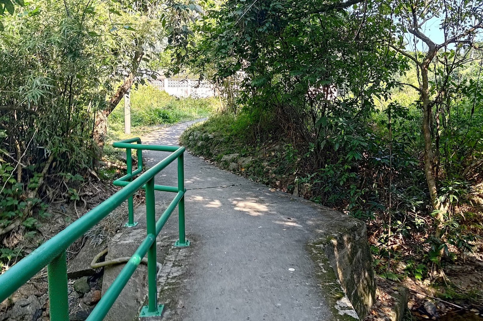
If you took the 275R bus, after getting off at the Wu Kau Tang (烏蛟騰) Bus Terminus, follow the 'Wu Kau Tang Tsuen' sign in front of the 'Double Haven Country Trail' marker and descend the green-railing slope.
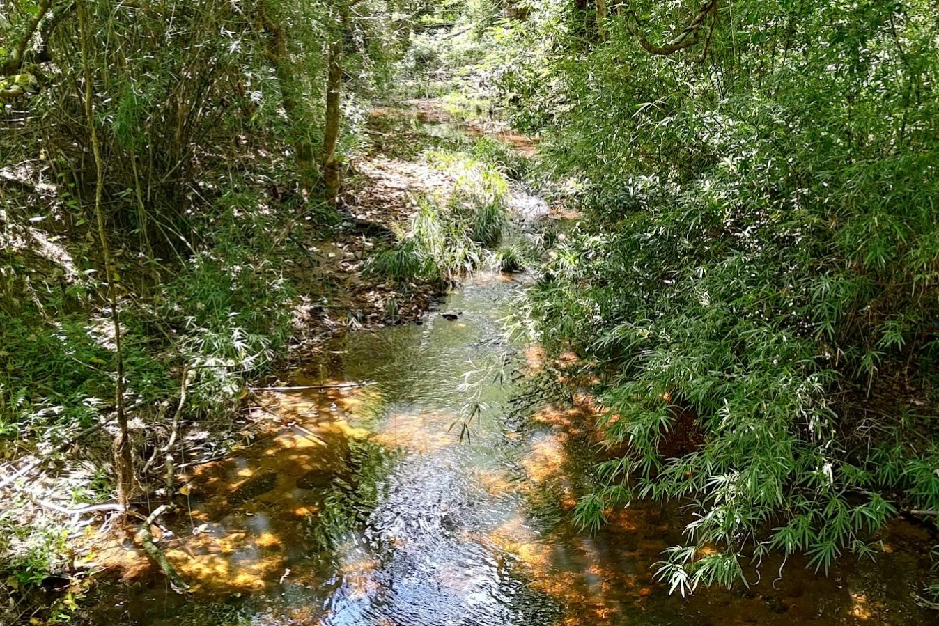
Follow the brown 'Sam A Tsuen' sign and take the bridge that goes across the little stream.
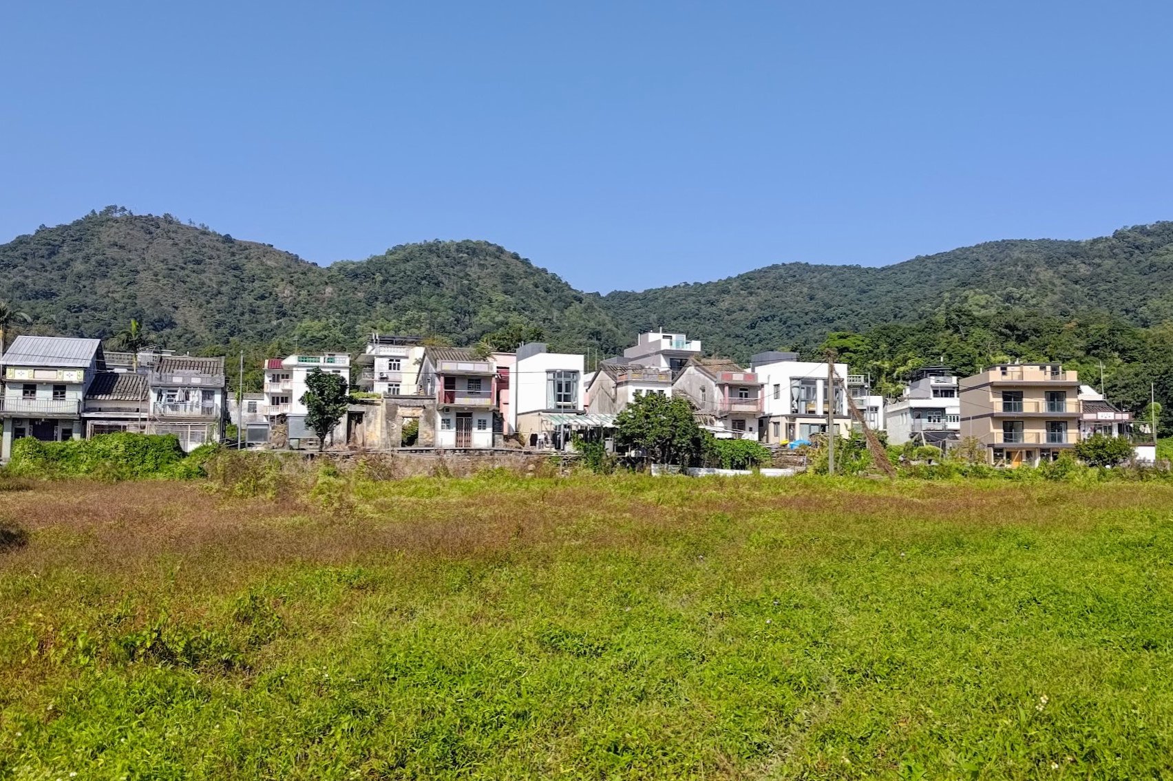
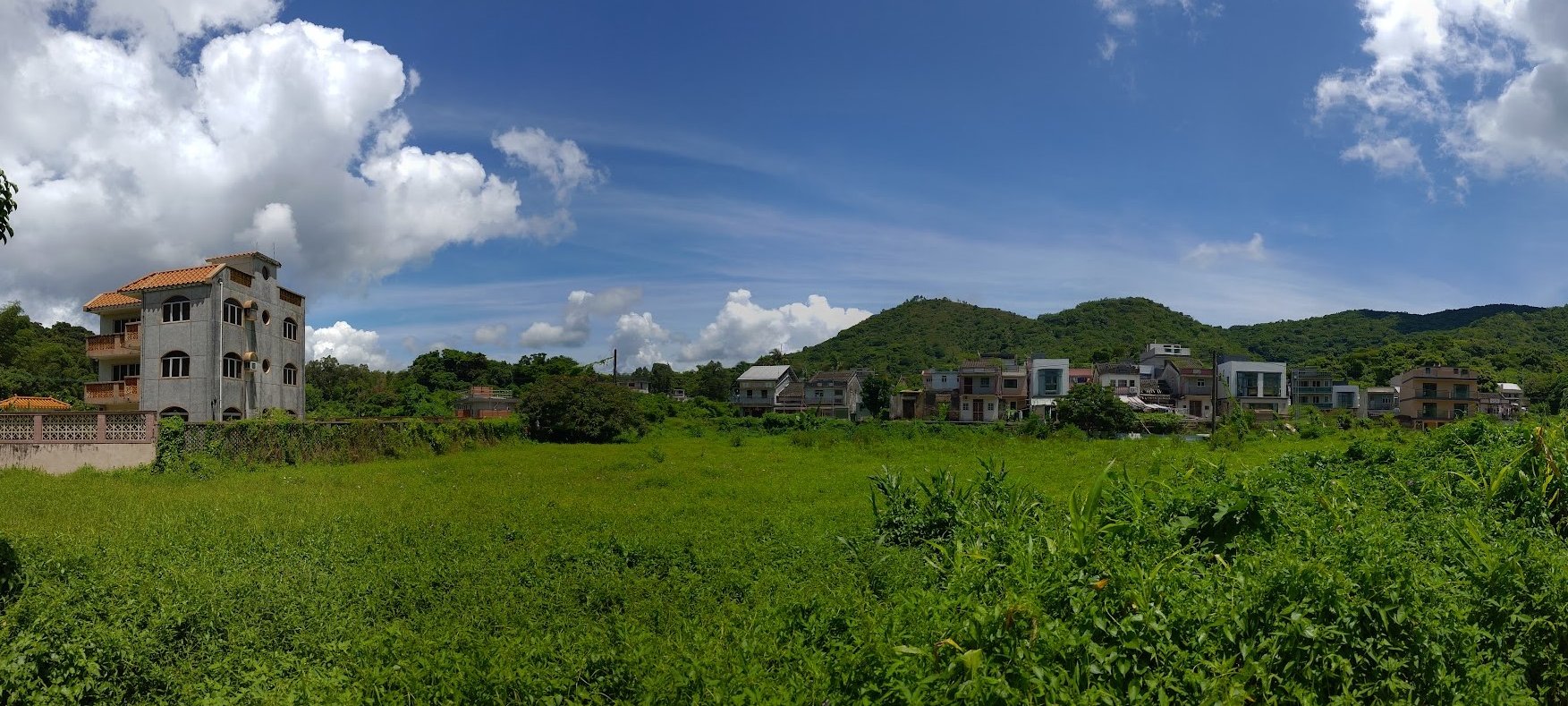
You'll emerge a few minutes later at Wu Kau Tang Village, which was founded around the 1660s.
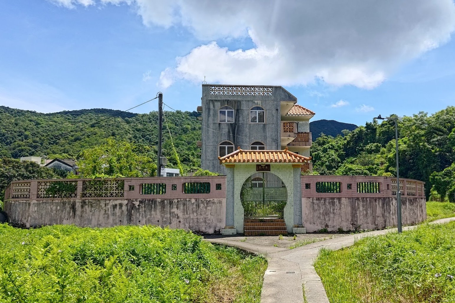
You'll see the main village to your left as you take the right fork around an impressive lone, walled house.
Wu Kau Tang is known for its butterflies (apparently, there are 137 species of butterflies that can be observed here), so take your time to admire the beauty of your surroundings.
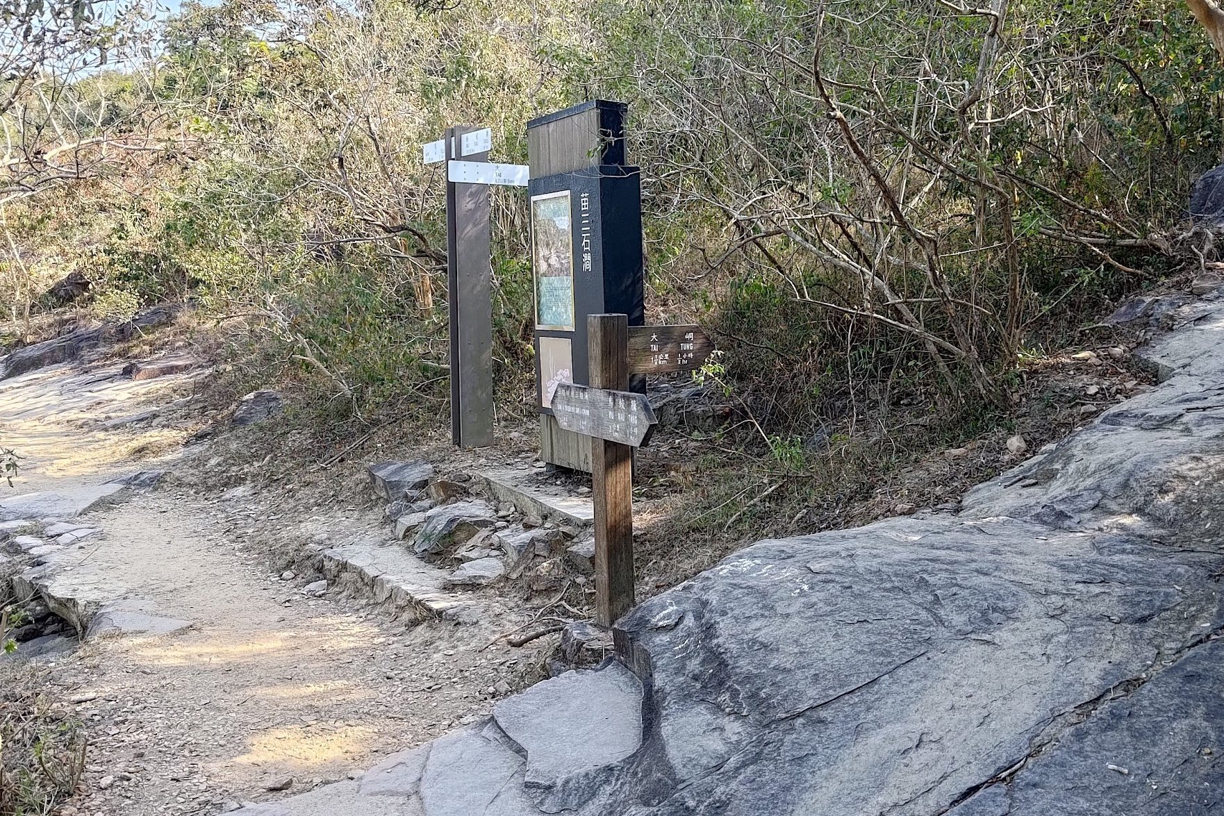
Kau Tam Tso Sign and Fork
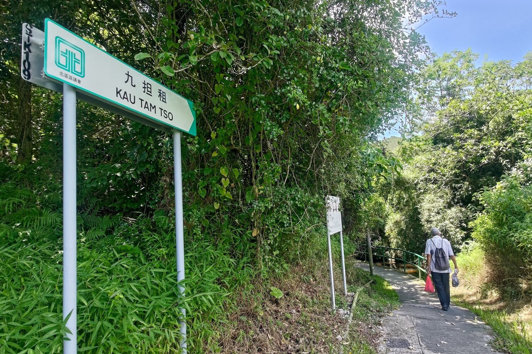
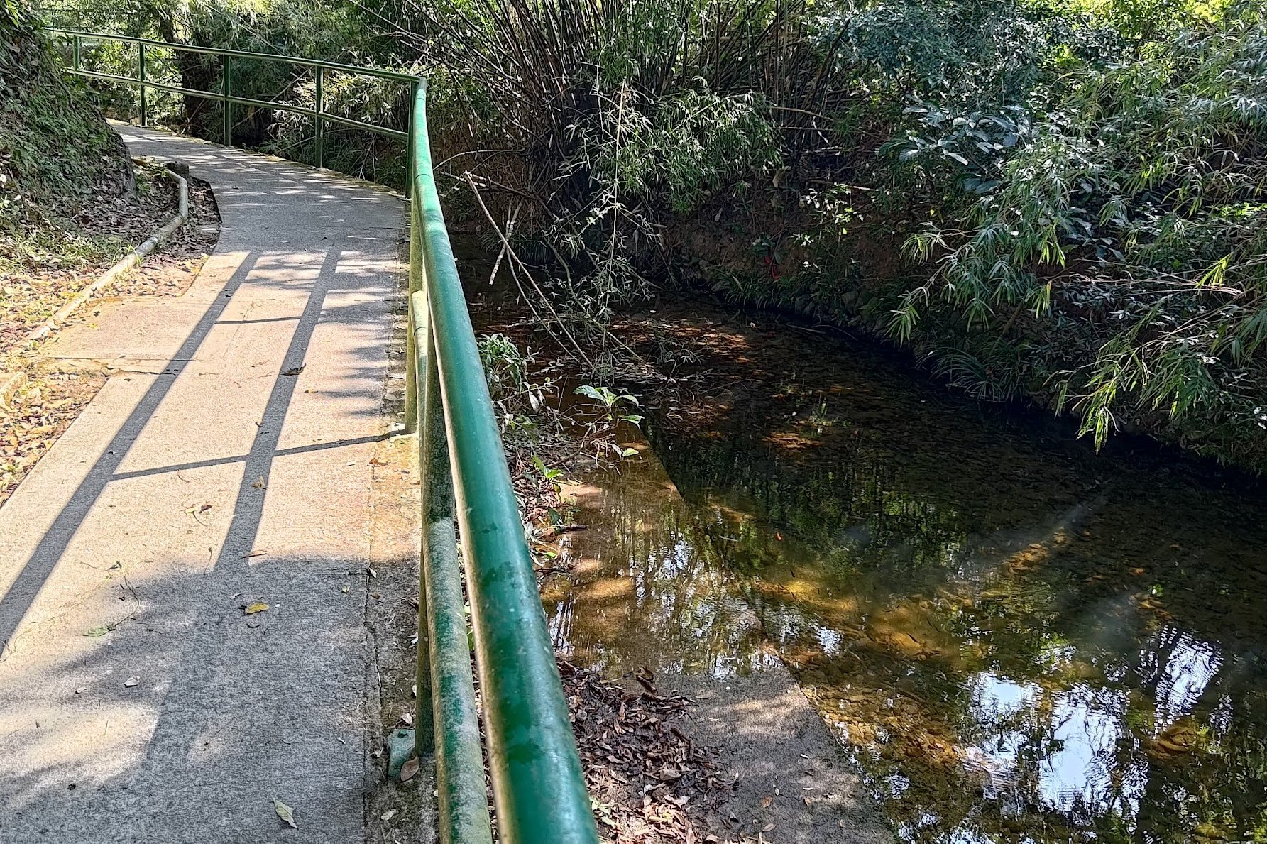
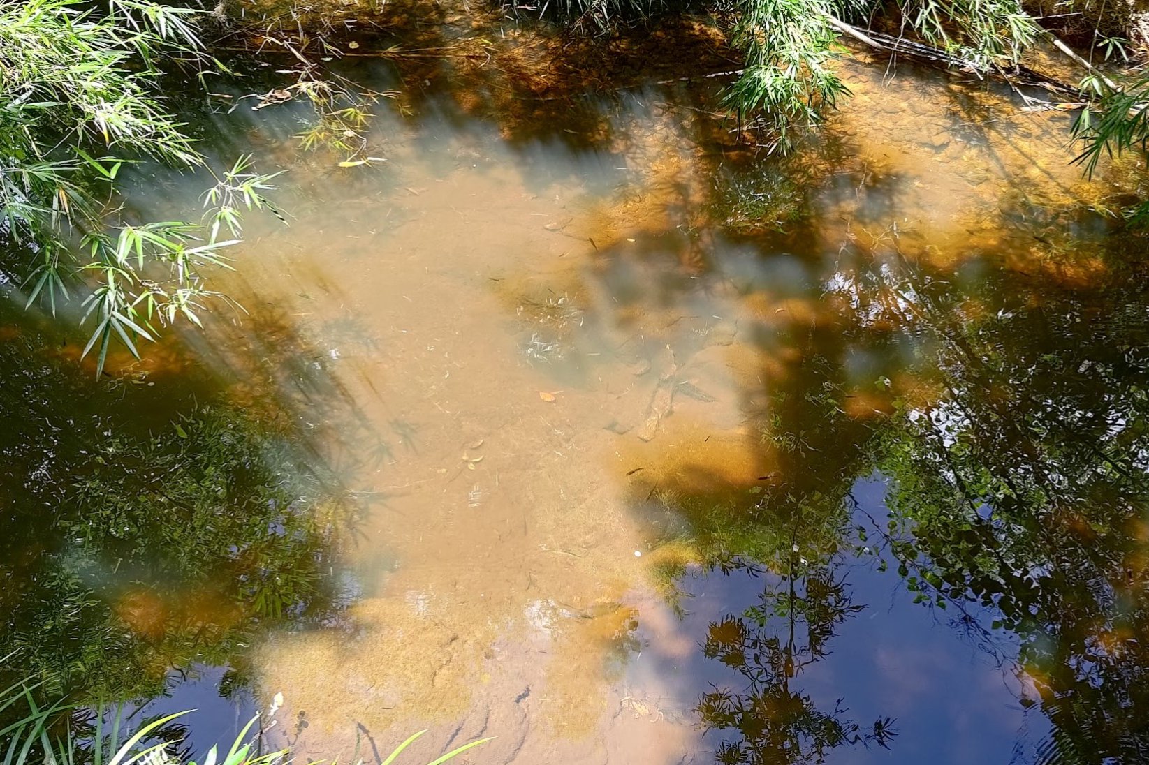
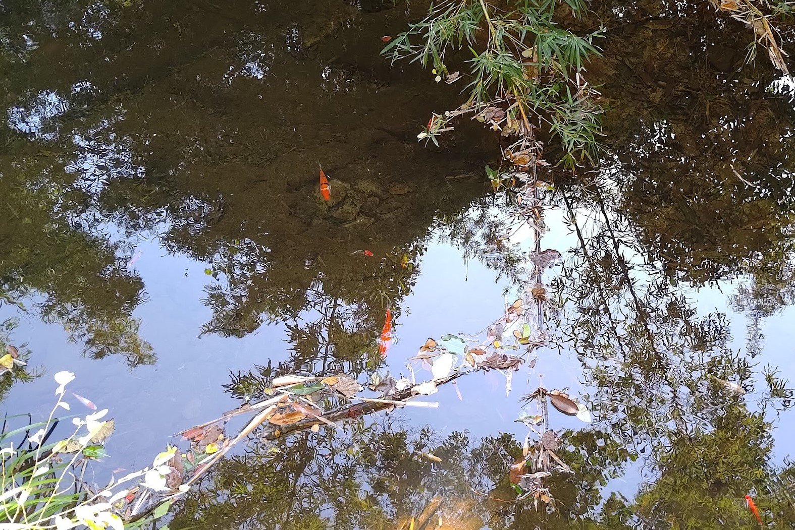
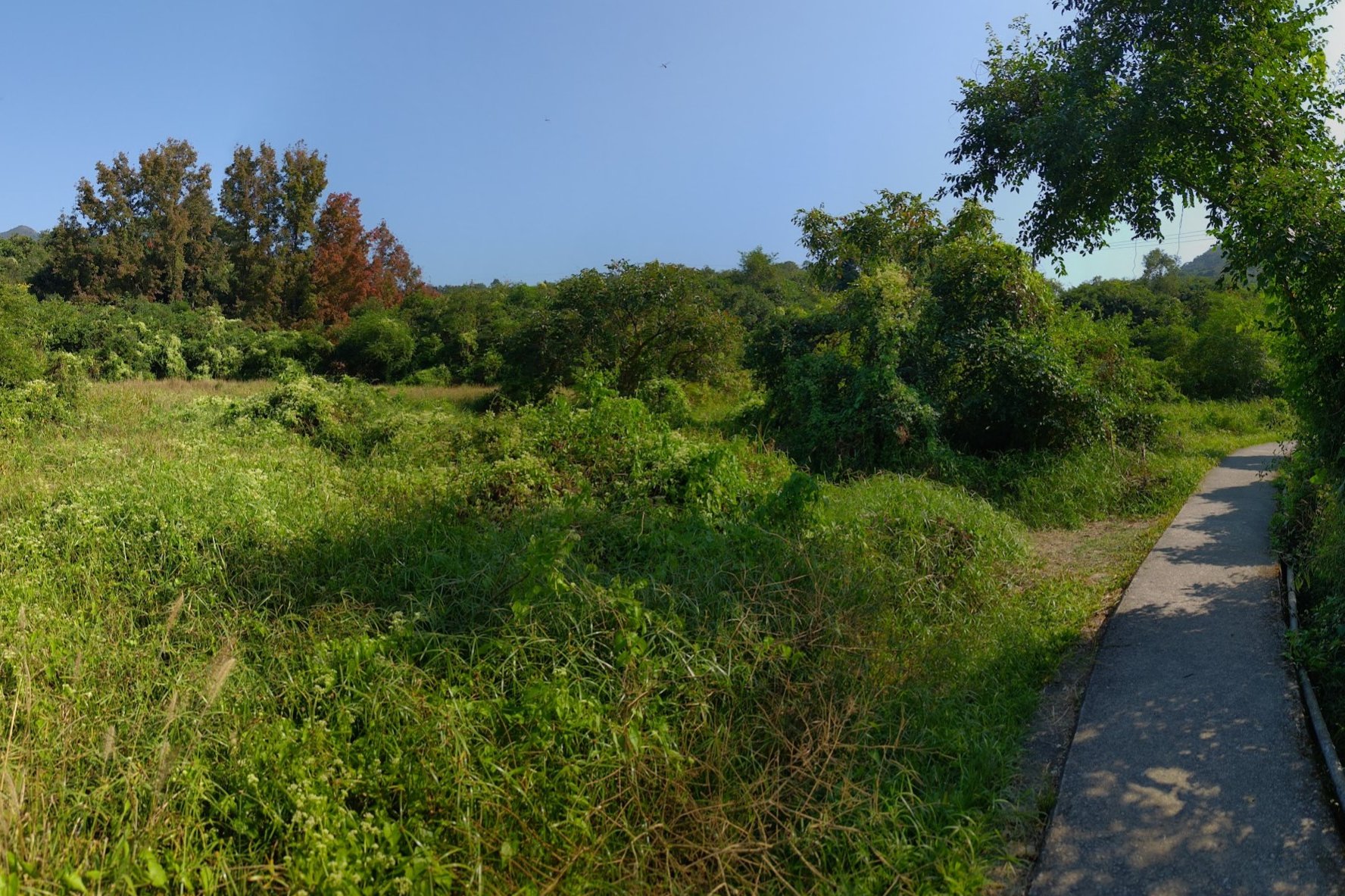
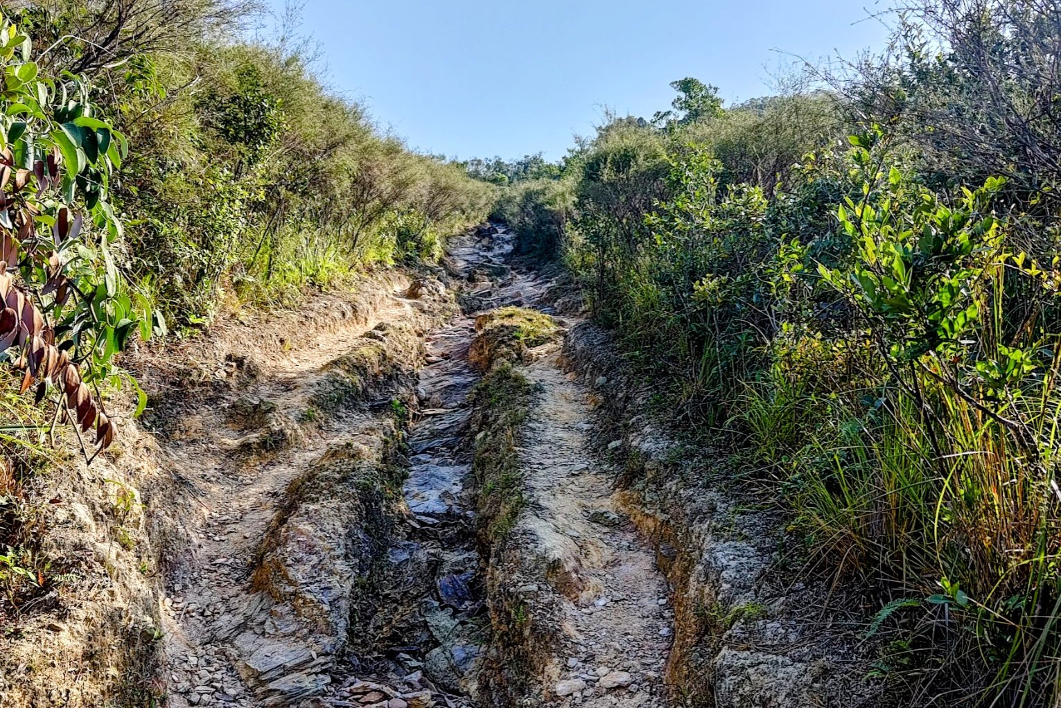
After going past the walled house, you'll see a sign pointing you towards 'Kau Tam Tso'. Follow the sign and walk past a beautiful stream with a plethora of intriguing fish in it (including koi). You'll then traverse through a large chunk of green grassland with maple trees in it and even some abandoned village homes.
At the fork in the road about 10 minutes later, heed the sign pointing to 'Sam A Tsuen' and take the path that slopes upward.
2 Weird Bridges and another Fork to the Right
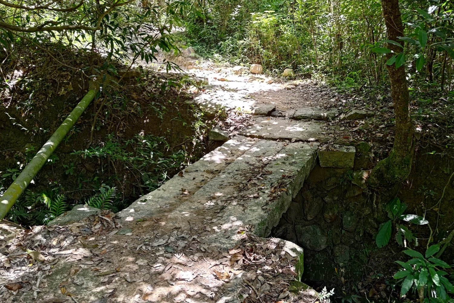
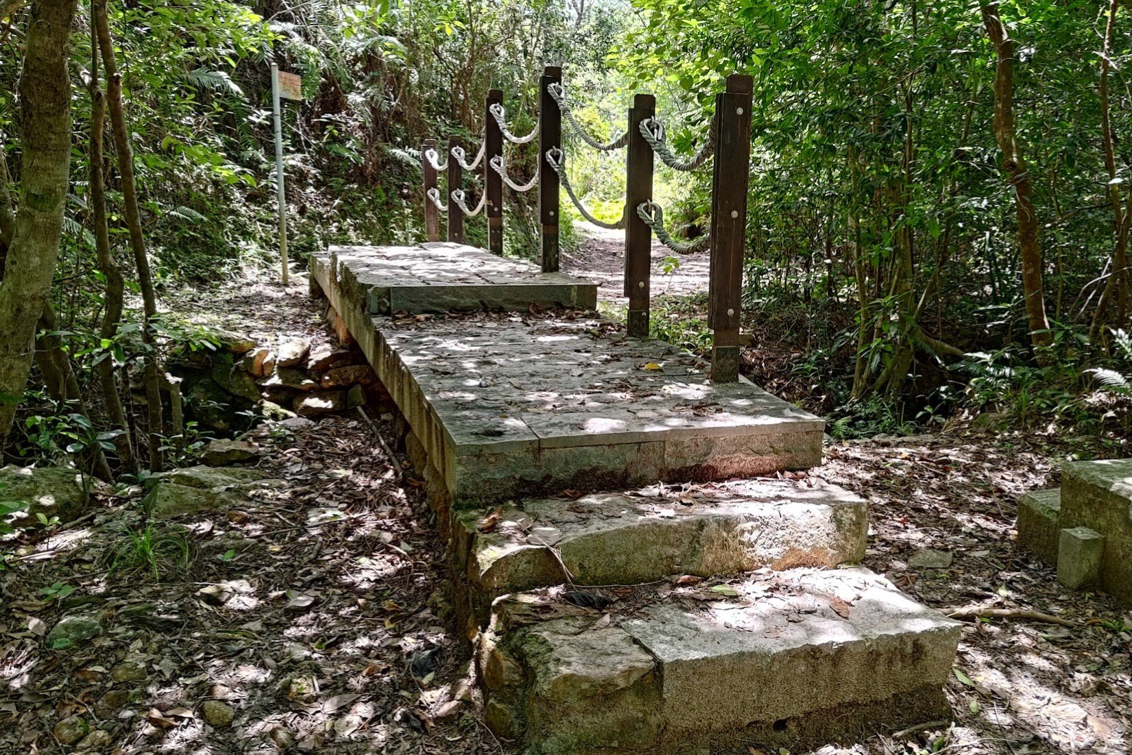
Keep following the trail for 10 minutes, going past a couple of strange bridges - one really small and almost inconsequential and the other super large and overdone.
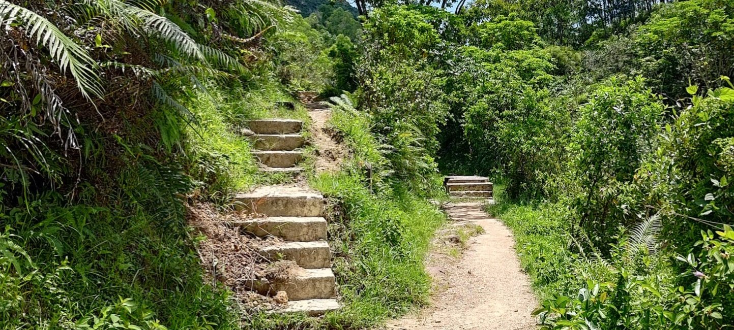
You'll emerge from the trees soon after and see a set of stairs heading upward to the left and a flat path on the right. Take the flat path and avoid the stairs heading upward.
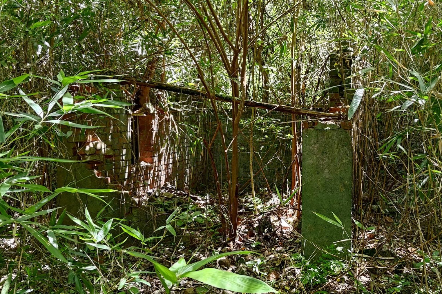
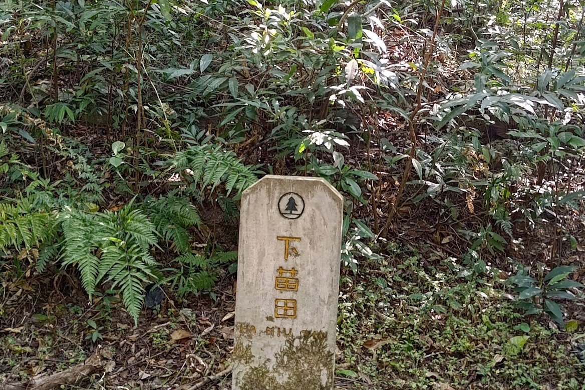
Sheung Ha Miu Tin Abandoned Village
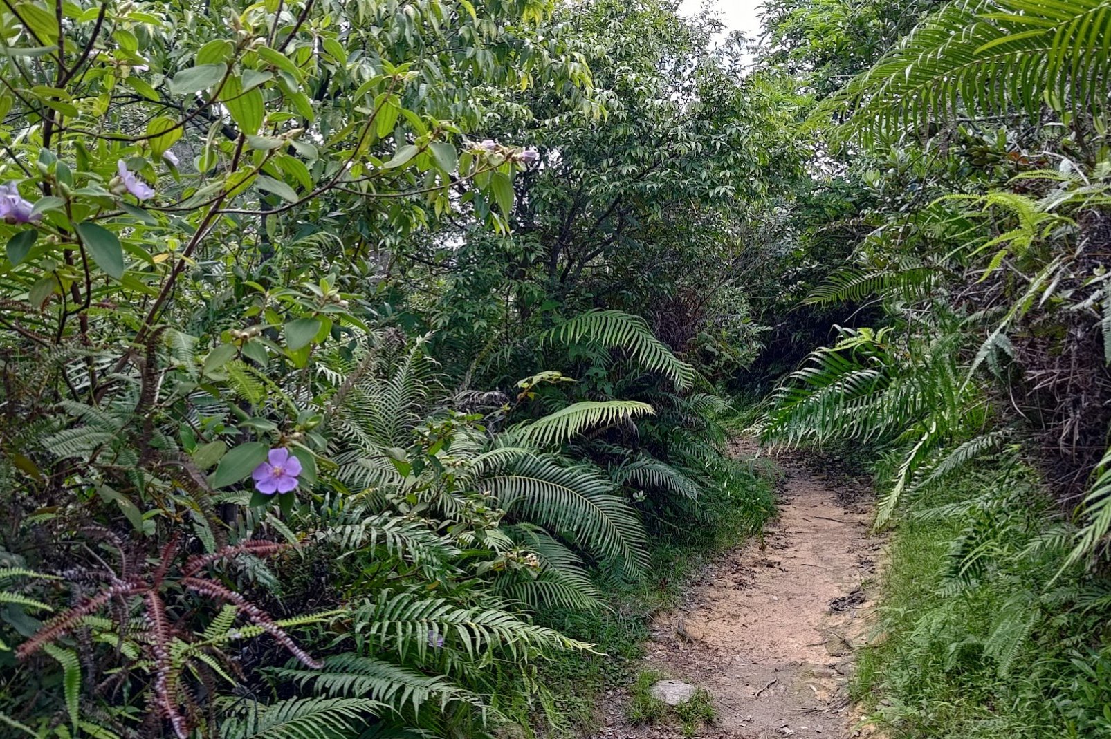

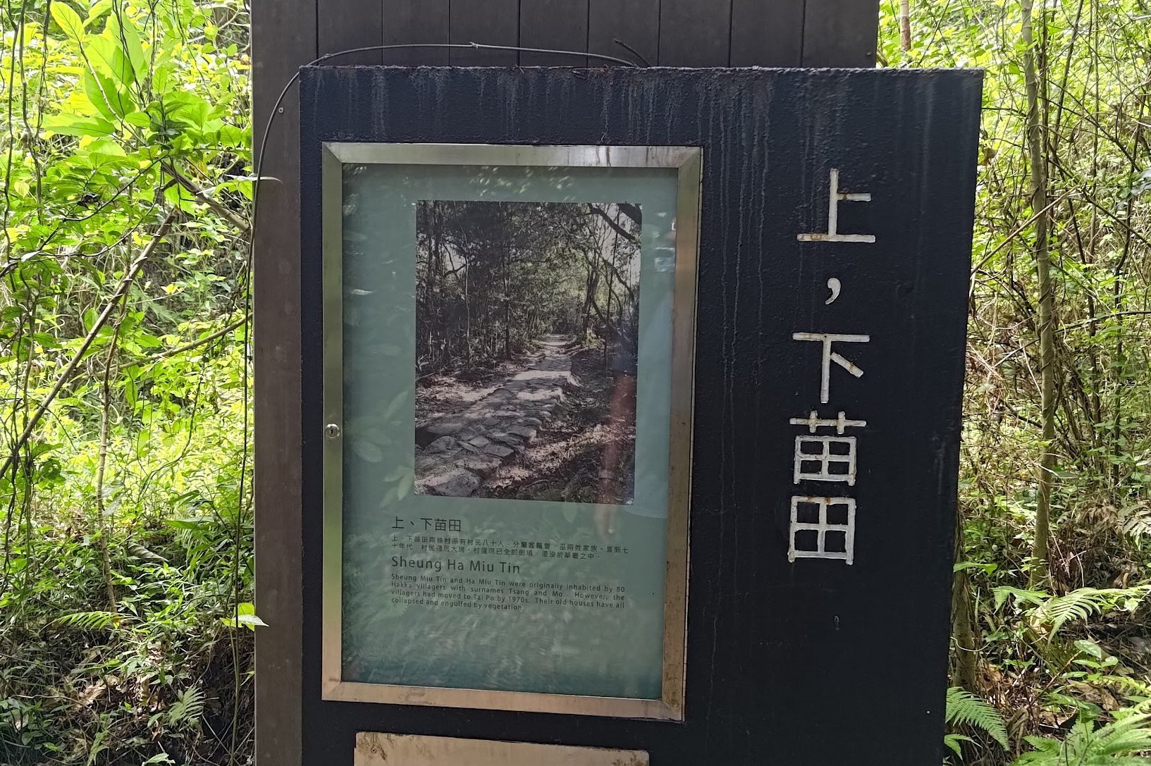
The next 25 minutes has you walking through a wonderful forested section of the trail that takes you past the remnants of Sheung (upper) and Ha (lower) Miu Tin Village, which was once home to the Tsang and Mo Hakka family clans.
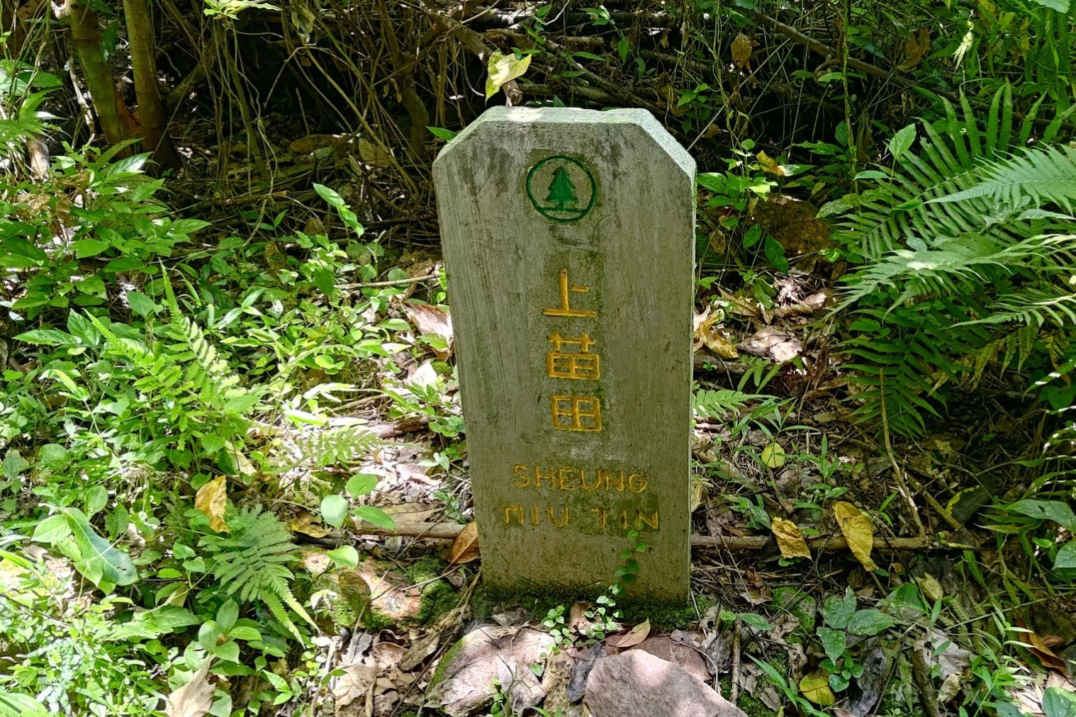
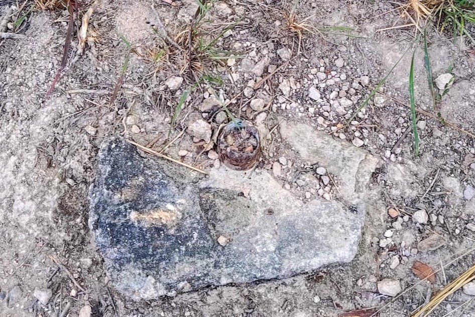
A little stone marker, almost like a small gravestone, marks the site where Sheung Miu Tin Village used to stand. It's now almost completely reclaimed by nature, sadly.
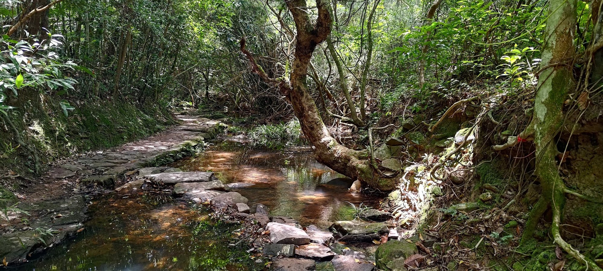
You'll go past a small stream crossing after, and then come across another marker for Ha Miu Tin. There's an optional detour to the abandoned Ha Miu Tin Village detailed below.
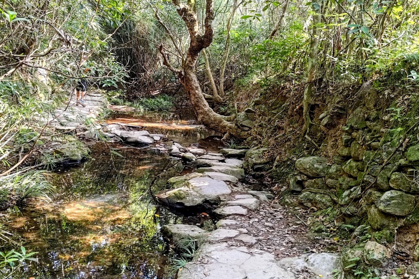
Head past Ha Miu Tin and you'll eventually cross a stream via some stepping stones with an incredible tree growing out from it. Your final landmark for this section is a set of signs.
Optional Detour: Ha Miu Tin Abandoned Village
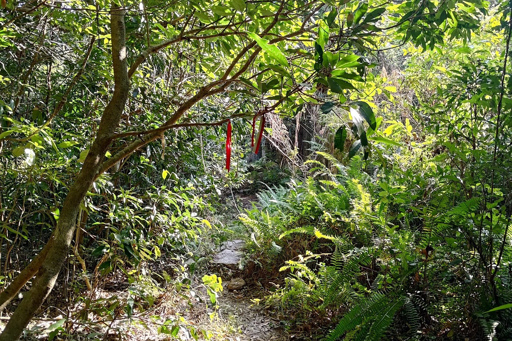
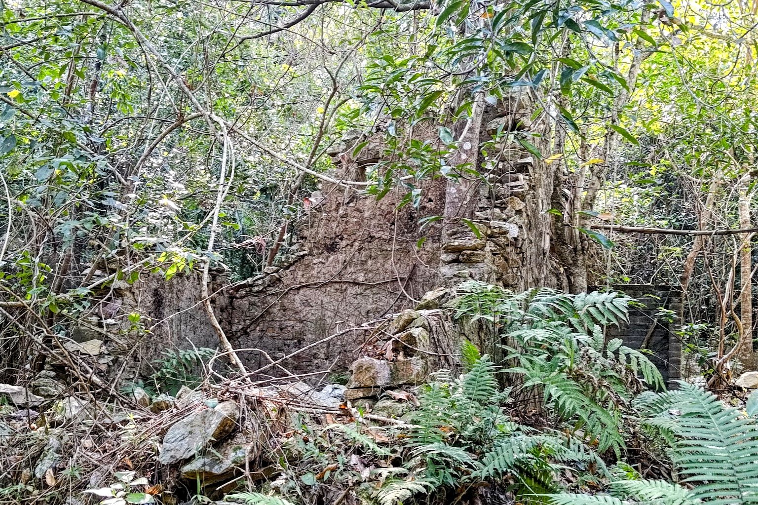
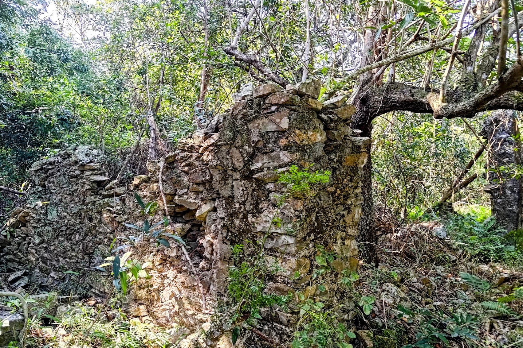
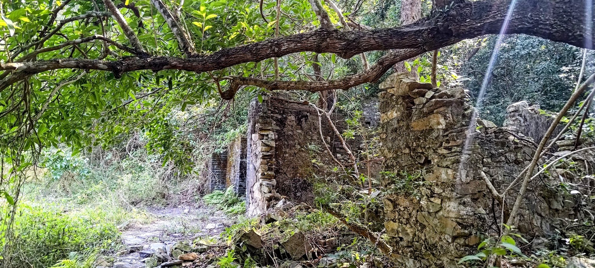
Before completing the section above, you'll see another stone marker for Ha Miu Tin Village. If you want to actually visit the ruins of this ancient place, look for a couple of red ribbons beside the marker.
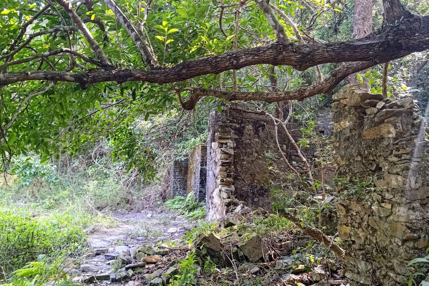
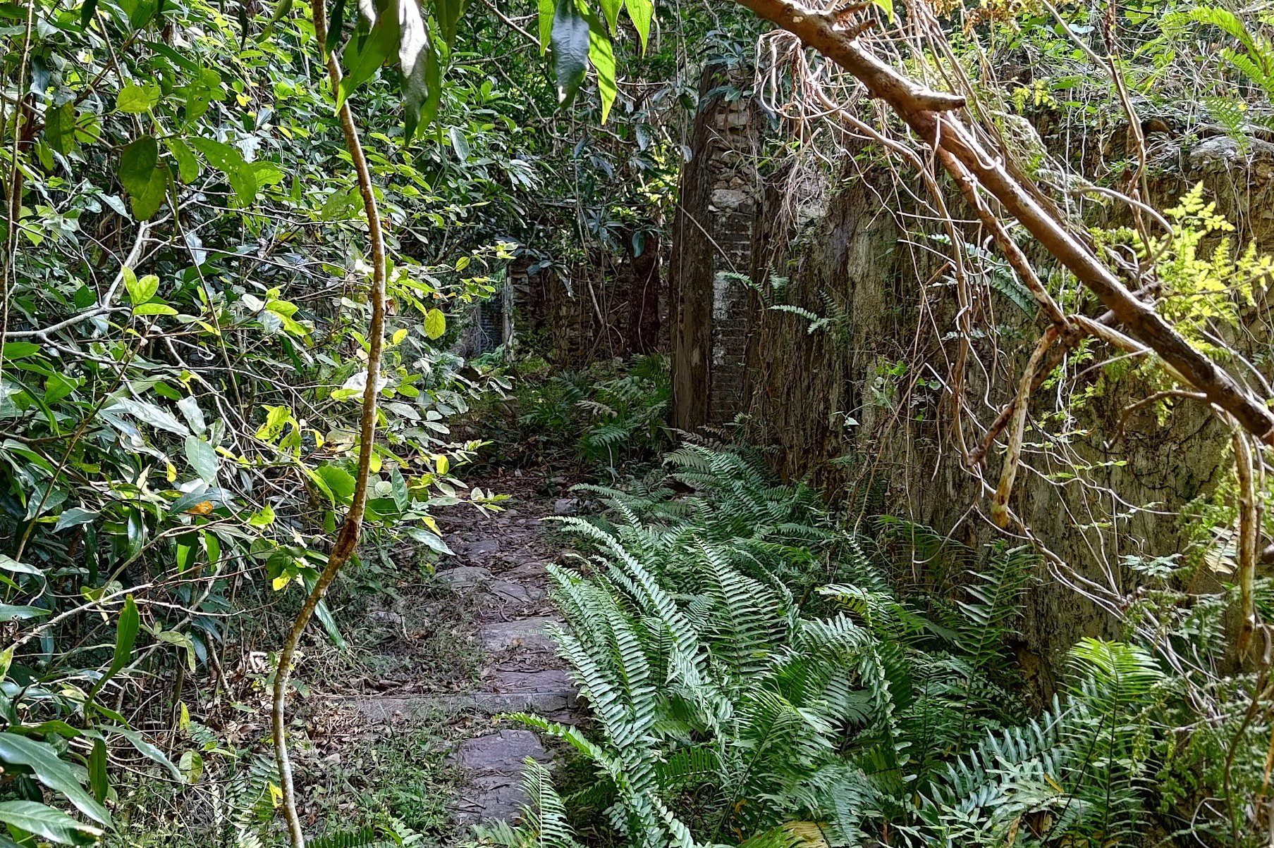
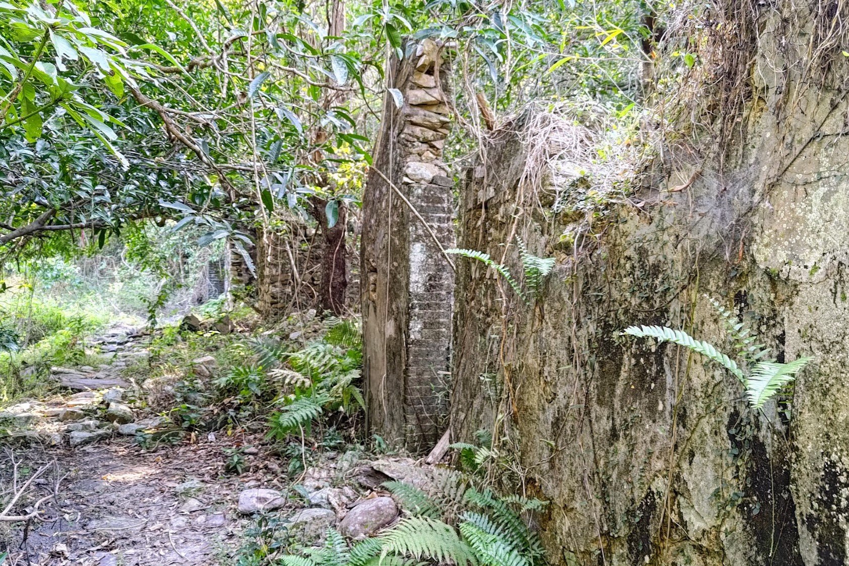
The ribbons demark an overgrown path that leads to the forlorn ruins of Ha Miu Tin. Many of the village homes still stand but are in really poor shape.
There's a certain haunting ambiance to the abandoned village as you walk through what once must have been a vibrant and bustling hub, full of life and vigor.
When you're done exploring, head back to the main trail.
The 30-40 Min Climb Up Tai Tung
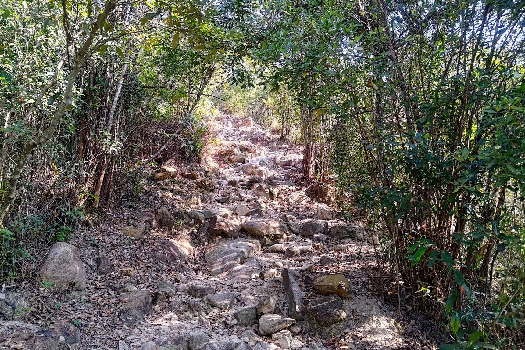
When you arrive at the set of signs after the stream crossing with the epic tree, you'll want to head right toward 'Tai Tung'. You'll see a rocky slope that marks the beginning of your 30-40-minute climb.
A short while later, you'll see another sign which you should also follow in the direction of 'Tai Tung'.
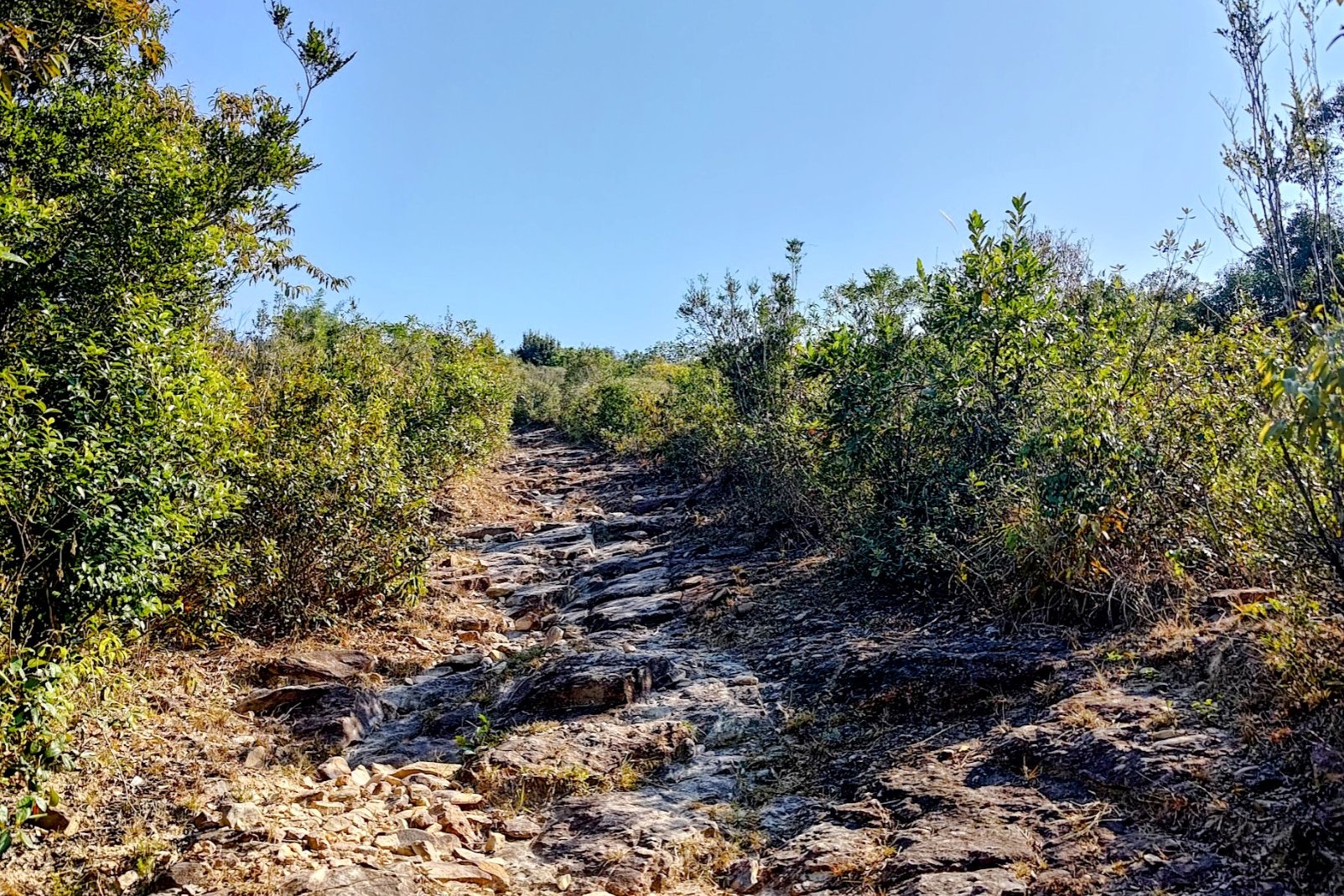
Much of this uphill section is covered in loose rocks, which you should navigate carefully to ensure you don't roll an ankle on the way up.
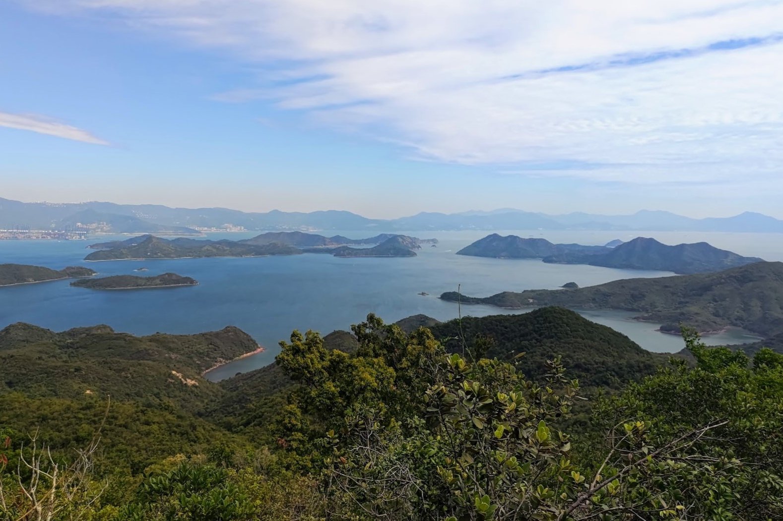
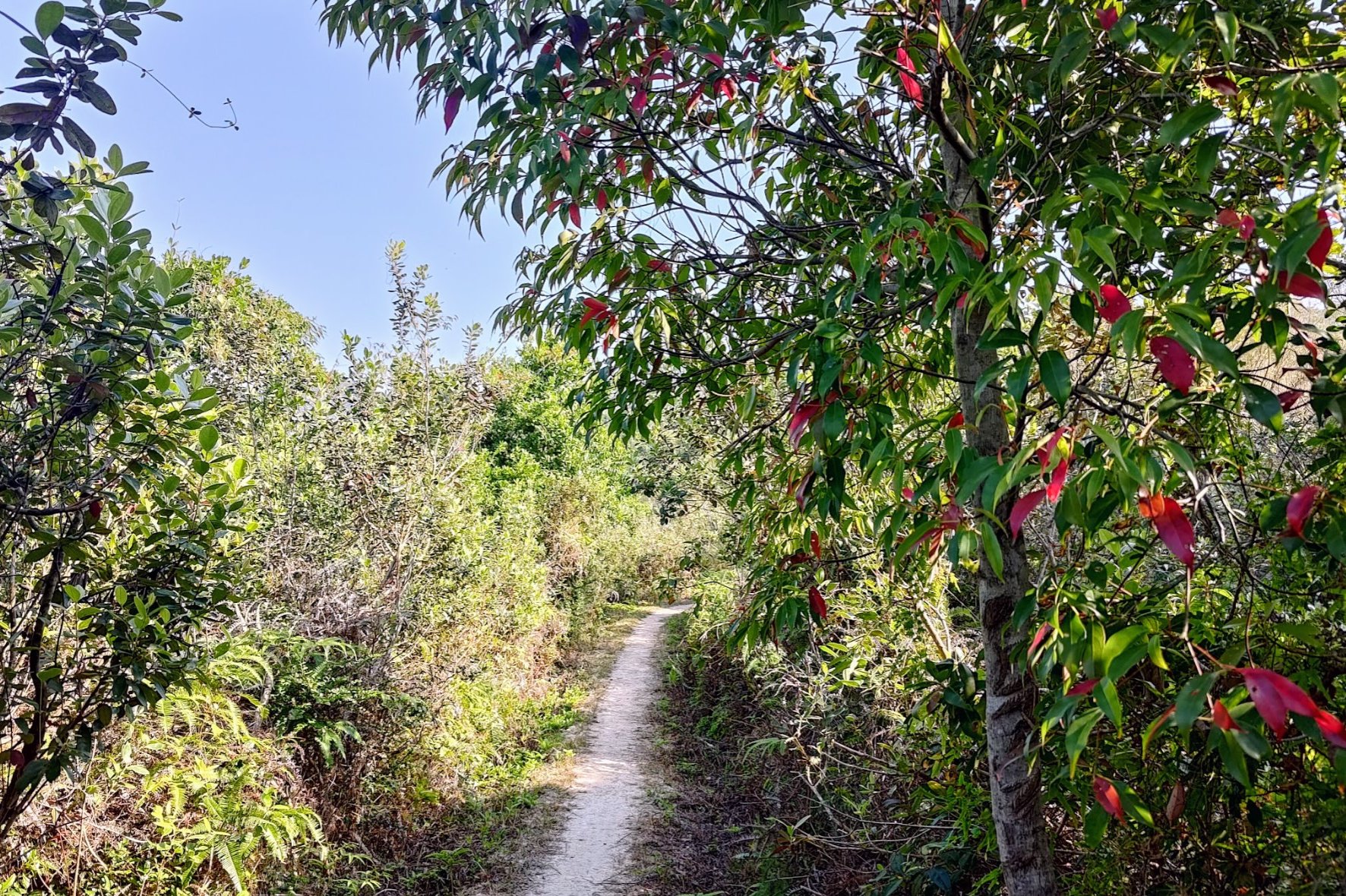
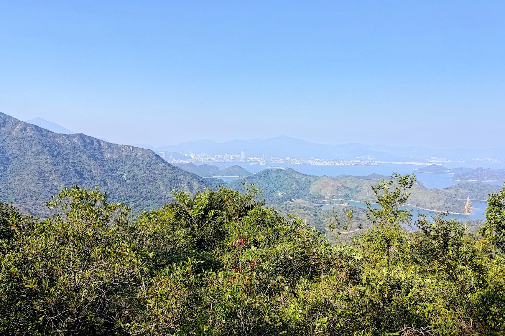
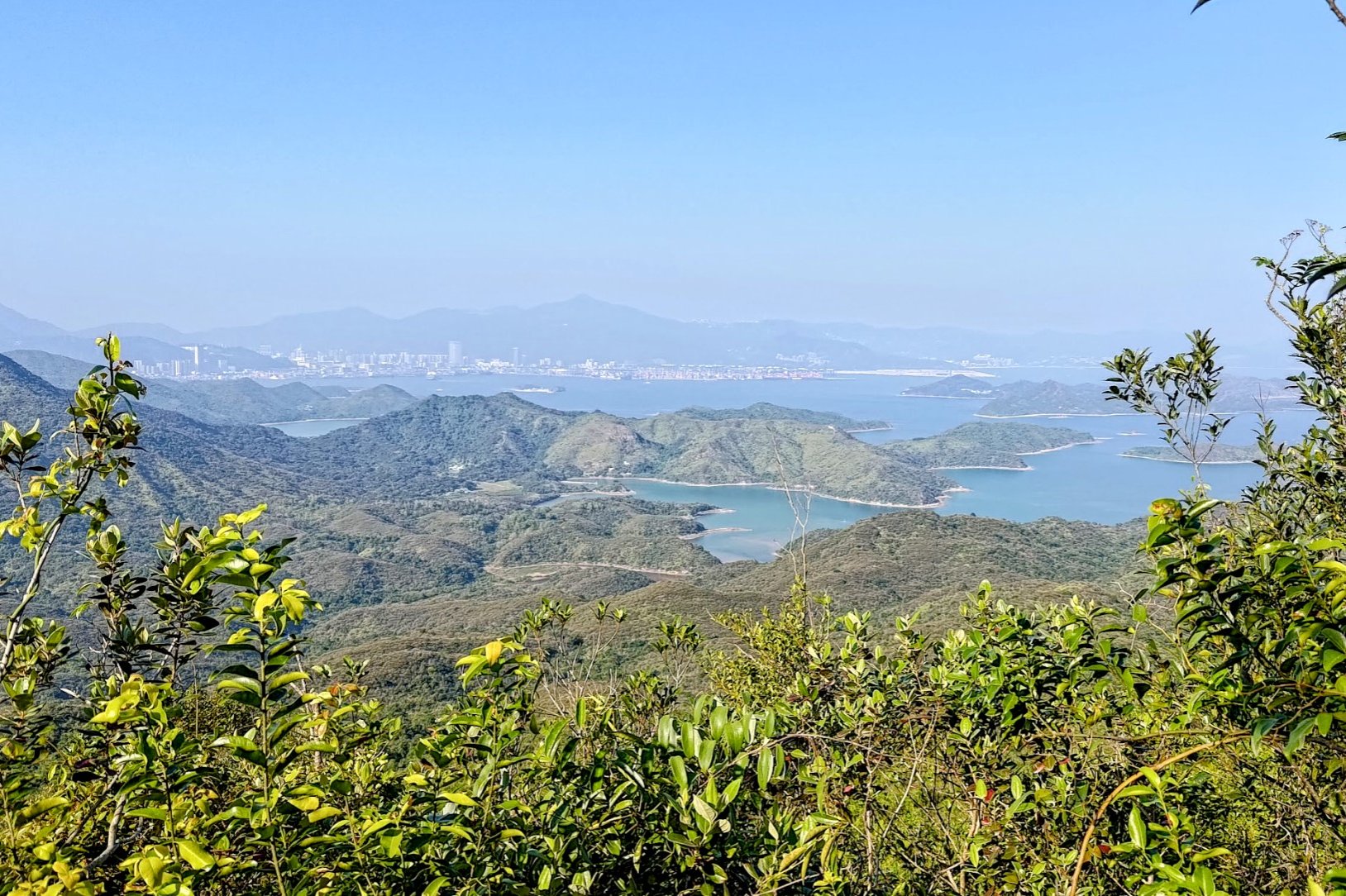
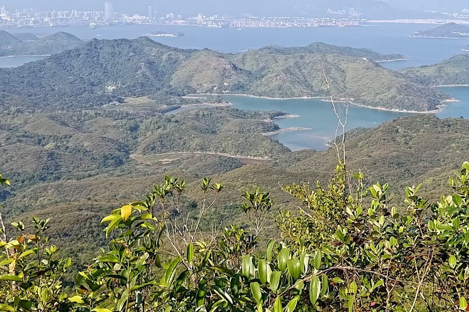
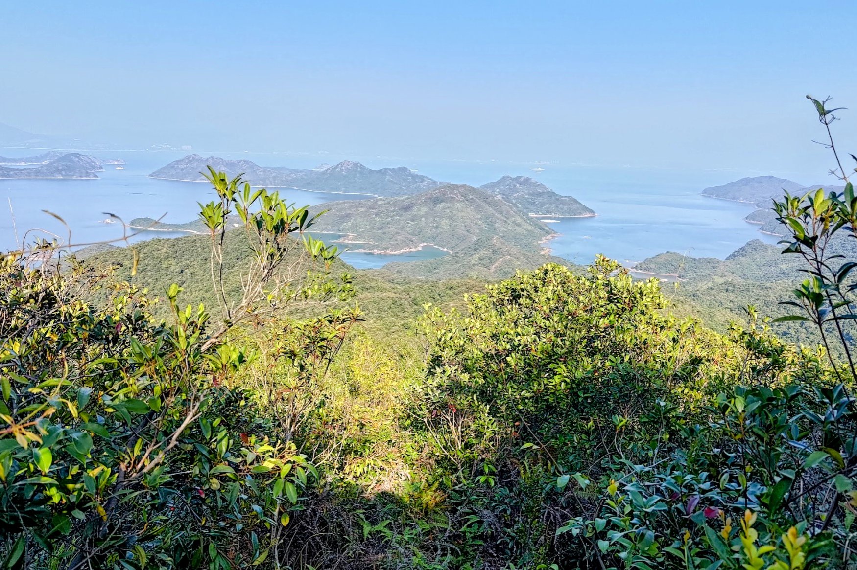
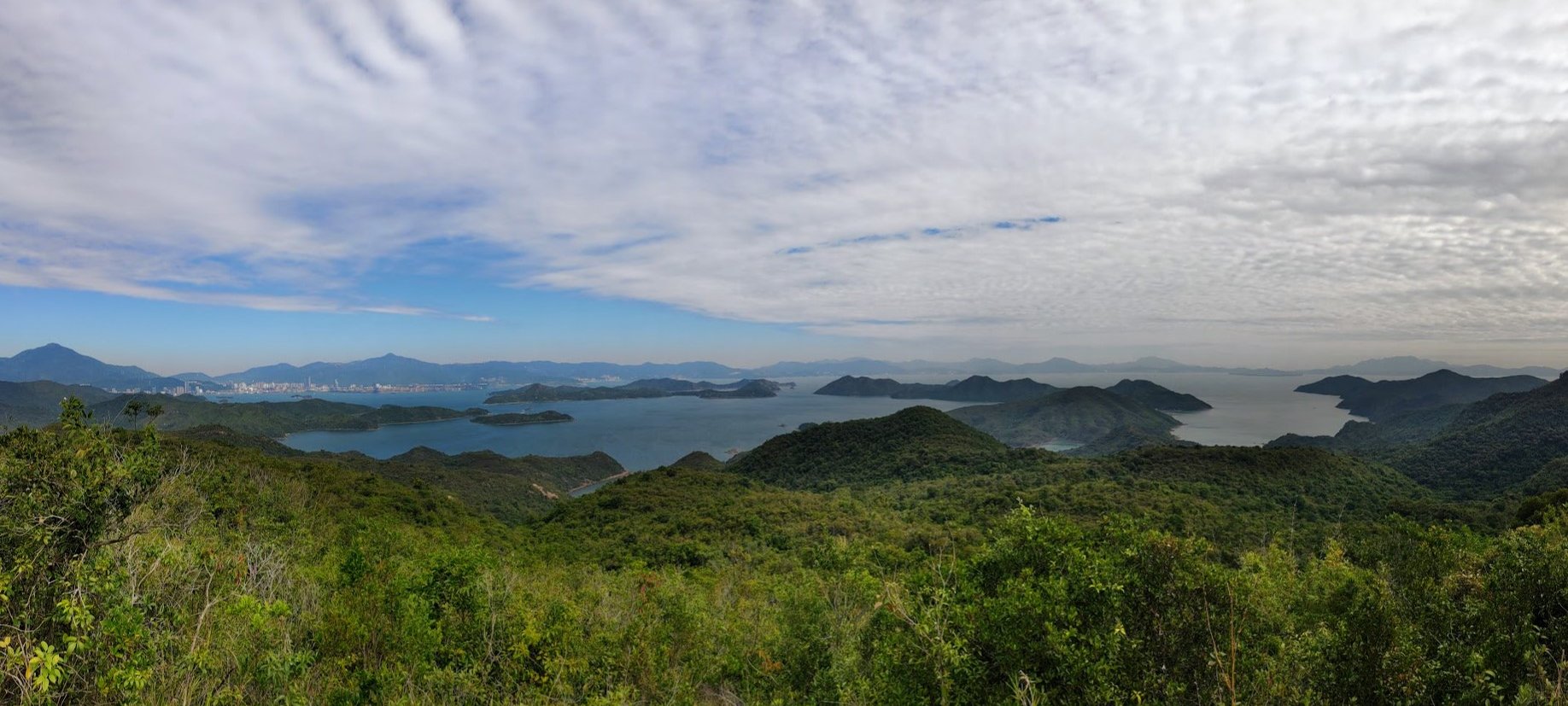
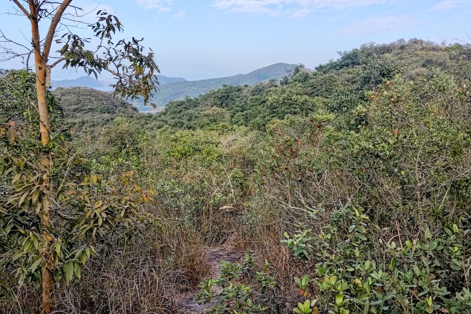
45 Minutes of Flat Walking and Great Ocean Scenery
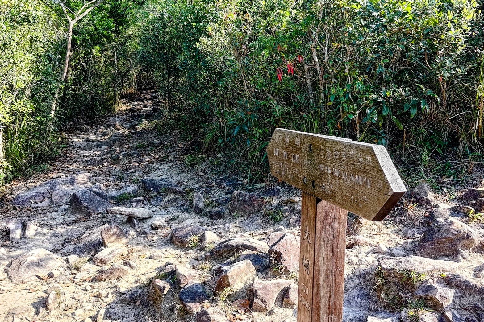
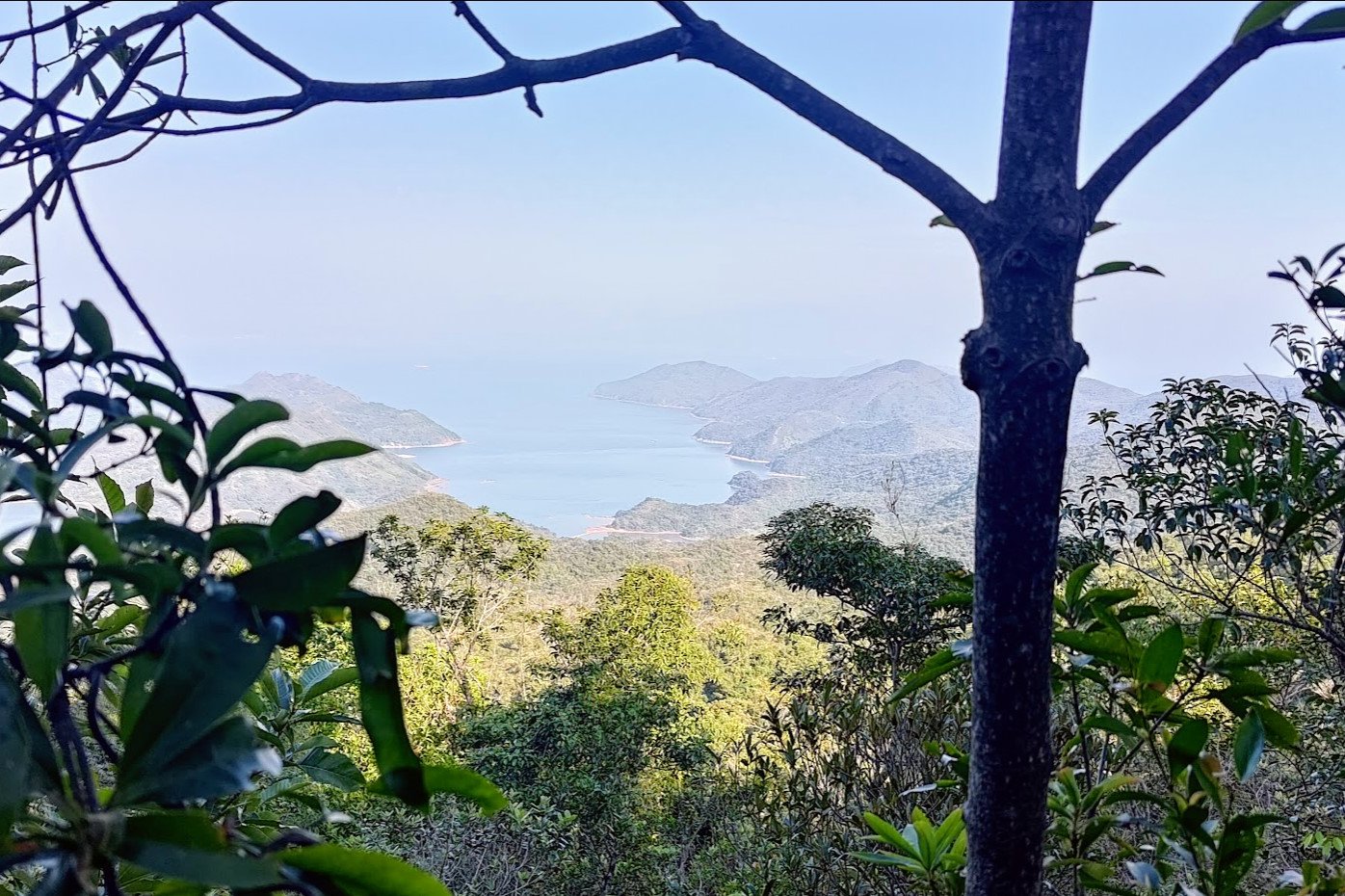
After a long climb, the trail flattens out and offers some respite. Follow the first wooden sign you see toward 'Luk Wu Tung' and just stay on the flat path.
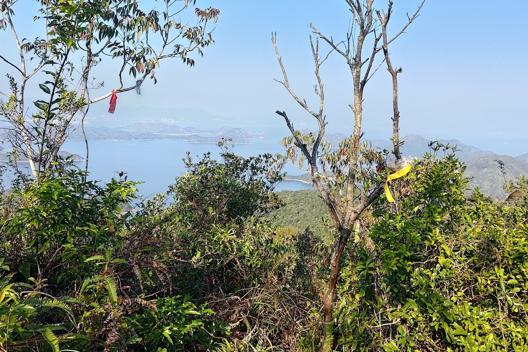
Much of this section is shaded and covered by trees, but on the occasions where you get open views, you'll be able to see Starling Inlet, Double Haven and Shenzhen to your left. On the right, you'll have uninterrupted vistas all the way out to Tai Mei Tuk Dam and even to Ma On Shan!
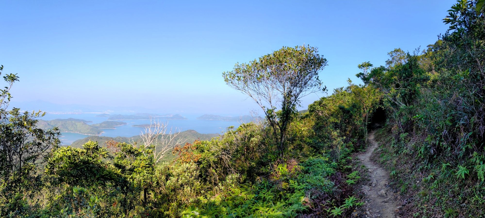
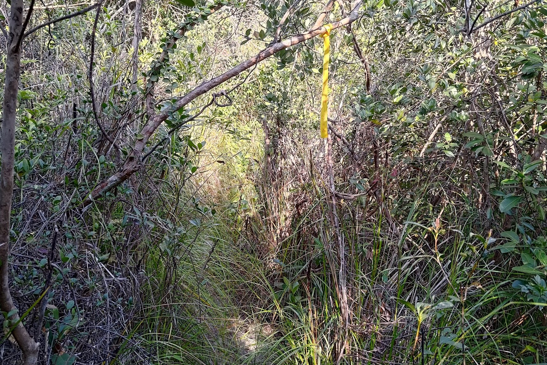
Once you encounter the second 'Luk Wu Tung' sign, be ready to spot some ribbons on your left about 10 minutes later. These will mark the beginning of the toughest section of the hike.
The flat section lasts about 45 minutes in total after the climb.
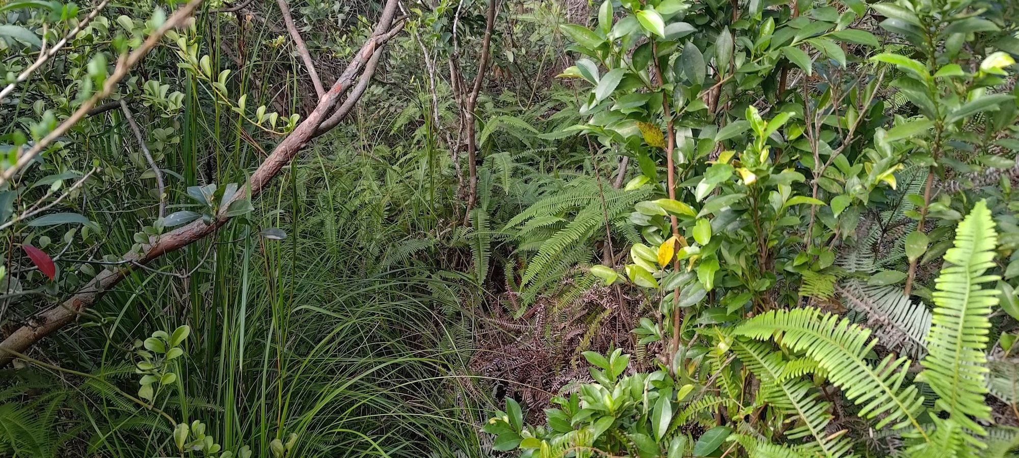
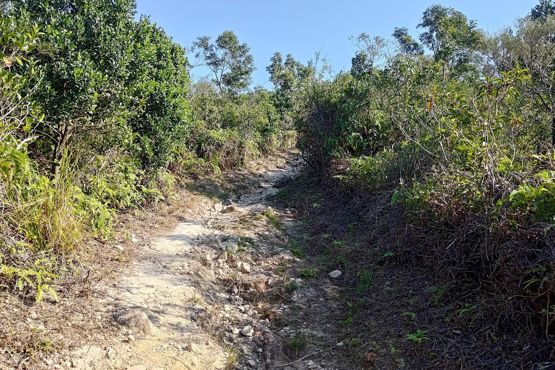
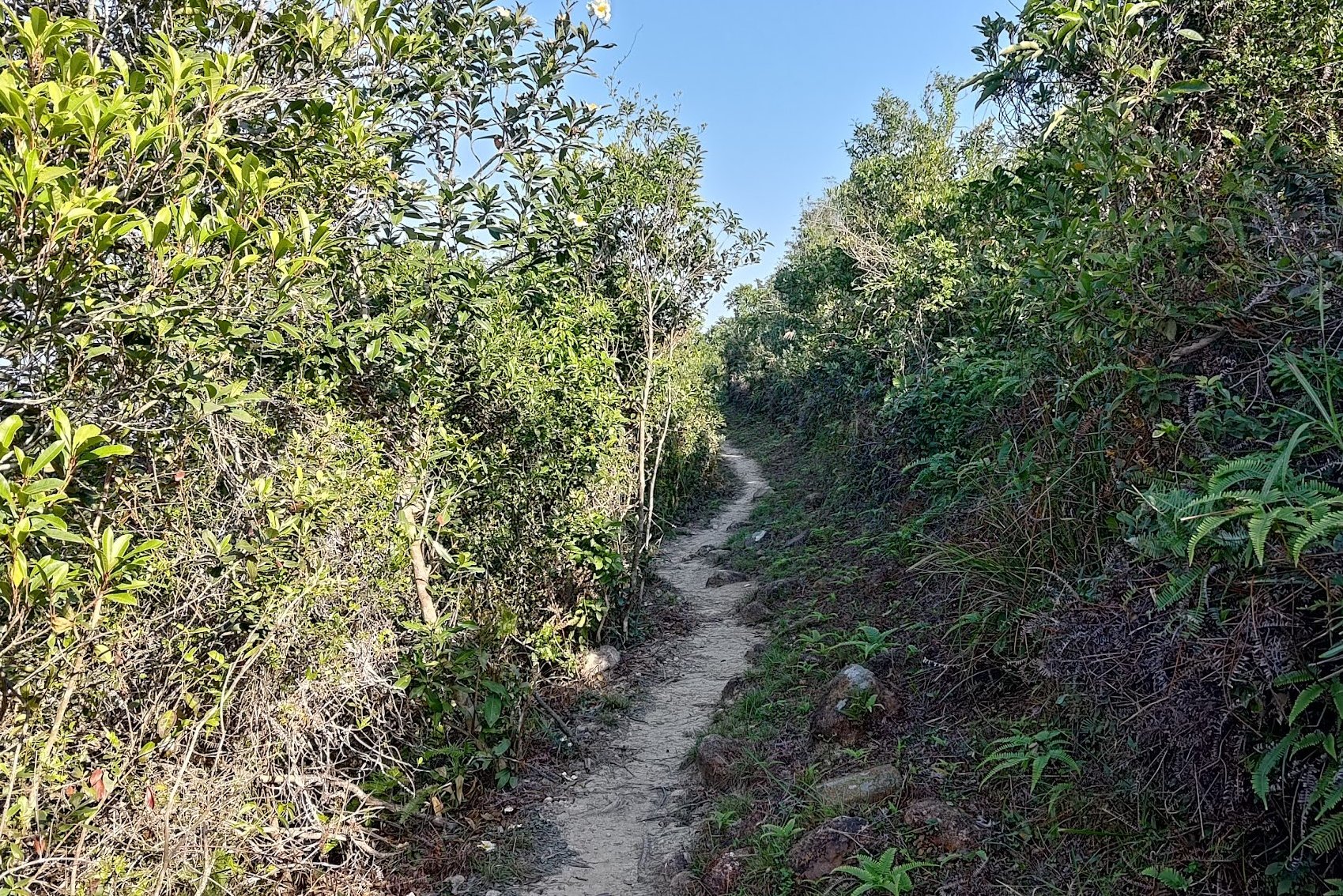
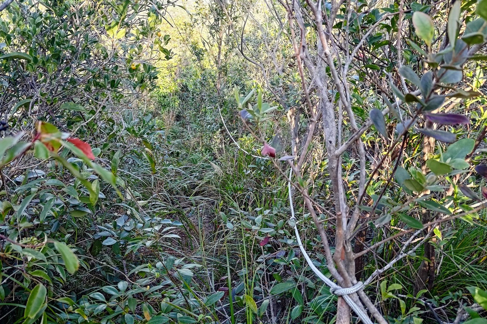
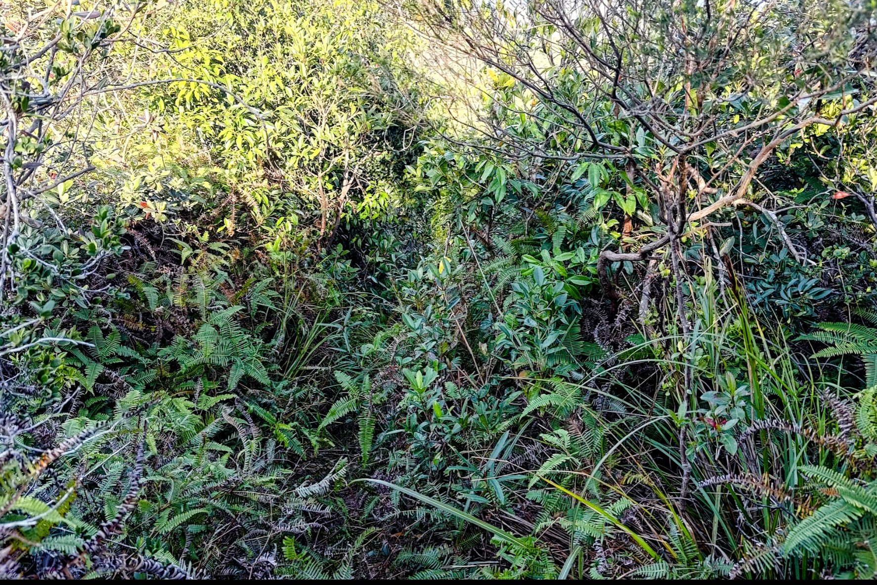
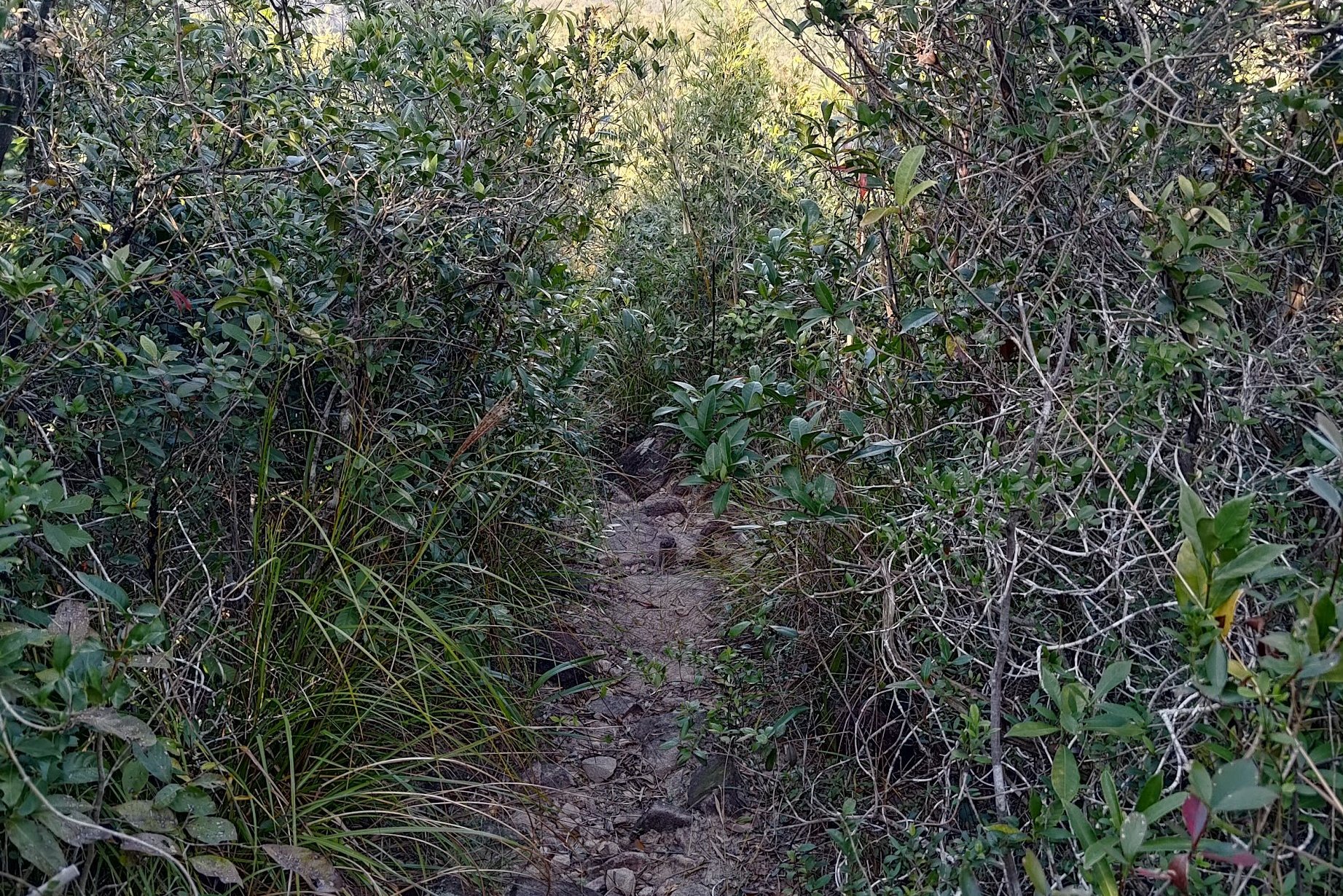
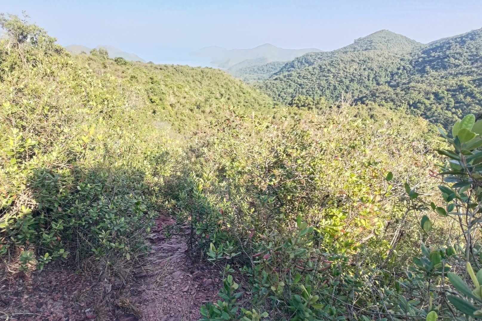
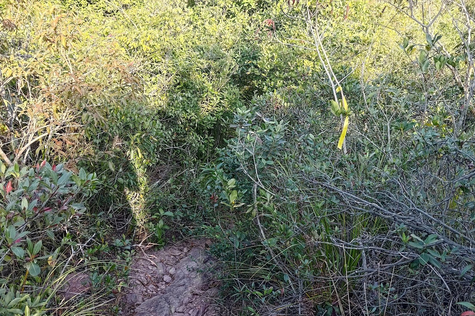
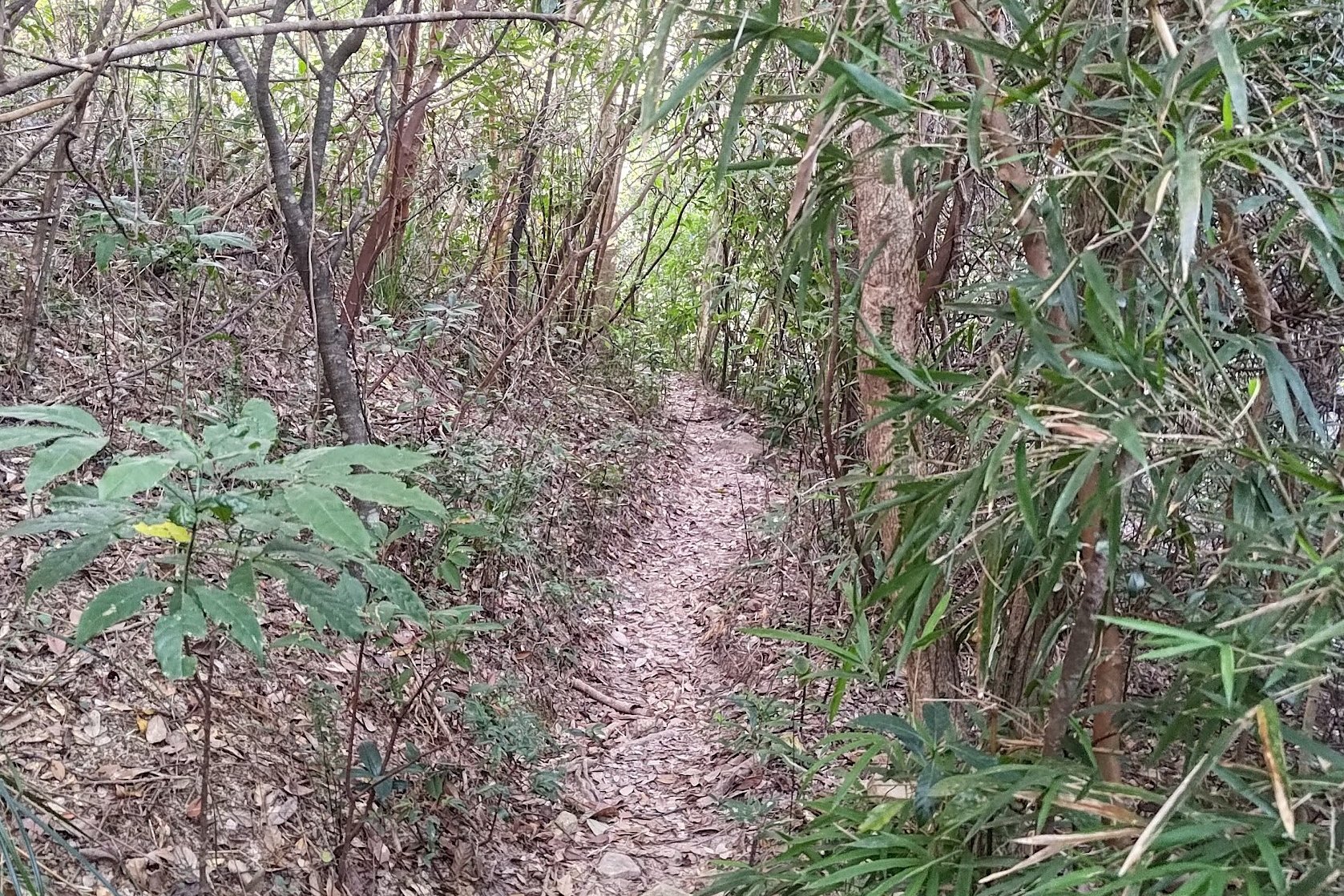
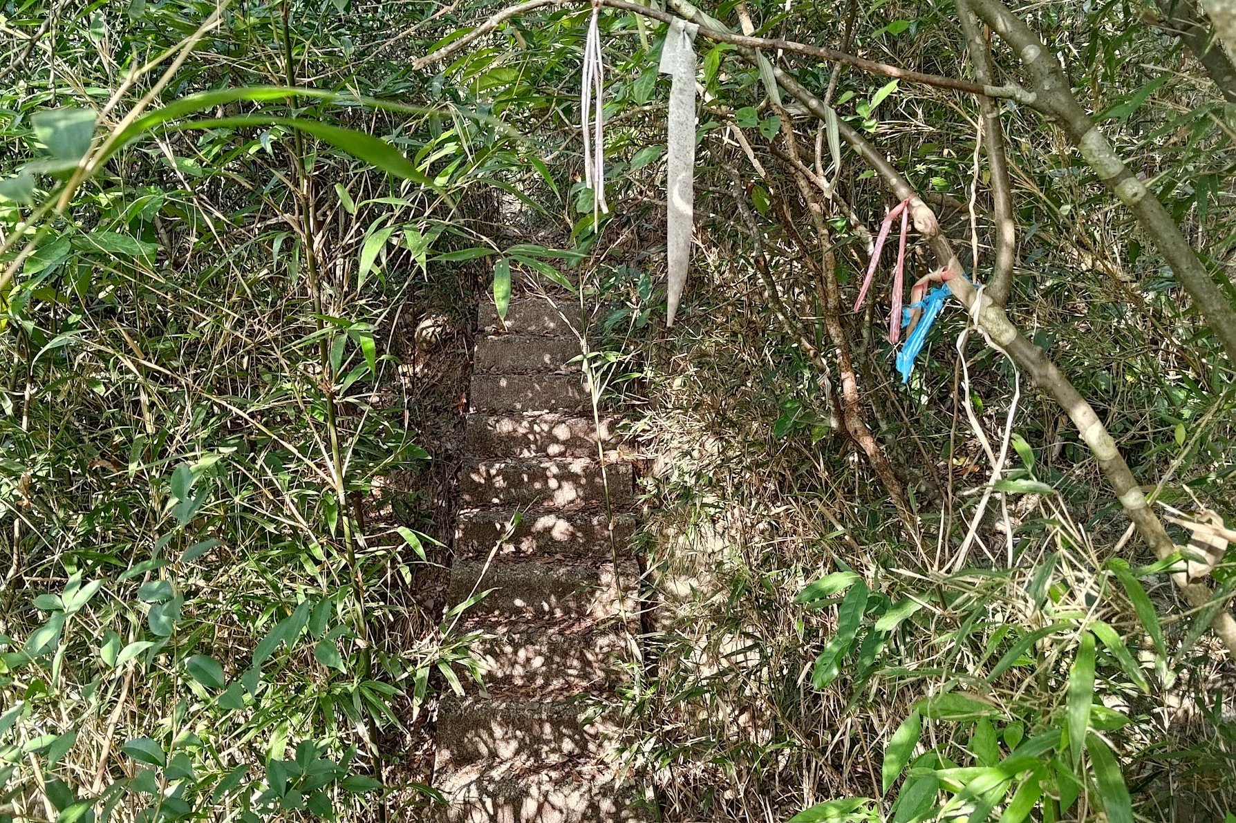
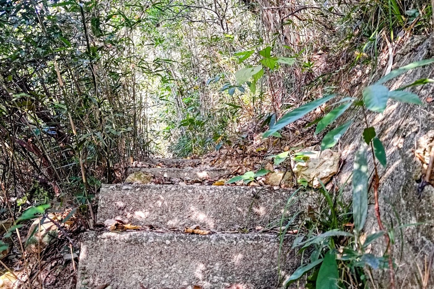
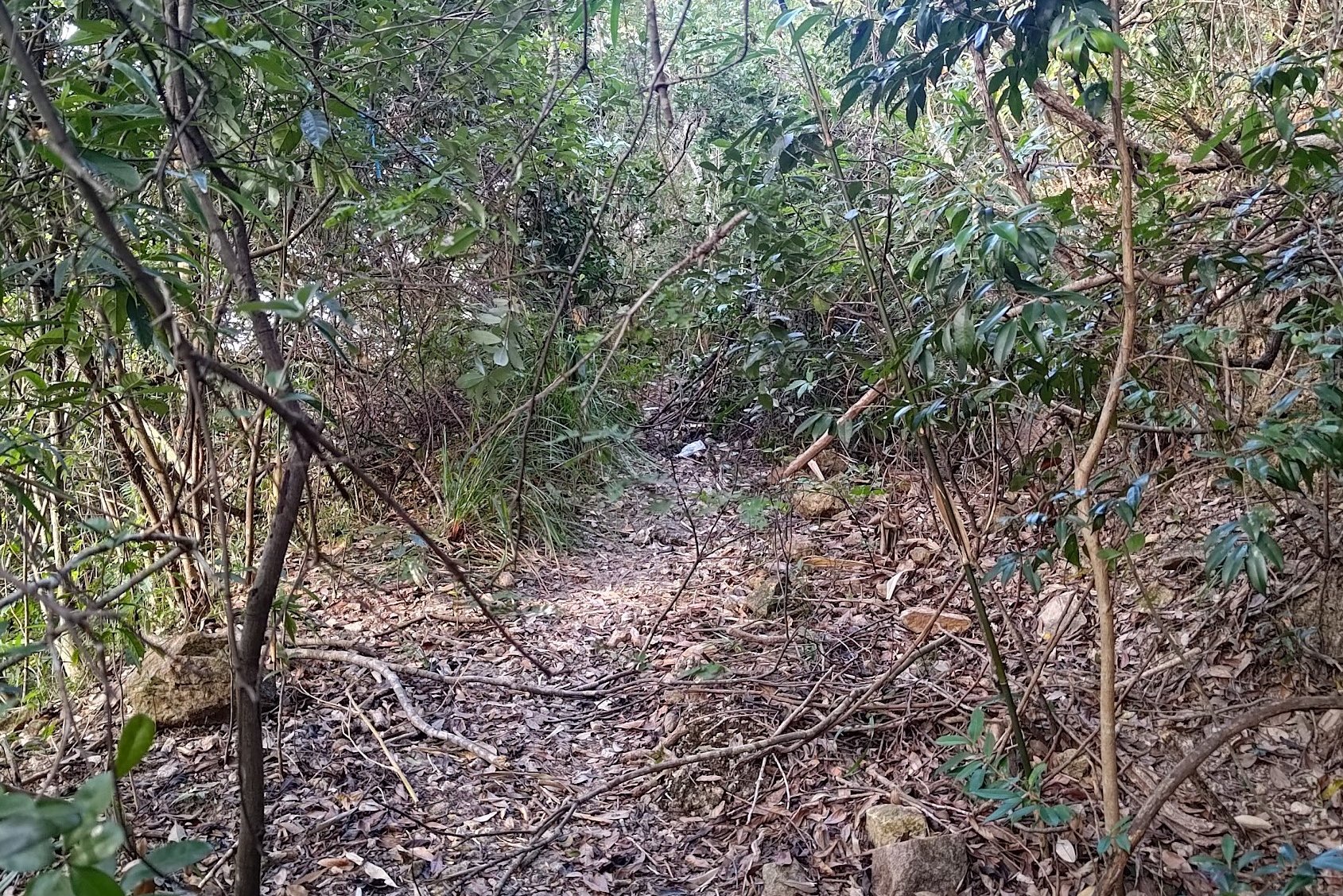
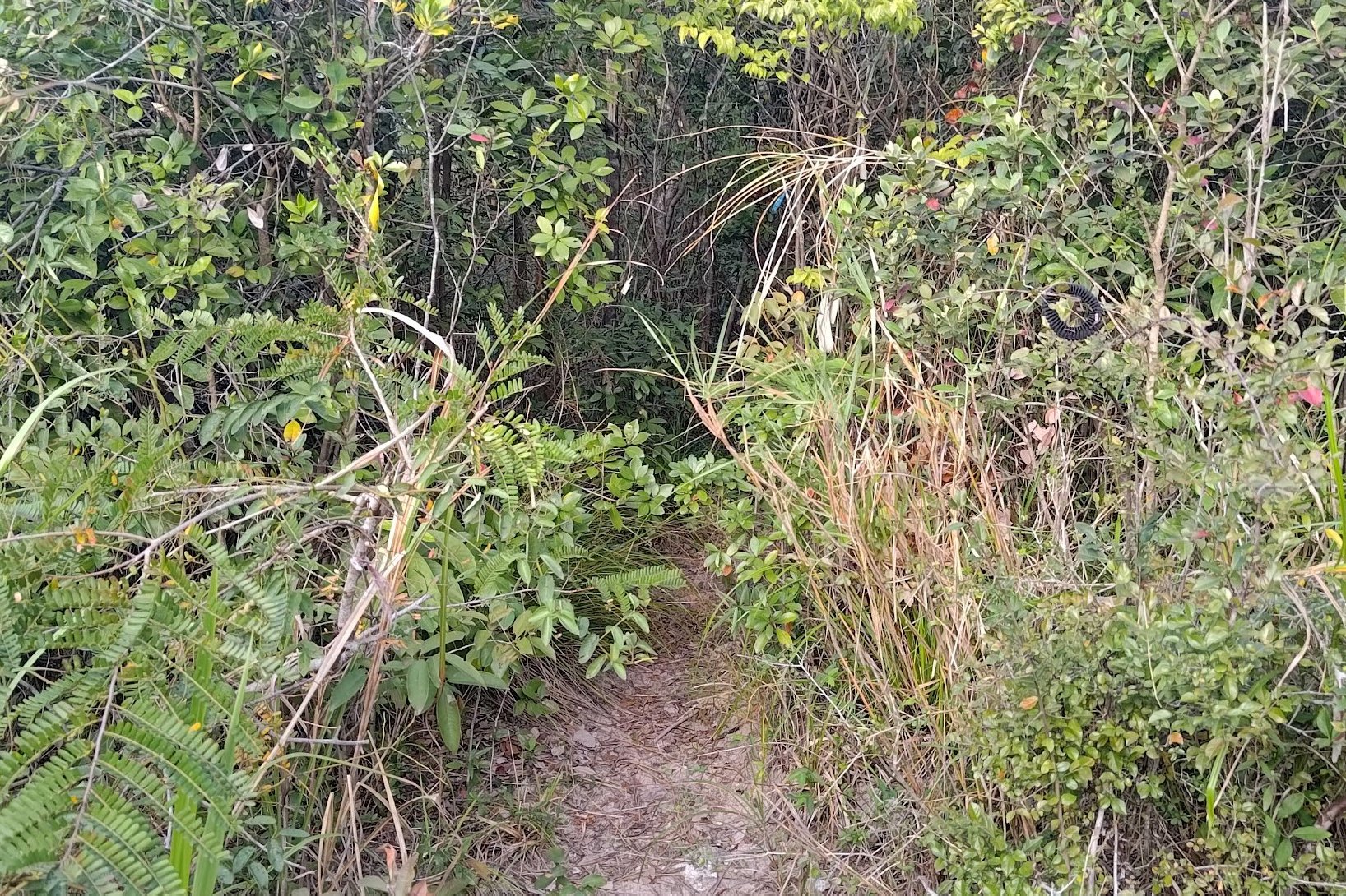
The Overgrown, Horrible Downhill Section
Getting to the reservoir takes about 35 - 40 minutes.
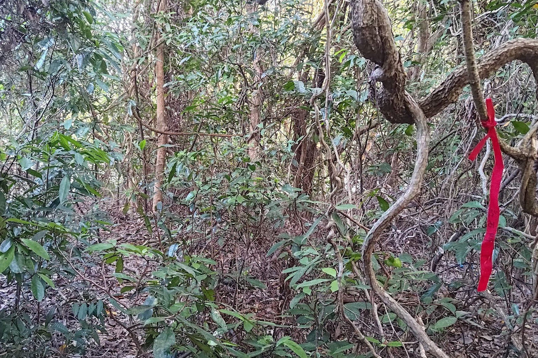
You'll begin by entering the trail marked by ribbons before encountering some ropes that guide you downward for a few meters.
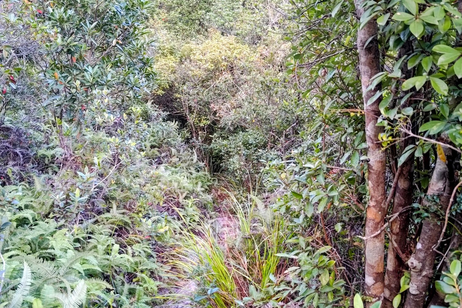
The ropes soon disappear but the trail isn't TOO overgrown at this point. As you head downward, the frustration of being covered in foliage is mitigated by amazing views that punctuate the trail.
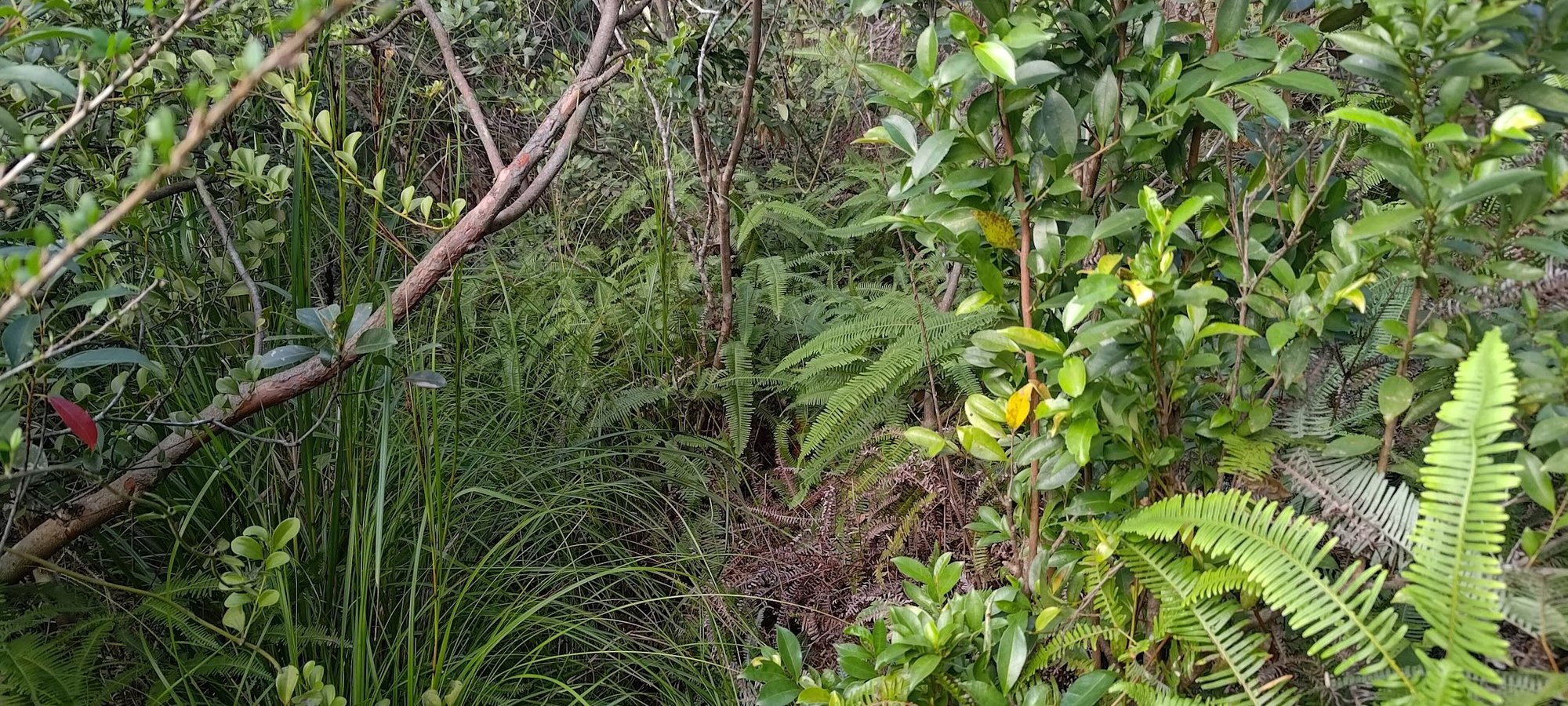
However, there is a point where the views disappear and you'll be blinded, scratched and tripped up by the abundance of jungle foliage trying to reclaim the trail. This section is tough and frustrating, especially since you'll need to stay focused and look out for ribbons along the way.
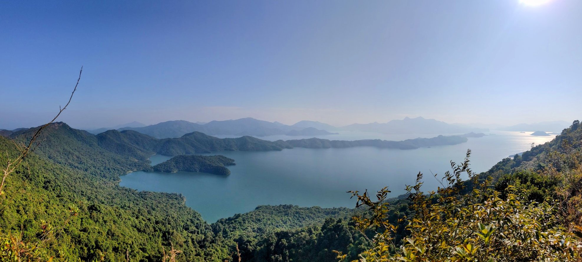
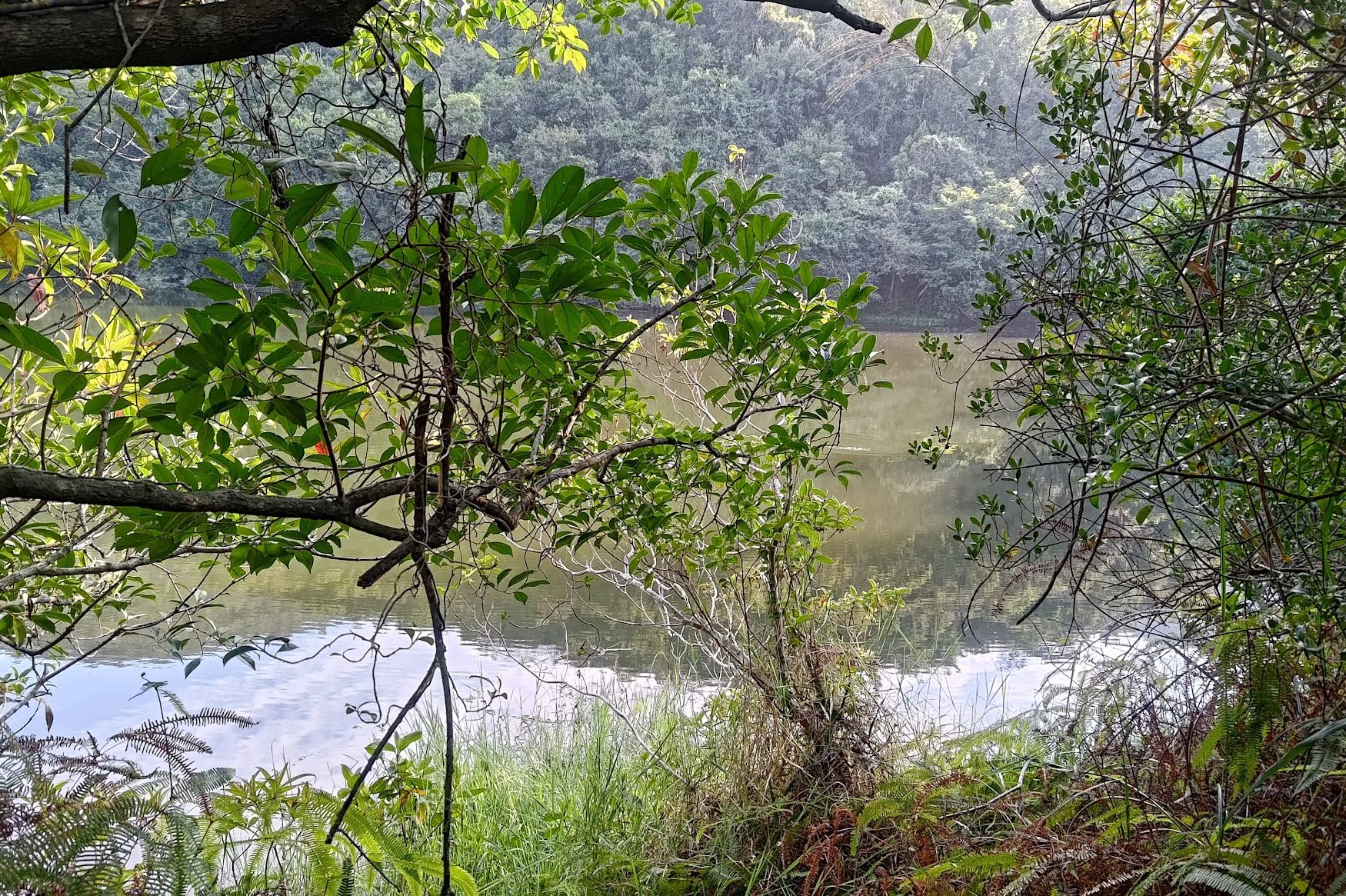
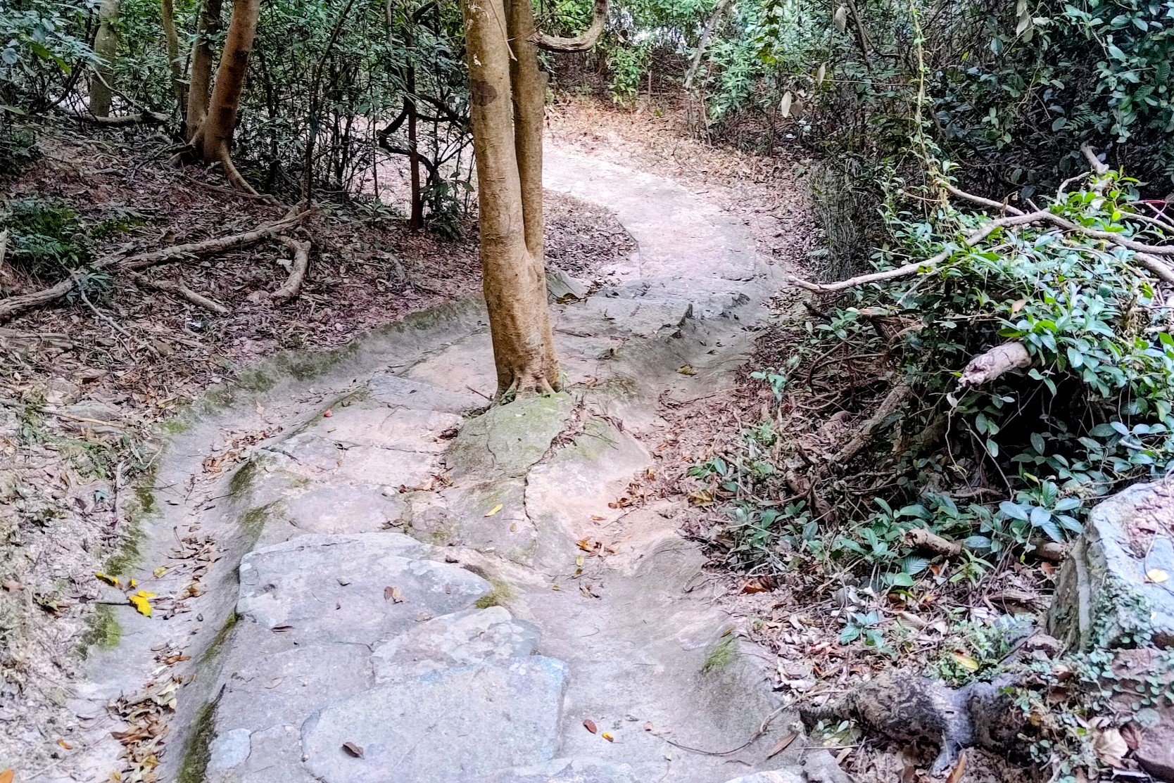
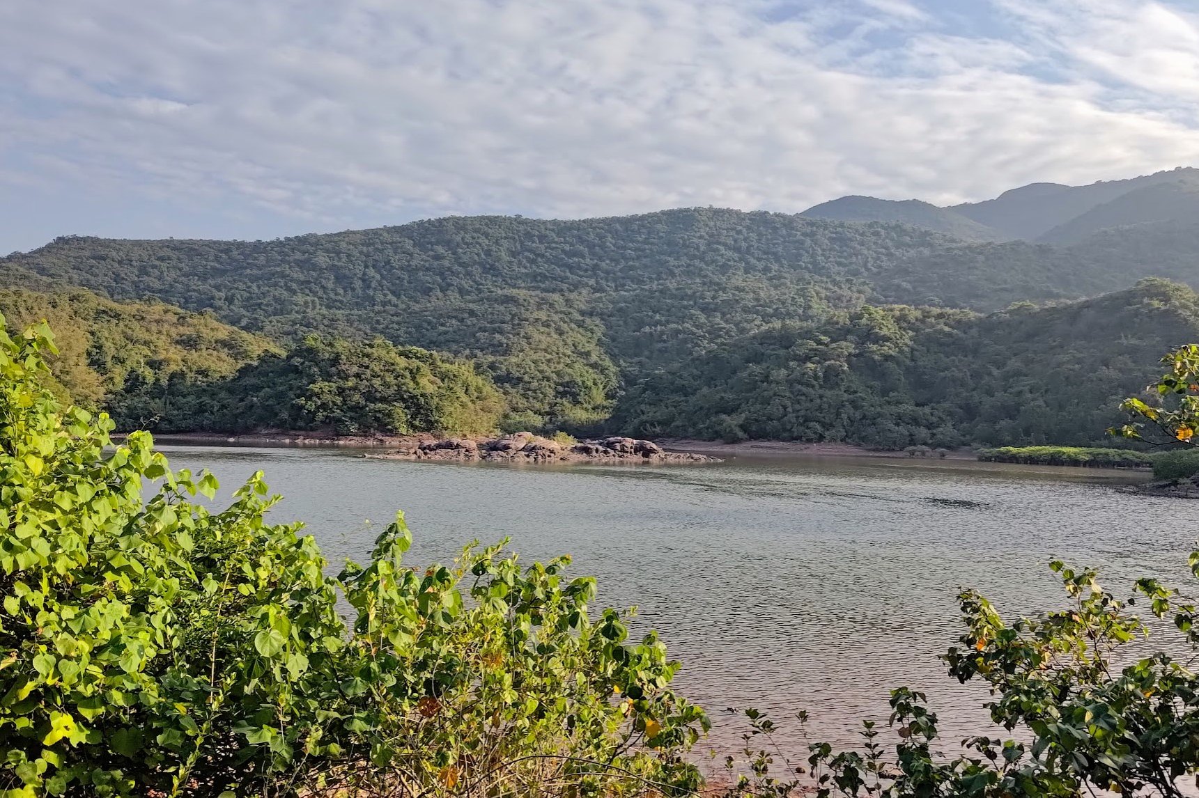
After plenty of suffering, you'll reach a forest track and promptly see a reservoir to your right. You may think this marks the end of your downhill torture, but it is just false hope.
Your torment shall continue.
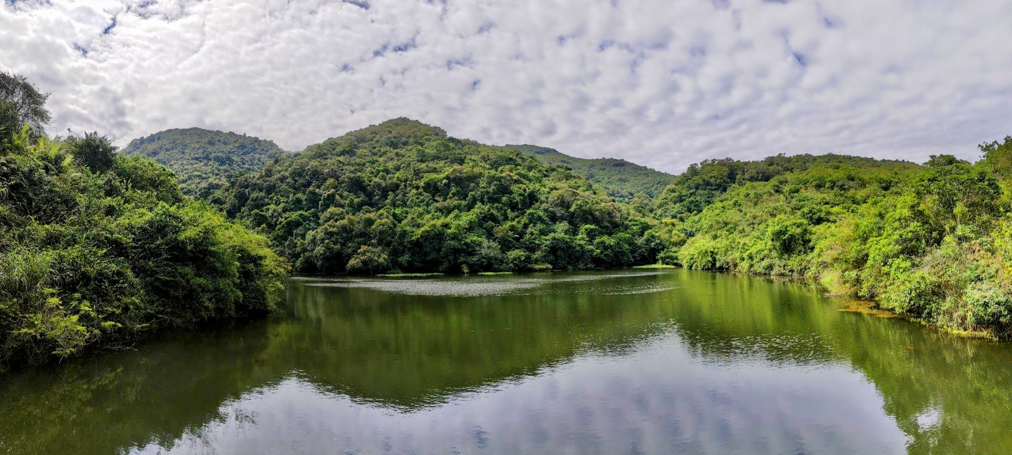
Reservoir to Hung Shek Mun
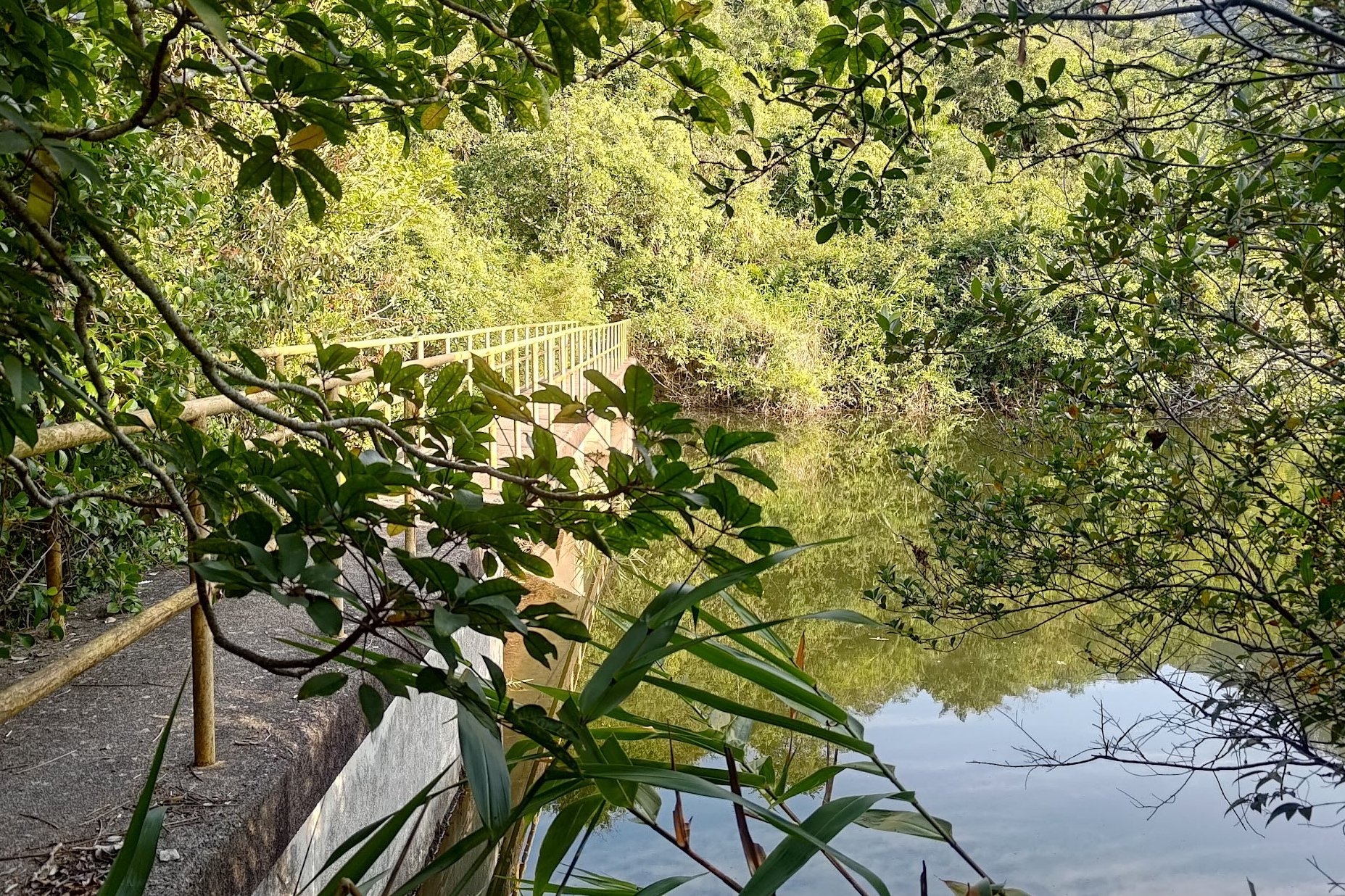
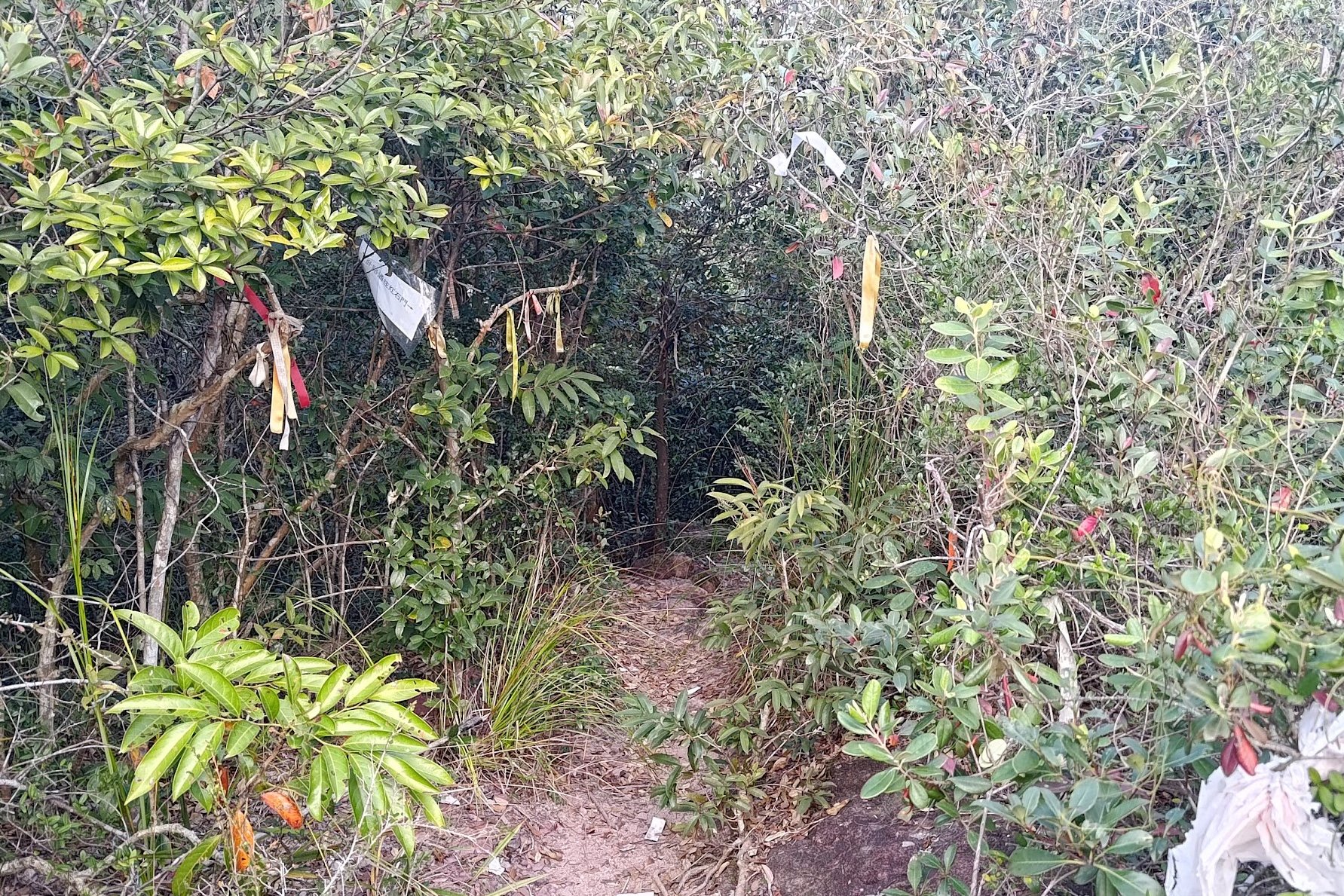
While it may seem like you're at the end of the downhill section near the reservoir, you've still got a ways to go. Getting to the beach from the reservoir takes an additional 20-25 minutes.
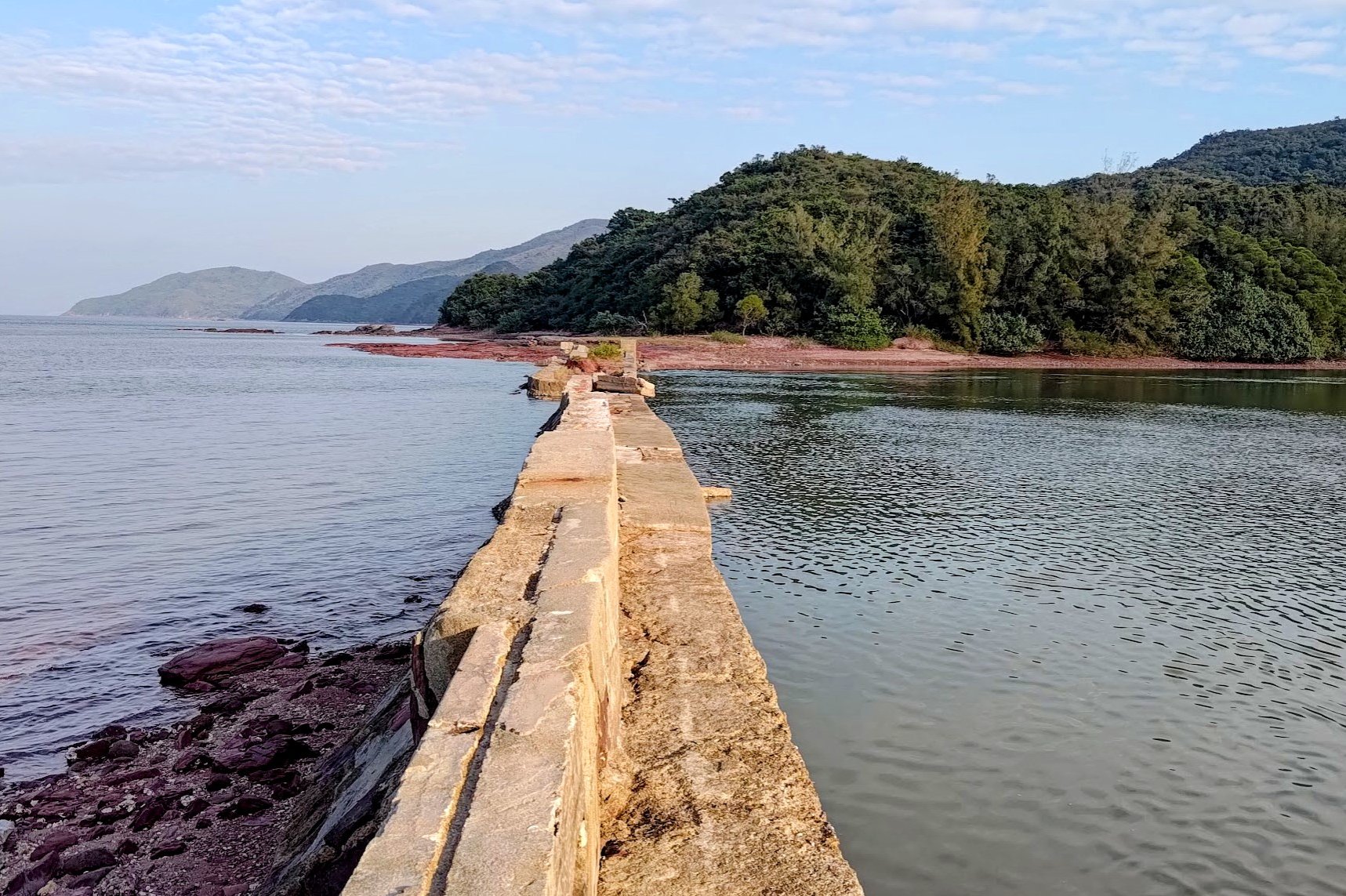
Cross the yellow bridge and look for the stairs to your left. After climbing the stairs, push through the trees beyond and you'll see another overgrown trail marked by ribbons.
IMPORTANT
Follow the trail for about 10 minutes and then look for a laminated piece of paper on your right. There are also many ribbons surrounding the paper.
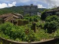
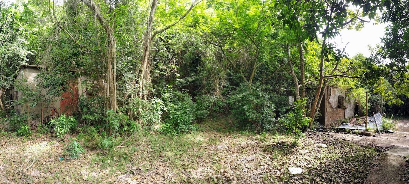
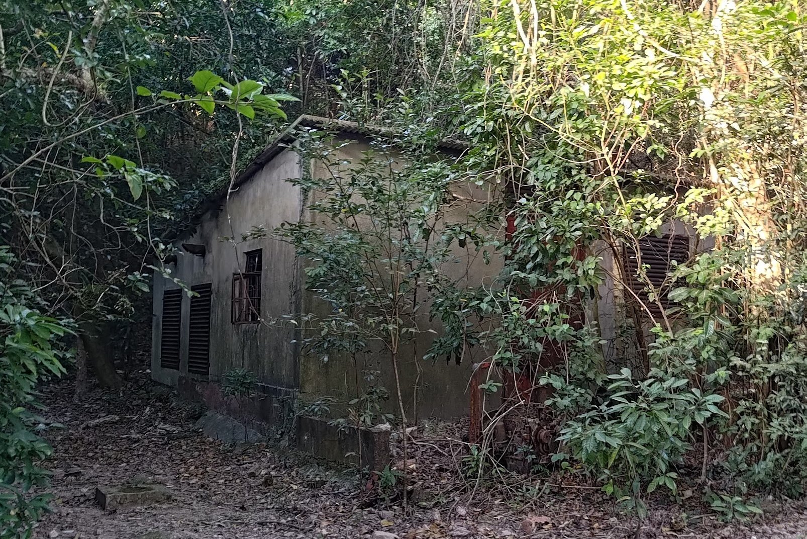
Follow the trail downward for another 10 minutes before you arrive at a small lake. Walk around the edge of the lake and you'll enter an abandoned village.
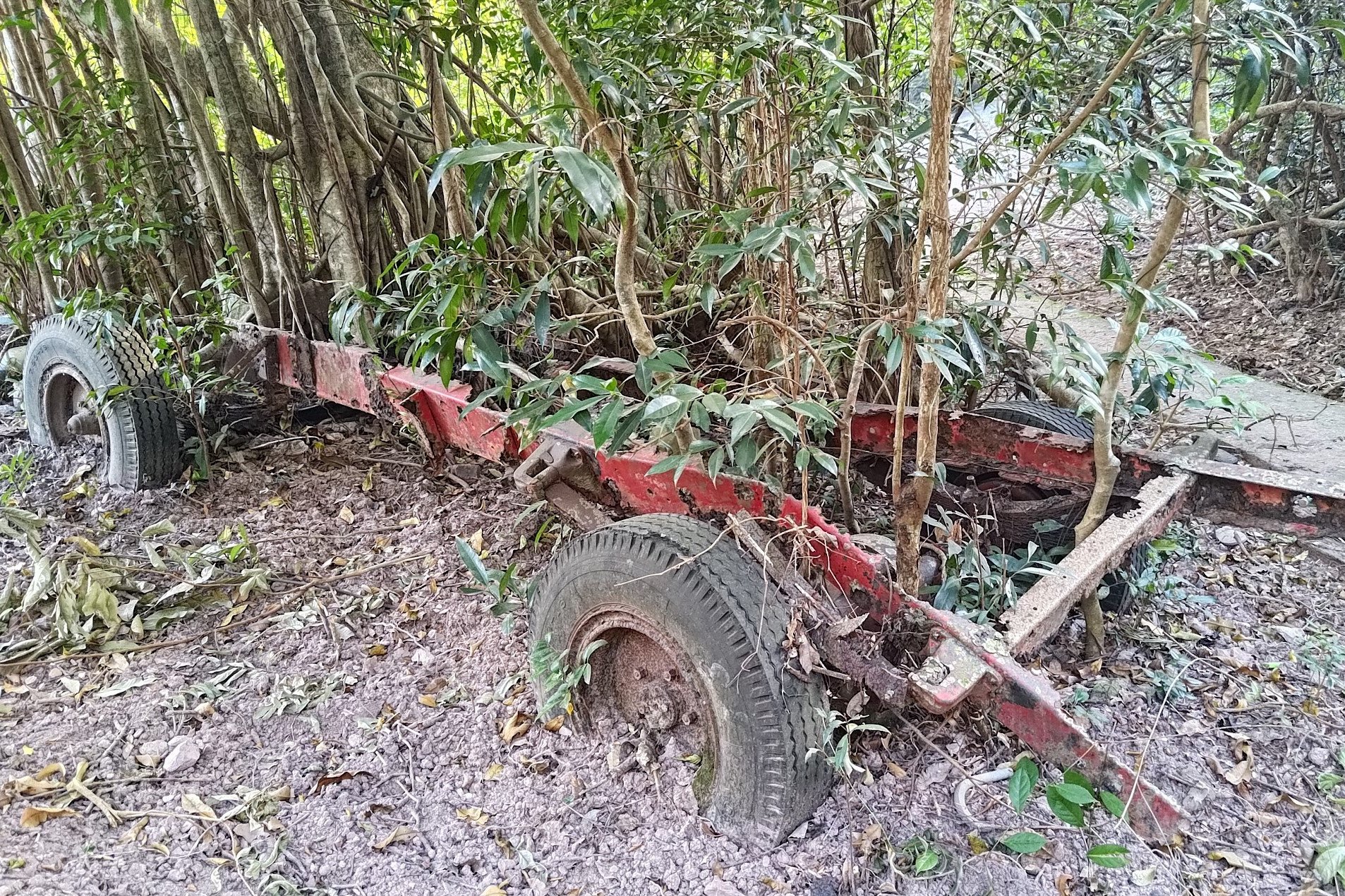
There are perhaps three houses that are obviously visible in this village, though all of them have definitely seen better days. An old pickup truck of some sort has been left to rot over what must have been a really long time. Trees are literally growing through the remaining chassis!
What's that famous Jurassic Park Quote?
Life, uh, finds a way.
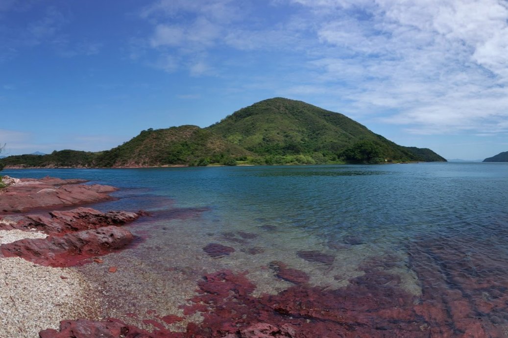
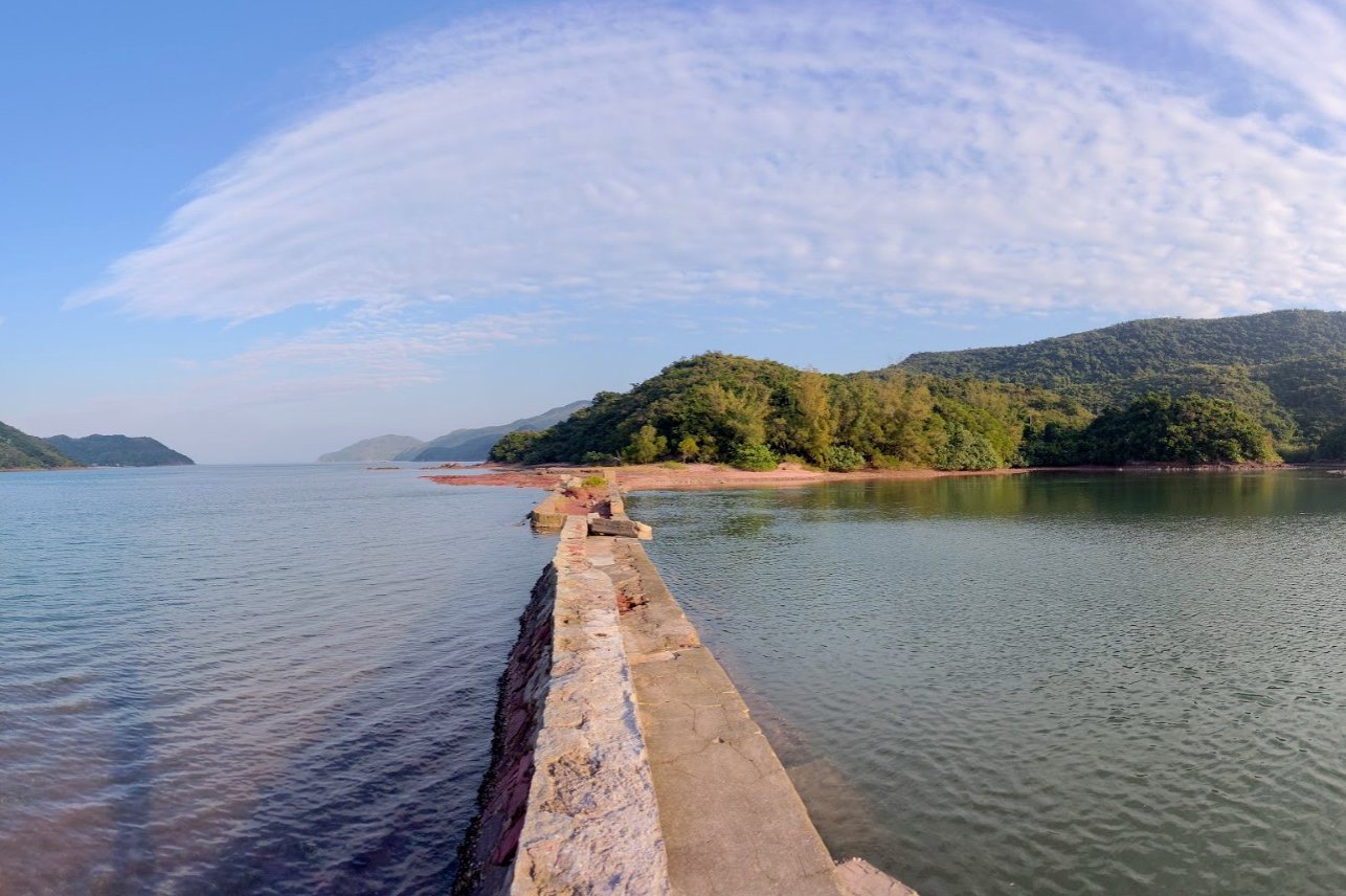
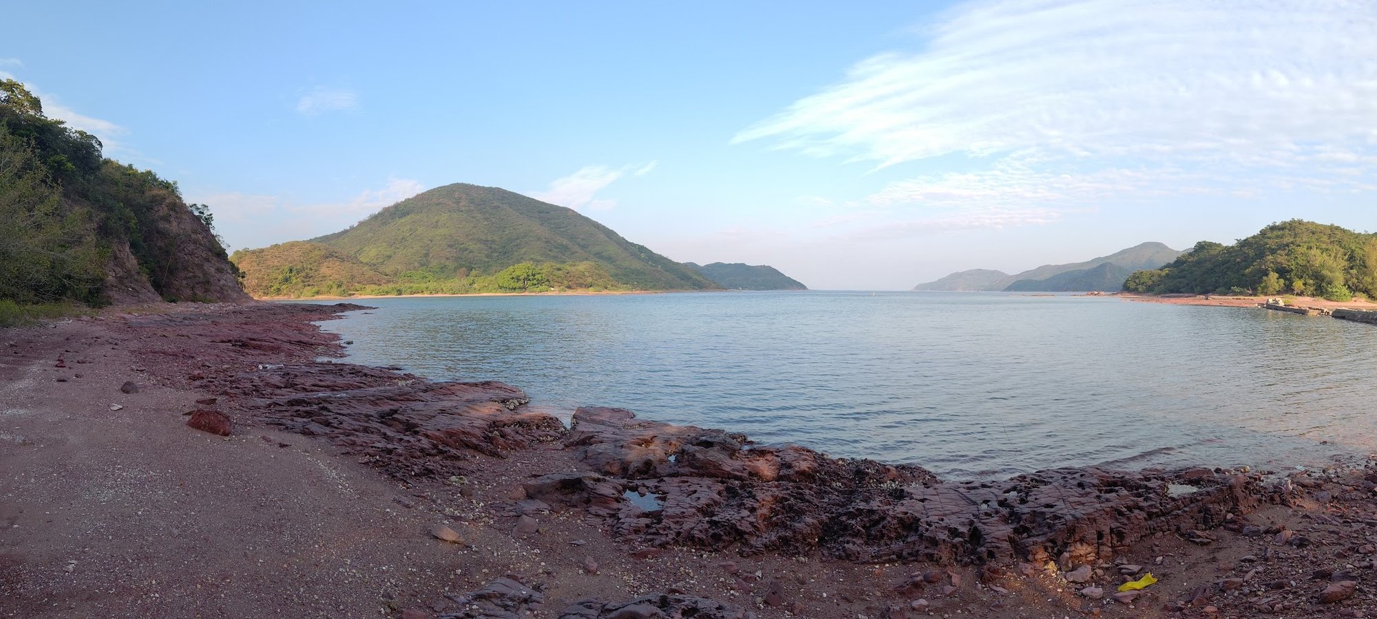
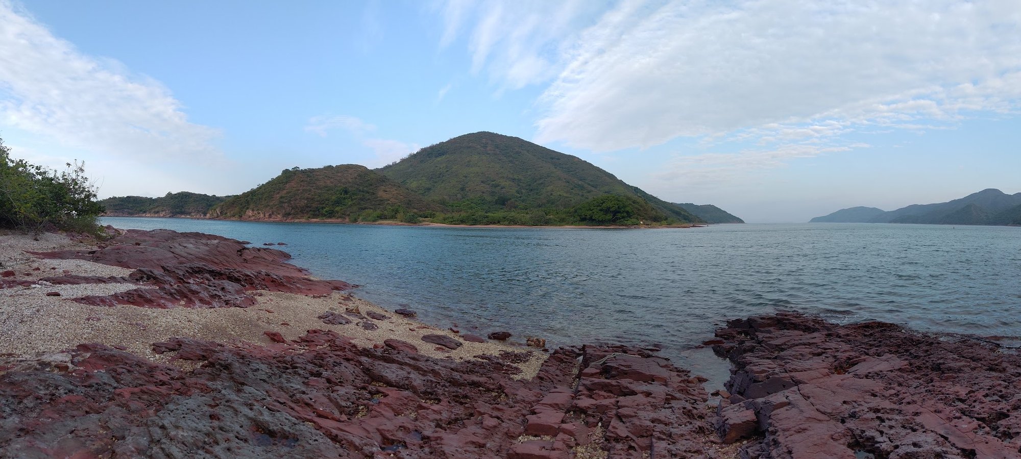
Hung Shek Mun in 2022
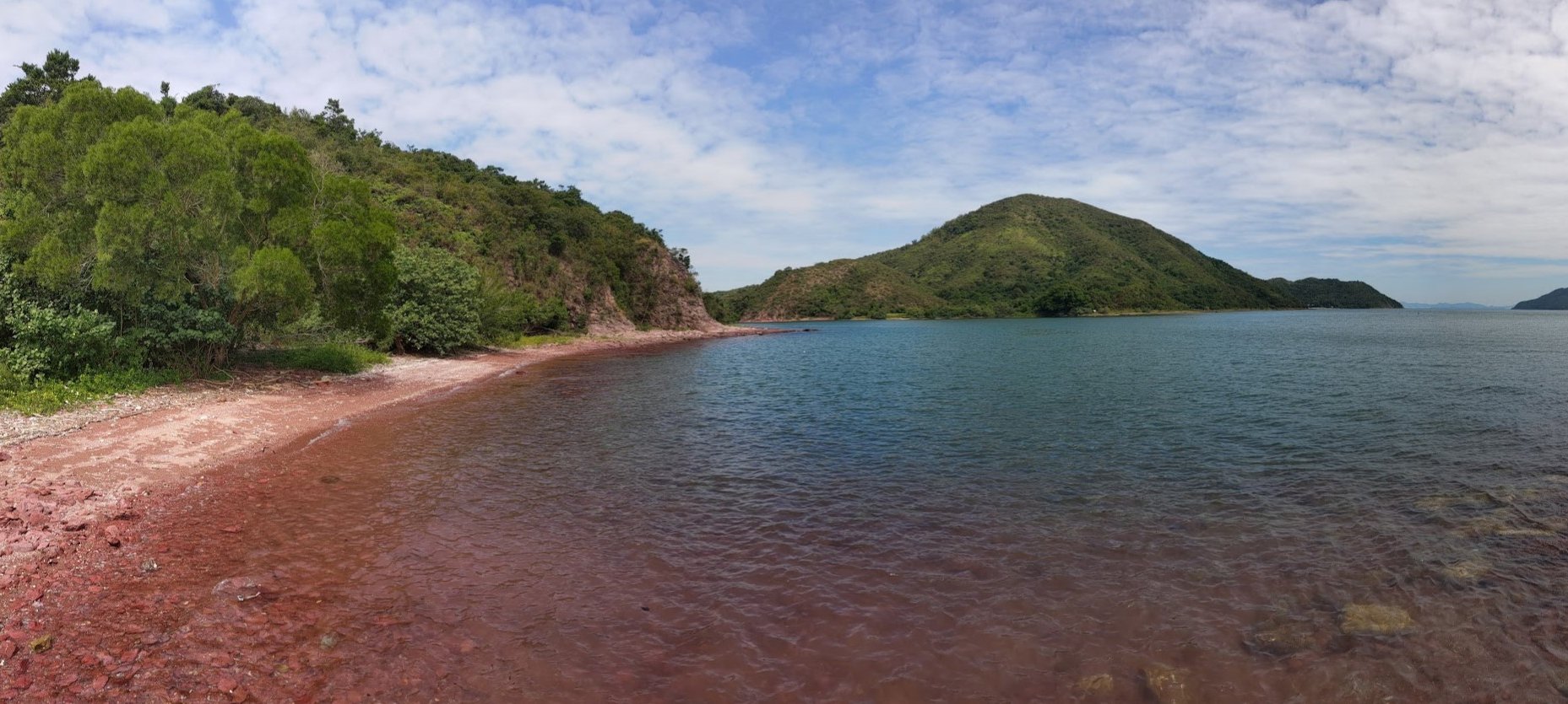
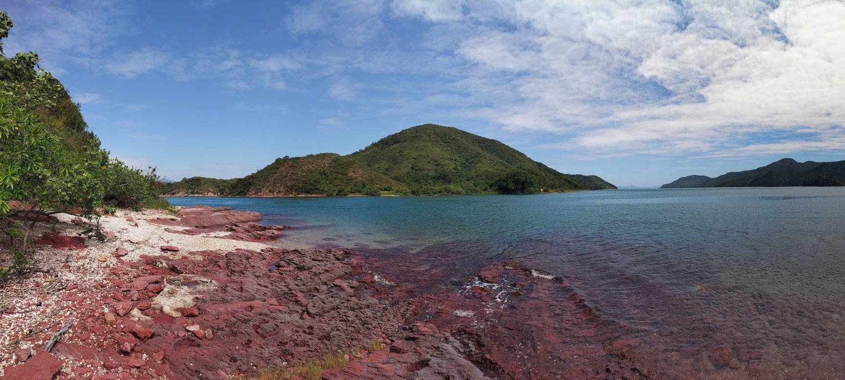
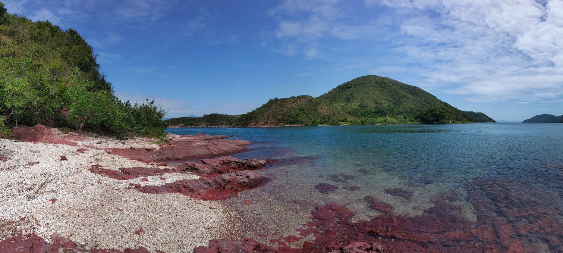
Walk straight from the village and in barely a minute you'll arrive at Hung Shek Mun.
I first visited Hong Kong's 'pink beach' back in 2022 and with the sun out to provide some epic lighting, the coastline and beach almost looked pink.
Still, given what I had heard and read about the pink beach, I was surprised to find that Hung Shek Mun is more of a rocky coastline than a beach full of fine, pink sand.
The area was undeniably gorgeous despite my assumptions, though even back in 2022, I wouldn't recommend that most people hike here given how small the beach is and how much effort is involved to get there.
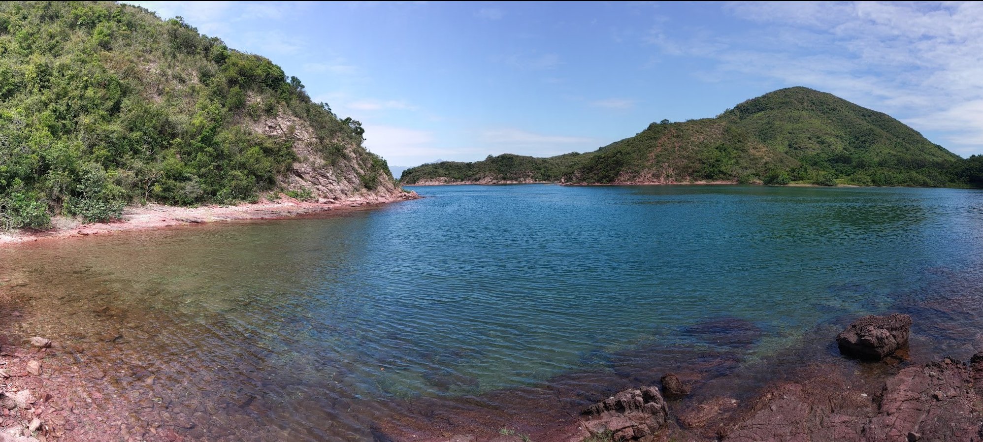
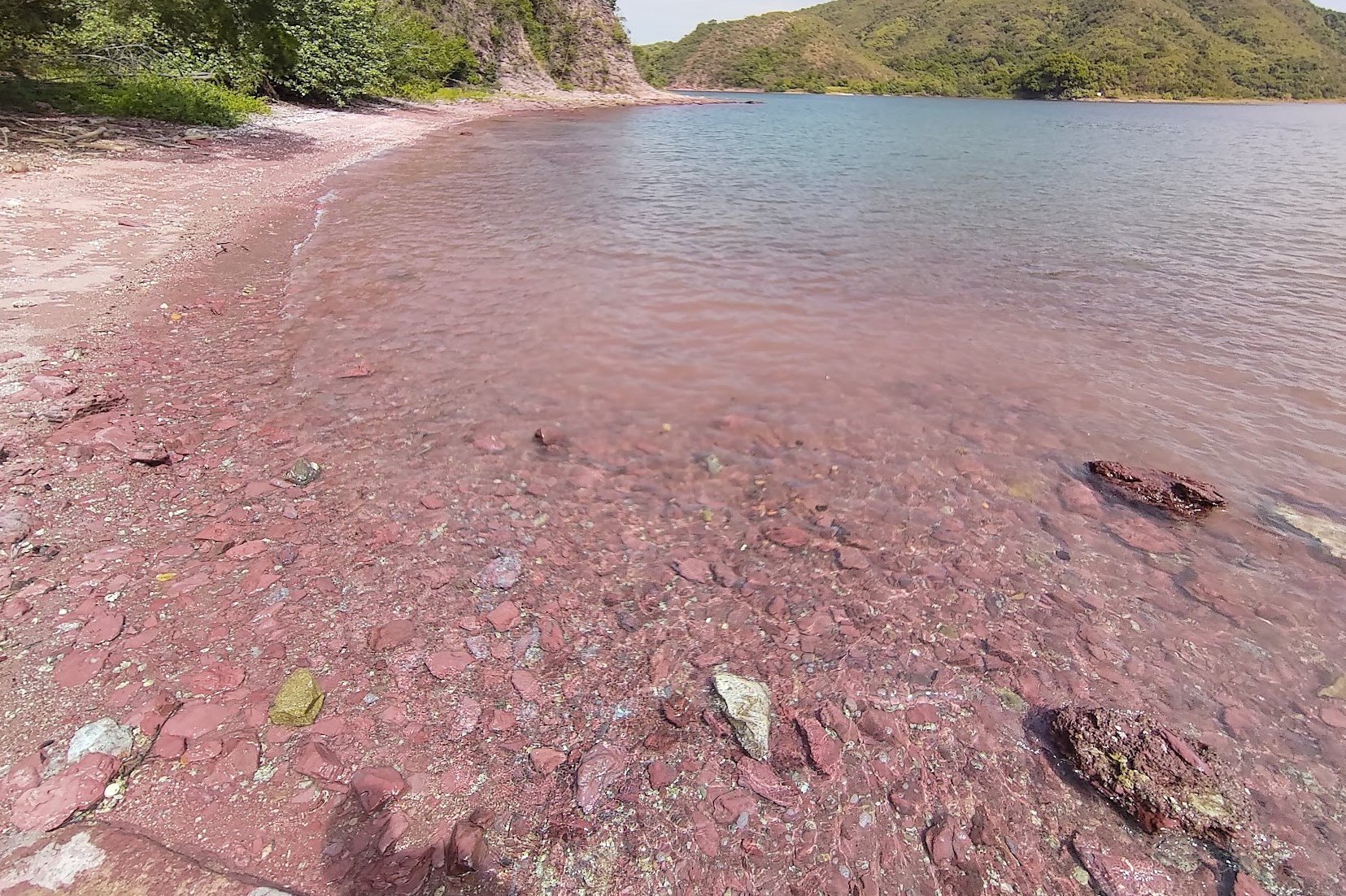
Hung Shek Mun in 2023
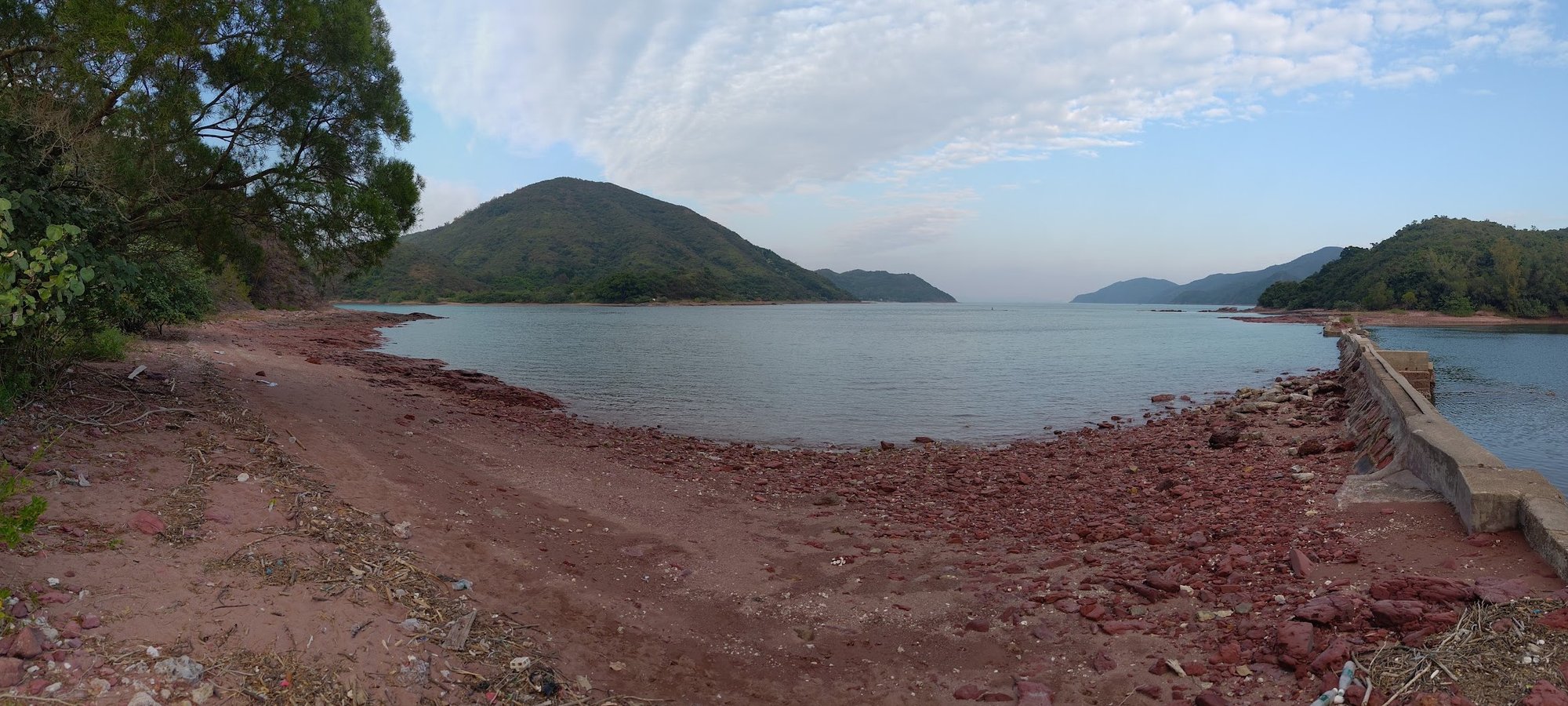
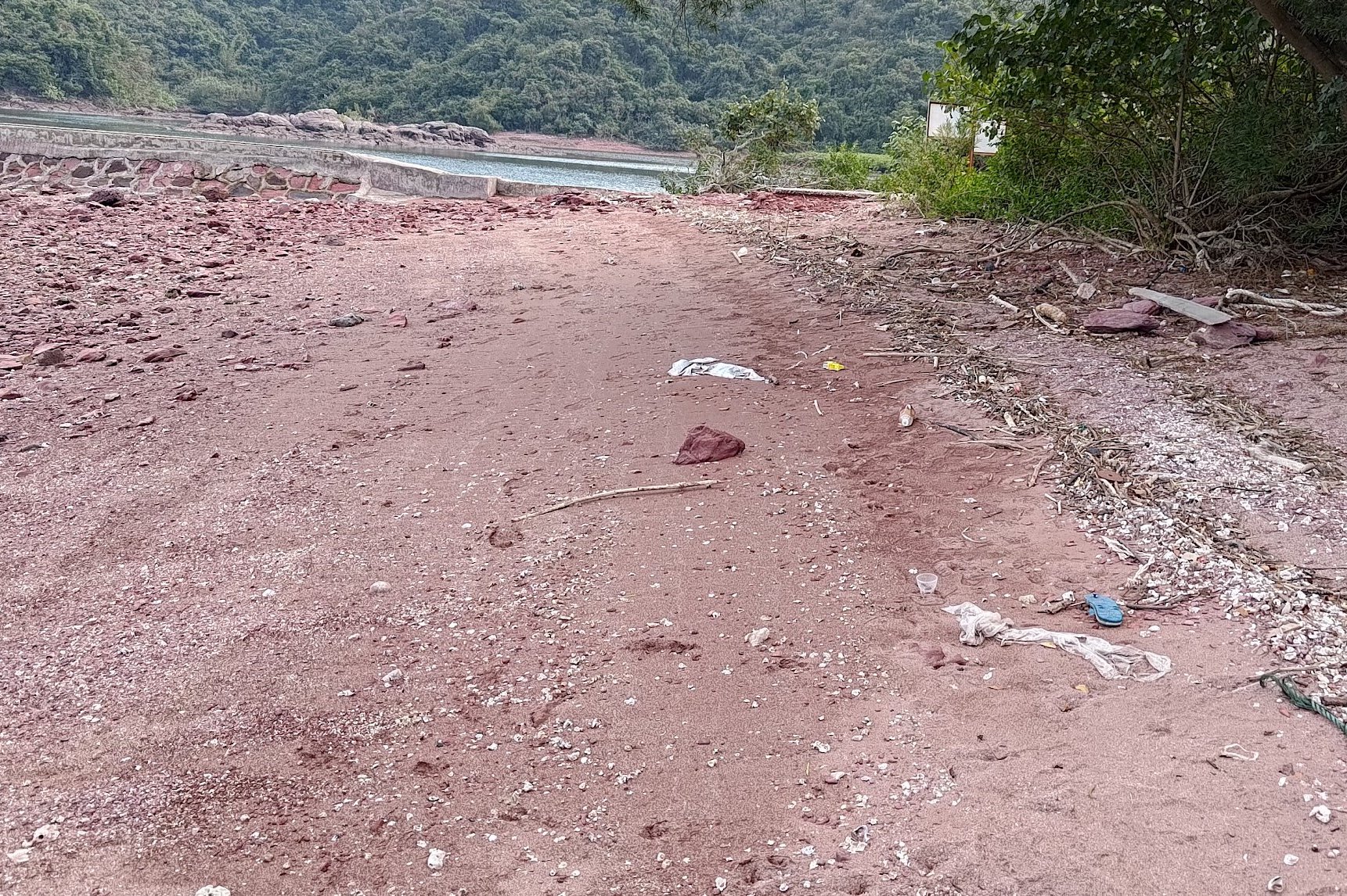
Revisiting Hung Shek Mun in 2023 was a real surprise - and not in a good way.
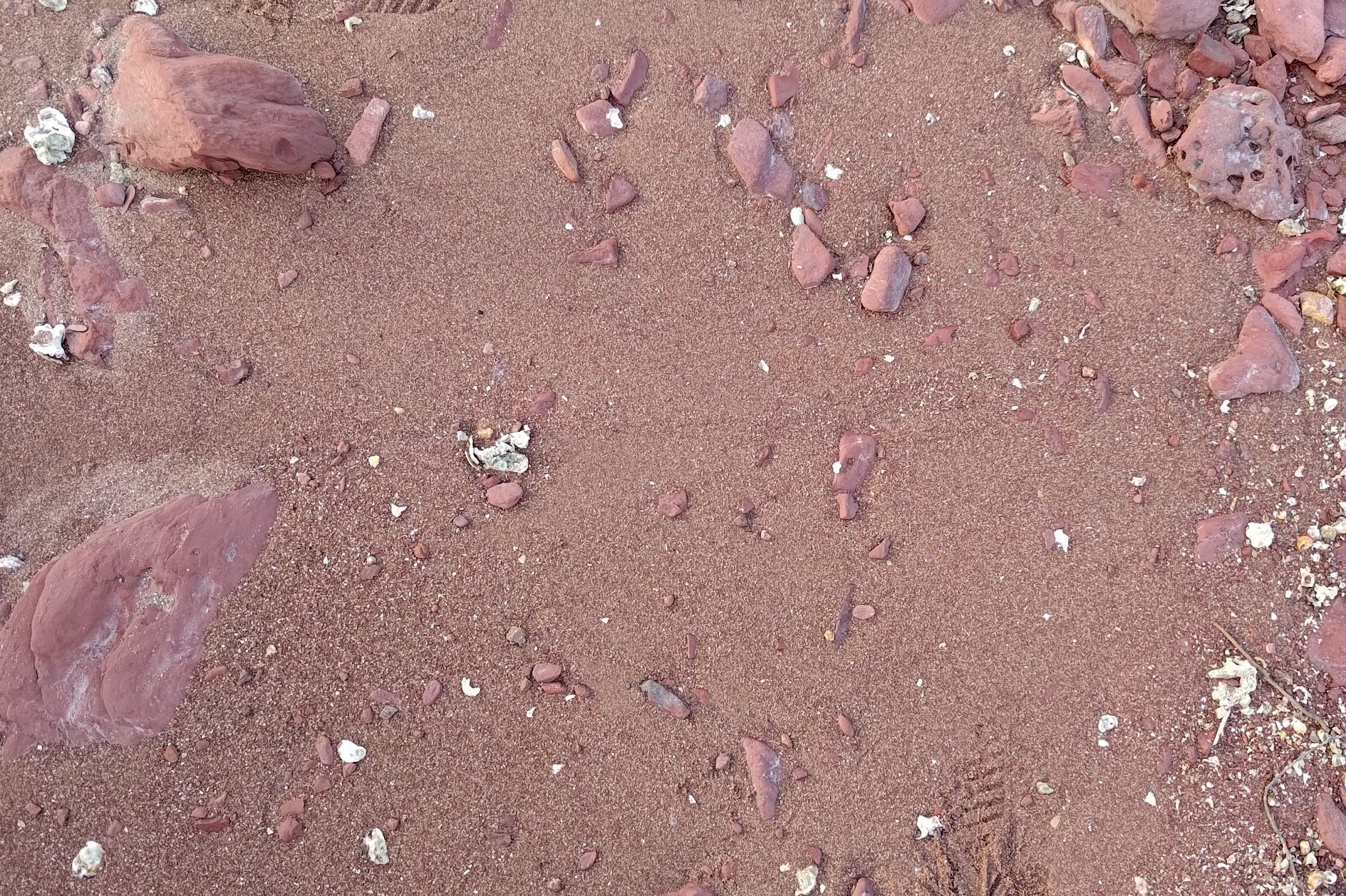
The beach, without the right lighting conditions, looks even less pink than when the sun illuminated it back in 2022. In the shade, Hung Shek Mun is definitely more of a bricky brown color rather than anything that resembles pink.
Perhaps worst of all was how polluted this beautiful spot had become. The beach was covered in rubbish that had been pulled in by the tide, and given Hung Shek Mun's remoteness, I doubt that there's going to be a cleanup anytime soon.
Getting Back
After exploring the beach and coastline, you'll have to hike back the way you came. That's another reason I don't really recommend this hike for anyone save hiking completionists and masochists.
When you arrive back at the start point, you can take the 275R bus to Tai Po Market MTR Station if it's Sunday from the Double Haven Trail sign at Wu Kau Tang Road.
If it's a Saturday or a weekday, you'll need to take the 20R minibus to Tai Po Market MTR Station. It arrives every 15th minute of the hour (06:15, 07:15, etc).
Make sure to wait at the first stop (at the end of Chi Sum Road), especially if it's a Saturday. There will be loads of people queuing as this is a popular hiking spot that connects to many different trails.
The 20R bus stop is the start point (green marker) of the hike in the Google Route Map section above.

