
3 Ways to Hike High Junk Peak: Easy, Medium and Hard
Contents
- Essential Information
- High Junk Peak Highlights
- Easy Route
- Medium Route
- Hard Route
- Google Route Map
- How to Get There
- Quick Route Summary
- High Junk Peak Viewpoint
- High Junk Peak Summit Views
- Clear Water Bay View
- Hard Route Optional Escape Point
- Hard Route Best Views
- The Descent
- The Way Back
Essential High Junk Peak Hike Details
- District: Clear Water Bay (NT)
- Duration: Easy Route: 1 hour, Medium Route: 1.5-2 hours, Tough Route: 3-3.5 hours
- Distance: 4.5-6.7 km depending on which route you take
- Highest Elevation: 344 meters
- Difficulty: Easy Route: 1.5/5, Medium Route: 2.5/5, Hard Route: 3/5
- Facilities: No facilities on the hike. Bring drinks and food with you.
Why Hike High Junk Peak?
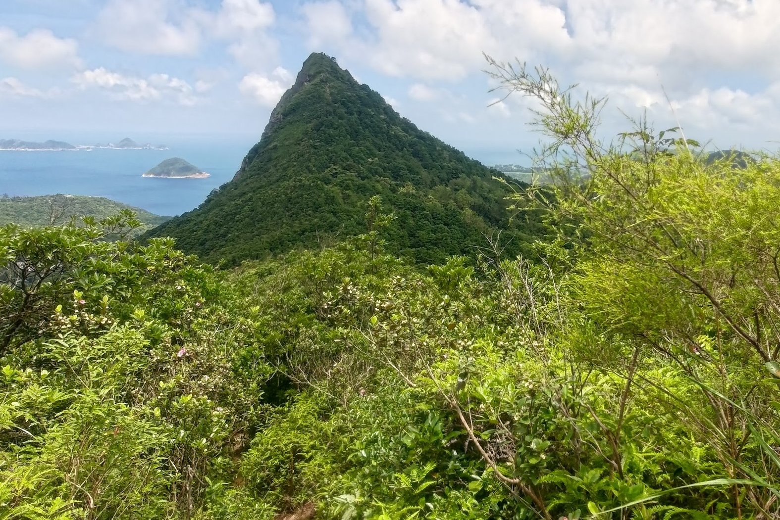
High Junk Peak (釣魚翁) is one of Hong Kong’s most iconic mountains and is the highest hikeable point along the Clear Water Bay Peninsula. With its pointed triangular tip and incredibly steep profile, you’ll easily be able to spot High Junk Peak even from a distance as you approach the hike’s start point.
Though it’s known as one of the city’s ‘Three Sharp Peaks’, High Junk Peak is actually a moderate-level hike with incredible views that make it worth the effort.
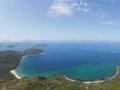
Those who successfully summit can enjoy 360-degree sweeping vistas that include parts of Kowloon, Hong Kong Island, Sai Kung, Clear Water Bay, and even several islands out on the South China Sea.
What makes High Junk Peak unique from a hiking perspective is that there are actually three different ways to hike it based on your skill level.
The Easy Route
The easiest route doesn’t even require you to summit High Junk Peak. Instead, it takes you on a gentle, shaded walk through bamboo forests and lush greenery as it circles around the mountain.
Before you know it, the trail deposits you safely back onto Clear Water Bay Road. This route is great for summertime hiking, families and beginner hikers.
The Medium Route
This route starts and ends the same as the easy route, but also takes you up to the summit of High Junk Peak for some incredible views and a moderate challenge.
You’ll still pass through whispering bamboo forests and tranquil natural paths, but there’ll be additional highlights such as seeing High Junk Peak up close and getting to gaze out across the South China Sea.
An ideal option for budding-intermediate hikers with an adventurous spirit!
The Hard Route
Even though this route is tougher than the other two, it’s still not truly that difficult compared to some of Hong Kong’s other great hikes. Sharp Peak, for example, is much tougher.
The entire first half of the hike is the same as the medium route, but instead of leaving the hike at Clear Water Bay Road, you’ll ascend up another mountain called Tin Ha Shan.
From there, you’ll be rewarded with a jaw-dropping panorama of Clear Water Bay Golf and Country Club and unobstructed views of the South China Sea and nearby islands.
This route is perfect for those seeking a challenge or on the hunt for some of Hong Kong’s clearest coastal views.
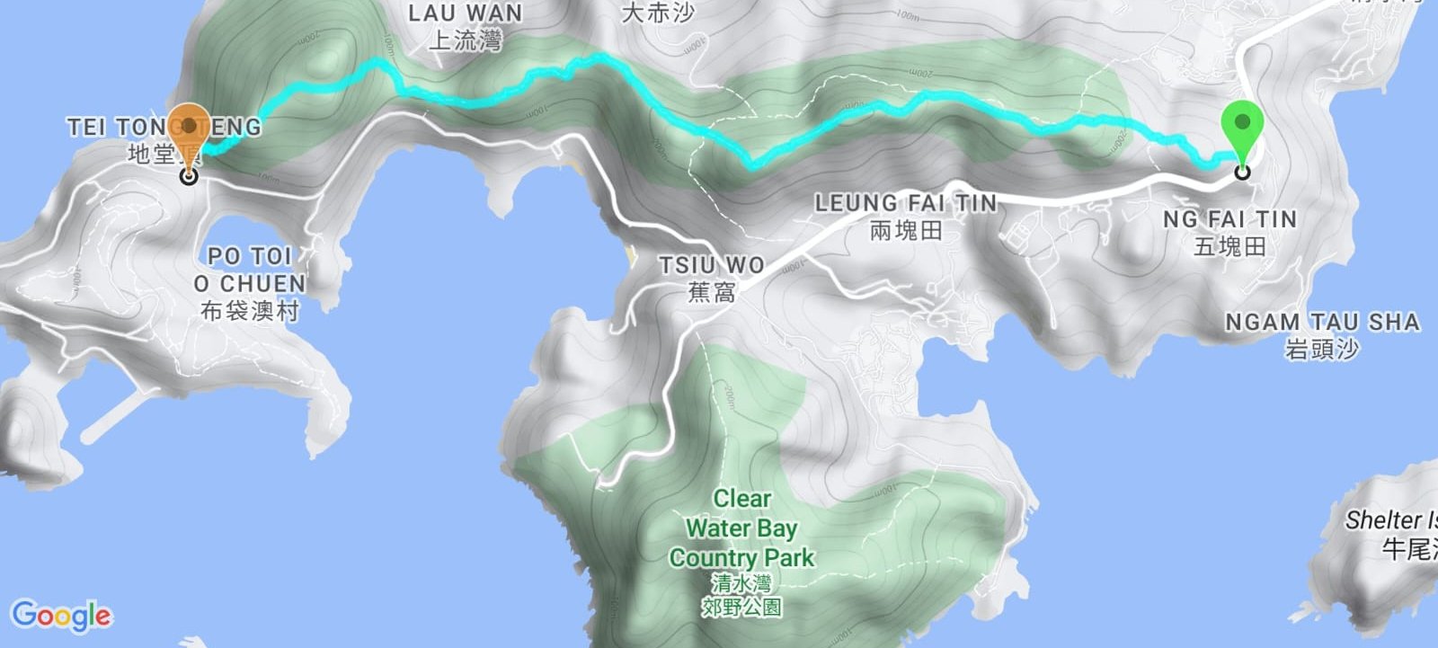
Google Route Map
How to Get to the High Junk Peak Hike Start Point
The start point of High Junk Peak is Ng Fai Tin (五塊田), which is pretty remote. There are only a few buses that reliably go to the start point.
From Kowloon:
- 91 bus - Get the MTR to Diamond Hill station and take exit C2. From there, grab the 91 bus from near the back of the bus terminus.
- 103 green minibus - Take the MTR to Kwun Tong and head to exit D4. Walk down Kwun Tong Road until you arrive at King Yip Lane. That’s where you’ll find the 103 green minibus stop. Show this to the driver to get off at the correct stop: 五塊田.
From New Territories:
- 16 green minibus - Take the MTR to Hang Hau station and get the number 16 green minibus from near Nan Fung Plaza on Pui Shing Road. Show this to the driver to get off at the correct stop: 五塊田.
- 103m green minibus - Get the 103m green minibus from near exit A, which leads to the Tseung Kwan O Public Transport Interchange. Show this to the driver to get off at the correct stop: 五塊田.
Quick High Junk Peak Hike Summary
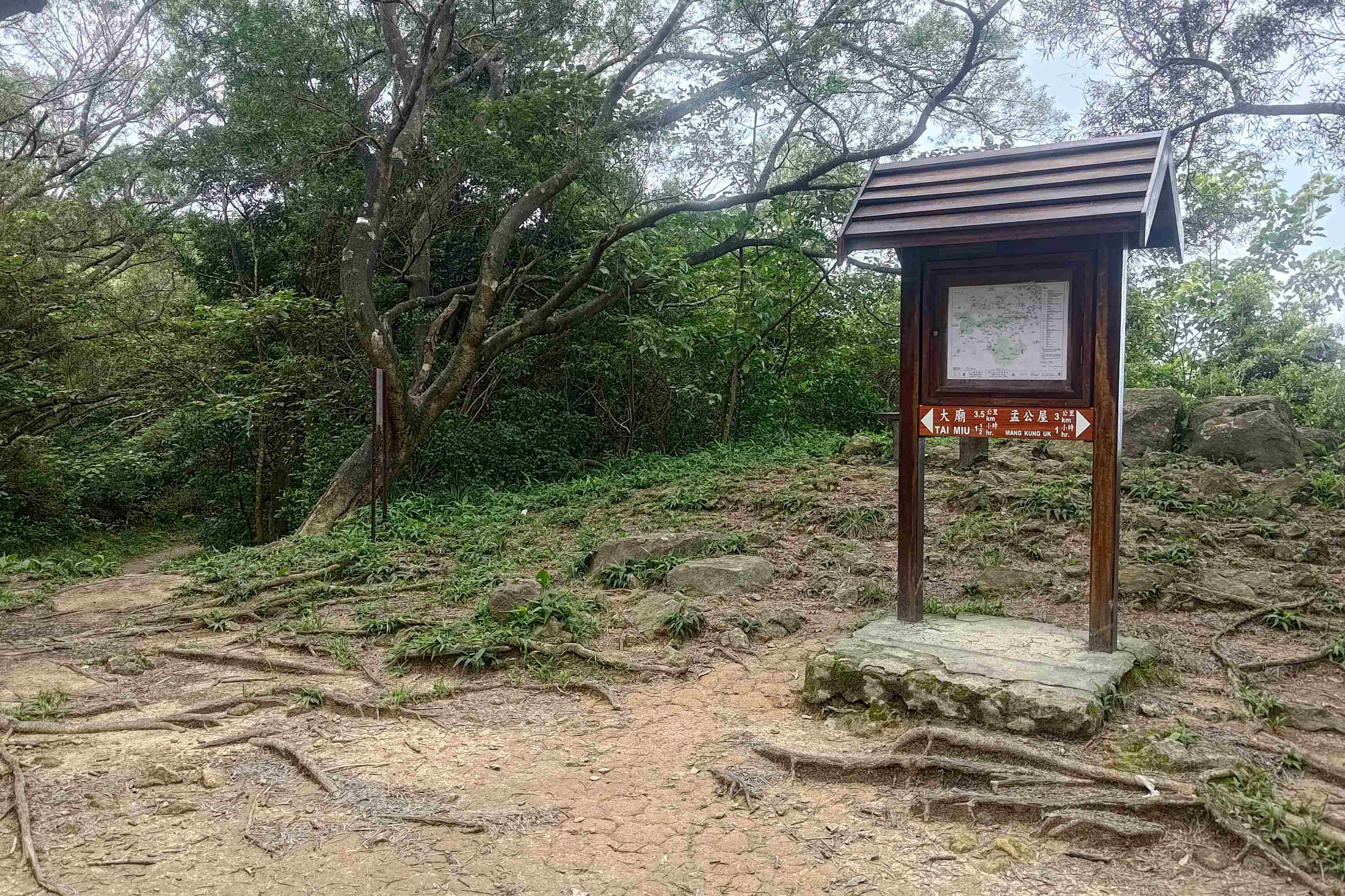
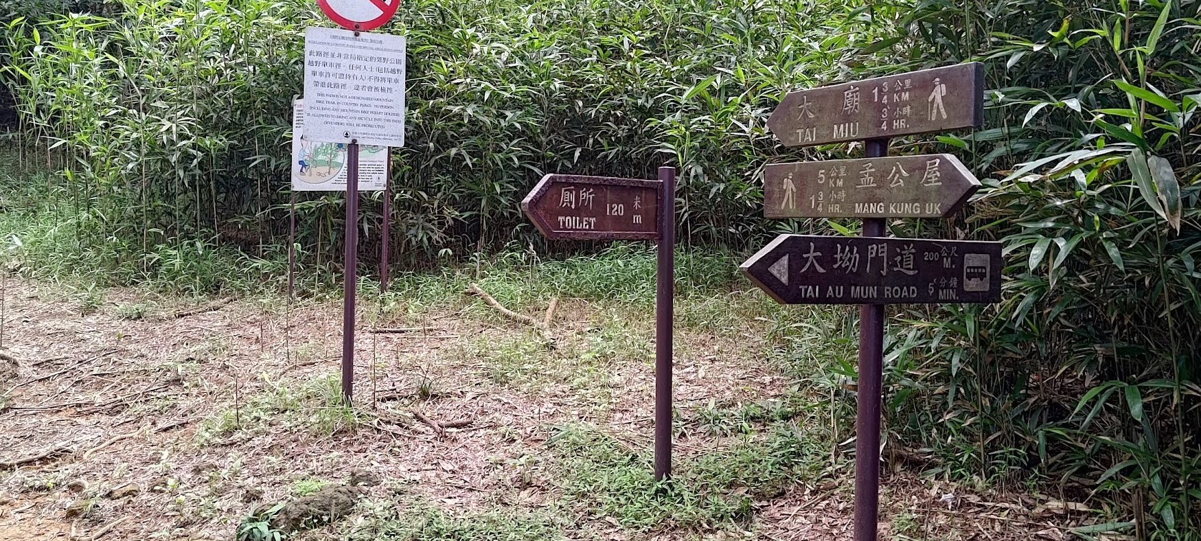
- 1. Head up the stairs next to the green pavilion and choose the Tai Miu sign fork
- 2. After the open area, follow the next sign that points to Tai Miu
- 3. Keep heeding the Country Trail signs upward. Do not use the intersecting mountain bike trails
- 4. As the trail flattens, ignore the undefined path heading left and upward into the trees
- 5. Keep following the Country Trail signs (2 in total) to signposts and a fork in the road:
Easy Route: follow the Tai Miu sign to the right and go around the mountain on a flat, shaded trail (keep reading from step 9)
Medium and Hard Route: Head left past the pointless brown barrier and red warning sign.
- 6. Ascend through the trees until you see epic views of High Junk Peak
- 7. Follow the trail toward High Junk Peak
- 8. A steep climb ensues before you summit
- 9. Head down the stone steps and you’ll soon arrive at a large crossroad of signs. The Easy Route reconvenes with the Hard/Medium route here
Easy and Medium Route: Follow the sign pointing to Clear Water Bay Road to end the hike
Hard Route: Follow the sign to Tai Miu
- 10. Follow the next Tai Miu sign before descending after the Country Trail sign
- 11. After a long descent, you will be able to leave the hike early by following the Tai Au Mun Road sign
- 12. If you’re ready for a tough ascent with great views, follow the Tai Miu Sign, instead
- 13. After plenty of stairs, the path flattens out and opens up to reward you with stunning views
- 14. Follow the path and descend at the stone steps, following the Tai Miu sign near the bottom to end the hike
Pavilions and Tombs
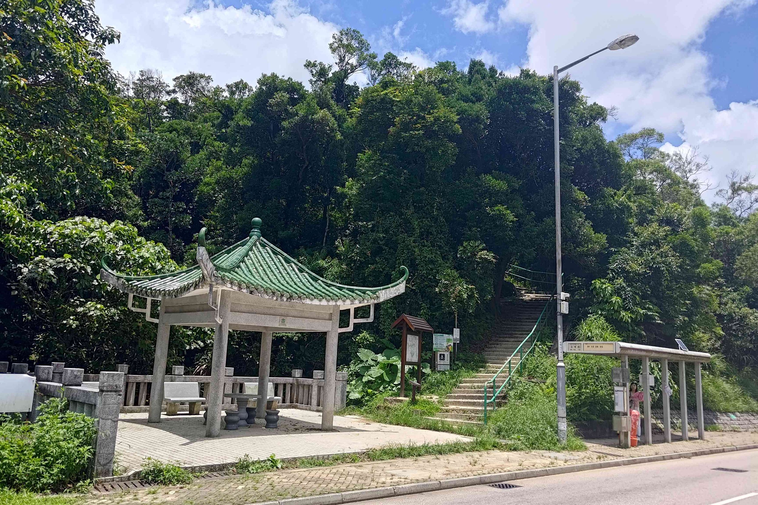
After crossing the road from the Ng Fai Tin bus stop, walk toward the green pavilion and take the stairs up directly next to it.
You will arrive at a fork in the trail almost immediately after the stairs. Take the left fork pointing toward Tai Miu. The right fork (which you should not take) will take you into a traditional cemetery with tombs in it.
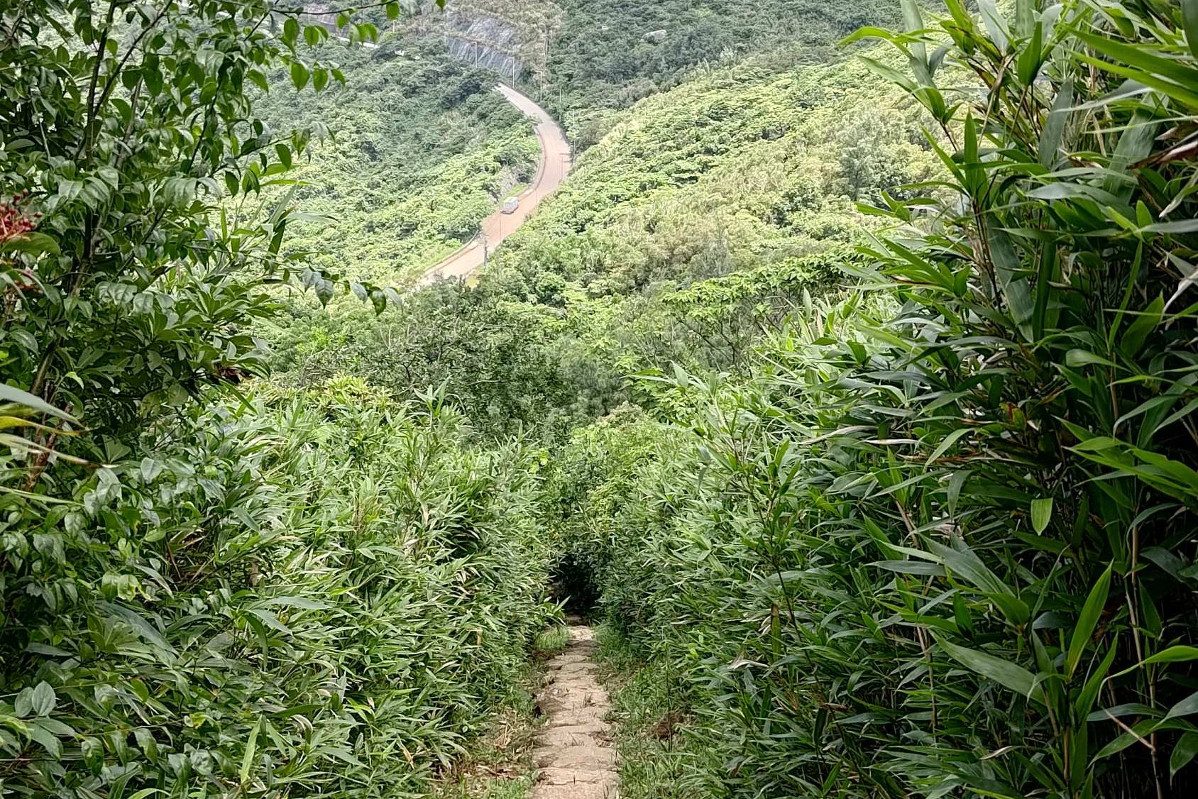
Three Types of Scenery in Ten Minutes
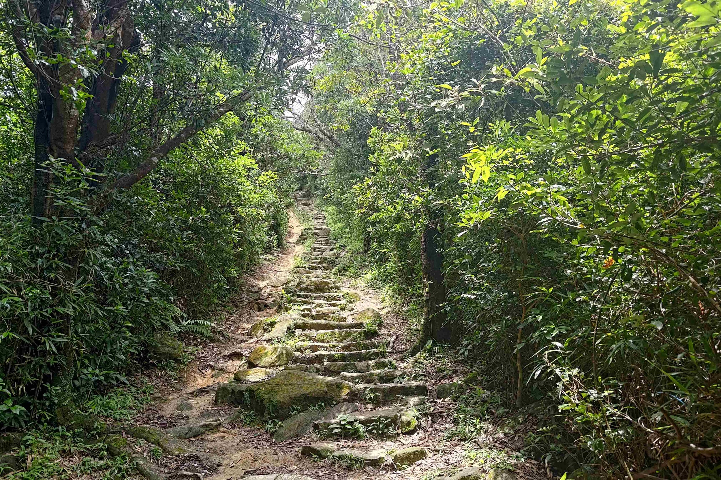
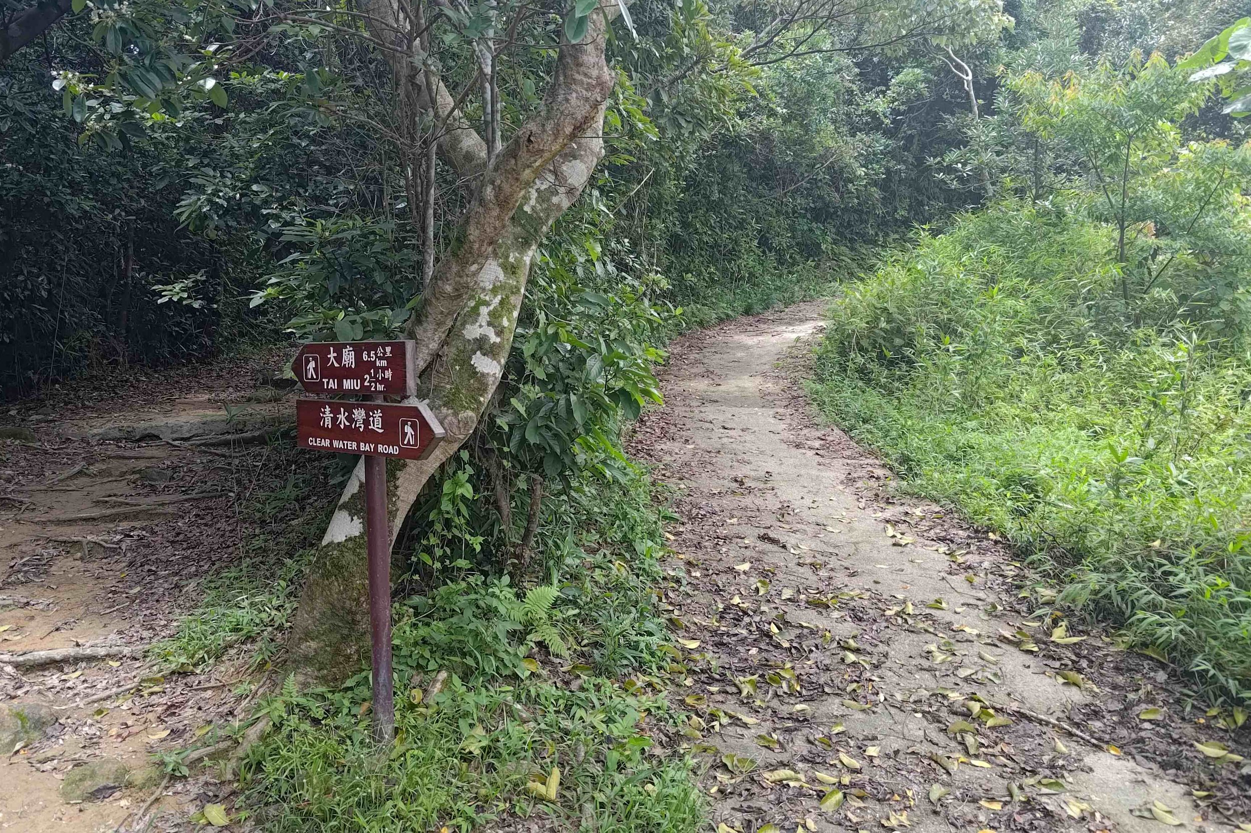
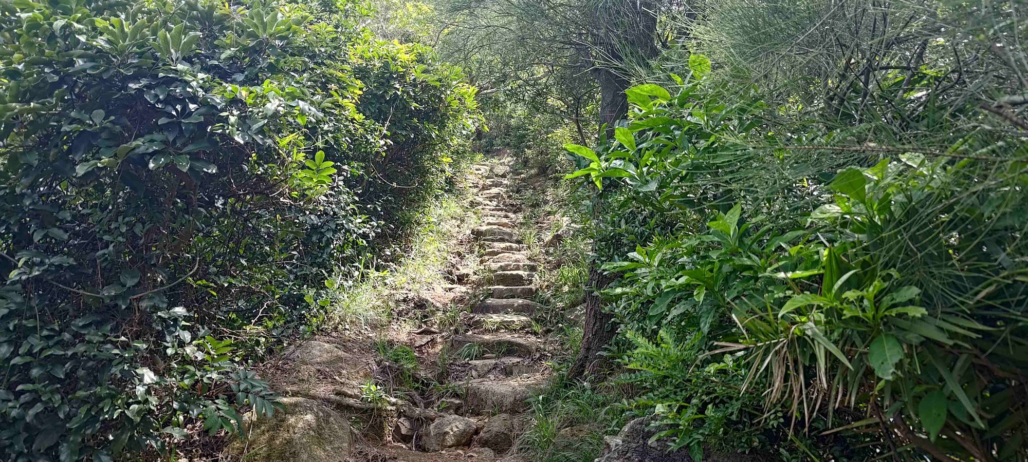
After the Tai Miu sign, you’ll ascend up some stone steps while being surrounded by tall trees.
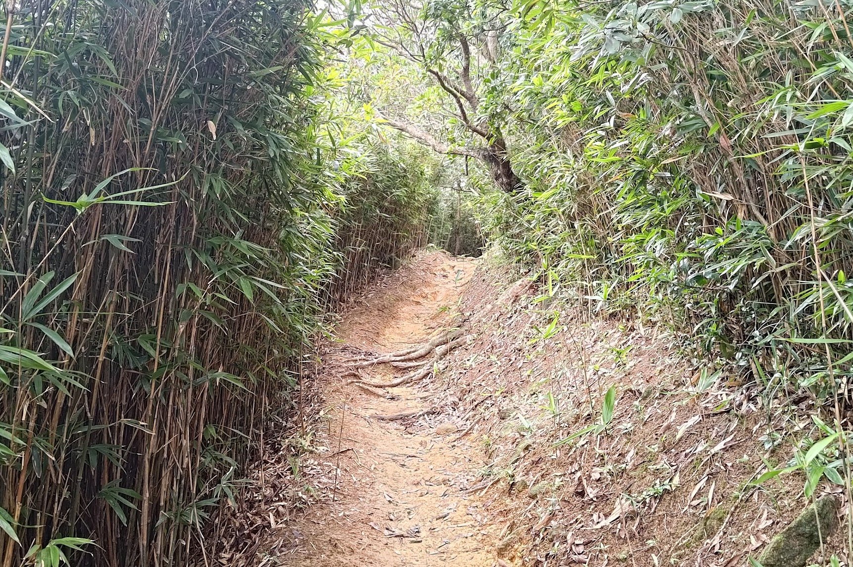
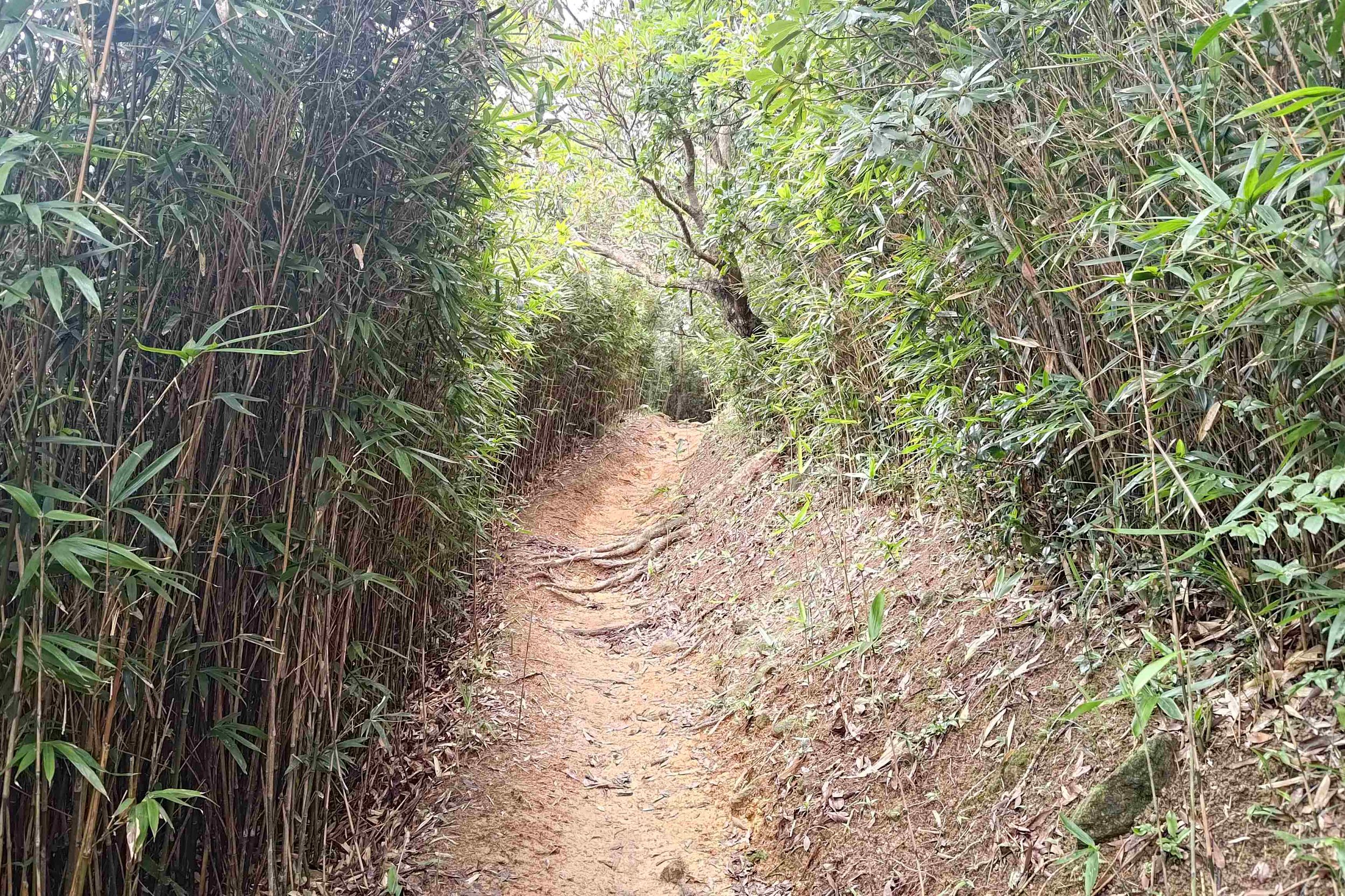
In a matter of minutes, you'll enter a bamboo forest. Take the time to appreciate the rustling of the bamboo leaves, or to imagine a scene from Crouching Tiger Hidden Dragon playing out before you.
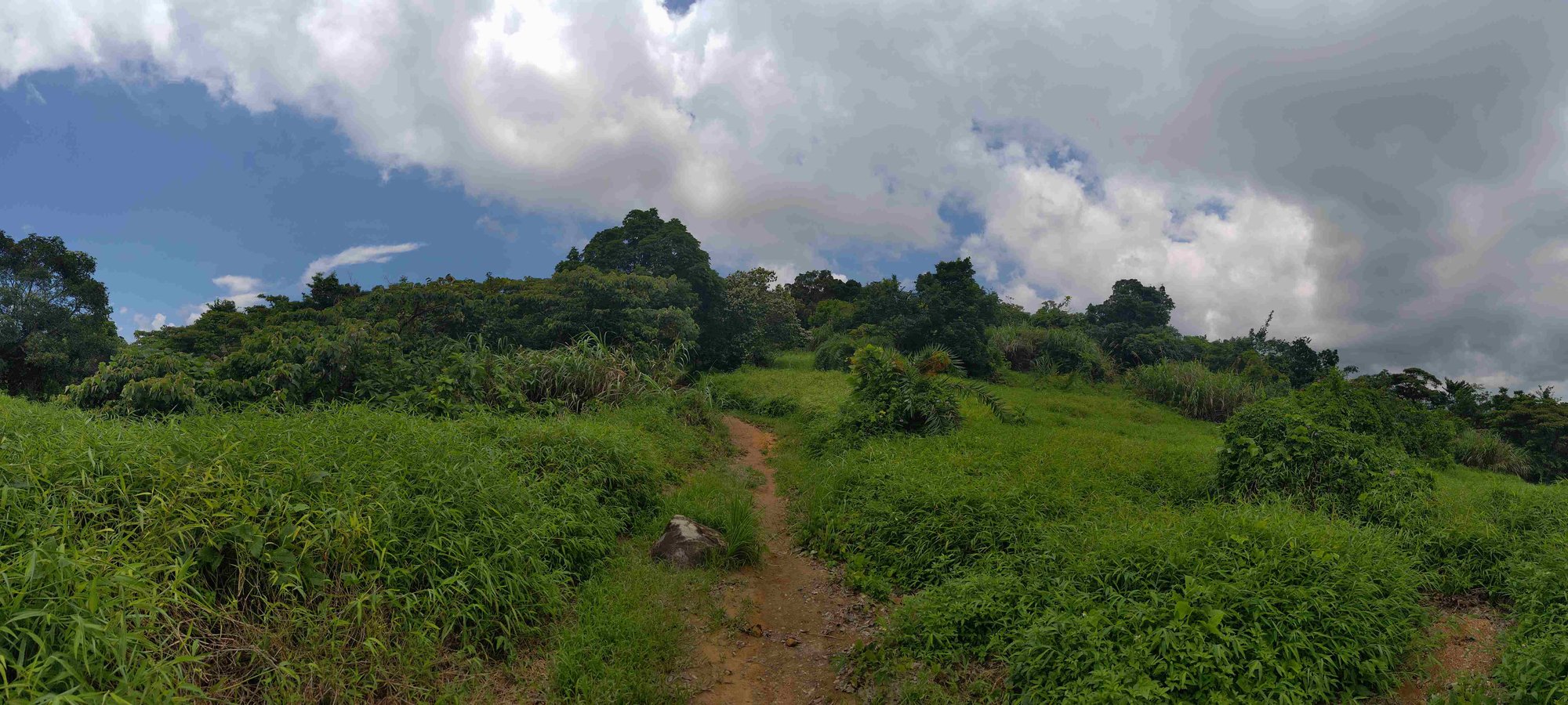
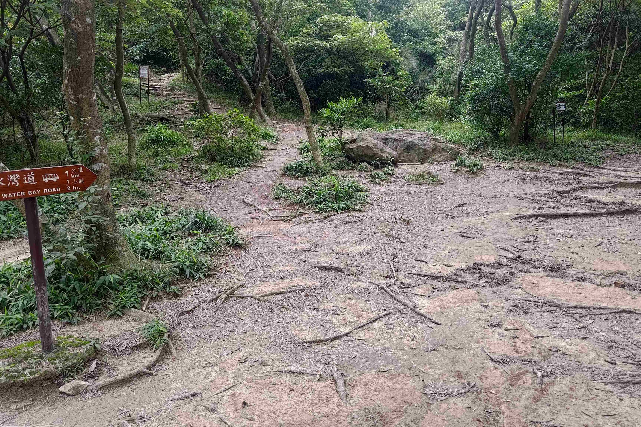
The bamboo forest cedes as the trail opens up and is replaced by tall grasses and shrubbery. Here, you’ll want to go in the opposite direction of the Mang Kung Uk sign until the trees take over again. Then Follow the Tai Miu sign.
Follow the Stone Steps
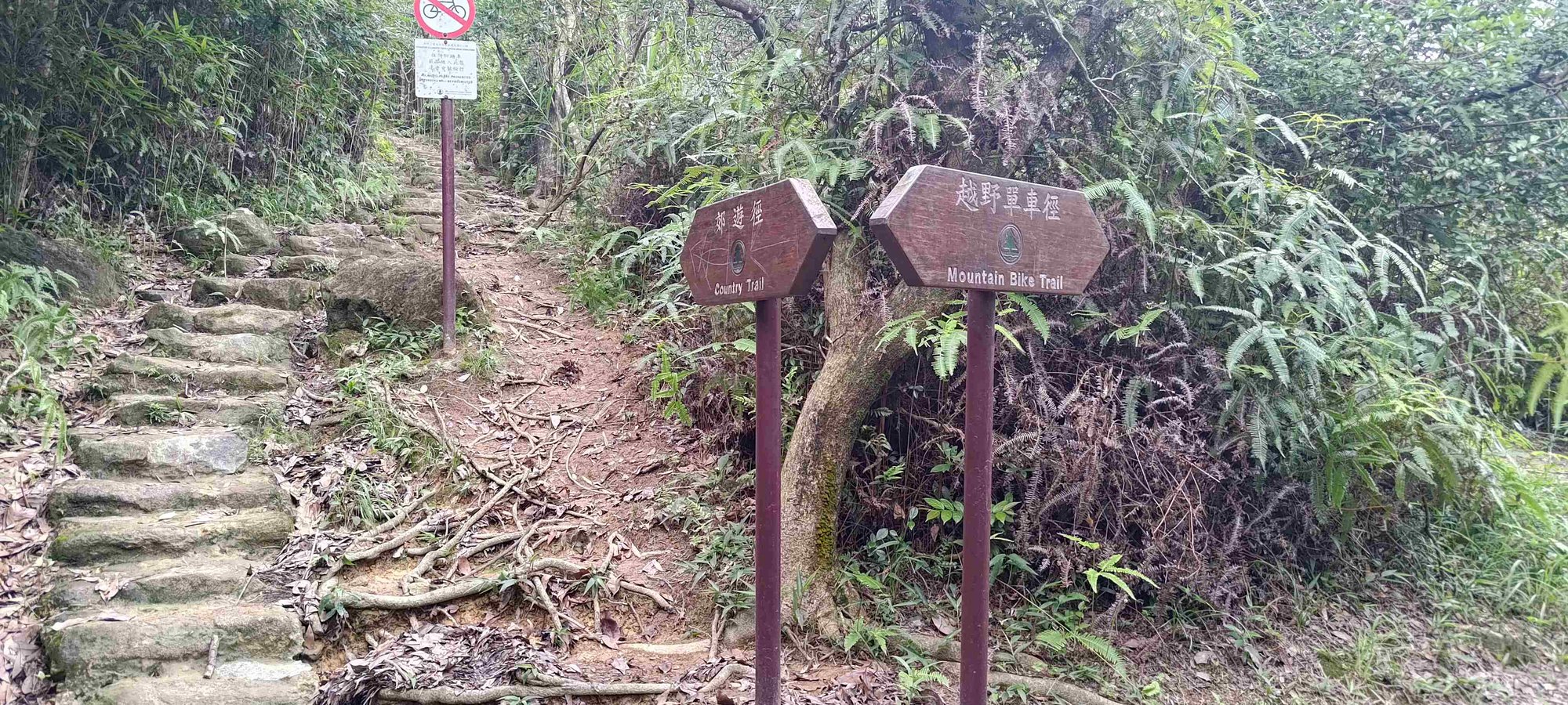
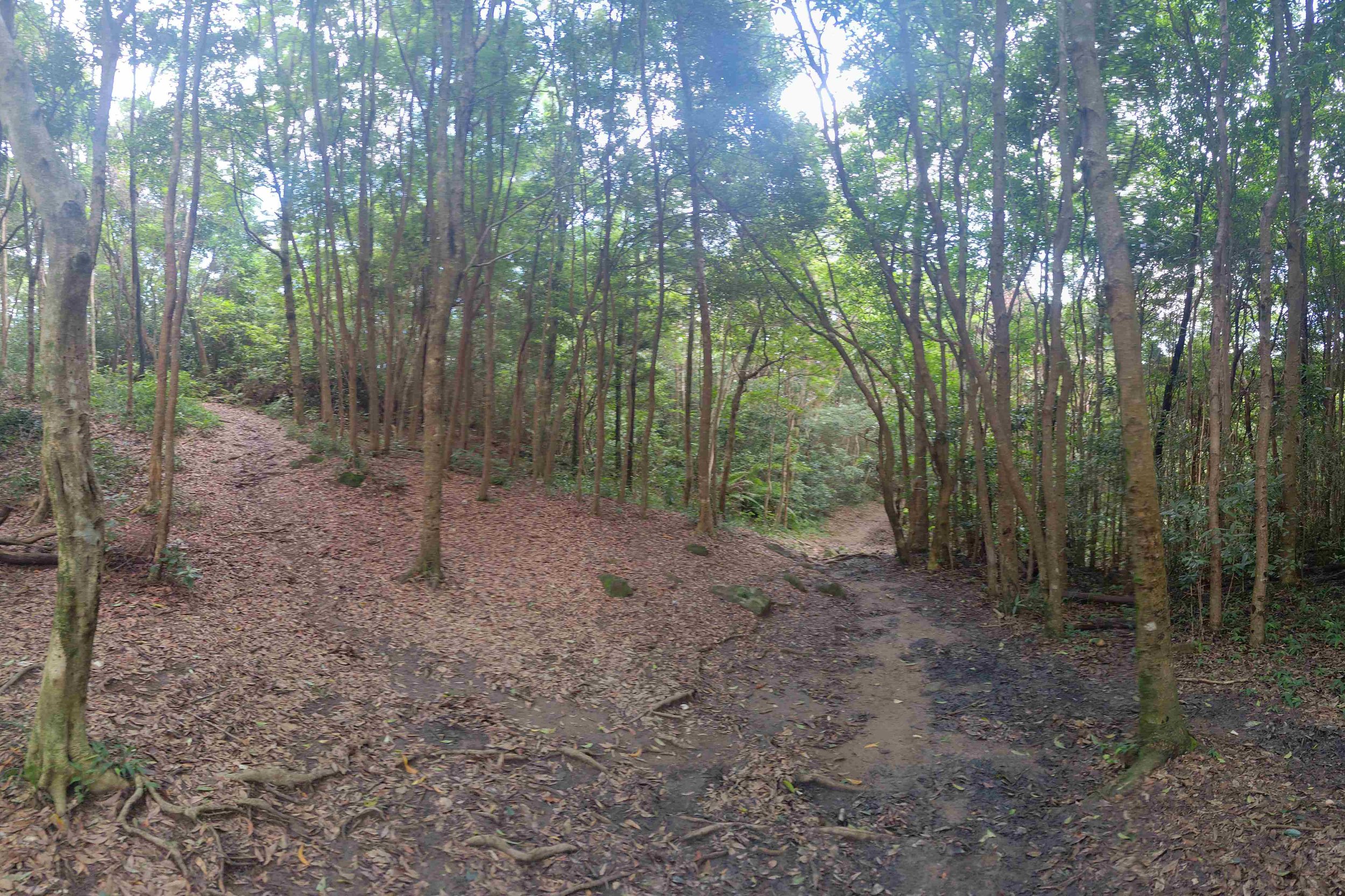
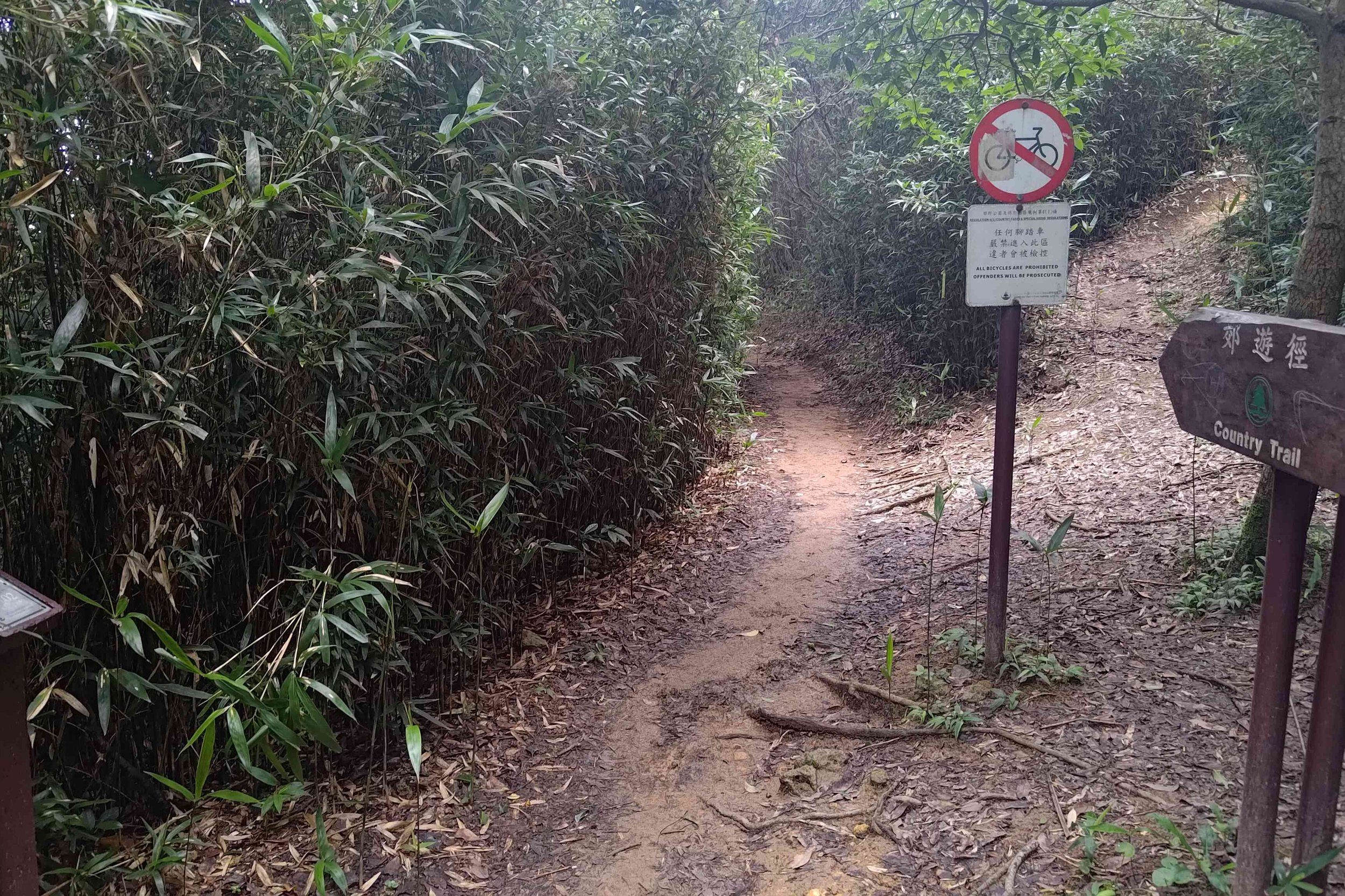
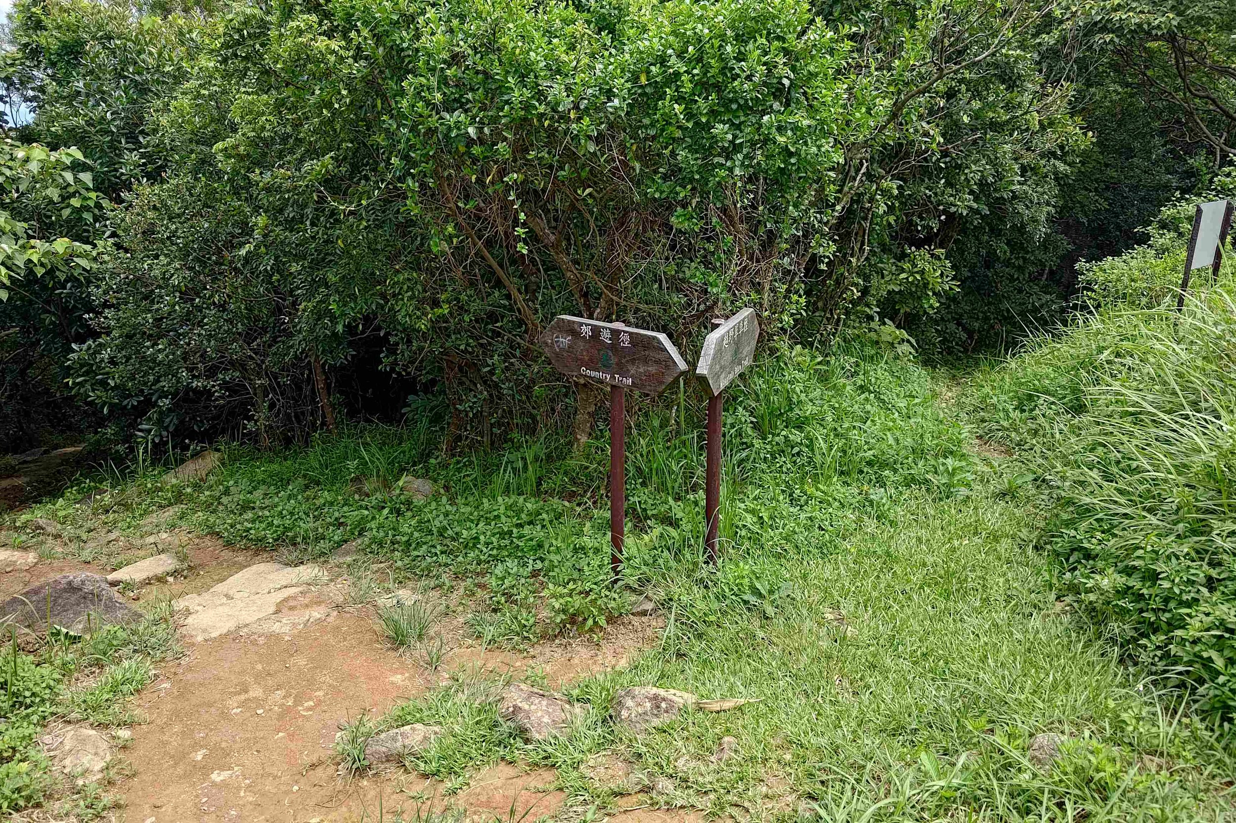
This part of the hike begins with steep, stone steps that take you higher up. You’ll see signs regularly that say Country Trail and Mountain Bike Trail. Never take the Mountain Bike trail tin order o avoid accidents with mountain bikers. They go really fast when traveling downhill!
Follow the Flat Path and Ignore the Left Trail
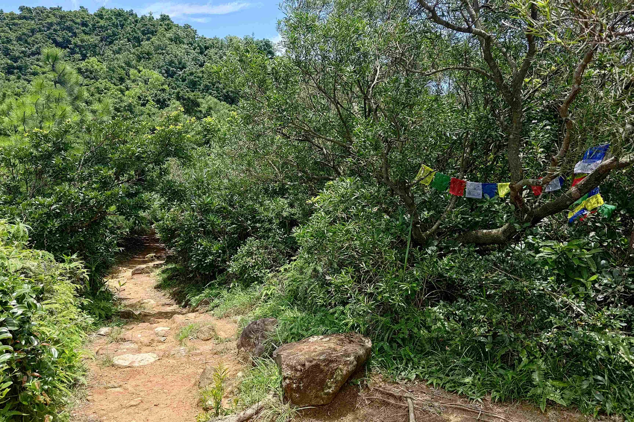
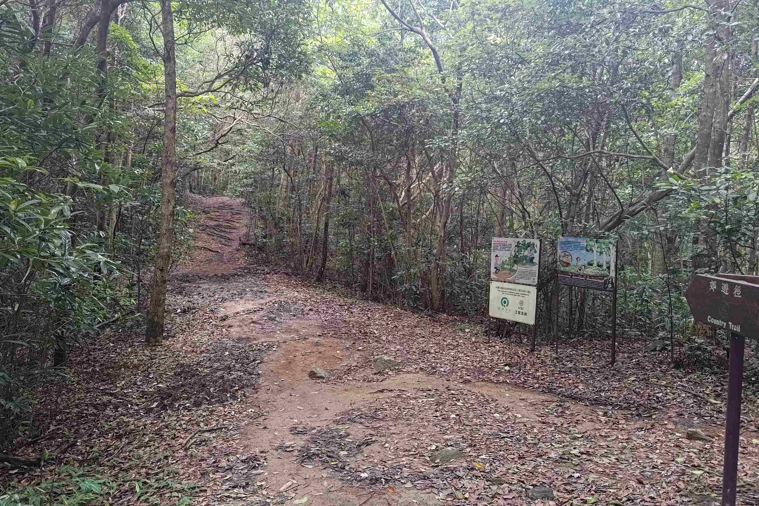
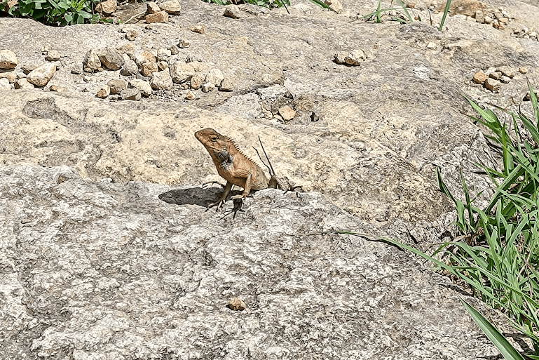
Fortunately, the stairs don’t last too long and you’ll walk along flat dirt once more. Head past the prayer flags and meander through the trees for a while. If you’re fortunate to have the trail to yourself, enjoy how tranquil it is here and look out for cool flora and fauna.
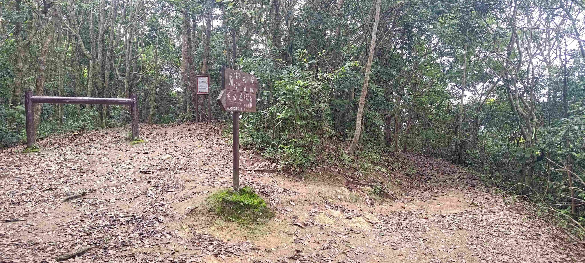
During your flat walk, there’ll be a widening of the trail where you’ll see an undefined path heading upward into the trees. Ignore this left fork in the trail and keep going straight until you arrive at another Country Trail Sign.
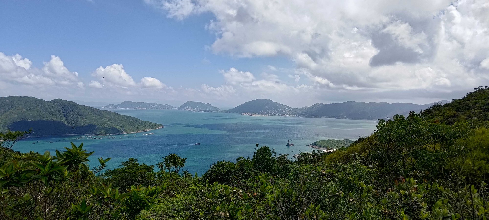
Follow the Signs and Enjoy Your First Ocean Views
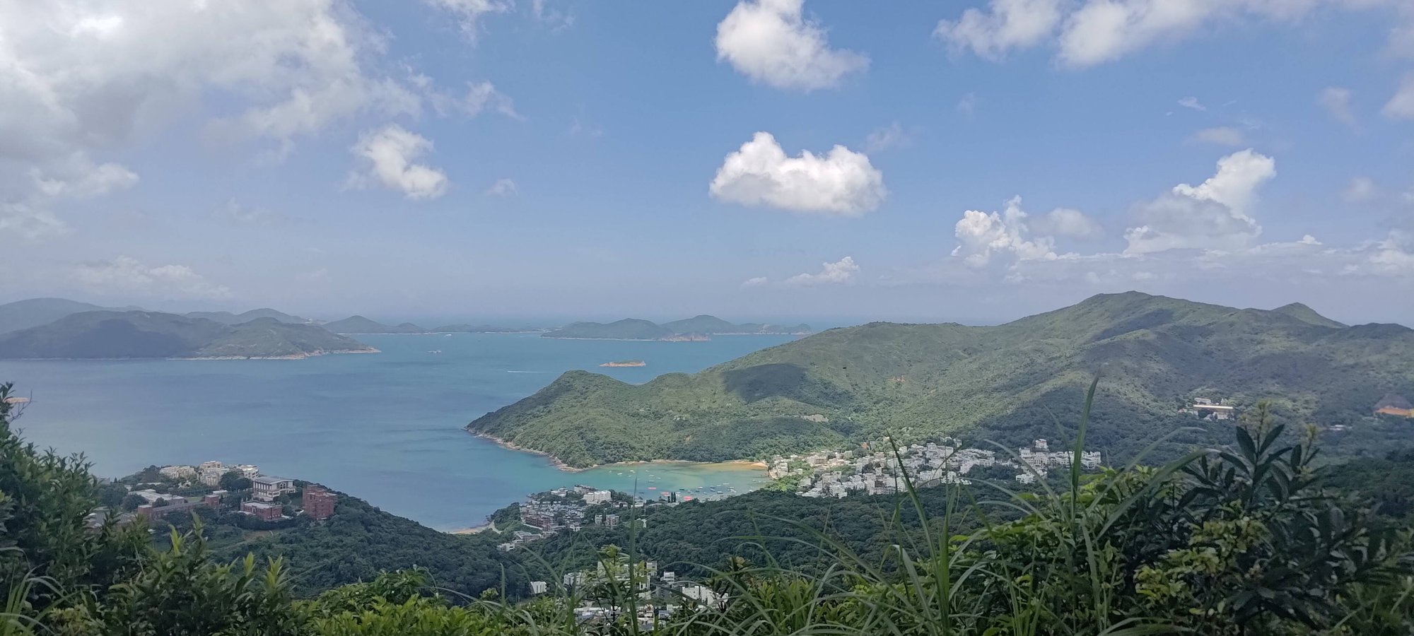
Go in the direction of the Country Trail sign before passing by another. The trail will reward you with views of villages, beaches and islands below! While most of the views will be partially obstructed, there’s one viewpoint with a totally clear view, so don’t miss that!
The Crossroads – Where the Easy Route Diverges from Medium and Hard
This is where the hike diverges for those doing the Easy Route and those doing the Medium/Hard route.
Easy Route: Follow the sign that points toward Tai Miu. This route will take you around High Junk Peak on a relatively flat trail. You won’t need to summit the mountain at all but also will miss out on the killer views from its peak. The path will be constantly shaded and will reconnect with the Medium/Hard route later.
Medium/Hard Route: Head left toward the odd brown barrier and the warning sign. Ignore both and begin ascending up through the trees.
Best Views of High Junk Peak
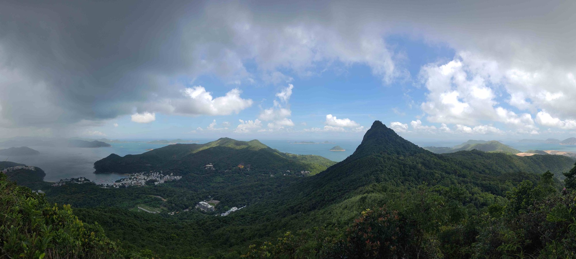
Keep climbing up the dirt steps that appear after the warning sign below. This section of the trail is a little more overgrown, with plants pressing in much closer. However, there’s still a very clear path to follow.
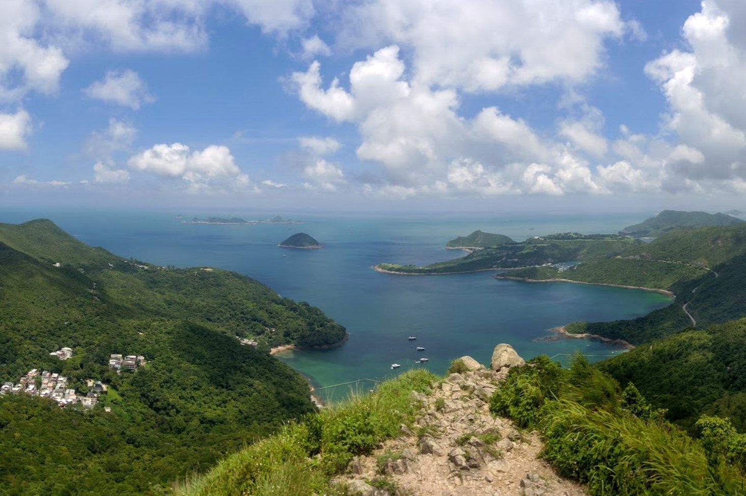
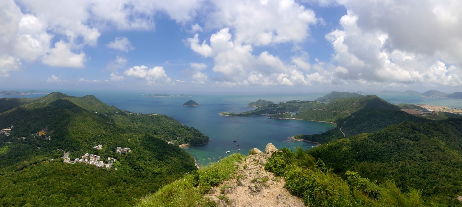
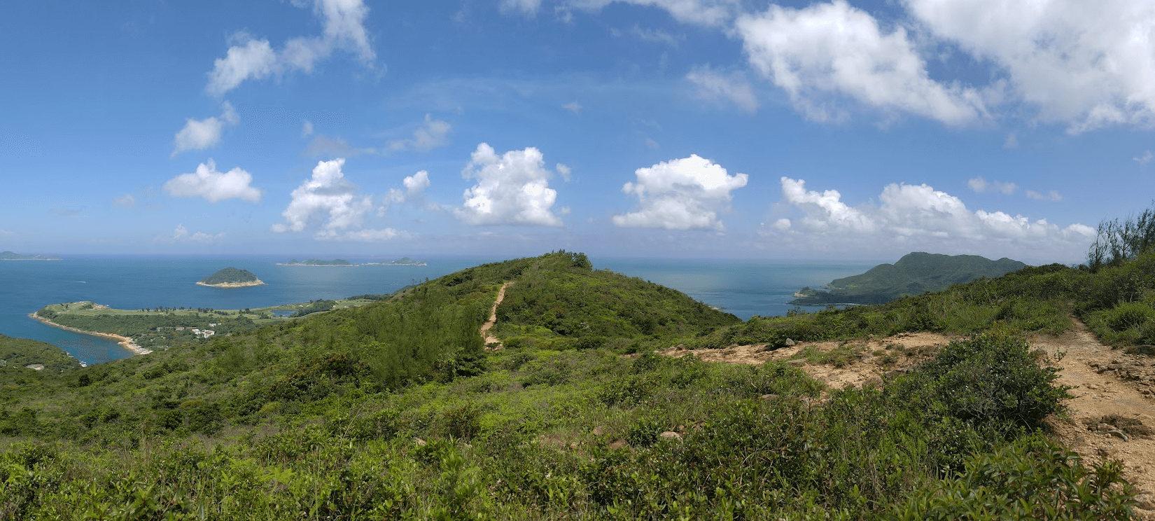
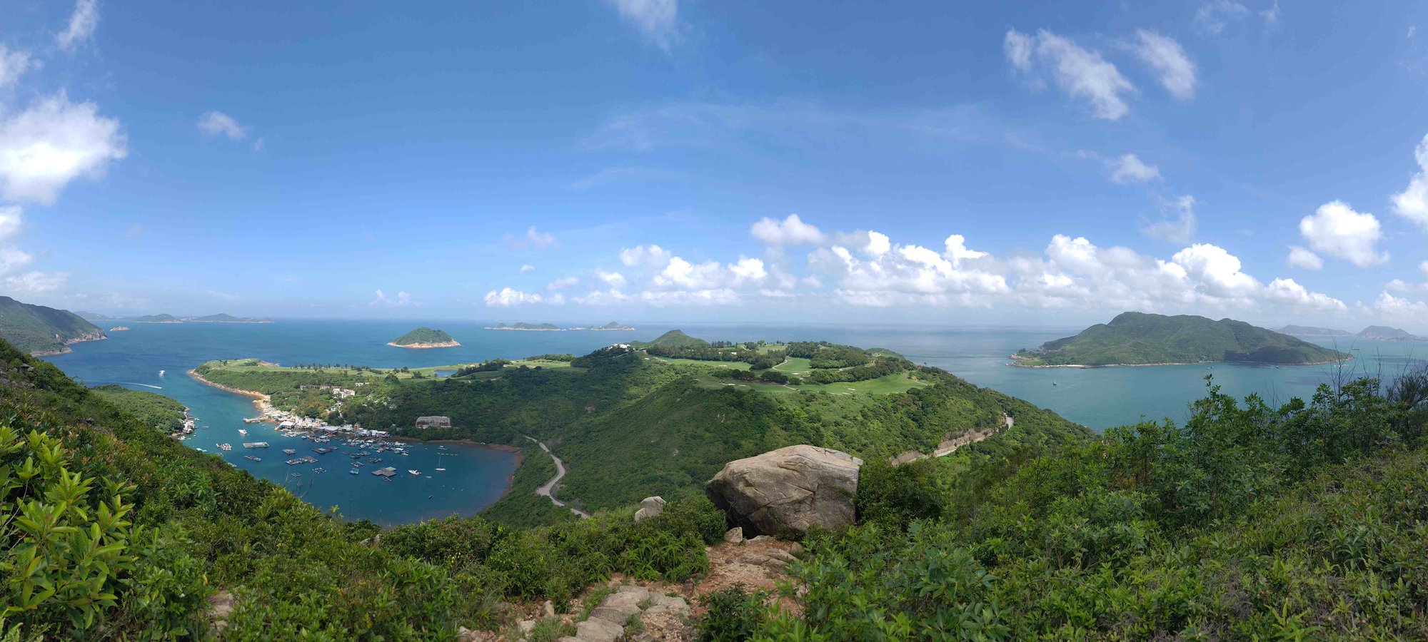
At the top of the hill, you’ll see High Junk Peak in the distance, as well as having 180 degree views that let you take in parts of Hong Kong Island, Kowloon, Clear Water Bay, the Clear Water Bay Golf and Country Club and even some islands out at sea.
For the best High Junk Peak views, head down the stone steps and you’ll have an unobstructed view of the mountain and the stunning scenery together.
Climbing High Junk Peak
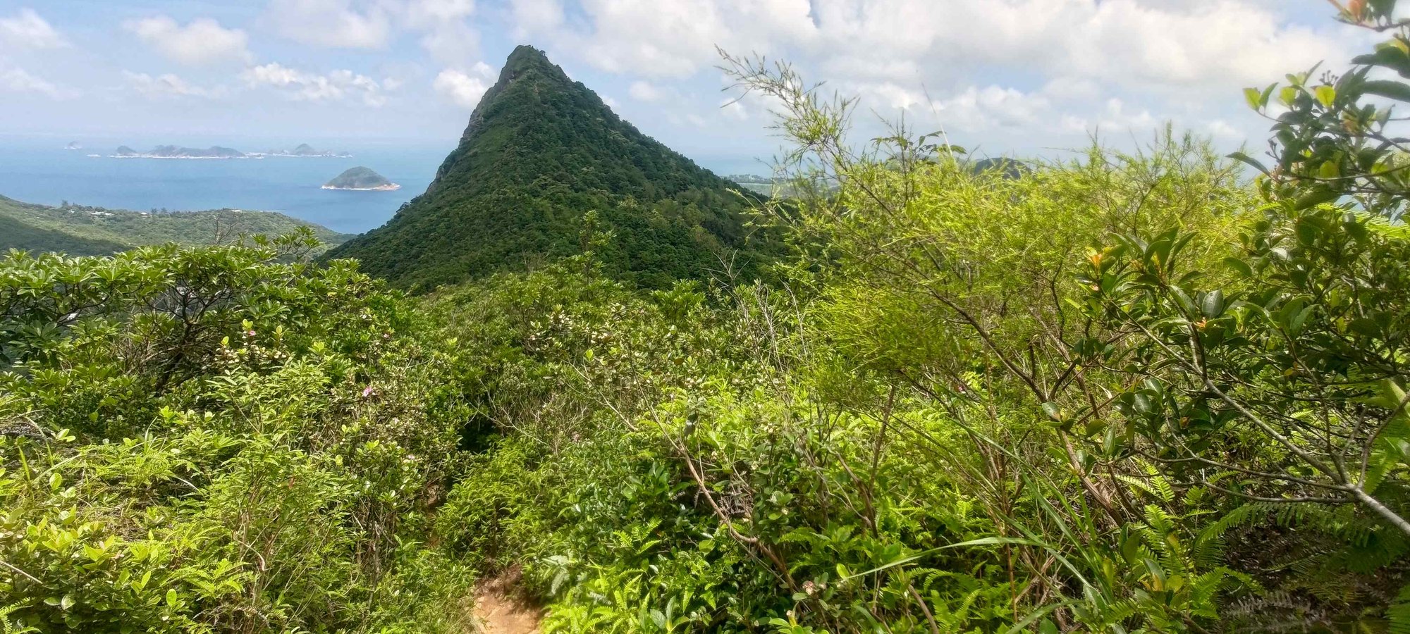
From the hill earlier, you’ll descend down the stone steps (best photo spot for High Junk Peak) and then ascend slightly before realizing just how close you now are to High Junk Peak. During much of your approach, it looms over you, as if in silent challenge to your goal of reaching its summit.
At the natural, dirt steps, your final ascent will begin. It’s short but steep, so take your time and enjoy the views behind you as you climb.
Views from High Junk Peak's Summit
At the summit you’ll see a trigonometrical point and have incredible 360 degree views that will take your breath away!
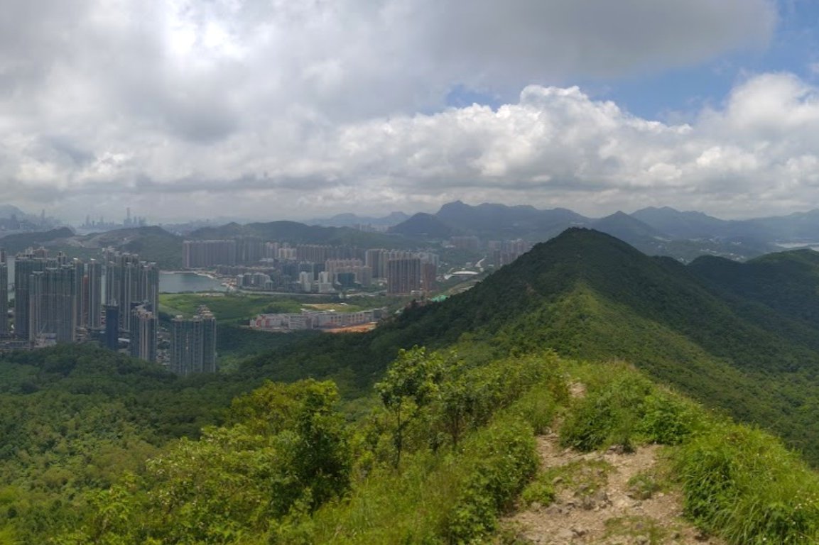
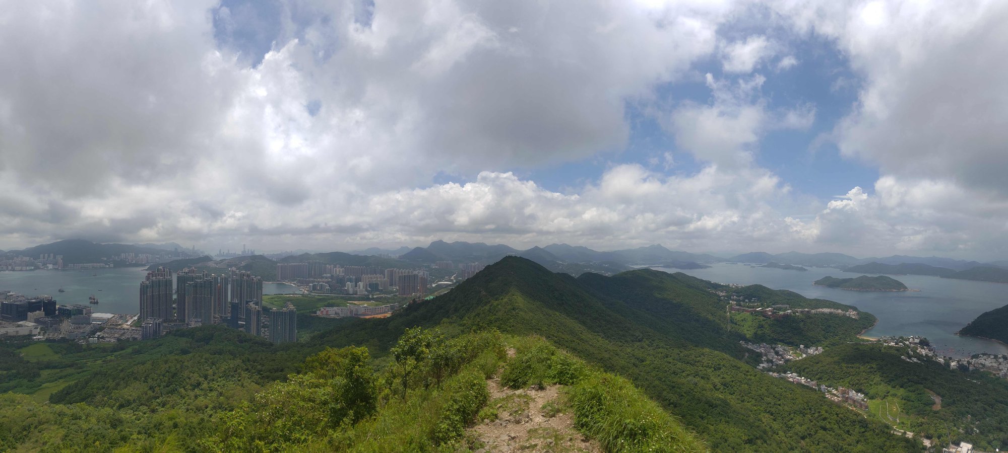
Behind you, you’ll be able to see famous mountains like Lion Rock, Ma On Shan and Suicide Cliff. Parts of Hong Kong Island and Kowloon are visible, as well as much of Sai Kung. You can even see Sharp Peak in the distance on a clear day!
In front of you, you’ll see all of Clear Water Bay, Steep Island, the Ninepin Islands, Clear Water Bay Golf and Country Club and even Tung Lung Chau.
Stone Steps Down
When you’re done admiring the view, follow the stone steps all the way down. You’ll have to scramble a tiny distance from the summit to reach the stairs, but it shouldn’t be too harrowing. Once you reach the bottom, follow the dirt trail until you reach another crossroad of signs.
Second Crossroads – Where the Easy/Medium Routes Diverge from the Hard One
All three routes converge at this crossroads.
Easy/Medium Route: follow the Clear Water Bay Road sign. It’ll take about 20-30 minutes to reach the road and the end of the hike.
Hard Route: Follow the Tai Miu Sign.
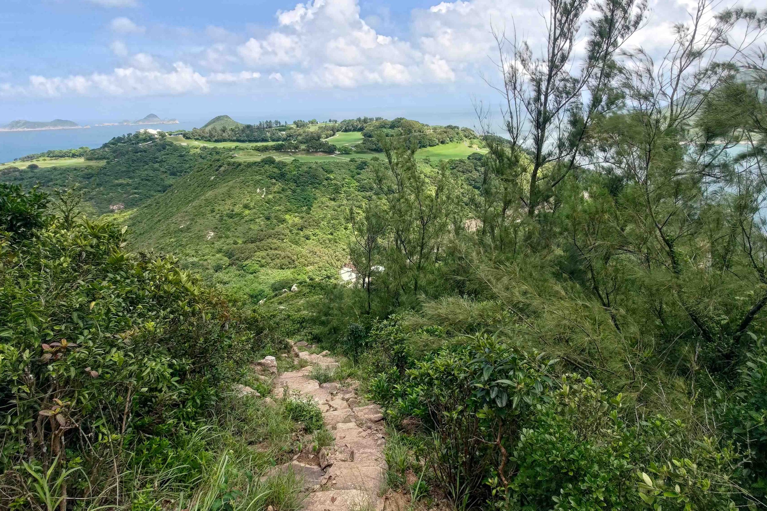
A Deceiving Gentle, Meandering Path
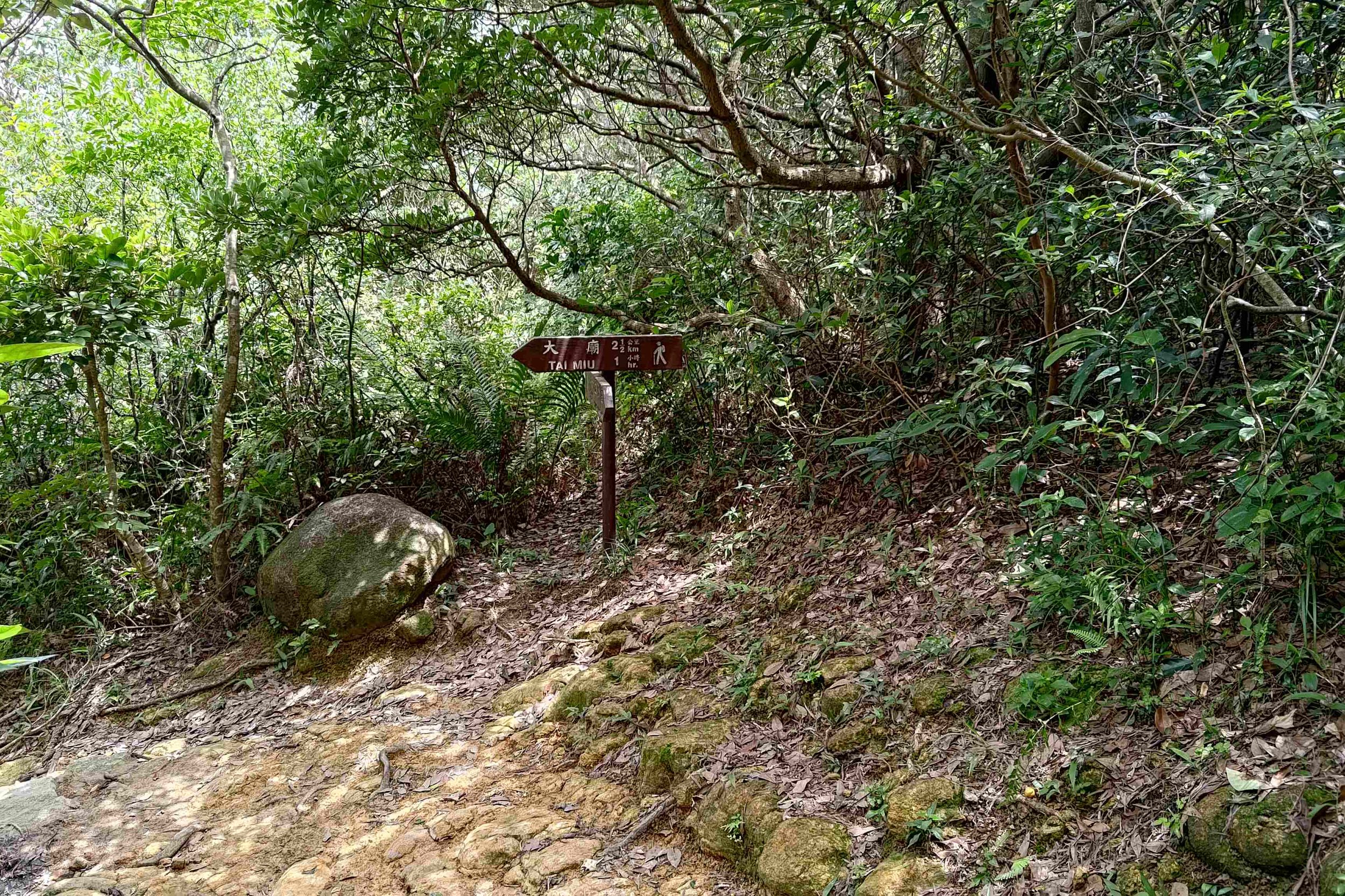
For about twenty minutes, you’ll be on a mostly shaded path that gently winds its way to another set of mountains. Go past the next Tai Miu sign and revel in how secluded and easy this part of the hike is. As the trail opens up, enjoy the views of High Junk Peak in the distance.
Another Big Descent (Optional Escape Route)
Follow the Country Trail sign and stone steps that lead you back down near the road. Do not take the Mountain Bike Trail route. It was infested with spider webs that were all at head height.
At the bottom of the stairs, you’ll see a collection of signs. Take the one pointing to Tai Au Mun Road if you want to end the hike early. If not, follow the sign to Tai Miu.
The Stairs of Death
This is the longest, steepest set of stairs on the entire hike. It’s mostly open, too, which means you’ll roast on a hot day (like I did). Take breaks as you need them and just know that when you make it to the top, your effort will be rewarded handsomely.
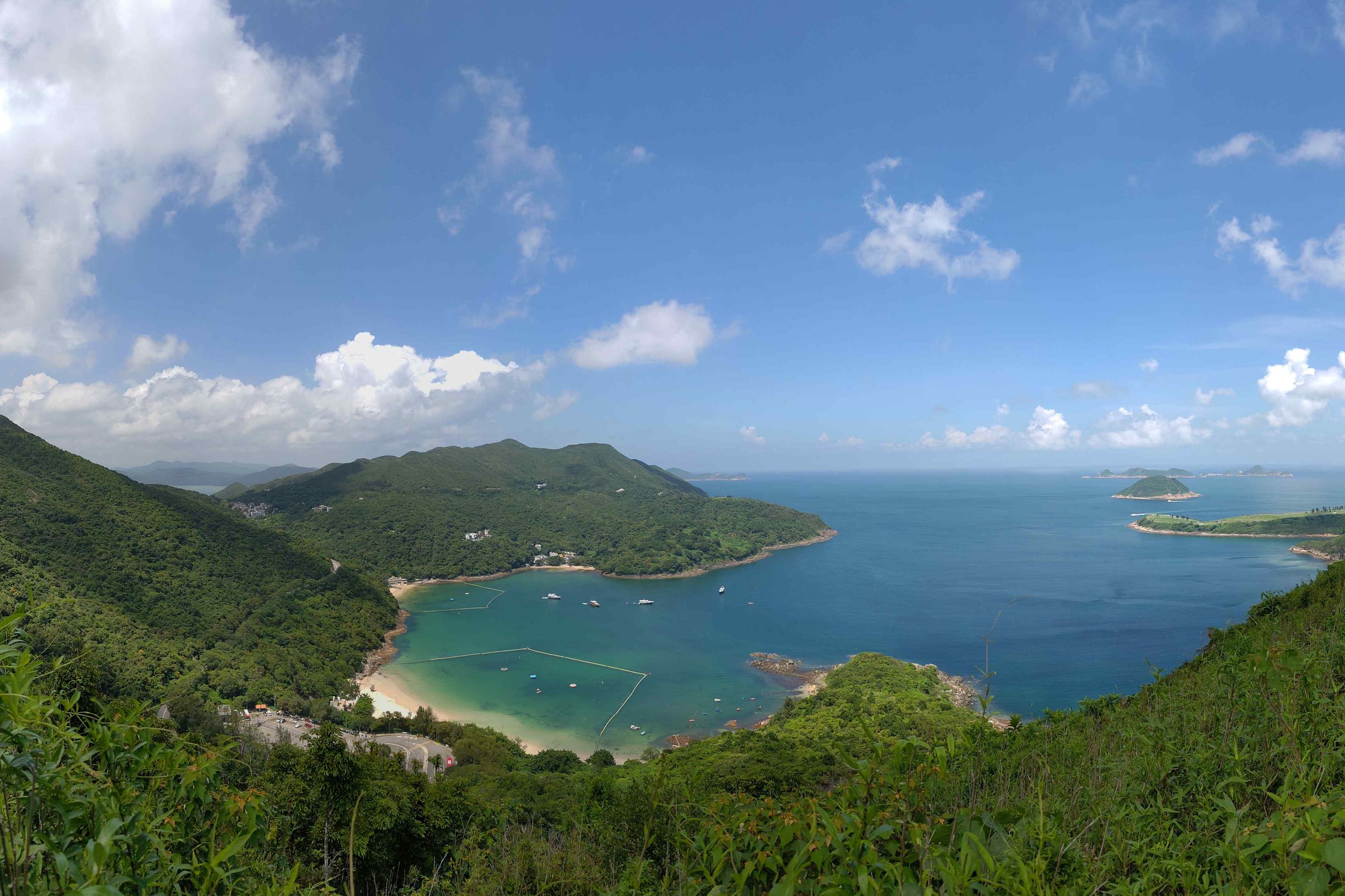
Walking to the Eastern Edge of Hong Kong
At the top of the stairs, the trail flattens completely, and you’ll soon be treated to arguably the best views of the whole hike.
The South China Sea stretches out into the horizon as you make your way to one of the easternmost parts of Hong Kong. Here, you’ll have views of rugged coastline, small villages, the golf course and many islands.
More Stone Steps to Descend From
Take the stone steps back down. You’ll see a sign pointing you to Tai Miu when you’re a few minutes away from the road.
The Way Back
Easy/Medium Route: All of the buses that you took to the start point will also service you at the end point of this hike since you’ll end the hike on Clear Water Bay Road.
Hard Route: Take a left and walk for 2 minutes to the intersection of Tai Au Mun and Po Toi O Chuen road. There, you’ll find a bus stop for the 16 green minibus.

