
Sharp Peak: A Treacherous Hike with a Spectacular View
Contents
- Essential Information
- Sharp Peak Highlights
- Google Route Map
- How to Get There
- Quick Route Summary
- Start Your Adventure at Ham Tin Wan
- Getting to Tai Wan Beach
- Optional Coastal Viewpoint
- Begin Hiking Sharp Peak
- The View from Just Under Half Way Up
- Steep Climb to the Summit
- Sharp Peak Summit Views
- The Descent
- The Way Back
Essential Sharp Peak Hike Details
- District: Sai Kung, New Territories
- Duration: 3-7 hours depending on your start point
- Distance: 7km from Ham Tin Wan, 19km as part of MacLehose Stage 2 starting from Sai Wan Pavilion
- Highest Elevation: 468 meters
- Difficulty: 4.5/5 Sharp Peak
- Facilities: Food, drinks and toilet available at Ham Tin Wan
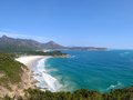
Why Hike Sharp Peak?

Sharp Peak wouldn’t be a particularly tough hike if its difficulty was purely based on its elevation. However, given the fact that the trail is made up of sandy dirt, loose stones and barely anything to grab onto for stability, it’s one of the few hikes in Hong Kong where descending is significantly more challenging than ascending.
At times, you’ll need to use your hands and legs to climb up due to the steep inclines. Heading back down to Tai Wan Beach will more than likely have you setting your pride aside and scooting on your bottom during particularly steep and slippery sections.
Why would you do this hike then? Well, for starters, there’s the simple joy of conquering any tough summit. But, perhaps more than that is the unbelievable views you know no one else will ever be privy to unless they successfully summit Sharp Peak.
Also, today's the youngest you'll ever be, so go on an epic adventure if you're able to!
Google Route Map
How to Get to Sharp Peak
If you want to hike Sharp Peak as part of Stage 2 of the MacLehose Trail starting from Sai Wan Pavilion, you can check out the below guide:
For the non-masochists out there, you can actually get a speedboat to Ham Tin Wan (a beach near Sharp Peak) directly from Sai Kung.
Getting to Sai Kung:
No MTR lines go directly to Sai Kung, so you have to take a bus or an MTR bus combo.
By Bus:
From Kowloon:
- 1A minibus from Choi Hung MTR (exit C1)
- 96R bus from Diamond Hill MTR station (exit C2) Sat, Sun and Public holidays only
- 9 red minibus from Ngau Tau Kok (Yee On Street)
- Mong Kok Express red minibus (from Dundas Street)
From the New Territories:
- 299X bus from Shatin (below New Town Plaza)
- 101M minibus from Hang Hau MTR (exit B)
From Hong Kong Island:
- The best way to get to Sai Kung from HK Island in the morning is to take the MTR to Hang Hau and get the 101M minibus.
- Causeway Bay Express red minibus:: Monday-Friday: 7pm to 12:30am Weekends: 5pm to 12:30am.
Speedboat from Sai Kung Pier to Ham Tin Wan (the hike start point)
From Sai Kung Pier, you can get a speedboat directly to Ham Tin Wan, which is a beach that’s really close to Sharp Peak. Look out for boat operators with signs that say Sai Wan or Ham Tin Wan at Sai Kung Pier.
If you don’t see any obvious signs, you can try asking around yourself at the pier. You can show any speedboat operators this: 鹹田灣.
The cost should be between 120-160 HKD per person and the ride will take about 30 minutes. Some speedboat owners will only make the trip after they’ve secured a minimum number of passengers, so having a group of people rather than going solo may result in a faster departure time.
Take note that the speedboat ride can be very bumpy, and you will have to disembark knee-deep or even waist-deep in the ocean before wading to the beach. Dress appropriately and protect your valuables accordingly.
Ham Tin Wan to Sharp Peak and Back Hike Summary

- Cross the rickety bridge in Ham Tin Wan to the restaurant (Hoi Fung Store)
- Ignore the concrete path by the water and head right on the dirt trail past the old house
- Continue on the trail past the pasture until it turns sandy
- Then follow the sound of the waves to Tai Wan Beach (multiple routes)
- Cross to the far end of Tai Wan Beach and locate the hidden entrance to Sharp Peak
- Begin your Ascent, following the rocky, slippery path upwards
- At the summit, don’t miss the viewpoint of Grass Island (Tap Mun), Cheung Wan, Nam She wan etc.
- Retrace your steps back down Sharp Peak
- Cross Tai Wan Beach and head back toward Ham Tin Wan
- Speedboat back to Sai Kung, continue hiking to Pak Tam Au and get the bus to Sai Kung or hike to Sai Wan Pavilion and get a minibus to Sai Kung
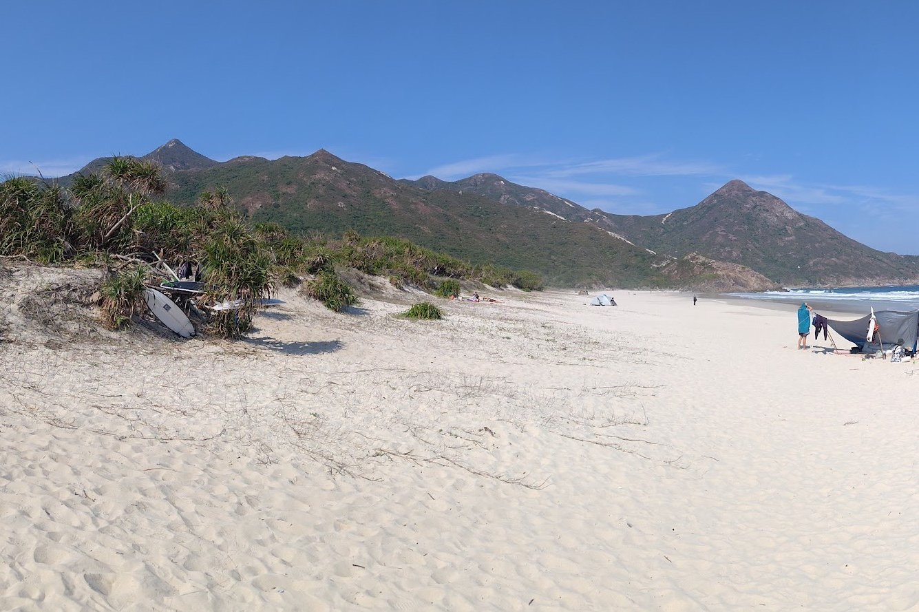
Start Your Adventure at Ham Tin Wan
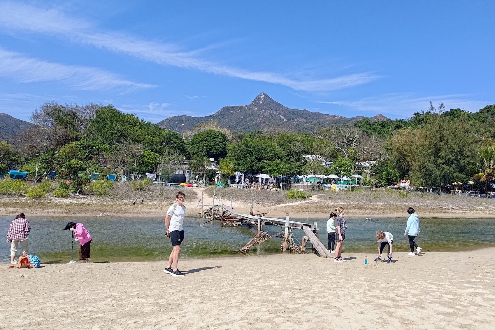
Before heading off on your great climbing adventure, take some time to enjoy Ham Tin Wan. It’s one of Hong Kong’s best beaches and will offer you a little time to collect yourself before the big climb up Sharp Peak.
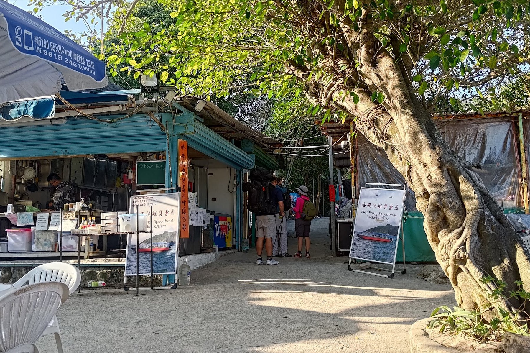
To continue the hike, you'll need to cross an old, rickety bridge to the Hoi Fung Store, where you can grab food and drinks before continuing onward.
Don’t forget to stock up on water if you haven’t already.
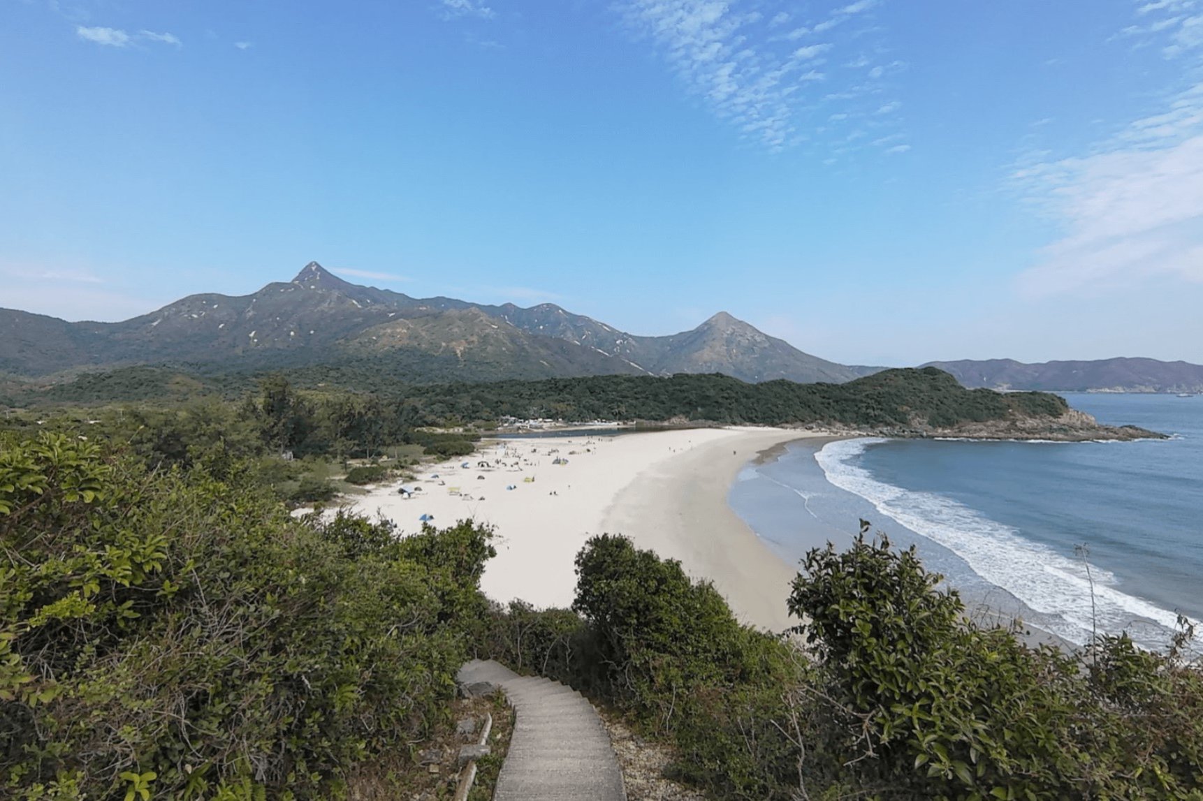
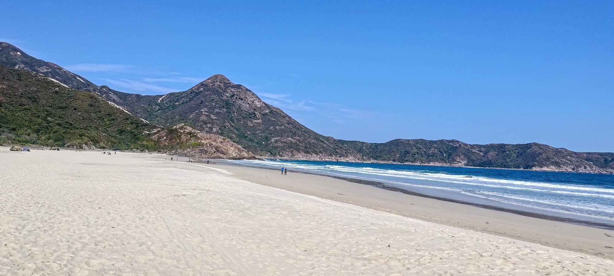
Getting to Tai Wan Beach
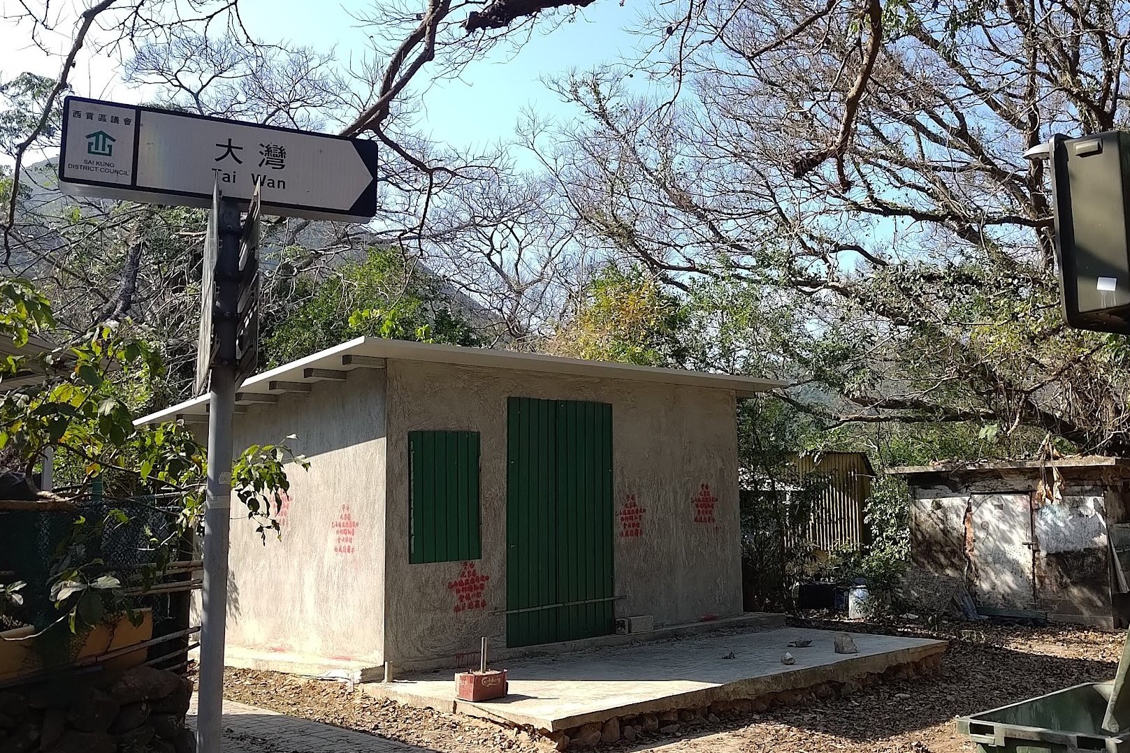
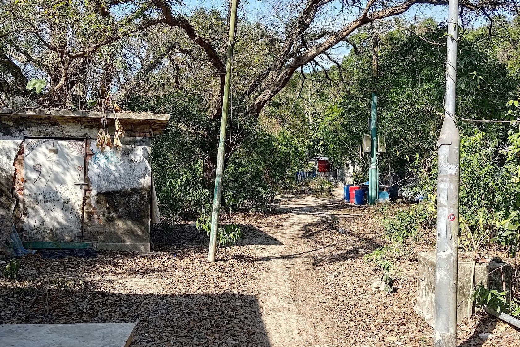
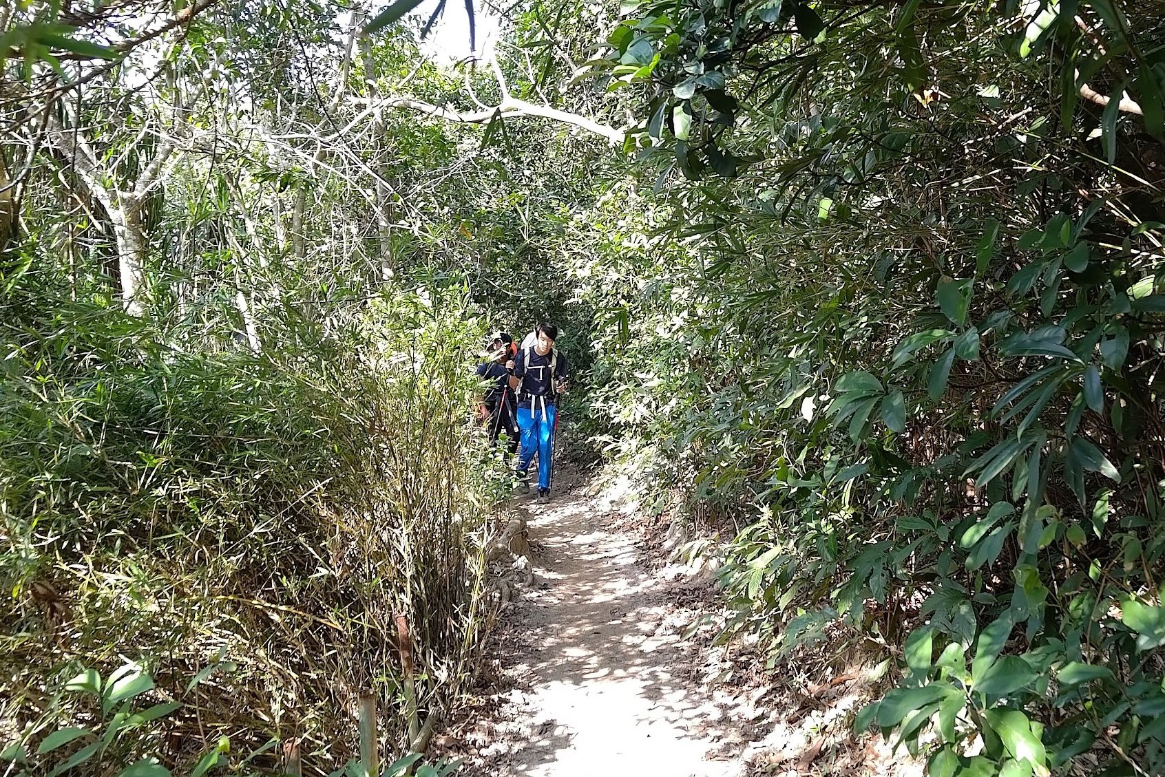
After walking past Hoi Fung Store, you'll want to follow the 'Tai Wan' sign to the left. You'll walk past a few old and abandoned homes before the trail takes you into the shade of some trees.
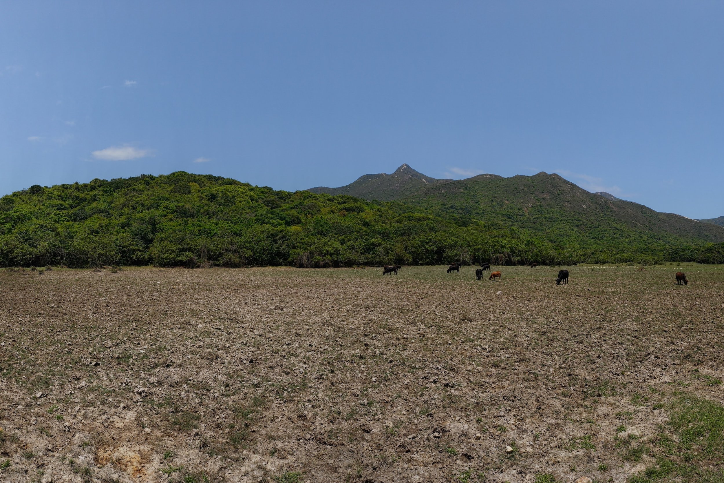
A few minutes later, you'll see a pasture on your left, which is often home to a herd of grazing cows.
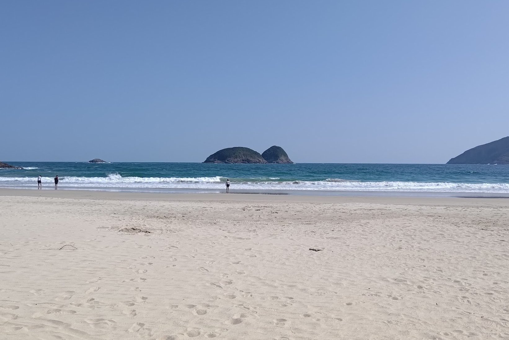
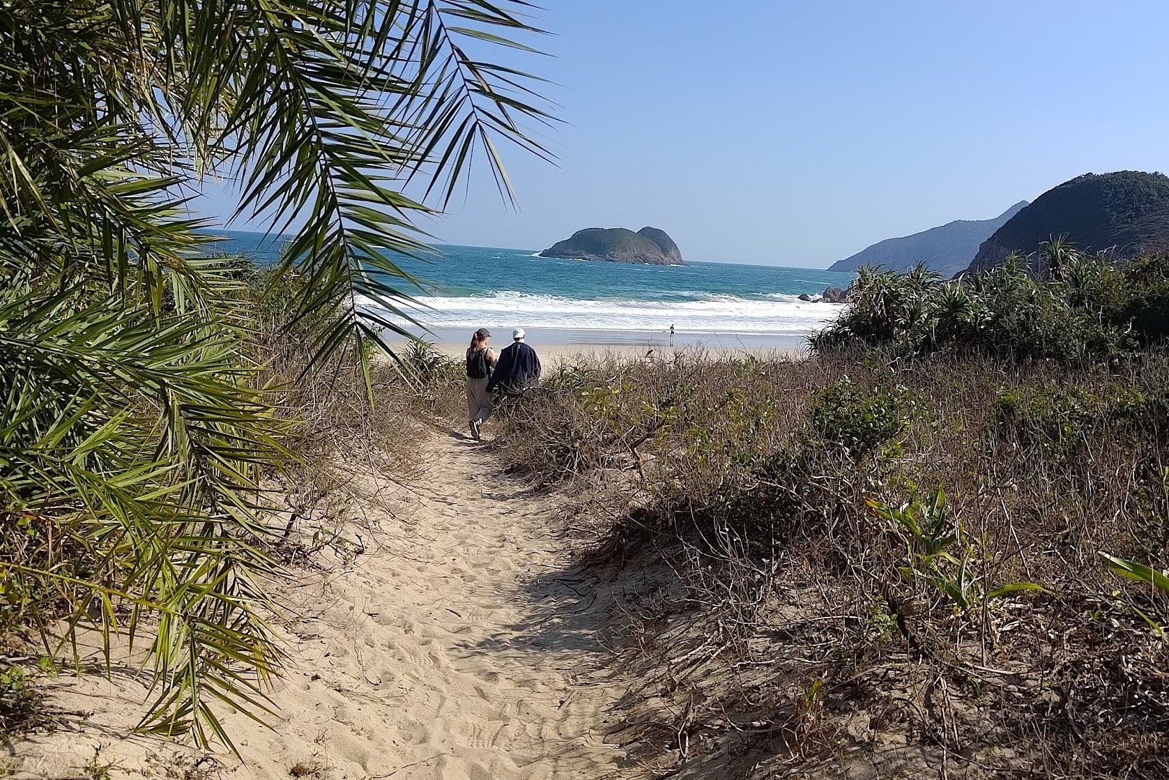
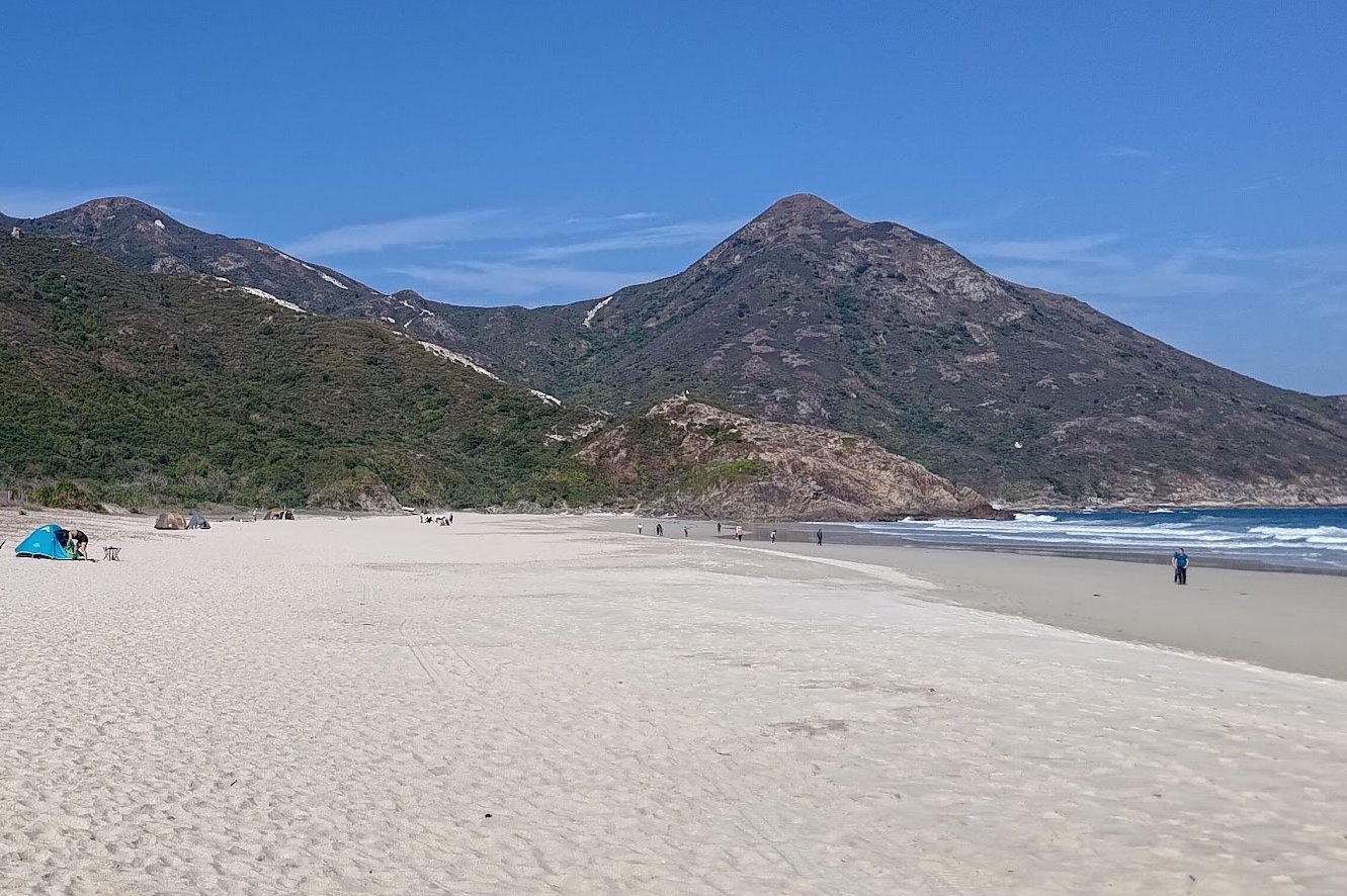
Not too long later, you will begin to notice the trail getting much more sandy. This means you're close to Tai Wan Beach. Follow the sound of the waves to your right and you should find one of the many entrances to the beach.
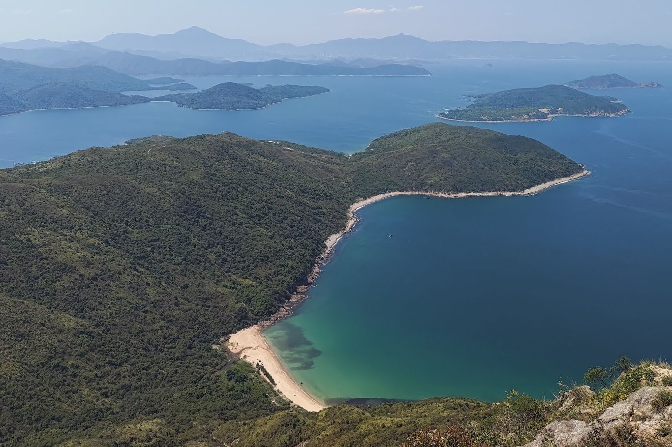
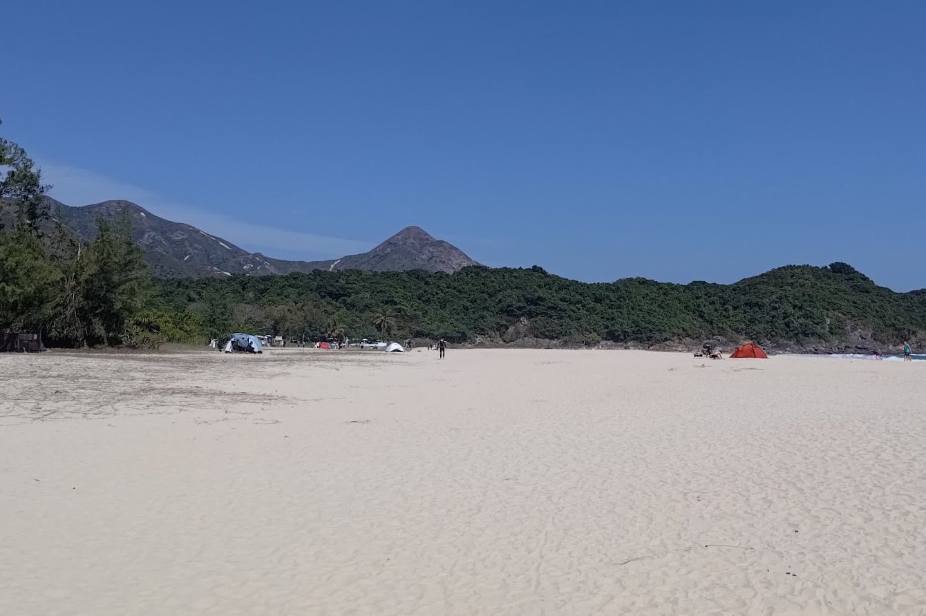
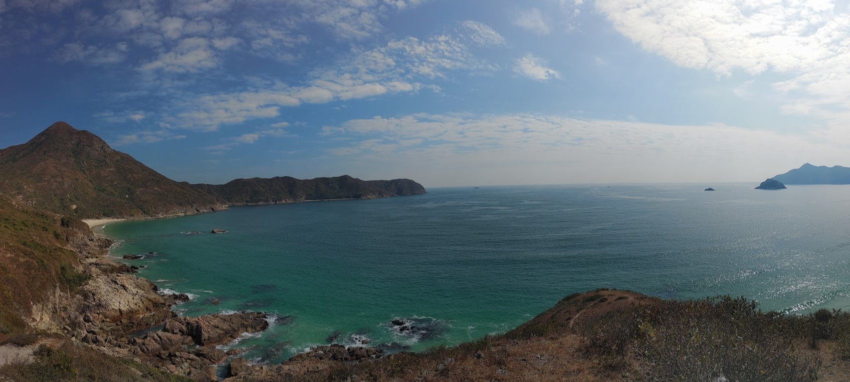
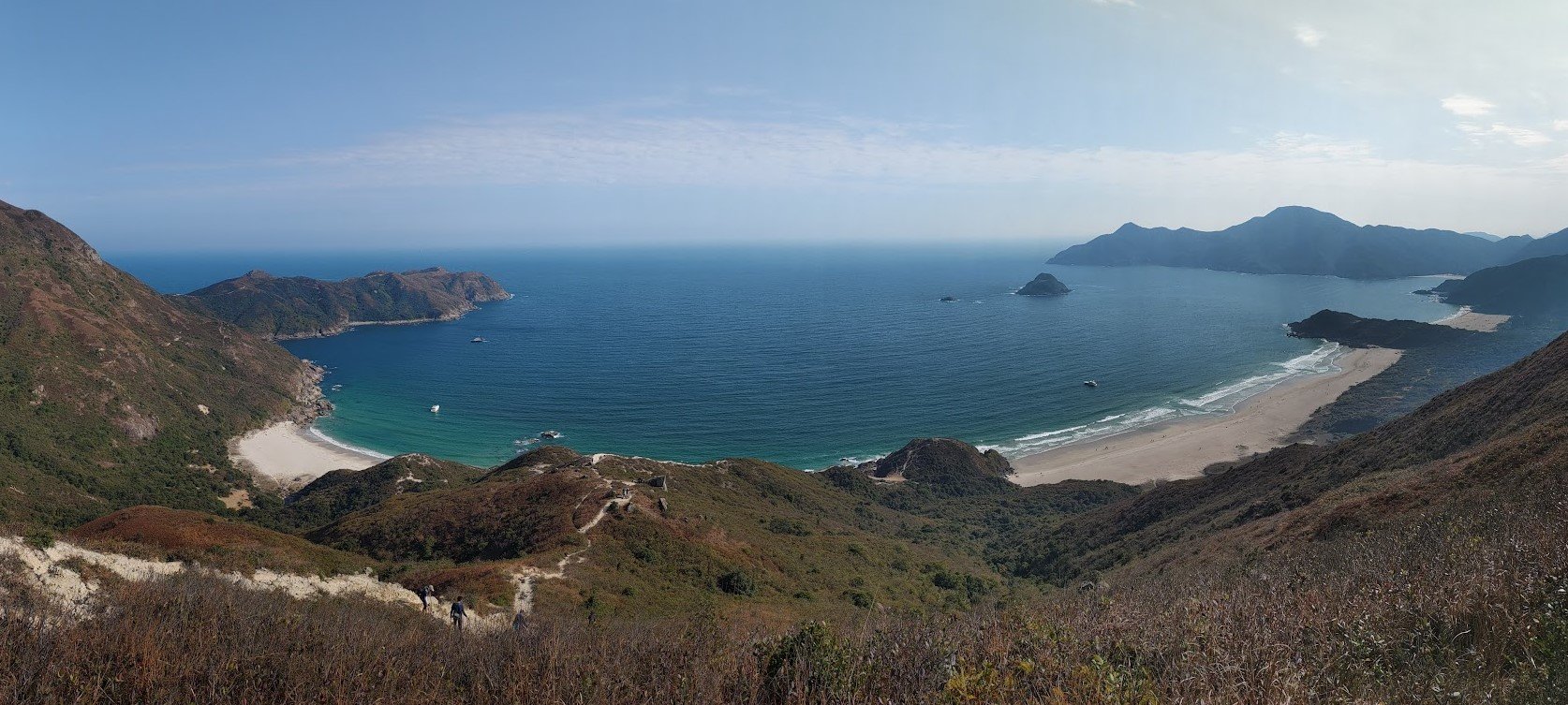
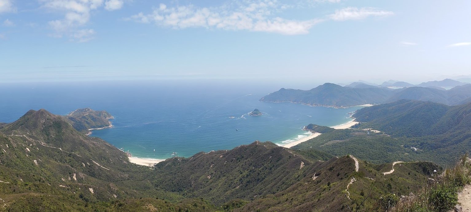
Tai Wan Beach (which literally means big bay) is the longest of Tai Long Wan’s four beaches: Sai Wan, Ham Tin Wan, Tai Wan and Tung Wan.
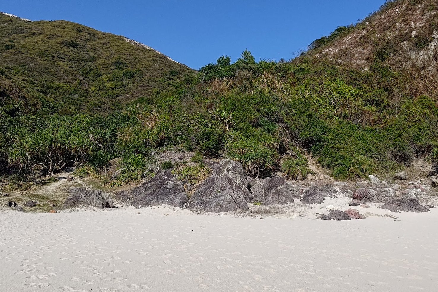
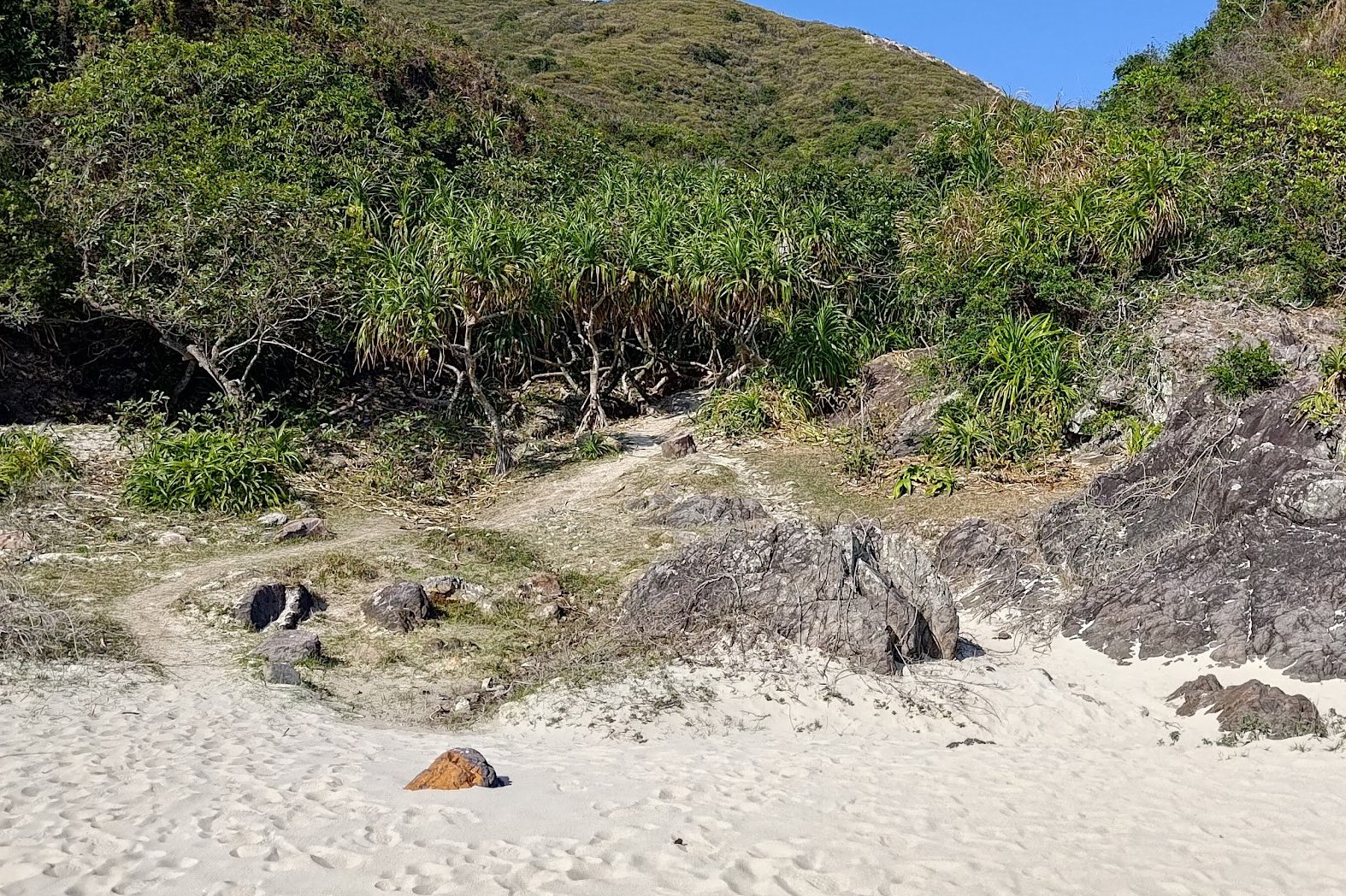
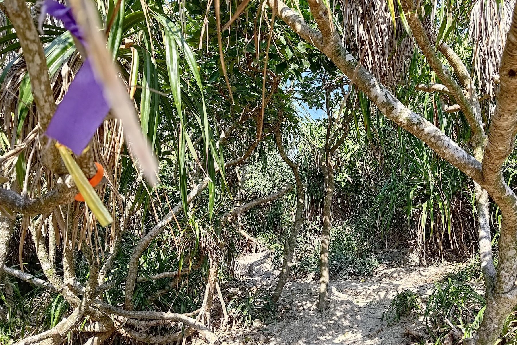
Walk across Tai Wan Beach until you make it to the far end. You’ll see a little path leading up into the trees. It’s a little steep at times and you will have to duck under plants and tree branches.
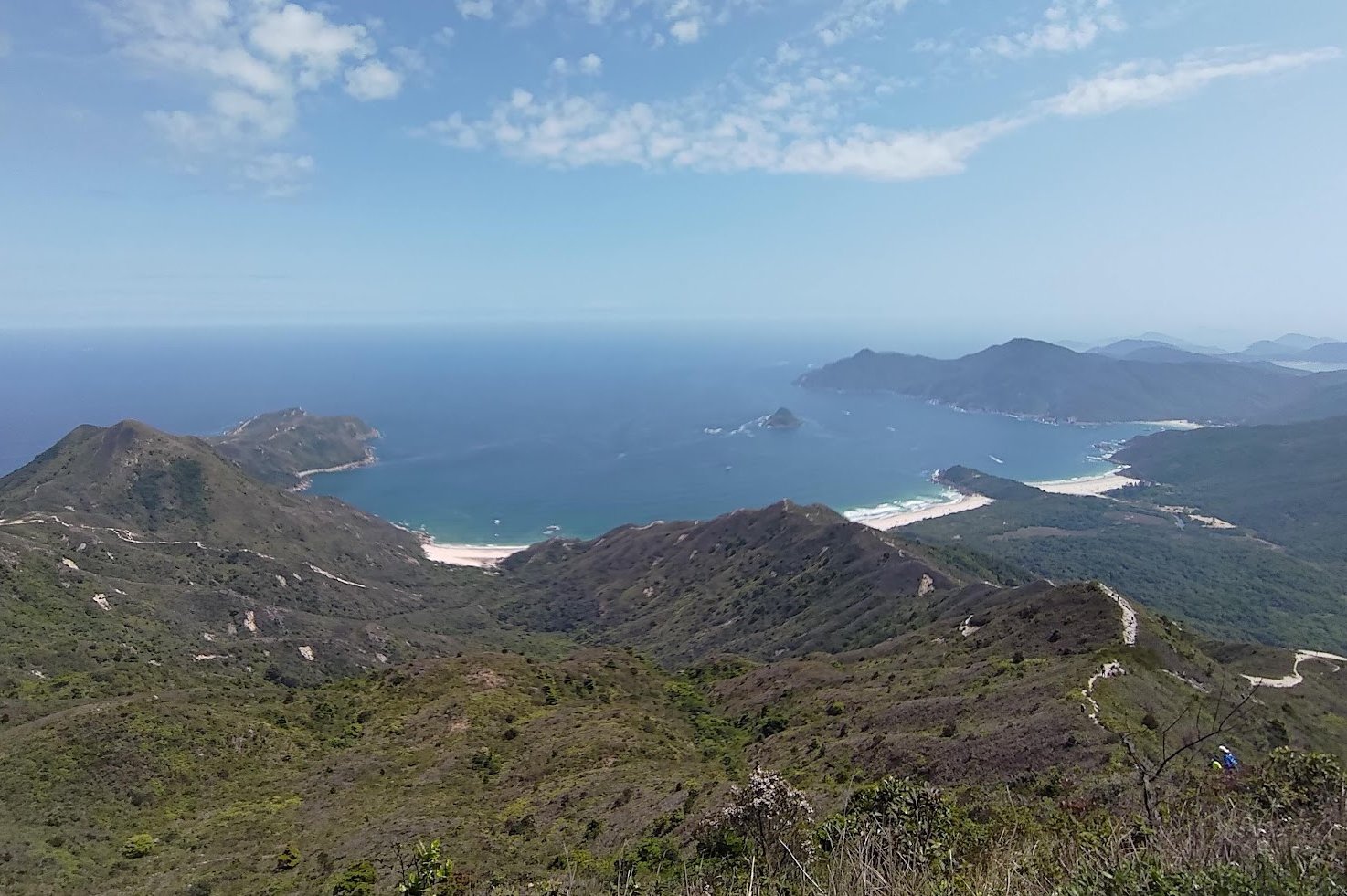
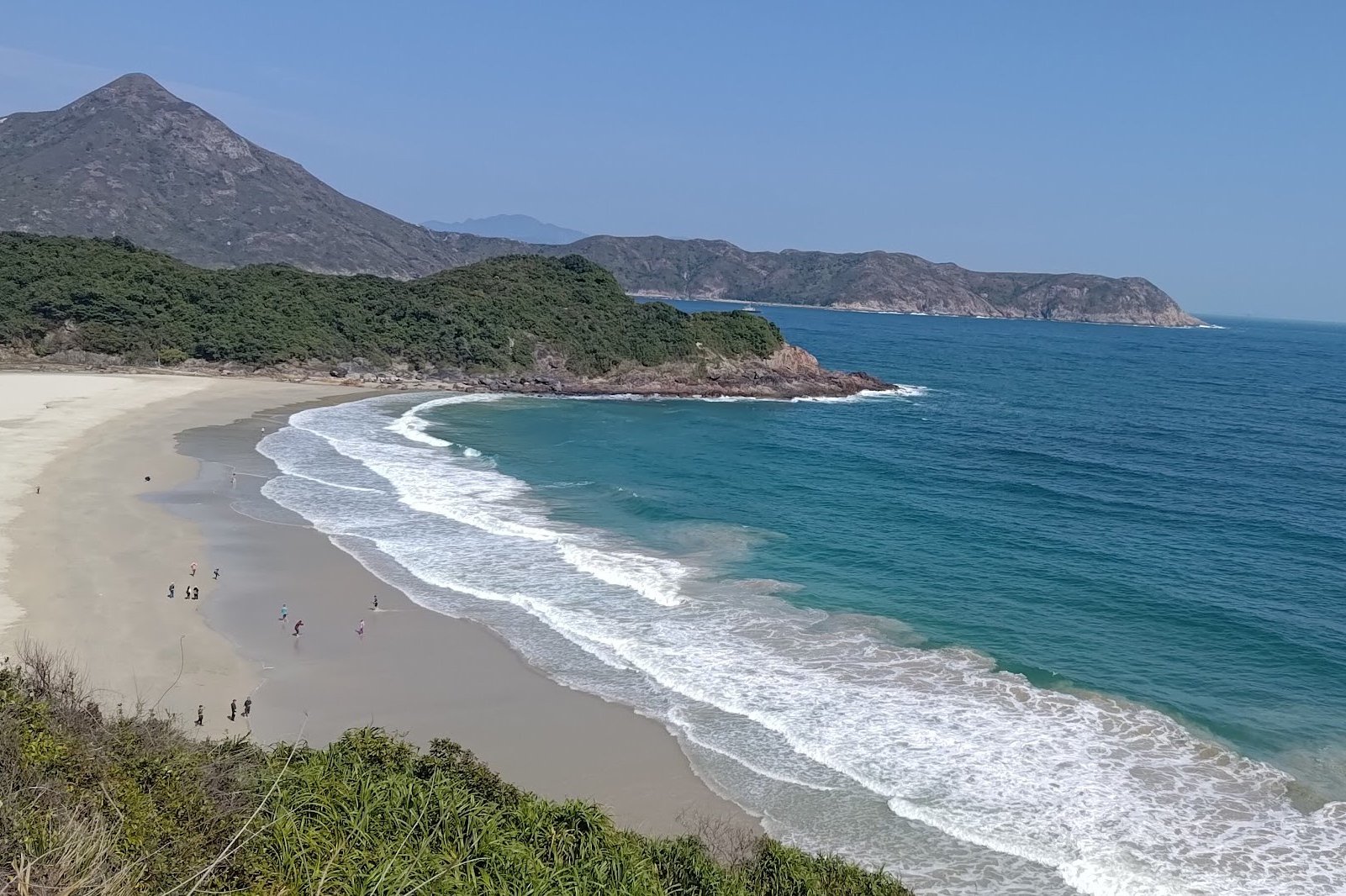
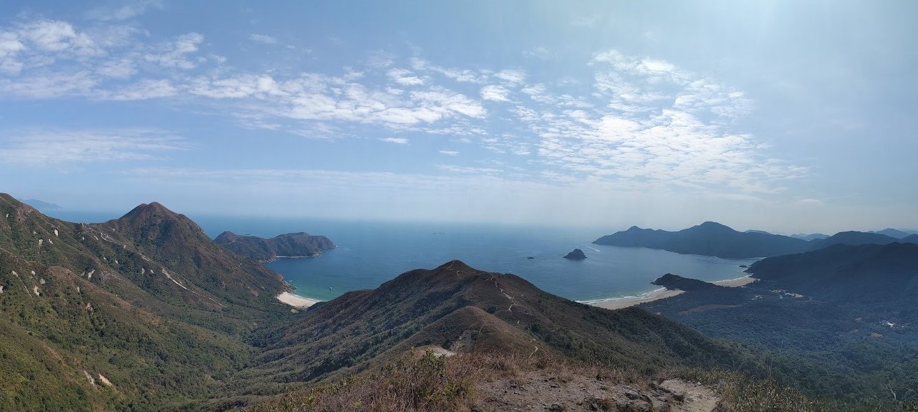
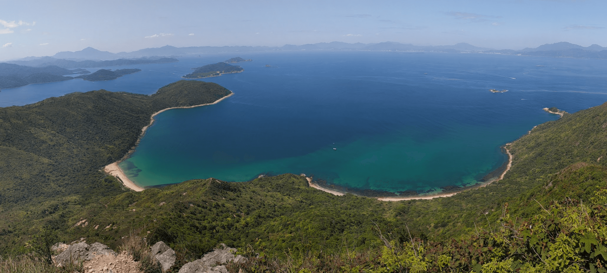
Coastlines and Crossroads
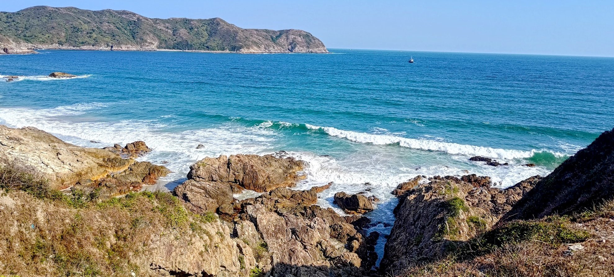

Eventually, you’ll arrive at an open section that overlooks the rugged coastline below. This area has several paths you can follow.
You can tackle a short climb on your right for optional rewarding ocean views, or save your legs for the path on the left that goes up to Sharp Peak
Optional Lung Mei Tau Viewpoint For Amazing Coastal Views
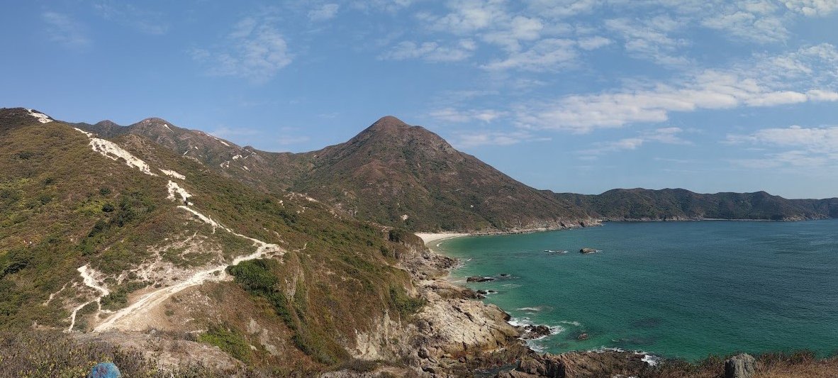
The trail to the hill on the right (Lung Mei Tau) is optional but totally worth it. It’s not very long or steep and offers a nice view out over the South China Sea. Just keep in mind that you will need to retrace your steps back down after.
Begin Hiking Sharp Peak

Back at the crossroads, you'll want to go left (upwards) to begin your official ascent to the summit. A short way up, there's a trail veering off to the right, which leads toward Tung Wan Beach – the most secluded of all Tai Long Wan’s four beaches. I haven’t done this section before, but the trails are very visible. Still, proceed with caution if you choose to go on this detour.
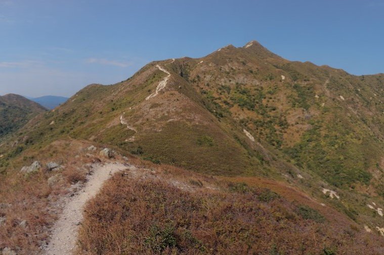
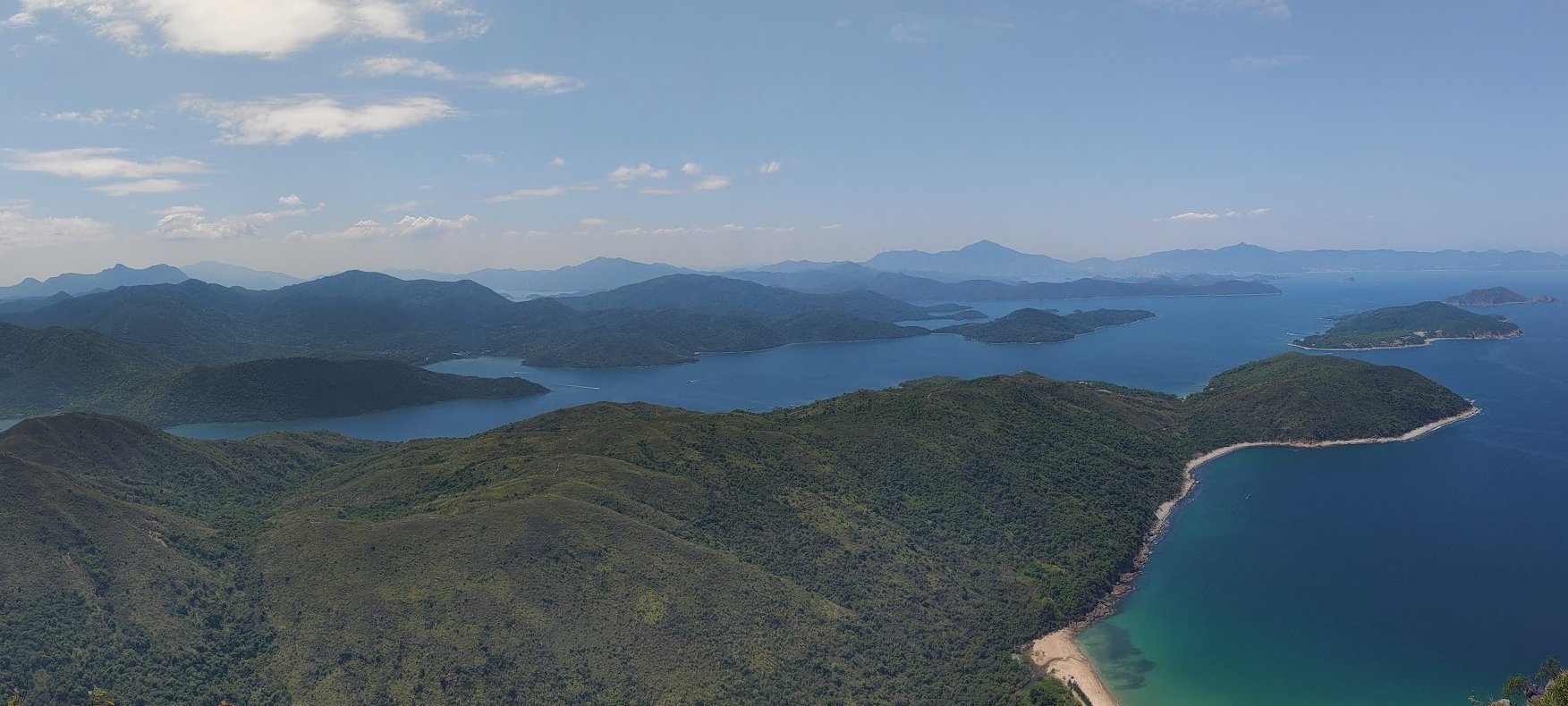
The View from Just Under Half Way Up
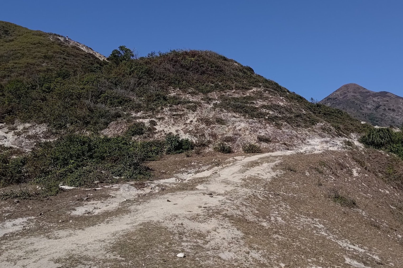
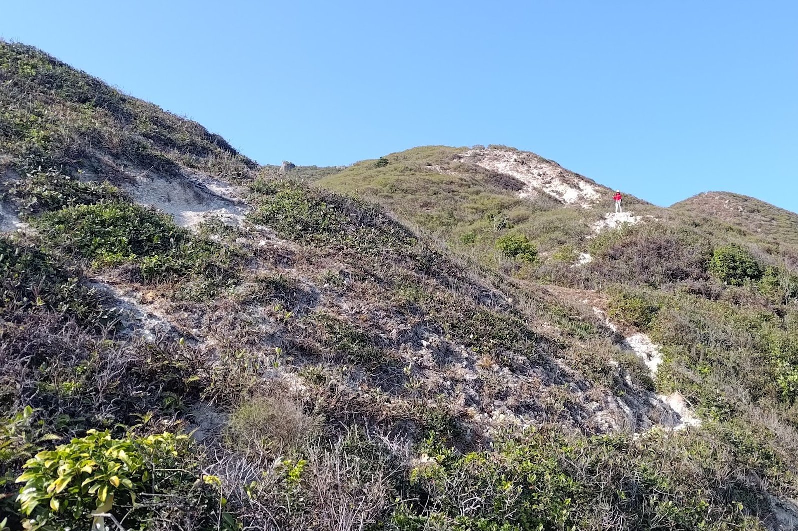
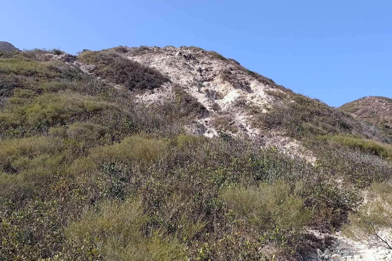
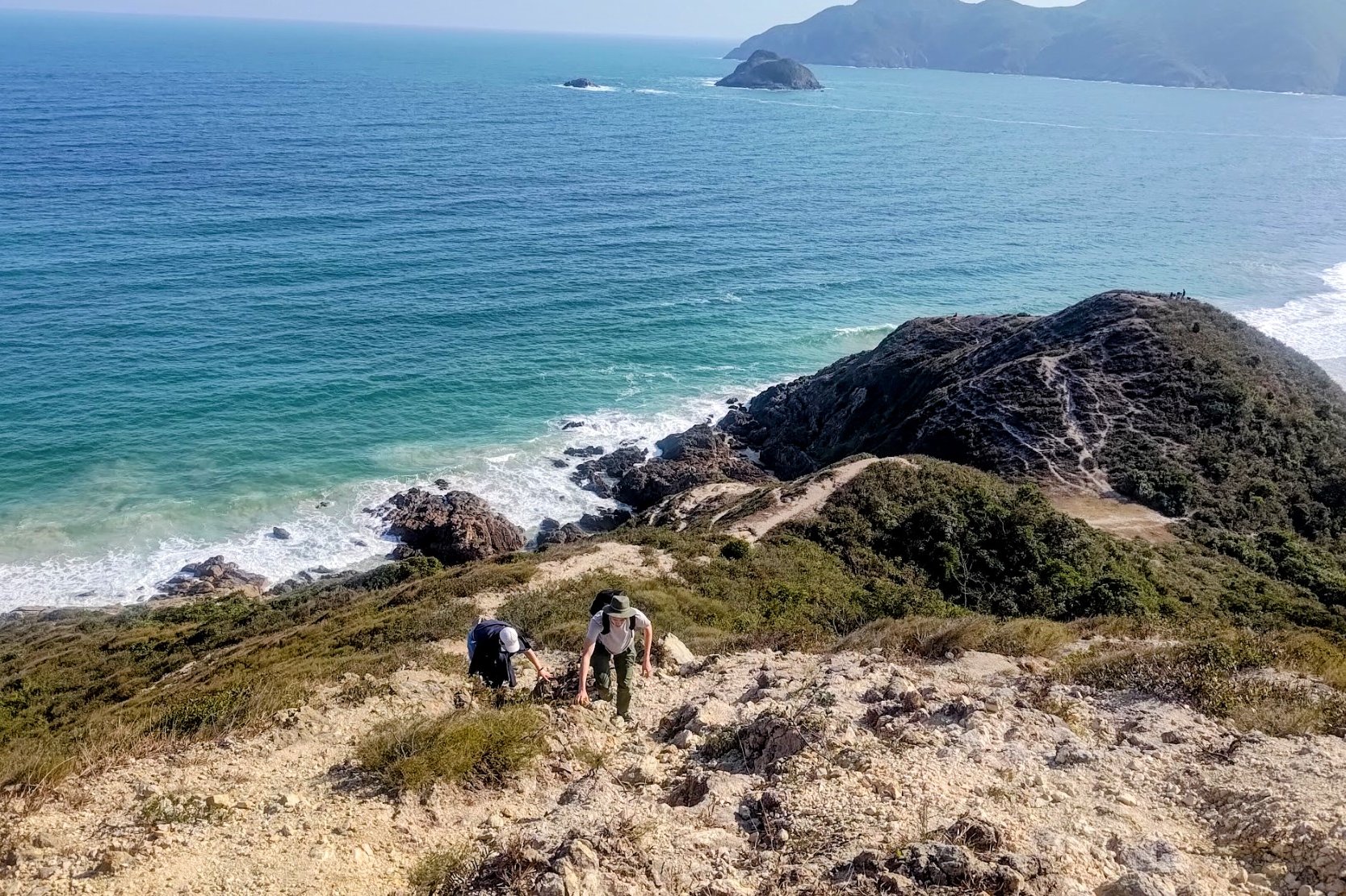
The climb up Sharp Peak is defined by loose rocks, slippery terrain and plenty of scrambling. Take your time and make sure you have stable footing with every step. Rolling an ankle up here would be pretty disastrous. You’ll notice that the climb has you cresting a number of shorter peaks before reaching the summit. Take the time to rest frequently on these peaks and enjoy the view as it unfolds behind you!
Rough and Tricky Escape Route
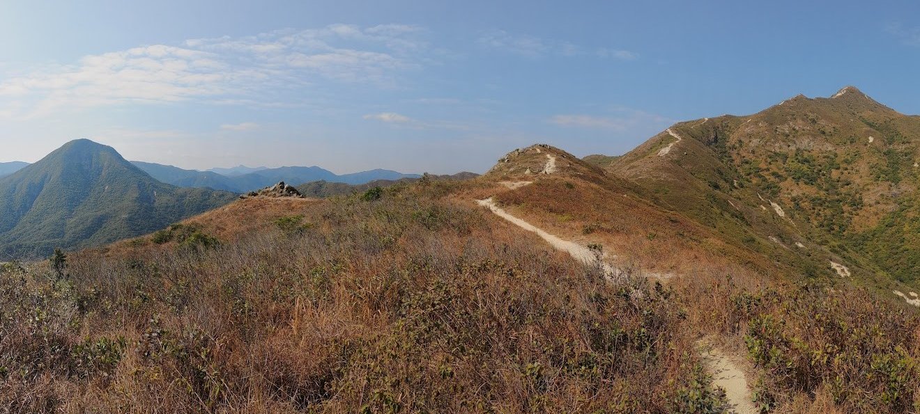
The climb gets gradually steeper and more treacherous as you ascend, but the views make it all worth it.
In case you're having second thoughts, there is an escape route just before the final push to the top. You can find it at a flat section where a few trails intersect. You can try taking the path to the (left if you’re walking toward the summit, right if you’re on the way down) and heading toward Chek Keng.
I’m just pointing out that this path exists, but take it at your own risk. I genuinely have no clue how safe or reliable it is.
Hike the Steep Route Up to the Top
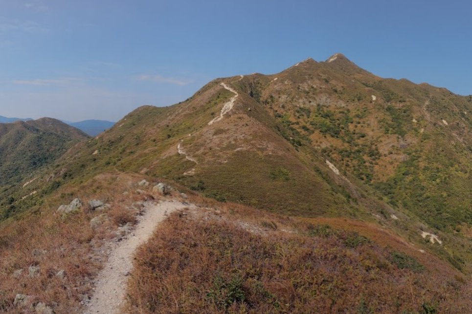
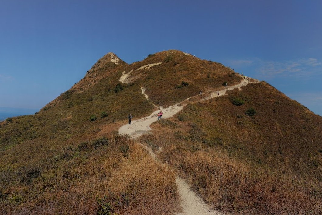
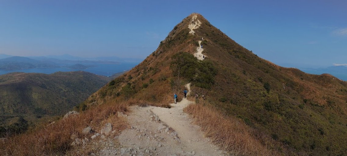
The climb up to the summit is definitely the steepest and most dangerous part of the hike. Take your time on this part and be sure to concentrate on your footing with each step.
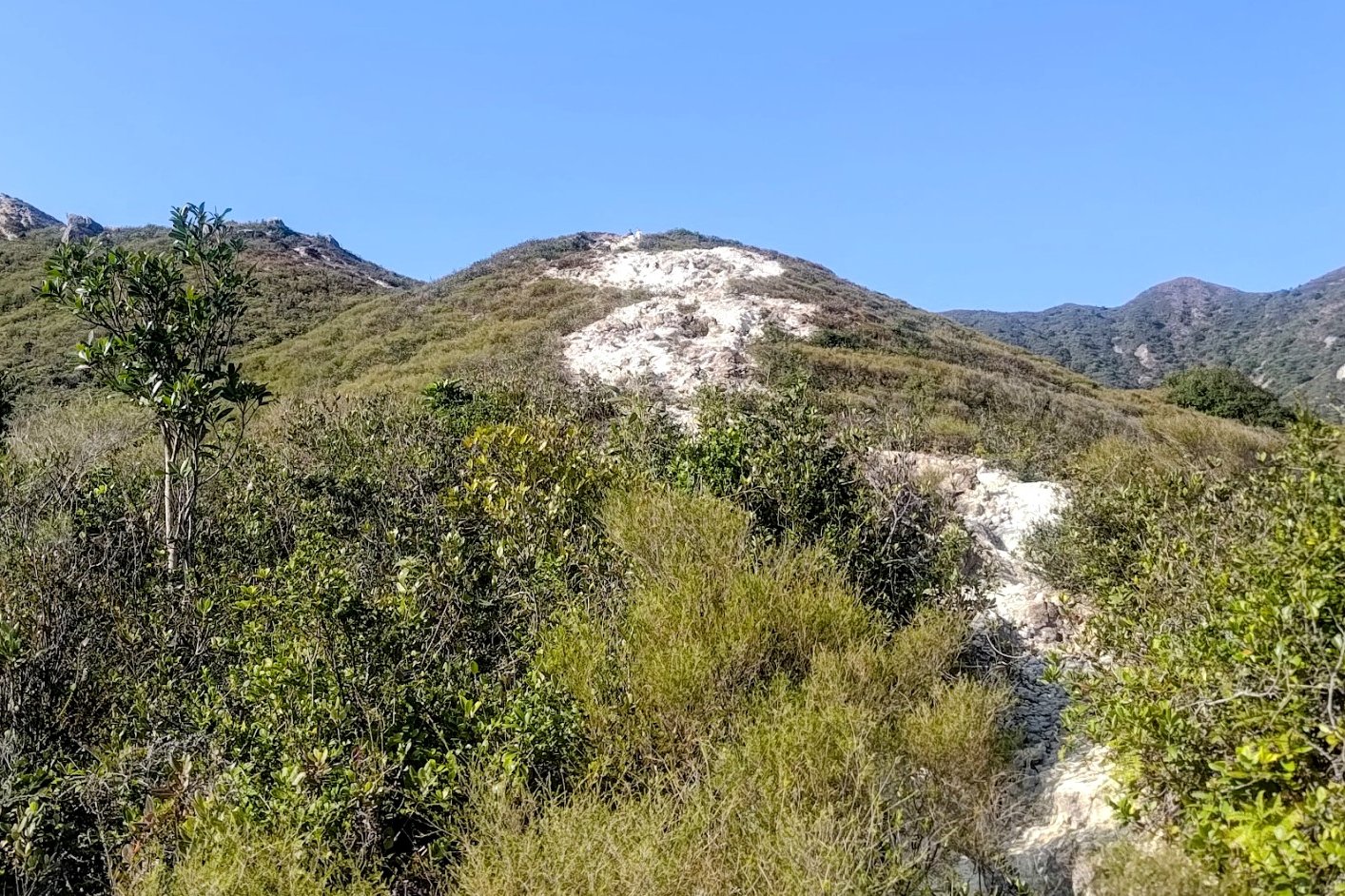
Fortunately, the top of Sharp Peak is now in sight and while you still have some way to go, the end of your uphill adventure is in sight!
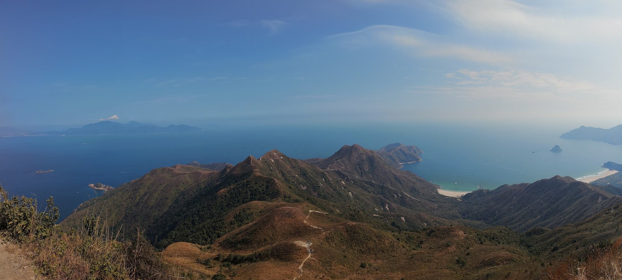
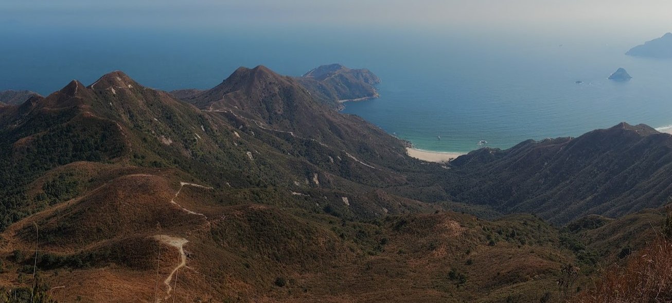
Best Summit Viewpoints
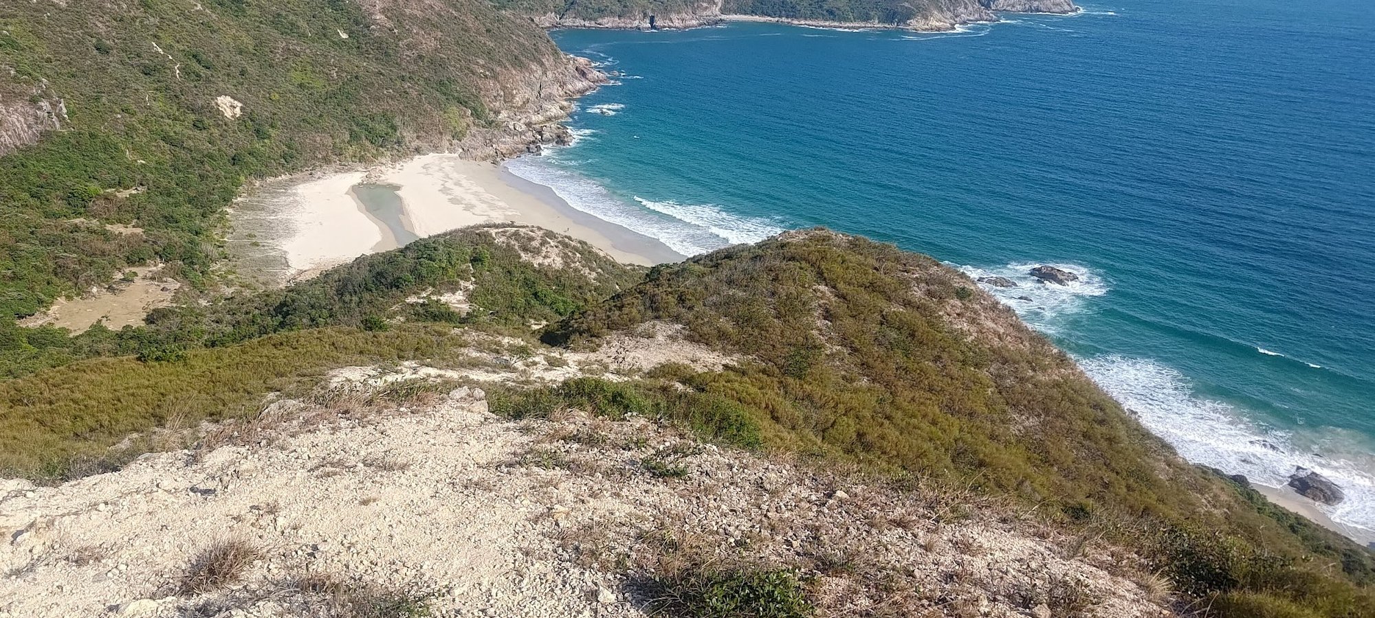
At the top of Sharp Peak, there are two major viewpoints. The first looks over the Tai Long Wan coastline and lets you see exactly where you came from. It puts into perspective how much you’ve climbed and shows you all four beaches below in their full glory! You’ll also have views out to the horizon of the South China Sea. Smashing!
The second view is a tiny bit below the peak (5 meters or so) on the opposite side from where you summited. This viewpoint isn't one to miss and lets you gaze out in wonder at Nam She Wan, Tap Mun, Cheung Wan, Mirs Bay and even into China on a clear day. The water and sand from this view looks unbelievably pristine and any photo you take from here will be postcard worthy!
Viewpoint One
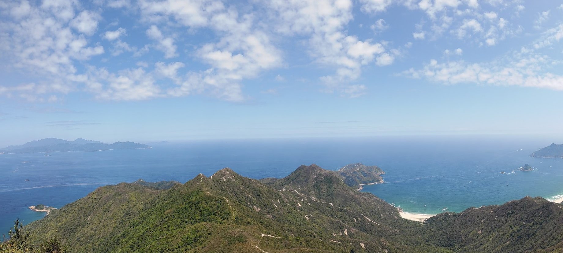
Viewpoint Two
The Highly Slippery Hike Back Down
If you thought the way up was difficult, heading back down is ten times more intense. The loose rocks and fine particles of sand are made worse when going downhill and you really have to make sure you're paying attention to EVERY. SINGLE. STEP.
It's extra tricky because by this point, you'll be fatigued from your hike up and the scenery is the same as you go down (unless you opt for the untested detour mentioned earlier).
You’ll want to descend all the way back to Tai Wan Beach and then retrace your steps past the pasture near the restaurant (Hoi Fung Store) at Ham Tin Wan. From here, you have a few options on how to get home.
The Way Back
- You can take a speedboat from Ham Tin Wan back to Sai Kung organized by the restaurant (Hoi Fung Store).
- You can continue hiking to Pak Tam Au (2-3 hours) and get the 94 bus or 96R bus from Pak Tam Road. The 94 goes back to Sai Kung and the 96R (weekends and public holidays only) goes to Sai Kung or Diamond Hill.
- Hike to Sai Wan Pavilion (1.5 hours) and get the NR29 minibus to Sai Kung. The minibus schedule can be found here. The NR29 bus only goes back to Sai Kung from Sai Wan Pavilion at 9.00 AM, 9.45 AM, 12.00 noon and 4.45 PM, according to the schedule.

