Jardine's Lookout and Siu Ma Shan Hike: Better Views than Victoria Peak
Contents
- Essential Information
- Jardine's Lookout and Siu Ma Shan Hike Highlights
- Google Route Map
- How to Get There
- Quick Route Summary
- Who is Jardine's Lookout Named After?
- The Osborn Memorial
- Climbing Jardine's Lookout
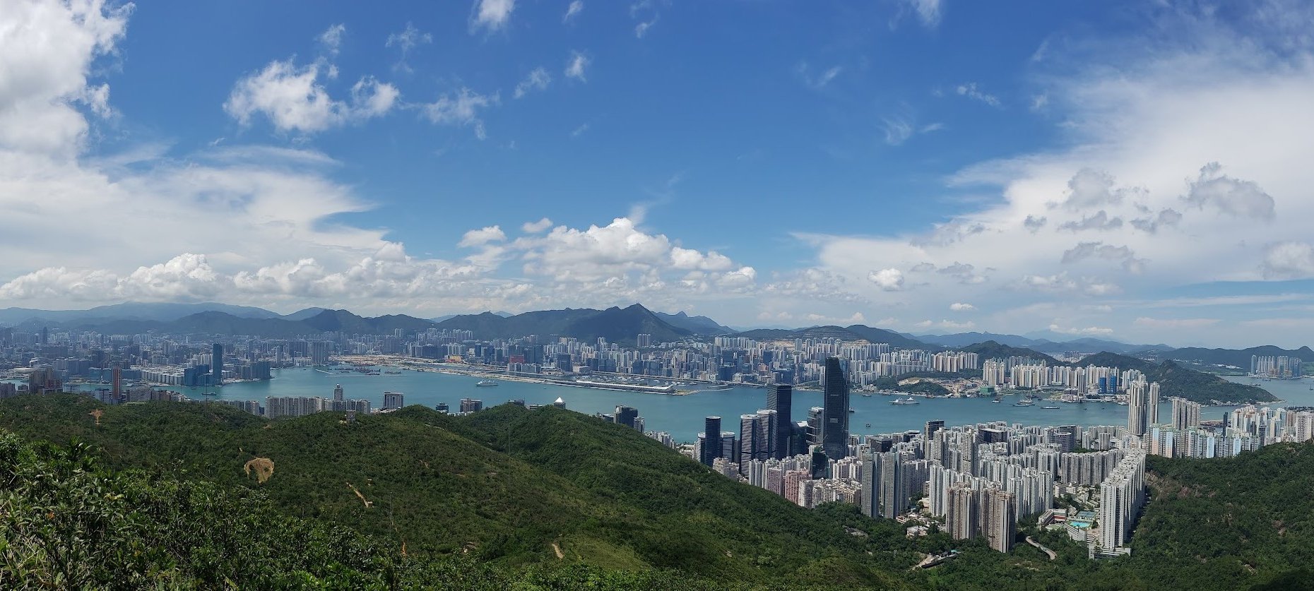
- Jardine's Lookout Summit Views
- Descending Jardine's Lookout
- Bomb Disposal Area
- The Creepy Tunnel
- The Path to Siu Ma Shan
- Siu Ma Shan Views
- The Confusing Descent to Mount Parker Road
- Mount Parker Road to Quarry Bay
- Getting Back
Essential Jardine's Lookout and Siu Ma Shan Hike Details
- District: Hong Kong Island
- Duration: 2-2.5 hours depending on the start point
- Distance: 6-7 km depending on the start point
- Highest Elevation: 424ish meters
- Difficulty: 2.5/5
- Facilities: Toilets at the start and a supermarket at Hong Kong Parkview
Why Hike Jardine's Lookout and Siu Ma Shan?

This is a medium-difficulty hike split by two steep uphill sections (Jardine's Lookout and Siu Ma Shan) that anyone with a reasonable level of fitness can tackle. The path is concrete for most of the way and the hike itself isn't particularly long.
It's one of those trails that I've done at least a dozen times by this point, but I keep going back to it because it offers such a rare perspective on Hong Kong Island's incredibly diverse landscapes.
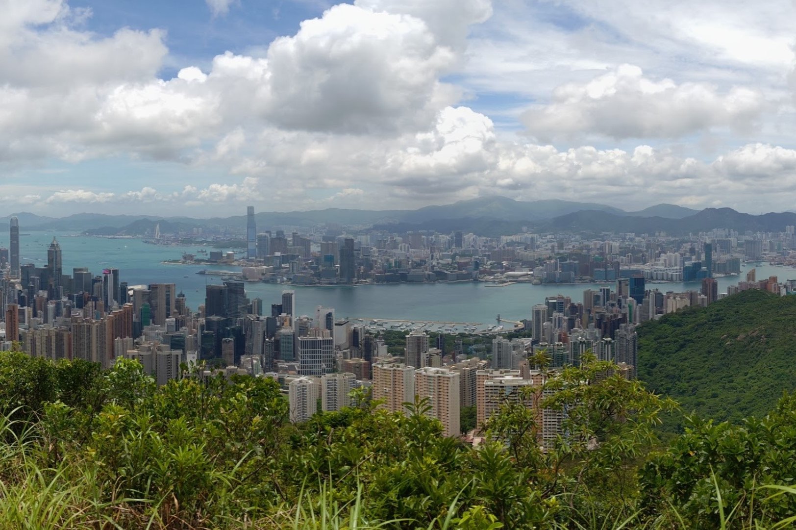
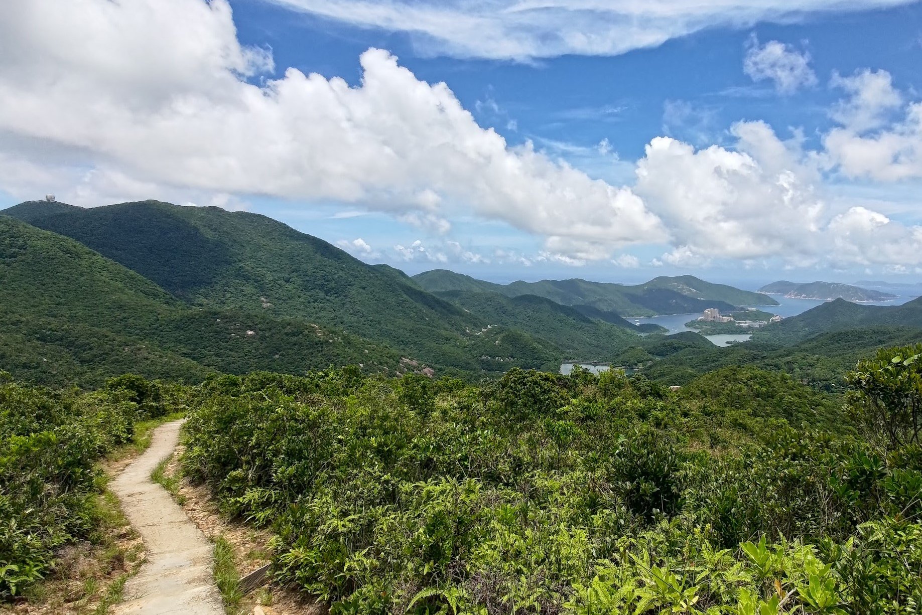
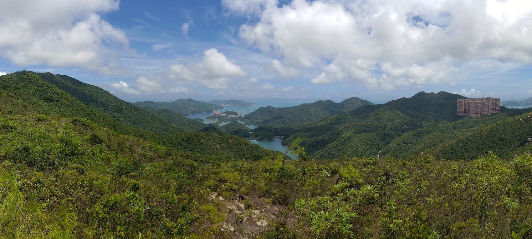
You'll be spoiled rotten by the incredible city views, which are often the highlight for most people. But, much of this hike also has you staring slack-jawed over stunning vistas of Tai Tam Reservoir while verdant green mountains (like Mount Butler) undulate lazily in front of you.
Being able to witness such a clear dichotomy between Hong Kong's frenetic city center, verdant green peaks and azure coastal waters makes this hiking experience so much more intriguing than the tourist-infested viewpoint at Victoria Peak.
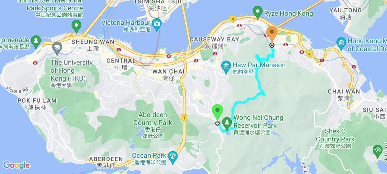
Google Route Map
How to Get to the Jardine's Lookout and Siu Ma Shan Hike Start Point
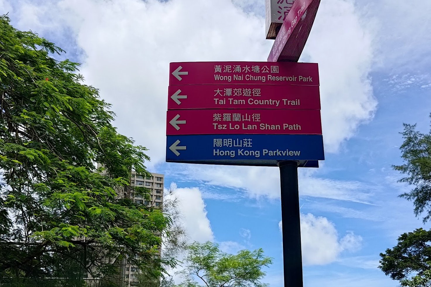
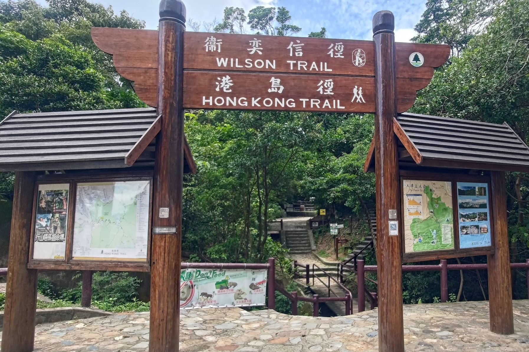
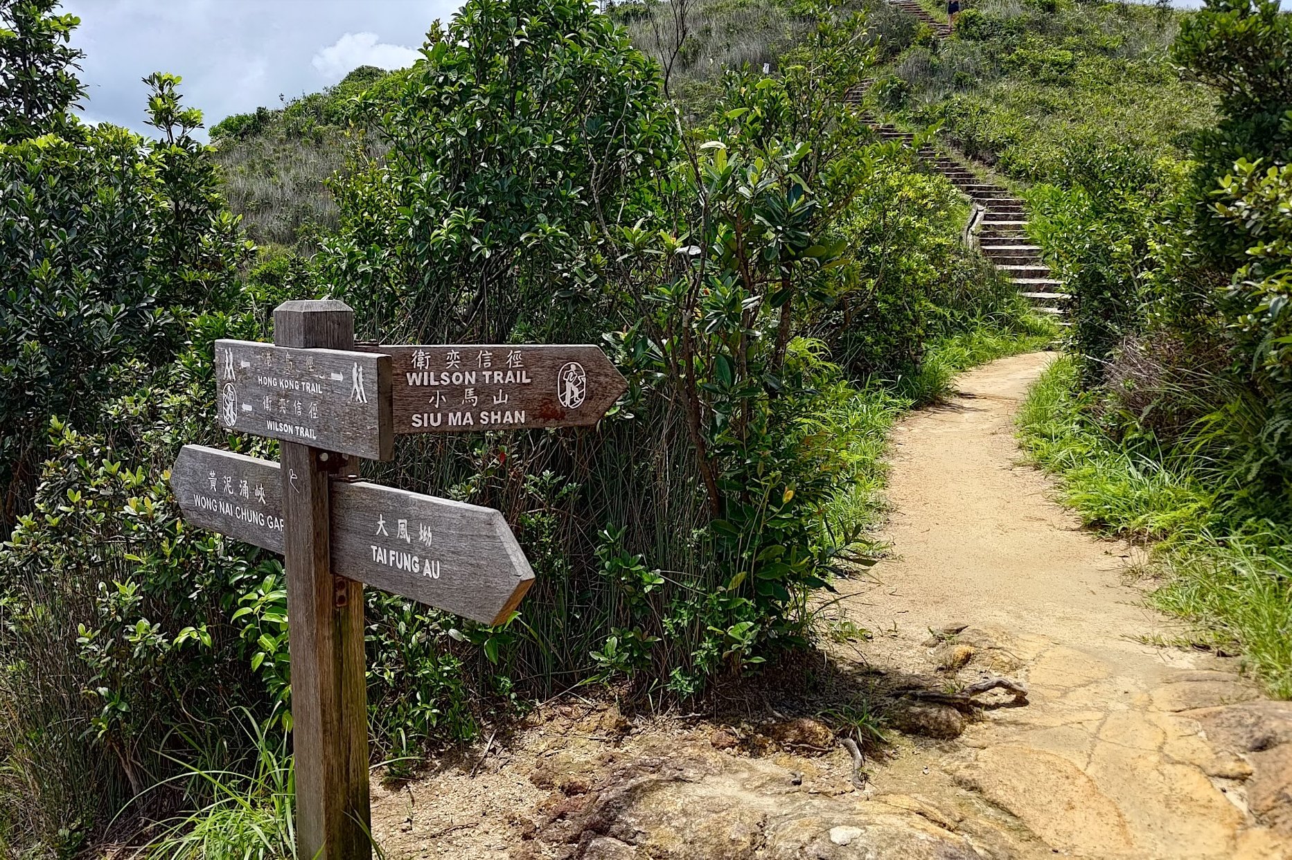
The start point of the Hike is near Hong Kong Parkview, which is located on Tai Tam Reservoir Road. A picture of the start point (a large wooden arch) is in the section after this one.
By Taxi
The easiest way to arrive at the hike start point is by taxi. If you plan on taking a taxi, show this to the taxi driver:
衛奕信徑第二 , 大潭水塘道
Keep watch for the brown arch on your left that marks the trail and ask the taxi driver to stop when you see it.
If the taxi driver doesn't know where the first address is, use the following one.
陽明山莊
This second address is for Hong Kong Parkview, which is about 2-3 mins away from the start. Just walk back the way the taxi came and look for the brown arch on the right side of the road.
By Bus
If you plan on taking the bus, you'll have to alight at the Hong Kong Tennis Centre and walk for about 20-30 minutes to the start point. It's a bit steep, too, and adds to the difficulty of the hike.
(Via Exhibition Centre and Wan Chai)
(Via Central, Admiralty and Wan Chai)
(Via Wah Fu, Aberdeen and Wong Chuk Hang) or (Via North Point, Tin Hau, Tai Hang)
(Via North Point, Fortress Hill, Causeway Bay, Tai Hang, Happy Valley) Does not operate on Sundays and public holidays
(Via Central, Admiralty and Wan Chai) or (Via Ma Hang, Chung Hom Kok and Repulse Bay)
(Via Causeway Bay and Wan Chai) or (Via Aberdeen and Wong Chuk Hang)
Walking from the Bus Stop to the Start Point
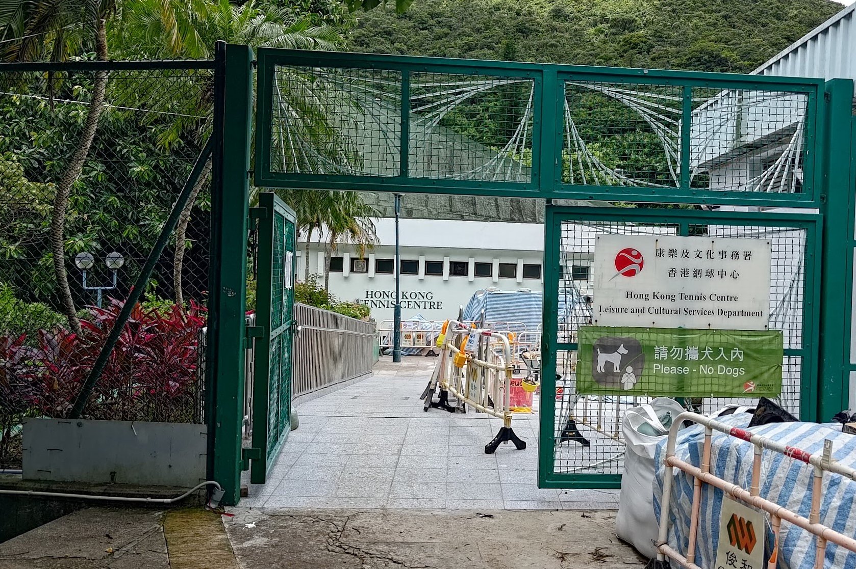


After alighting at the Hong Kong Tennis Centre, continue walking along Wong Nai Chung Gap Road.
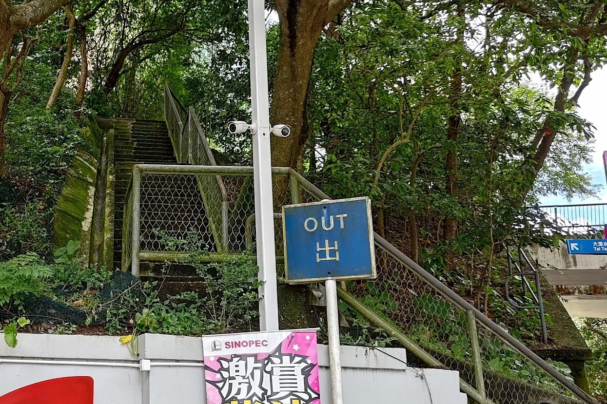
You'll go past the Hong Kong Cricket Club before arriving at a SINOPEC gas station. Just behind the gas station is a 'Tai Tam Reservoir Road' sign pointing to some stairs.
Take the stairs up and follow the sign to 'Hong Kong Parkview'.
A steep climb up Tai Tam Reservoir Road ensues.
After about 10 minutes, you will arrive at the start point, which is marked by a large 'Wilson Trail' and 'Hong Kong Trail' arch.
Quick Jardine's Lookout and Siu Ma Shan Hike Route Summary
- Follow the 'Jardine's Lookout Sign up the stairs
- 5 minutes later, you'll go past the Osborne Memorial
- Keep climbing until you reach the summit of Jardine's Lookout with epic Victoria Harbour views
- Descend toward the Explosive Ordinance Disposal (EOD) site (the large crater)
- Follow the stairs upward next to the EOD site
- After summiting, follow the trail forward before turning at the 'Siu Ma Shan' sign
- Climb up past the tower and enjoy more incredible views
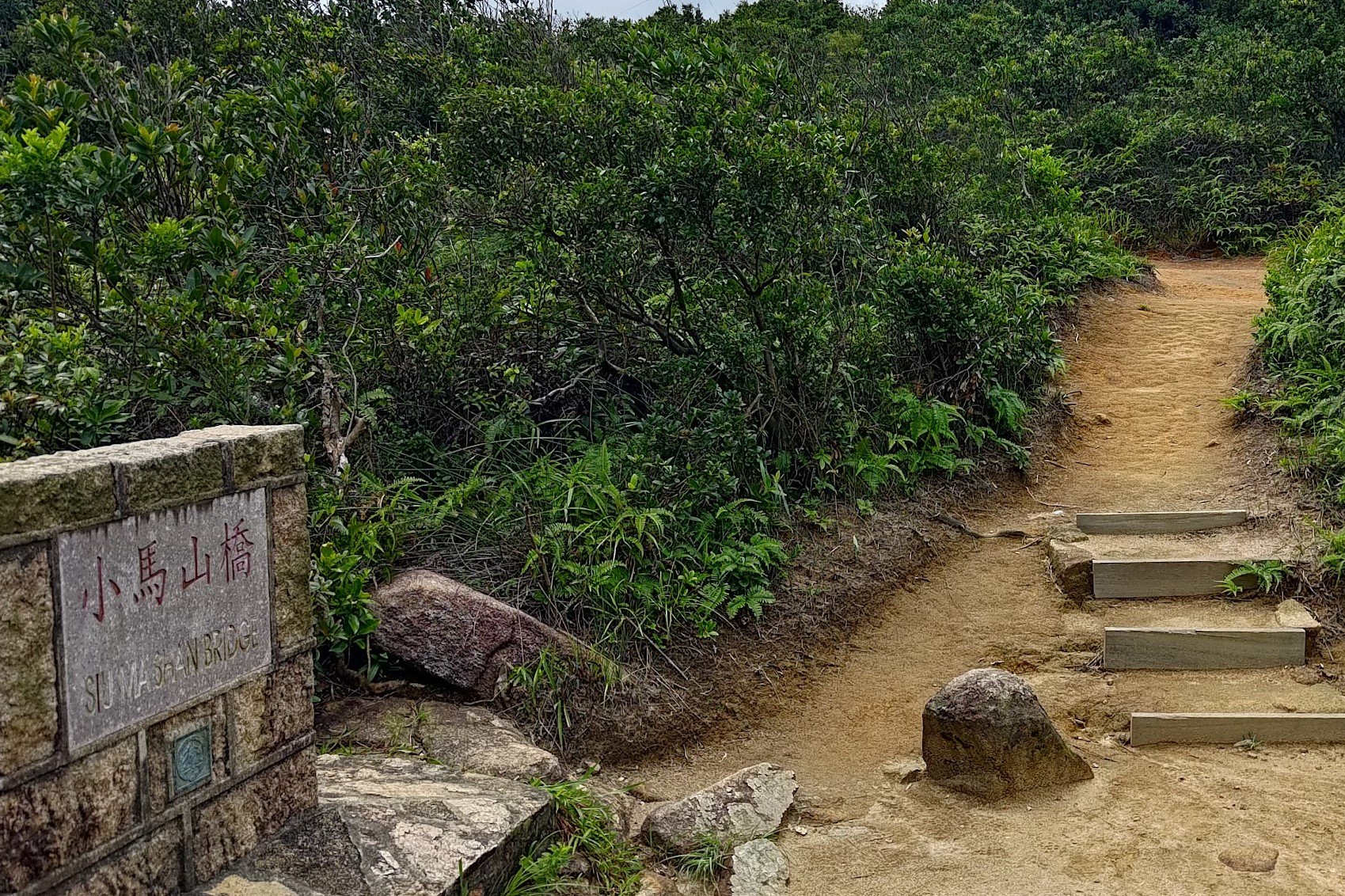
- Begin your descent and cross the Siu Ma Shan Bridge
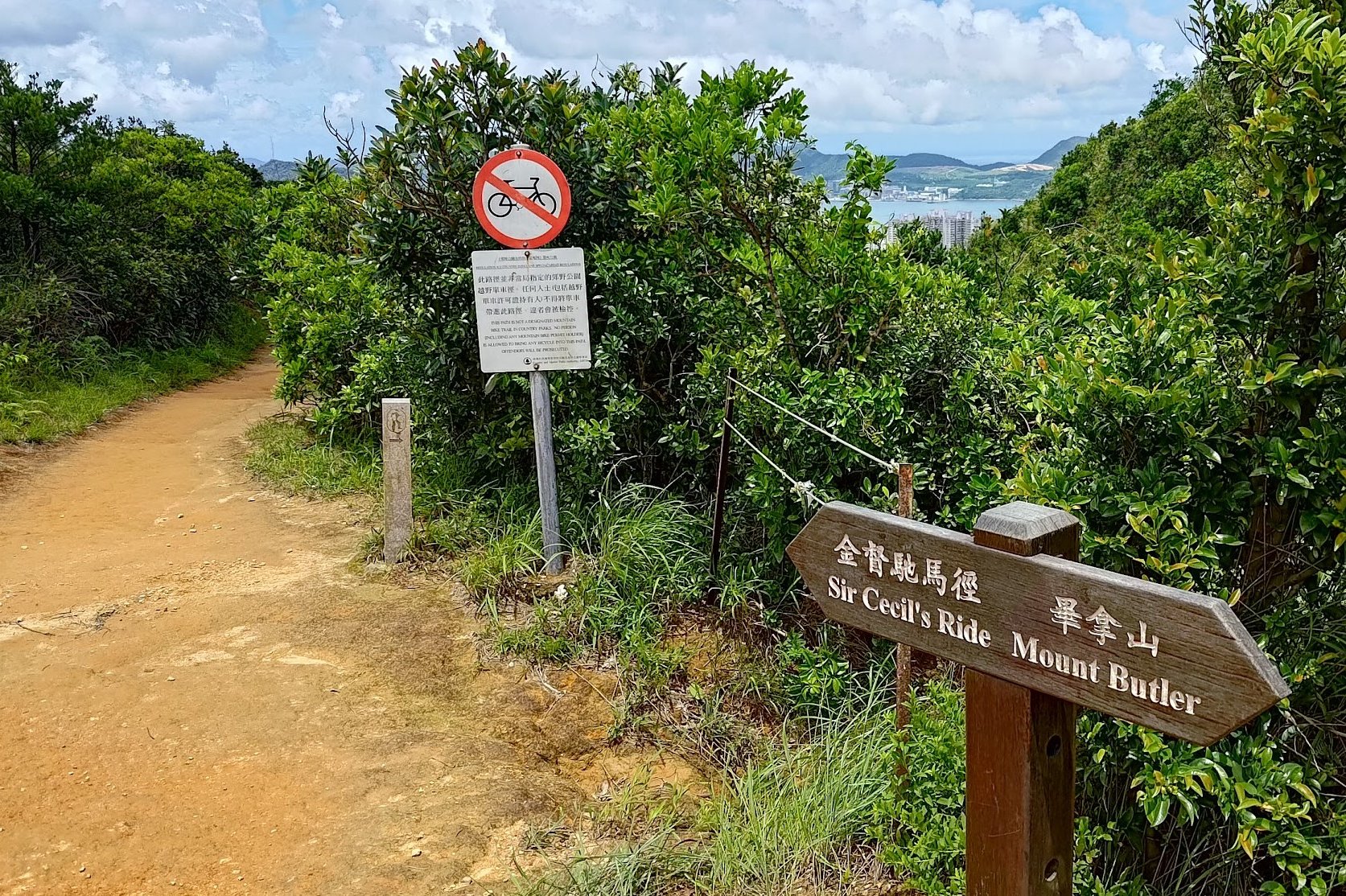
- Follow the 'Sir Cecil's Ride' sign just after the Siu Ma Shan Bridge marker
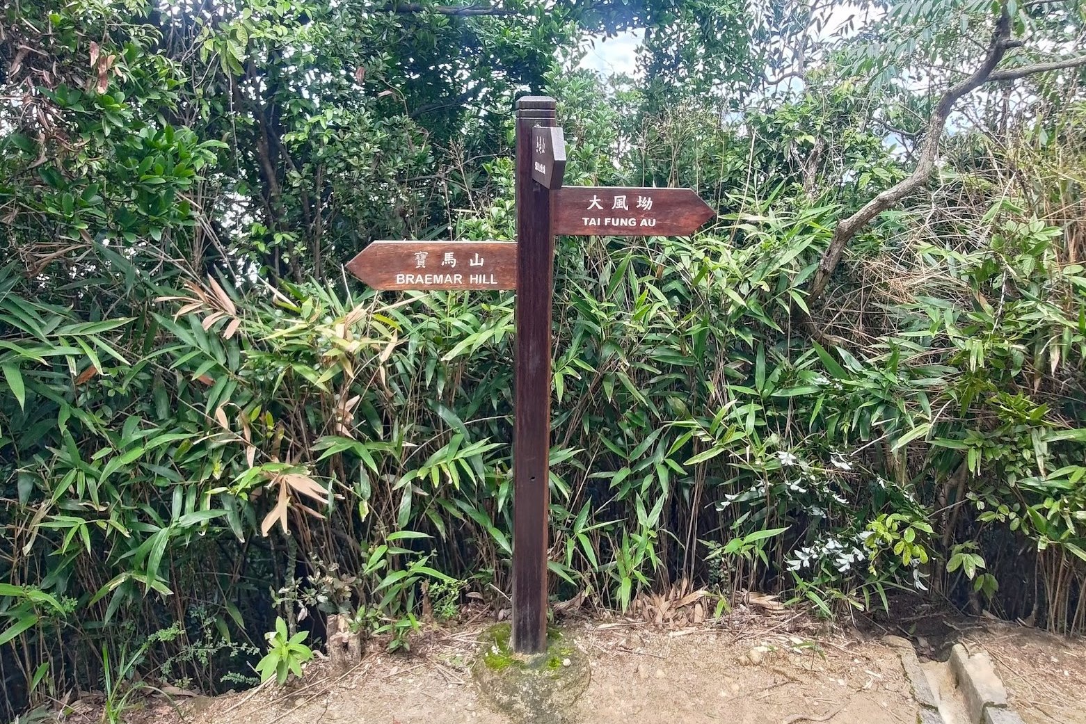
- Keep descending. When the stairs end, follow the 'Braemar Hill' sign left
- A few minutes later, follow another 'Sir Cecil's Ride' sign
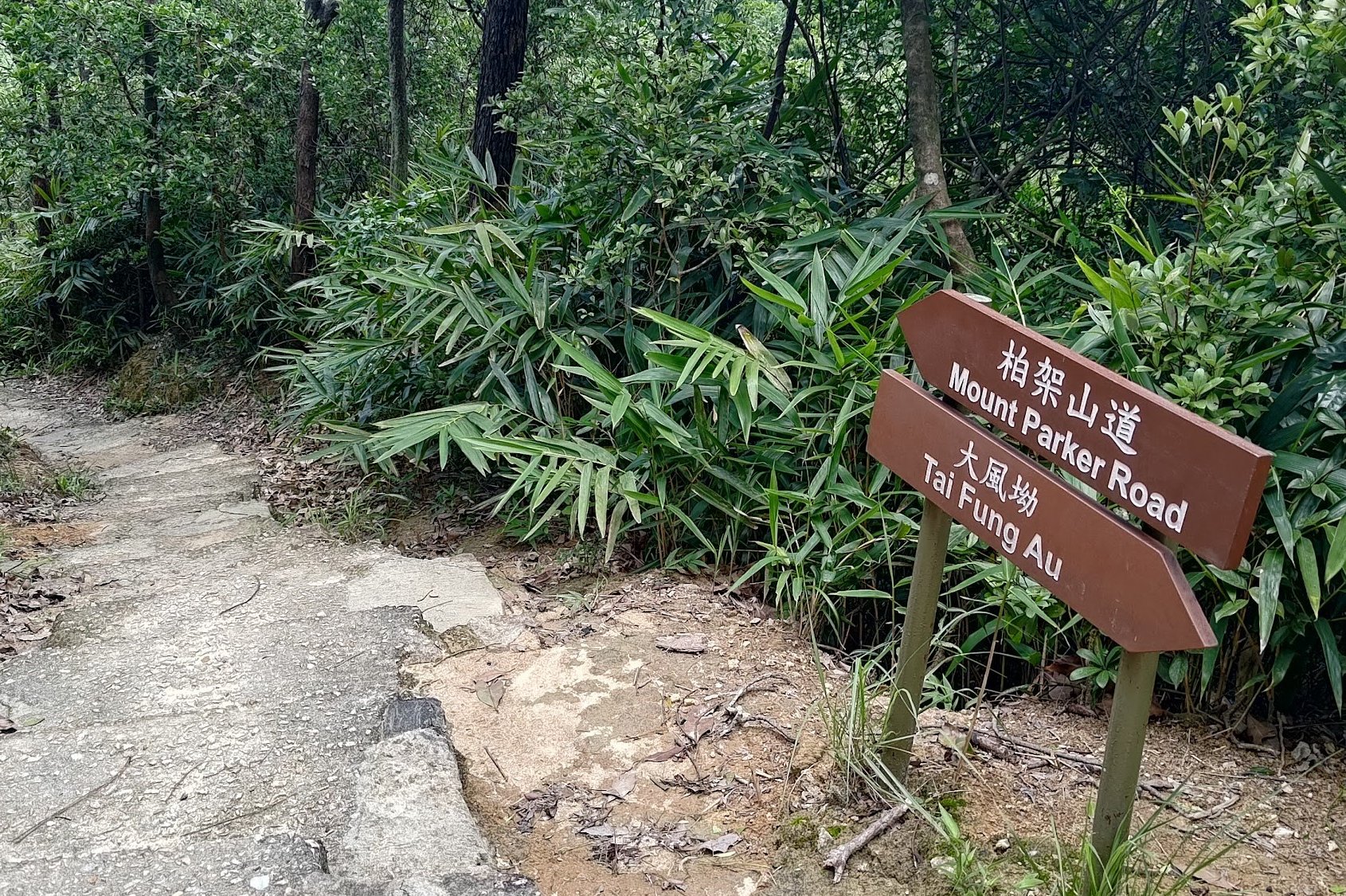
- After about 5 minutes follow the 'Mount Parker Road' sign down the stairs
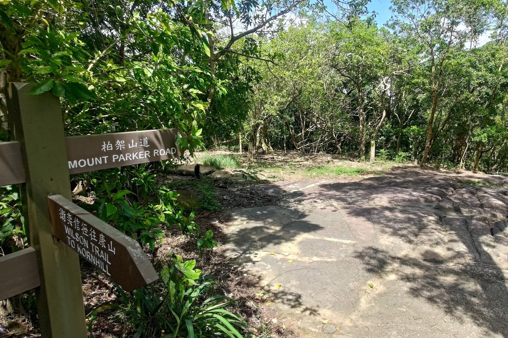
- Heed the next 'Mount Parker Road' sign and keep descending
- Follow the concrete road all the way down to Quarry Bay
Begin the Climb Up Jardine's Lookout
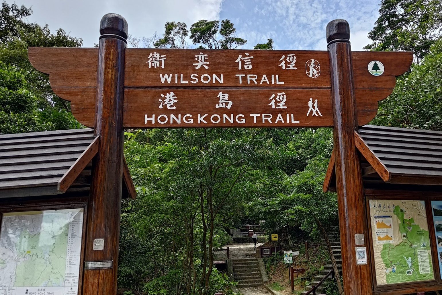
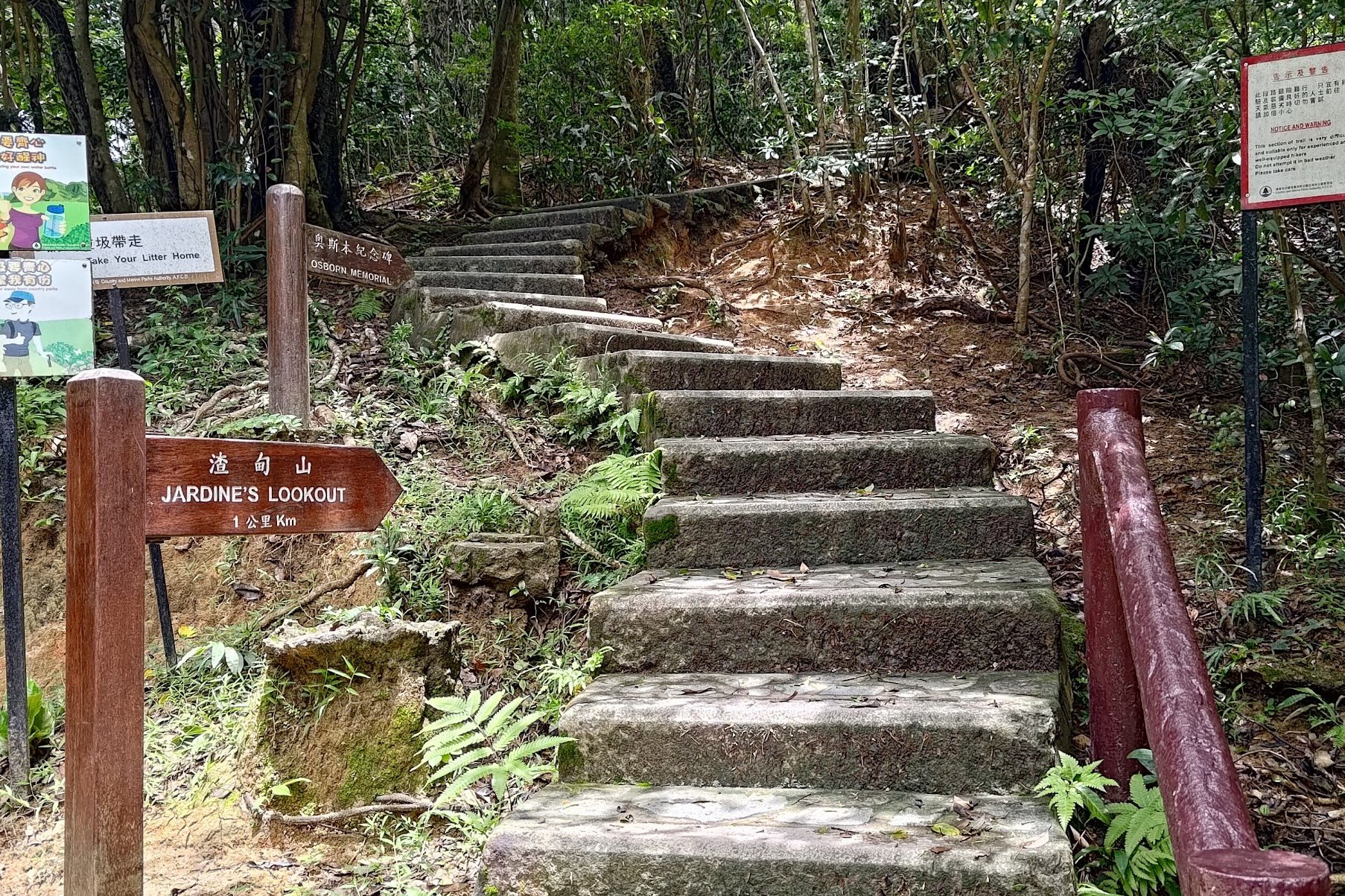
After passing through the 'Wilson Trail' arch, follow the 'Jardine's Lookout' sign and begin the first of two steep uphill sections of this hike.
Jardine's Lookout is named after William Jardine, founder of Jardine Matheson. After the cessation of Hong Kong in 1842 via the Treaty of Nanking, Jardine made Hong Kong the headquarters of his business empire which focused heavily on smuggling opium into China from India, who were controlled by the British at that time.
In the book, 'The Blood Never Dried: A People's History of the British Empire' by John Newsinger, Jardine Matheson has been called the "most successful opium smuggling company in the world".
The Osborn Memorial
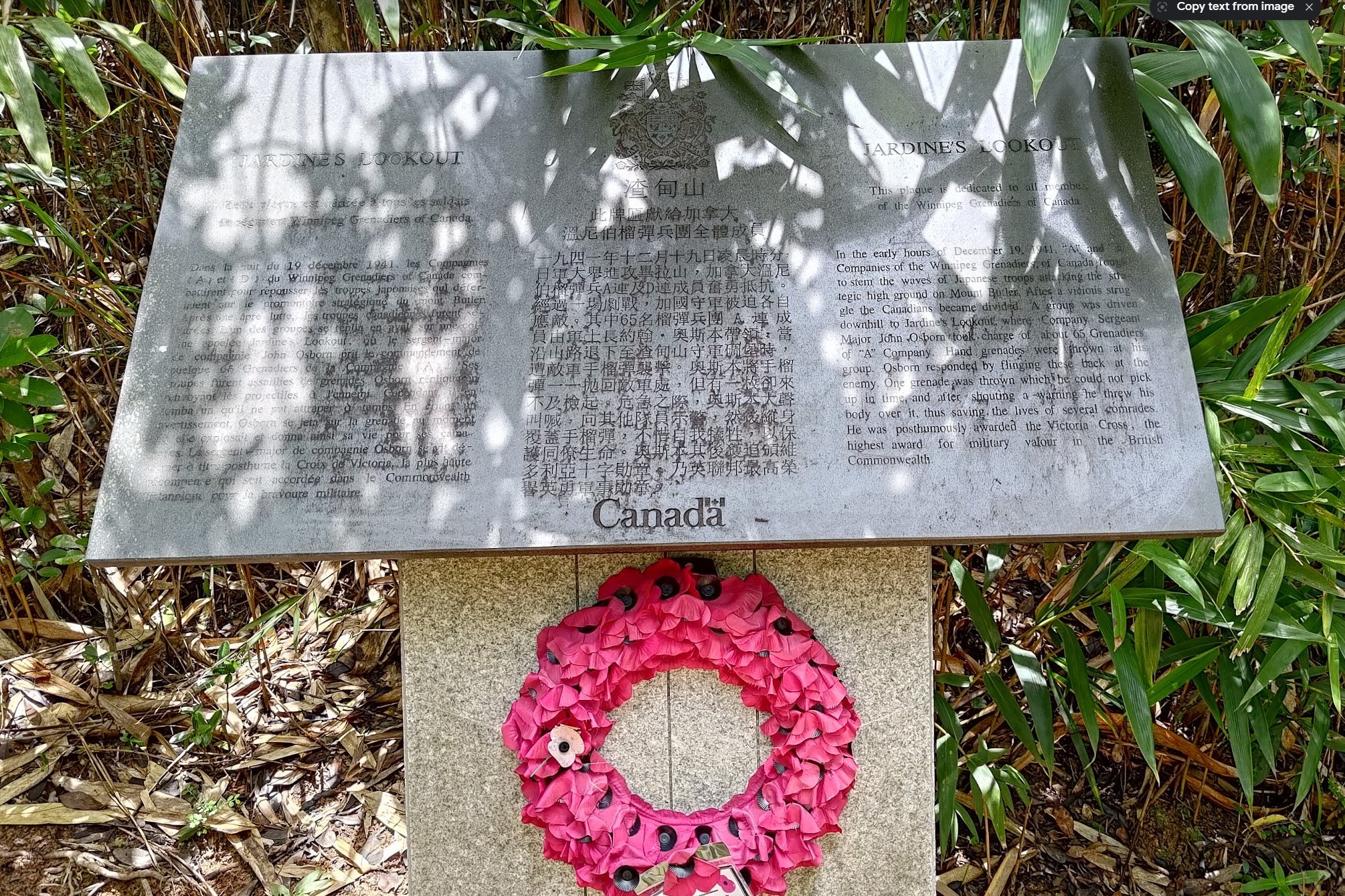
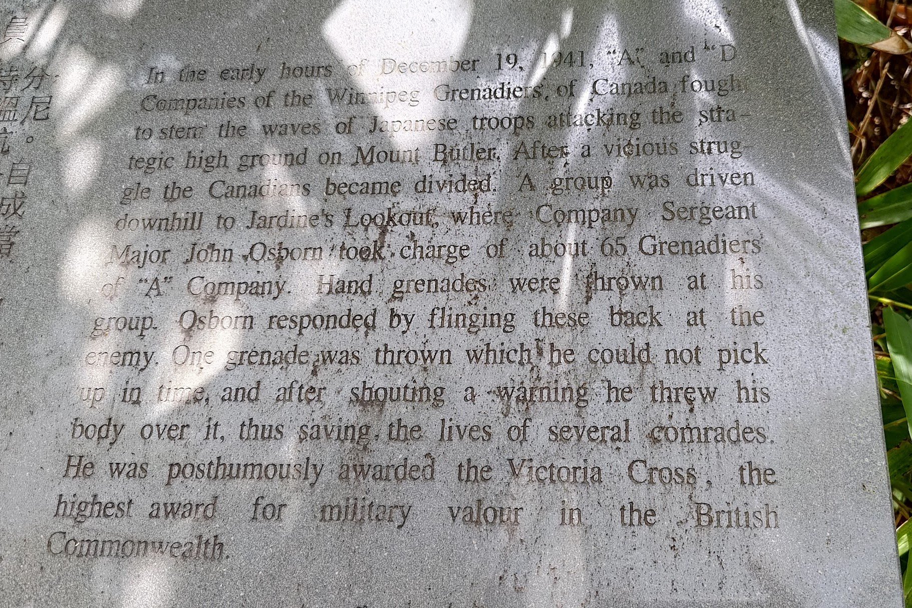
Barely five minutes into climbing Jardine's Lookout, you'll come across the Osborn Memorial.
This important historical epitaph describes the heroics of the Winnipeg Grenadiers and Company Sargent Major John Osborn in protecting Hong Kong from invading Japanese troops in 1941.
As the Japanese began to storm the strategic high ground on mount Butler, two groups of the Winnipeg Grenadiers ('A' Company and 'B' Company) were separated in the fighting.
Company Sargent Major John Osborn took charge of about 65 men of 'A' Company who had been driven down to Jardine's Lookout.
Amidst intense fighting, Osborn was seen hurling back Japanese grenades that had been thrown at his men.
He bravely sacrificed his life to protect his team by covering one of the grenades, which he could not pick up in time, with his own body.
Company Sargent Major John Osborn was posthumously awarded the Victoria Cross, the highest award for military valor offered by the British Commonwealth.
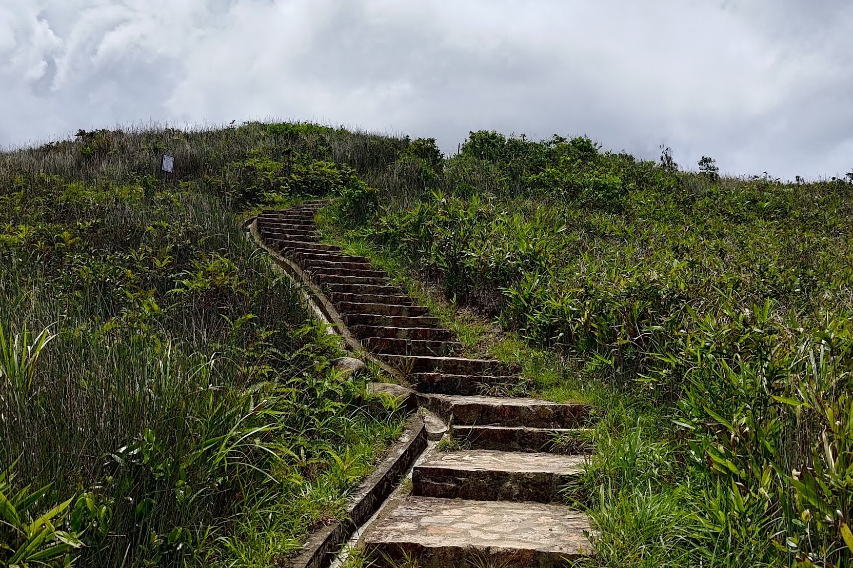
The Climb to the Top of Jardine's Lookout
The climb to the top of Jardine's Lookout takes about 20 minutes with no breaks and a steady pace.
It's quite steep in parts and it's essentially a long staircase up the mountain. Take your time and stop for a breather whenever you feel tired - especially if you do this hike in Hong Kong's unforgiving summer heat!
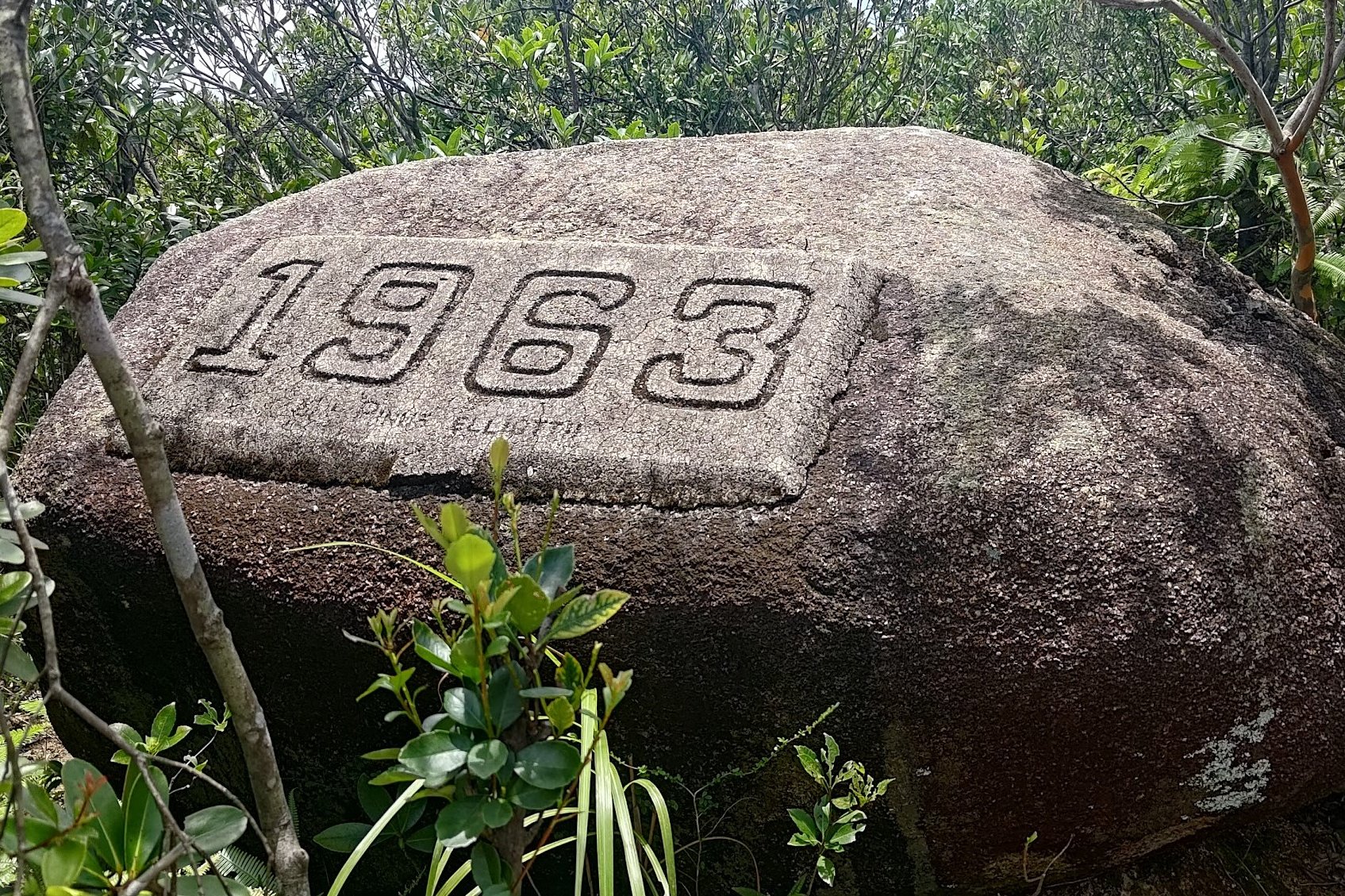
On your way up, you'll pass by a stone with 1963 engraved on it, which is definitely new since I've not seen that engraving before 2023 (or maybe I'm just unobservant).
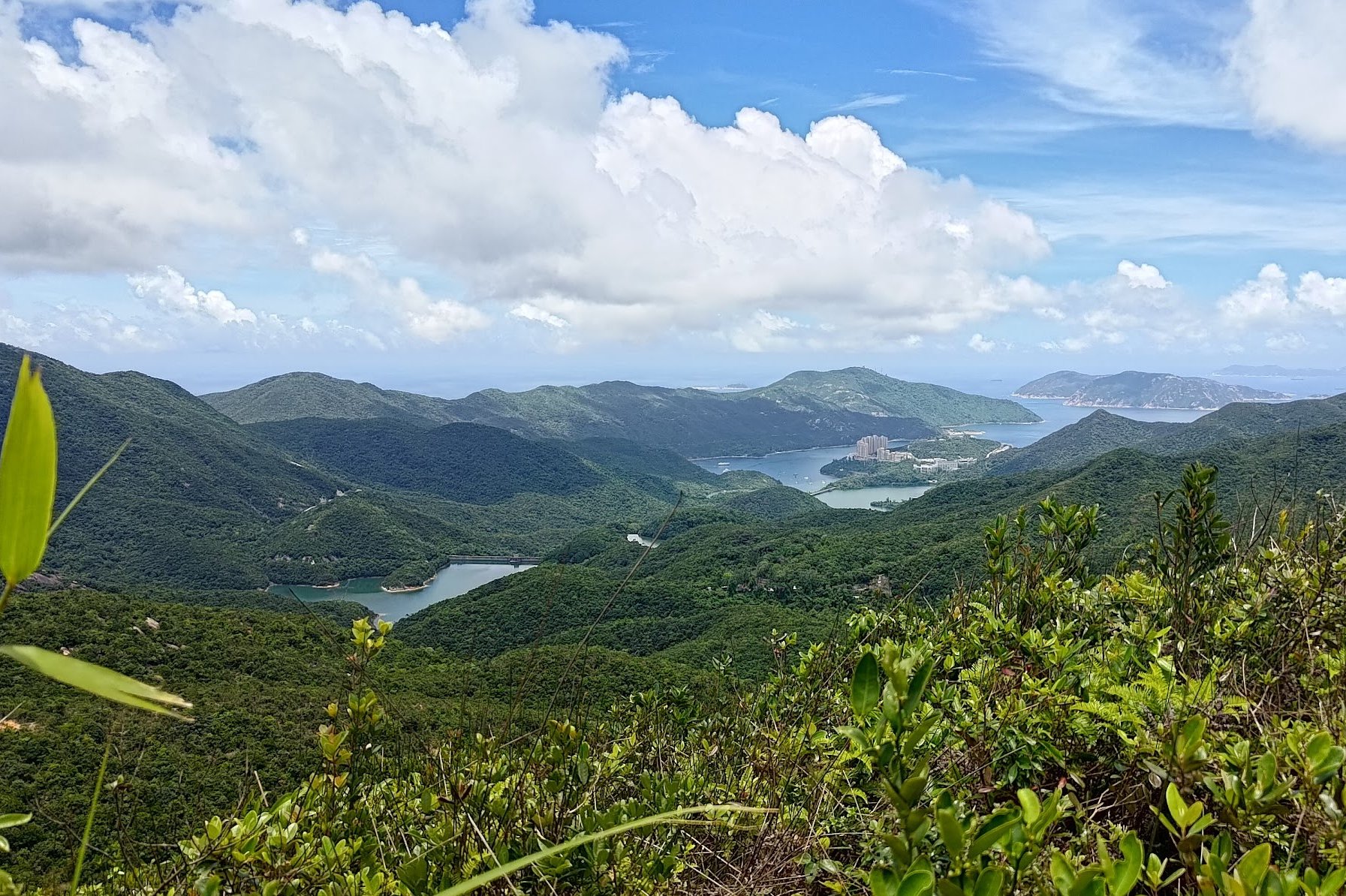
Also distracting you from the cardio of the climb are epic views of Tai Tam to the right and stunning mountains behind you.
Don't Miss Jardine's Lookout

I've seen people so worn out from the climb up Jardine's Lookout that they don't realize there's an incredible view just left of the main path.
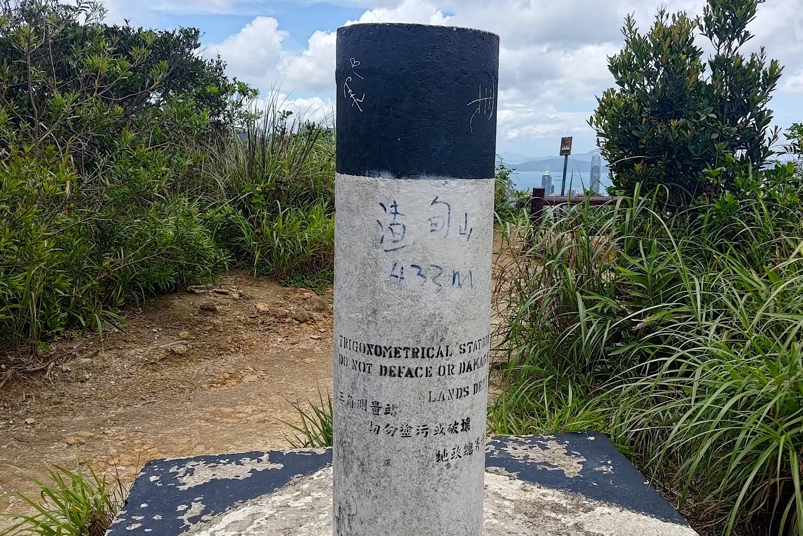
When you see the brown sign pointing you forward to 'Mount Butler' walk behind it, past the trigonometrical point and take some time to savor the views.
This viewpoint was also where William Jardine would have a watcher who kept an eye out for ships sailing into Hong Kong from India and England. Once a ship was sighted, news would be relayed and a smaller ship would be sent out to the arriving ship to collect Jardine's mails.
This would help him gain intel about global affairs and run his various business interests - including the trade of opium.
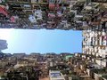
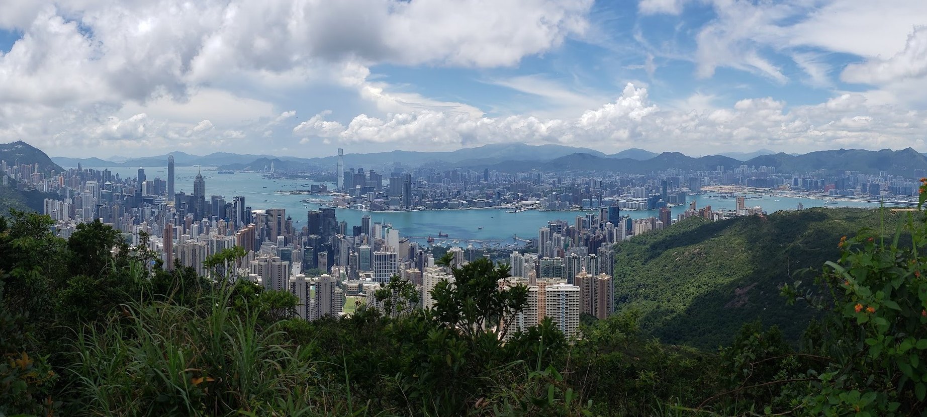
Jardine's Lookout Views

Descending Jardine's Lookout
Once you've had your fill of the incredible views at Jardine's Lookout, follow the brown sign pointing to 'Mount Butler'.
You'll begin to descend a long staircase with views of Tai Tam to your right and more city views to your left.
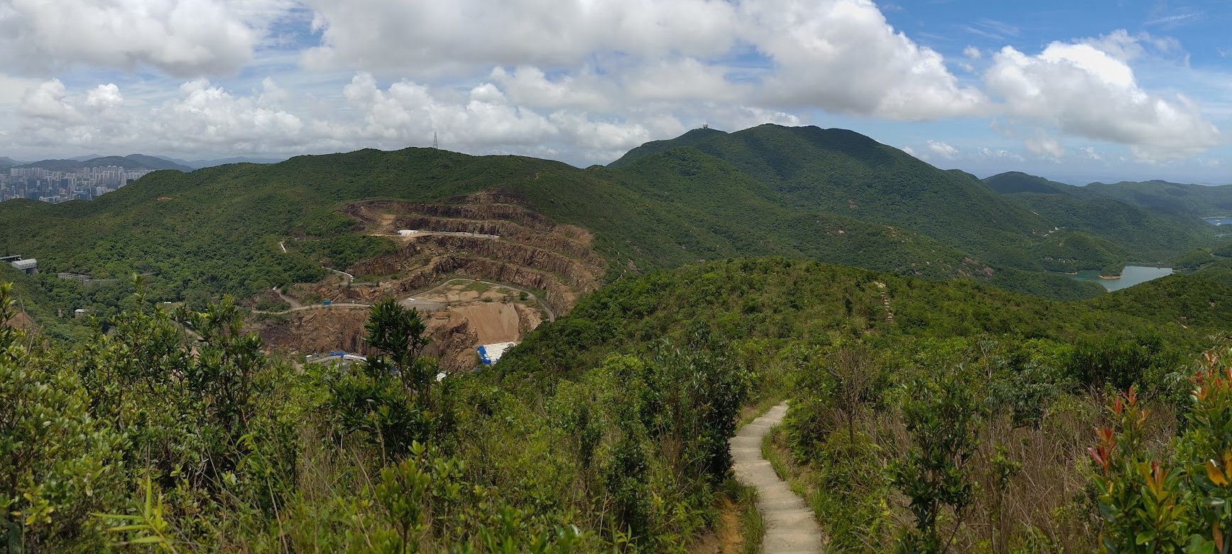
In front of you, you'll see what looks like a massive crater in the mountain. We'll get to what that is soon enough.
Arriving at the Explosives Ordinance Disposal Unit
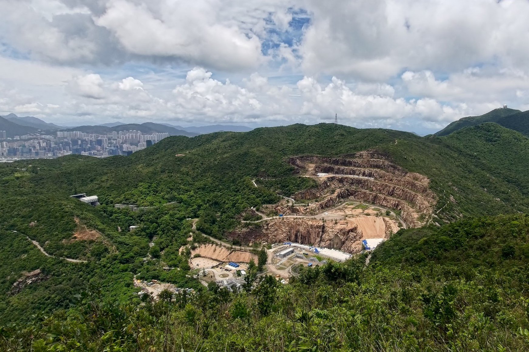

At the bottom of the stairs, you'll arrive at the massive crater, which is the home of Hong Kong's Explosive Ordinance Disposal Unit (EOD). This branch of the Hong Kong Police Force tests and disarms explosive devices!
Don't be alarmed, the crater was actually a quarry in the past. There wasn't some catastrophic bomb incident that caused it...that we know of.
The Next Steep Uphill Begins
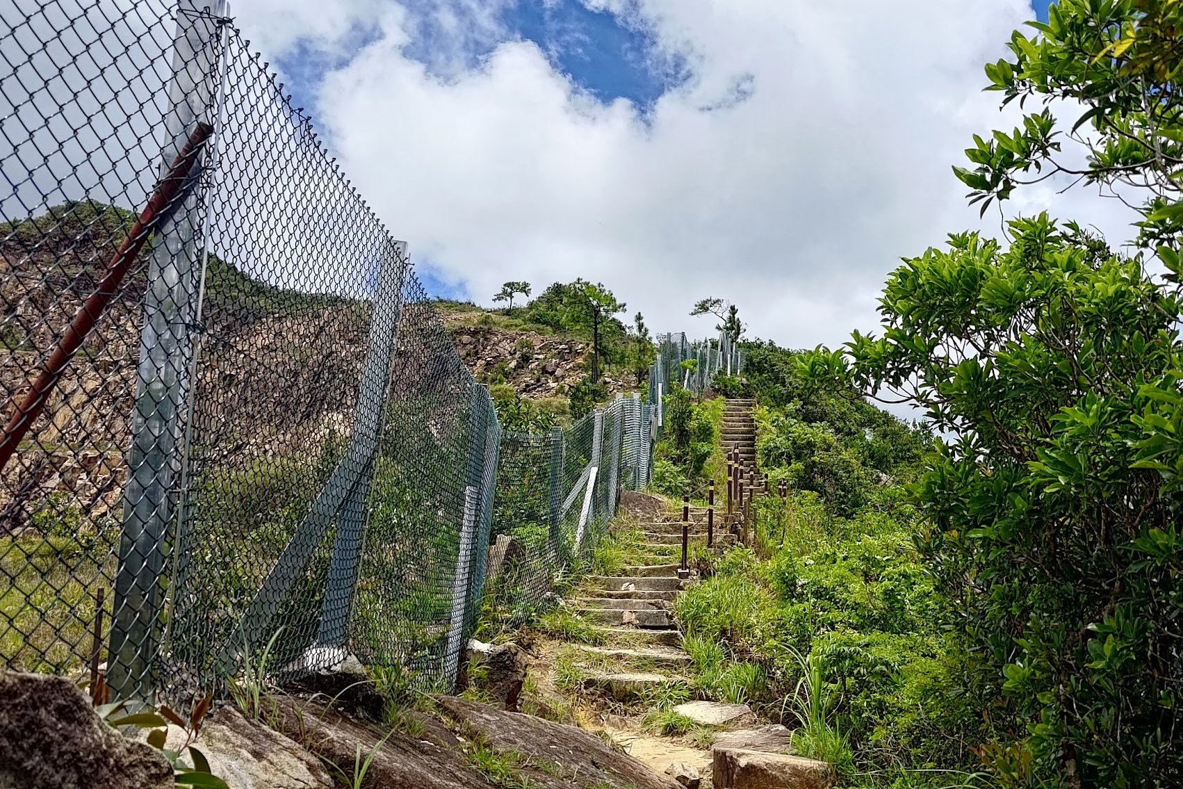
After admiring the strangeness of the EOD, begin climbing the stairs beside it. This is another really steep climb that takes about 10 minutes if you climb with zero breaks and set a decent pace.
Again, don't rush the climb. Go at your own pace and take your time, especially since this portion of climbing is totally exposed to the elements, making it particularly punishing in the summer.
The Creepy Tunnel
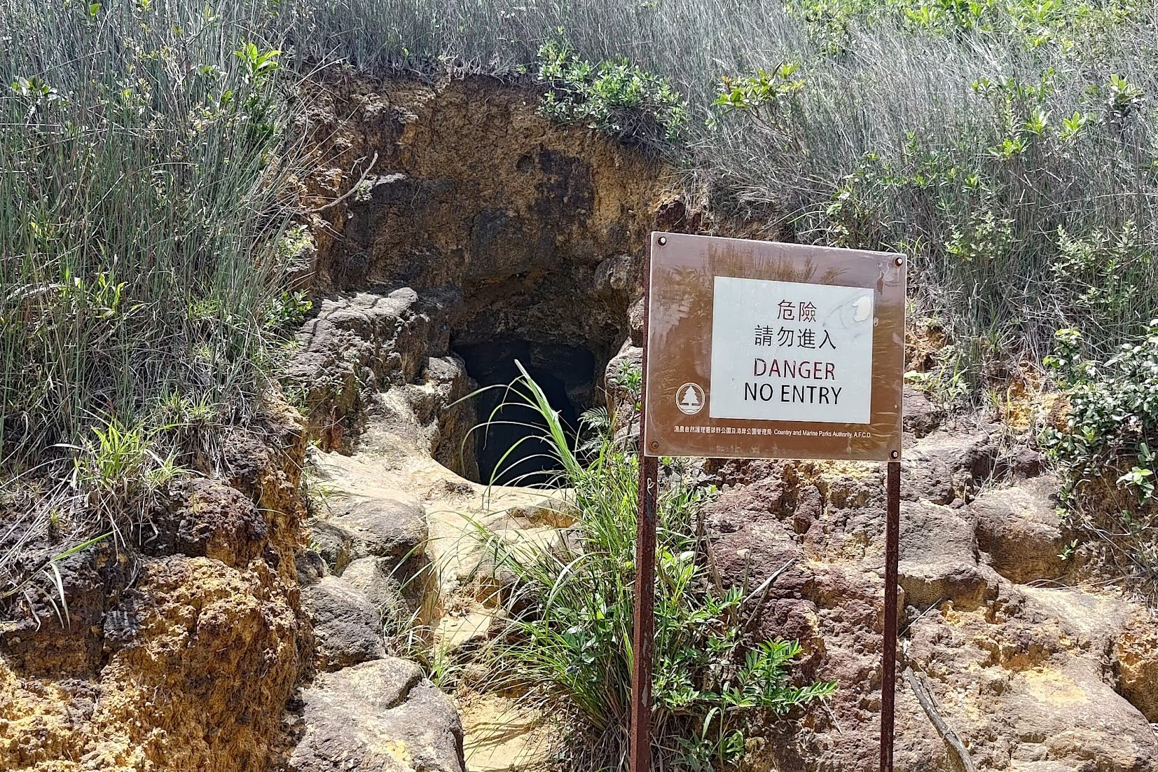
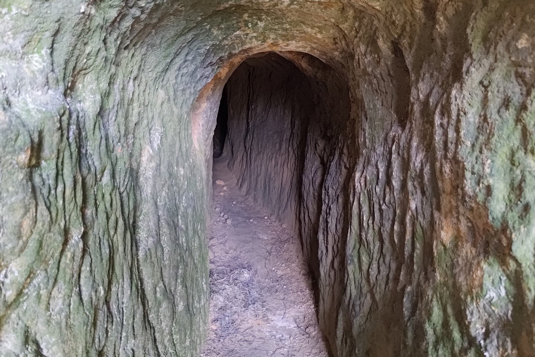
Once you reach the top of the stairs, you'll see a danger sign and the entrance to a tunnel to your left. I took shelter in the cool shade of the tunnel for a few minutes to escape the brutal sun.
Eventually, curiosity got the better of me and I found that the tunnel actually seemed to go pretty deep into the mountain. There were also two different paths to take near the entrance.
I've seen enough horror films to know that this was a bad idea, especially since the tunnels quickly plunge you into pitch-black darkness. I quickly made my way back and reemerged into the sunshine.
I do not recommend exploring these tunnels.
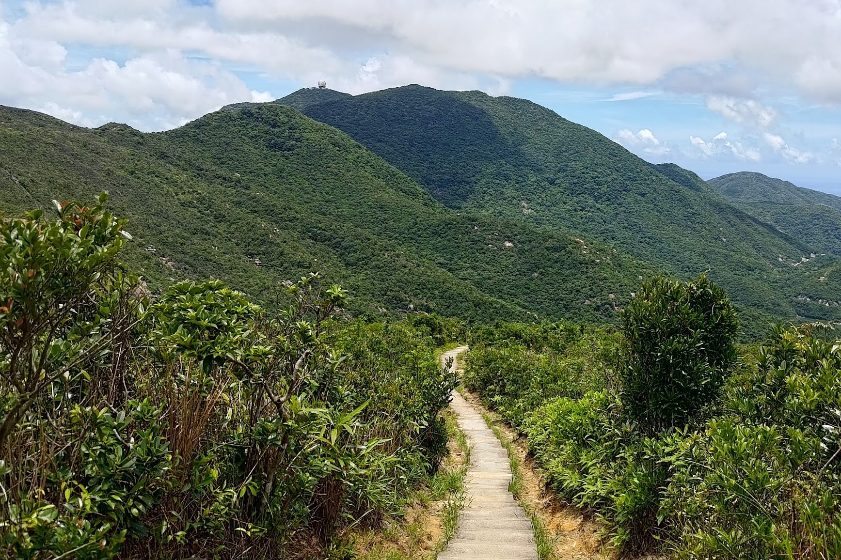
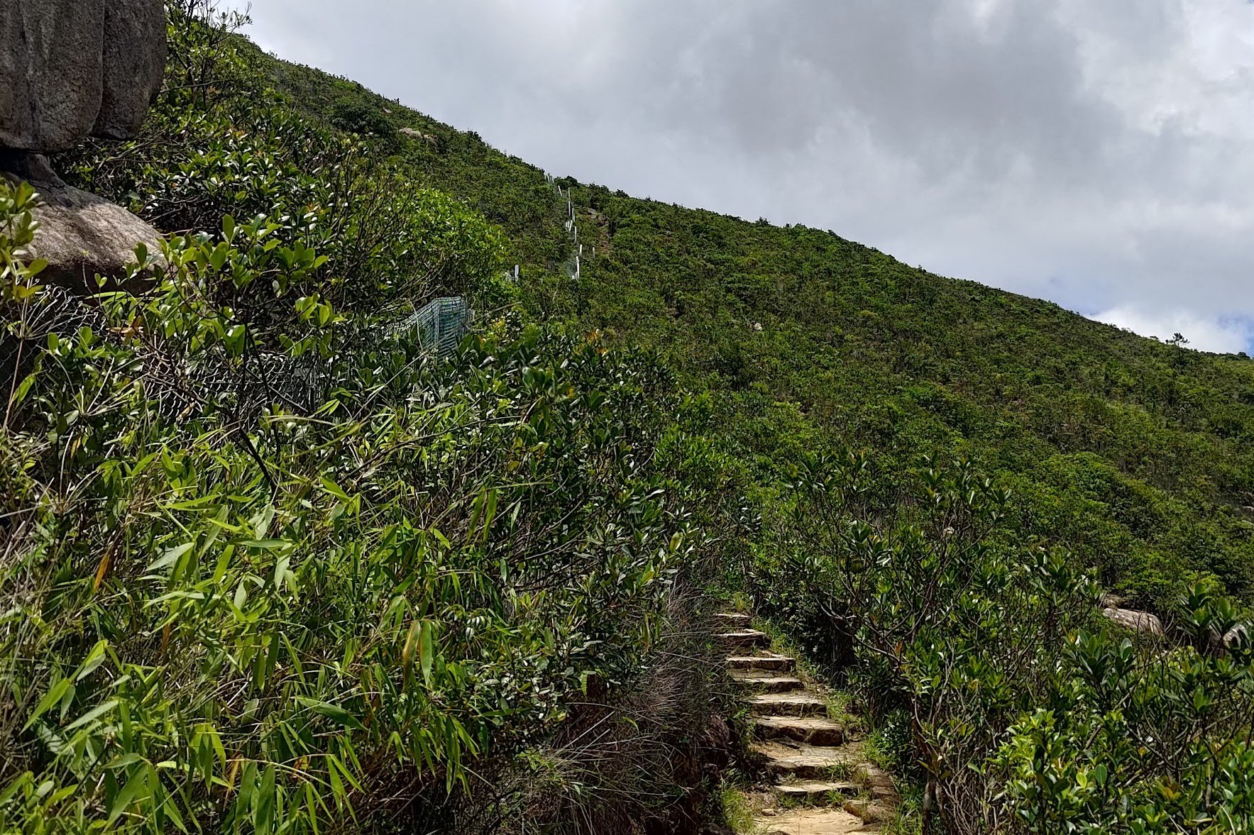
The Path to Siu Ma Shan
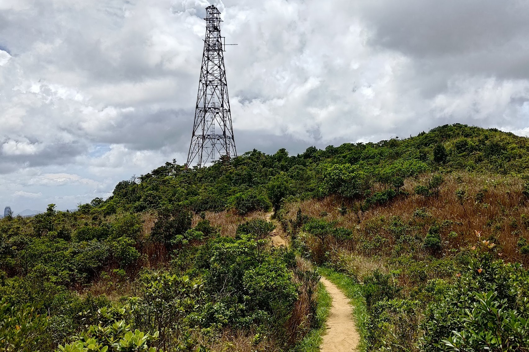
After the cave, follow the rocky path forward until you see a signpost. Make sure to follow the sign pointing to 'Siu Ma Shan' on the left.
You'll start climbing up another steep staircase, though this one is much shorter than all the previous climbs of the hike.
Once you reach the top of Siu Ma Shan (near the tower), you'll be in for a real treat!
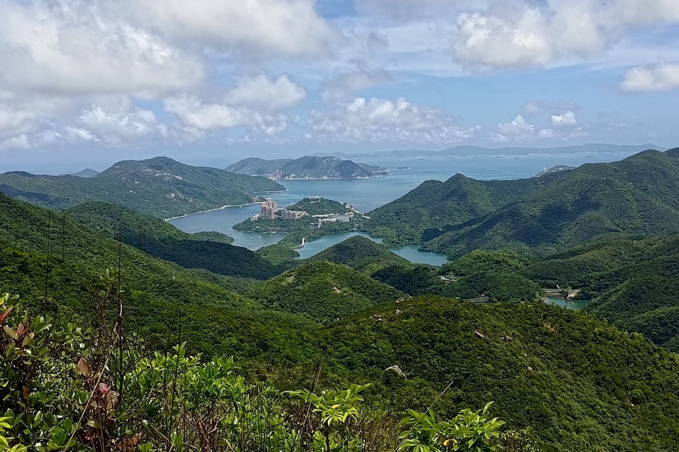
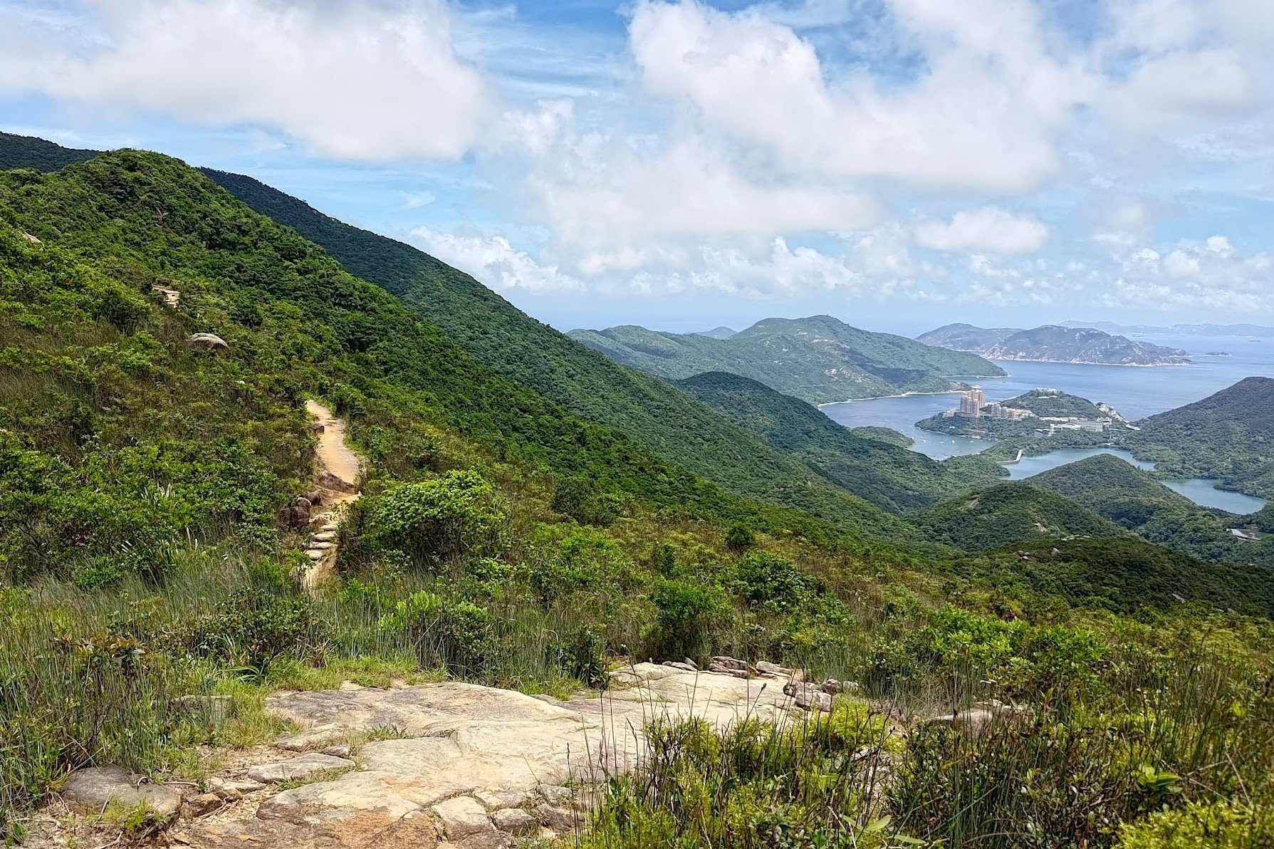
Siu Ma Shan Views
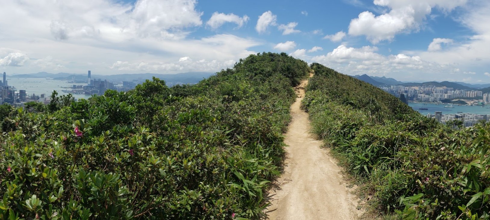
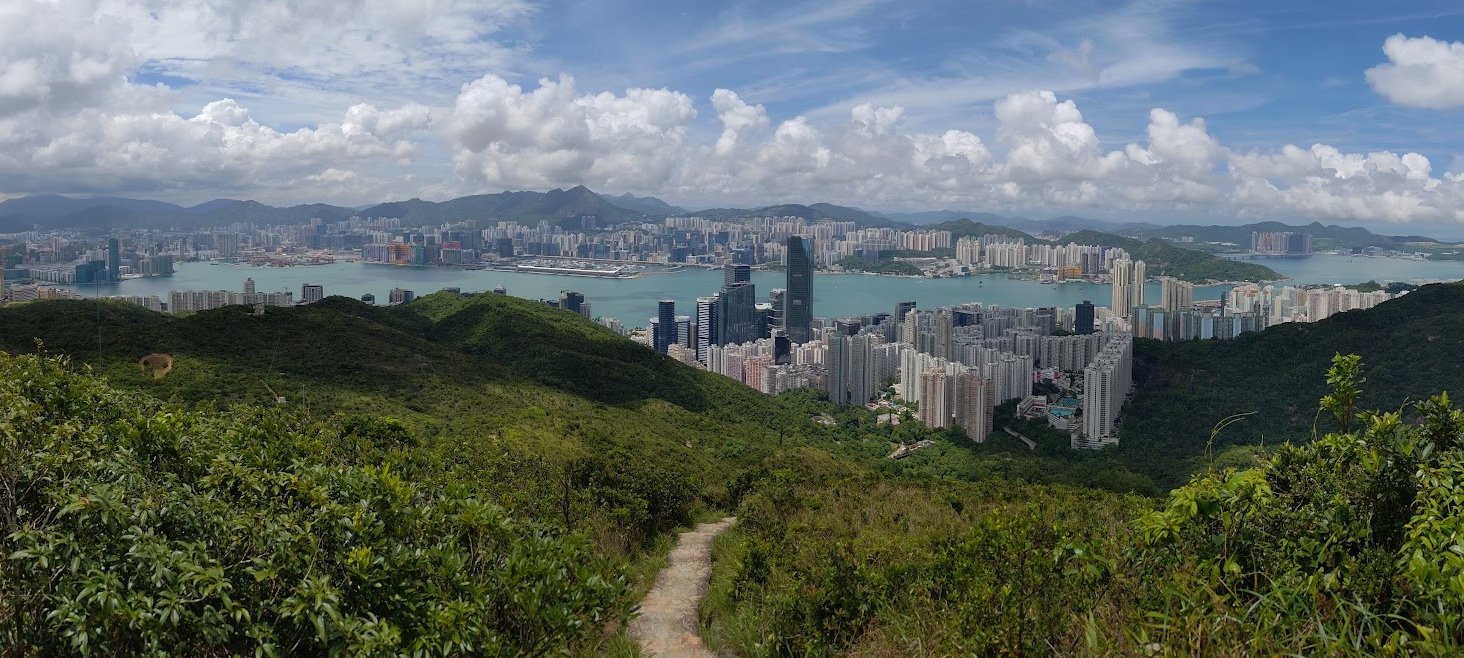
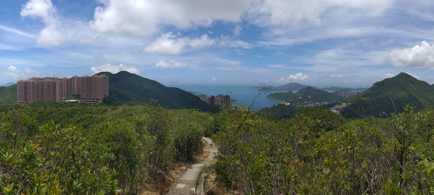
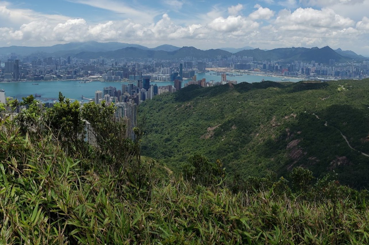
At the top of Siu Ma Shan and during the beginning of your descent, you'll be treated to a pretty unique view of Hong Kong Island, Kowloon and even a little sliver of the New Territories in Clear Water Bay.
The Confusing Descent to Mount Parker Road

I've tried to condense this confusing section into 5 easy steps.
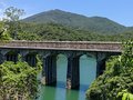
- After 15 minutes of descending, you'll come across a stone plaque that says 'Siu Ma Shan Bridge'.
- Walk past it and then follow the 'Sir Cecil's Ride' sign pointing to the right.
- After another 10 minutes of descending, the stone steps finally come to an end. At this point, turn left by following the 'Braemar Hill' sign.
- Stay on the flat dirt path for 10 minutes until you see the next set of signs. Follow the one pointing to 'Sir Cecil's Ride'.
- Less than 5 minutes later, you'll see a set of stairs to the right and a sign pointing to 'Mount Parker Road'. Follow the stairs down and heed the next 'Mount Parker Road' sign, too.
Mount Parker Road to Quarry Bay

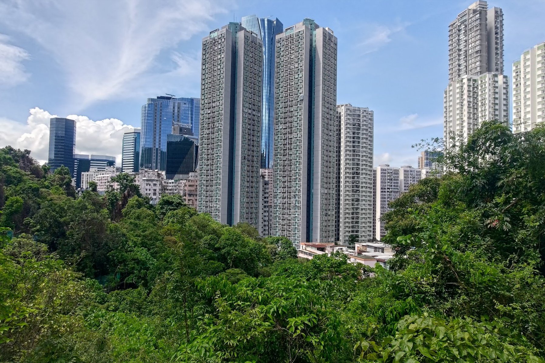
Once you arrive at Mount Parker Road, follow it as it slopes gently downward. You'll begin to see the buildings looming larger around you until you finally arrive back in the city.
Getting Back
From where Mount Parker Road ends, you can turn right and walk for about 5-10 minutes to Tai Koo MTR station, or turn left and walk a shorter distance to Quarry Bay MTR station.
There are also loads of buses at the bus stop right where Mount Parker Road ends.
Alternatively, you can take a tram to any district from Kennedy Town to Chai Wan. It's a great way to unwind after a hike!