Red Incense Burner Hill Hike: Unforgettable Views in 15 Mins
Contents
- Essential Information
- Red Burner Incense Hill Highlights
- Google Route Map
- How to Get There
- Quick Route Summary
- Detailed Route
- The Flat Trail
- Don't Miss this Right Turn!
- The First Summit
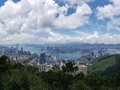
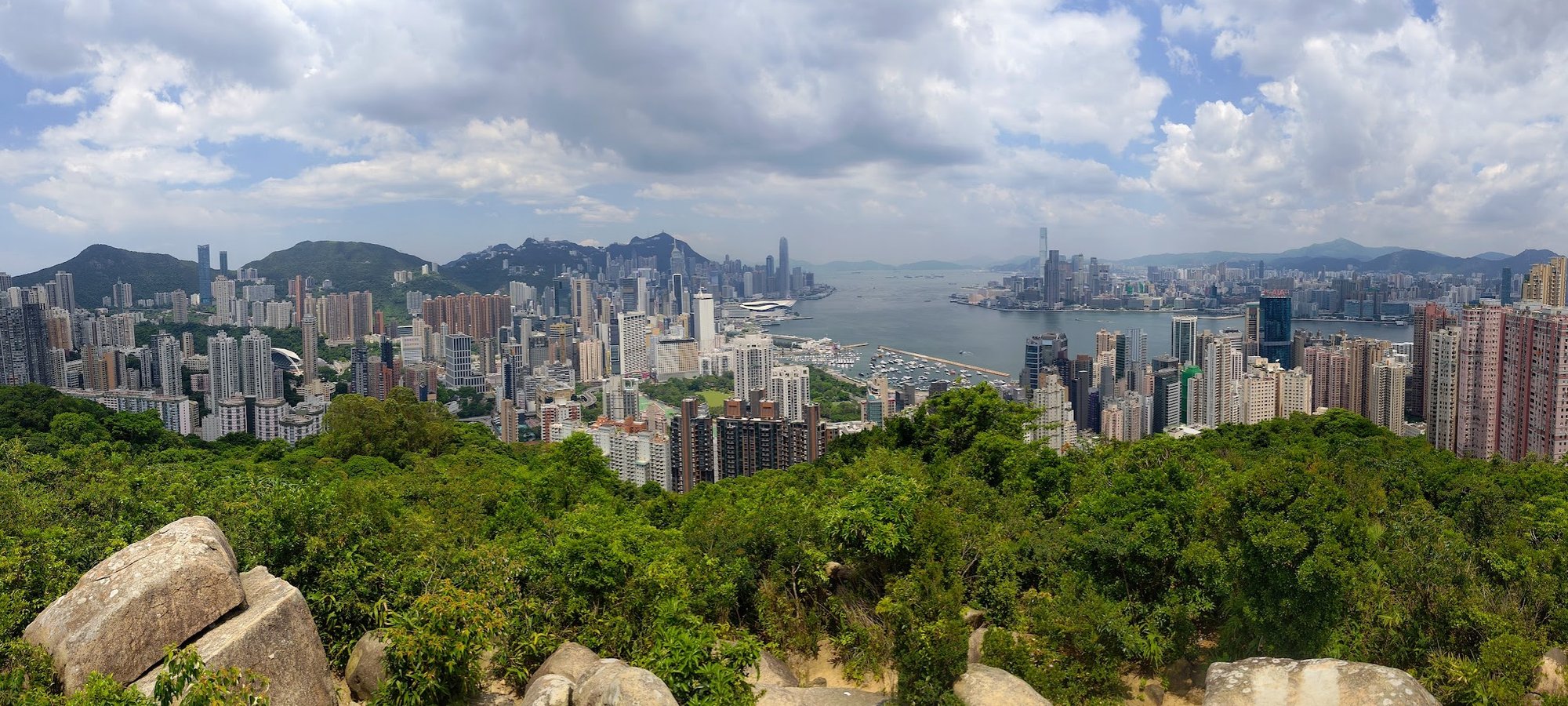
- Views From the First Summit
- Getting to the Main Summit
- Views From Red Incense Burner Hill Summit
- Getting Back
Essential Red Incense Burner Hill Hike Details
- District: Hong Kong Island
- Duration: 30 minutes round trip (with no breaks)
- Distance: 1.5ish km depending on the start point
- Highest Elevation: 230 meters
- Difficulty: 0.5/5
- Facilities: None. Stock up on water and use the toilet beforehand
Why Hike Red Burner Incense Hill?
If you've got an afternoon free and are planning a trip up to Victoria Peak for the umpteenth time, pause your plans and consider the Red Incense Burner Hill hike instead!
It's relatively simple to get to and only requires fifteen minutes of hiking from the start point to reach the summit.
The toughest terrain you'll encounter is clambering up some boulders to the summit. As long as you take your time and mind your footing, you'll be fine.
How're the views? Well, I'd say they're comparable, if not better than the ones you get at Victoria Peak. Best of all, there are far fewer visitors vying for the best viewpoints - unless you go on a weekend for sunset views. That's when the summit will be full of instantgrammers.
If you attempt this hike at daytime on a weekday, though, you're almost guaranteed to have one of Hong Kong's most epic viewpoints all to yourself.
Oh Joy!
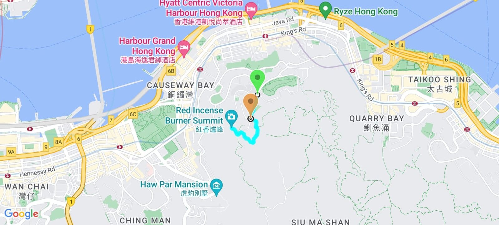
Google Route Map
How to Get to the Red Incense Burner Hill Hike Start Point
Take any of the following buses to the Braemar Hill Mansions bus stop and walk up Braemar Hill Road for about 2 minutes to St. Joan of Arc Secondary School.
- 25 (from Central, Admiralty, Wan Chai and Causeway Bay)
- 27 (from North Point and Fortress Hill)
- 81A (from Chai Wan, Shau Kei Wan, Sai Wan Ho, Tai Koo Shing, Quarry Bay and North Point) No service on Sundays and public holidays
- 23B (from Wan Chai, Admiralry, Mid Levels, Central, Causeway Bay and Tai Hang)
- 108 (from To Kwa Wan, Hung Hom, Causeway Bay and Tai Hang)
- 25A (from Wan Chai, Causeway Bay and Tai Hang)
- 85 (from Siu Sai Wan, Chai Wan, Shau Kei Wan, Sai Wan Ho, Tai Koo Shing, Quarry Bay and North Point)
- Green minibus 25 (from Causeway Bay and Tai Hang)
Quick Red Incense Burner Hill Hike Route Summary
- Head into the alley beside St. Joan of Arc Secondary School
- Take the stairs up
- At the fork, stay on the flat path and ignore the stairs to the left
- Follow the brown sign towards 'Jardine's Lookout'
- Walk along the flat trail for 5-6 minutes
- At the crossroads, go right into the trees
- Begin climbing up the path with the tree root stairs
- Follow the boulder path to the first summit
- Take the path below the main summit
- Walk through the trees and climb the boulders to the Red Incense Burner Hill summit
The Secret Alley Beside the School
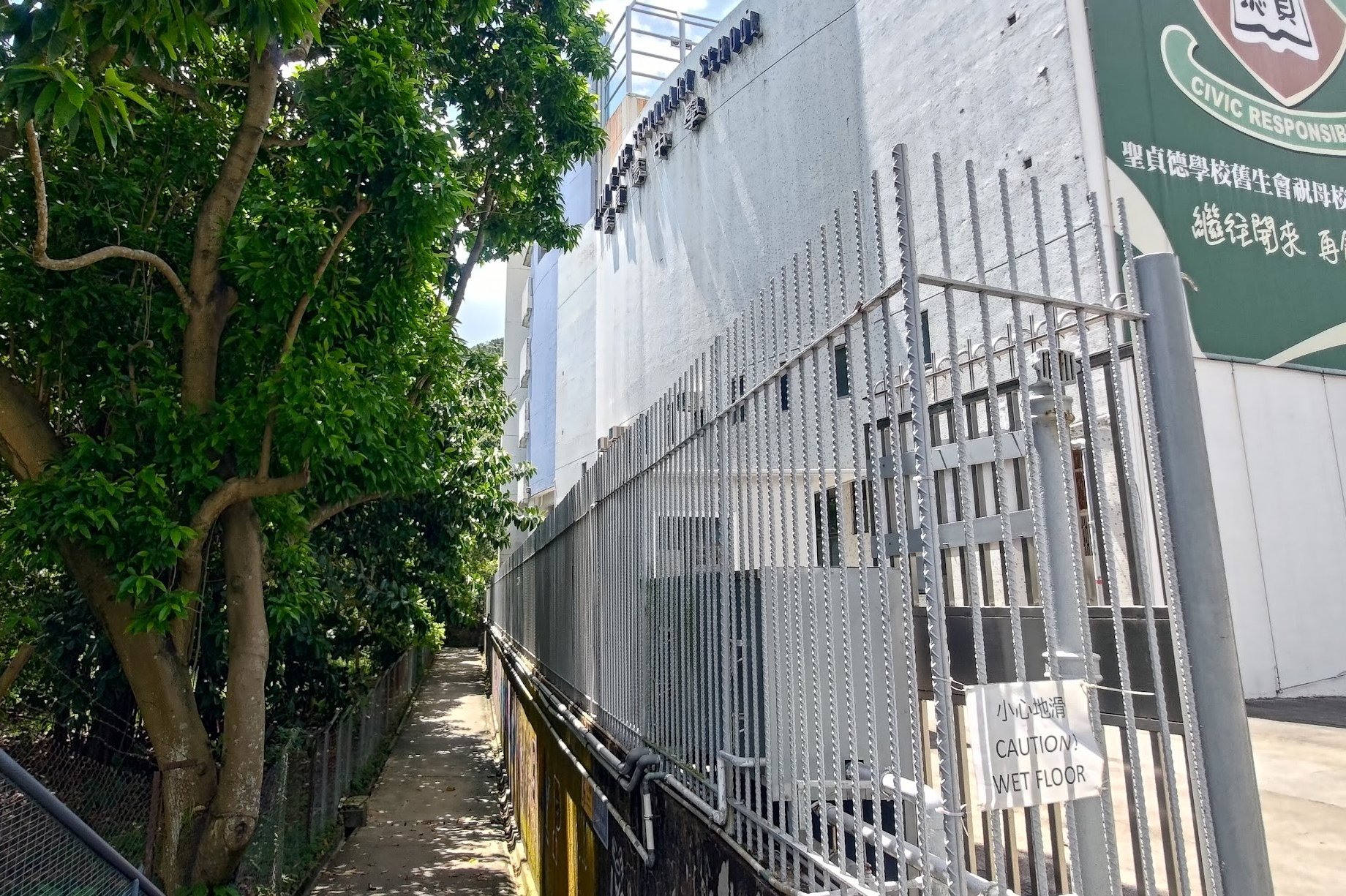
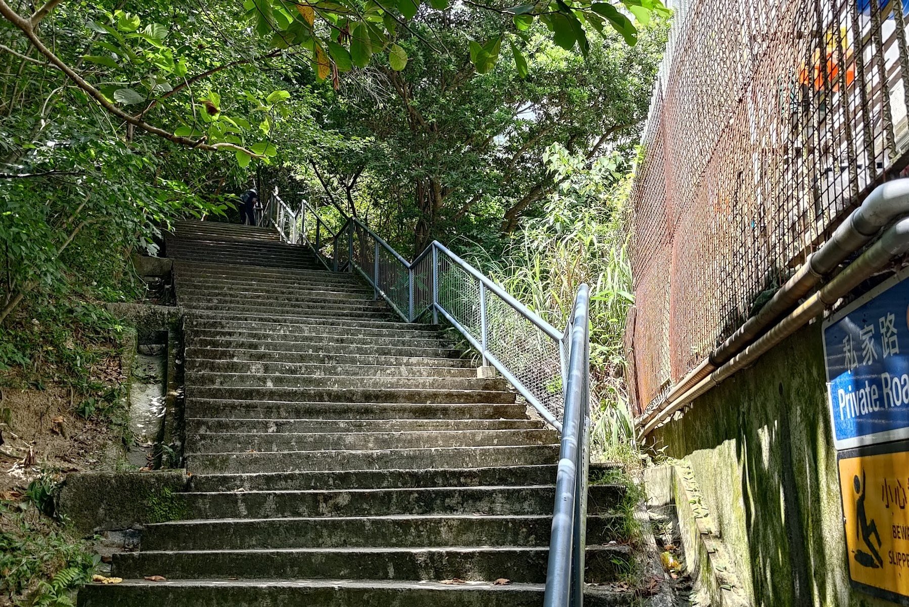
Upon arriving at St. Joan of Arc Secondary School, head down a short staircase and into the graffitied alley right beside it.
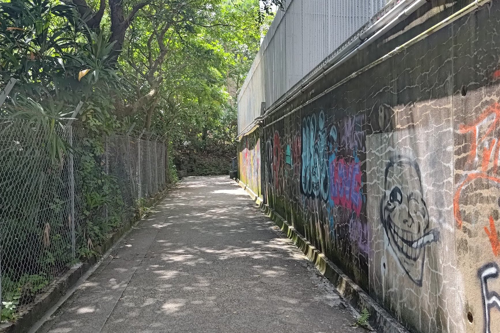
After reaching the end of the alley, you'll see some stairs to your right that you need to climb.
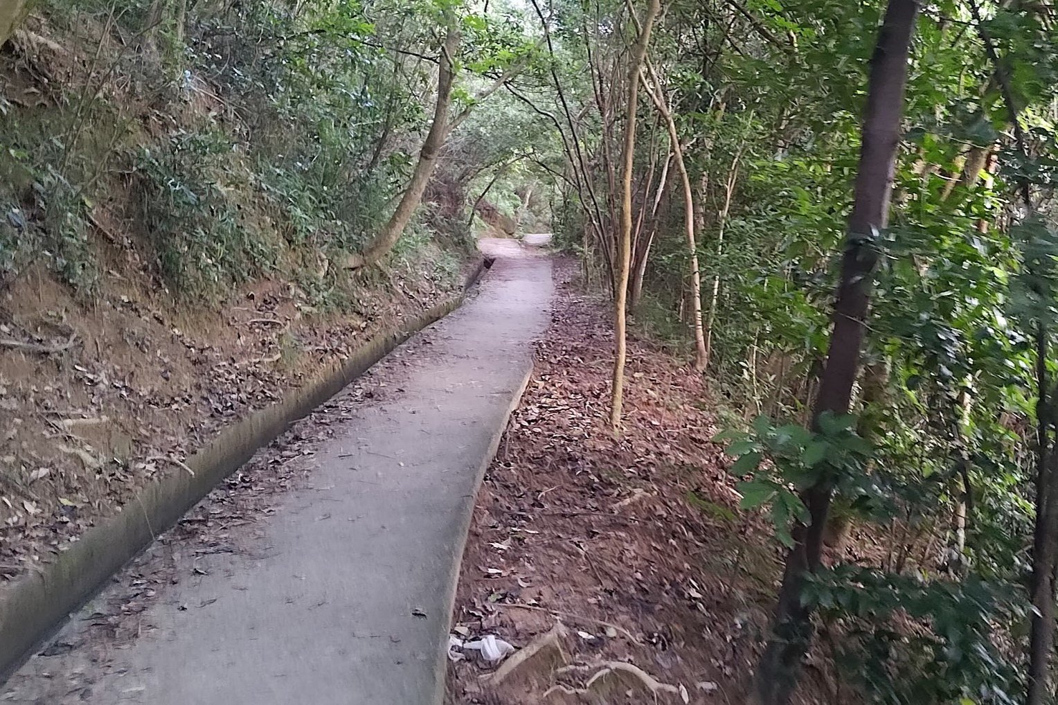
A short while later, the stairs turn into an upward-sloping concrete path.
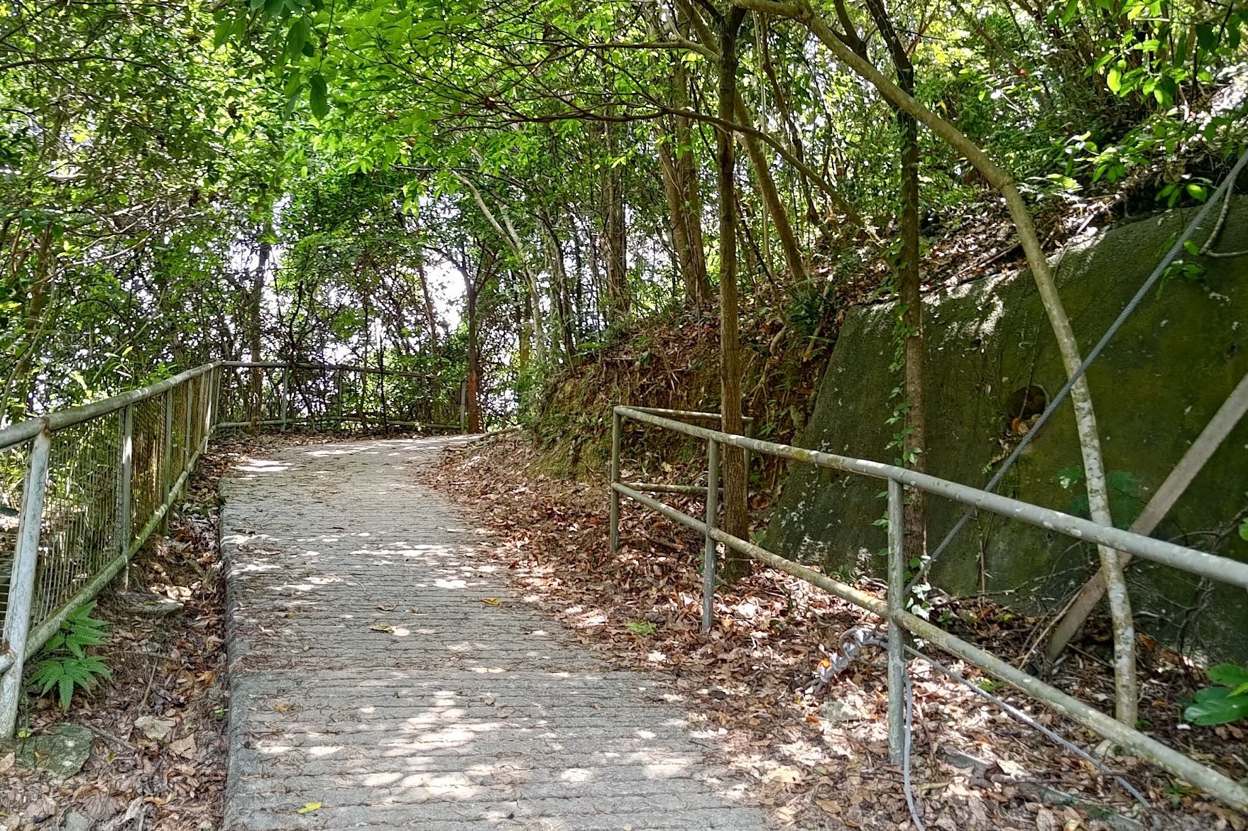
Stay on the Flat Trail and Turn Right at the Fork
Make sure to ignore the stairs on your left as you stay on the concrete path. Before long, the concrete vanishes and is replaced by a natural earth trail.
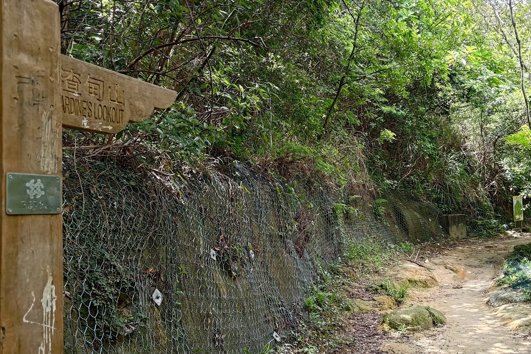
Pretty much exactly where the concrete path turns into a real hiking trail, you'll see a brown sign. Follow it toward 'Jardine's Lookout' to the right.
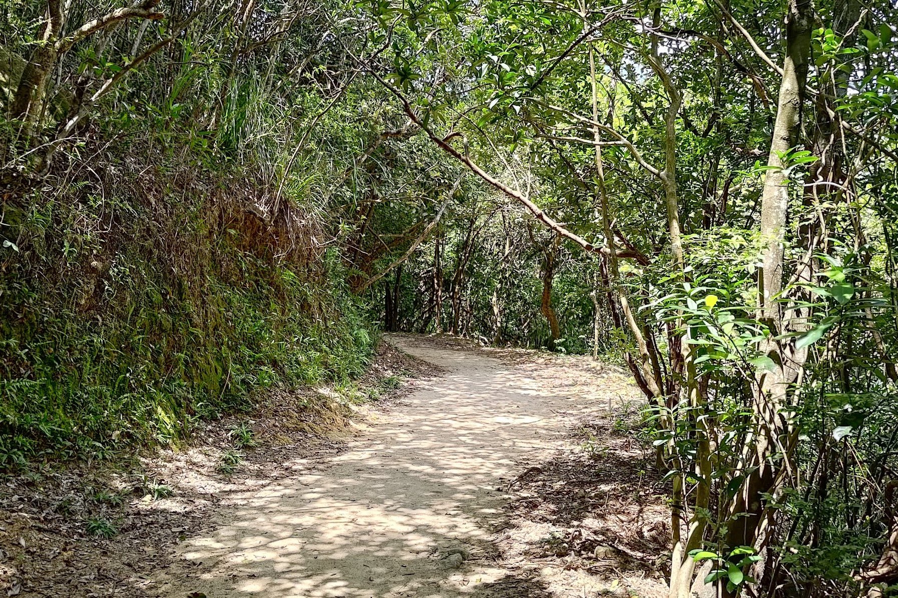
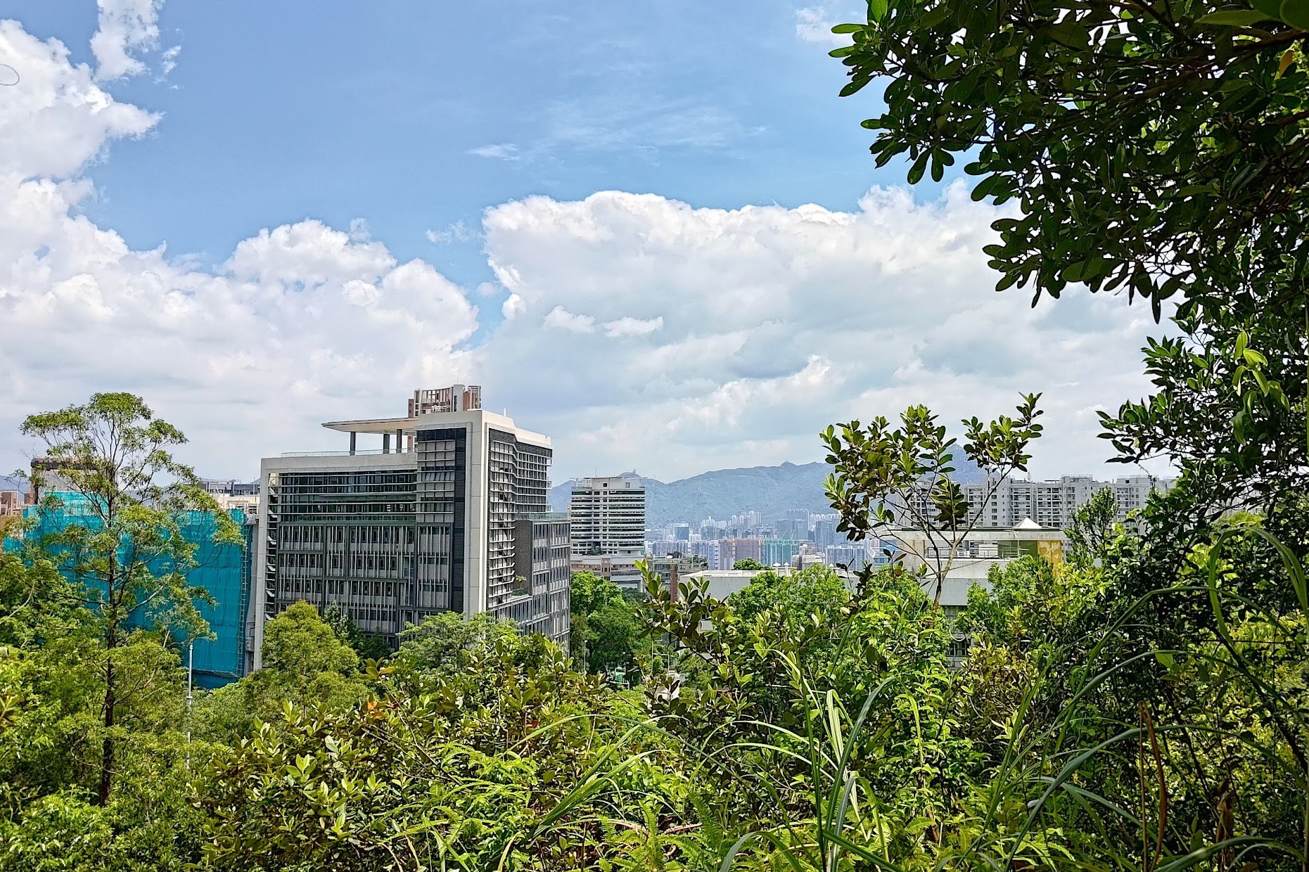
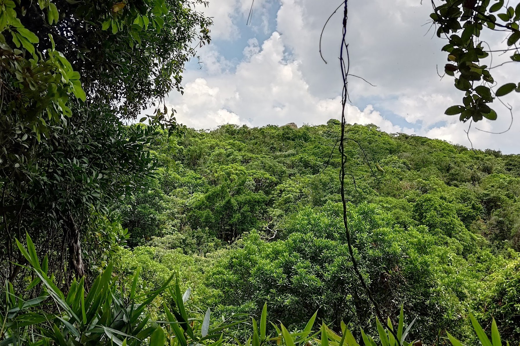
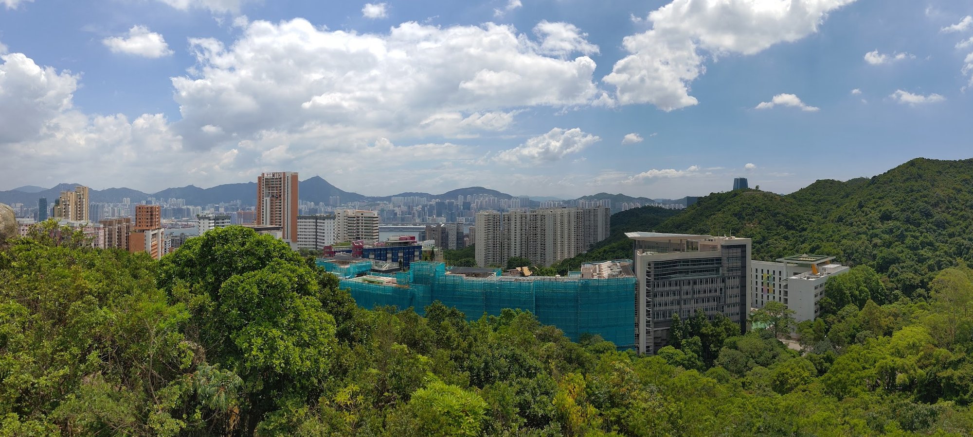
Stay on the flat trail for another 5-6 minutes, taking in your first city views and a view of where the summit of the hike is.
Don't Miss this Right Turn!
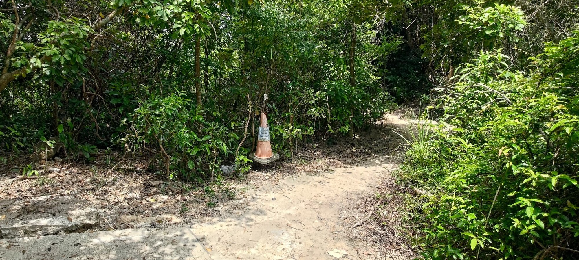
This is where everyone gets lost!
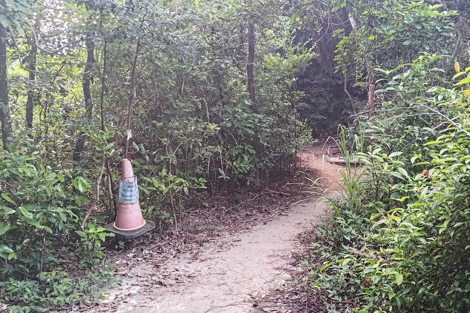
Just after the buildings come into sight on the flat trail, you'll come across a fork in the trail that's really easy to miss.
Look for the orange cone, which is where you should turn right.
If you're doing this hike much later than 2023 and the cone is gone, just make sure to keep your eyes peeled for where you need to turn right.
Climbing to the First Summit
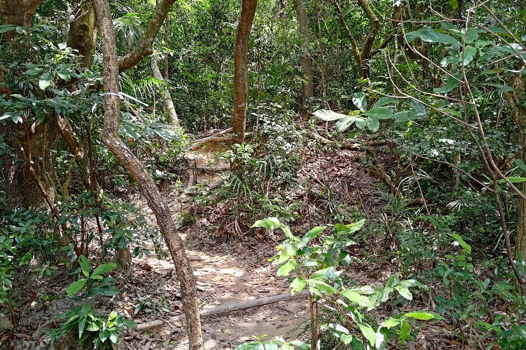
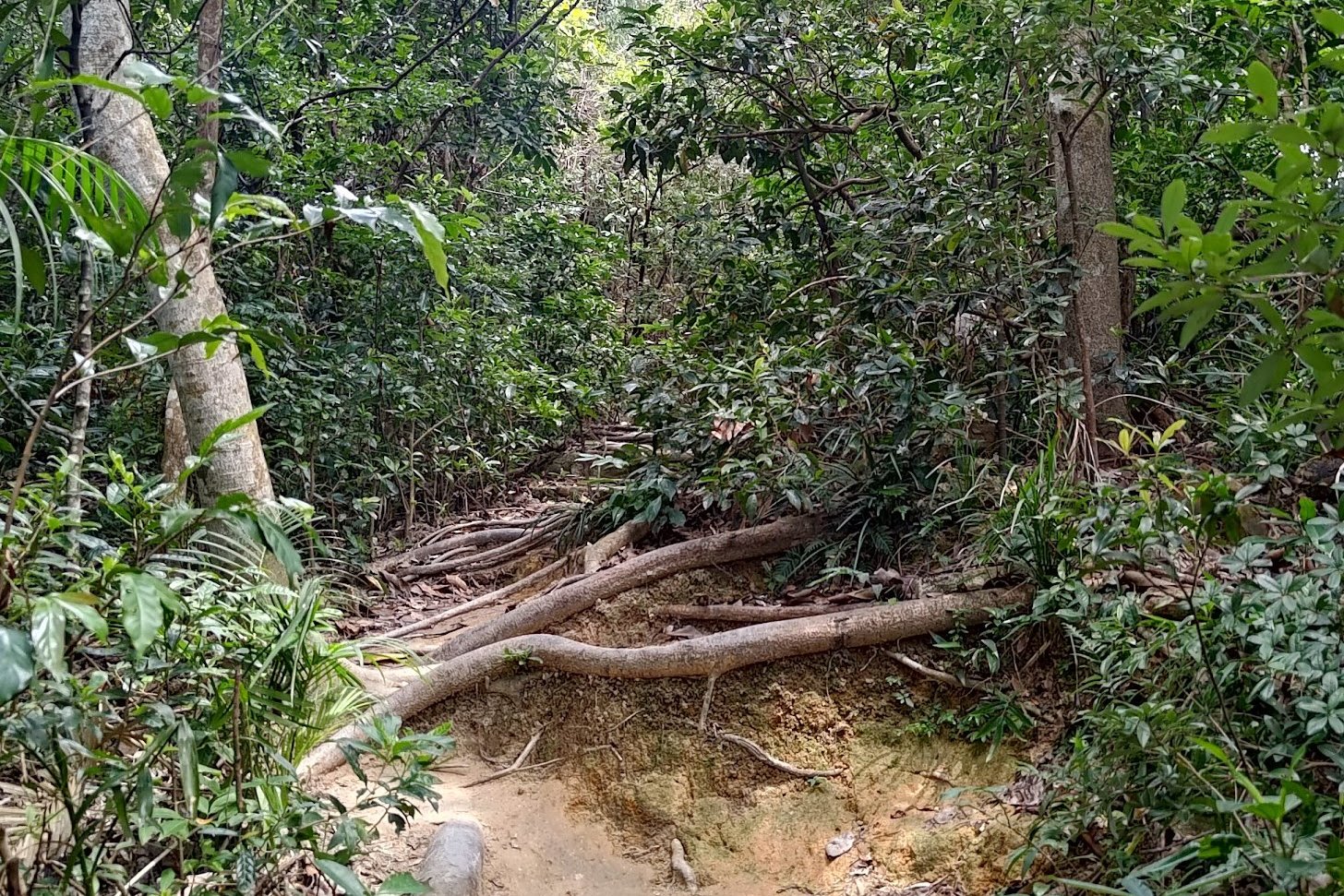
After turning right at the fork, look for the steps that are made of tree roots. They will be behind some trees on the right. Start climbing when you find the tree root steps.
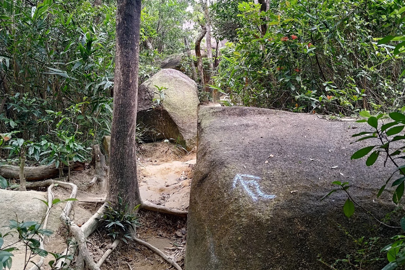
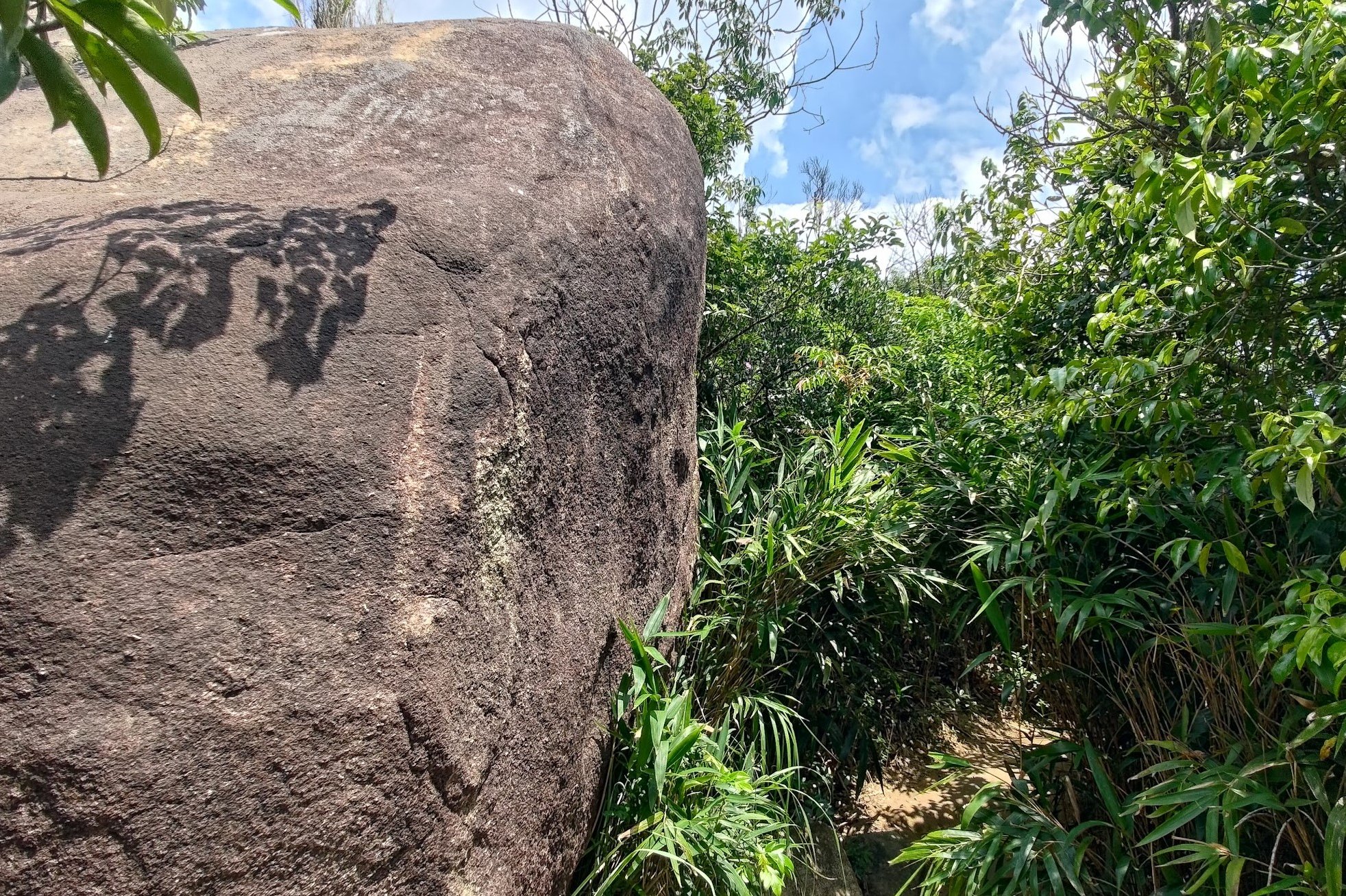
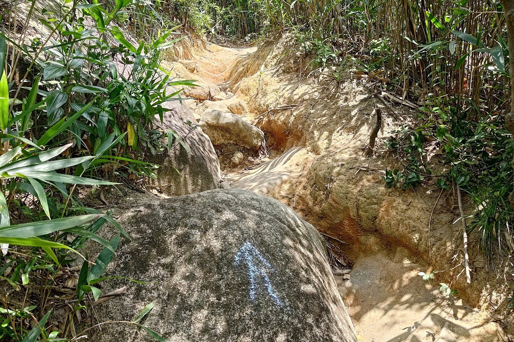
You'll soon encounter a few massive boulders, which is a good sign since some of them are marked with arrows showing you the way.
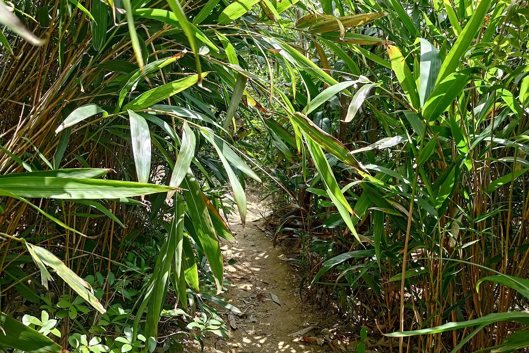
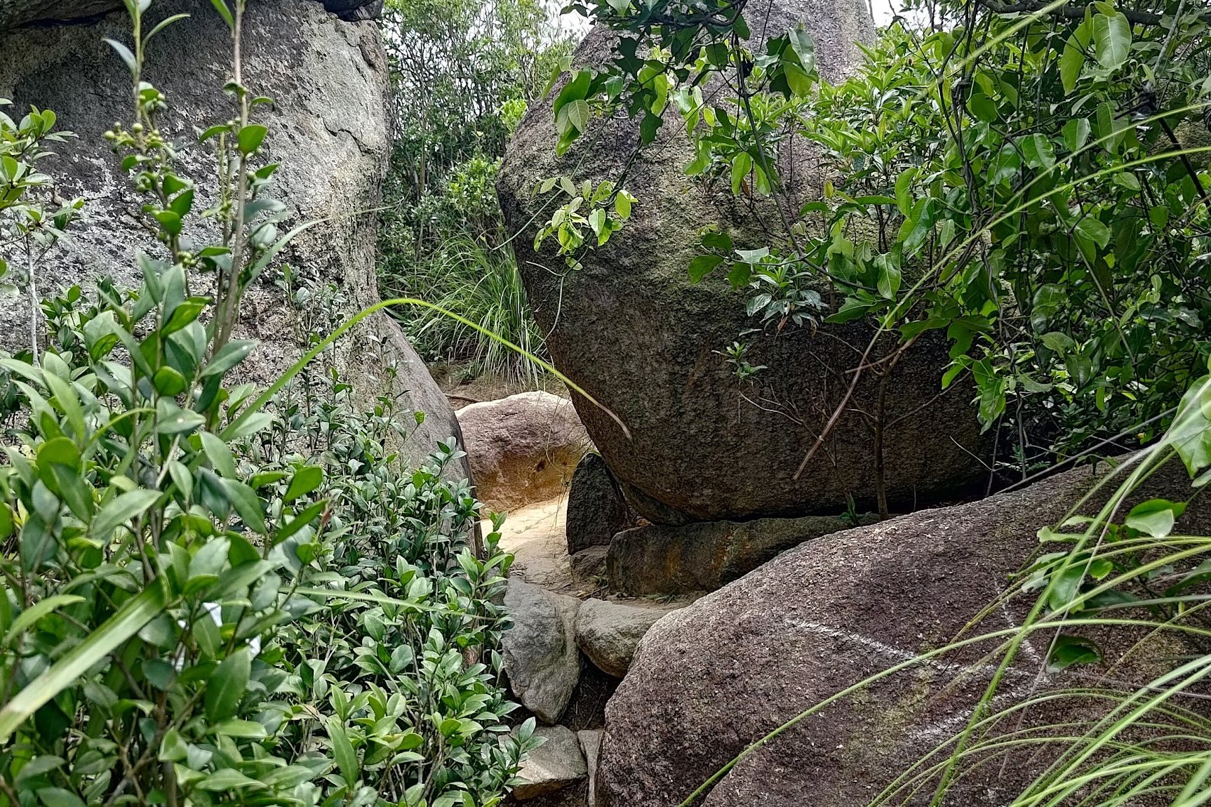
Once you climb past a particularly massive boulder, head into the trees just past it.
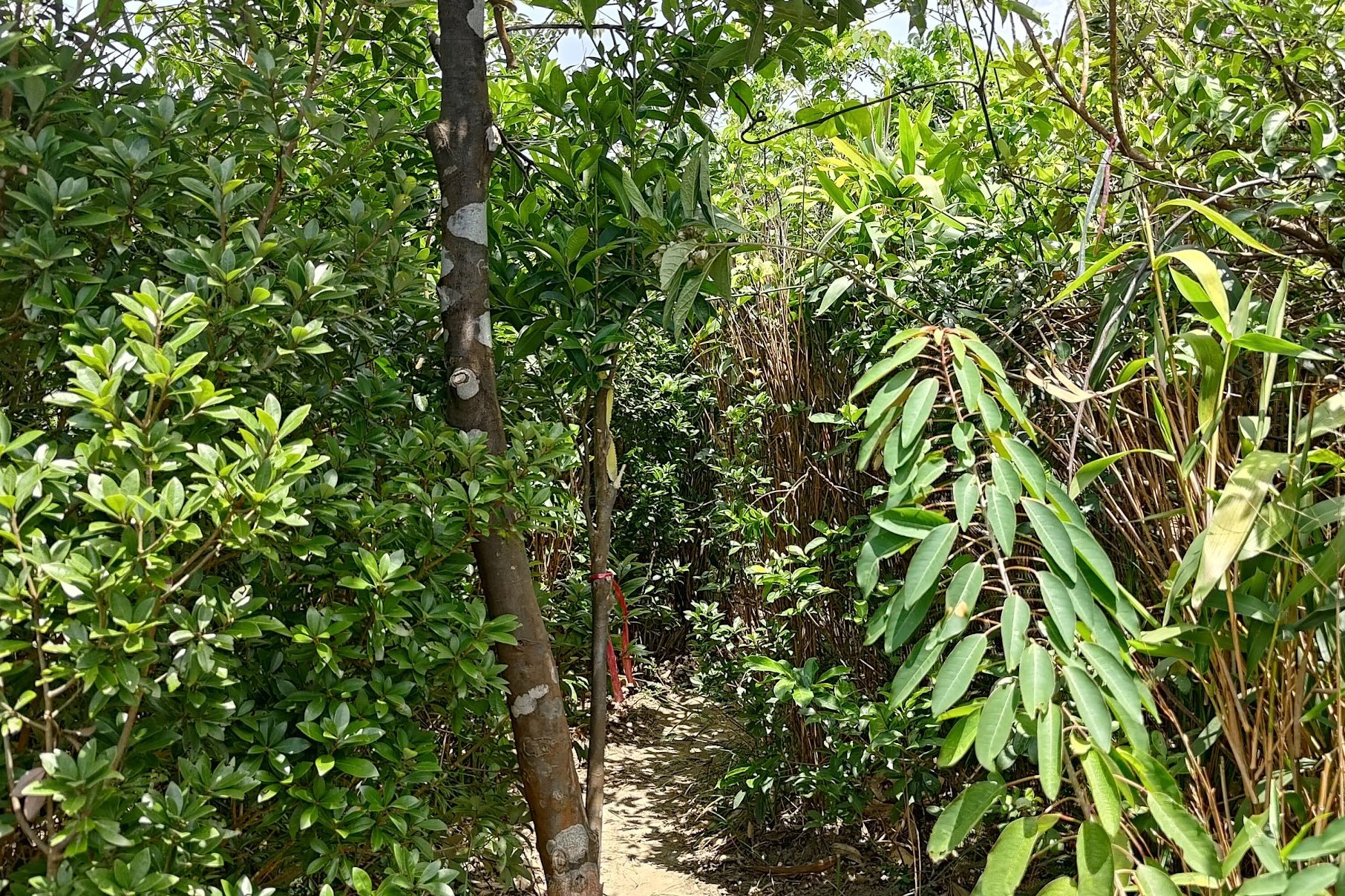
The trees (which are actually bamboo) are well over head height and can be a bit overgrown at times. You may have to duck to get through.
Barely a minute later, you'll see some natural steps leading you upward before the first summit appears to your left. You'll need to squeeze through a little opening between two large rocks and you're pretty much at the first summit!
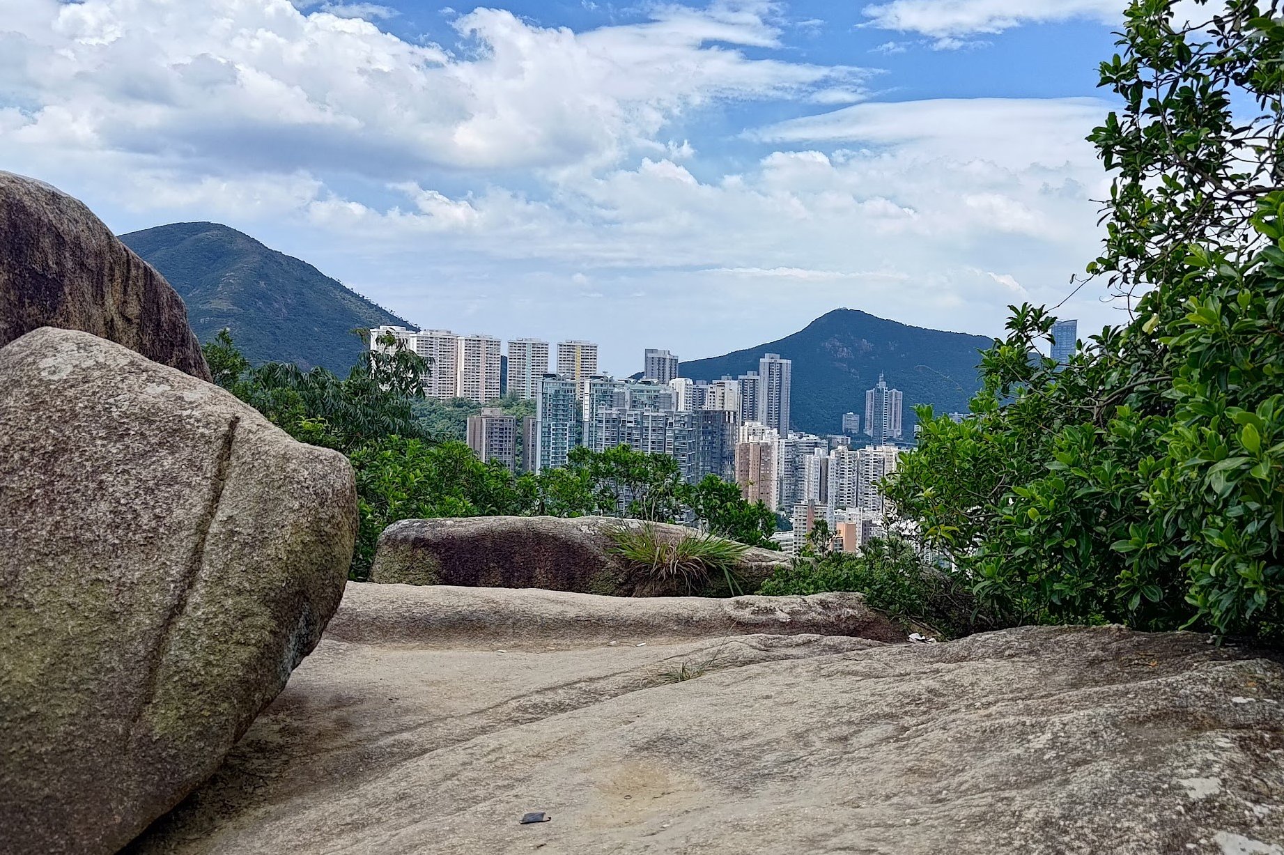
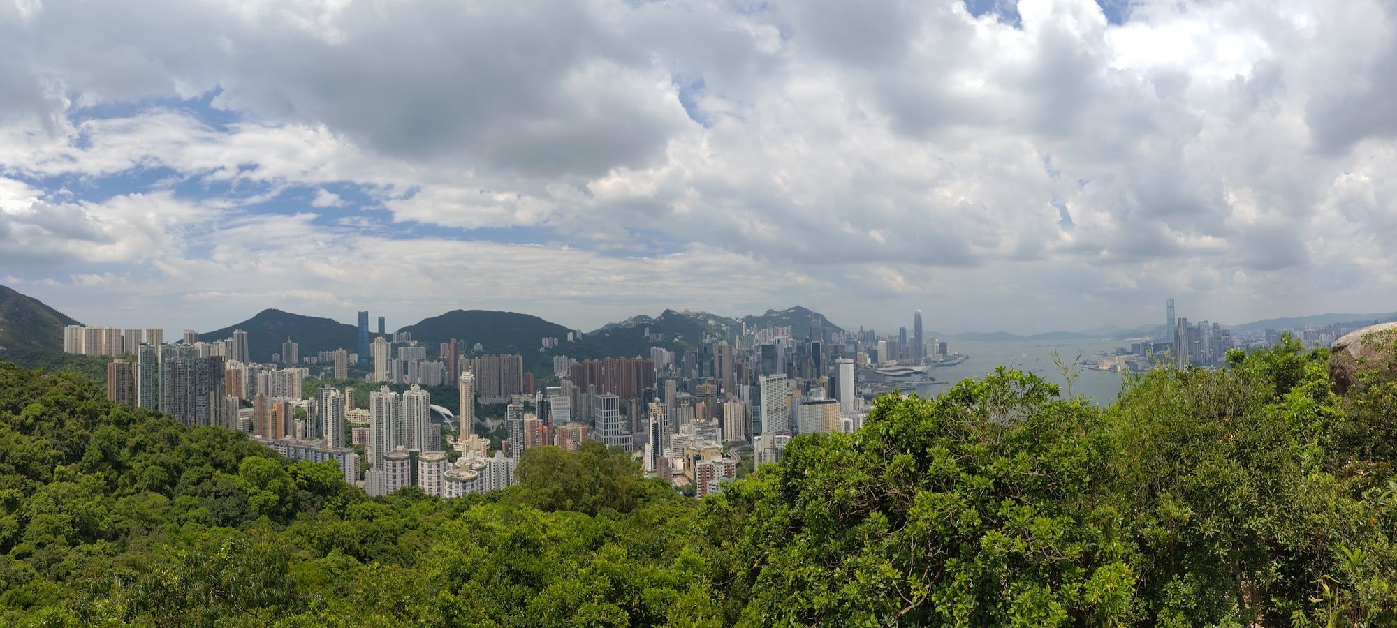
Views From the First Summit
Getting to the Main Summit
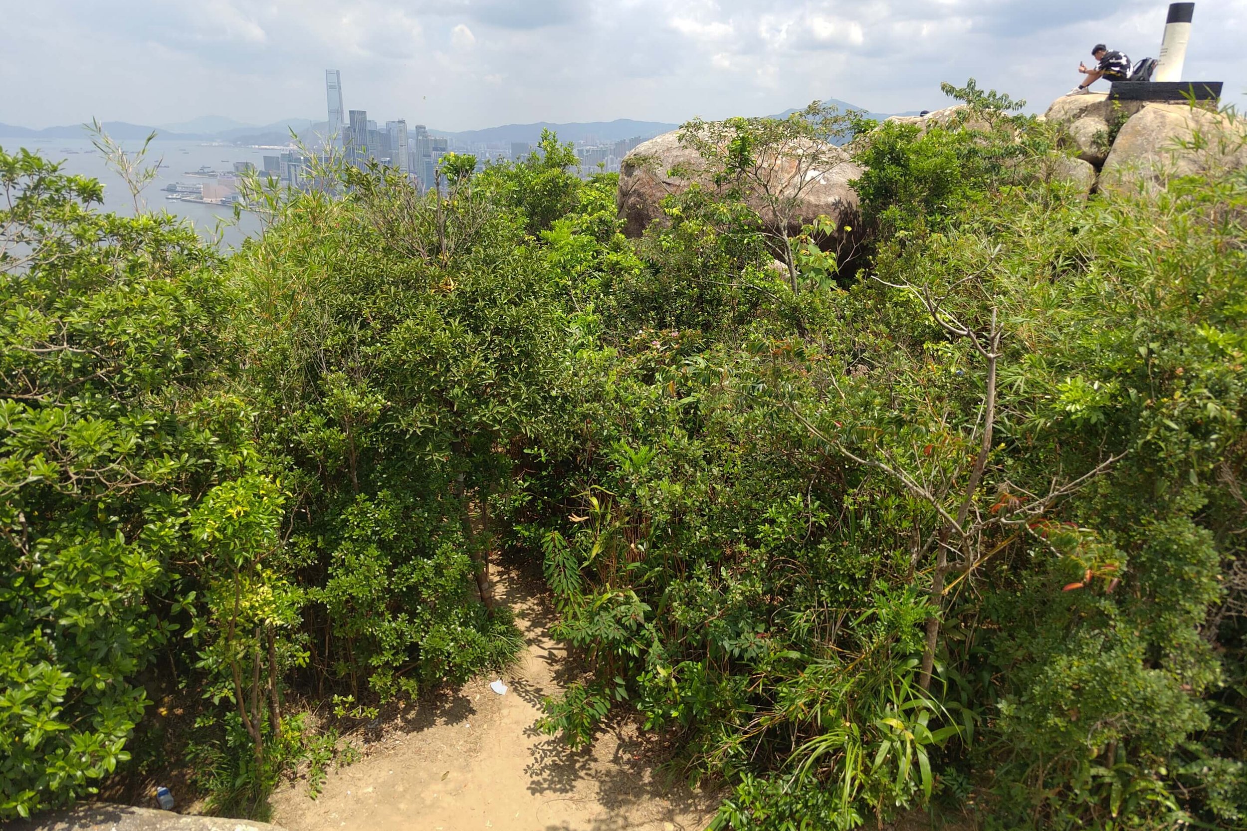
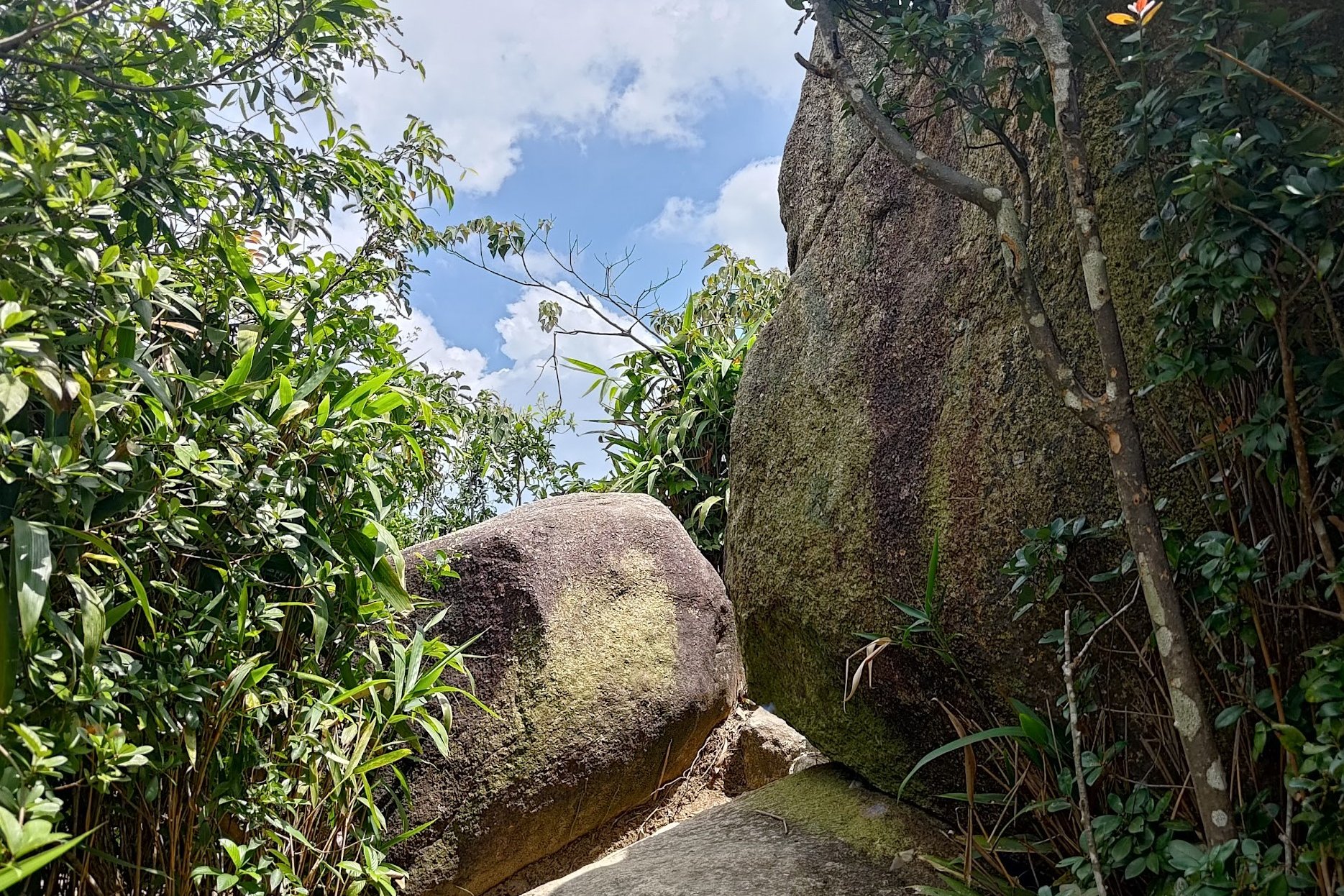
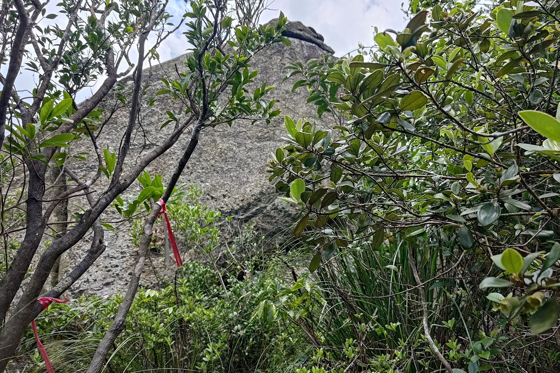
To reach the true summit, climb back down the boulders of the first summit.
You'll see a dirt trail leading into some trees at the bottom of the first summit, which you should follow.
Ribbons mark the trail so you know you're going in the right direction.
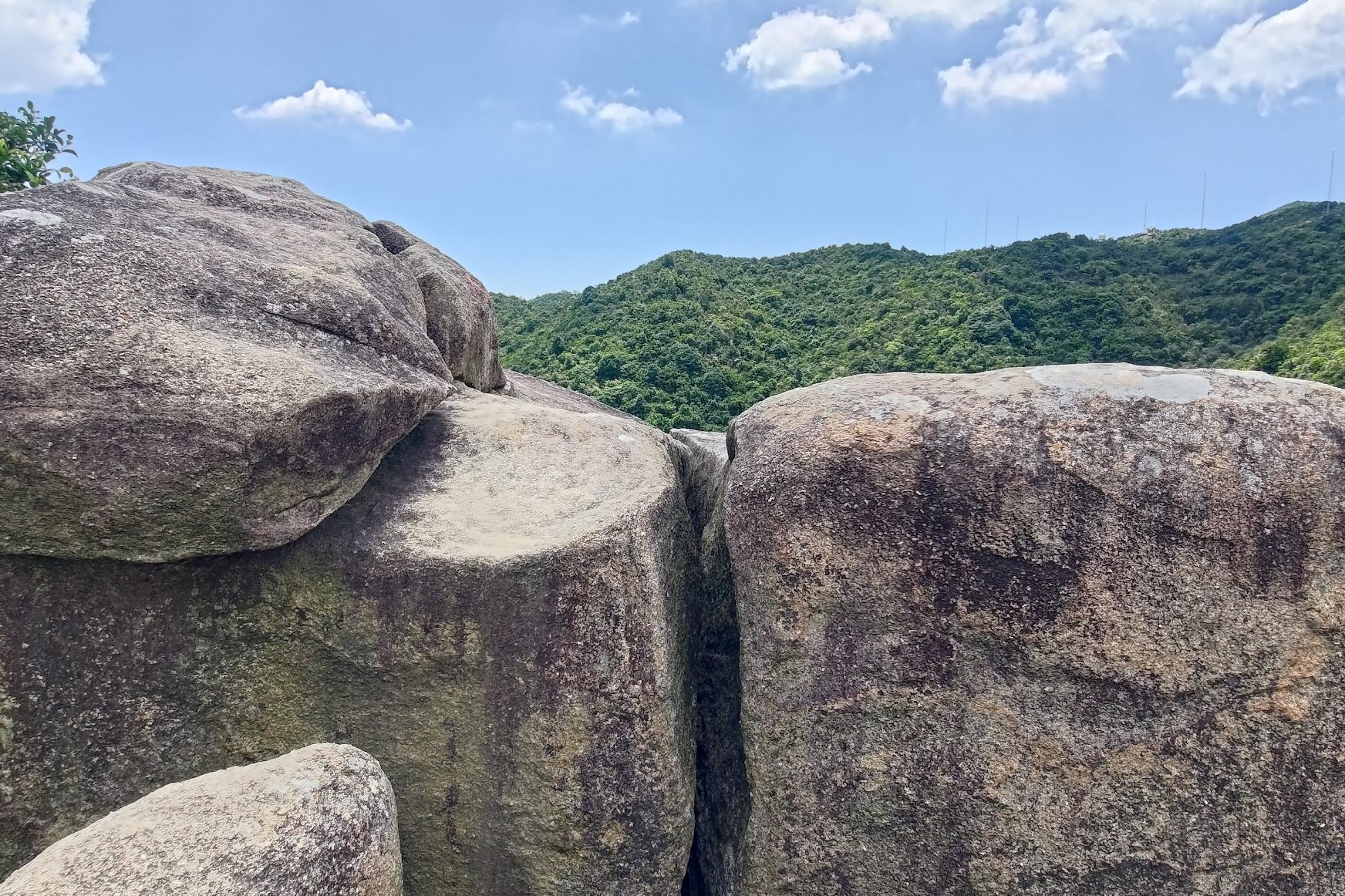
Soon, you'll begin climbing more boulders until the true summit comes into sight.
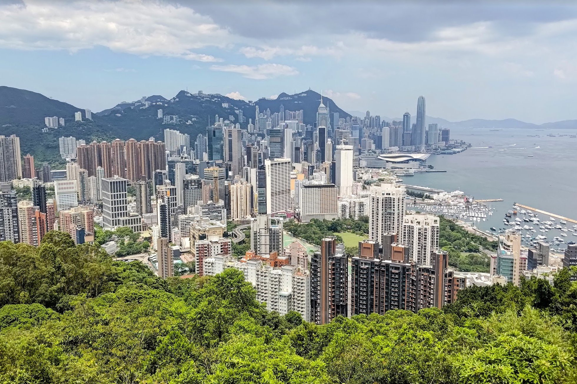
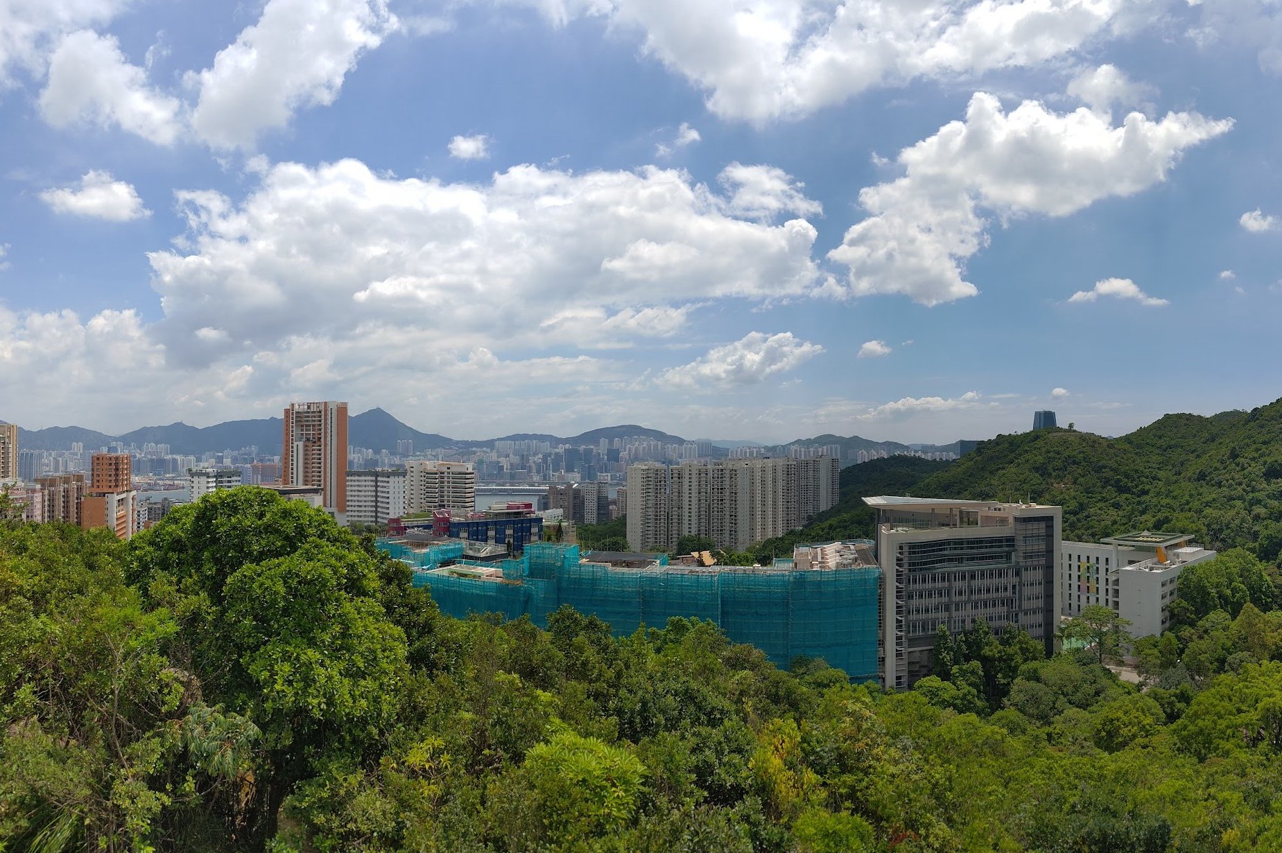
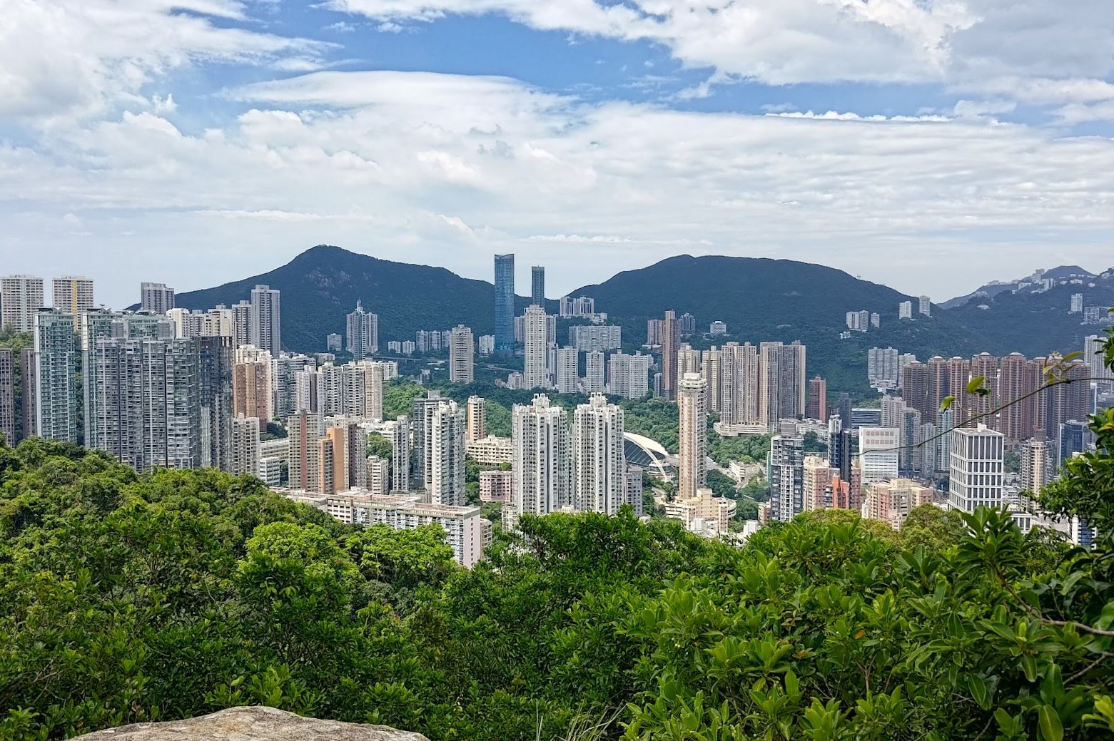
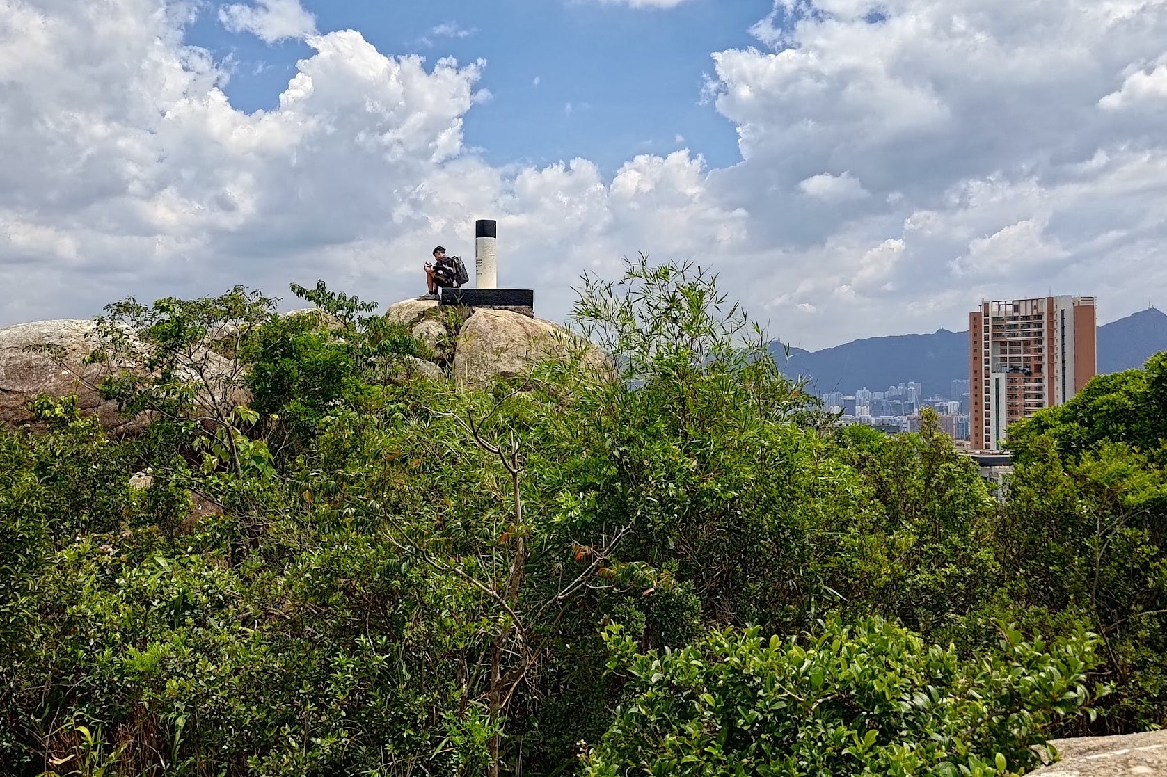
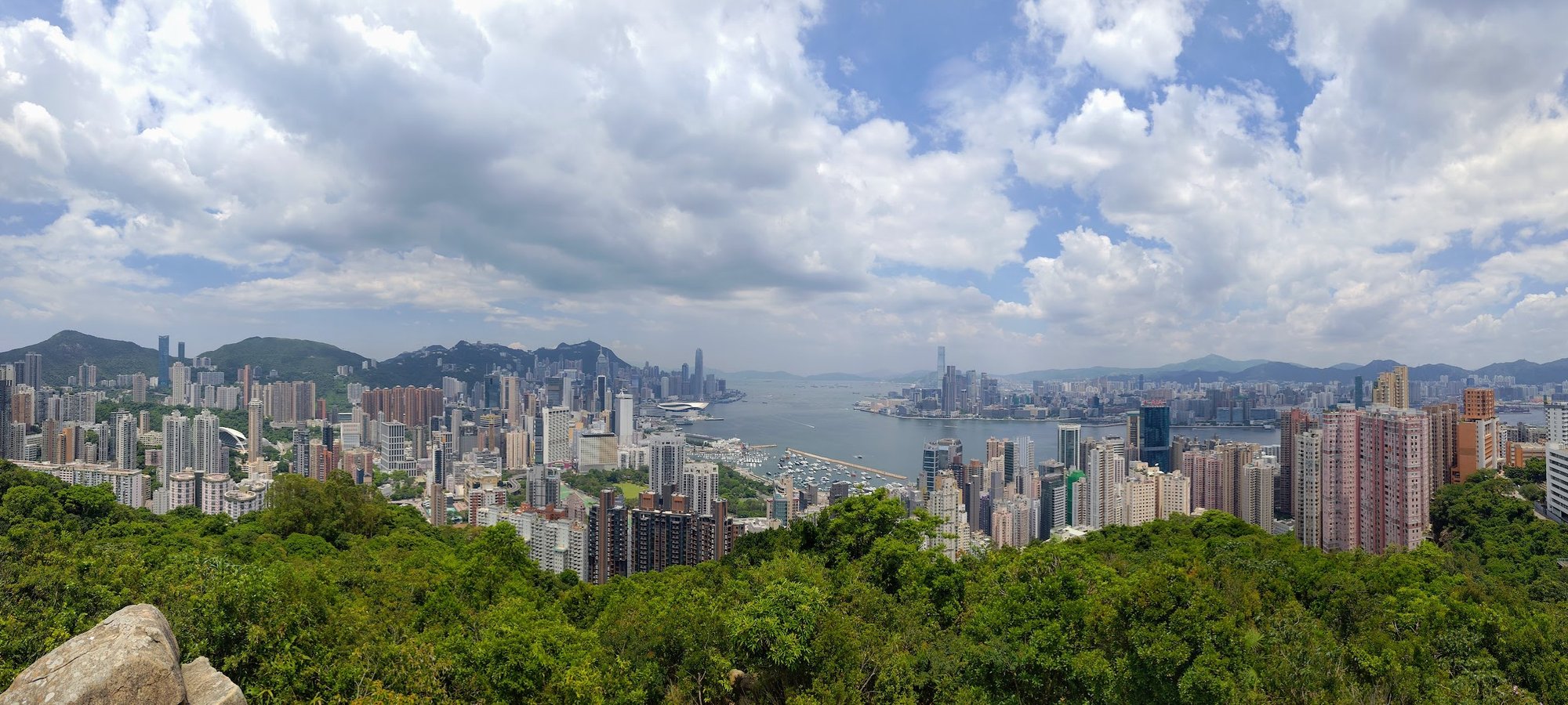
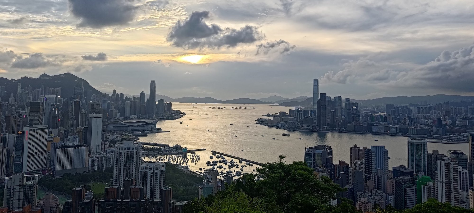
Views From Red Incense Burner Hill Summit
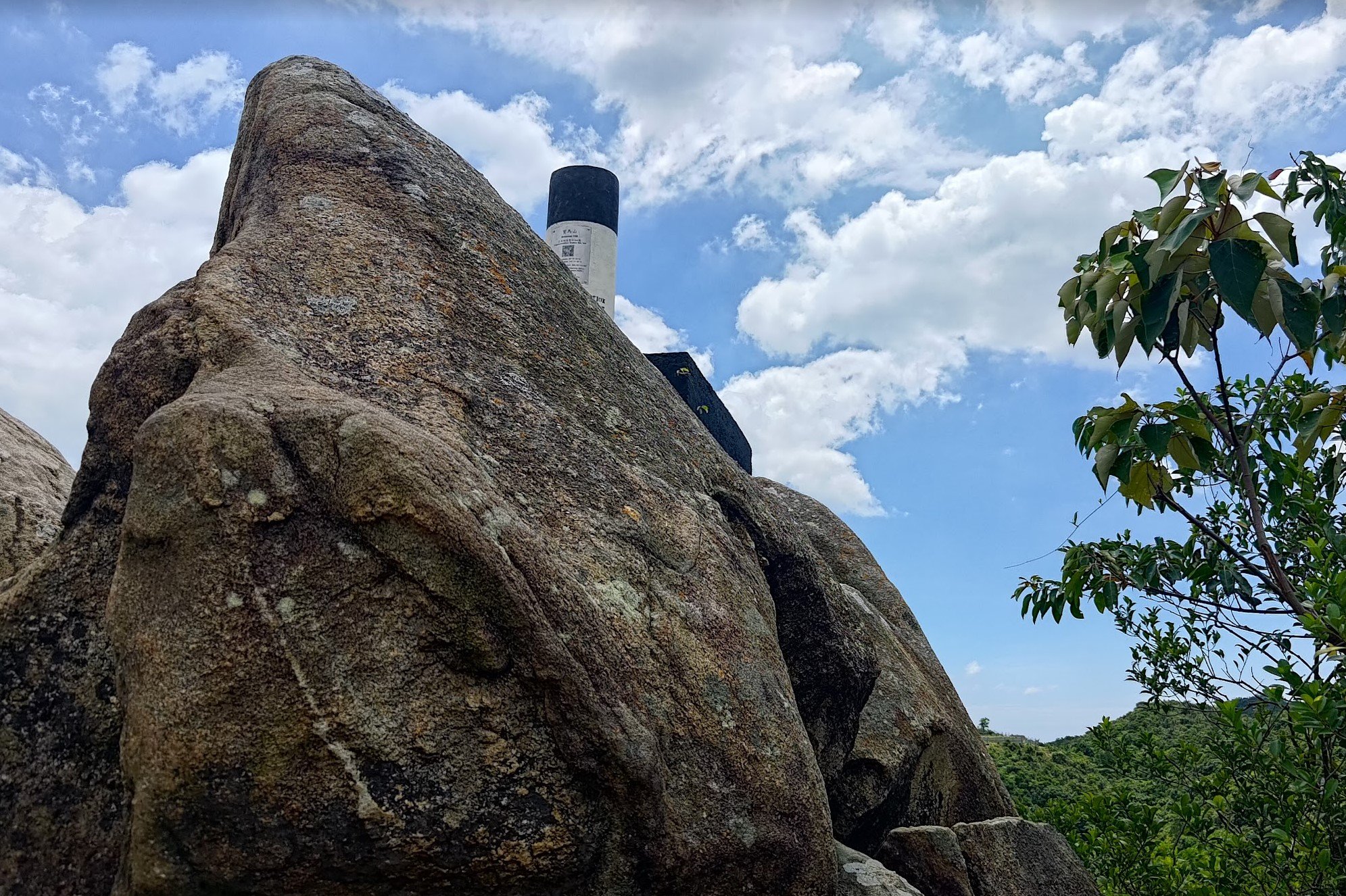
After arriving at the top of Red Incense Burner Hill, youll see a black and white trigonometrical point that marks the summit.
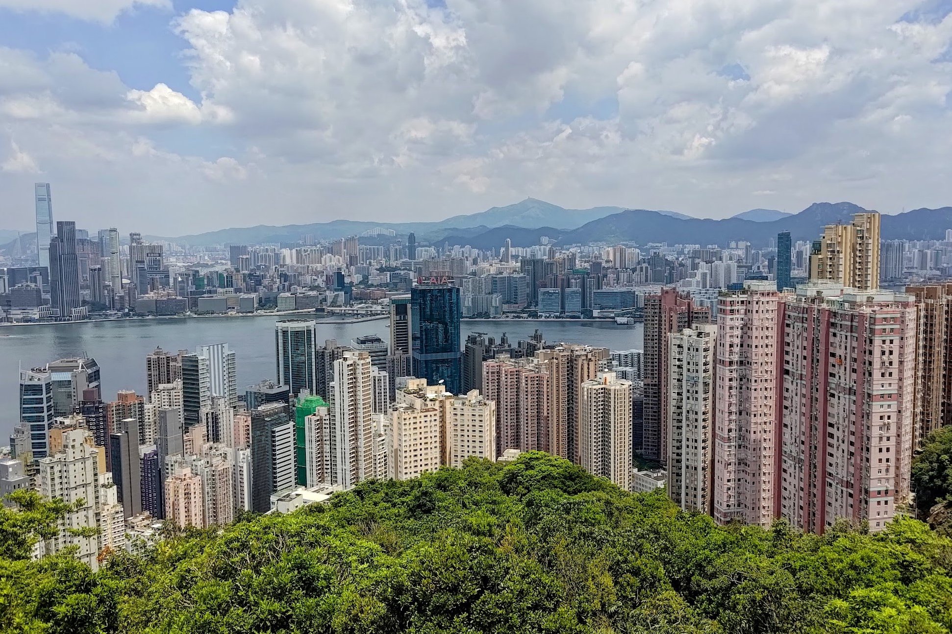
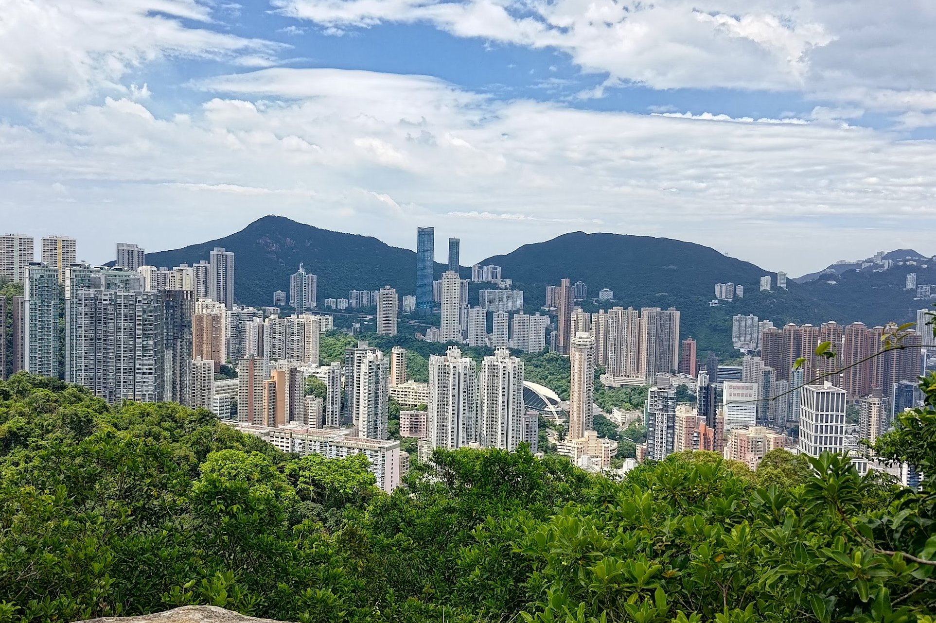
Spend some time to enjoy sweeping vistas across Victoria Harbour. You'll be uniquely positioned to have Hong Kong Island to your left and Kowloon to your right.
If you're able to do this hike on a weekday, you're almost guaranteed to have this spot all to yourself!
When you're ready, head back down and retrace your steps back to the start.
Getting Back
Outside St. Joan of Arc Secondary School (near the hike start point), there's a bus terminus with a few buses that head back into the city. If you walk further down Braemar Hill Road, you'll find even more bus stops.