
Po Pin Chau Hike: Incredible Ocean Views at the Very Edge of Hong Kong
Contents
- Essential Information
- Hike Highlights
- Google Route Map
- How to Get There
- Quick Route Summary
- Fa Shan Viewpoint
- Descending to 'Trash Beach'
- The 'Heart of Hong Kong'
- Getting to the Po Pin Chau Viewpoint
- Po Pin Chau Viewpoint
- Getting back to East Dam Safely
- East Dam
- Getting Back
- Pair This Hike With High Island Reservoir
Po Pin Chau Hike Details
- District: New Territories
- Duration: 1.5 hours
- Distance: 3ish km
- Highest Elevation: 95 meters
- Difficulty: 1/5
- Facilities: None during the hike. Stock up on food and water and use the toilet beforehand
Why Hike Po Pin Chau?
Po Pin Chau (破邊洲) is a really short hike with huge visual clout. Starting from the already scenic East Dam, you'll be able to reach the main viewpoint in under 30 minutes!
That being said, the route can get a little steep and technical at parts. However, if you take things slow and be sensible and careful, this hike is pretty accessible and easy for the most part.
The only thing that might really ruin your experience of this magical place is an overabundance of visitors.
At the risk of sounding like a grumpy grandpa, Po Pin Chau was pretty inaccessible back in 2020, when I took most of these photos. Because of that, only those who were willing to truly struggle would be able to make it to the viewpoint.
These days, there is a clear and easy path all the way to Po Pin Chau, meaning that on the one hand, just about anyone can see this wonderful location, and on the other, it can get pretty crowded.
This is definitely one of those hikes to go to if you have a weekday free, but try to avoid it on holidays and weekends.
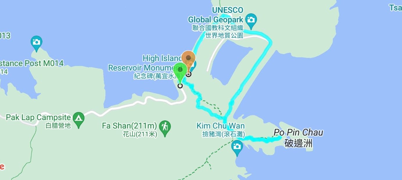
Google Route Map
How to get to the Po Pin Chau Hike Start Point
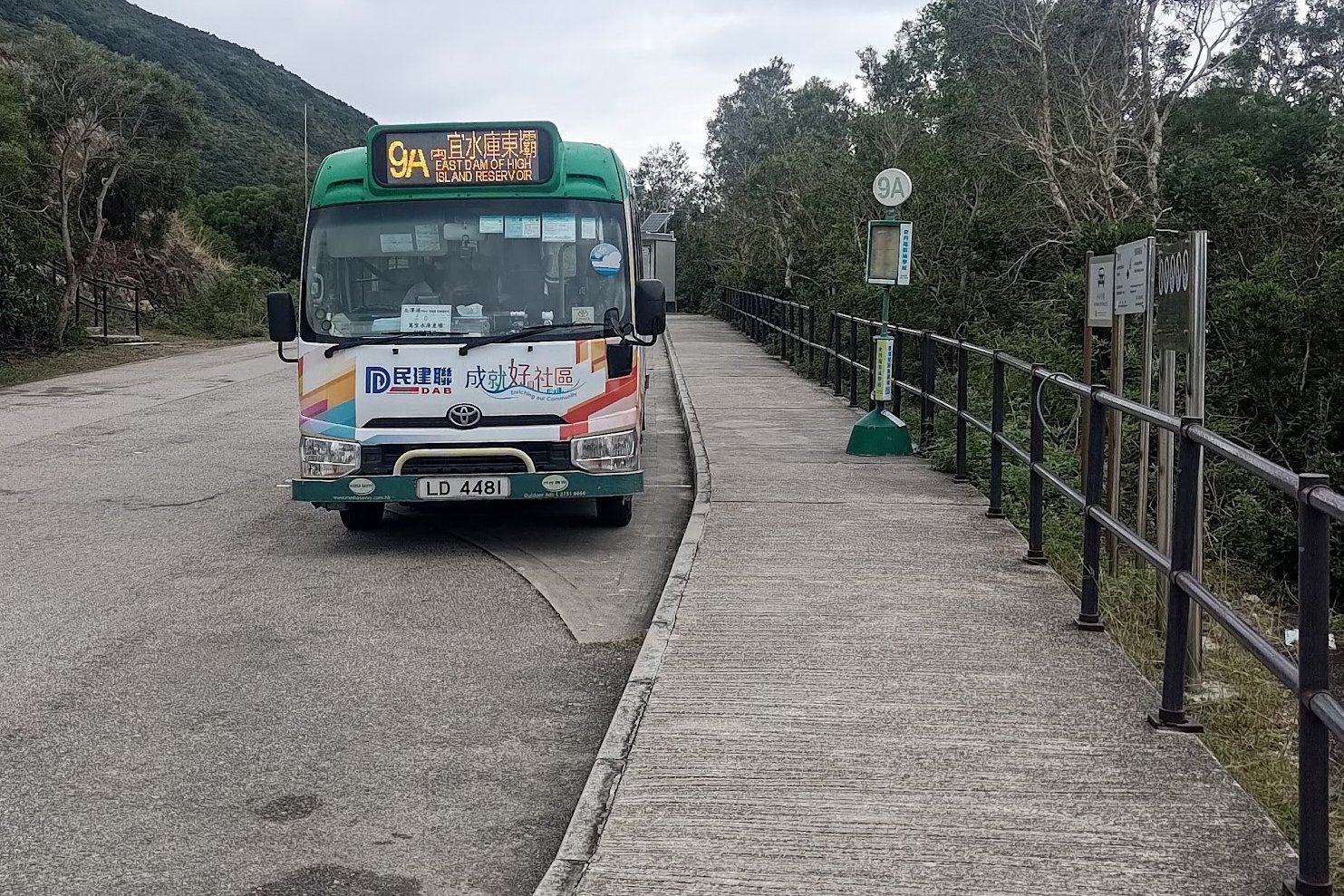
The 9A green minibus going to East Dam (the start point of the Po Pin Chau hike) departs from Pak Tam Chung (北潭涌) in Sai Kung Country Park. Here's how to get there.
Option 1: Direct Buses
- The 96R bus from Diamond Hill MTR station (exit C2) goes directly to the start point. It operates on Sat, Sun and Public holidays only.
- The 289R bus also goes directly to the start point from Shatin Station right below New Town Plaza. It operates on Sat and public holidays from 7 am to 1:30 pm.
Option 2: Get to Sai Kung Town, Then Take a Second Bus to the Start Point
For all buses listed below, you will have to stop off in Sai Kung Town first and then connect to another bus from there.
From Kowloon to Sai Kung Town:
- 1A minibus from Choi Hung MTR (exit C1)
- 9 red minibus from Ngau Tau Kok (Yee On Street)
- Mong Kok Express red minibus (from Dundas Street)
From the New Territories to Sai Kung Town:
- 299X bus from Shatin (below New Town Plaza)
- 101M minibus from Hang Hau MTR (exit B)
From Hong Kong Island to Sai Kung Town:
- The best way to get to Sai Kung from HK Island in the morning is to take the MTR to Hang Hau and get the 101M.
- Causeway Bay Express red minibus: Monday-Friday: 6pm to 11:35pm, weekends and public holidays: 5pm to 11:45pm
Getting to the Hike Start Point from Sai Kung Town:
After arriving at Sai Kung Town, head to the bus terminus to grab any of the below buses to Pak Tam Chung (北潭涌) where you can get the 9A minibus to East Dam (the start point of the hike).
Option 3: Hike There From Sheung Yiu
While this option still requires you to take a bunch of buses, you can skip the 9A minibus and hike to Po Pin Chau via High Island Reservoir. For directions, Check out the guide below to learn more.
Quick Po Pin Chau Hike Route Summary
- Climb the stairs right opposite the 9A minibus stop at East Dam
- Go past the red danger sign at the top of the stairs
- Ascend up the wooden steps and don't miss the Fa Shan viewpoint on your left
- Continue along the trail after the viewpoint, ascending Fa Shan gently
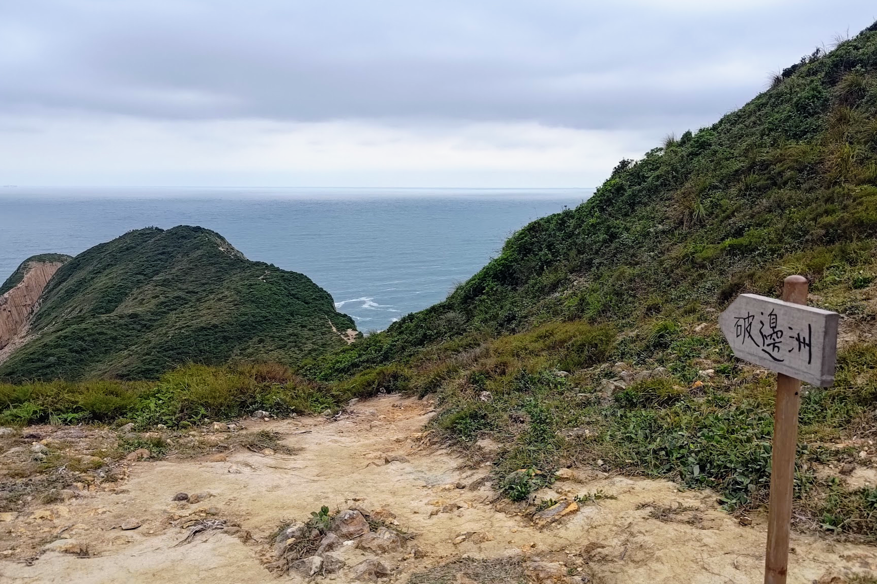
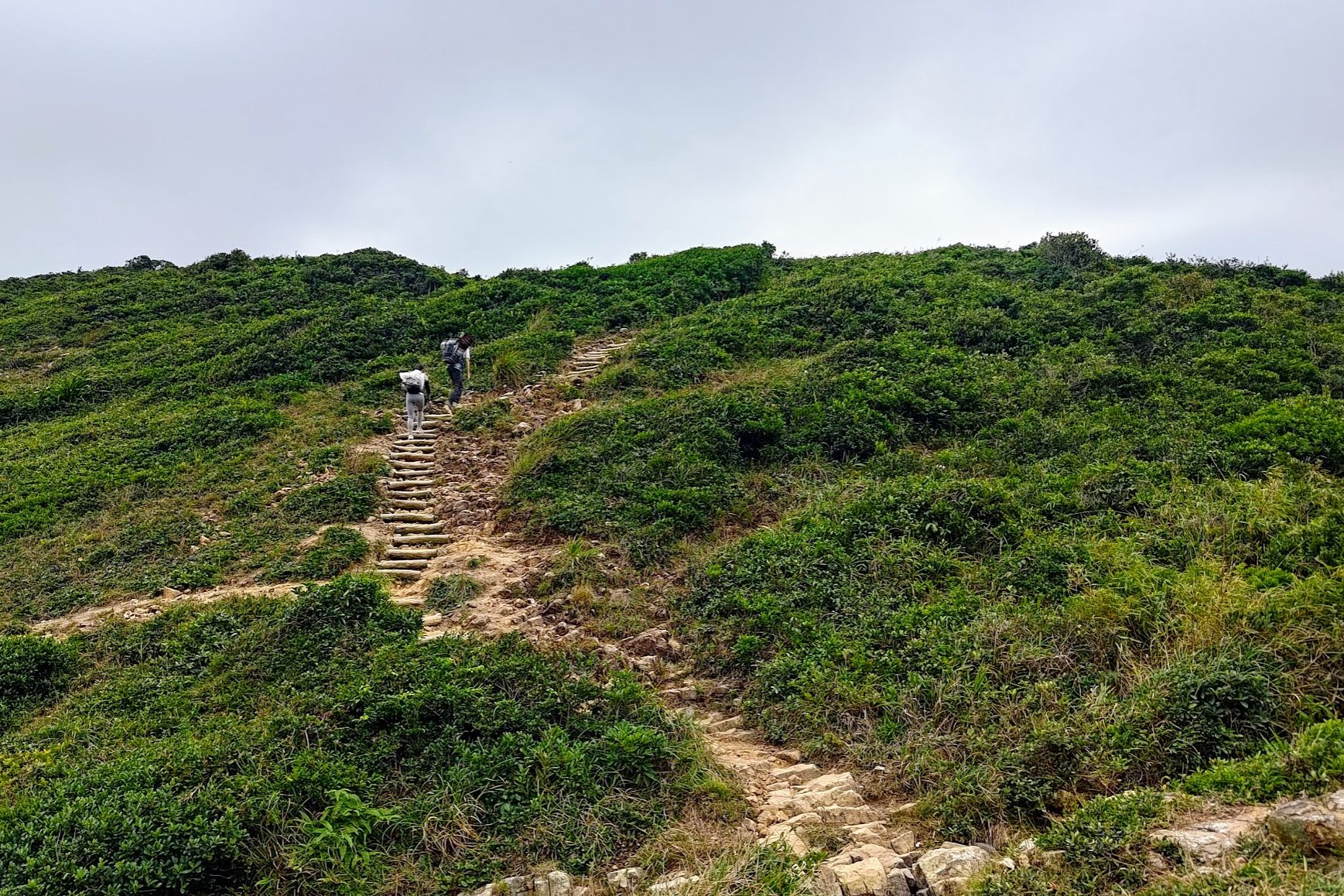
- Take the long set of stairs down Fa Shan by following the wooden Chinese sign pointing to Po Pin Chau
- Head up the second hill by taking the wooden stairs
- Keep ascending and follow the trail until you go past the 'X' and reach the Po Pin Chau viewpoint
- Retrace your steps to Fa Shan. At the crossroads, you can either climb back up Fa Shan and return the same way, or take the flat path by the coast and exit directly from East Dam
*The flat path directly to the dam is relatively easy, but getting onto the dam safely is tricky and may be uncomfortable for some. I will include pictures in the guide. Please make sure you're comfortable before attempting this particular route.
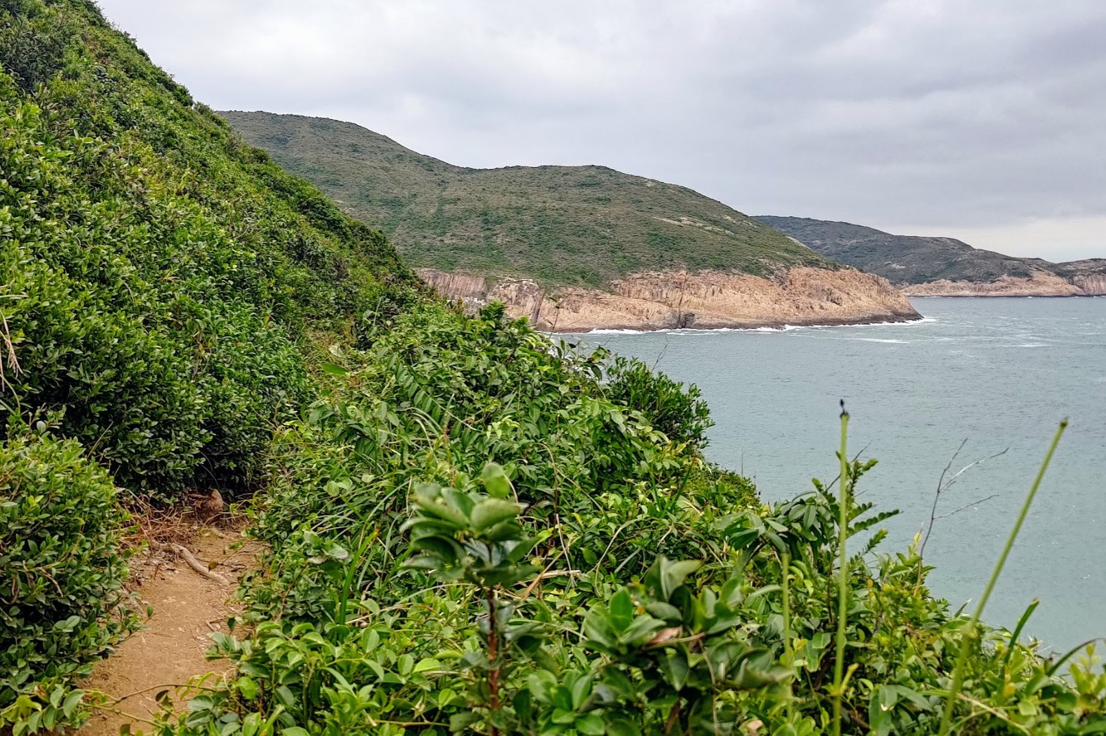
Hiking to the Fa Shan Viewpoint
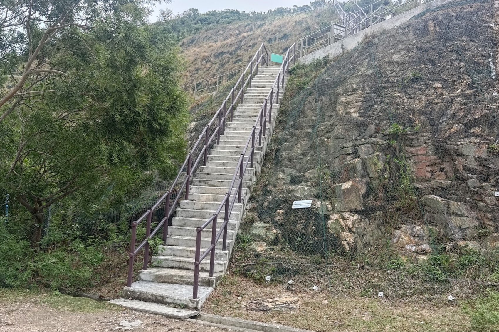
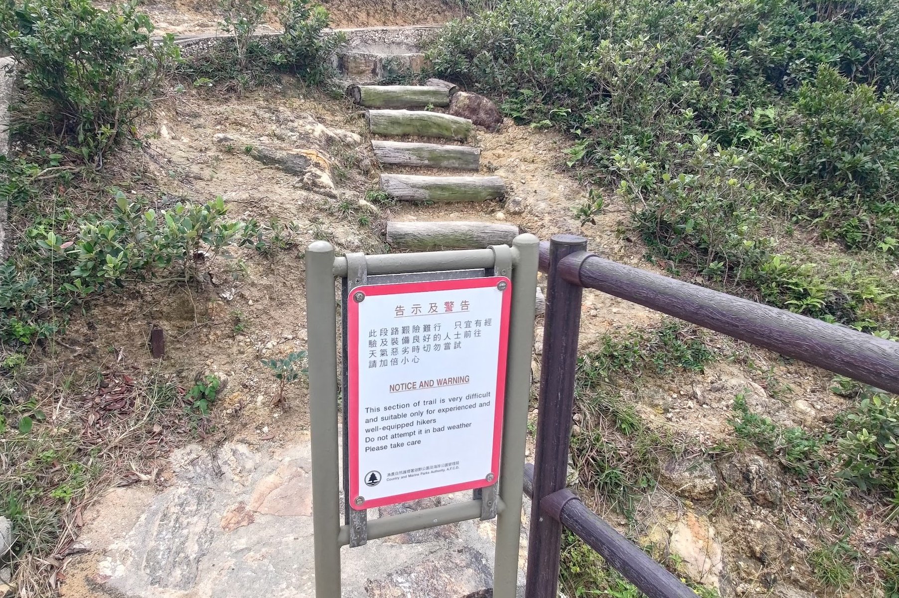
After arriving at East Dam, look for the stairs directly opposite the minibus stop. At the top of the concrete stairs, look for the red danger sign to your right.
Go past that sign and begin a short, but steep ascent to the Fa Shan Viewpoint. The viewpoint will be located to your left, so keep a lookout for a break in the foliage.
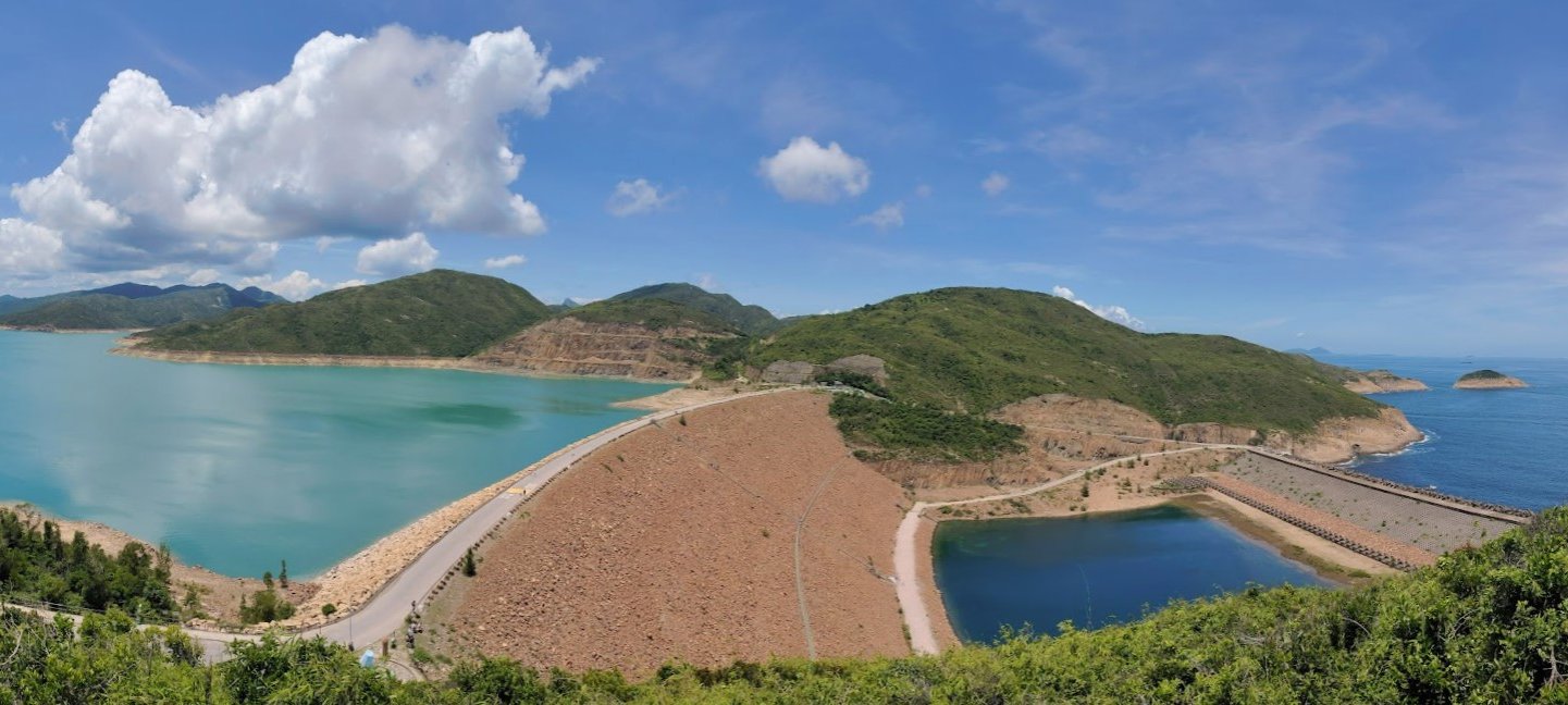
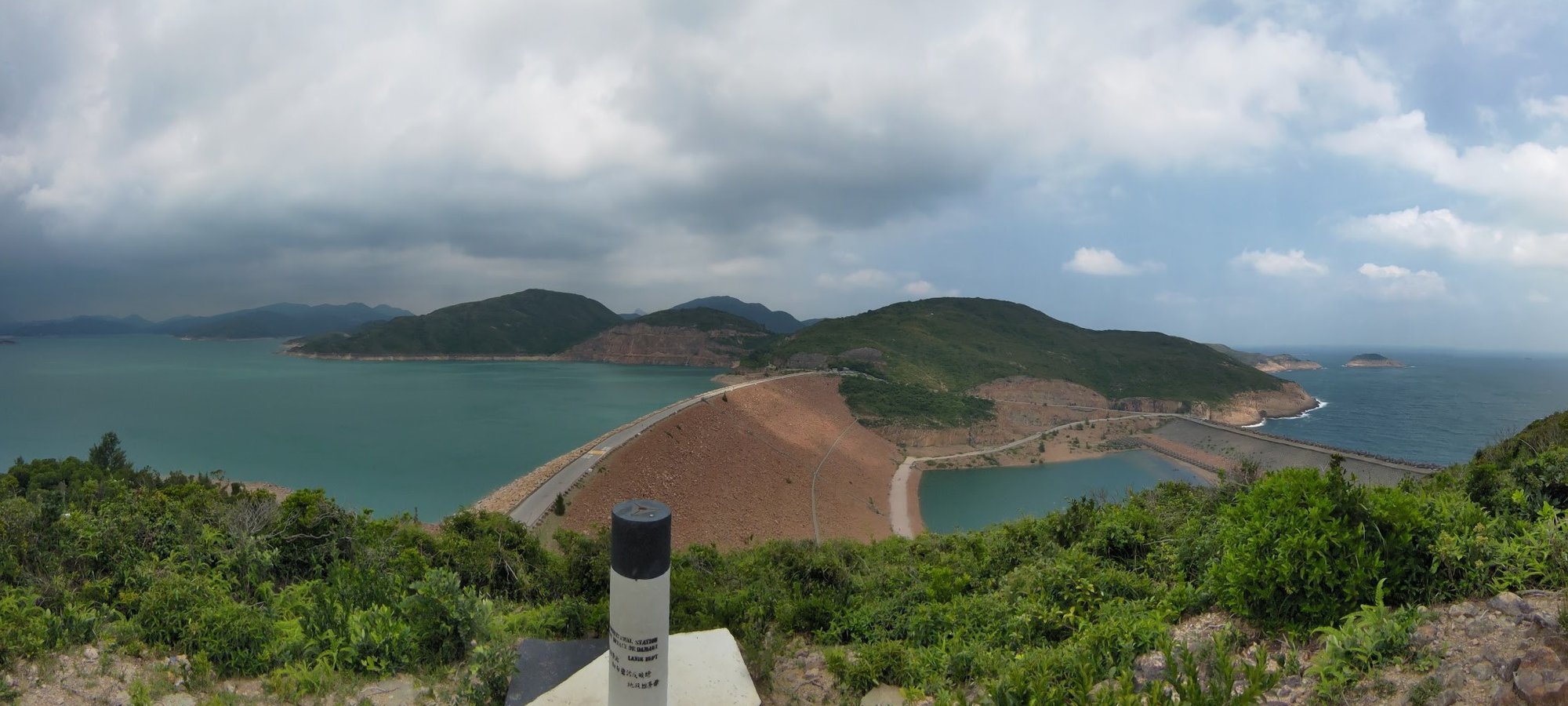
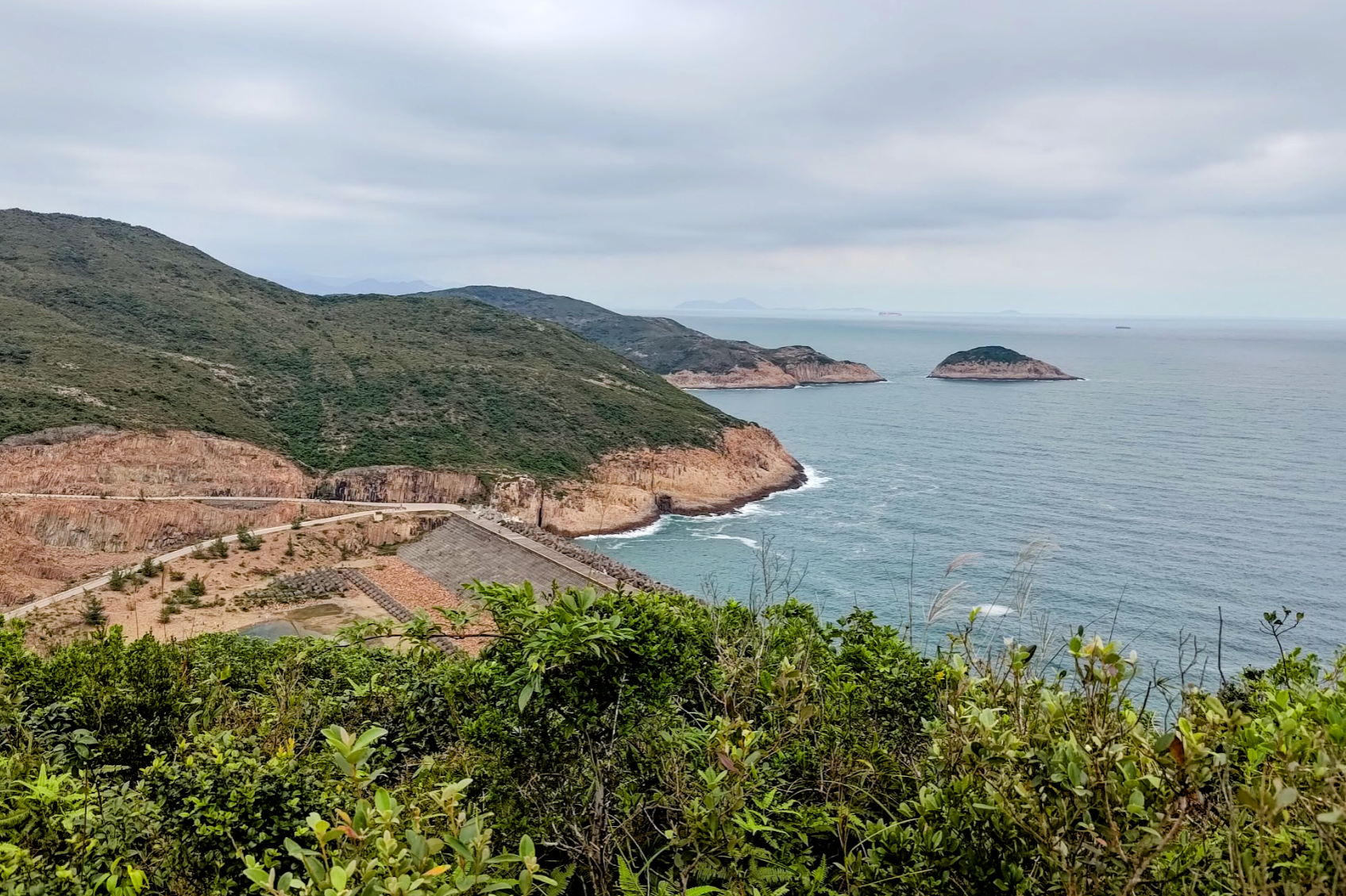
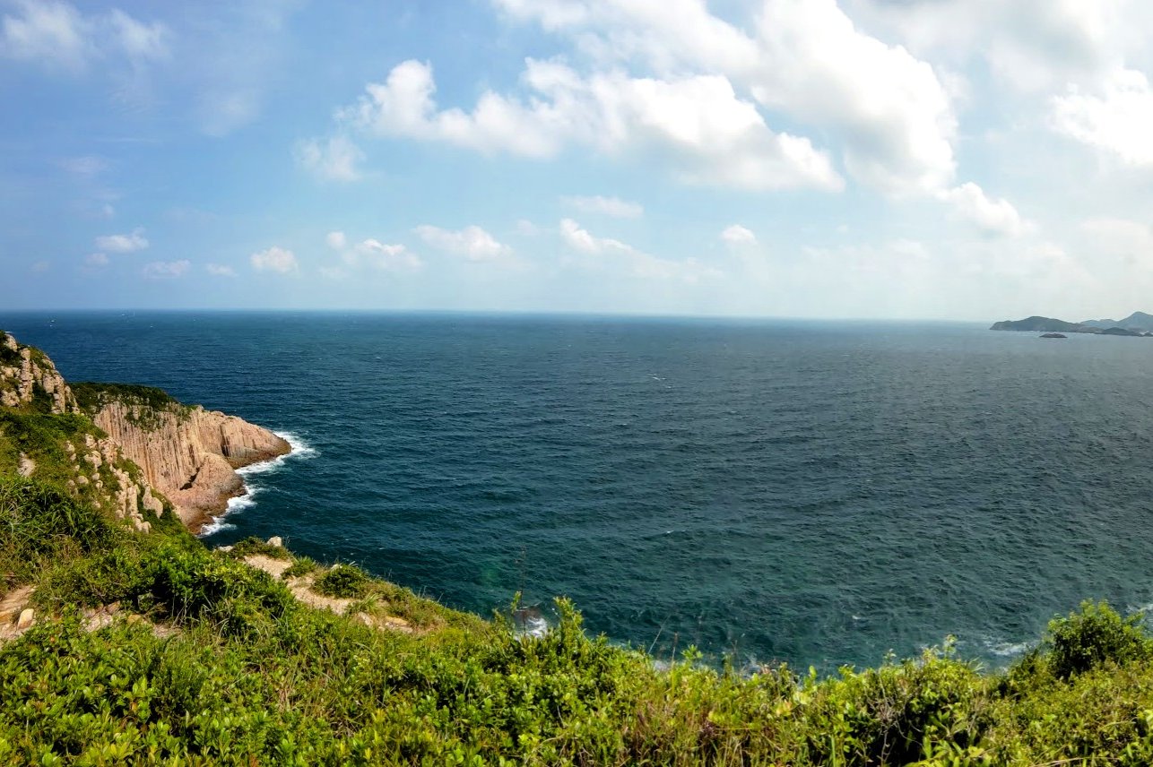
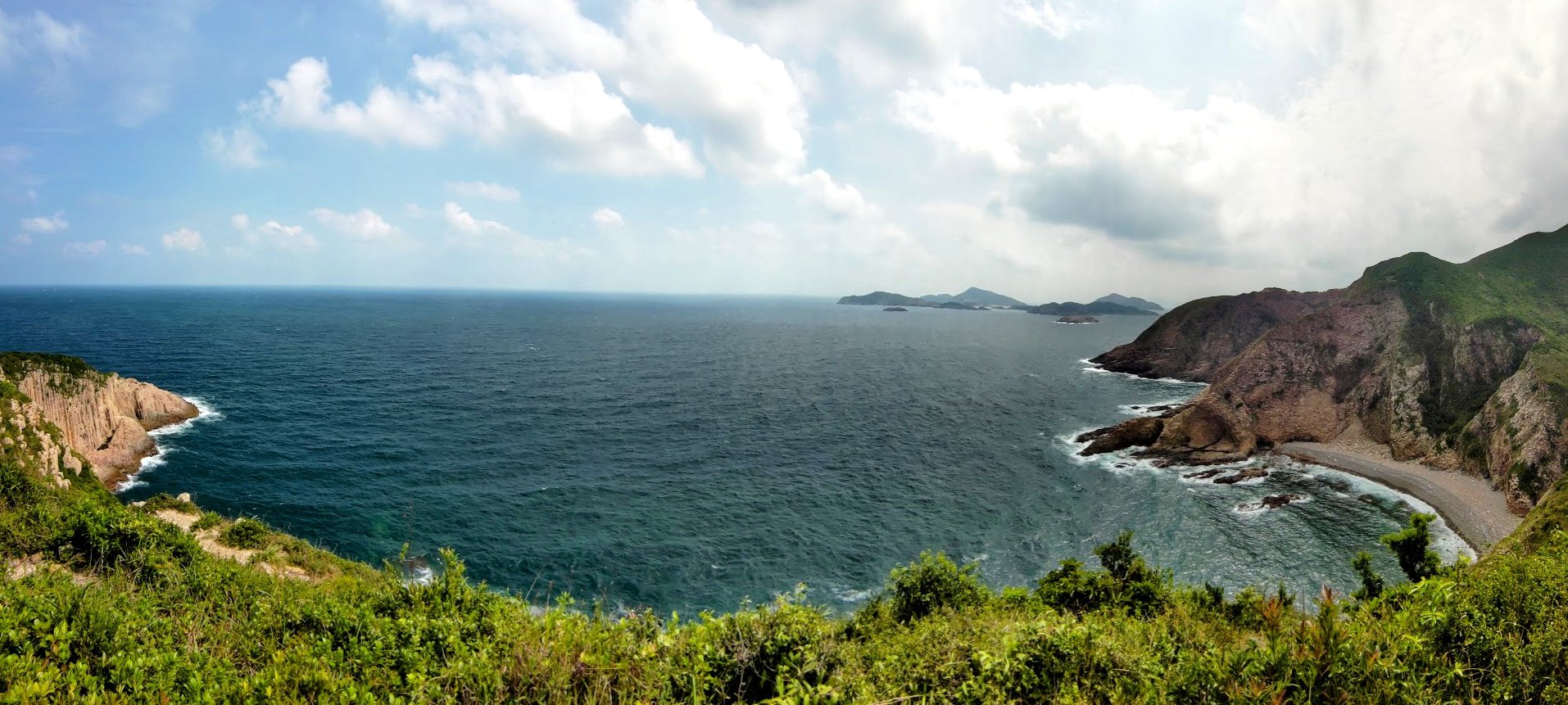
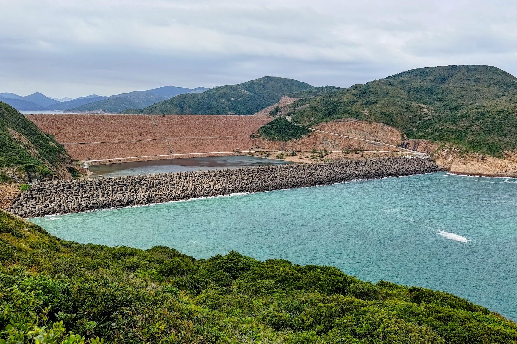
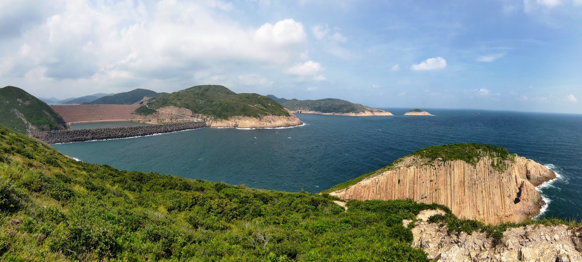
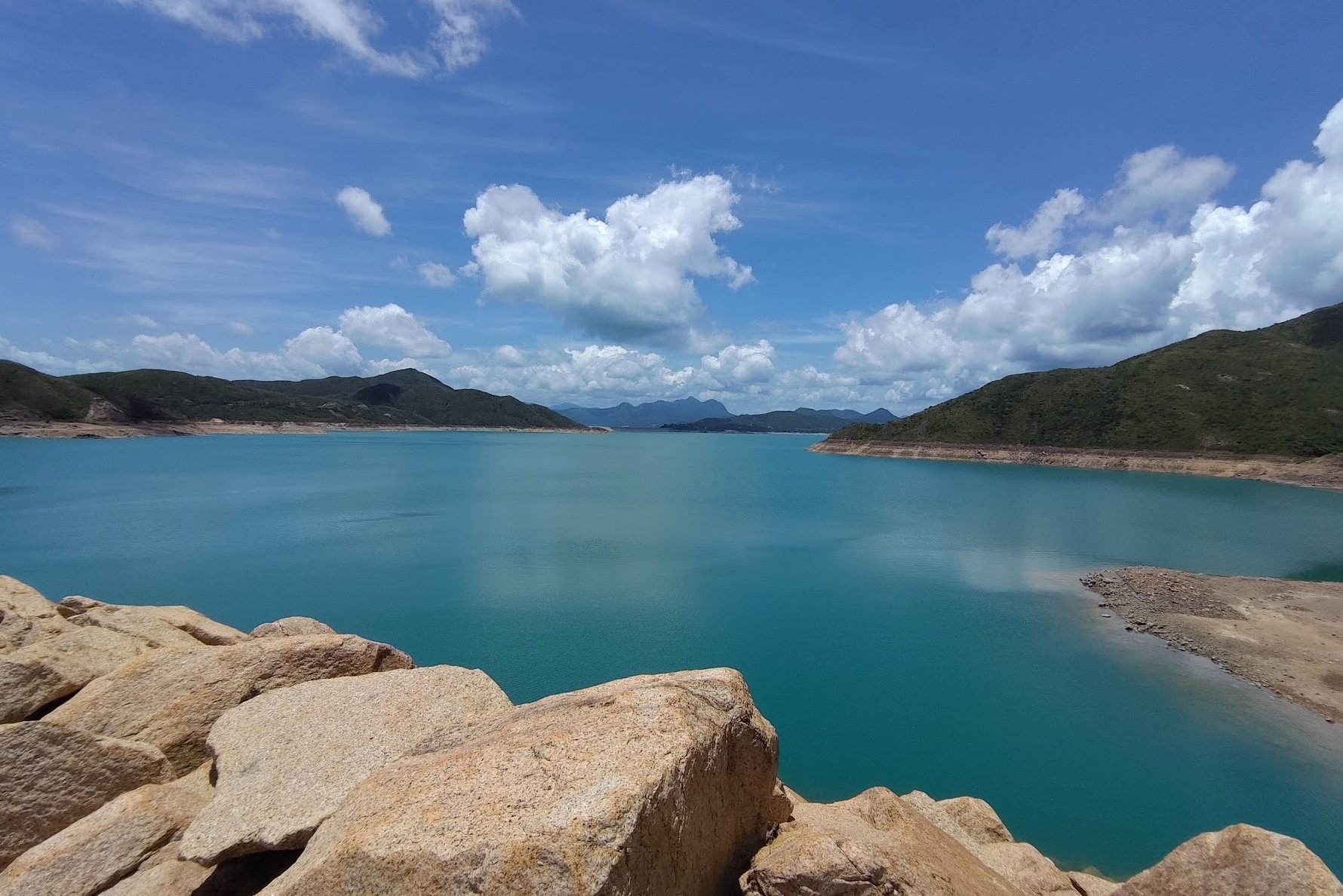
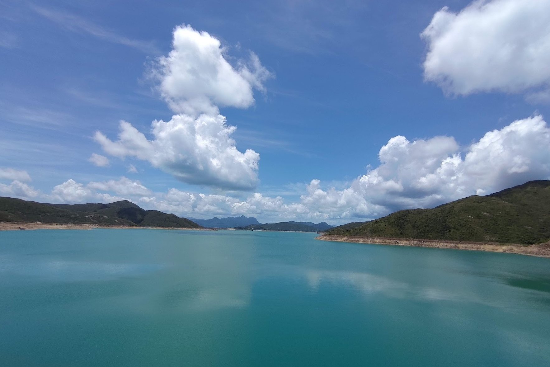
When you see a gap in the trees, walk a short distance to the viewpoint and enjoy commanding views of East Dam, High Island Reservoir and the South China Sea.
Pay attention to the color of the water. The drinking water in the reservoir is usually a totally different hue to the ocean water on the right - even on a cloudy day!
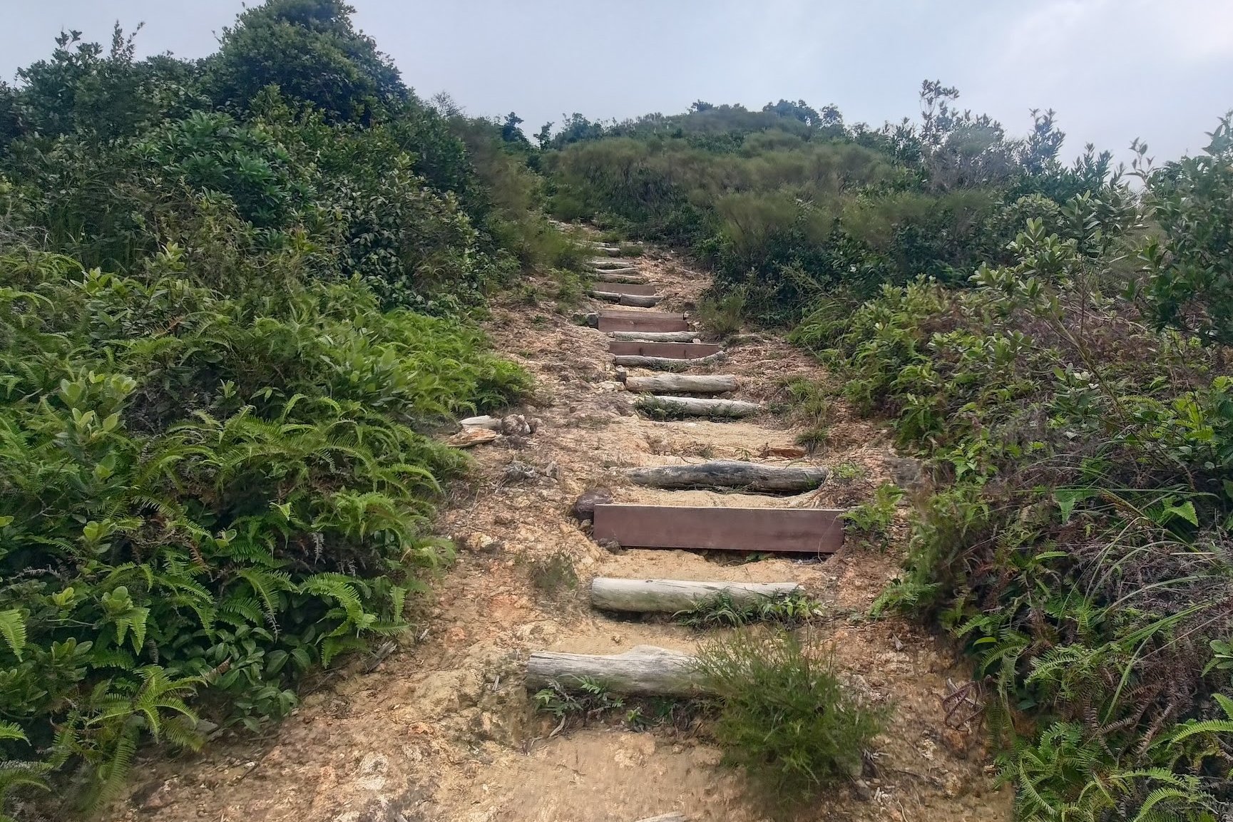
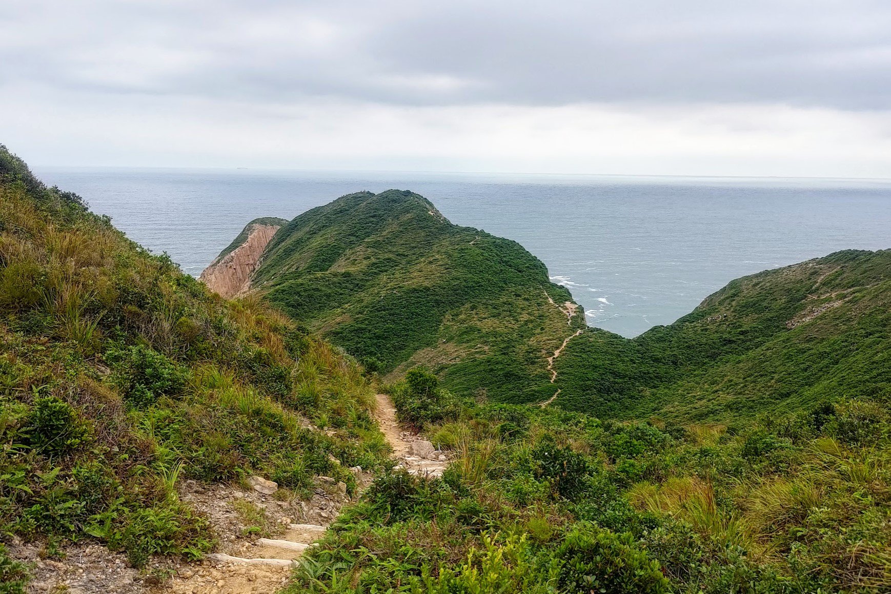
Continue to the Top of Fa Shan
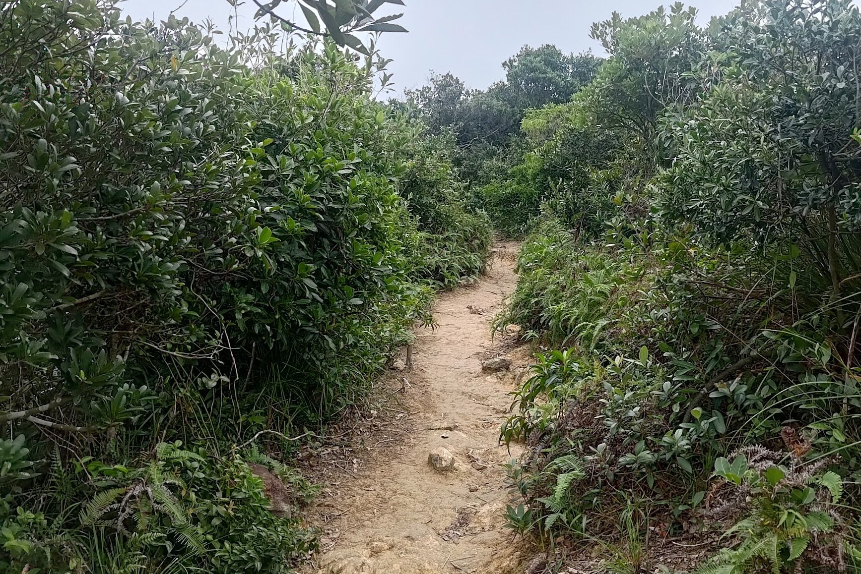
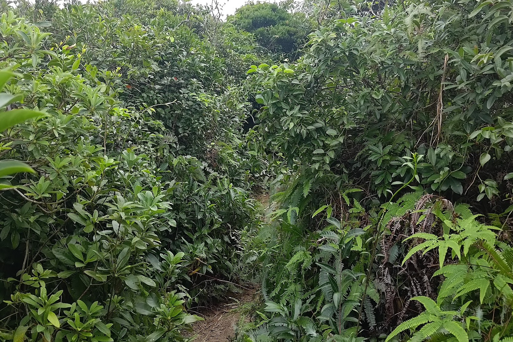
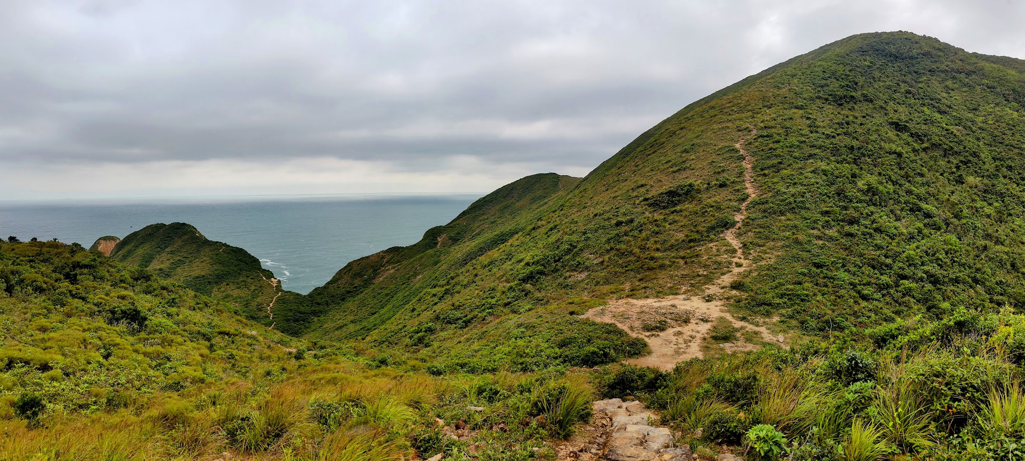
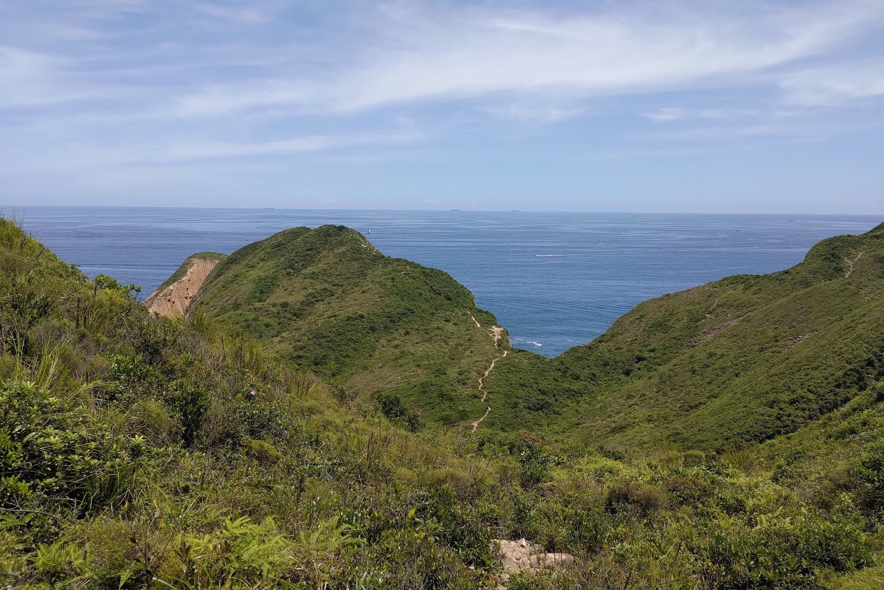
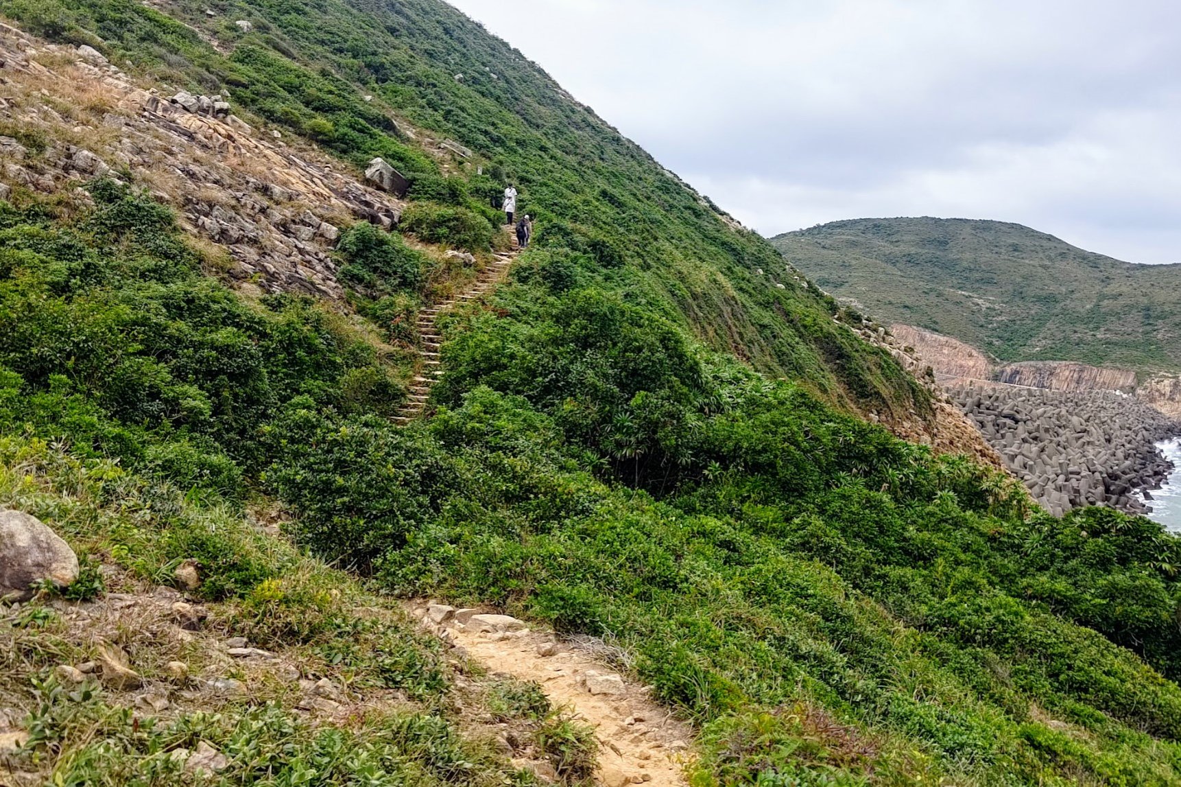
After checking out the Fa Shan Viewpoint, head back onto the trail and continue upward. It can get a little overgrown, but luckily it doesn't stay that way for long.
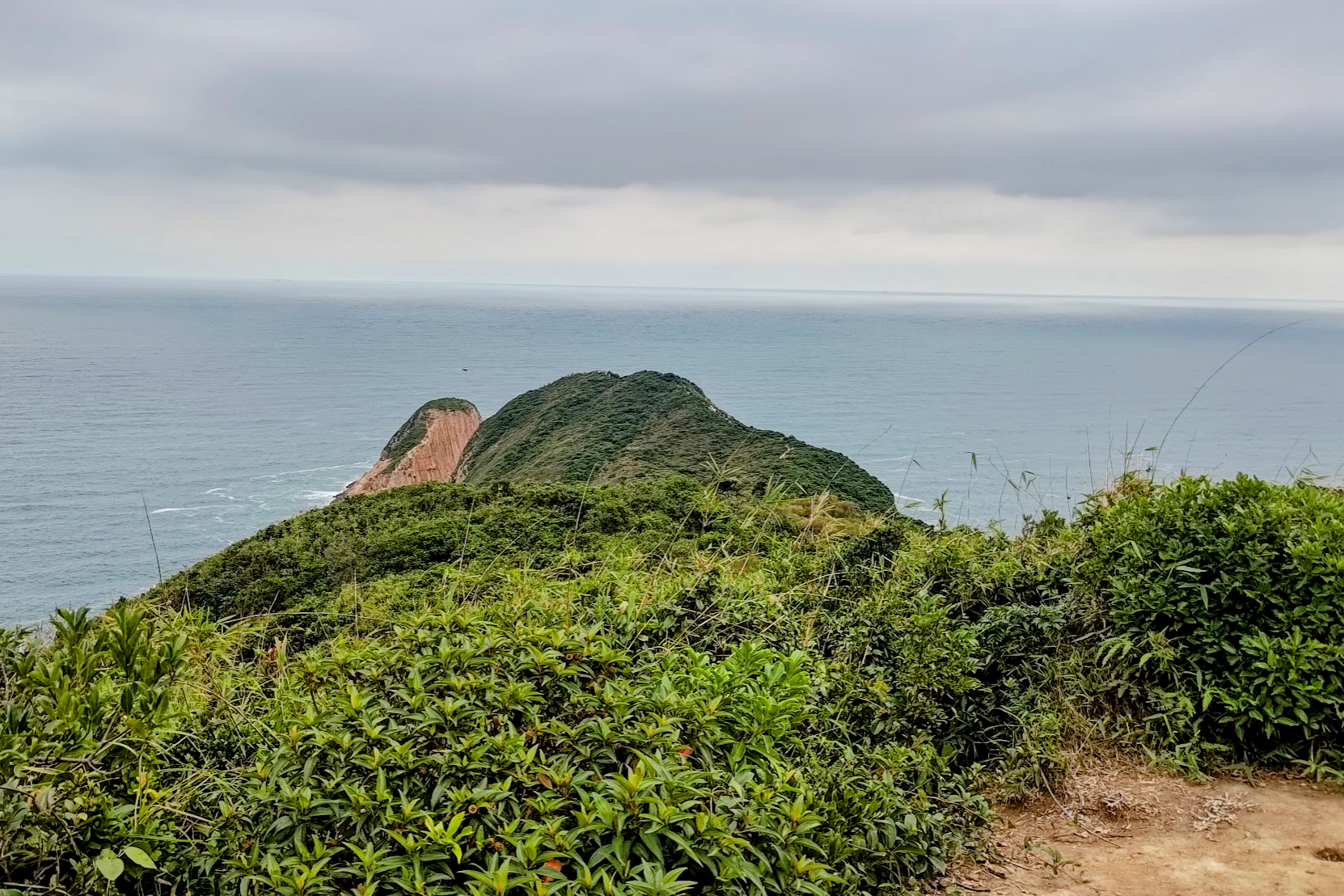
When the path opens up again, you'll have another bird's eye view of East Dam, and will even be able to see Po Pin Chau peeking out in the distance.
Near the top of Fa Shan, you'll see a wooden sign with Po Pin Chau written on it in Chinese. Follow that sign, and you'll soon see some stairs leading downward.
Descending to 'Trash Beach'
Follow the stairs and path downward. As you descend, you'll see what initially looks like a pretty nice beach.
Upon closer inspection, you'll see that it's sadly covered in trash. Hence, I've given this beach the nickname 'trash beach'.
Once near trash beach, you'll walk along a flat, rocky path before seeing more wooden stairs to ascend to the right.
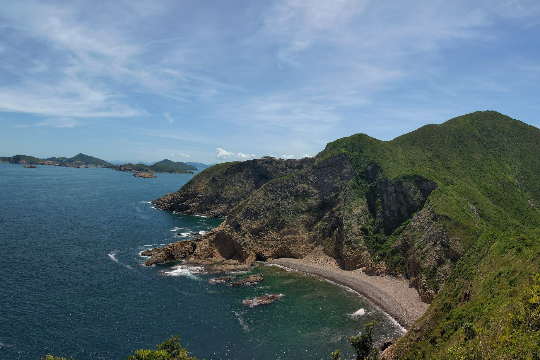
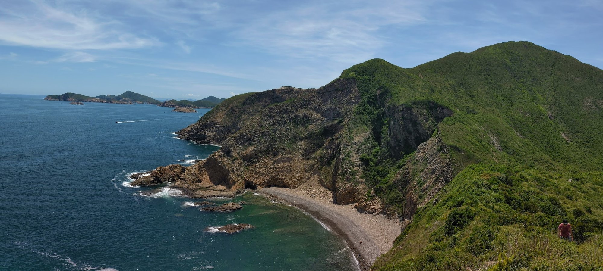
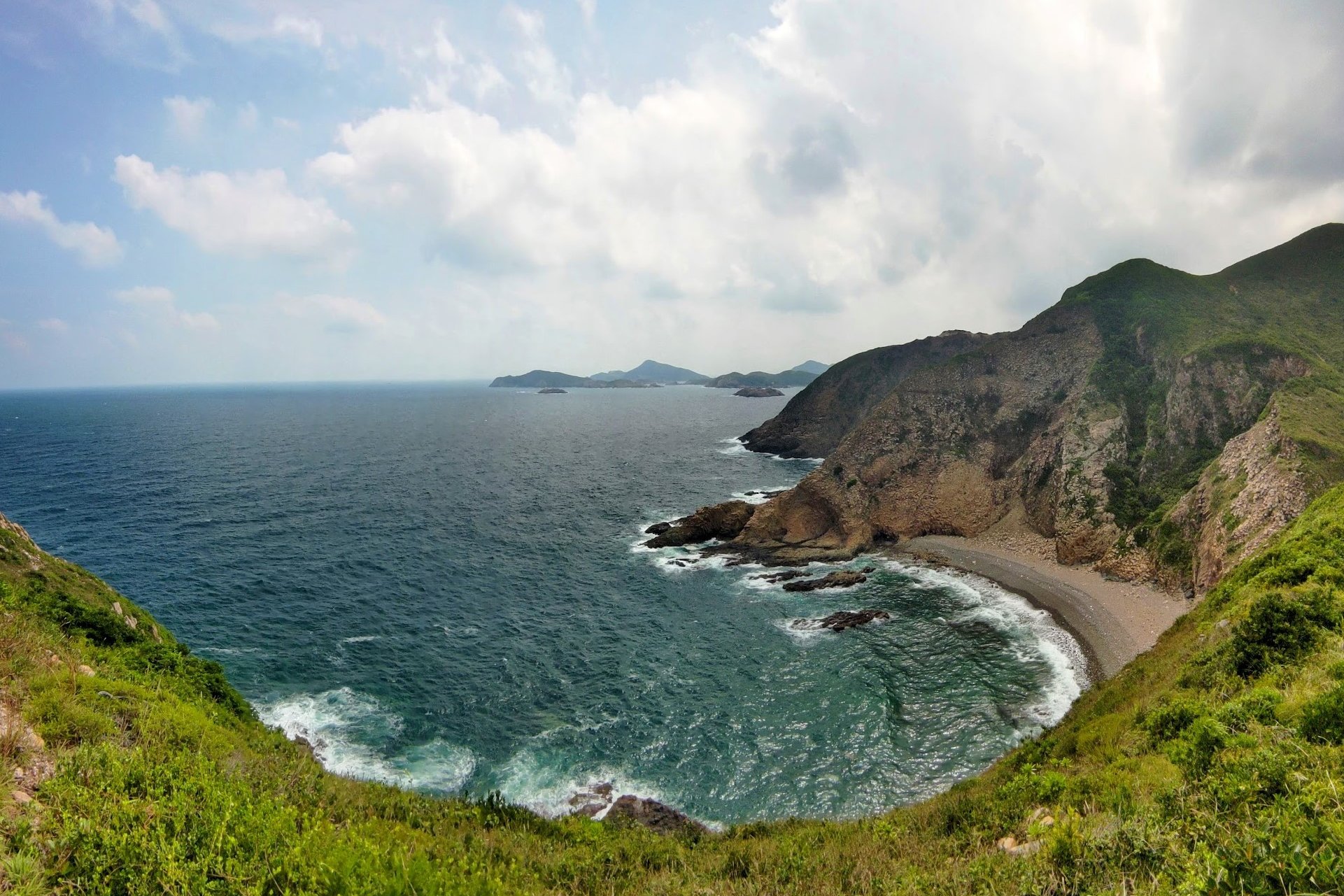
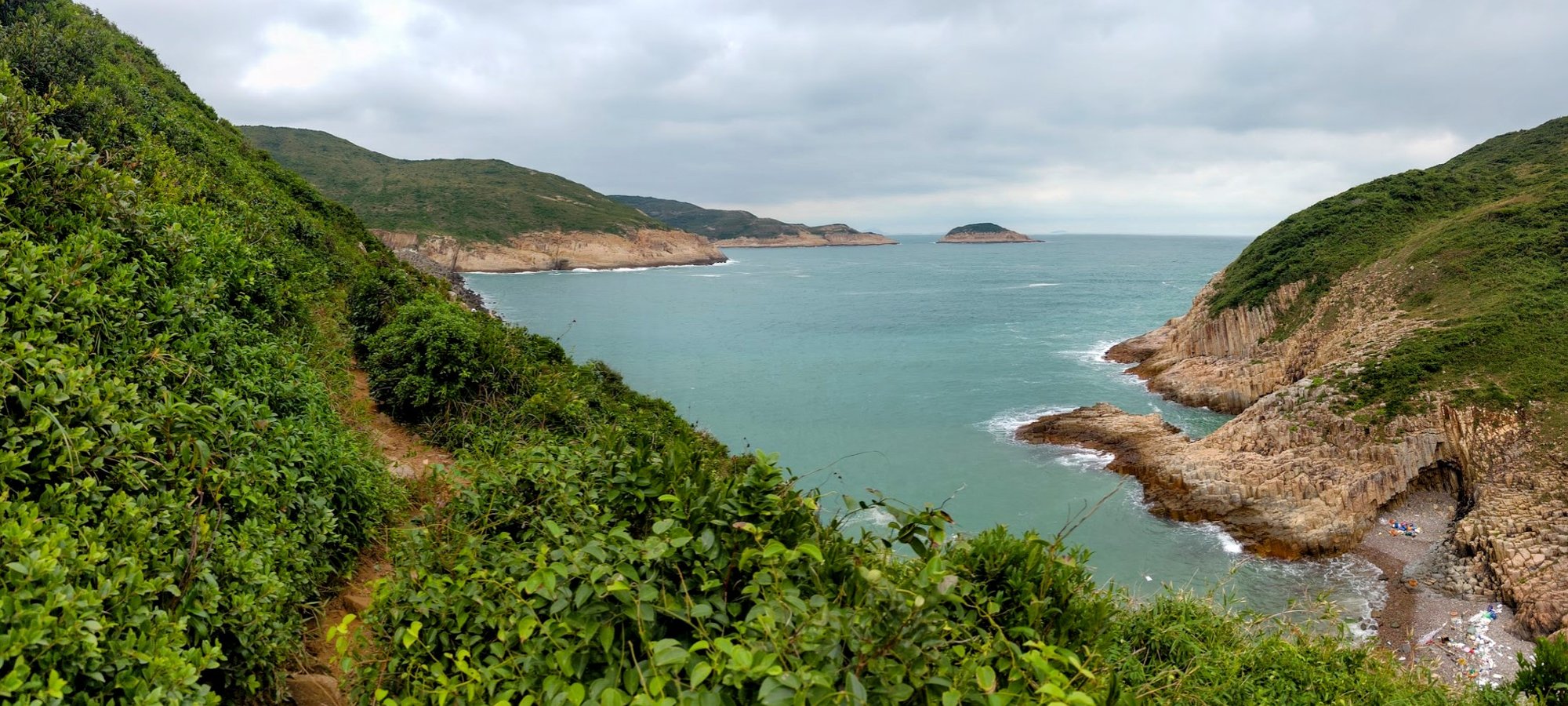
Ascending to Views of 'The Heart of Hong Kong'
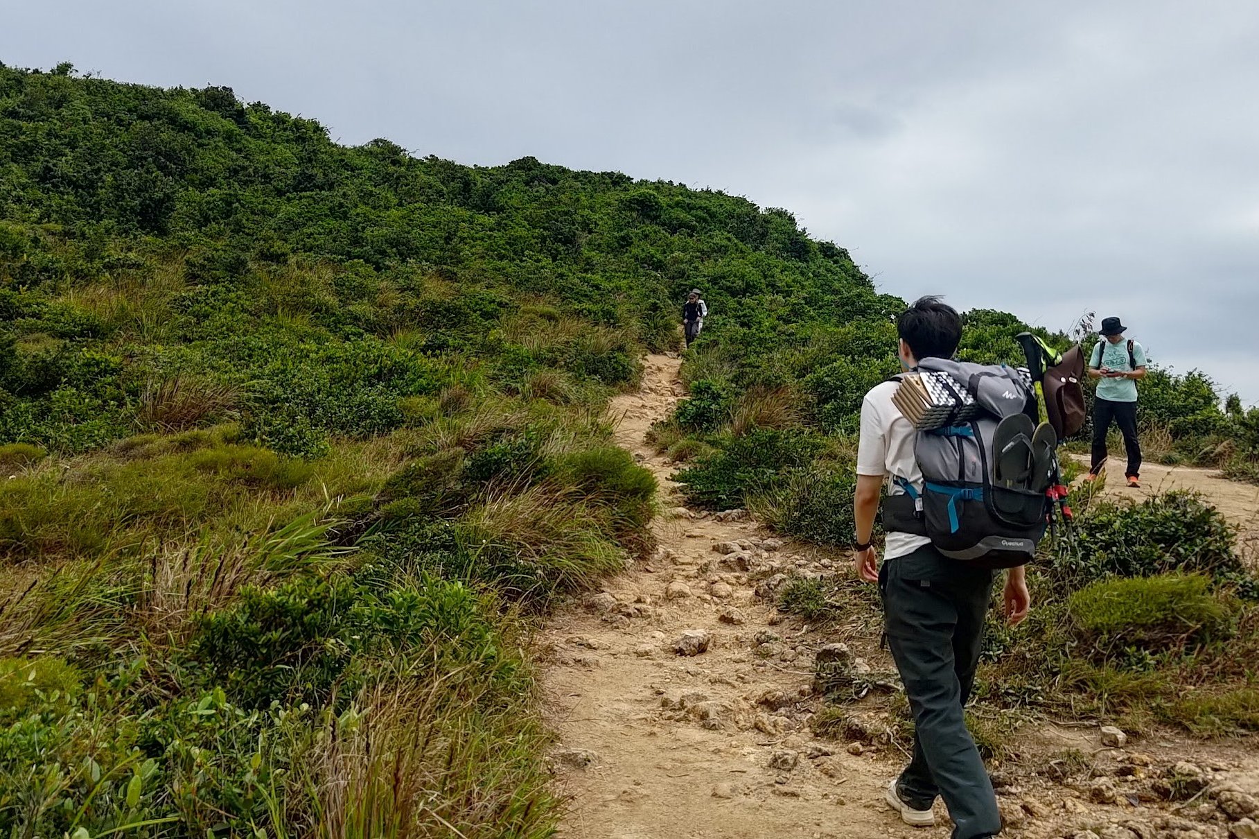
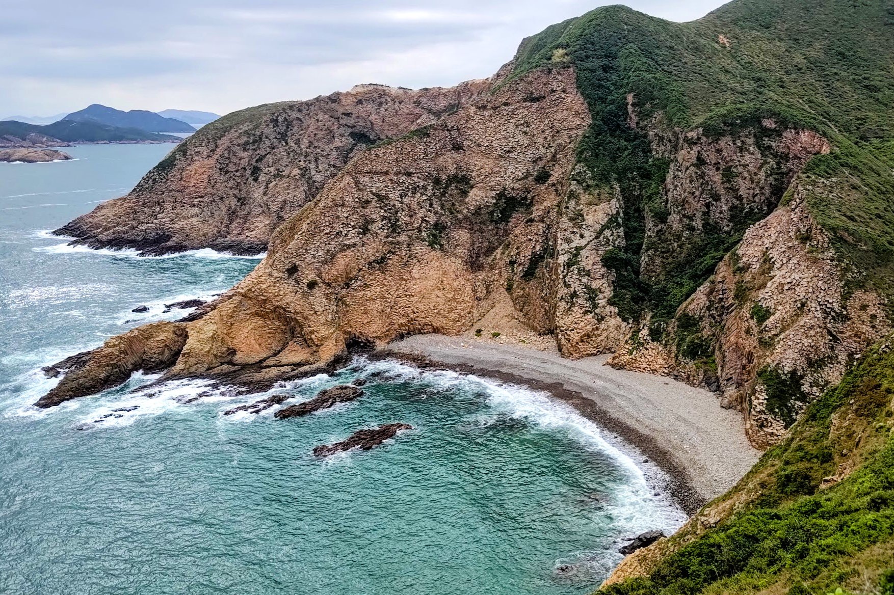
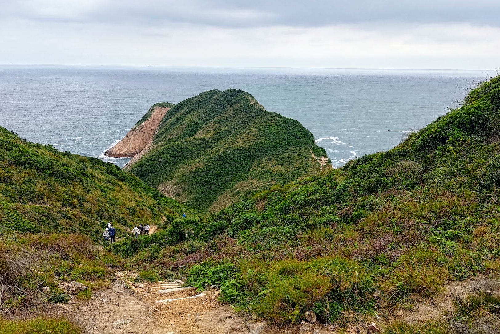
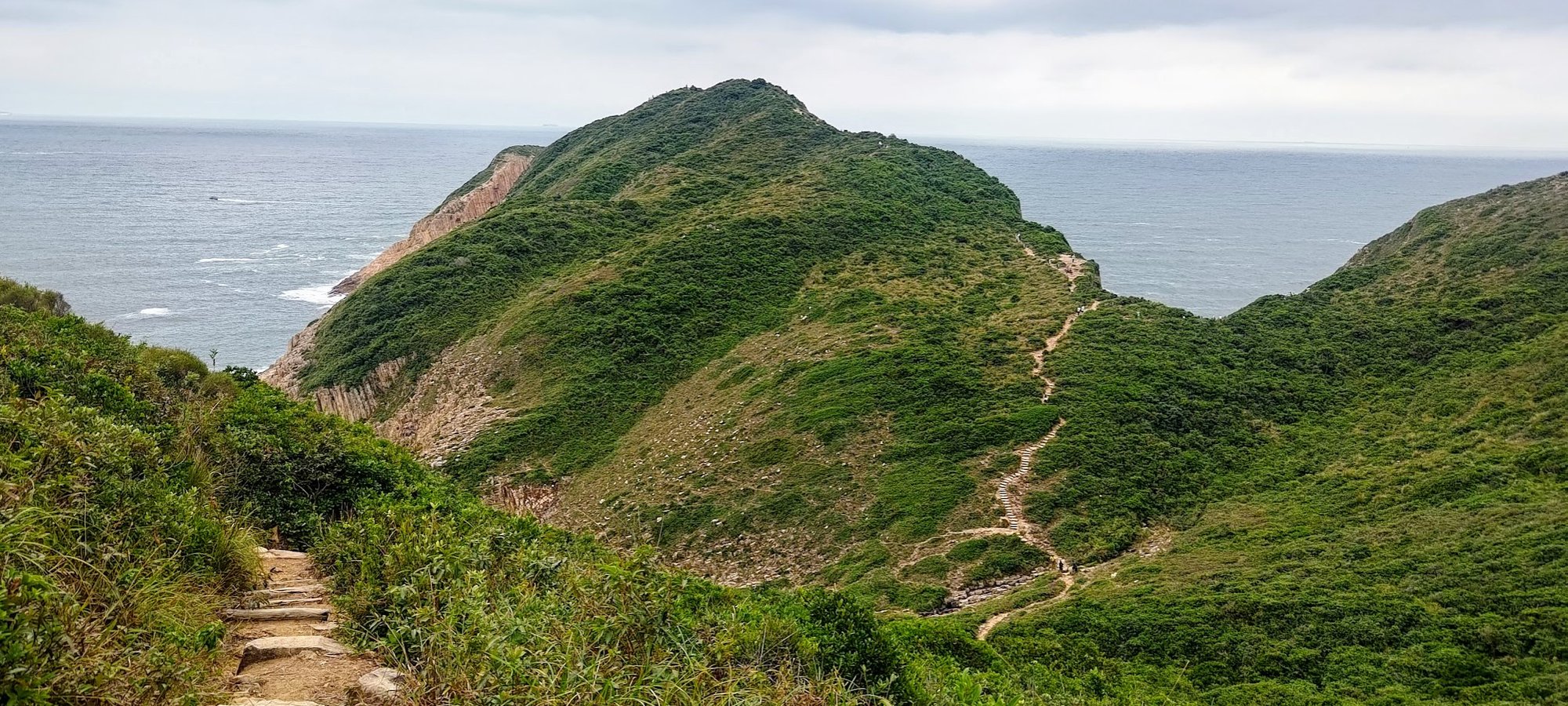
Once you've gone past trash beach, it's time to begin ascending the second hill for a VERY dramatic shift in scenery.
The moment the second hill's stairs end and the path turns to dirt, you'll be able to look over the edge and witness the South China Sea stretching out as far as the eye can see.
You'll also have a stunning vantage point over what's often termed 'The Heart of Hong Kong'. This grey beach, when combined with the curve of the mountain actually looks like half a heart, though I'm not certain if this is the reason this area has been bestowed this epic moniker.
Either way, keep climbing and continue to be spoilt by the scenery.
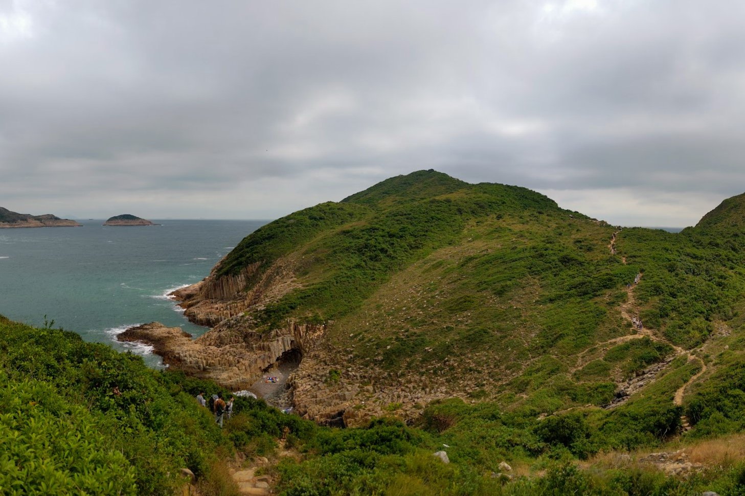
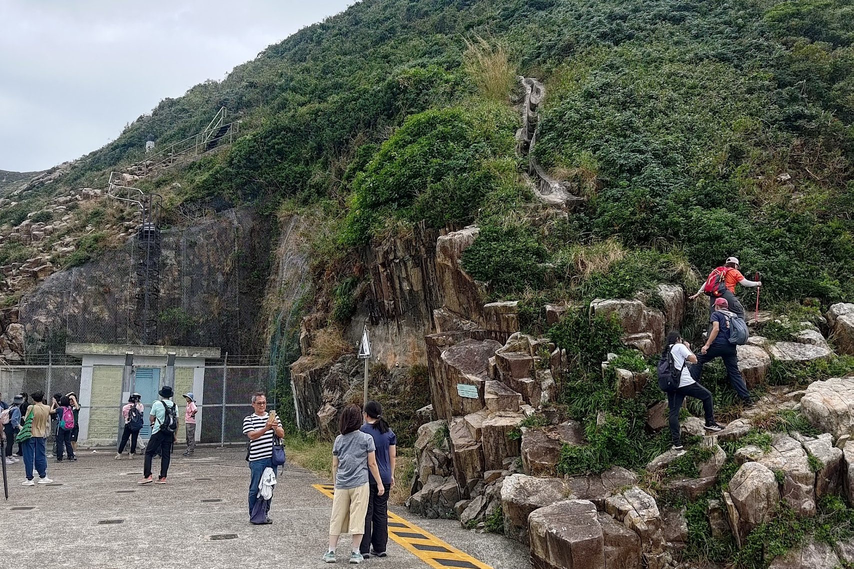
Getting to the Po Pin Chau Viewpoint
When you get to the top of the second hill, you'll reach what looks like a giant 'X'.
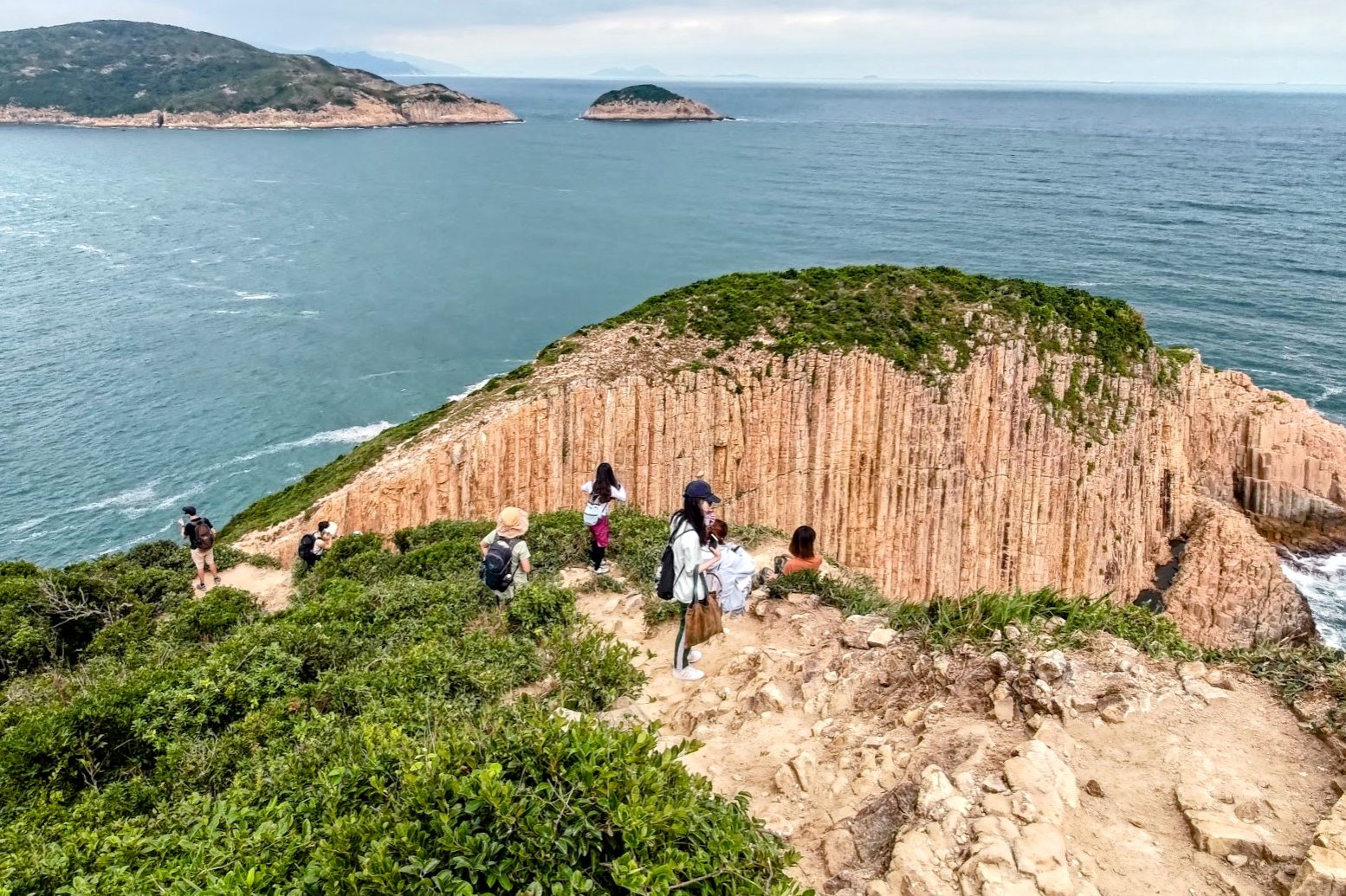
When hiking to Po Pin Chau in 2020, this area was empty both times I visited. I hypothesize this is because the trail is now much easier to navigate and far less overgrown in 2023.
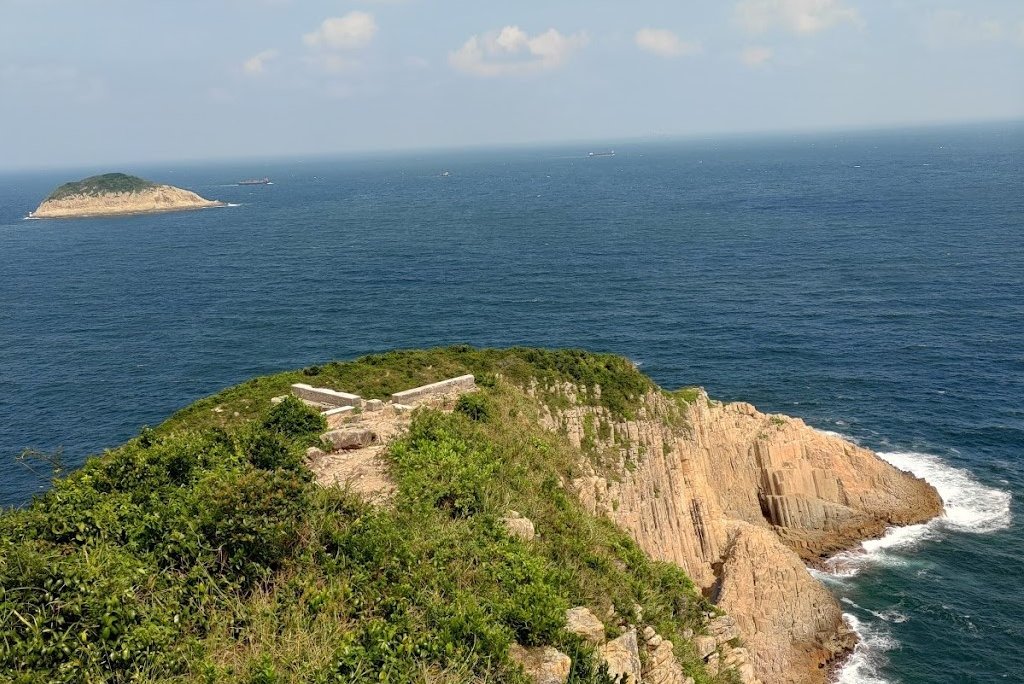
Anyway, from the 'X', take the dry, slippery path downward to the Po Pin Chau Viewpoint. Be careful and mind your step when descending to the viewpoint.
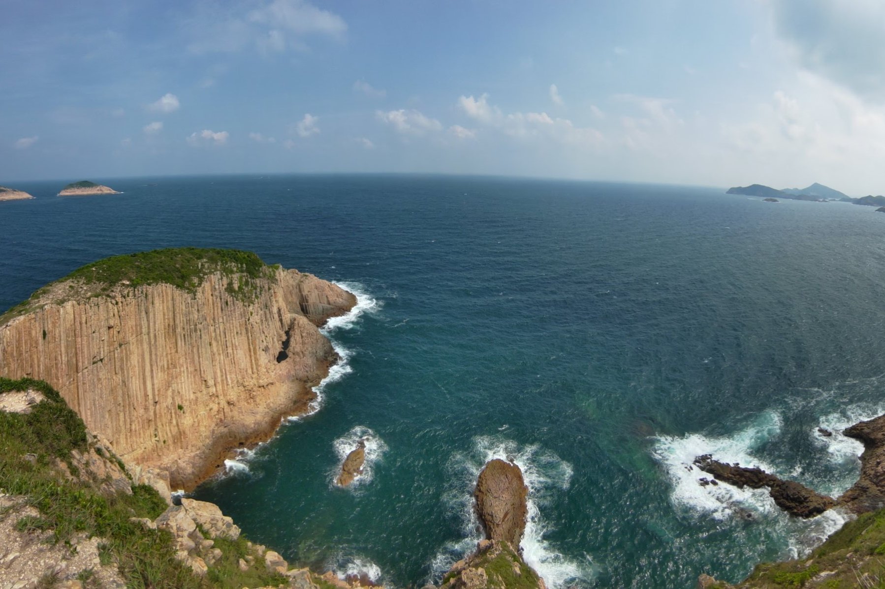
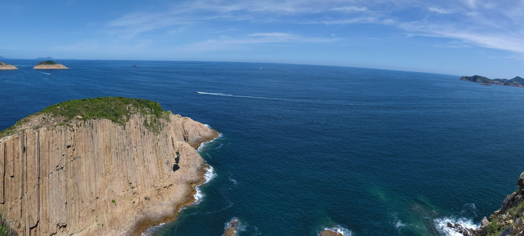
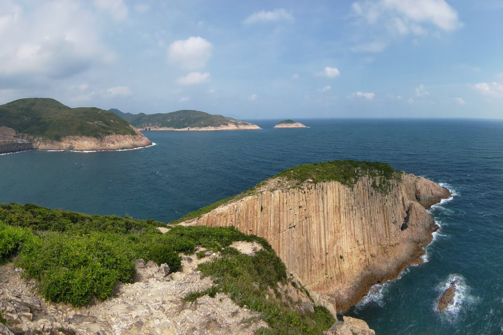
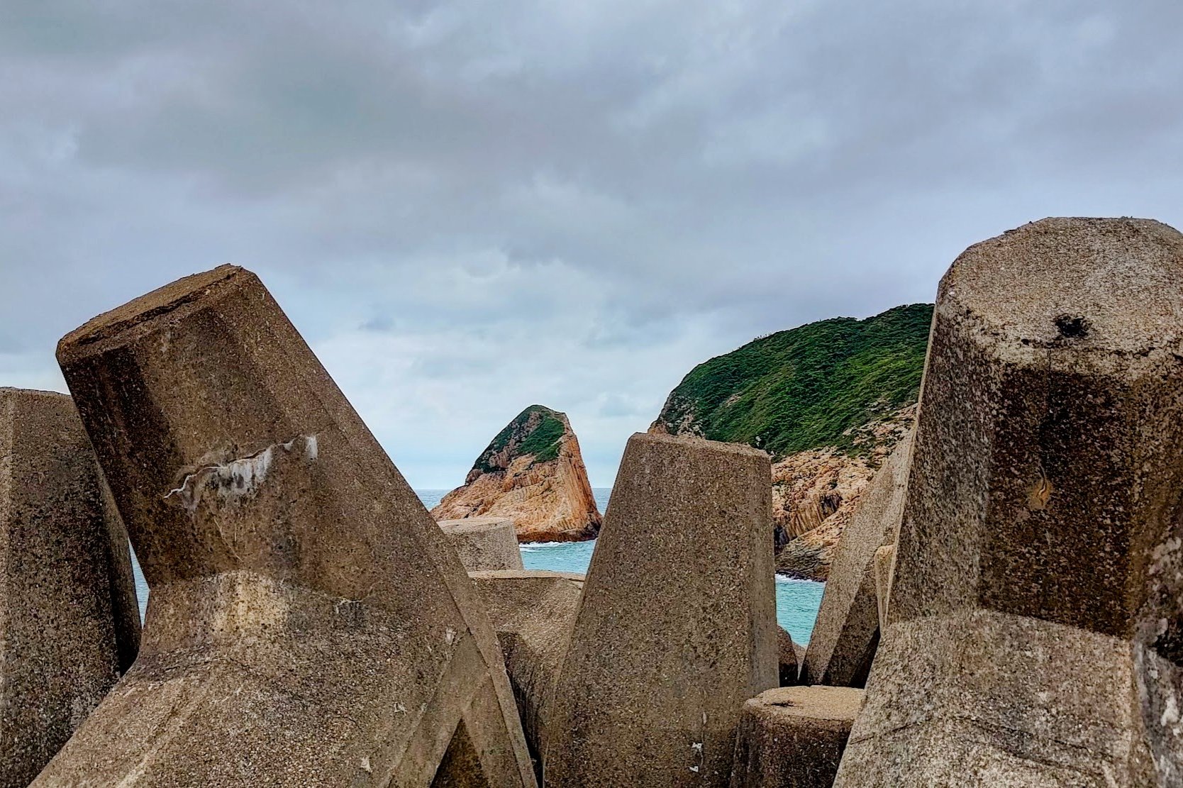
Po Pin Chau Viewpoint
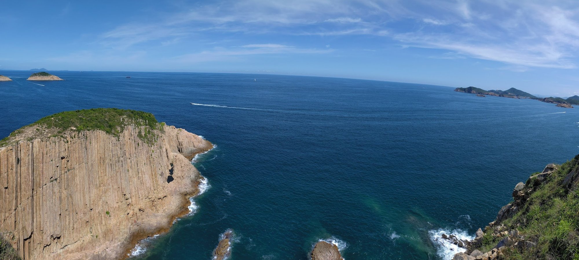
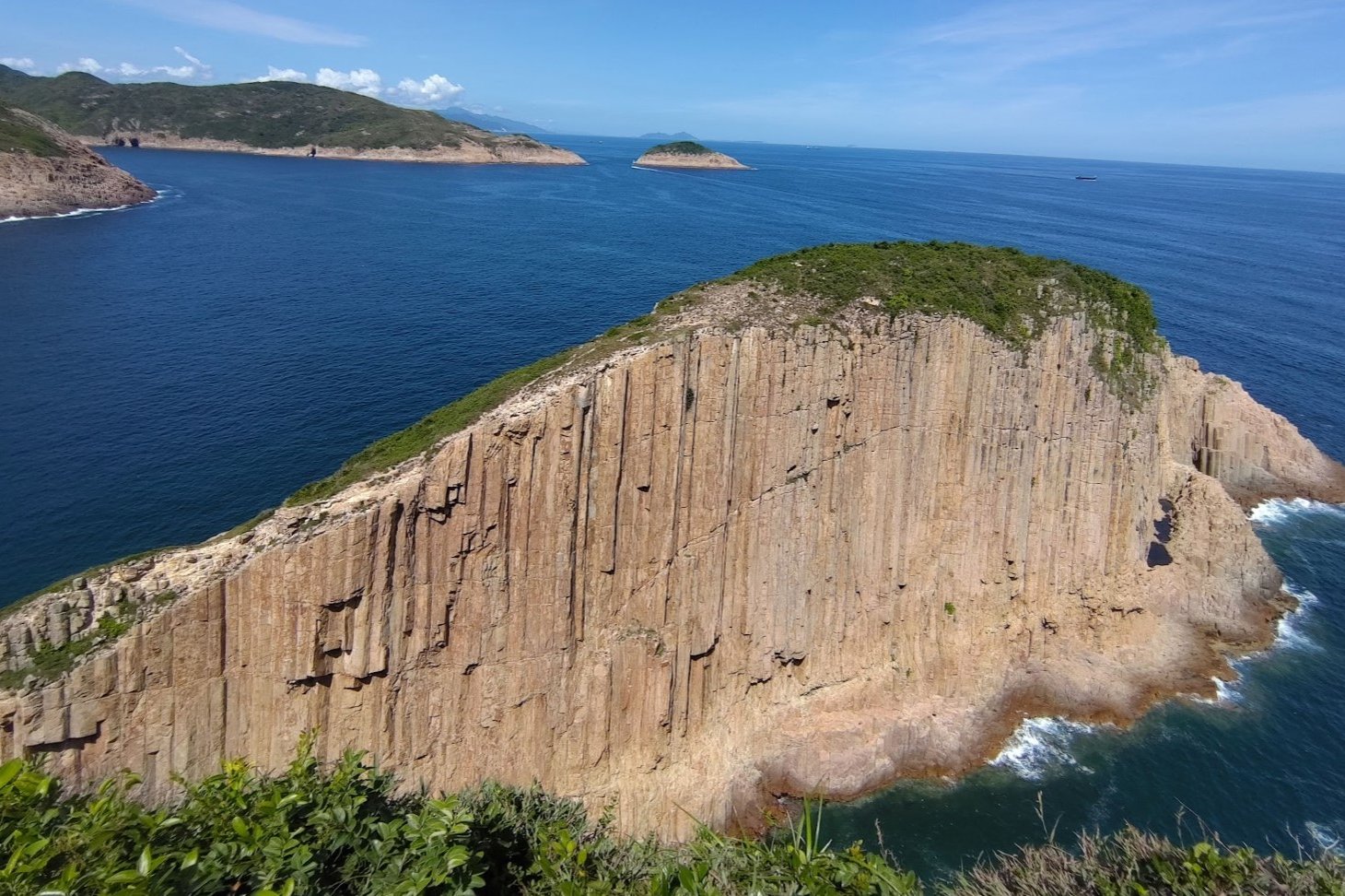
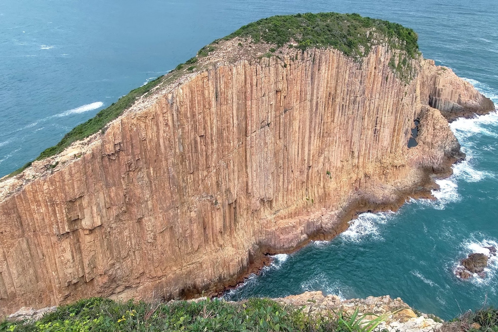
The Po Pin Chau viewpoint is pretty darn spectacular! There's a reason that this place is so crowded now in 2023.
Though you might have to try and find a good spot amongst all the other hikers, it's totally worth it for this incredible coastal scenery at the very edge of Hong Kong!
If you want a better chance of having Po Pin Chau to yourself, try to visit on a weekday. Your view may be compromised with loud chatter and people constantly jostling for the best photo spots on weekends.
Getting back to East Dam Safely
When you're ready to return to East Dam from the Po Pin Chau viewpoint, retrace your steps to the base of Fa Shan.
From there, you can either take the stairs back up to the top of Fa Shan and return the same way you came, or take the shorter path around the coast to East Dam.
The coastal route is MUCH more technical, so if you prefer the safest route back, take the route that goes back up Fa Shan (the same way you came).
If you want to take the shorter, coastal route, take the stairs that lead to the flat path at the base of Fa Shan.
You'll go past trash beach and in just a few minutes, you'll see East Dam looming before you.
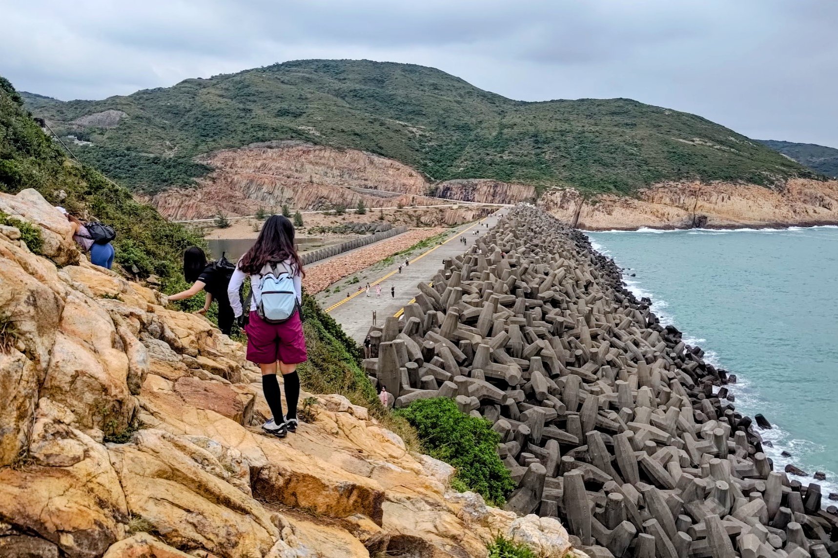
IMPORTANT
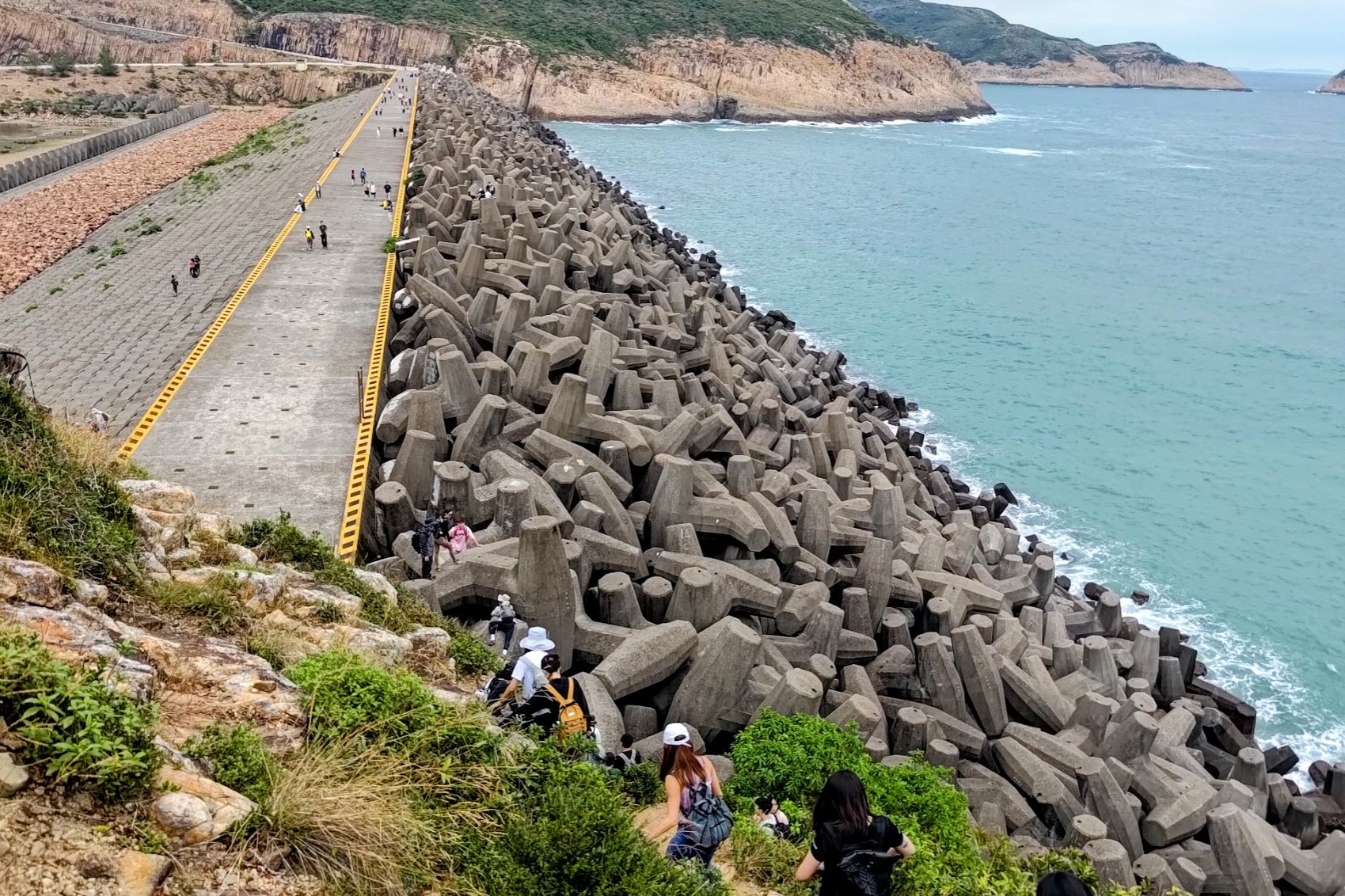
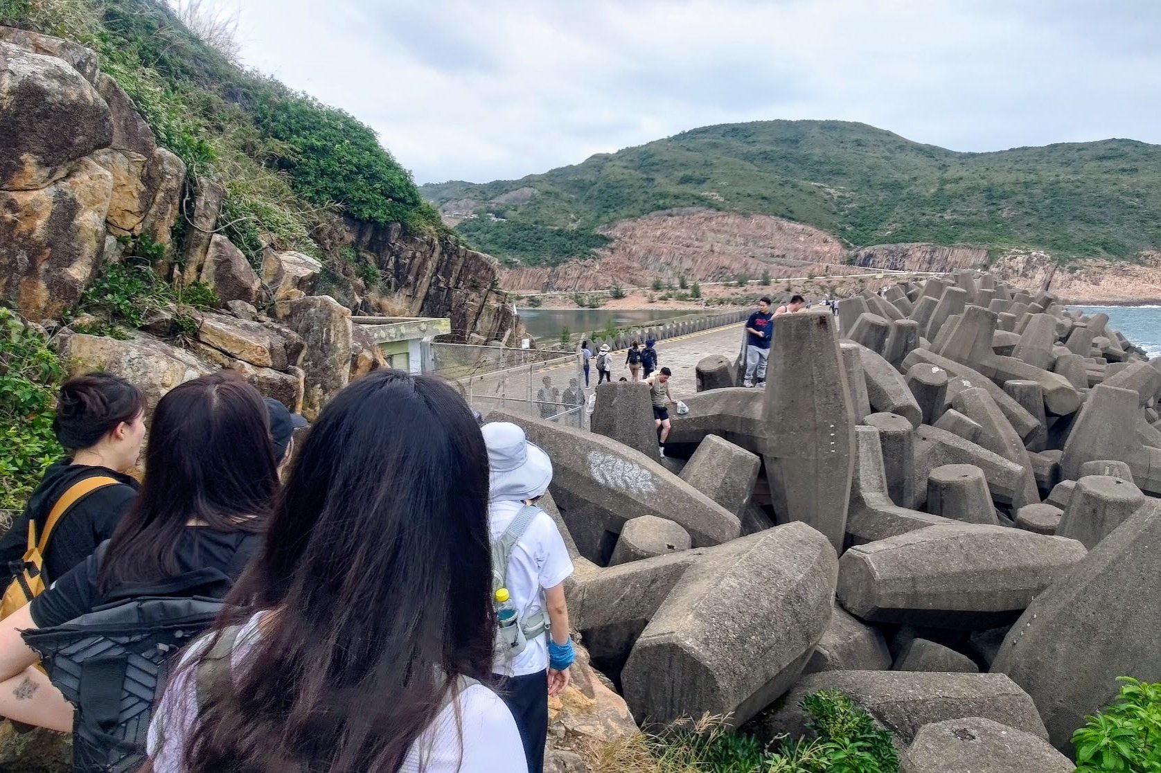
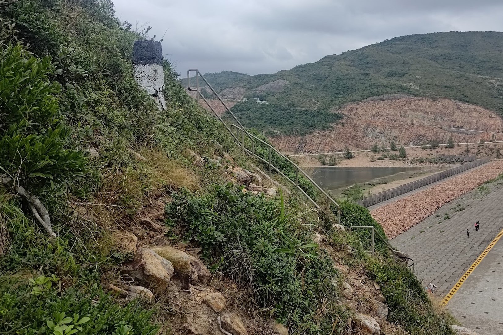
When descending down to East Dam, you may be tempted to go down the first path you see. This path is really technical, usually has a line of hikers congesting the route and requires navigating along the giant dolosse that protect East Dam from powerful ocean waves.
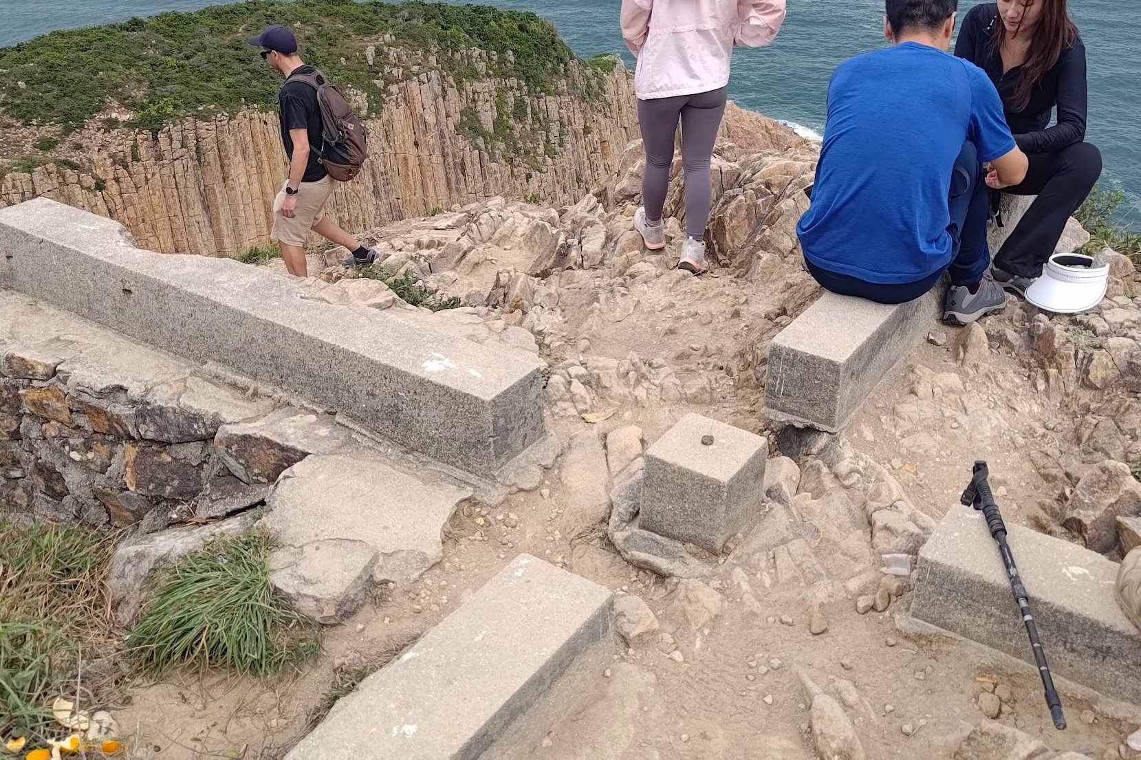
Instead, if you head upward to the black and white marker, walk past it and avoid the stairs next to it, you'll come to a drainage slope that's much safer to descend into East Dam from. There are images above if you're uncertain how to do this.
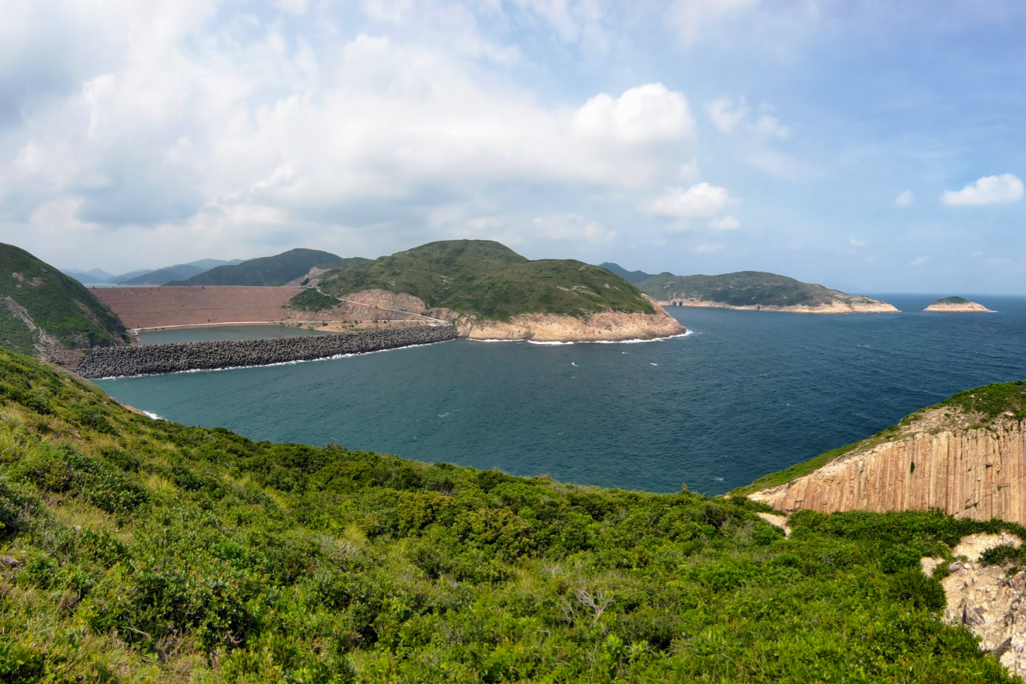
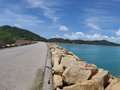
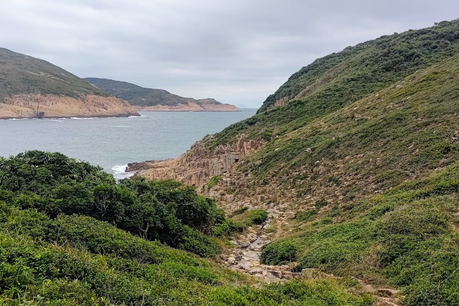
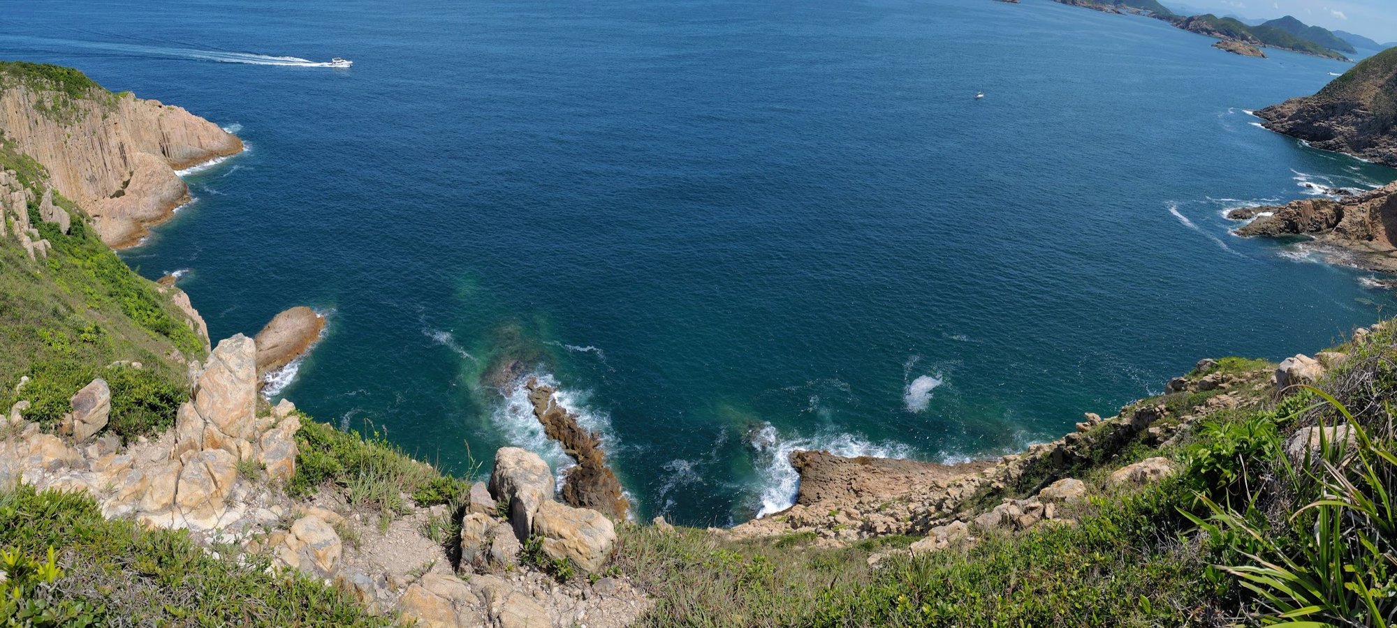
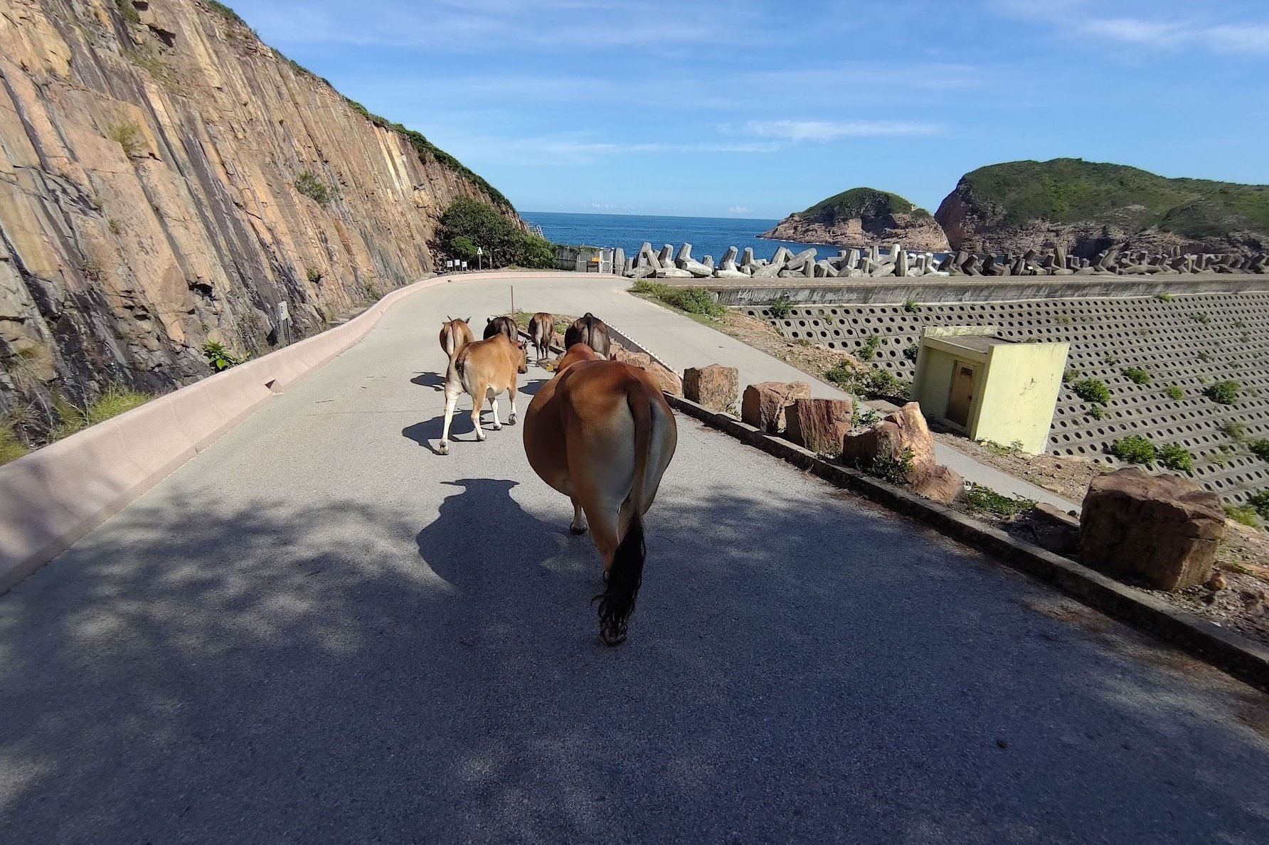
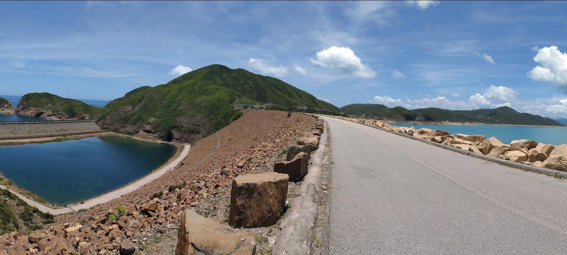
East Dam
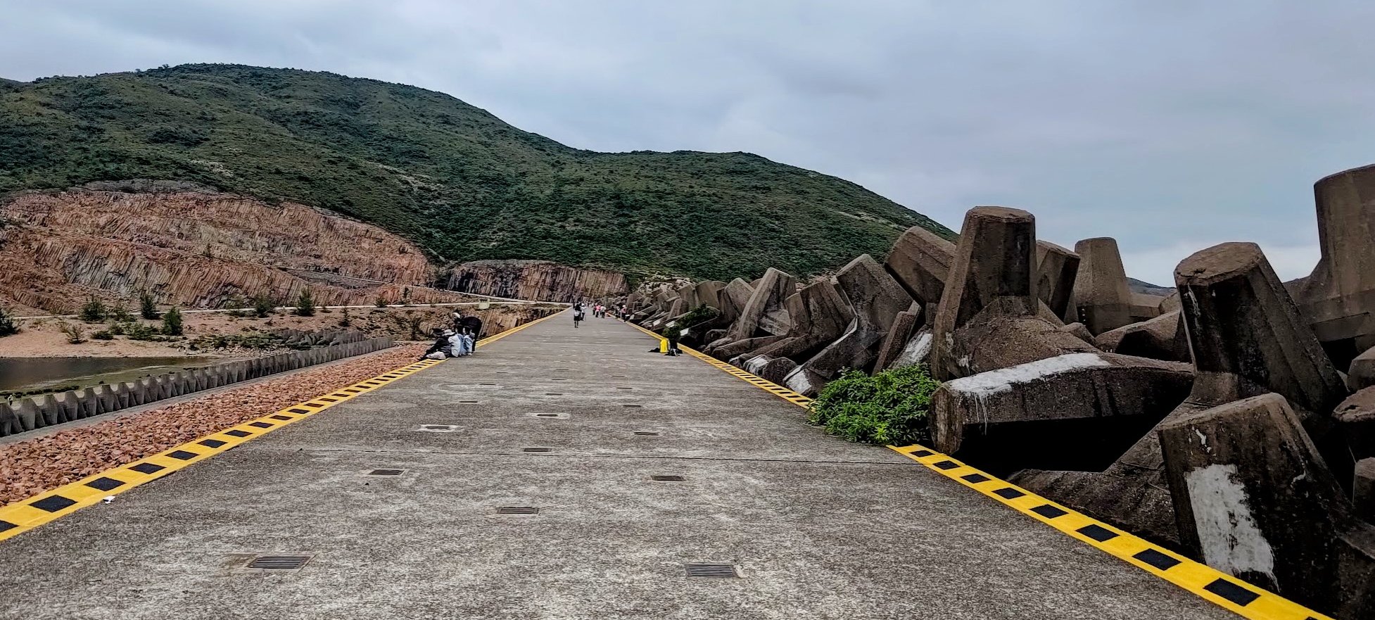
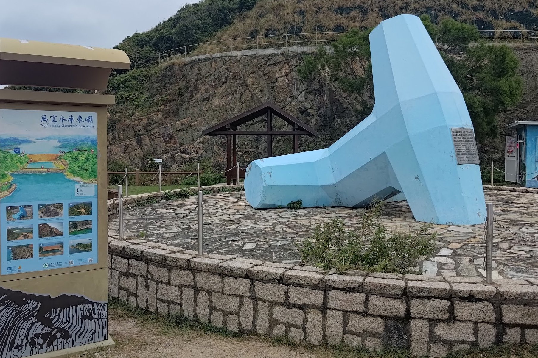
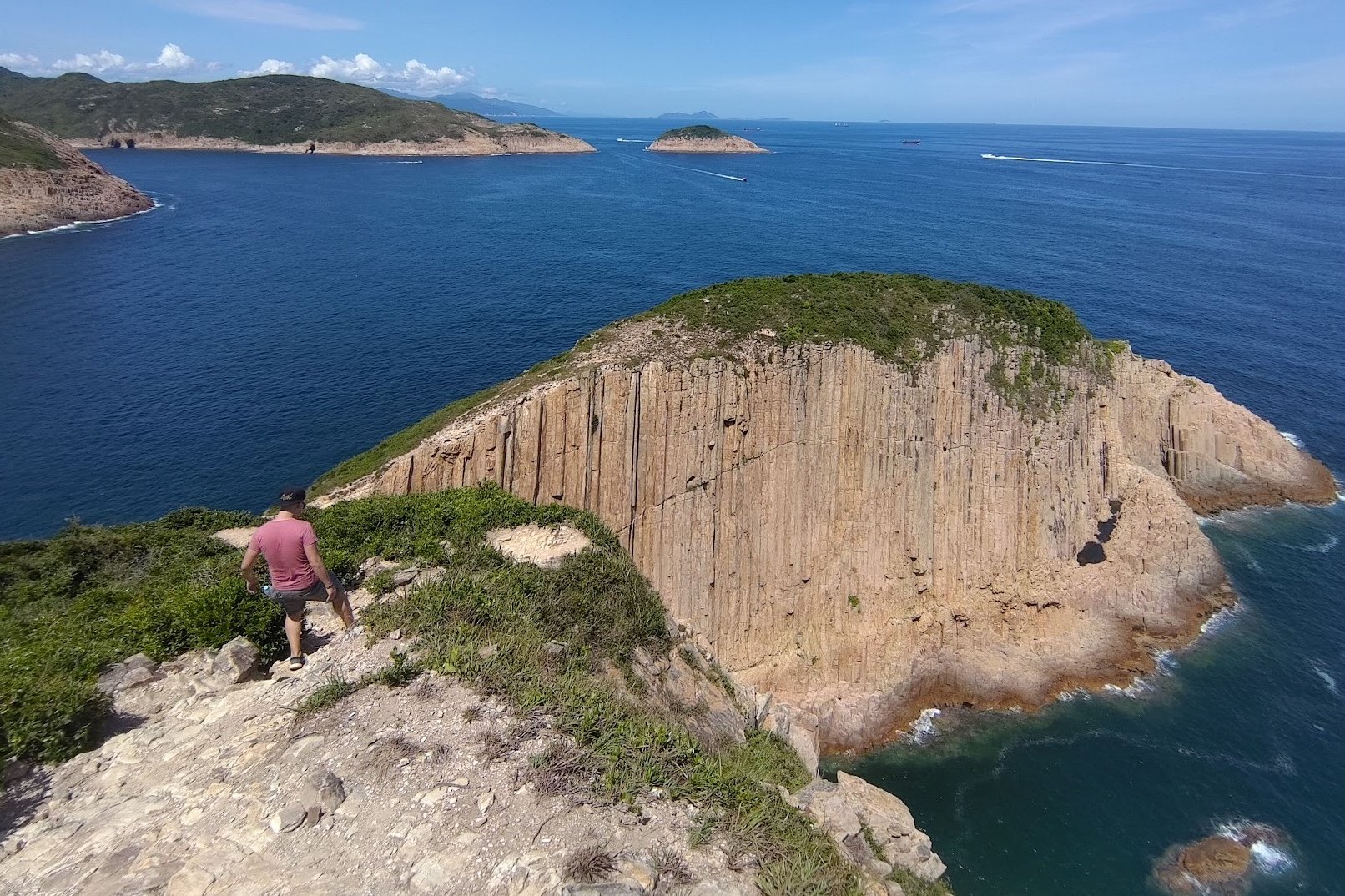
As you walk across the oceanside wall of East Dam, don't miss the cheeky little view of Po Pin Chau you can get from between the huge dolosse.
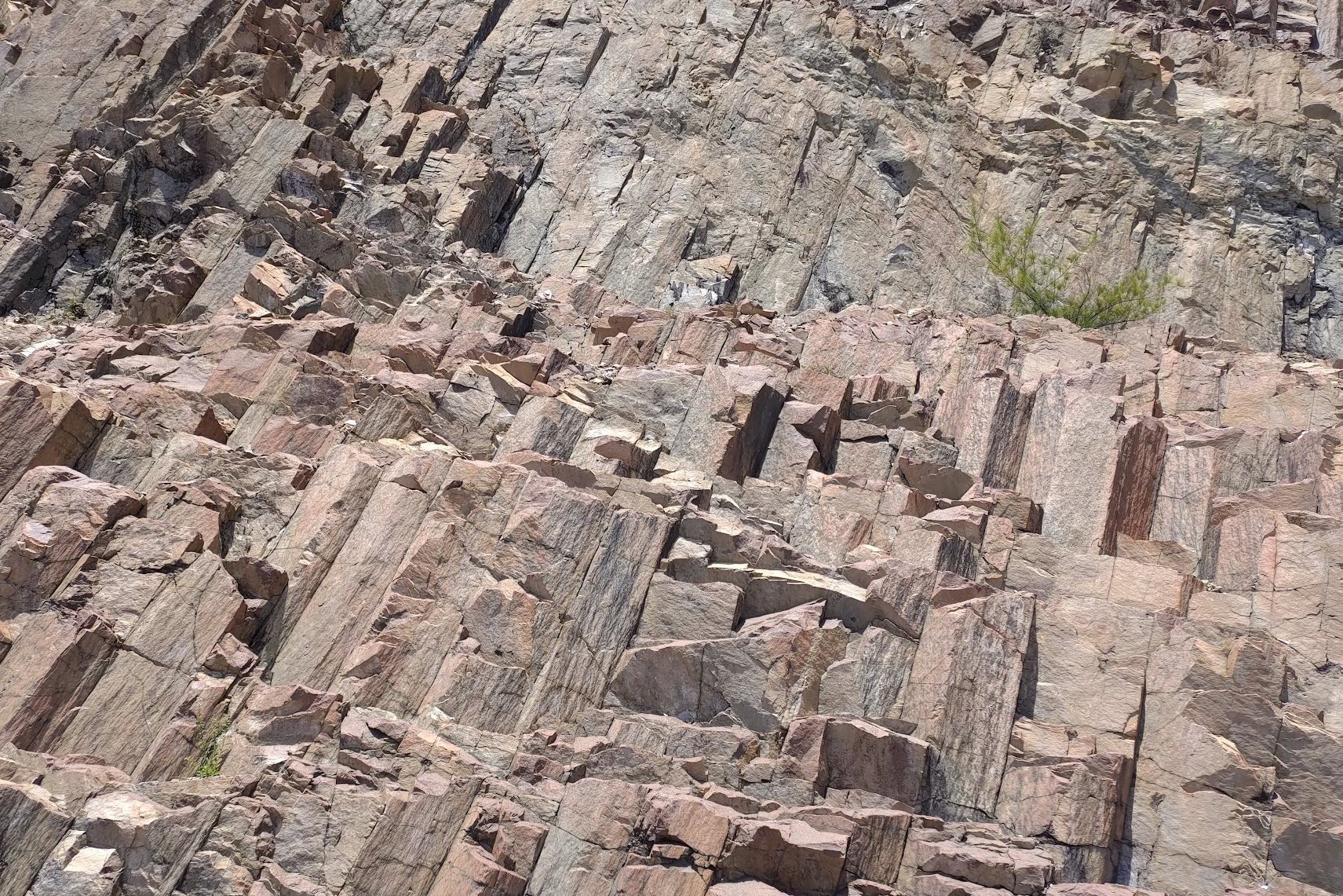
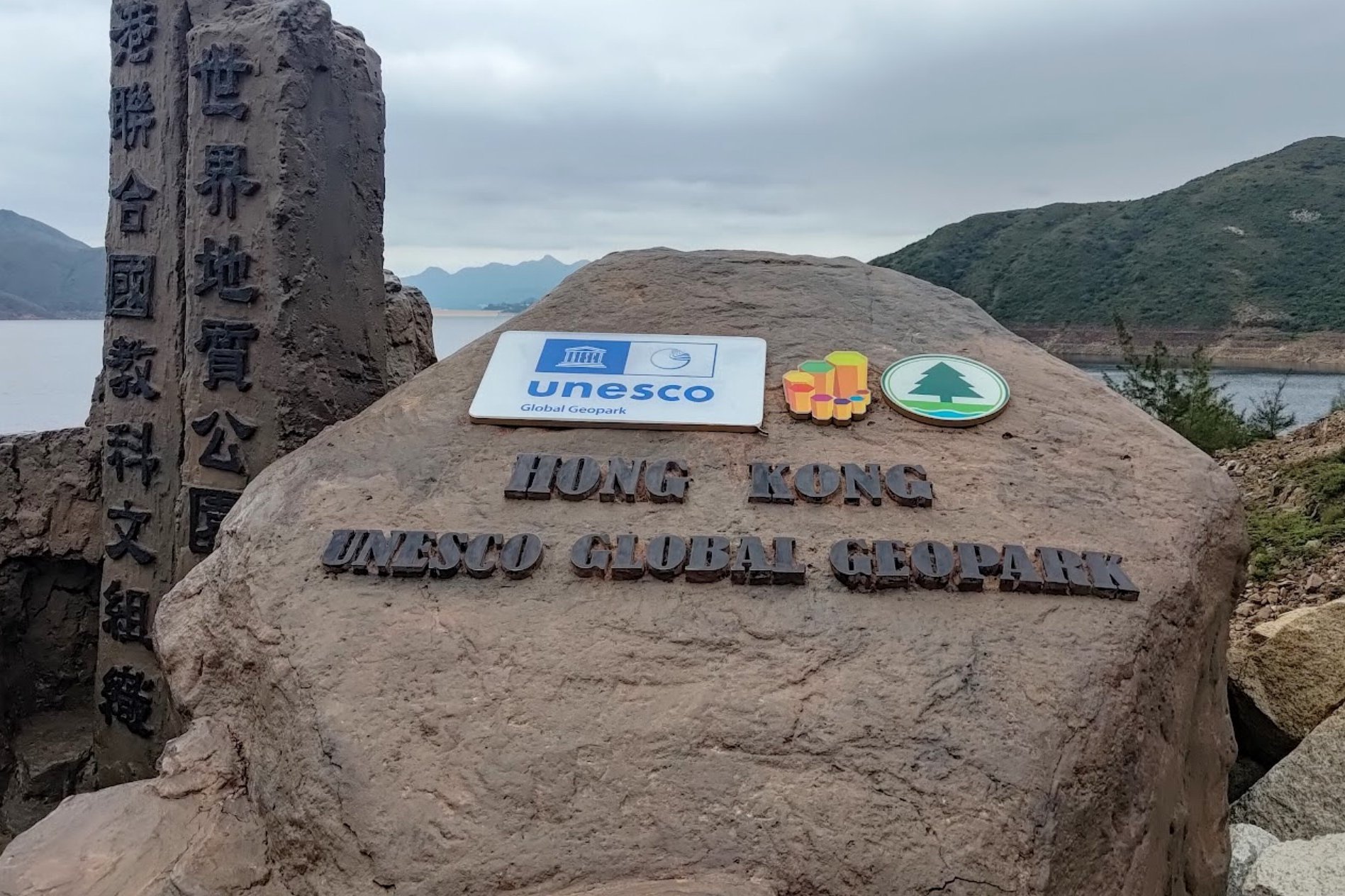
When ascending to the upper wall of the dam, you'll see some really cool hexagonal rock formations that were created some 240 million years ago by a volcanic activity that actually created Sai Kung as we know it today!
This is one of the reasons why this area of Sai Kung is a designated geopark.
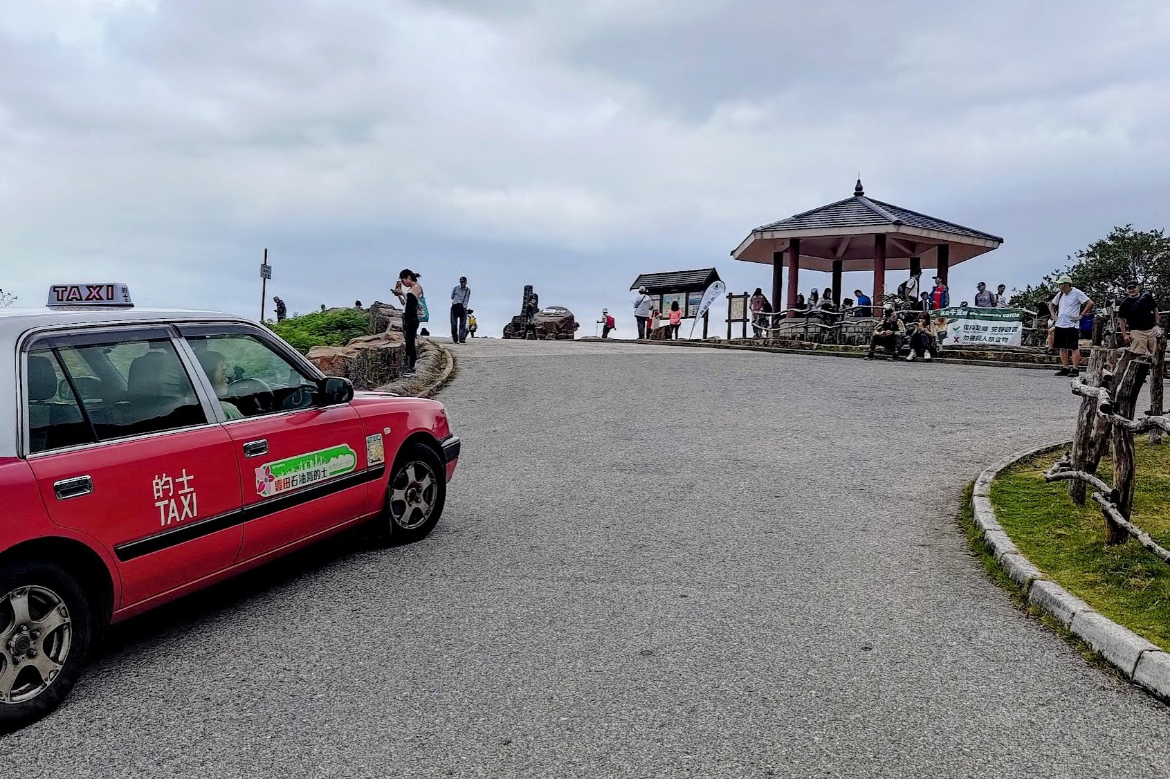
There's a pavilion at the top, where you can catch taxis back to Sai Kung or other places in Hong Kong.
Walking across the upper dam wall will give you stellar views of High Island Reservoir, which is Hong Kong's largest reservoir measuring in at 6.67 square kilometers with a maximum storage capacity of up to 281 million cubic meters of water.
Once you reach the other side of the upper dam, you'll be right back where you started and back at the bus stop.
Alternatively, if you returned via the same route, you'll arrive back at the start point, anyway.
Getting Back
There are 3 ways you can get back to the city from East Dam.
By Taxi
At the pavilion pictured above, you can flag down a taxi or call an Uber Taxi to pick you up. If it's crowded, leave a tip on the Uber Taxi app or you might be waiting for a while for a ride due to high demand.
By Minibus
The 9A minibus leaves frequently from just below the secret stairs at the start point of the hike. It'll drop you at Pak Tam Chung bus stop, where more buses connect to Sai Kung Town or back to the city.
By Hike
Hike back to the start point via High Island Reservoir (Stage 1 of the MacLehose Trail)
Too Easy? Pair This Hike With High Island Reservoir
If this hike was too easy, you can actually hike back to Sheung Yiu bus stop via MacLehose Stage 1. You'll get awesome High Island Reservoir views on this route and it's not particularly tough.
Find out more in the article below and check out the route map for more guidance.

