
Devil's Peak to Lei Yue Mun: A Hike to a World War 2 Battle Site and Traditional Villages
Contents
- Essential Information
- Hike Highlights
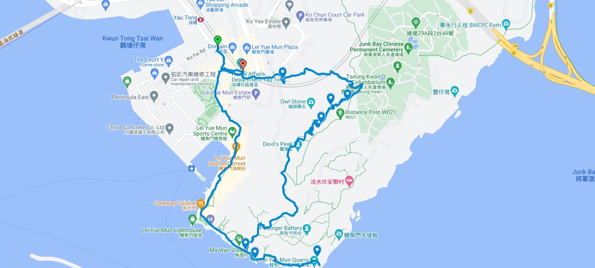
- Google Route Map
- How to Get There
- Quick Route Summary
- Detailed Route
- Devil's Cave
- Devil's Peak Battery (The Summit)
- Best Hong Kong Island View of the Hike
- Observation Post
- Early Exit Back to Yau Tong
- Getting to Lei Yue Mun
- Ma Wan Village, Lei Yue Mun
- Tin Hau Temple and Ma Pui Village
- Old Lei Yue Mun Quarry
- Getting Back
Devil's Peak to Lei Yue Mun Hike Details
- District: New Territories
- Duration: 2.5 hours (with the Lei Yue Mun Quarry detour) 1.5 hours if you just head back to Yau Tong after Devil's Peak
- Distance: 6.3km
- Highest Elevation: 222 meters
- Difficulty: 1.5/5
- Facilities: None. Make sure to use the toilet and stock up on liquids and food before arriving at the start point
Why Hike From Devil's Peak to Lei Yue Mun?
This route is a bit different to the traditional route up to Devil's Peak, though you will see all major points of interest and even a few more, like Devil's Cave. The start of the traditional route is marked with a pin on the route map below and is very close to the route I like to take.
With that out of the way, this is a hike that will really speak to those who have a penchant for history, culture and adventure. While hiking up to Devil's Peak (魔鬼山 | 炮台山) isn't a tremendous challenge, there are loads of secret locations and points of intrigue along the way.
From hidden caves to military batteries, Devil's Peak is a location steeped in incredible stories and historical significance. It was also the site of one of World War II's major battles in Hong Kong, as is recounted in the diary of British Major John Monro:
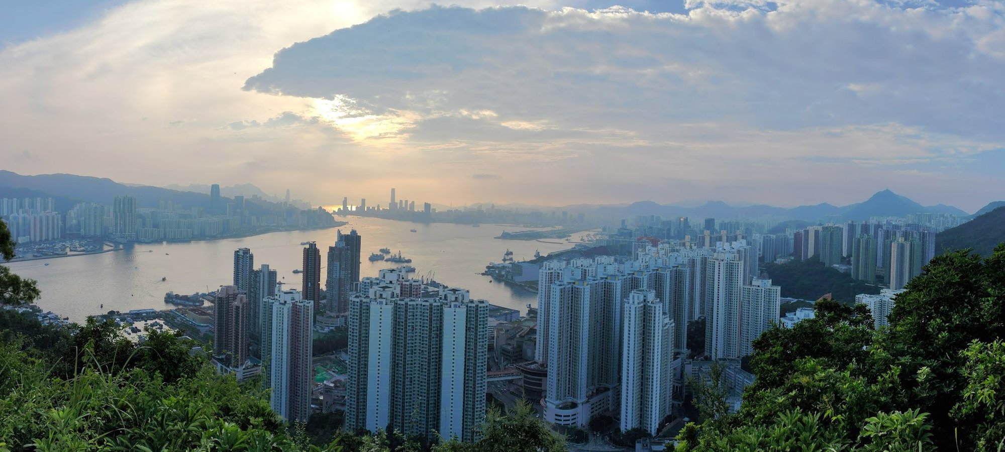
Pretty harrowing stuff! Fortunately, the summit of Devil's Peak, which was once a point of strategic importance for soldiers to spot incoming Japanese ships, is now just a really unique location to get stellar views of Hong Kong Island and parts of Kowloon and the New Territories.
Heading back down, the hike continues through Lei Yue Mun Fishing Village (鯉魚門村), which was built over 200 years ago! There's an old quarry and a grassland along with preserved houses and a traditional temple flanked by cannons!
Get ready for A LOT of adventure in a very short span of time!
Google Route Map
Devil's Peak and Lei Yue Mun GPX (does not include detour to the quarry. Refer to the below map for that)
In the map below, it doesn't show the turn you have to make to Gough Battery. I've marked the turn to Gough Battery with a pin in the below map. Instructions and pictures for the turn are also in the article.
How to get to the Devil's Peak Hike Start Point
Simply take the MTR to Yau Tong station. The hike begins from exit A2.
Quick Devil's Peak and Lei Yue Mun Hike Route Summary
- Go down the stairs just outside Yau Tong MTR Exit A2
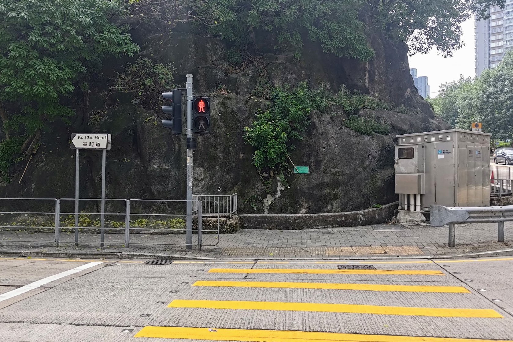
- Follow Cha Kwo Ling Road before turning left on Ko Chiu Road
- Cross to the other side of Ko Chiu Road and follow it straight ahead
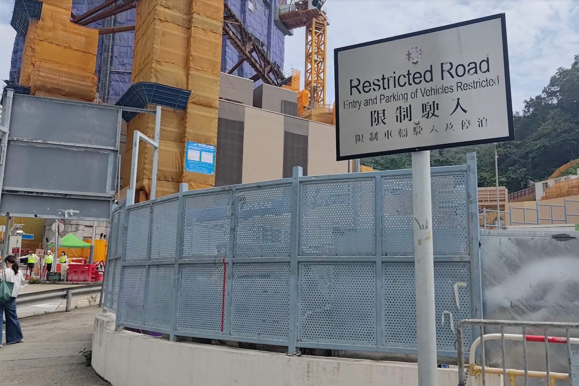
- You'll need to go right on an unmarked road (it's after a grey 'Restricted Road' sign
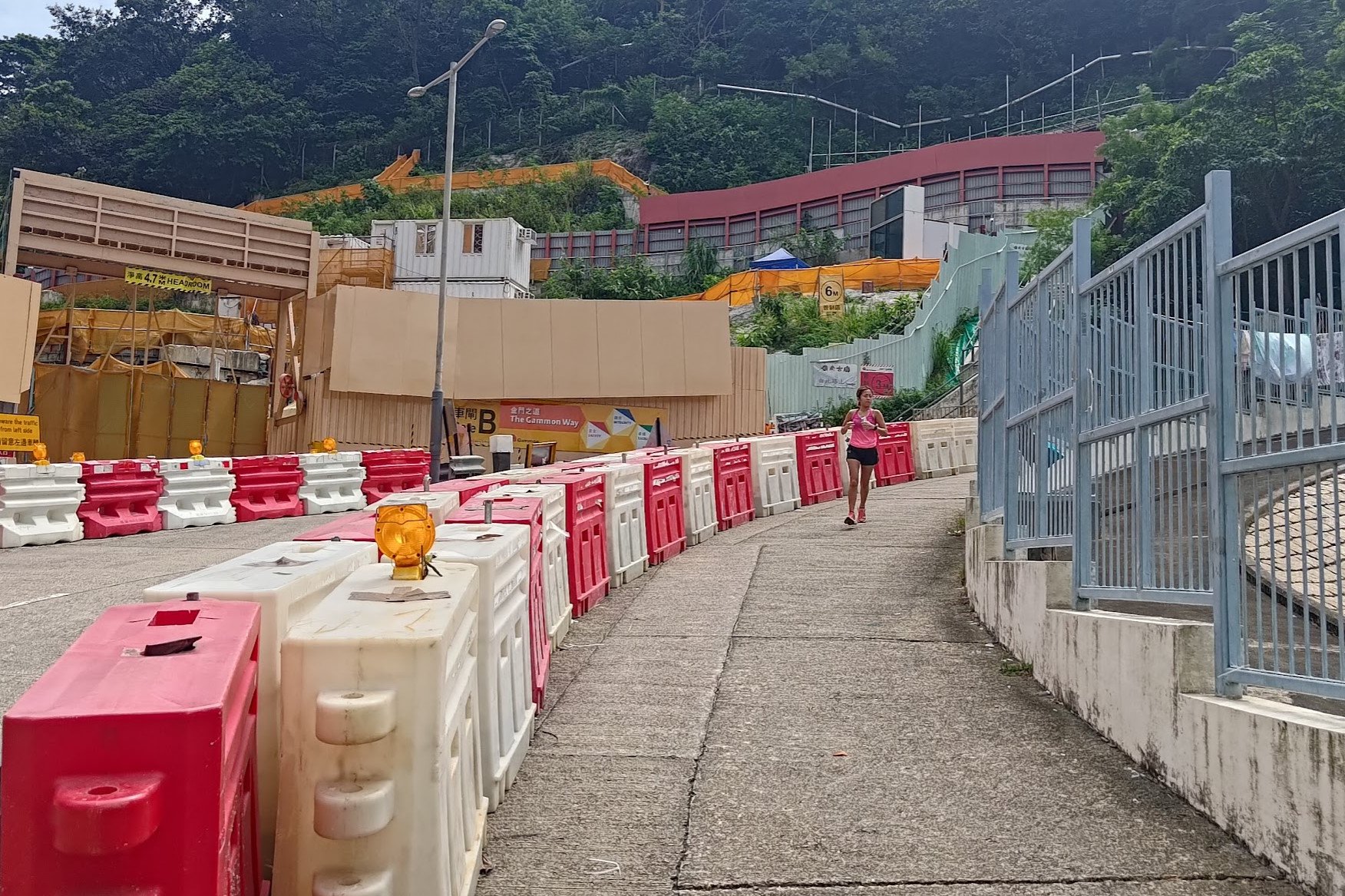
- Almost immediately after turning, you'll see a set of stairs with black/grey railings to your left. In 2023, these stairs are surrounded by white/grey construction barriers
- The stairs merge into a path that goes past the red Lingnan Temple
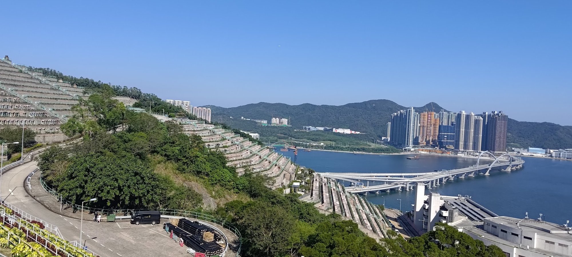
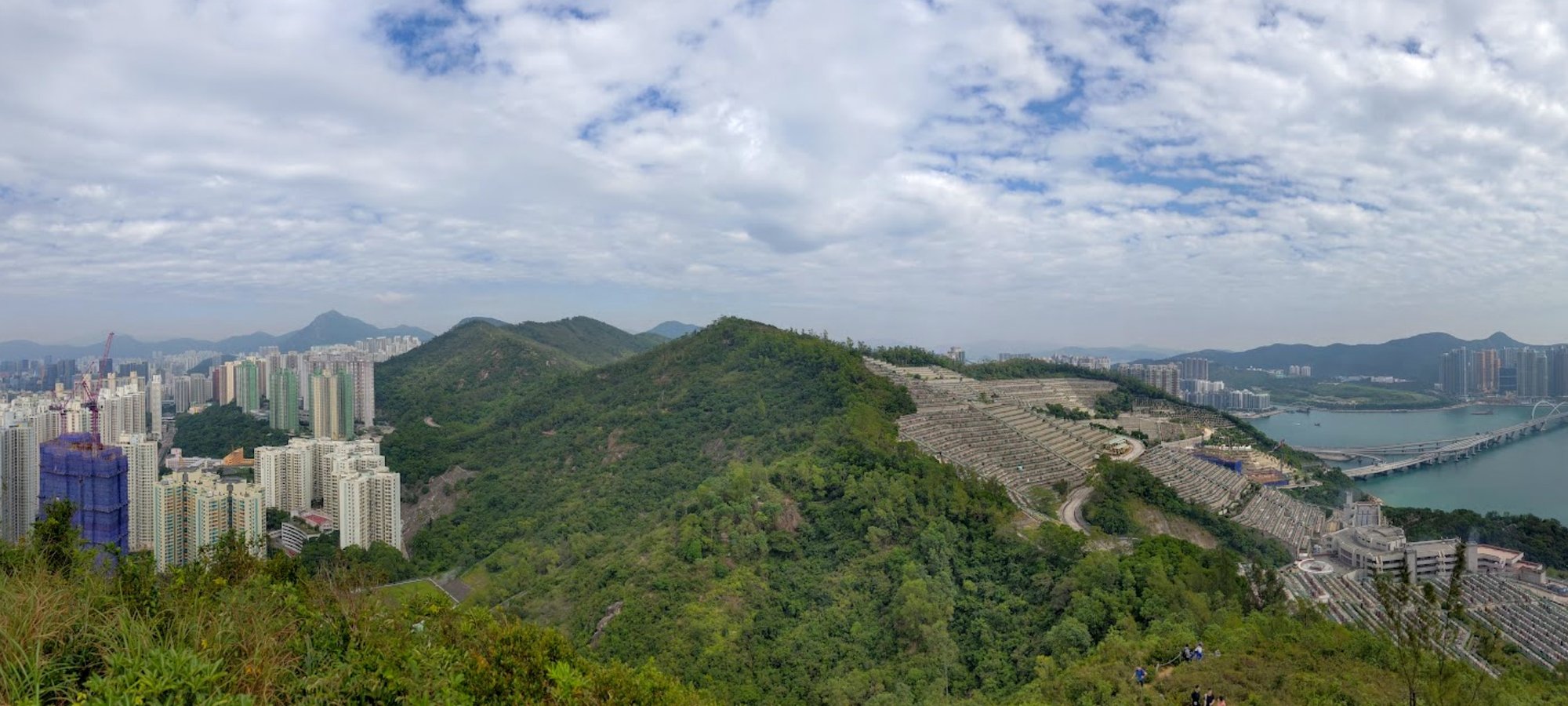
- About 10 minutes later, the path will open to reveal the nearby cemetery along with expansive views of LOHAS Park and the Tseung Kwan O Cross Bay Bridge
- As you begin to climb the stone steps with rope supports, look for Devil's Cave to your right. It's easy to miss, so keep your eyes peeled
- After exploring the cave (it doesn't go very far), return to the cave entrance and climb to the summit of Devil's Peak, which is the Devil's Peak Battery
- After exploring, take the red-railinged stairs down on the opposite end from where you entered Devil's Peak Battery (epic views of HK Island here)
- Once the stairs turn into a downward-sloping path in the trees, look for an unmarked, overgrown, upward-sloping dirt path on your left. This leads to the Devil's Peak Observation Post
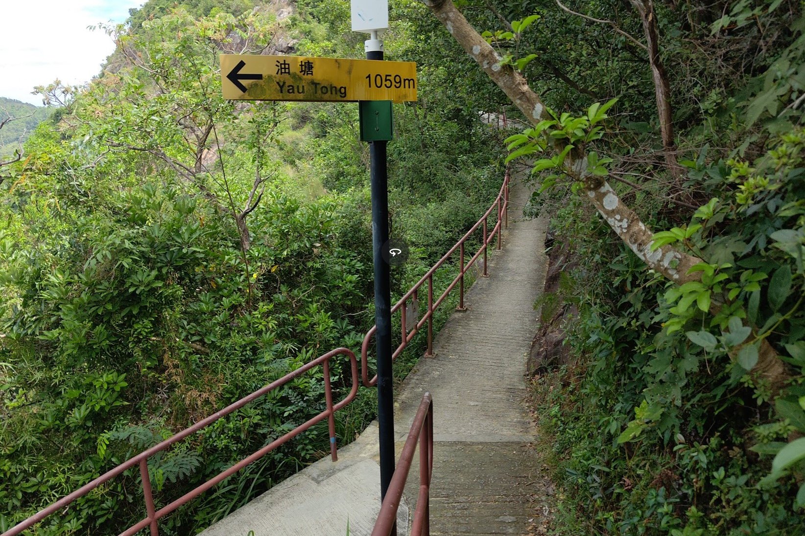
- Return to the main trail, and continue heading downward, following the yellow signs to Yau Tong
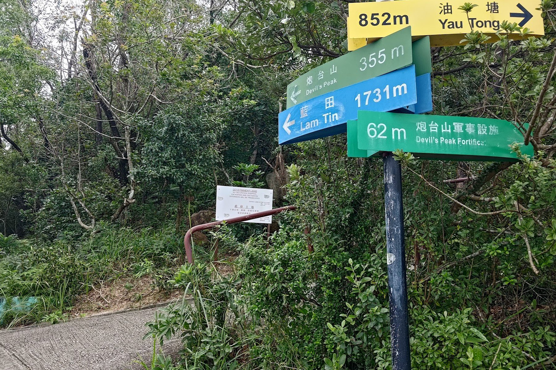
- On the way down, look for the sign pointing you to 'Devil's Peak Fortifications' (this is actually Gough Battery)
- Follow the red railings up slightly and you'll be able to explore Gough Battery
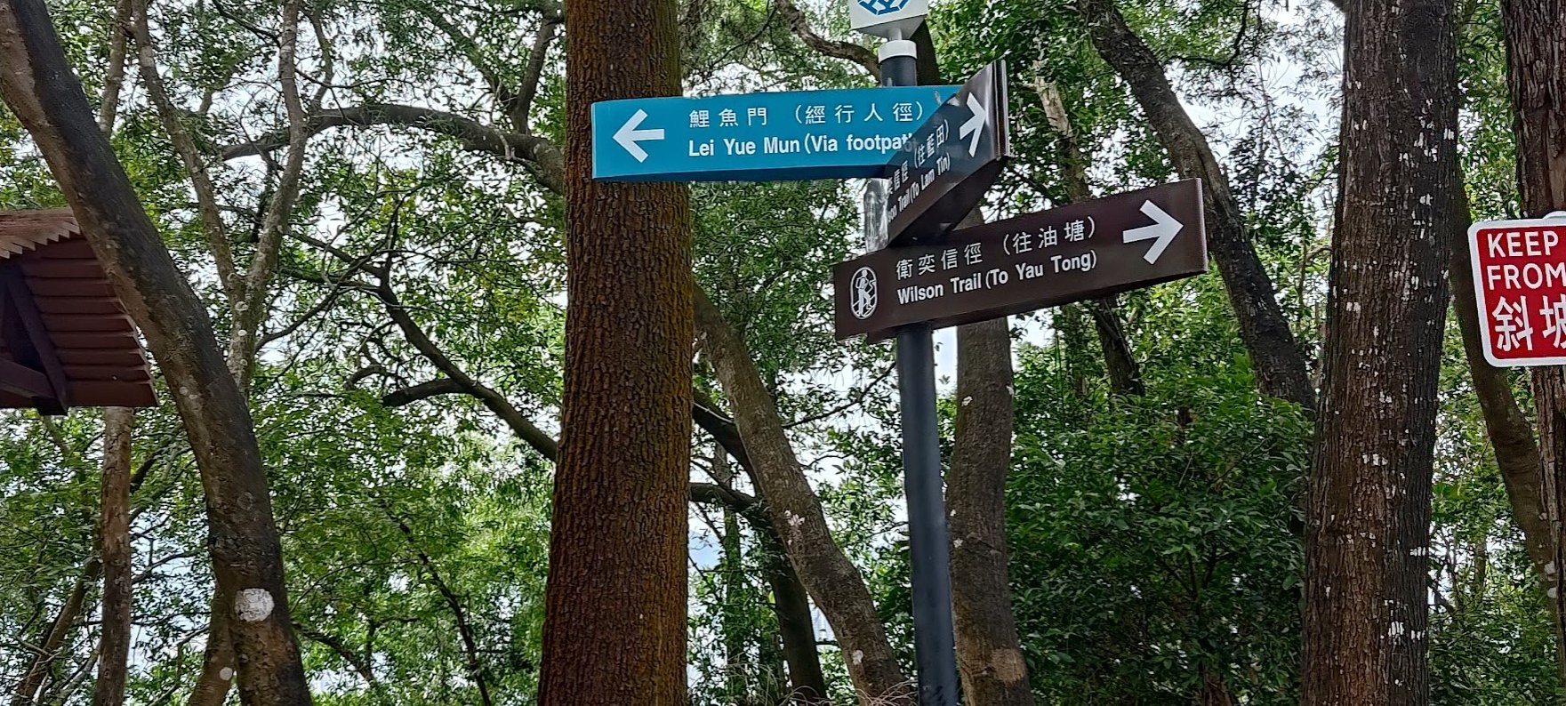
- Return back to the sign when you're done and keep heading downward. You'll arrive at the unmarked road you started climbing from earlier (a lot further up)
- Follow the blue sign left, to Lei Yue Mun (via footpath). Heed the second sign pointing you to 'Lei Yue Mun (via footpath)' and follow it to the right
- Follow the trail all the way down until you arrive in Ma Wan Village
- (optional detour to the Old Lei Yue Mun Quarry) Go left at the waterfront and walk through the red Tin Hau Temple with the huge rocks and cannons in front of it
- Keep going forward through Ma Pui Village until you arrive at a beach with some ruins
- take the stone steps next to one of the ruins and you'll reach the quarry and grasslands. Retrace your steps back when you're done exploring
- Back in Ma Wan Village, go the opposite direction of the quarry and walk through the village homes and seafood shops, staying on Lei Yue Mun Hoi Pong Rd East
- Turn right onto Lei Yue Mun Hoi Pong Rd Central and follow it until it merges into Leu Yue Mun Praya Road
- A red minibus goes to Kwun Tong from the end of Lei Yue Mun Praya Road. CASH ONLY TO PAY
- To walk back to Yau Tong MTR Station, head to Cha Kwo Ling Road and follow it for about 10 minutes until you arrive back at the station
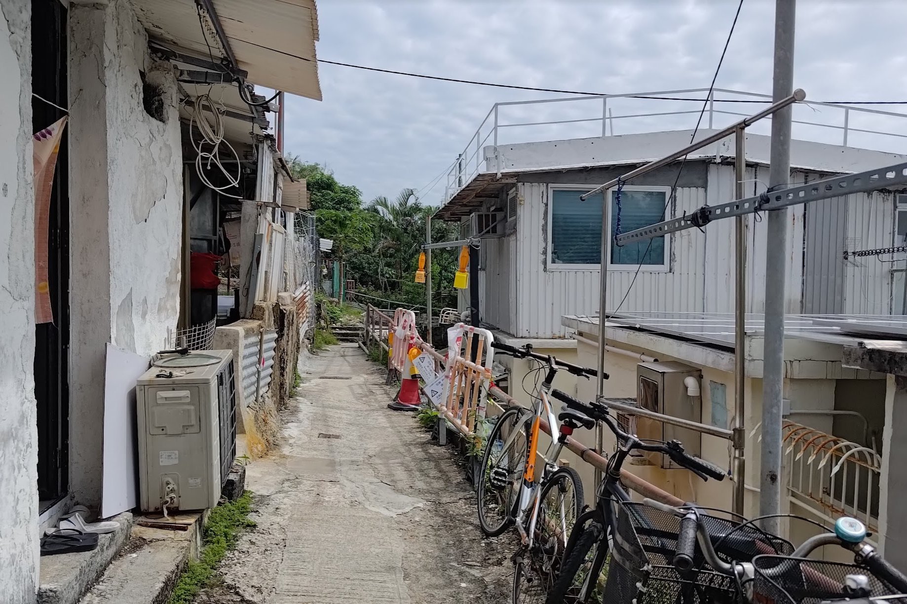
Yau Tong MTR to the Official Start of the Hike
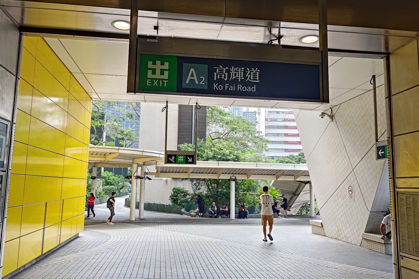
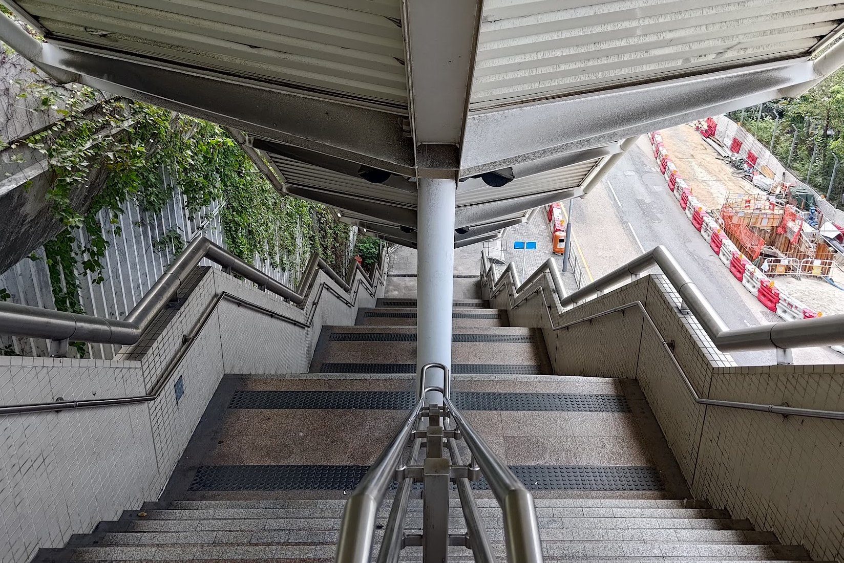
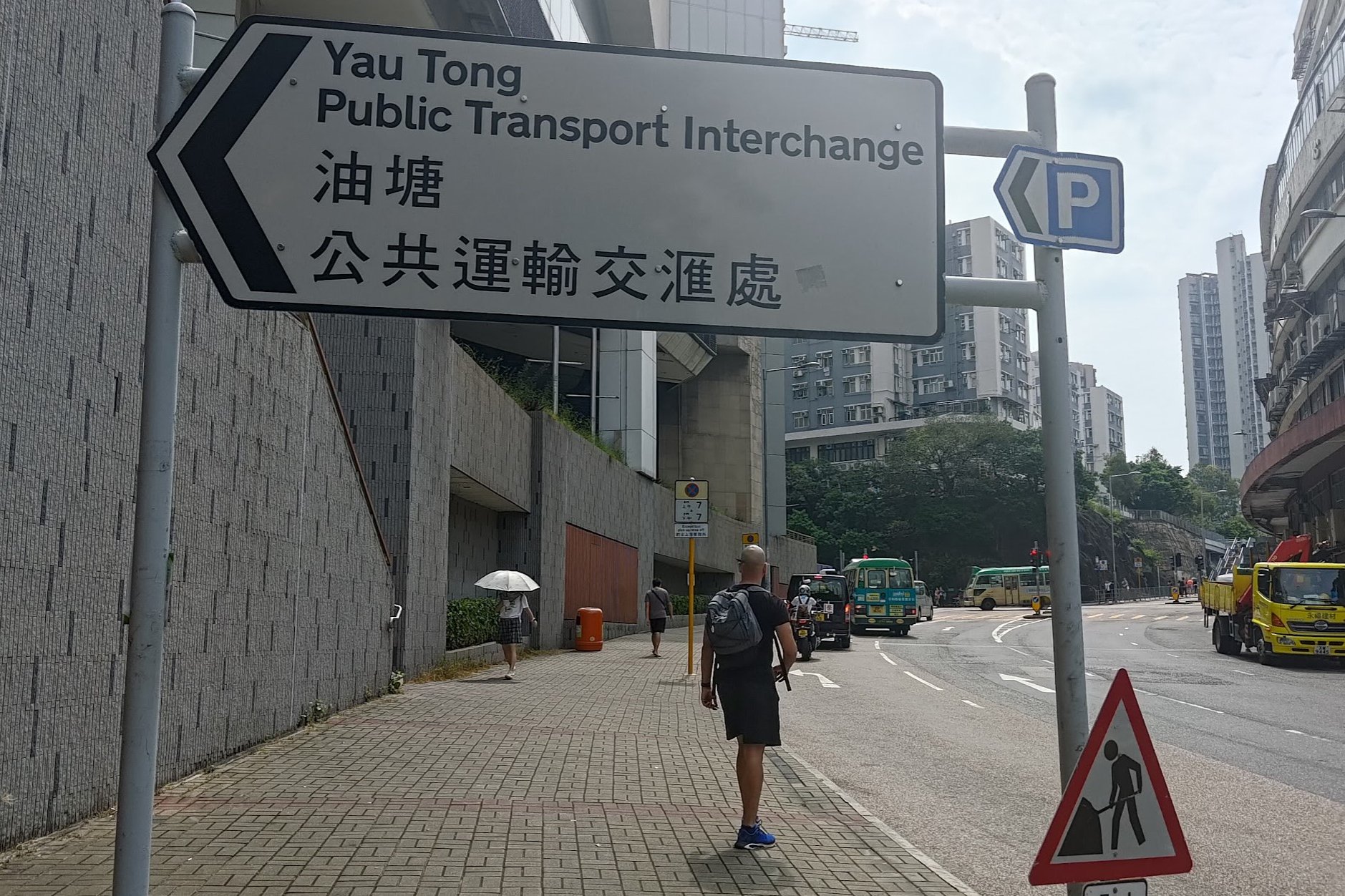
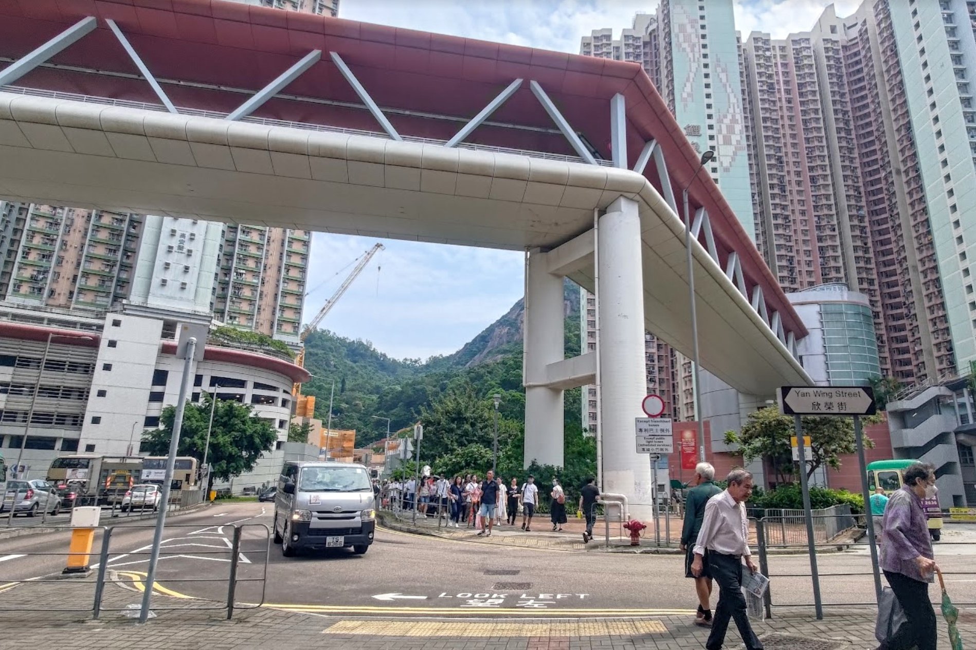
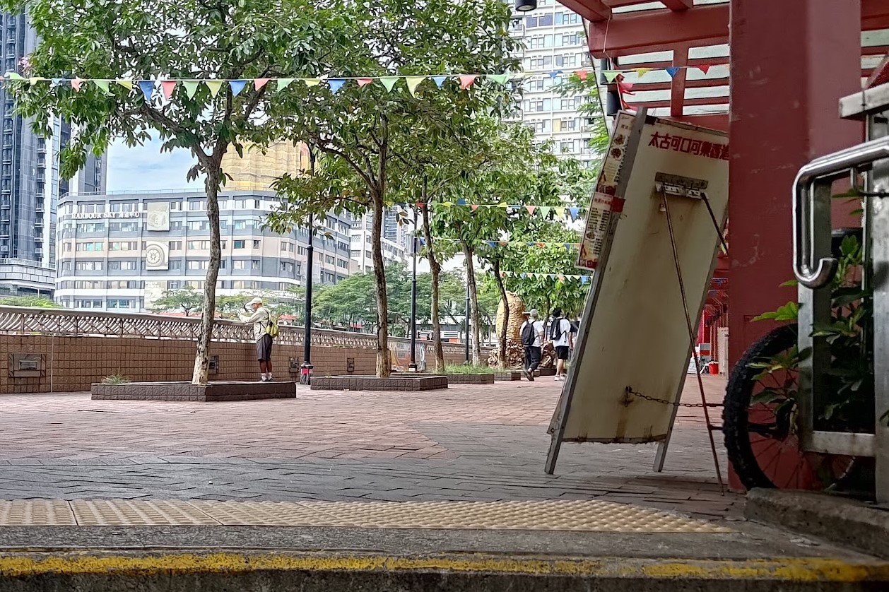
Once you arrive at Yau Tong MTR Station, head out exit A2 and take the stairs down to Cha Kwo Ling Road.
Walk forward until you intersect with Ko Chiu Road. Cross the street here and turn left so that you're following Ko Chiu Road.
Keep on heading straight; walking under a large, red footbridge and going past a grey 'Restricted Road' sign.
Turn right after the sign and look for a set of stairs with blackish handrails that's next to some white/grey construction barriers.
The specific starting point and route I'm outlining in this guide is what I feel is the most efficient, least-crowded and fully comprehensive way to see as many of Devil's Peak's secrets as possible without needing to backtrack. It's steeper than the regular route, though.
There is a much gentler route to the top (which is where we'll end up exiting from) that you can take instead. It's about ten minutes up the road from the start point mentioned here.
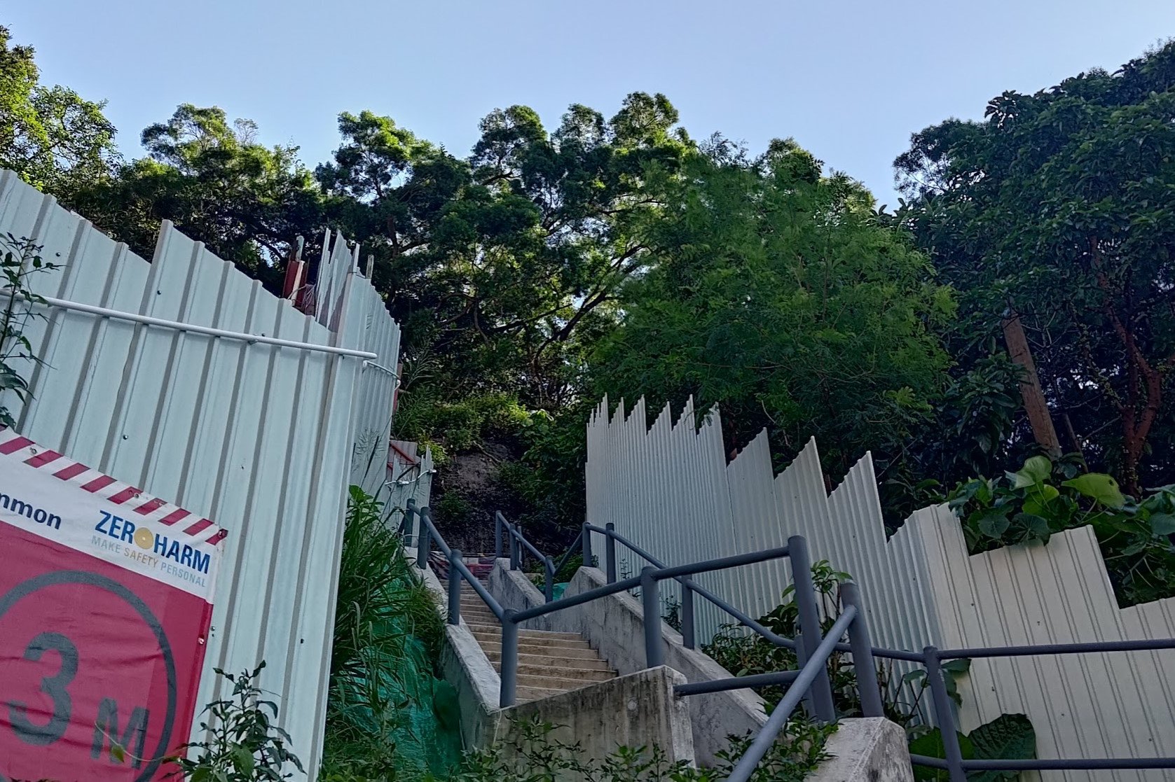
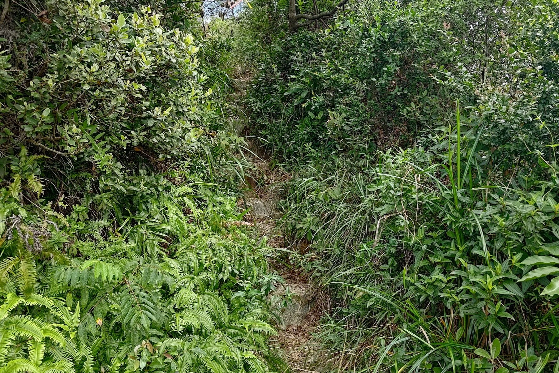
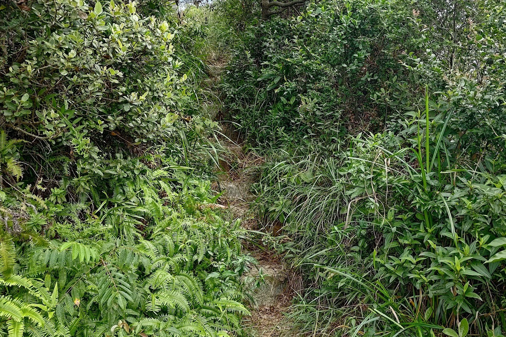
A Steep Climb to Devil's Cave
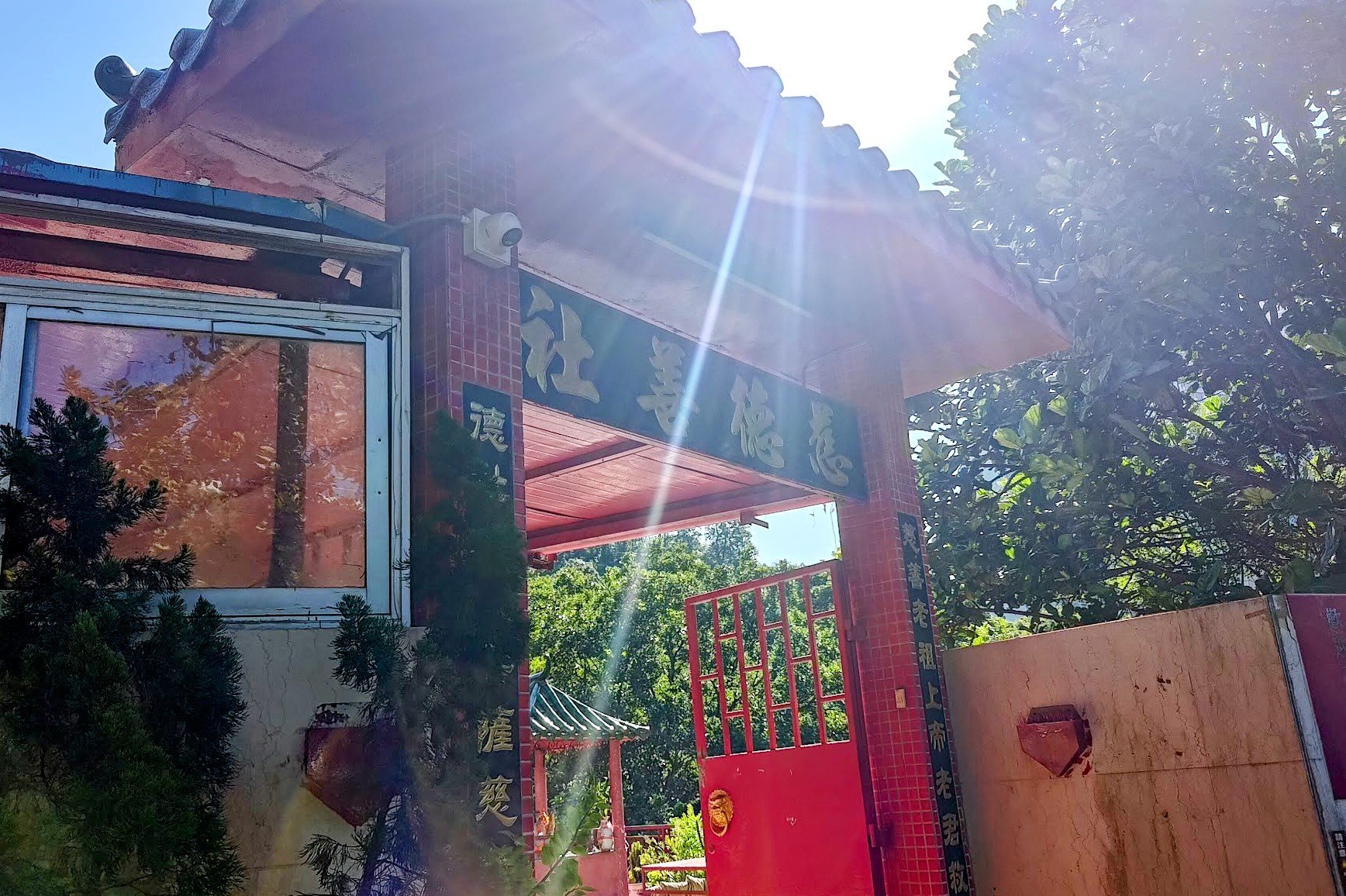
This section takes about 10-15 minutes at a fair clip with no rests. Once you begin climbing the stairs beside the construction barrier, you'll quickly come across the Lingnan Temple.
The Lingnan Temple was built in 1975 according to a post on their their official Facebook page. It is a Taoist place of worship with several different buildings dedicated to various deities.
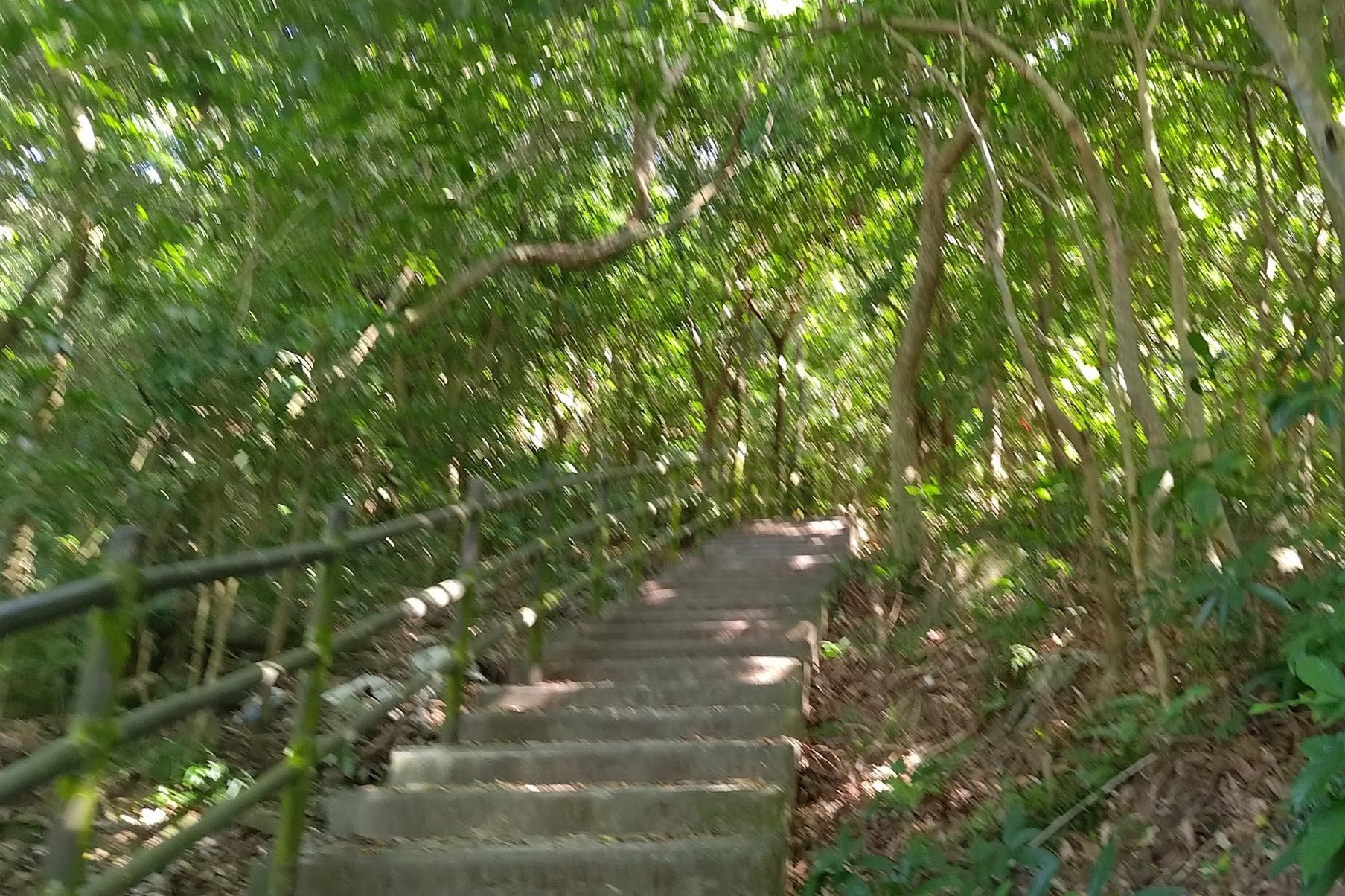
Once you're done exploring, start climbing the stairs within the bamboo forest. I love how green and peaceful this section is.
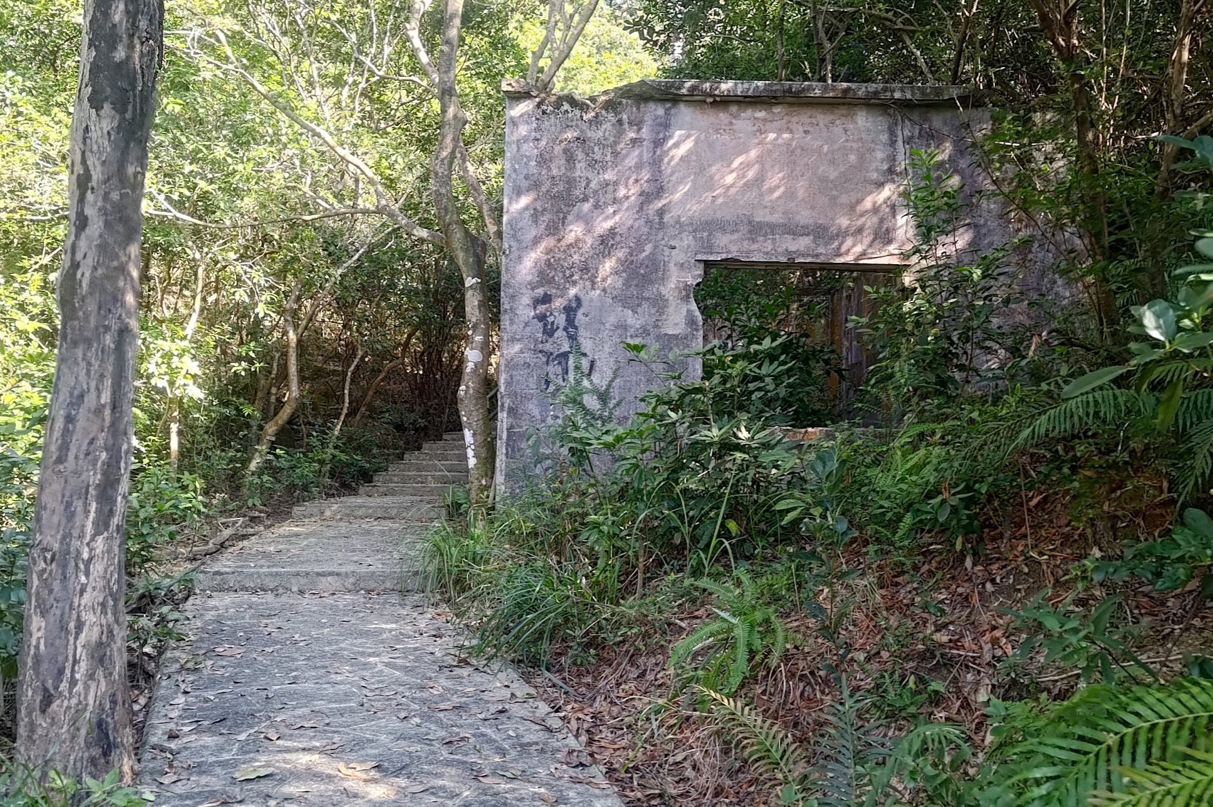
Perhaps 5 minutes later, you'll begin seeing abandoned structures, a small prelude of things to come!
The trail will soon open up, revealing really clear views of the Permanent Chinese Cemetary, LOHAS Park and the Tseung Kwan O Cross Bay Bridge.
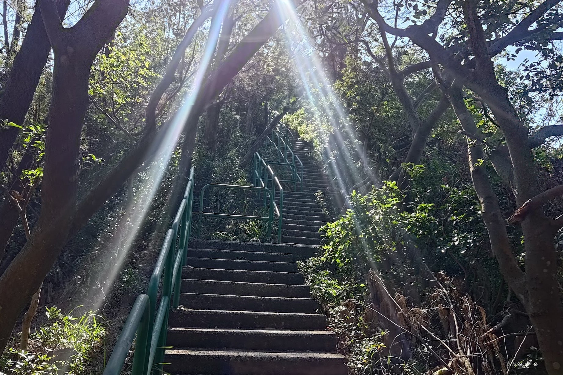
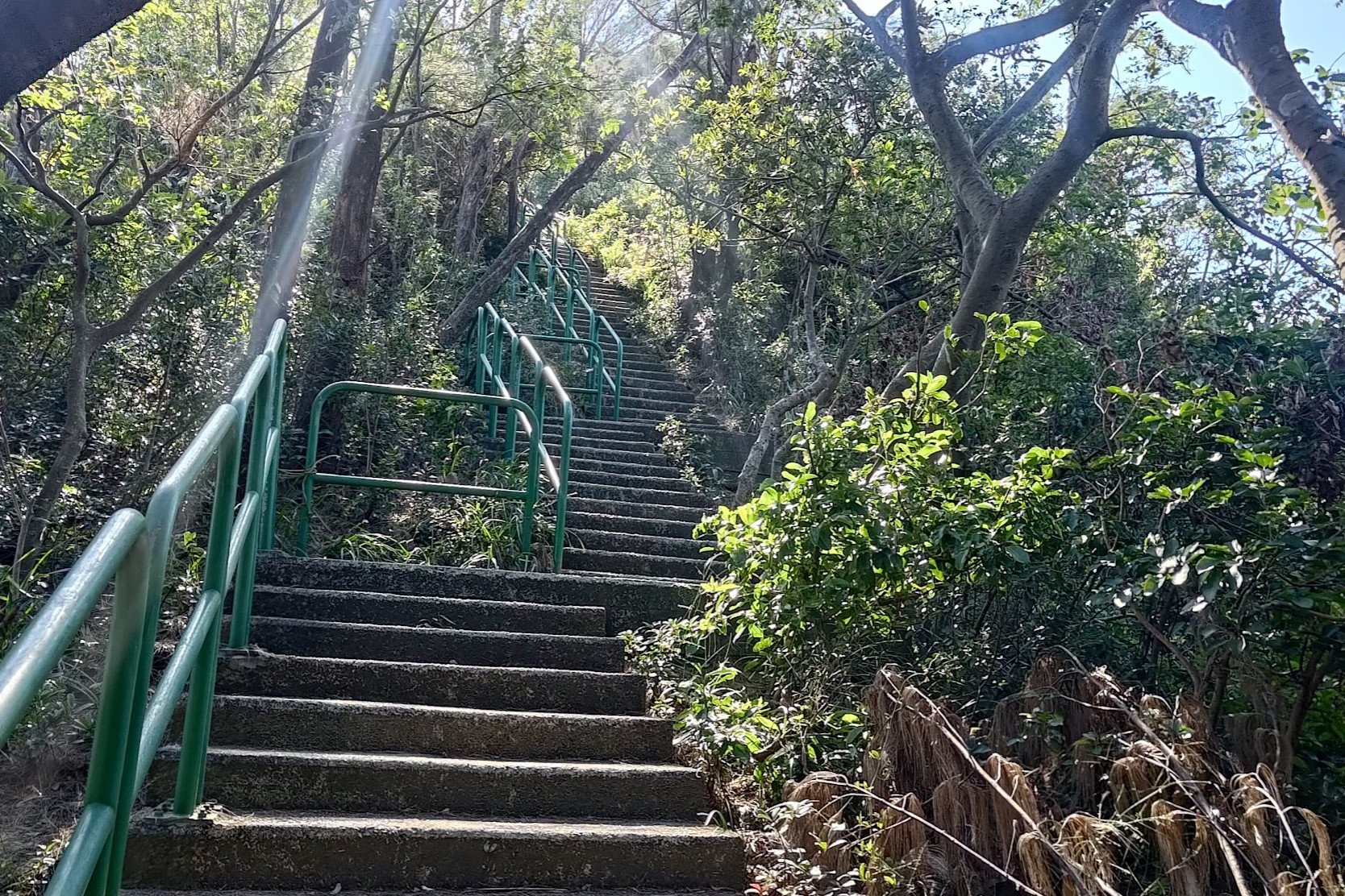
Right after the view, you'll begin ascending a very steep set of stairs.
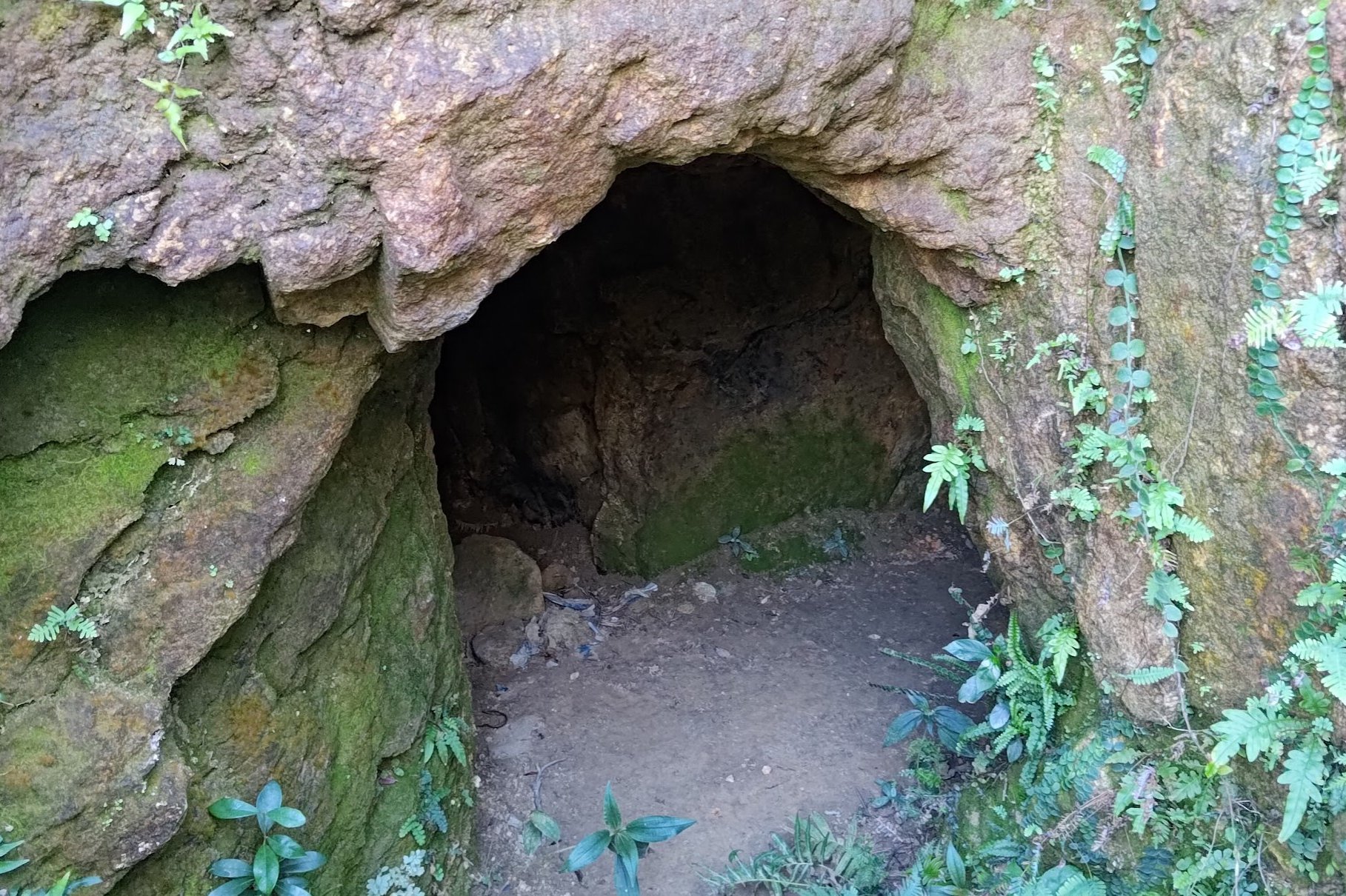
Devil's Cave
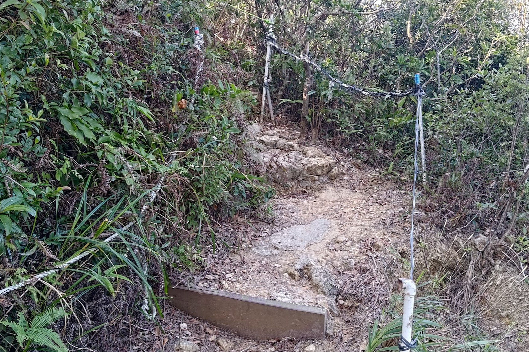
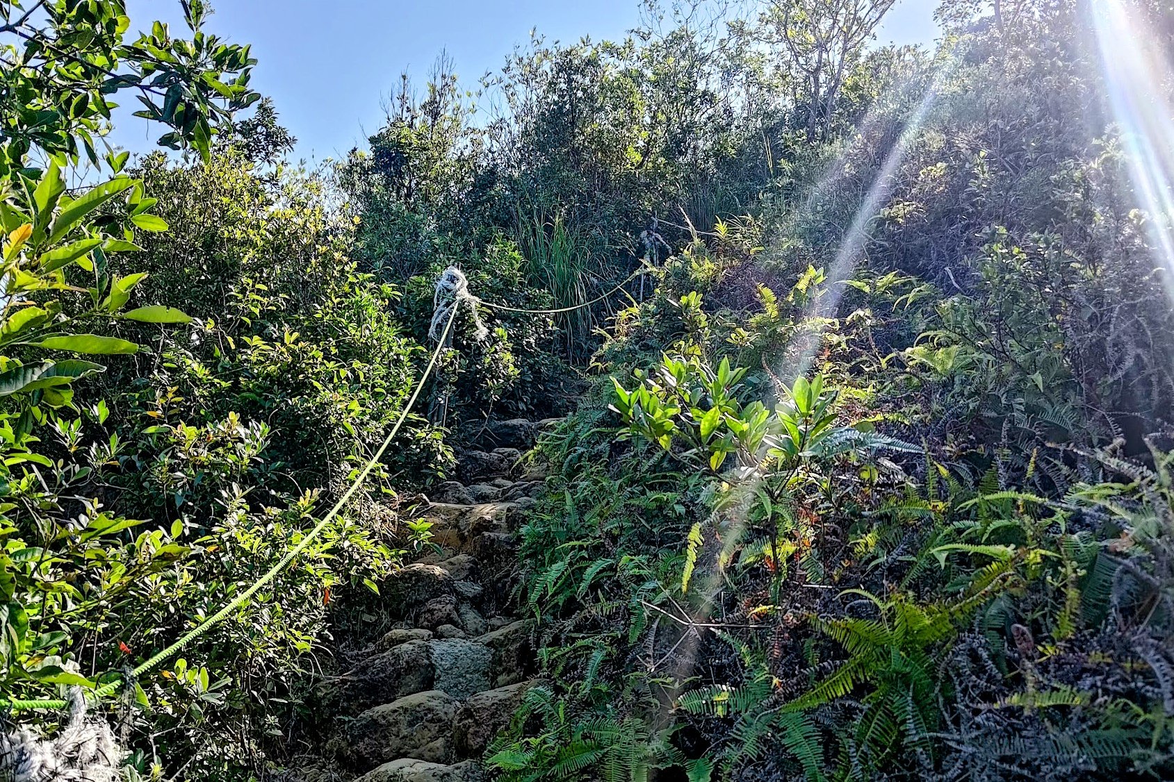
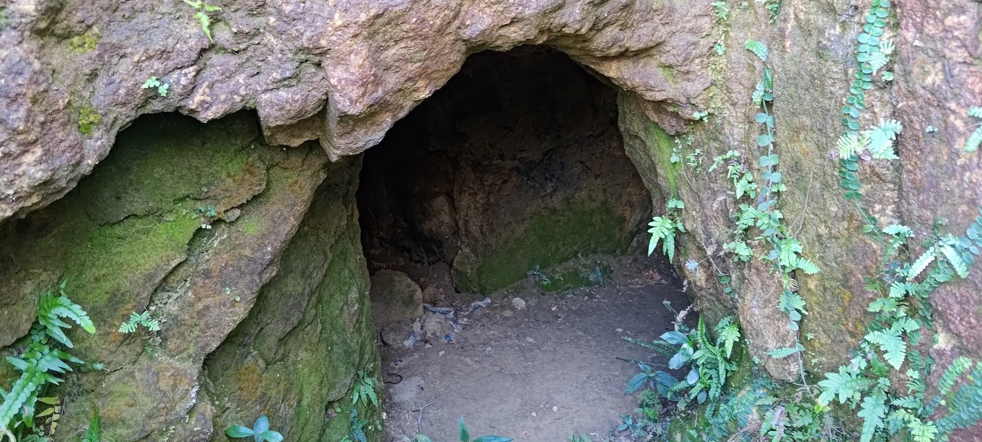
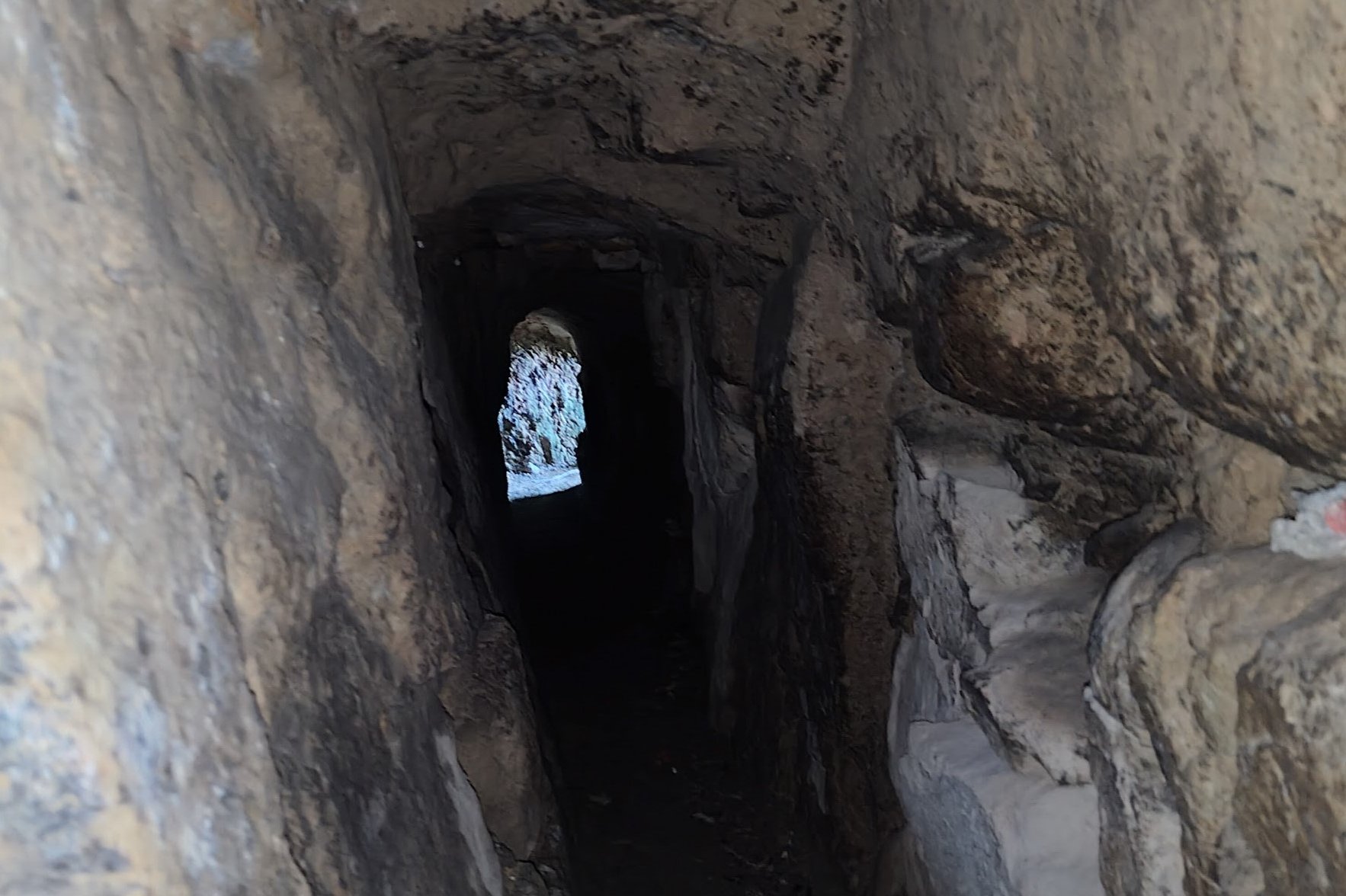
When the concrete stairs begin to get more natural (become stone steps), you know you're close to Devil's Cave.
Keep a keen lookout to your right for the entrance to the tunnel or else you'll miss it completely on your way up.
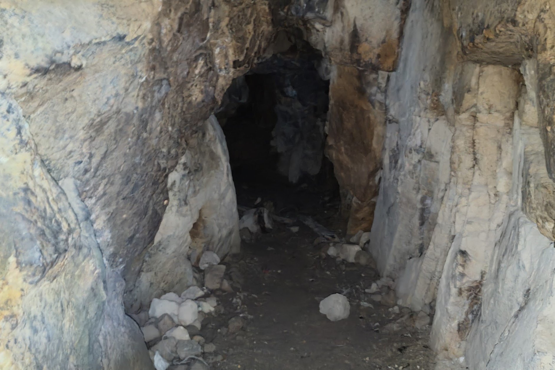
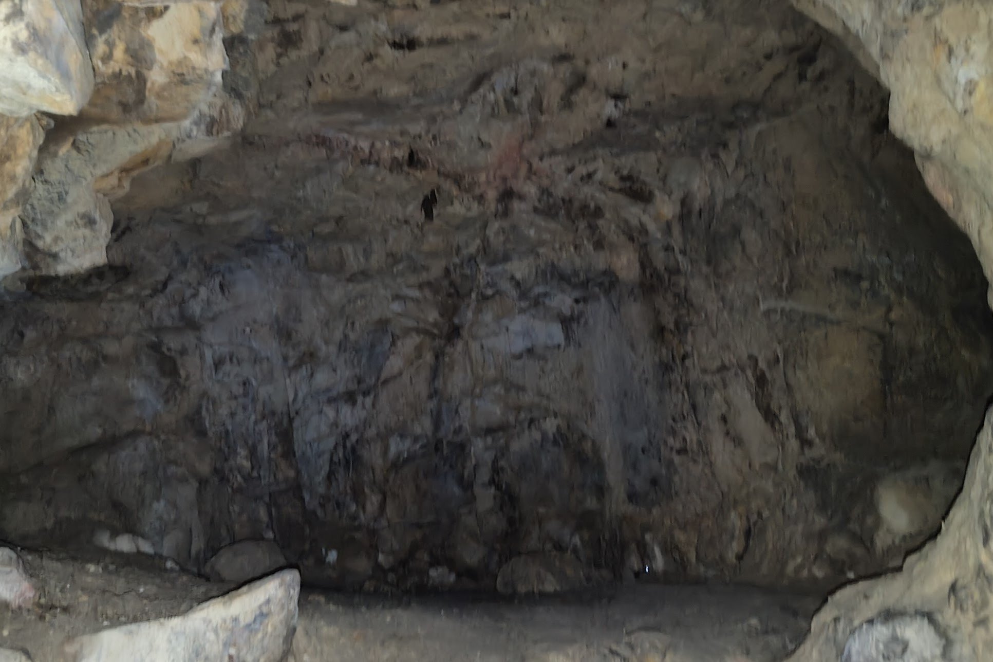
Once you see it, you can choose to explore it or not. I decided to head in and can report that it seems pretty safe and doesn't really go a very long distance. Maybe just 2-3 minutes to the end. There were also no animals or creepy crawlies within.
If you plan on exploring, head in and turn right at the big chamber. You'll emerge in an overgrown section of the mountain. There is a really faint, very overgrown path that probably leads back to the main trail from here, but I opted for the easier option of heading back through the tunnel instead. I also suggest you do the same.
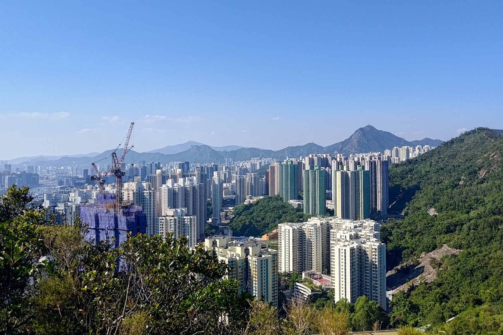
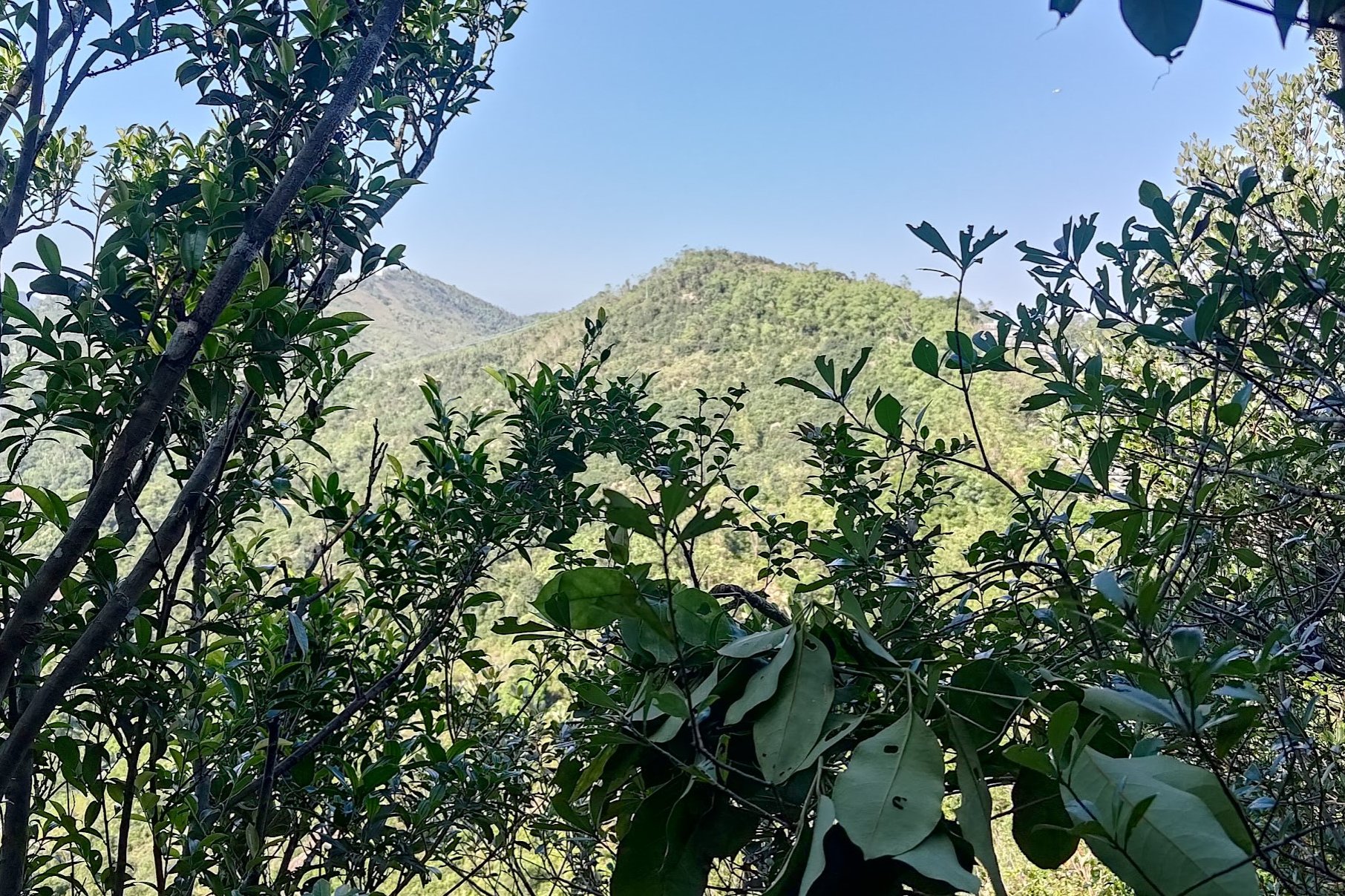
Once back at the entrance, keep climbing for a few more minutes and you'll get an epic view of Kowloon and the surrounding mountains, like Lion Rock!
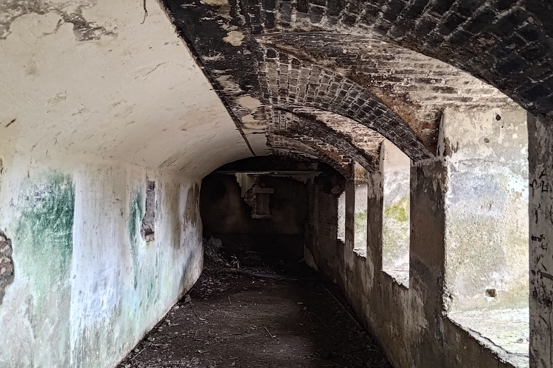
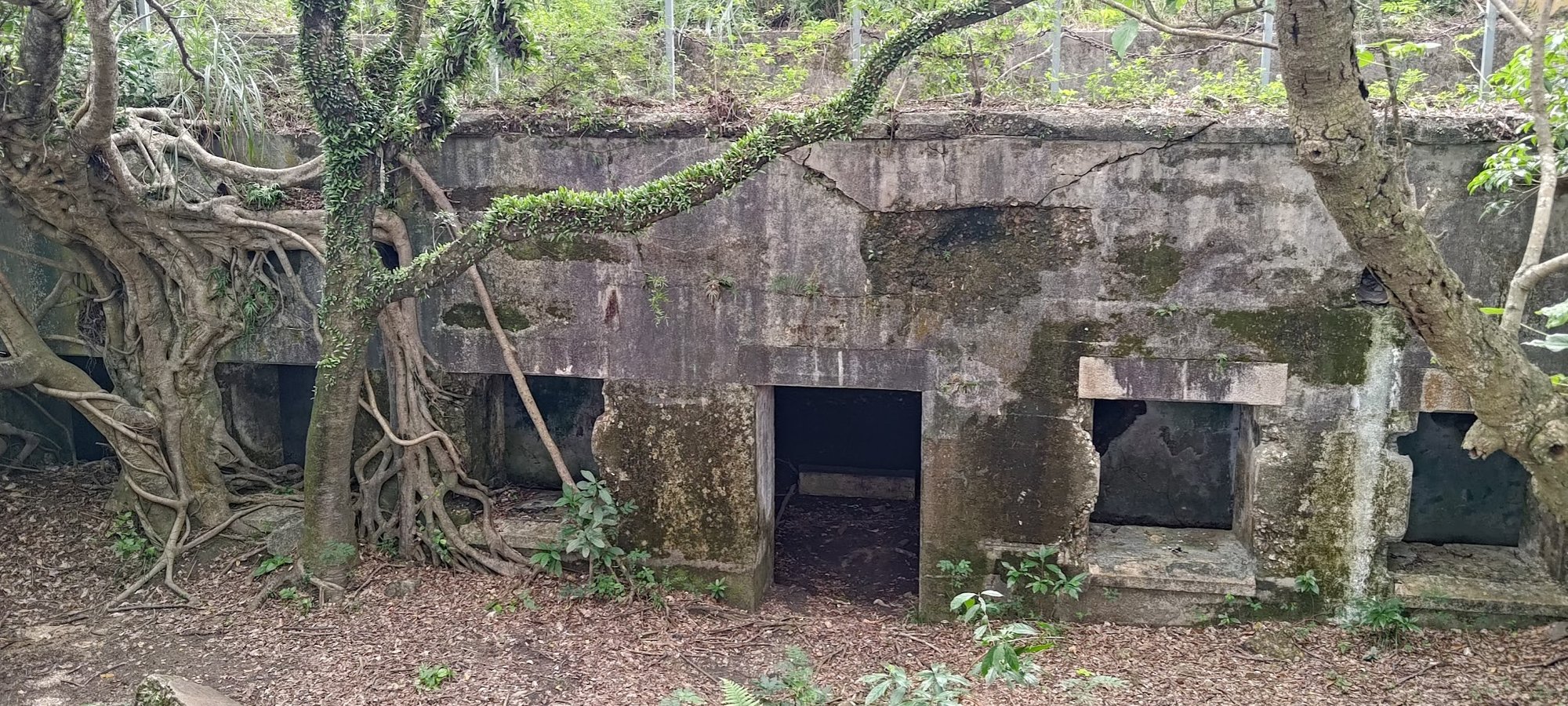
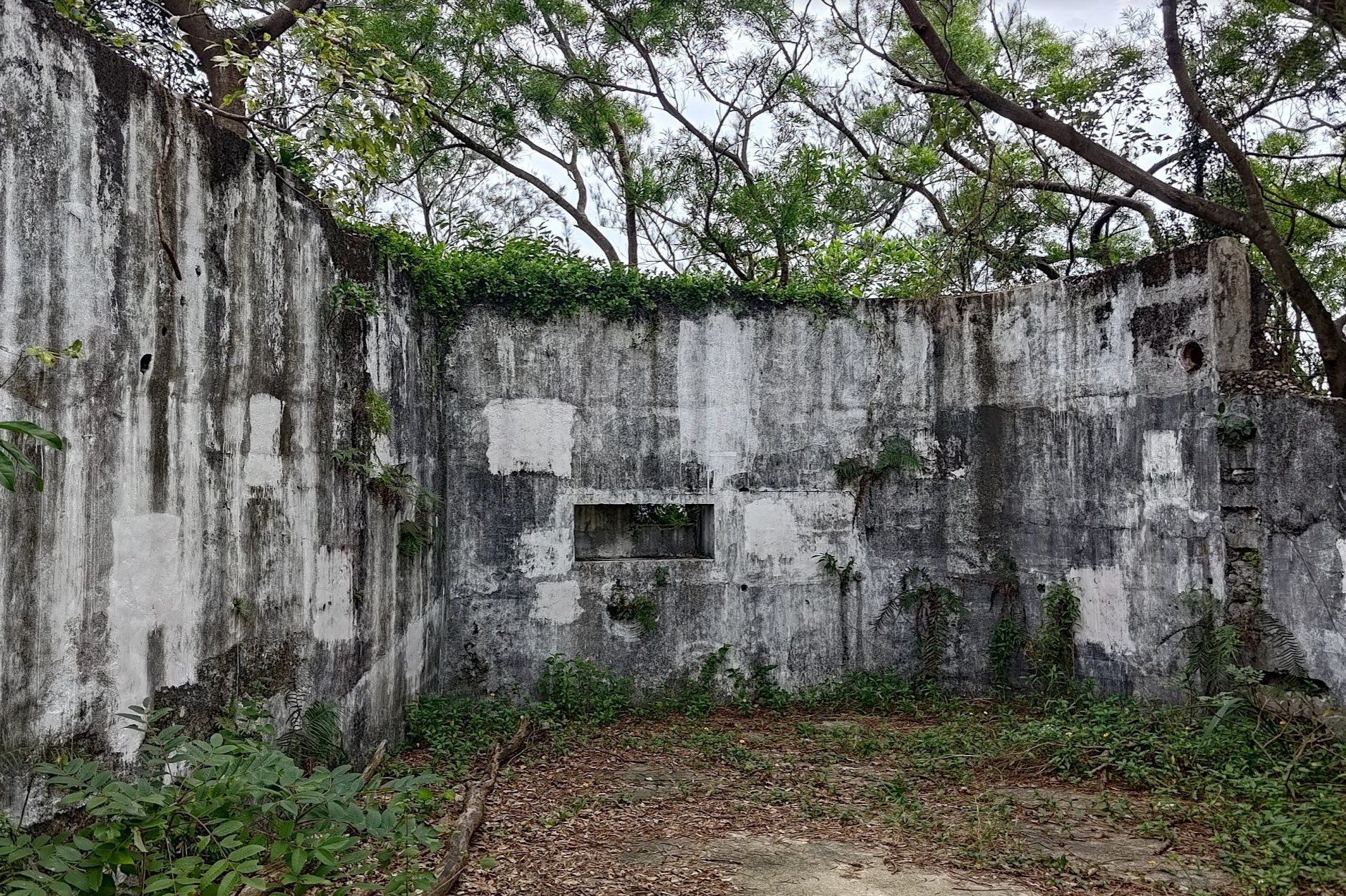
Devil's Peak Battery (The Summit)
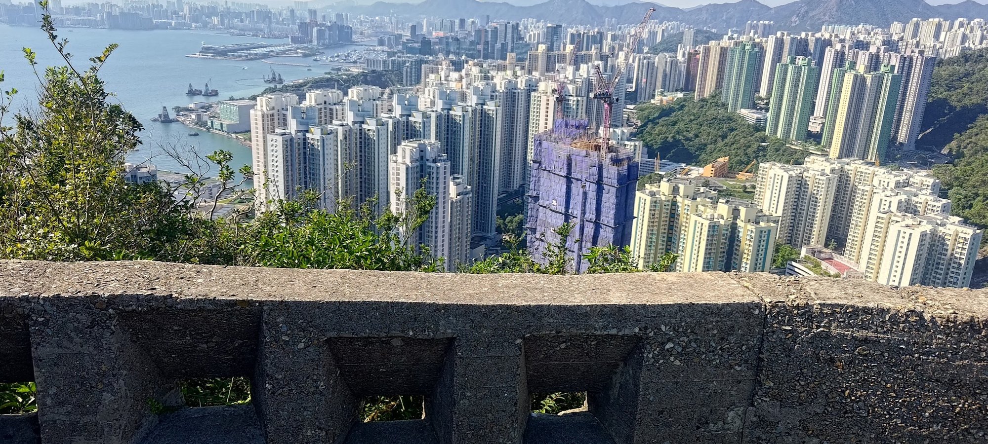
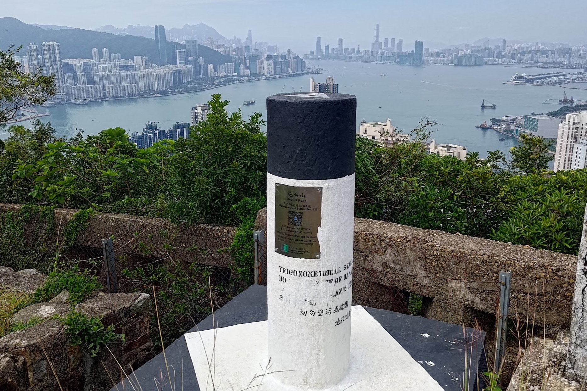
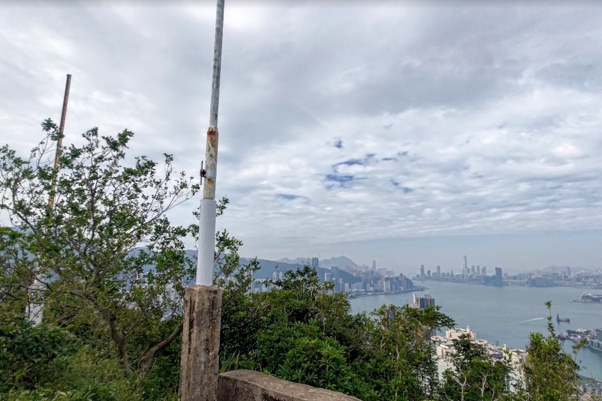
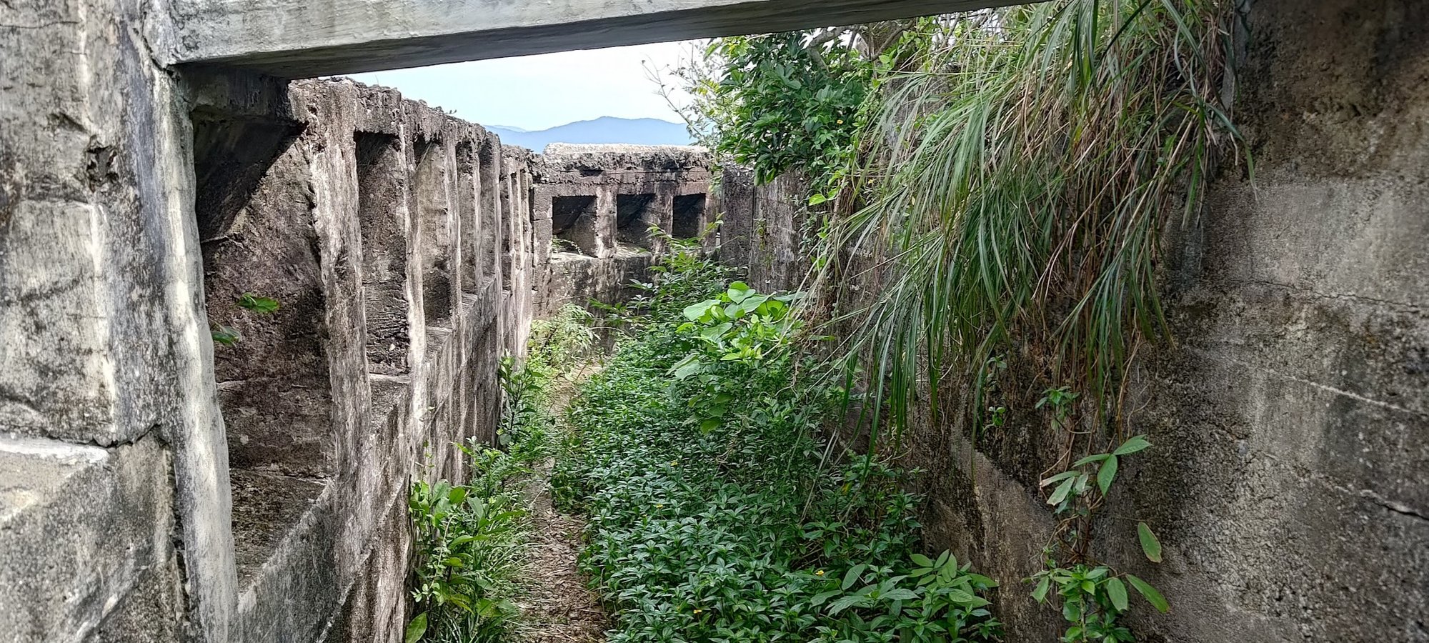
It's only a few more minutes of climbing until you reach the summit of Devil's Peak, where you'll also find the Devil's Peak Battery.
This was a strategically important area during World War II as it overlooked the eastern entrance to Victoria Harbour. Soldiers could keep an eye out for enemy ships and attack with a number of guns situated throughout Devil's Peak.
On the Devil's Peak Battery, there were 5 machine gun placements. Larger guns were situated lower down at Gough Battery and further away at Pottinger Battery (which is not covered in this guide)
Because of its military importance, British forces engaged with Japanese soldiers on Devil's Peak on December 12th, 1941, during the Battle of Hong Kong. The following day, they were forced to retreat and the Japanese forces took control of Devil's Peak.
British Major John Monro recounts, "The (Hong Kong) mainland was lost by December 13, when the Allies were forced to evacuate their last stand, the Devil’s Peak Peninsula, to the east of the Kowloon Peninsula."
Major Monro also explained that the British were able to transport their guns away from Devil's Peak, denying the Japanese a free boost in firepower. Boats with their mules were sunk by the Japanese during the evacuation, and all the mules perished.
With this incredible context, exploring the Devil's Peak Battery evokes images of battle and chaos during a time when Hong Kong was in the midst of a fight for its very soul and survival.
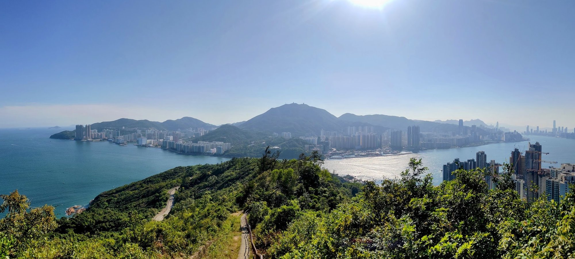
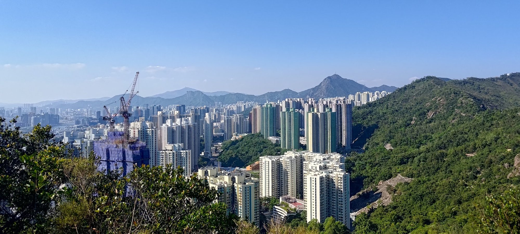
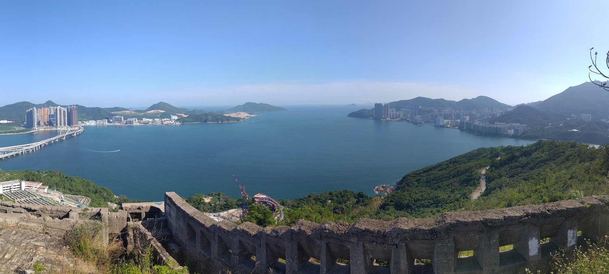
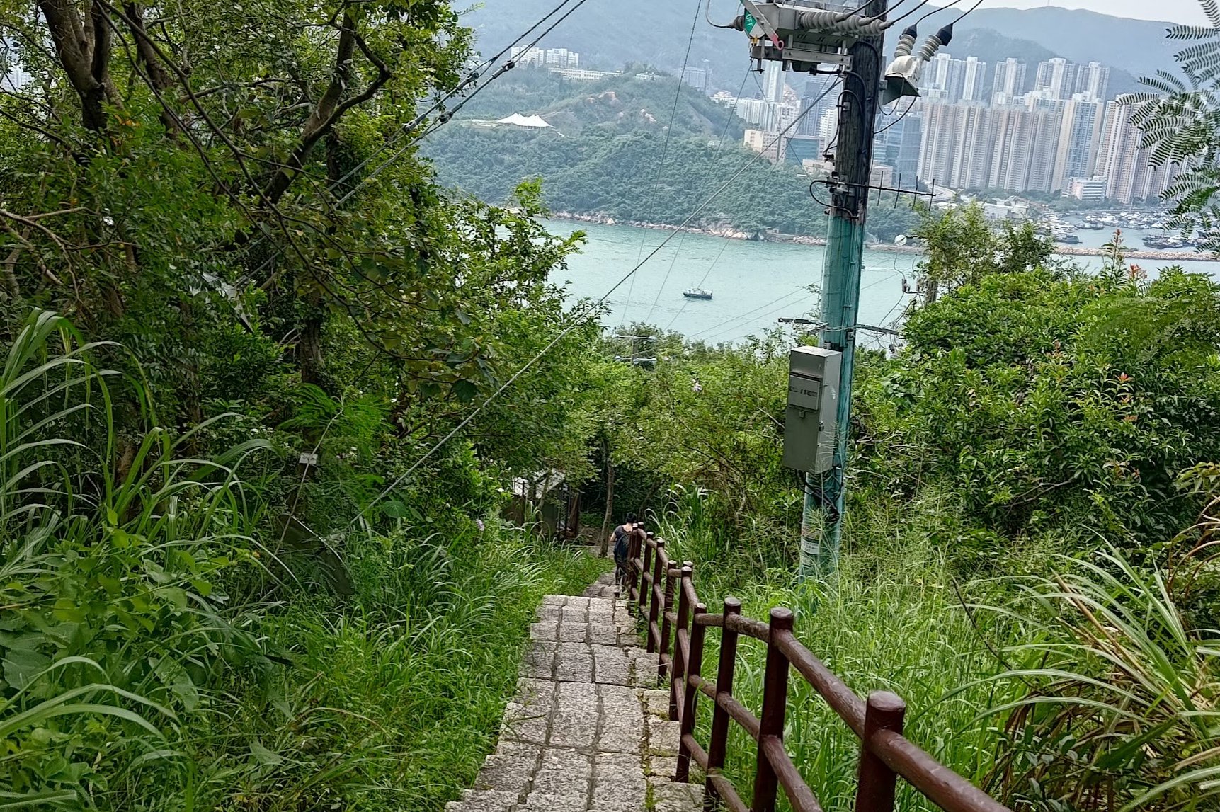
Beginning Your Descent With Epic Hong Kong Island Views
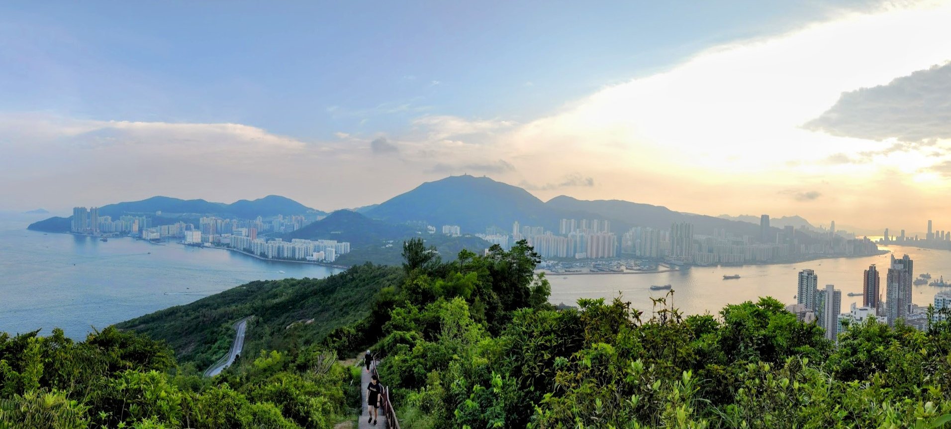
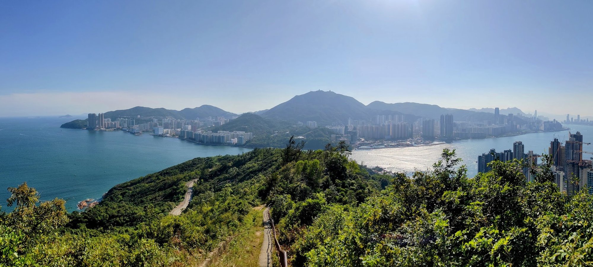
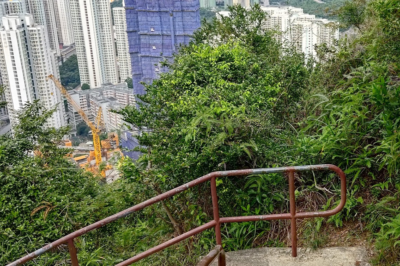
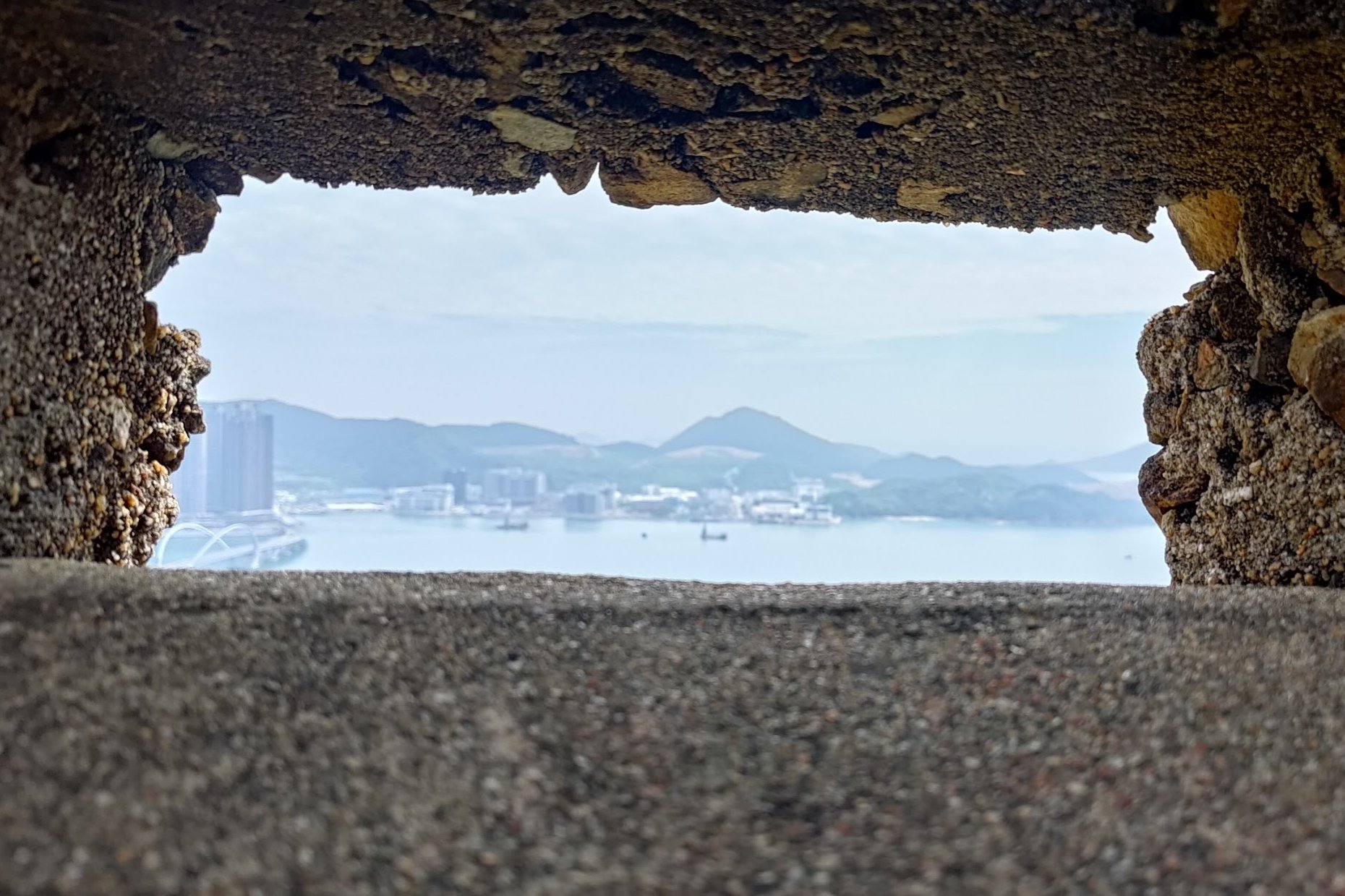
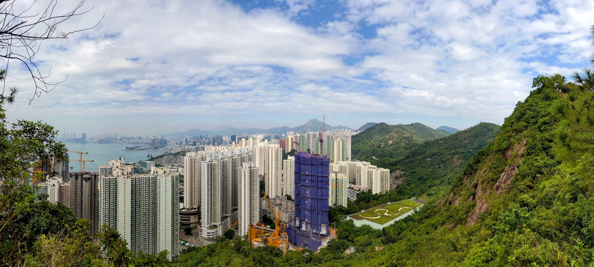
When you're ready to descend, take the stairs on the opposite side from where you ascended from. You'll know if they're the right set of stairs because they'll have a set of red/brown railings to either side. Also, they'll quickly lead you to the best view of Hong Kong Island of the whole hike!
Keep descending down the stairs until it turns into a concrete path. The railings will remain, so just keep following them.
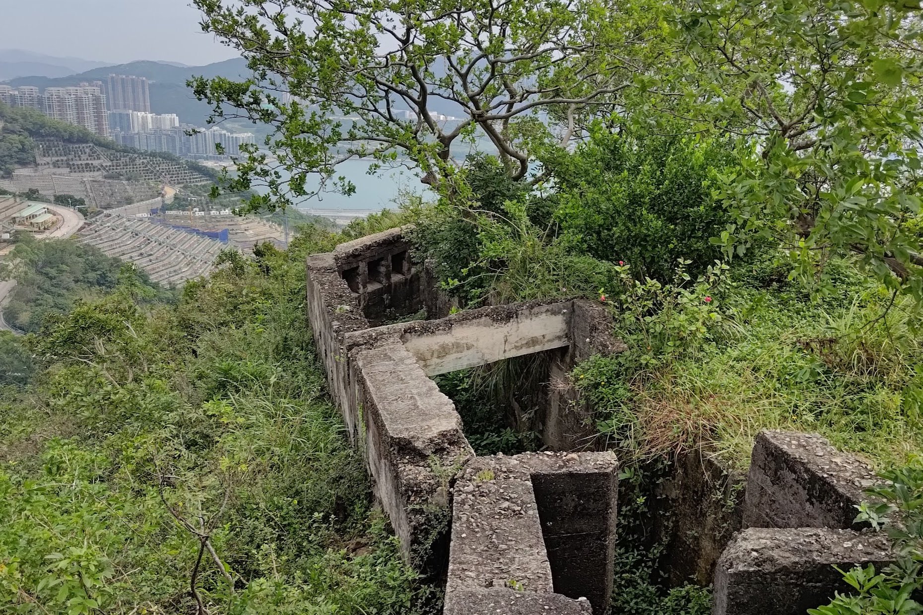
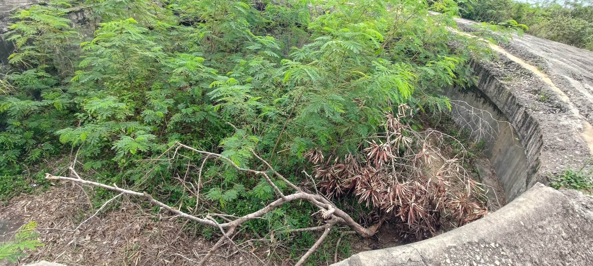
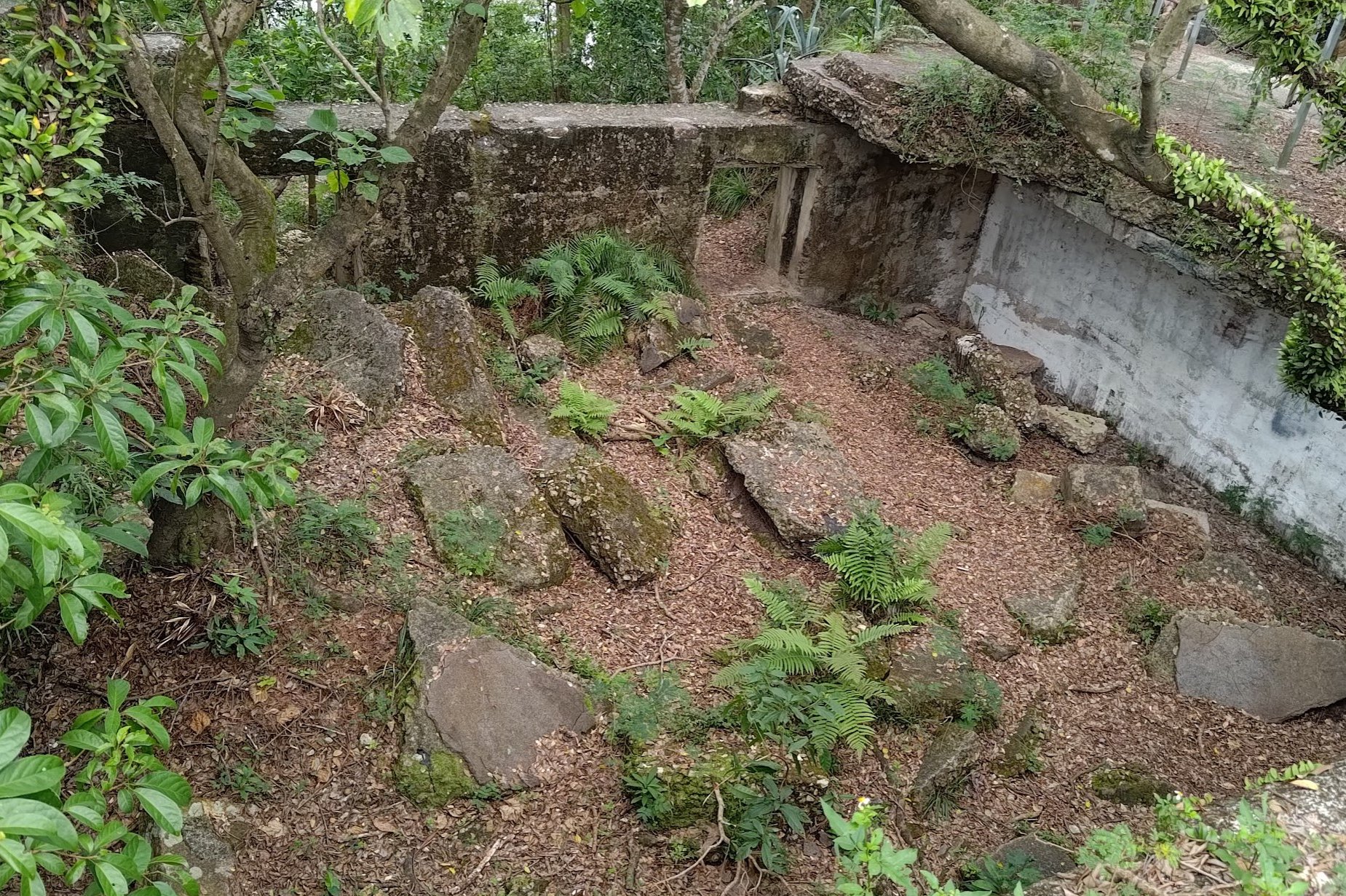
Just over 5 minutes after you begin your descent, you'll see an unmarked, overgrown path to your left. Climb it if you want to check out a small ruin that was once the Devil's Peak Observation Post.
On Google Maps, this little ruin is what's marked as the Gough Battery, but it seems this is a mistake as the actual Gough Battery is lower down.
If you don't fancy going through the overgrown path, don't worry, just skip to the next section and the guide continues exactly from this point.
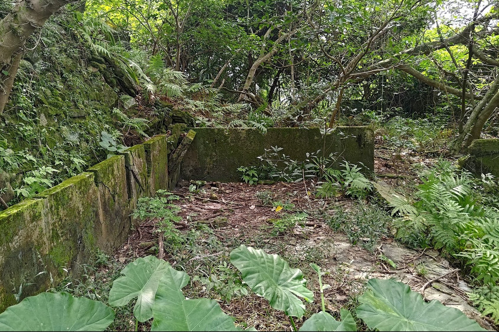
Optional Detour to Devil's Peak Observation Post (Might Be Part of Gough Battery)
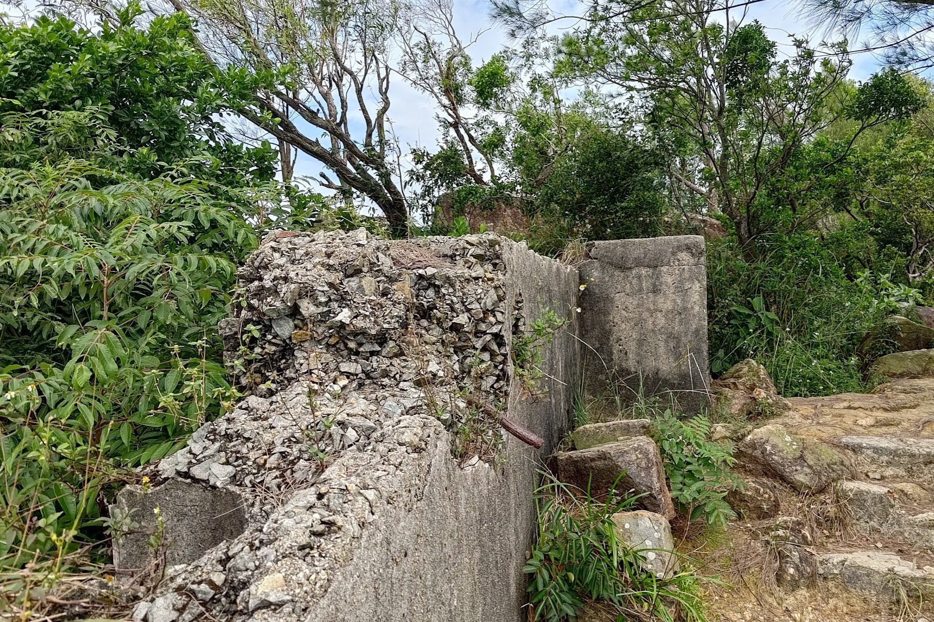
After climbing the overgrown path, which takes barely a minute, you'll immediately see the dilapidated ruins of the observation post. On Google Maps, this is marked as Gough Battery, but it is definitely not the main part of the battery.
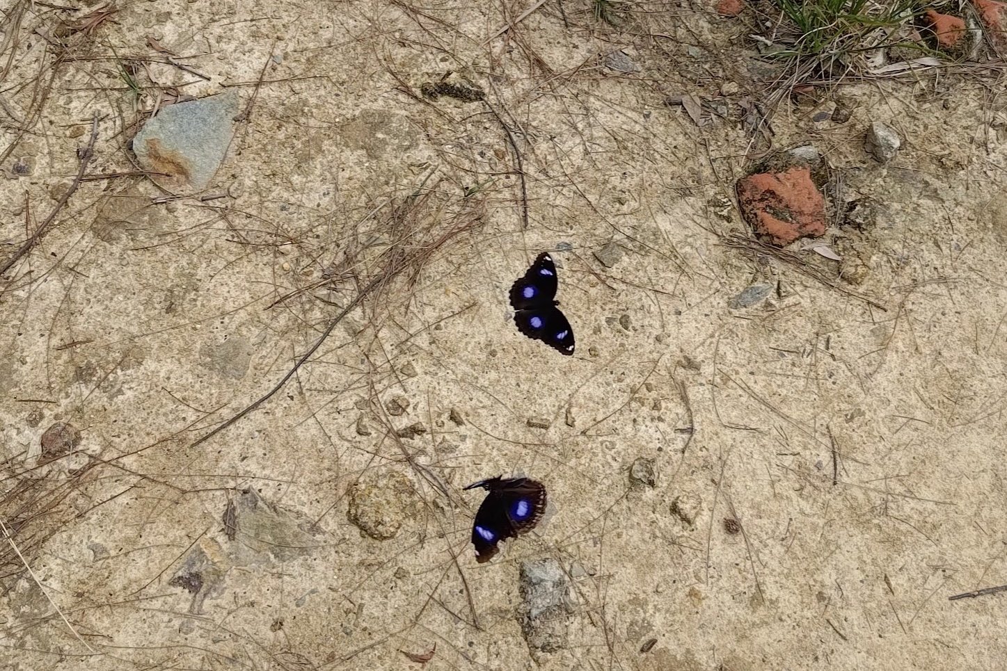
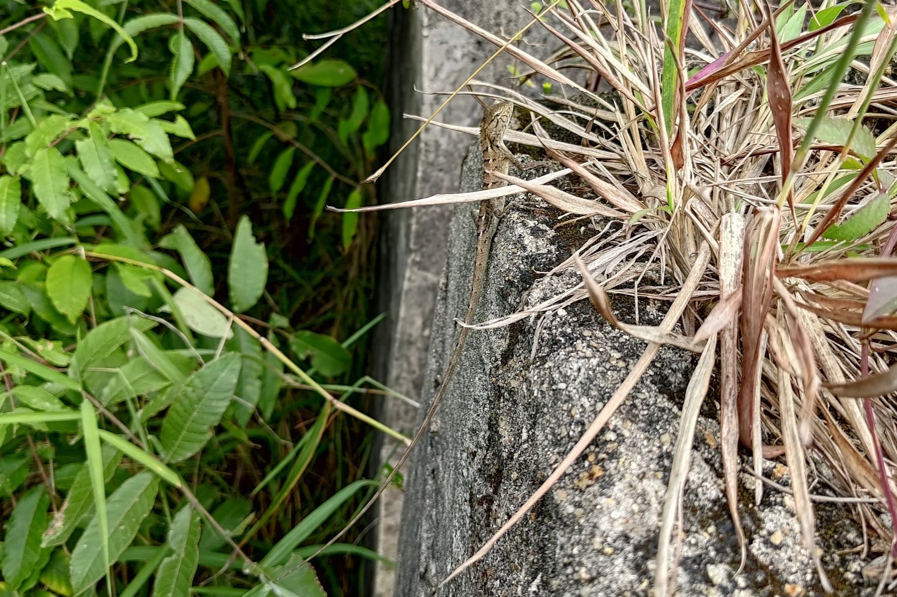
Anyway, this area is being slowly consumed by nature and most people don't visit. That's probably why I saw some gorgeous butterflies and a fantastic changeable lizard!
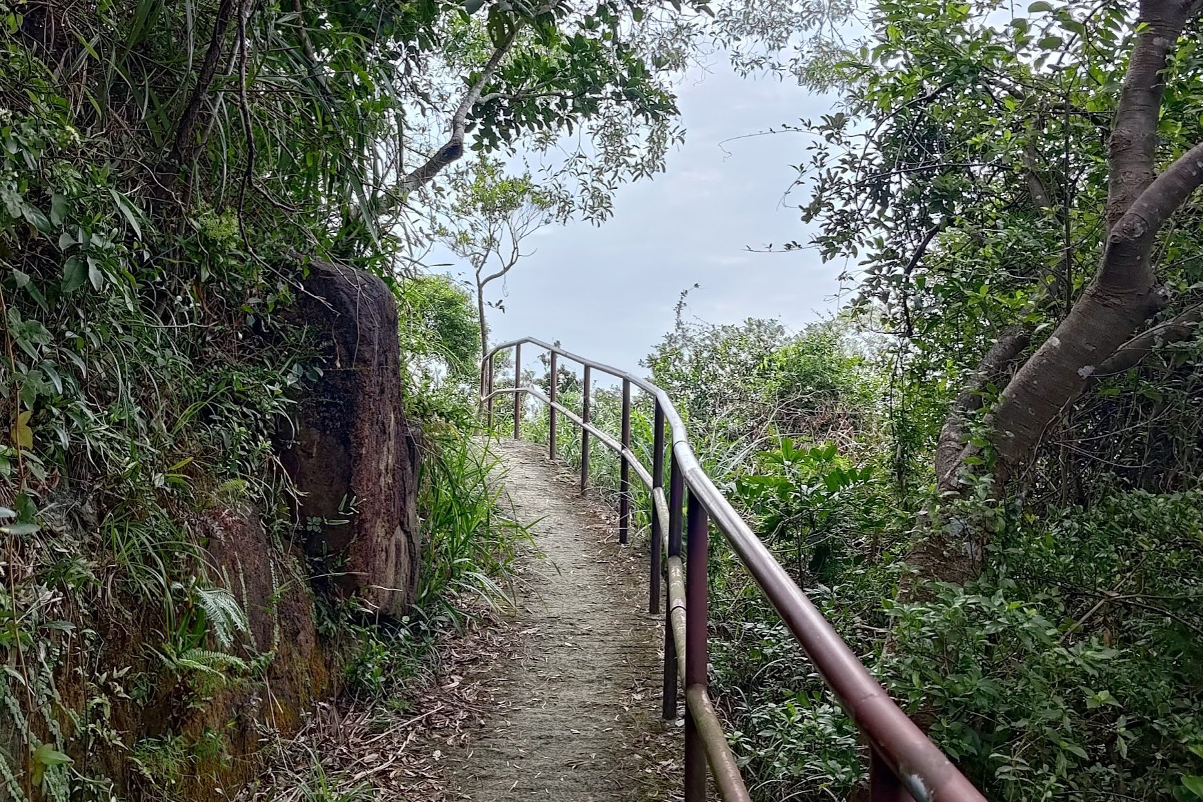
When you're done, head back down the overgrown path. There is another path ahead, but it might get confusing to navigate the trail from there.
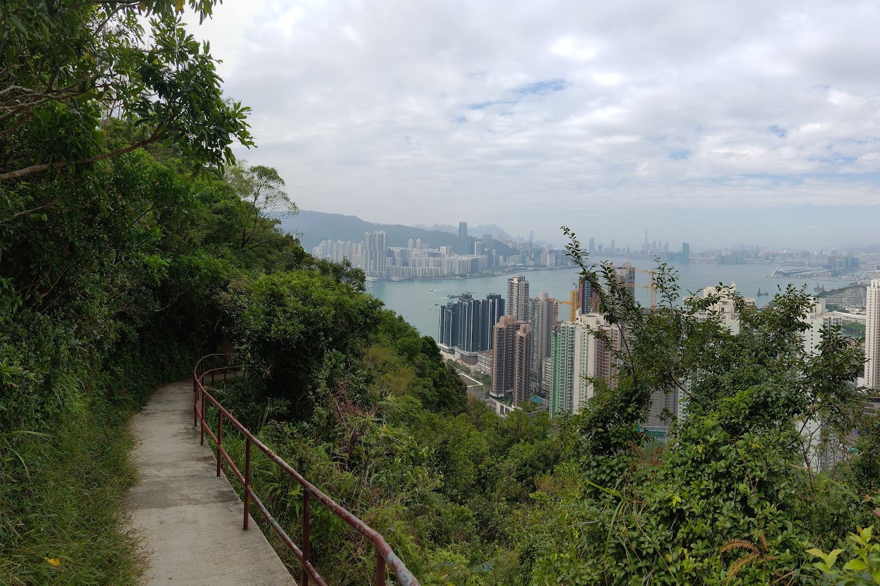
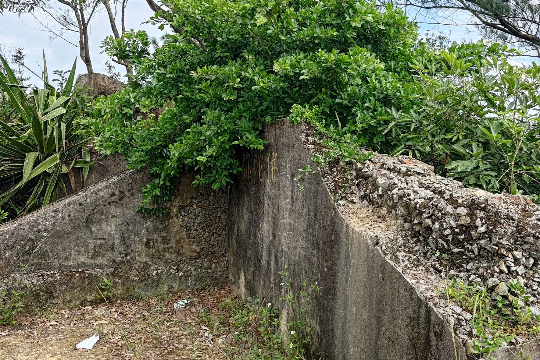
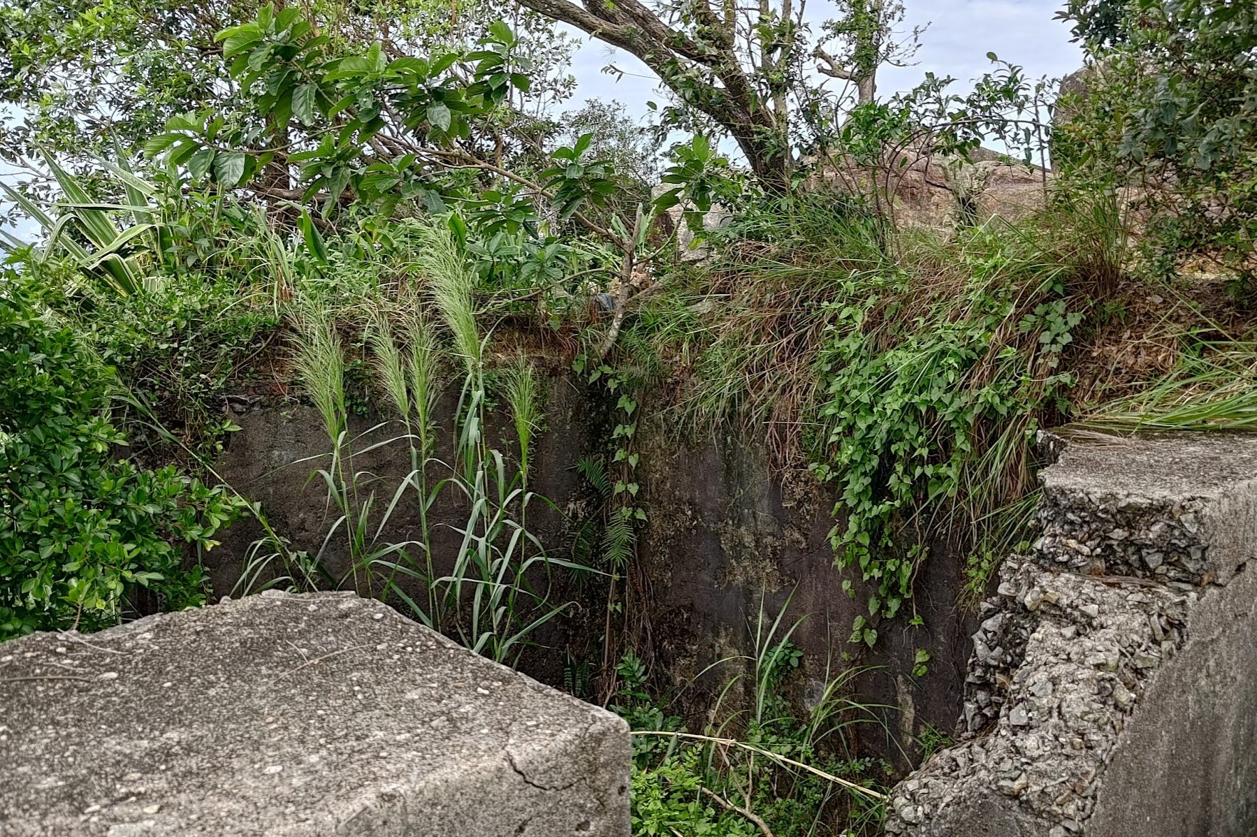
Descending to Gough Battery
As you descend, the views open up and it becomes abundantly clear why this area was picked for the Devil's Peak Observation Post.
Keep following the red-brown railings and pay attention to the yellow signs pointing you towards Yau Tong.
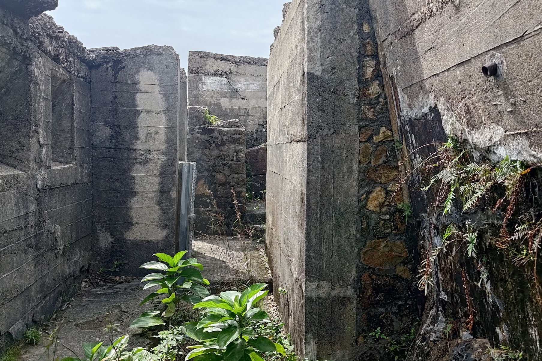
Lower down, you'll see a set of signs with one of them (green in color) directing you to the 'Devil's Peak Fortifications'. This is the actual location of Gough Battery.
Take that path and in just a couple of minutes, you'll arrive!
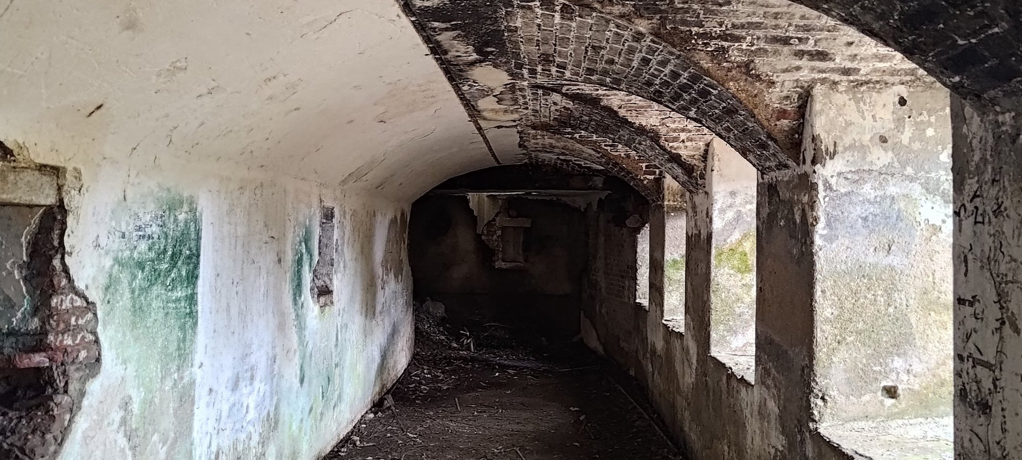

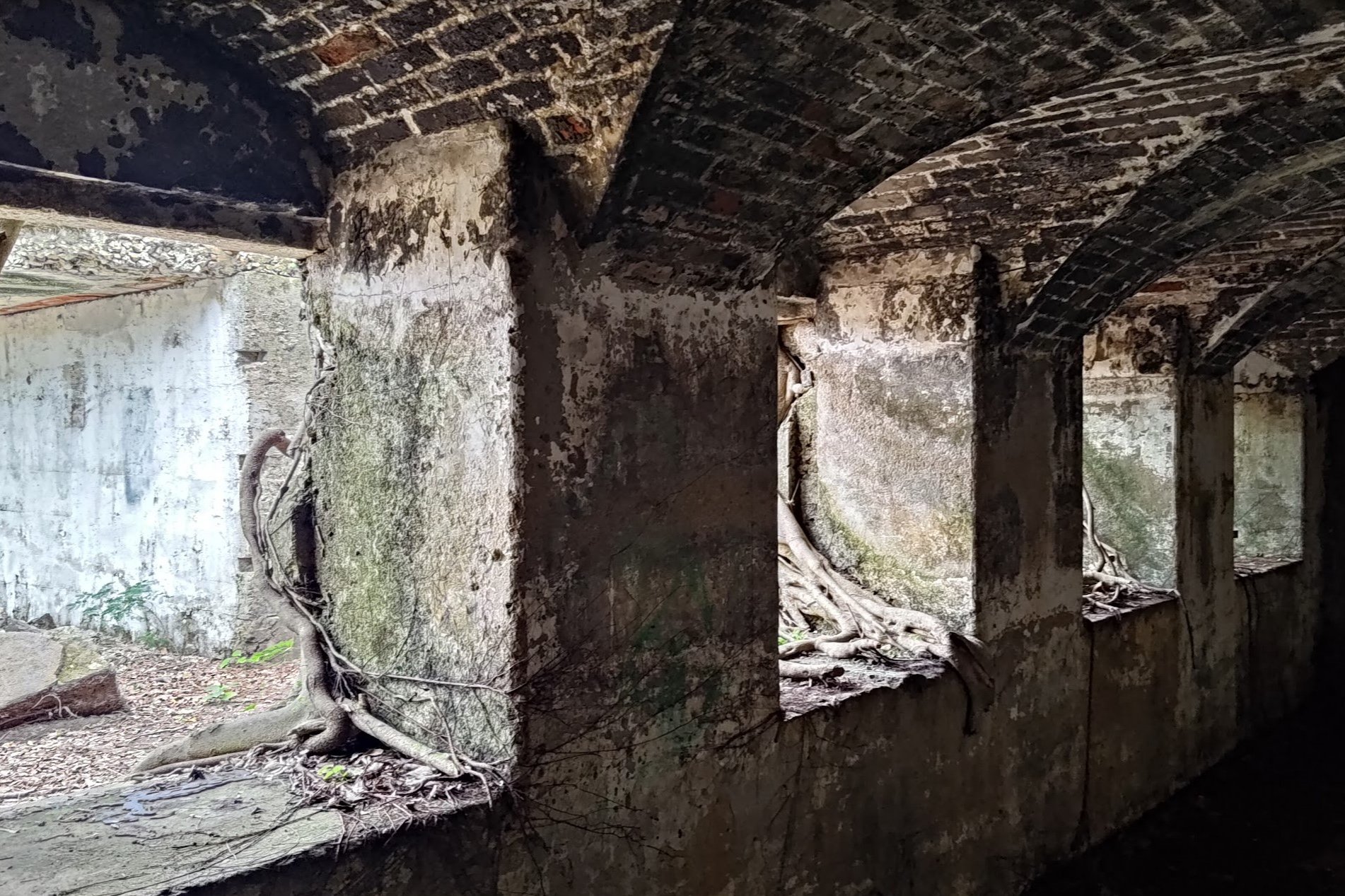
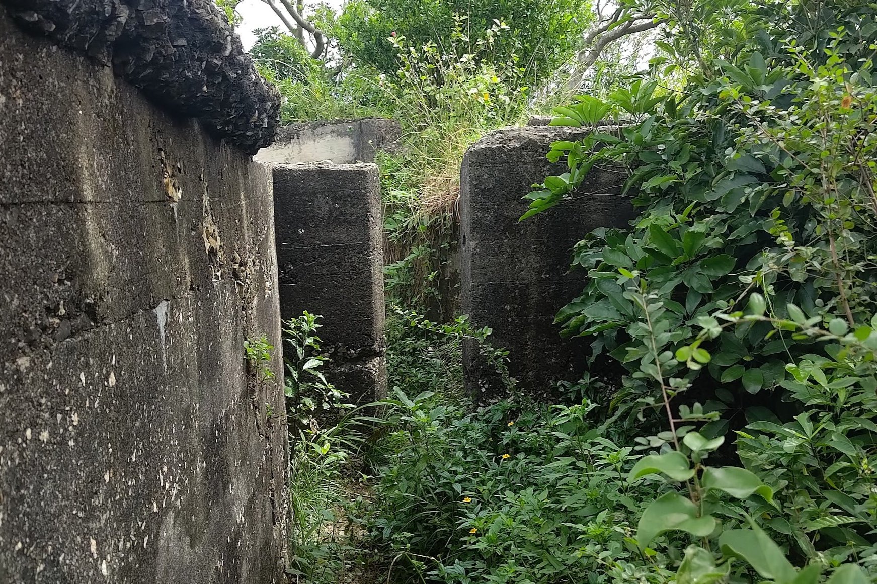
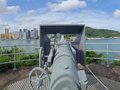
The Gough Battery was the site of two heavy-duty guns that were imperative to the defense of Hong Kong. The first was a cannon that was mounted atop a circular section of the battery, pictured above. The second was a quick-firing gun that was mounted on a smaller circular section, which I forgot to photograph. Oops.
You can wander about along the top of the battery as well as head down into it via a small stone 'staircase'.
Some portions of the battery have also been turned into traditional Buddhist or Taoist shrines, which is pretty cool, albeit a little creepy.
There's another exit point back onto the trail on the opposite end of where you entered Gough Battery from. I'd suggest just heading down the same way, though, when you're ready to leave.
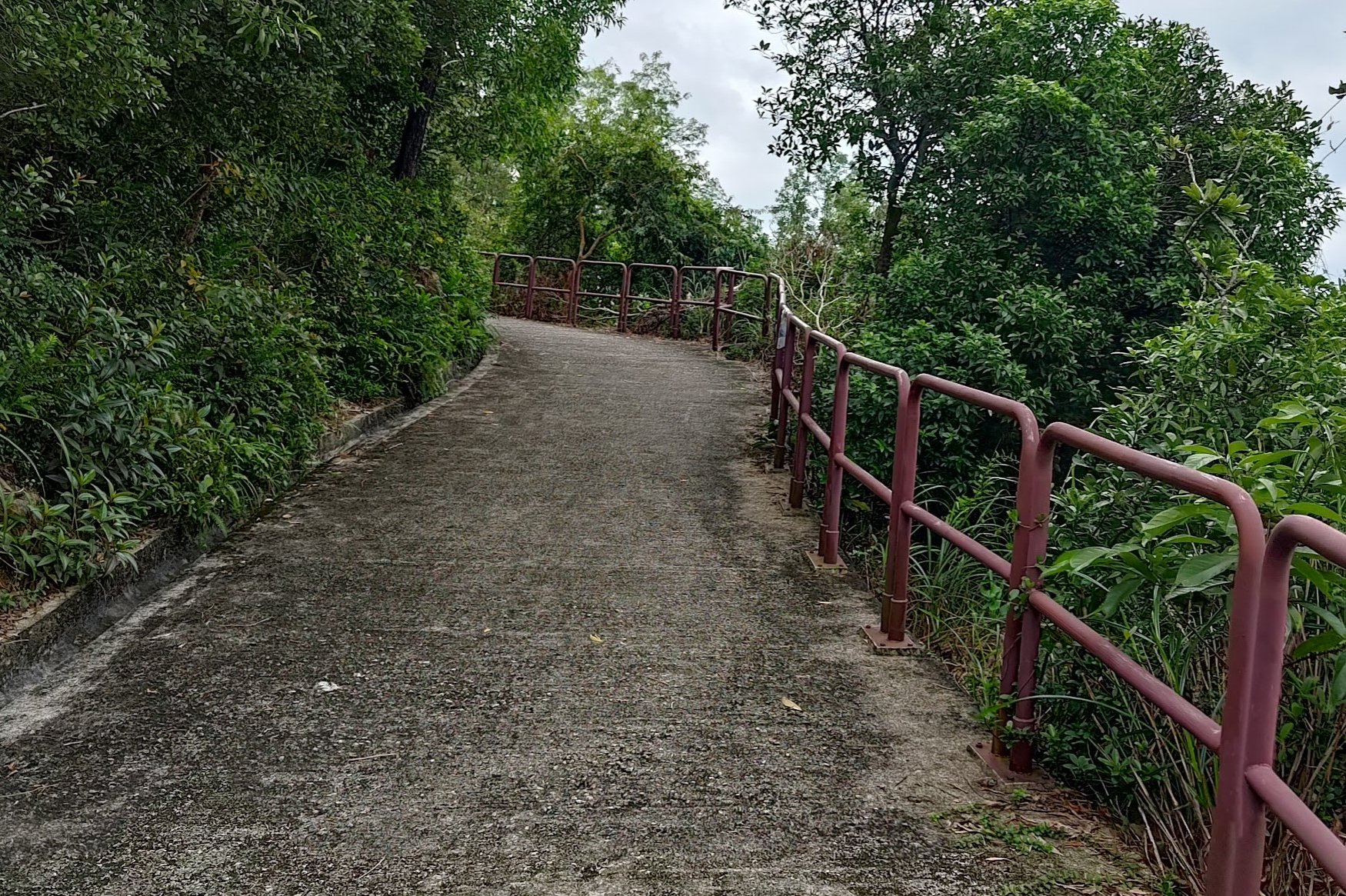
Getting Back to the Main Road
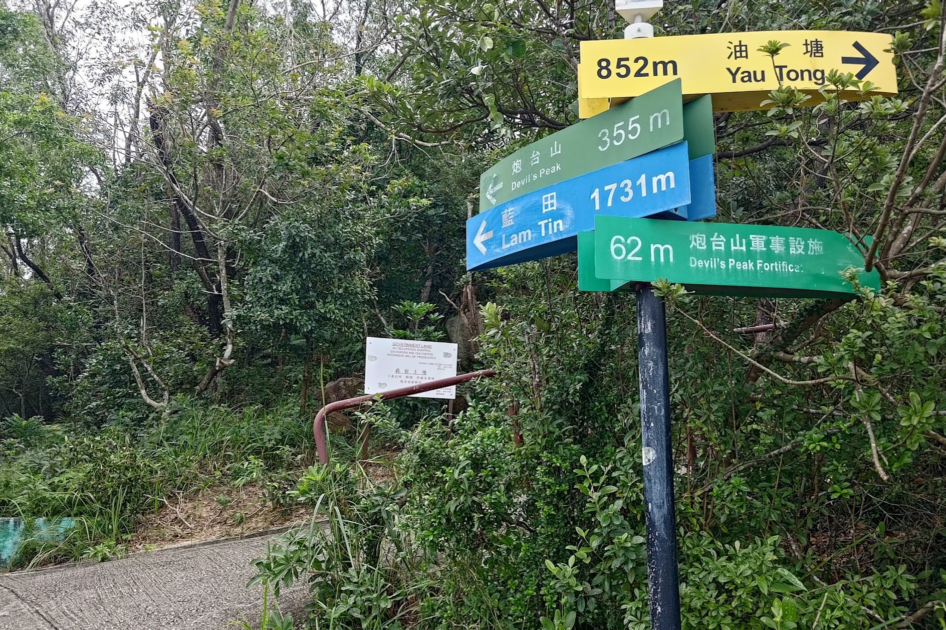
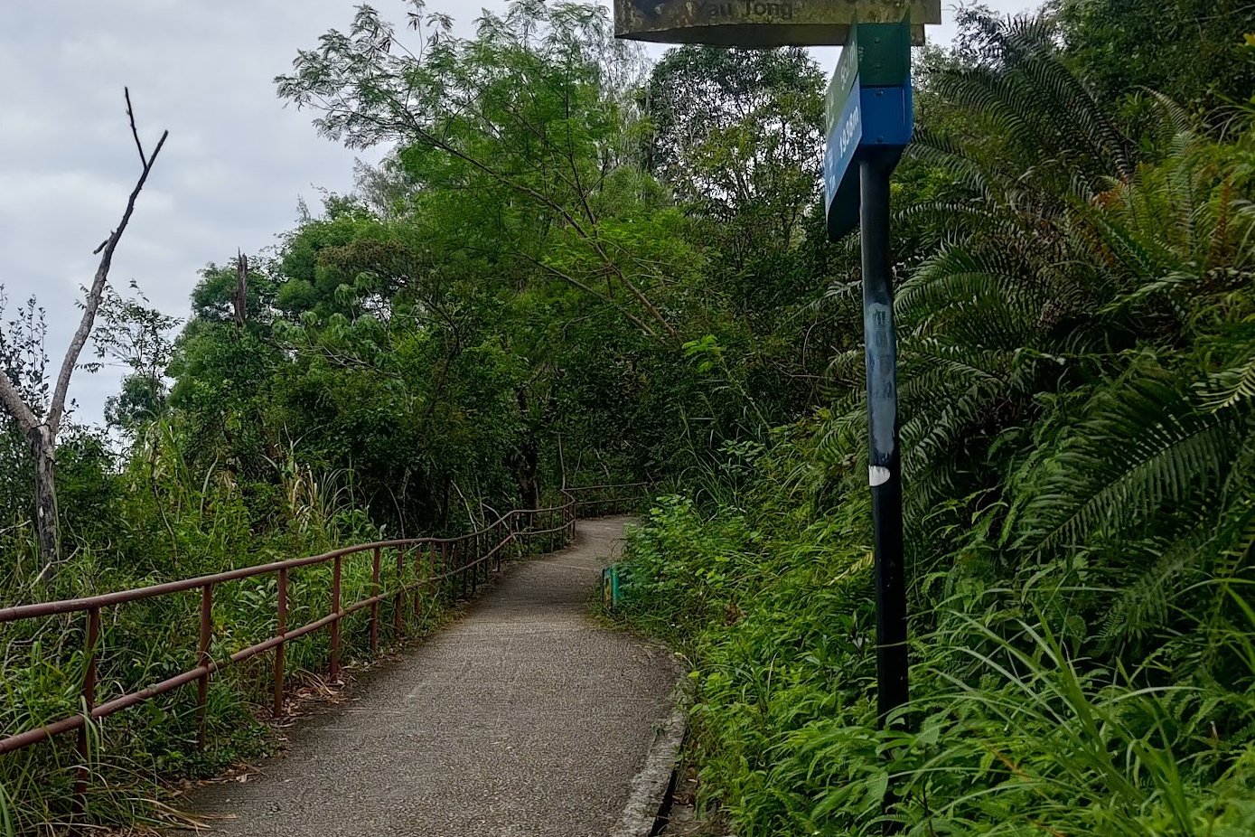
It takes about 10 minutes to get back onto the main road from Gough Battery. Simply keep following the yellow signs pointing you to Yau Tong.
When you're on the main road, turn right to head back the way you came if you want to return to Yau Tong.
Otherwise, go left by following the blue Lei Yue Mun (via footpath) sign.
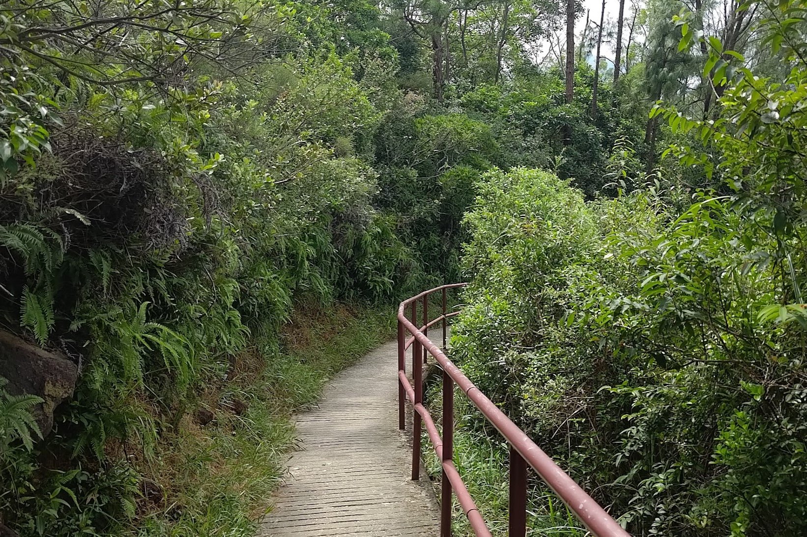
Getting to Lei Yue Mun
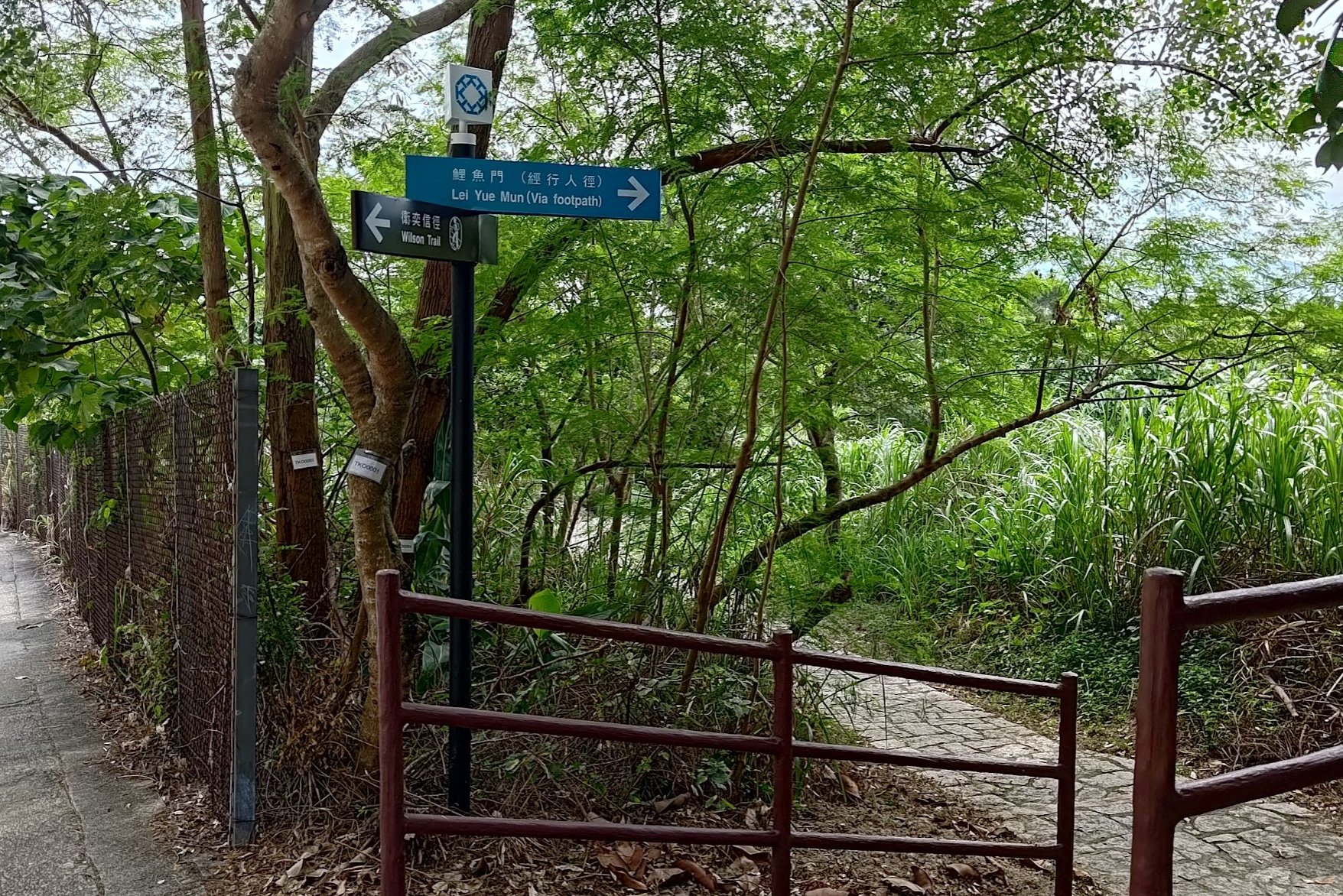
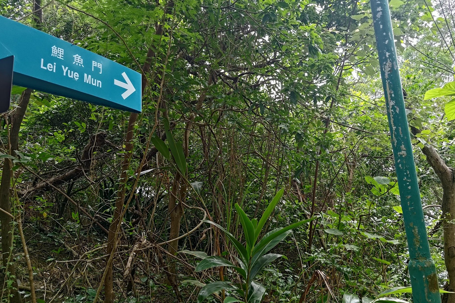
It takes about 20-25 minutes after arriving at the main road to reach Ma Wan Village in Lei Yue Mun.
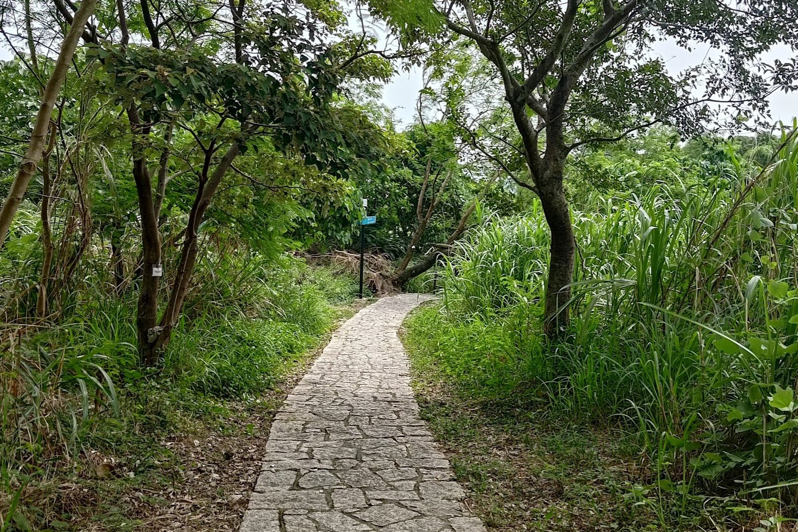
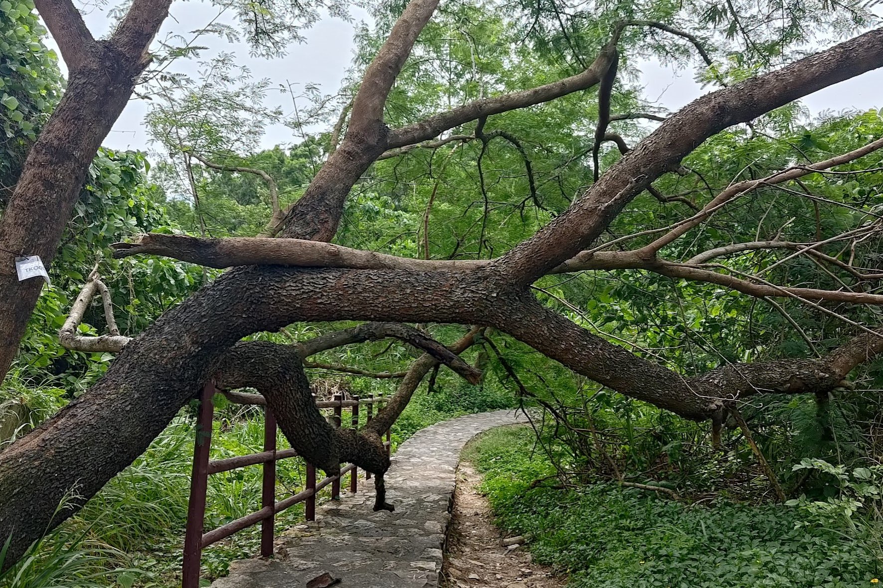
After turning left, look for another blue sign that'll point you in the direction of Lei Yue Mun. Follow it right and begin your descent. This section is pretty easy and gentle. There's a lot of nature and even a few abandoned structures along the way!
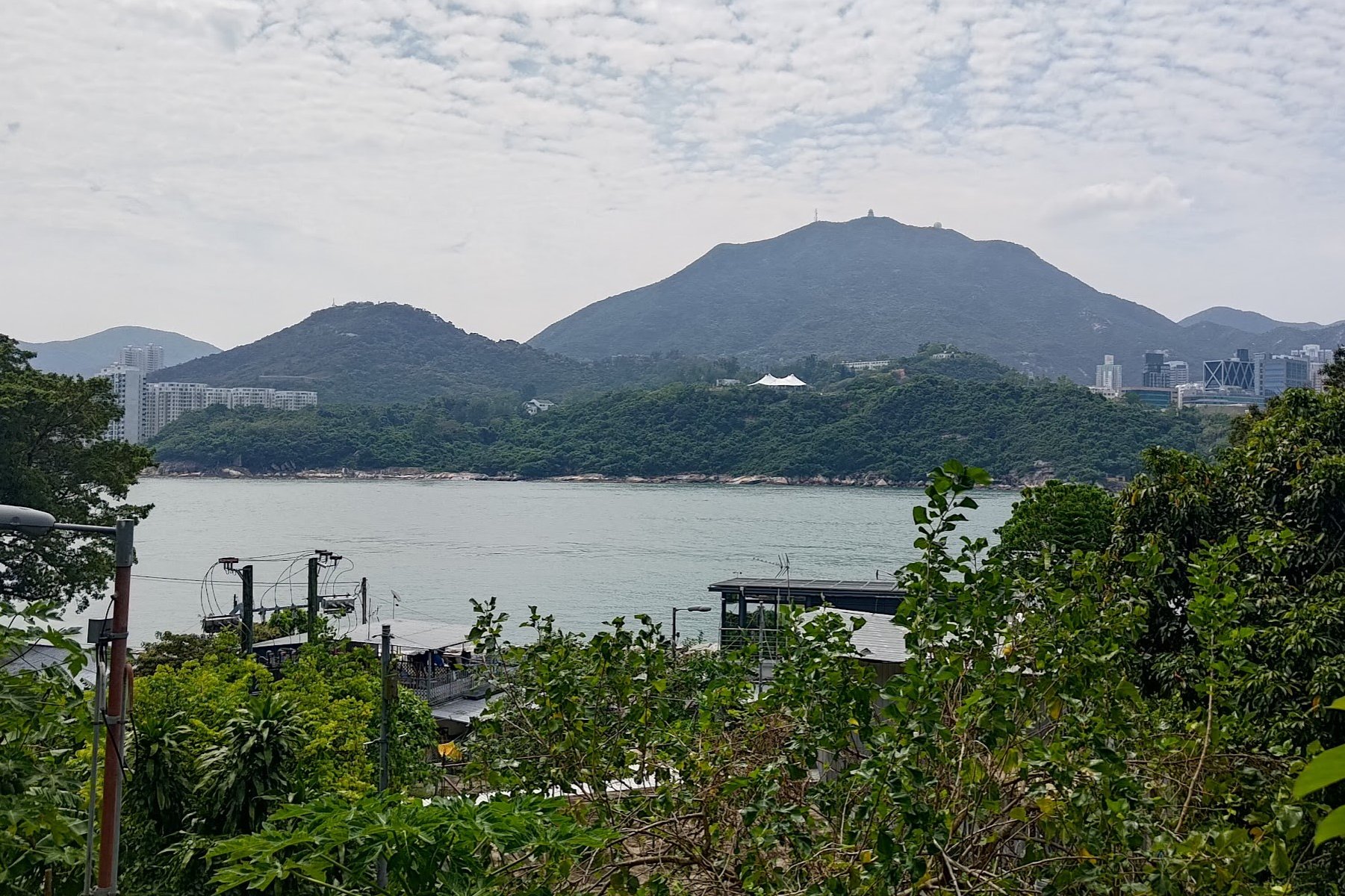
Near Lei Yue Mun, which is actually just the name of the ocean channel, rather than any of the villages, you'll get a clear view of the Museum of Coastal Defence in the distance. That's a great place to visit to learn more about Hong Kong's defense during World War II.
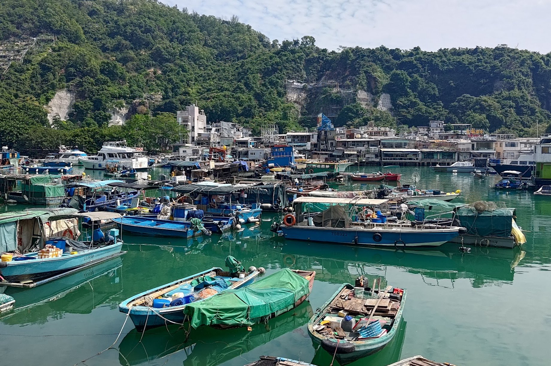
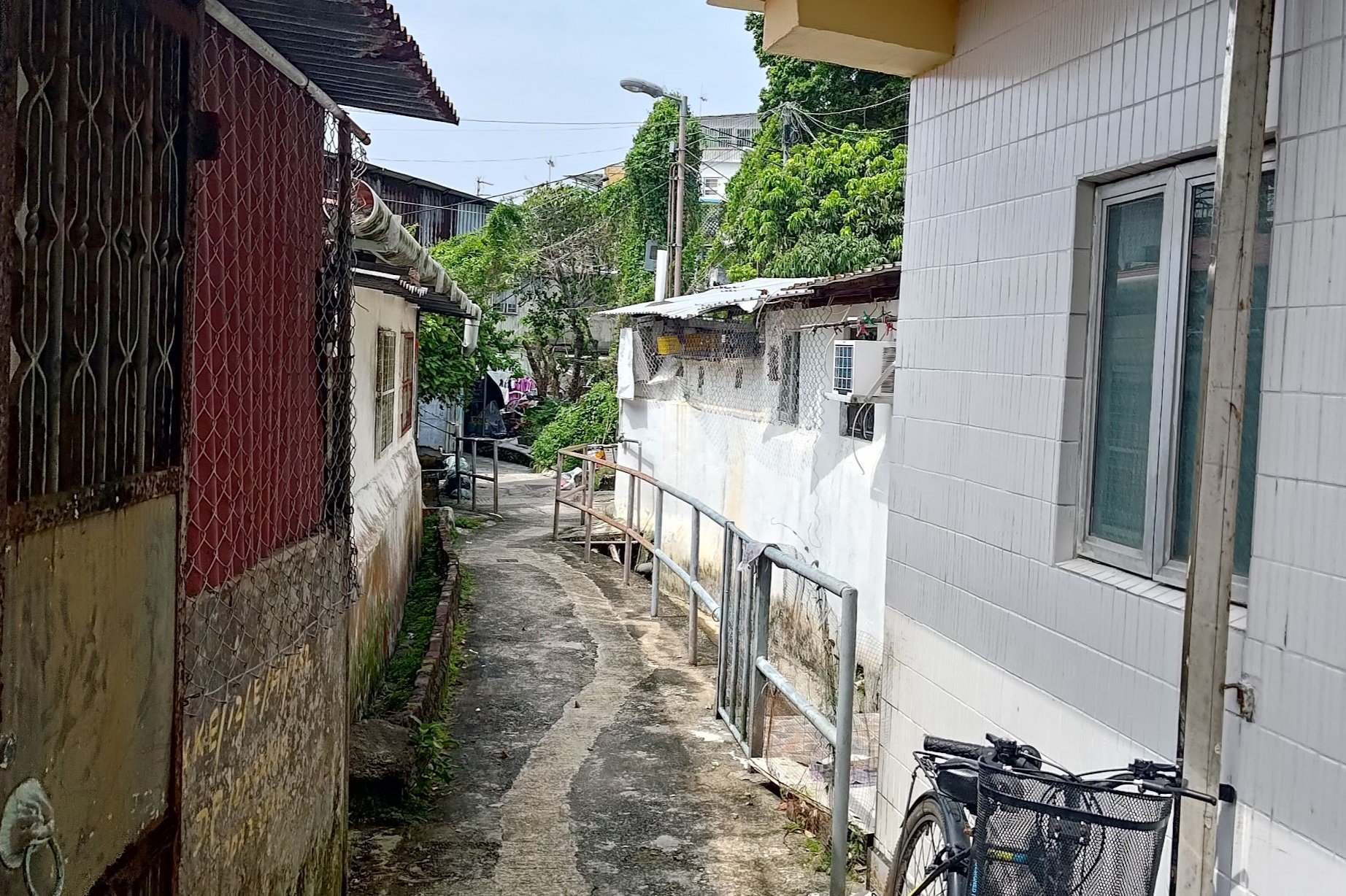
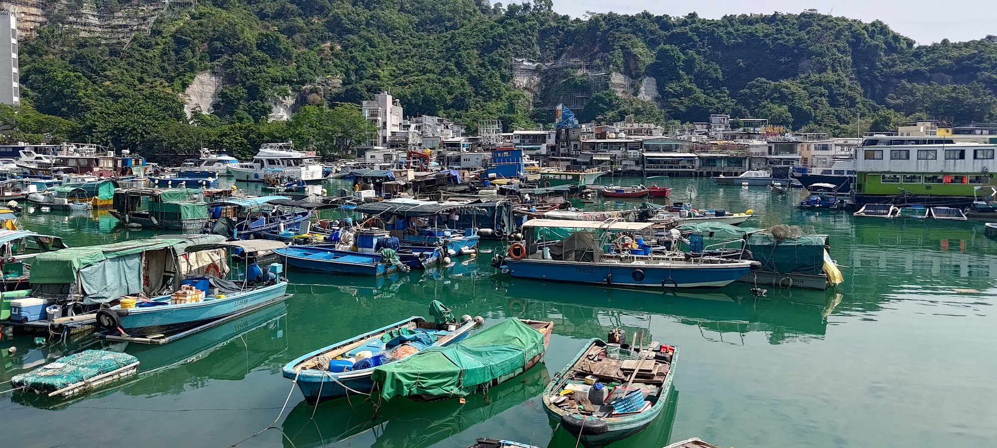
Ma Wan Village, Lei Yue Mun
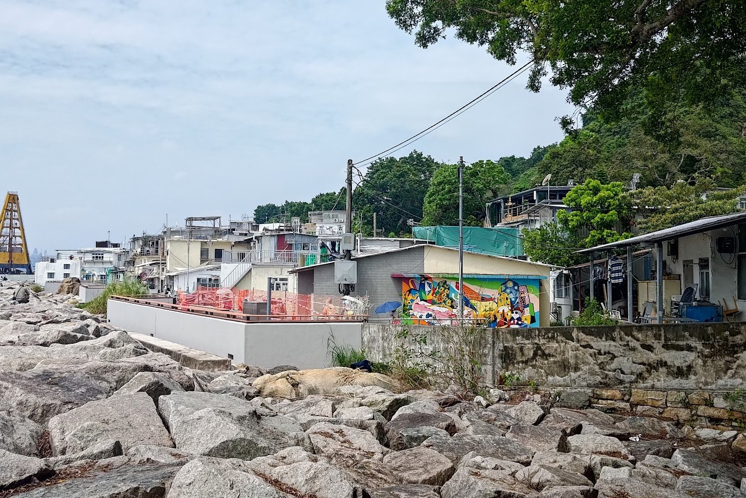
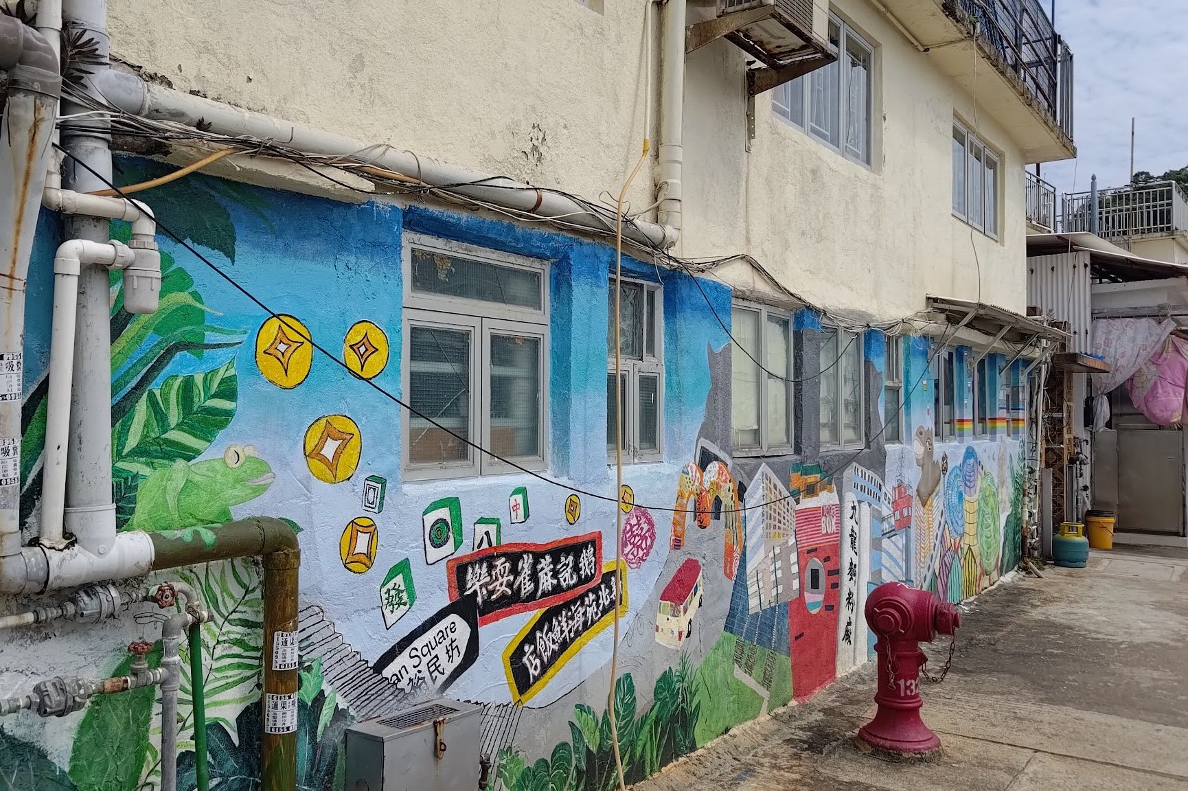
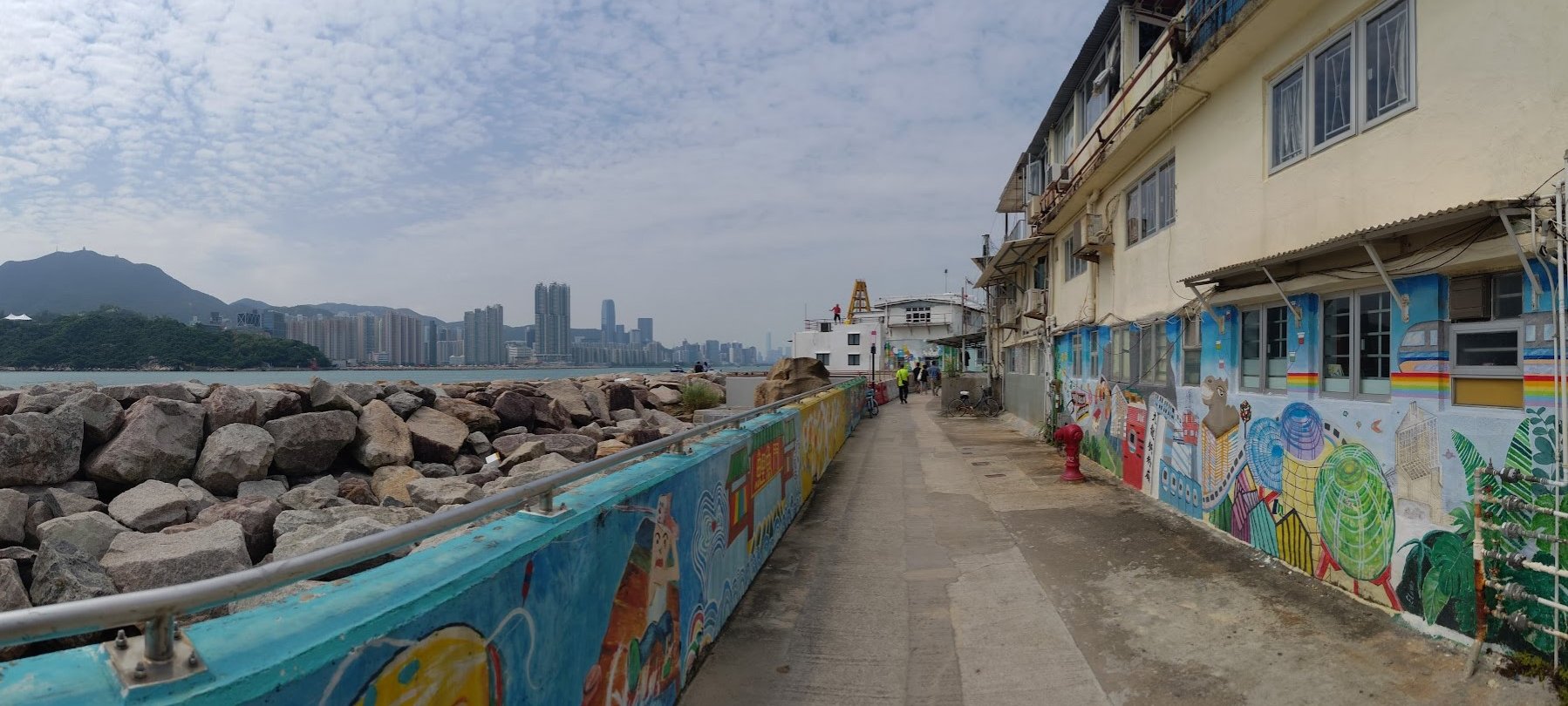
Ma Wan is a fishing village that was established about 200 years ago. Today, the residents of the village try to maintain their traditional way of life by drawing in tourists. While their homes remain simple and relatively traditional, they've started utilizing vibrant art to bring in visitors, who are curious about this blend of old and new.
Apart from Ma Wan, there are three other villages in the Lei Yue Mun area. One is Ma Pui Village, which you will go past on the way to the old quarry. The next is Sam Ka Village, which is more modern and is closer to the end of the hike. Finally, there's Che Ting village, which is further inland a short way off from where we just descended from.
After exploring Ma Wan and arriving at the waterfront, turn left to begin heading toward the Tin Hau Temple, Ma Pui Village and the old quarry.
Getting to the Old Quarry
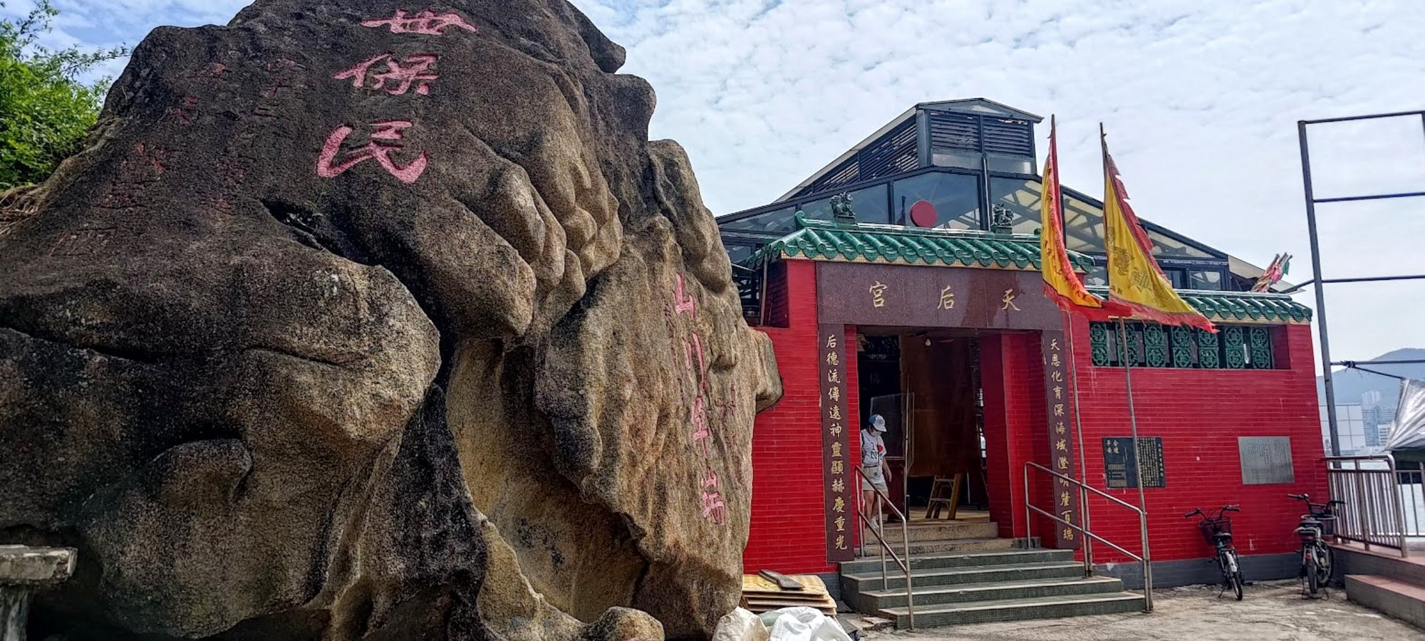
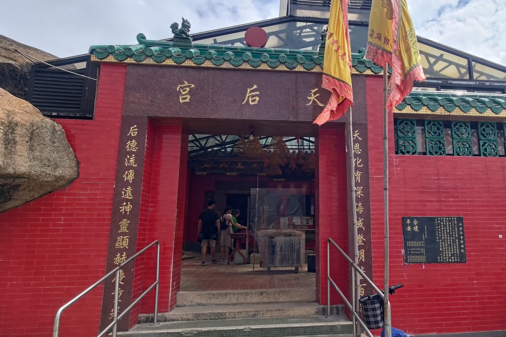
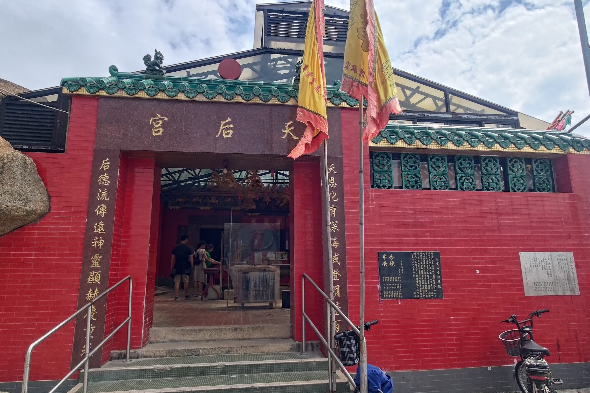
The Lei Yue Mun Tin Hau Temple was built in 1753 during the reign of the Qianlong Emperor and was then completely reconstructed in 1953.
The cannon in front of the temple is a reminder of the 1800s, when piracy was rampant in and around Hong Kong. Areas like Lei Yue Mun, where coastal villages were located, often had to fend off pirate attacks.
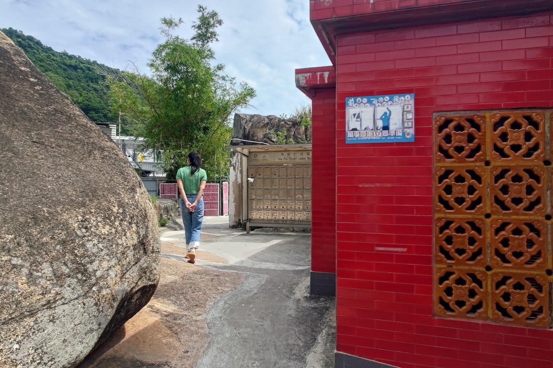
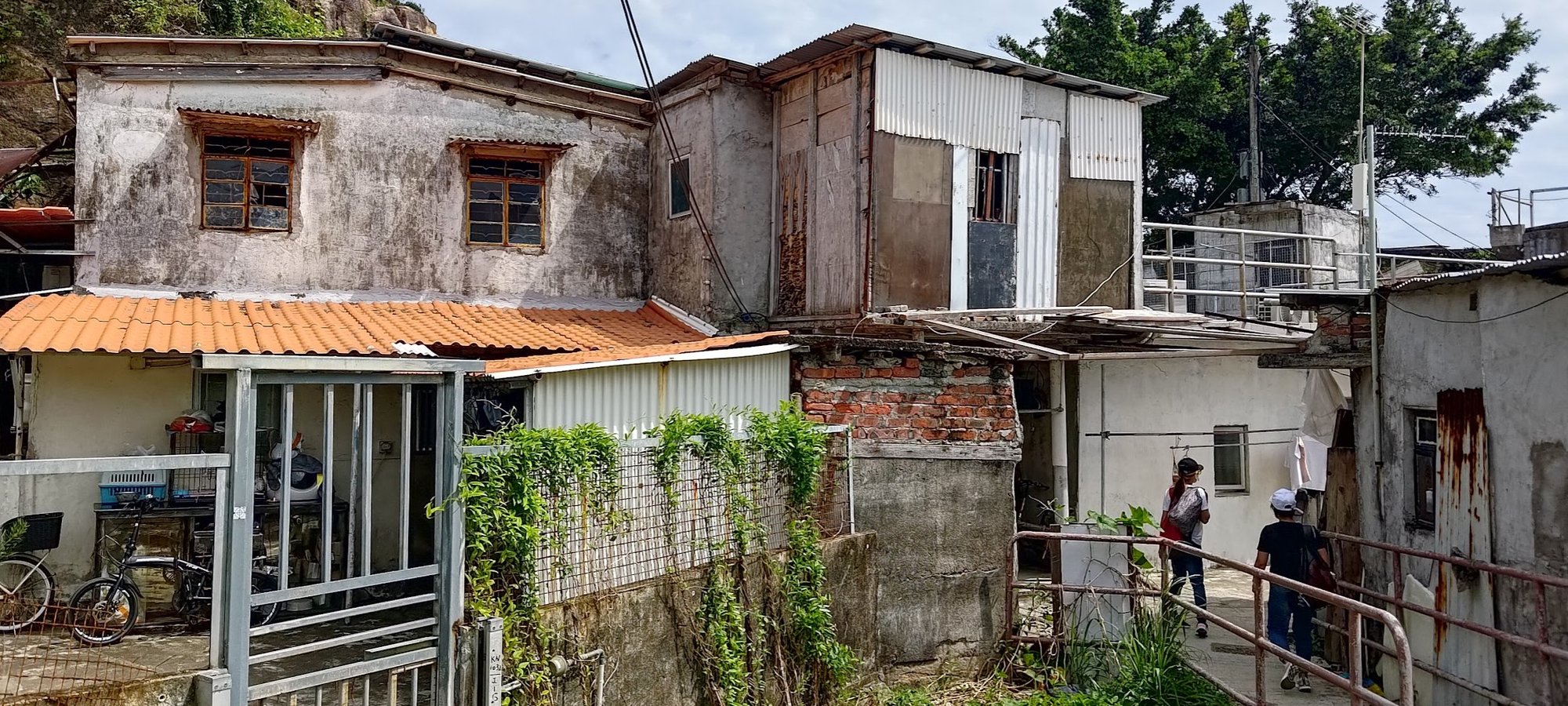
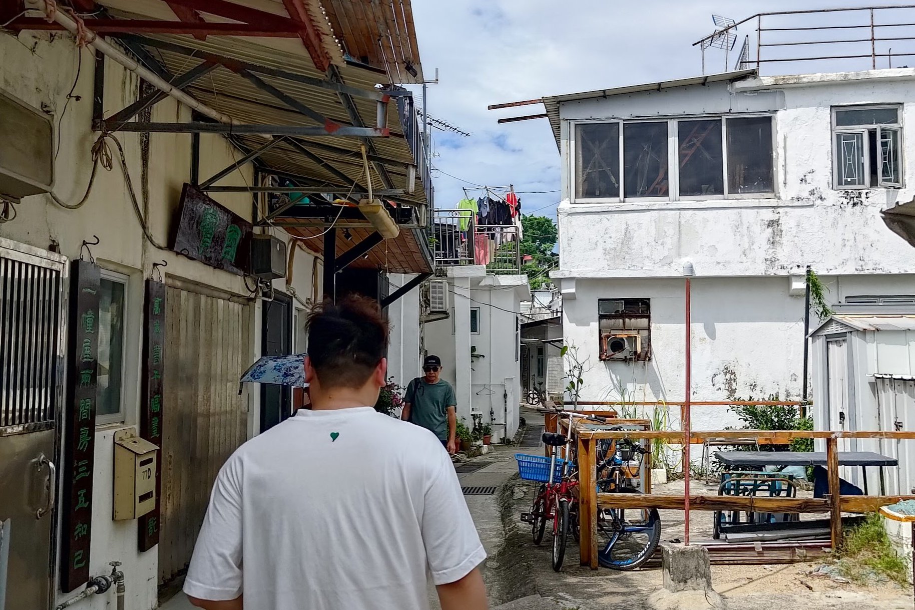
After heading through the temple, follow the yellow sign left as you enter Ma Pui Village. You'll notice that the homes here are a lot more traditional, with a few even falling apart. Many of the structures here are deemed illegal by the Hong Kong government, but they are allowed to remain because of the historical and cultural significance they hold.
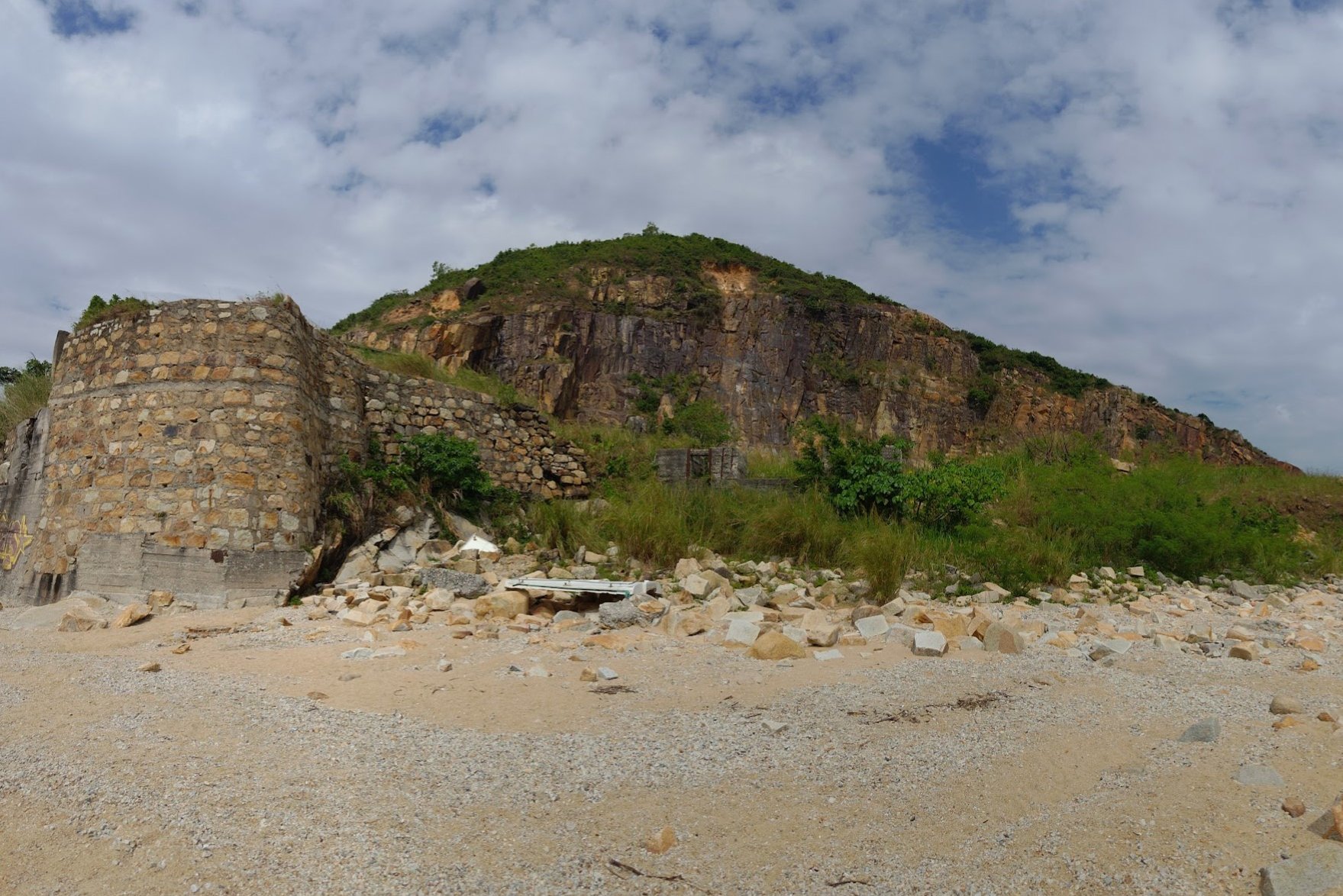
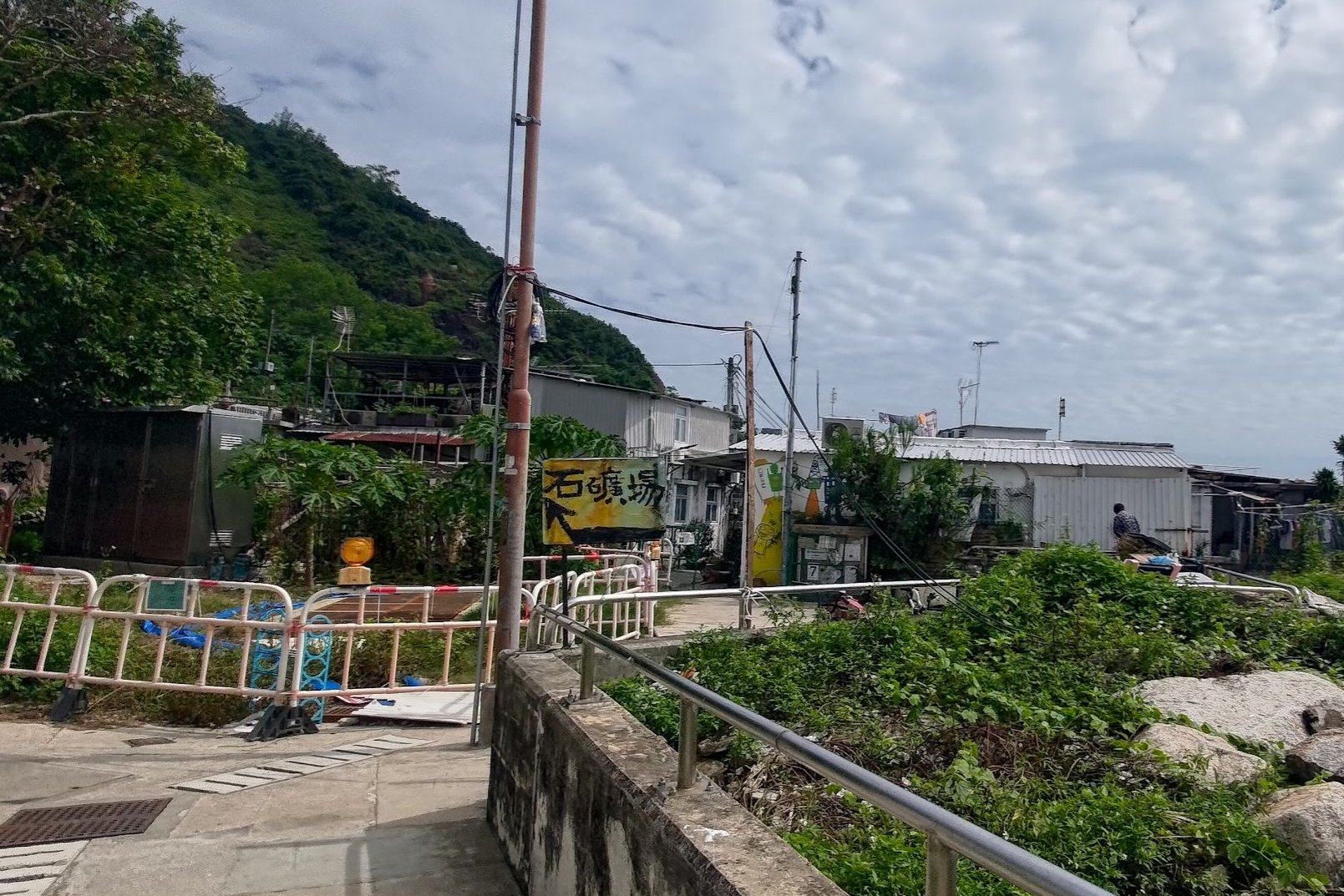
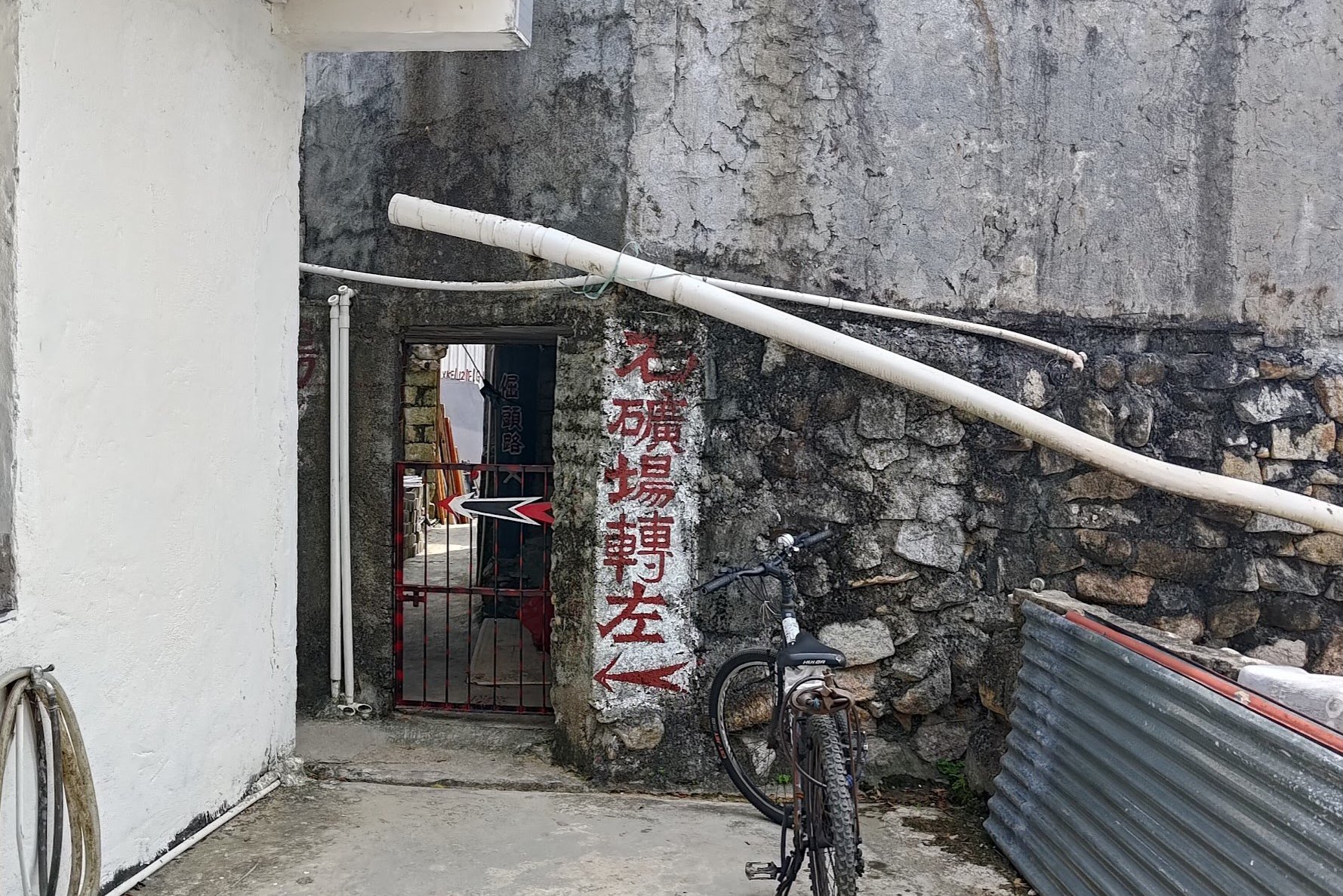
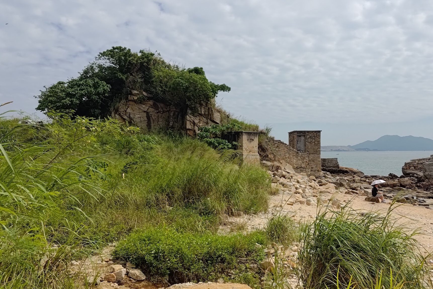
Once you reach a dead end in the village, follow an arrow painted into the wall of a village home and turn left. You'll then arrive at a beach with old, stone structures in the distance. This is part of the old quarry.
It takes between 10 and 15 minutes to reach the quarry from Tin Hau Temple.

Old Lei Yue Mun Quarry
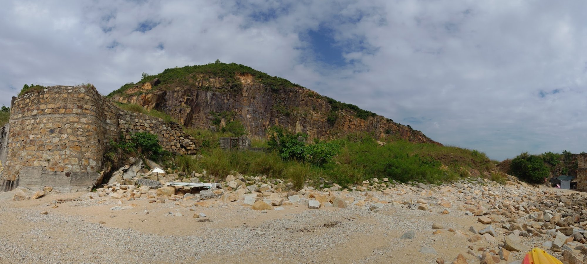
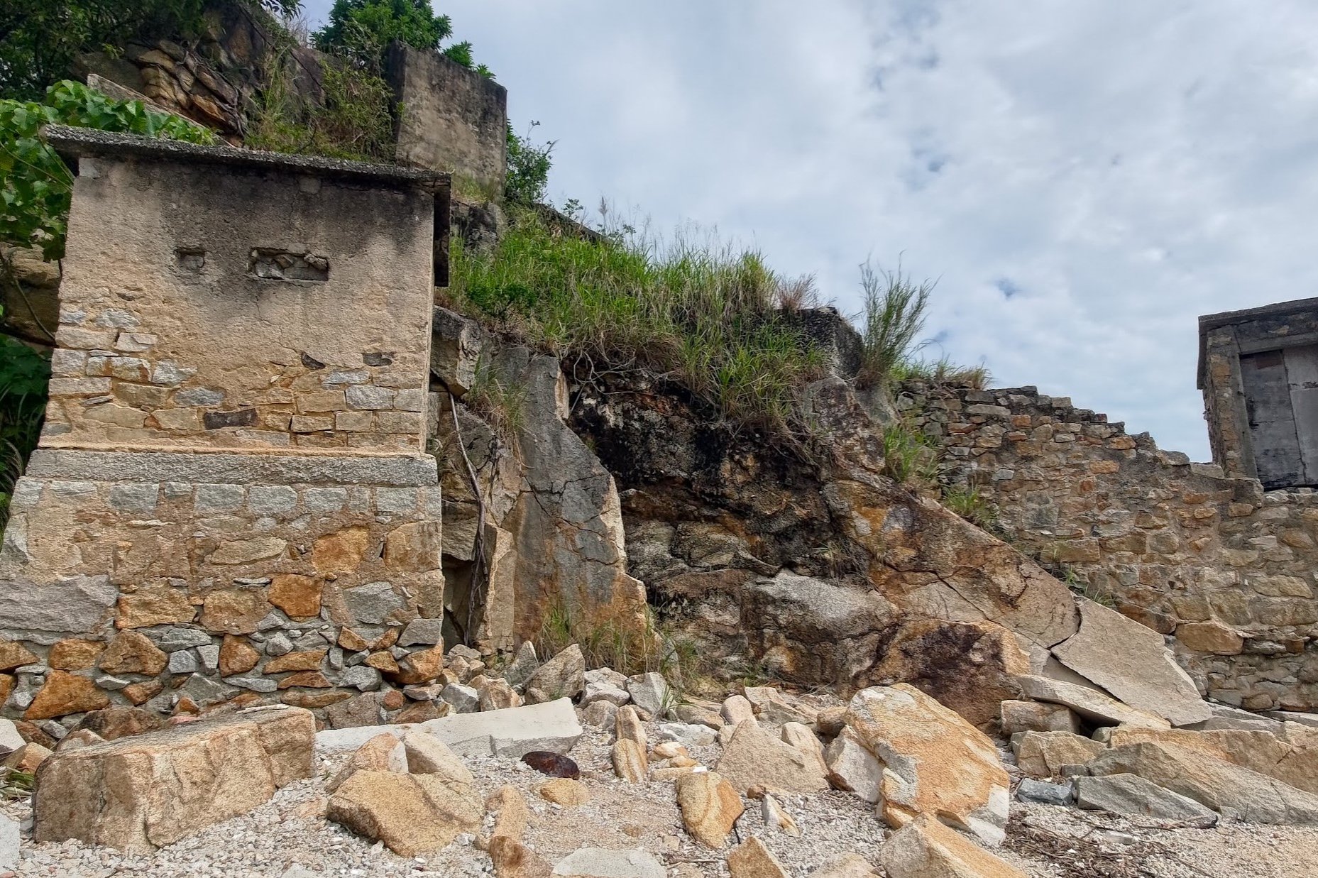
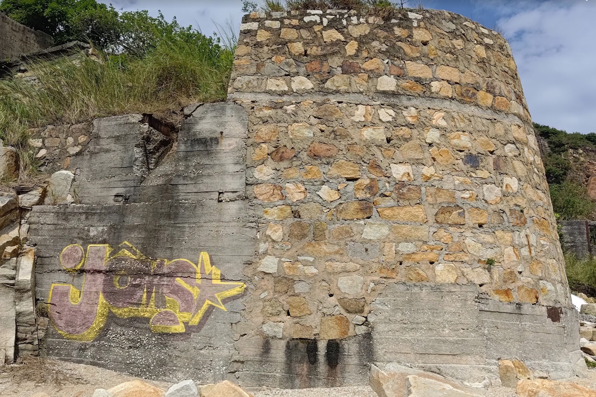
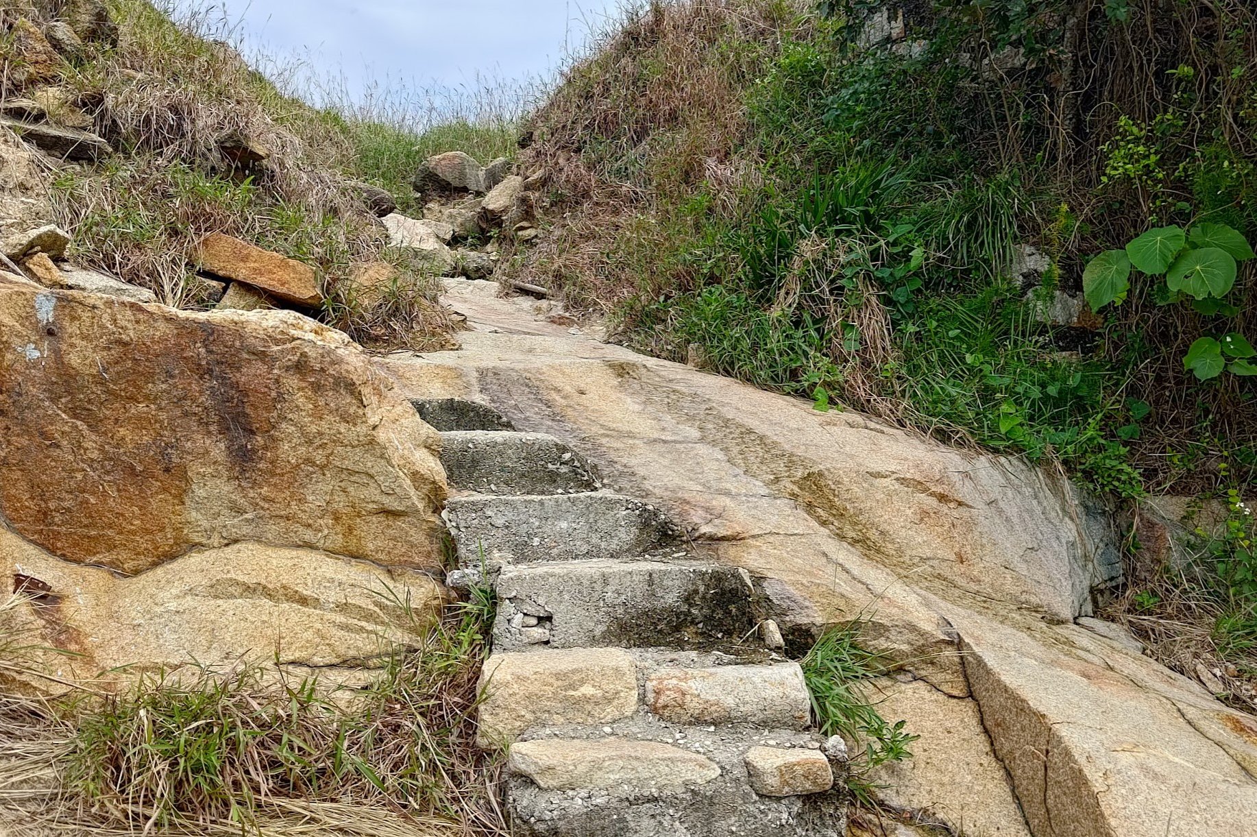
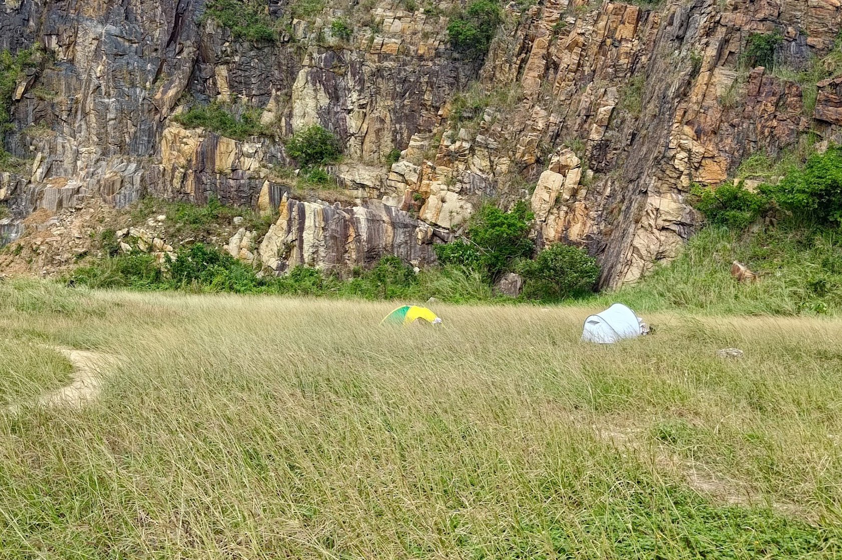
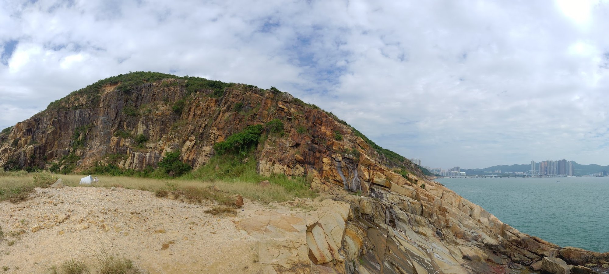
Once you arrive at the beach, it's pretty much a case of walking about and exploring. Near one of the structures, which were actually dormitories that housed quarry workers from the 1940s to the 1970s, you'll find a set of steps that takes you up to a grassland and more impressive rocky hills.
The quarry, itself, went into operation after World War II as Hong Kong's population ramped up in size and more building materials were needed to facilitate this huge boom.
Conditions, by all accounts, were very dangerous and brutal.
The quarry was shut down sometime in the early 1970s, or perhaps in the latter part of the 1960s. Due to a government ban on using explosives in 1964, collecting rocks from the quarry proved difficult, while demand for rocks had already begun to steadily decline.
Today, the Old Lei Yue Mun Quarry stands as a strange remnant of old Hong Kong, untouched by the metal and glass of modernity, though one need just look across to Junk Bay to see that the city has indeed moved on while the quarry remains frozen in time in its own special little bubble.
Getting Back
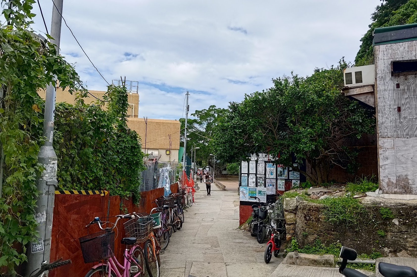
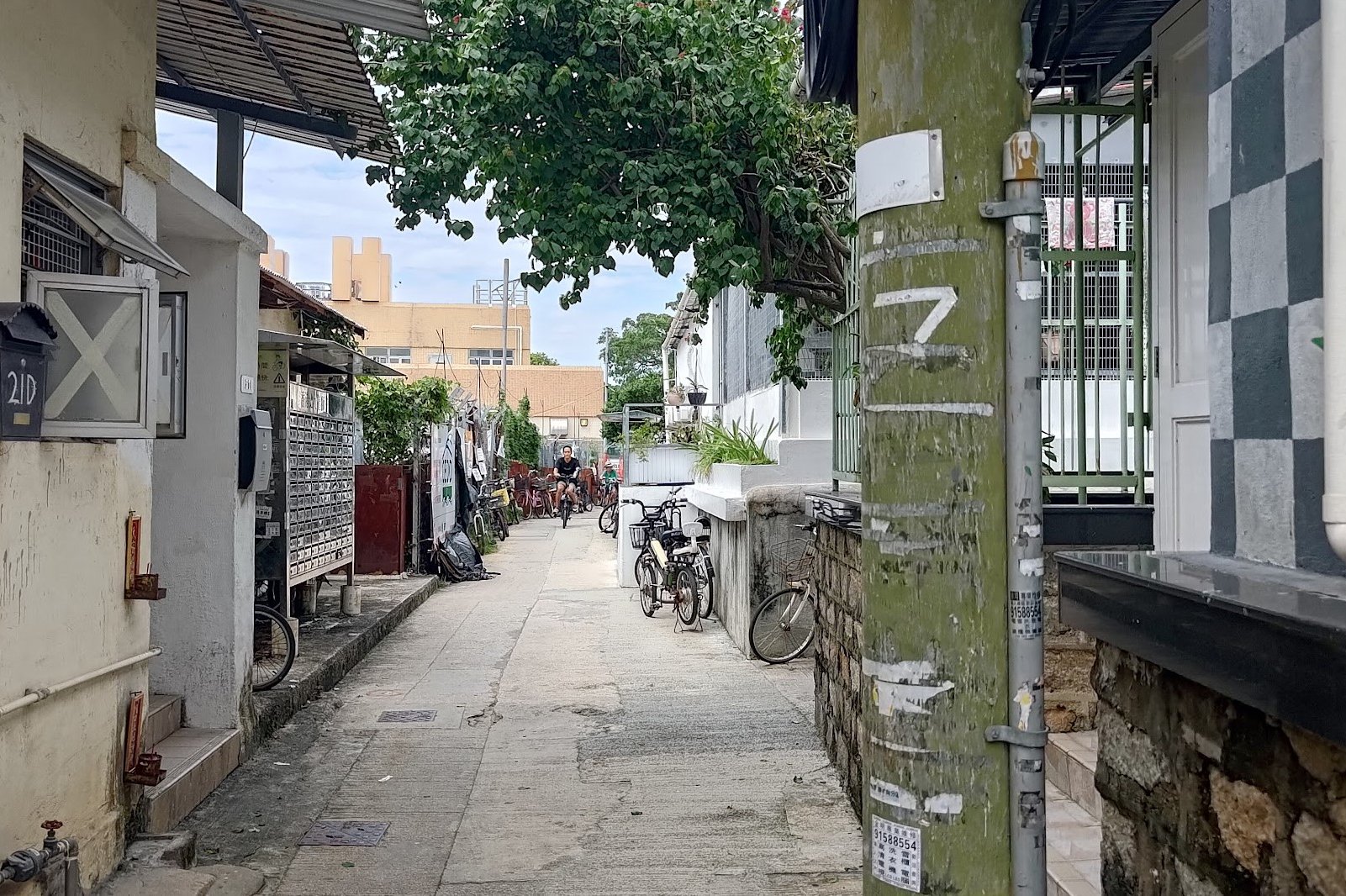

Strolling through Ma Wan is a really enjoyable experience. while you're in the traditional village area, you'll be walking along Hoi Pong Road East.
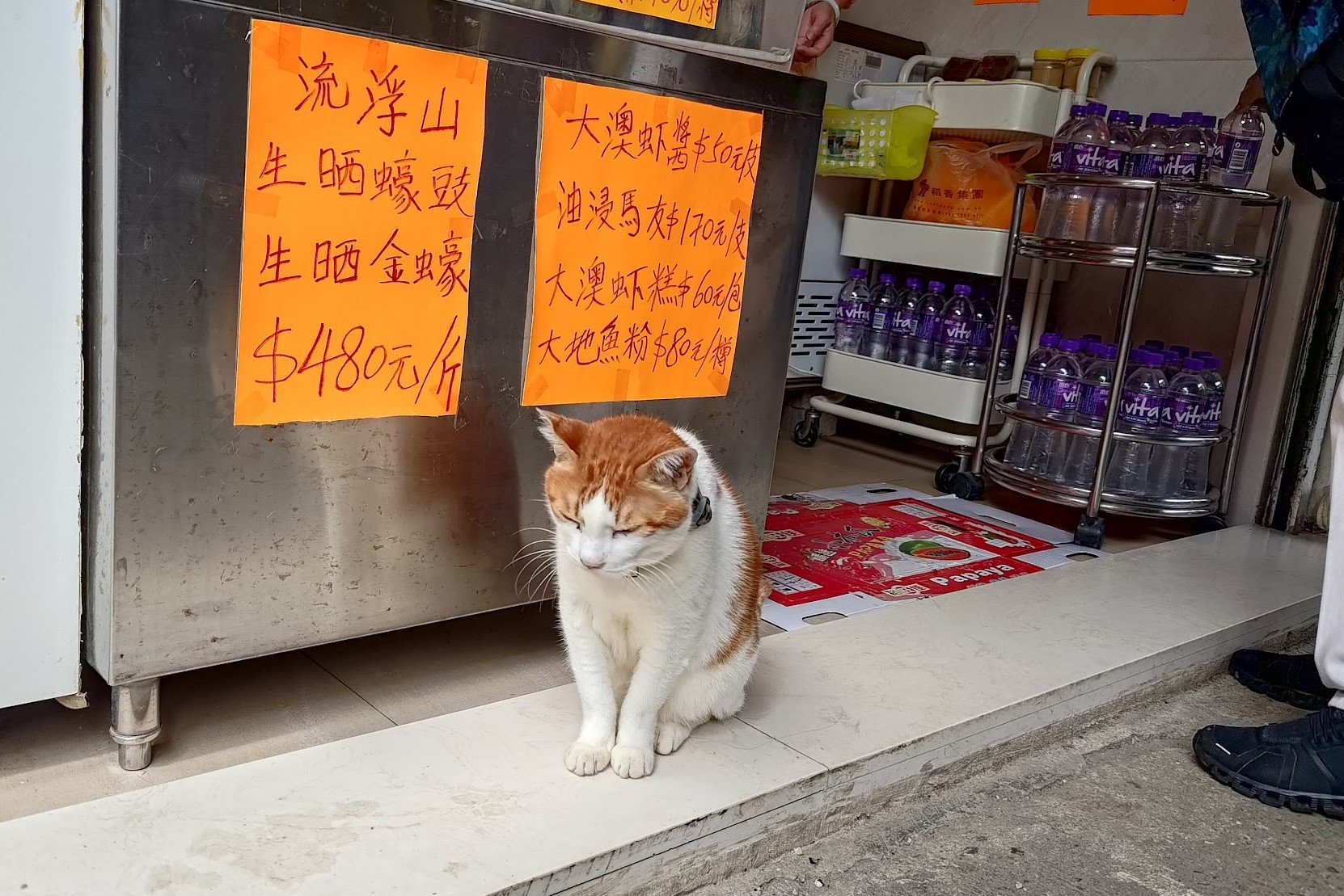
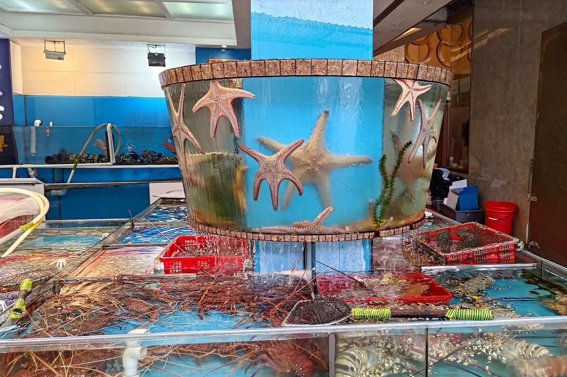
The minute you turn right, you'll be walking along Hoi Pong Road Central. This is where you'll see an abundance of seafood shops and restaurants.
Hoi Pong Road Central will merge into Lei Yue Mun Praya Road. A short while later, you'll see a red minibus with a signboard indicating it's going to Kwun Tong. If you take this bus, you have to pay by cash.
Other buses in this area go to different parts of Hong Kong.
Otherwise, continue straight and connect back onto Cha Kwo Ling Road. Keep following Cha Kwo Ling Road for just under 10 minutes to return to Yau Tong MTR Station.

