
Cape D’Aguilar Hike: Caves, Bones, A Lighthouse and the Sea
Contents
- Essential Information
- Hike Highlights
- Google Route Map
- How to Get There
- Quick Route Summary
- Detailed Route
- Drinks and Food
- Best Lighthouse View and WW2 Battery
- The Lighthouse Up Close
- Thunder Cave
- Whale Bones
- Crab's Eye Cave
- Coastal Views
- The Way Back
Essential Cape D'Aguilar Hike Details
- District: Hong Kong Island
- Duration: 3 hours (both ways without exploration)
- Distance: 8+km (8km there and back. More with exploration)
- Highest Elevation: 130ish meters
- Difficulty: 1.5/5
- Facilities: Toilets and convenience stores available at the MTR station and mid-way
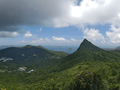
Why Hike Cape D'Aguilar?
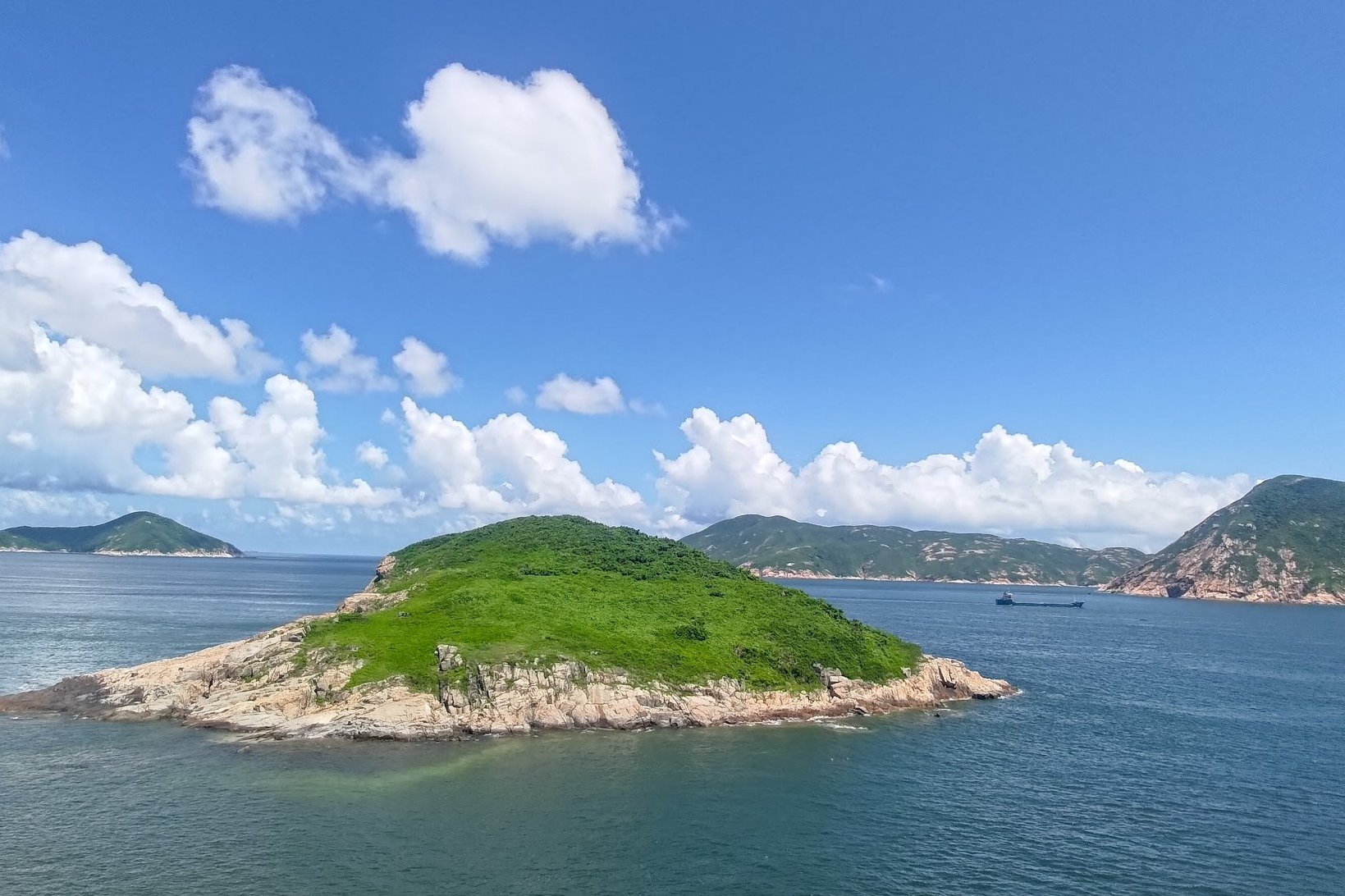
Cape D’Aguilar is a there-and-back hike that’s surprisingly rich in nature, historical significance and as a spot for adventuring. It’s the type of place that gets the imagination rearing with its sparkling blue waters, distant green islands and rich brown coastlines.
Steeped in lore, Cape D’Aguilar is named after Major-General Sir George Charles D'Aguilar (1784–1855), who served as Lieutenant Governor of Hong Kong and Commander of the British Forces in Hong Kong from 1843 to 1848.
While on the hike, I couldn’t help imagining this idyllic setting being at the forefront of World War 2 battles. Perhaps even being the last bastion of defense keeping Hong Kong from being overrun by hostile forces. Indeed, the remnants of a pair of old batteries (a cluster of cannons working in a group) can still be found around the rugged coastline of Cape D’Aguilar.
In addition to wartime history, the protected marine status of Cape D’Aguilar means the water is stunningly beautiful. In the summer sun, the ocean shimmers and entrances the eye with varying shades of blue depending on depth.
As Hong Kong's only marine reserve, "Cape D'Aguilar has 16% of the [marine] species recorded in Hong Kong". In the summer sun, the ocean shimmers and entrances the eye with varying shades of blue depending on depth.
If you’re someone who has adventure in their veins, a couple of hidden caves provide respite from the sun and a unique feeling of discovery as you clamber over rocks to reach the water’s edge.
The best part about this hike is that it’s EASY! You’re following a concrete road the entire way and when you arrive at the end point, you can explore as much or as little as you like. Either way, you’ll still be privy to inspiring vistas of the South China Sea.
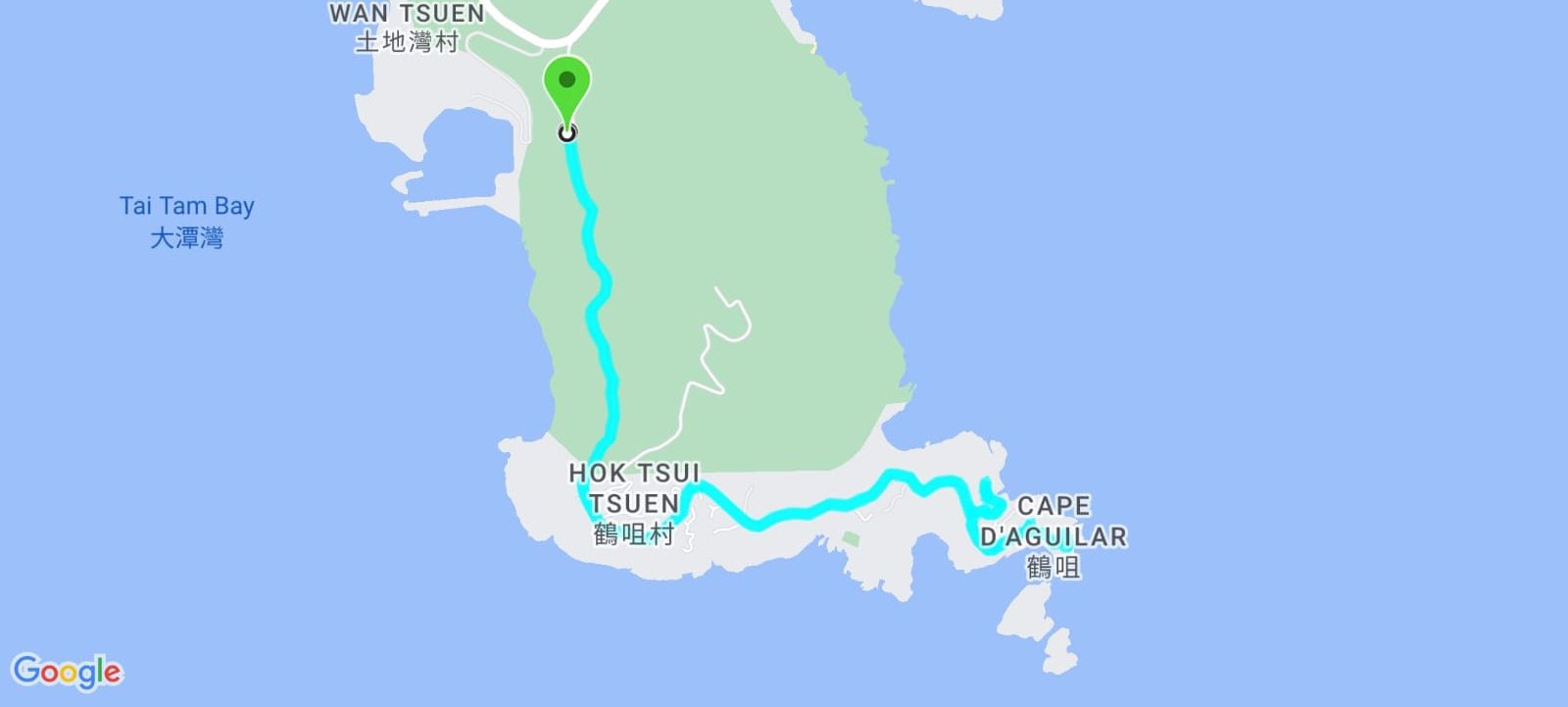
Google Route Map
How to Get to the Cape D’Aguilar Hike Start Point:


Getting to the start of Cape D’Aguilar is super simple.
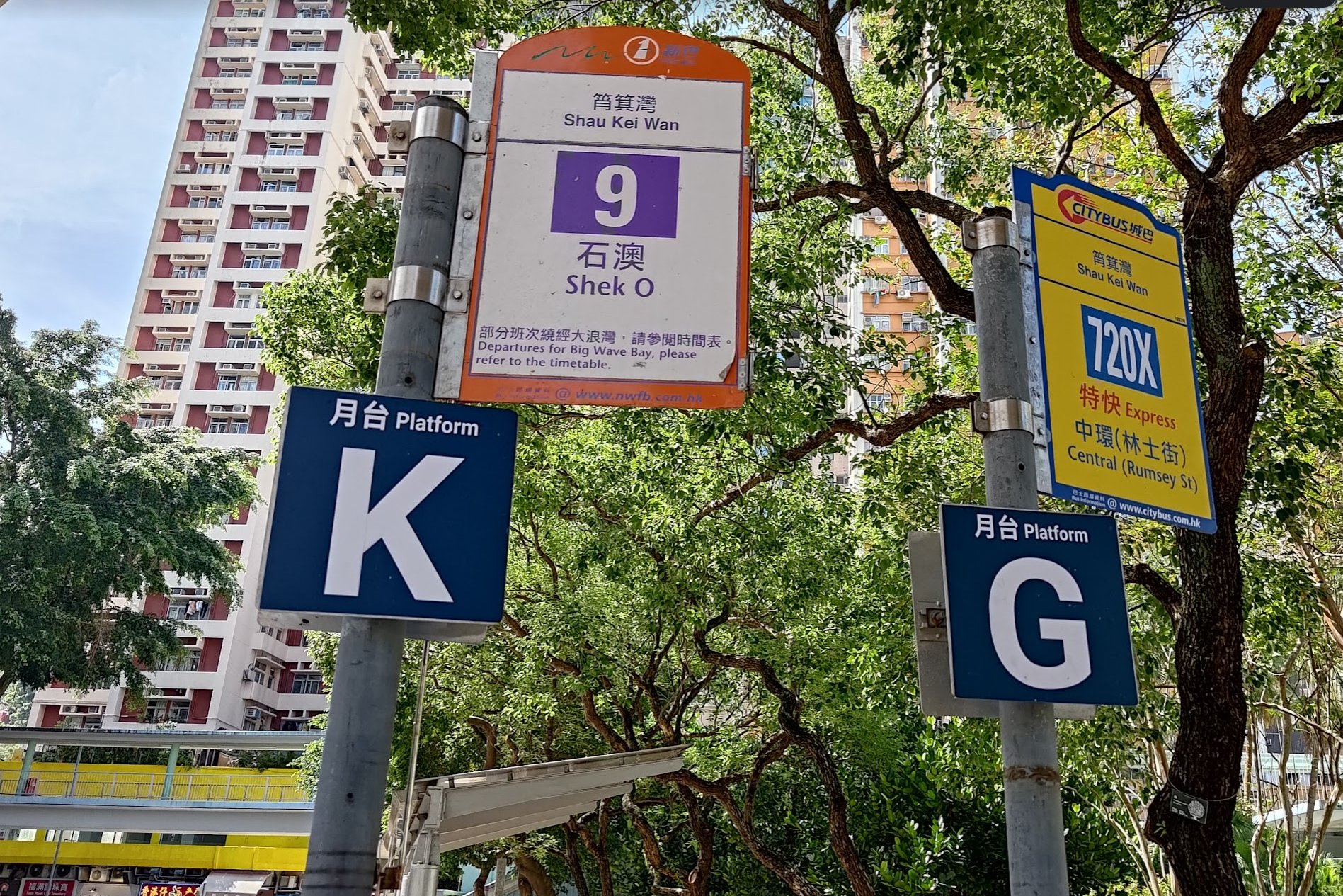
1. Take the MTR to Shau Kei Wan Station
2. Get the number 9 bus from outside exit A2 and get off at the Cape D’Aguilar stop
- Make sure the bus is going past Cape D’Aguilar. Some skip this stop. It’ll indicate on the bus signage whether it’s via Cape D’Aguilar or not
- If you need to be certain, show this to the bus driver: (鶴咀)
3. There’s also a red minibus that goes past Cape D’Aguilar from the indoor bus terminus next to exit A2. Double confirm with the driver by showing them this: (鶴咀)
4. Alternatively, on weekends, you can get the X9 bus from Central. Get off at the Cape D’Aguilar stop
Quick Cape D’Aguilar Hiking Guide
- From where you get off the bus, follow Cape D’Aguilar Road by walking past the ‘Stay Green’ mural
- After 30 minutes you’ll see a restaurant banner (you can turn here for food and drinks)
- Another 30 minutes later, you’ll arrive at the Radio Station Area
- Follow the dirt trail in the grass behind the red sign
- At the back of the Radio Station Area, follow the blue sign that says 300m (not the ascending path)
- Follow the brown ‘Cape D’Aguilar Marine Reserve’ sign
- Look for the steps heading up on your left for great views of the lighthouse
- At the crossroads, take the blue ’50m’ sign if you want to visit the lighthouse. It’s just past the pink-roofed houses at the next junction
- At the same crossroads, take the other fork down towards Cape D’Aguilar Marine Reserve Area
- Climb the rocky area with the triangular tower on it for amazing views (at your own risk)
- Visit Thunder Cave just before arriving at the Institute of Marine Science
- Check out the whale bones, beach, Crab's Eye Cave and the coastal cliffs
- Return the way you came
One of the Most Stunning Roads in Hong Kong
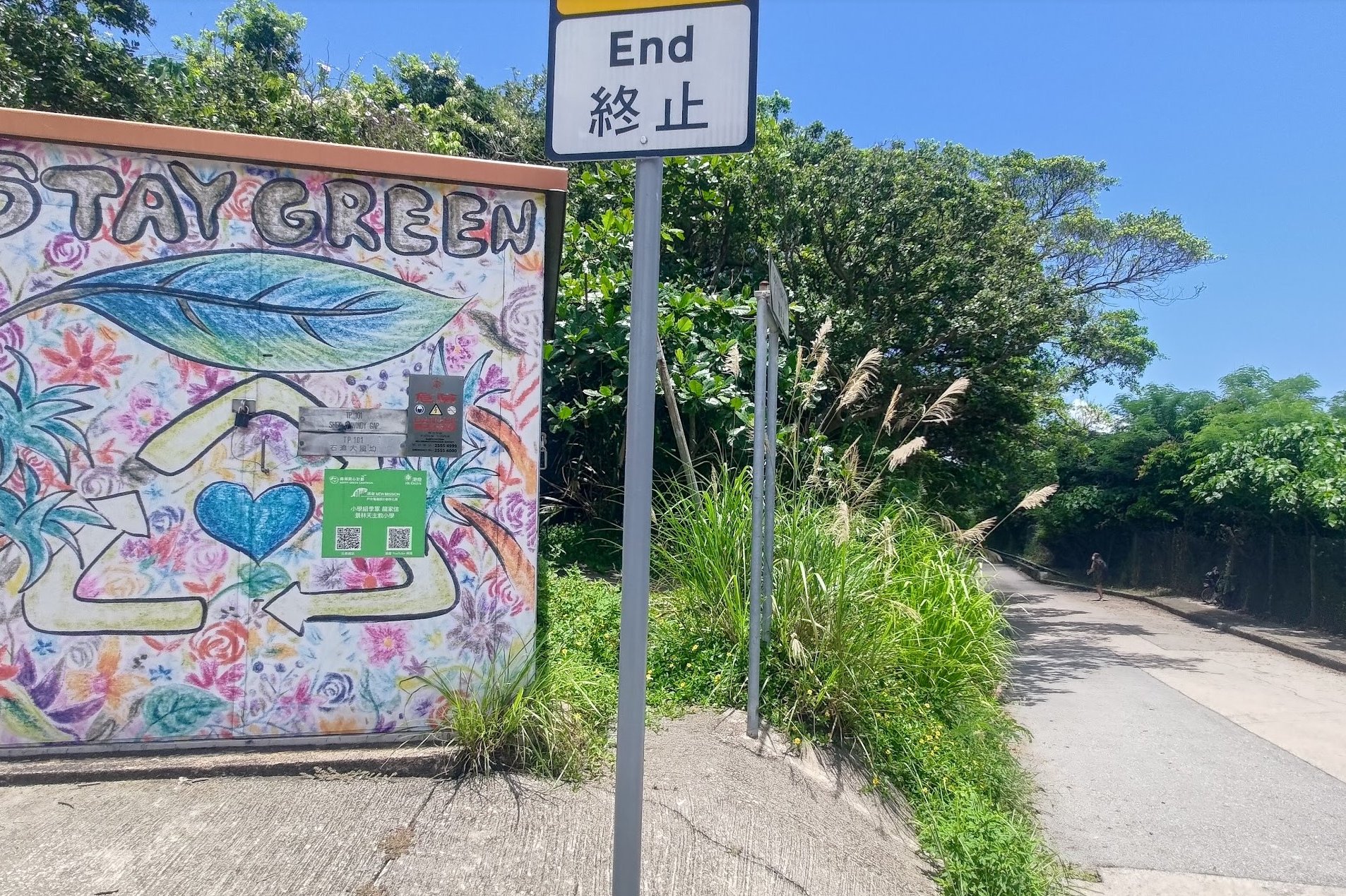
After being deposited at the roundabout by your bus of choice, look for the ‘Stay Green’ mural. Head toward it and begin walking along Cape D’Aguilar Road.
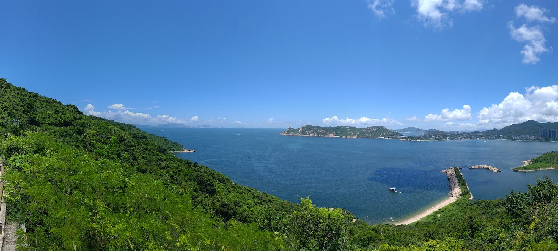
I usually hate hikes that are on paved surfaces, but as far as roads with views go, this one is really stunning. While avoiding the odd car or van can get very tedious, you’re spoiled with views of islands and beaches the entire way, so it’s worth the hassle.
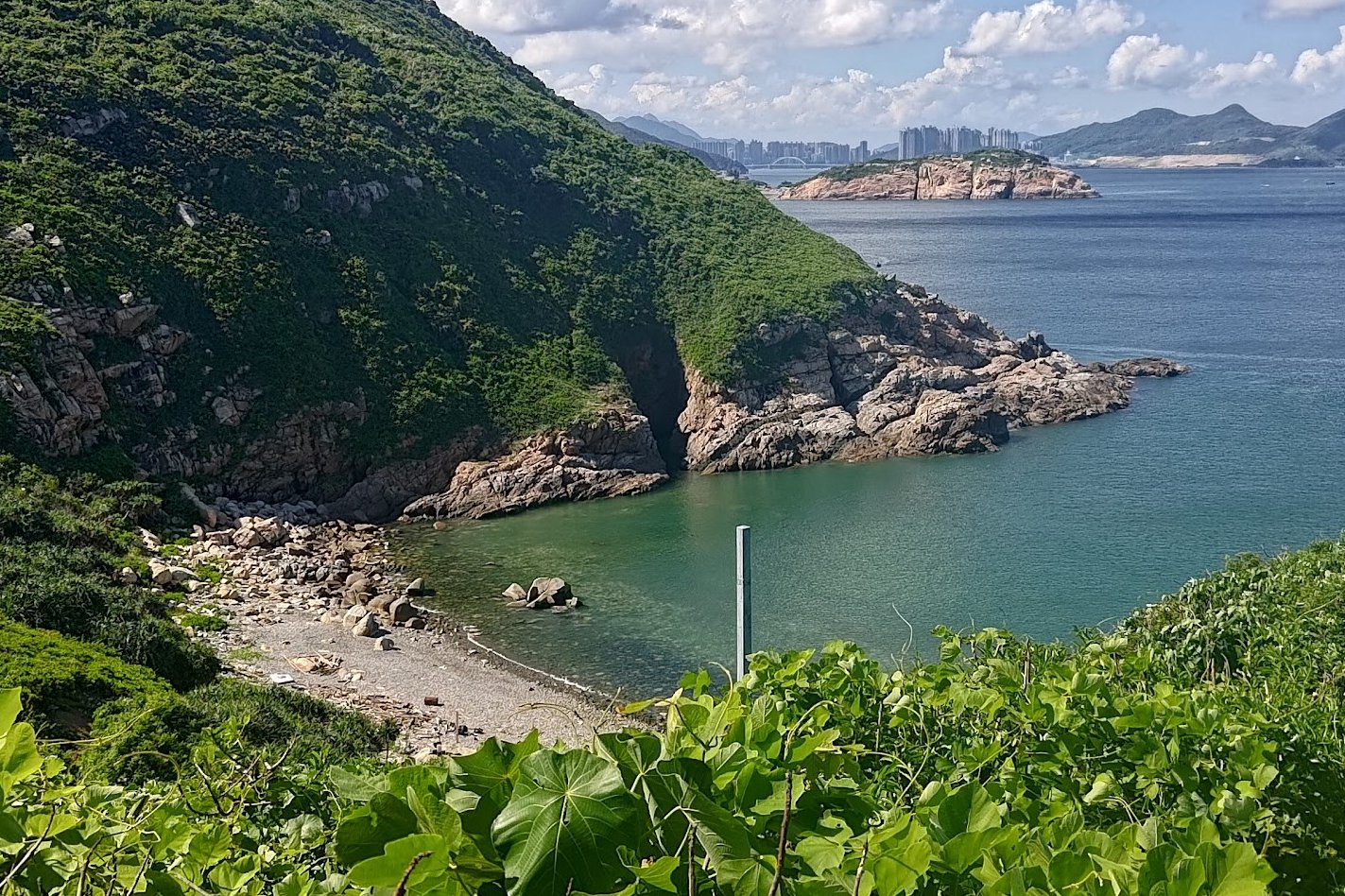
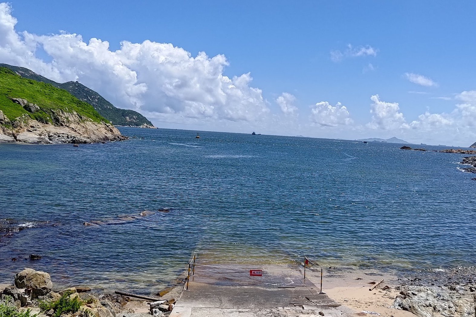
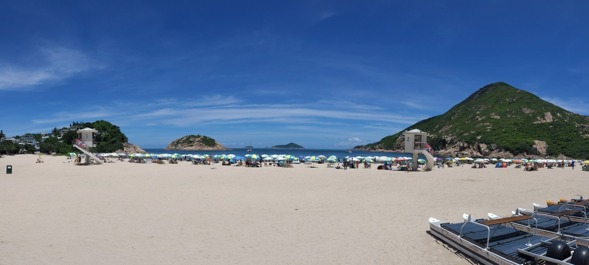
One of the first points of interest is a boat shelter and beach right next to To Tei Wan. There’s a rocky slope you can climb for great views, but do so at your own risk.
A Faded Banner Pointing the Way to Drinks, Desserts and Snacks

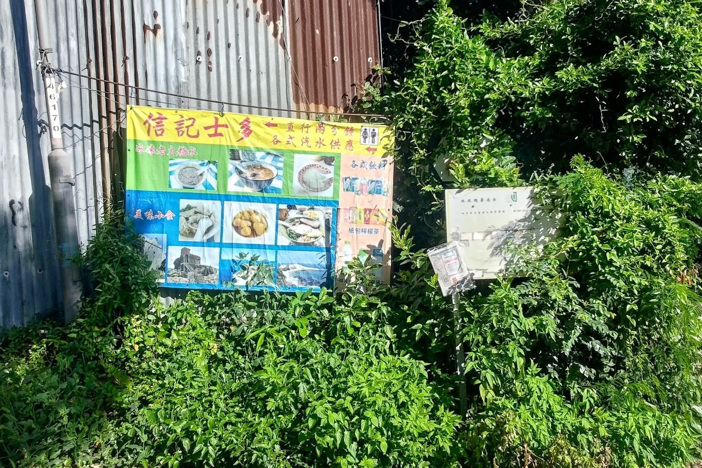
After about 20-30 minutes of walking, you’ll see a slightly faded banner advertising a restaurant. There’s a fork in the road here, where you can turn off Cape D’Aguilar Road to stock up on water or grab something small to refuel.
Keep it in mind on the way back if you run out of fluids, especially on a toasty summer day!
Another easy marker to know when you’re close is to look for the old green minibus that’s stranded nearby (though it could be moved by the time you try this hike).
Views of Po Toi, Hong Kong’s Infamous Pirate Island
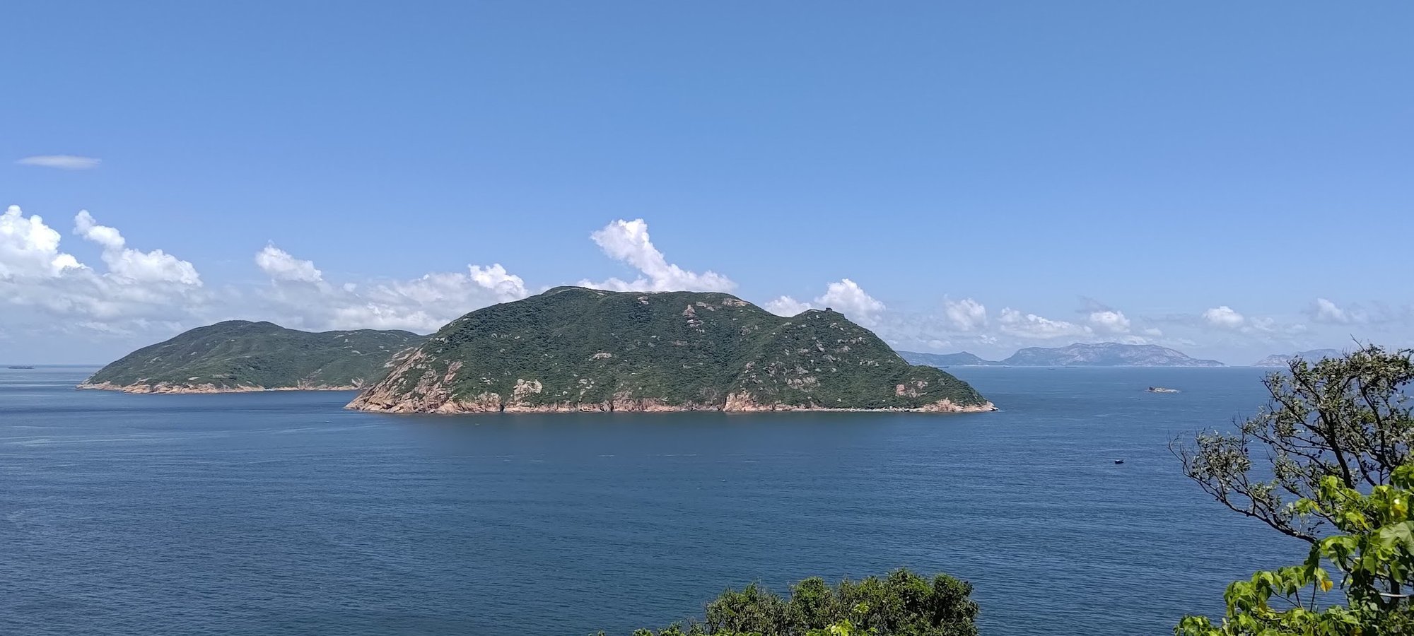
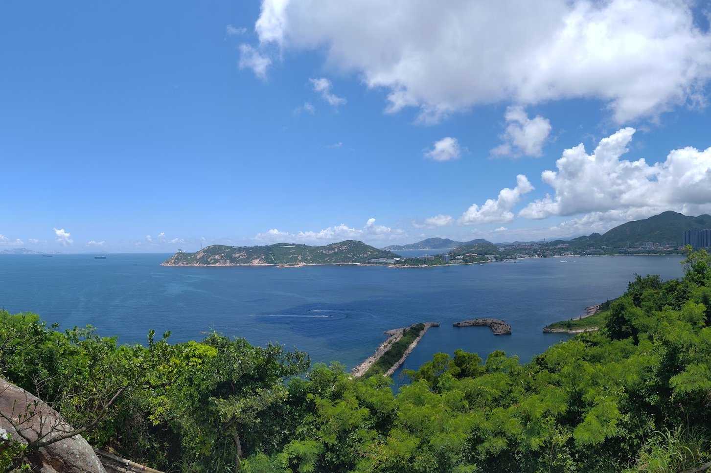
Another 30-minute stretch of walking lets you admire stunning views of Beaufort Island with the infamous Po Toi pirate hotspot right behind it. Po Toi was one of the prime spots for pirates to hide out during Hong Kong’s heyday as a hub for piracy in the 1800s.

The Radio Station and Rubbish Bay
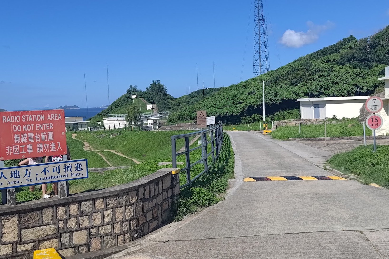
You can’t miss the Radio Station when you arrive because you’ll see a ton of signs telling you not to trespass. Heed these signs and take the dirt trails on the lawn-like grass patch behind the red ‘DO NOT ENTER’ sign. As you walk beside the fences of the Radio Station, you’ll notice a little beach down on the coast to your left.
This beach is Lap Sap Wan, otherwise known as rubbish bay. I thought the name was pretty harsh until I looked closer and realized the beach was indeed full of rubbish. I actually felt pretty sad for Rubbish Bay because it has the potential to be a genuinely beautiful spot.
You can even see High Junk Peak in the background!
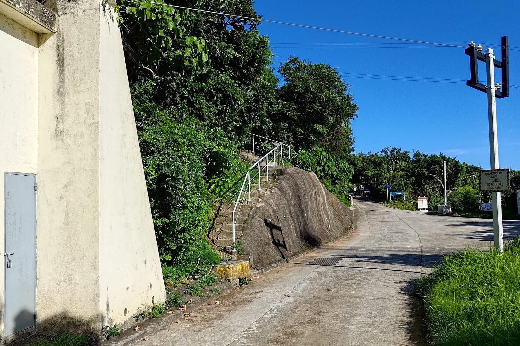
Follow the Blue 300m Sign. Avoid the Upward-Sloping Path.
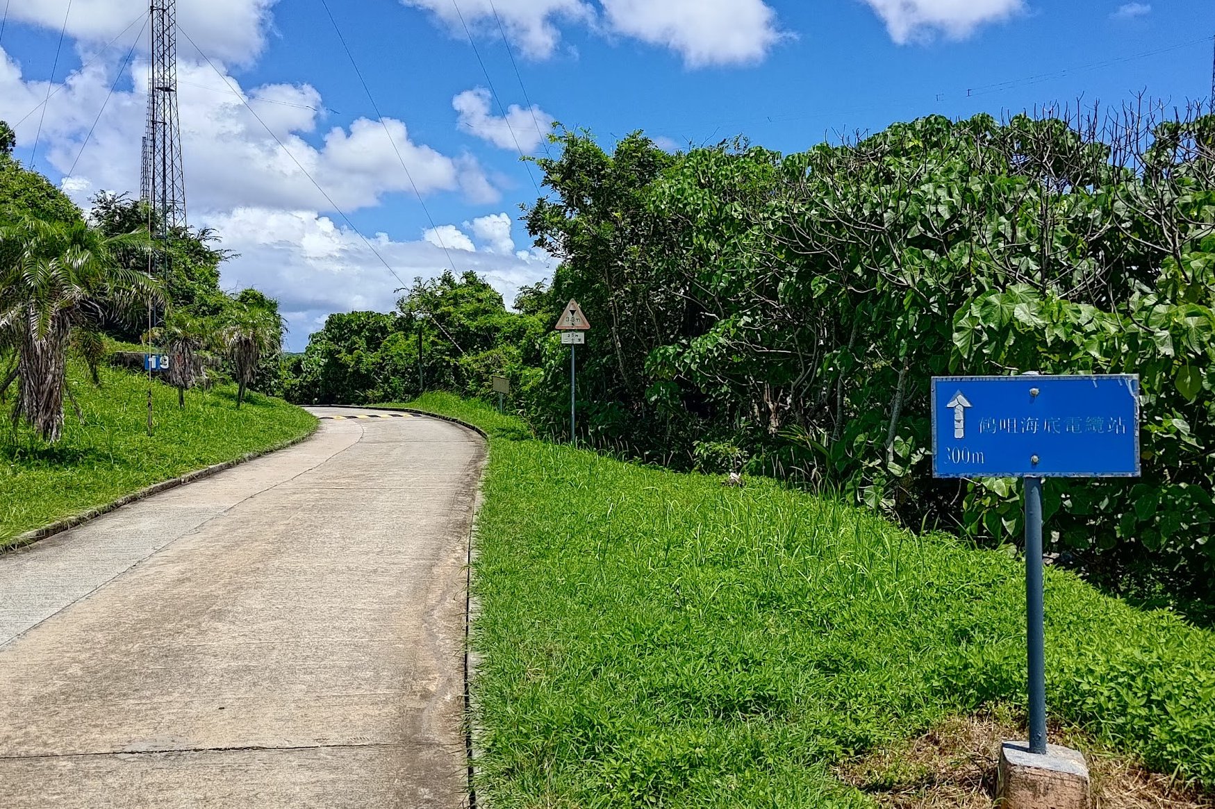

At the very end of the Radio Station, you’ll see a path sloping upward and a flatter one next to it. Take the flat path marked by a blue ‘300m’ sign.
I initially explored the upward-sloping path until I was thwarted by a row of massive spider webs and hand-sized spiders all looming before me at head-height.
Nope!
On the correct path, enjoy even closer views of Beaufort Island and Po Toi Island.
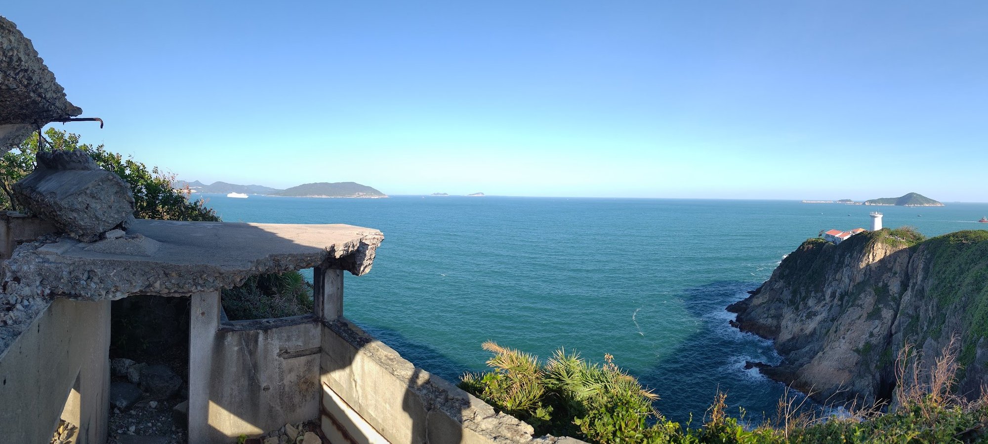
Secret Cape D'Aguilar Lighthouse View and Bokhara Battery
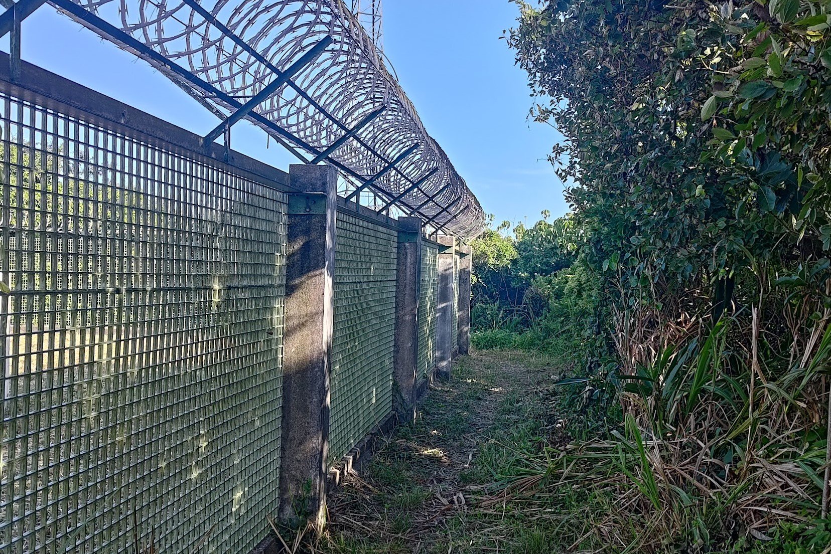
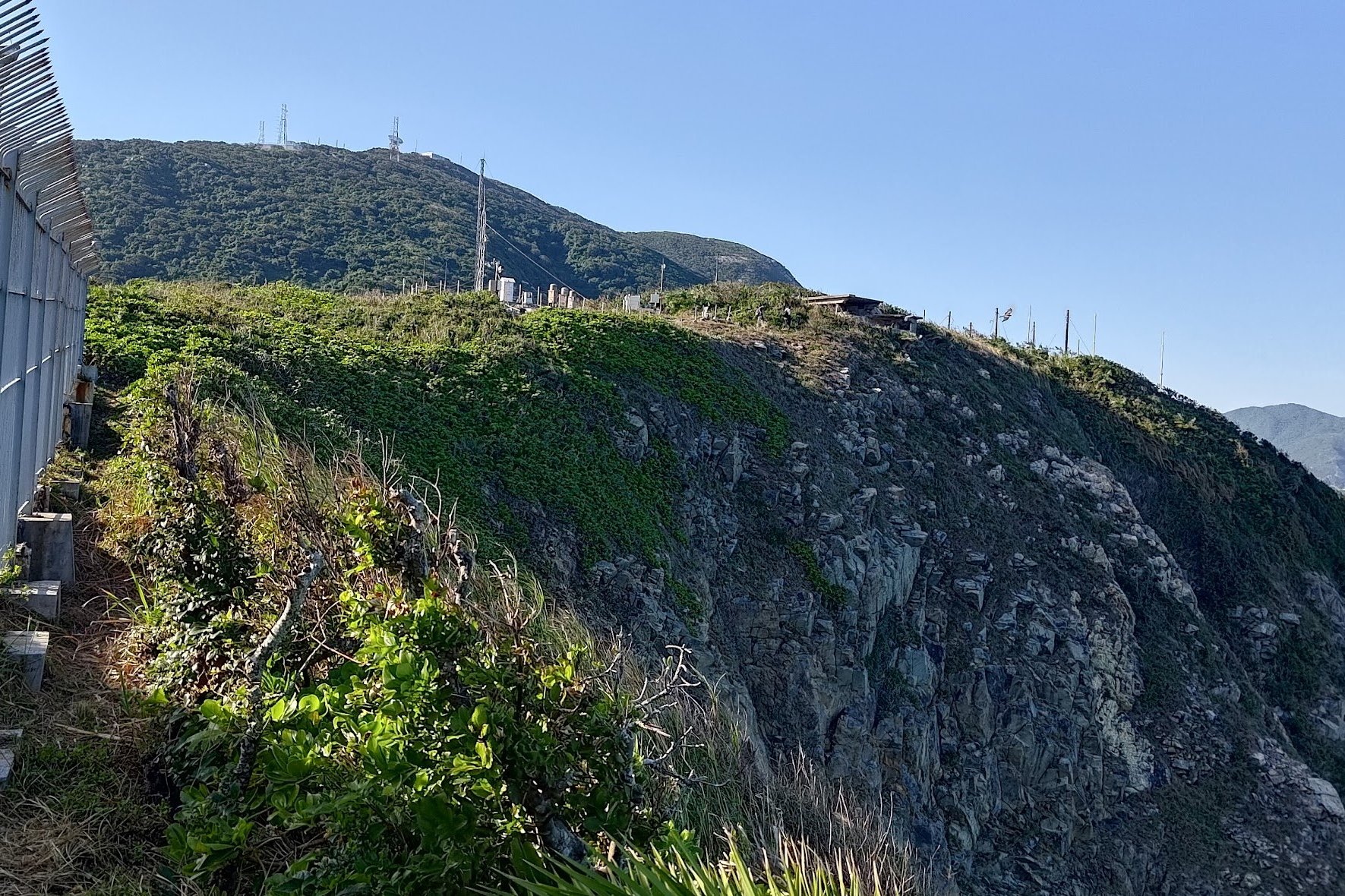
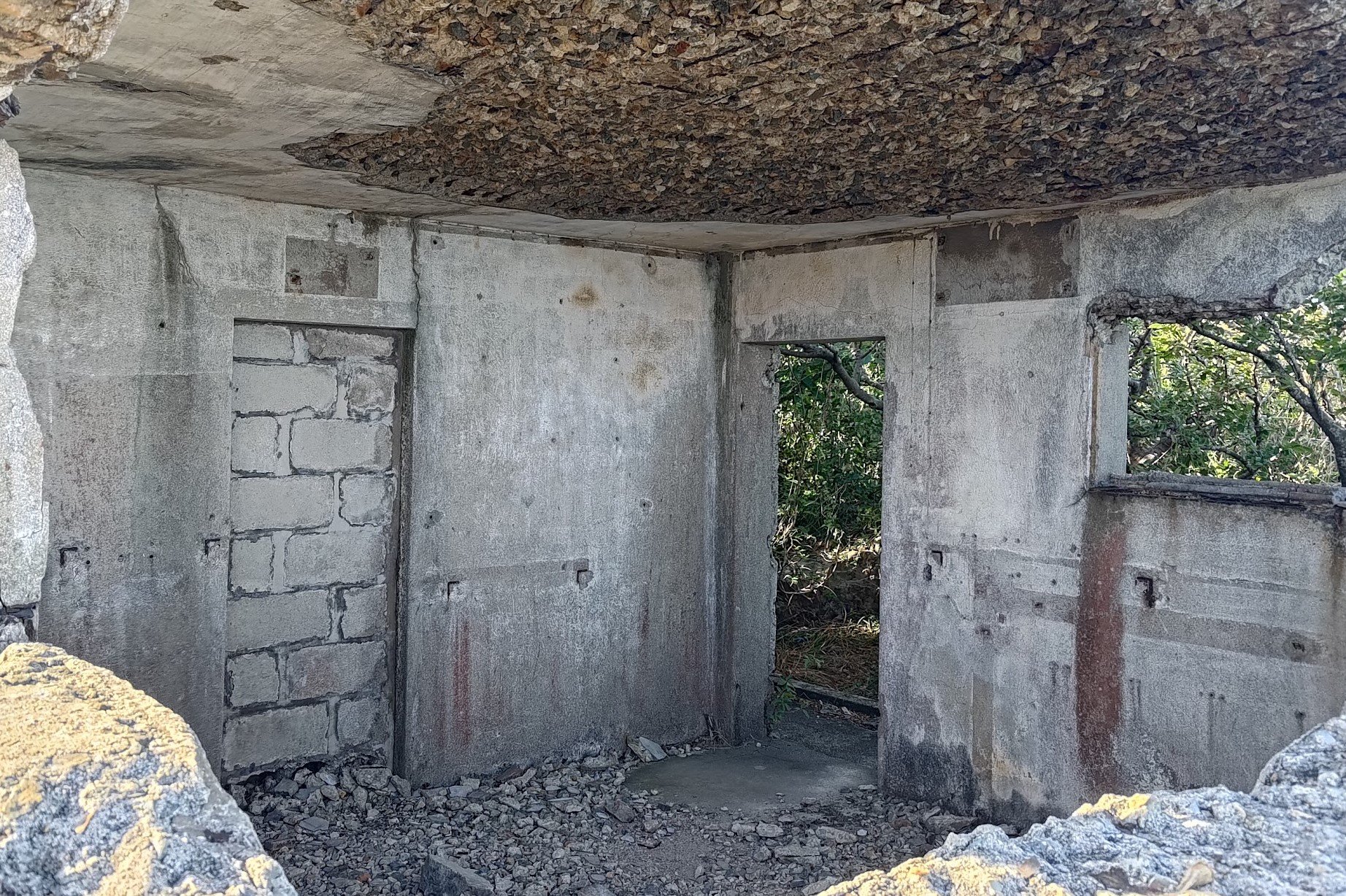
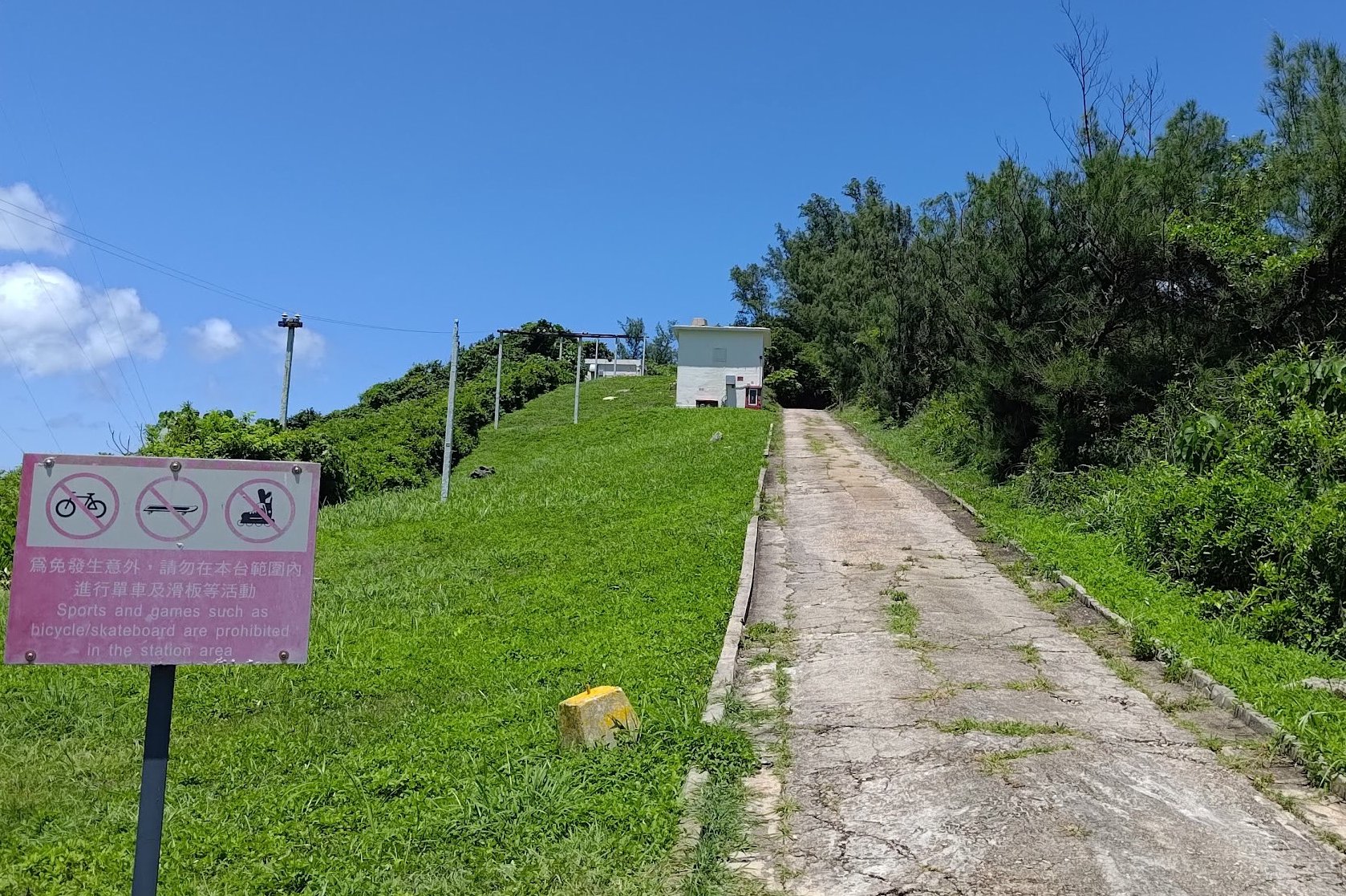
Five minutes or so later, you'll see a set of stairs to your left after passing the white storage buildings.
If you're looking for the best views of the lighthouse, take the stairs up and turn right at the barbed wire fence.
Follow the path beside the barbed wire fence for a couple of minutes and you'll suddenly see the lighthouse to your right and stunning views of the ocean in front of you!
If you want even better views of the lighthouse, continue around the edge of the barbed wire fence and head upward. You'll see a radio tower and the Bokhara Battery in the distance.
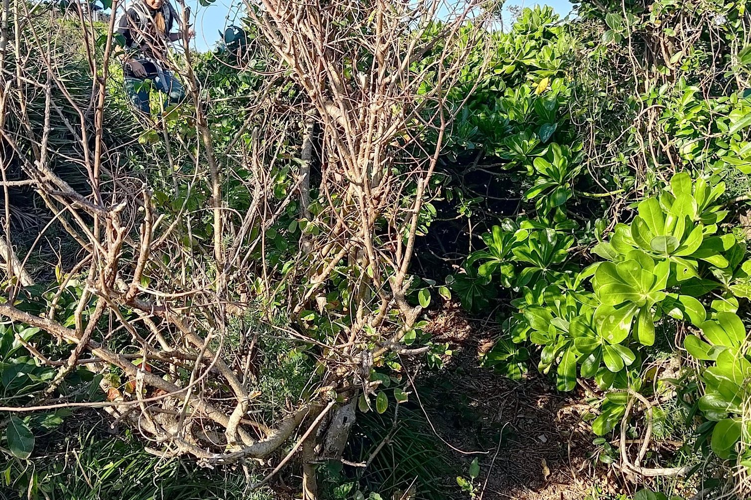
Near the top corner of the fence, look for a path through the bushes. You may have to battle your way through and might get a bit scratched up.
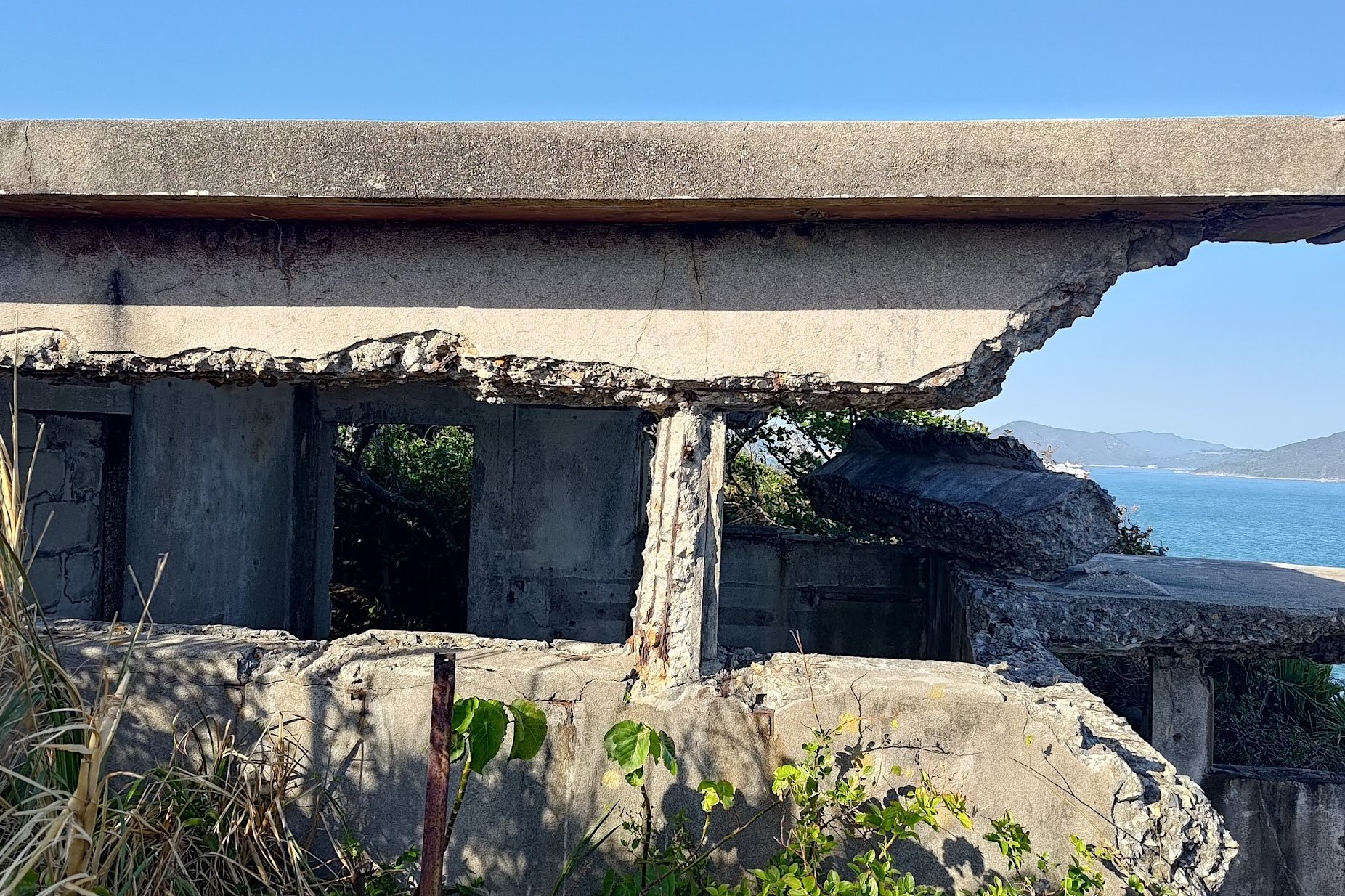
The views are worth it, though. Plus, you'll get to check out the Bokhara Battery, which was built in 1941 and "was armed with two 9.2 inch guns." It was considered a highly strategic military location in World War 2, and was manned by the 30th Coast Battery, 8th Coast Regiment and Royal Artillery.
When you're done, retrace your steps back to continue hiking from the bottom of the stairs (where you started this awesome little detour from).
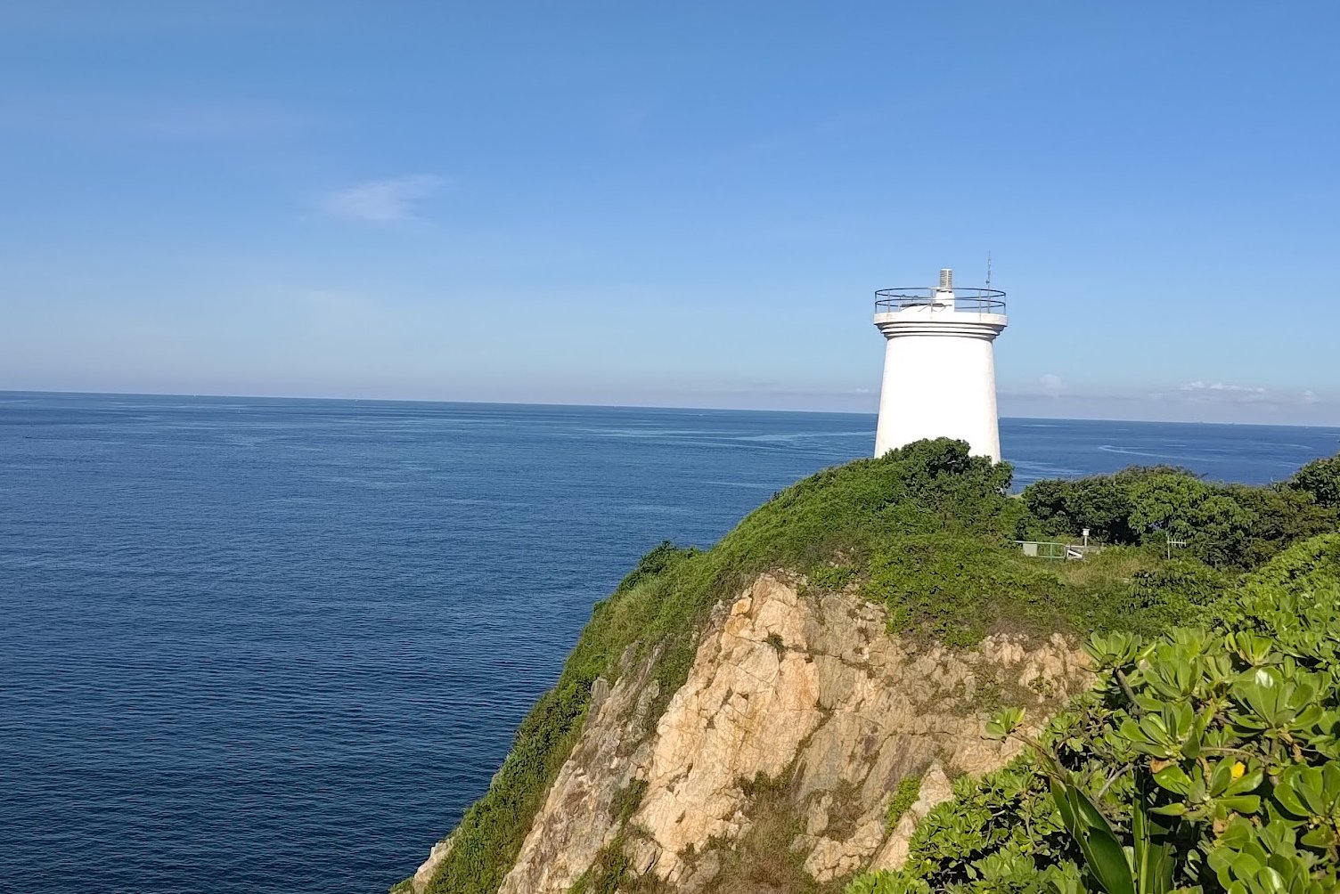
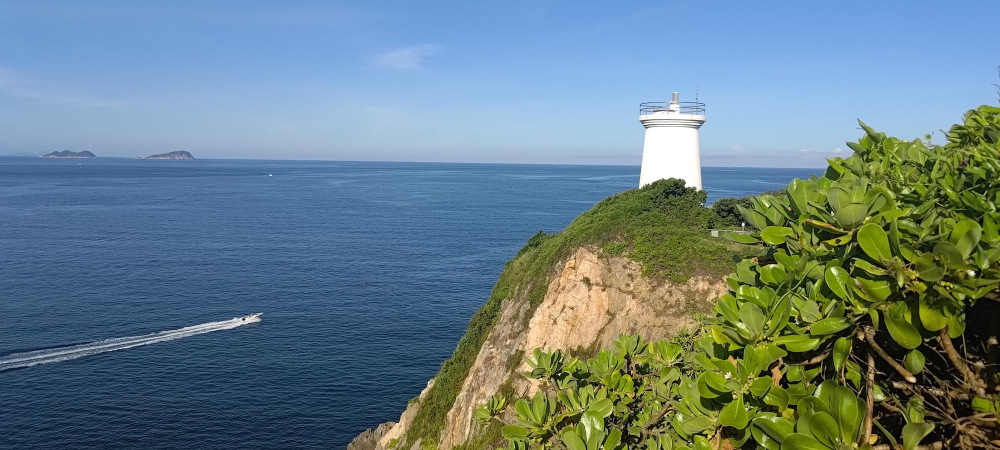
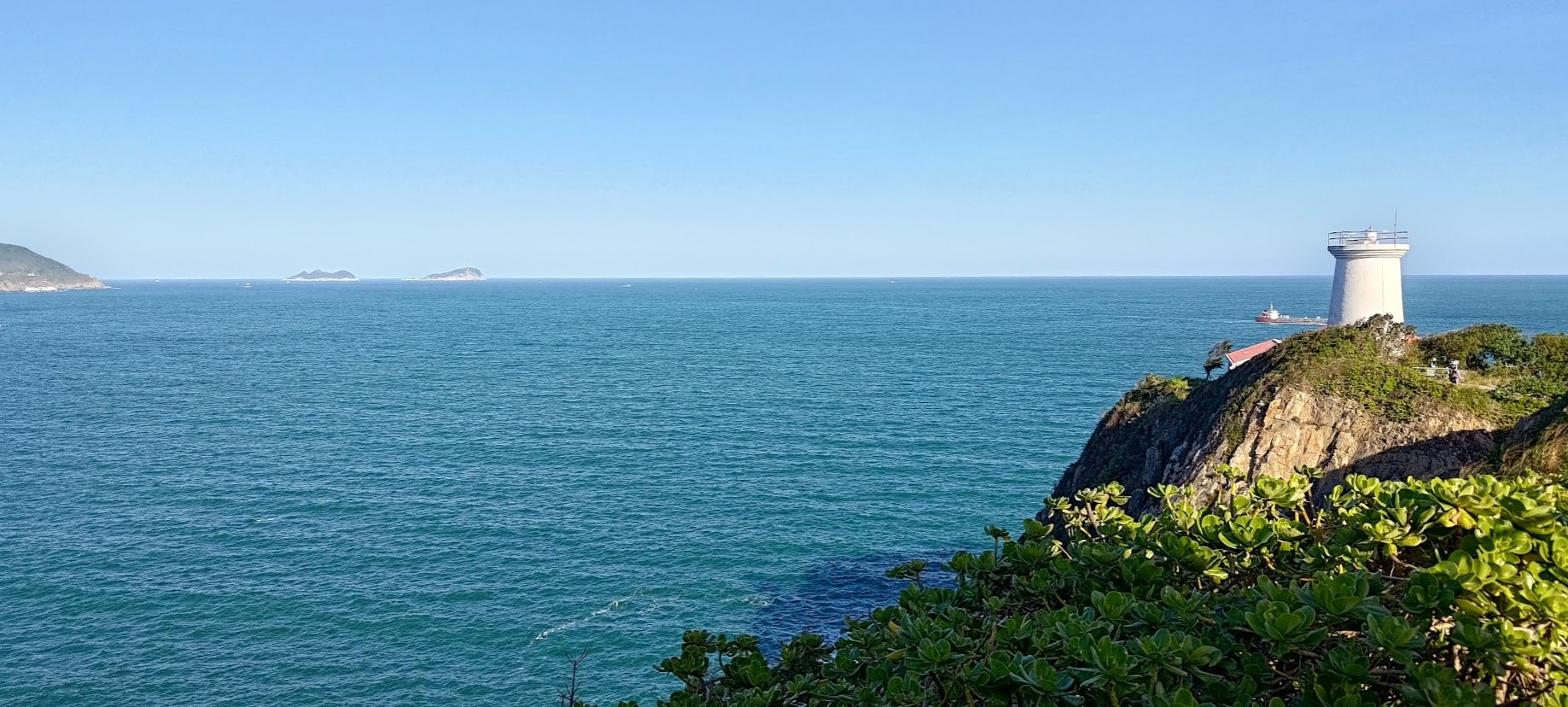
Cape D’Aguilar Lighthouse (Optional Detour)
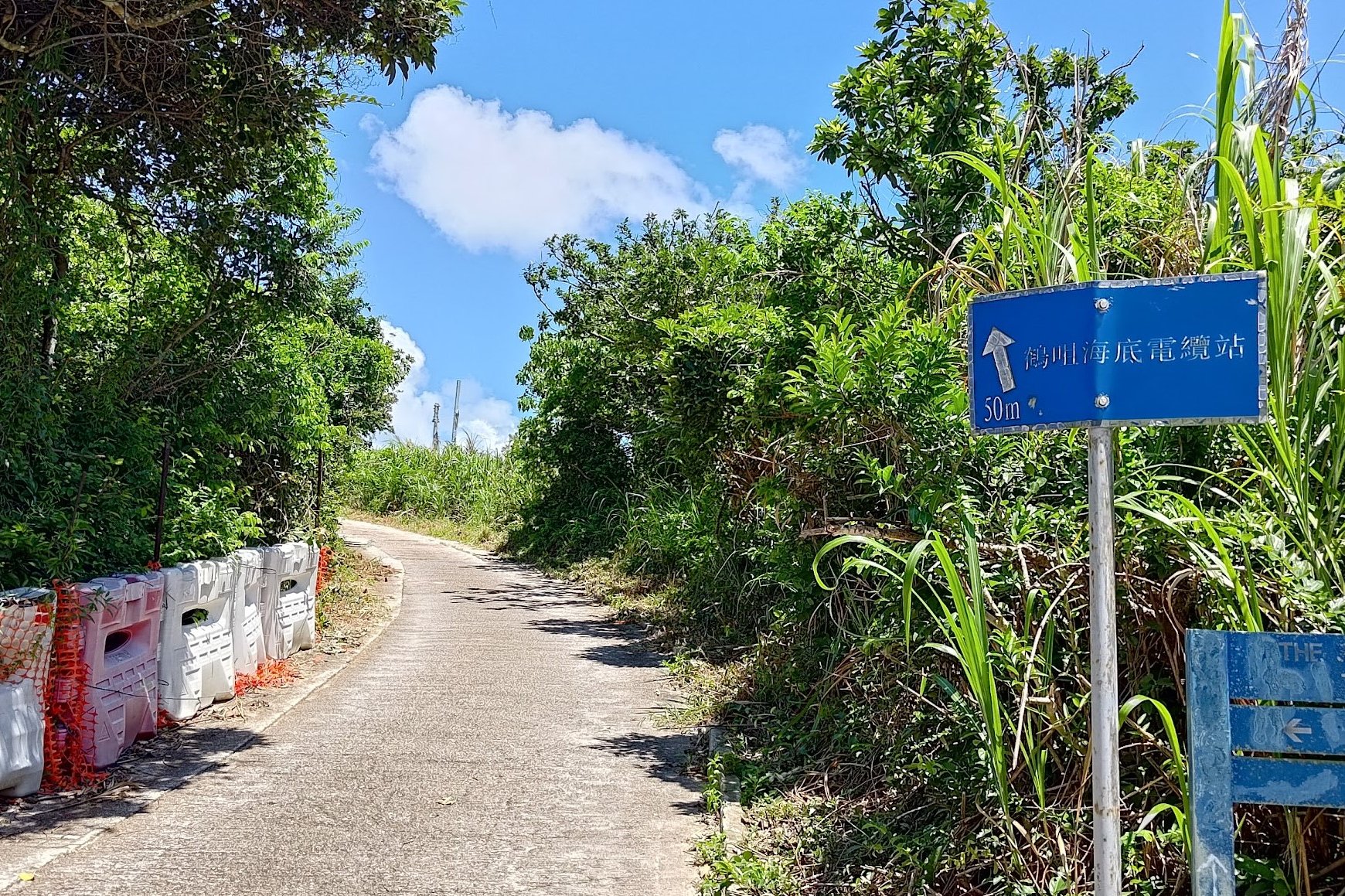
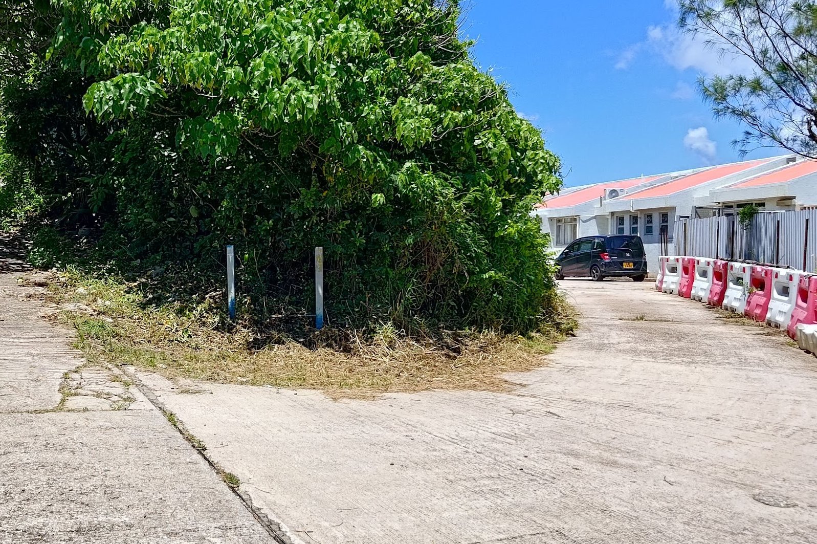
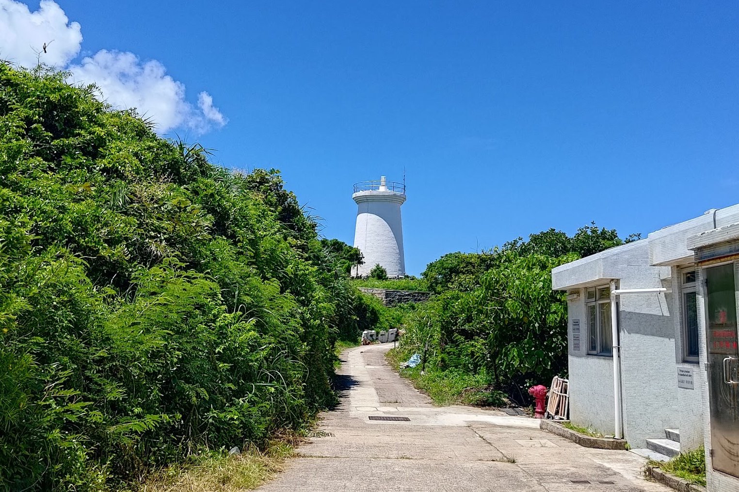
When you arrive at the next fork in the road, if you plan on visiting the lighthouse, follow the blue ‘50m’ sign. It’ll slope gradually upward and bring you to a second fork. Take the right path where you can see the houses with pink roofs.
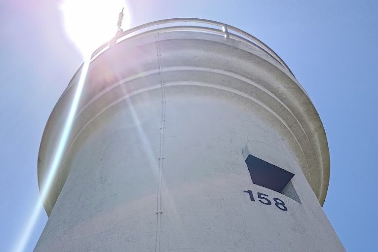
Walk past the houses and you’ll see Cape D’Aguilar Lighthouse right in front of you. At the end of the road there’ll be a little set of stairs right beside the locked gate. Climb up it and you’ll be at the foot of the lighthouse.
The lighthouse was put into service on the 16th of April 1875. Its light beam could be seen from up to 23 nautical miles away!
Cape D’Aguilar lighthouse’s services were discontinued in 1896 after a new lighthouse was built on the Waglan Islands in 1893.
The Path to Cape D’Aguilar Marine Reserve
At the same fork, follow the ‘Cape D’Aguilar Marine Reserve’ sign to begin the final trek toward the main attraction of the hike.
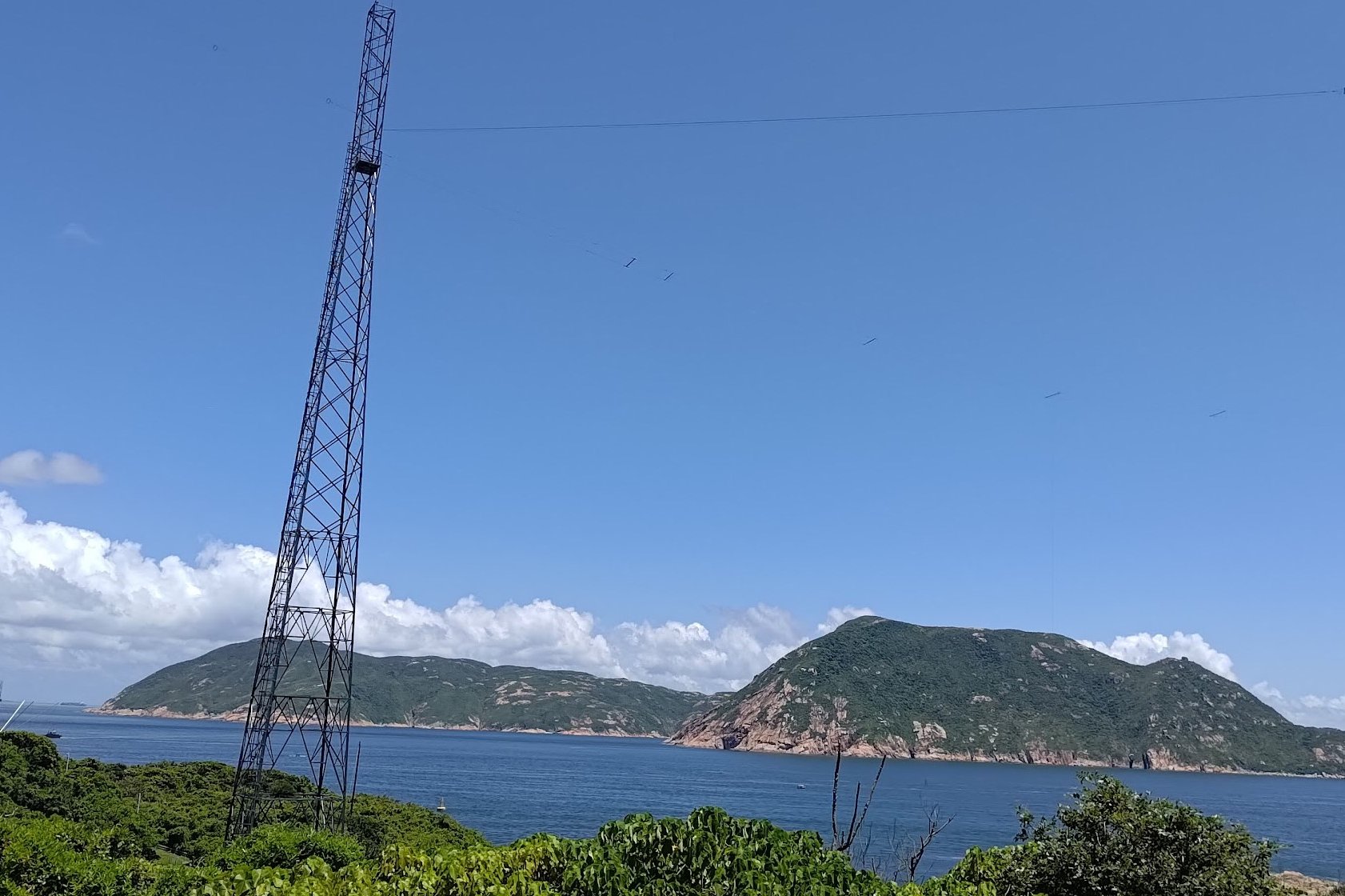
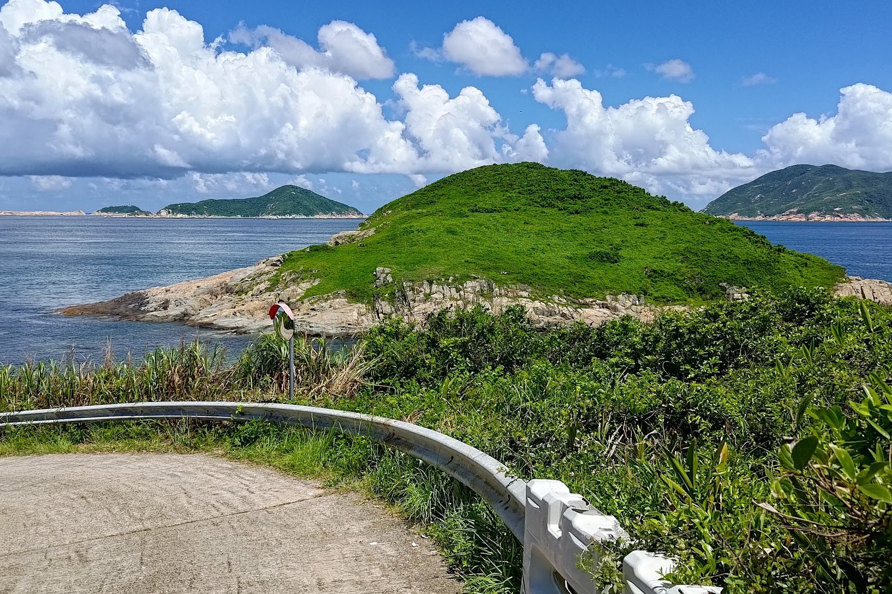
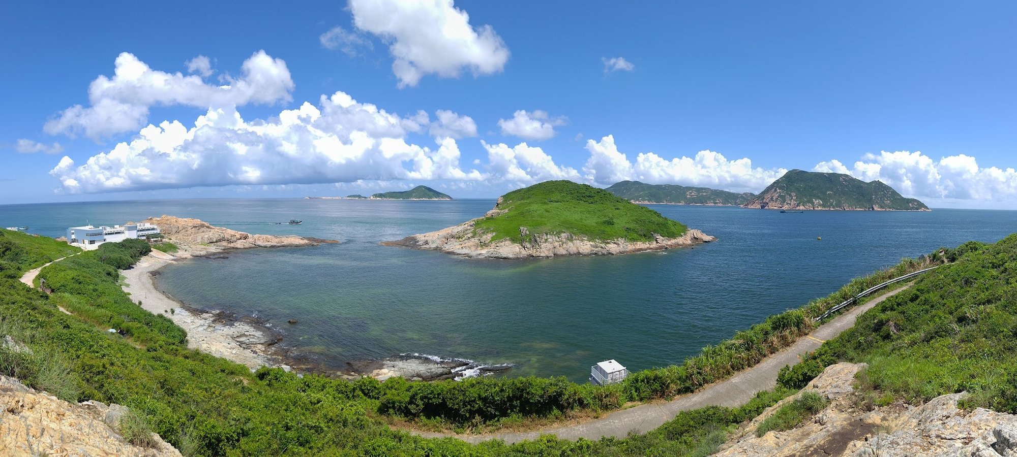
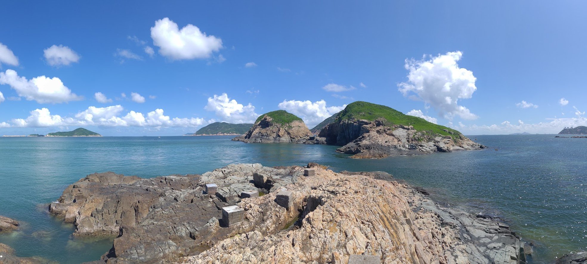
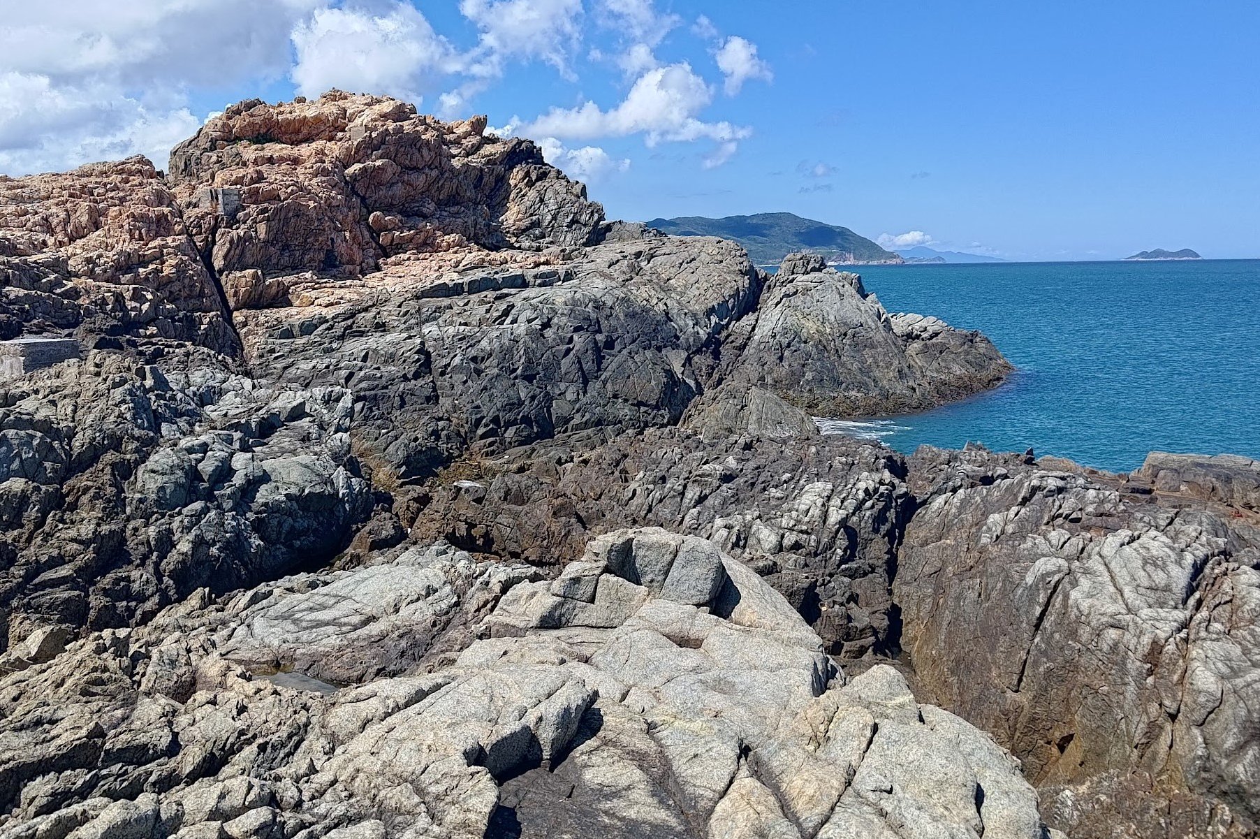
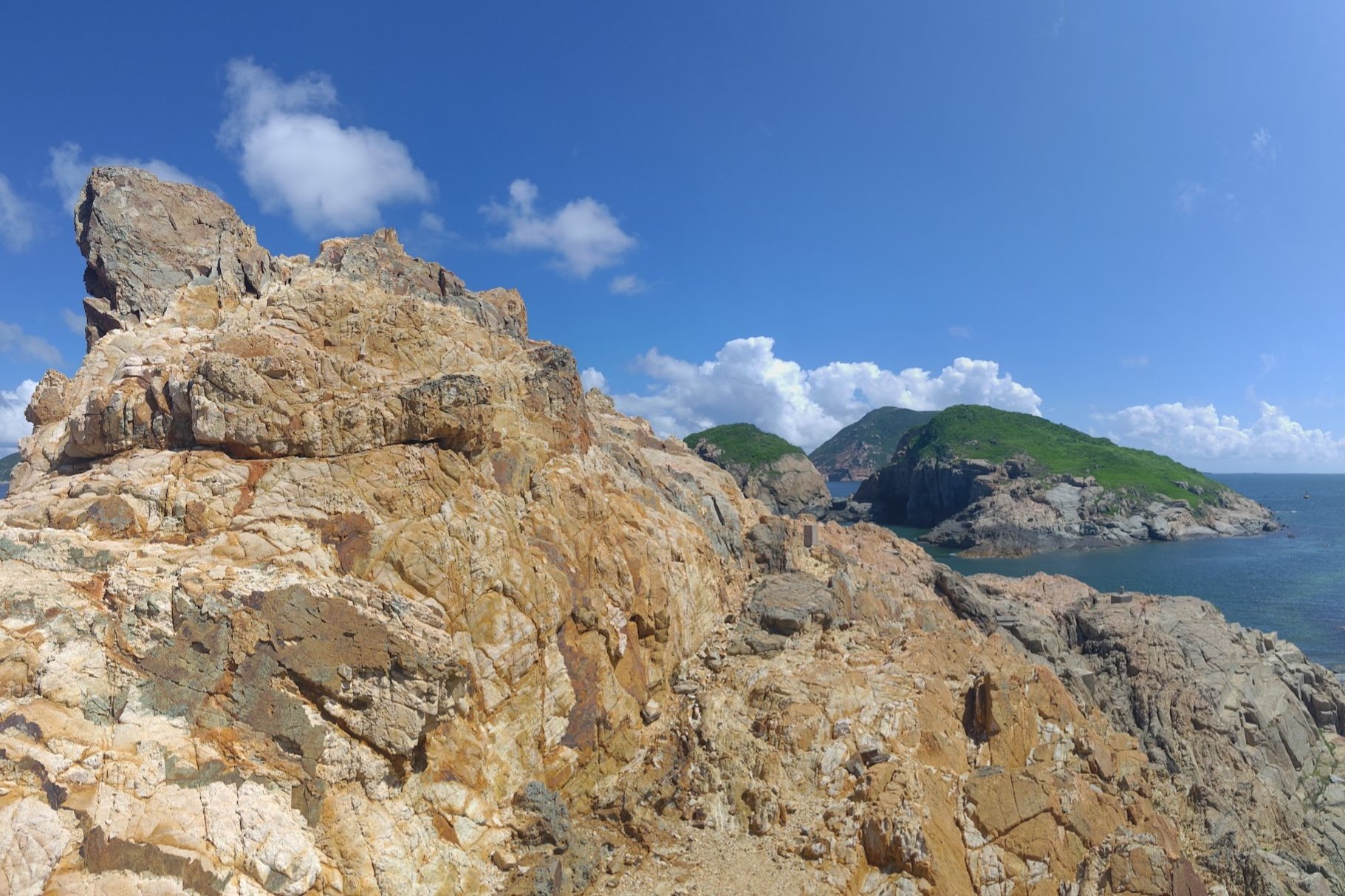
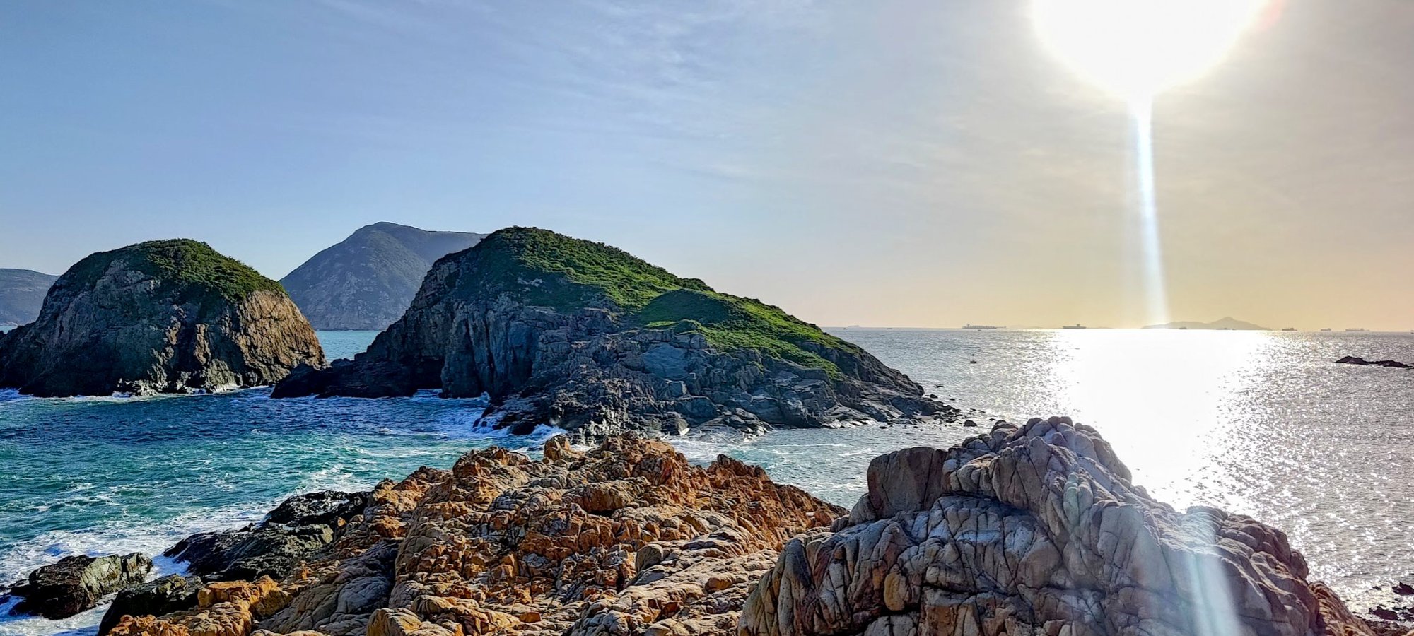
There’s a rocky cliff with a triangular structure on the top where you can get uninterrupted views of Kau Pei Chau, Beaufort Island, Po Toi and a smattering of smaller islands, too.
You’ll also pass by a commemoration stone to mark ‘the First Batch of Marine Parks’.
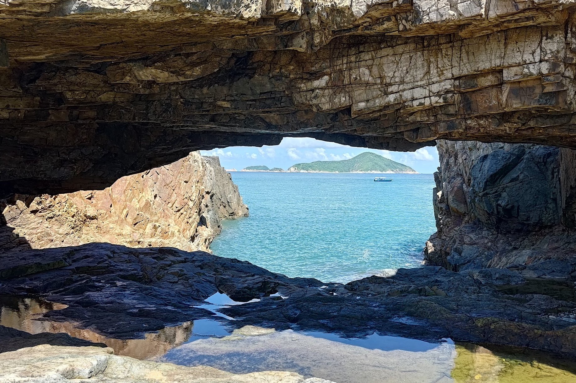
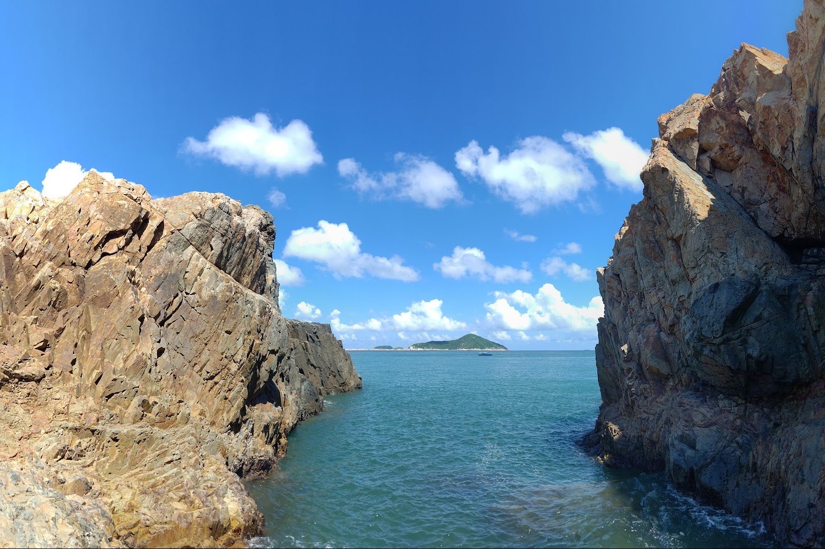
Thunder Cave (Optional Detour)
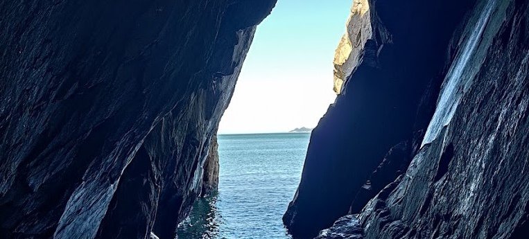
Just before arriving at the marine reserve, you’ll see a set of stairs to your left. Head down it and walk into Thunder Cave, where the echoing sounds of waves crashing against the rock mimic the sound of rumbling thunder in the distance.
Since the cave is pretty dark, the sliver of light that comes through from its narrow opening makes it look like a portal or fissure through time…or I just have an overactive imagination.
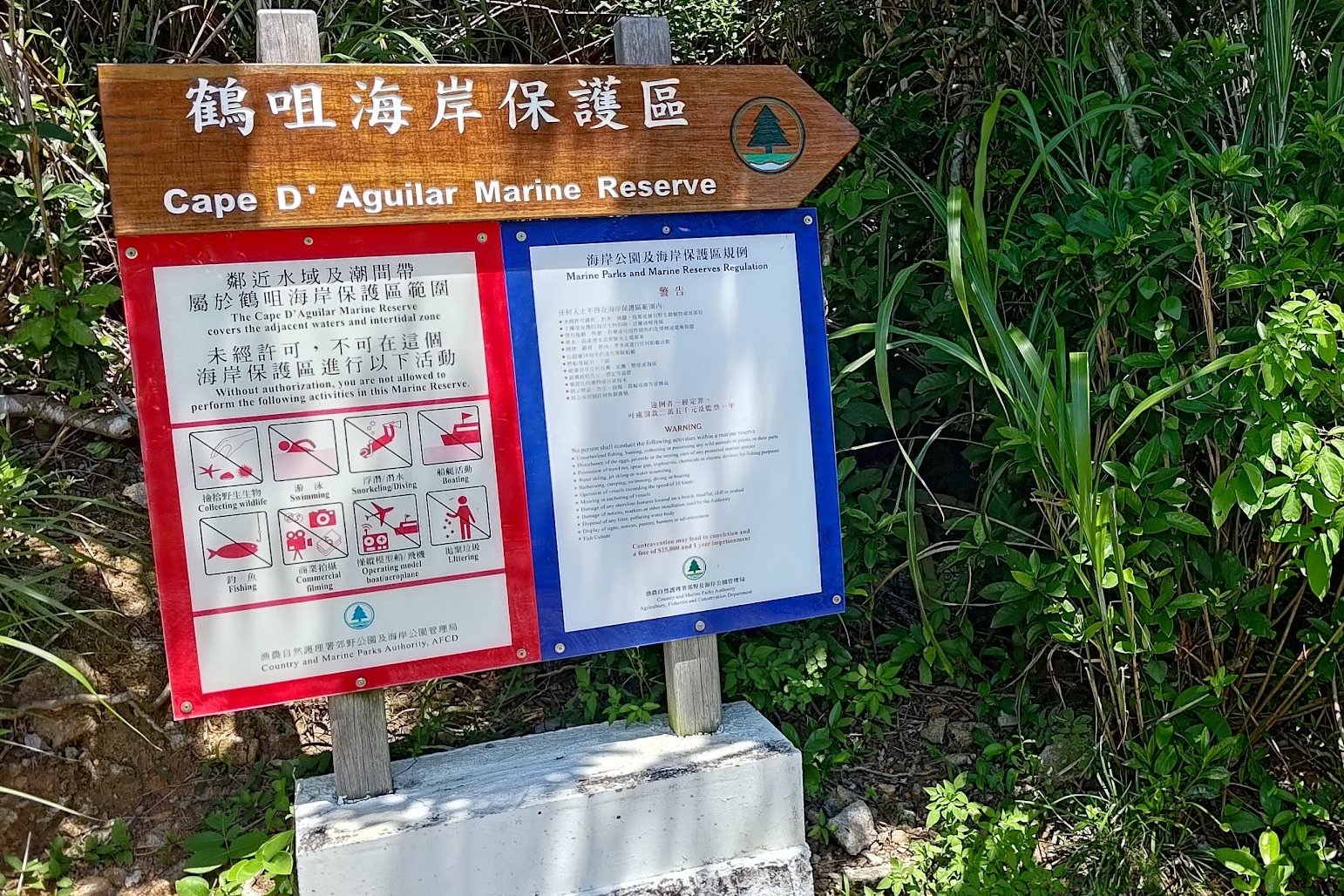
Cape D’Aguilar Marine Reserve
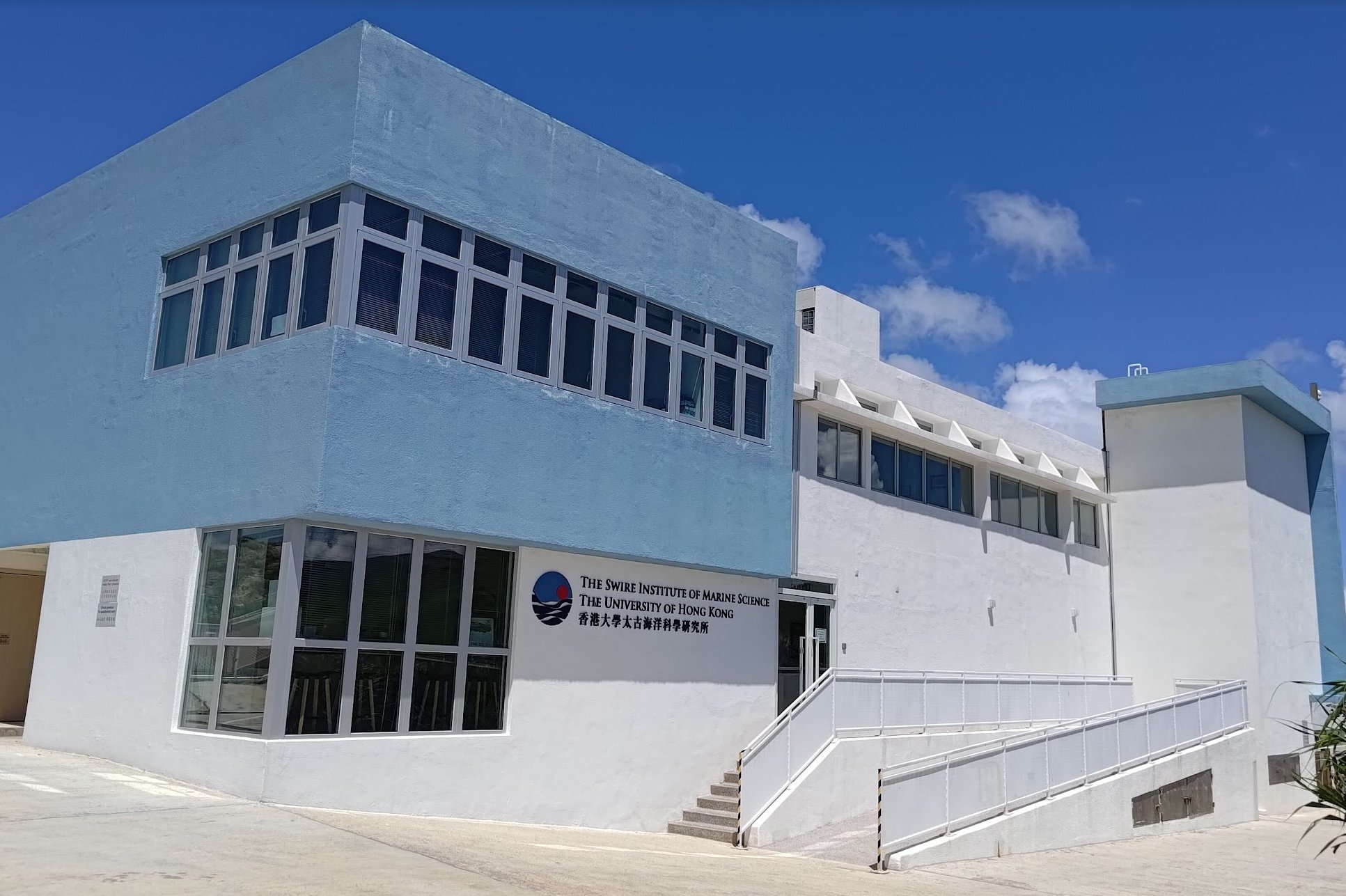
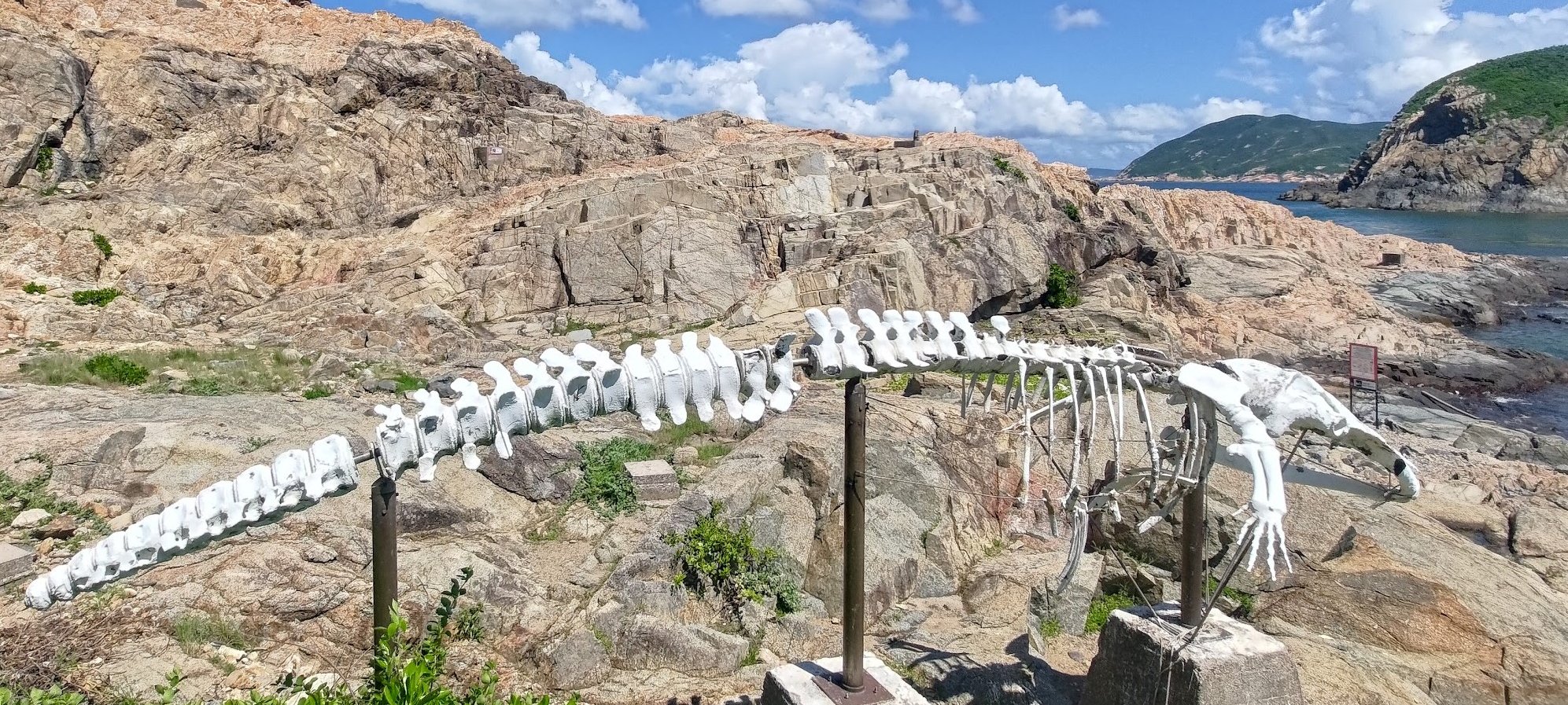
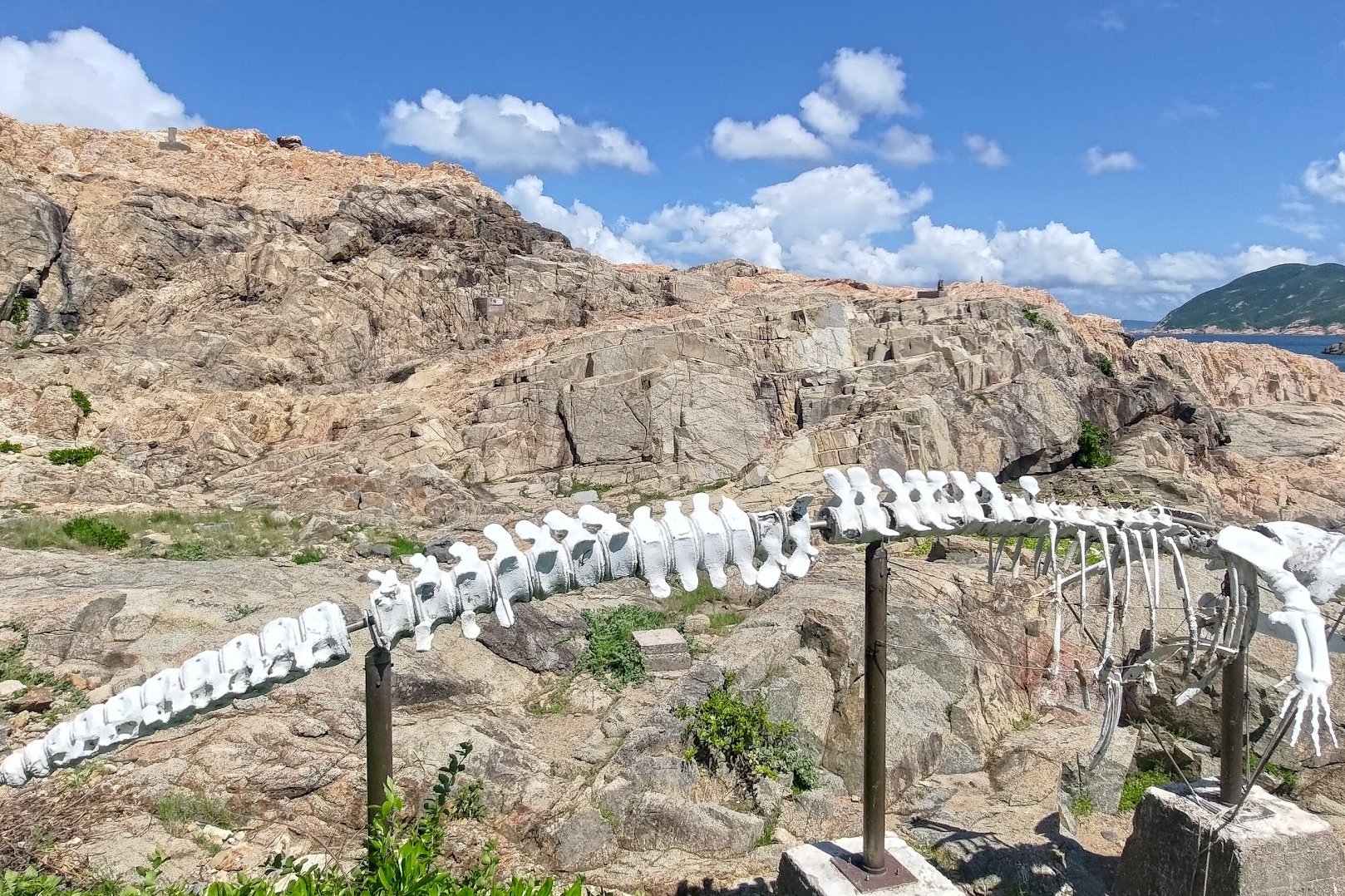
The Institute of Marine Science indicates that you’ve reached the end of the mandatory part of the hike. You can relax here and drink in the stunning coastal scenery and enjoy the intrigue of the ‘Bones of Miss Willy’, a whale with a shifty origin story.
The whale bones are in a slight state of disrepair as of July 2023, but it’s still a very peculiar sight.
*Update: the bones are gone as of November 2023
Crab's Eye Cave (Optional Detour)
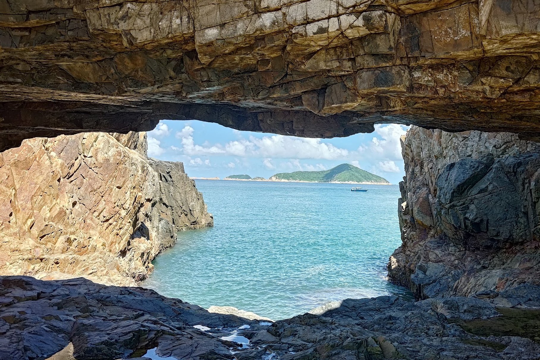
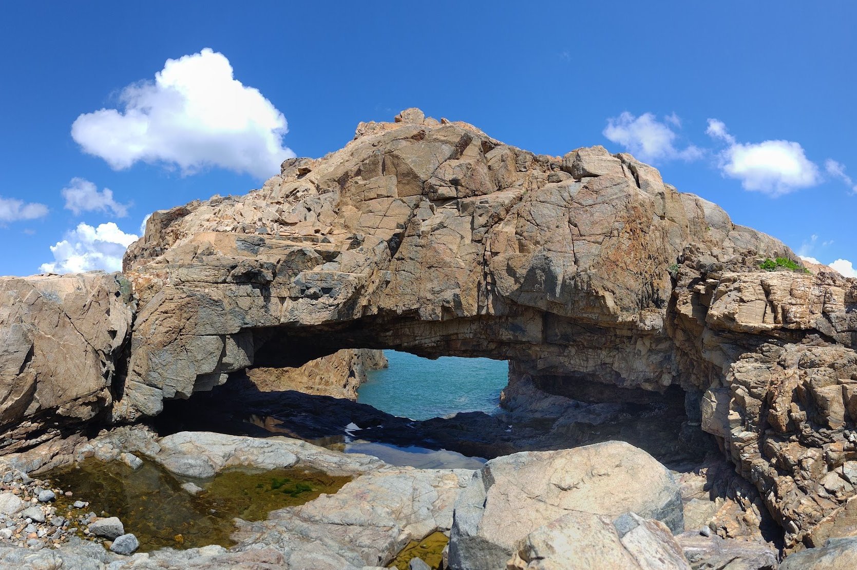
Located right next to the ‘Bones of Miss Willy’, you can easily traverse a few rocks and get to this cave that looks like the shape of a crab! At its center, is a square-shaped hole that lets you see out to the ocean.
Upon venturing deeper into the cave, you discover that the hole is not actually square-shaped. But the view from within feels pretty special!
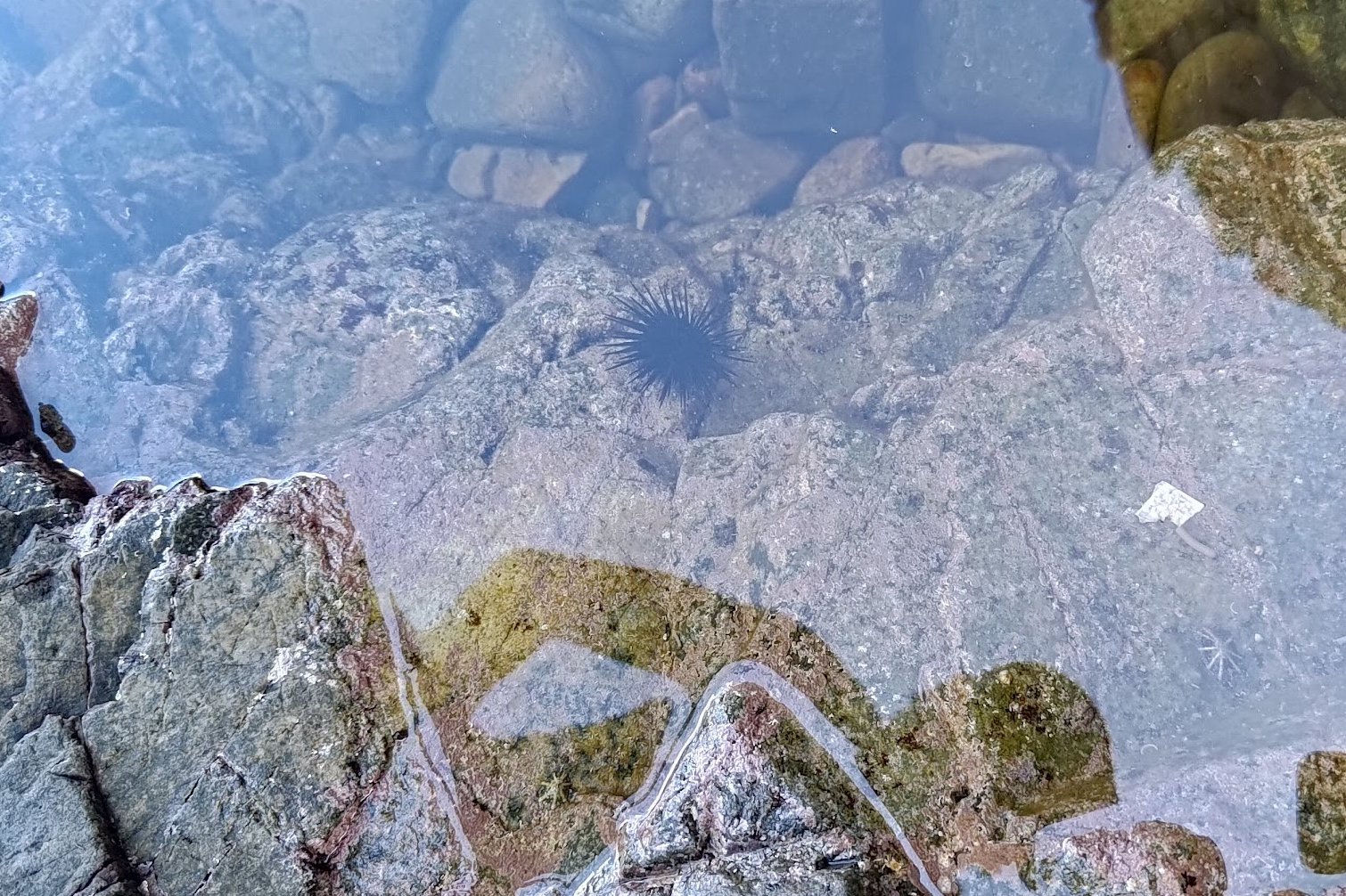
Don’t forget to look into the tide pools, too, and discover surprising wildlife like little spiky sea urchins!
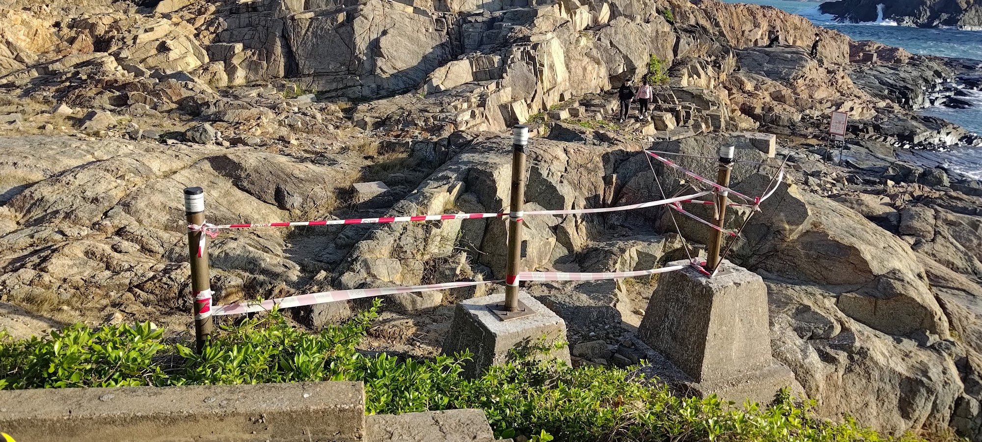
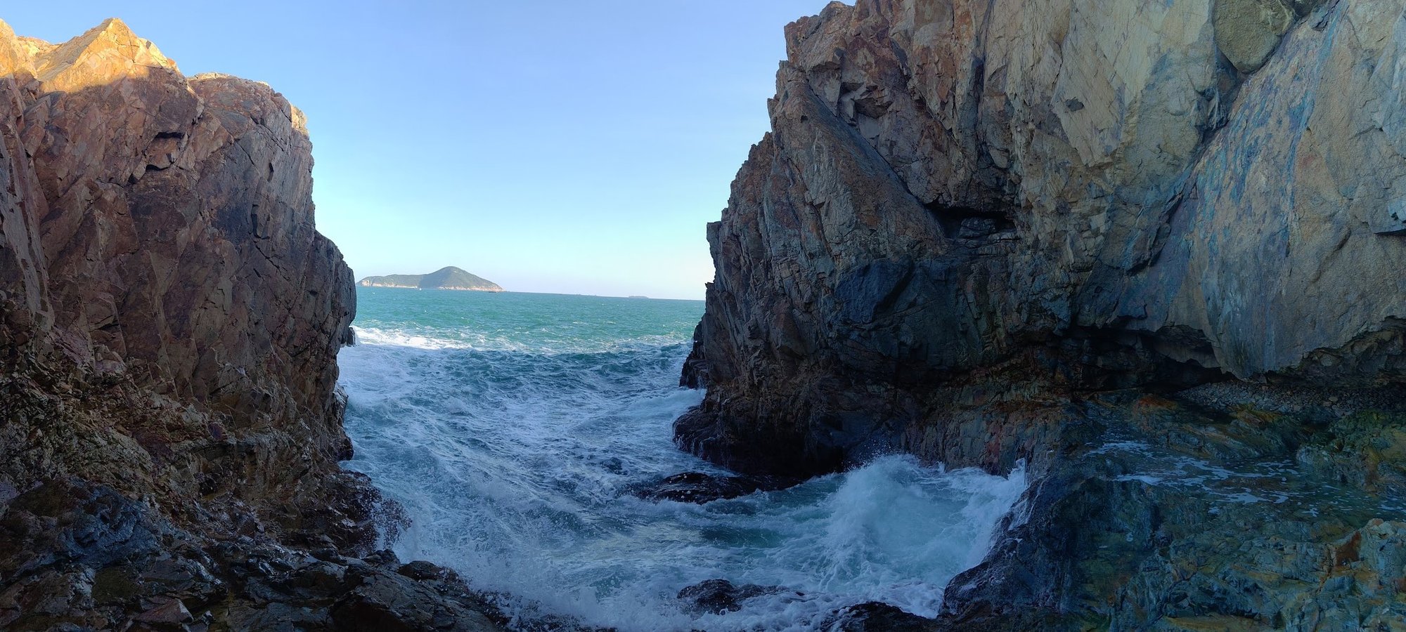
Coastal Climbing
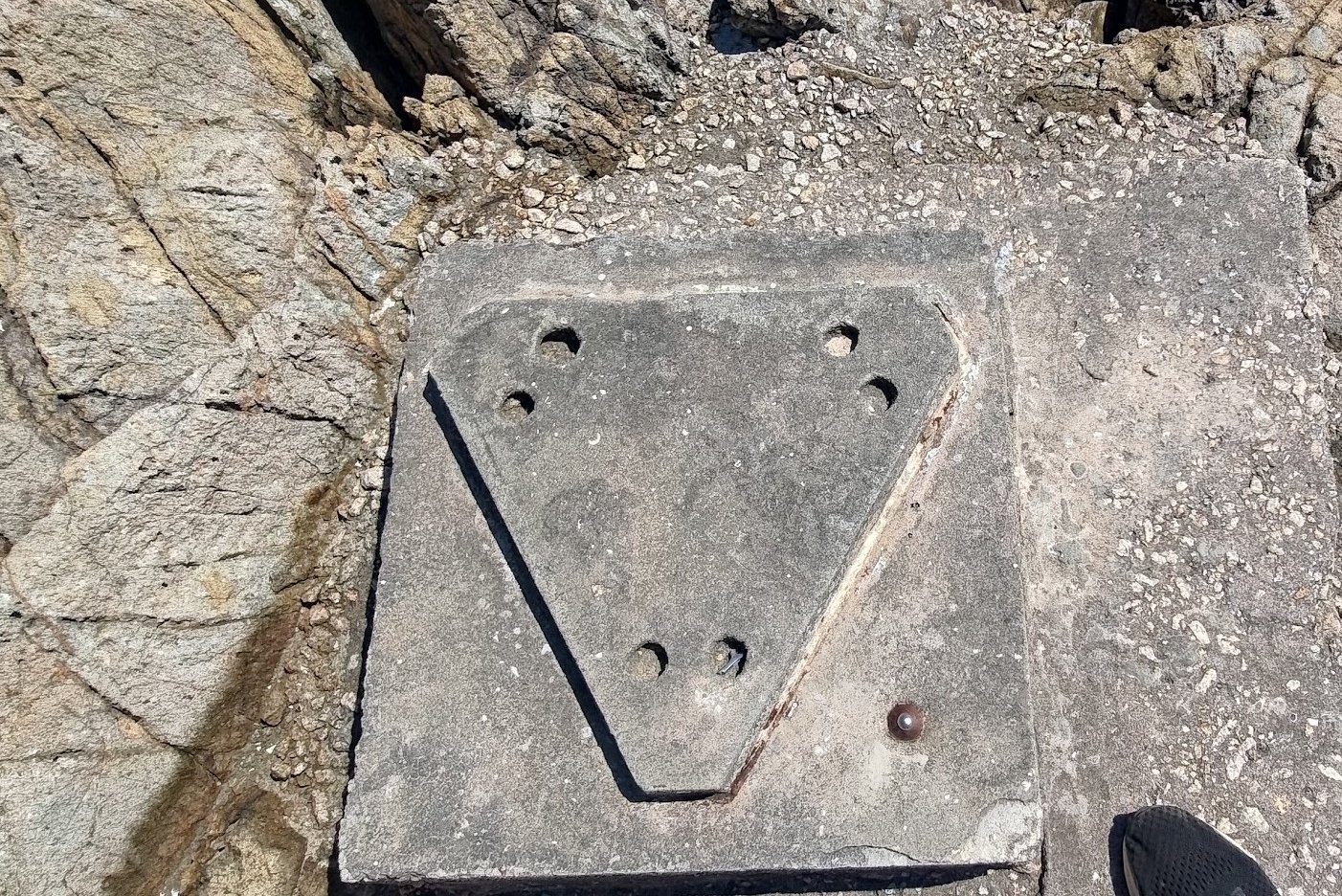
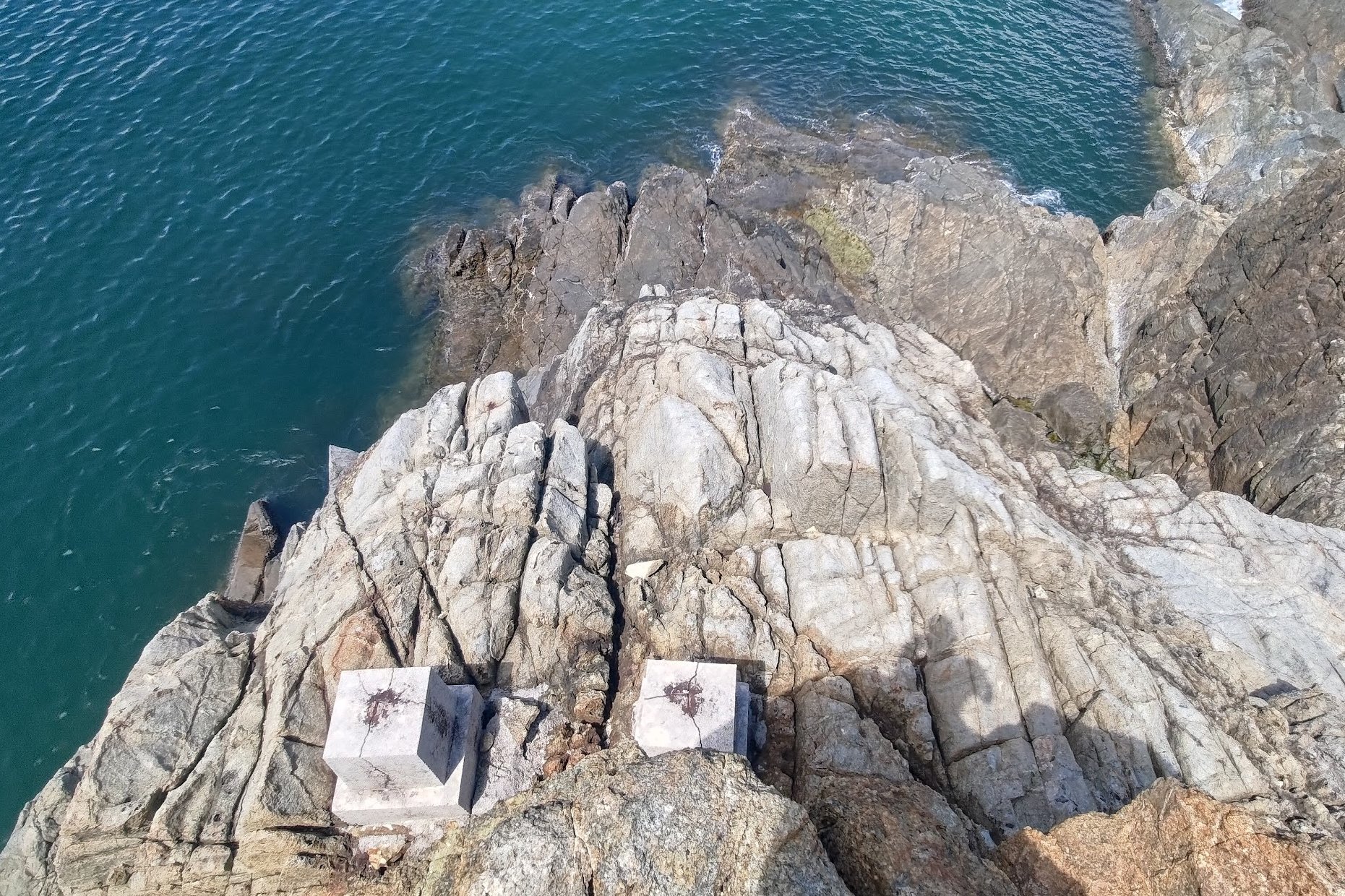
The coastline around the marine reserve has several mounting points, though what they were used for, I'm not certain. Climb to the top of Crab's Eye Cave for epic views and to see a few remnants a few of these mounting points. Given that the Bokhara Battery is nearby, it's plausible that these mounting points were used in Hong Kong's World War 2 defense effort, too.
You can also venture beyond Crab's Eye Cave and climb other coastal cliffs for more amazing vistas.
The Way Back
Return the same way you came. Don’t forget that you can buy drinks, snacks and desserts at the half-way point back by following the faded banner and turning off Cape D’Aguilar Road.
You can grab any bus heading back to the city or to Shek O from the hike's start point.

