
Tai Lam Chung Reservoir: A Scenic Hike Around Hong Kong's 'Thousand Island' Lake
Contents
- Essential Information
- Hike Highlights
- Google Route Map
- How to Get There
- Quick Route Summary
- Getting to the Trail From the Bus Stop
- The Beginning of the Trail
- Secret Detour with INCREDIBLE Views
- Starting Point of the Shorter Route
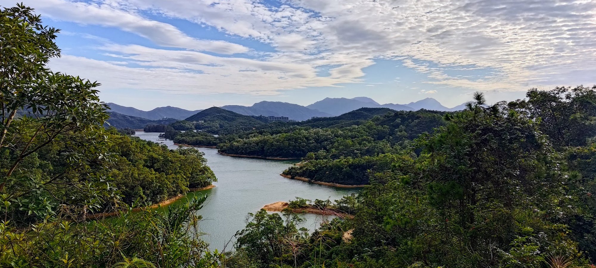
- Thousand Island Viewpoint
- Descending to the Horse Temple
- Walking to the Minibus Stop
- Getting Back
Essential Tai Lam Chung Reservoir Hike Details
- District: New Territories
- Duration: 3.5 hours (full route), 2.5 hours (short route)
- Distance: 11.9 km (full route), 8.7km (shorter route)
- Highest Elevation: roughly 200 meters
- Difficulty: 1.5/5
- Facilities: Toilets and a snack kiosk near the end of the hike
- test
Why Hike Tai Lam Chung Reservoir?

There are actually two different routes to Tai Lam Chung Reservoir, both of which will be covered in this guide.
I'd highly suggest the longer route because not only does it extend the duration of time you'll get to walk by the reservoir, but it also lets you experience some of the area's most natural and stunning trails.
Starting from the shorter route puts you on a concrete road almost immediately, which is a little depressing in an area as rich in flora and fauna as Tai Lam Chung.
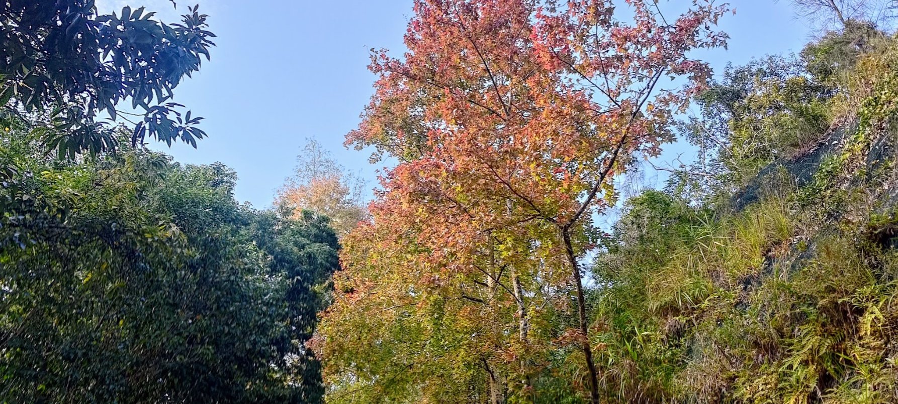
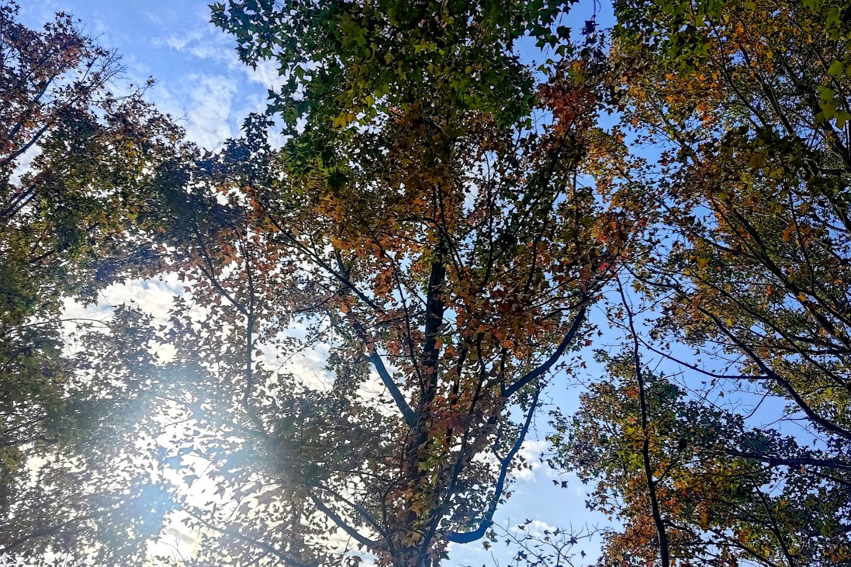
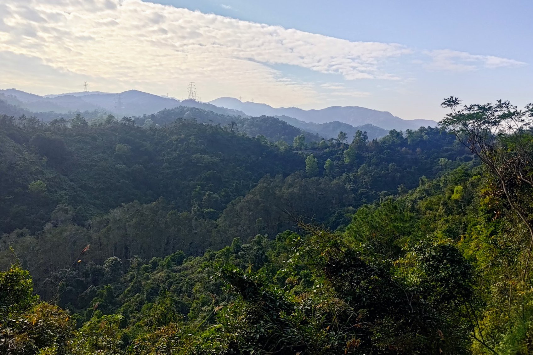
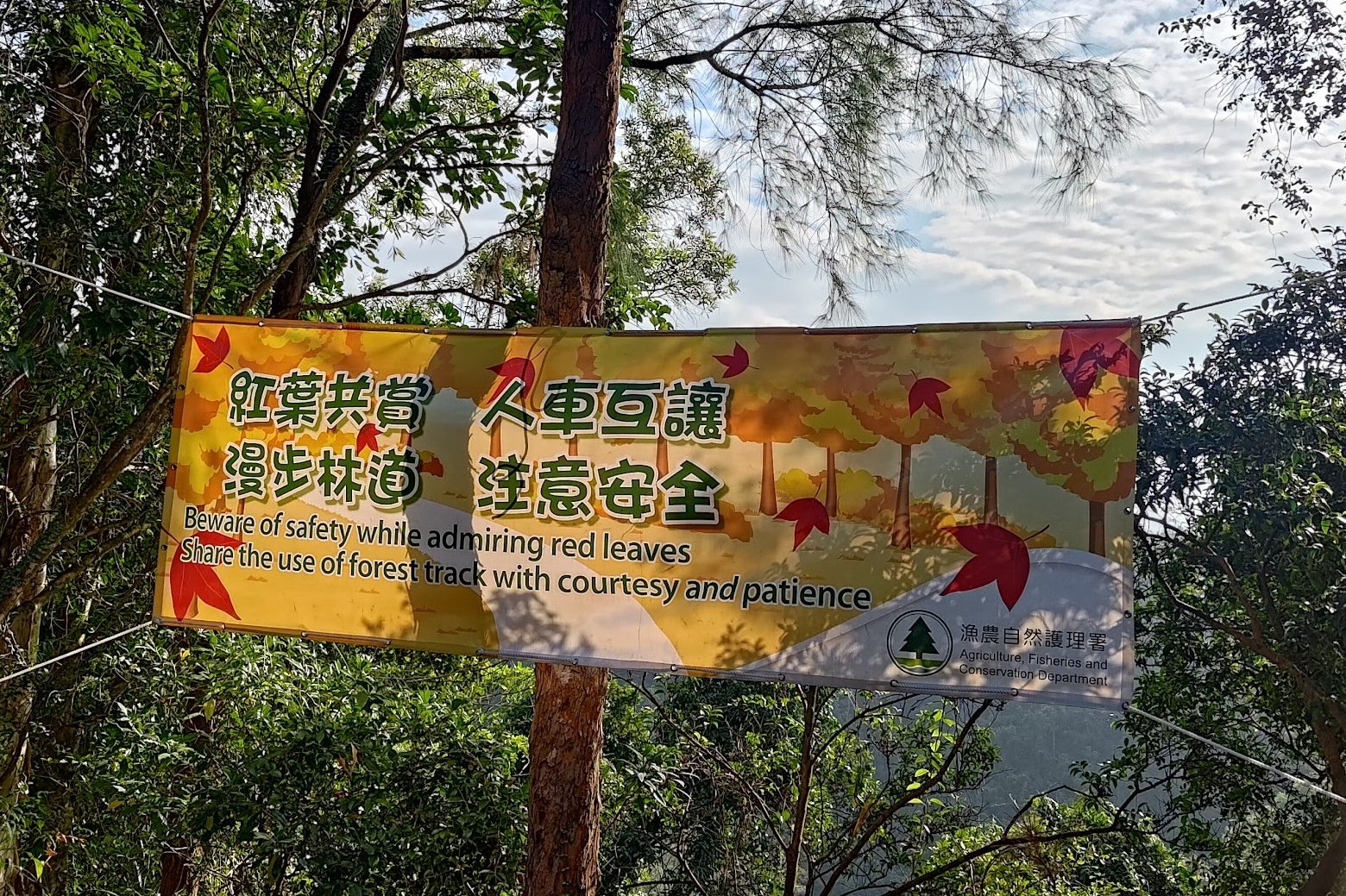
That being said, no matter which route you opt for, the views are unlike anything else you'll see in Hong Kong, with mountains, forest, water and even city views. There is also an area of gum trees that turn golden, orange and red in the autumn, which is really special!
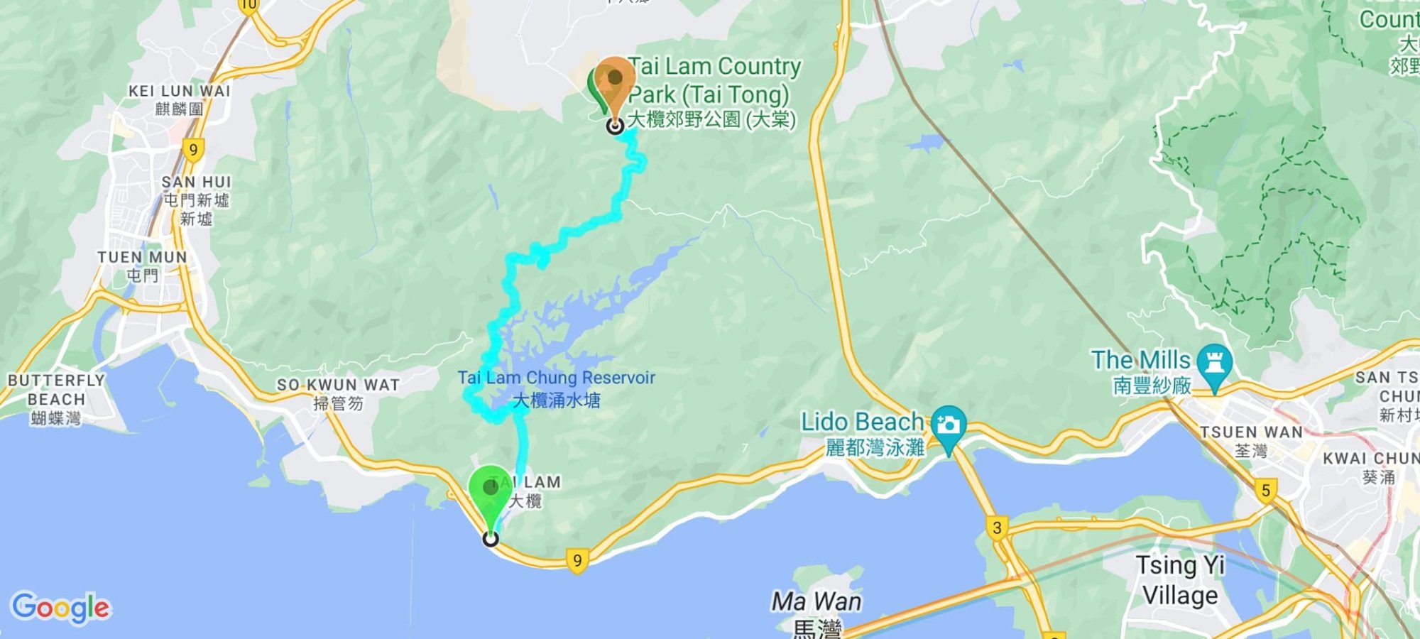
Google Route Map (Long Recommended Route)
Google Route Map (Shorter Route)
How to Get to the Tai Lam Chung Reservoir Hike Start Point
By Bus (Longer Route)
Take any of the following buses to Tuen Mun Road Bus Interchange.
From Kowloon
- Bus 57m (daily) - Lai King, Kwai Fong, Kwai Chung, Tai Wo Hau
- Bus 58m (daily) - Kwai Fong, Kwai Chung, Tai Wo Hau, Tsuen Wan
- Bus 59X (daily) - Mong Kok East, Mong Kok, Sham Shui Po, Cheung Sha Wan, Lai Chi Kok, Mei Foo
- Bus 60X (daily) - Jordan, West Kowloon, Yau Ma Tei, Mong Kok, Sham Shui Po, Cheung Sha Wan, Mei Foo
- Bus 61X (daily) - Kowloon City Ferry, San Po Kong, Wong Tai Sin
- Bus 62X (daily) - Lei Yue Mun, Yau Tong, Ngau Tau Kok, Kowloon Bay, Diamond Hill
- Bus 63X (daily) - West Kowloon, Sham Shui Po, Mong Kok
- Bus 66M (daily) - Tsuen Wan
- Bus 66X (daily) - Olympic Station, Mong Kok, Sham Shui Po, Cheung Sha Wan, Lai Chi Kok, Mei Foo
- Bus 67A (daily) - Kwai Fong, Kwai Hing, Tai Wo Hau, Tsuen Wan
- Bus 67M (daily) - Kwai Fong, Kwai Hing, Tai Wo Hau, Tsuen Wan
- Bus 67X (daily) - Mong Kok, Prince Edward, Sham Shui Po, Cheung Sha Wan, Lai Chi Kok, Mei Foo
- Bus 258D (daily) - Lam Tin, Ngau Tau Kok, Kowloon Bay, Diamond Hill
- Bus 259D (daily) - Lei Yue Mun, Yau Tong, Lam Tin, Kwun Tong, Ngau Tau Kok, Choi Hung
- Bus 260X (daily) - Hung Hom, Tsim Sha Tsui, Jordan, Yau Ma Tei, Mong Kok, Austin
- Bus 50 (daily, mornings only) - Kowloon Station, Tsim Sha Tsui, Jordan, Yau Ma Tei, Mong Kok, Mei Foo, Kwai Chung
From Hong Kong Island
- Bus 960 (daily) - Exhibition Centre, Wan Chai, Admiralty, Central, Sheung Wan
- Bus 961 (daily) - Exhibition Centre, Wan Chai, Admiralty, Central, Sheung Wan
- Bus 962X (daily) - Causeway Bay, Wan Chai, Admiralty, Central, Sheung Wan
From The New Territories
- Bus 59m (daily) - Tsuen Wan
- Bus 60m (daily) - Tsuen Wan
- Bus 68A (daily) - Tsing Yi, Long Ping, Yuen Long
- Bus 263 (daily) - Sha Tin
From Lantau
Take the E36A to Tuen Mun Town Hall. From there, get either the 60X or 61X to Tuen Mun Road Bus Interchange. You will then need to follow Castle Peak Road Tai Lam to intersect with the start point of the hike.
By Bus (Shorter Route)
Take the MTR to Tuen Mun Station and leave through exit F2. When you arrive at San Hui Market (Ho Pong Street), you can grab green minibus number 43 or 43S to So Kwun Wat Tsuen (掃管笏村).
You can show the Cantonese text to the bus driver to make sure the bus is going to So Kwun Wat Tsuen and so the driver can help you get off at the right stop.
When you get off the bus, follow So Kwun Wat Tsuen Road past the Tin Hau Temple and all the way forward until you connect to MacLehose Stage 10.
By Taxi (Longer Route)
A taxi can take you closer to the start point. Show the taxi driver the following address for Tai Lam Correctional Institution: 大欖懲教所, 大欖涌路. The taxi won't be able to enter the Correctional Institution and will drop you outside. You need to walk through to reach the start point. The guards are very used to people passing through to get to Tai Lam Chung and will happily give you directions.
By Taxi (Shorter Route)
Show the taxi driver the following address for So Kwun Wat Tsuen (掃管笏村).
Quick Tai Lam Chung Hike Route Summary
- From Tuen Mun Road Bus Interchange, take the green stairs down and start walking toward bus stop C3
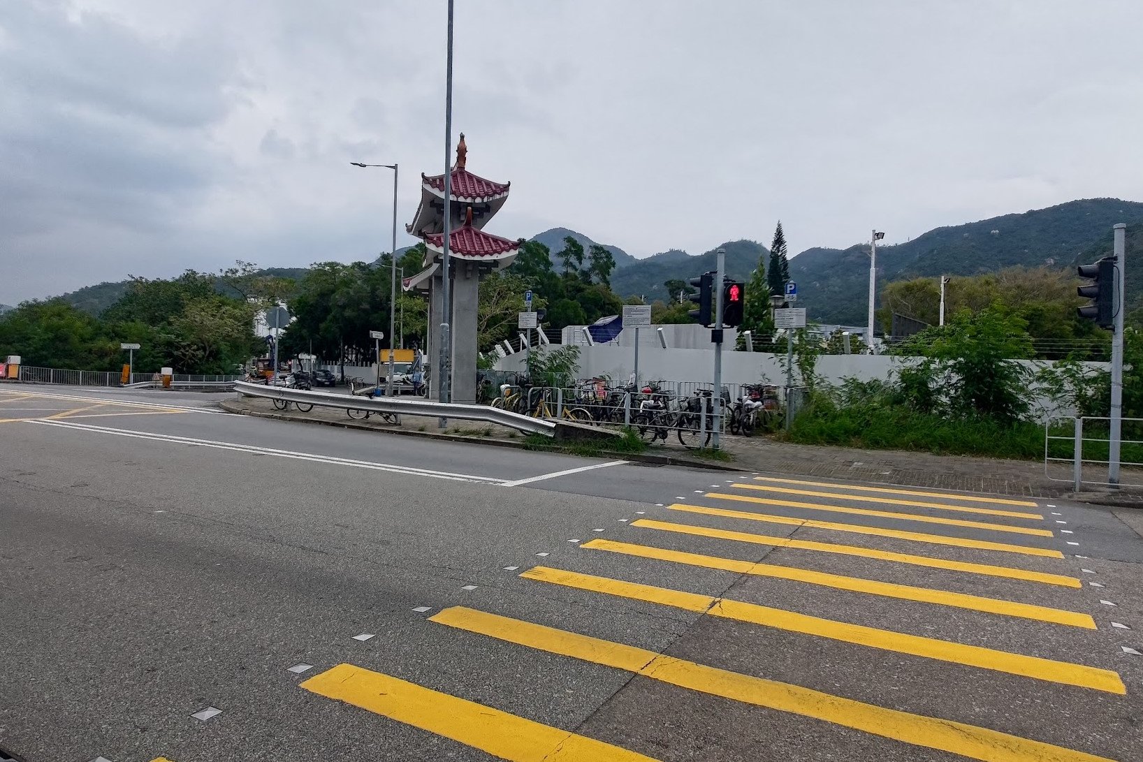
- Head through the tunnel and walk straight along Castle Peak Road - Tai Lam, until you see a crossing with a traditional red structure
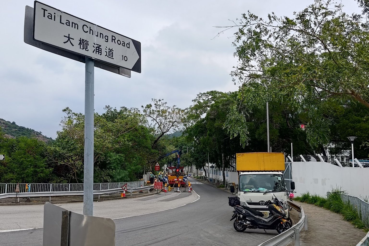
- Cross the street and turn onto Tai Lam Chung Road
- Walk straight, going past the small village homes and through the Tai Lam Chung Correctional Institute
- Cross the blue bridge in the institute and follow the concrete road upward until you reach the silver Tai Lam Chung Reservoir sign
- Follow the brown sign pointing to 'Siu Lam Castle Peak Road' and enter the trail
- Go across the dam that appears after 5 minutes
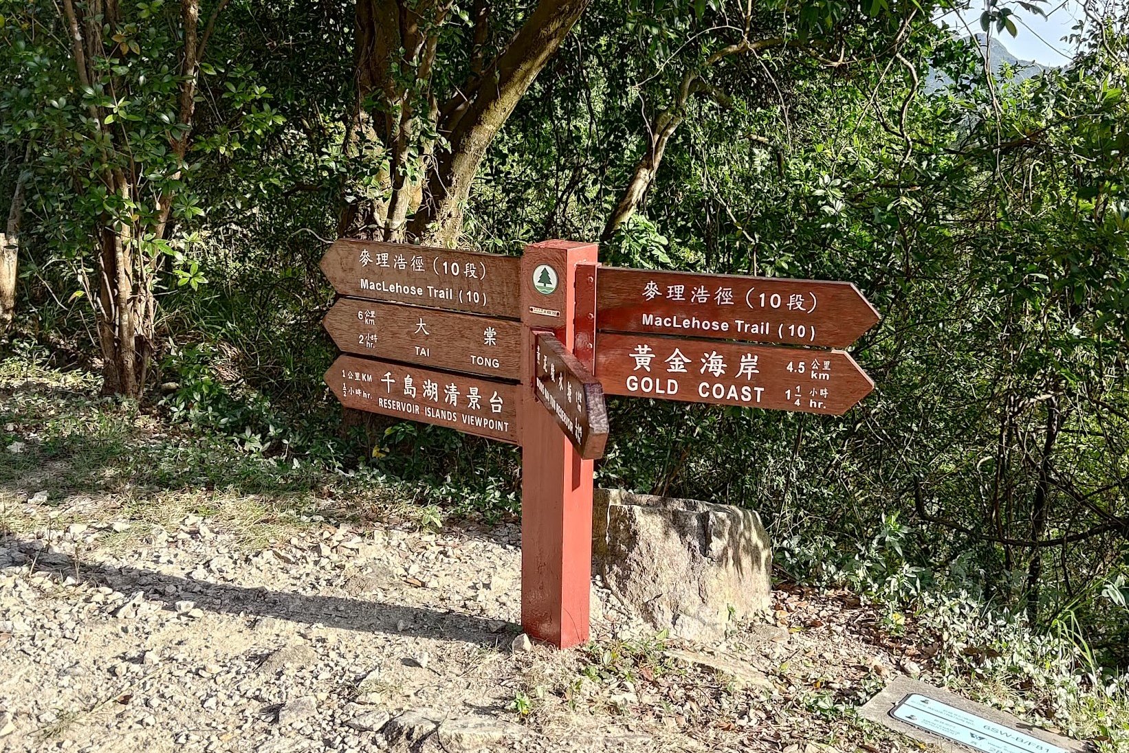
- Follow the natural trail for 15 minutes. When you see a blue sign, follow it right
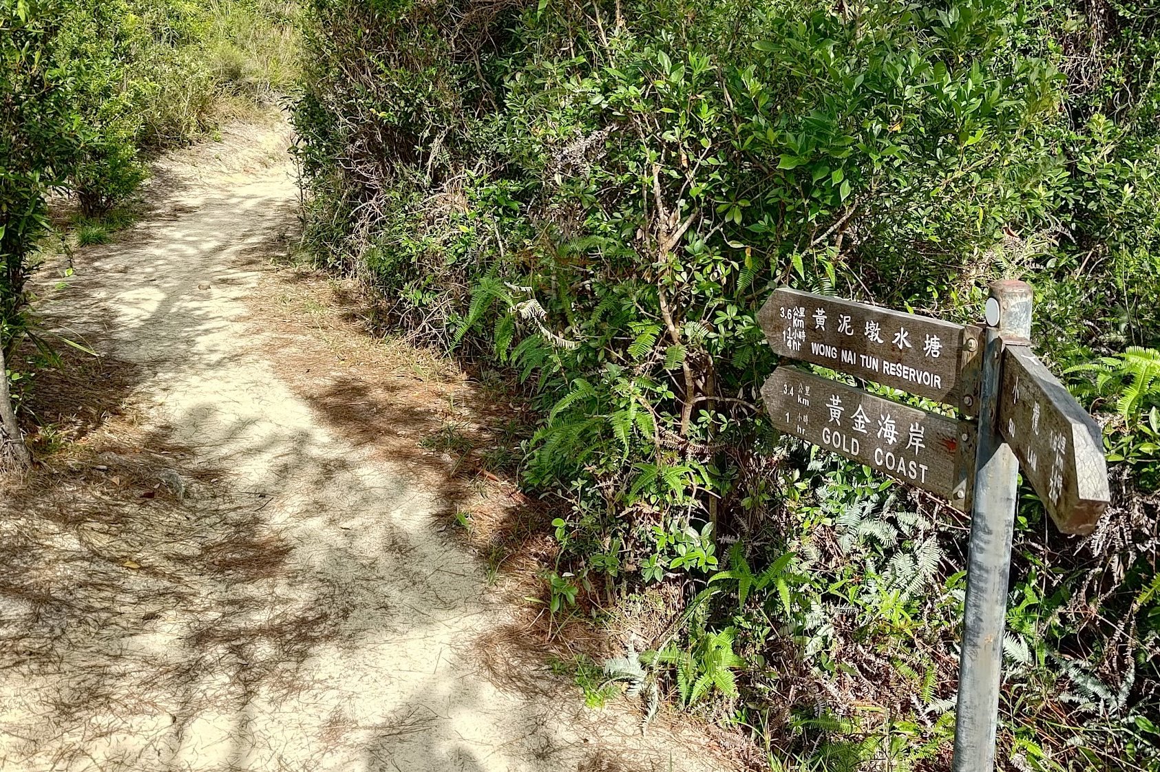
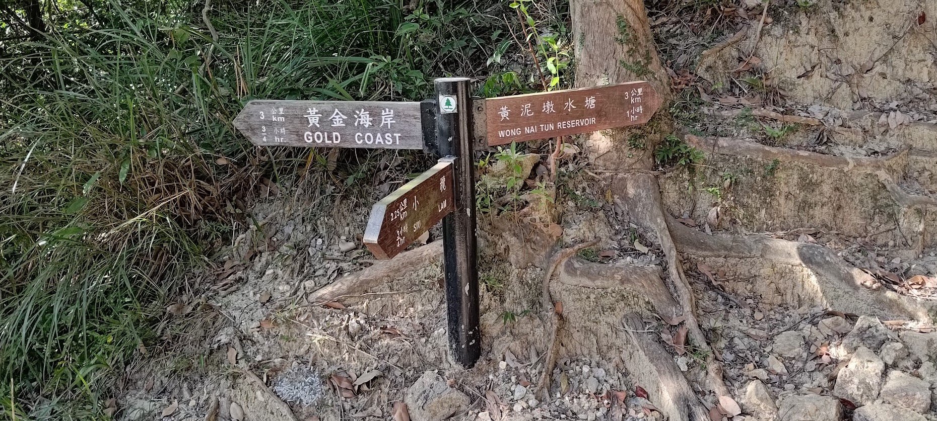
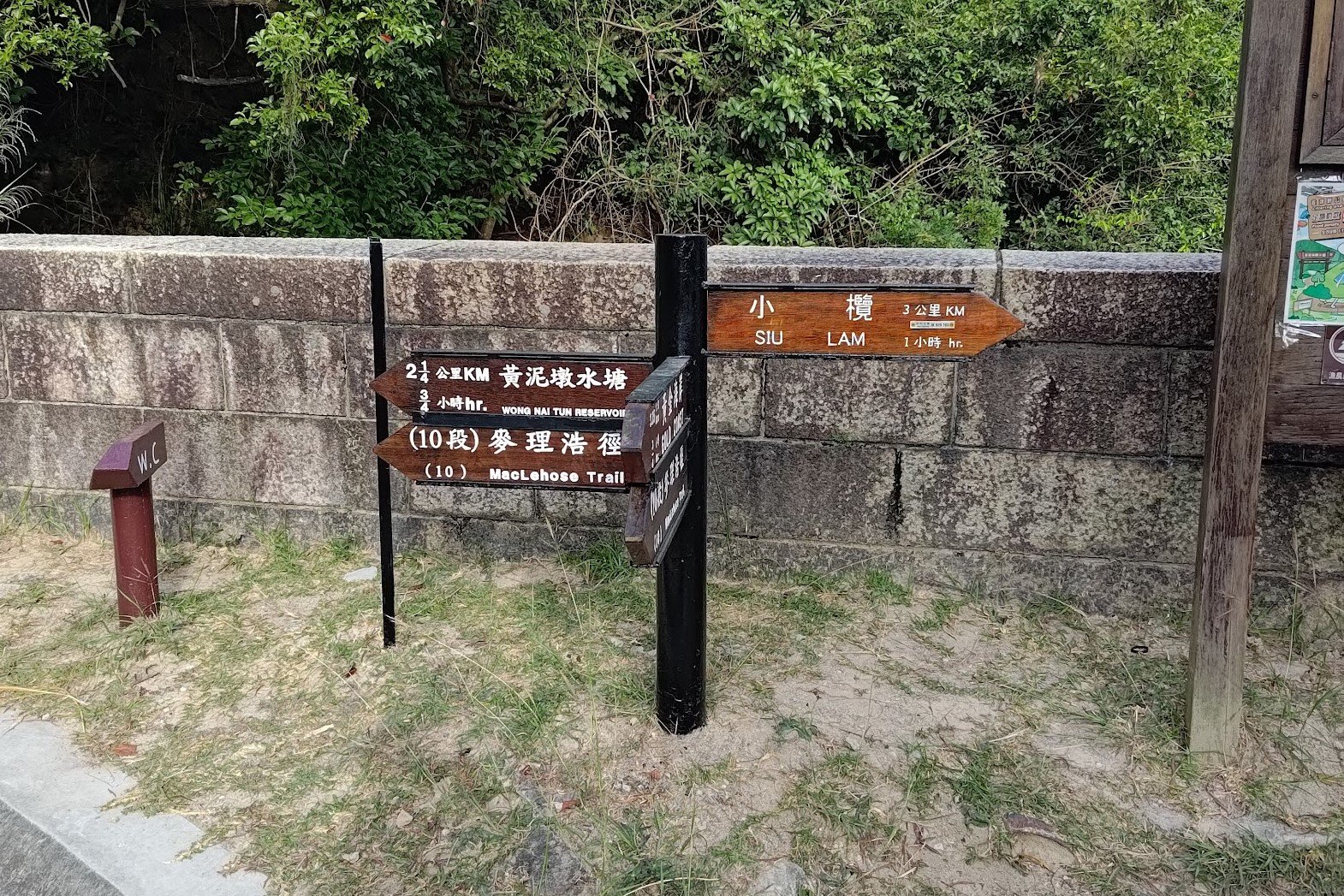
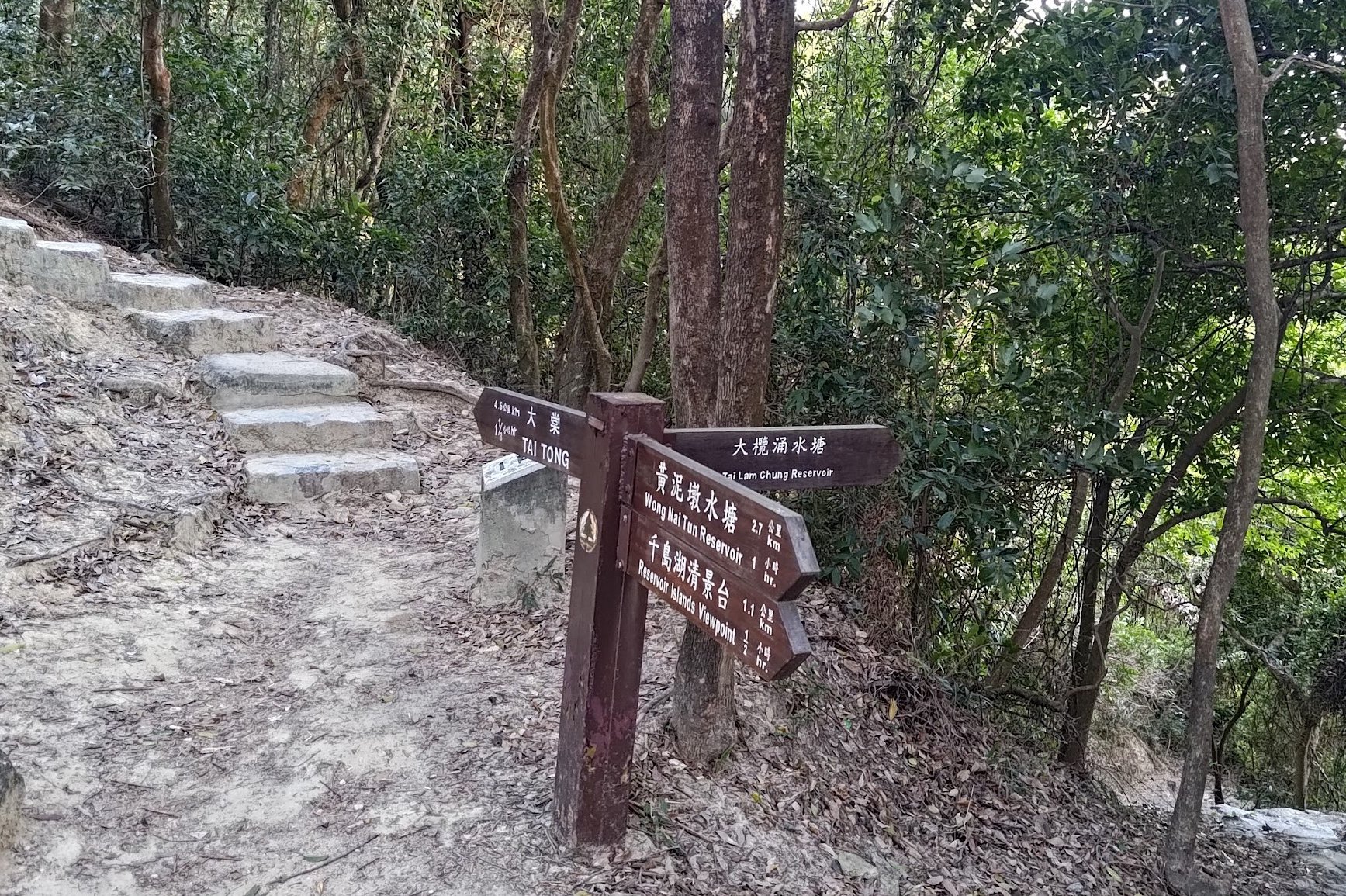
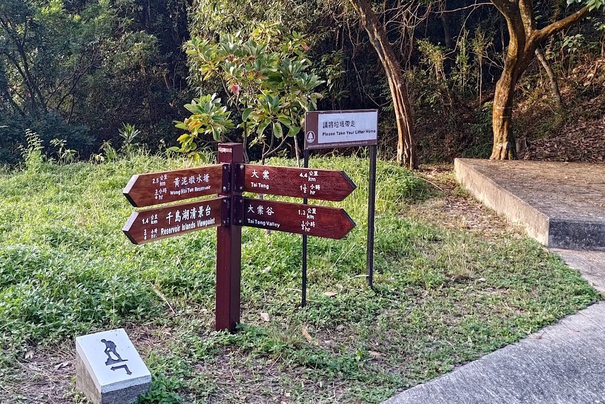
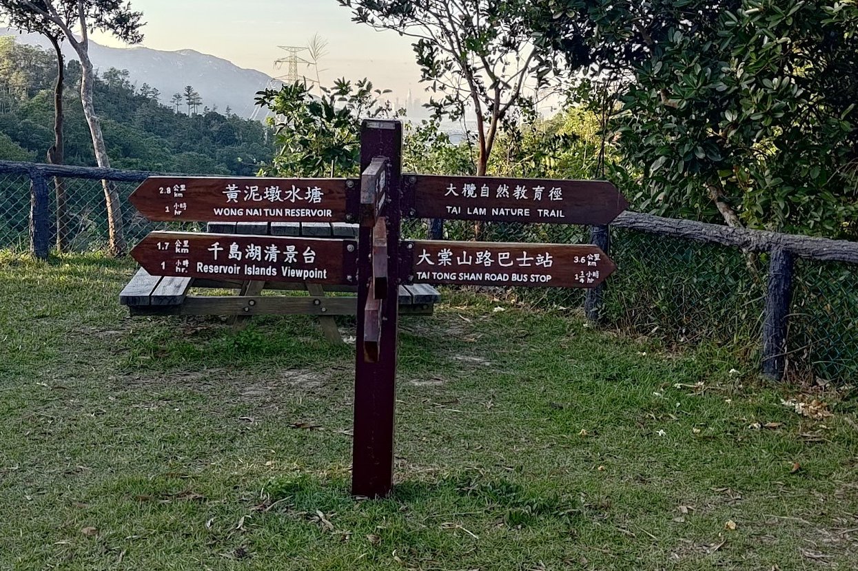
- Follow the brown sign that points to 'Wong Nai Tun Reservoir'
- 15 minutes later, follow the next brown sign also pointing to 'Wong Nai Tun Reservoir'
- Cross the next dam you come across after another 15-20 minutes of hiking. This is where the short trail begins
- Follow the concrete road upward for 20-25 minutes and follow the next brown sign pointing to 'Reservoir Islands Viewpoint'
- Don't miss the reservoir island viewpoint stairs on your right after 10 minutes. Climb them, enjoy the viewpoint and return back down the stairs to continue
- 15 minutes later, you'll come across a small temple with a horse statue. Follow the sign to 'Tai Tong' next to the temple
- 5 minutes later, there's another 'Tai Tong' sign. Follow it down a wide concrete road
- From this point on, keep following the signs to 'Tai Tong Shan Road Bus Stop'
- There's a special minibus from Tai Tong Shan Road Car Park that goes to Yuen Long Station
Getting to the Trail From the Bus Stop
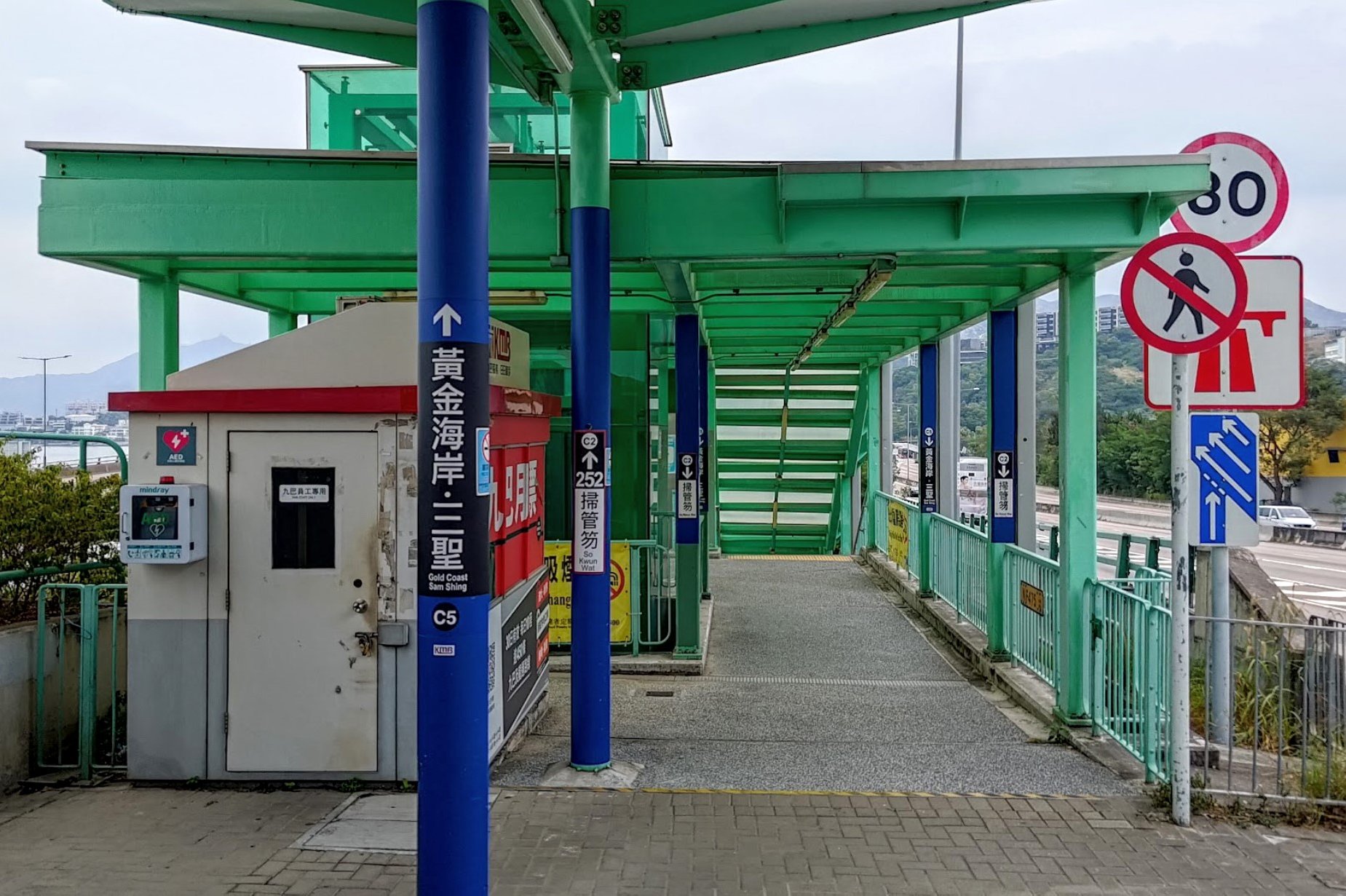
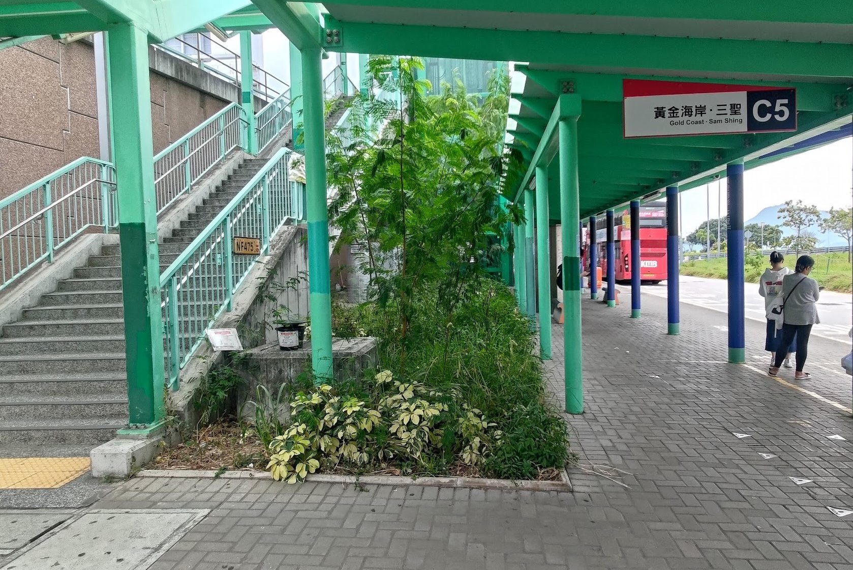
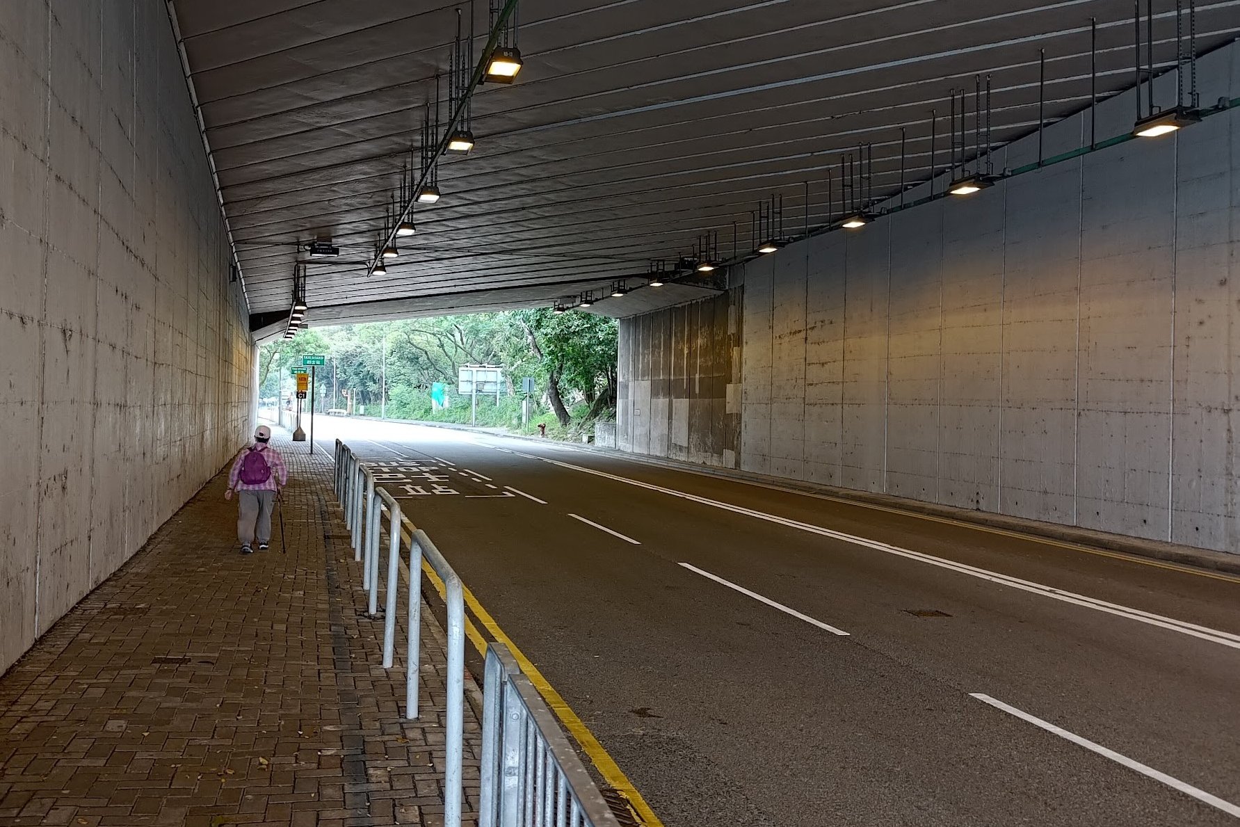
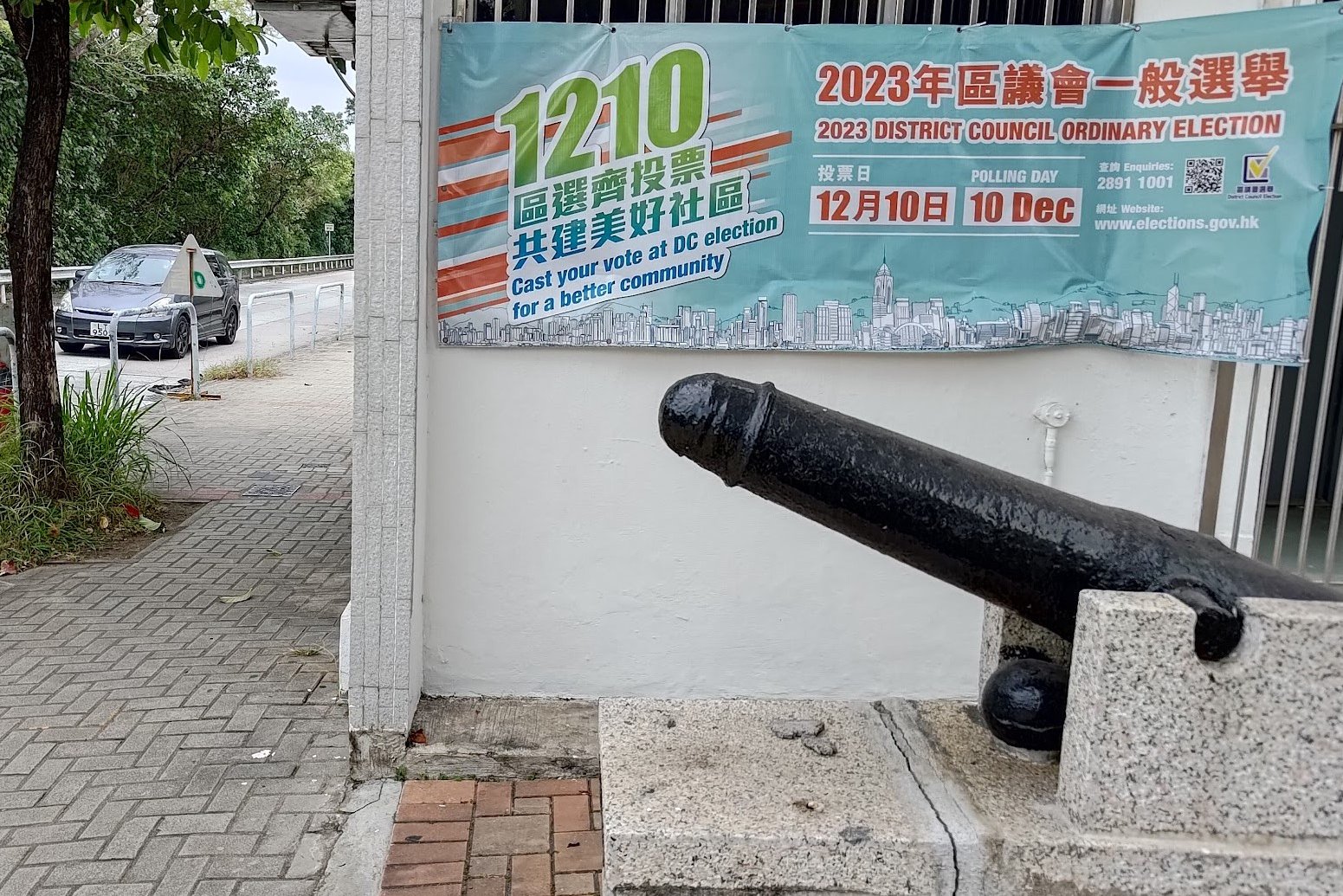
After alighting at Tuen Mun Road Bus Interchange, take the green stairs down and follow the line of bus stops to your left.
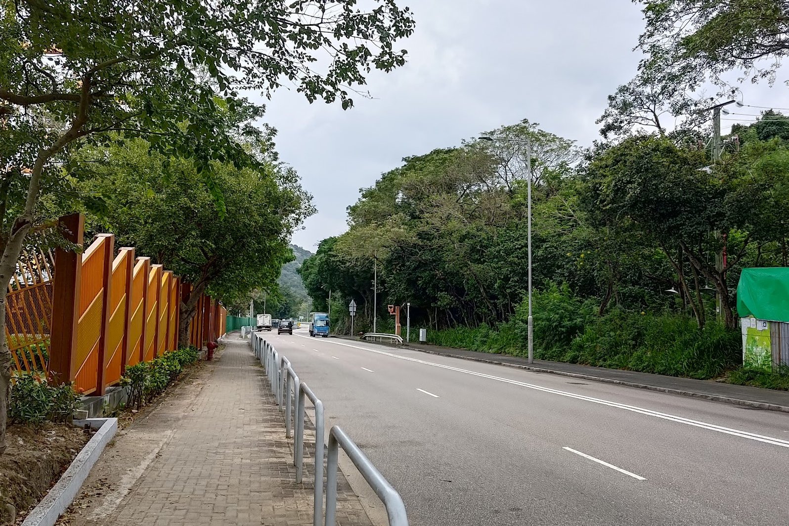
After walking past bus stop C3, you'll soon see a tunnel on your left. Walk into the tunnel and keep going straight along Castle Peak Road - Tai Lam for about 5 minutes.
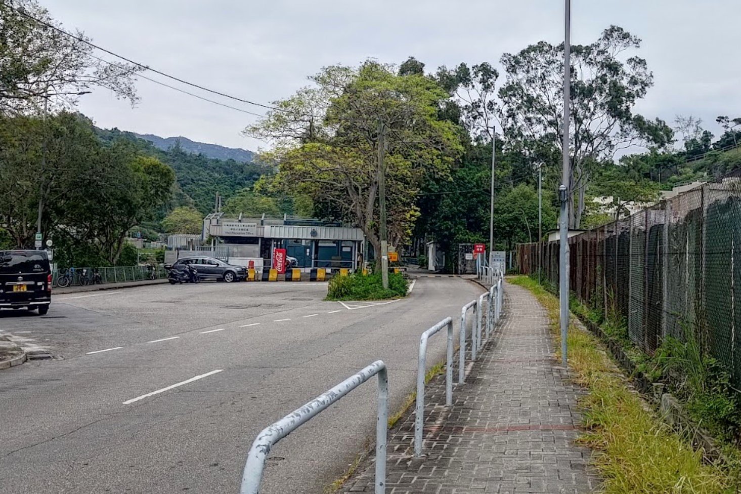
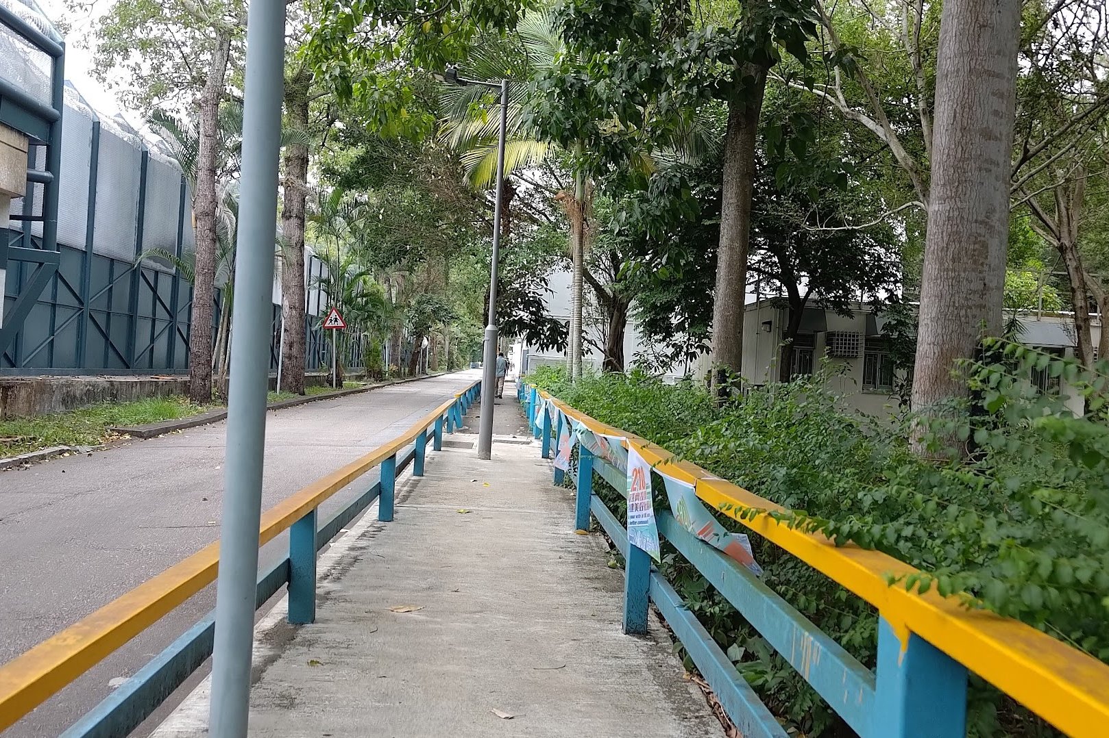
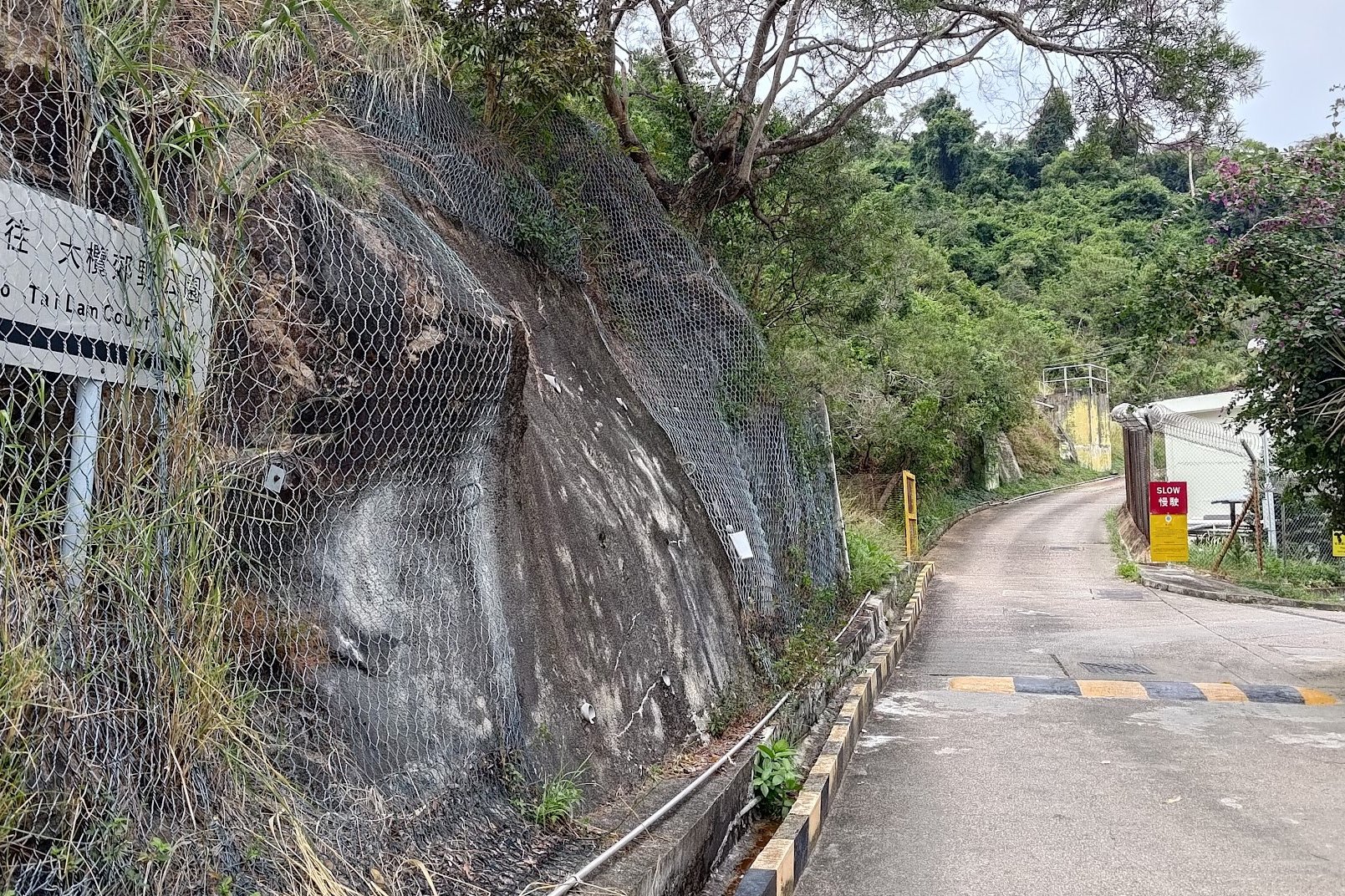
When you see a crossing with a traditional red-roofed structure, cross the street and follow Tai Lam Chung Road for 10-15 minutes until you arrive at the Tai Lam Correctional Institution.
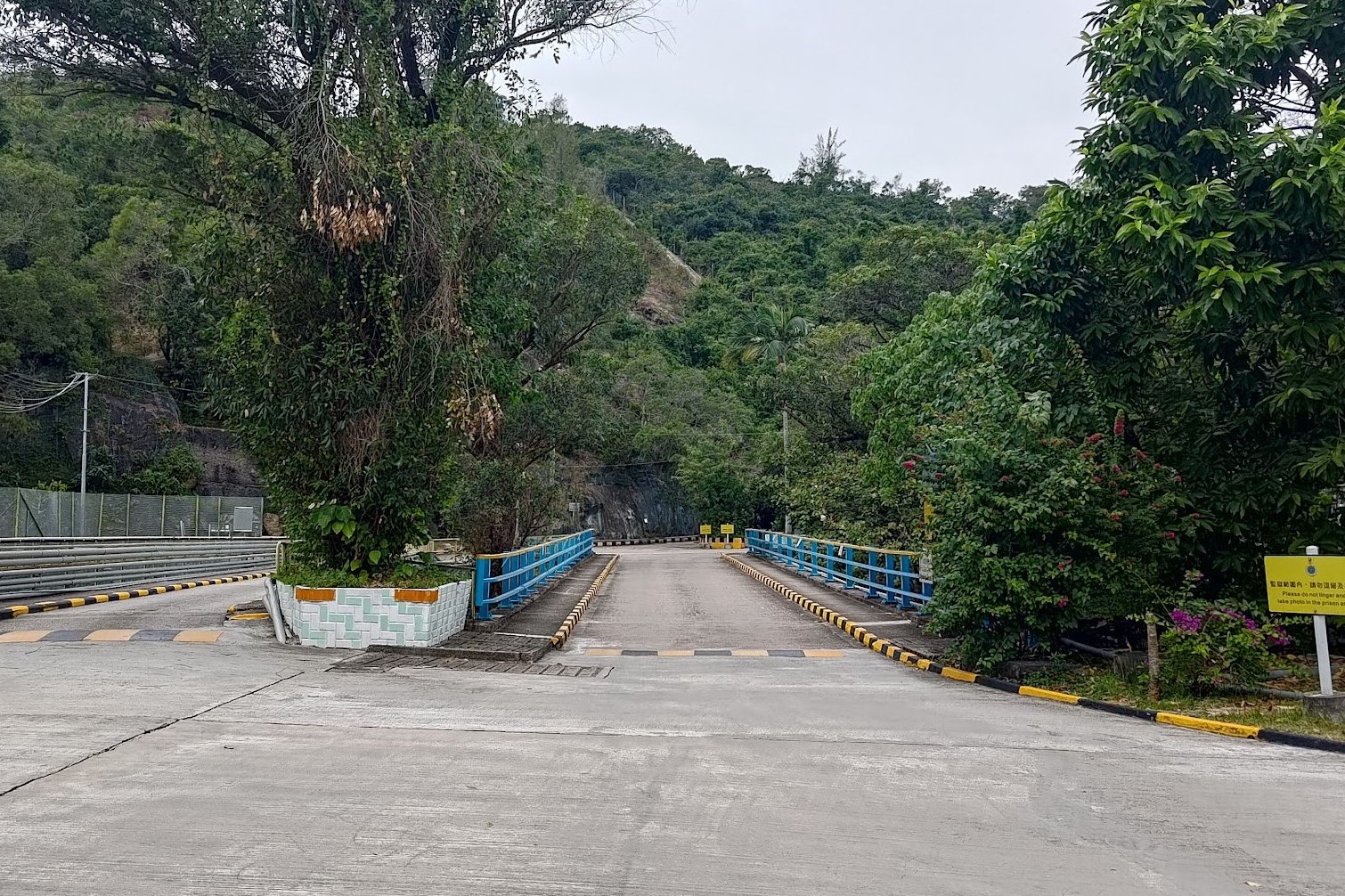
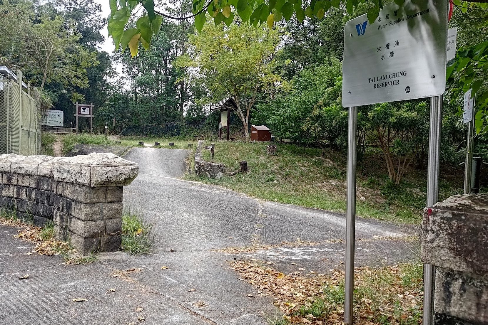
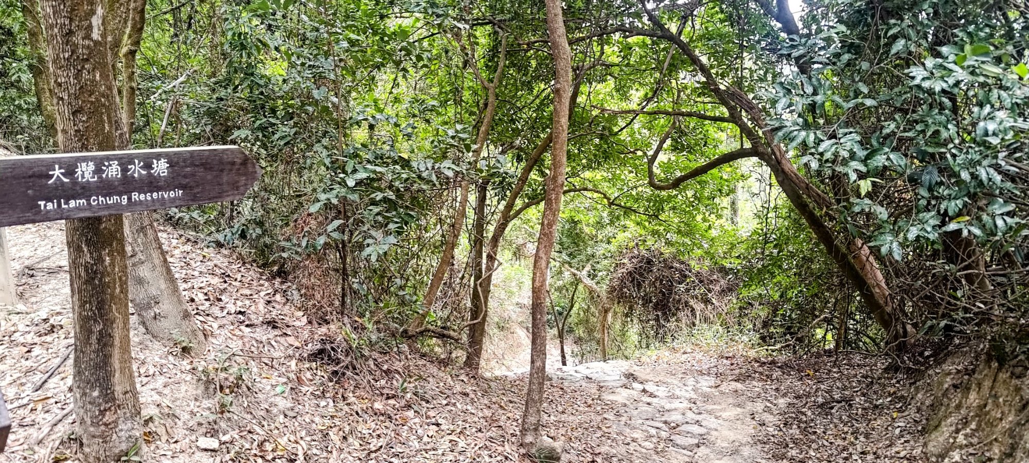
Walk through the car barrier and follow the same road straight through the institution, crossing a blue bridge and then turning right to climb a concrete road until you reach the start point of the trail. A silver sign that says 'Tai Lam Chung Reservoir' lets you know that you've arrived.
Optional Reservoir Detour (5 Mins)
Before entering the trail, there's a dam and reservoir viewpoint to the right.
Make sure to return back if you explore the dam and reservoir view area.
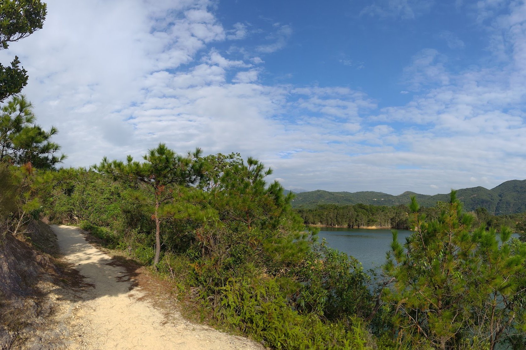
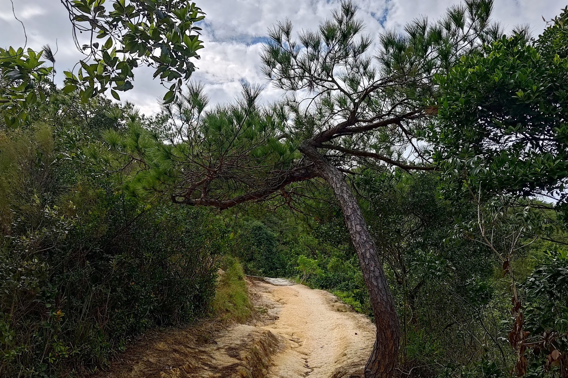
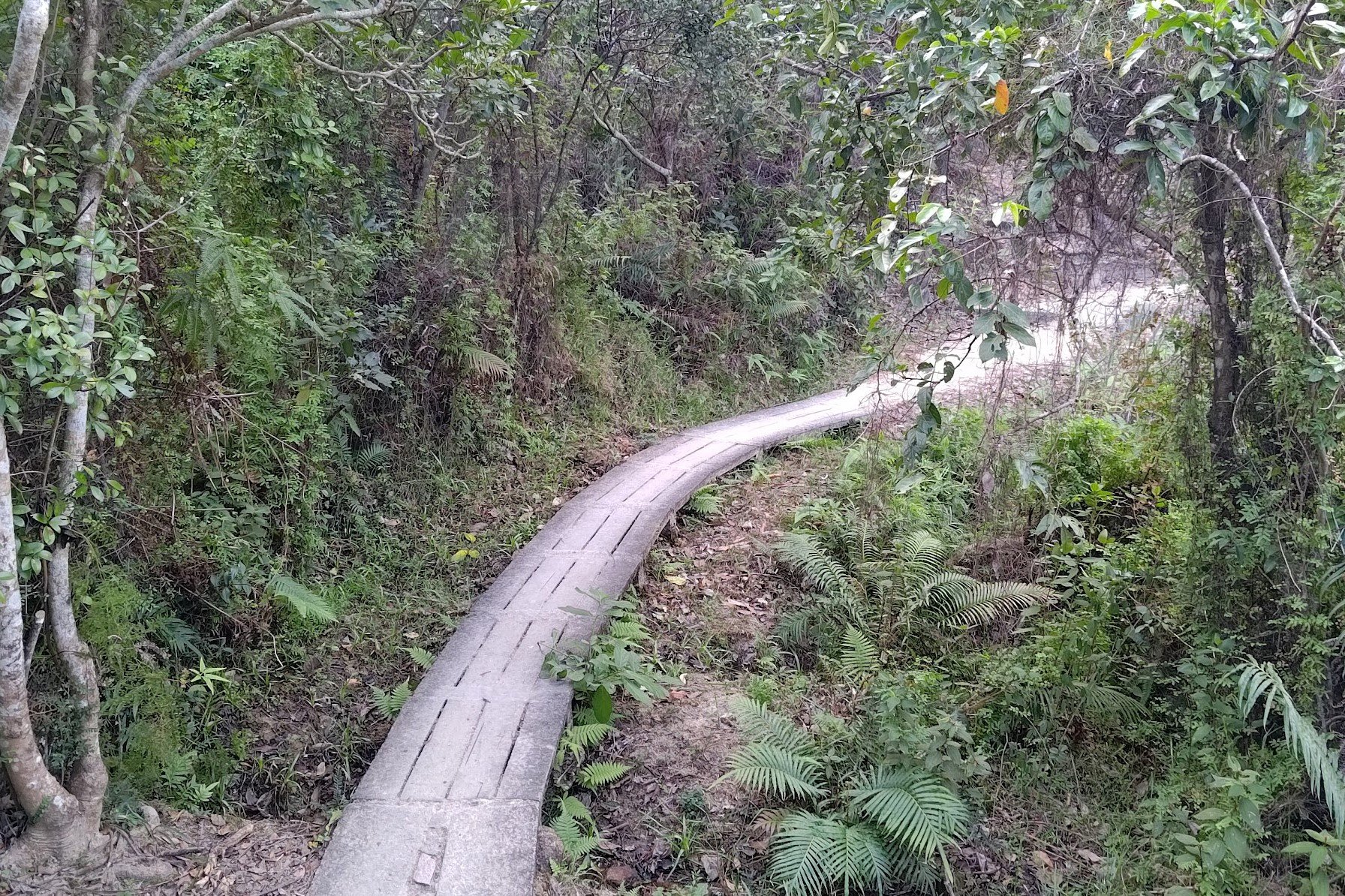
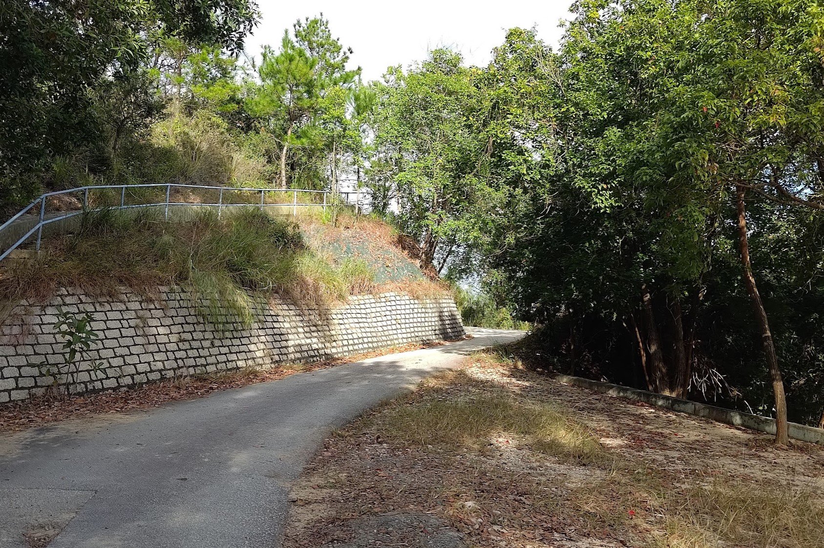
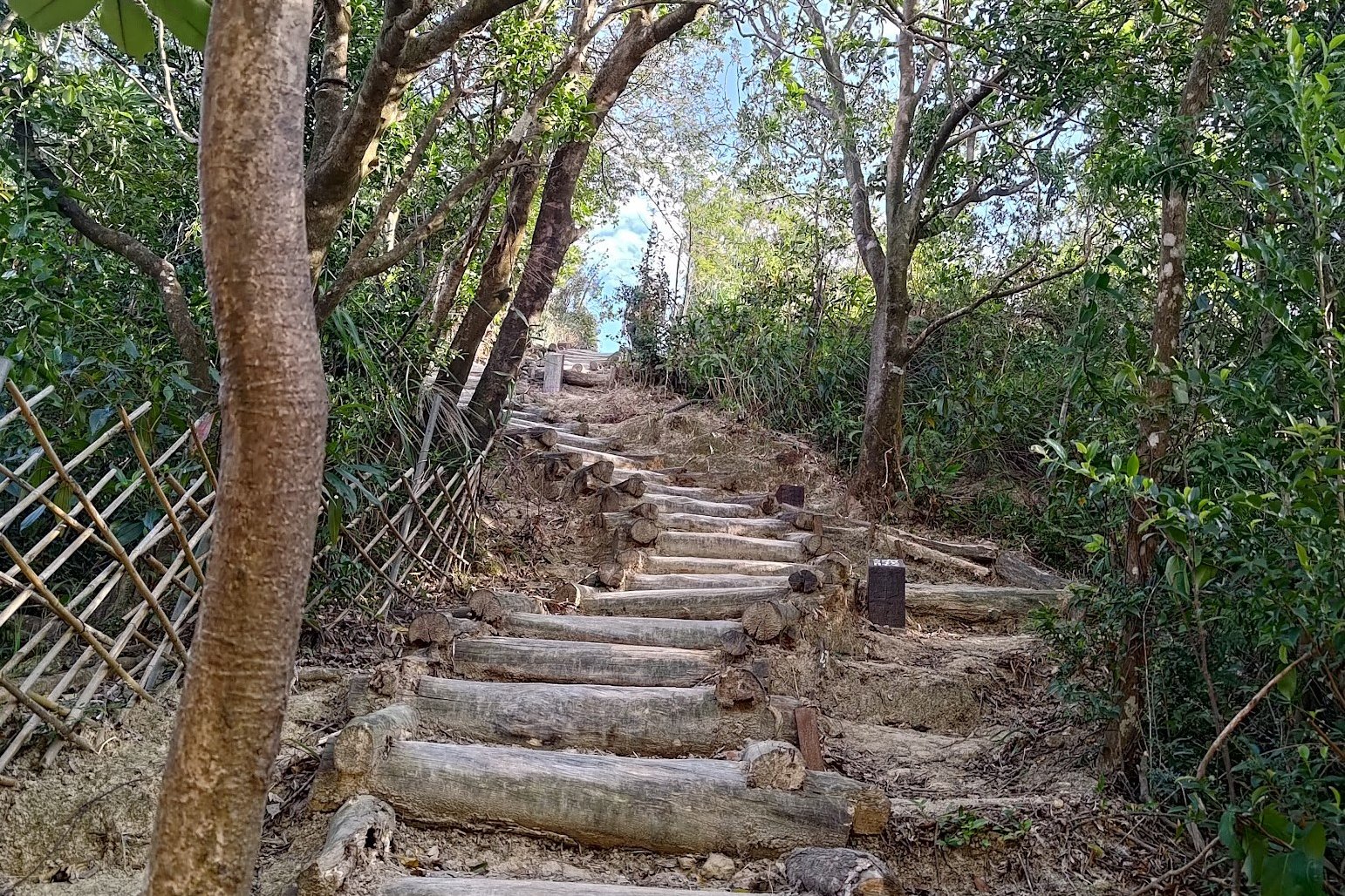
The Beginning of the Trail
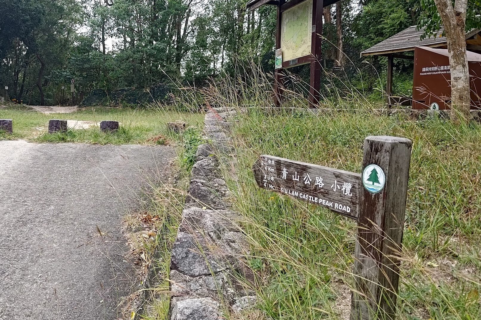
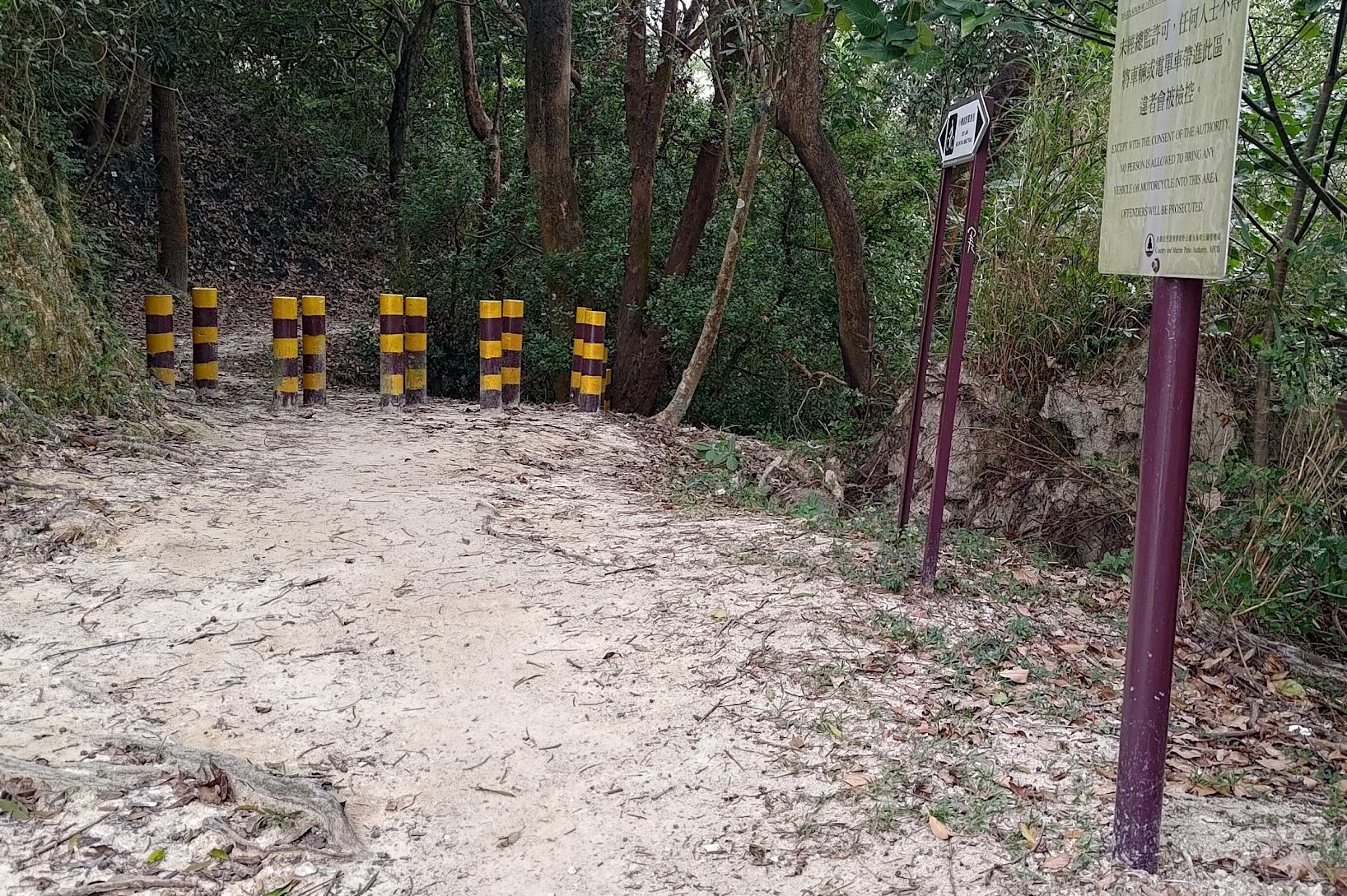
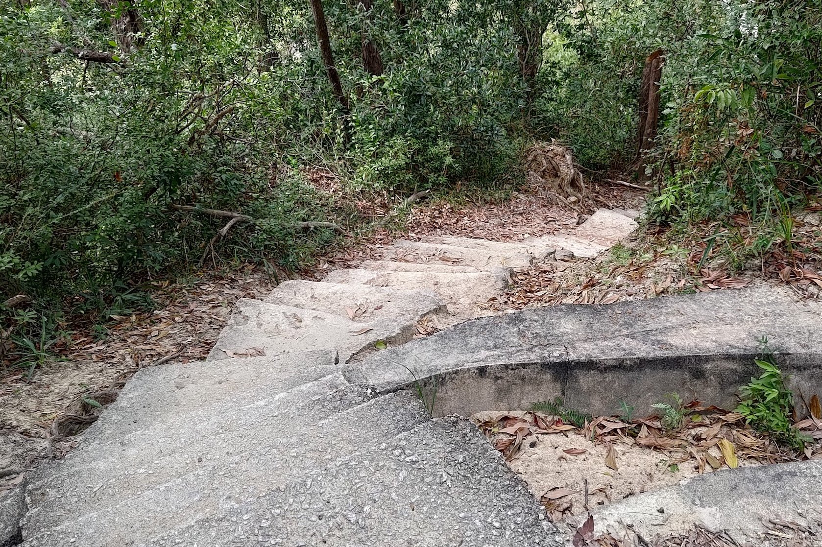
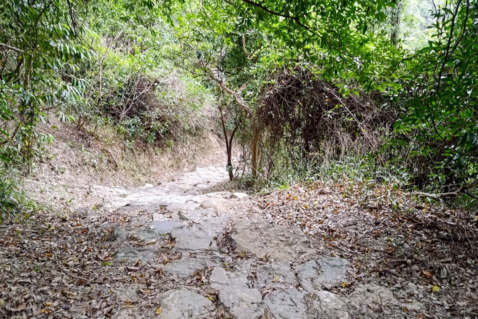
Follow the brown sign pointing to 'Siu Lam Castle Peak Road'. Once you go past the striped barriers, you'll begin walking on a wonderful natural trail.
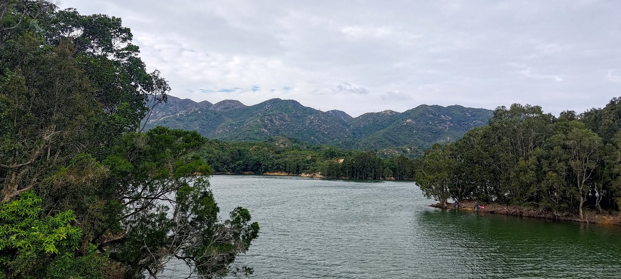
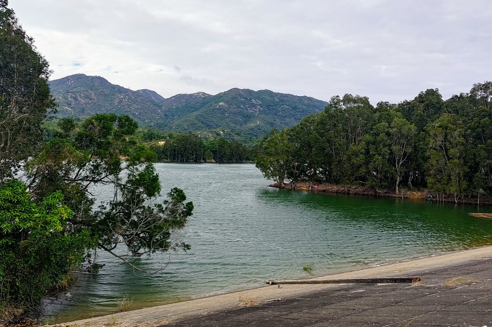
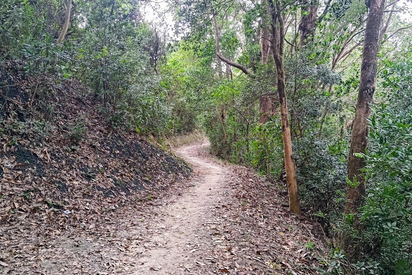
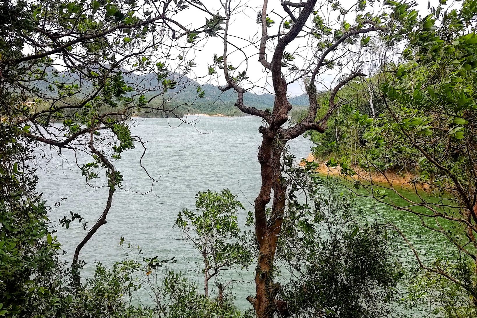
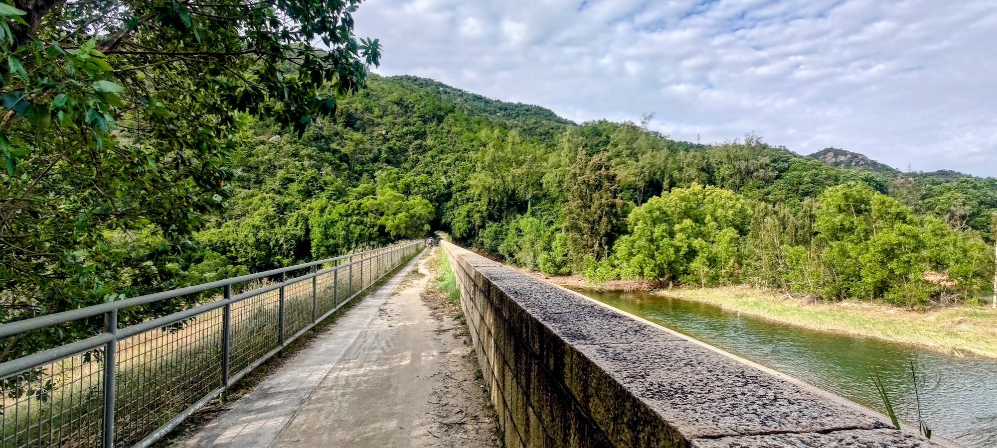
Enjoy the trail for a few minutes as you walk beside the reservoir and get some awesome views.
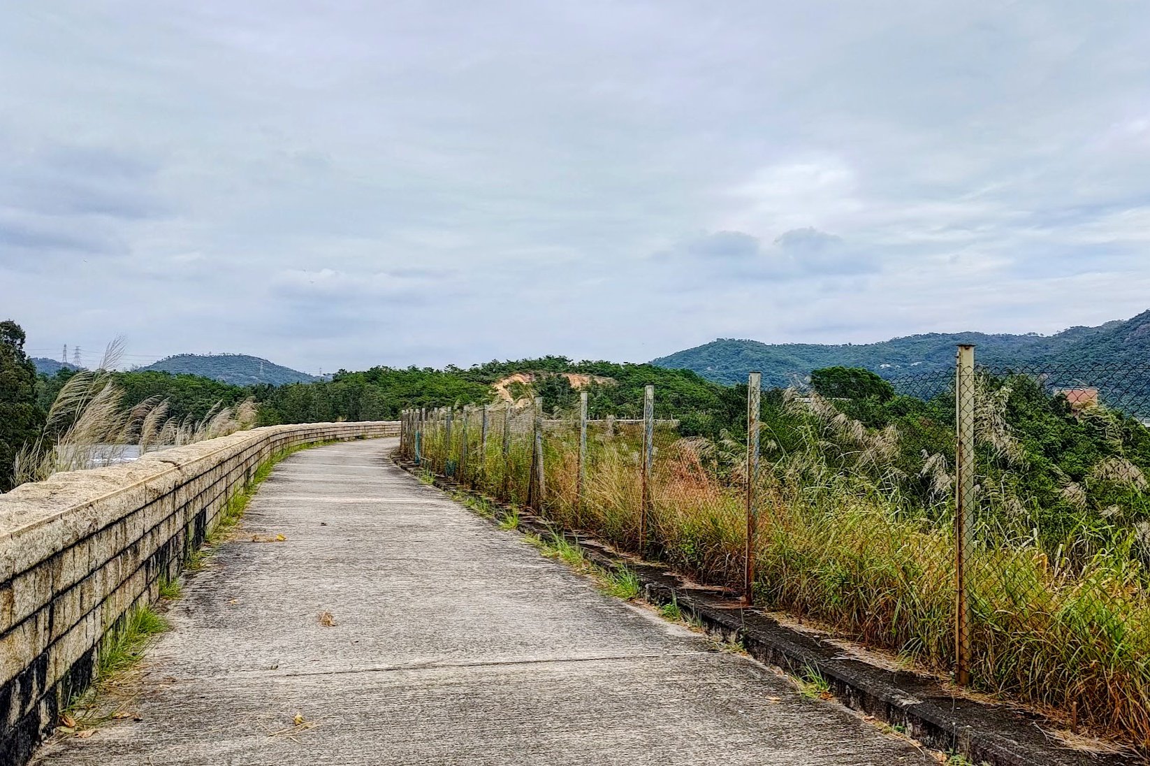
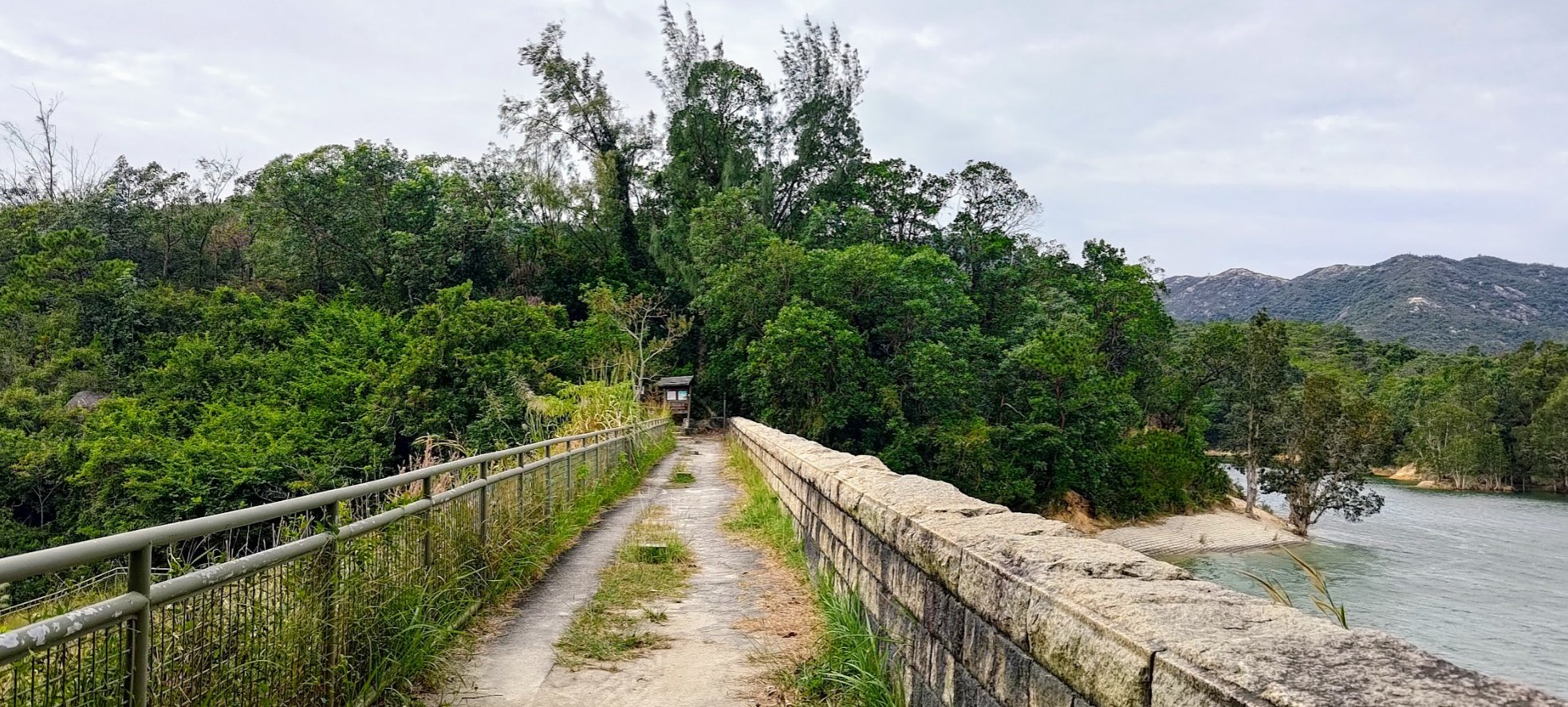
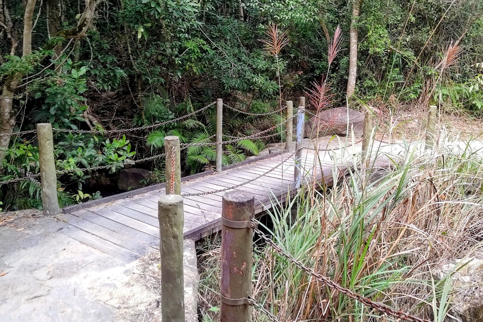
When you see a dam in the distance after about 5-10 minutes of hiking, you'll want to walk across it.
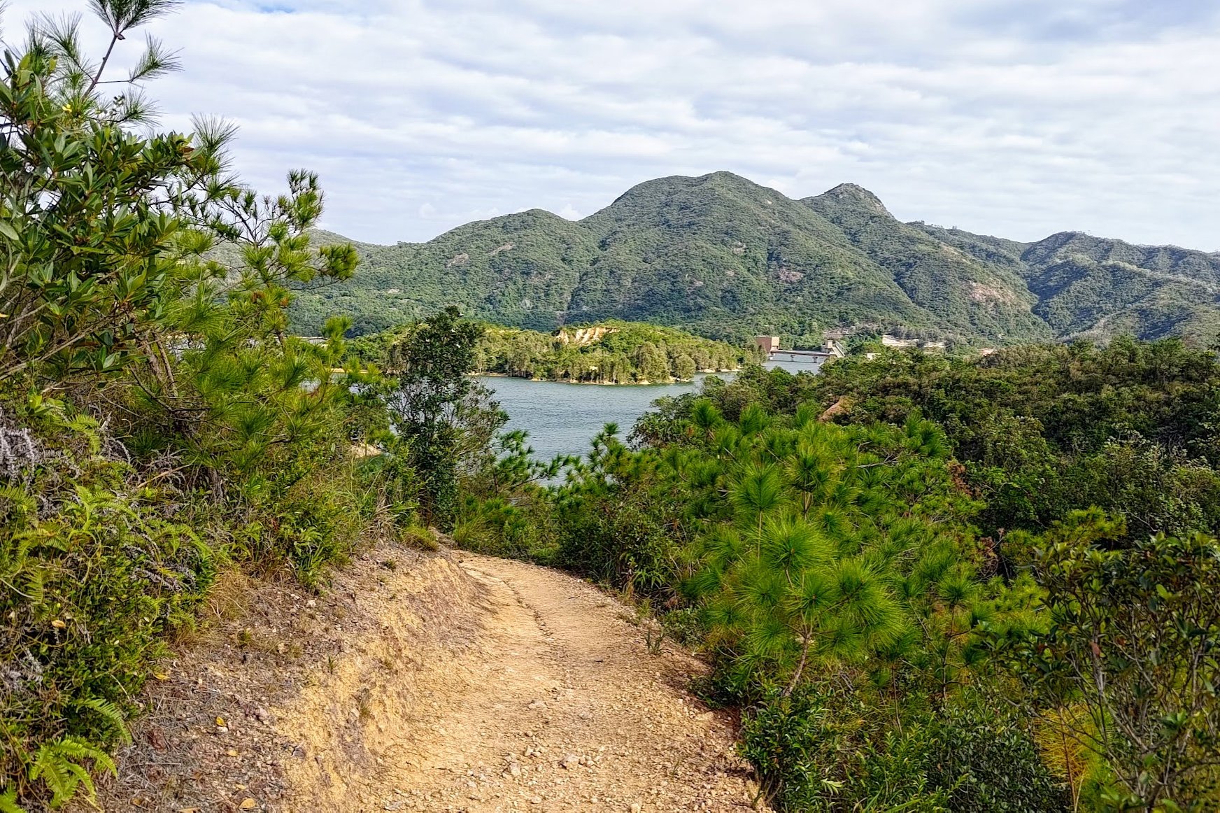
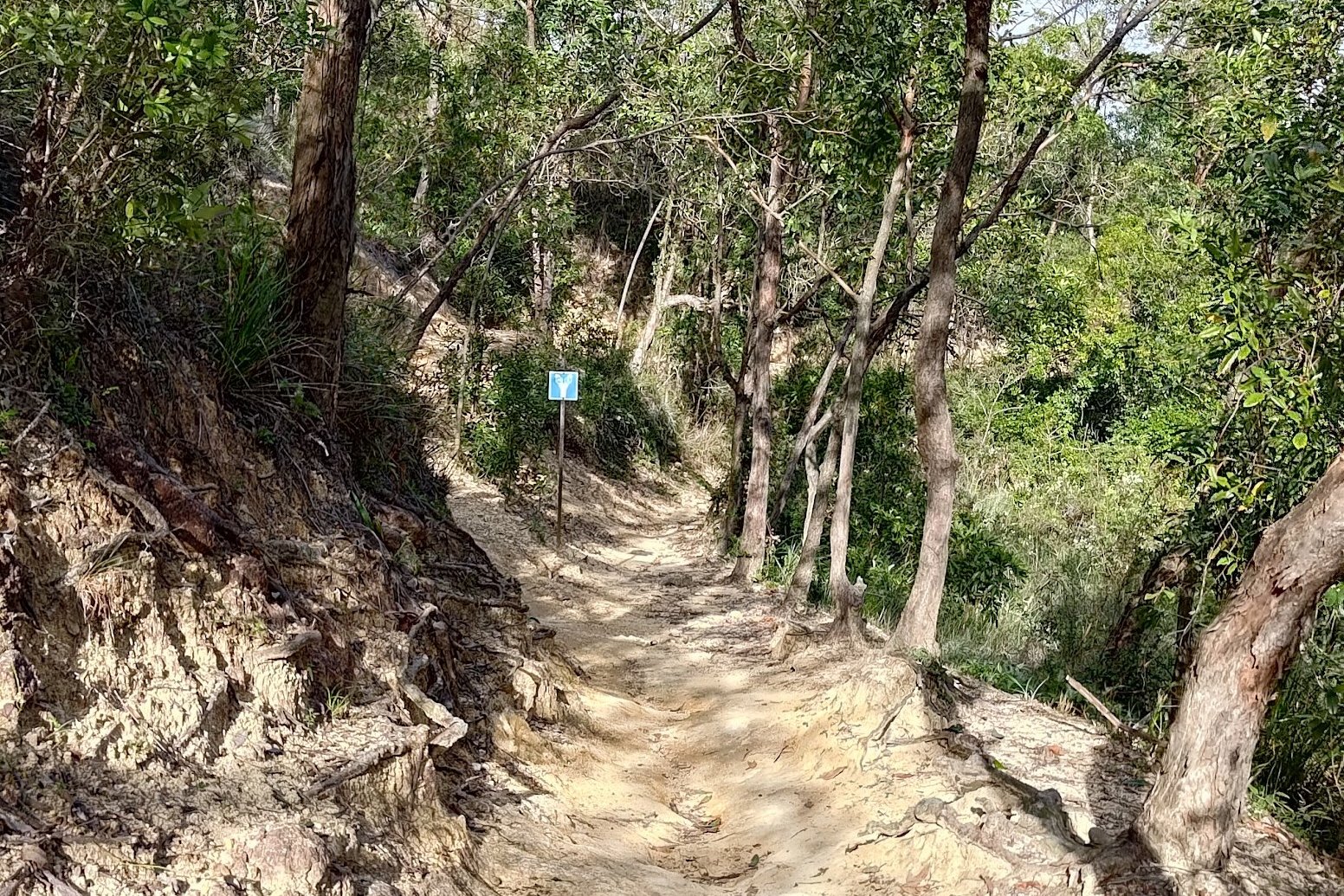
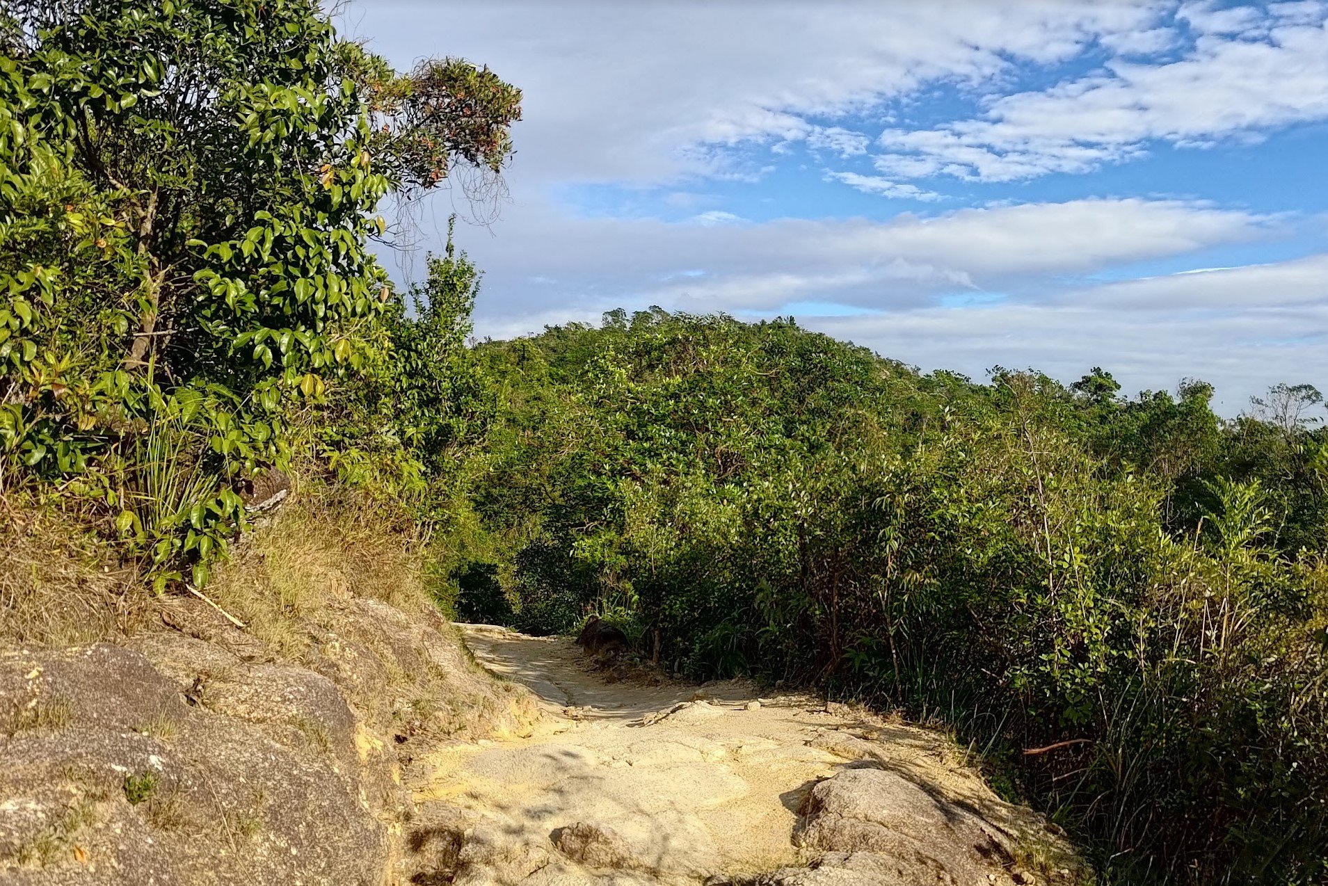
More Gorgeous Natural Trails
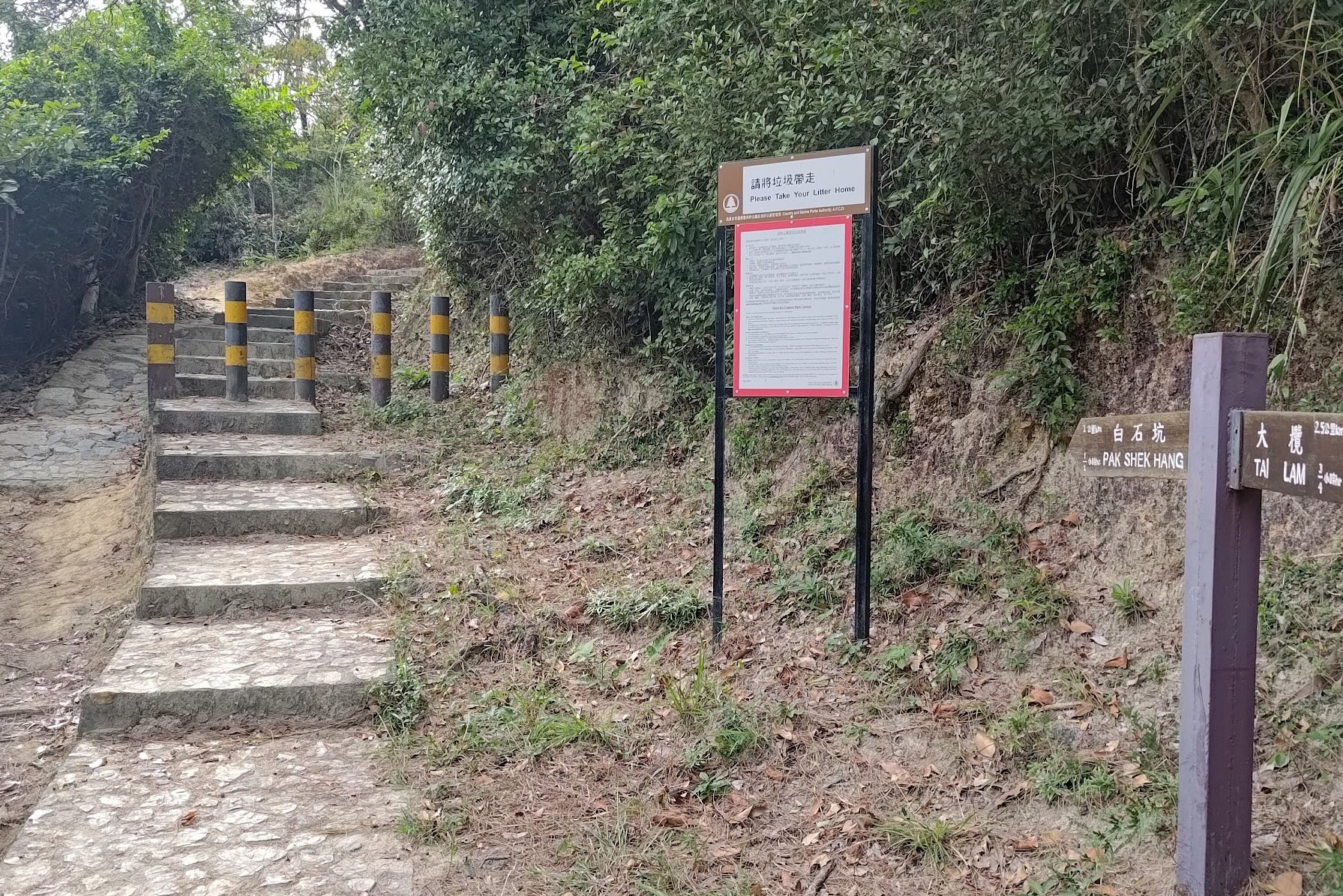

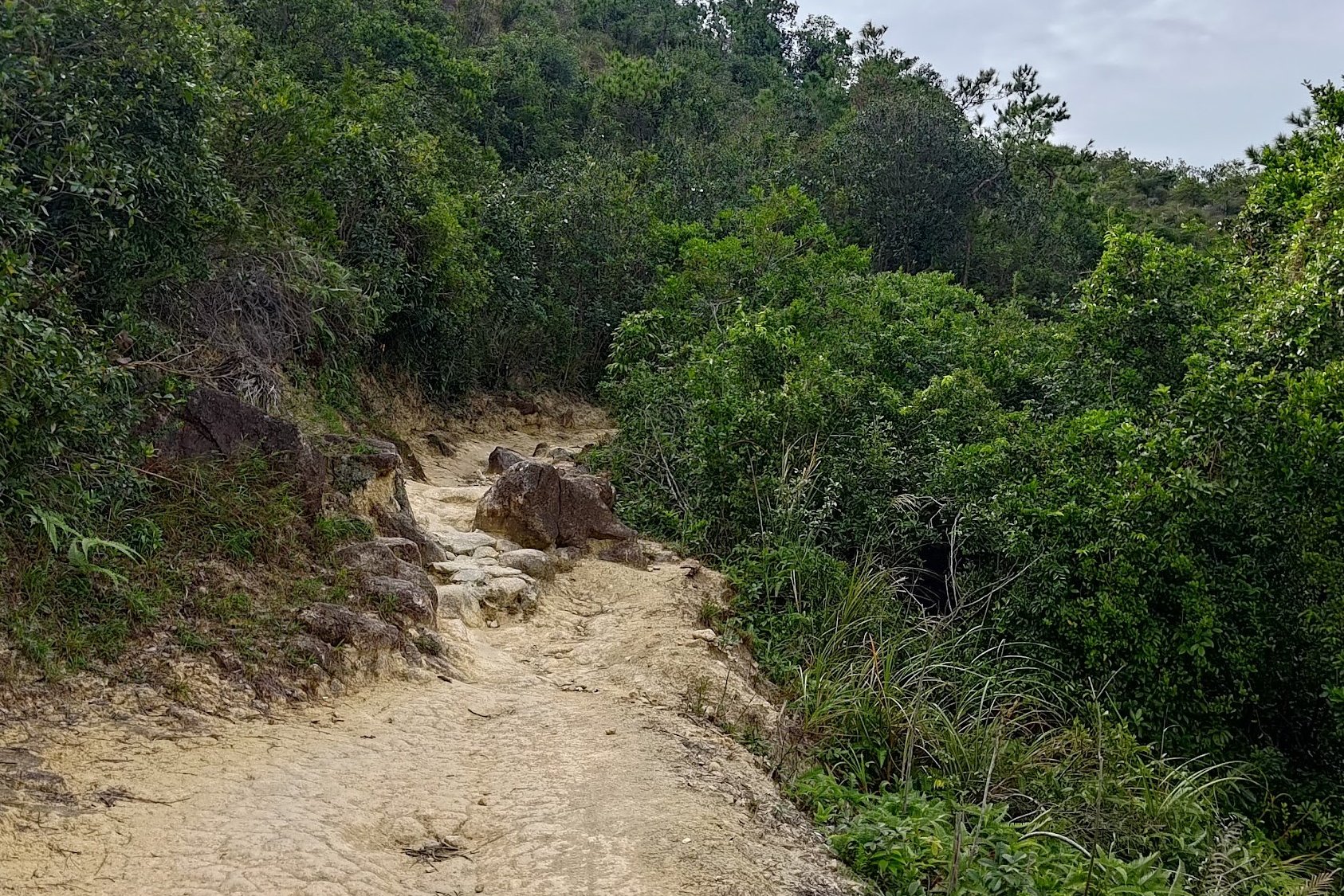
After crossing the dam, follow the brown sign to Pak Shek Hang.
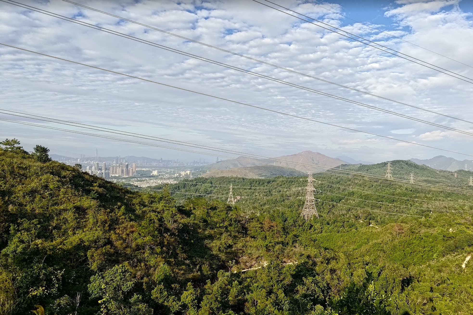
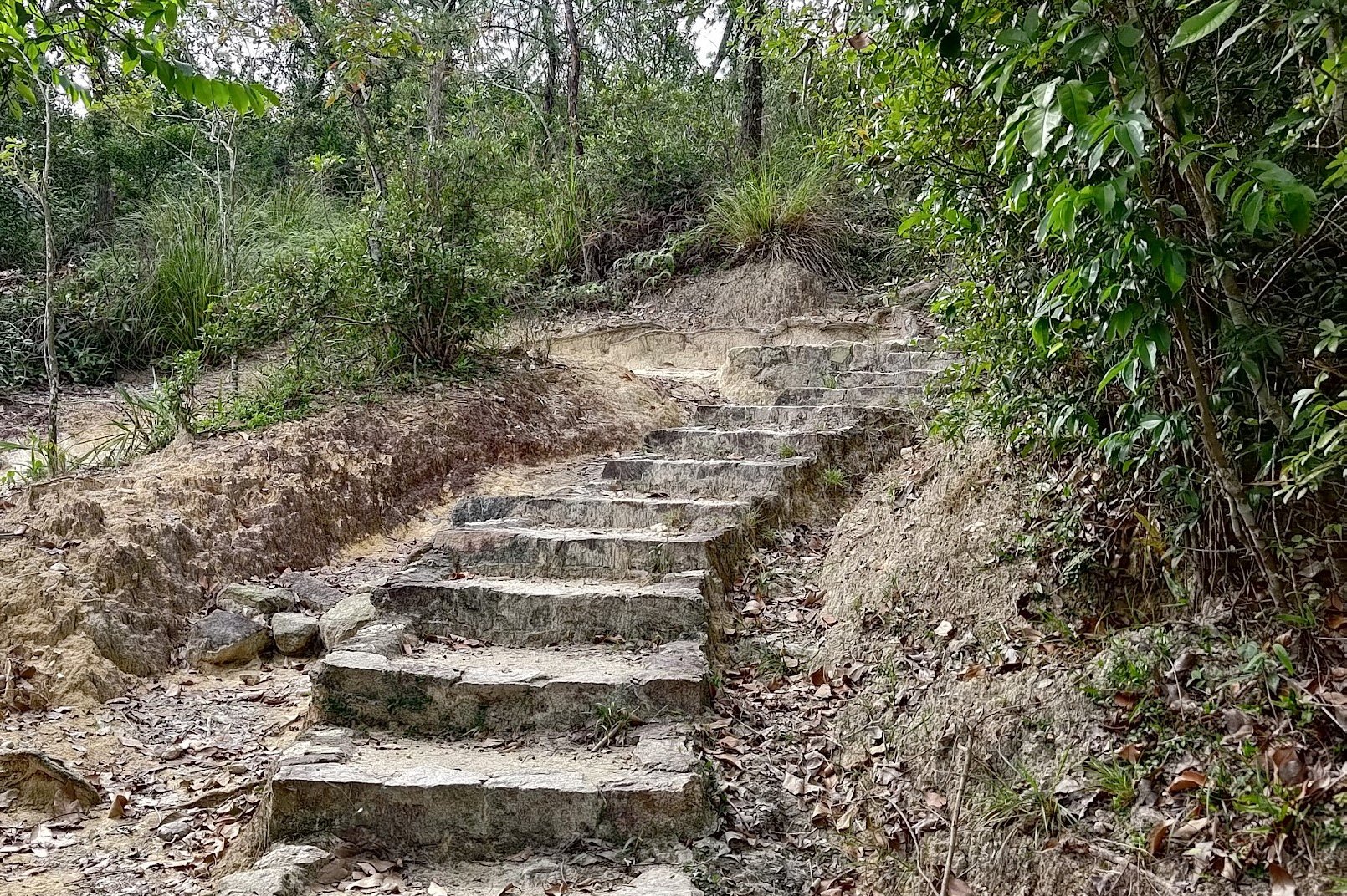
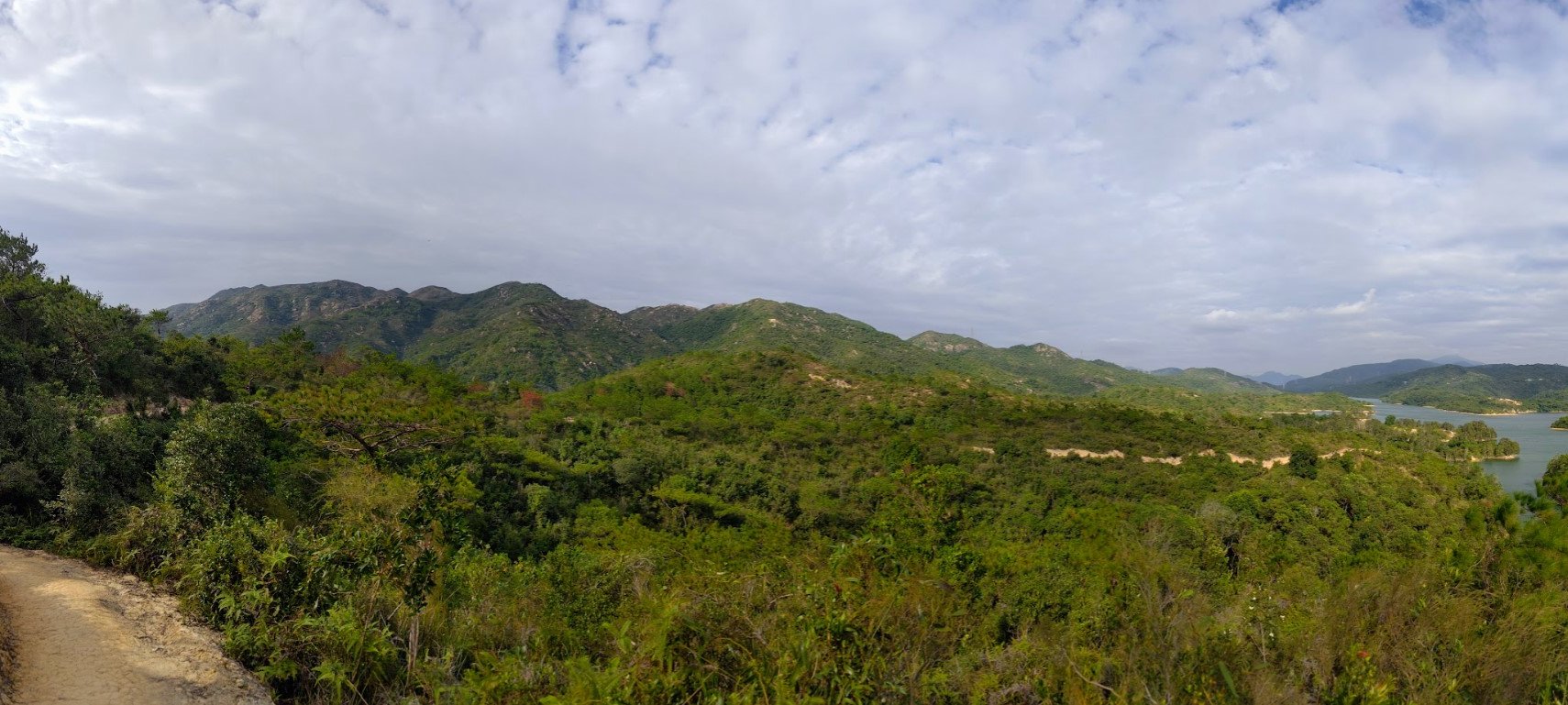
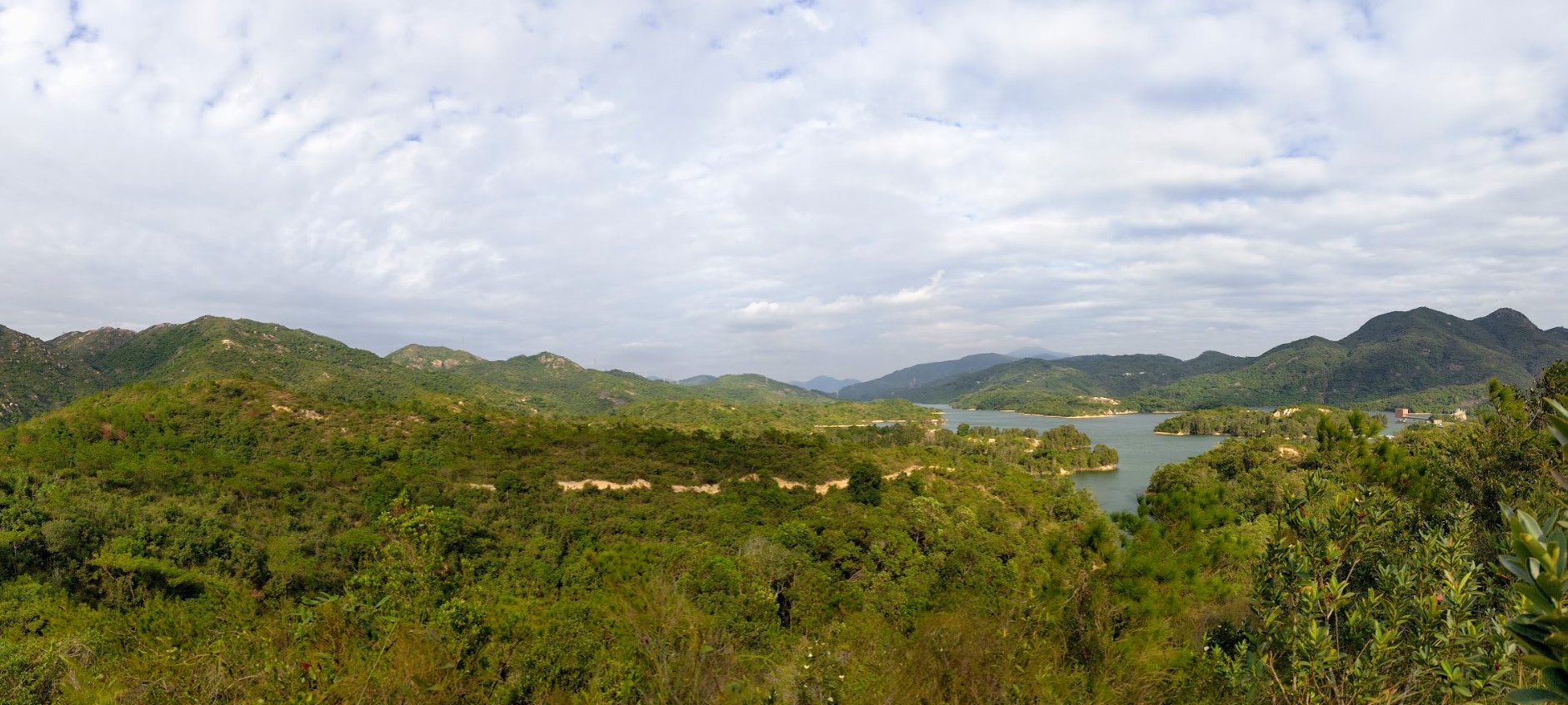
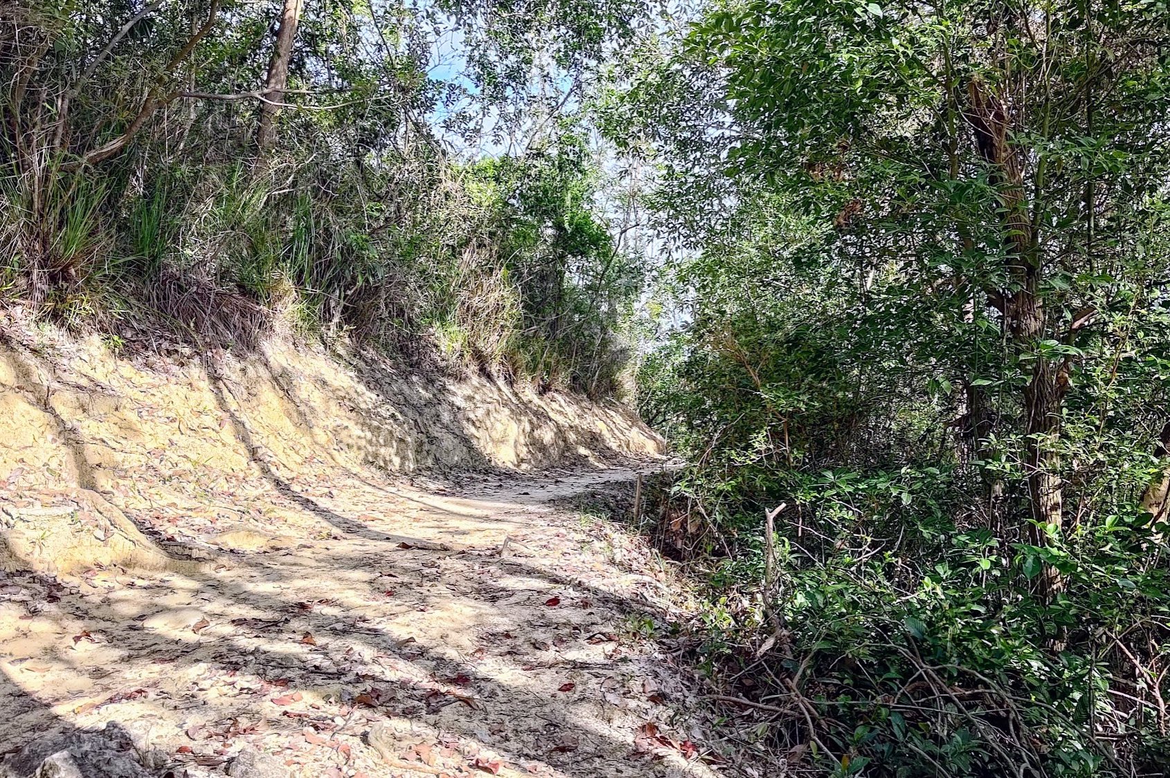
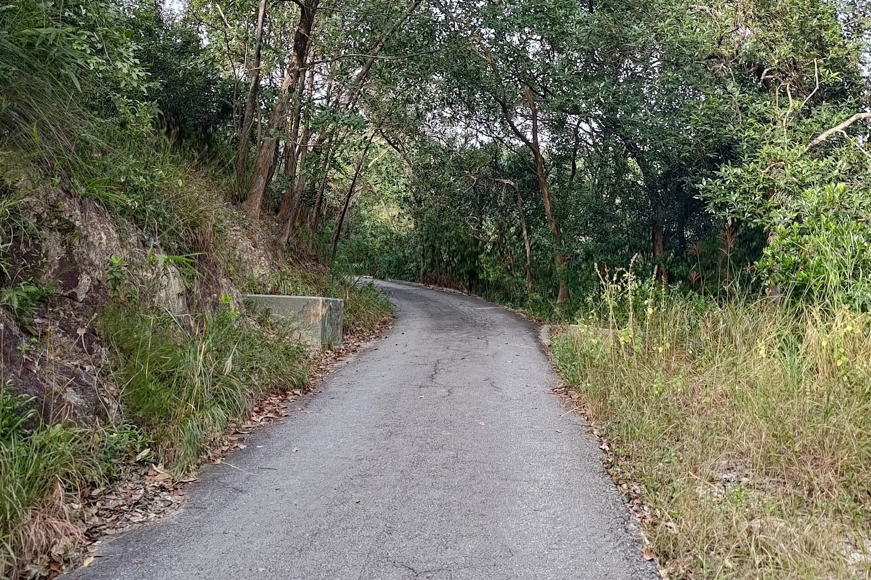
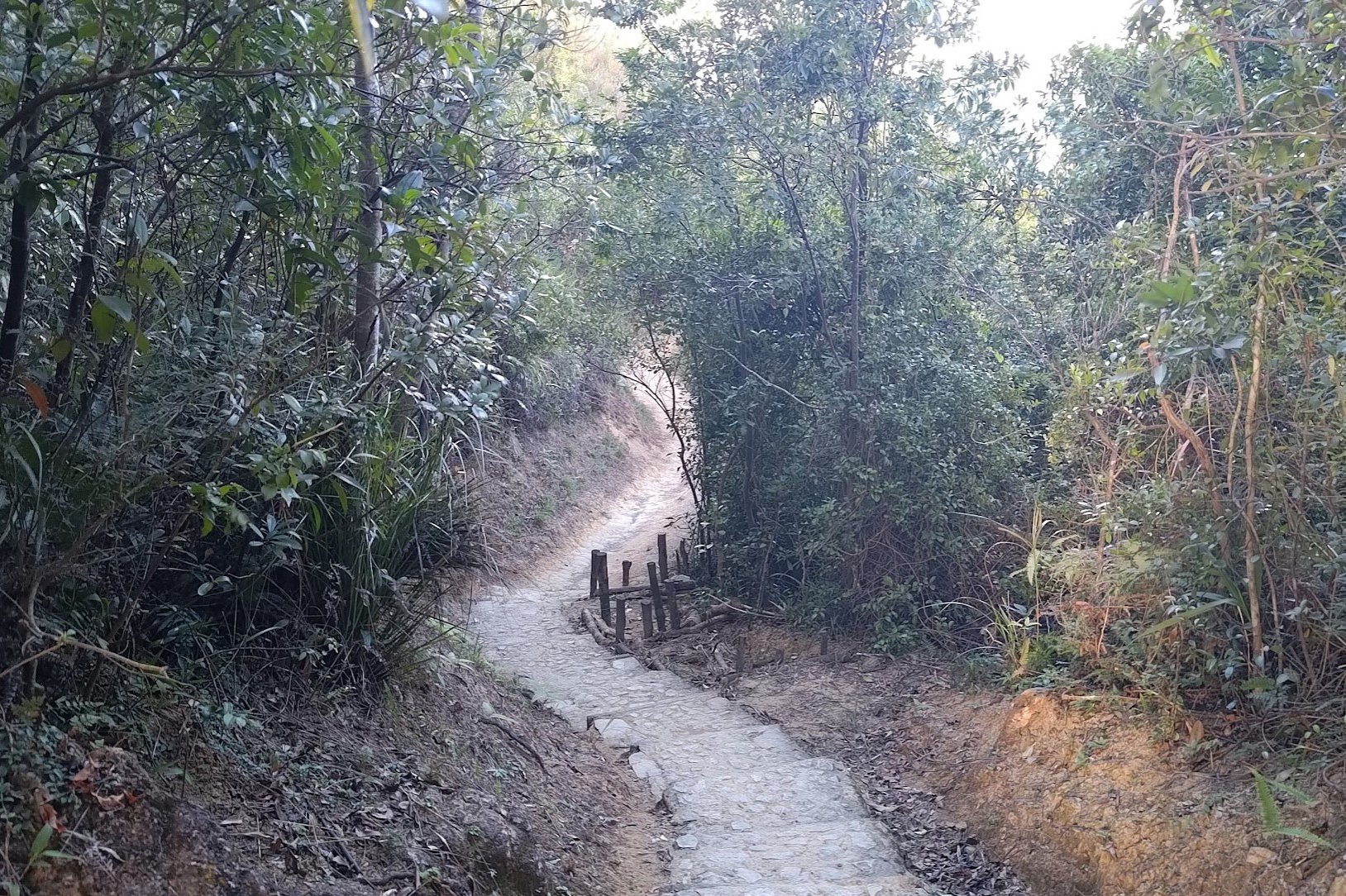
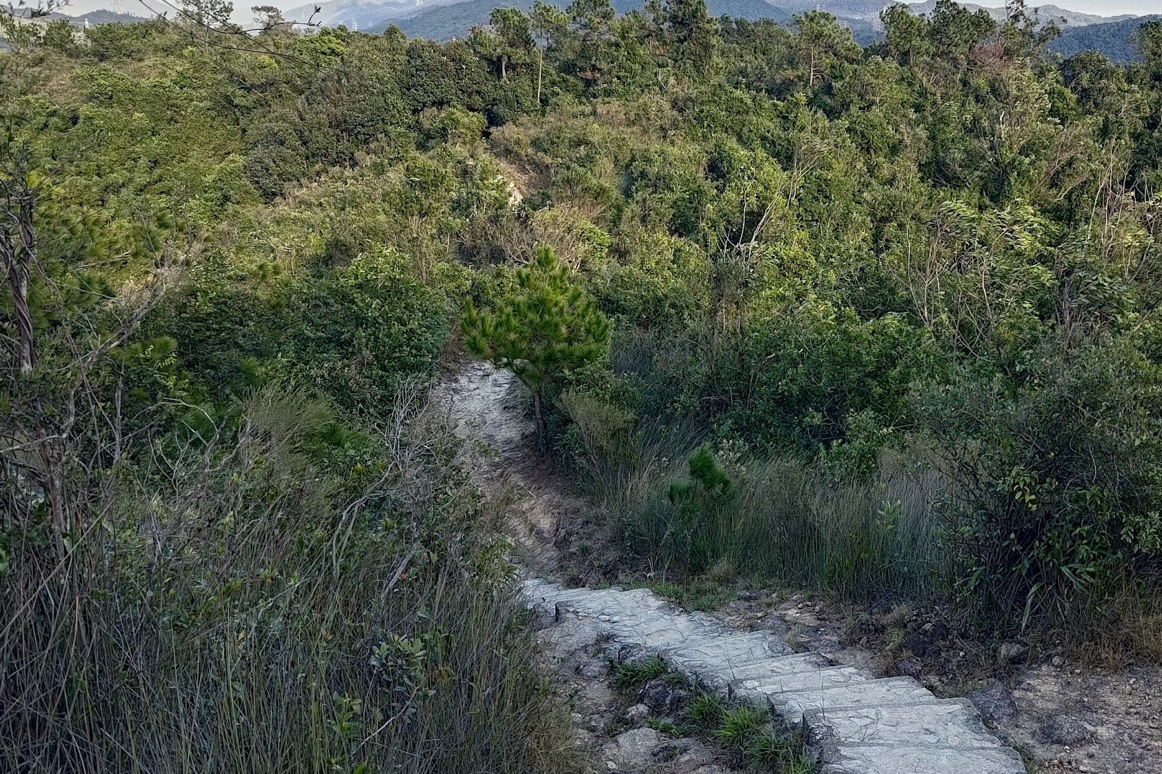
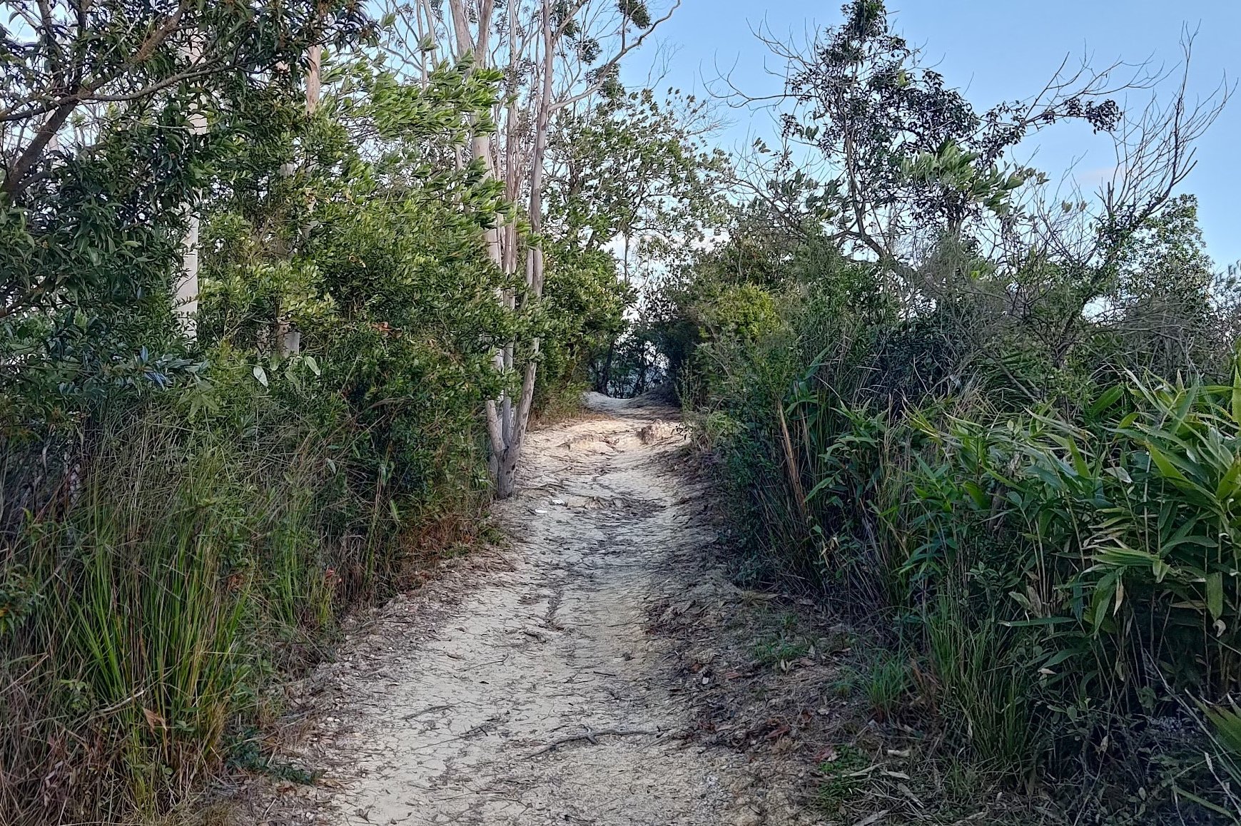
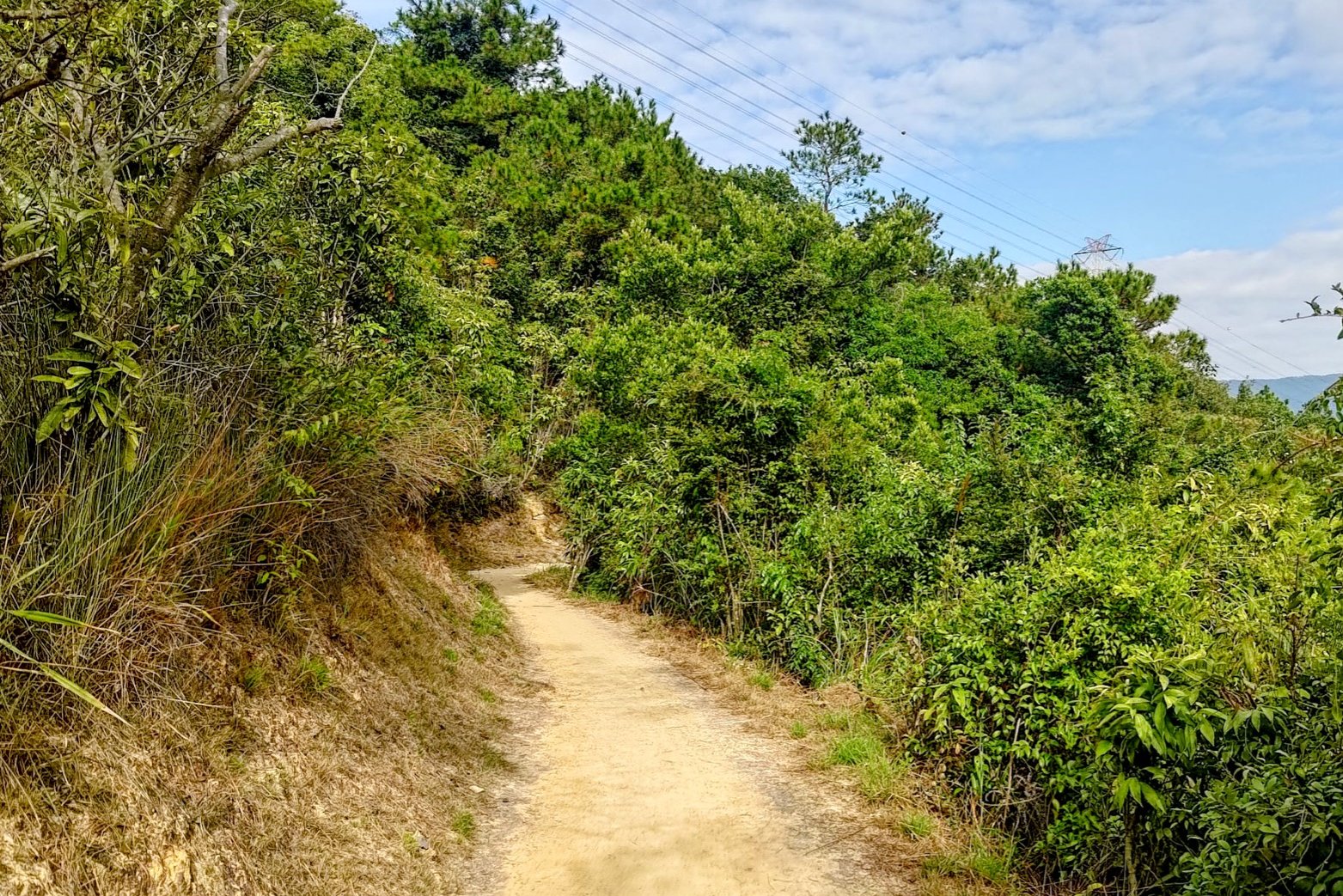
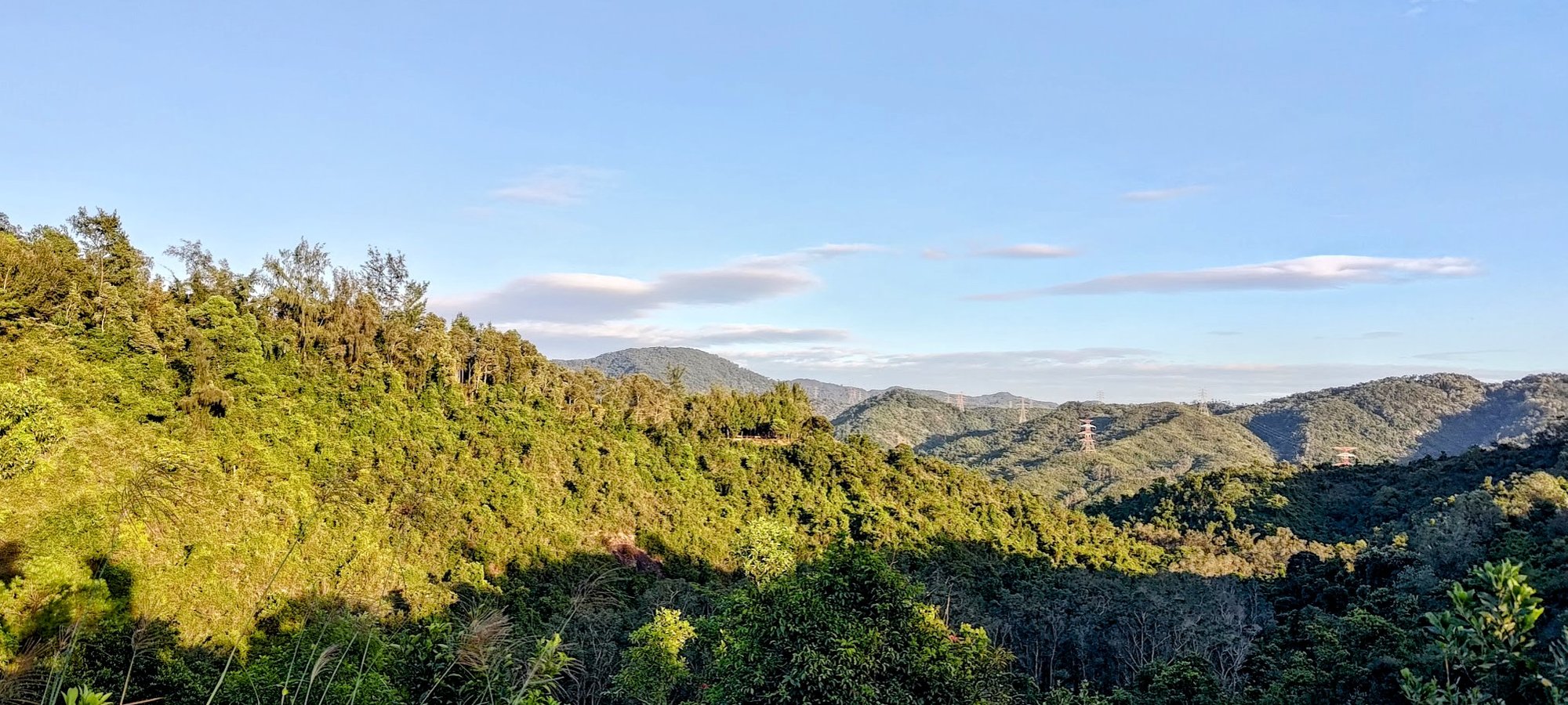
You'll begin a short climb upward that will reward you handsomely. At the top of the climb, you'll walk along one of my favorite natural trails in Hong Kong.
The path is open, surrounded by lush greenery, affords you wonderful views of the reservoir and has zero concrete.
The thing is, it only gets better from here!
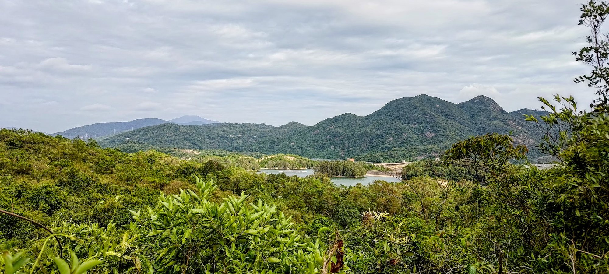
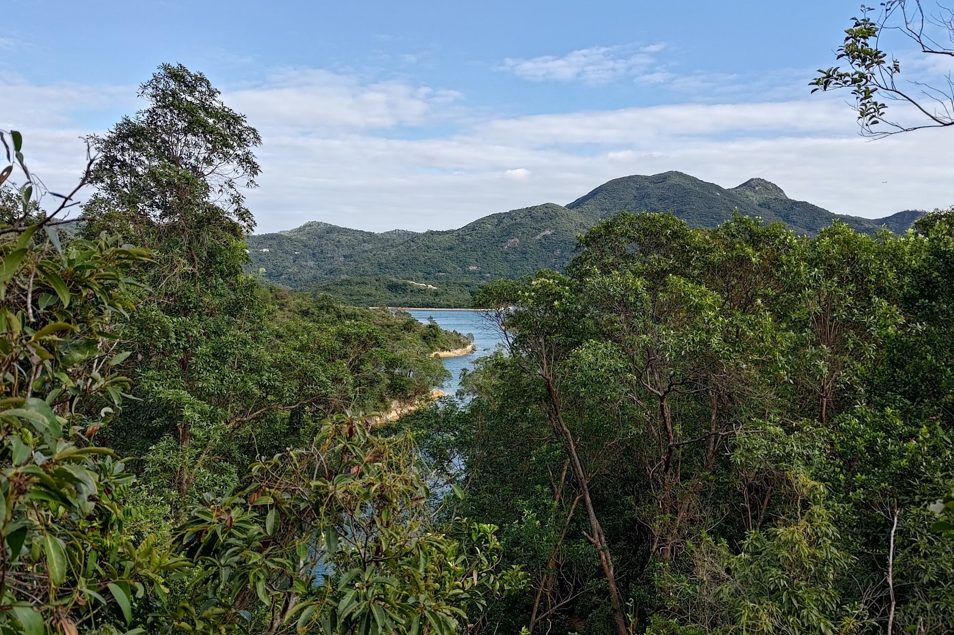
Secret Detour with INCREDIBLE Views
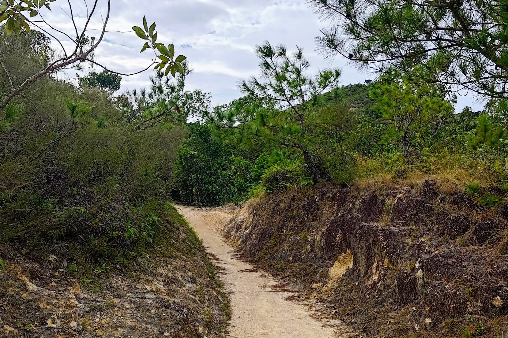
This section takes only 15 minutes, but what a glorious 15 minutes it is!
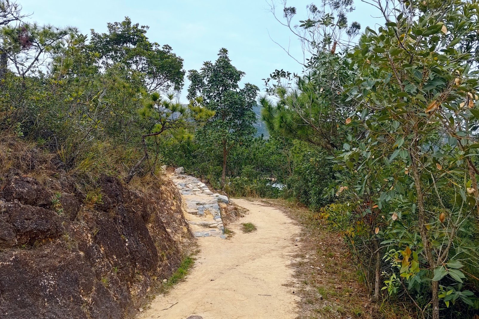
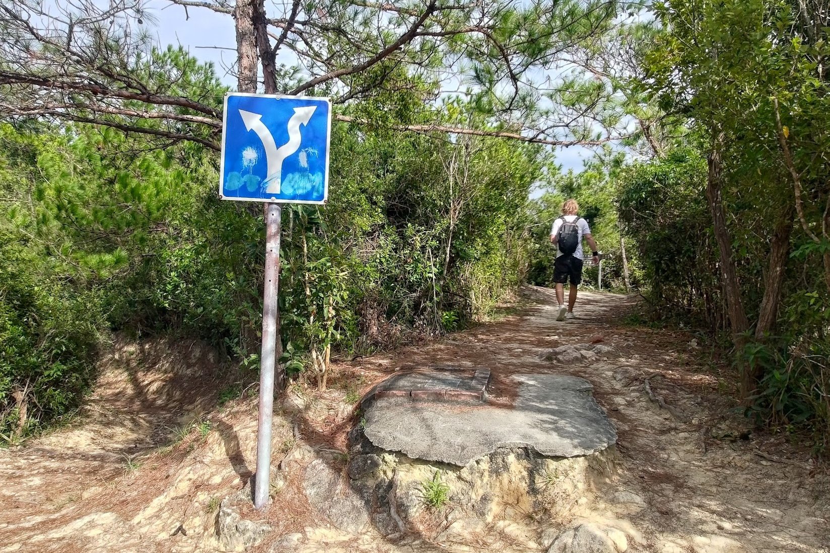
The key here is to turn right at the blue sign. This secret trail is not marked on Google Maps (as of Nov, 2023), so don't be alarmed if you don't see it on your phone. It's super well-maintained and gorgeous.
After the blue sign, follow the brown sign immediately after that points to Wong Nai Tun Reservoir and let the epicness begin.
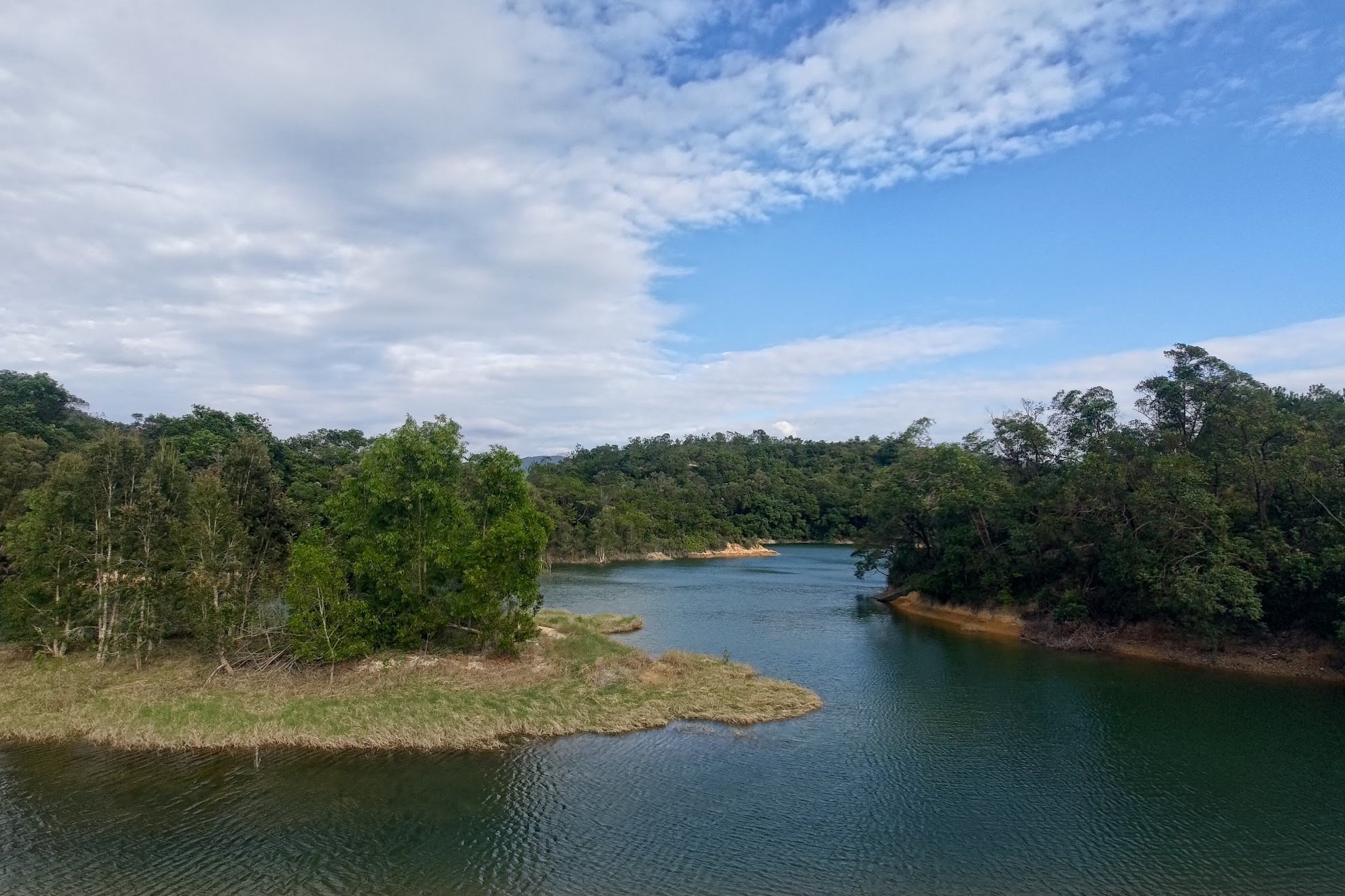
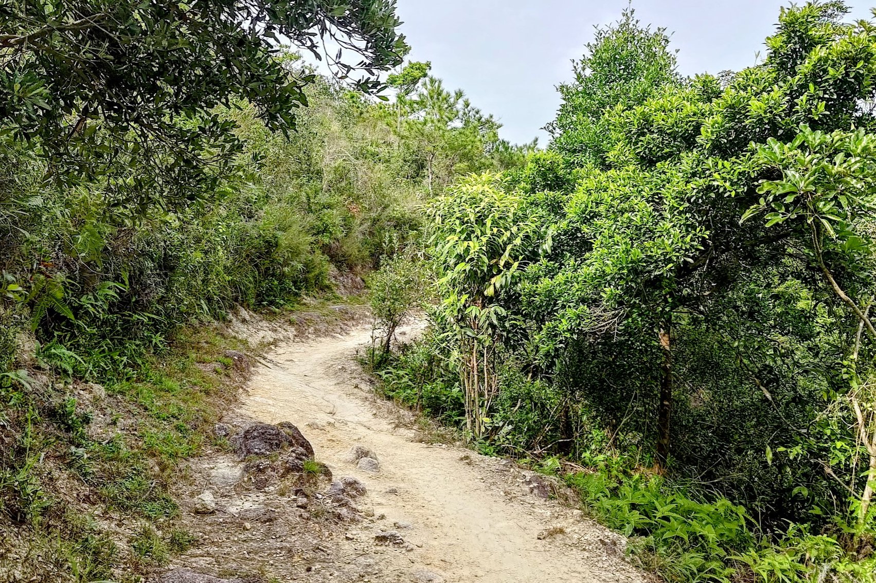
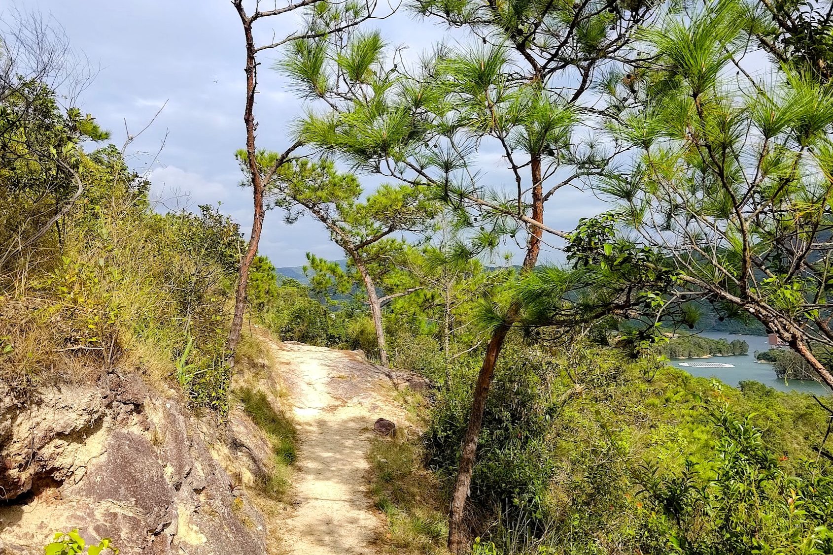
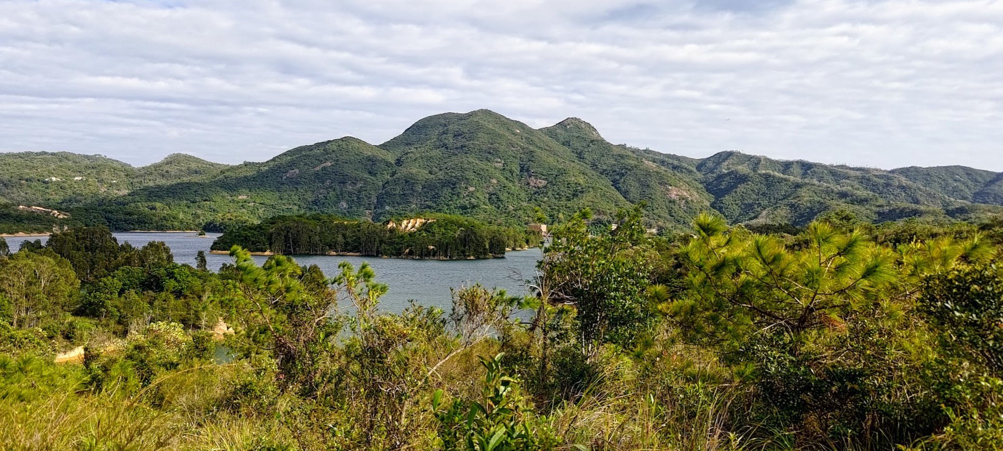
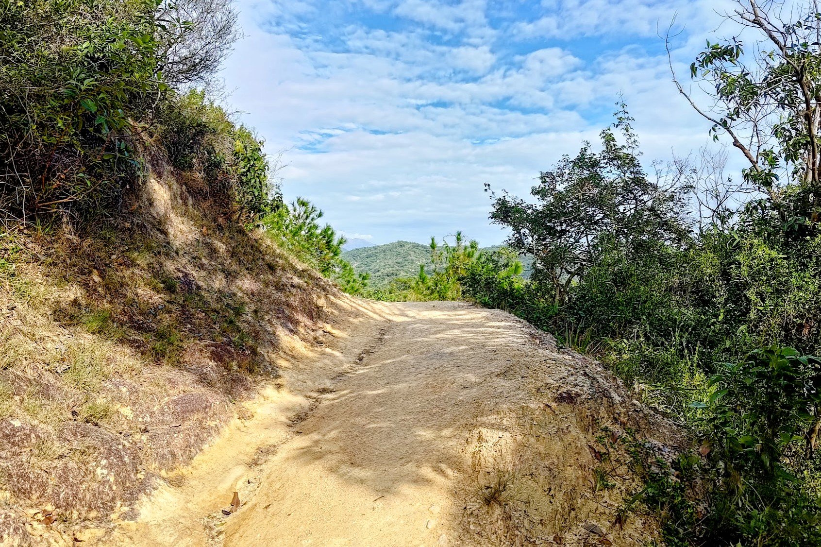
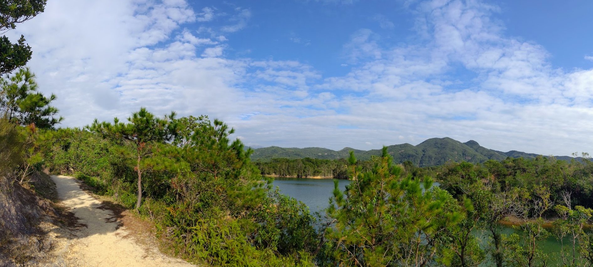
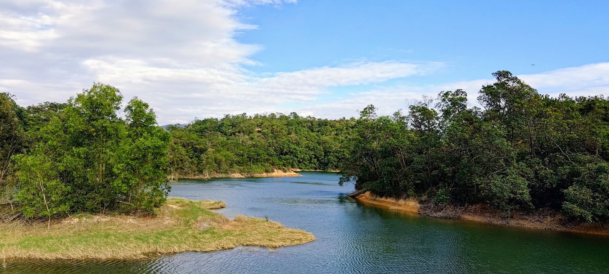
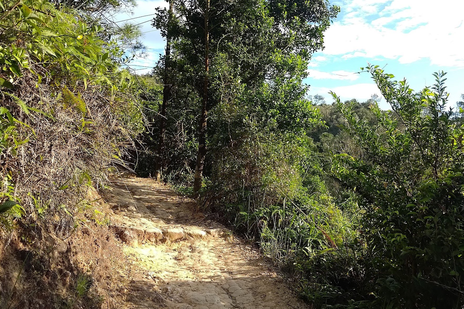
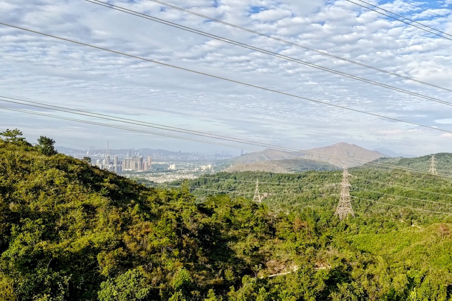
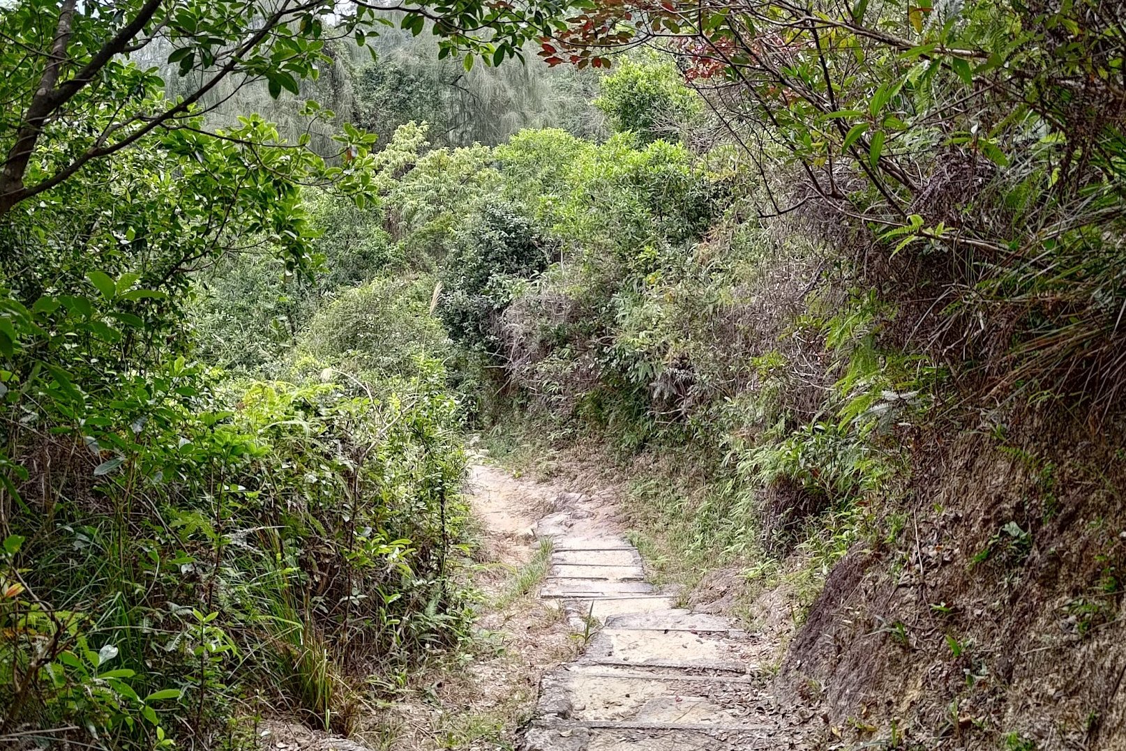
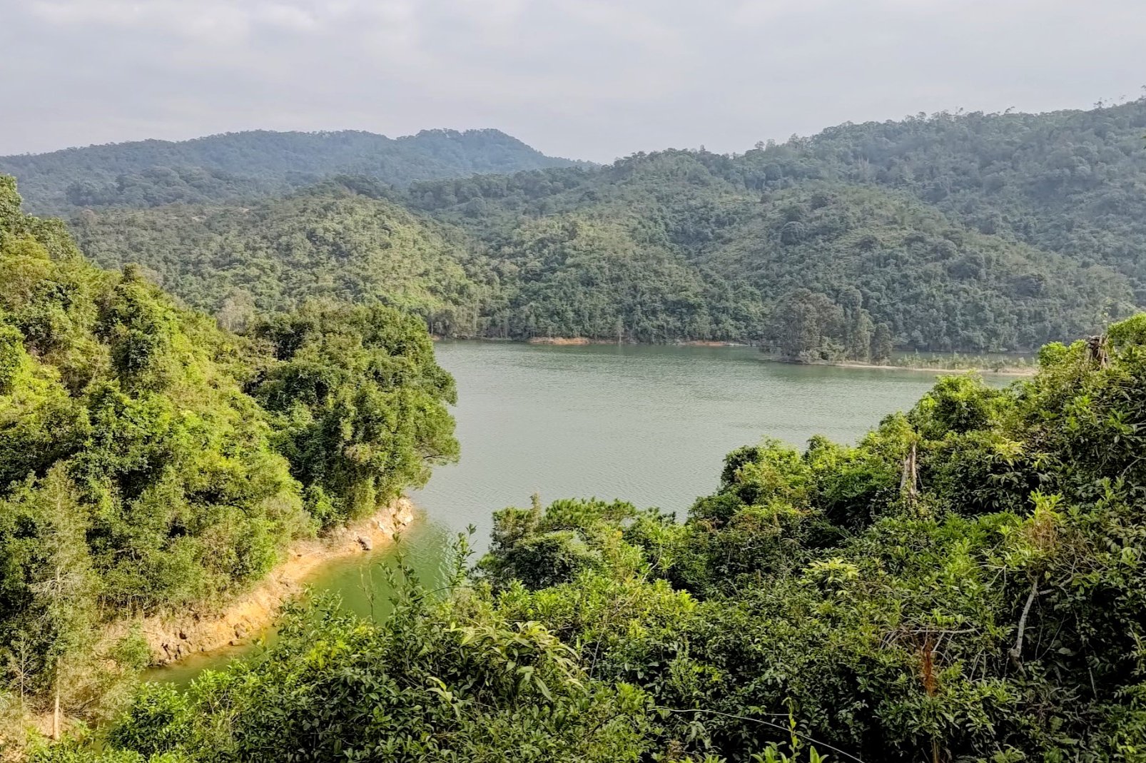
You'll be following a natural, open trail that climbs slightly to present you with some of the best reservoir views of the hike. The trail will then descend and bring you close to the water's edge so you can appreciate the reservoir from even closer.
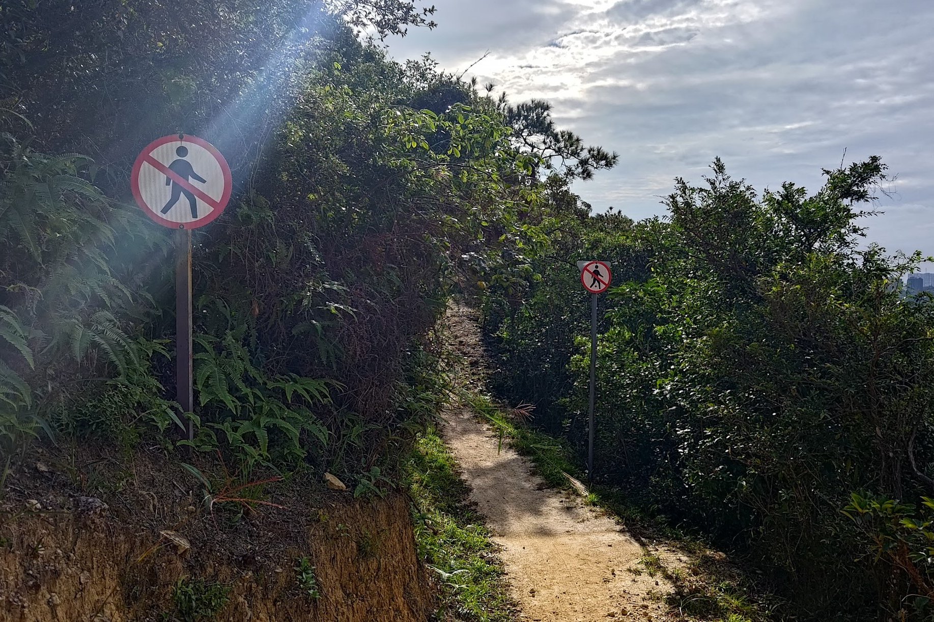
After the views end and you enter the forested area again, keep an eye out for the red signs warning you not to proceed. Heed those signs and follow the trail downward and back.
You will then come across another brown sign pointing to Wong Nai Tun Reservoir, which you should follow.
Walking to Stage 10 MacLehose Trail (Shorter Route Start Point)
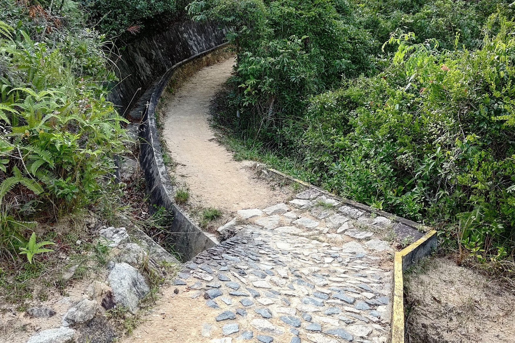
This portion of the hike takes about 20 minutes.
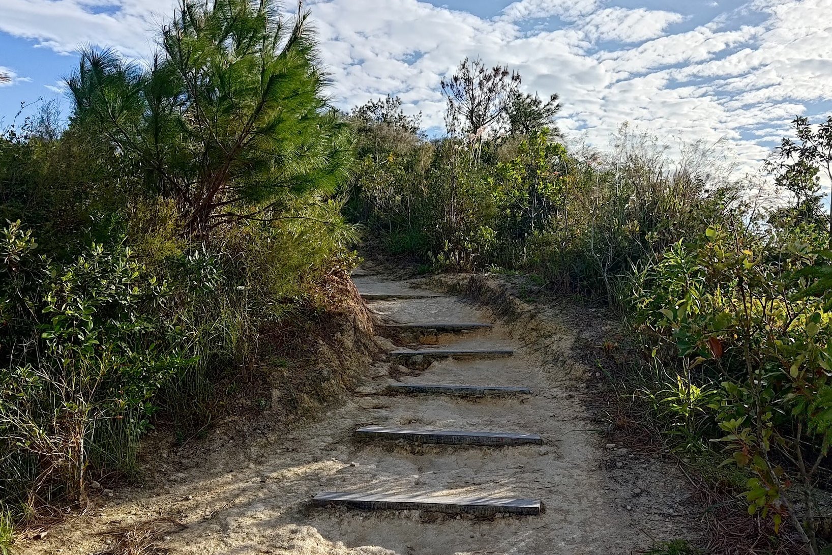
After following the brown Wong Nai Tung Reservoir sign, keep following the natural trail. There are no deviations or areas where you can get lost here, so just enjoy the views and the wonderful nature around you.
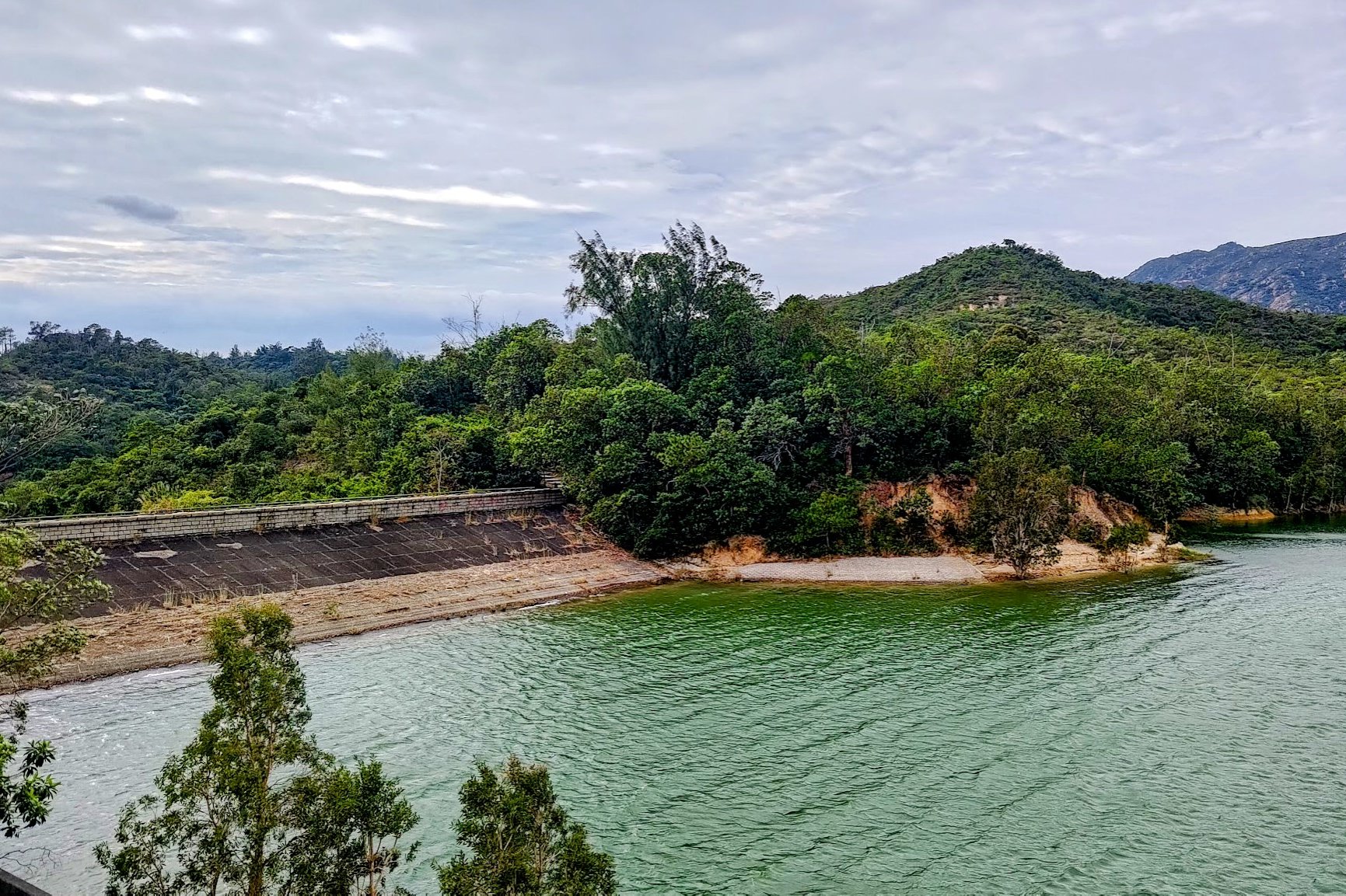
After climbing slightly, you'll eventually descend and arrive at a dam.
Cross the dam and you'll be on stage 10 of the MacLehose Trail, where the short route begins.
Stage 10 MacLehose Trail Up to the Reservoir Islands Viewpoint
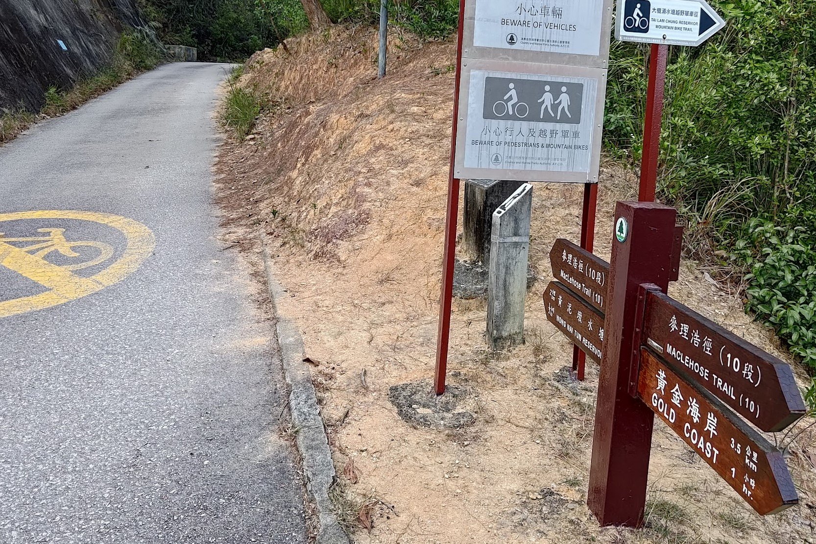
As soon as you arrive at the concrete road, you're not only at MacLehose Stage 10, but you're also at the start point of the shorter route mentioned at the start of the guide.
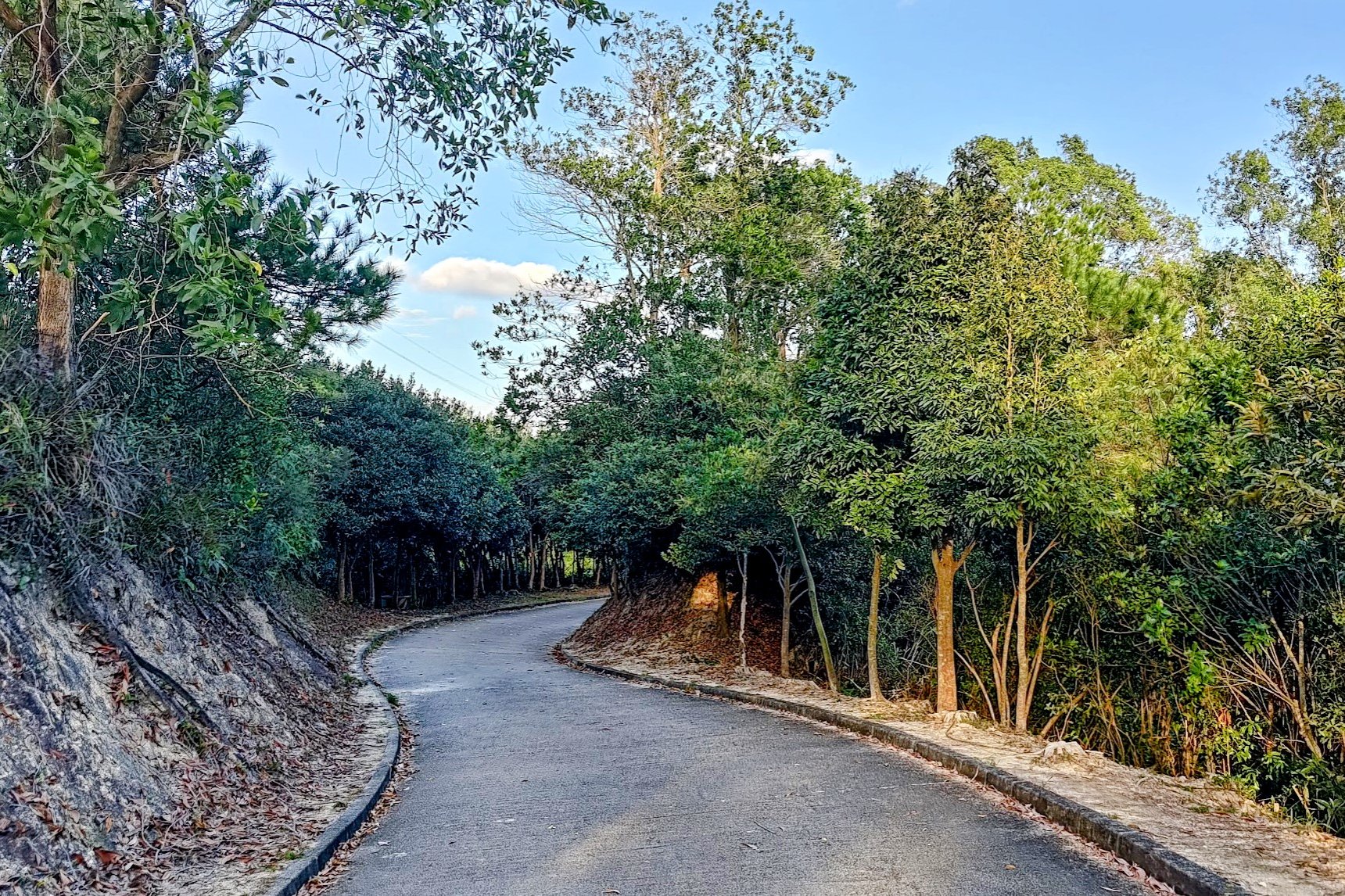
Follow the brown sign in the direction of MacLehose Stage 10 and begin climbing up the concrete road. The climb to the top of the road takes about 20 minutes, but you'll get really amazing views of the reservoir on your way up that breaks up the monotony.
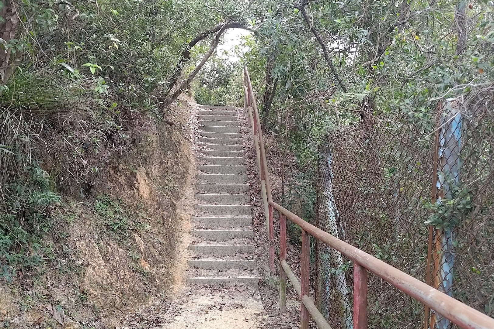
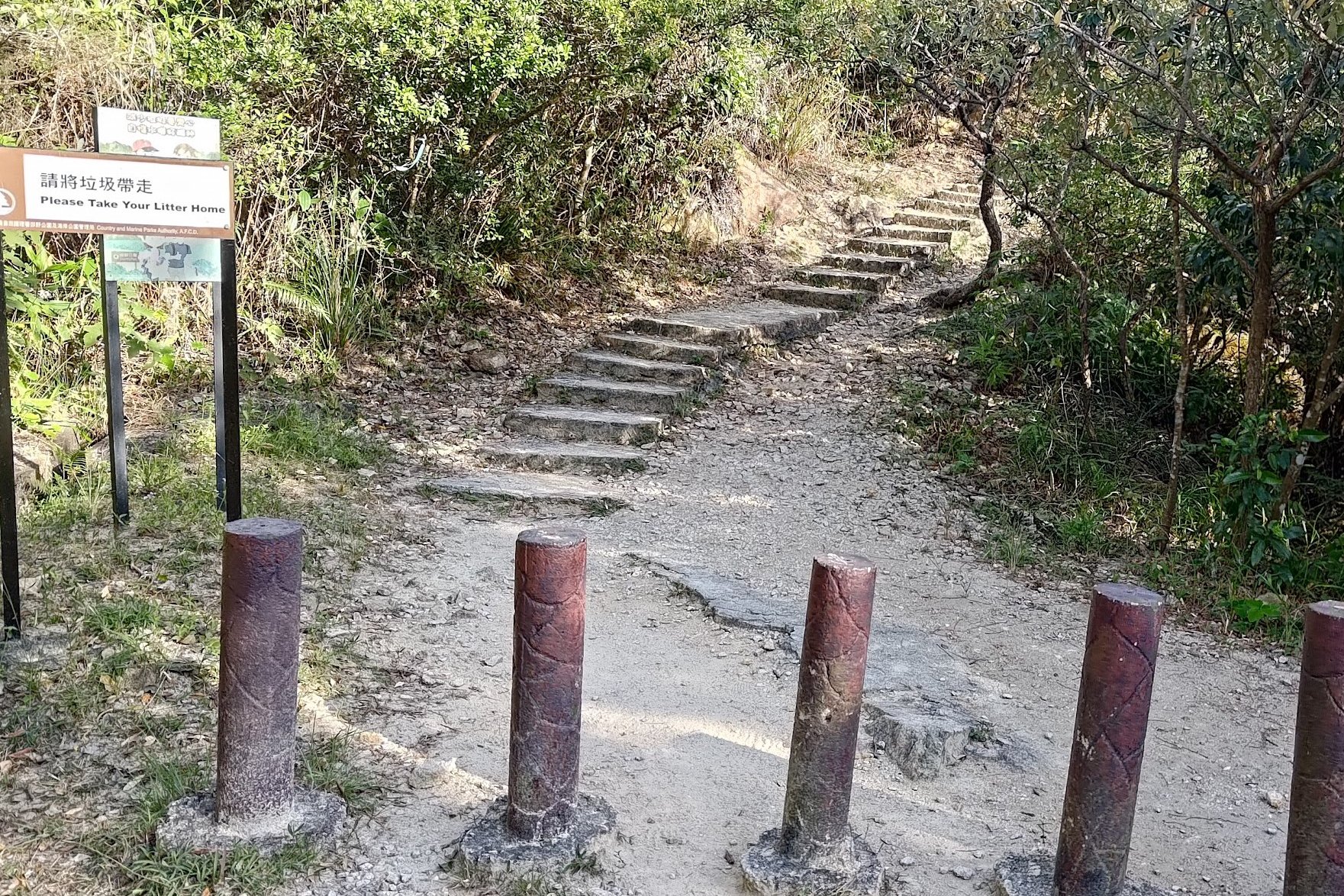
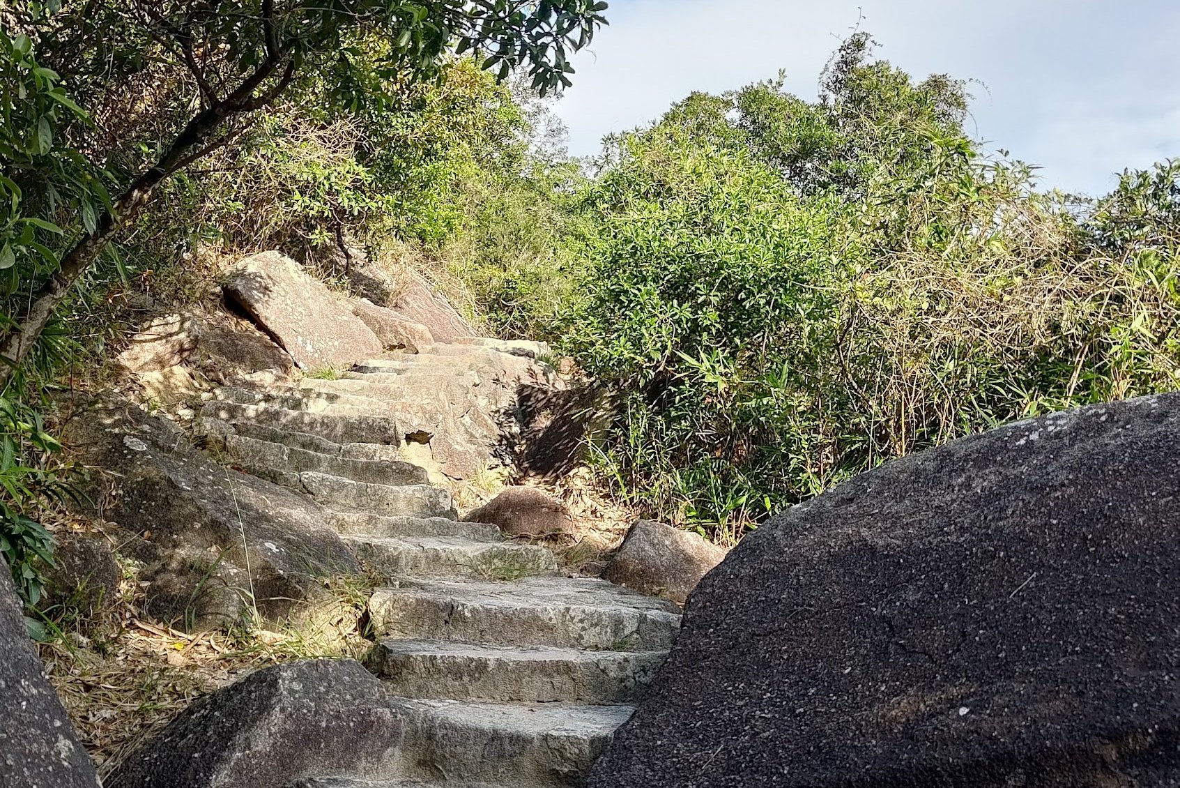
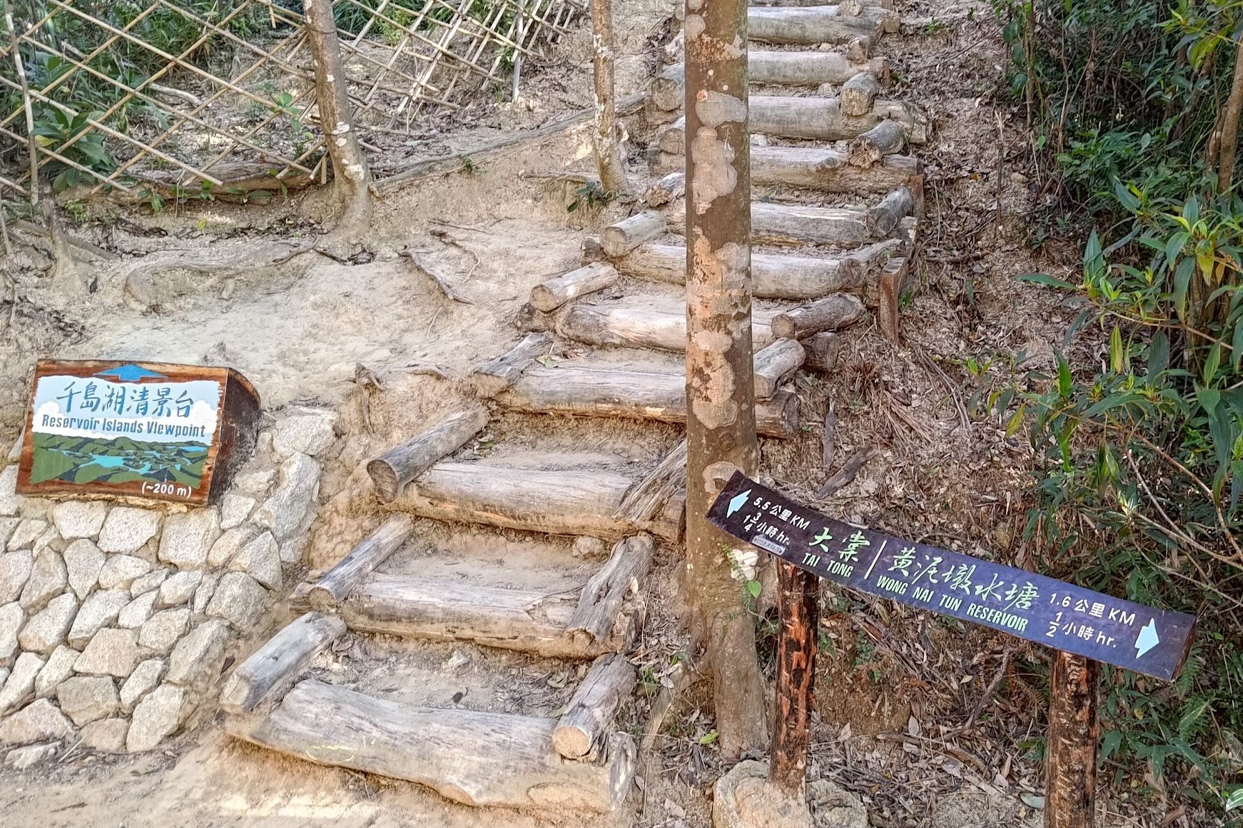
At the top of the road, look for the brown sign pointing to the 'Reservoir Islands Viewpoint'. It'll lead you to some stairs behind a set of barricades designed to keep mountain bikers out.
Climb the stairs and get ready for another incredible view of the reservoir.
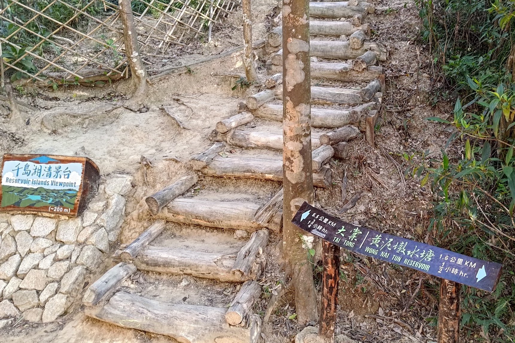
From there, just follow the trail until you see the Reservoir Islands Viewpoint sign and stairs on your right.
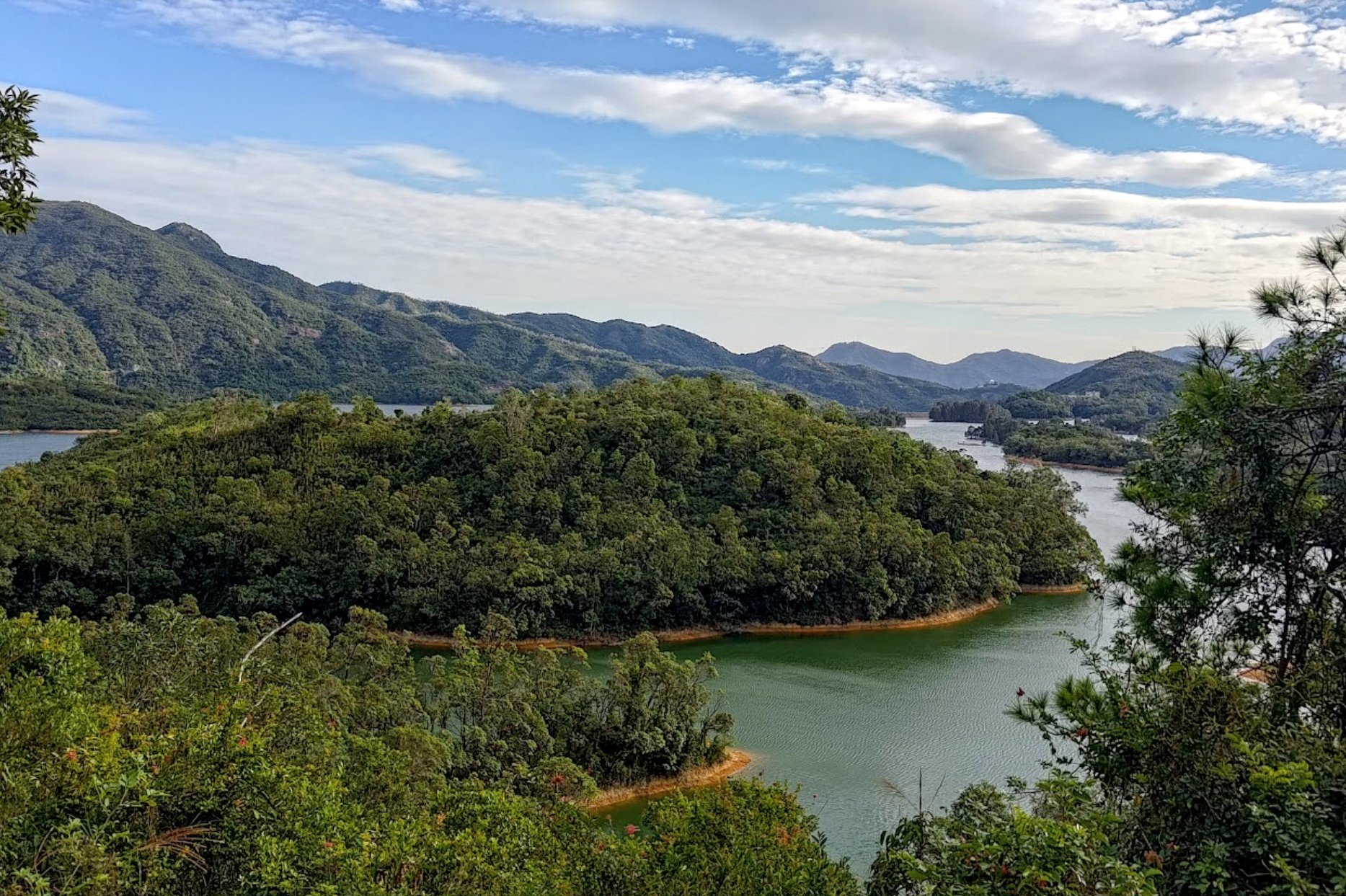
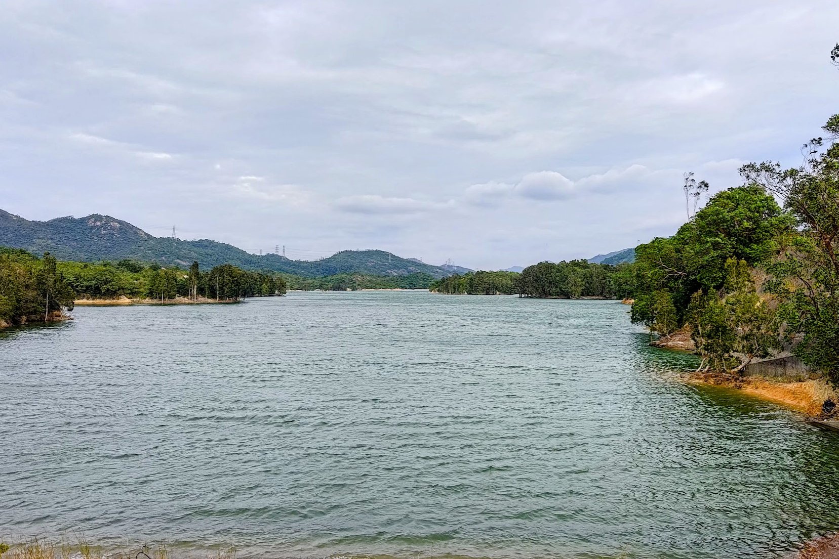
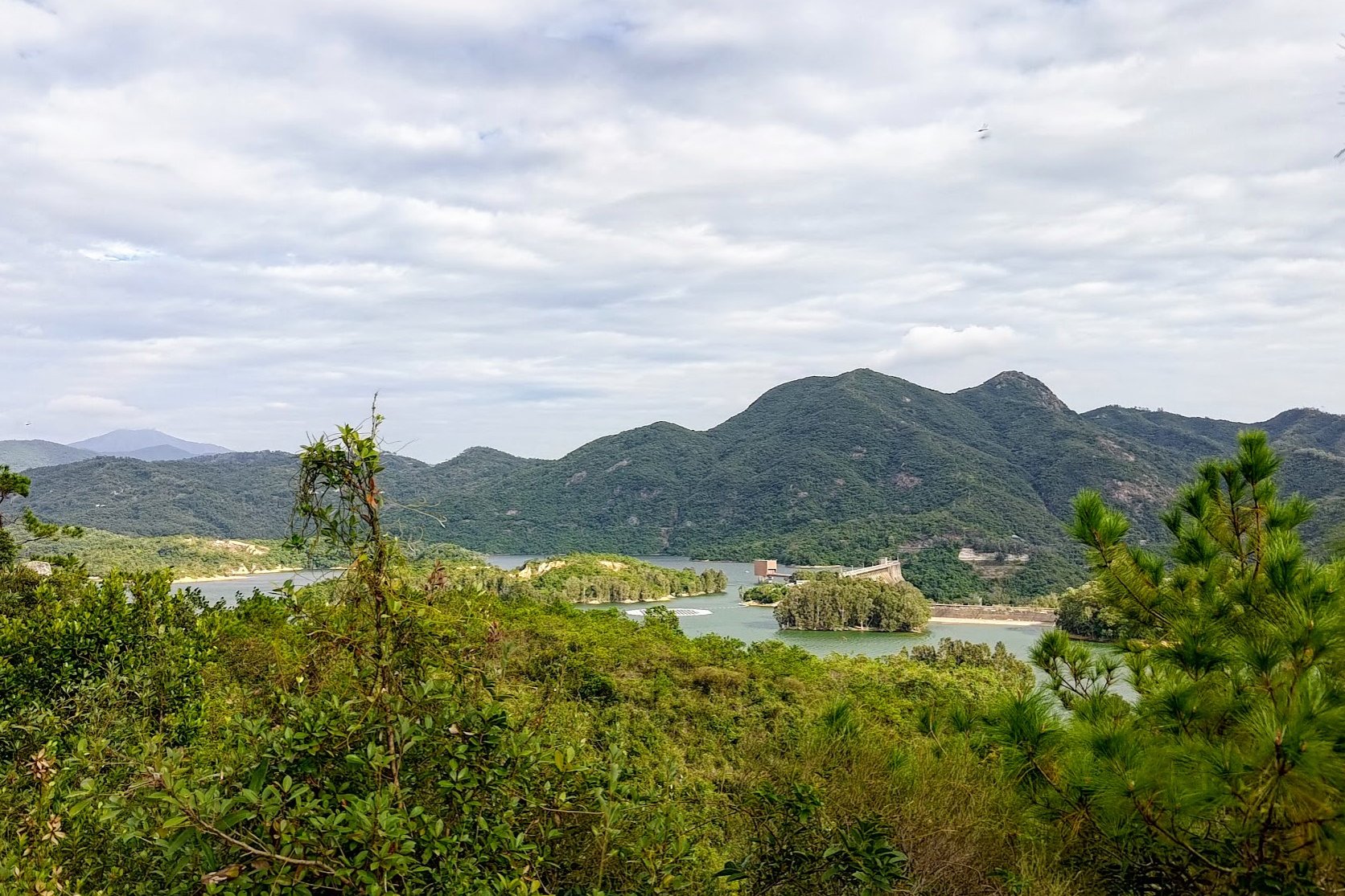
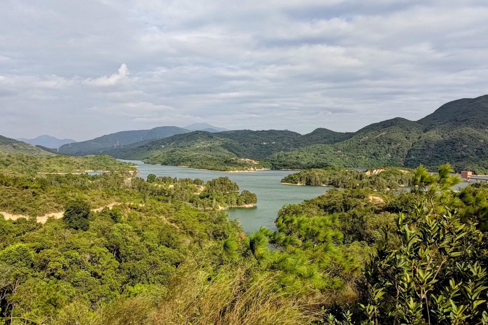
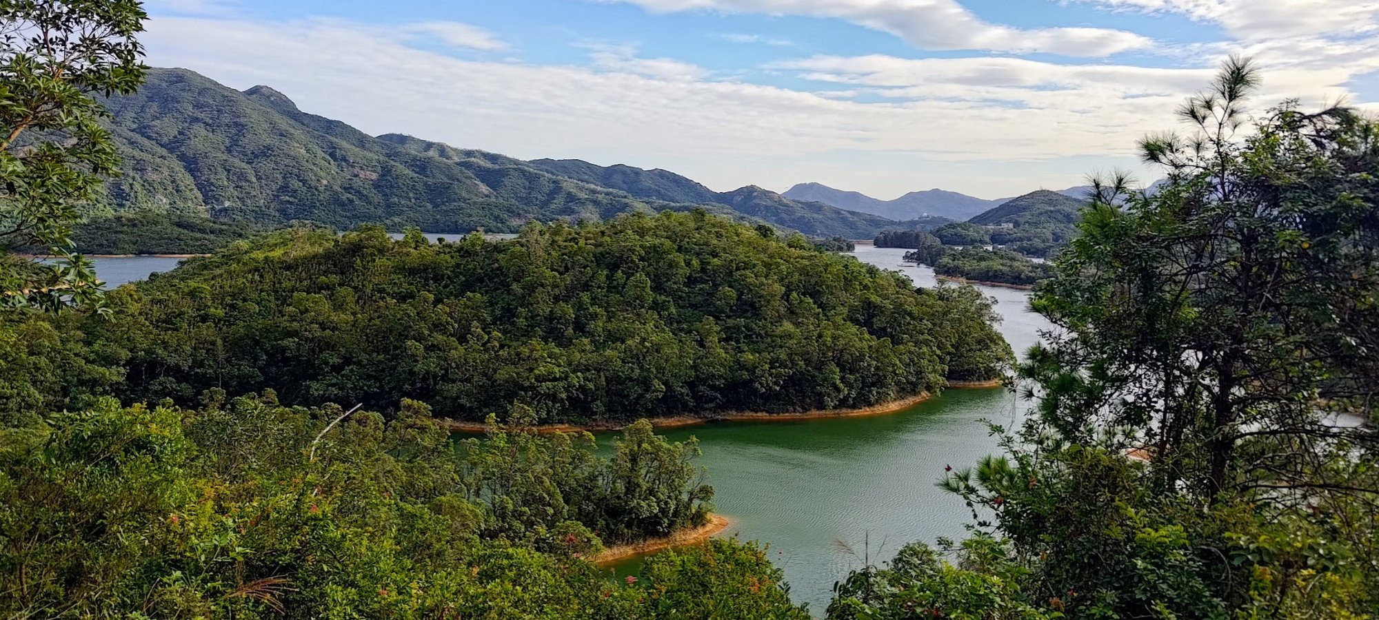
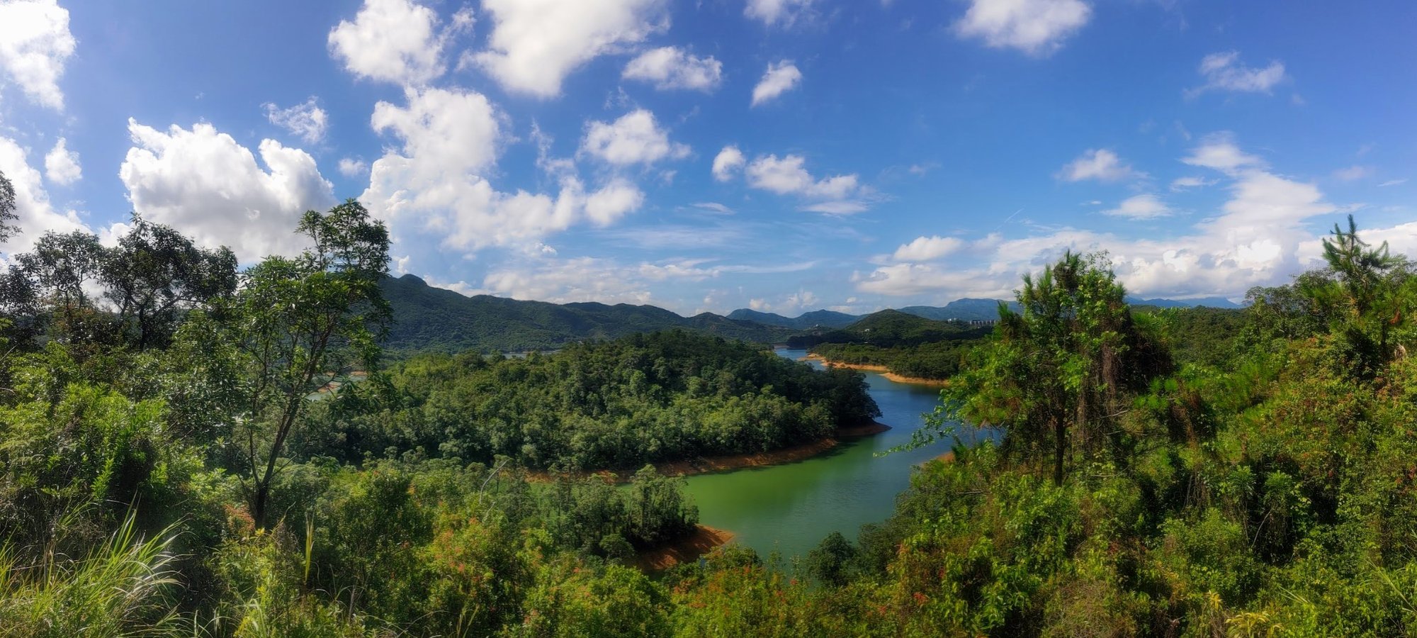
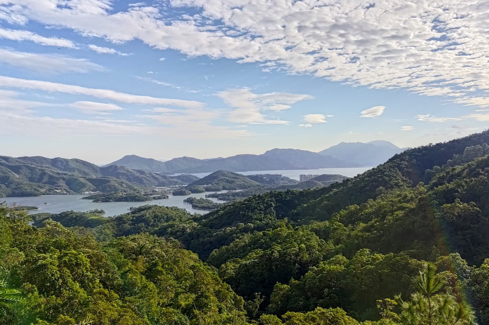
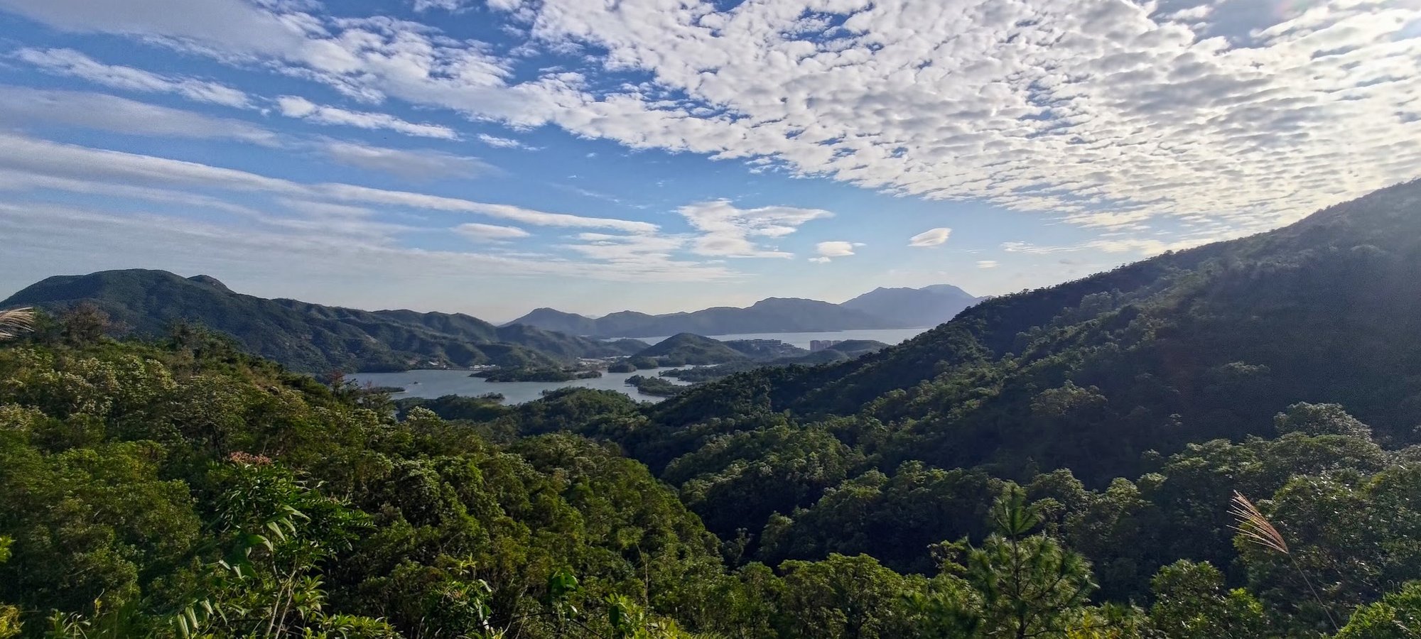
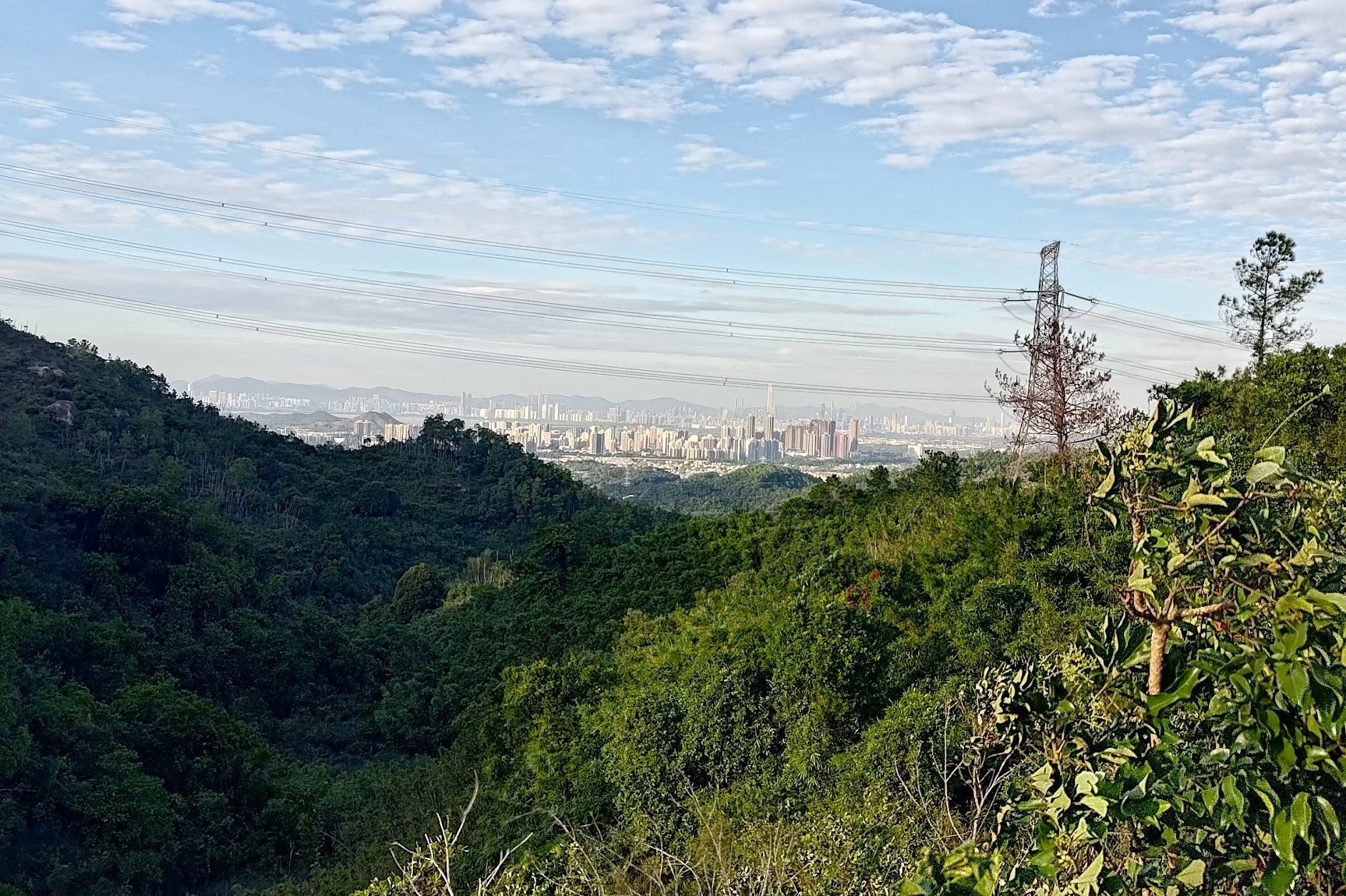
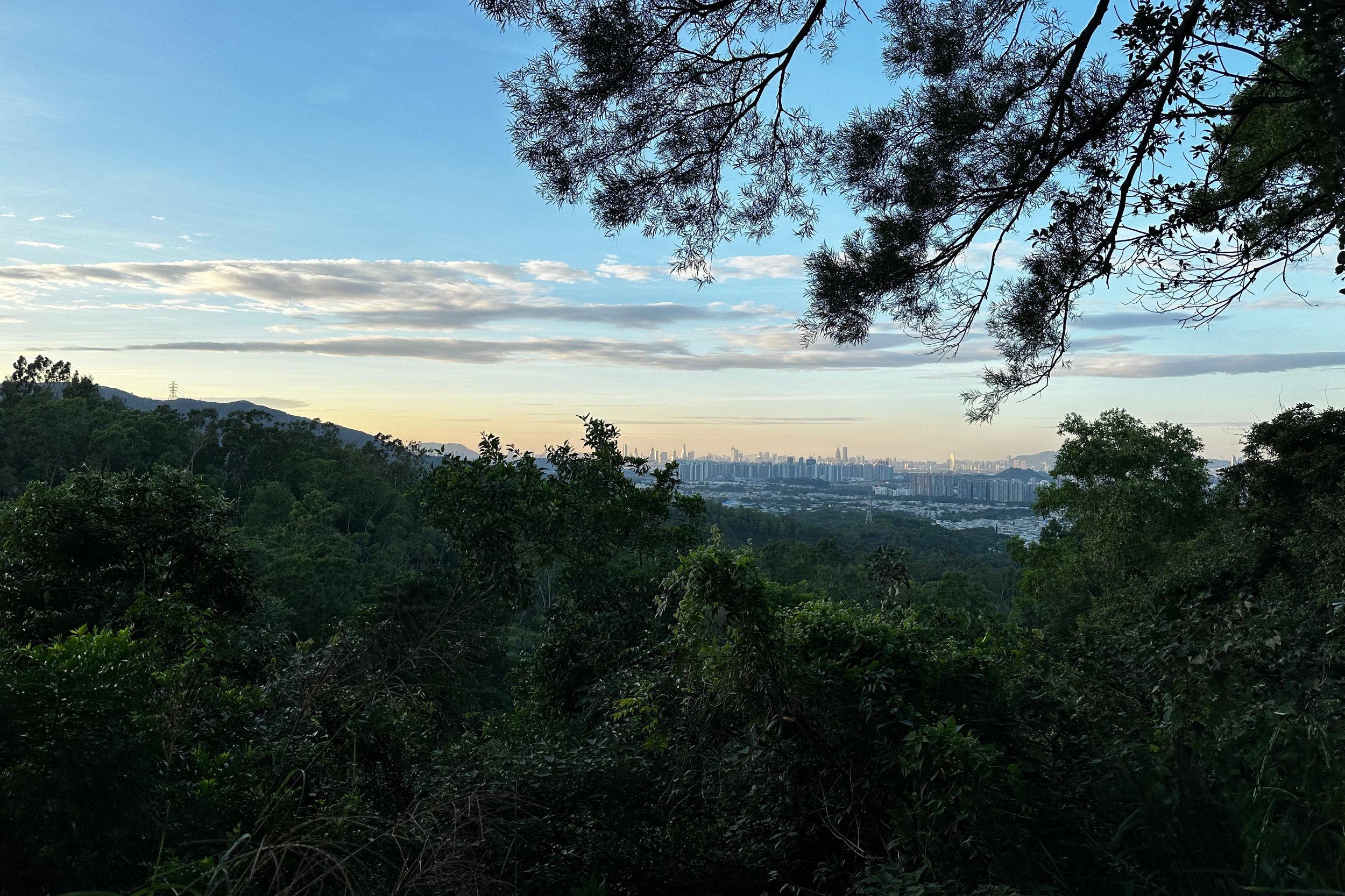
Thousand Island Viewpoint
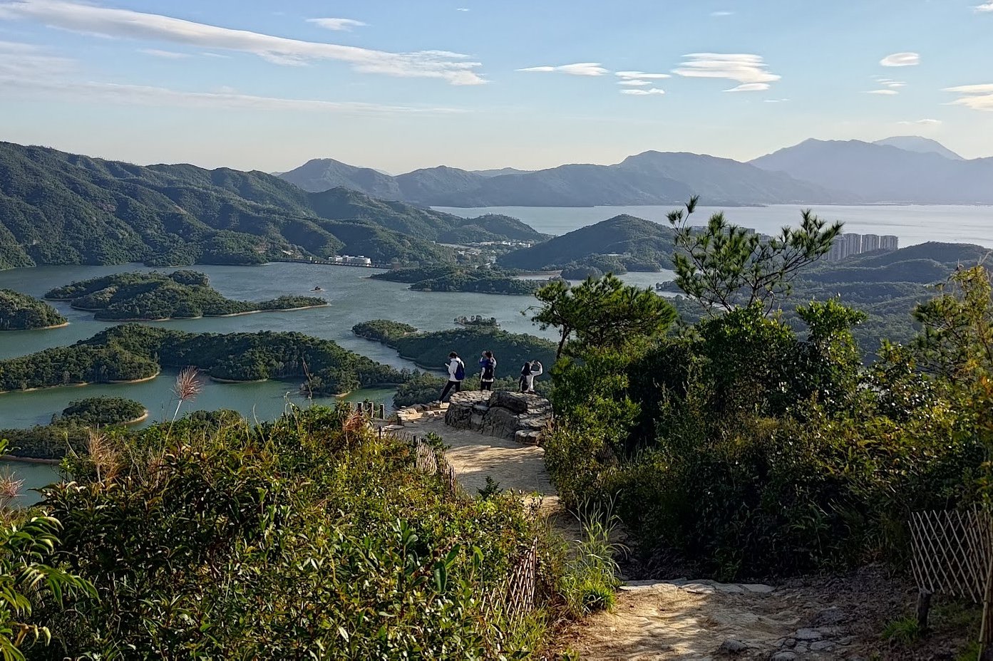
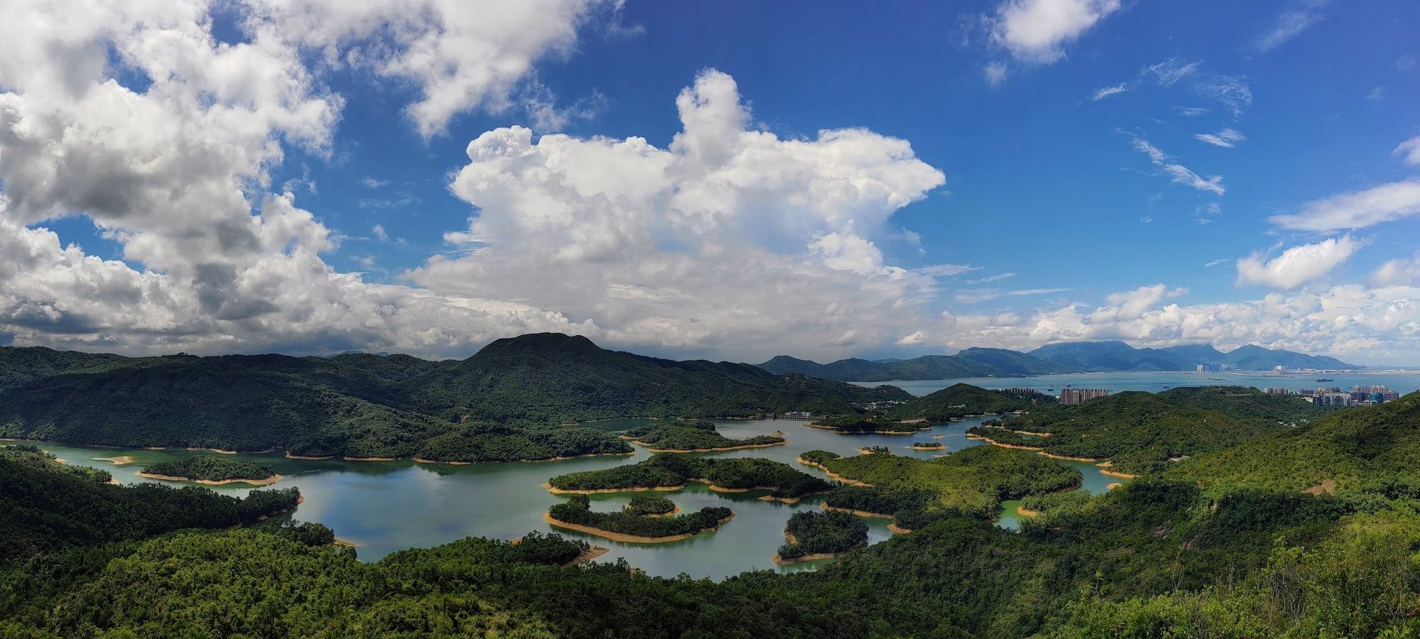
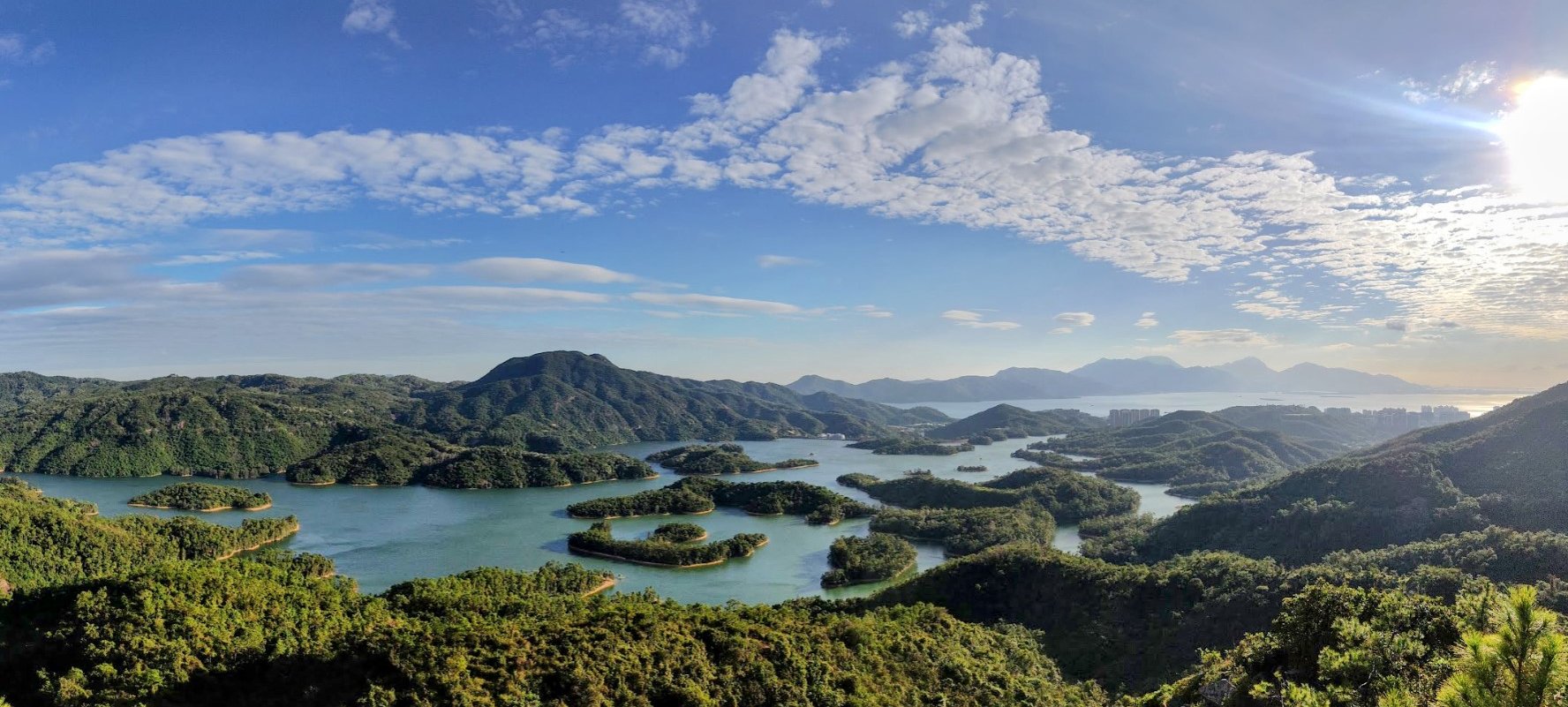
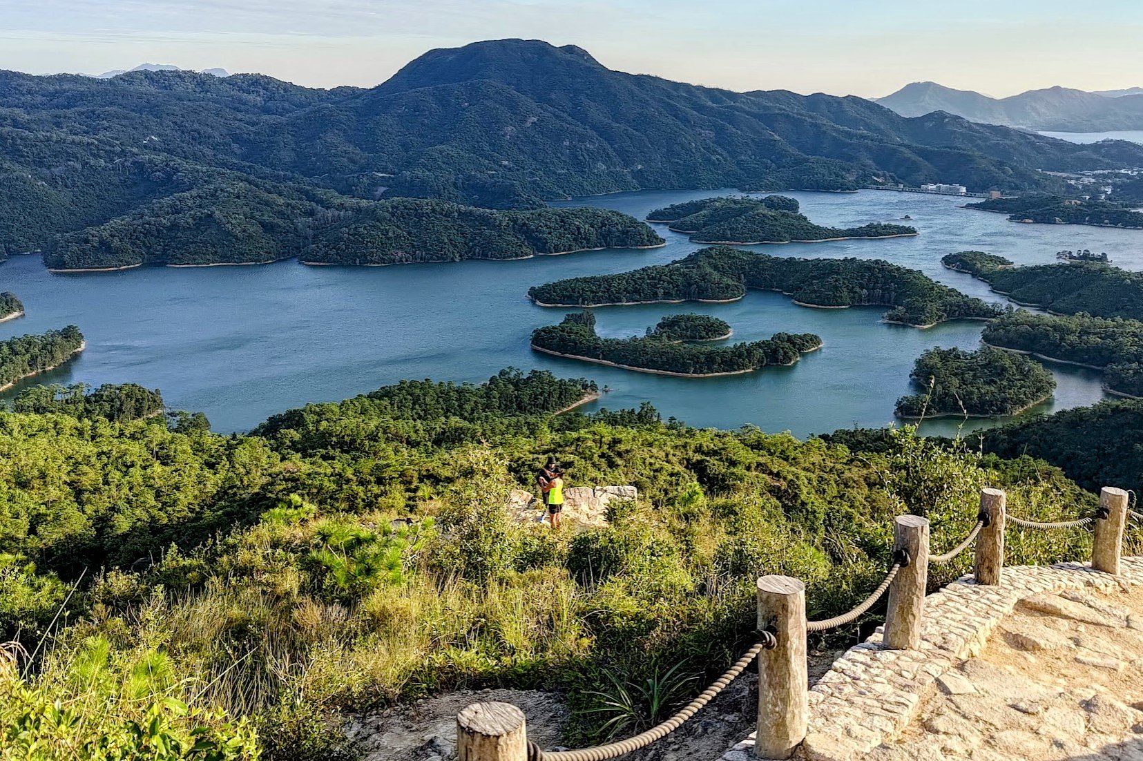

Climb the wooden stairs marked by the 'Reservoir Islands Viewpoint' sign that lead to amazing mountain vistas with a clear view into Shenzhen, China on the left.
Follow the trail forward and you'll soon arrive at the main viewpoint. It's a genuinely awesome view as the oddly shaped islands below punctuate the glassy waters of the reservoir.
There's an additional viewpoint a little lower, but it's a little tricky to get to. If you're not sure-footed, avoid the lower viewpoint.
When you're done, retrace your steps and head back down the stairs.
Descend to the Little Horse Temple
Getting to the temple takes perhaps 15 - 20 minutes from the bottom of the viewpoint stairs.
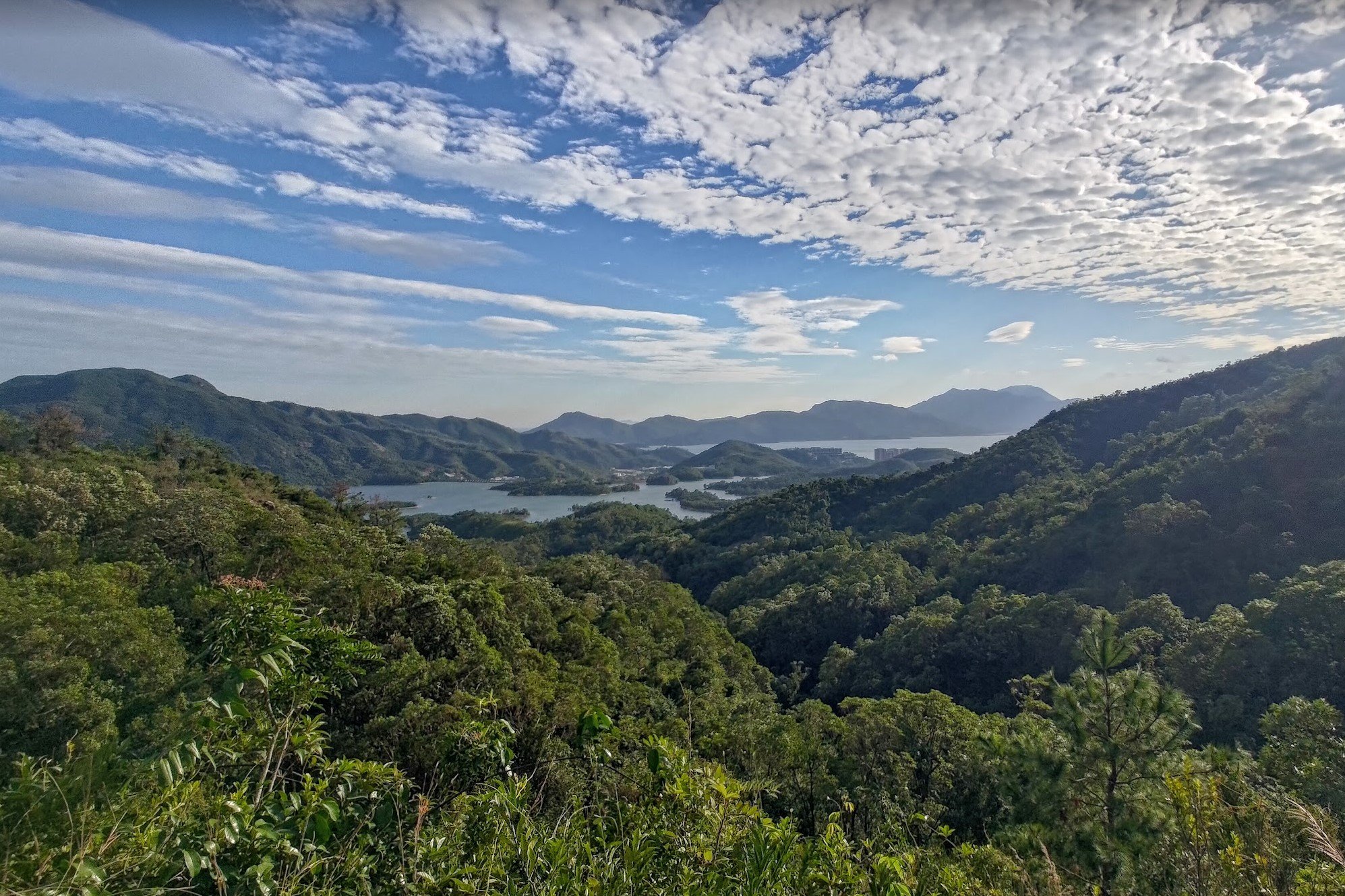
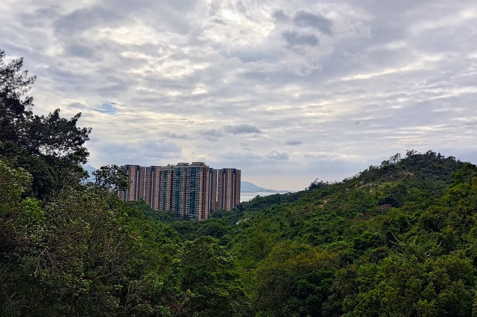
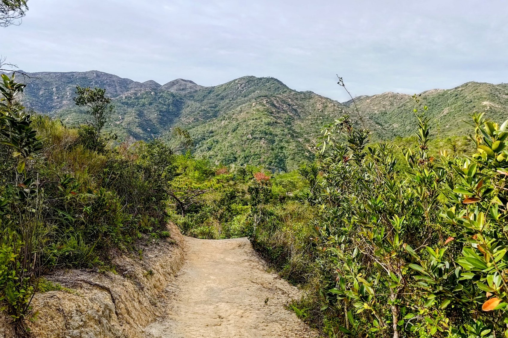
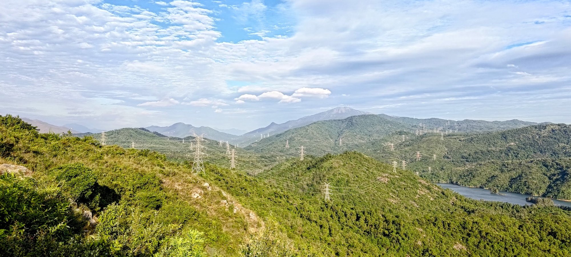
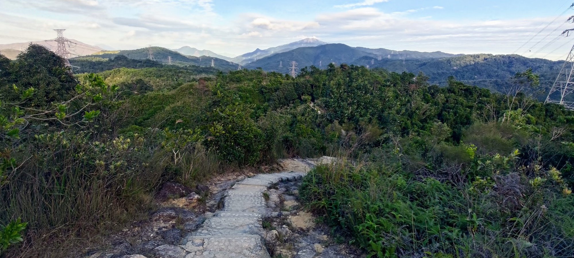
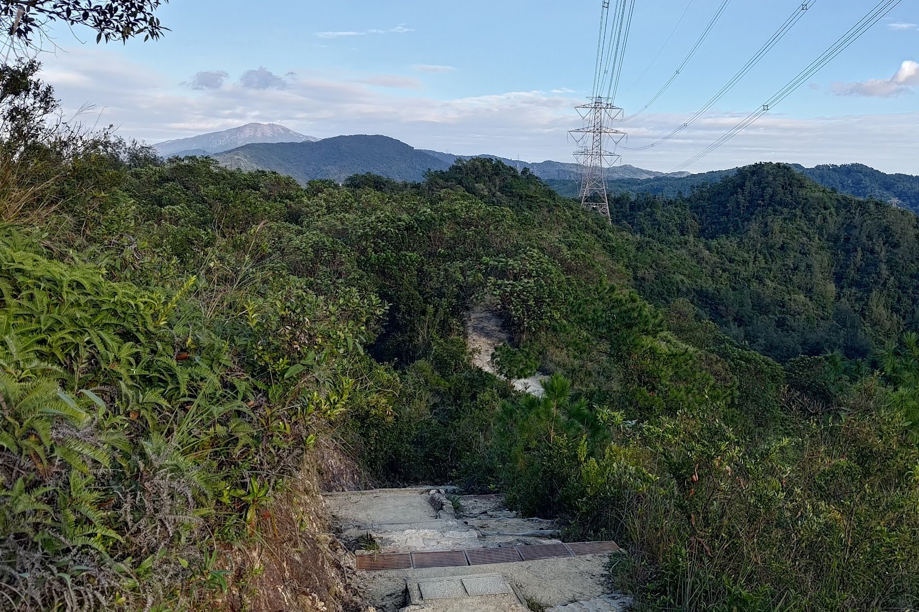
You'll basically continue onward and follow the trail from the opposite direction in which you came from. Pretty soon into your descent, the trail opens up and you'll get views of Shenzhen to your left with awesome mountains in front of you.
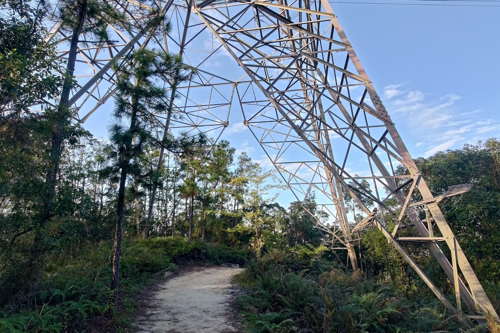
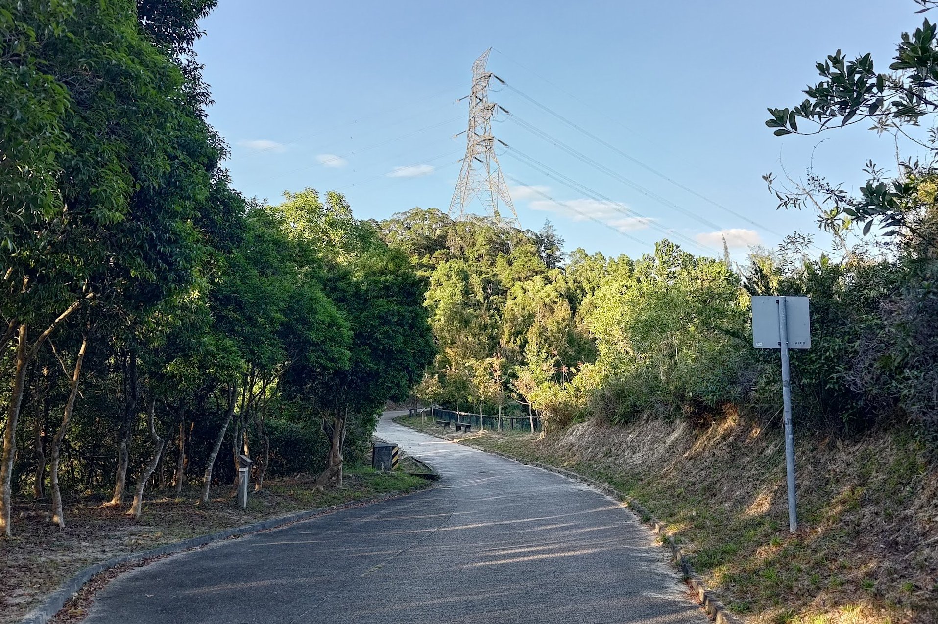
One of the coolest parts of the descent is walking right under one of those large towers.
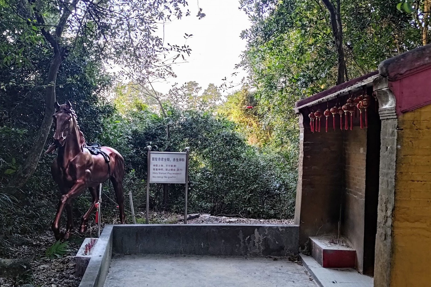
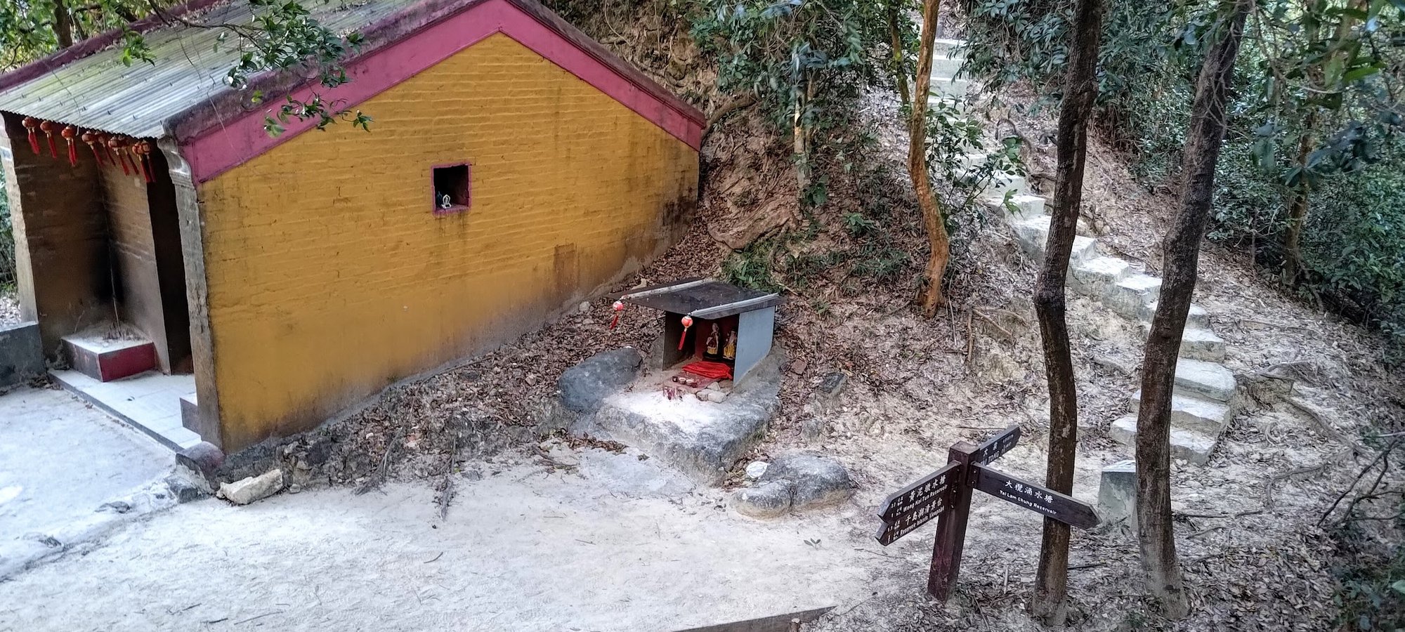
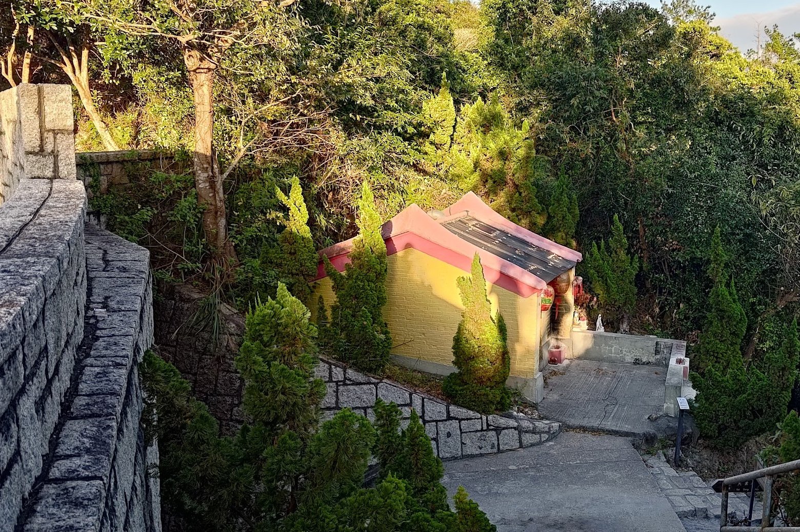
Not too long after that point, you'll arrive at a little temple, which always seems to have some chanting music being played. There's also a horse statue beside the temple.
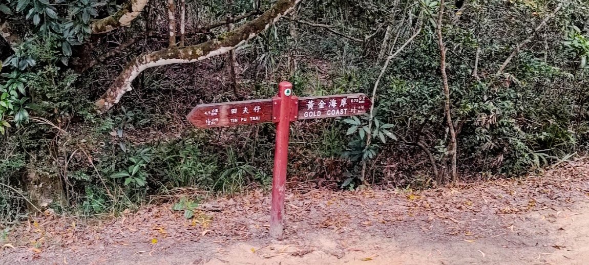
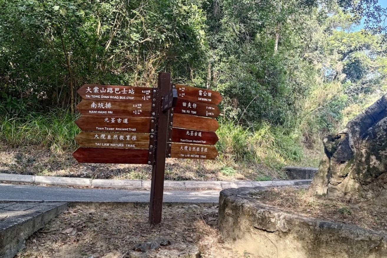
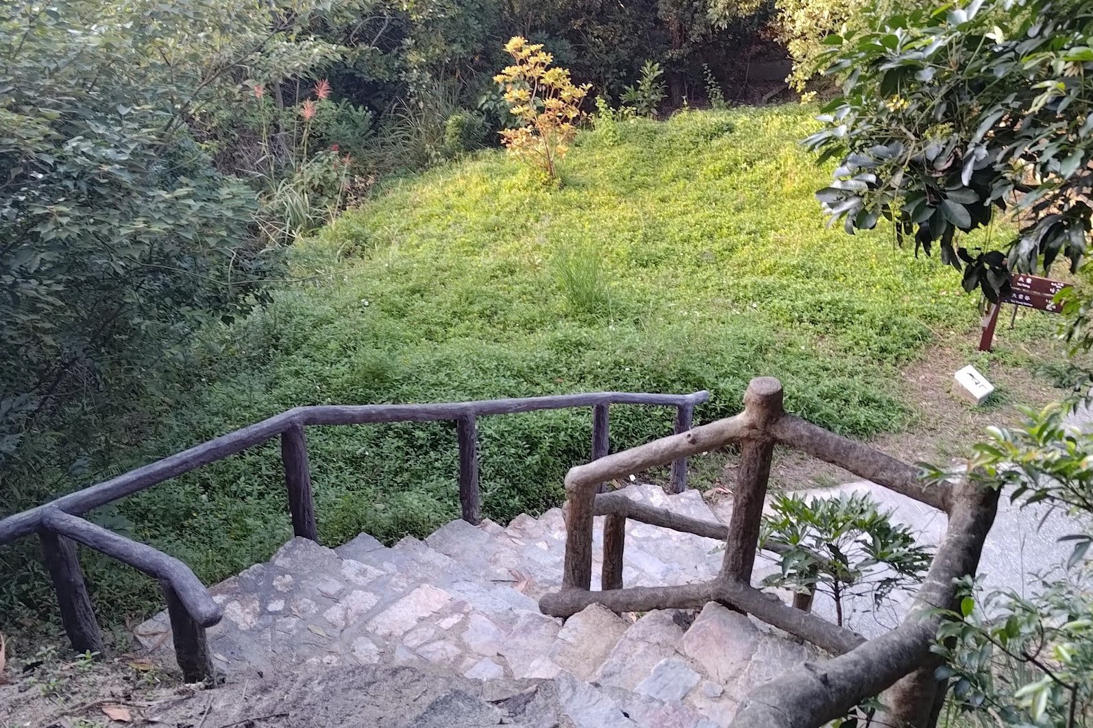
Next to the temple is a sign pointing to Tai Tong. Follow that up the stairs and walk straight a bit along the natural trail.
Optional Reservoir and Maple Tree Detour: (Adds 1 Hour)
This detour will take you back down toward Tai Lam Chung Reservoir before bringing you back up a concrete road that's full of maple trees that turn red and gold during autumn.
This detour will add 1 hour to the total length of your hike, so keep that in mind before committing to it.
To begin, follow the wooden sign to 'Tai Lam Chung Reservoir' from the temple. You'll descend some stairs for about 15 minutes before arriving at another sign and a flat section.
*There are supposedly some 'village relics' to the right of the sign, but I didn't spot any.
Follow the sign to the left in the direction of Tin Fu Tsai. You'll follow the reservoir for some time and get the occasional view of the water beyond the trees. This section is very gentle and peaceful.
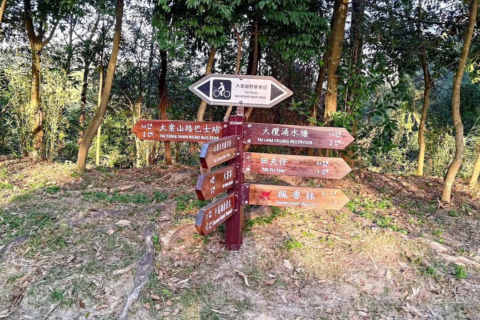
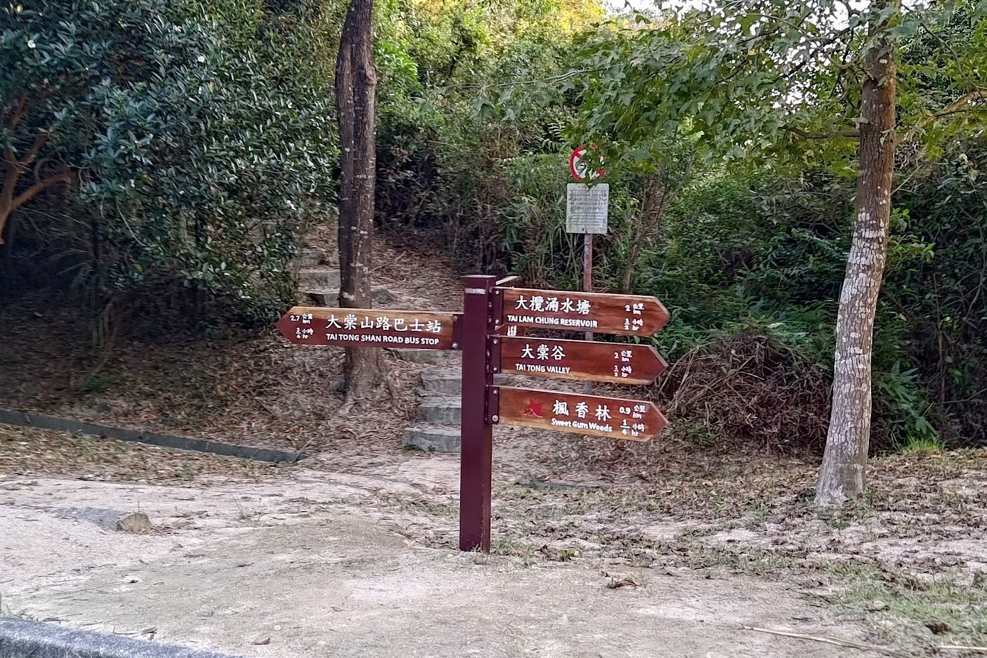
When you arrive at a concrete road, you'll see a huge bunch of signs. Follow the sign pointing to 'Tai Tong Shan Road Bus Stop' (left). The concrete road will take you back uphill.
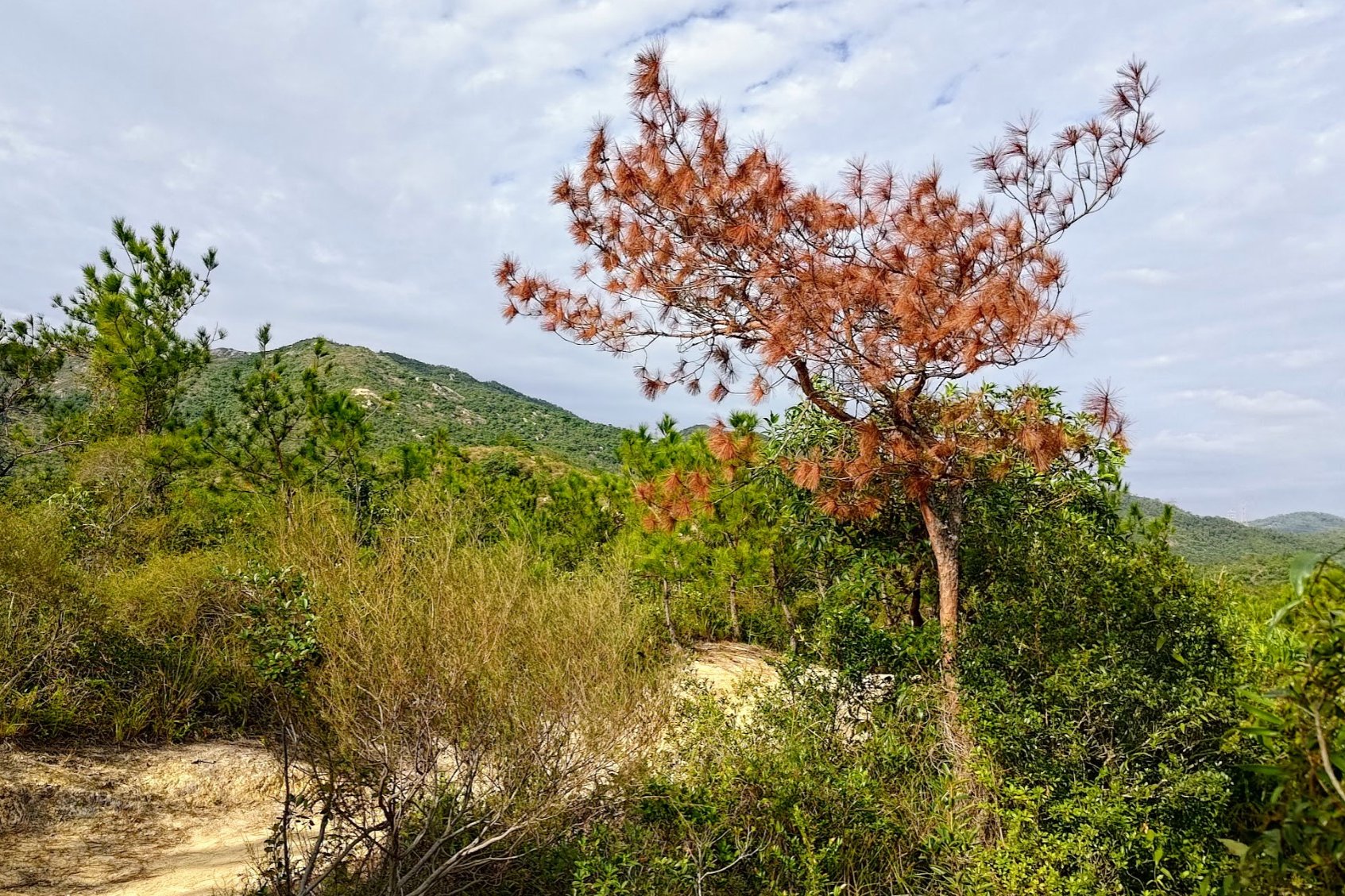
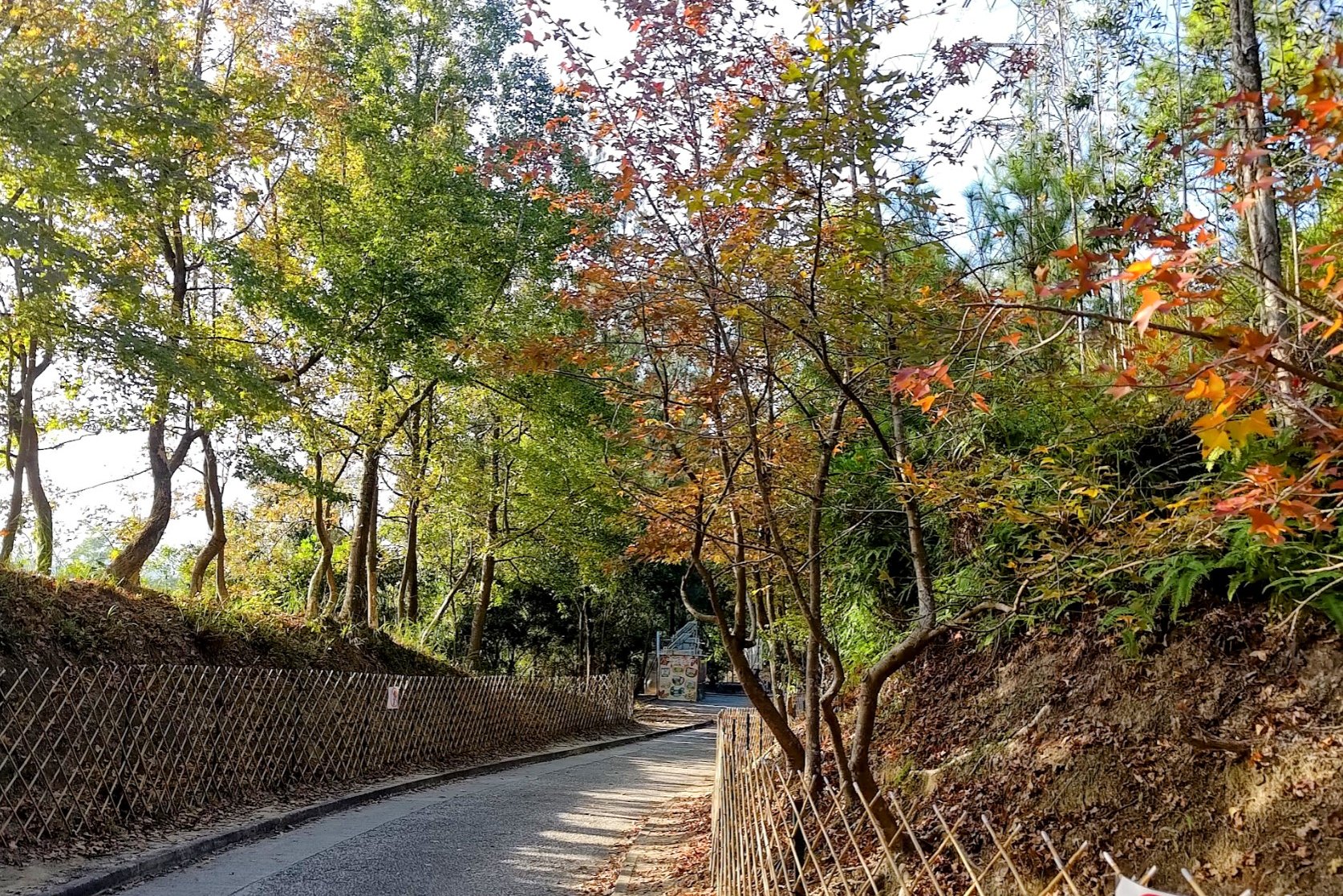
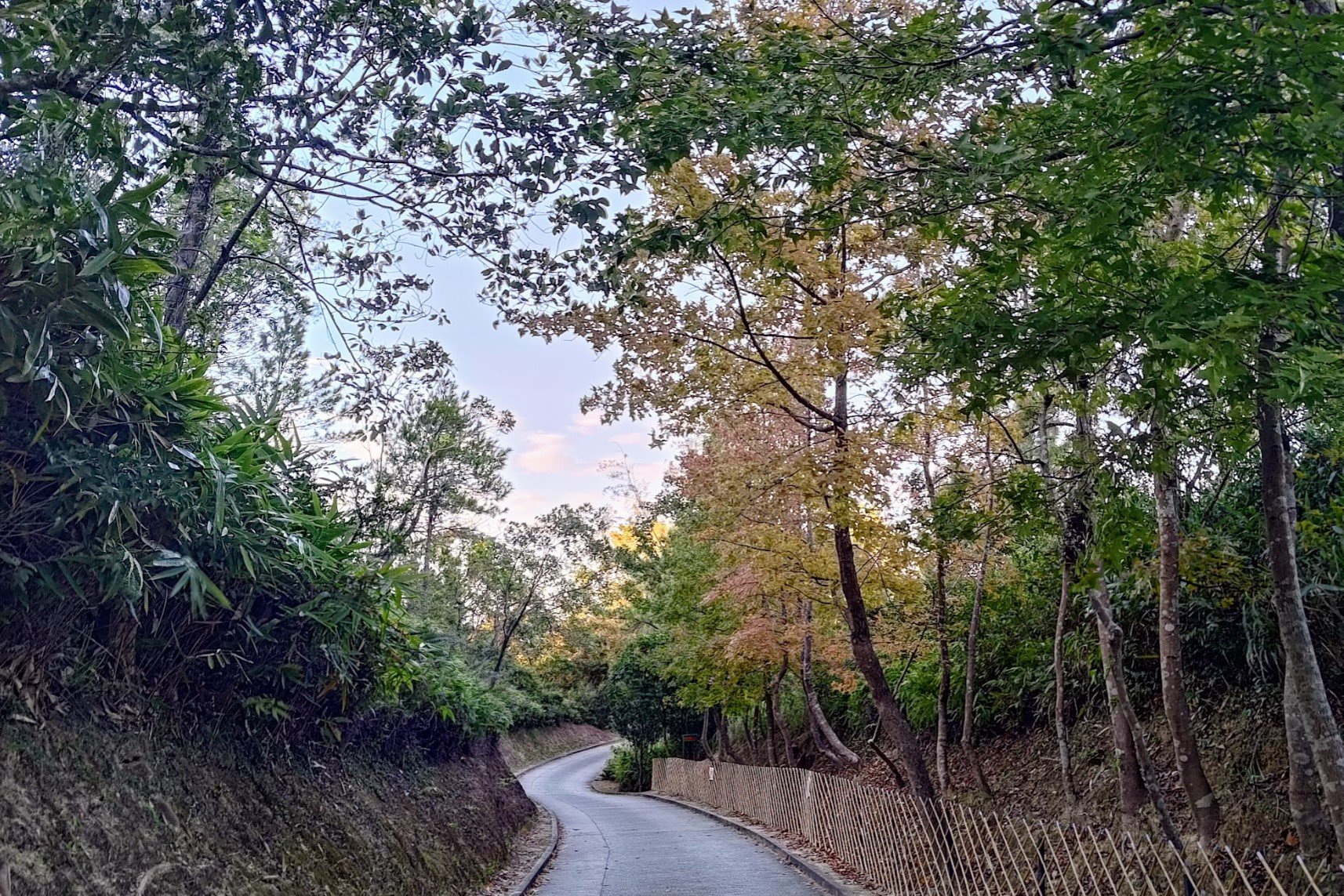
On the way up, you'll pass by plenty of maple trees that turn gold, orange and red in the autumn. I went in early December and the trees looked really gorgeous.
At the top of the road, you'll reconnect with the main trail. Follow the next section of the guide to get to the bus stop.
Walking to the Minibus Stop
Take the stairs down to the concrete road and heed the sign in front of the stairs pointing to Tai Tong.
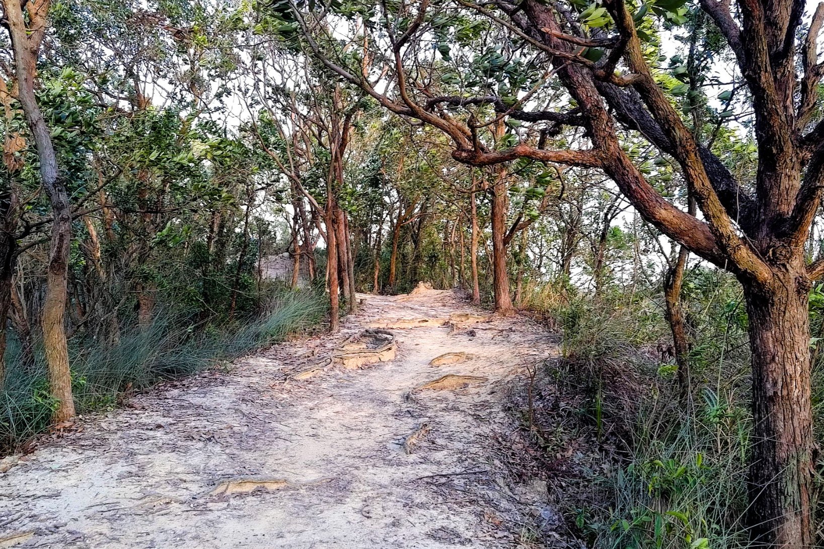
The next part of the hike follows the same concrete road (Tai Tong Shan Road) for 45 minutes or so. Along the way, you'll pass by another temple and the famous gum trees that visitors often flock to see during autumn because of their vibrant colors.
Throughout your walk on the road, you'll see several signs pointing to 'Tai Tong Shan Bus Stop'. Always follow these signs, and you'll be heading in the correct direction.
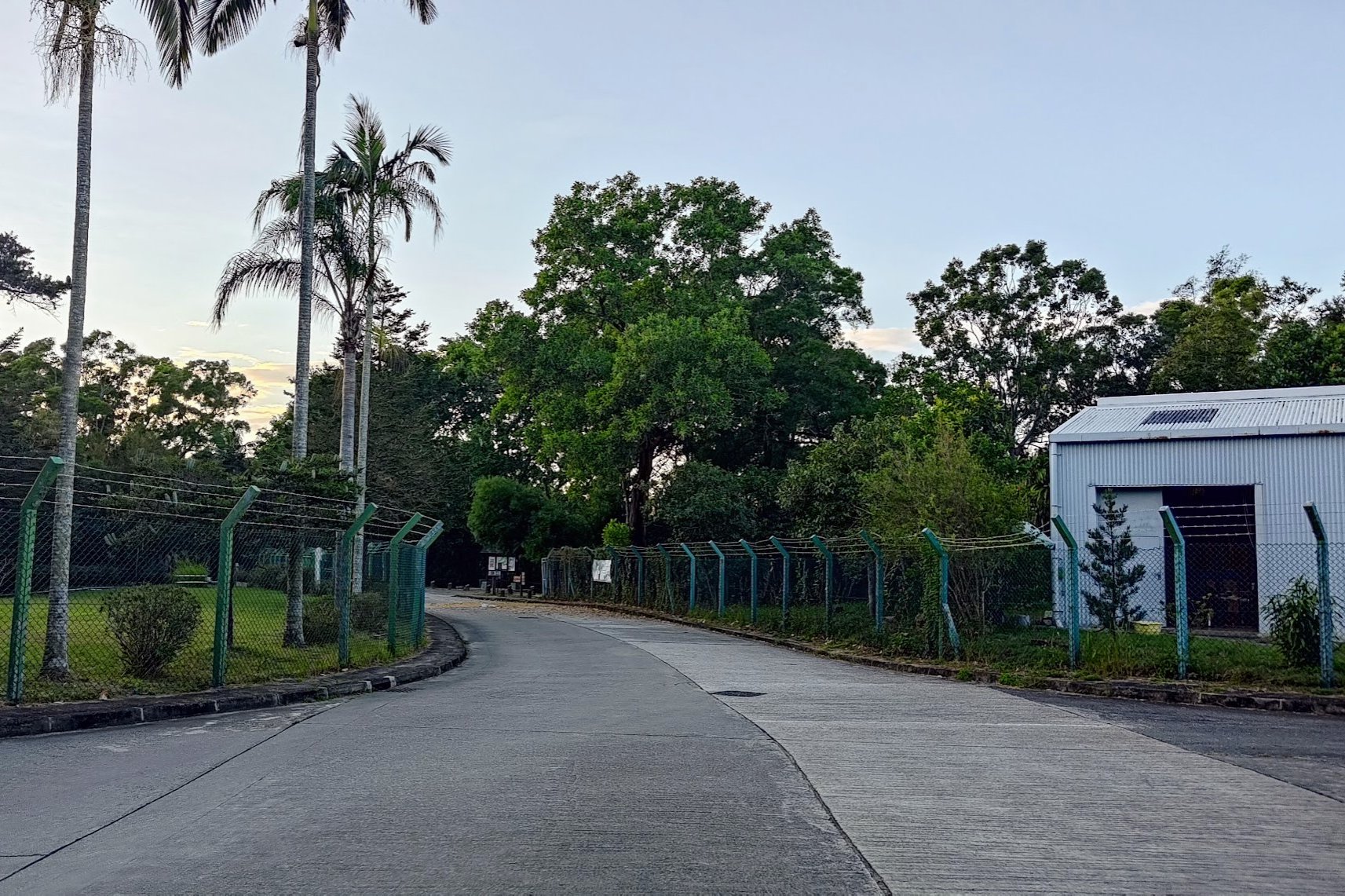
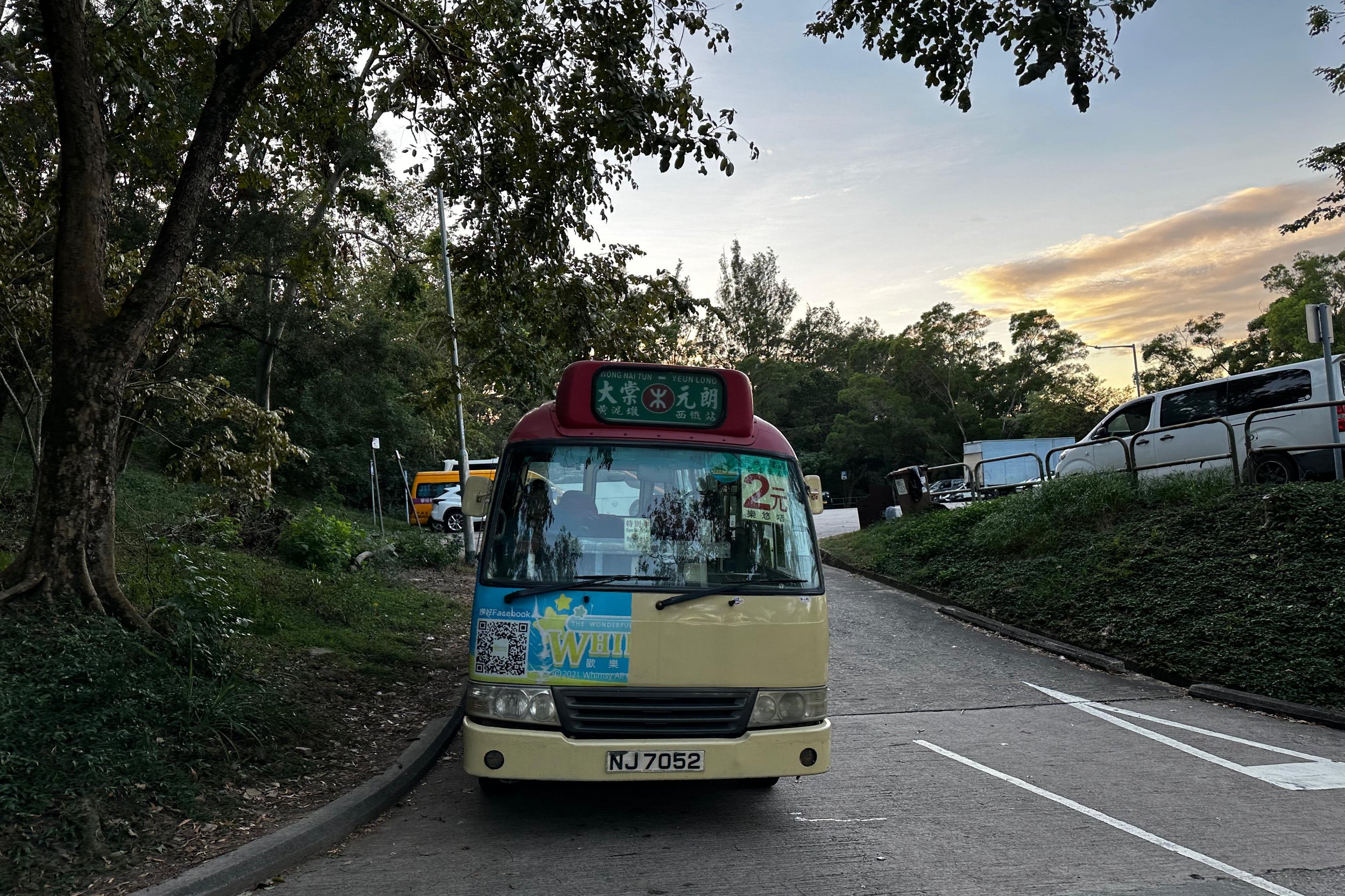
About 30 minutes into this section of hiking, you'll arrive at the Tai Lam Country Park Management Centre. From here, walk past a bunch of campsites and stay on the same road until you reach the Tai Tong Shan Rd Car Park, where you can find red minibuses going directly to Yuen Long MTR Station.
It's 15HKD per person and they take cash only!
Getting Back
After the minibus drops you off in Yuen Long, take the MTR to wherever you need to go. There are also buses that go to several districts from near the station.

