
Ap Lei Chau to Ap Lei Pai: A Gorgeous Island Hike with Steep Climbs
Contents
- Essential Information
- Hike Highlights
- Google Route Map
- How to Get There
- Quick Route Summary
- Detailed Route
- Views from Mount Johnston Summit
- The Sandbar
- Lighthouse Views
Essential Ap Lei Chau to Ap Lei Pai Hike Details
- District: Hong Kong Island
- Duration: 2.5-3 hours
- Distance: 4 km
- Highest Elevation: 198 meters
- Difficulty: 3.5/5
- Facilities: Toilets and convenience stores available at the start and end
Why Hike Ap Lei Chau to Ap Lei Pai?
Hiking from Ap Lei Chau (鴨脷洲) to Ap Lei Pai (鴨脷排) has to be one of the most unique outdoor experiences you can find in Hong Kong – or perhaps even globally. Where else can you find a trail that lets you begin in a crowded metropolis, overlook a theme park, cross a sandbank connecting two islands, visit a lighthouse and then enjoy coastal views of the South China Sea all the way out to waters owned by Mainland China?
Though this hike is only 4 kilometers long, it still takes nearly 3 hours to complete (to the end and back the same way). That’s because almost the entire route is either a vertical slog up or a tricky climb down. With barely any flat sections, you’ll have your fitness tested and also get to work on your balance while tackling some slightly more technical terrain.
While this probably isn’t the best route for beginners, it’s very doable for anyone with an intermediate to advanced hiking aptitude. Aside from the steep climbs and descents, the terrain is filled with loose rocks and debris, making it possible to slip or roll an ankle. It’s also completely unshaded, meaning that if you tackle this hike in the summer (like I foolishly did), you’ll feel like you’re roasting alive.
That being said, the views are honestly jaw-dropping. If you’re a beginner and fancy discovering a unique ocean panorama, you can simply hike Mount Johnston (the first peak) and return back in 45 minutes or so.
Google Route Map
How to Get to the Ap Lei Chau to Ap Lei Pai Hike Start Point
Getting to the start of the Ap Lei Chau to Ap Lei Pai hike is really easy. Take the MTR to Lei Tung Station and get out at exit B. That’s the start point of the hike.
Quick Ap Lei Chau to Ap Lei Pai Hike Summary
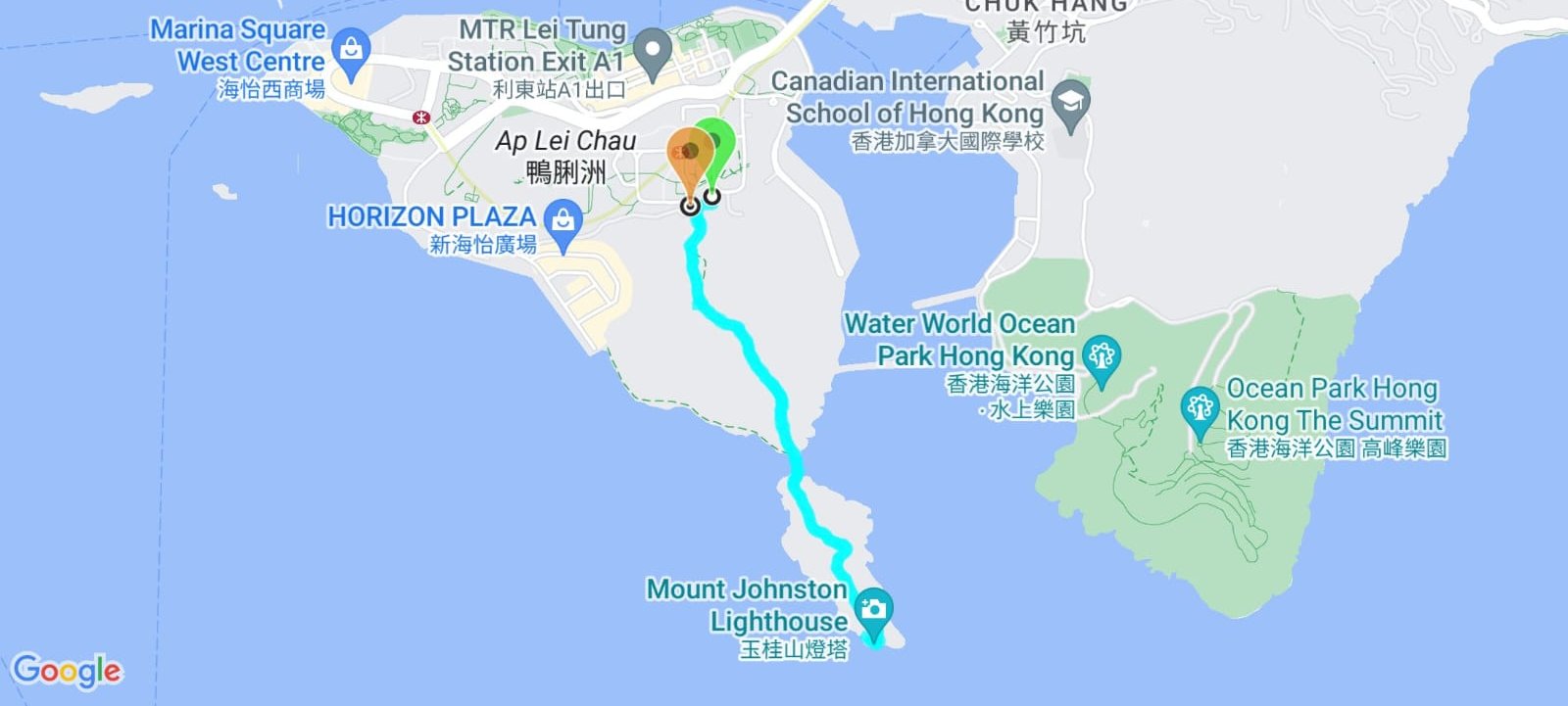
- From Lei Tung Station exit B, head toward the two yellow guard posts at the back of the bus terminus
- Hop the barrier and follow the pipes before taking the leftmost set of stairs
- At the caged fence, go left and start climbing
- Take the right path at the ‘Notice and Warning’ sign and climb to the top of Mount Johnston
- Descend down to the sandbank
- Cross the sand bank to Ap Lei Pai
- Climb the rocks that look like narrow natural steps (ignore the rope path to the right)
- Head into the trees before emerging onto an open path
- Walk to the end of Ap Lei Pai
- Enjoy the views of the lighthouse and the ocean before heading back the way you came
Locating the Hidden Entrance to Narnia
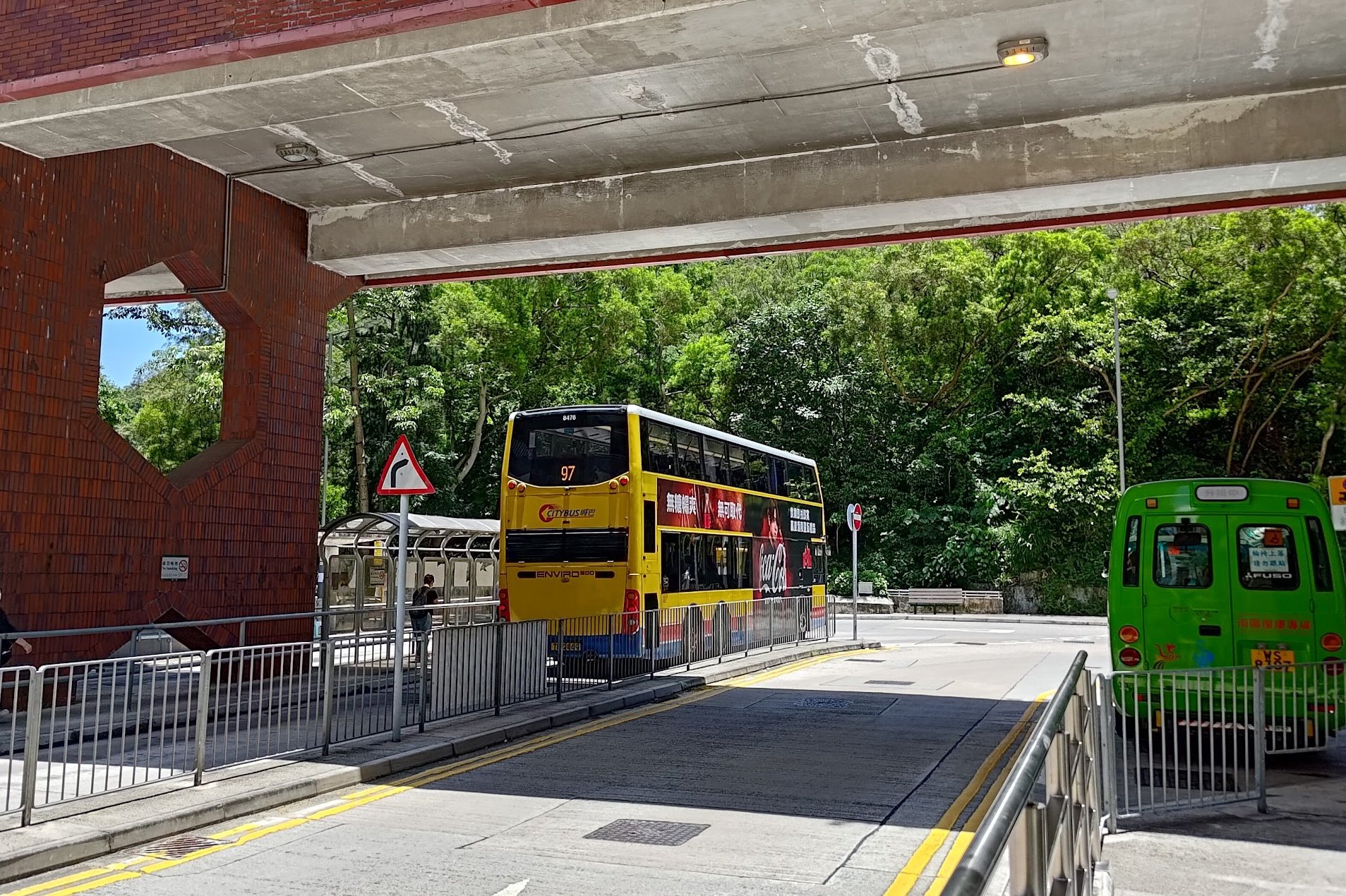
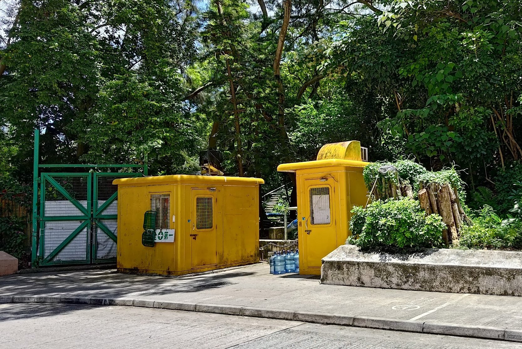
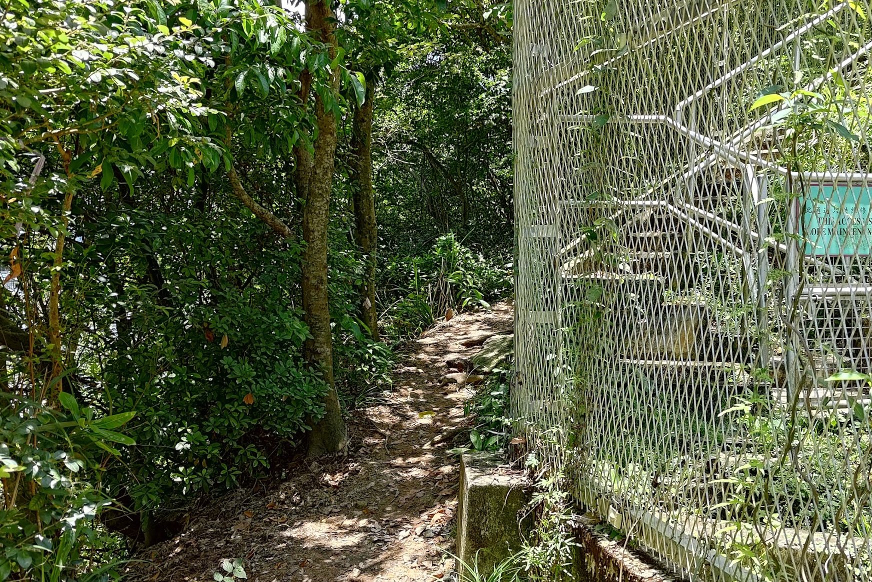
From Lei Tung Exit B, head right toward the bus terminus. While this looks like any ordinary bus terminus at first glance, it’s hiding its own portal to Narnia in plain sight. Look for the two bright yellow guard stations and enter between them.
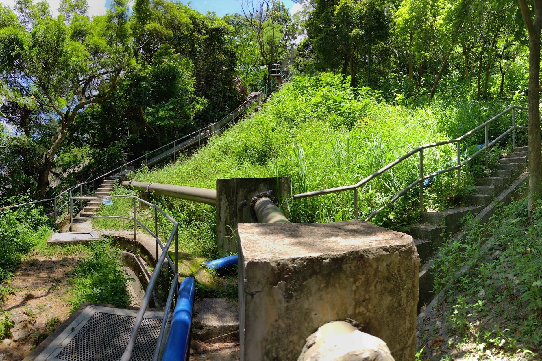
There, you’ll find a magical world of…pipes and concrete. Follow the pipes for a minute before you see three concrete staircases. Take the one on the far left until you reach a caged fence. Go left from there and begin your epic climb.
To the Top of Mount Johnston (Yuk Kwai Shan)
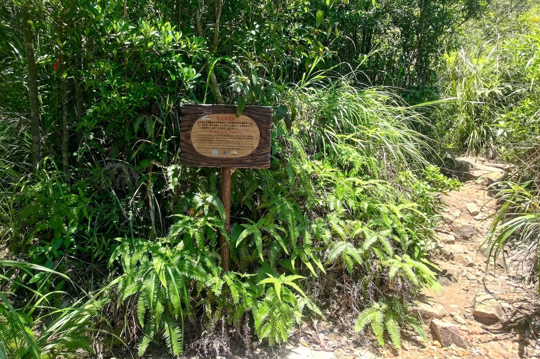
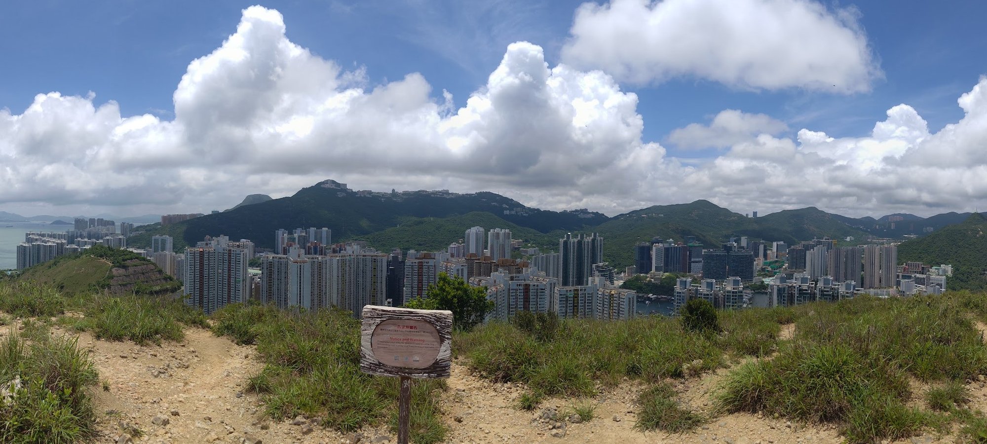
When you arrive at the brown ‘Notice and Warning’ sign, you’ll be able to choose between taking a path going left and one going right. I picked the right path, but the left one will also get you to the top of Mount Johnston. It might also be a bit easier since the right path was pretty steep and required me to use my hands to assist in my climb. Bring gloves if you have sensitive hands.
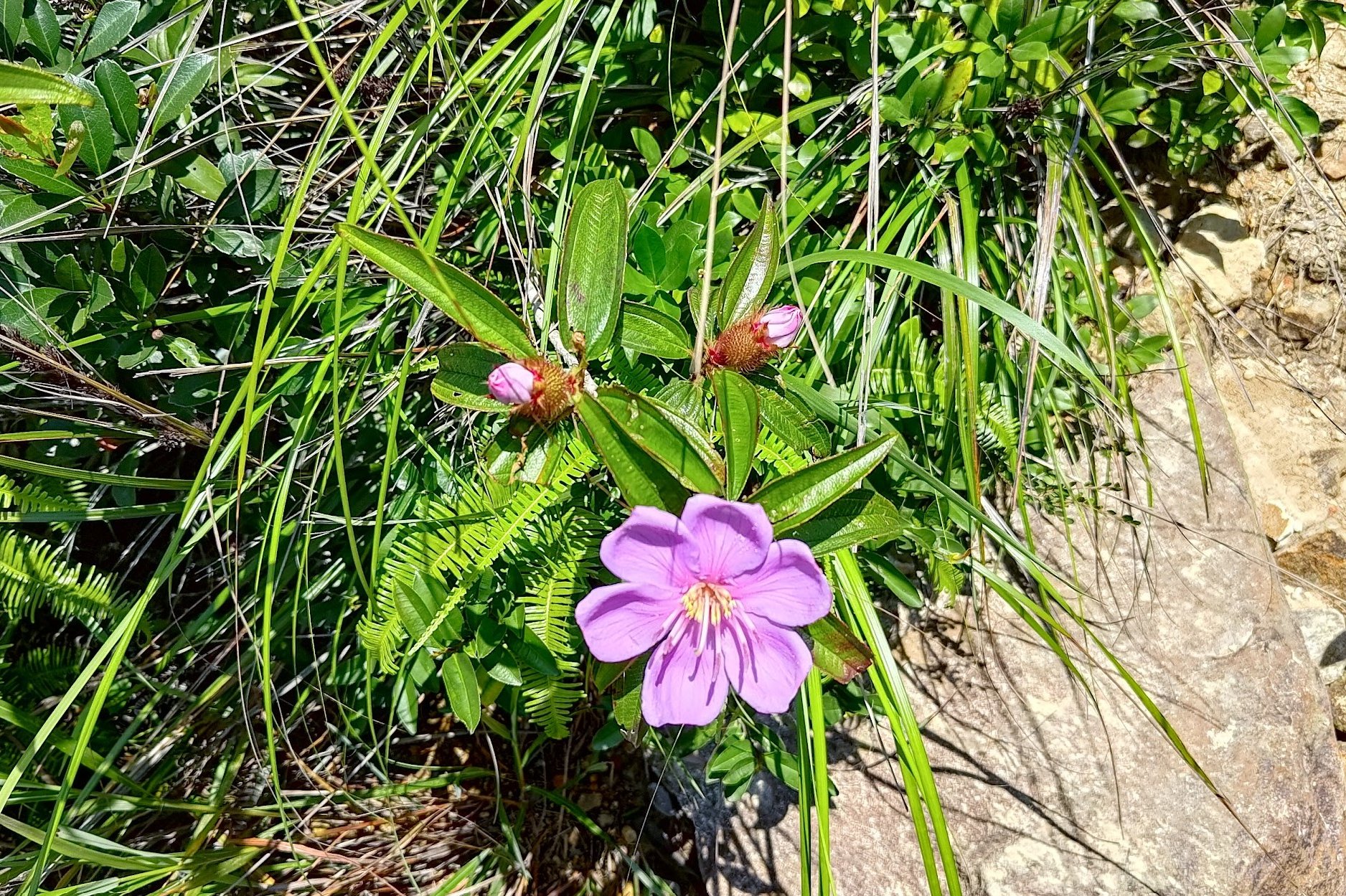
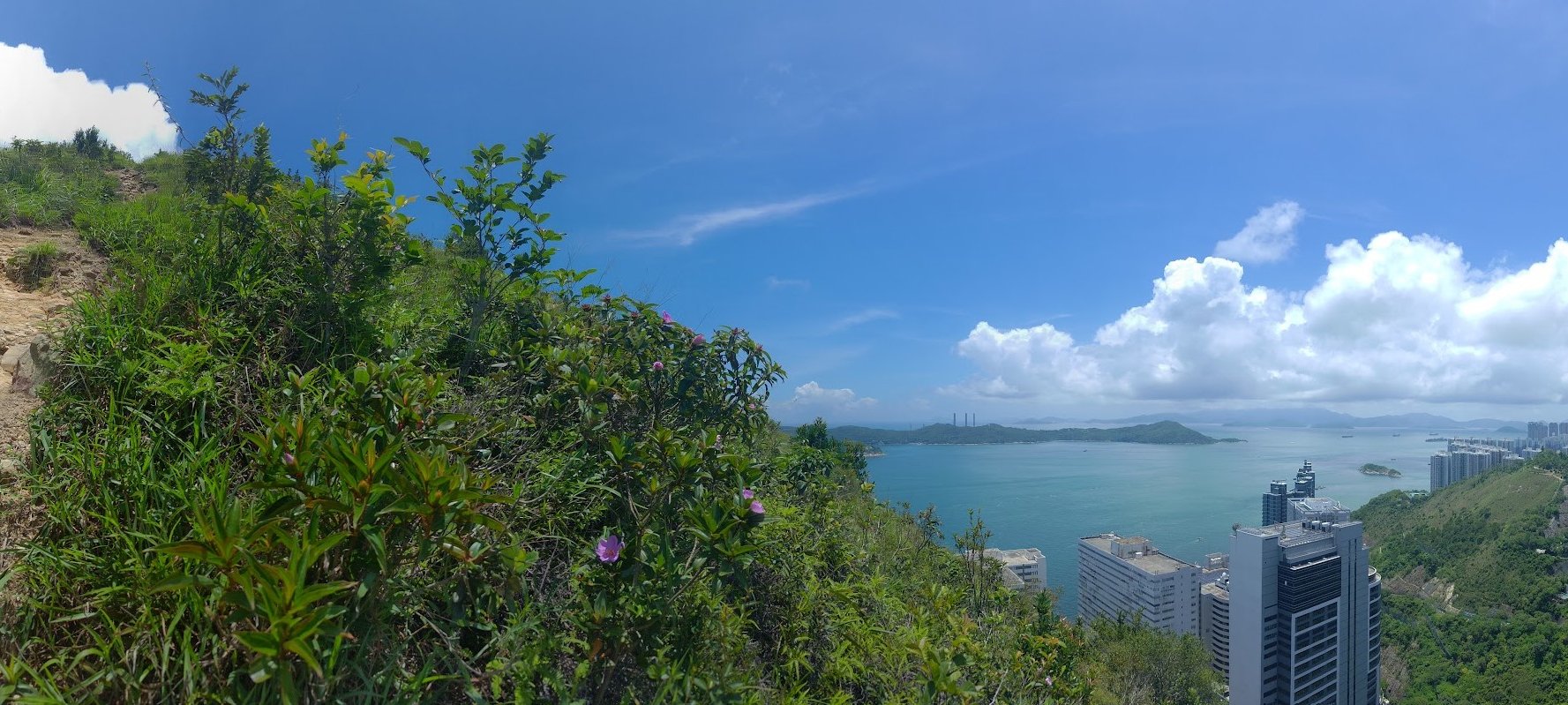
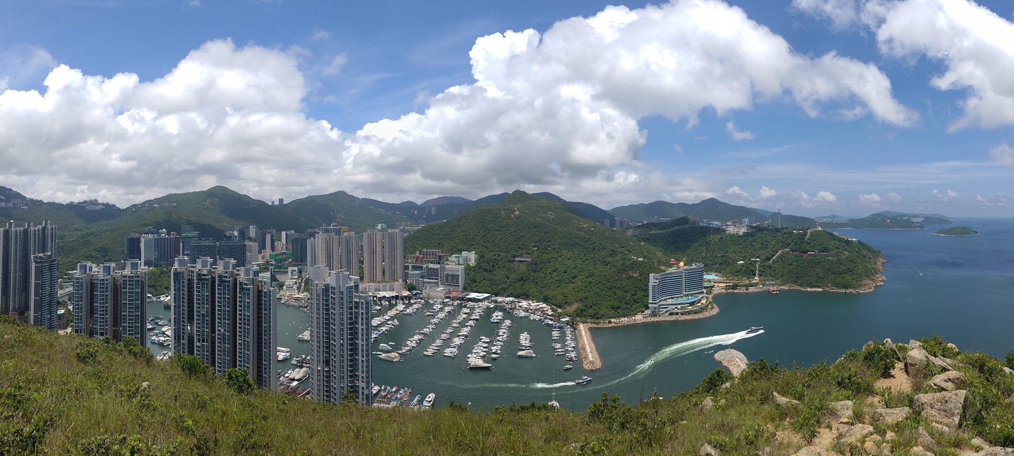
You’ll be treated to views of Lei Tung and Ap Lei Chau behind you as you climb. You’ll also get to see Lamma Island poking out from behind Mount Johnston, which makes the steep climb totally worth it.
There were some frayed ropes on this section, but they looked old and unreliable, so I wouldn’t recommend using them.
Before you know it, you’ll ascend to the summit.
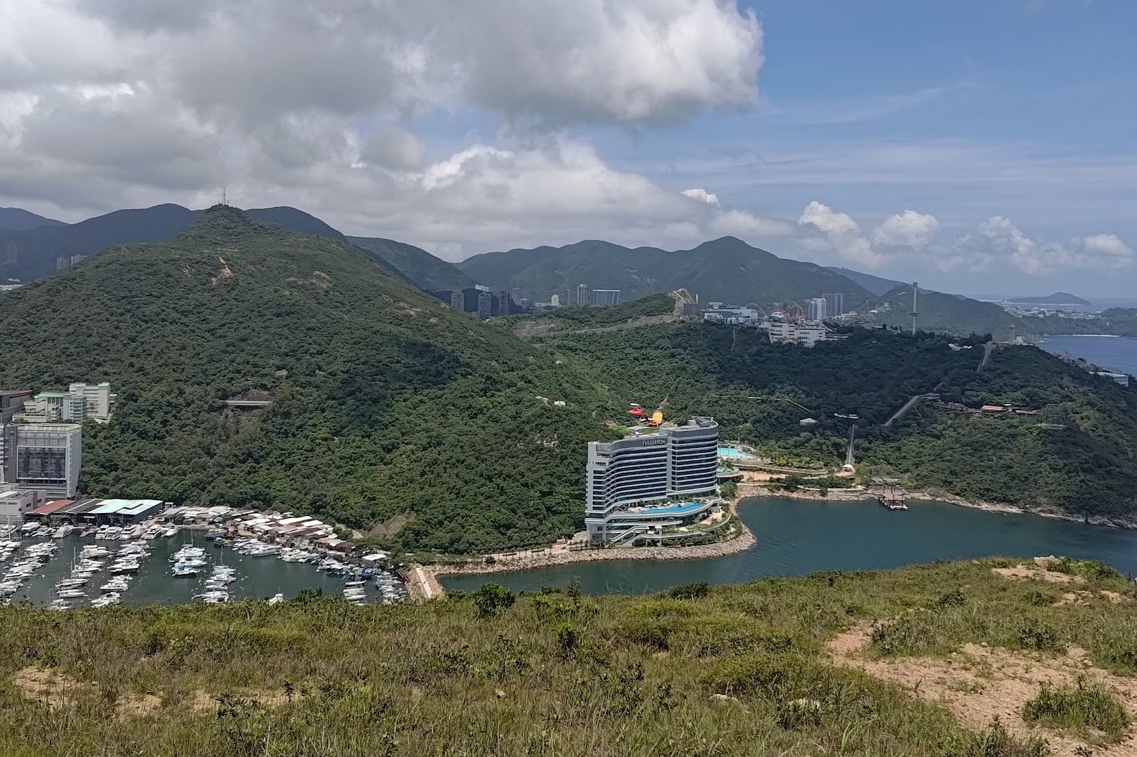
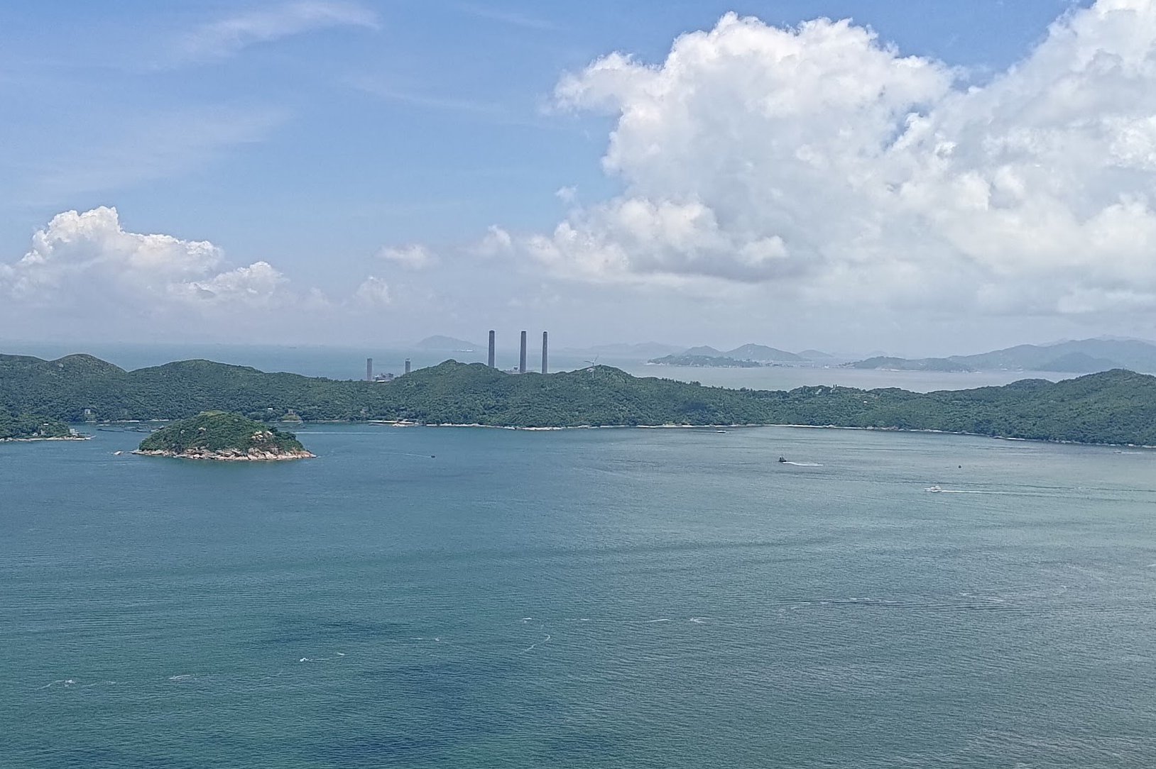
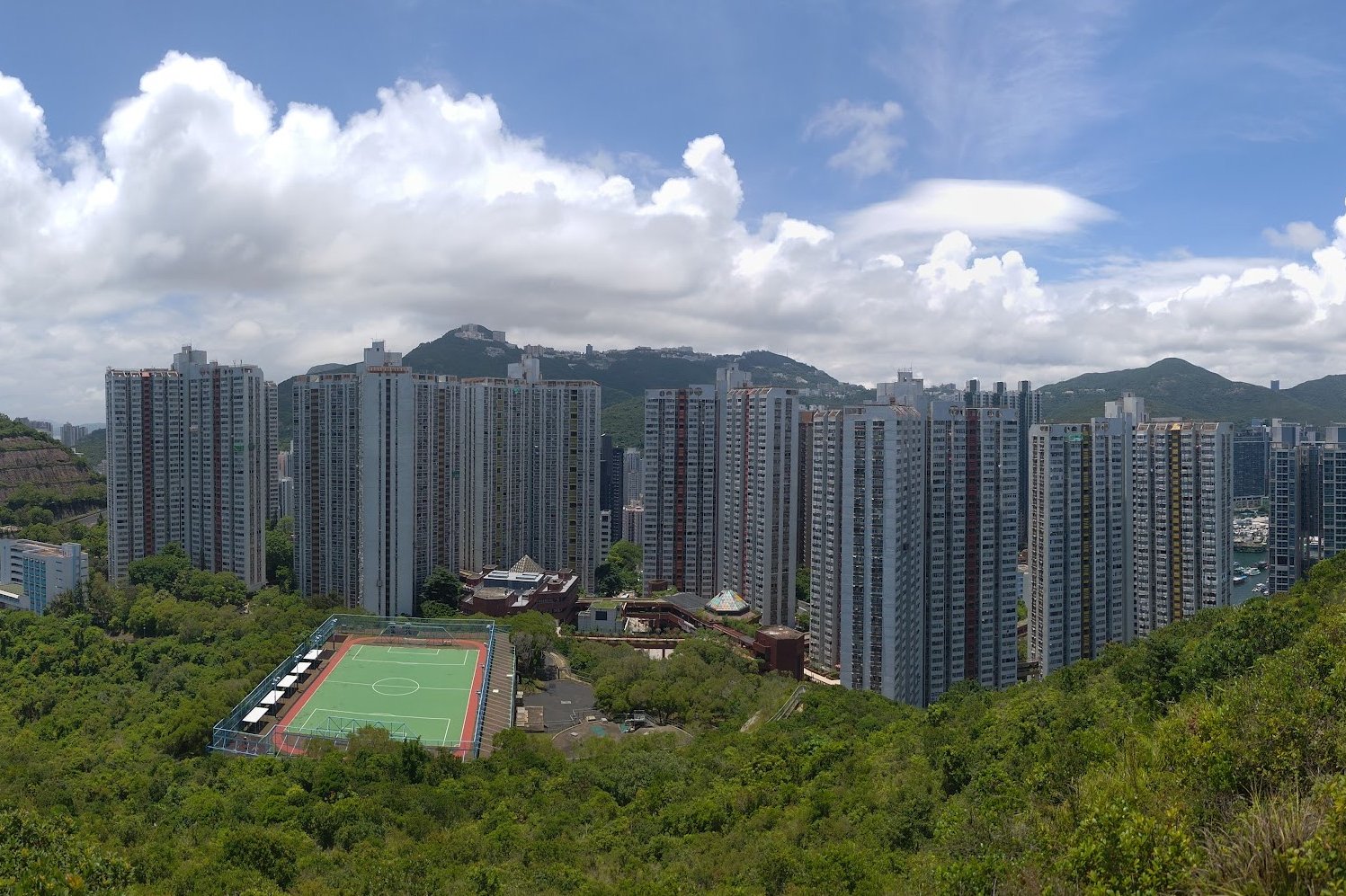
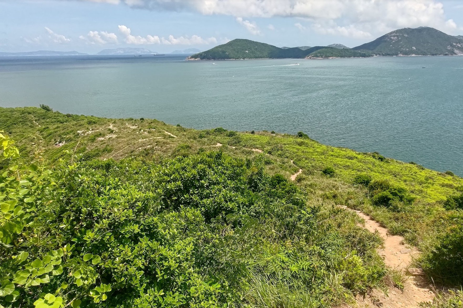
Mount Johnston 360 Degree Views
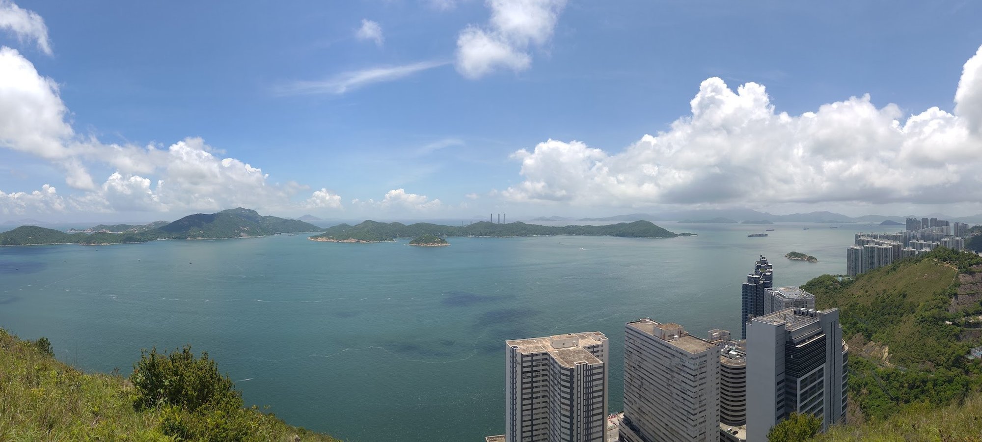
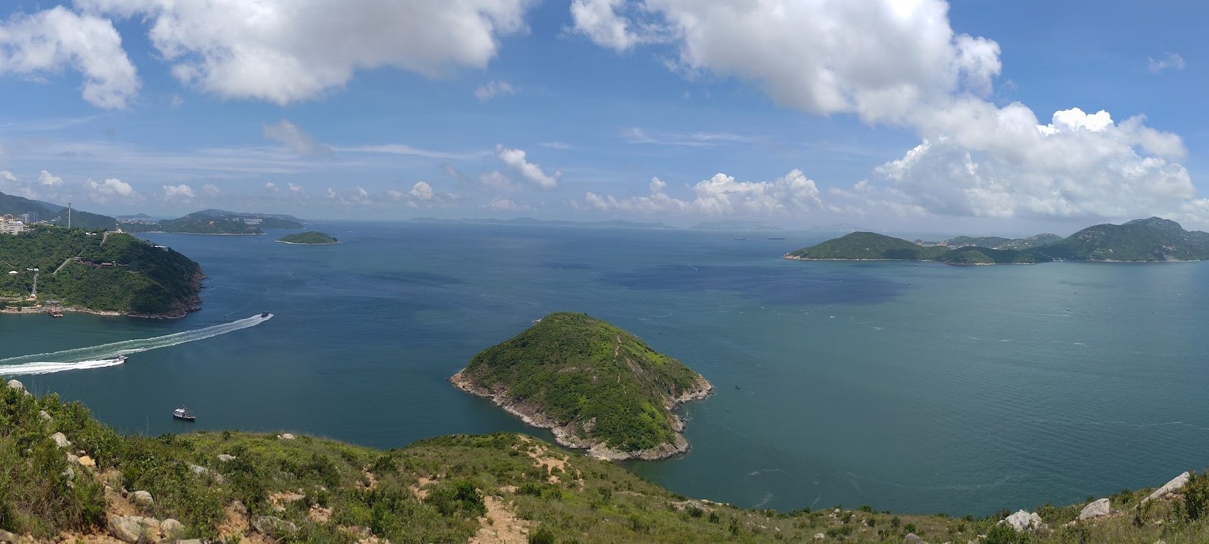
At the top of Mount Johnston, you’ll be treated to 360 degree views of the surrounding area. The main views are:
Ap Lei Chau, Aberdeen and the mountains of Hong Kong Island behind you.
Lamma Island to your right with the three iconic chimneys of its power station making it instantly recognizable.
Ocean Park to your left, where you’ll be able to see both its Water World theme park and its regular park.
Ap Lei Pai and Dangan Island, which is part of Mainland China in the far distance on a clear day.
Mount Johnston Trigonometric Point and Historic Landmark
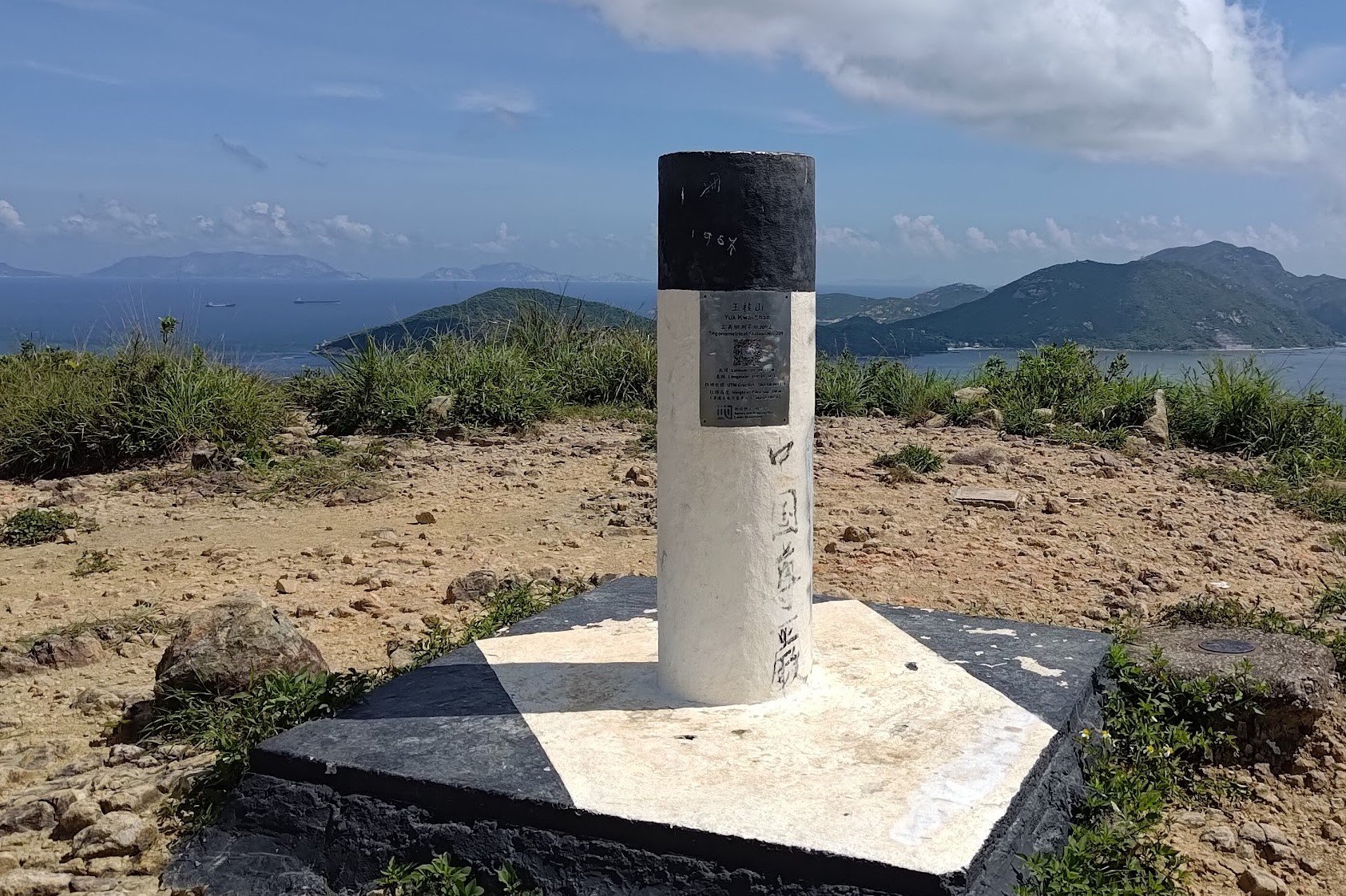
At the top of Mount Johnston, you’ll see the usual white and black trigonometric point giving you key information about the coordinates of the mountain and your current elevation.
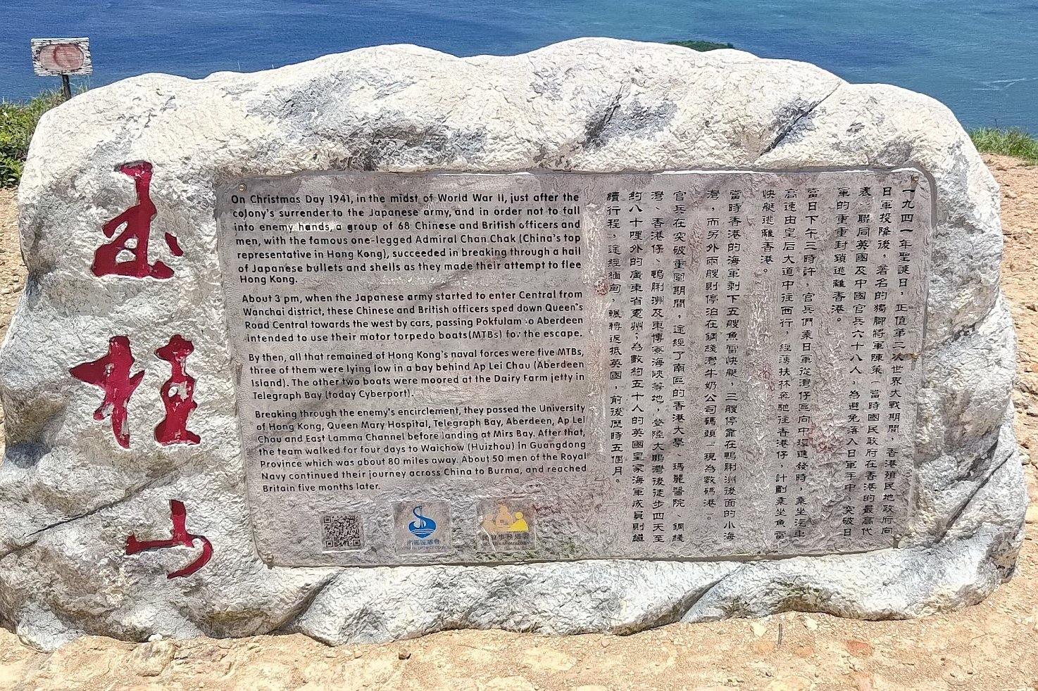
It’s also worth taking a look at the historic stone nearby that tells an incredible story of bravery and selflessness by soldiers in World War 2. It puts into perspective how lucky we are to be able to enjoy these incredible views without the risk of being attacked by foreign forces.
Here's a quick summary of the tale:
- In 1941, the colonial government in Hong Kong surrendered to Japan
- In a daring escape attempt, 68 Chinese and British soldiers made a break for freedom
- The men drove past Central and Pok Fu Lam to reach Aberdeen where they intended to use 3 motor torpedo boats (MTBs) parked behind Ap Lei Chau to escape. All the while evading bullets and gunshots
- On their MTBs, they broke through the Japanese naval blockade and passed by several locations including Ap Lei Chau and Lamma Island before landing in Mirs Bay.
- From there they walked for several days to Huizhou. 50 men from the royal navy continued their journey through China and Burma and eventually reached Britan five months later.
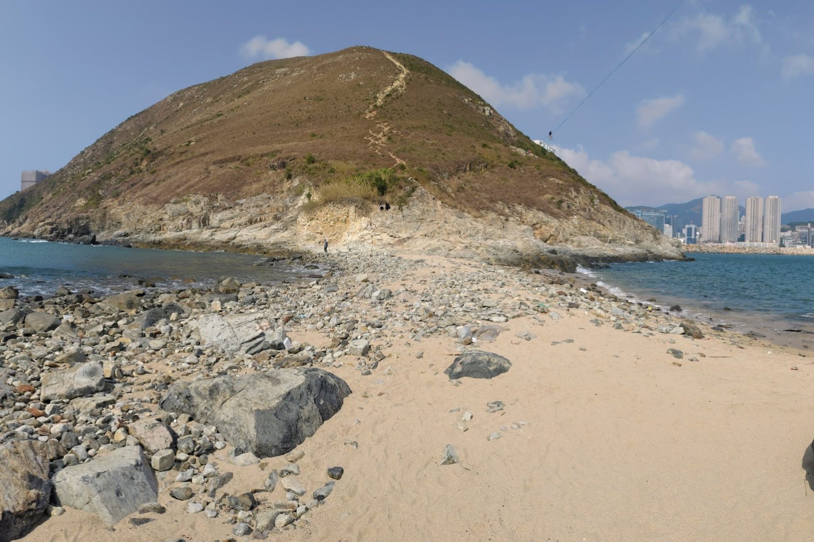
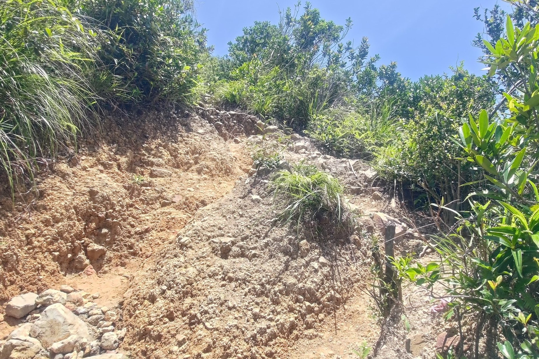
Descending to the Sandbar
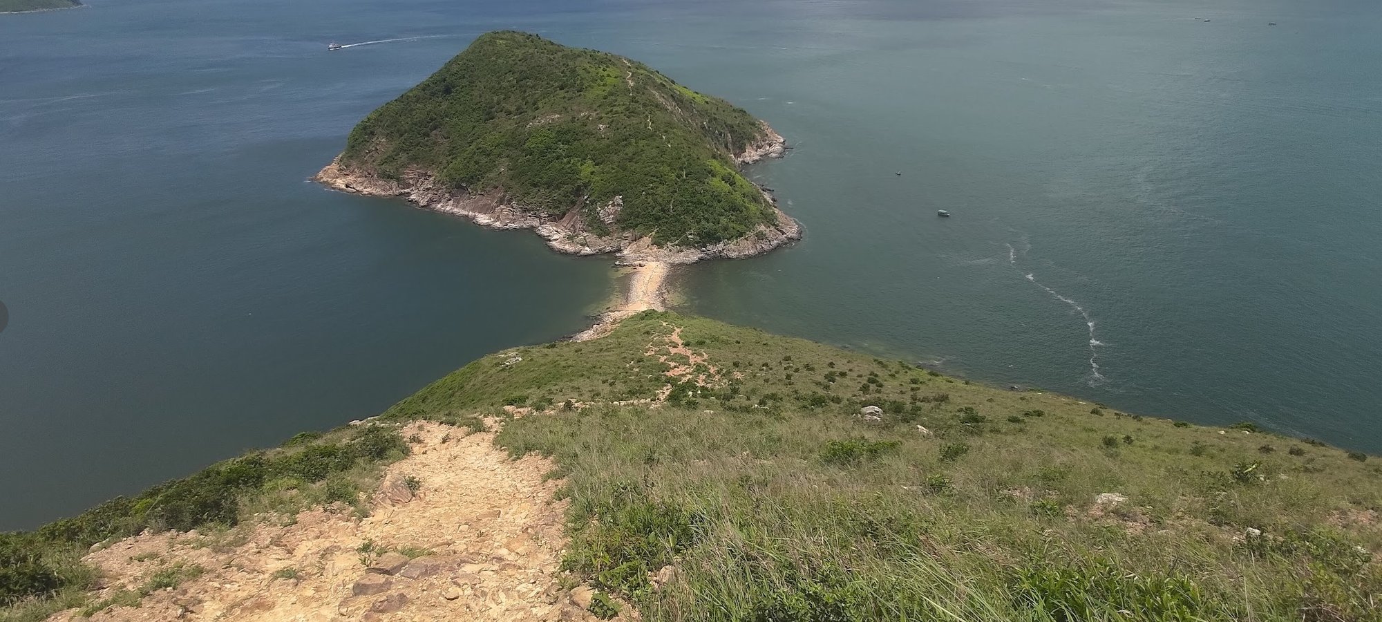
There are two sections to the descent. The first section is relatively steep, but there are fewer loose rocks than the second section, which makes it a little easier to manage. If you’re not confident with keeping your footing, scoot along your bottom or take the time to grab onto larger rocks to help you navigate this part of the hike safely.
There actually used to be ropes on this part of the trail, but they’ve been removed as of July 2023.
When You arrive at the second section of your descent, you’ll find finer debris and loose rocks, which means it’s easier to slip. Take this part of the hike at your own pace rather than trying to rush to the bottom.
The Sad State of the Sandbar
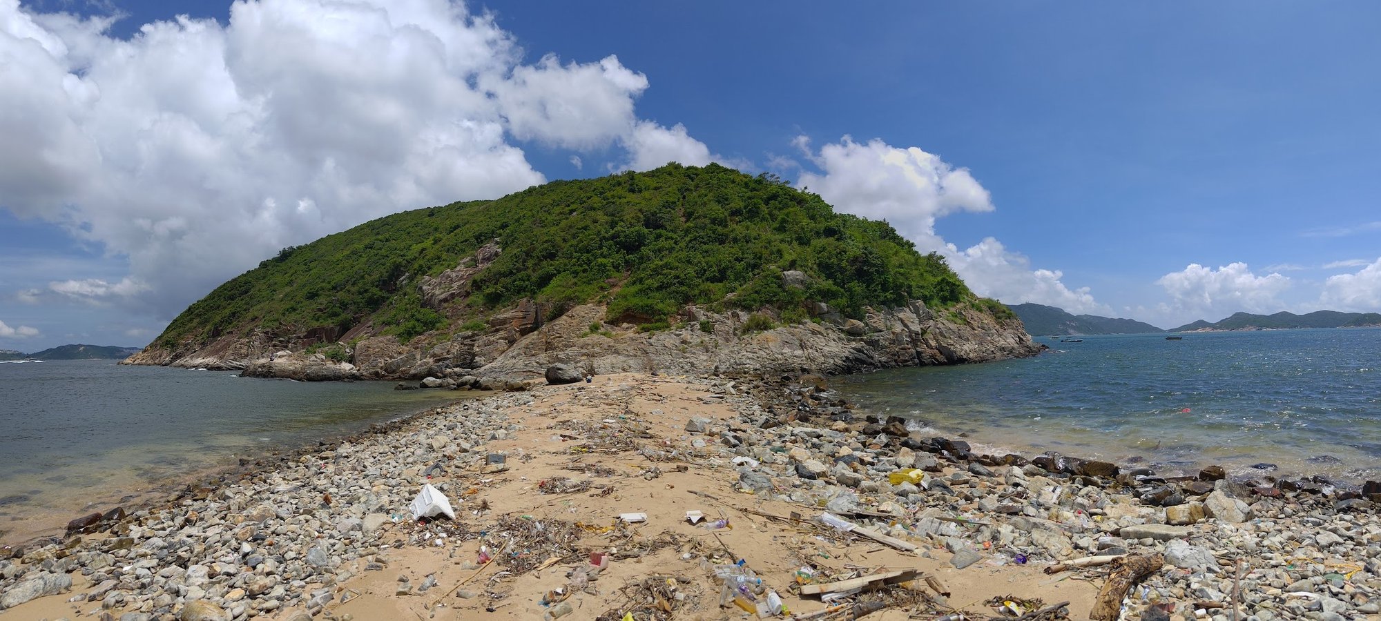
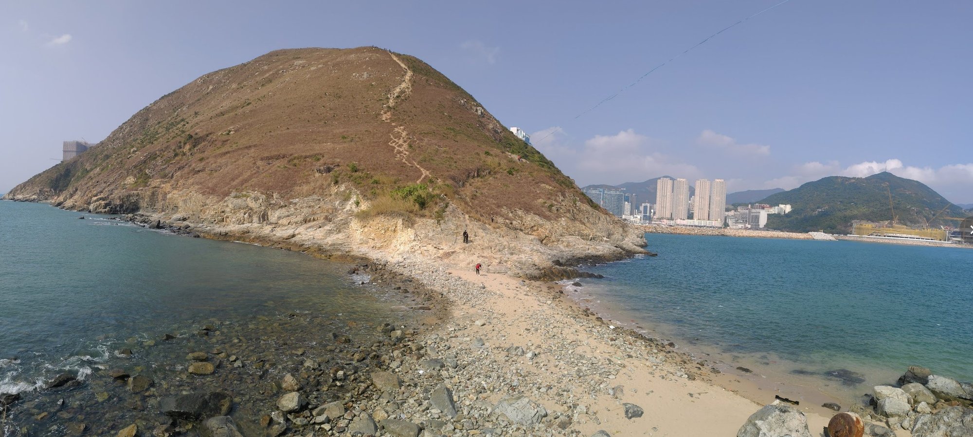
I was genuinely thrilled to reach the sandbar until I realized the state that it was in. Rubbish has been washed up on the beach and left to rot here. This is a far cry to when I visited a few years ago and the beach was in a much better state. It’s still an incredible experience to cross the sandbar, but I was left saddened by how much it’s changed in just a few short years.
The Summit of Ap Lei Pai
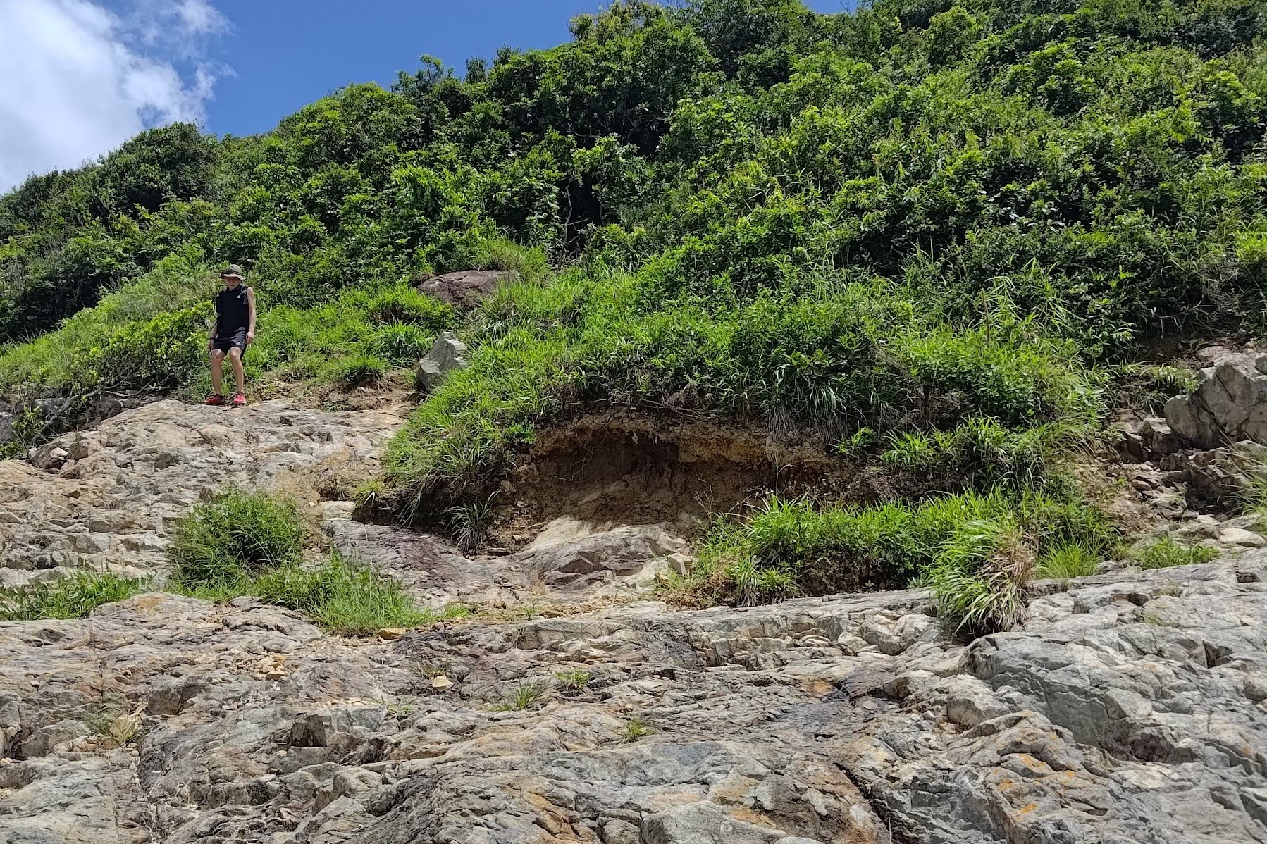
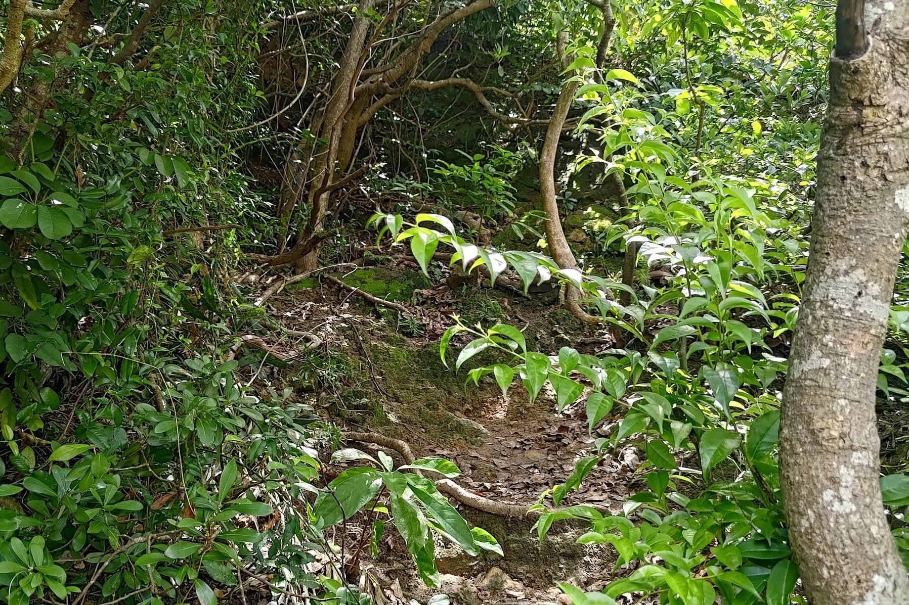
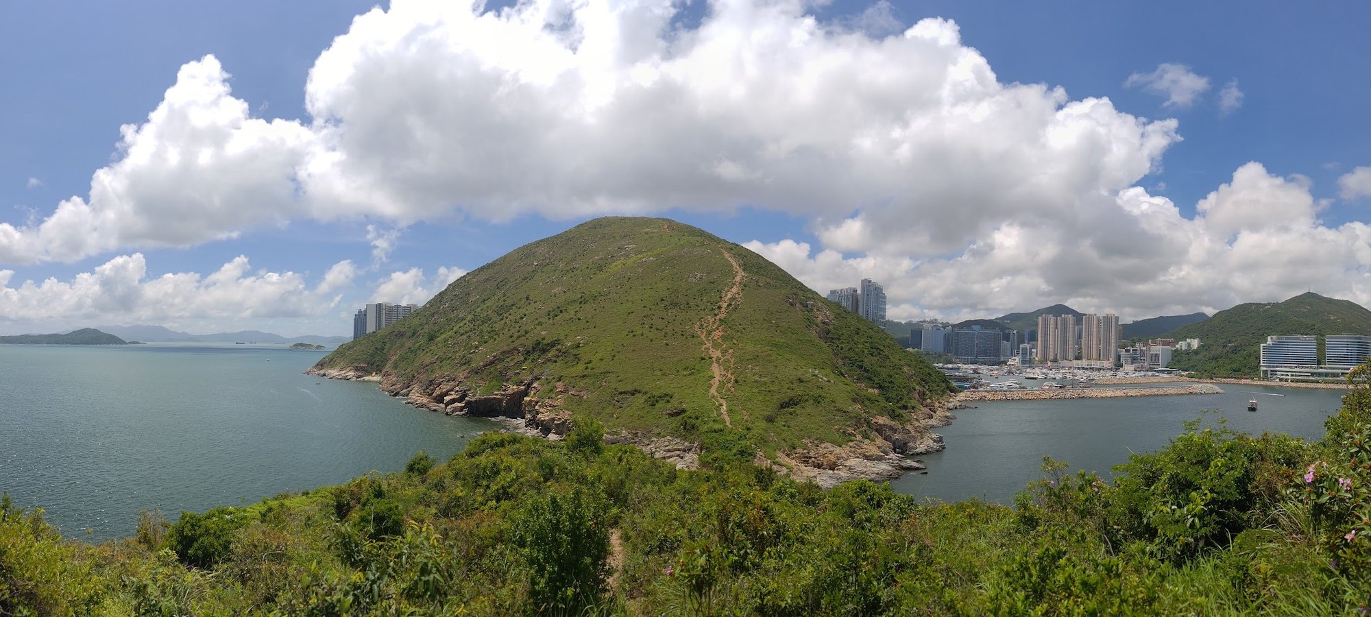
Ap Lei Pai is a little tricky to climb, not because its summit is particularly tall, but because the trail is a little overgrown and tough to navigate.
At the end of the sandbar, you’ll see a rock face in front of you, which you should begin climbing. There will be a section of the rock that looks like little narrow steps that leads to an opening in the trees above. That’s where you want to head towards.
There’s also path that goes around the edge of Ap Lei Pai with ropes for support, but that route seemed a little dangerous, so I stuck to the way I was familiar with.
In the trees, keep climbing up until you emerge out in the open once more. You can enjoy views of Mount Johnston behind you and Lamma Island up ahead.
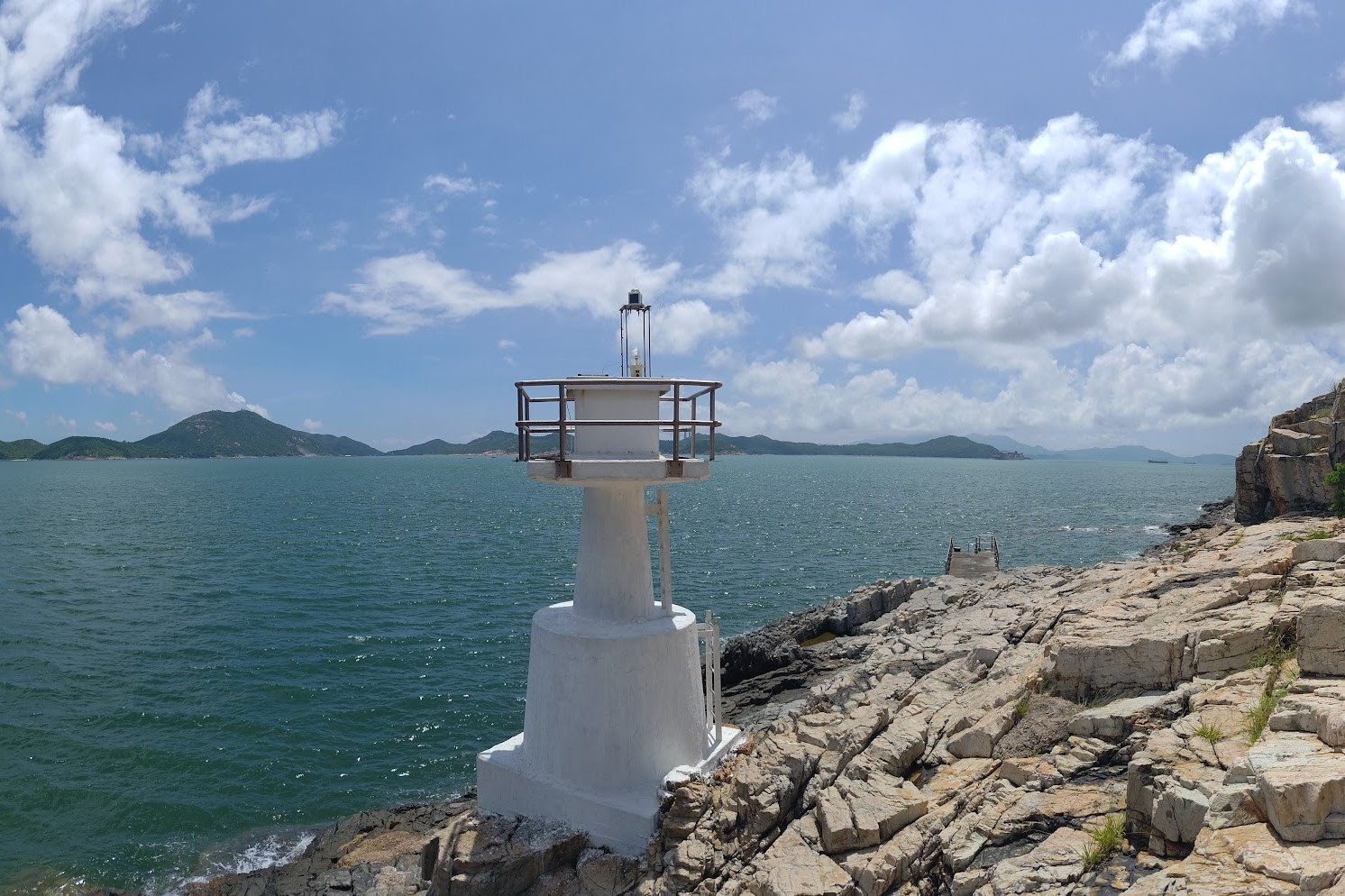
To Mount Johnston Lighthouse
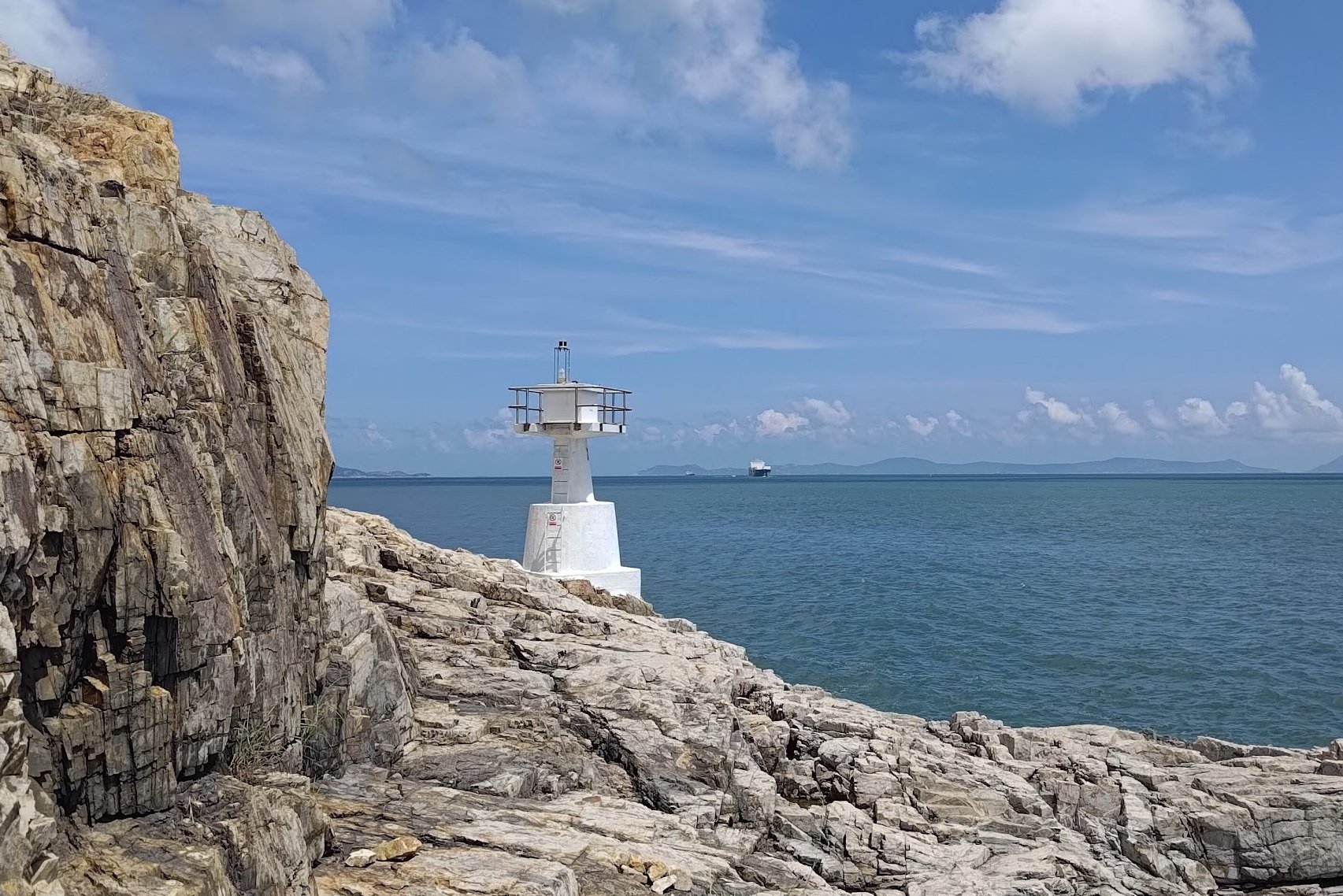
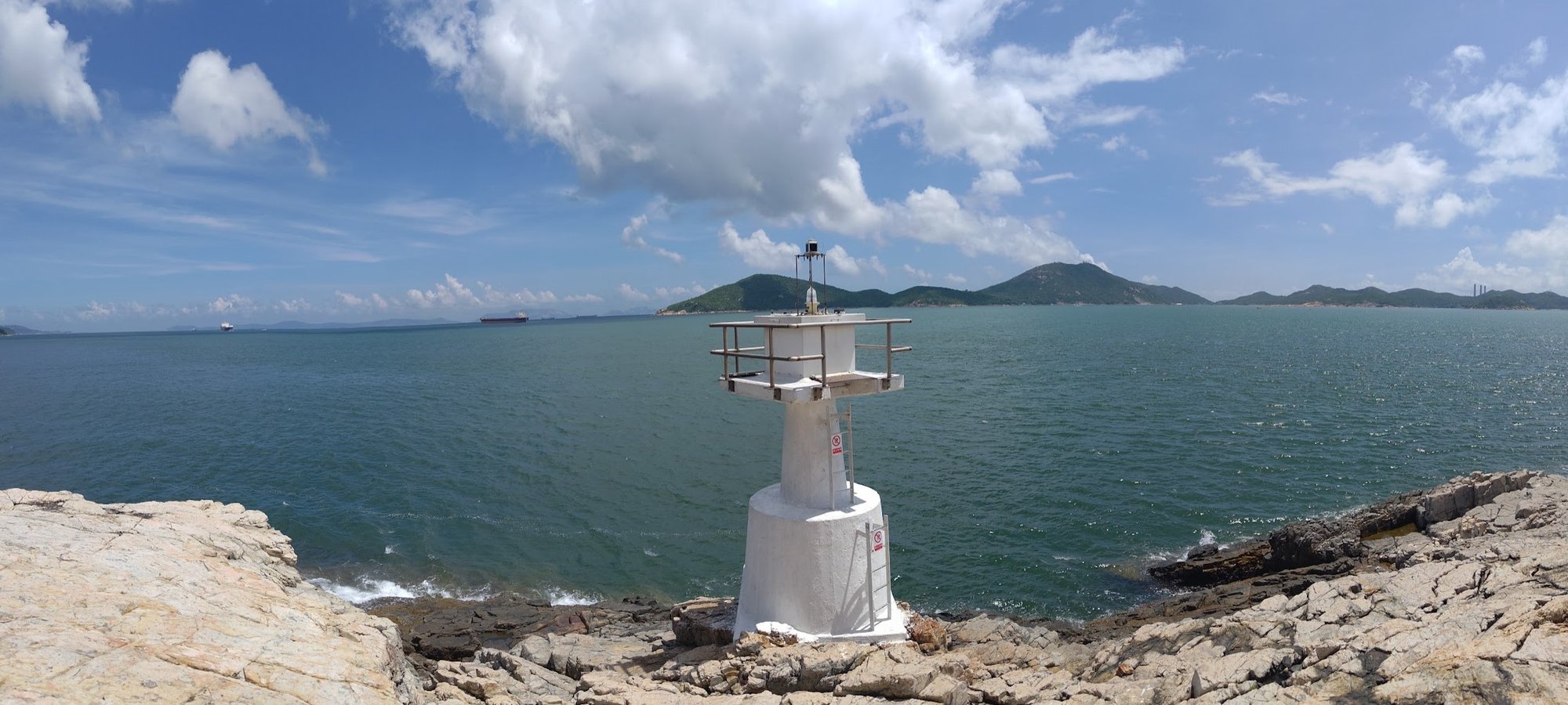
The path is clearly visible at this point, so it’s difficult to get lost. Just stay on the trail until you suddenly get swallowed up by the trees. At this point, you’re super close to the lighthouse.
When you emerge from the trees, you’ll see the lighthouse right in front of you.
You can go left or right to reach the lighthouse.
Right path: Make sure to walk downward behind the pier before turning back toward the lighthouse. This is the safest route.
Left: It’s a much more direct path to the lighthouse from here. Just follow the natural cuts of the rock that form a sort or uneven staircase down.
Ap Lei Pai Pier (Optional Escape Route)
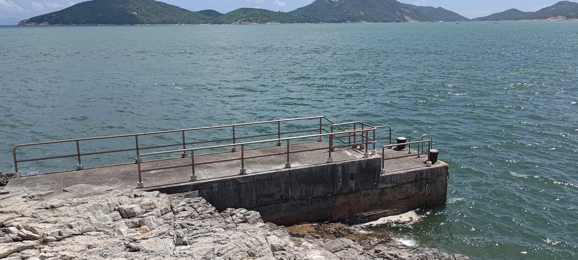
The pier next to Mount Johnston Lighthouse has a sampan service that makes irregular trips back and forth between Ap Lei Pai and Aberdeen.
The number the contact the sampan operator is 92378915.
The Way Back
Return the same way you came from. The hiking trail ends right at Lei Tung MTR station exit B, where you started from.

