
Toad Rock (Kam Kui Shek Teng) Hike: A Quick, Rugged Trail Overlooking Azure Waters
Contents
- Essential Information
- Hike Highlights
- Google Route Map
- How to Get There
- Quick Route Summary
- Sai Wan Pavilion to the First Fork
- Getting to the Brown MacLehose Sign
- 25-min Overgrown Hike to Toad Rock
- Toad Rock Views
- Getting Back
Essential Toad Rock Hike Details
- District: Sai Kung, New Territories
- Duration: 2 hours to Toad Rock and back to Sai Wan Pavilion. Longer if you hike to Sai Wan or Ham Tin Wan
- Distance: 6.5km round trip (roughly)
- Highest Elevation: 178 meters
- Facilities: None, unless you hike down to Sai Wan or Ham Tin Wan
Toad Rock Hike Highlights
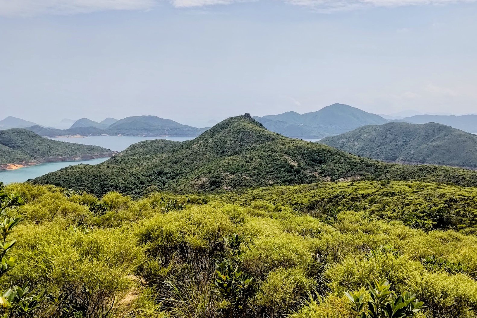
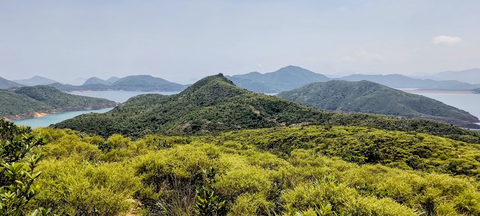
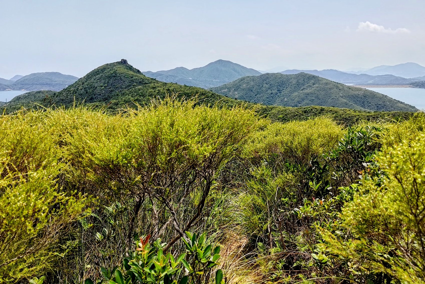
Toad Rock, or Kam Kui Shek Teng (蠄蟝石頂), is a 178-meter-tall hexagonal rock formation right at the start of MacLehose Stage 2. The rock is not perched particularly high, but getting to it is a bit of a challenge because of the rugged terrain you'll have to cross.
The journey from Sai Wan Pavilion initially follows a very safe concrete road, but once you veer off the trail into the overgrown shrubs and grass that leads to Toad Rock, you'll have to be quite focused.
While there is a trail of sorts to follow, it gets technical in parts and you can get lost if you're not paying attention.
It's worth noting that this is a there-and-back journey, so the hike to Toad Rock will have to be repeated in reverse to get back to Sai Wan Pavilion. Even if you plan on continuing to Ham Tin Wan, or Sharp Peak, you'll still have to re-trek the rugged section.
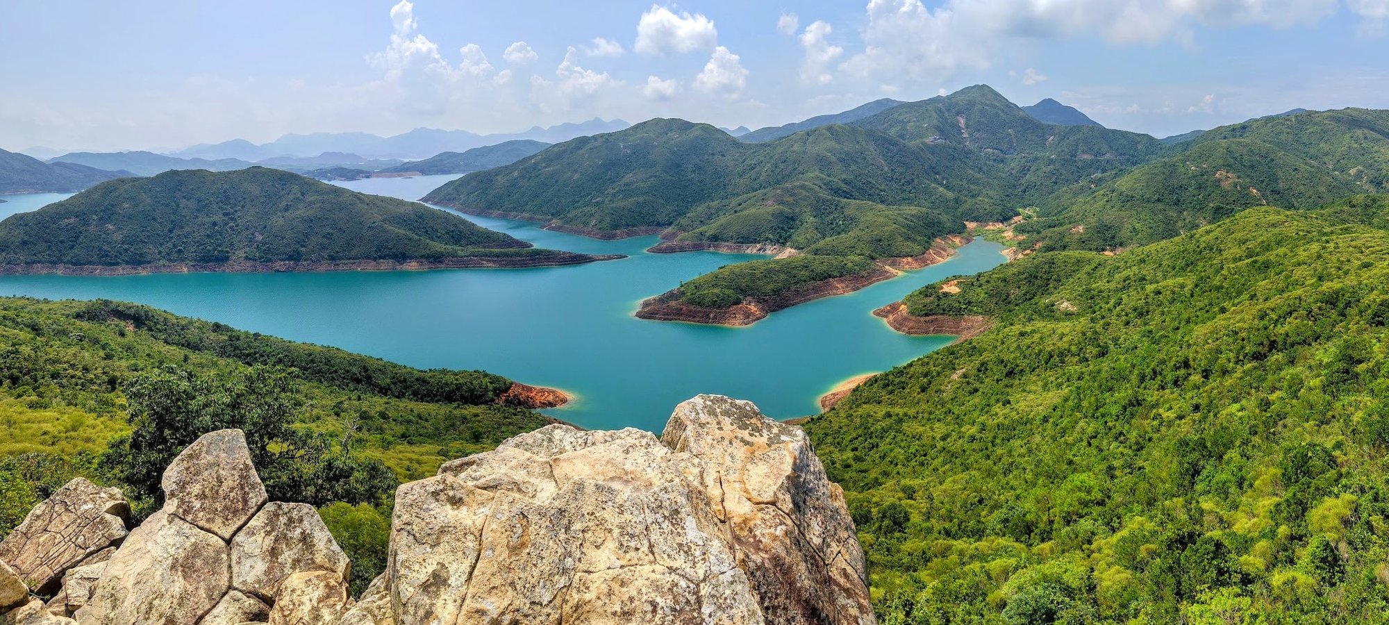
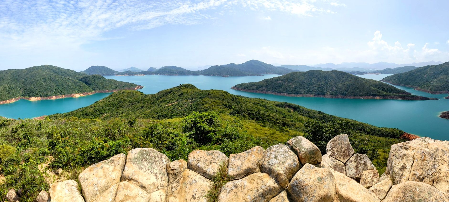
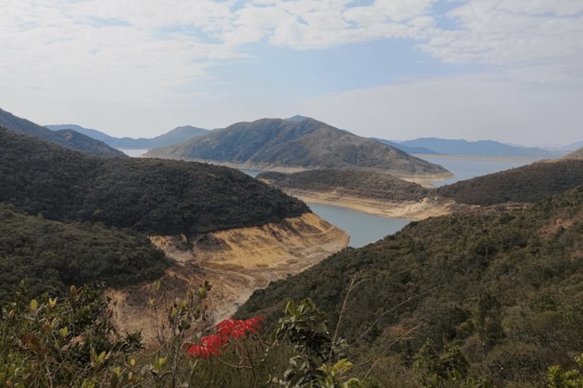
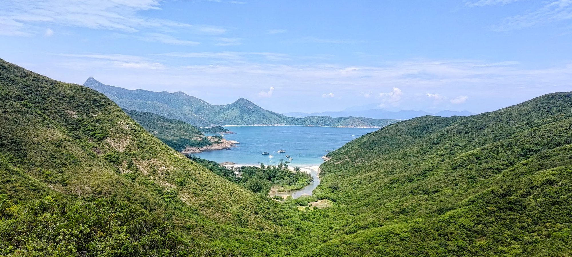
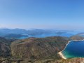
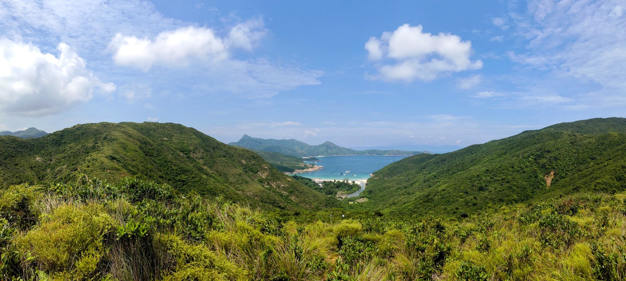
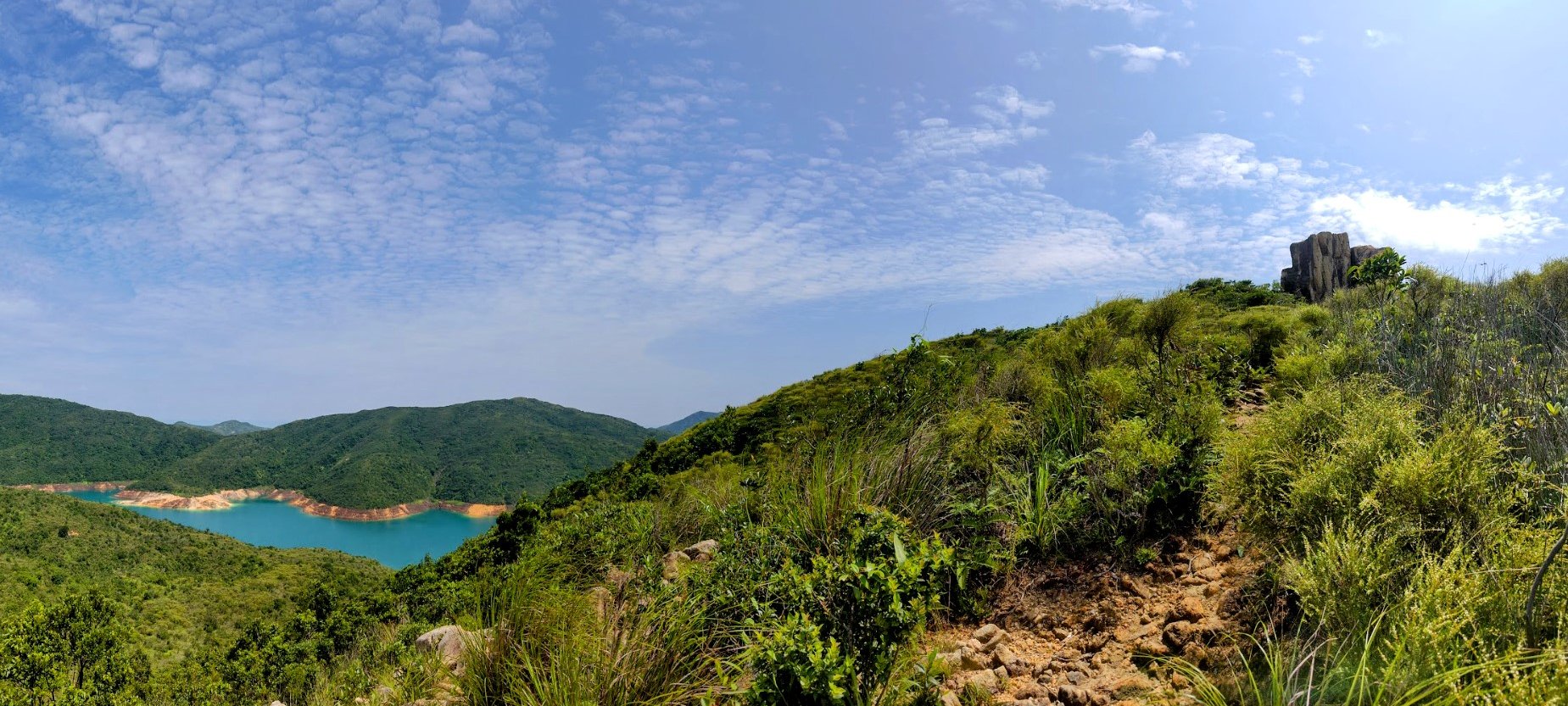
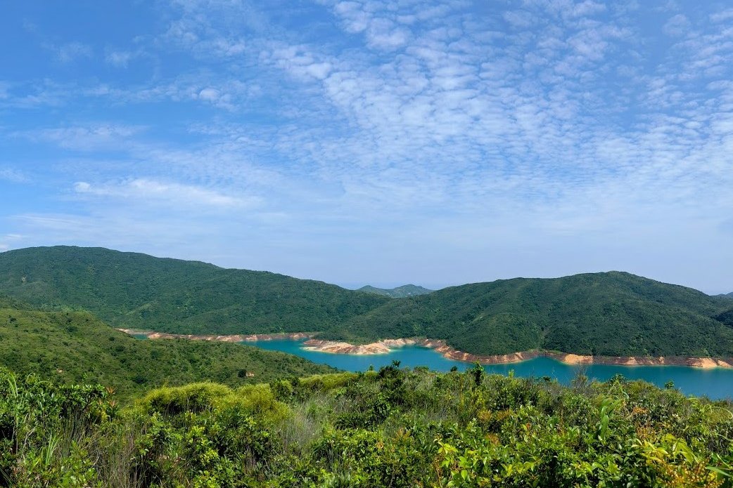
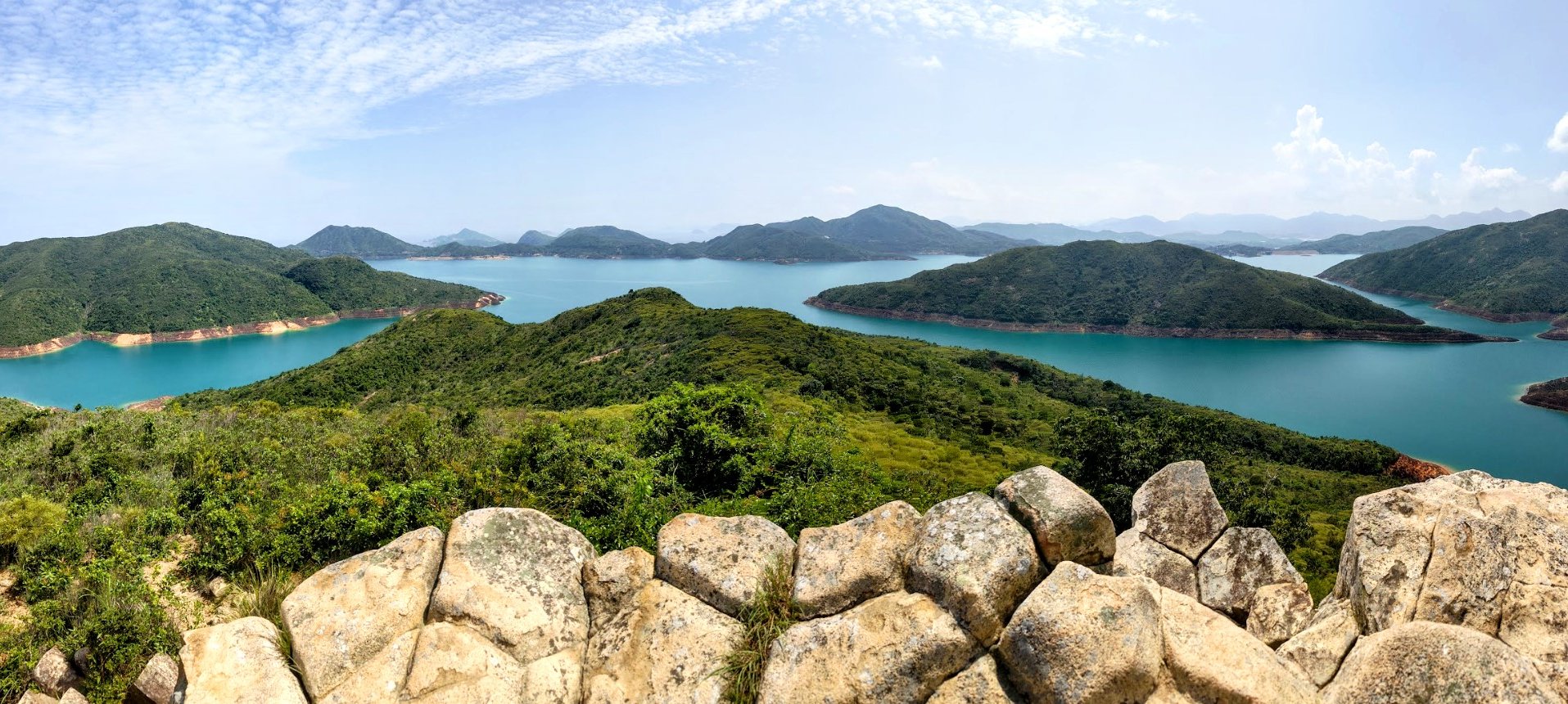
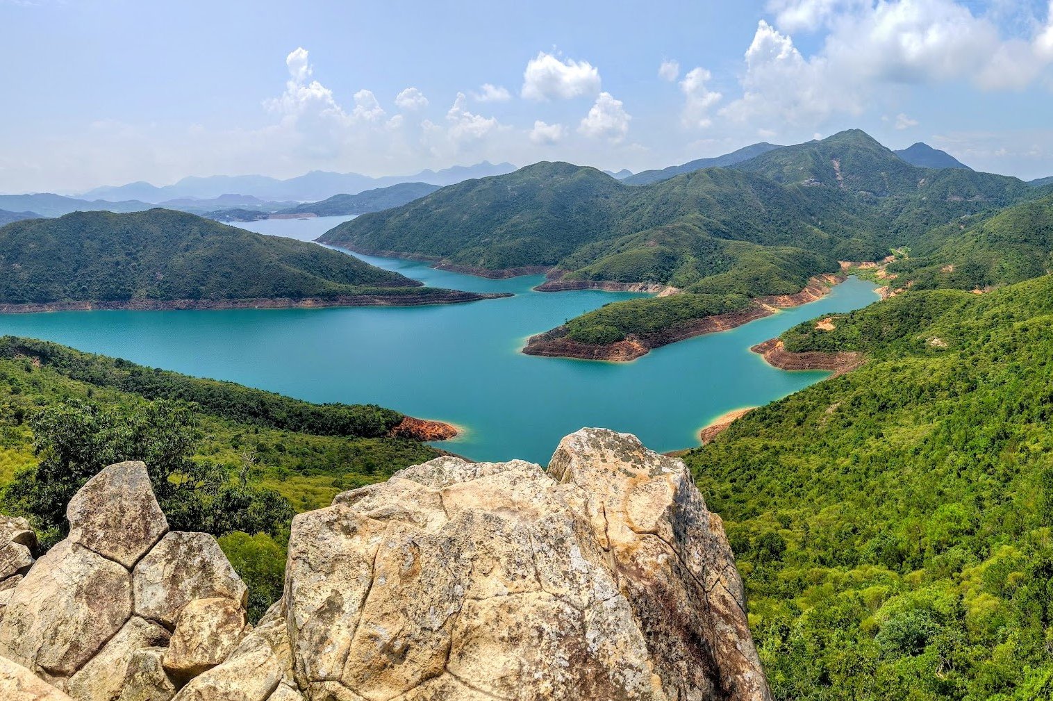
I find that it's totally worth it though (on a clear day), as the views from Toad Rock are truly one of a kind! High Island Reservoir, which is full of drinking water, looks resplendent while perched atop the rock while the sun shines down.

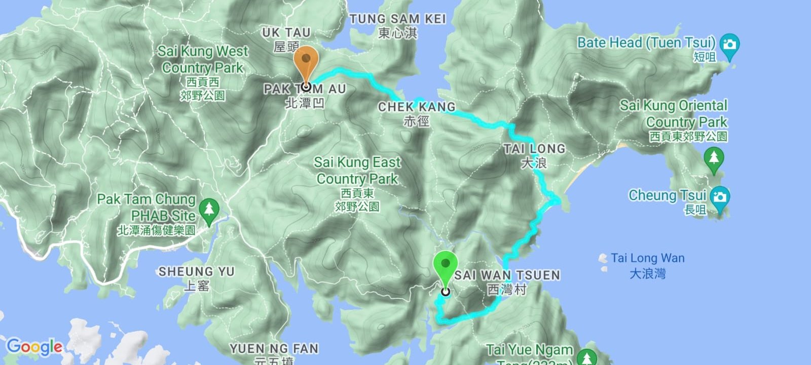
Google Route Map
*Click the box icon in the top right of the map below to load the blue route directly into your own Google Maps. You can then see your location relative to the trail in real time!
How to Get to Sai Kung
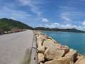
The easiest way to get to Toad Rock is to start from Sai Wan Pavilion in Sai Kung.
Getting to Sai Kung:
No MTR lines go directly to Sai Kung, so you have to take a bus or an MTR bus combo.
By Bus:
From Kowloon:
- 1A minibus from Choi Hung MTR (exit C1)
- 96R bus from Diamond Hill MTR station (exit C2) Sat, Sun and Public holidays only
- 9 red minibus from Ngau Tau Kok (Yee On Street)
- Mong Kok Express red minibus (from Dundas Street)
From the New Territories:
- 299X bus from Shatin (below New Town Plaza)
- 101M minibus from Hang Hau MTR (exit B)
From Hong Kong Island:
- The best way to get to Sai Kung from HK Island in the morning is to take the MTR to Hang Hau and get the 101M minibus.
- Causeway Bay Express red minibus: Monday-Friday: 7pm to 12:30am Weekends: 5pm to 12:30am.
Getting From Sai Kung to Sai Wan Pavilion (Start Point)
I usually get a taxi from Sai Kung Town (or anywhere else) and head directly to Sai Wan Pavilion. Show the taxi driver this to get there: 西灣亭, 西貢
Alternatively, you can get the NR29 bus that departs from Chan Man Street straight to Sai Wan Pavilion. You can find the timetable here. Just note that line for the bus is really long, especially in the morning.
Quick Toad Rock Hike Summary
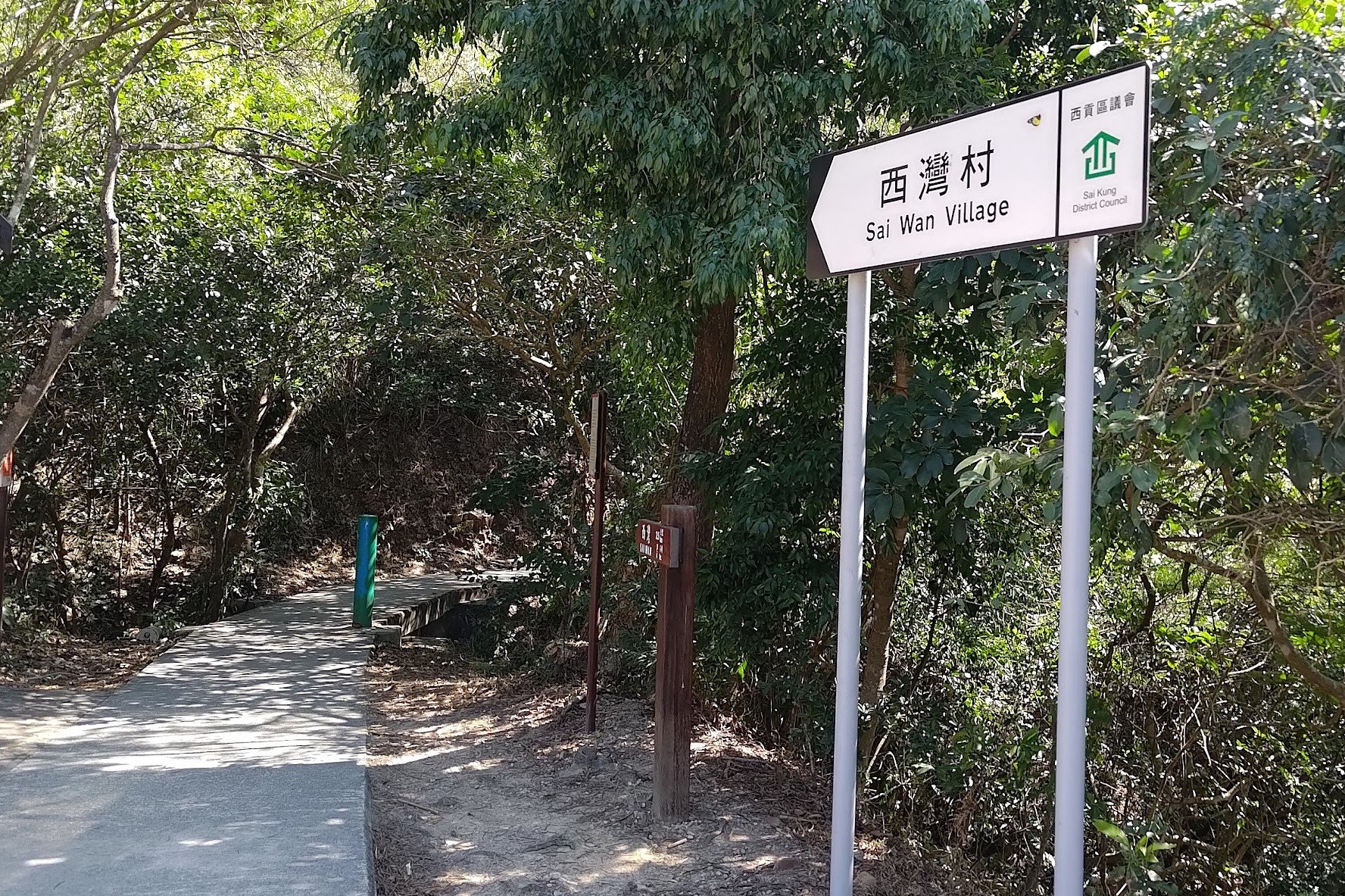
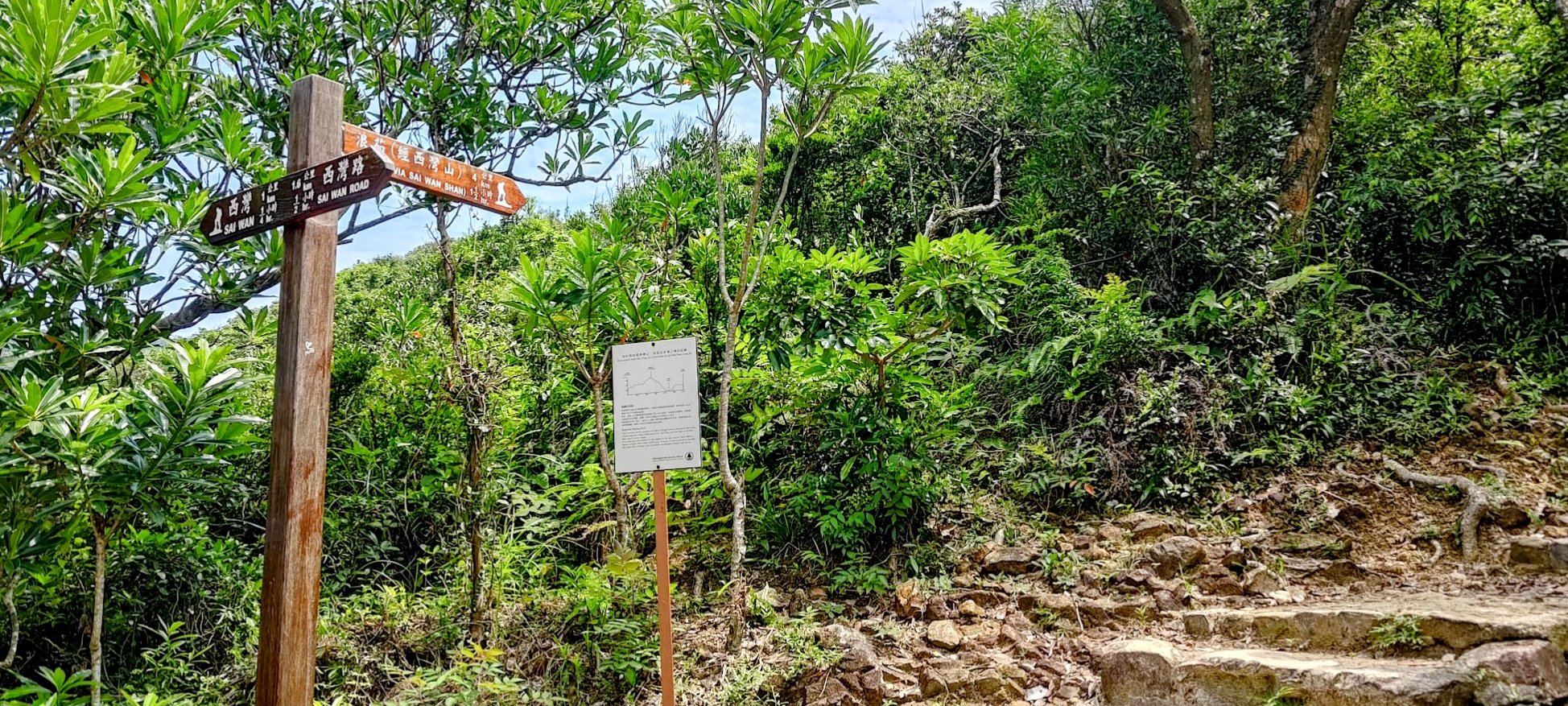
- From Sai Wan Pavilion, follow the concrete path until you arrive at a set of brown signs
- Follow the sign on the right pointing to Long Ke Via Sai Wan Shan
- Climb the stone steps and stay on the trail for just under 10 minutes. Look for a brown MacLehose Trail sign next to the overgrowth on your right
- You will see a barely noticeable overgrown trail beside the MacLehose Trail sign. Follow it.
- From hereon out, you'll be navigating by ribbons. Look for ribbons that will guide you to Toad Rock
- You'll also be able to see Toad Rock in the distance. It takes about 25 minutes to get to Toad Rock.
- Retrace your steps back. You can either head to Sai Wan Pavilion and wait for the minibus, continue hiking all the way to Pak Tam Au, or hike to Ham Tin Wan and get a speedboat back to Sai Kung.
If you want to keep hiking, check out the article below.
Sai Wan Pavilion to the First Fork in the Trail
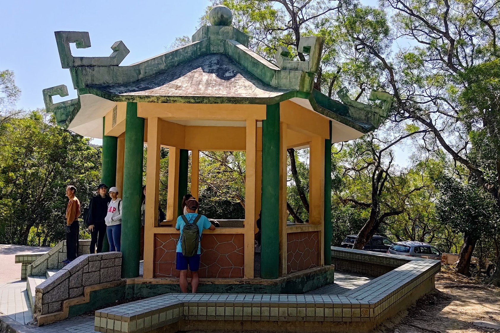
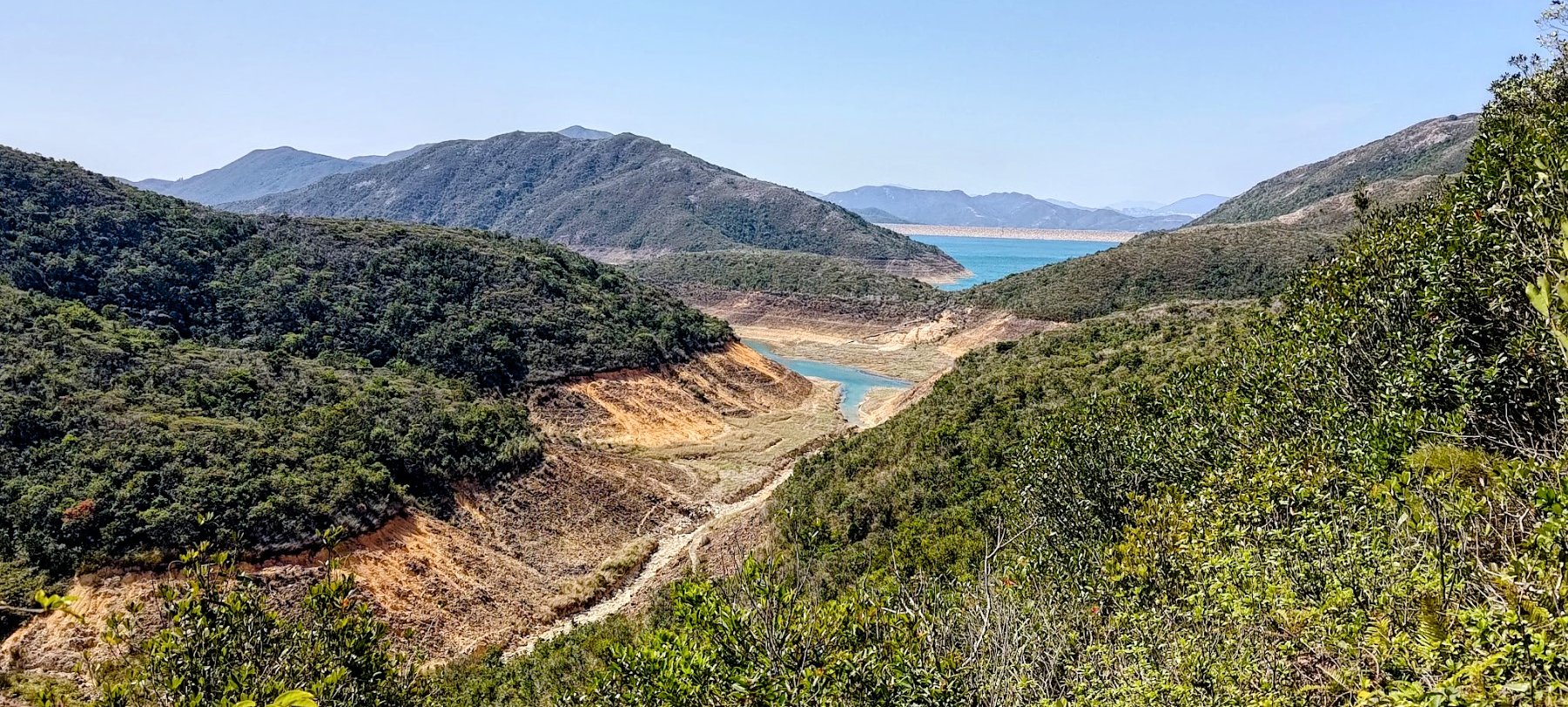
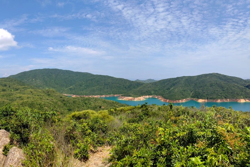
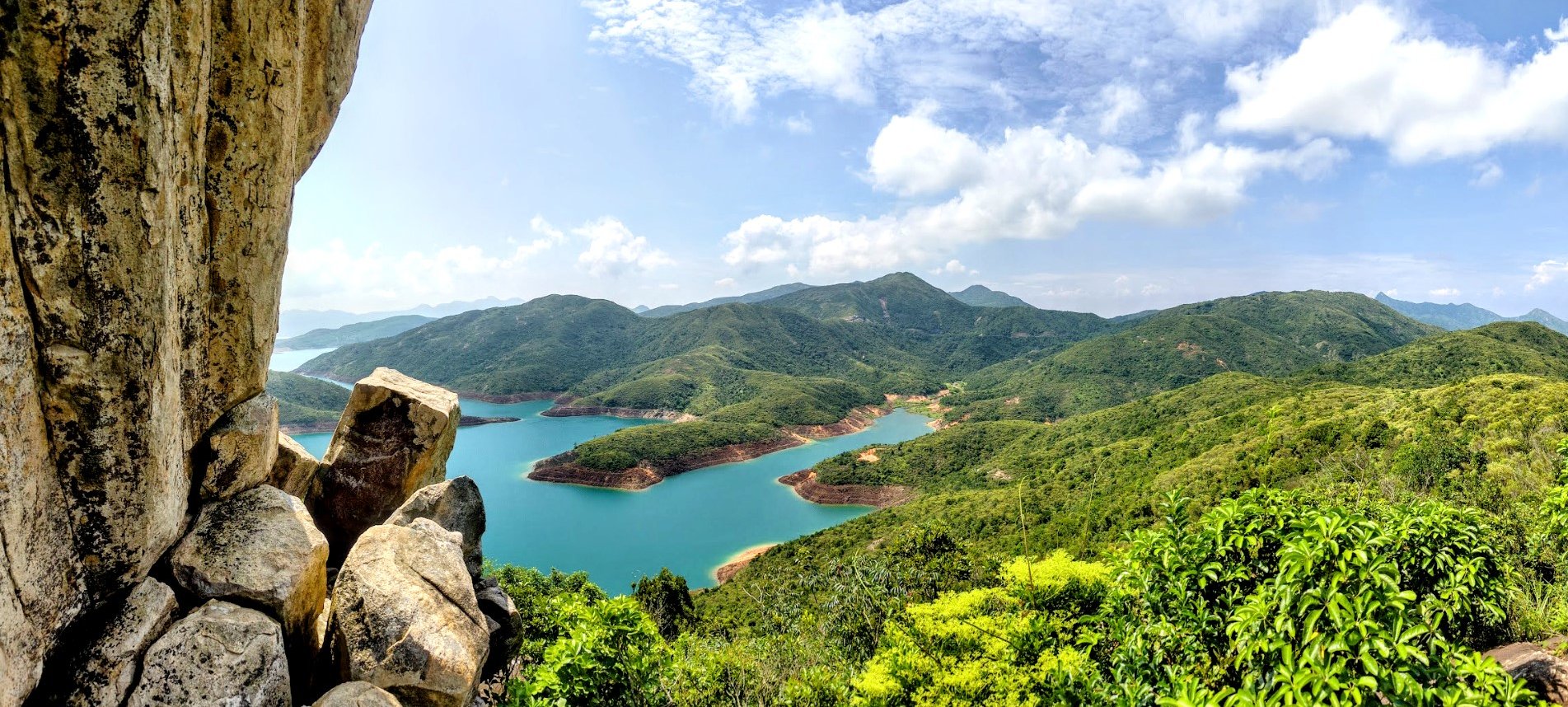
As you begin following the concrete path from Sai Wan Pavilion, you’ll soon be treated to views of High Island Reservoir - which was built in 1978 - to your right. Of particular note is just how turquoise the waters look on a clear day, which is in stark contrast to the deep, earthy browns and reds of the soil and rock surrounding it.
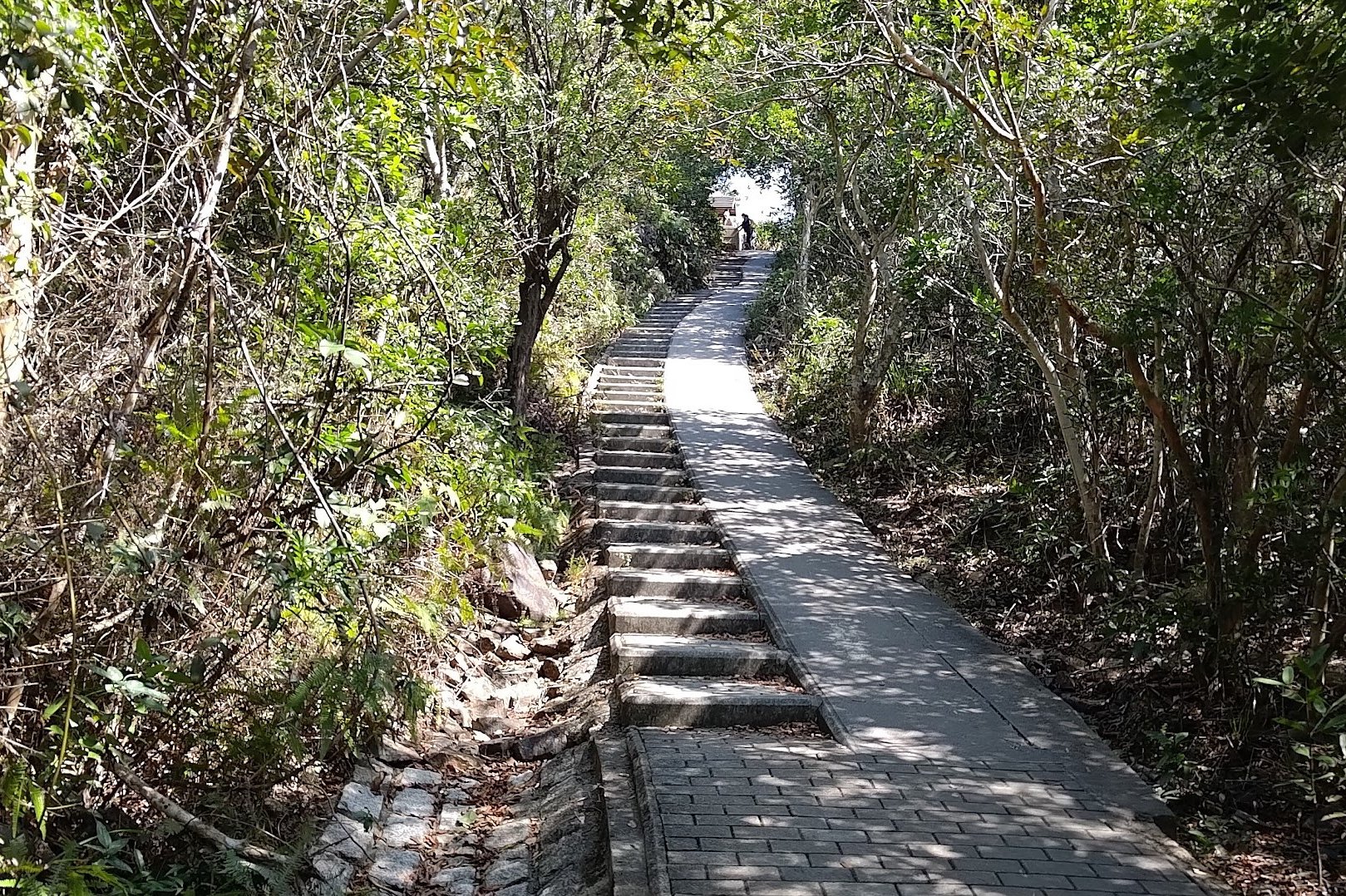
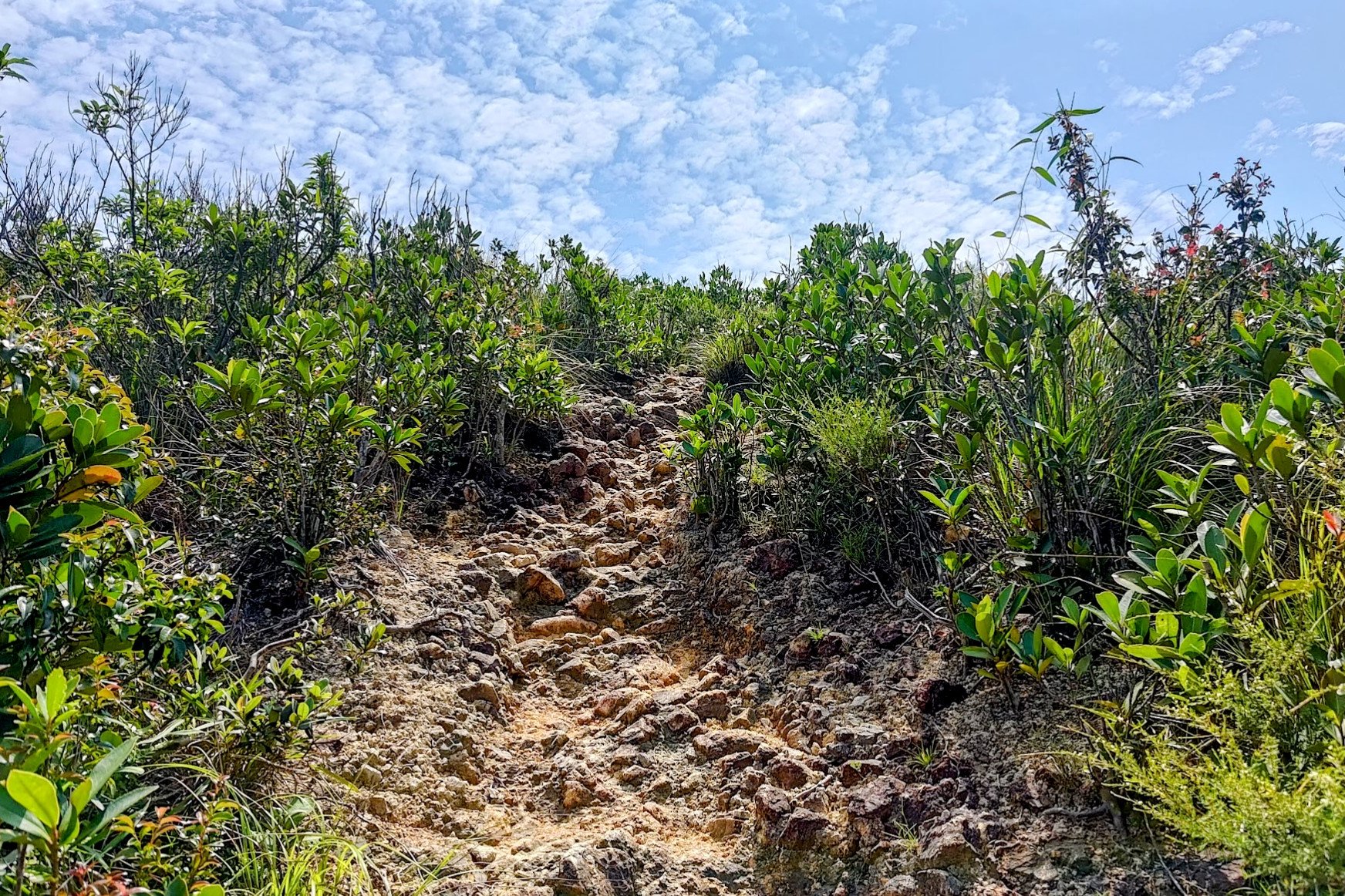
After a slightly steep uphill section, you will come across a signpost. Heed the sign pointing up the stairs on the right that says Long Ke Via Sai Wan Shan.
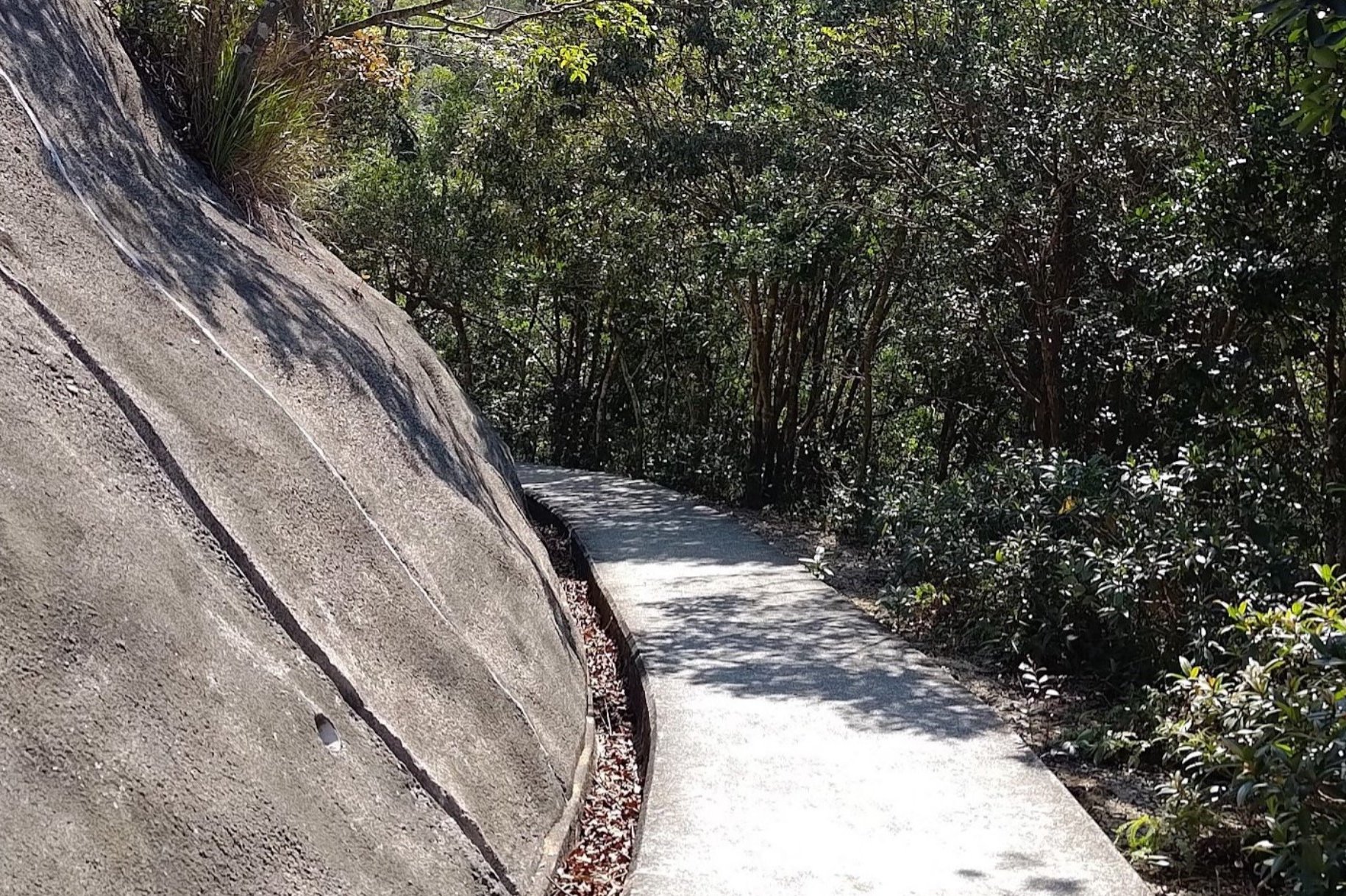
10 Mins of Hiking to the Brown MacLehose Sign
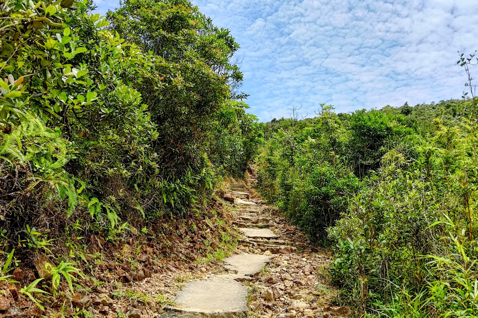
Begin climbing the concrete steps. It's a little steep, but the views of Long Ke, and Sharp Peak on your left makes the climb totally worth it!
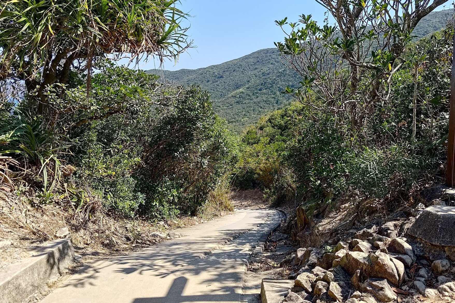
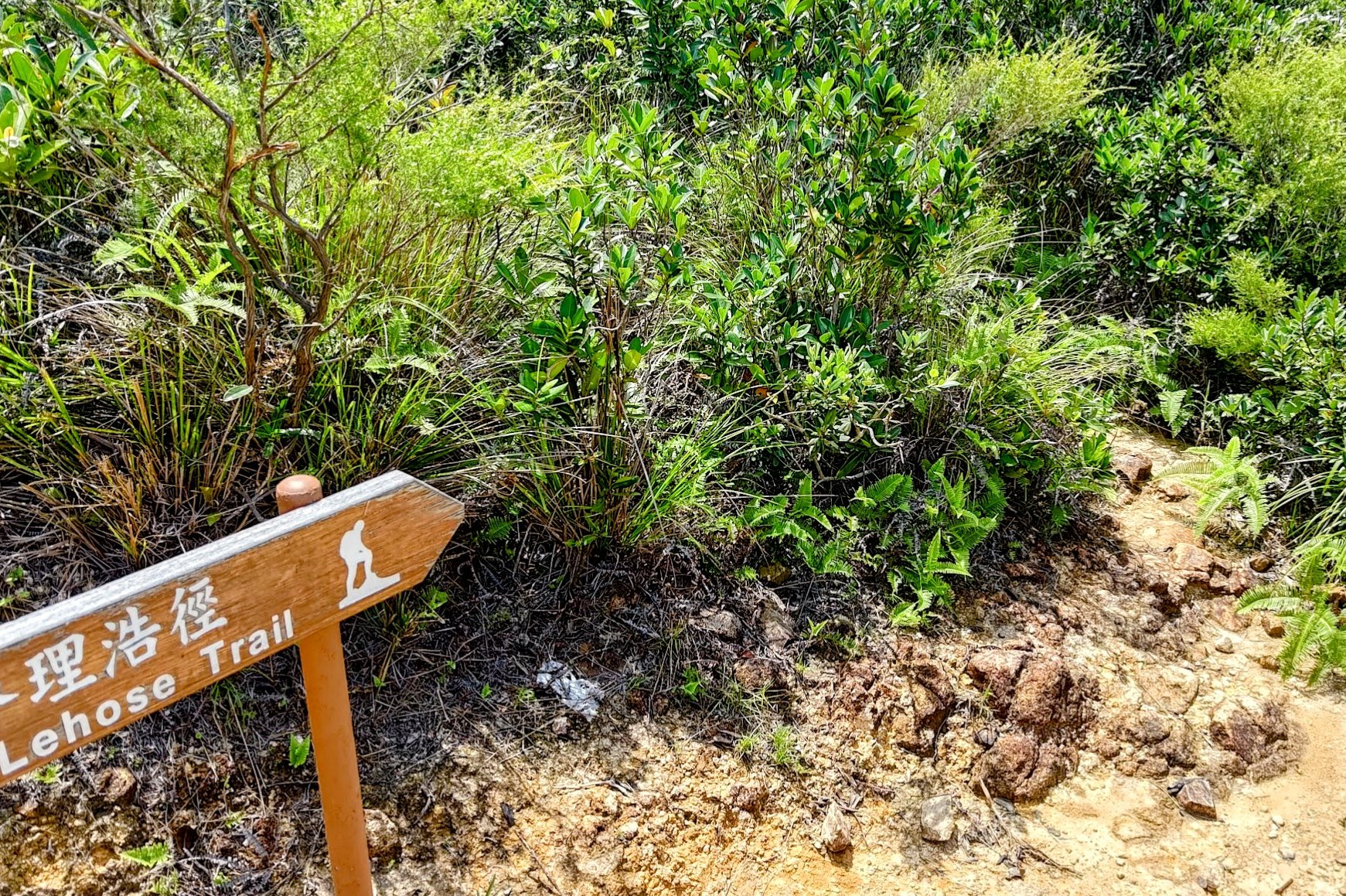
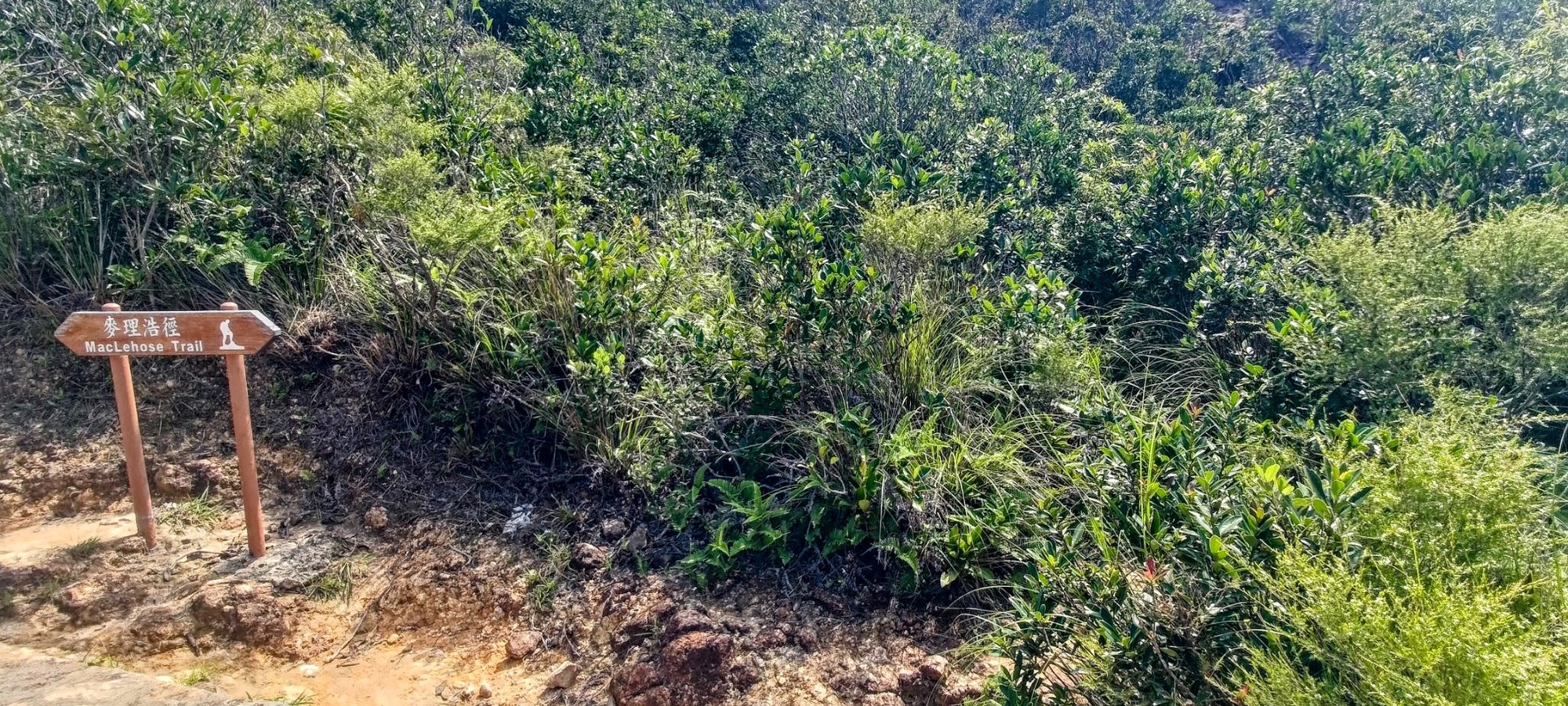
Barely ten minutes later is when you'll come across a brown MacLehose Trail sign. Just beside it is the overgrown trail to Toad Rock.
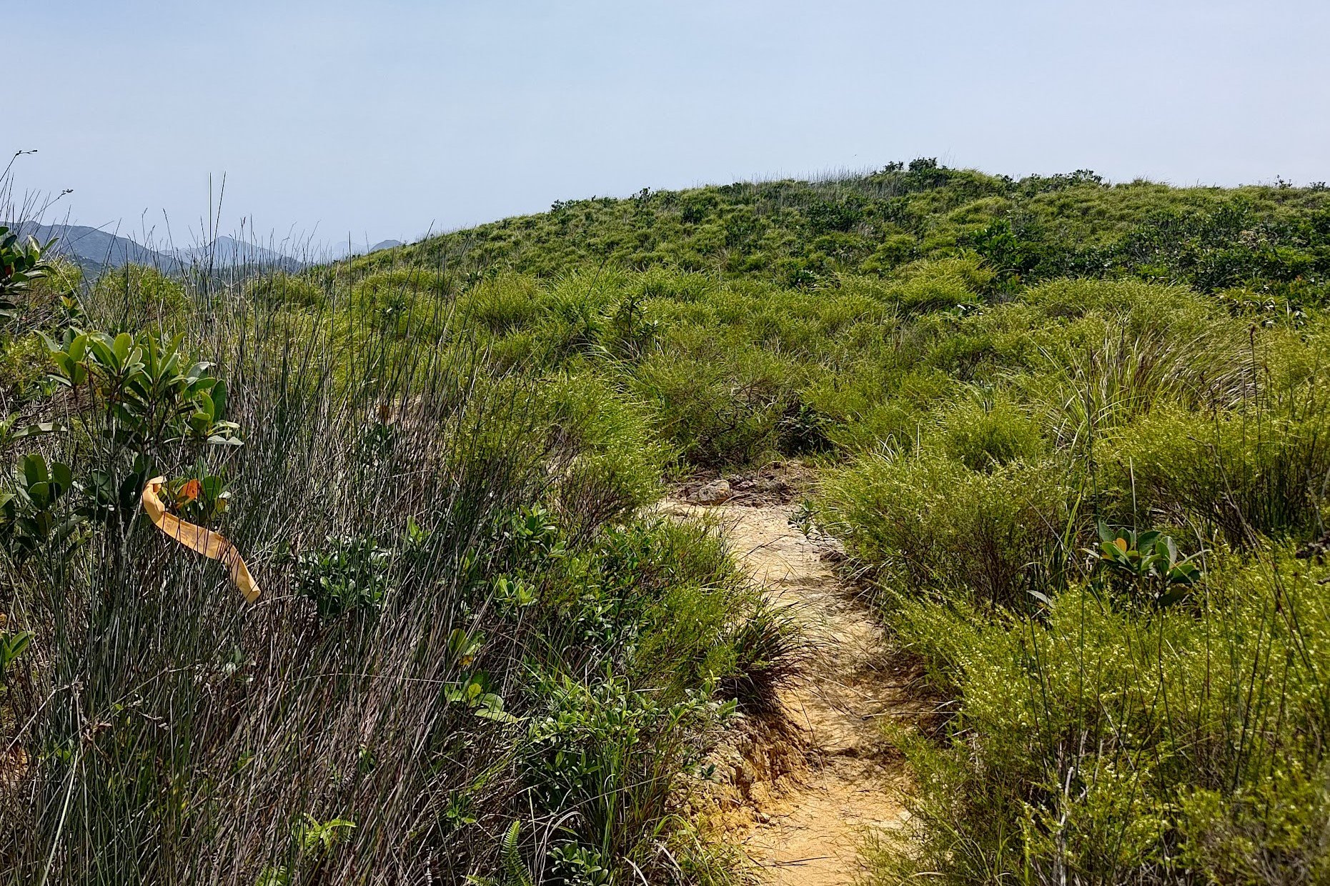
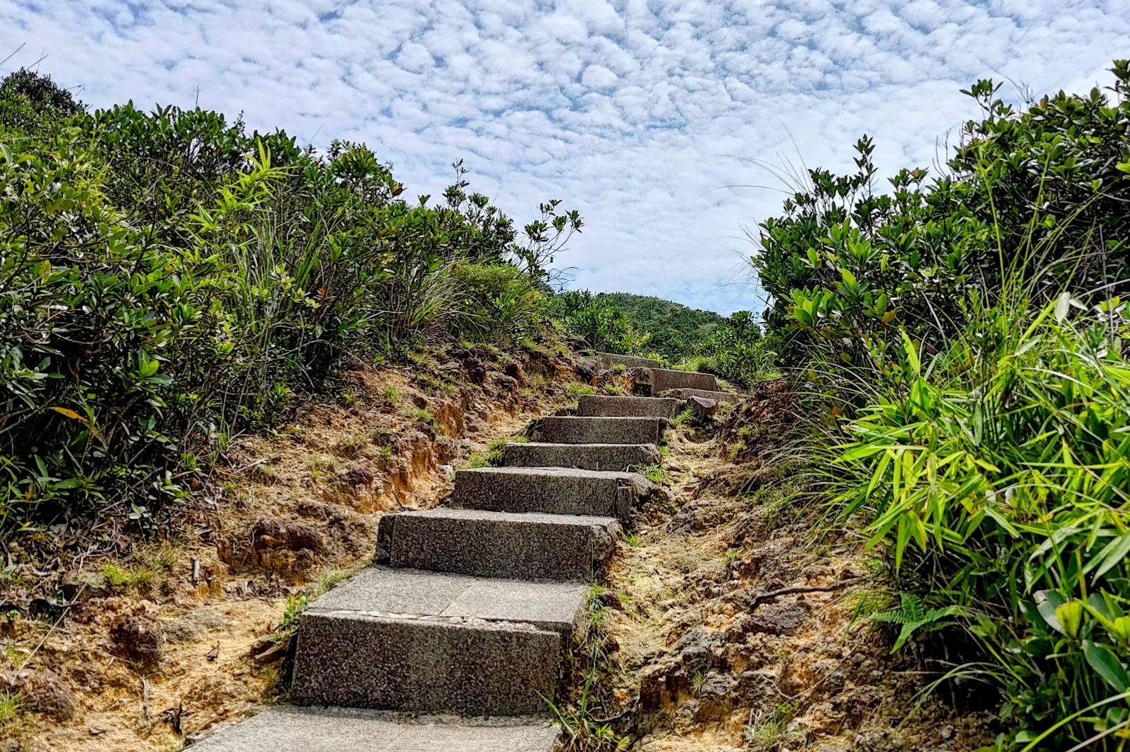
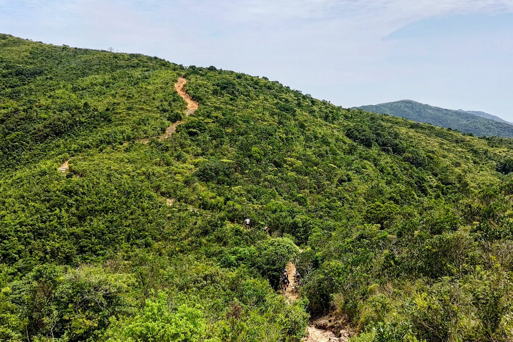
The 25-min Overgrown Trail to Toad Rock
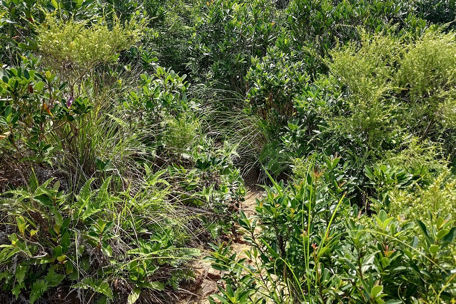
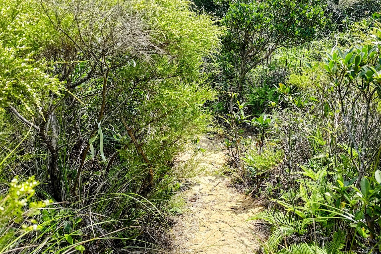

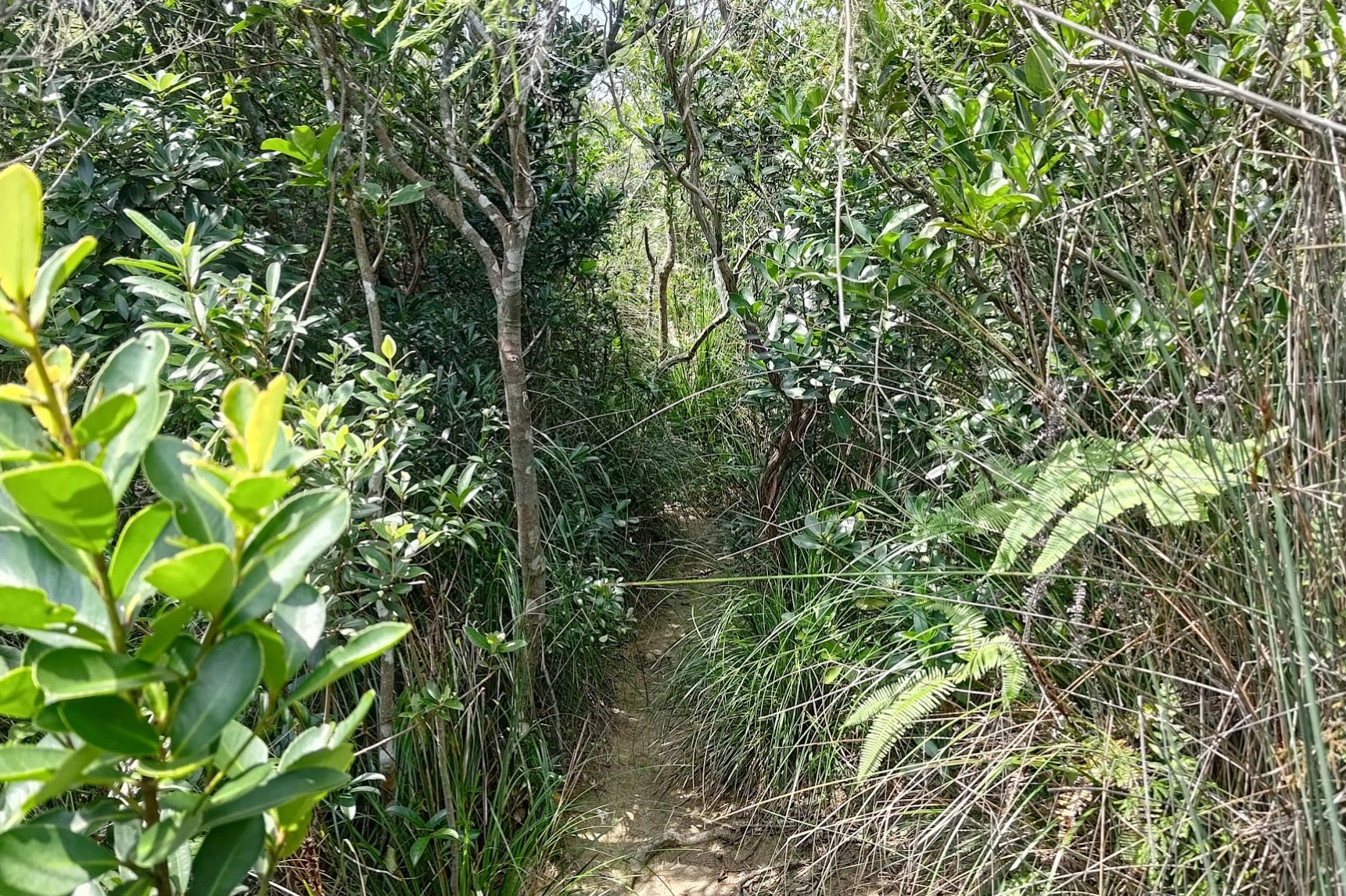
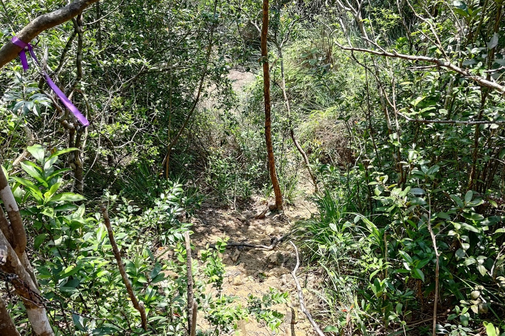
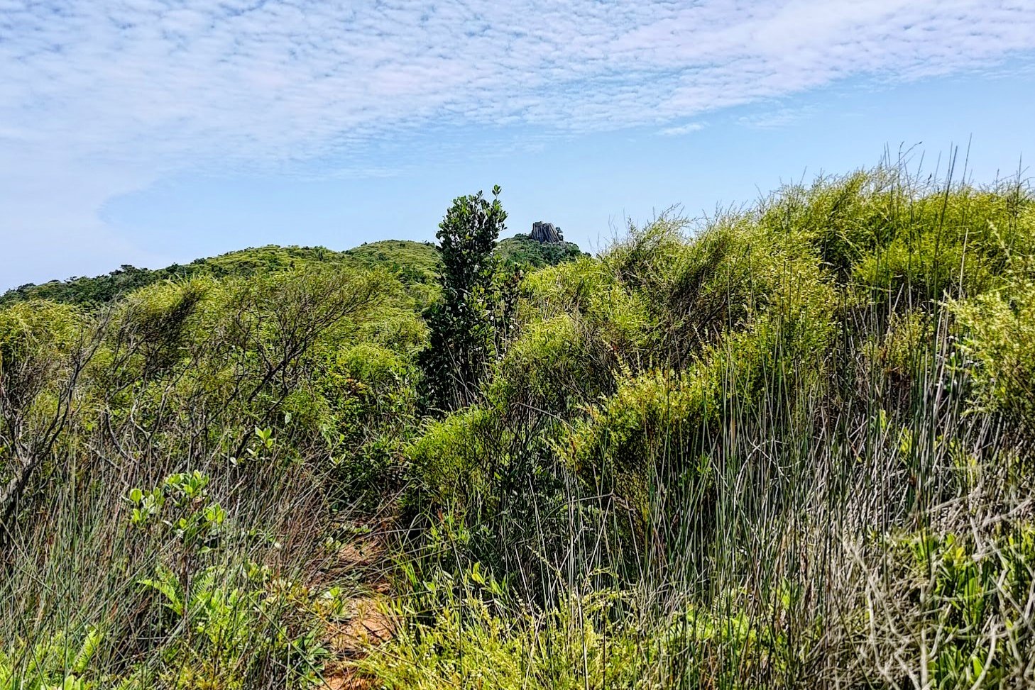
This section is by far the toughest and most technical. It'll take 25-30 minutes from the MacLehose sign to Toad Rock.
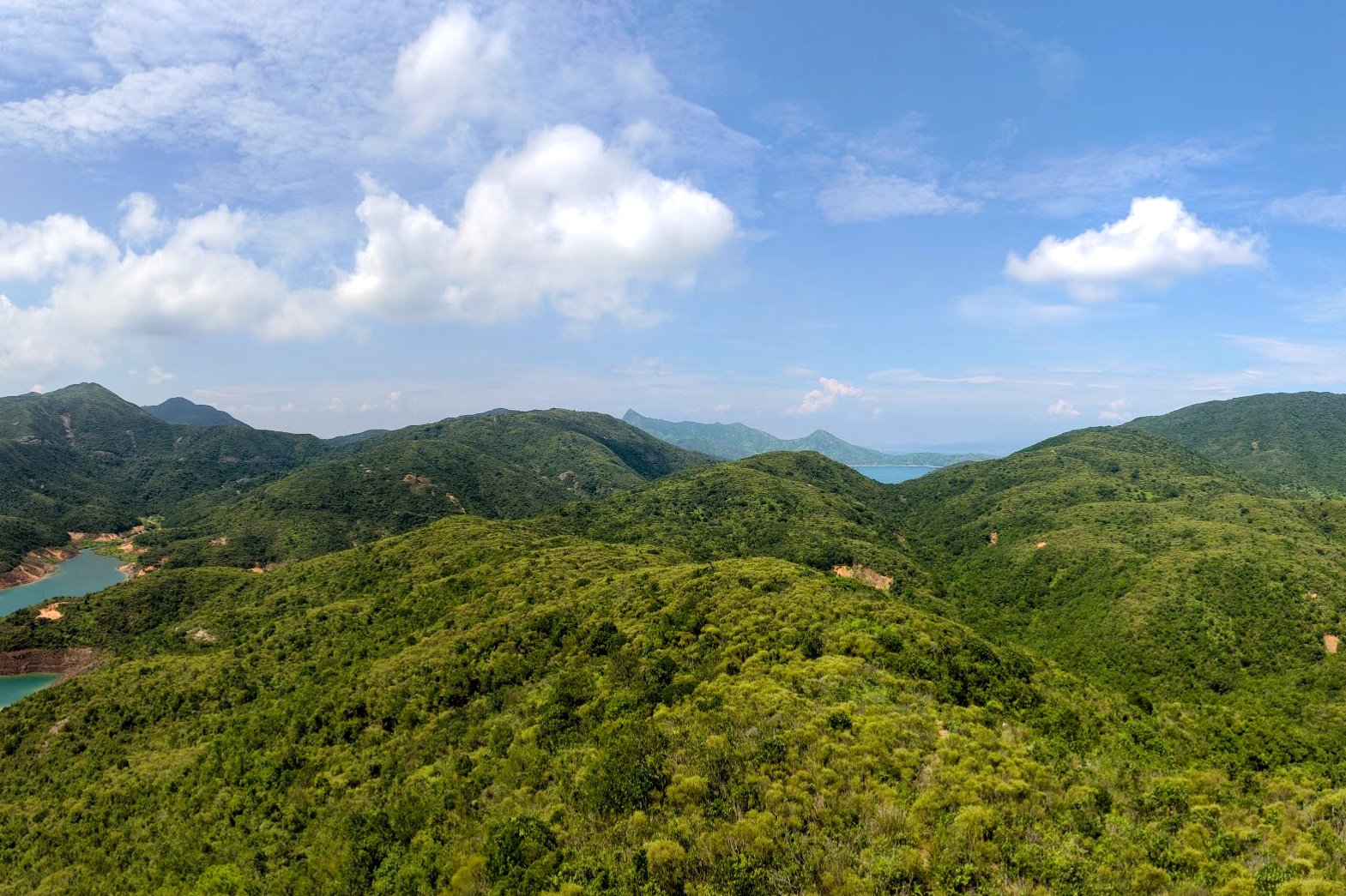
Much of the trail is overgrown and will also require climbing up and then back down. Look for ribbons throughout this section to guide you, as well as visually clocking where Toad Rock is each time you crest a small hill.
Toad Rock Views
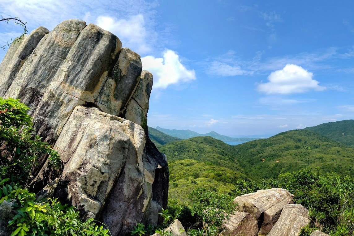
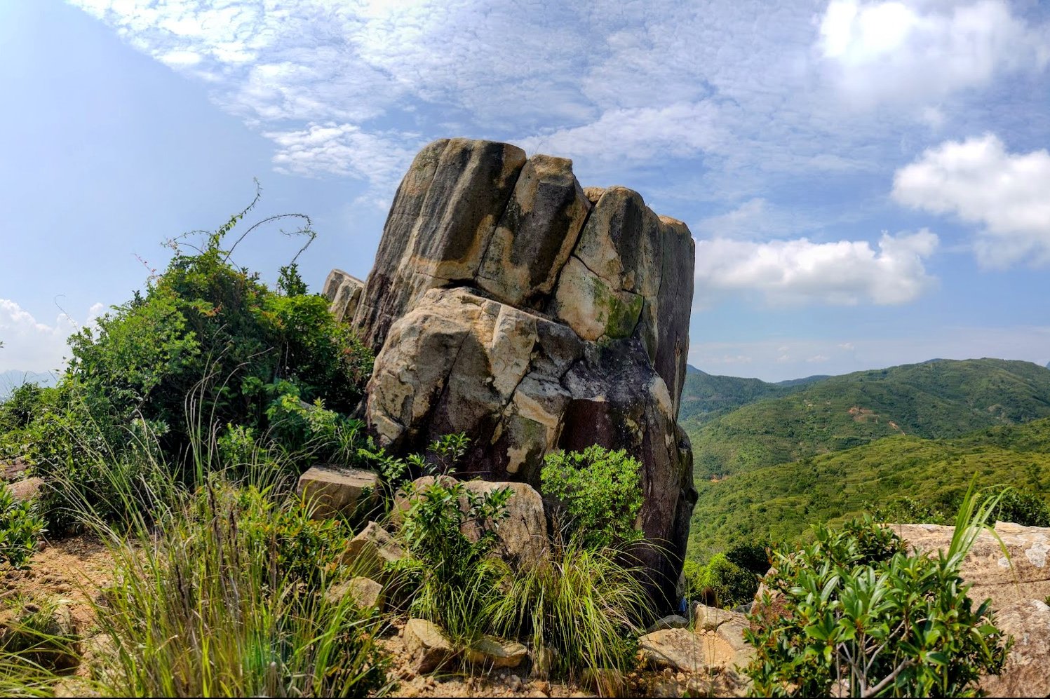
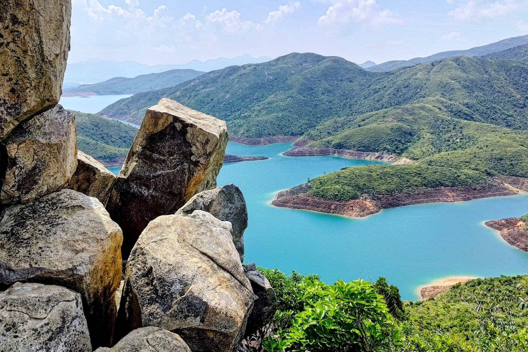
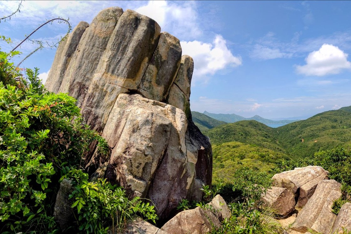
All your effort will certainly pay off once you reach Toad Rock. The rock itself is characterized by a series of hexagonal columns that are fused tightly together. It makes for quite a brilliant sight, though I struggled to see why the rock is named after a toad. Perhaps its moniker makes more sense when viewed from above.
The true standout view though is that of High Island Reservoir below. If you attempt this hike in good weather, it's tough to find anywhere else in Hong Kong where you'll see waters as blue and vibrant as here.
When you're done admiring the scenery, you'll have to retrace your steps.
Getting Back
You can either:
- Return to Sai Wan Pavilion and wait for the rather infrequentNR29 bus
- Hike to Ham Tin Wan, where you can get a speedboat back to Sai Kung Town at the Hoi Fung Store
- Hike all the way to Pak Tam Au, where you can take the 96R bus (Sat, Sun and Public holidays only) that heads to both Sai Kung and then Diamond Hill MTR Station or get on the 94 bus to Sai Kung and connect to one of the other buses that gets you closest to home.

