
Three Fathoms Cove: Five Types of Scenery in One Hike
Contents
- Essential Information
- Hike Highlights
- Google Route Map
- How to Get There
- Quick Route Summary
- Detailed Route
- Rocky Canyon Scenery
- Abandoned Village Houses
- Sham Chung Village (Field Scenery)
- Sham Chung Manor
- Beach Scenery and Optional Escape Point
- Mangrove Scenery
- The End of the Hike
- The Way Back
Essential Three Fathoms Cove Hike Details
- District: New Territories
- Duration: 4 hours
- Distance: 12.5km
- Highest Elevation: 130ish meters
- Difficulty: 2/5
- Facilities: Shops and toilets at the start and end. Food and drinks throughout.
Why Hike Three Fathoms Cove?
The Three Fathoms Cove hike is one of those hikes that takes a bit of effort to get to, but is totally worth it. With the trail consisting of zero tough uphill sections, you’re basically going on an extended walk through some of Hong Kong’s most breathtaking scenery.
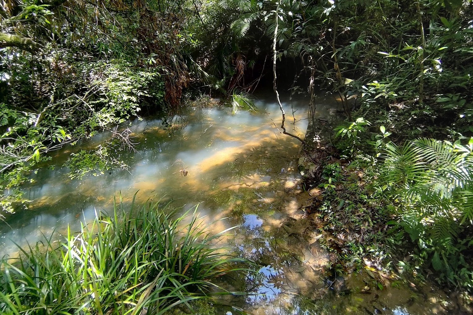
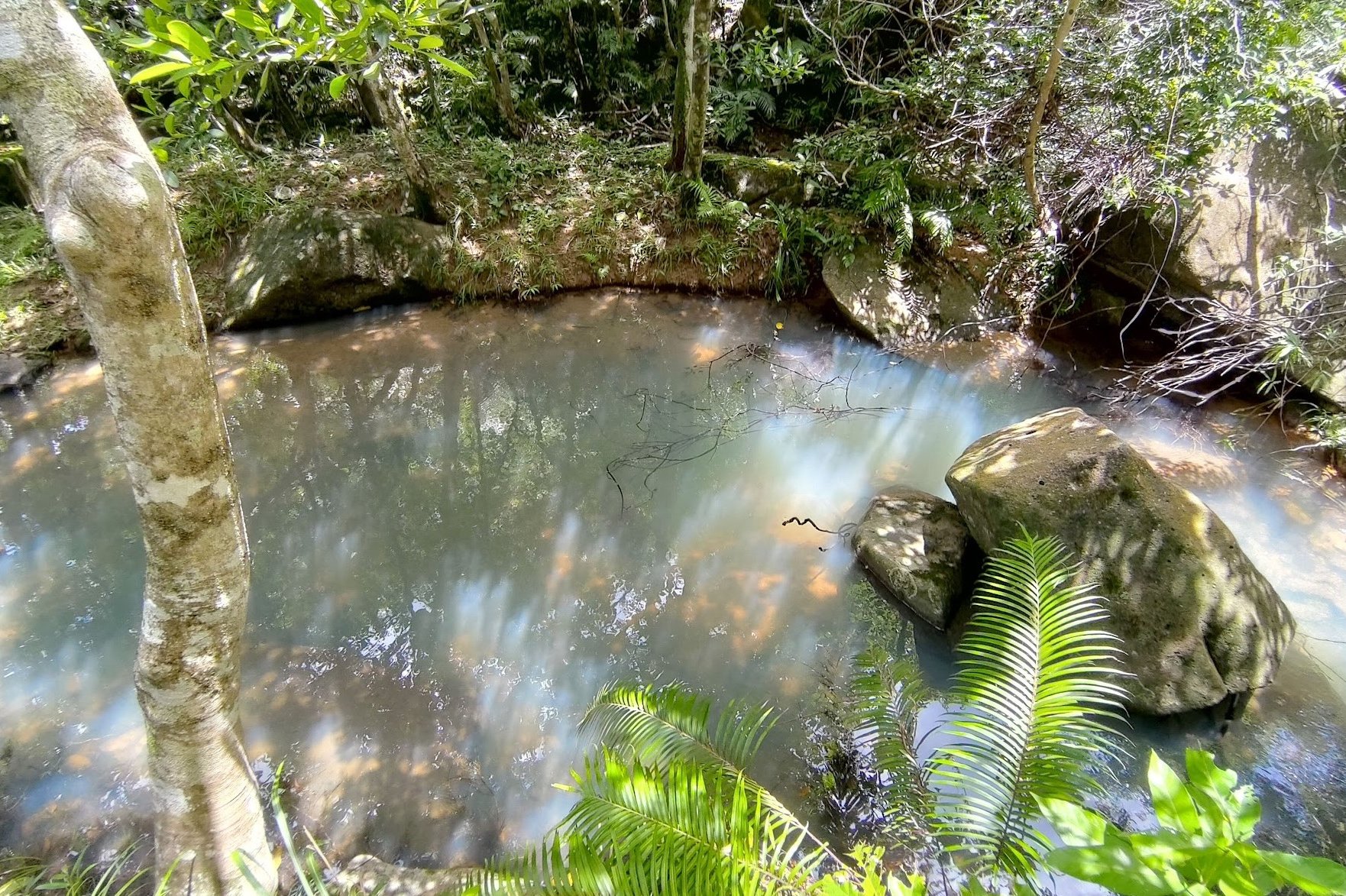
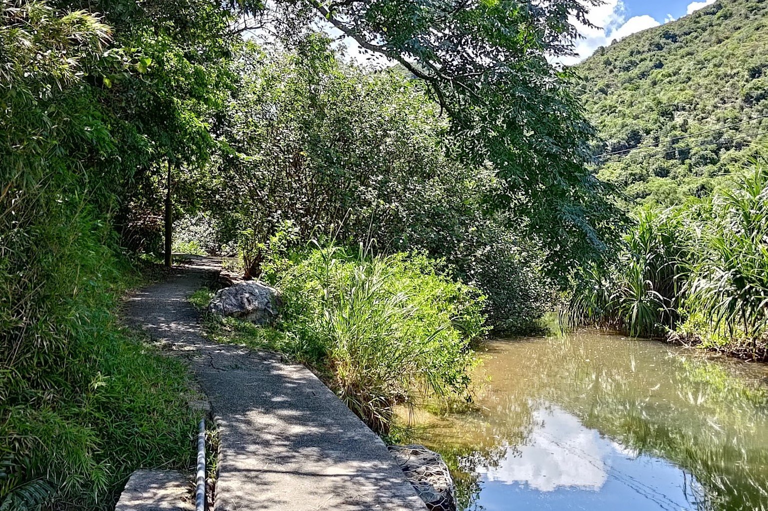
The hike starts you off in a shaded forest with gentle, flowing streams running right next to the trail. The way the sunlight hits the water and makes it seem to glow is honestly mesmerizing. Before long, you’ll emerge into a section of the hike that takes you through a rocky canyon that adds a little excitement to the hike.
From the canyon, you’ll suddenly switch to open fields dotted with traditional Hakka houses. This area, called Sham Chung, was once the home of a thousand Hakka villagers, but is now abandoned – save for a few remaining homes.
Going through the field and village, you’ll hug the coast, walking past several stunning beaches with super-clear water.
Finally, the trail even lets you experience a rare mangrove ecosystem with little crabs scurrying about in the mud. Don’t worry, you’re not actually wading through the mangroves, there’s a concrete path that keeps your feet dry with the mangroves to either side of you.
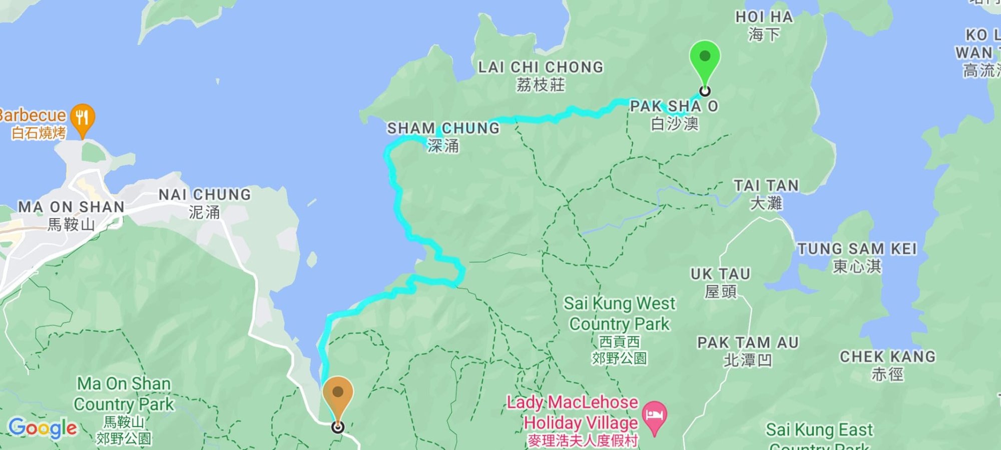
Google Route Map
How to Get to the Three Fathoms Cove Hike Start Point:
Get to Sai Kung
From Kowloon:
- 1A minibusfrom Choi Hung MTR (exit C1)
- 96R bus from Diamond Hill MTR station (exit C2) Sat, Sun and Public holidays only
- 9 red minibus from Ngau Tau Kok (Yee On Street)
- Mong Kok Express red minibus (from Dundas Street)
From the New Territories:
- 299X bus from Shatin (below New Town Plaza)
- 101M minibus from Hang Hau MTR (exit B)
From Hong Kong Island:
- The best way to get to Sai Kung from HK Island in the morning is to take the MTR to Hang Hau and get the 101M minibus.
- Causeway Bay Express red minibus:: Monday-Friday: 7pm to 12:30am Weekends: 5pm to 12:30am.
Sai Kung to Pak Sha O (Official Hike Start Point)
From Sai Kung Pier Minibus Terminal, you can get green minibus number 7 directly to Pak Sha O.
The minibus has no indication of what stop you're at once you get on, so show the driver this: 白沙澳 and they can help you get off at the correct stop.
If you miss Pak Sha O, it's a ten minute walk from the last stop (Hoi Ha), so it's not a disaster either way.
Quick Three Fathoms Cove Hiking Guide
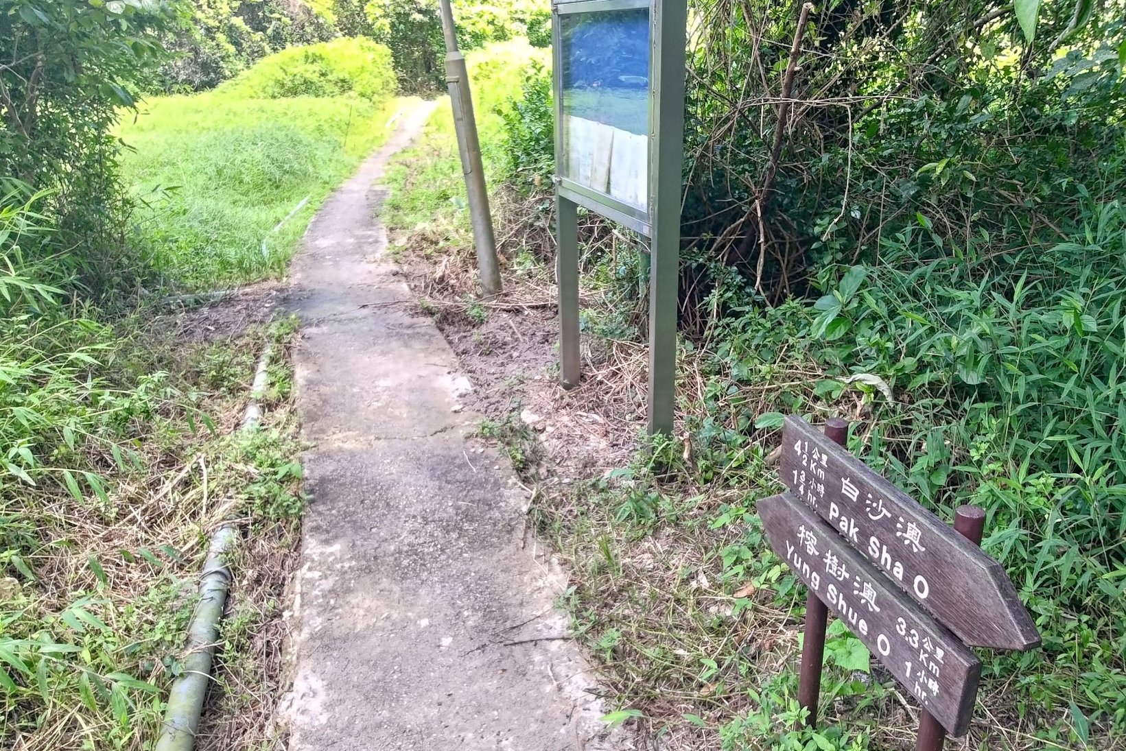
- Follow the 'Pak Sha O' sign into the forest when you get off the minibus
- Follow the concrete path past the old village buildings
- 15 mins later, follow the 'Sham Chung' and 'Lai Chi Chong' sign
- 10 mins later, follow the 'Sham Chung' sign at the fork
- Follow the rocky canyon path downward
- Go past the abandoned village houses and arrive at Sham Chung
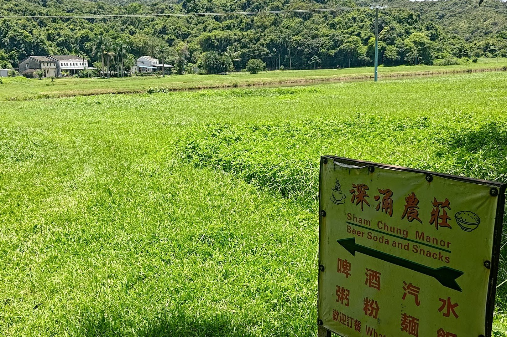
- Sham Chung Manor (Hakka house with 1936 written on it) serves food and drinks
- Walk across the grass field and follow the path along the coast (optional escape point)
- 40 mins later, there's another place for food and drinks
- Arrive at Yung Shue O Village
- Follow the concrete road to Sai Sha Road (roughly 1 hour)
- Get the bus back
Forest, Streams and Old Village Buildings
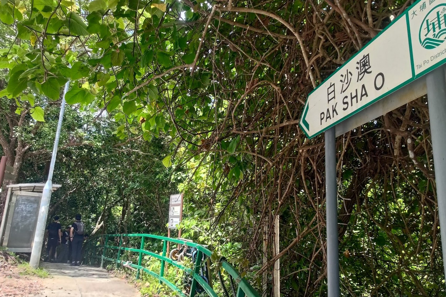
When you get off the number 7 minibus, look for the 'Pak Sha O' sign. There'll also be a set of brown signs nearby that will point you in the direction of 'Sham Chung' and 'Lai Chi Chong'.
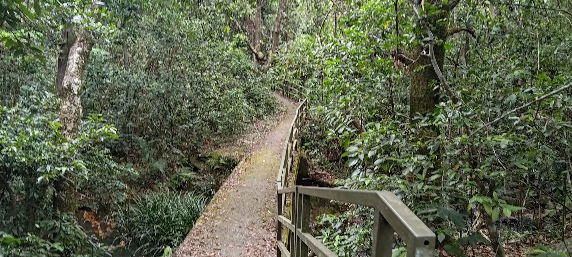
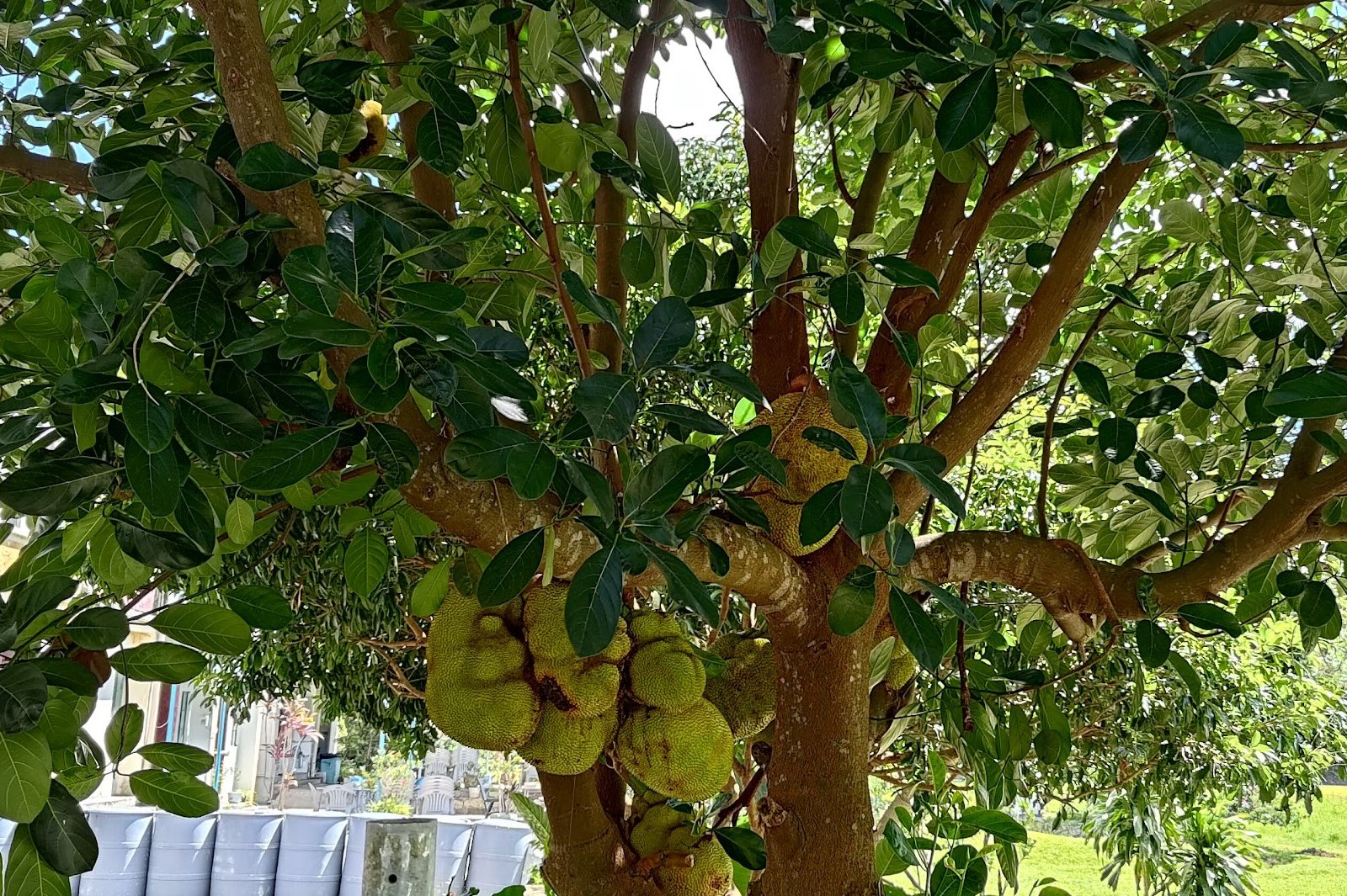
Head down the concrete path into the forest where you'll pass some fields and an old village home.
Before long, you'll see a little stream meandering gently alongside the path with tiny fish in it.
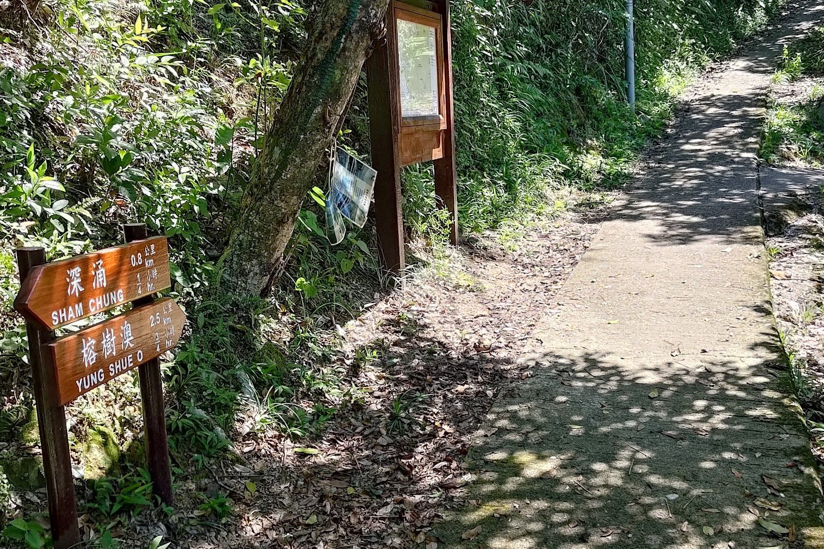
Follow the Sign to Sham Chung
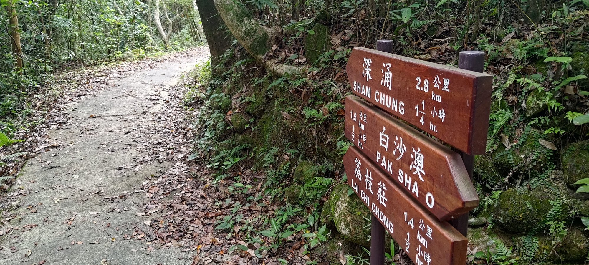
15 minutes after beginning your hike, you'll see this sign pointing you toward 'Sham Chung' and 'Lai Chi Chong'.
Sham Chung is the next destination, so heed the sign and keep hiking!
Keep Going Toward Sham Chung at the Fork
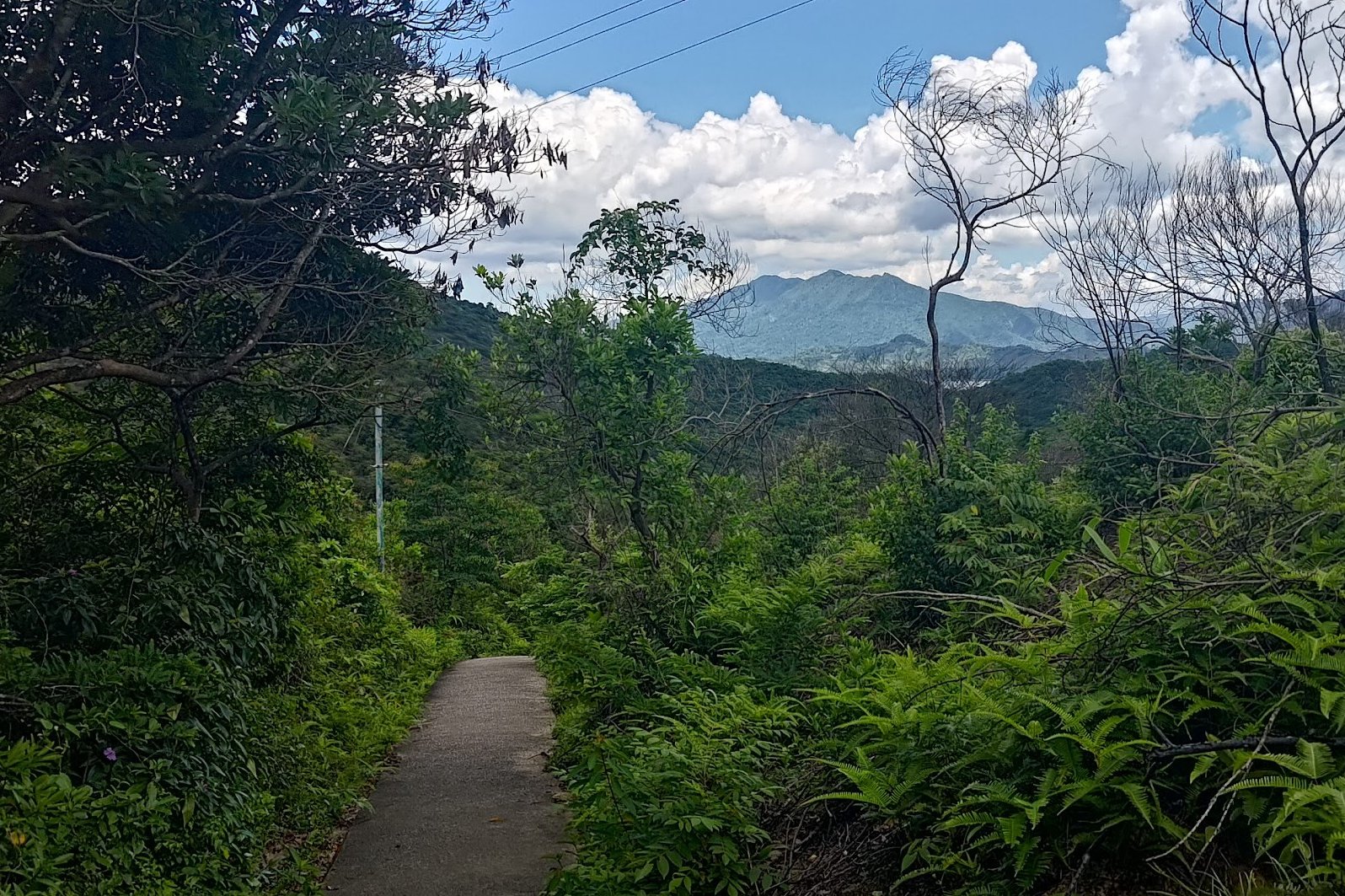
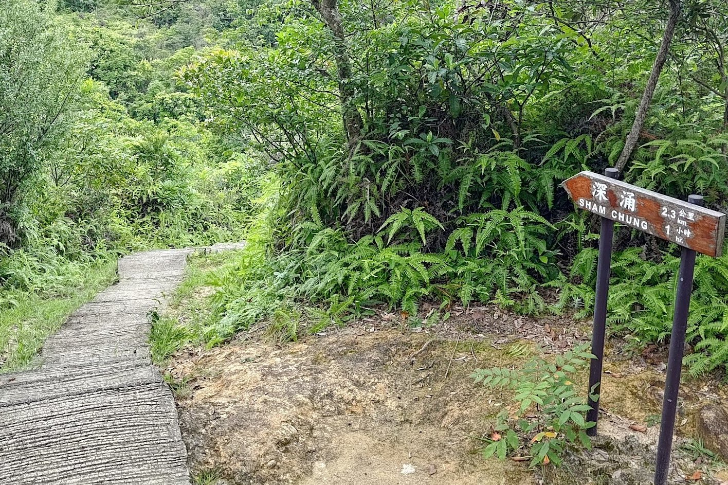
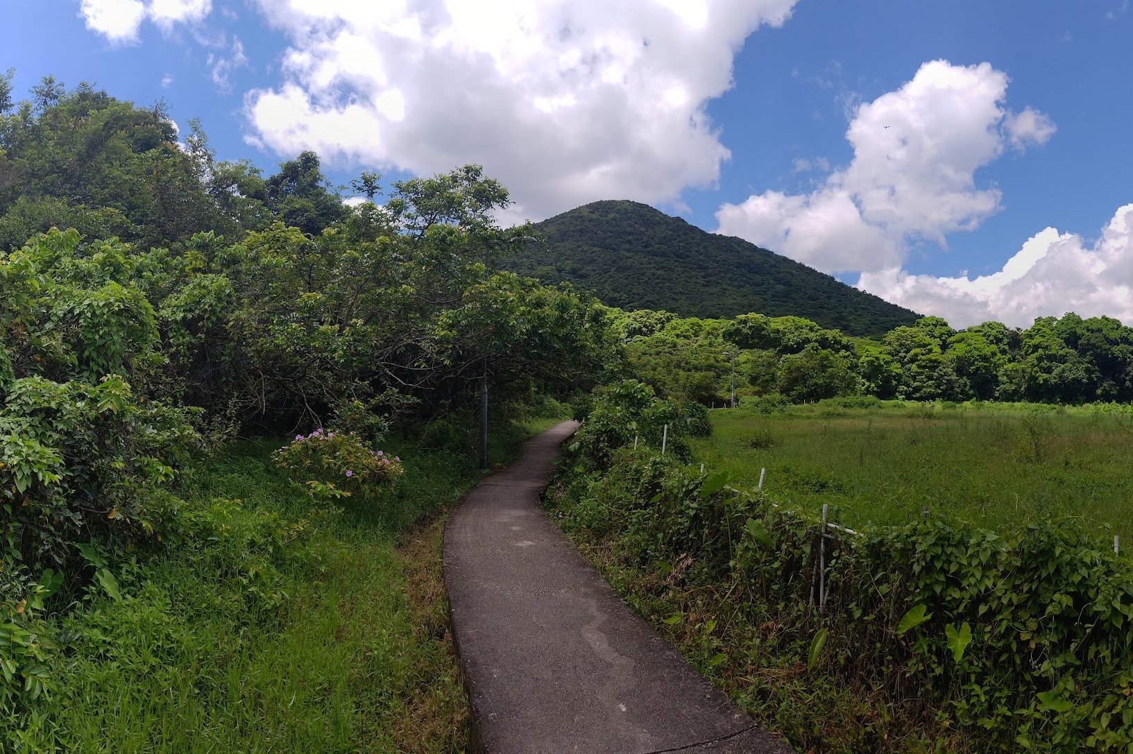
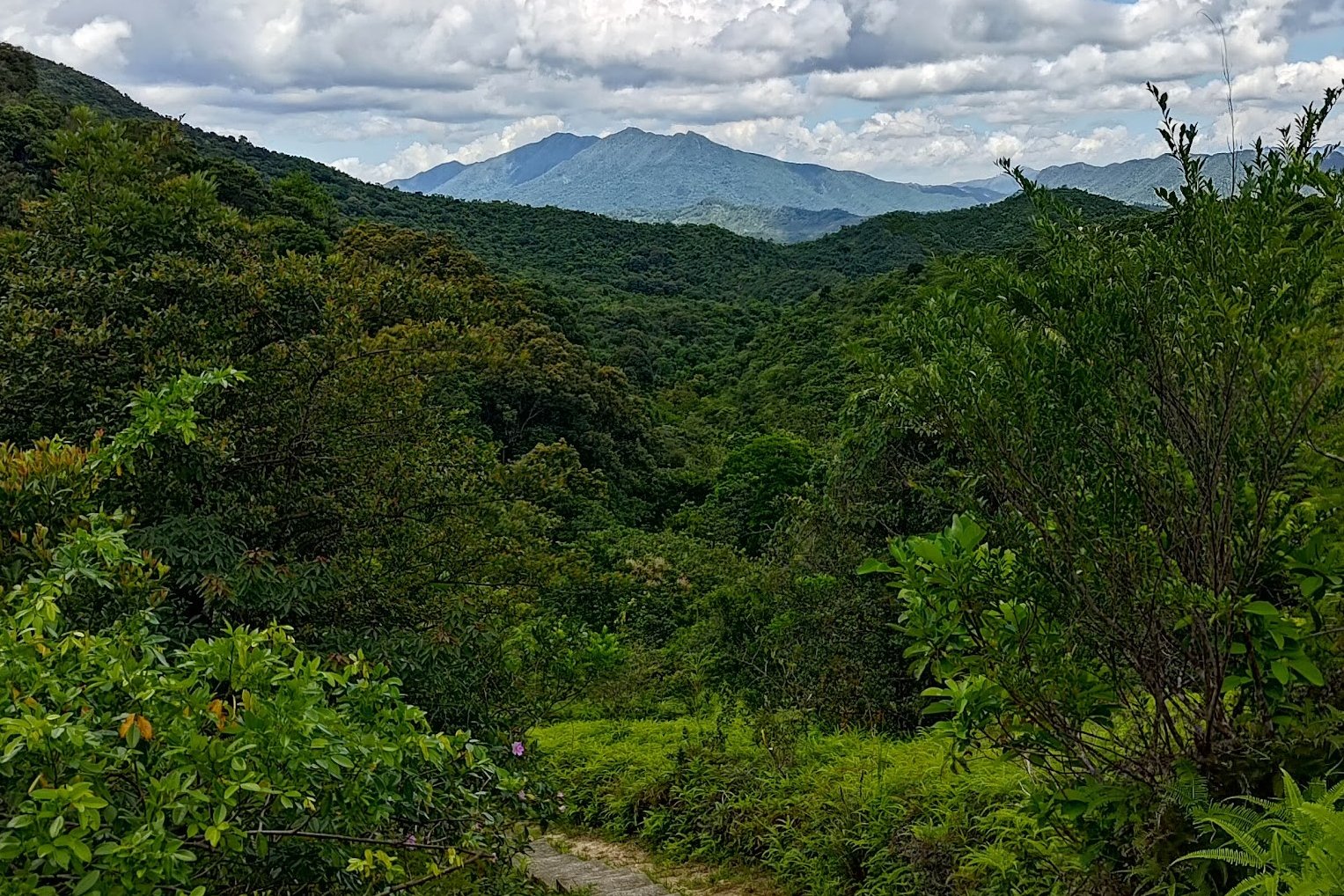
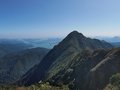
The forested trail opens up a bit at this point and you'll be able to see Pat Sin Leng (The Eight Immortals) in the distance.
About ten minutes after the first 'Sham Chung' sign, you'll arrive at a fork in the trail. Ignore the 'Lai Chi Chong' sign and head toward Sham Chung
From Forest to Rocky Canyon
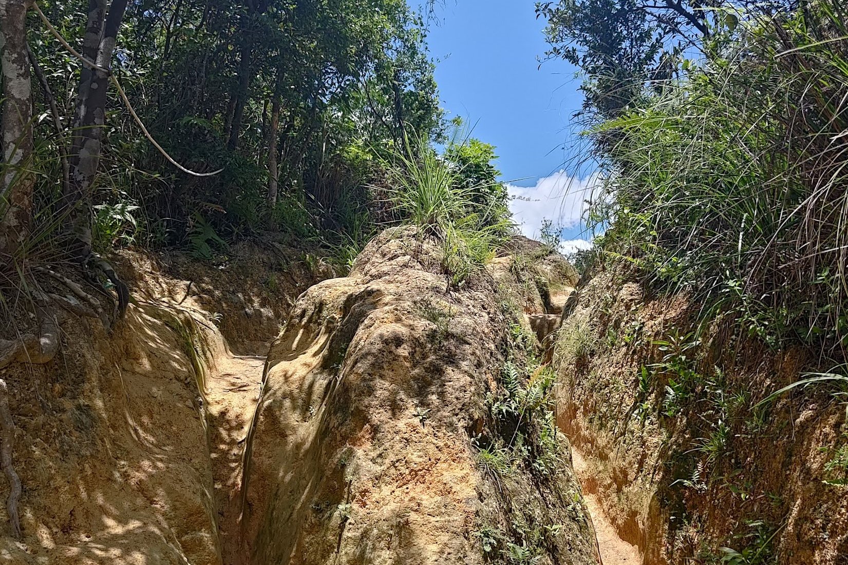
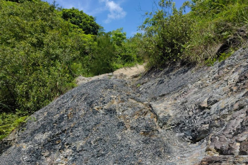
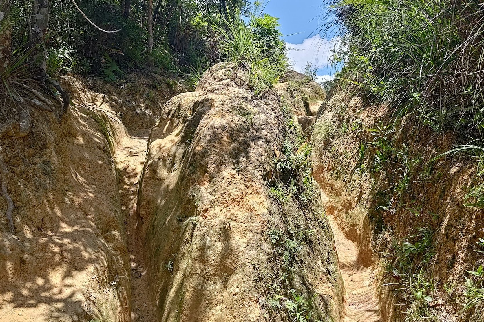
Not too long after the second 'Sham Chung' sign, you'll notice the terrain starting to switch. You'll see drier paths before entering a rocky canyon-like section with dark-grey stone.
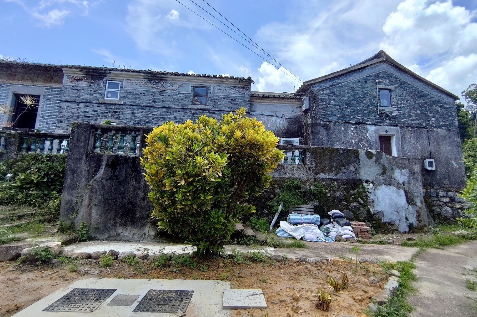
Go Past the Abandoned Village Houses
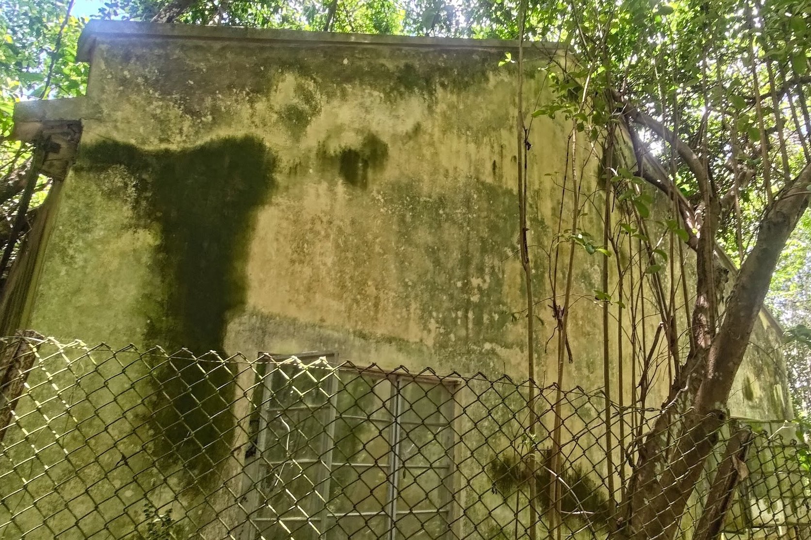
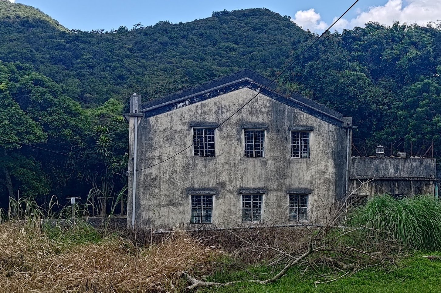
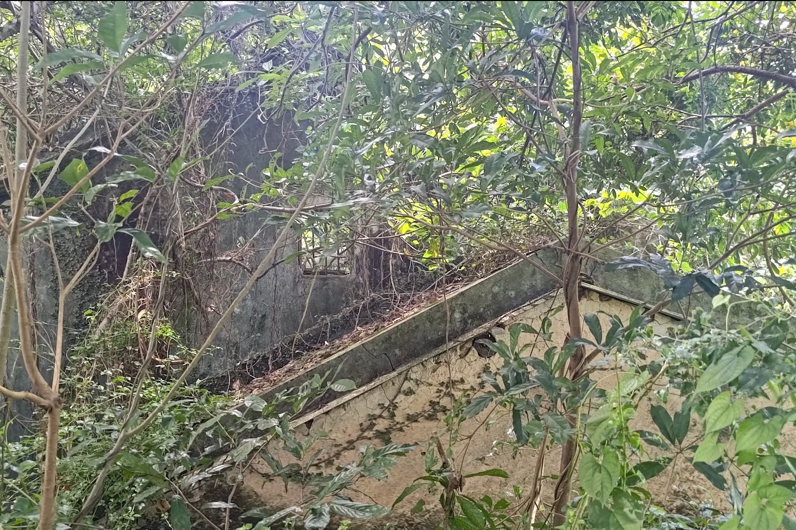
At the bottom of the rocky canyon section, you'll come face-to-face with some dilapidated abandoned traditional buildings. These were all part of Sham Chung Village, a once-thriving community of Hakka people who entered Hong Kong some 300 years ago.
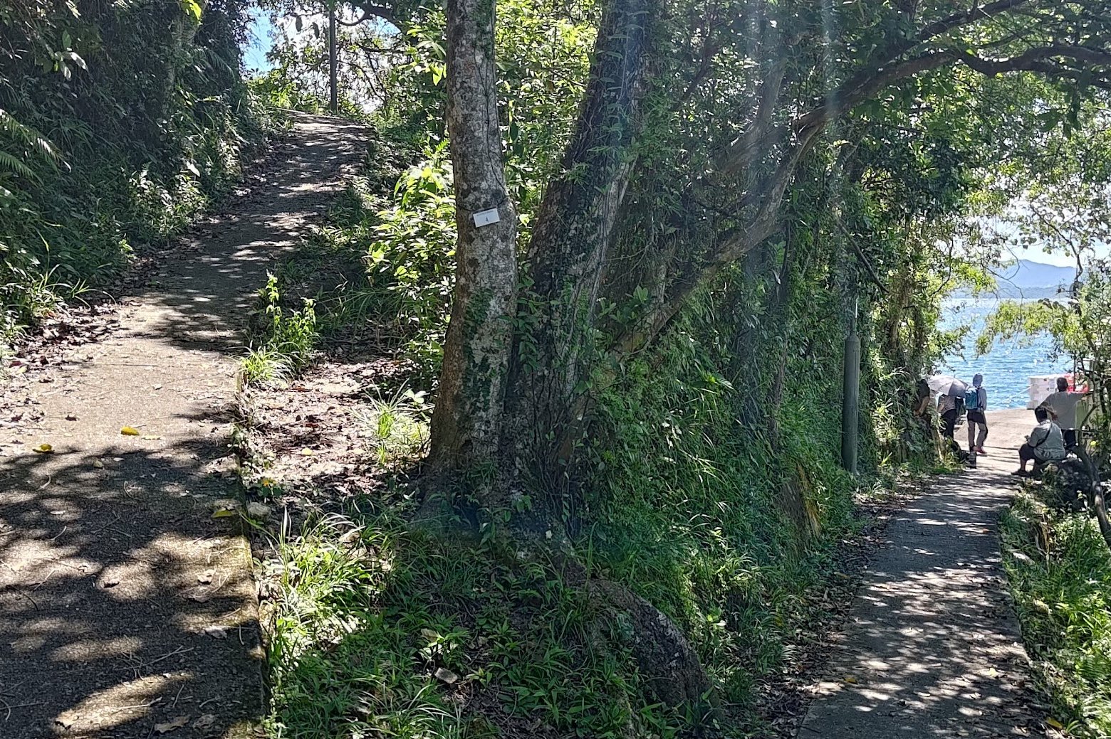
Before arriving at the well-preserved part of Sham Chung Village, you'll need to follow the Yung Shue O sign.
Sham Chung Village
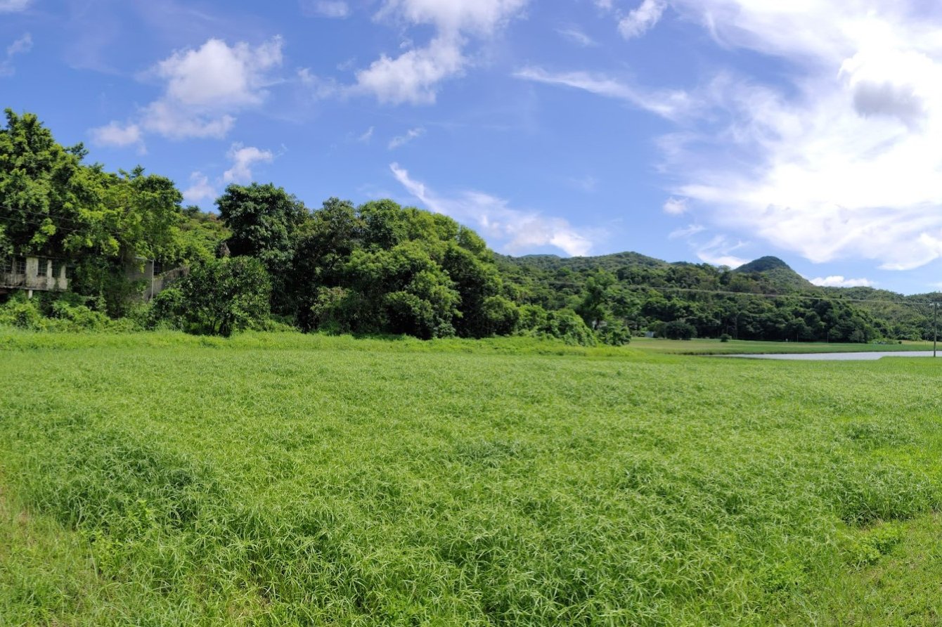
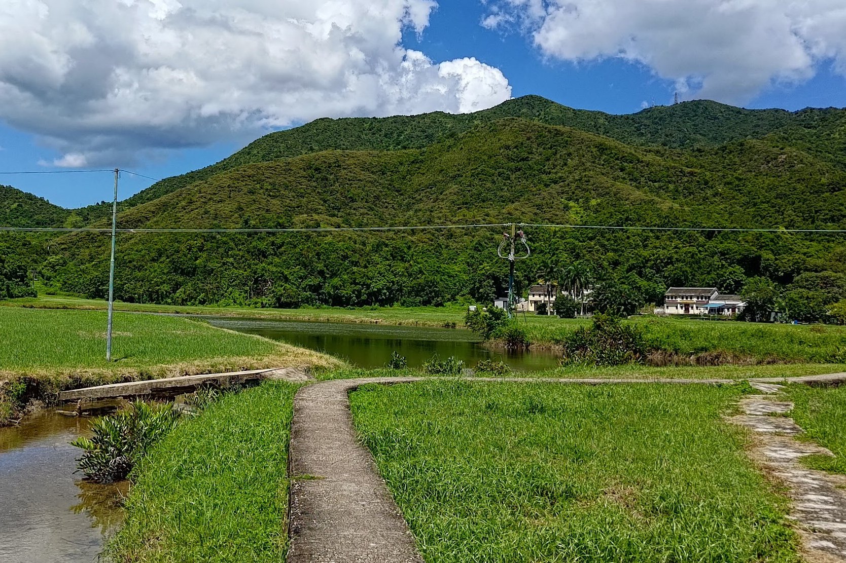
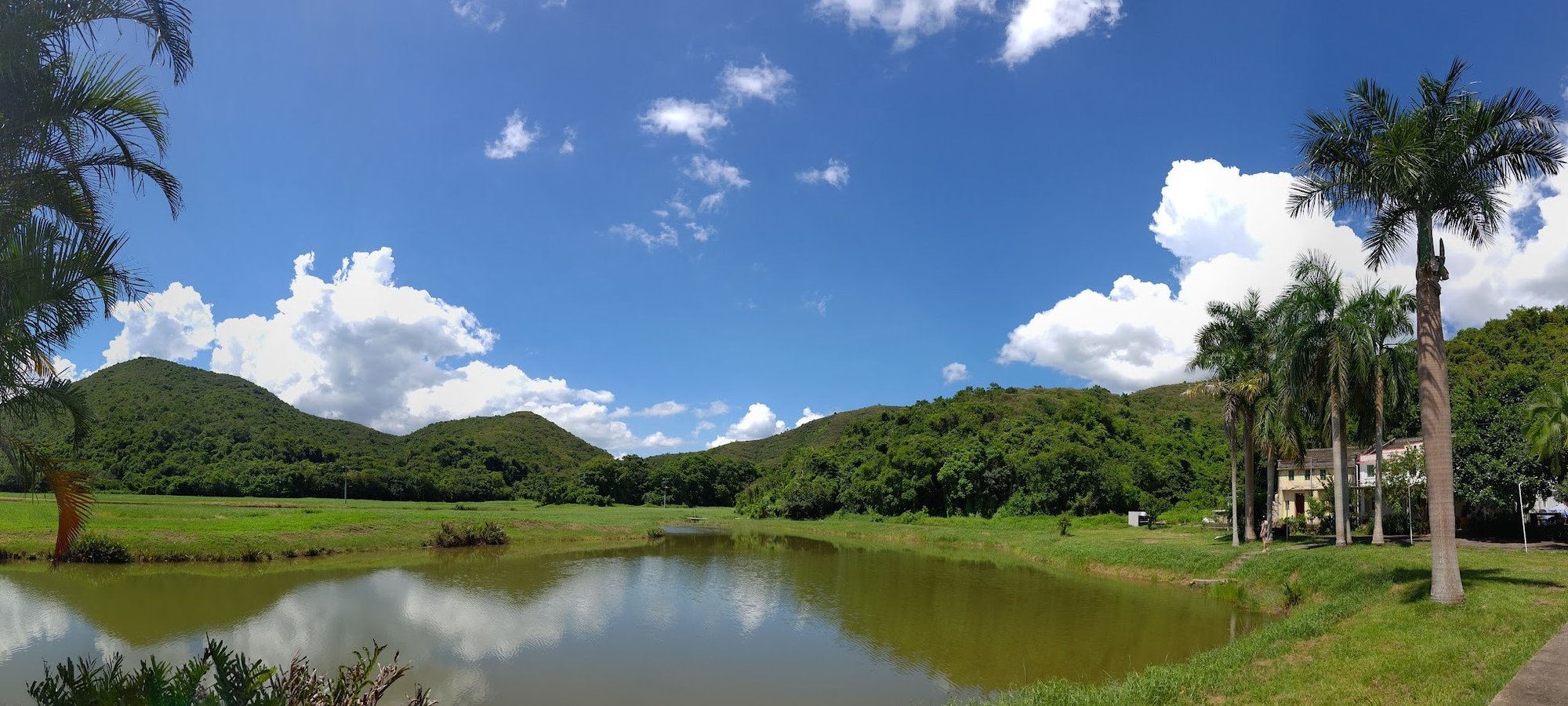
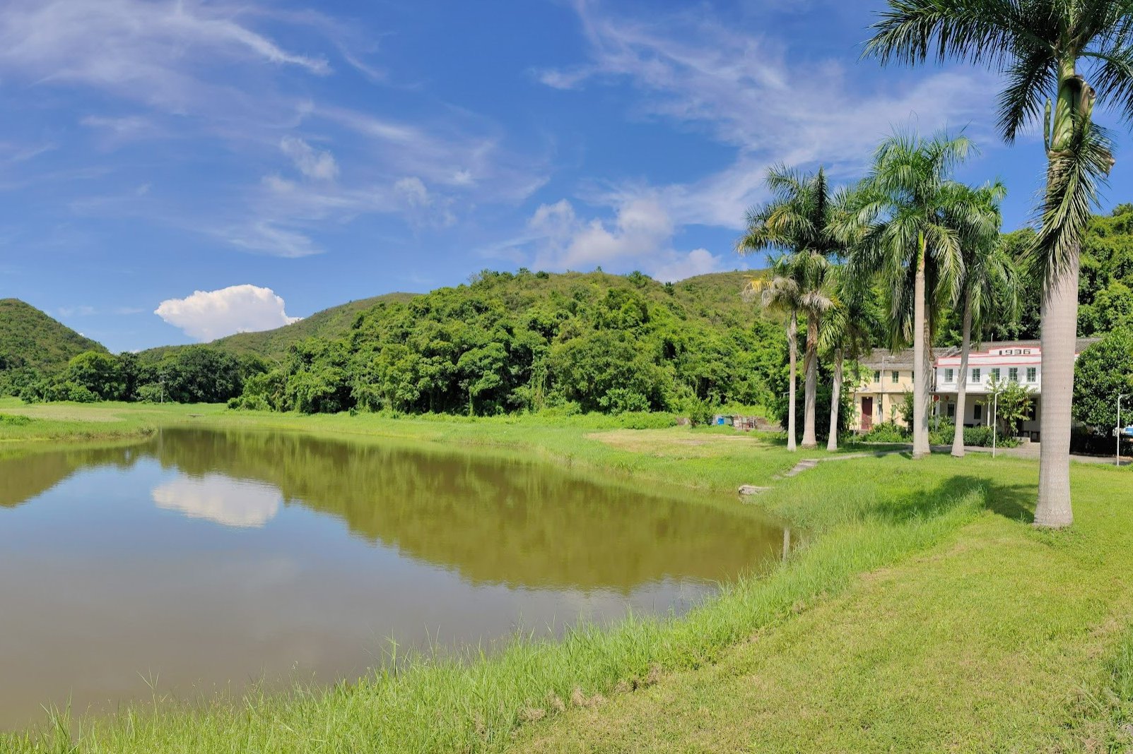
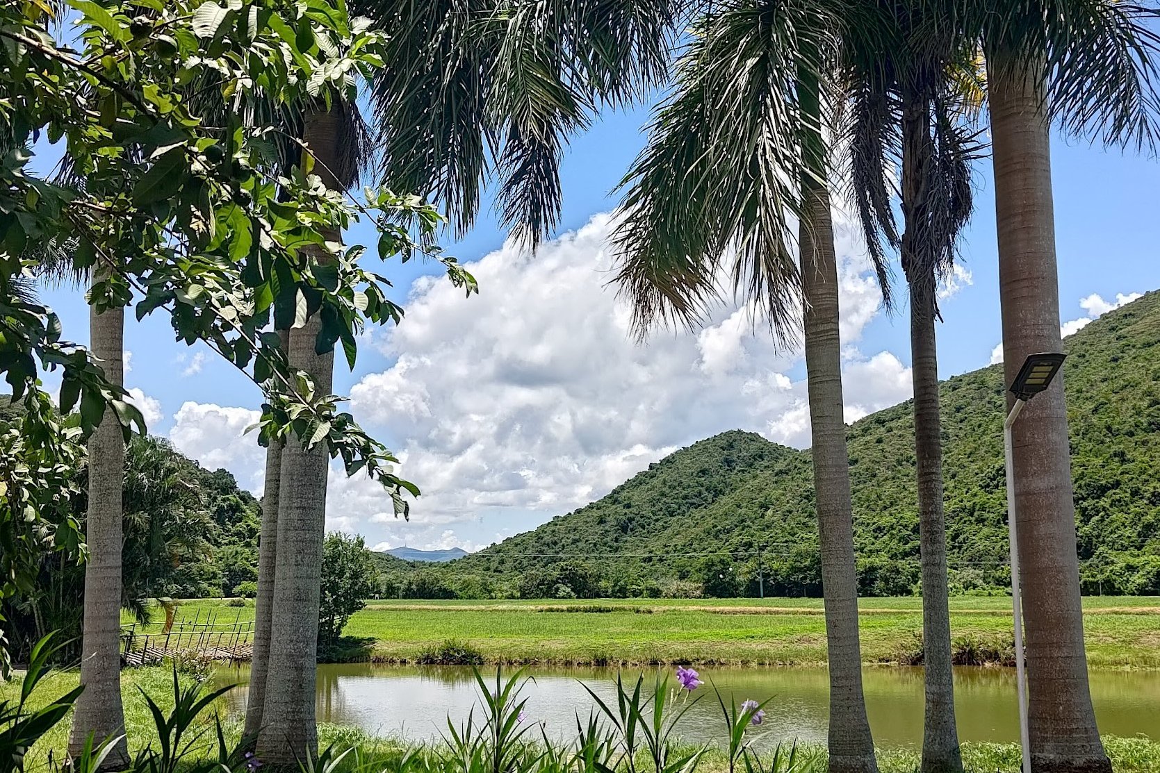
Once you arrive in Sham Chung, you'll encounter a vast, open green field. Given how densely packed Hong Kong's city districts are, coming across such a vast expanse of open space is almost alien-feeling.
If you're wondering how a massive field suddenly appeared in the middle of an area that was traditionally mangroves, there's actually a rather simple reason for it. The field was actually mostly farmland and mangrove at one point, but was sold to developers who drained the mangroves and planted the grass for a golf course. The golf course was never completed, but the grass stayed.
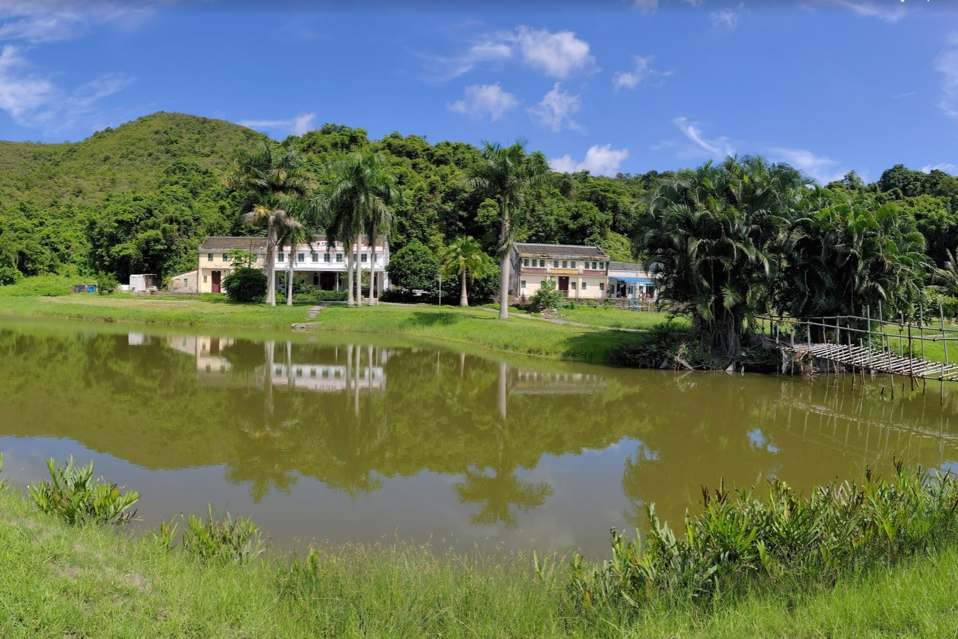
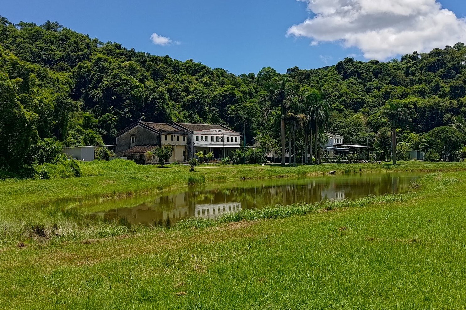
Take the time to explore around since there are a plethora of abandoned village areas all around Sham Chung. When you're done, head over to Sham Chung Manor to examine a well preserved Hakka village house and grab some snacks and drinks if you need a top up mid-hike.
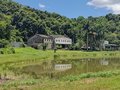
Sham Chung Manor
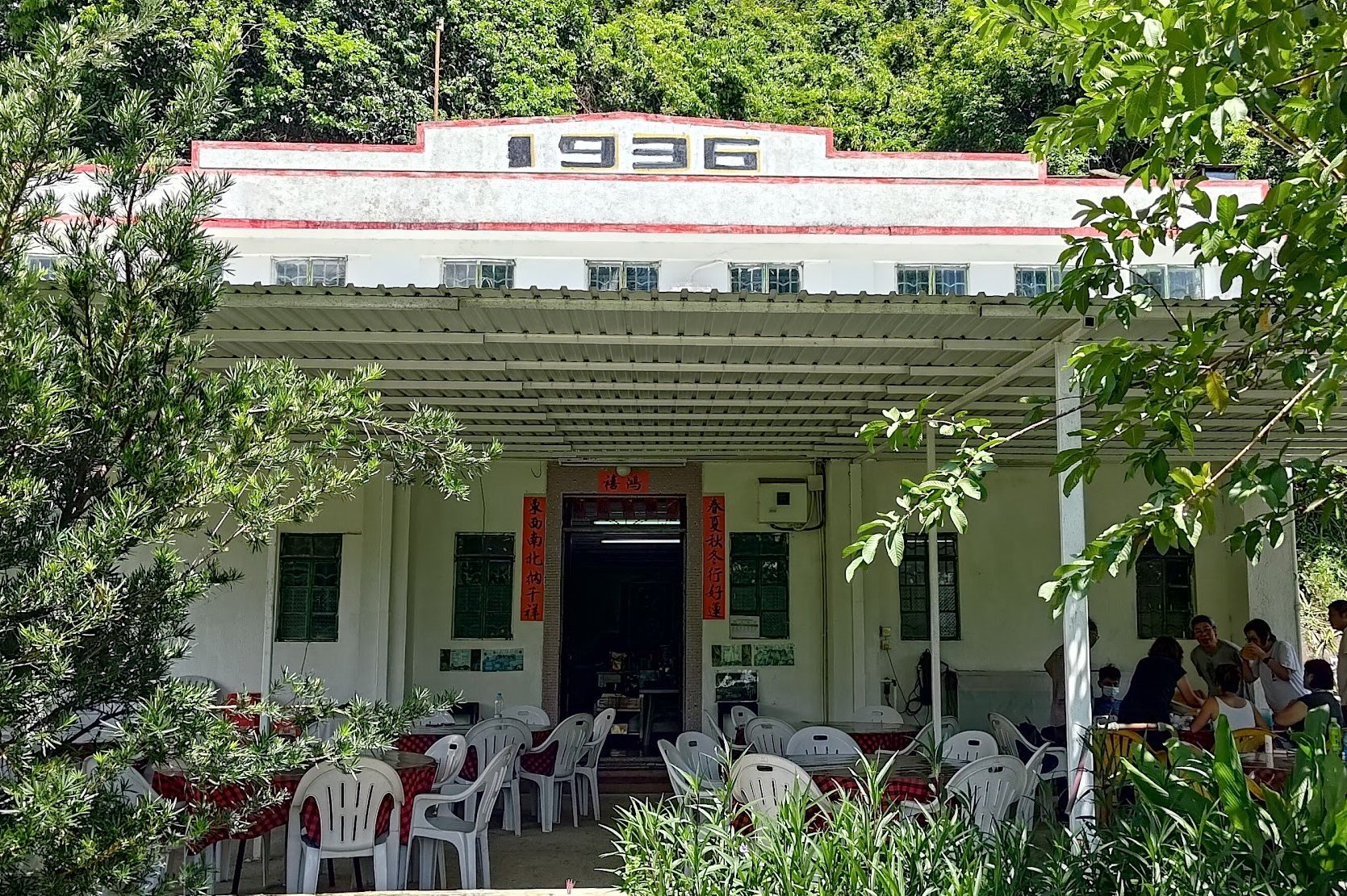
While grabbing a bite at Sham Chung Manor, I was fortunate enough to start chatting with Mike Li, a seventh generation descendant of the original Li Clan who first settled in Sham Chung.
This is honestly a great spot to appreciate the beauty of your surroundings, refresh before continuing the hike and learn more about the history of Hong Kong's Hakka people and their way of life.
You can get in touch with the folks at Sham Chung Manor through the following WhatsApp number: 93345704.
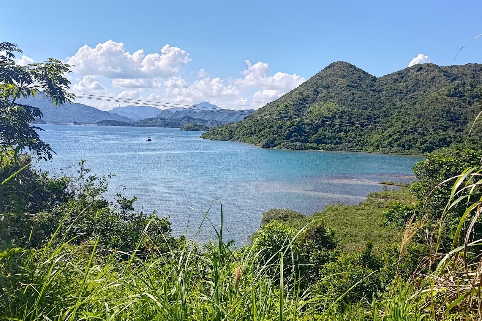
Three Fathoms Cove (Optional Escape Point)
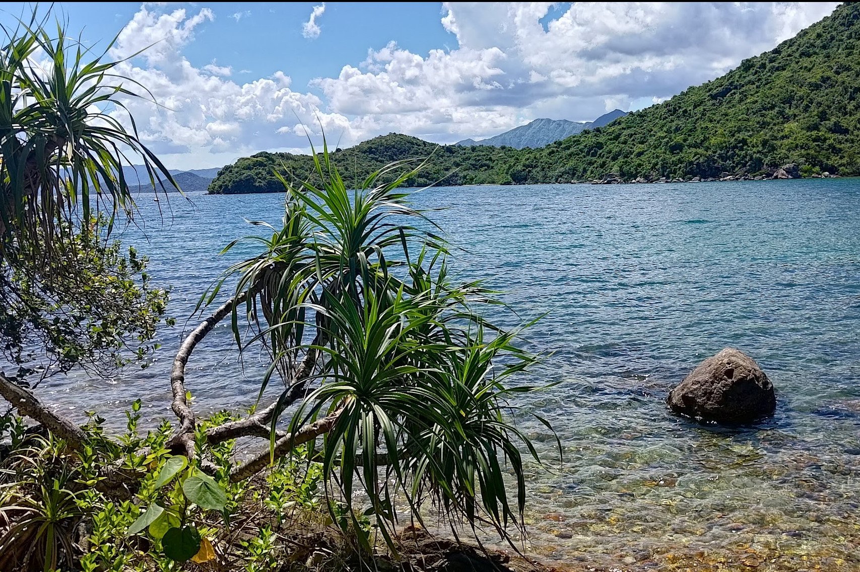
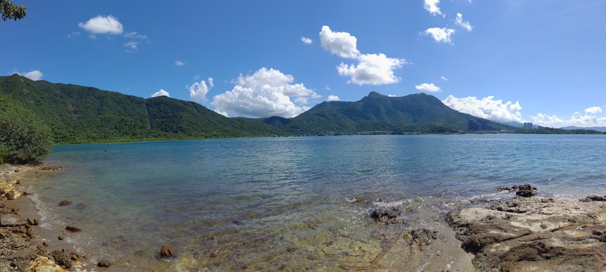
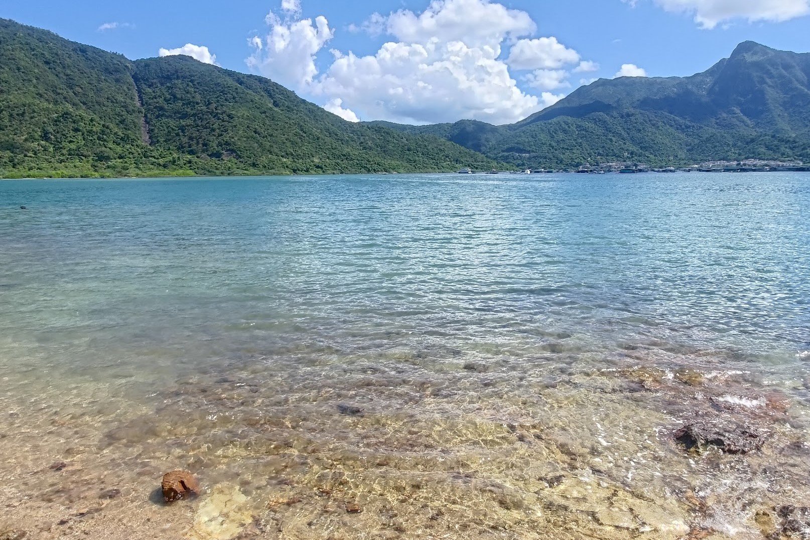
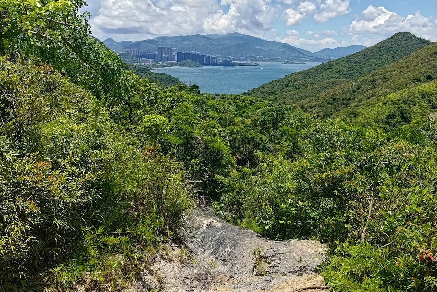
There's a little concrete path on the opposite side of the Sham Chung field from where you entered it. Follow that path and you'll be treated to some truly stunning coastal scenery as you officially begin your hike around Three Fathoms Cove.
If you're tired, after about ten minutes of walking, you can take a right turn at the fork in the road to Sham Chung Wan Ferry Pier. Ferries from this pier go to Wong Shek Pier in Sai Kung or to Ma Liu Shui Pier in Shatin. You can find the ferry timetable here.
If you decide to keep going, follow the path forward and heed the 'Yung Shue O' sign. Enjoy the breathtaking views of Ma On Shan in the background and even more pristine beaches along the way.
Mangrove Scenery and an Optional Food Pitstop
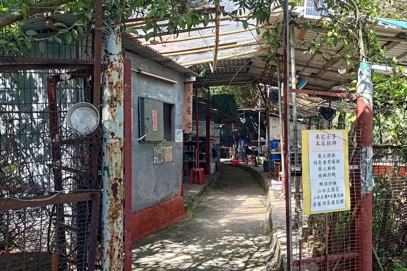
Perhaps five minutes after the last beach with the Ma On Shan view, you'll see a gate on the left side of the path. This leads to a row of restaurants where you can get everything from beers to seafood.
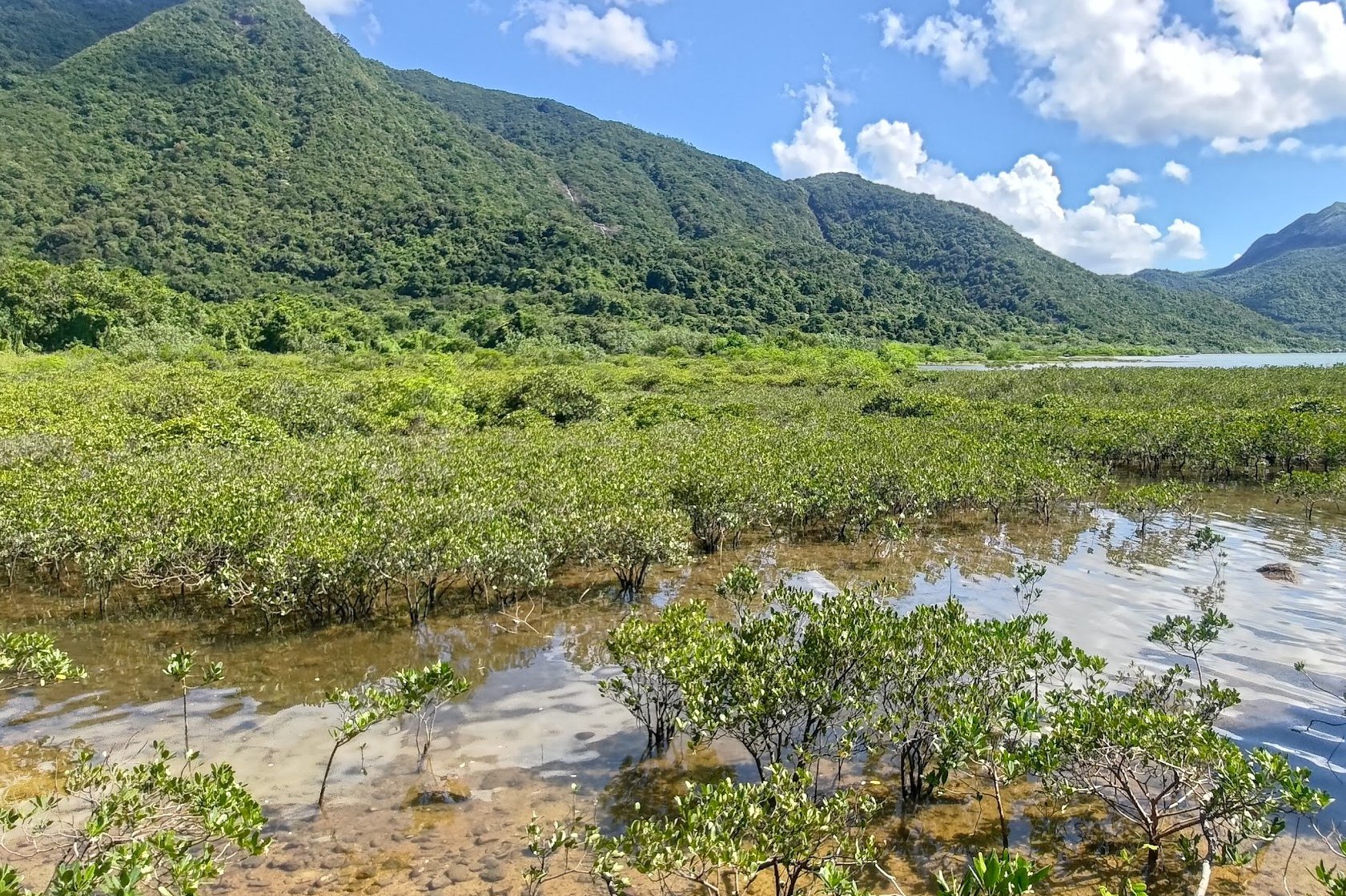
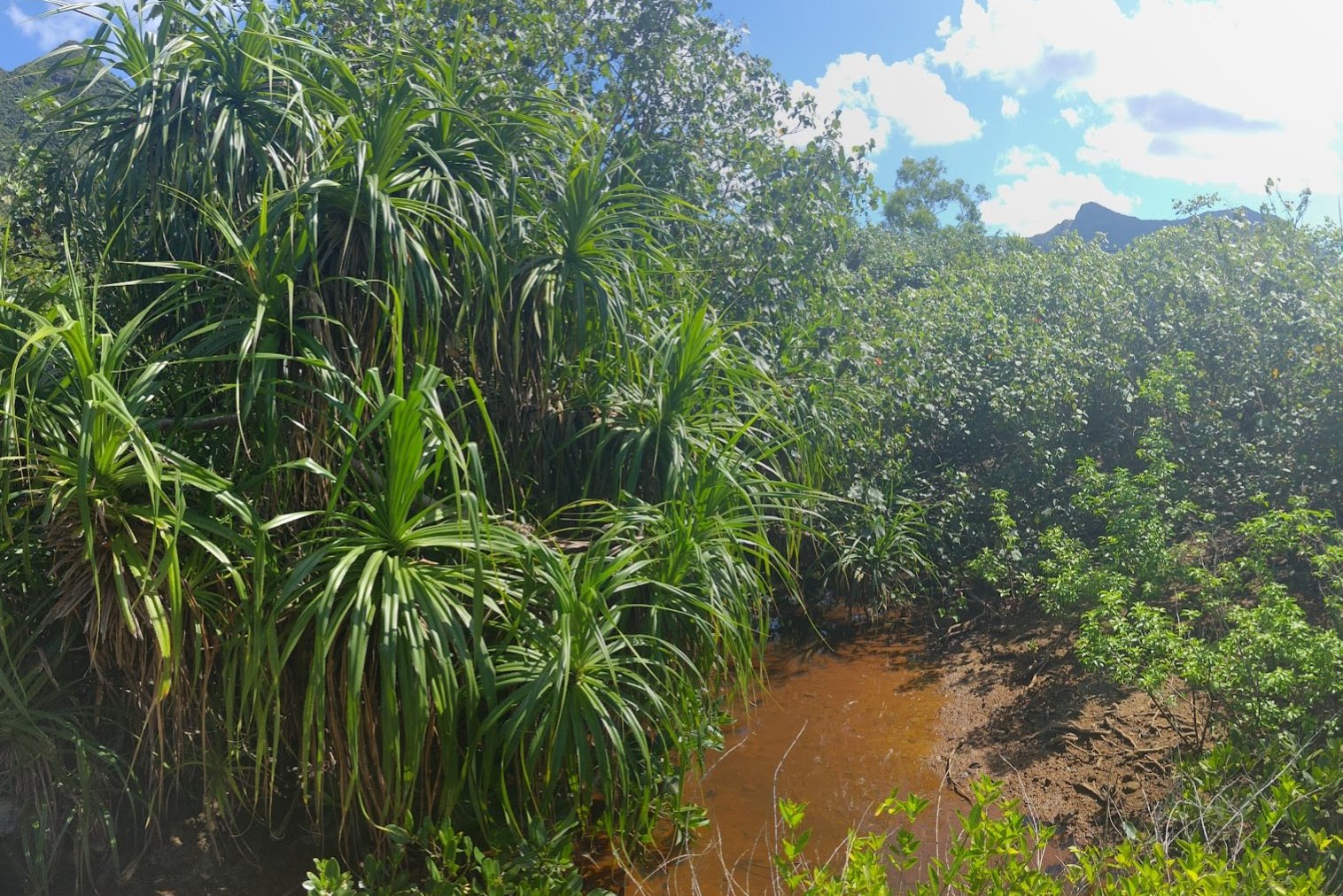
If you're not in need of a refill, continue down the concrete path as it leads you toward the mangroves. At one point, Hong Kong had many more mangrove areas, but construction has removed a lot of them.
Mangrove ecosystems play a huge role in managing the force of incoming tides and keeping the soil intact. Mangroves are also an important habitat for a lot of unique Hong Kong wildlife.
For example, according to the Hong Kong Bird Watching Society, 26 species of birds were recorded around Sham Chung. The mangroves and areas around them are also home to the rare Hong Kong Paradise Fish, super rare species of butterflies, wild coffee plants, rare dragonflies and much more!
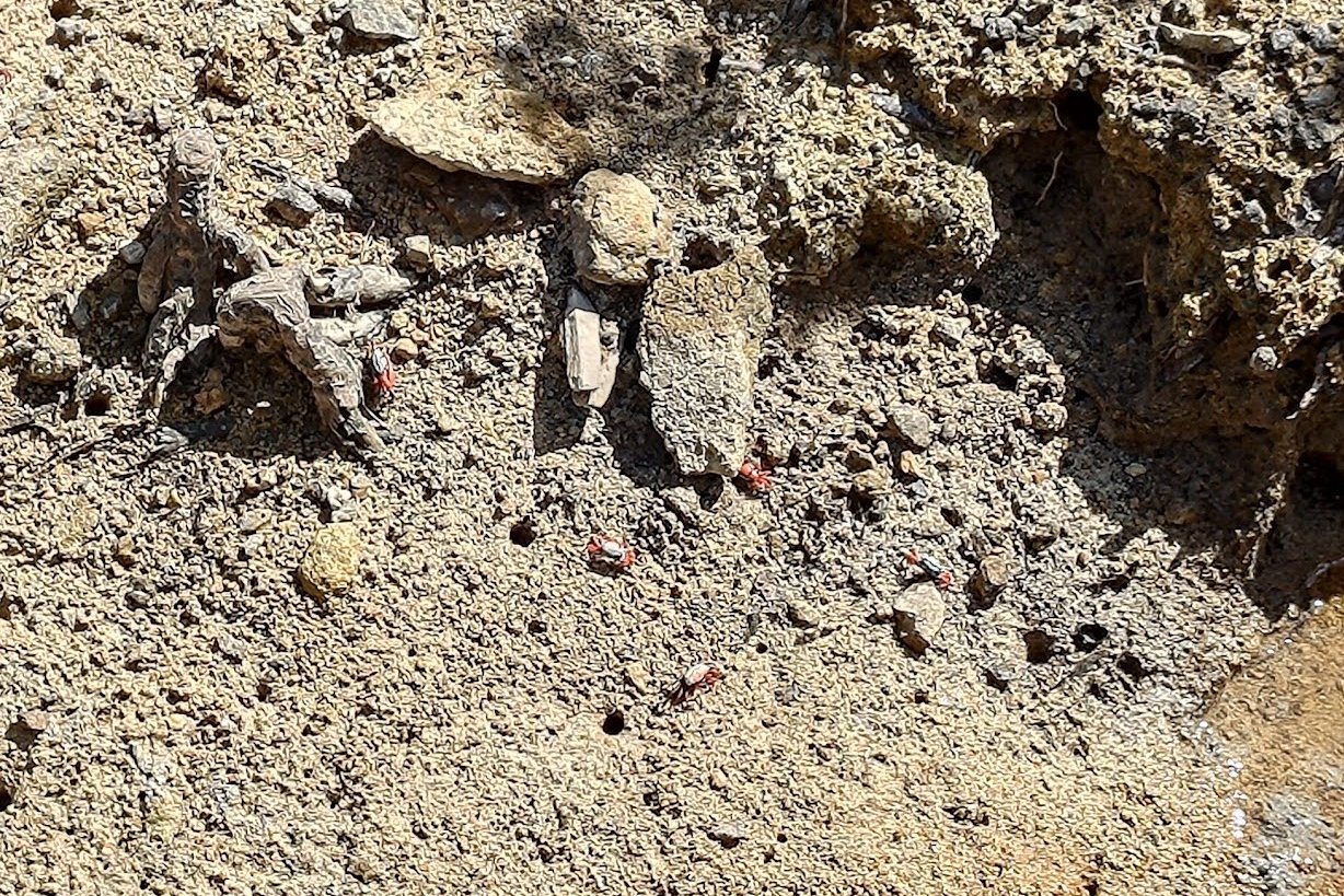
If you look closely, you're almost guaranteed to see cute red crabs marching along the muddy mangroves beside you.
Yung Shue O Village to Sai Sha Road
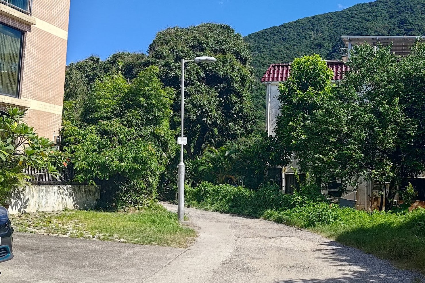
After the mangroves, you'll promptly arrive in Yung Shue O village.
Turn right and follow the road that curves around the village. Head to the top of the village and you'll see a set of green railings by the road.
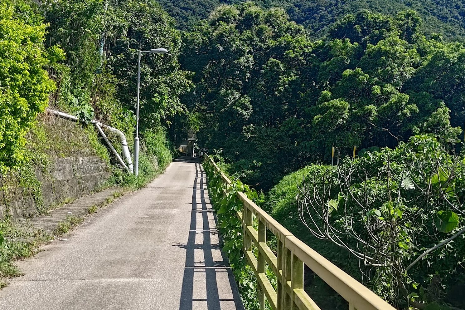
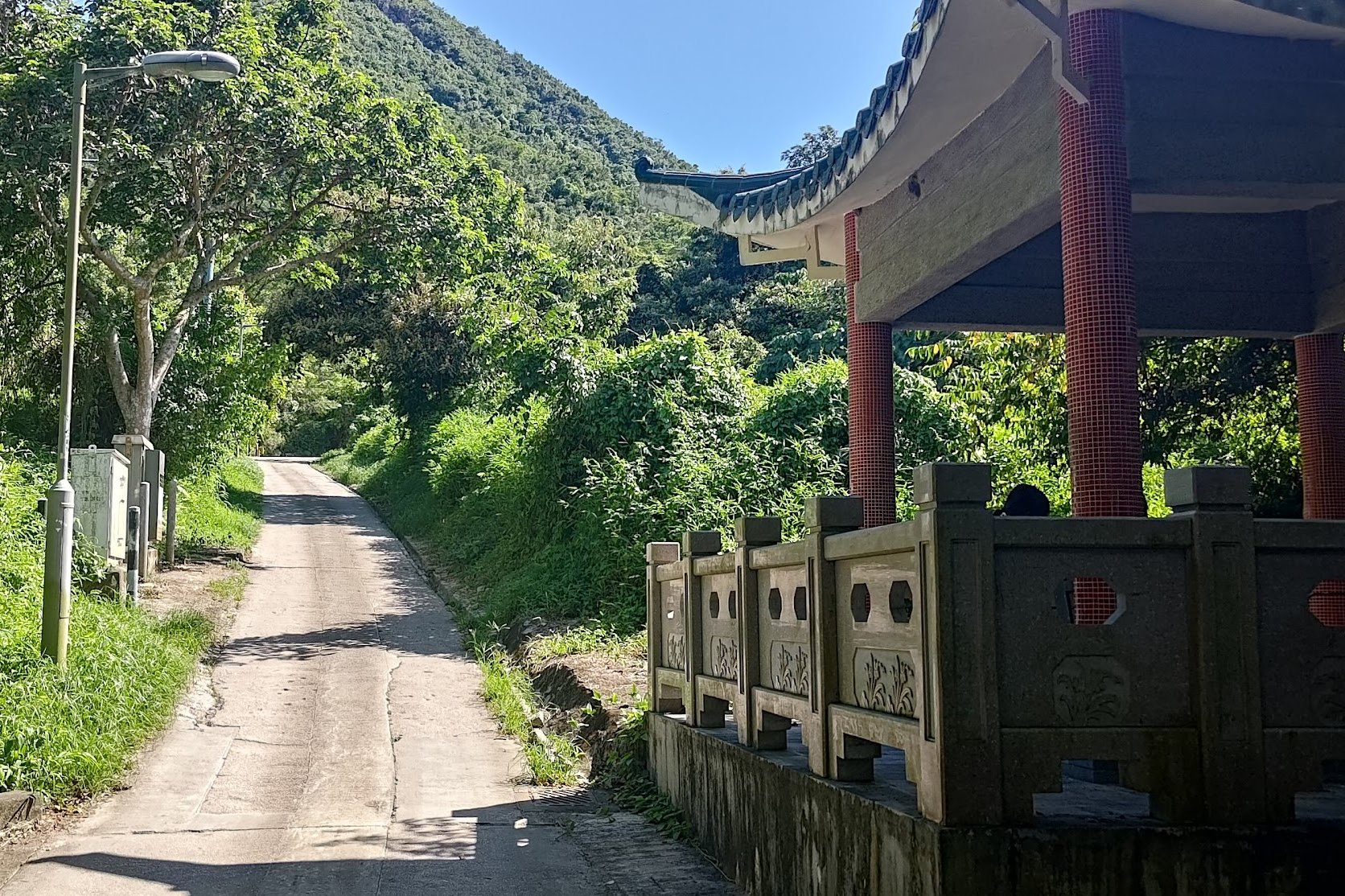
Follow the railings past a public toilet and eventually past a pavilion before the road begins to slope upward.
You'll be following this bleak concrete road for around an hour. Occasionally, you'll be treated to the odd nice view, but most of it is really drab and dull. If it's a hot day, this is the part of the hike where the sun will really get to you.
After an hour, you'll arrive at Sai Sha Road between stages 3 and 4 of the MacLehose Trail. Turn left and walk for a few minutes to the O Tau bus stop and catch a bus back to civilization.
The Way Back
From O Tau, you can take the 299X bus toward Sai Kung or Shatin. There are a few other buses from this stop, too.

