
Ma Shi Chau (Horse Dung Island) Hike: A 280-million-year-old Coastline Connected by a Secret Tombolo
Contents
- Essential Information
- Hike Highlights
- Google Route Map and GPX
- How to Get There
- Quick Route Summary
- Starting at Sam Mun Tsai New Village
- History of Sam Mun Tsai New Village
- Abandoned Primary School Optional Detour
- Climbing Past Tombs to a Pavilion
- Locating the Hidden Tombolo
- Crossing the Secret Tombolo
- Ma Shi Chau Nature Trail
- Getting Back
Essential Ma Shi Chau Hike Details
- District: New Territories
- Duration: 2.5-3 hours (depending on detours)
- Distance: 7.5km
- Highest Elevation: 120ish meters
- Difficulty: 3/5
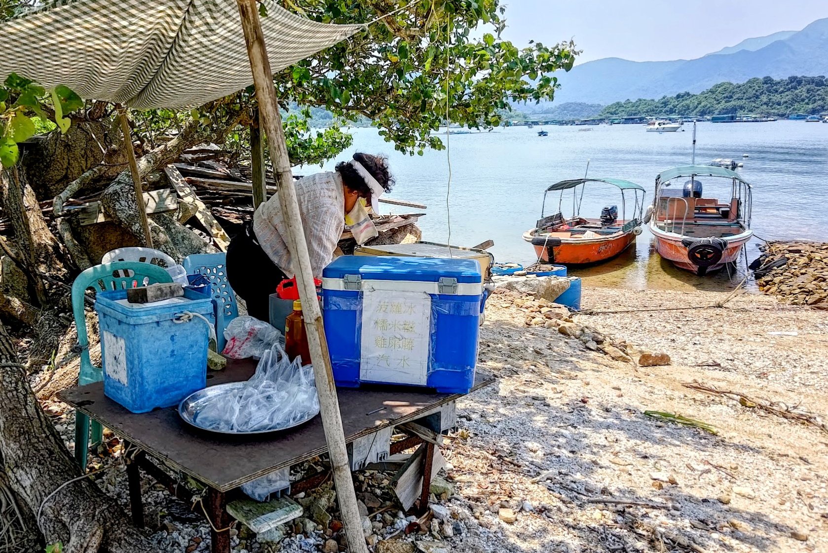
- Facilities: Toilets and restaurants at Sam Mun Tsai New Village. A lady sells drinks at the tombolo in the middle of the hike. Bring cash. No one in the area takes any other form of payment.
Why Hike Ma Shi Chau?
Ma Shi Chau (馬屎洲特別地區), directly translated as Horse Dung Island, is one of those hikes that’s a little difficult to quantify in terms of difficulty because the terrain varies so much throughout the seasons.
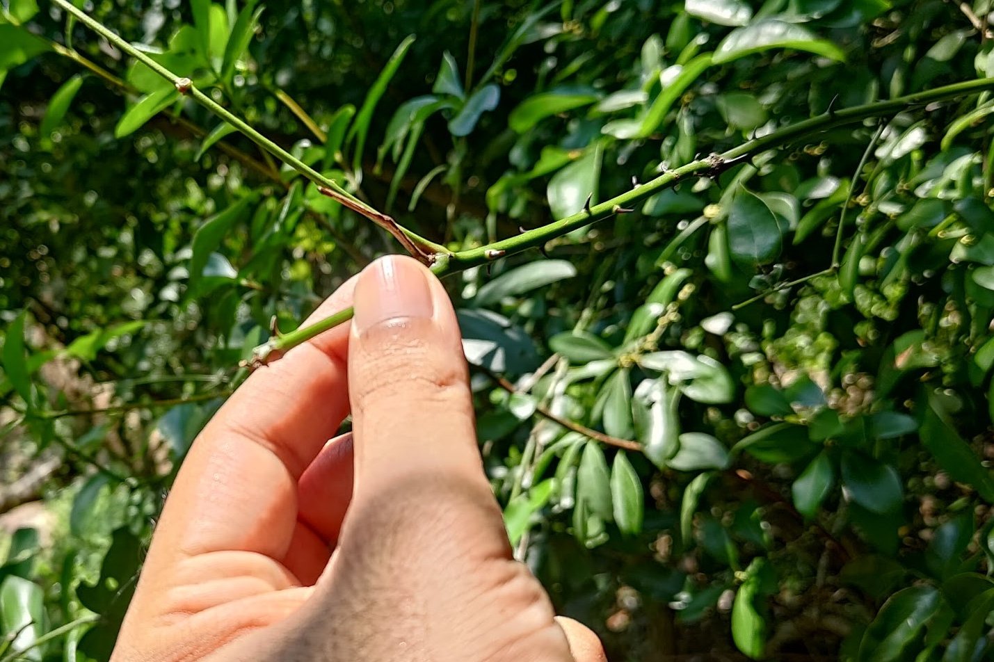
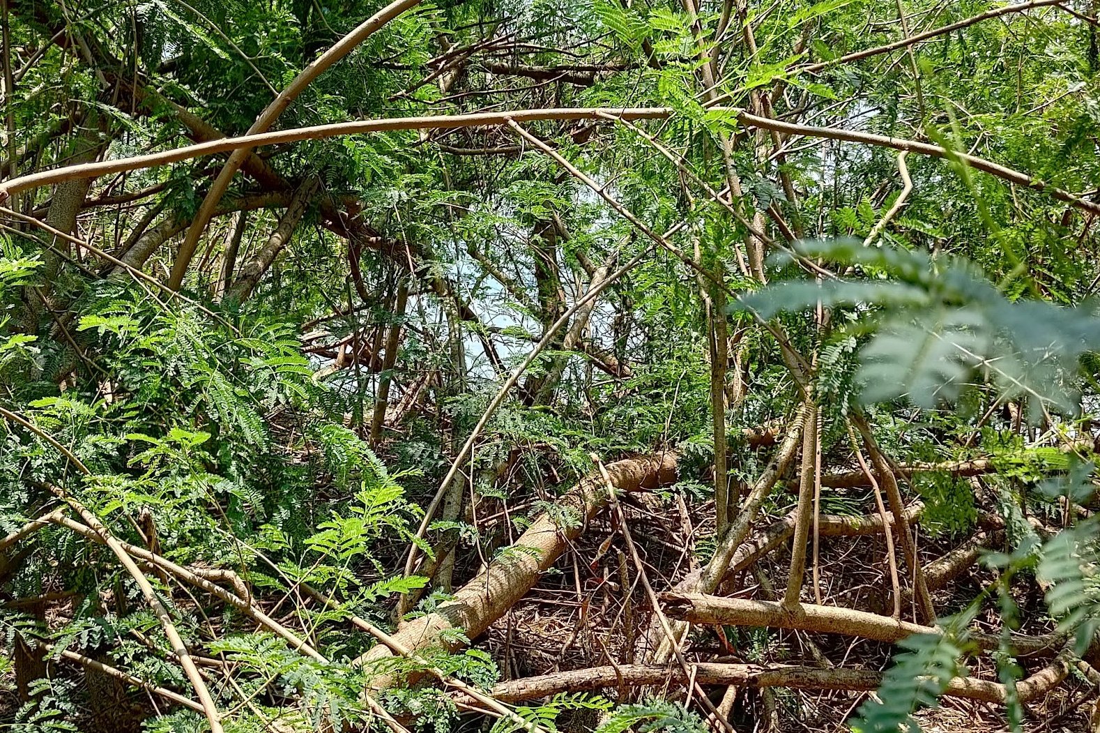
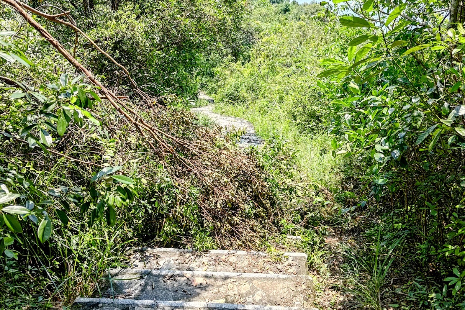
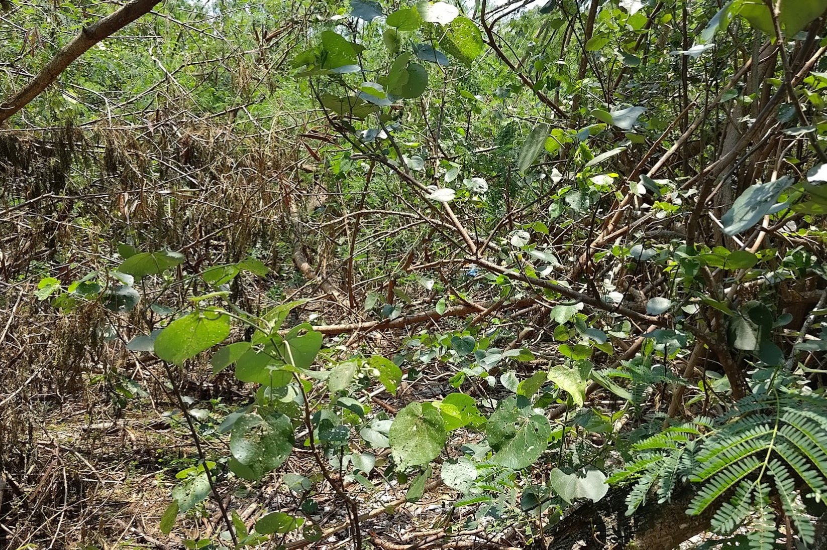
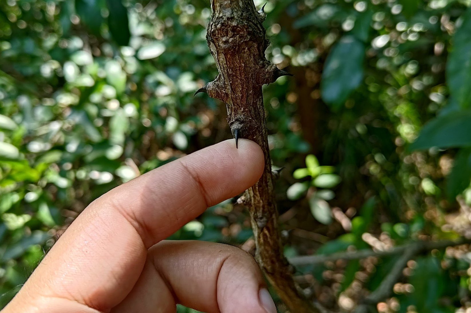
For example, when I visited Ma Shi Chau, it was just after Typhoon Wipha had ripped through Hong Kong, and much of the trail was blocked by fallen foliage. The ground was very muddy and slippery in places, and the trail hadn’t been maintained in certain sections, making it necessary to battle through seriously spiky and thorny areas of overgrowth.
Also, DO NOT do this hike in summer. You will roast alive. And then, you'll get eaten alive by the mozzies.
With all that out of the way, the hike is one of Hong Kong’s most unique outdoor adventures as it takes you through fascinating geological landscapes, anchored by rich cultural heritage.
You’ll begin at Sam Mun Tsai New Village, a fishing village that was settled as early as 1898. It has a deep history, quite literally, because the original village was submerged in the waters of Plover Cove Reservoir as part of its construction in 1965. 400 villagers were relocated to the new site as compensation.
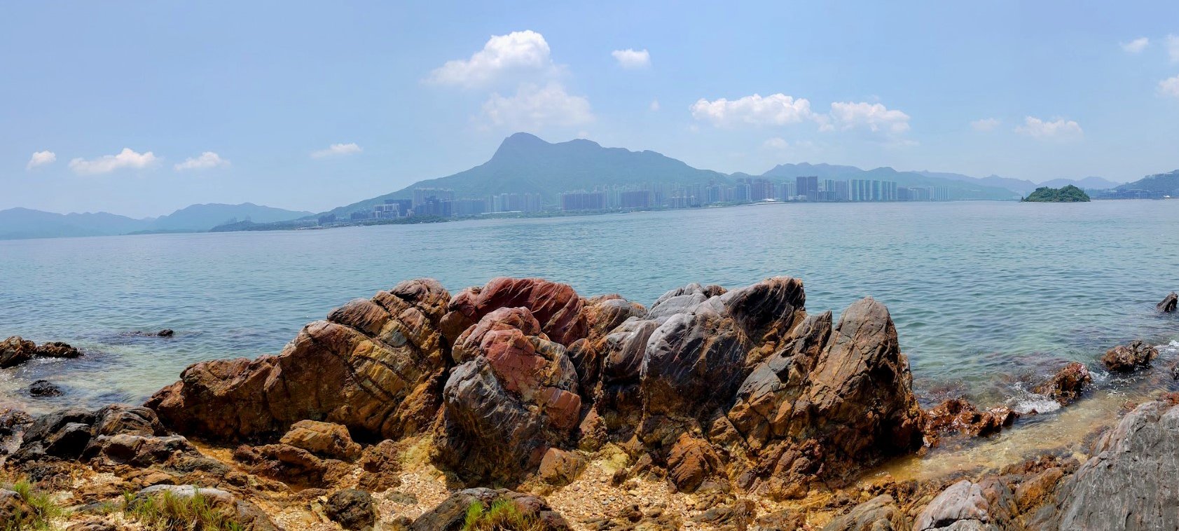
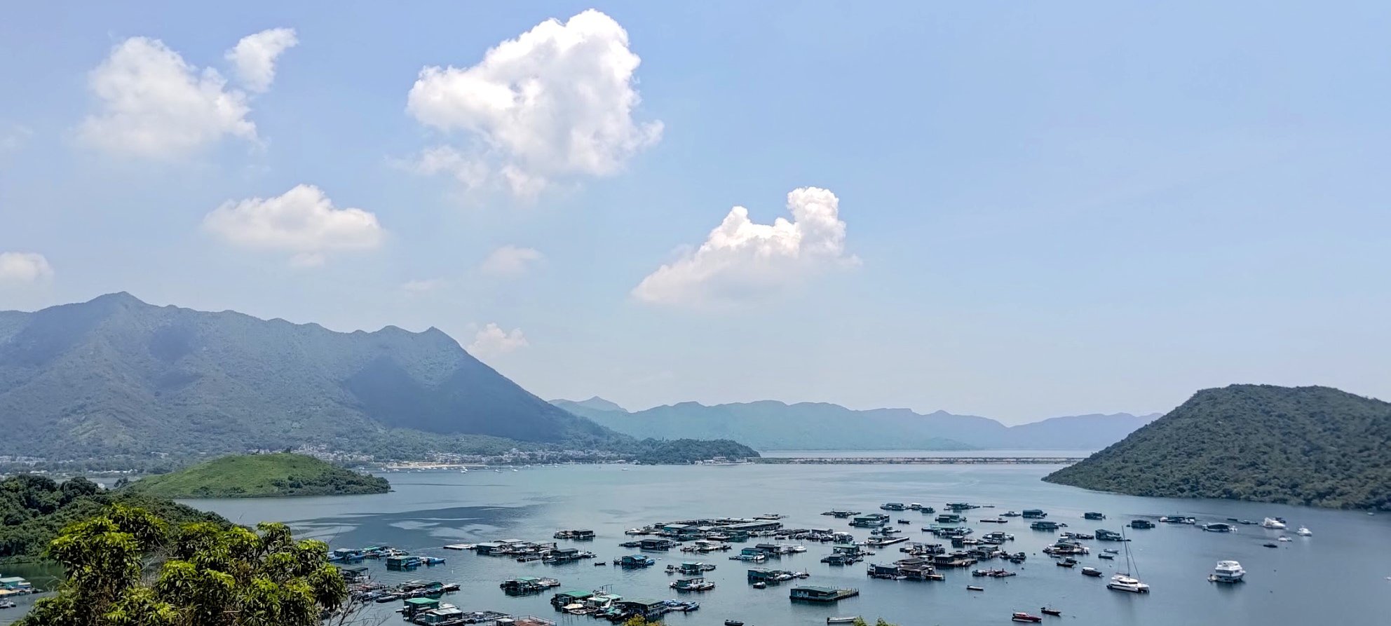
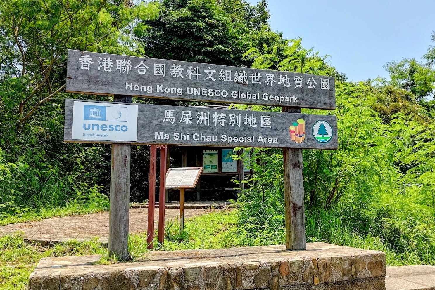
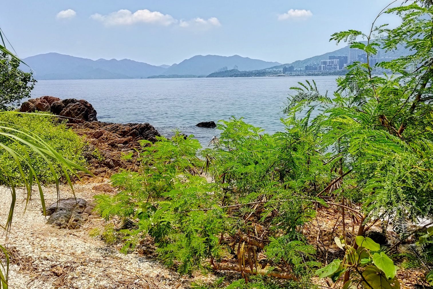
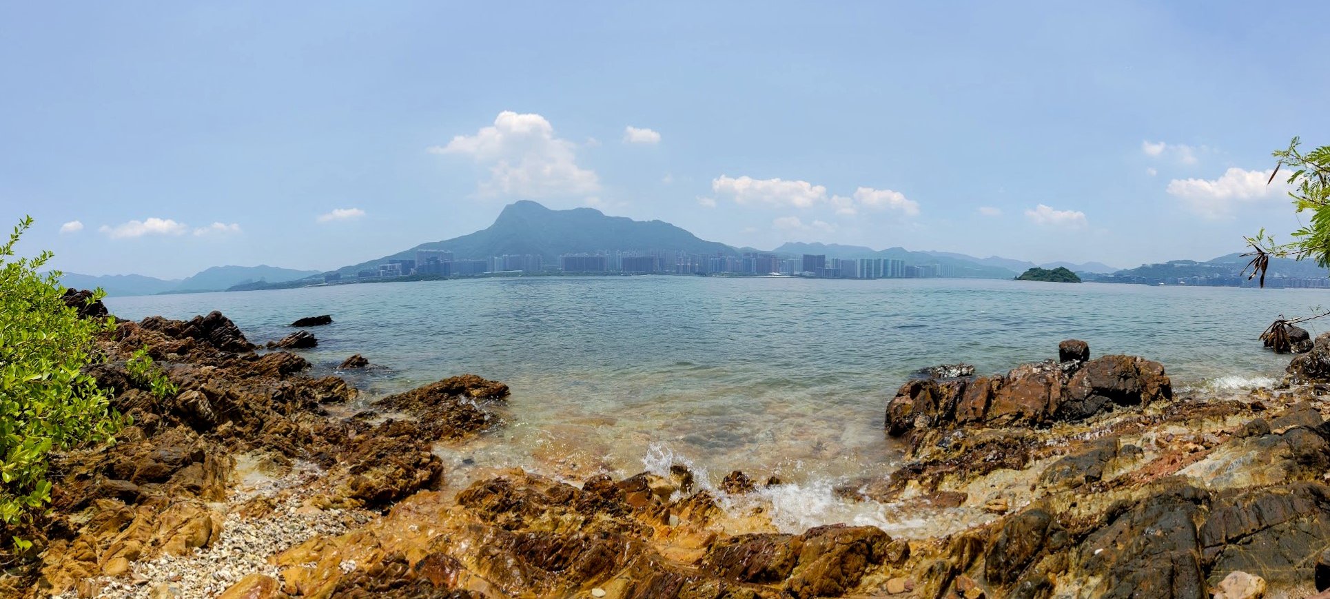
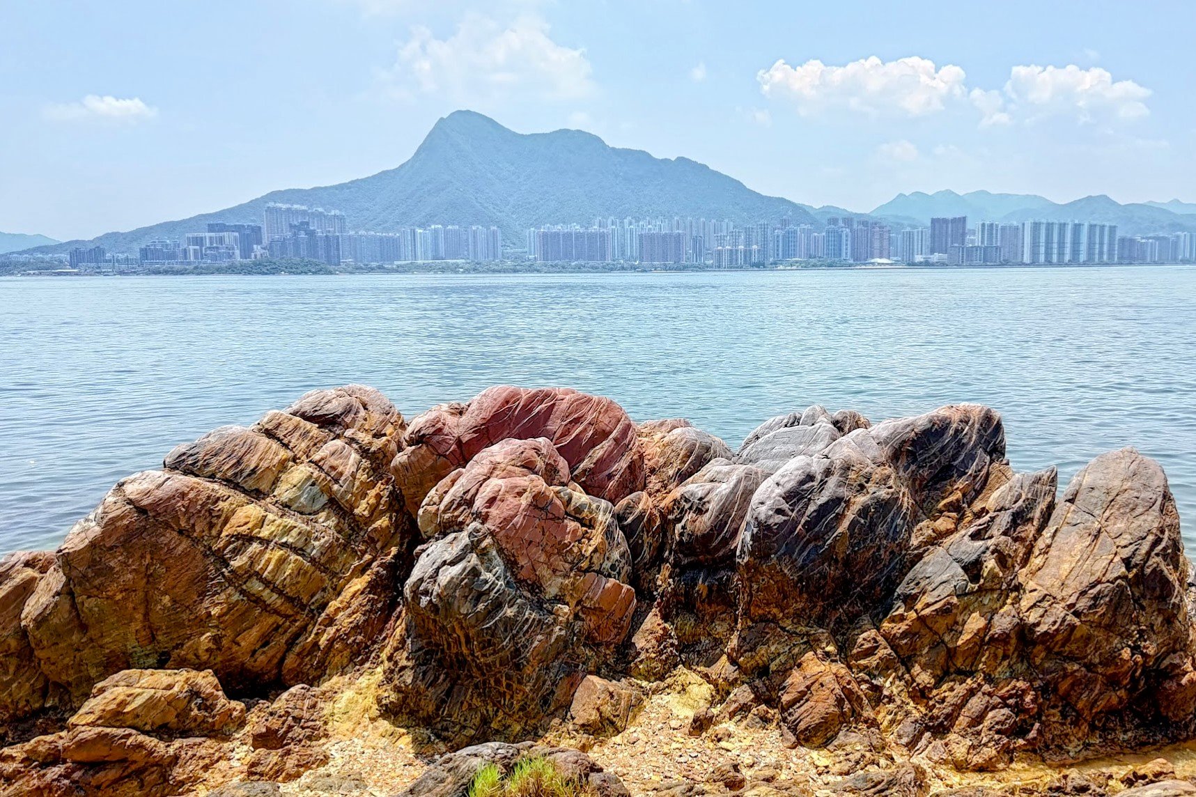
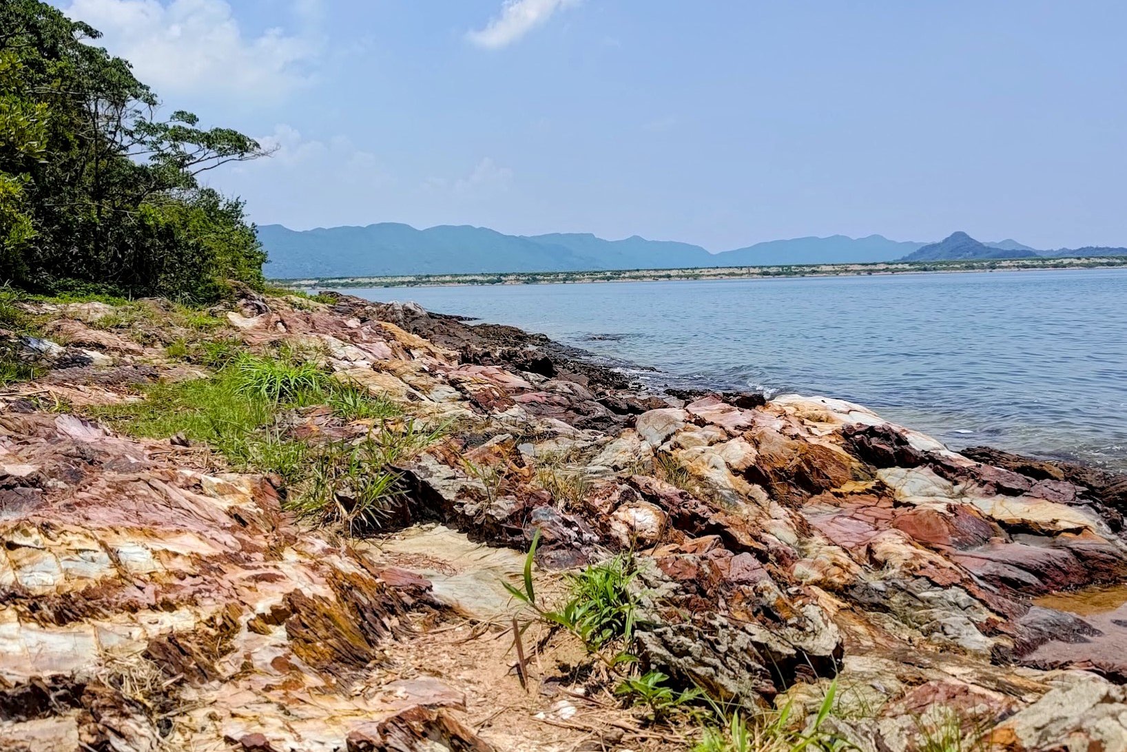
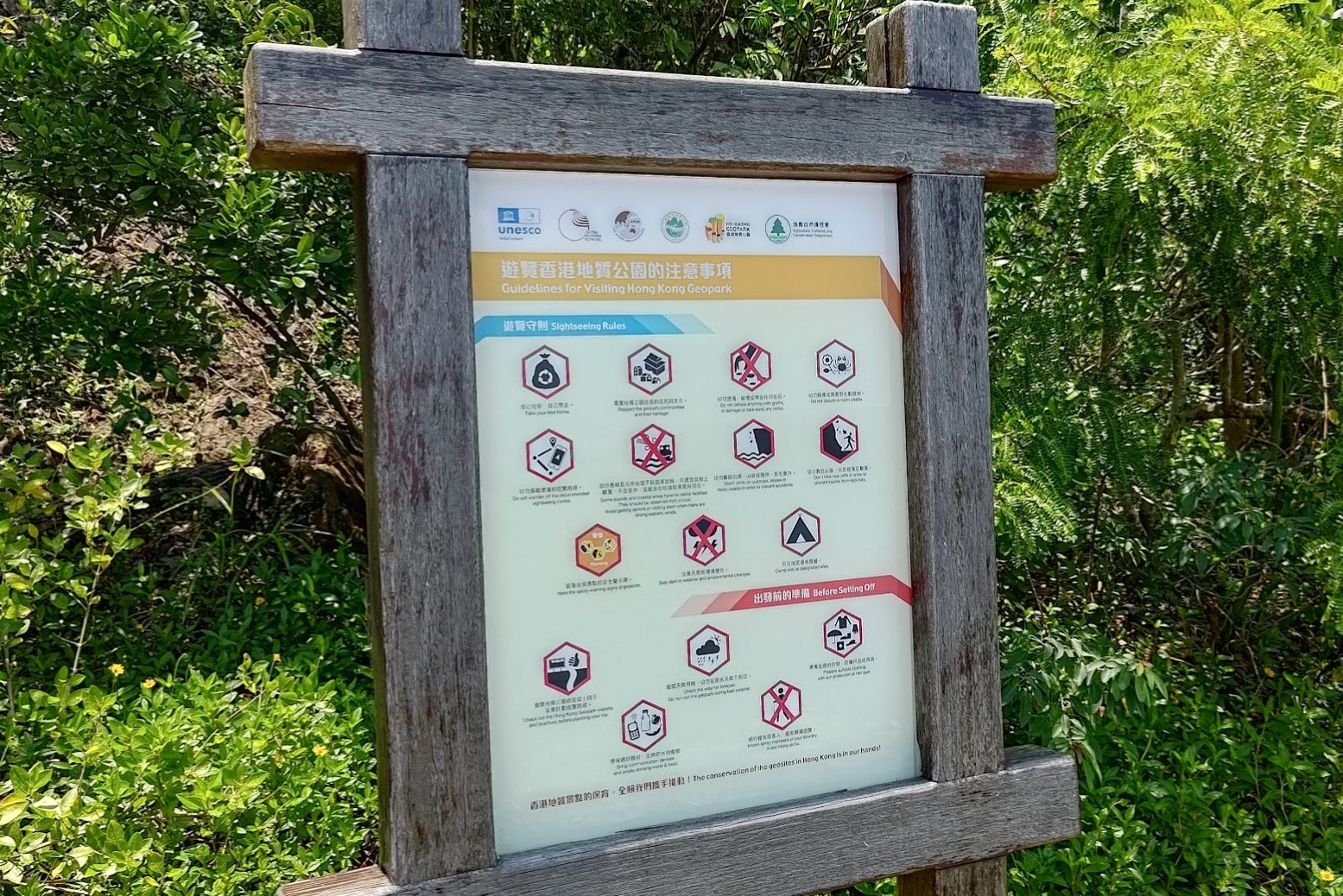
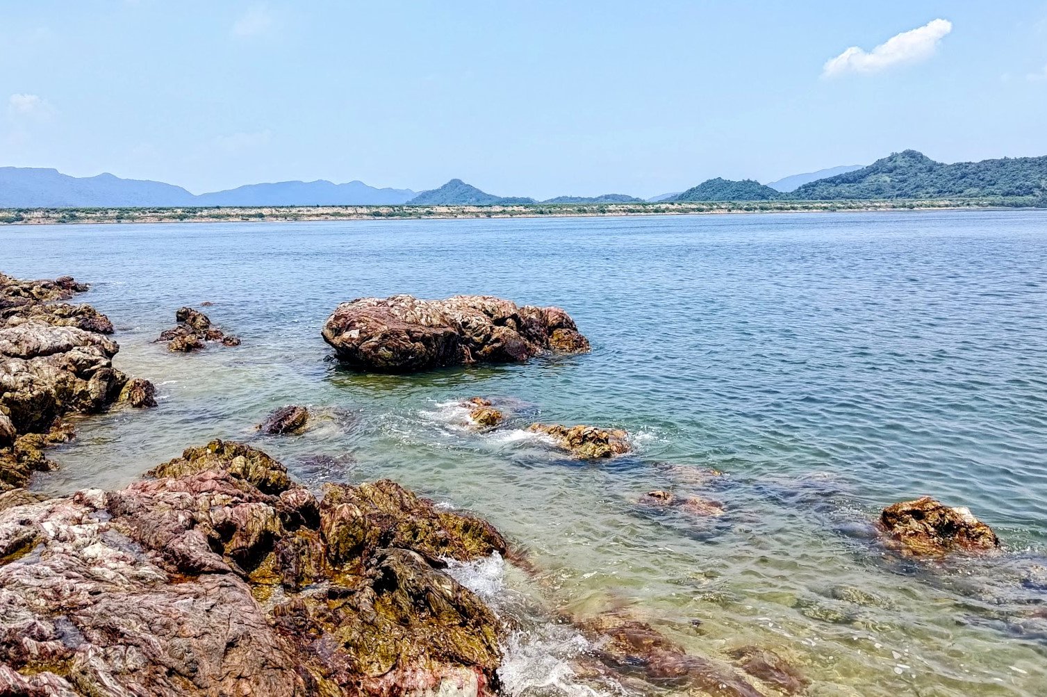
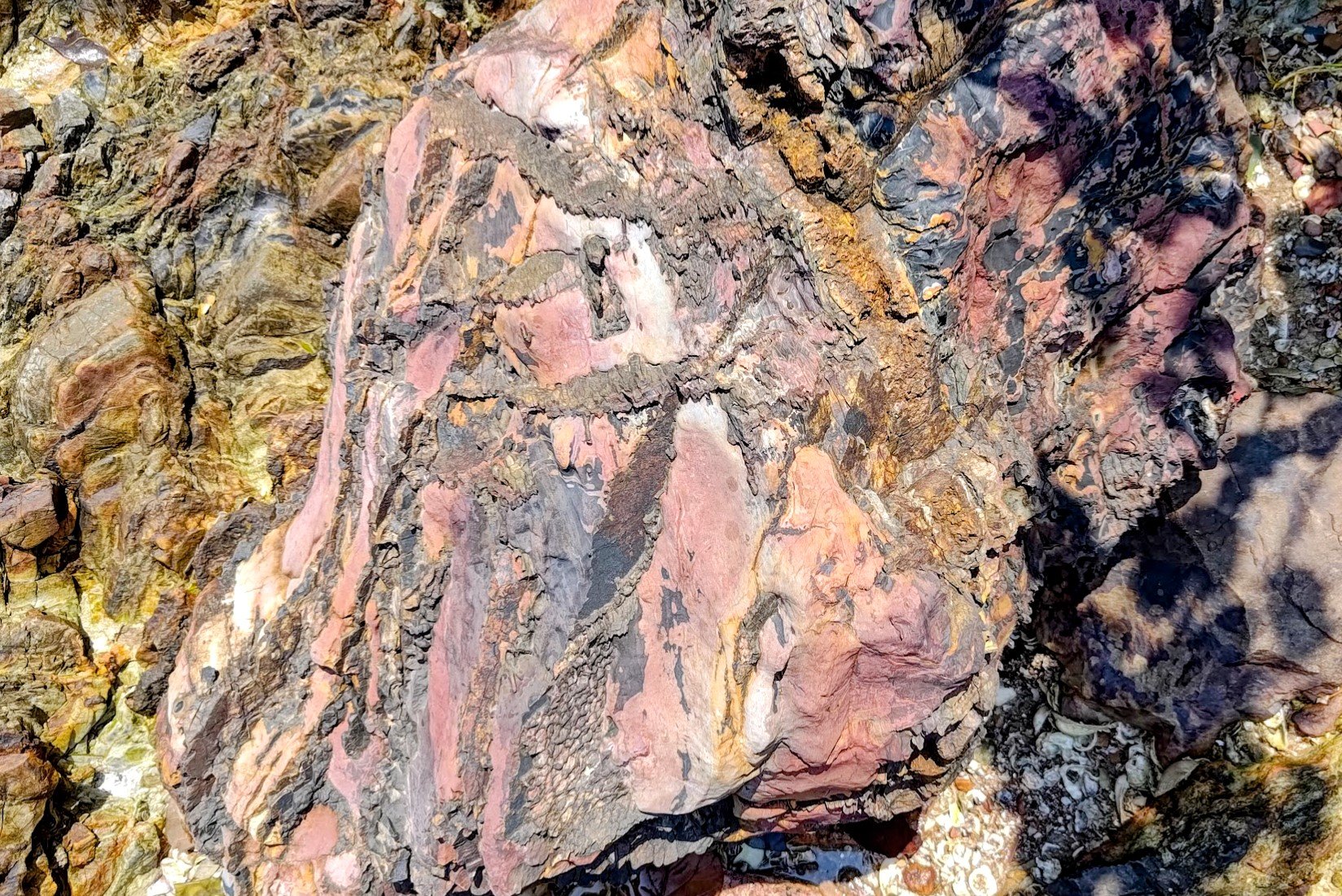
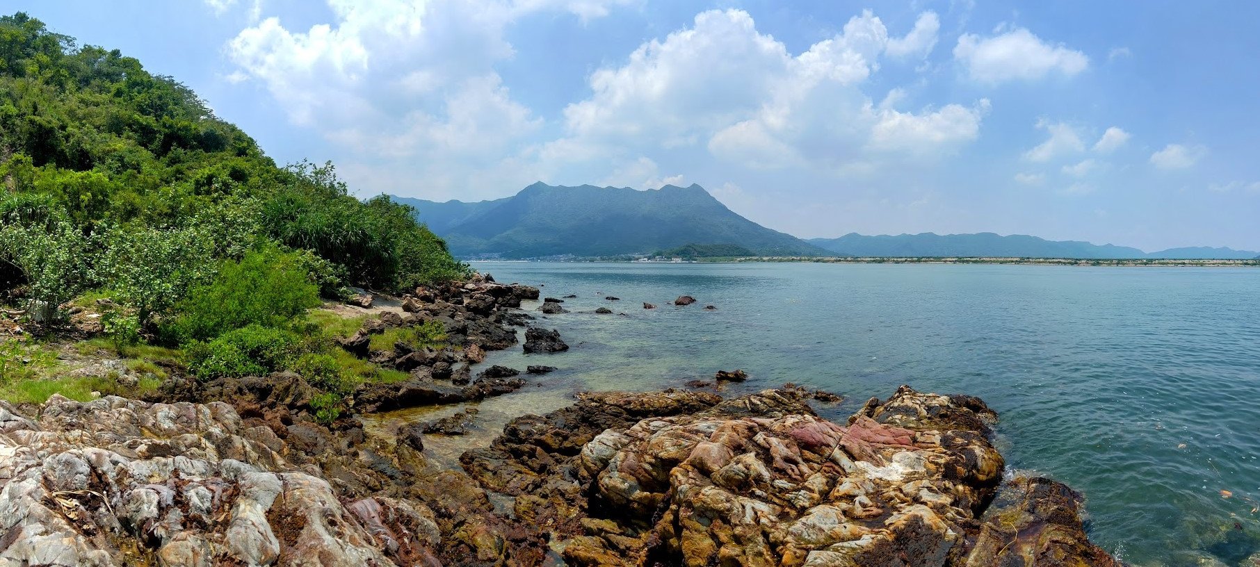
You’ll then traverse a hill covered in ancient tombs before crossing a secret tombolo (a stretch of land connecting the mainland to an island), and finally hug the coast, which consists of shell beaches and 280-million-year-old geological rocks dating back to the Permian period. It's even a designated UNESCO site!
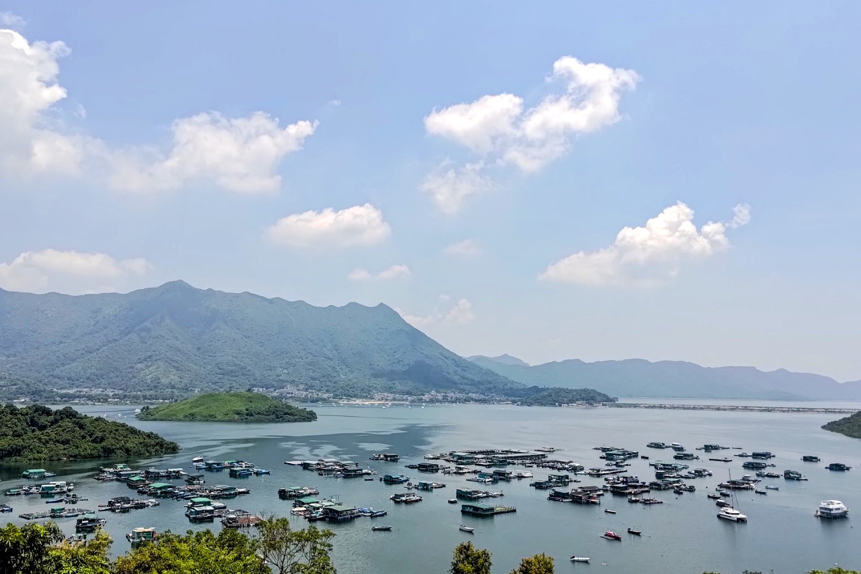
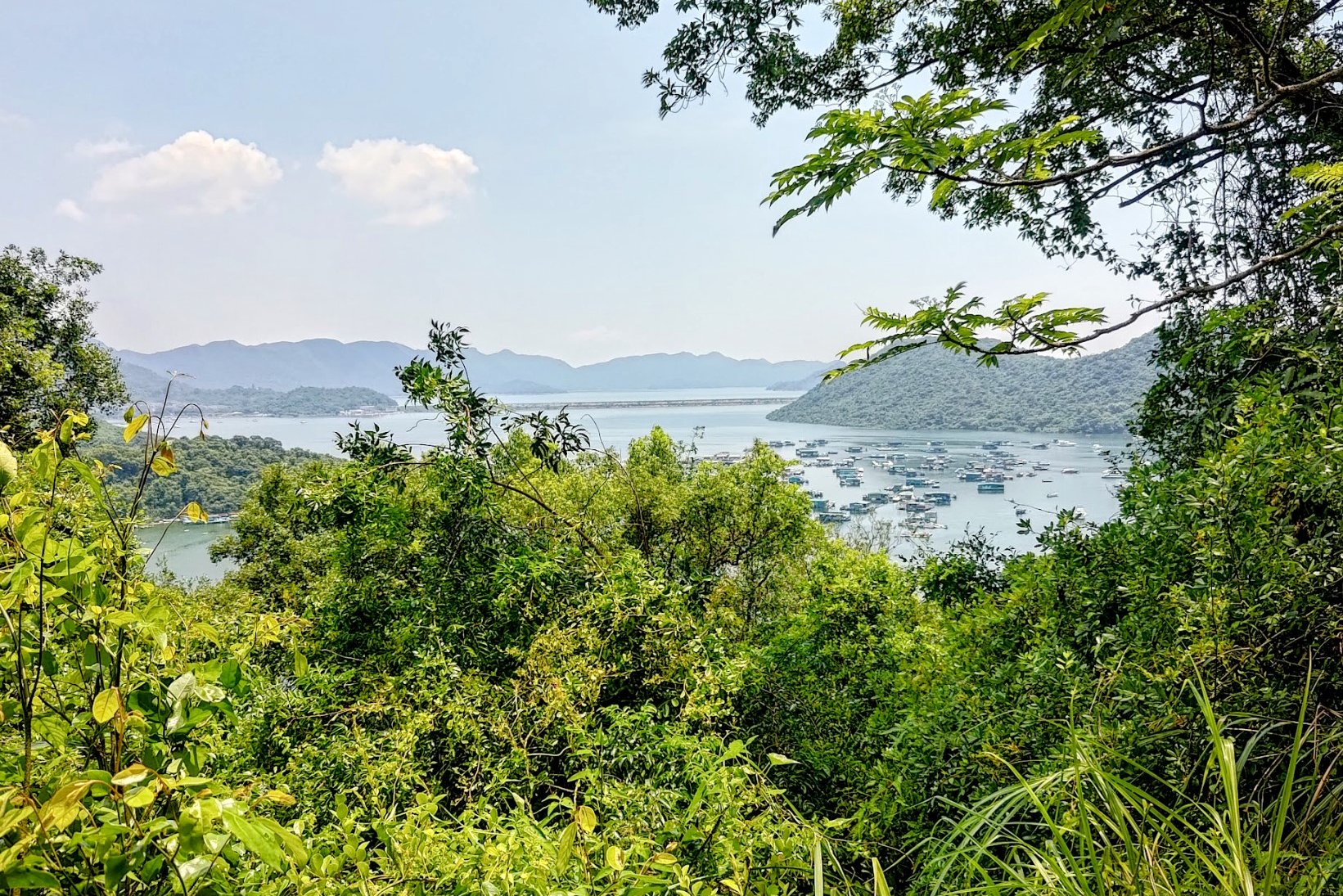
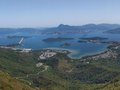
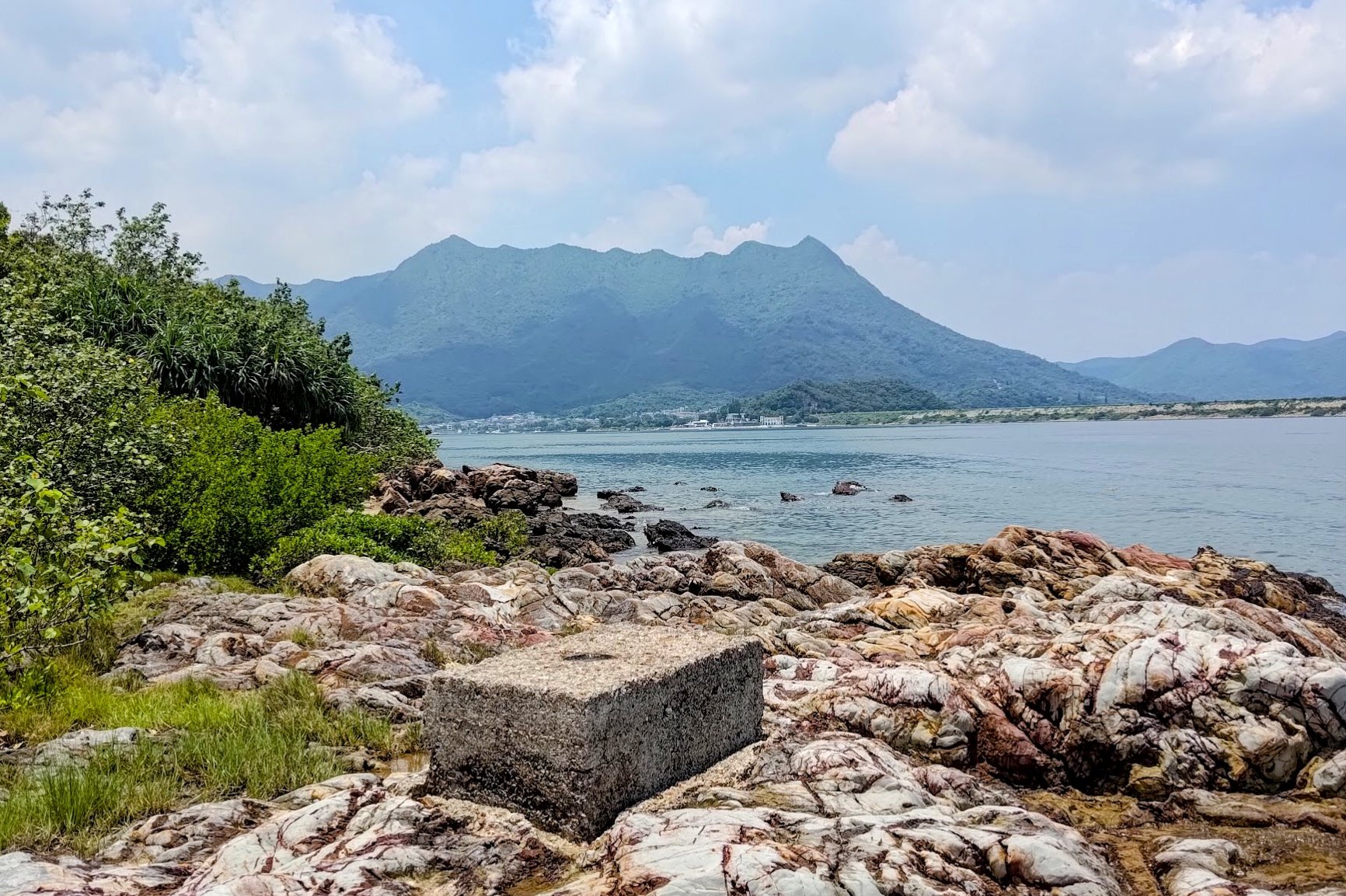
The hike also presents plenty of opportunities to drink in stunning views of Pat Sin Leng, Ma On Shan, the Plover Cove Main Dam, and lots of other wonderful scenery along the way!
Ma Shi Chau Google Route Map and GPX
*Click the box icon in the top right of the map below to load the blue route directly into your own Google Maps. You can then see your location relative to the trail in real time!
How to Get to the Ma Shi Chau Hike Start Point
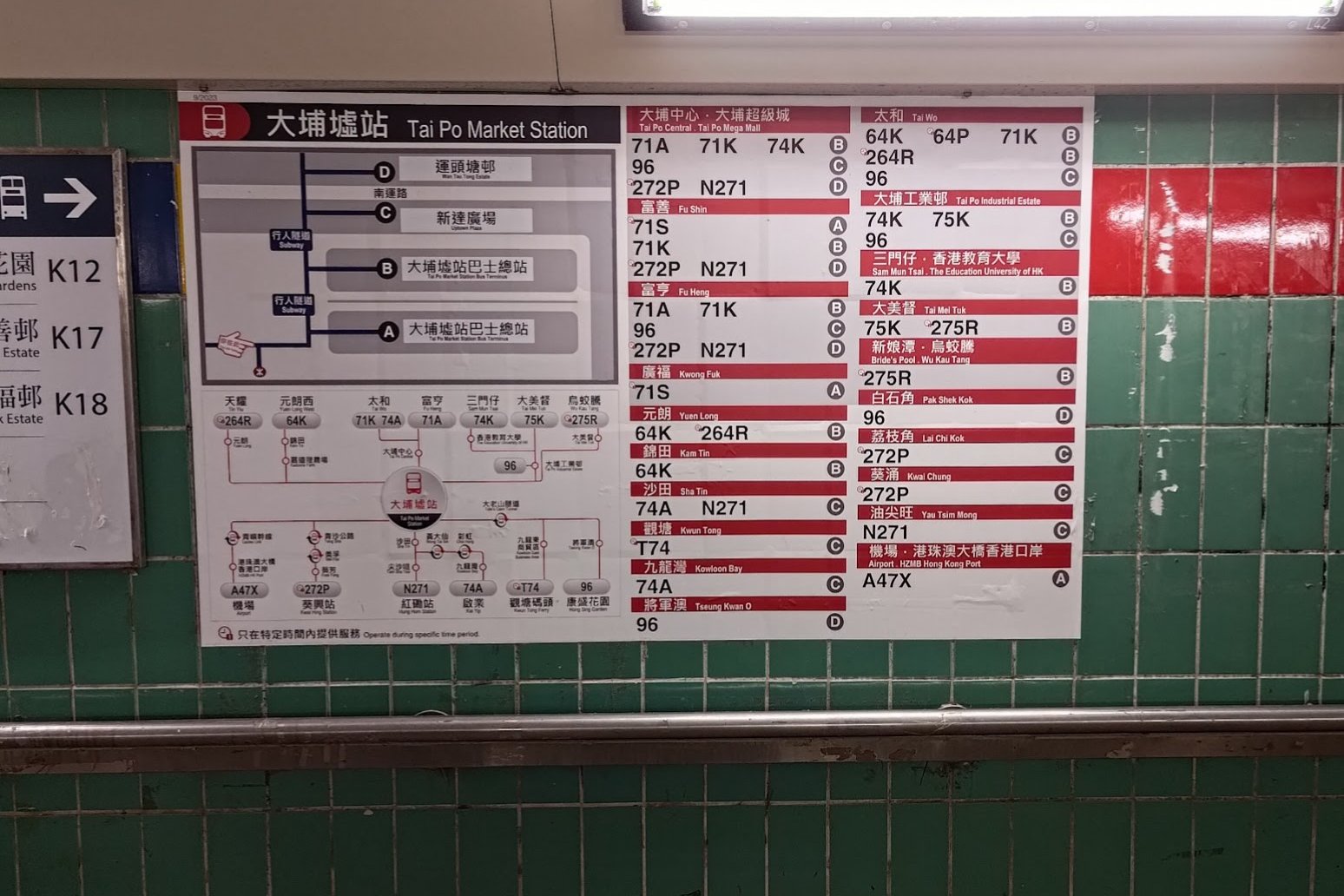
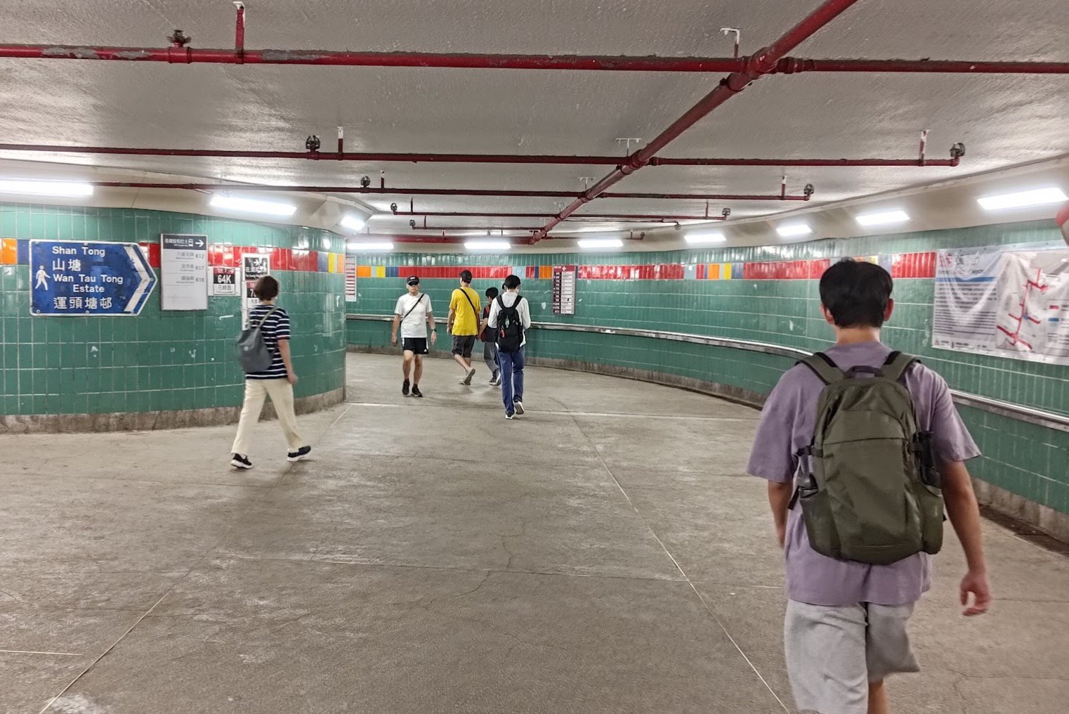

Take the MTR
Board the East Rail Line and alight at Tai Po Station.
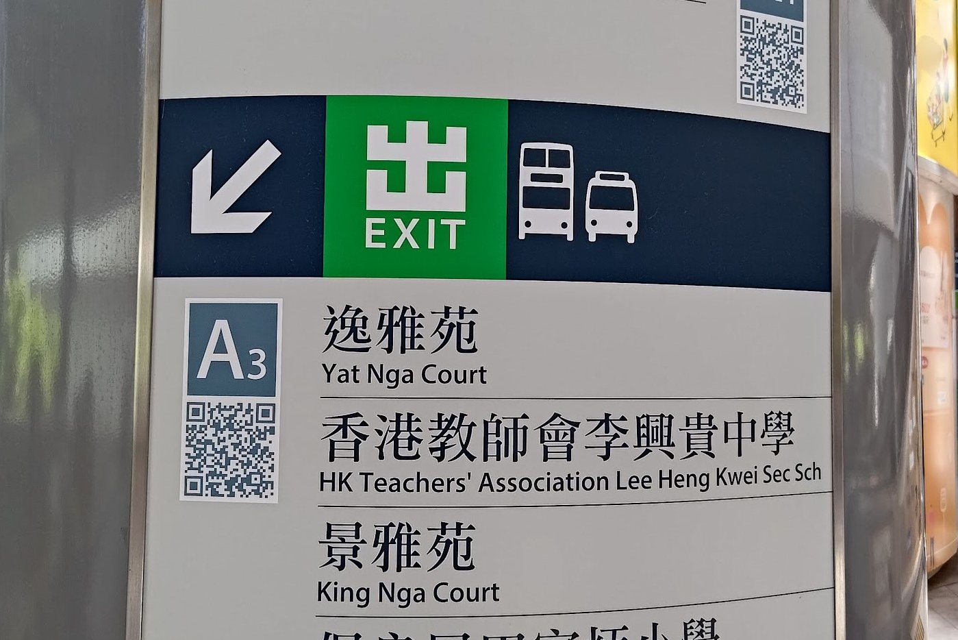
Exit the Station
Leave Tai Po Station through Exit A3.
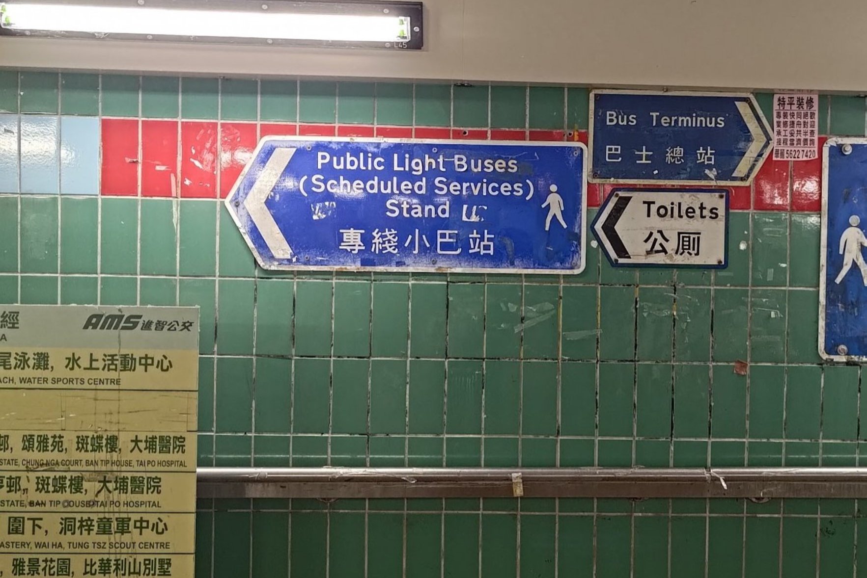
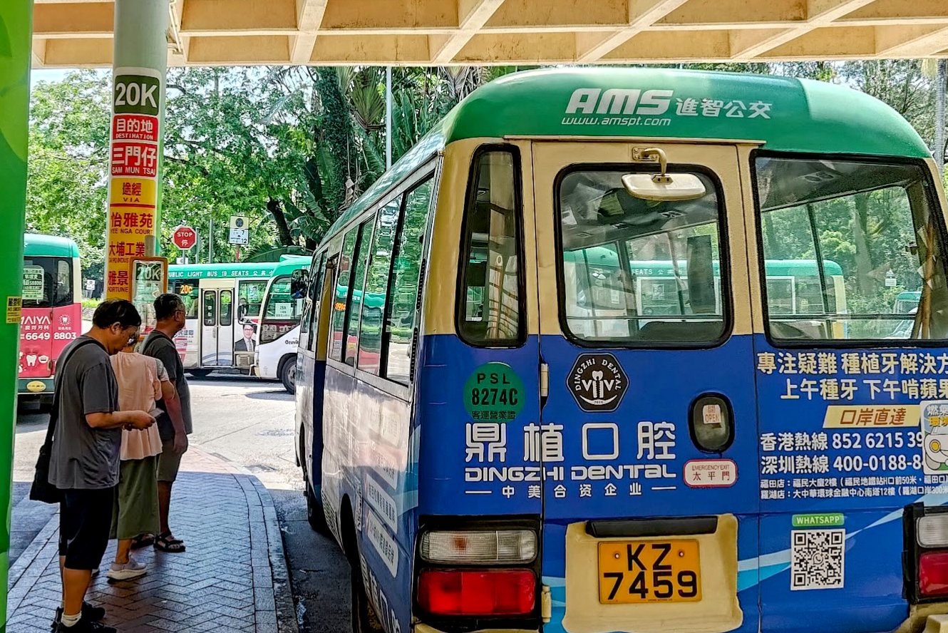
For the 20K Minibus
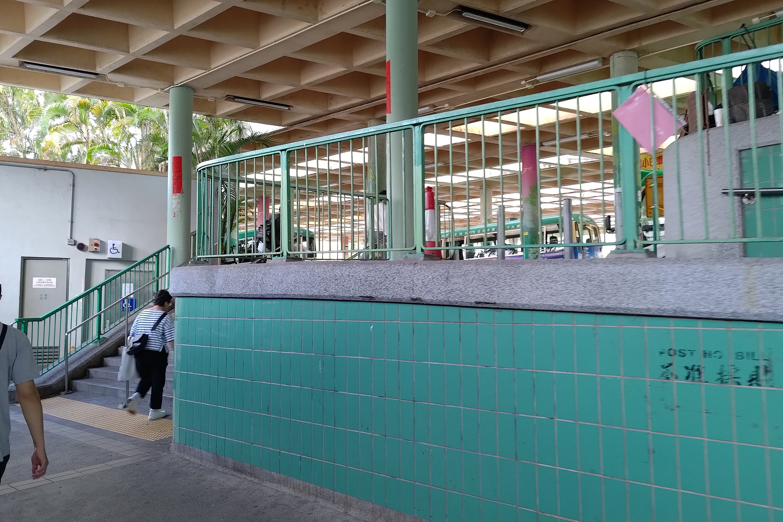
Turn left immediately after Exit A3 to reach the minibus terminus.
Find the queue for the 20K minibus and board it to its final stop at Sam Mun Tsai.
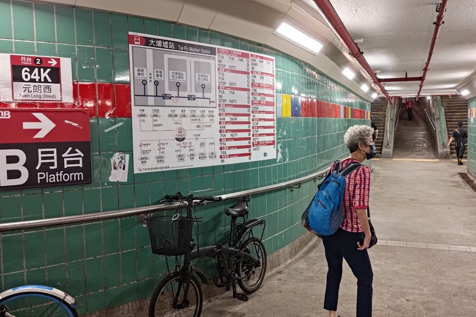
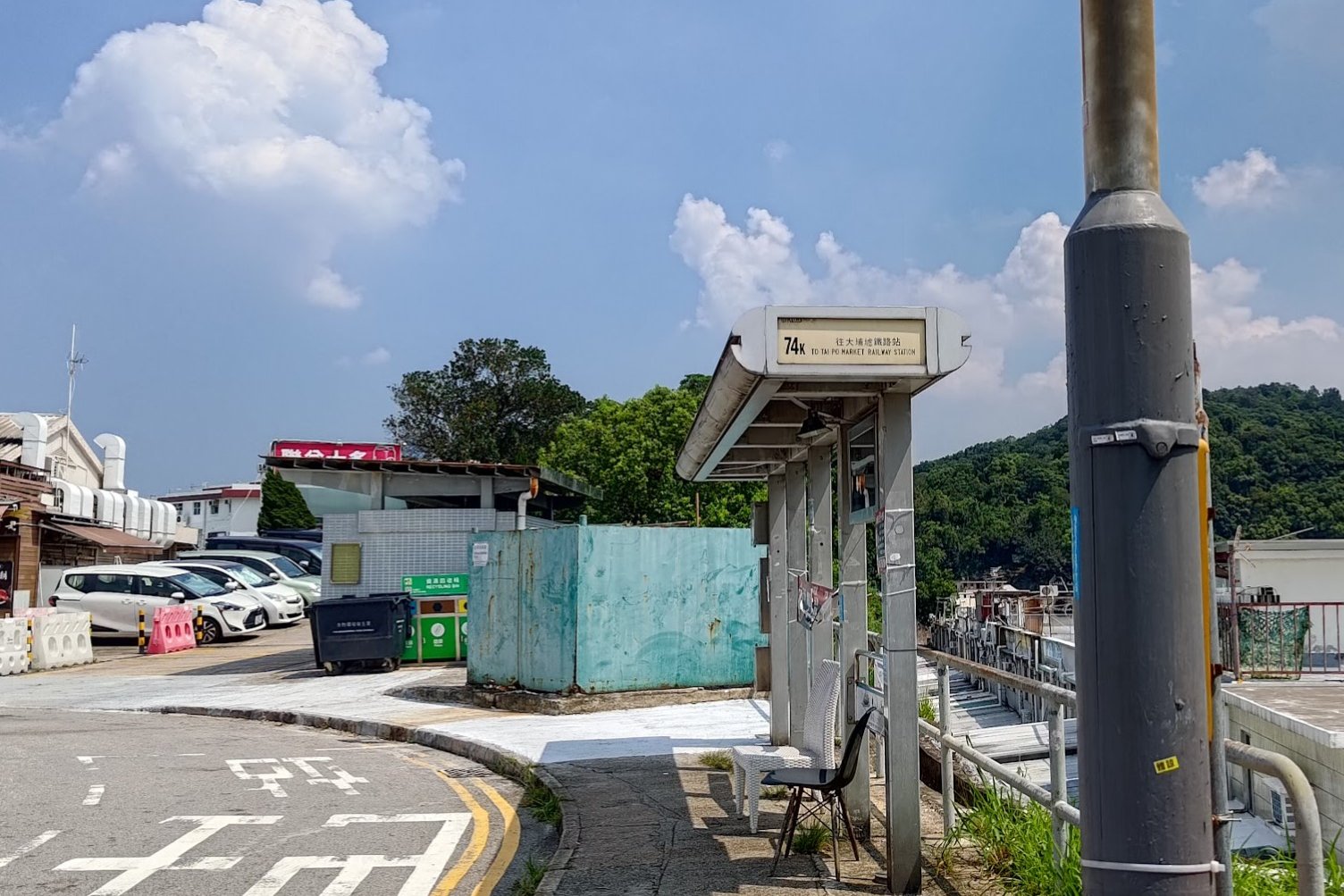
For the 74K Bus
Turn right after Exit A3 and walk toward Platform B.
Locate the 74K bus stop just past the slope near Platform B. Make sure to alight at the Sam Mun Tsai stop.
Quick Ma Shi Chau Hike Route Summary
1. Arrival & Entry:
- Get off at Sam Mun Tsai New Village.
- Look for the brown "Sam Mun Tsai New Village" sign by the stairs and enter the village.
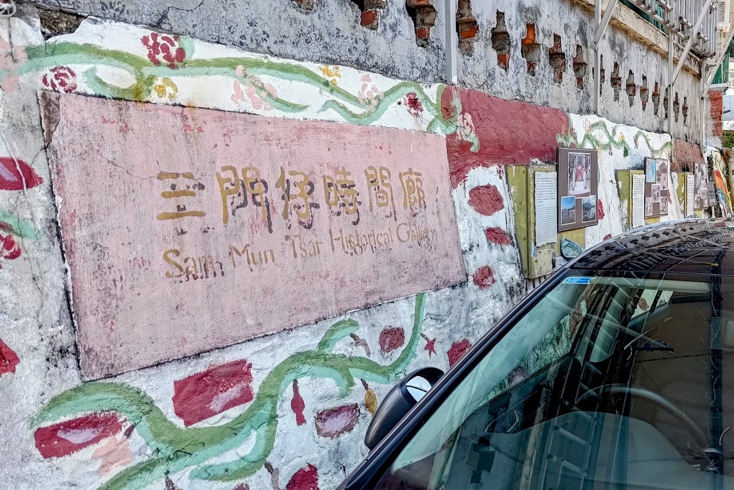
2. Walk Through the Sam Mun Tsai New Village:
- Walk along the village's main road.
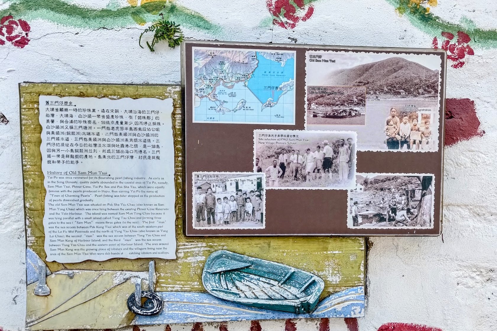
- Pass a wall with displays about the village's history.
- Midway through the village, watch for a white laminated Chinese sign with an arrow.
- Follow it left onto the path with green railing and stairs.
3. Climb the Stairs:
- Begin the climb; keep an eye out for an old abandoned school on your right.
- Continue upward until the stairs end at a flat path.
4. Flat Path & Old Tombs:
- Walk along the flat path. Ignore the stairs on the right leading upward.
- The trail will pass several old tombs as you go toward the tombolo.
5. Trail Fork:
- At the fork, stay on the flat trail. Do not go down the right-hand descending path.
6. Orange Pavilion:
- Eventually, you’ll reach an orange pavilion.
- Take the stairs down from here.
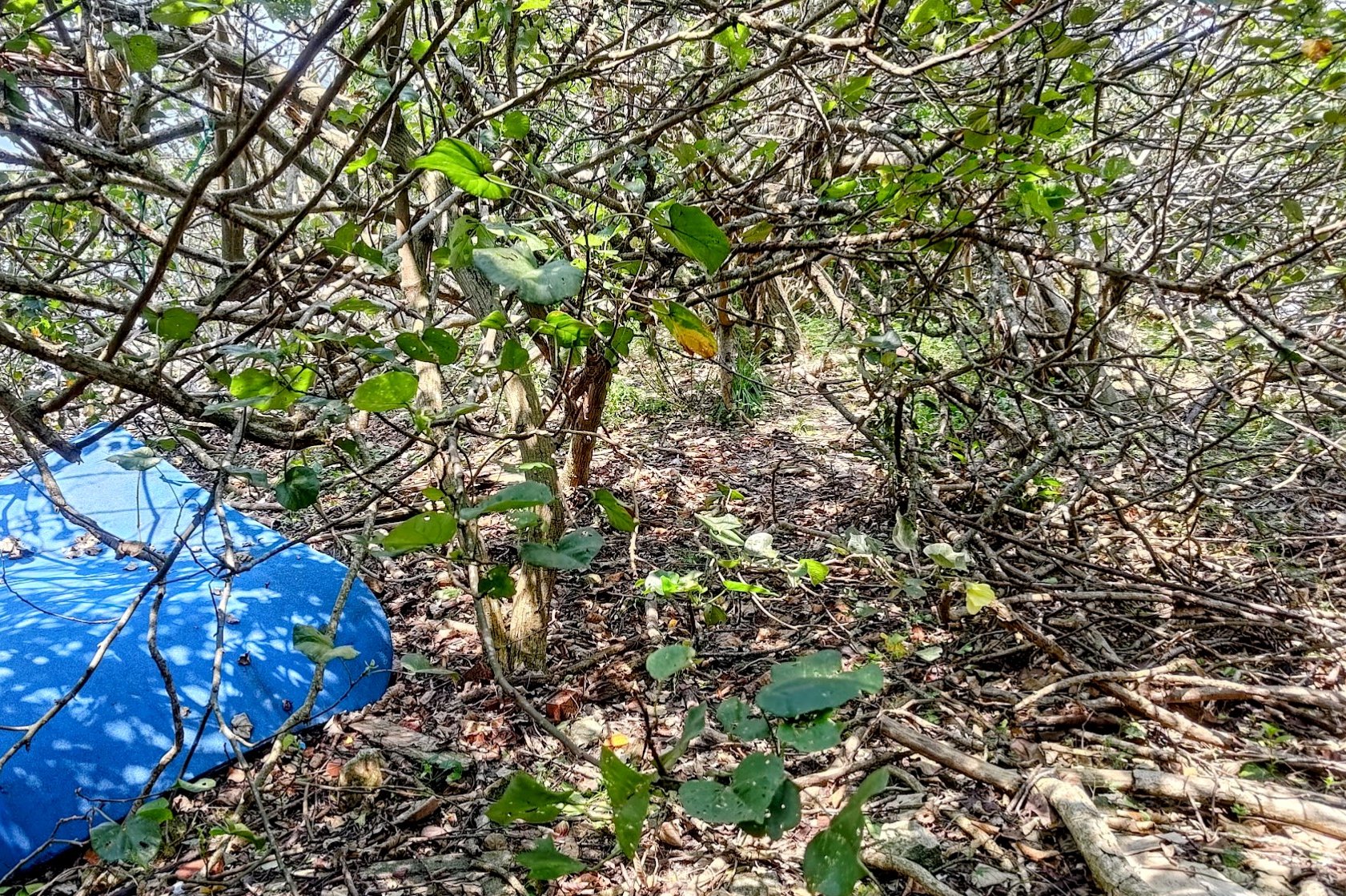
7.Mangrove & Hidden Path:
- At the bottom, you’ll be in a mangrove area. On your left, look for a crumbling concrete path.
- There was a blue tarp as an easy marker in 2025. The path to the tombolo was to the right of the blue tarp.
- If the tarp isn't there, look left at the bottom of the stairs, and you'll see a path through the mess of tree roots and branches. It's quite hard to spot. Do not continue straight ahead after the stairs. You will get lost in the maze of roots and branches.
8. Cross the Tombolo:
- Cross to the tombolo. There is often an old aunty selling water here; she can also arrange a boat back to Ma Shi Chau for 150 HKD per person (cash only).
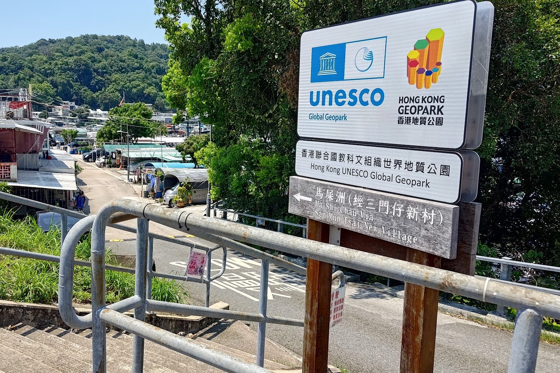
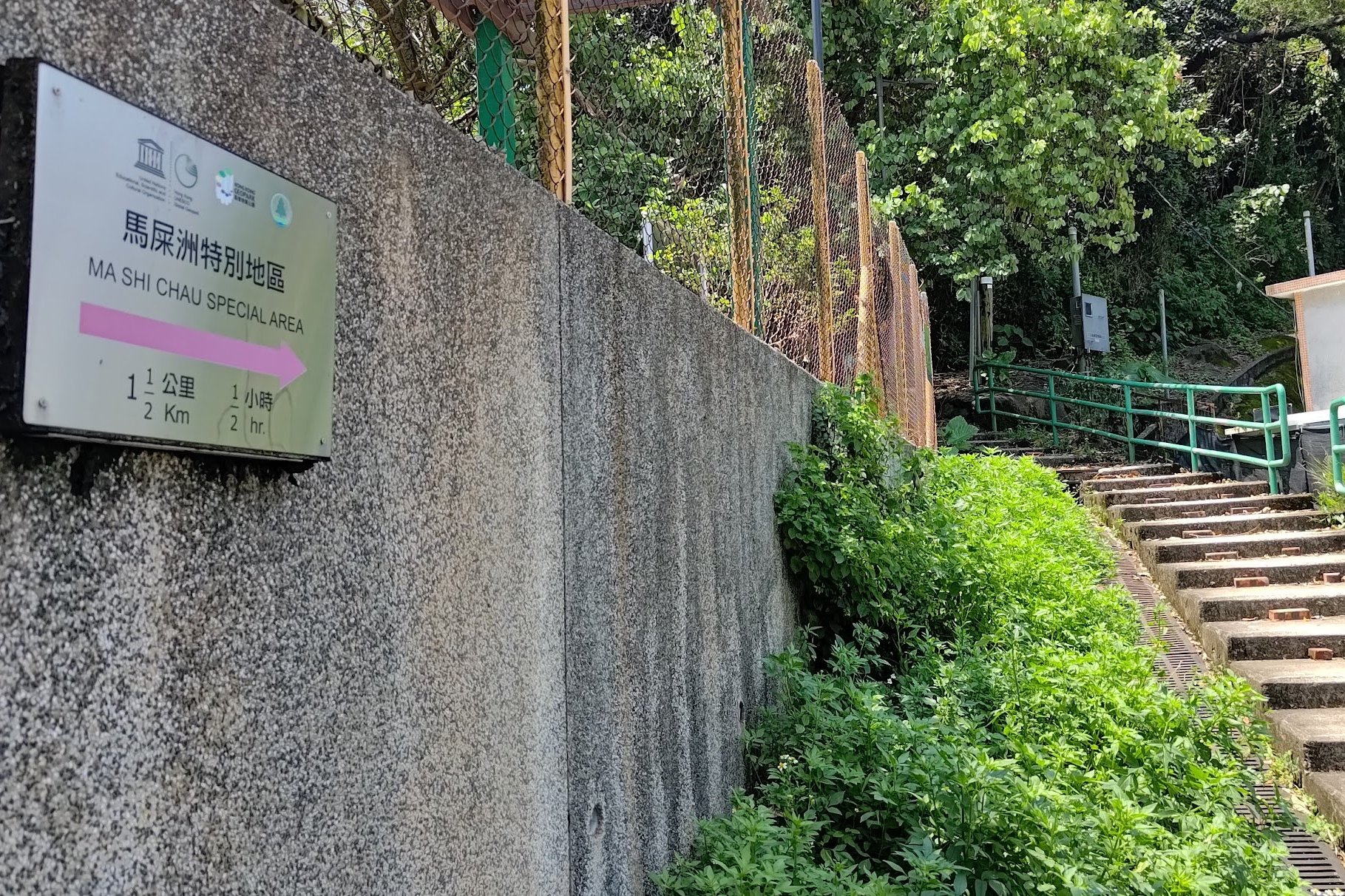
9. Ma Shi Chau Nature Trail:
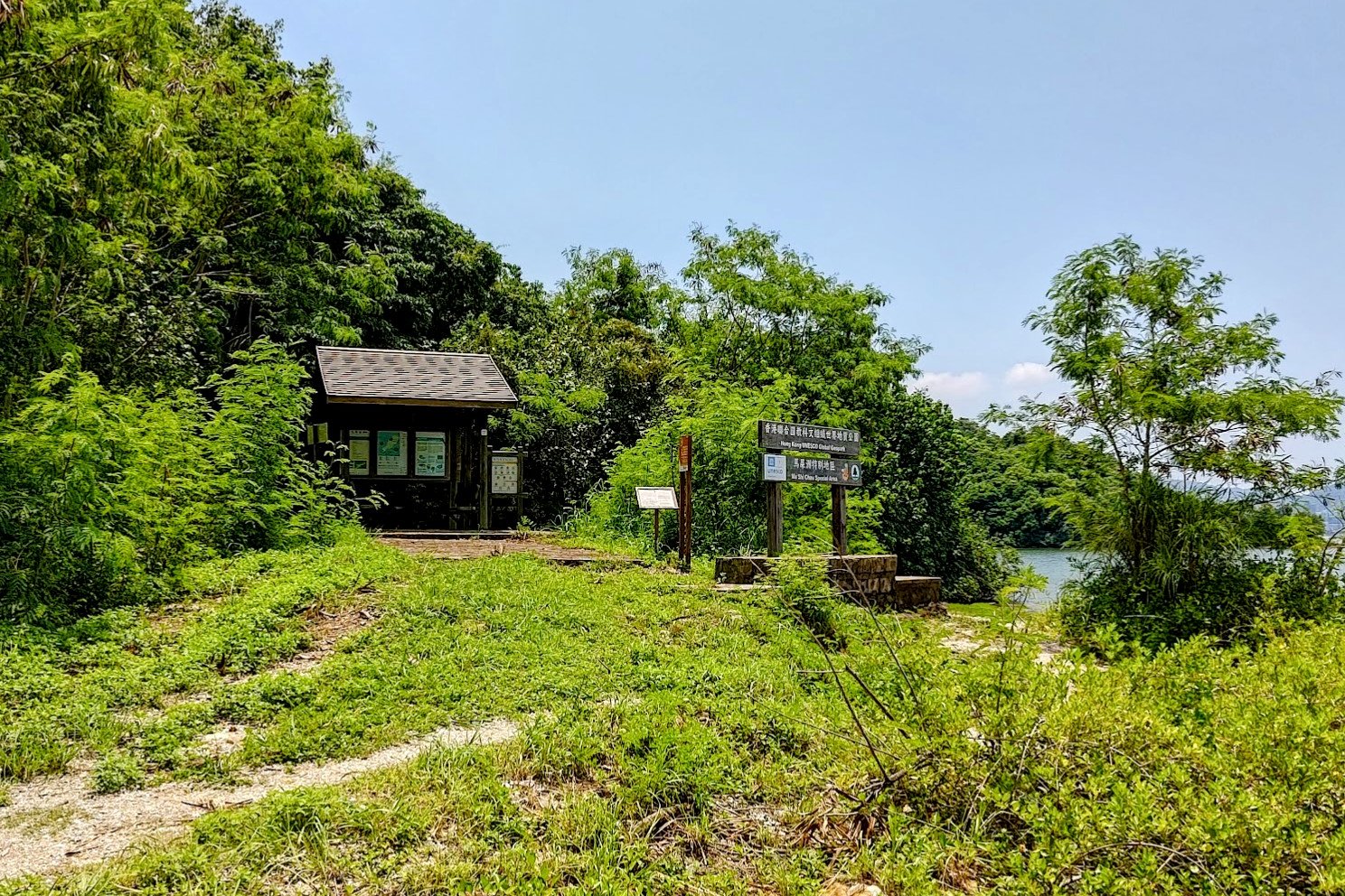
- Follow the Ma Shi Chau Nature Trail after the UNESCO Ma Shi Chau Special Area sign.
- You will need to alternate between coastline and inland trail—if the inland path is very overgrown, stick with the coast or double back until you see a clear path with no tree branches blocking your way.
- Allow about 45 minutes to reach the top of Ma Shi Chau for panoramic views.
10. Return Options:
- Reverse the hike to Sam Mun Tsai New Village bus stop.
- Or, take the boat (if available) from the tombolo as arranged above.
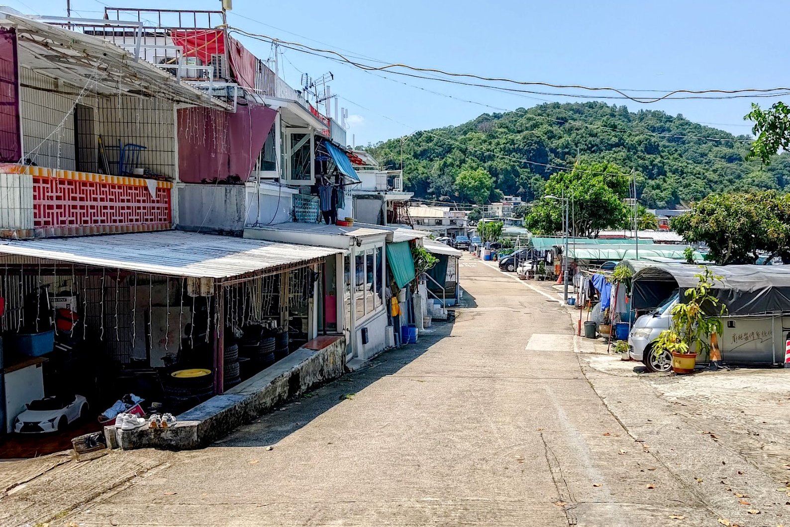
Starting out at Sam Mun Tsai New Village


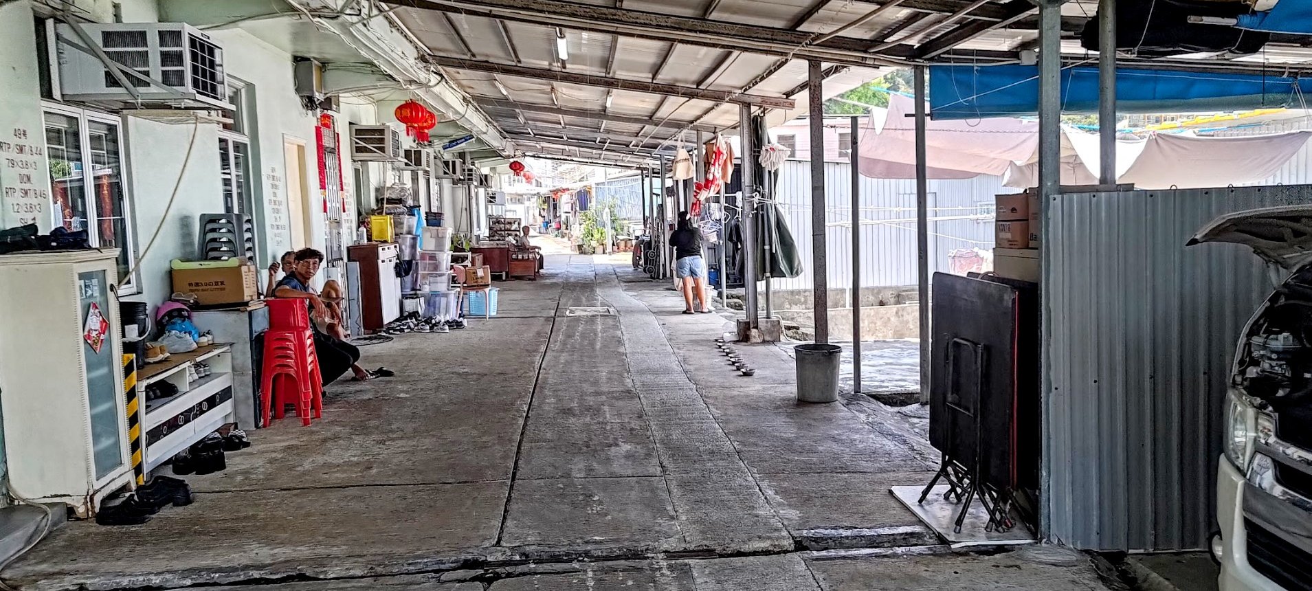
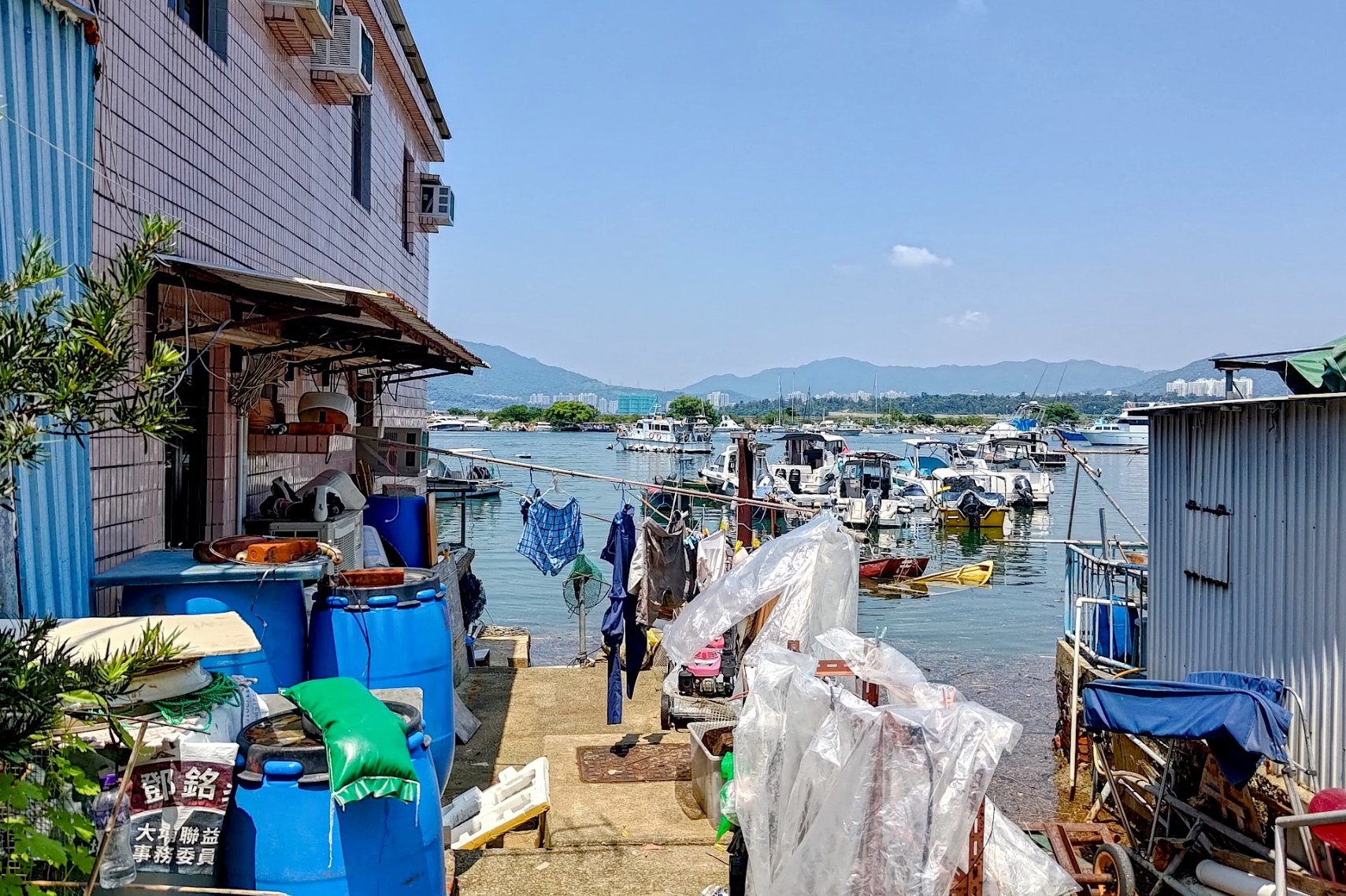
After alighting from the bus, follow the signs down into Sam Mun Tsai New Village and walk through it.
There is a public toilet and you can buy supplies from village shops, though they accept cash only.
When you arrive at the green stairs at the end of the village, you'll be at the next part of the hike.
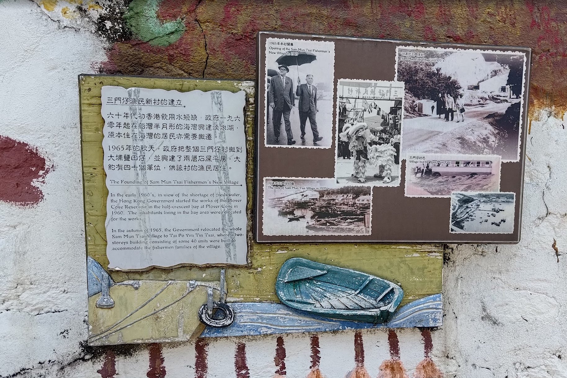
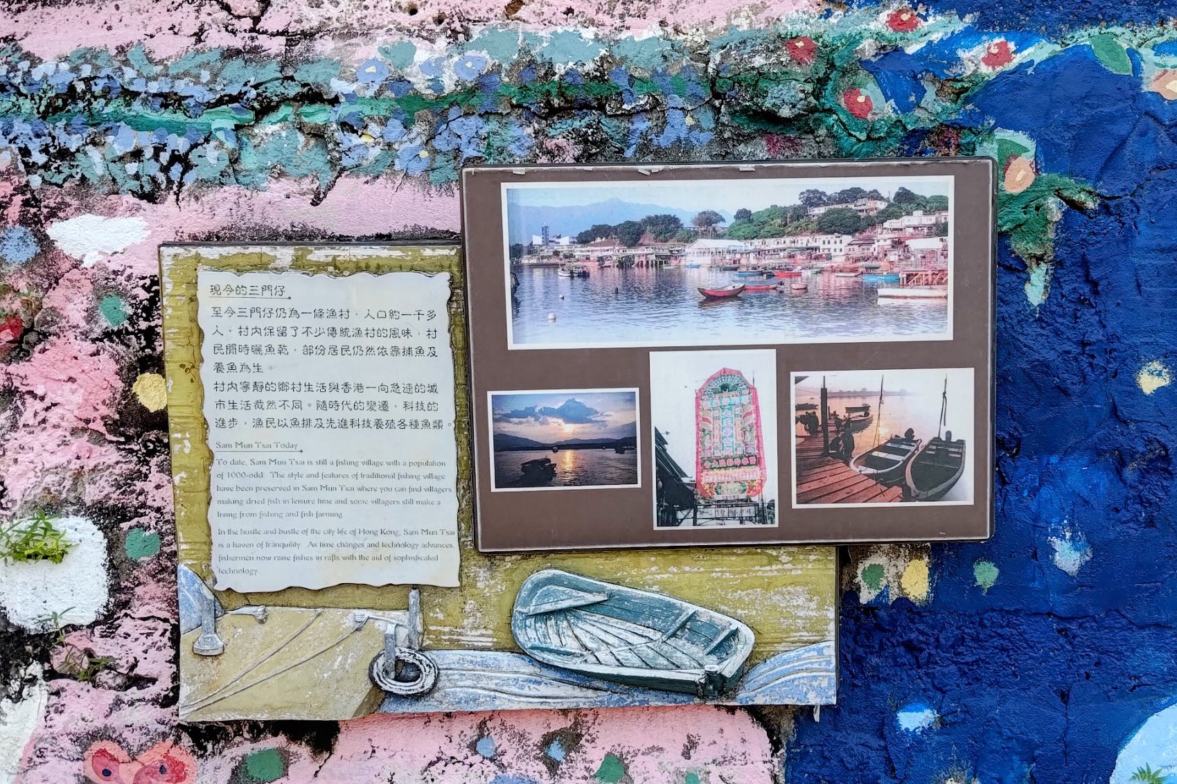
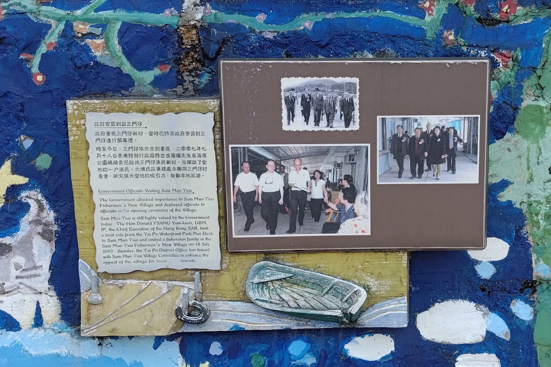
The History of Sam Mun Tsai New Village
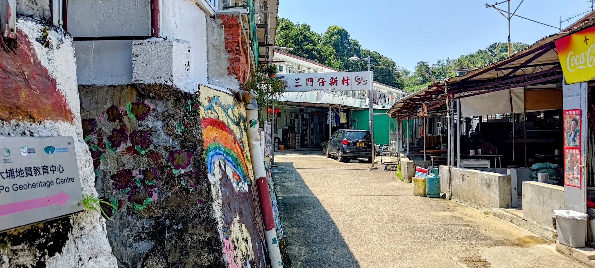
Sam Mun Tsai is a traditional fishing village with origins tracing back to the Song Dynasty (1127–1279).
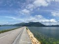
In the 1960s, the original village was situated near what is now the northeastern shore of the Plover Cove Reservoir. The reservoir’s construction, completed by 1968 due to a lack of freshwater, submerged the village as it involved damming a sea inlet—the first of its kind in Hong Kong.
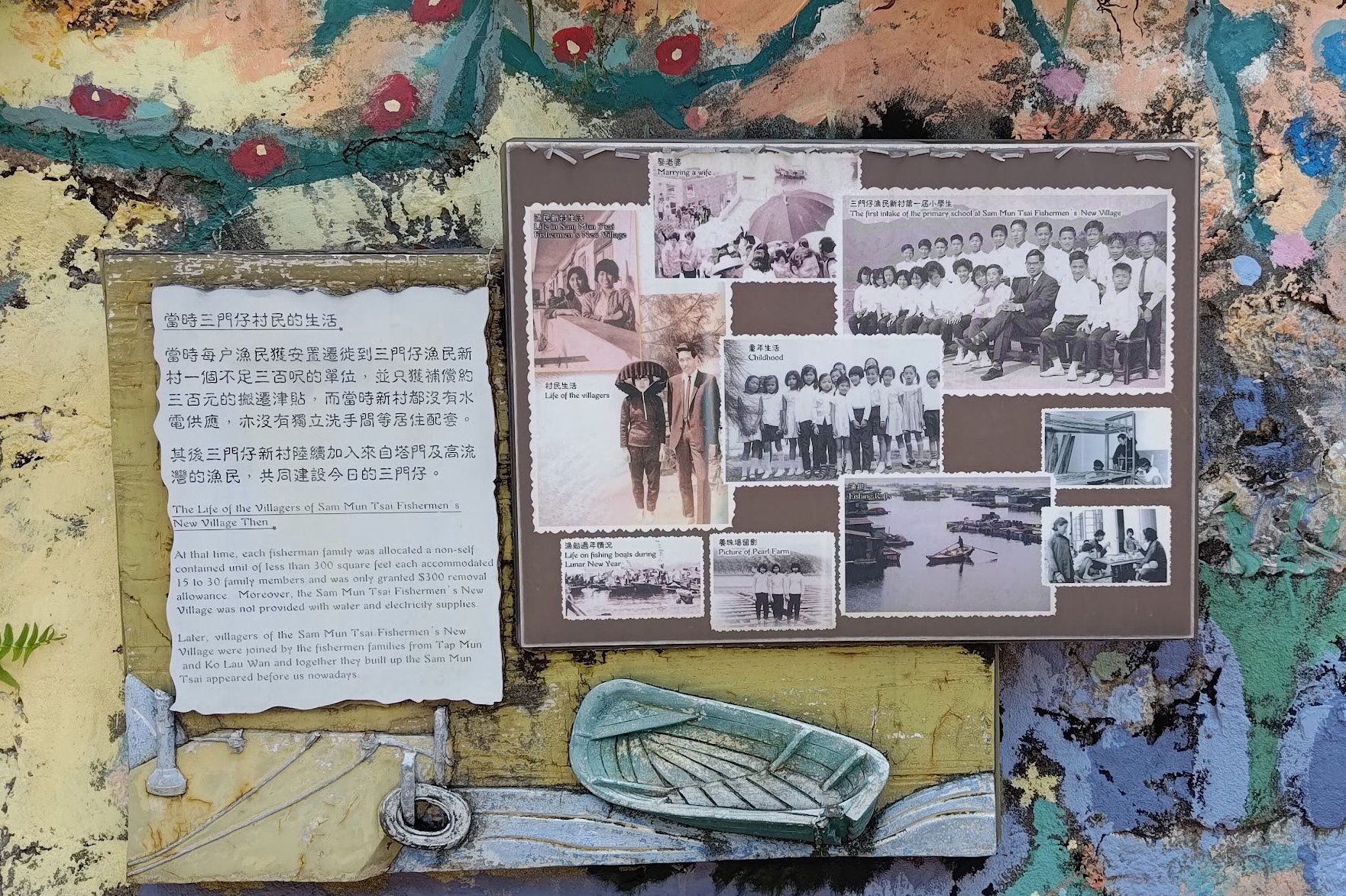
The original Sam Mun Tsai villagers were relocated in 1965 due to the reservoir project. Unlike many displaced communities, they did not receive standard government compensation but were resettled at Tai Po Yim Tin Tsai—a different place from the Sai Kung island with the same name.
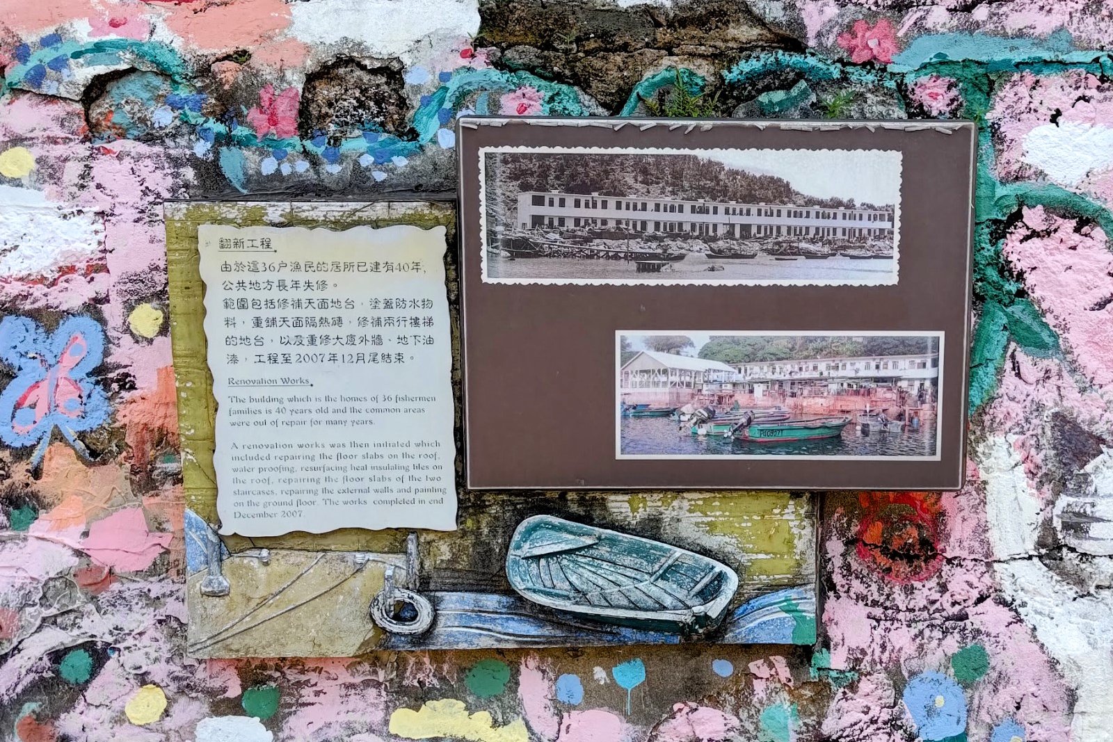
The new Sam Mun Tsai New Village consisted of government-built two-story houses for 36 families, much smaller than their previous homes and boats, forcing a shift from a boat-based fishing lifestyle to a largely land-bound living.
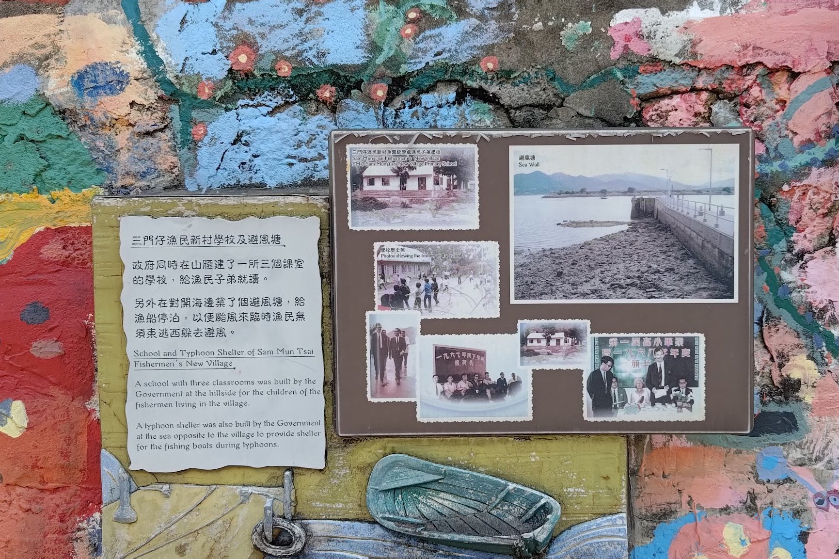
Today, the village remains home to roughly 1,000 people, preserving its fishing heritage while modernizing. It underwent important renovations in 2006–2007, is recognized under the New Territories Small House Policy, and benefits from infrastructure like the village pier and nearby cycle track.
Sam Mun Tsai is also notable for cultural traditions and a unique natural phenomenon—blue luminescent coastal waters caused by algal blooms—highlighting the village’s enduring connection to its maritime environment and resilience through significant changes.
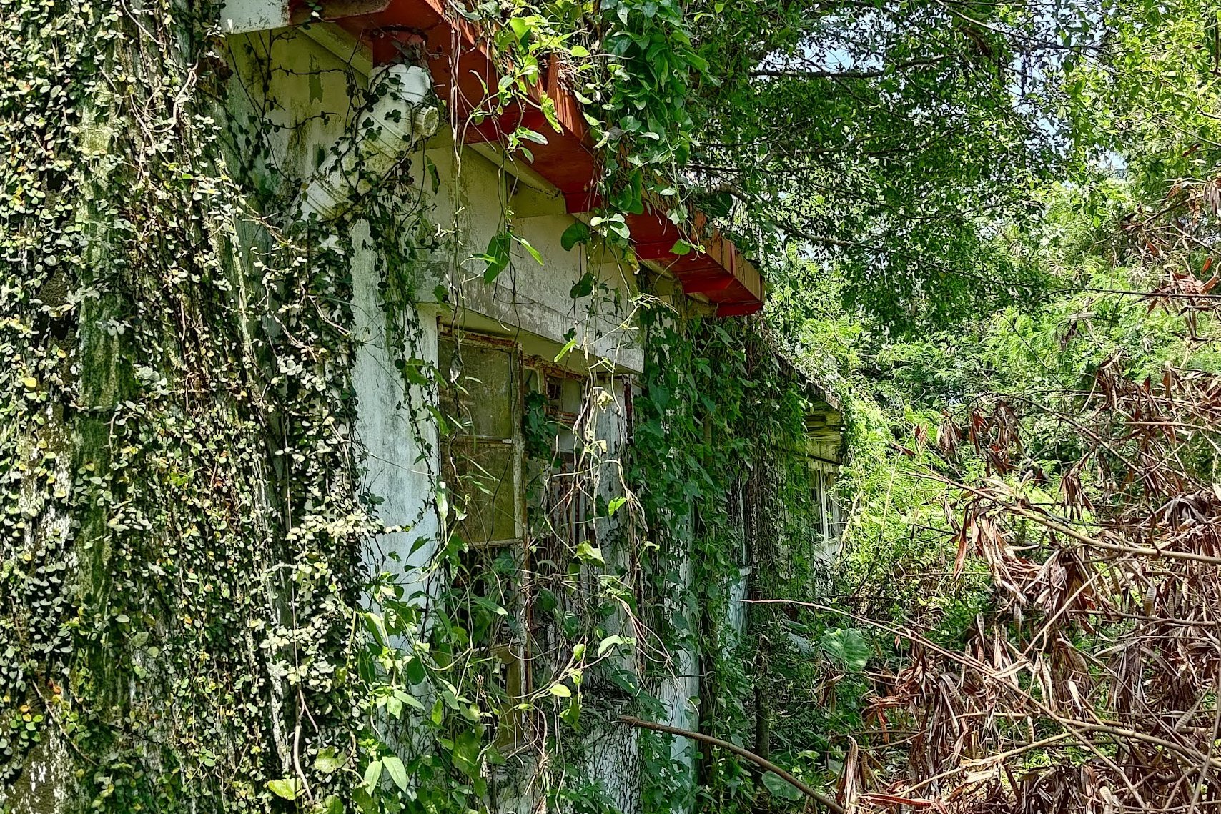
Abandoned Primary School Optional Detour


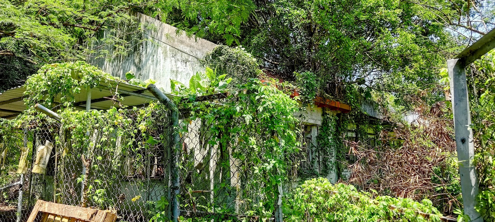
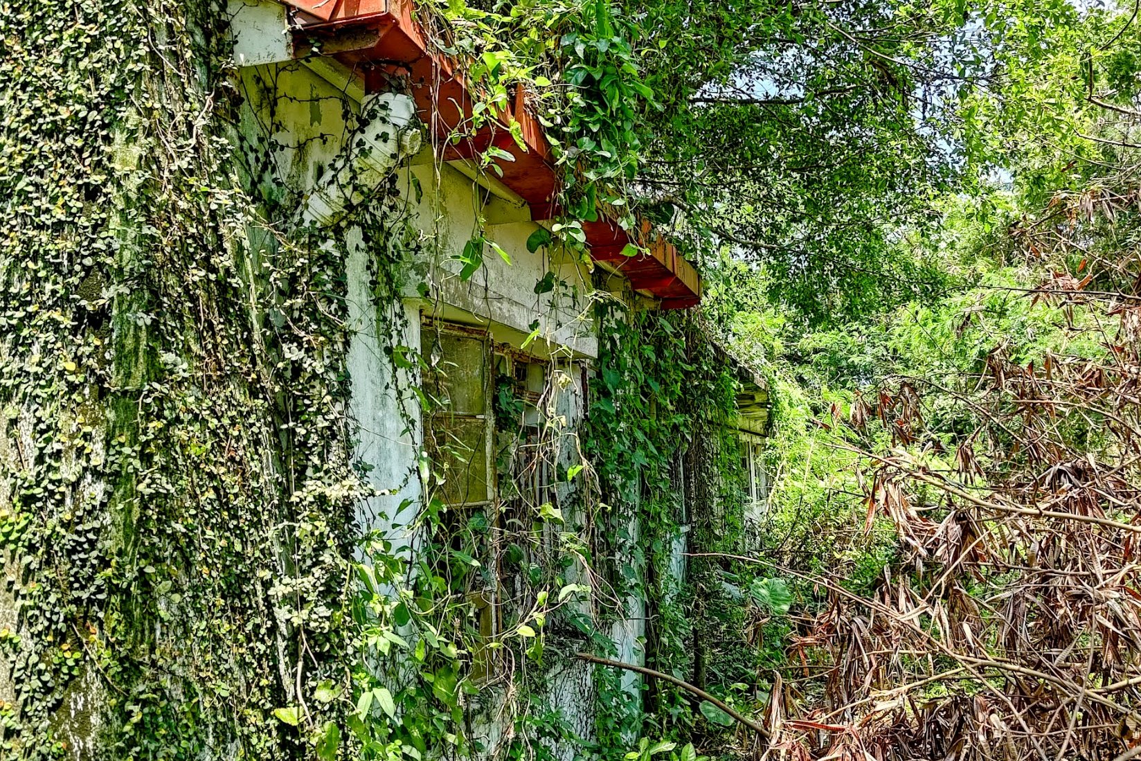
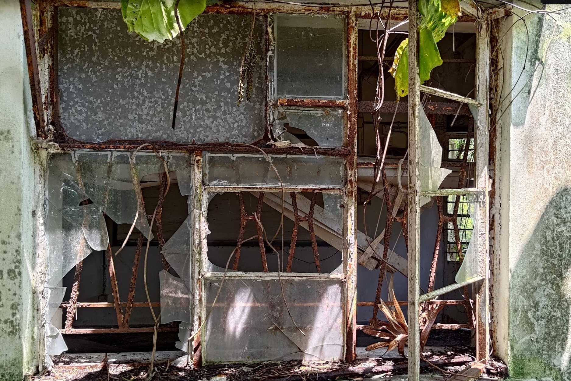
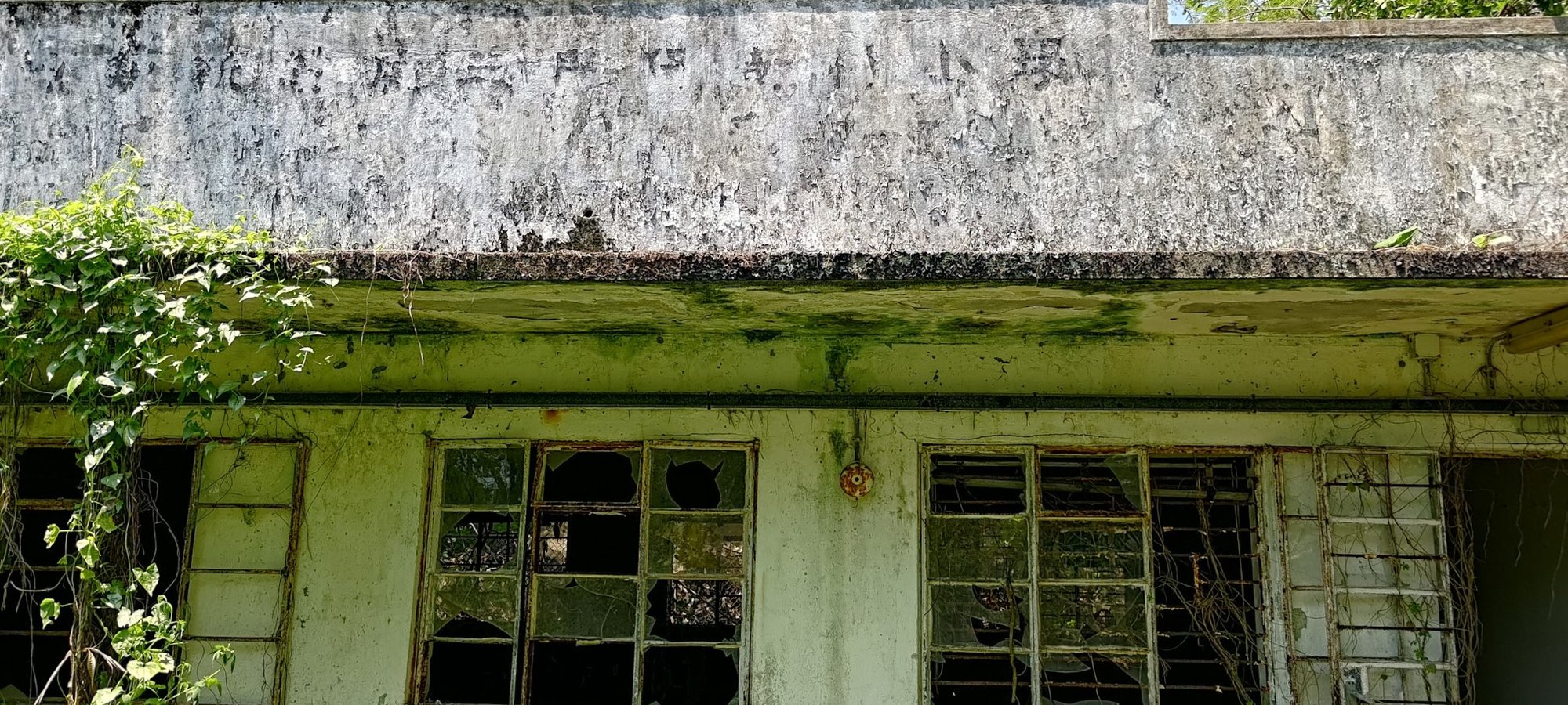
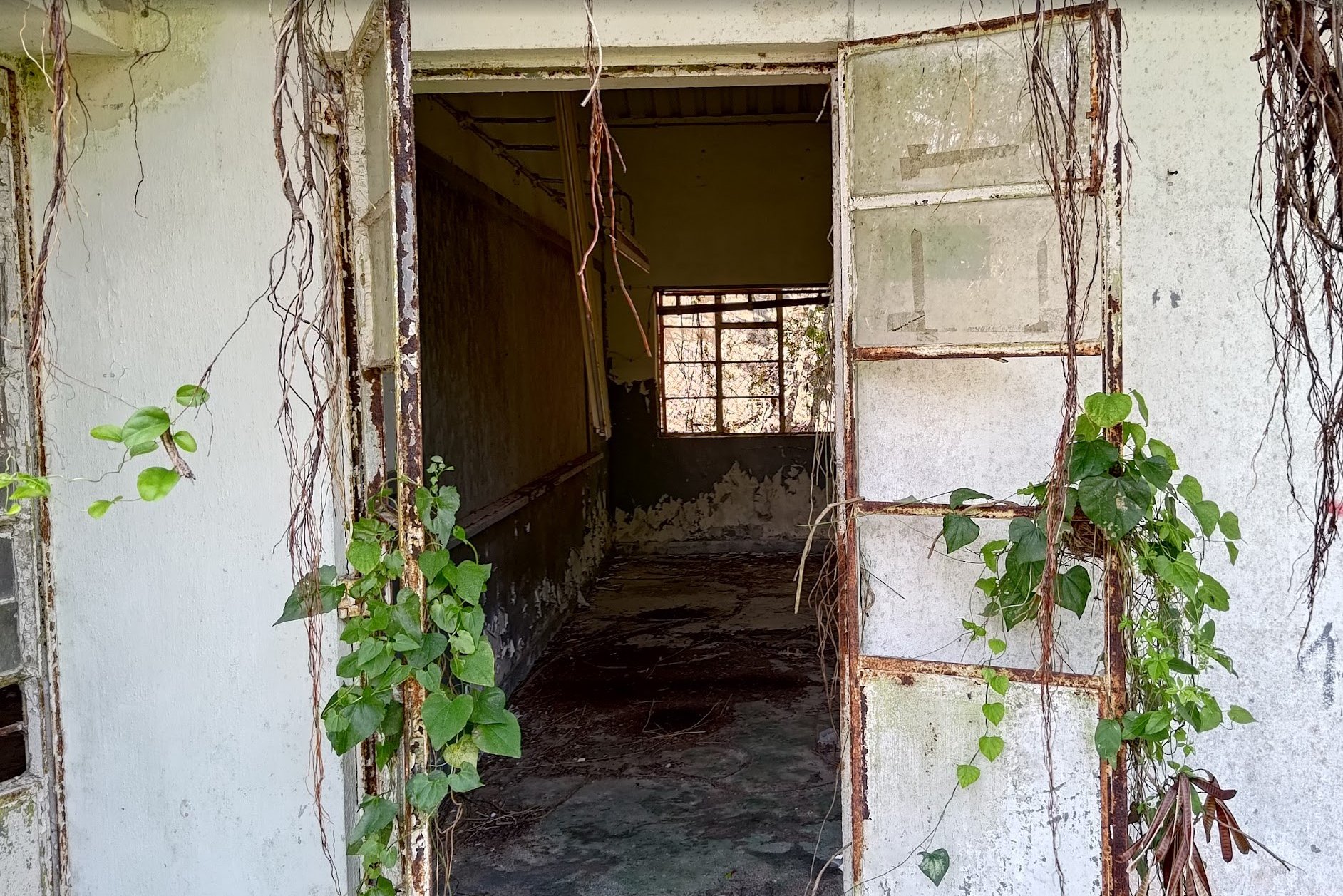
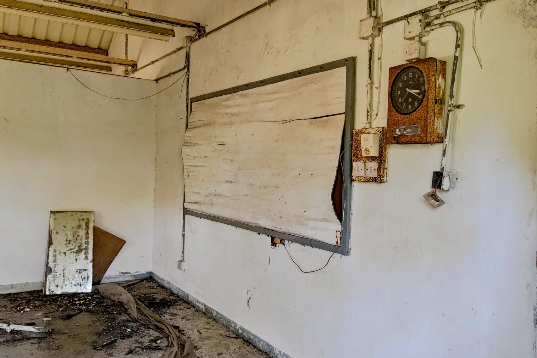
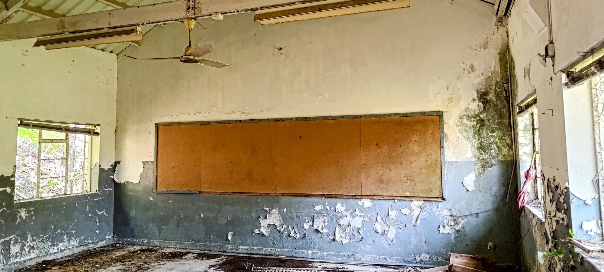
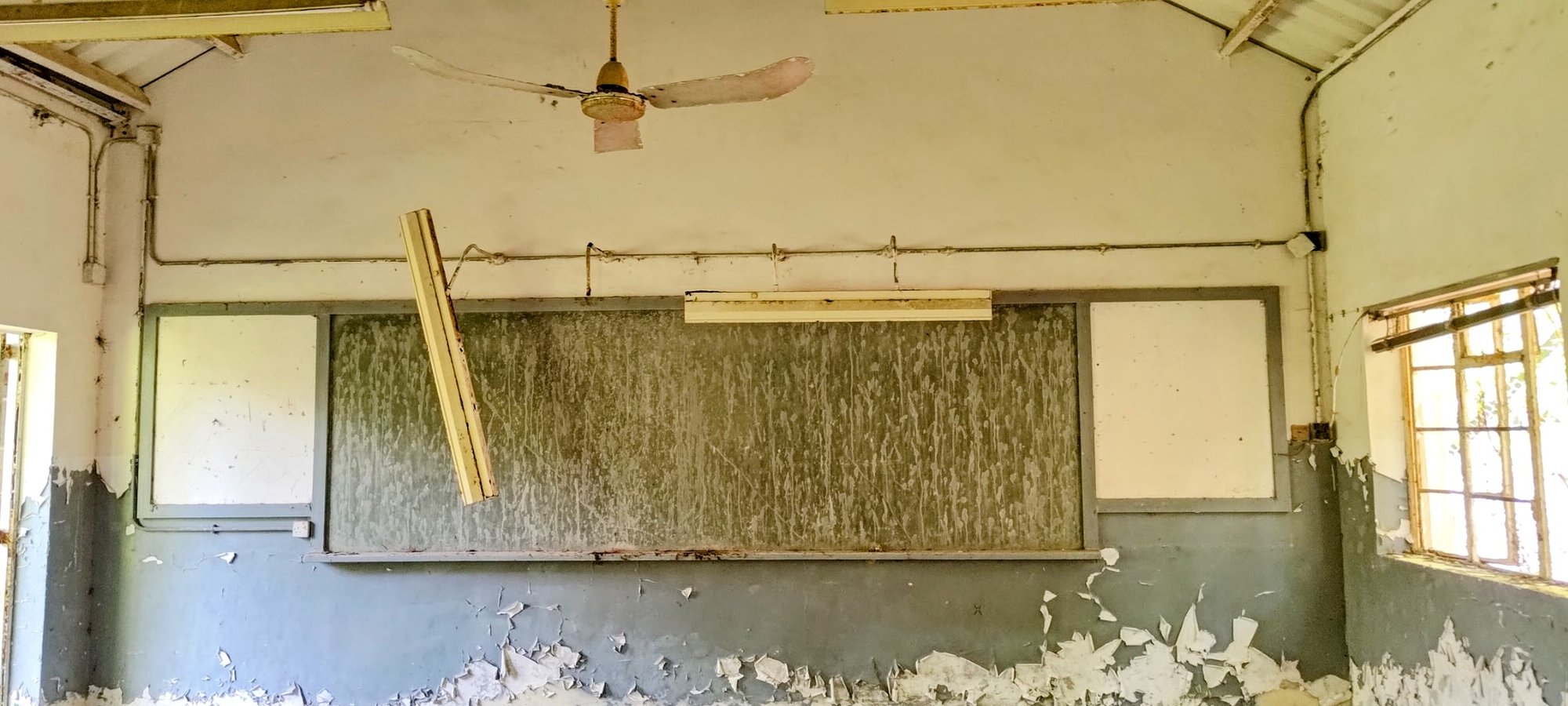
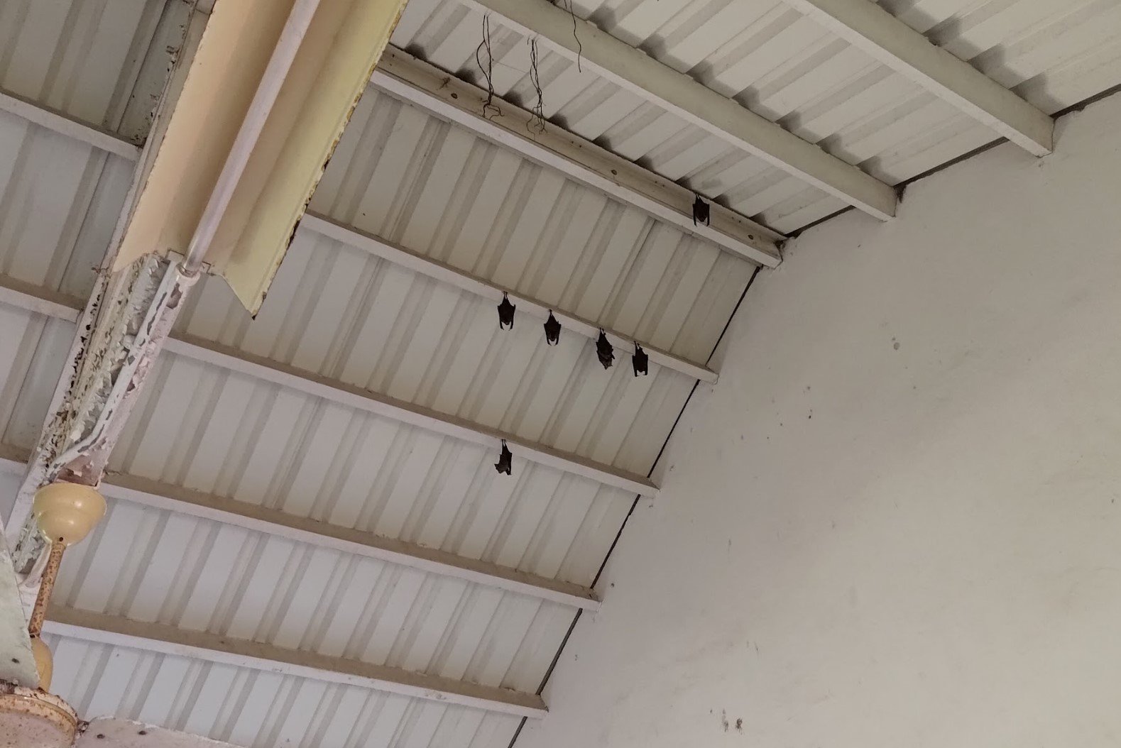
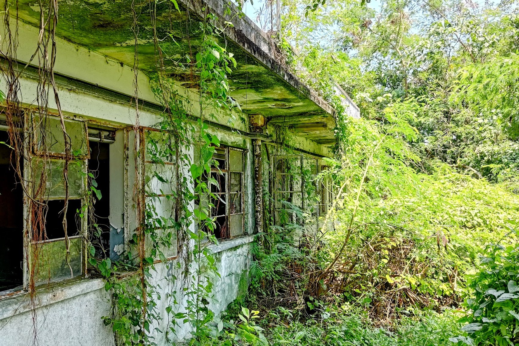
I'm not really certain when this school was built or abandoned, but it's definitely an interesting little detour.
Most of the classrooms are still intact, and though there aren't any students using them any longer, it's wonderful to see that families of bats now use them instead.
I'd recommend exercising caution if you decide to check the school out as there is broken glass around and because the area is very overgrown in parts. Look out for wildlife, since most people don't visit the school any longer.
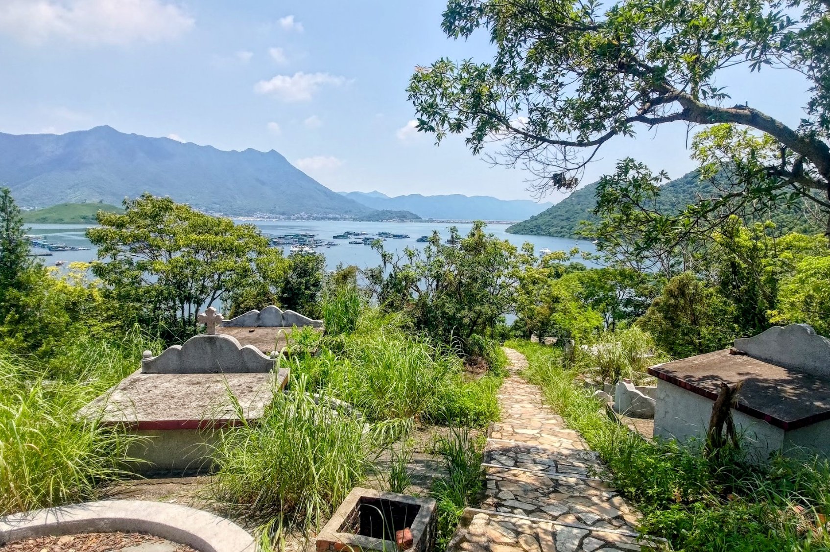
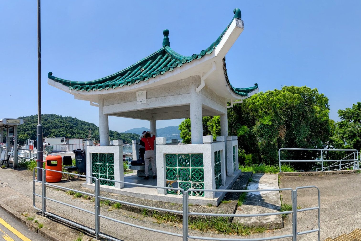
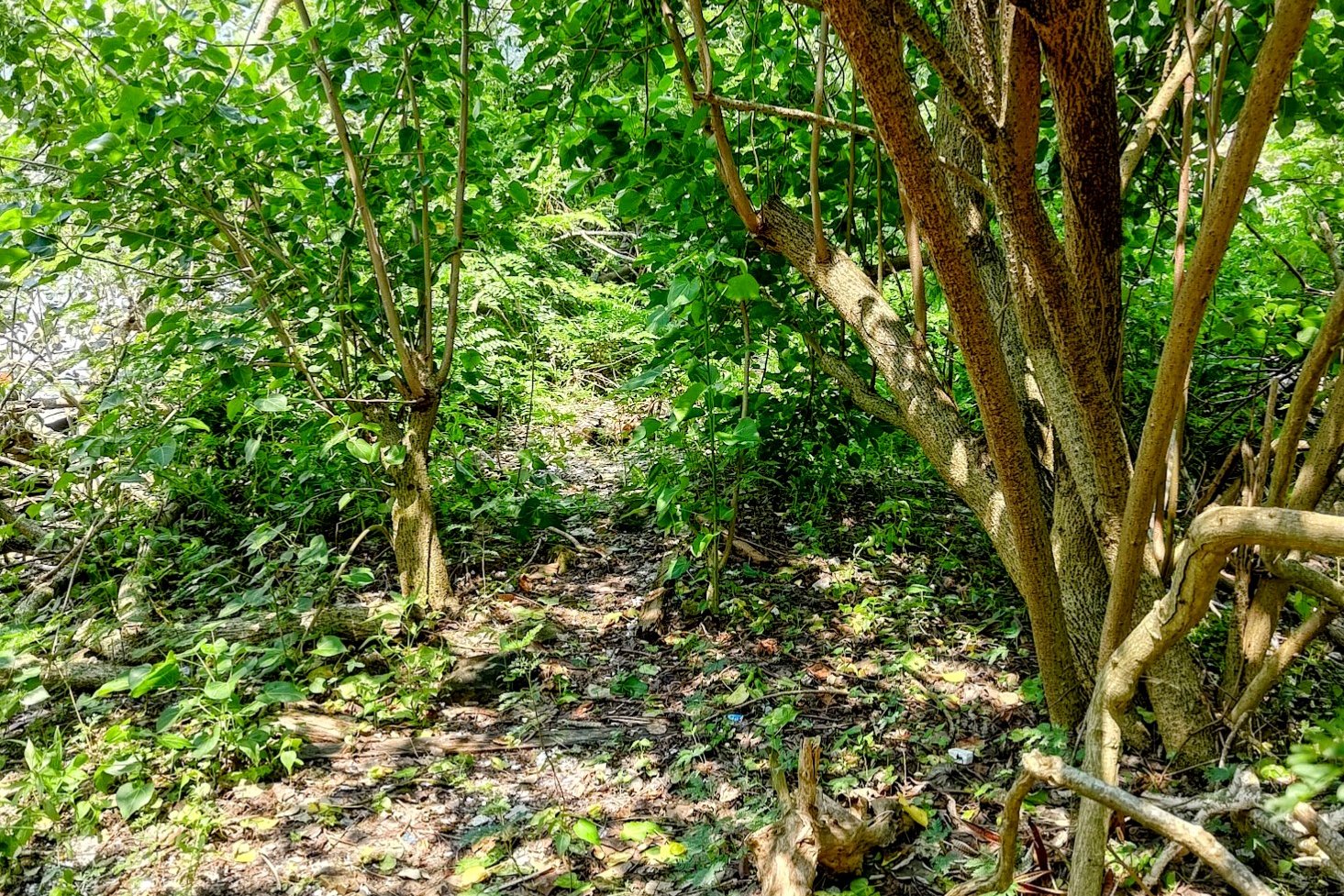
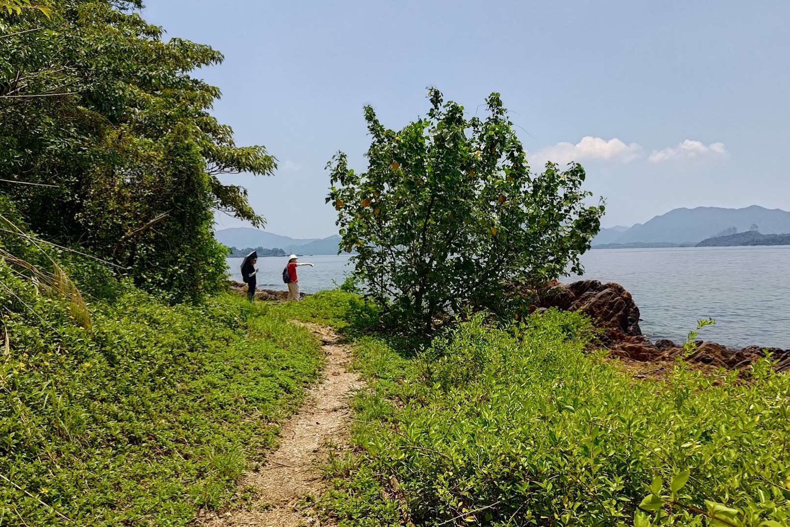
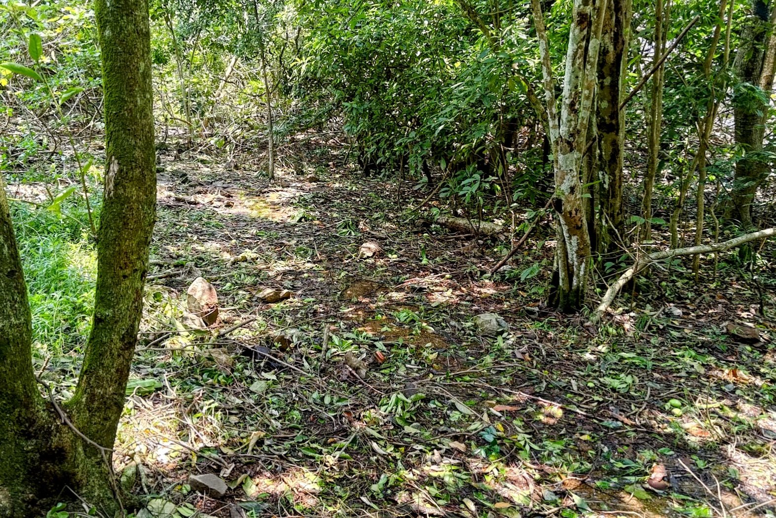
Climbing Past Tombs to a Pavilion
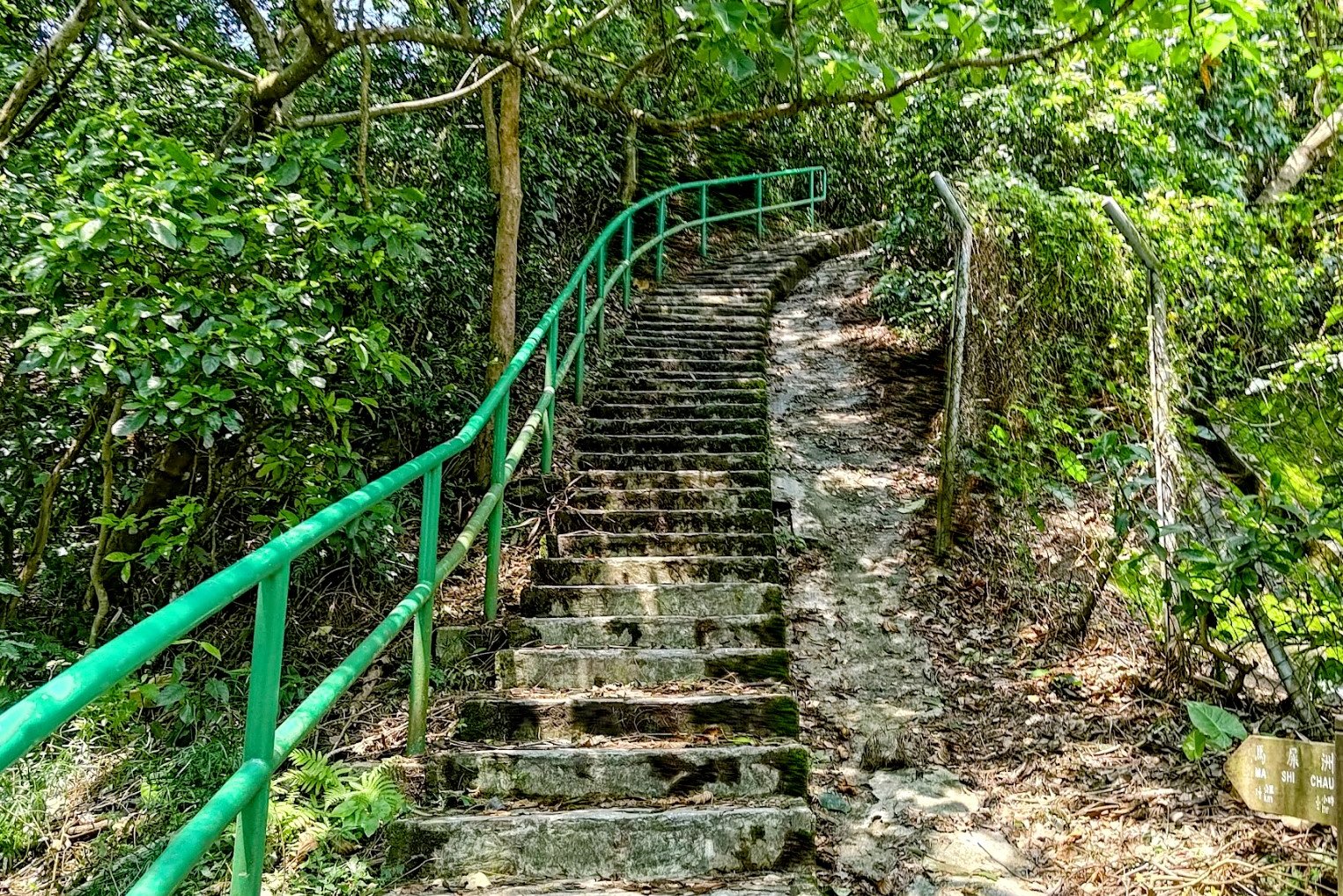
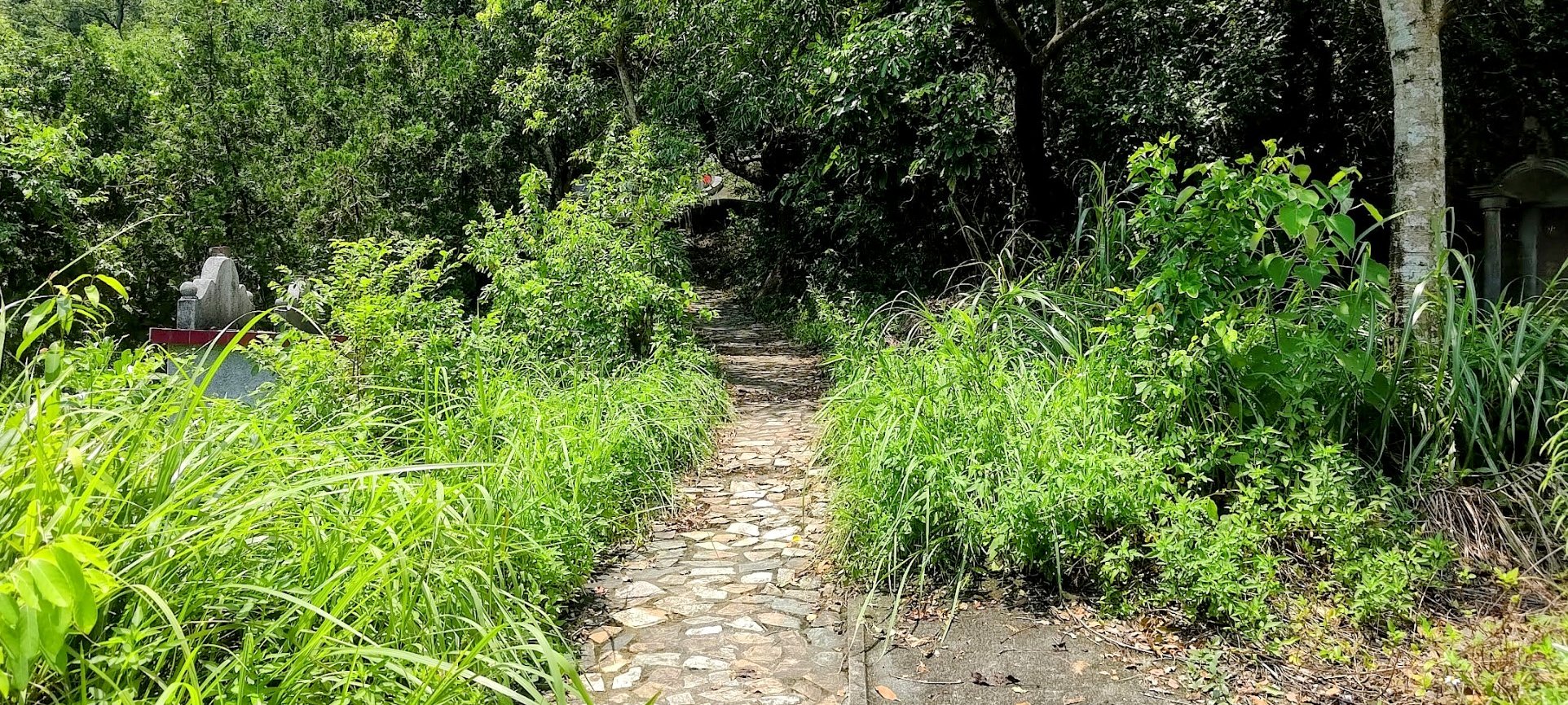
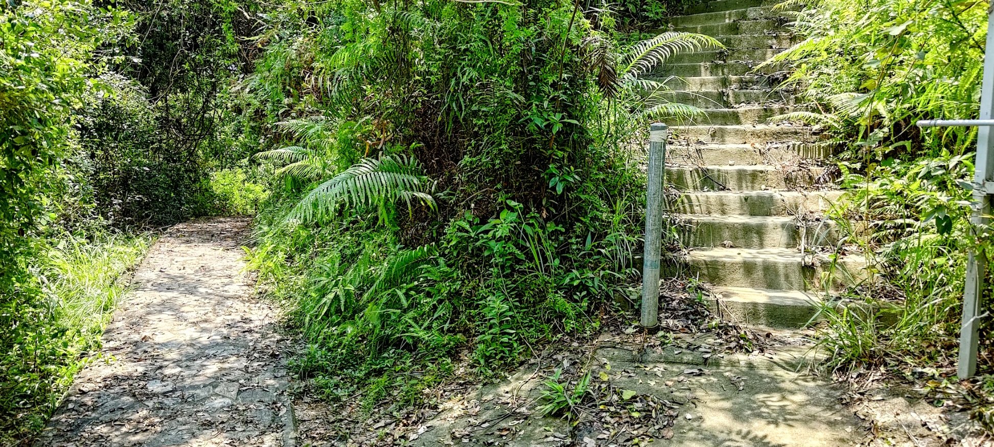


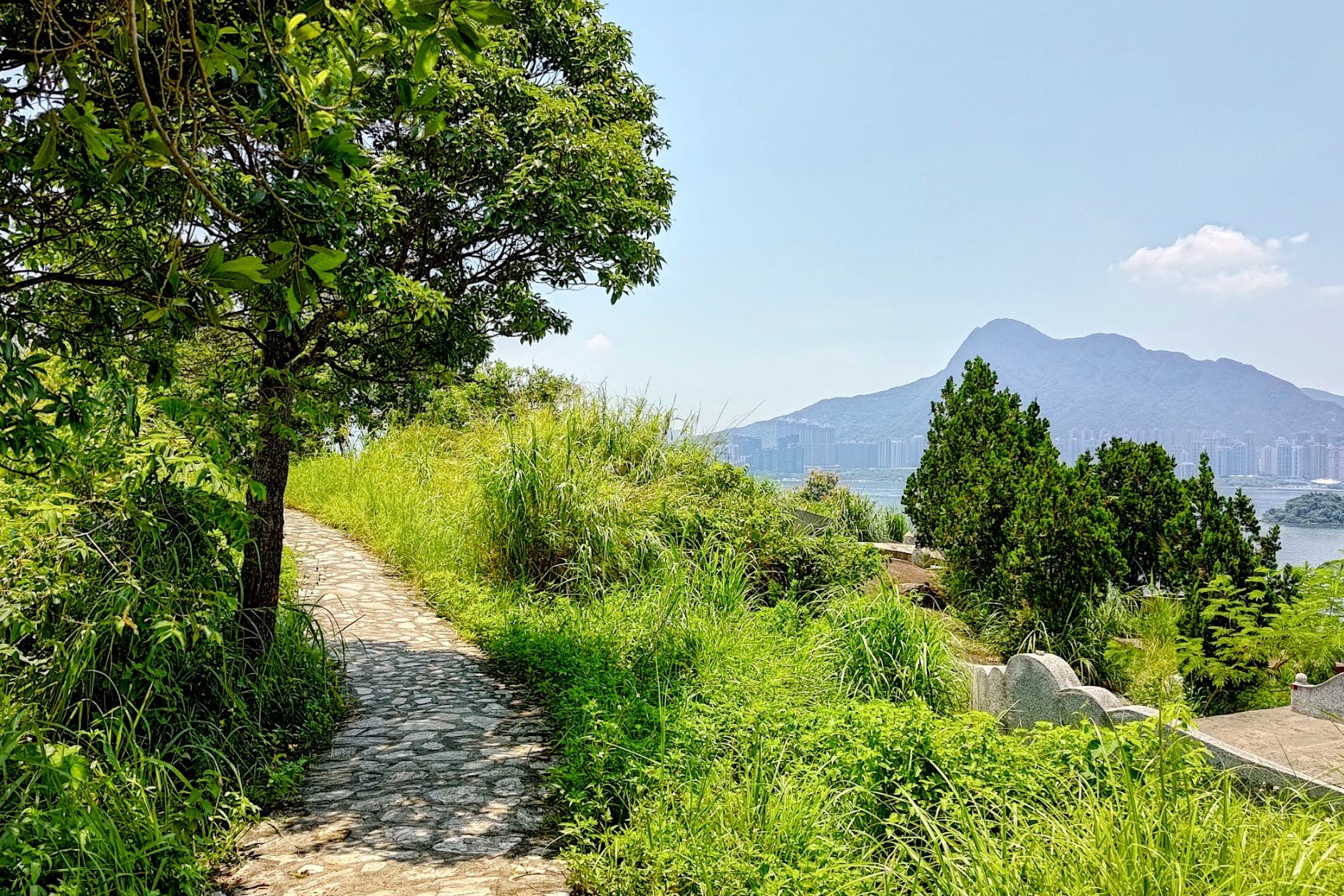
Though this section of hiking is short, it's very eventful. You'll be passing by tombs pretty much the entire way, so if that type of thing unsettles you, this might not be the best hike to attempt.
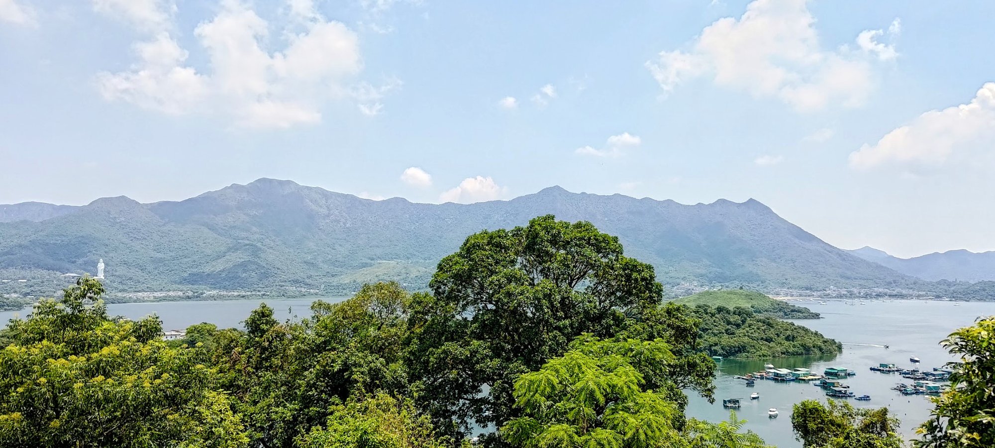
The views, however, are breathtaking. I especially loved the views out over Pat Sin Leng with Plover Cove in the foreground.
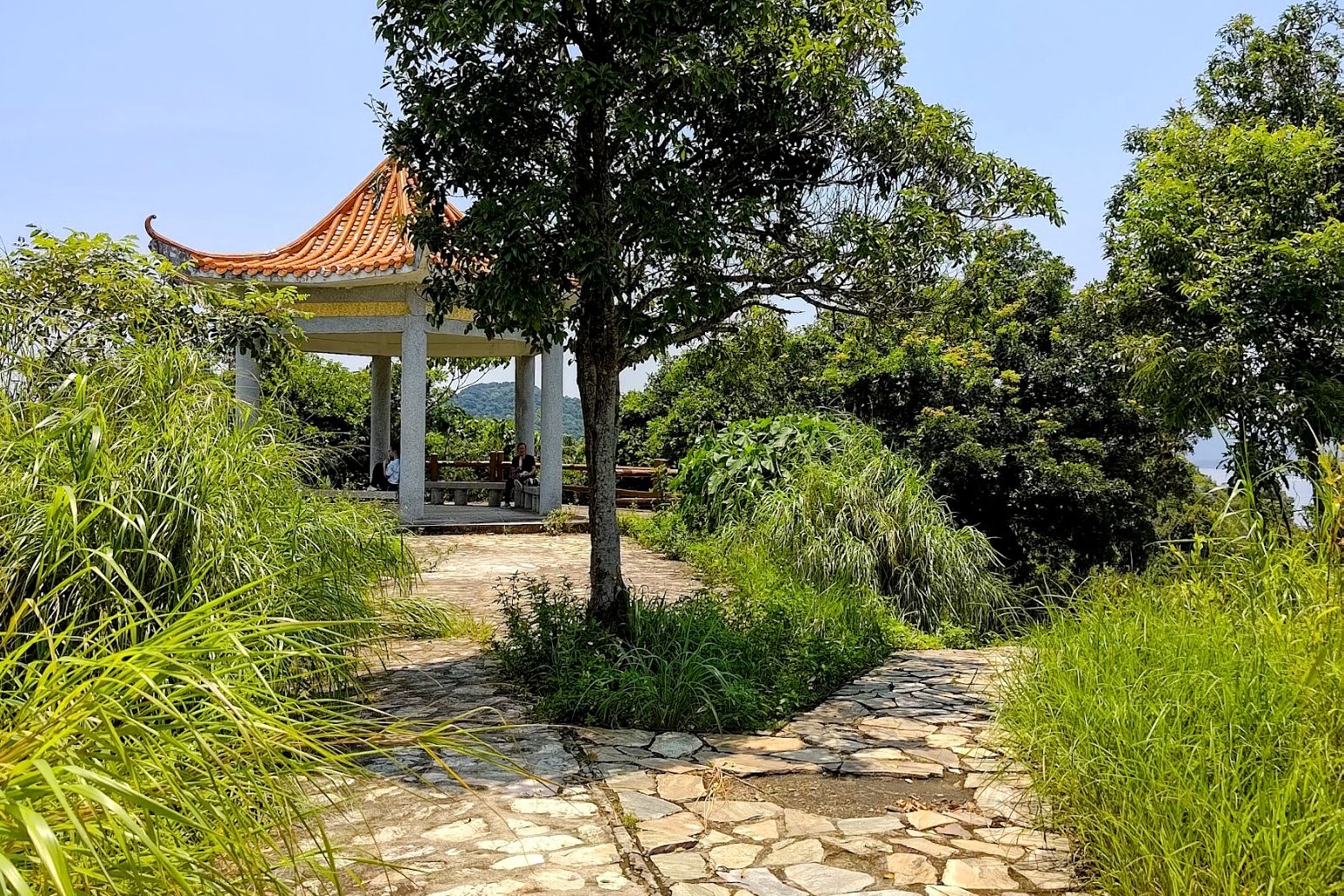
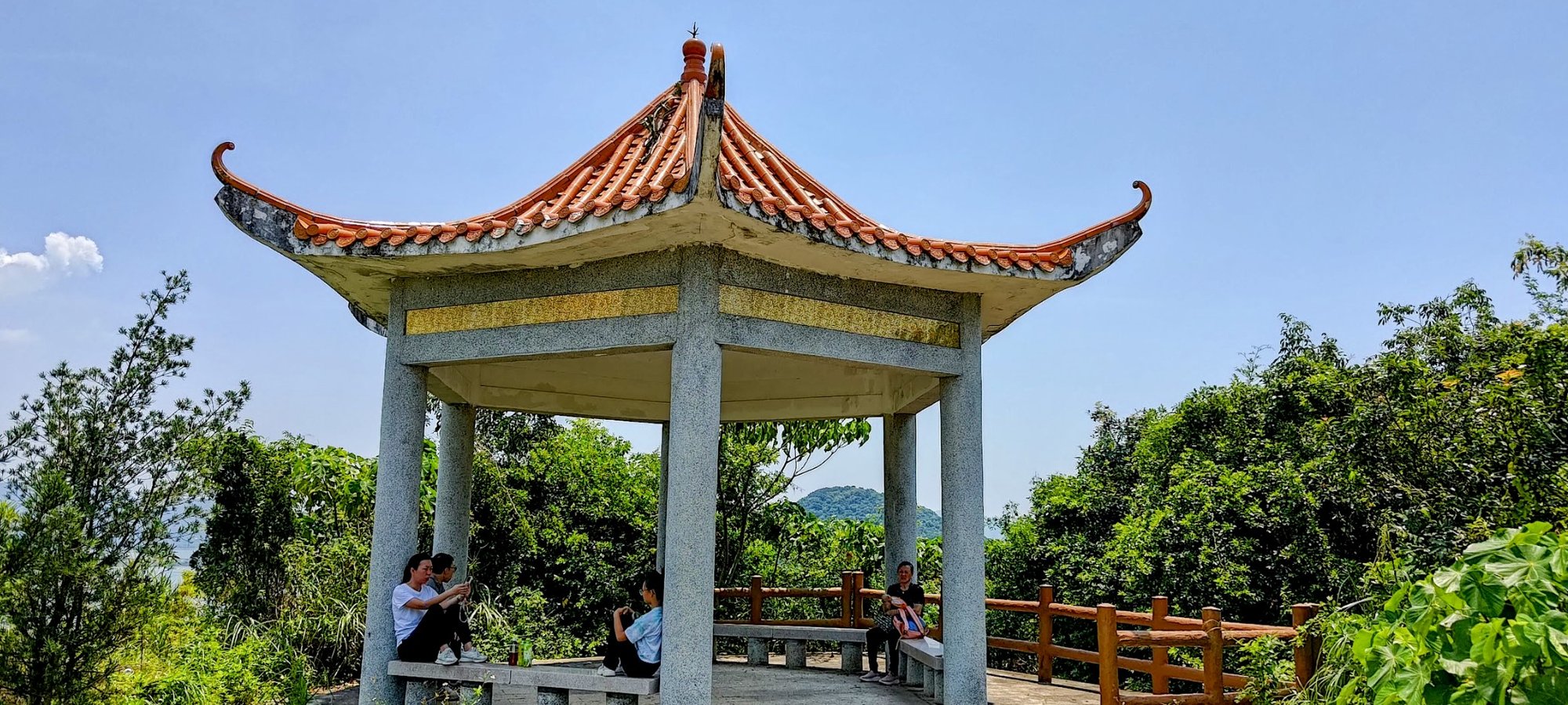
Keep in mind that when you arrive at both forks, you'll want to stay left and take the flat path. Before long, you'll arrive at the pavilion, where you can take a rest if needed.
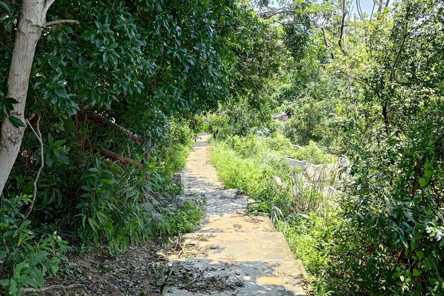
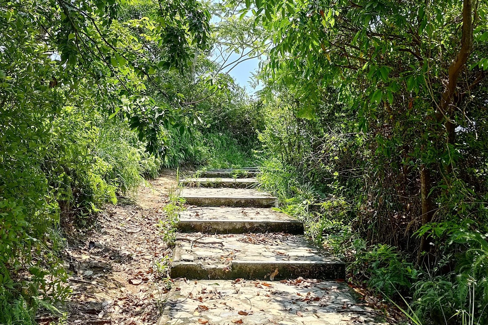
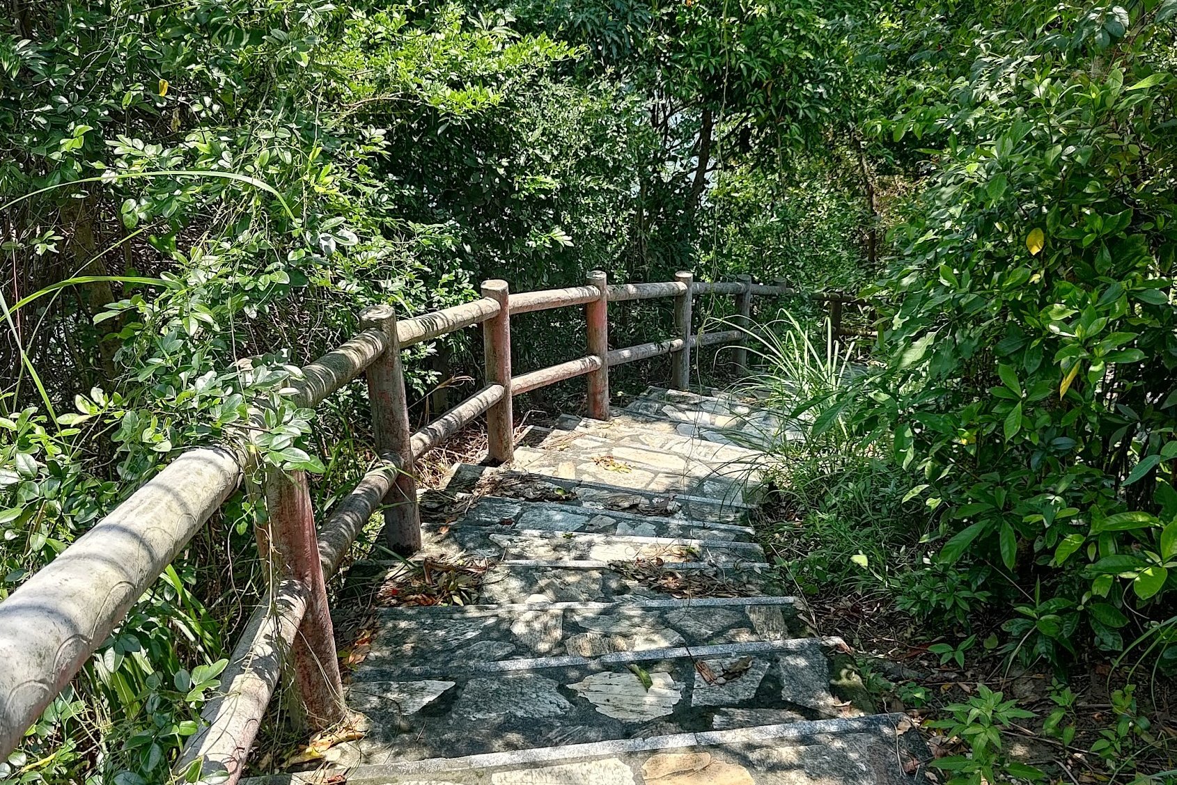
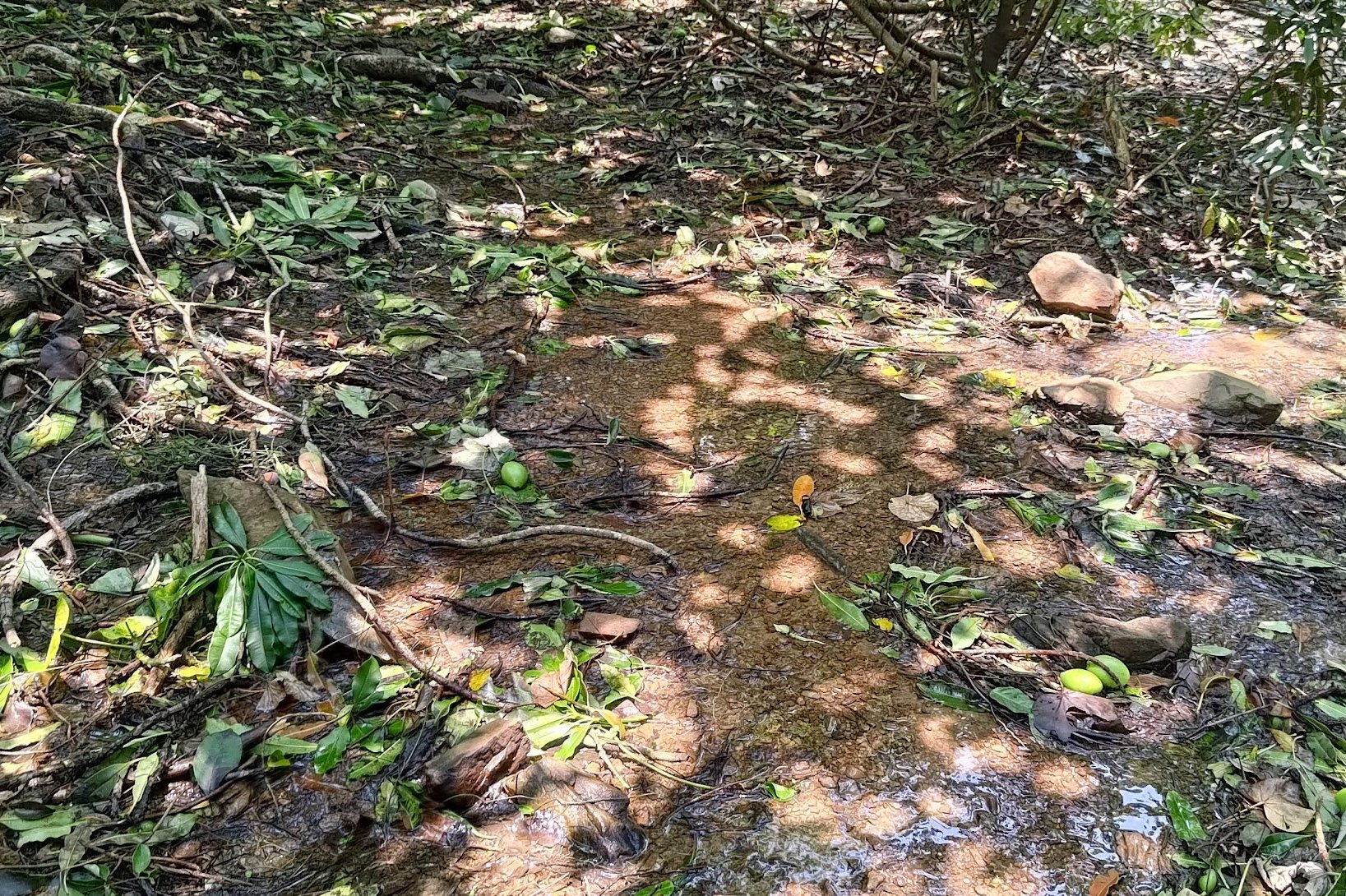
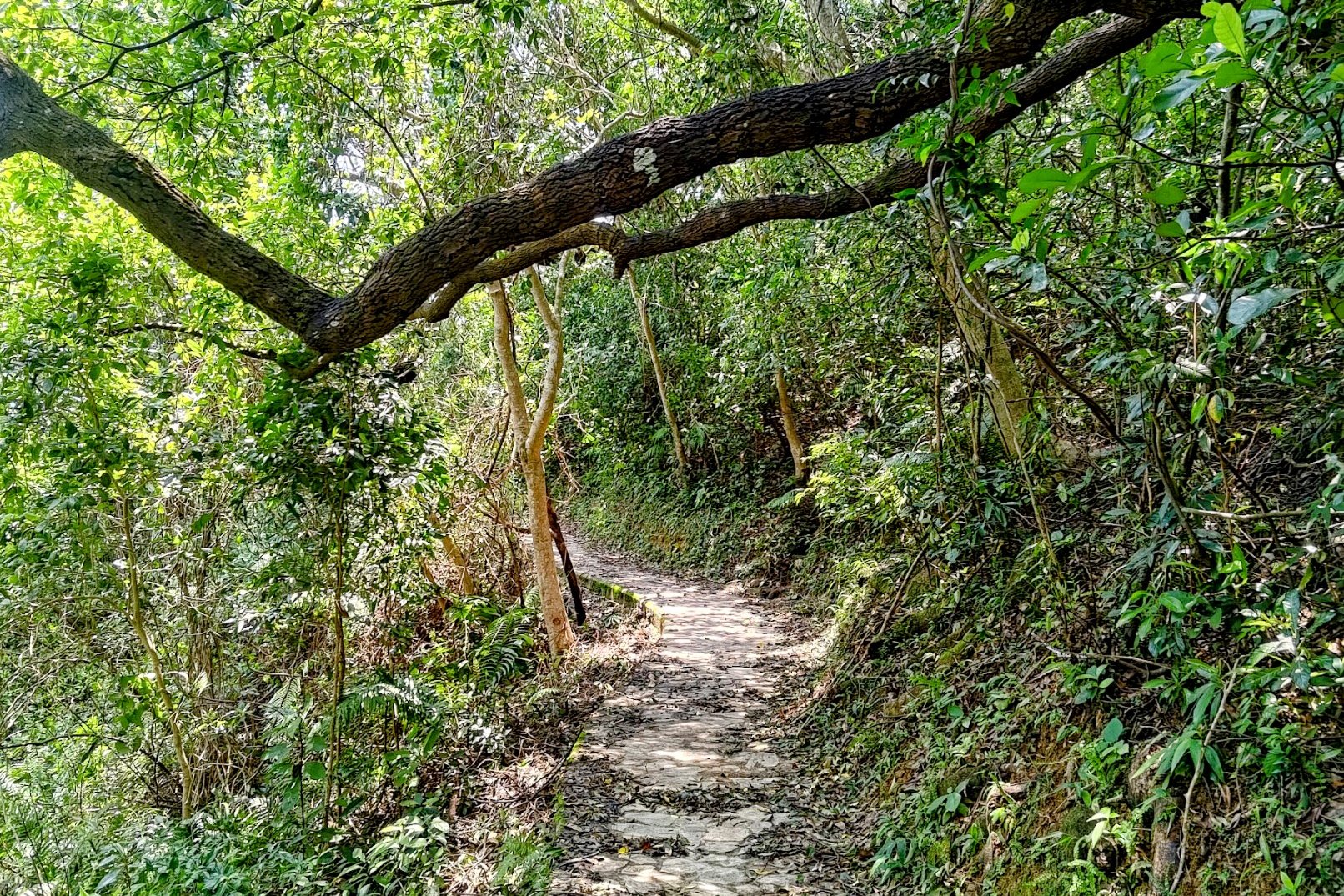
The descent down to the mangrove takes just over 10 minutes.
Simply follow the trail and you'll get to the mangrove area with no real issues. The views along the way (as with most of this hike) are wicked!
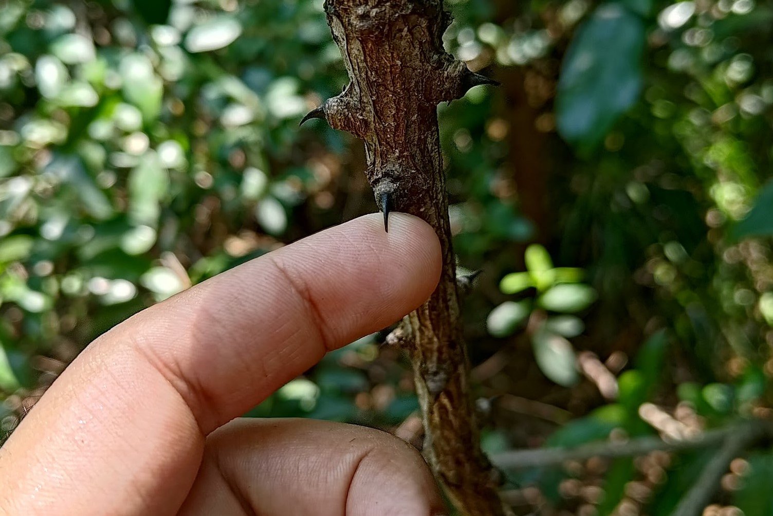
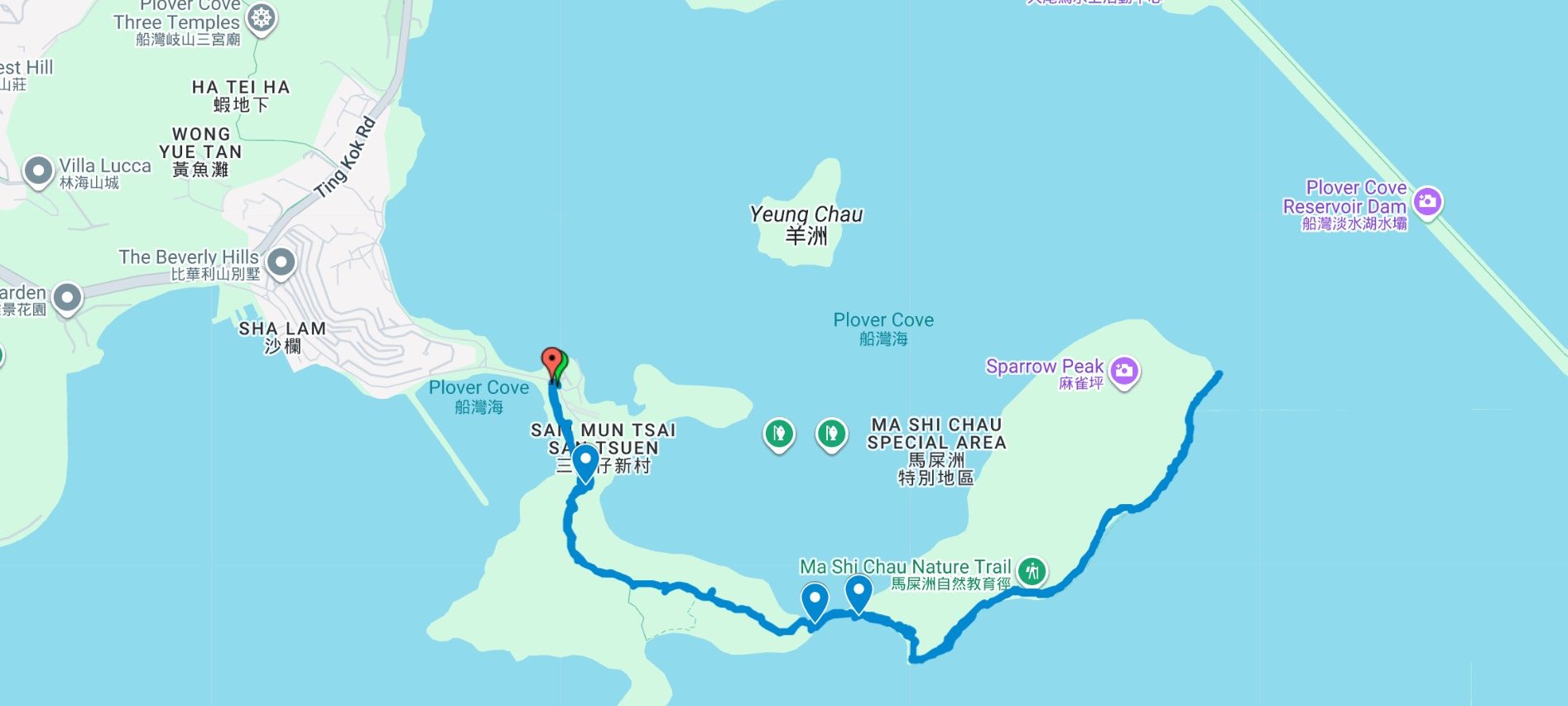
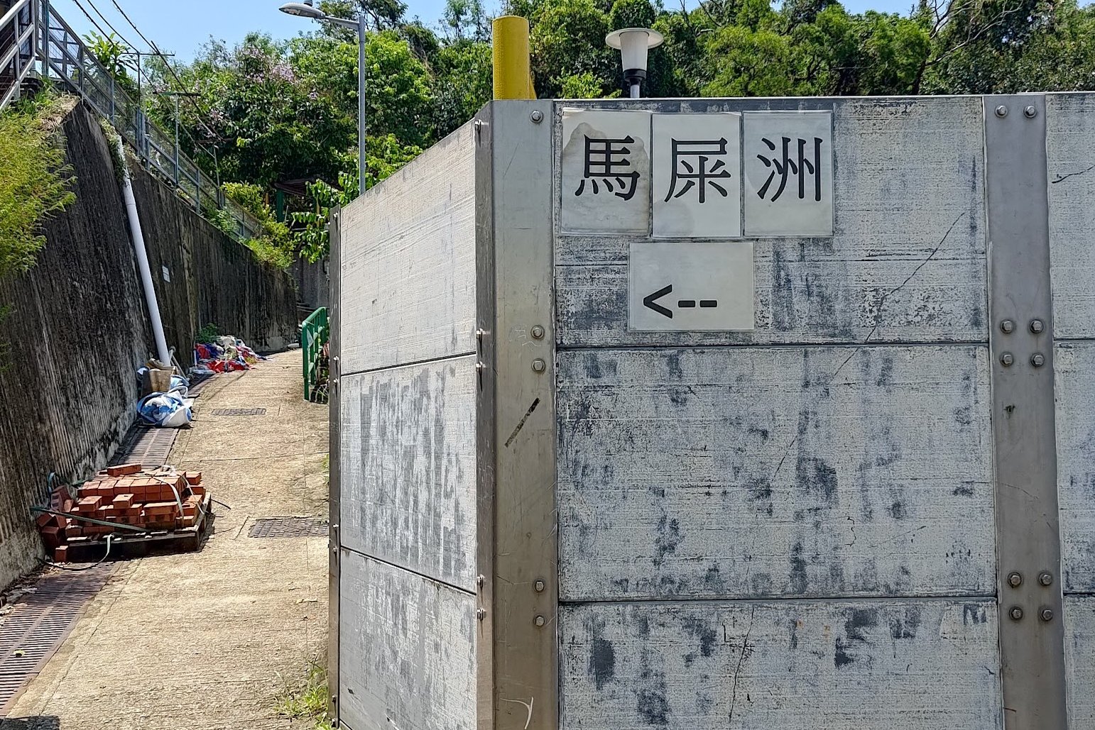
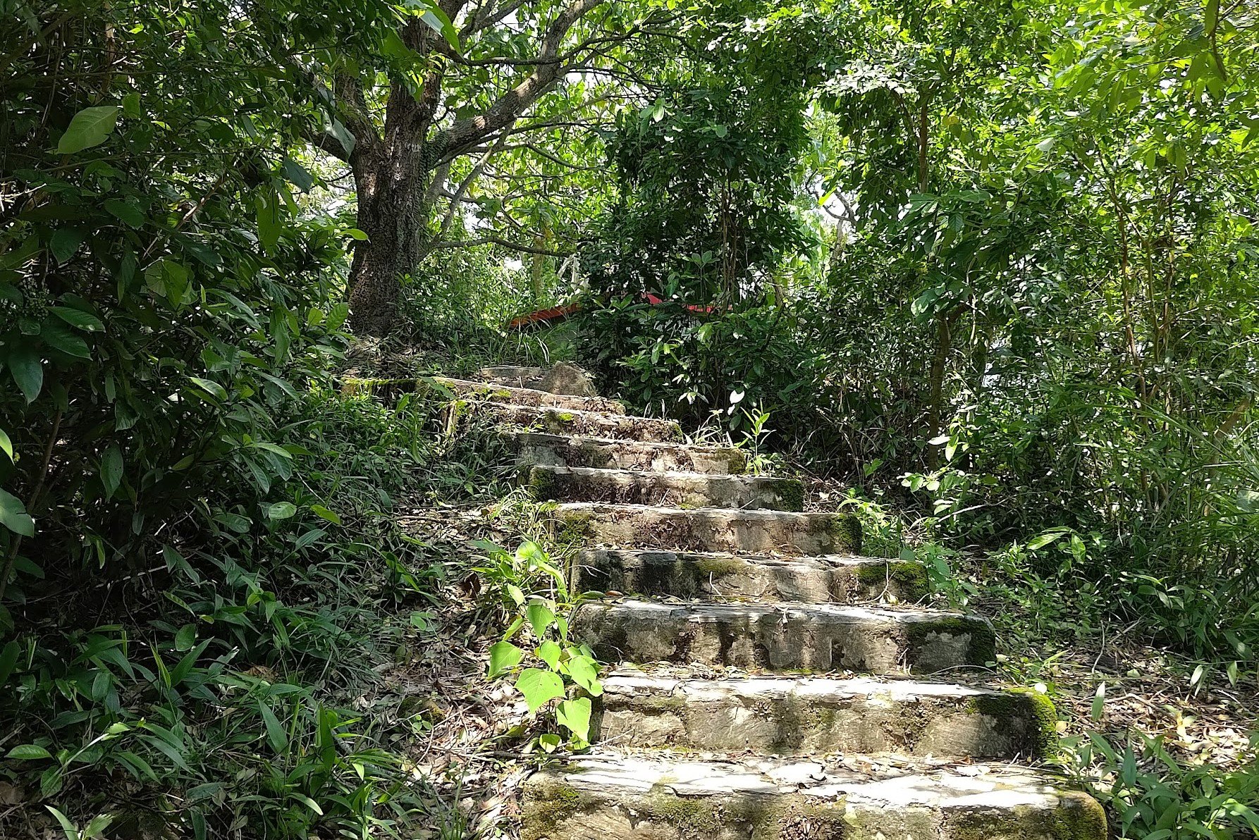
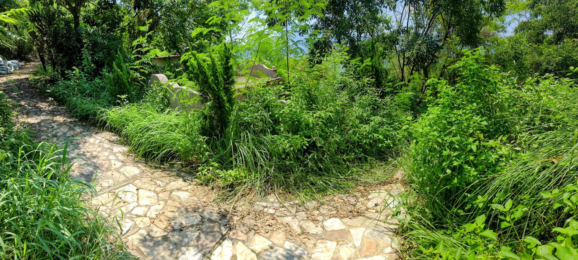
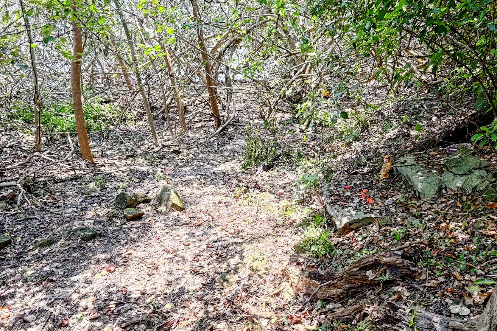
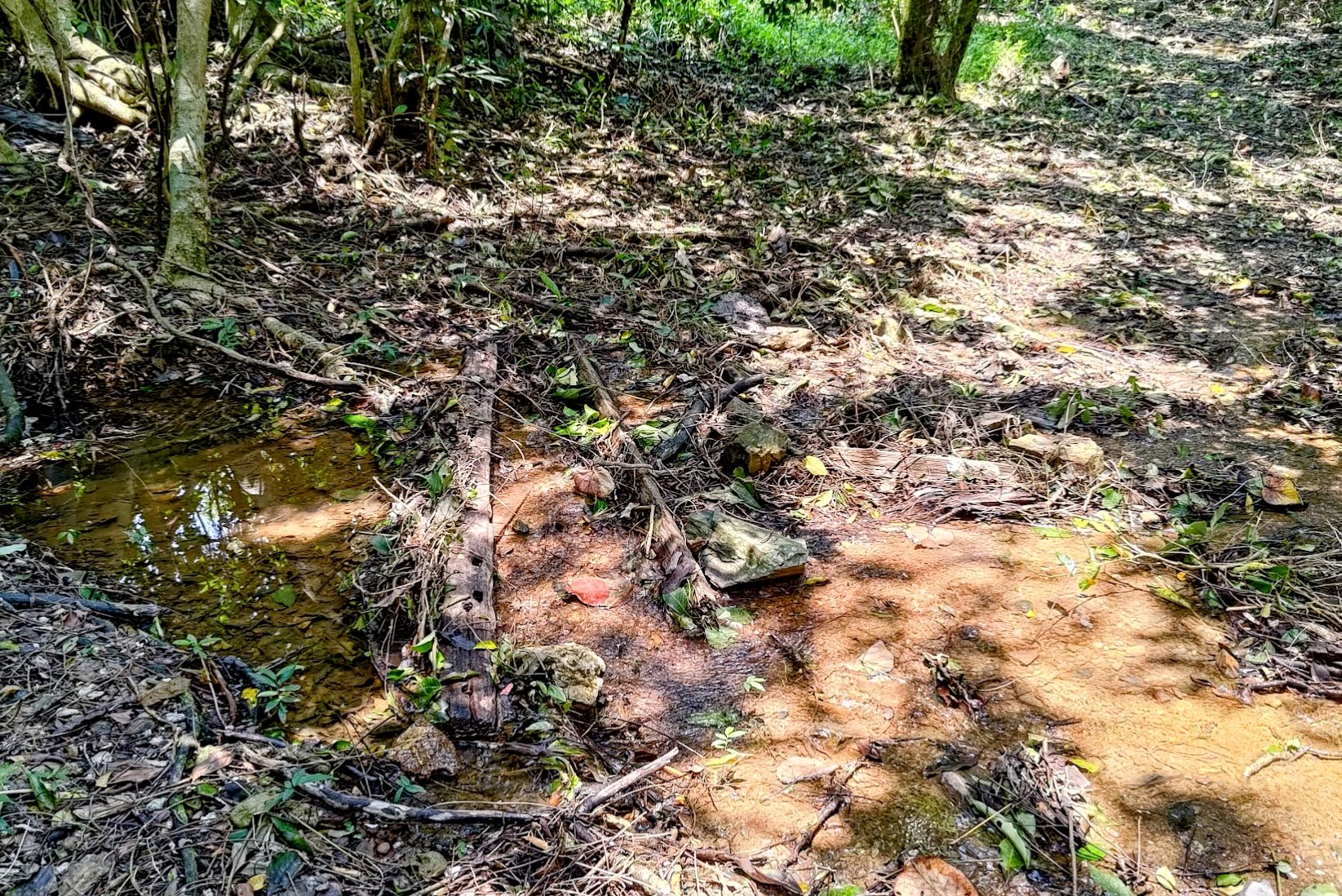
Locating the Hidden Tombolo
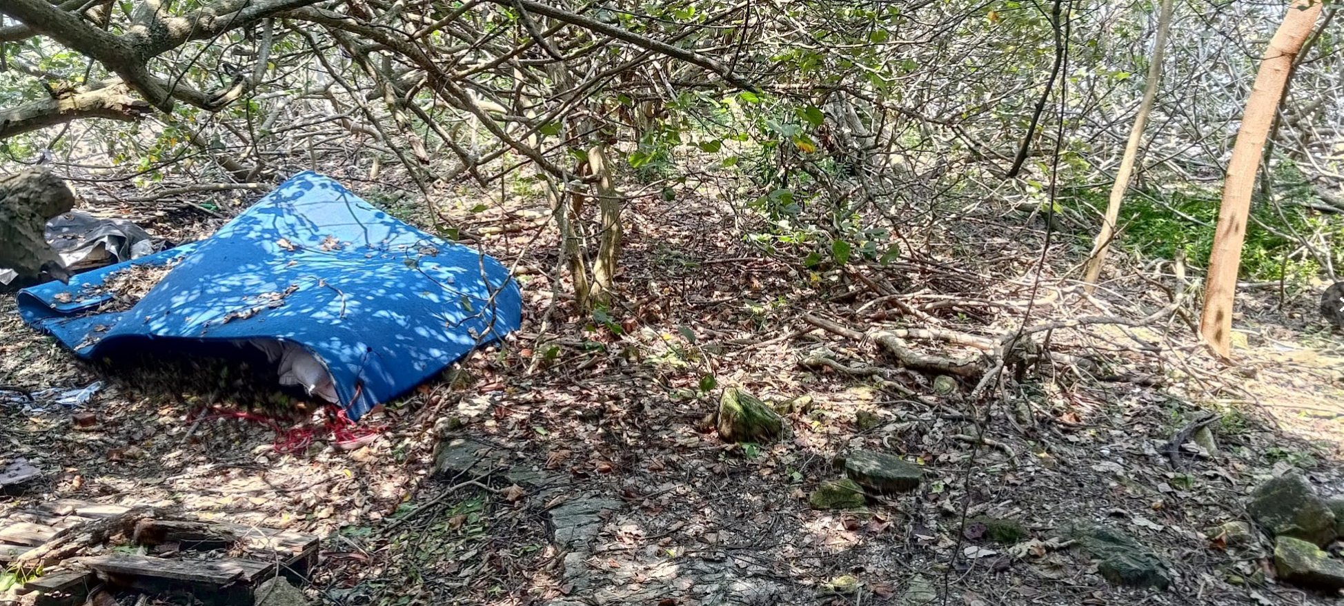


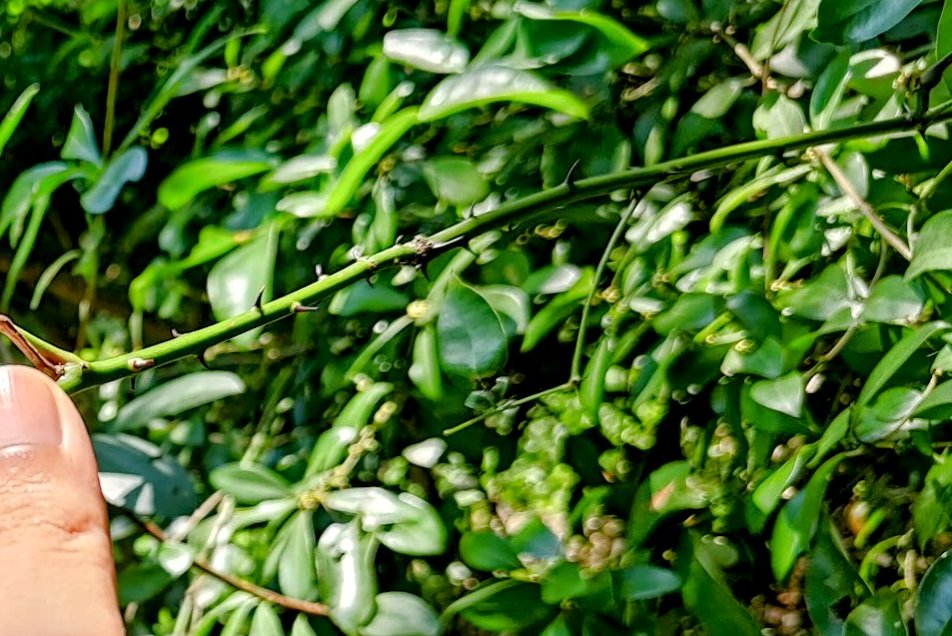

It was genuinely a tough task finding the hidden entrance to the tombolo.
Make sure to turn left immediately after the stairs. If you see a blue tarp, use that as a visual marker and look for the trail to the right of it.
If the tarp isn't there, look for the crumbling concrete path, and the hidden entrance to the tombolo is to the right of the path.
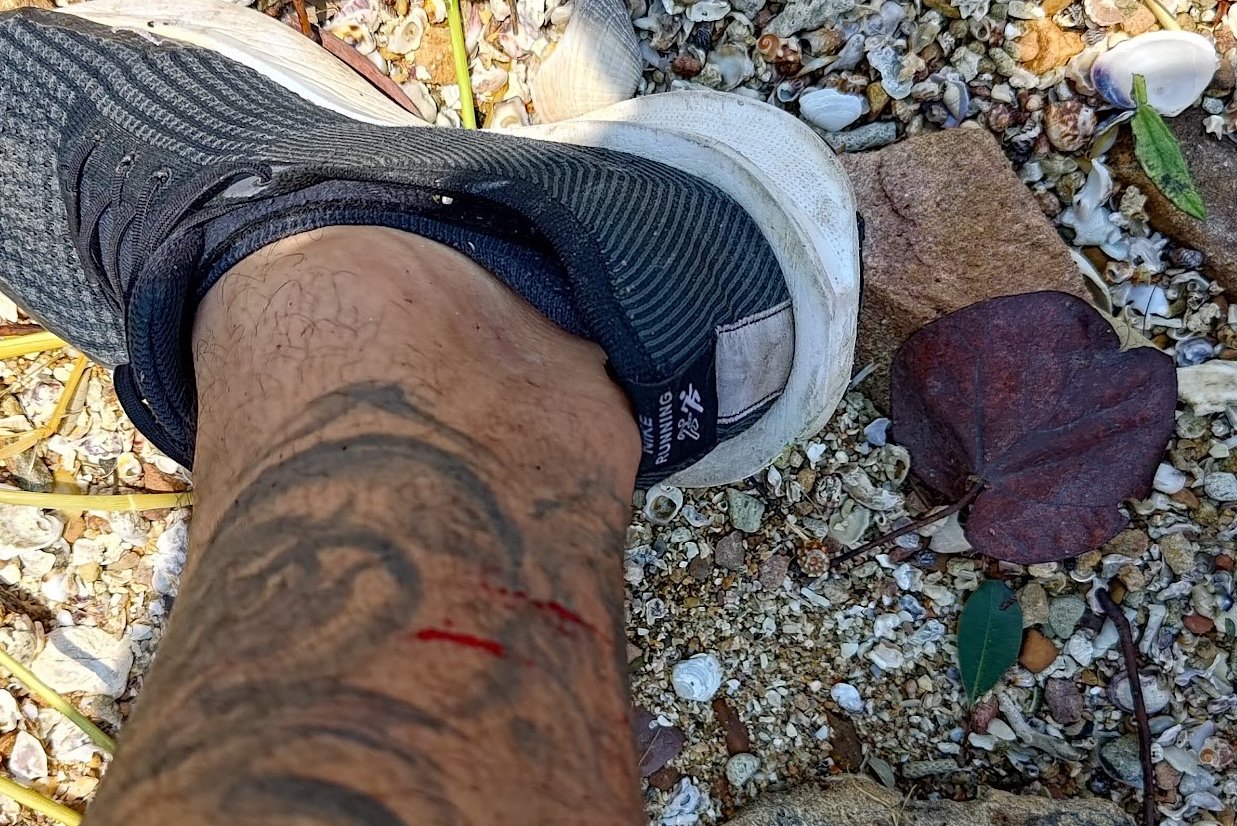
When you do find the trail to the tombolo, be super careful as there are thorns galore that will try and cut you up!
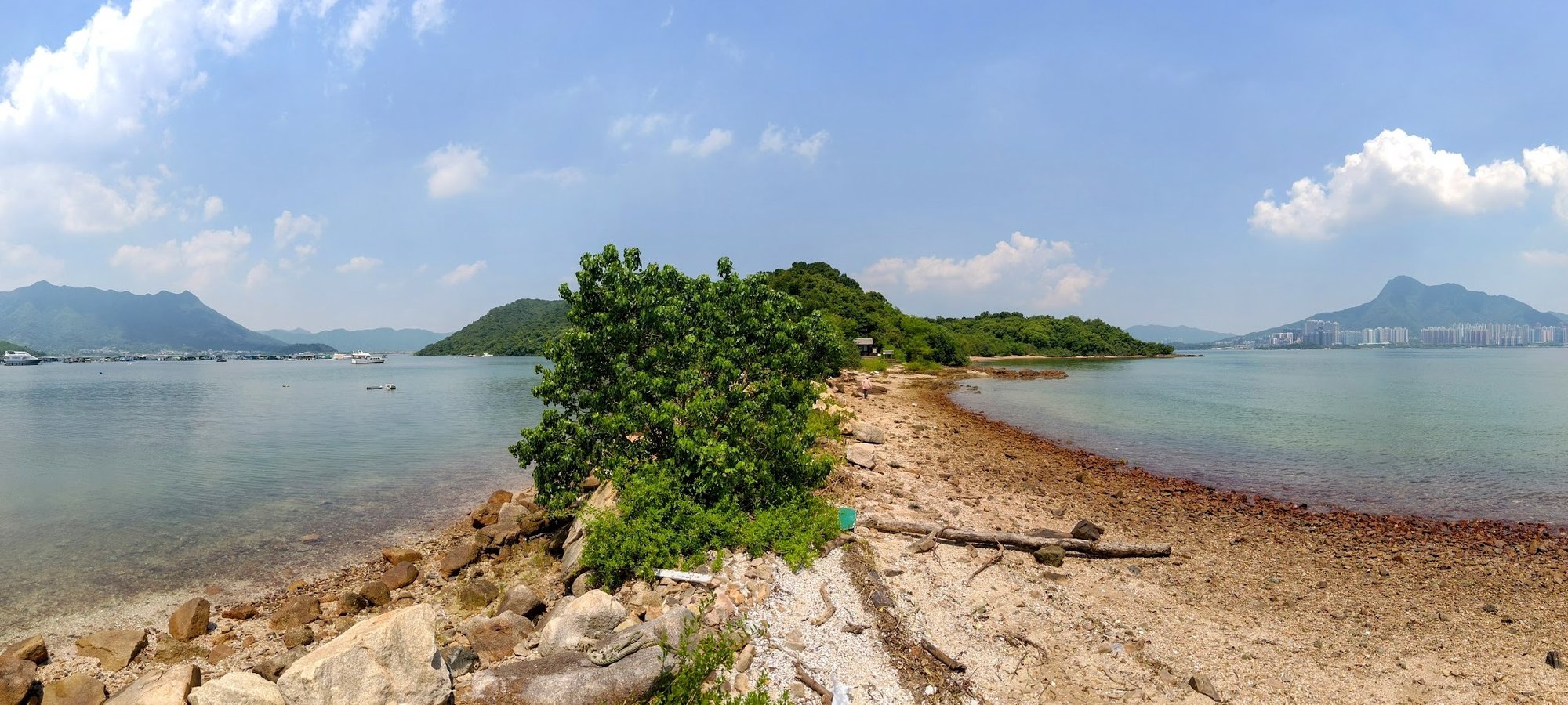
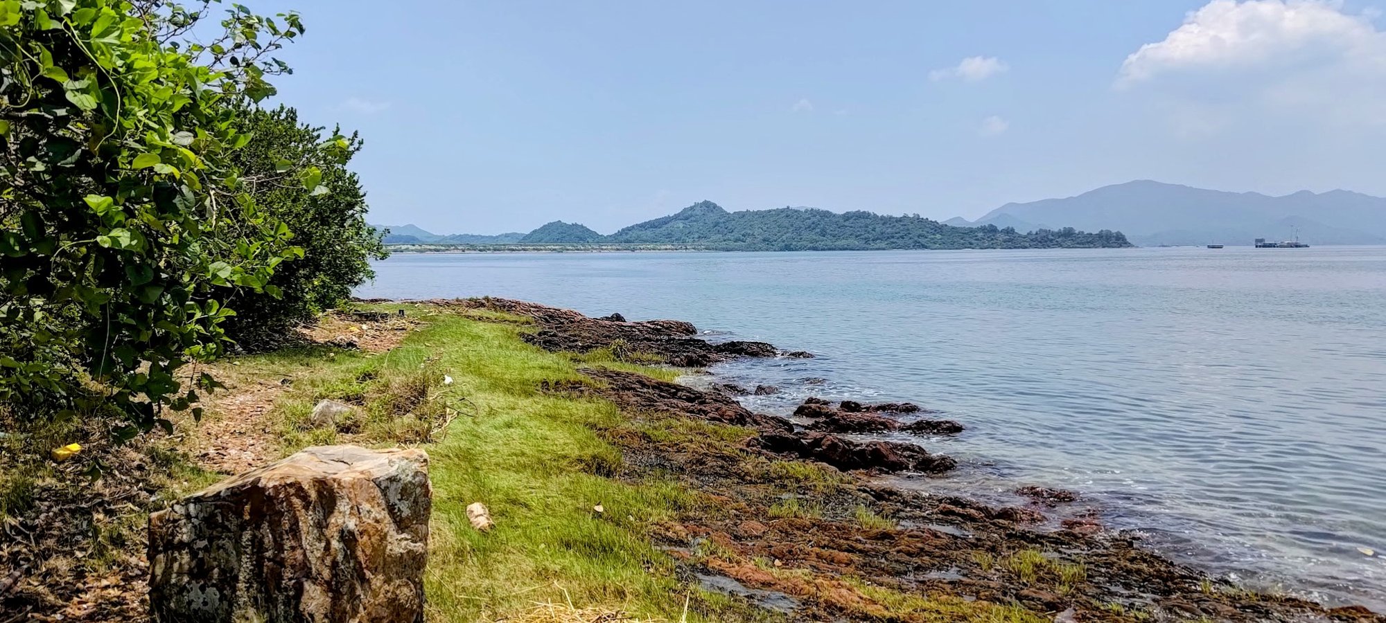
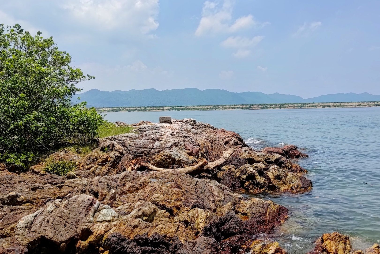
Crossing the Secret Tombolo
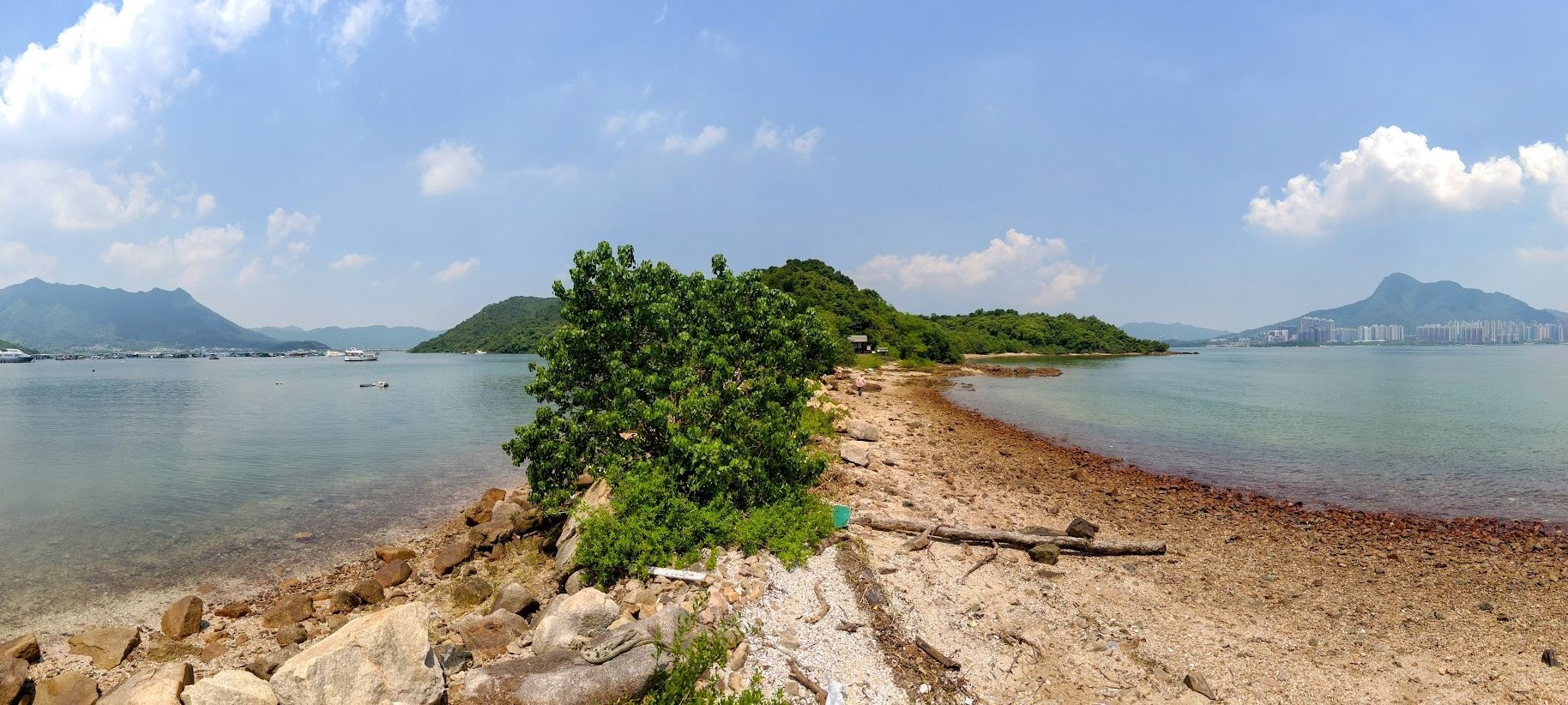
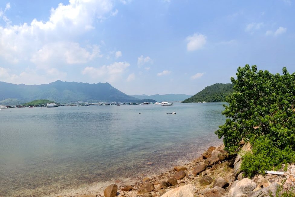
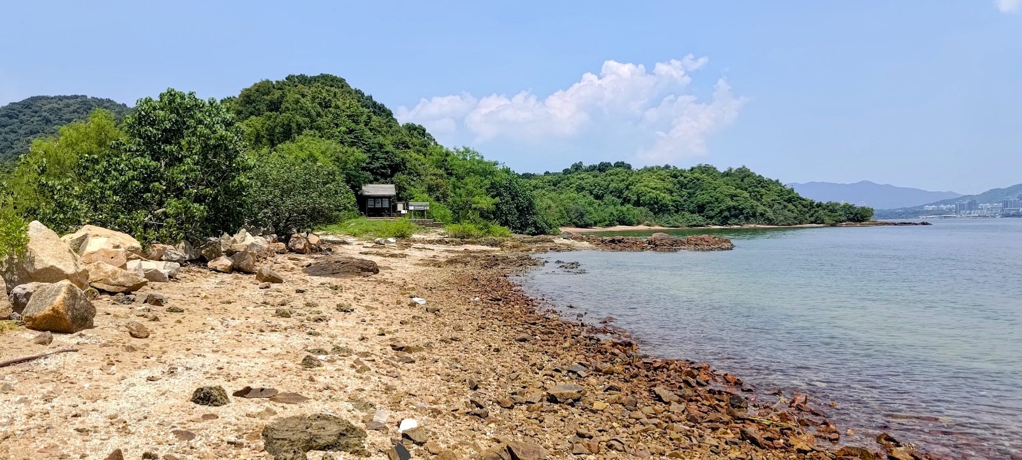
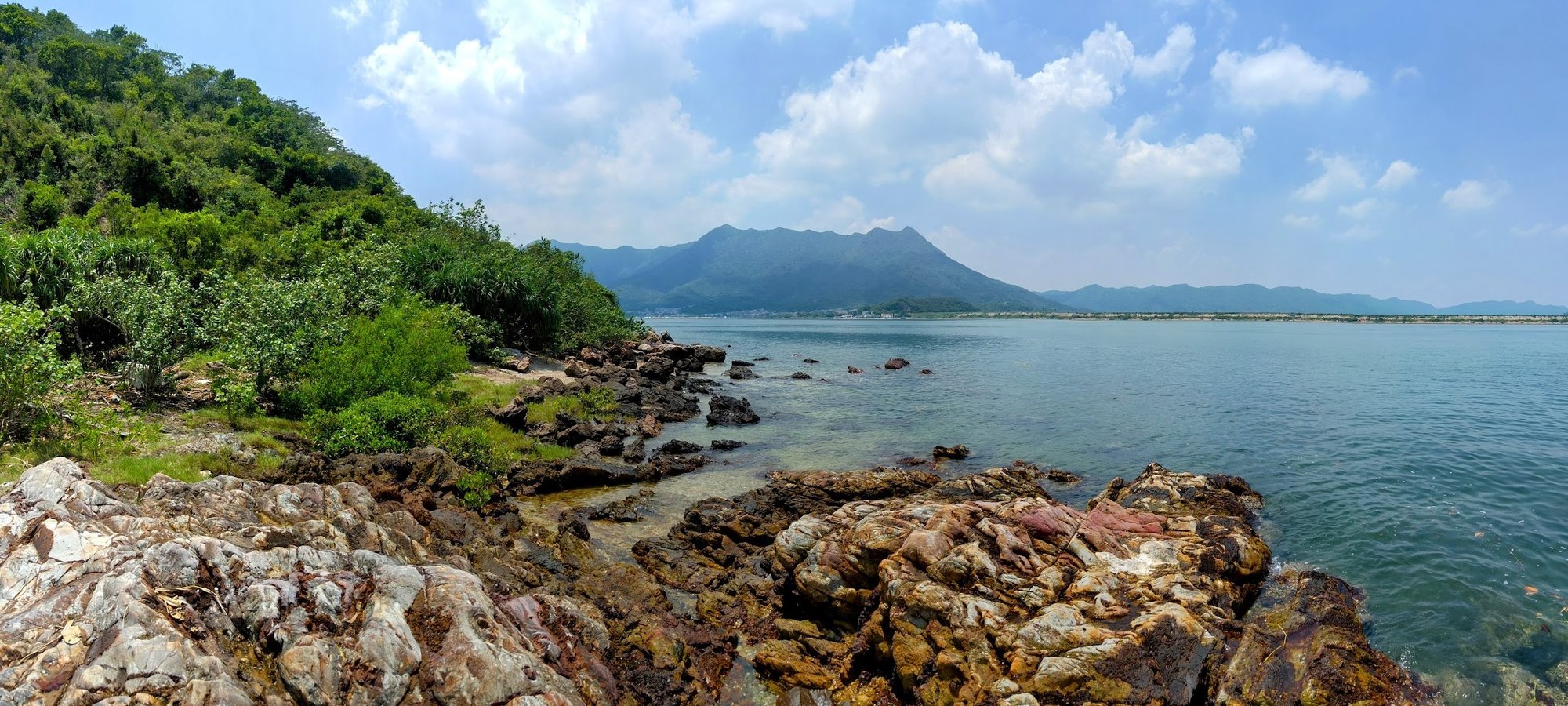
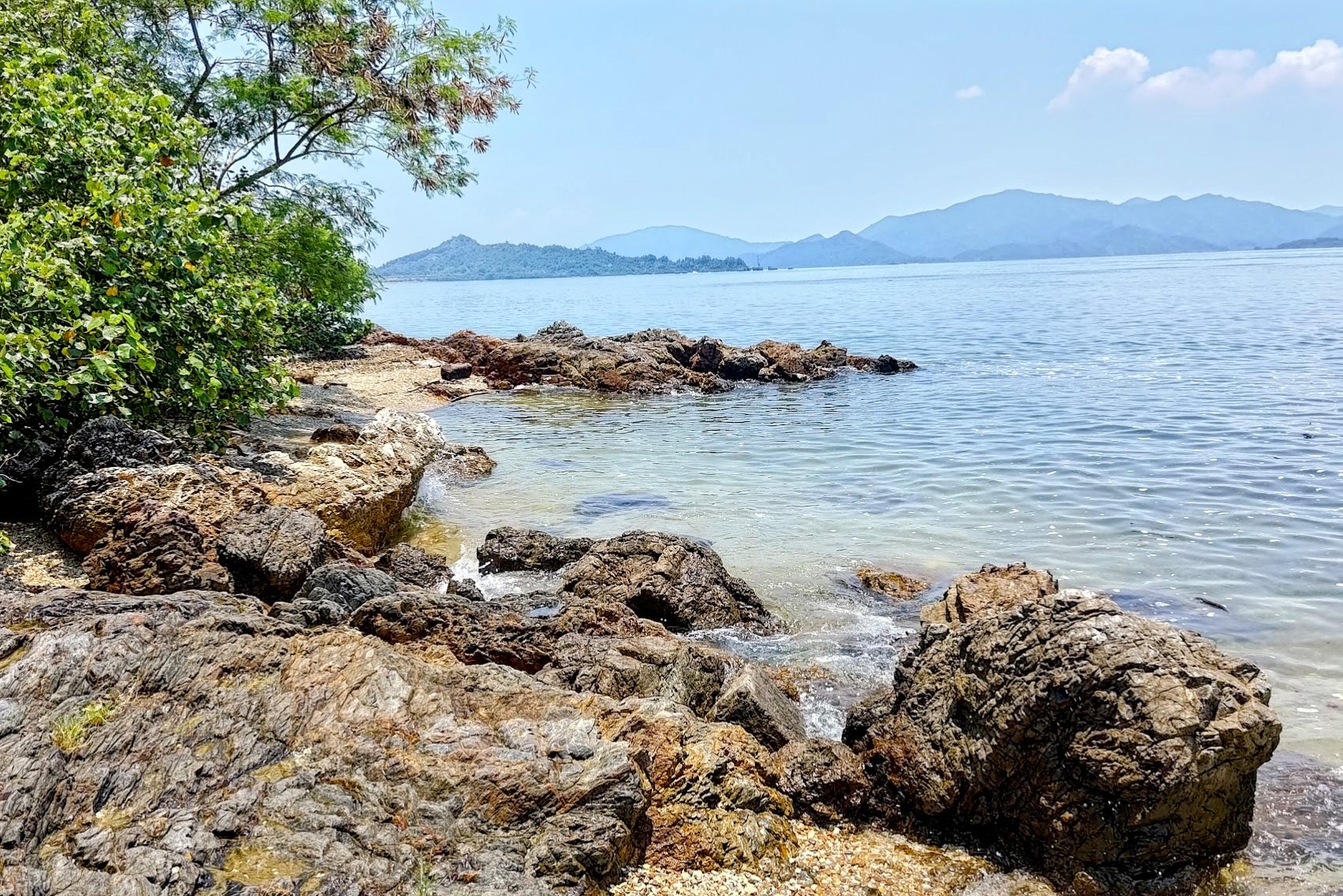
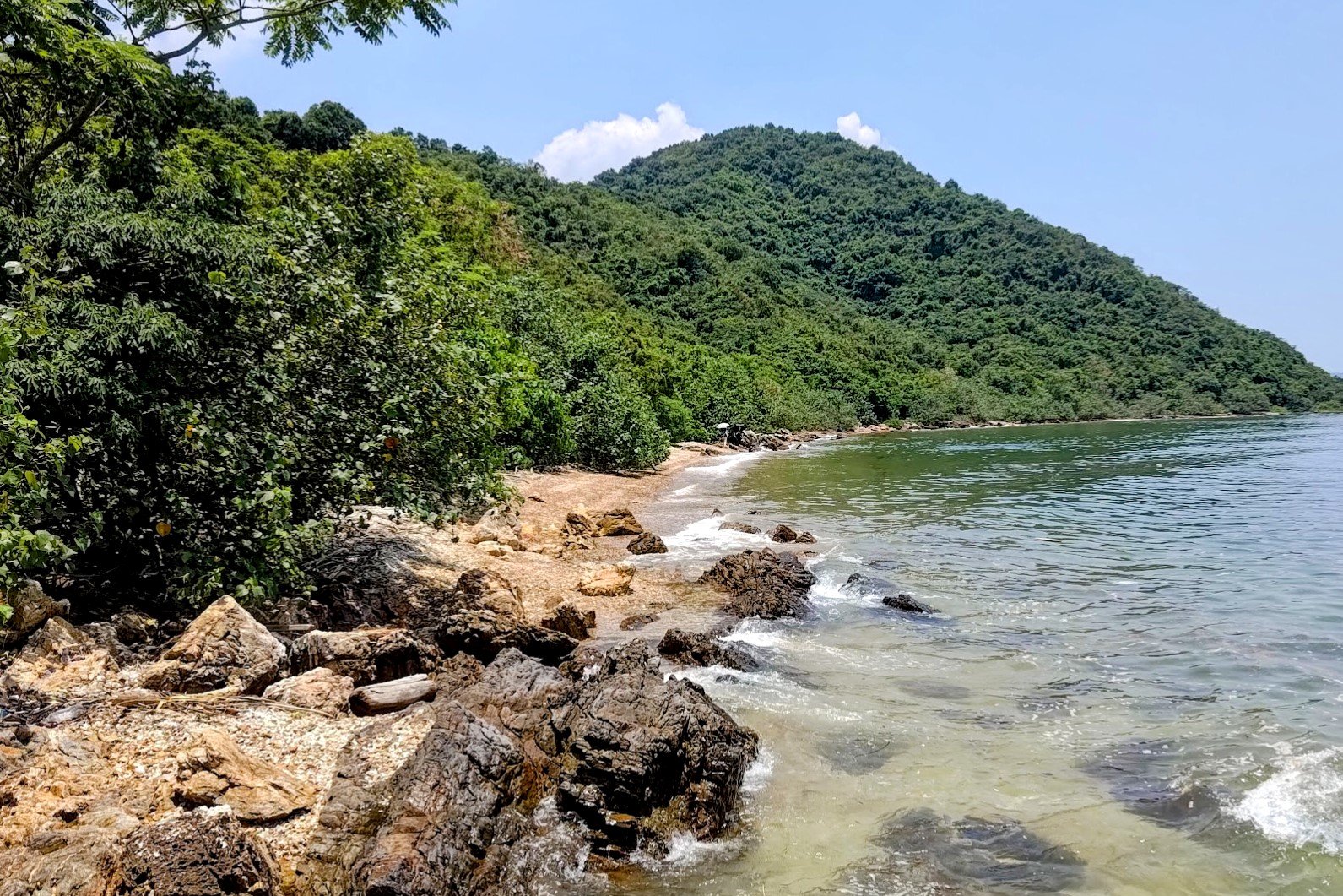
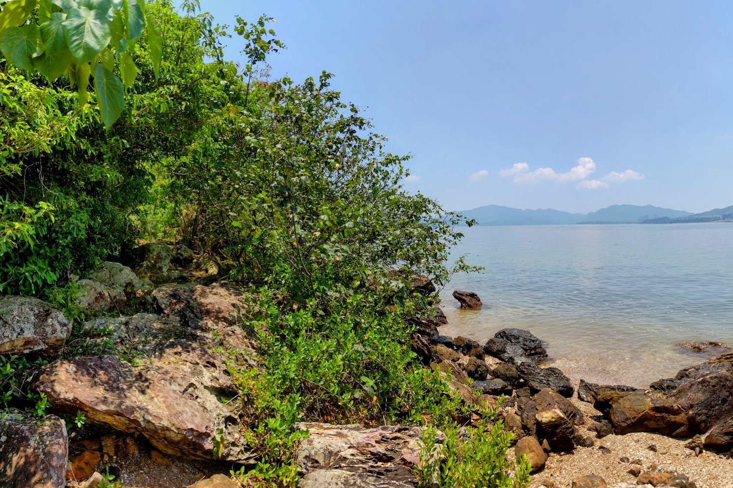
The tombolo is quite the geological wonder! It's basically a little band of rocky sand that connects you with Ma Shi Chau's nature trail.
As far as I know, the tombolo is never fully submerged, so this trail should be doable any time and all throughout the year.
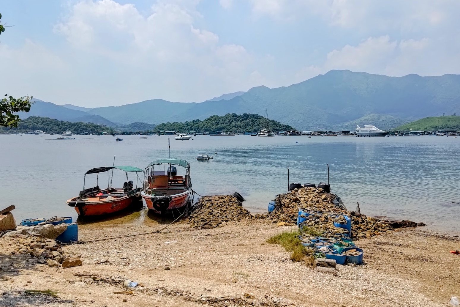
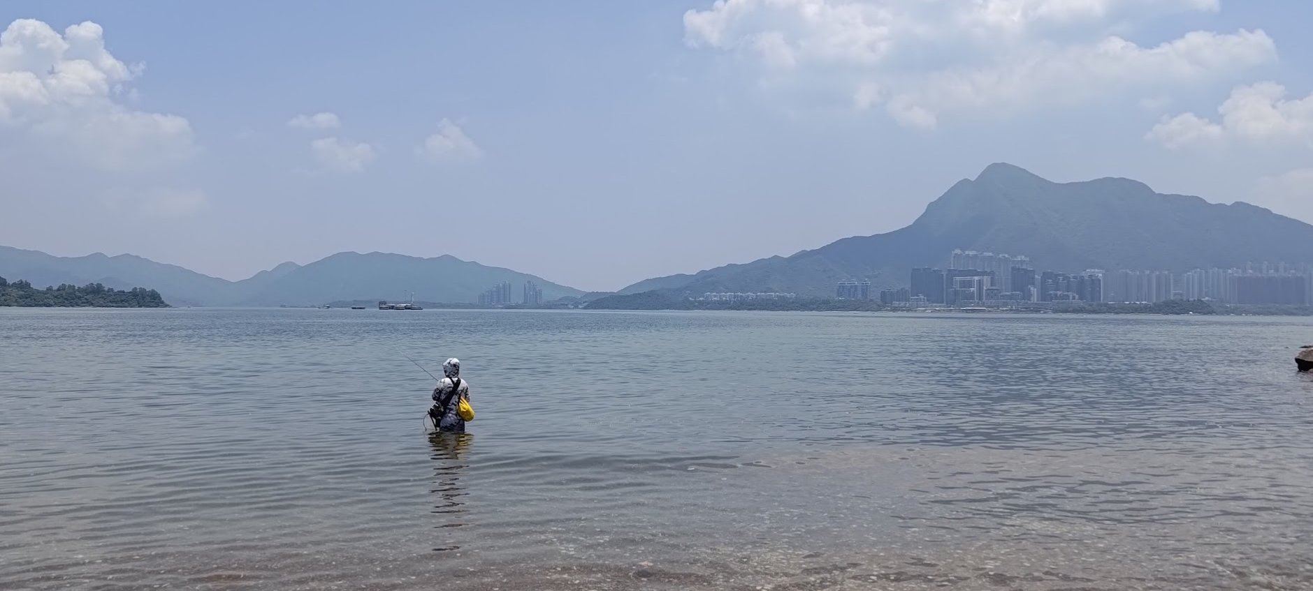
This is also where you'll meet tombolo aunty. She has a cooler filled with cold drinks, and can get you on a boat back to civilization. Drinks are reasonably priced (for Hong Kong) at 12-15 HKD a bottle. A boat ride will set you back 150 HKD per person.
CASH ONLY!
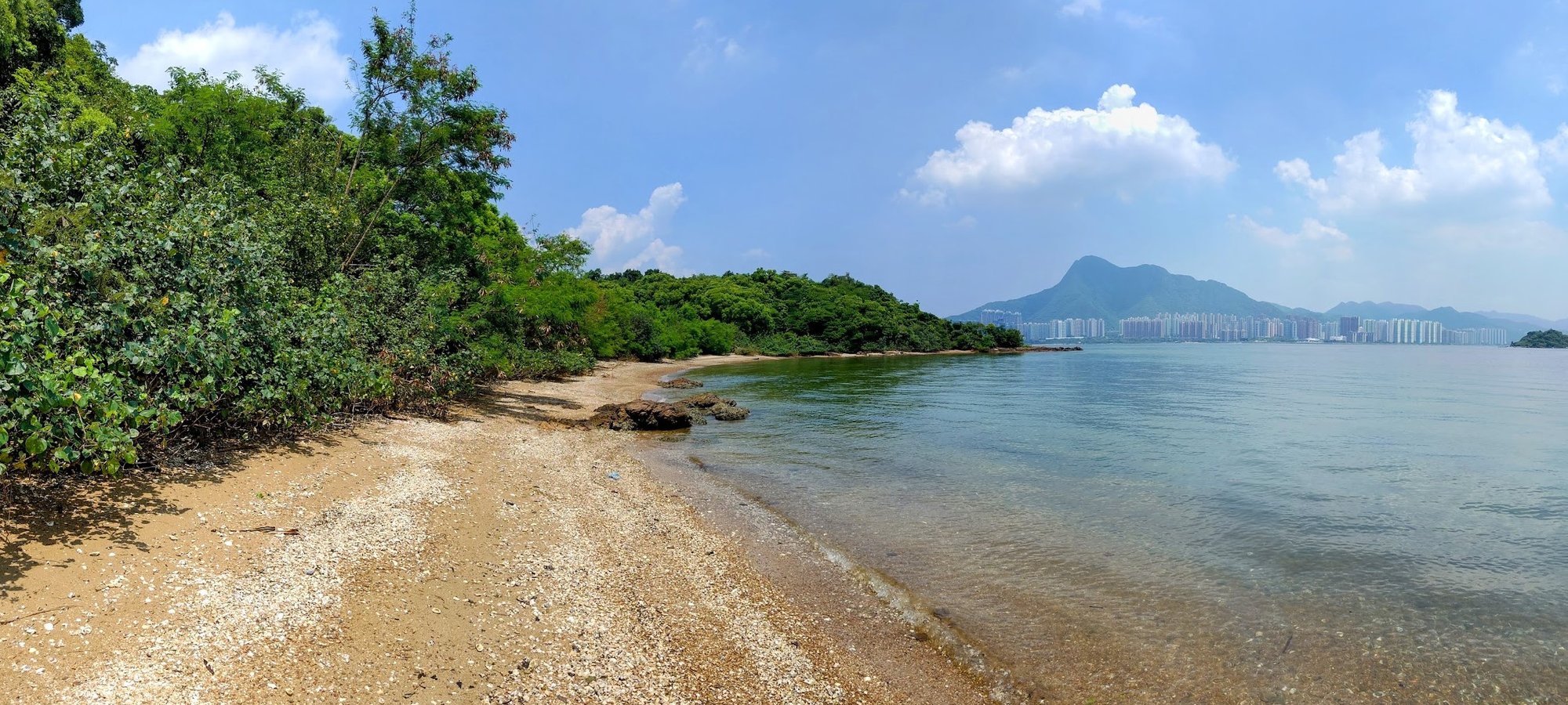
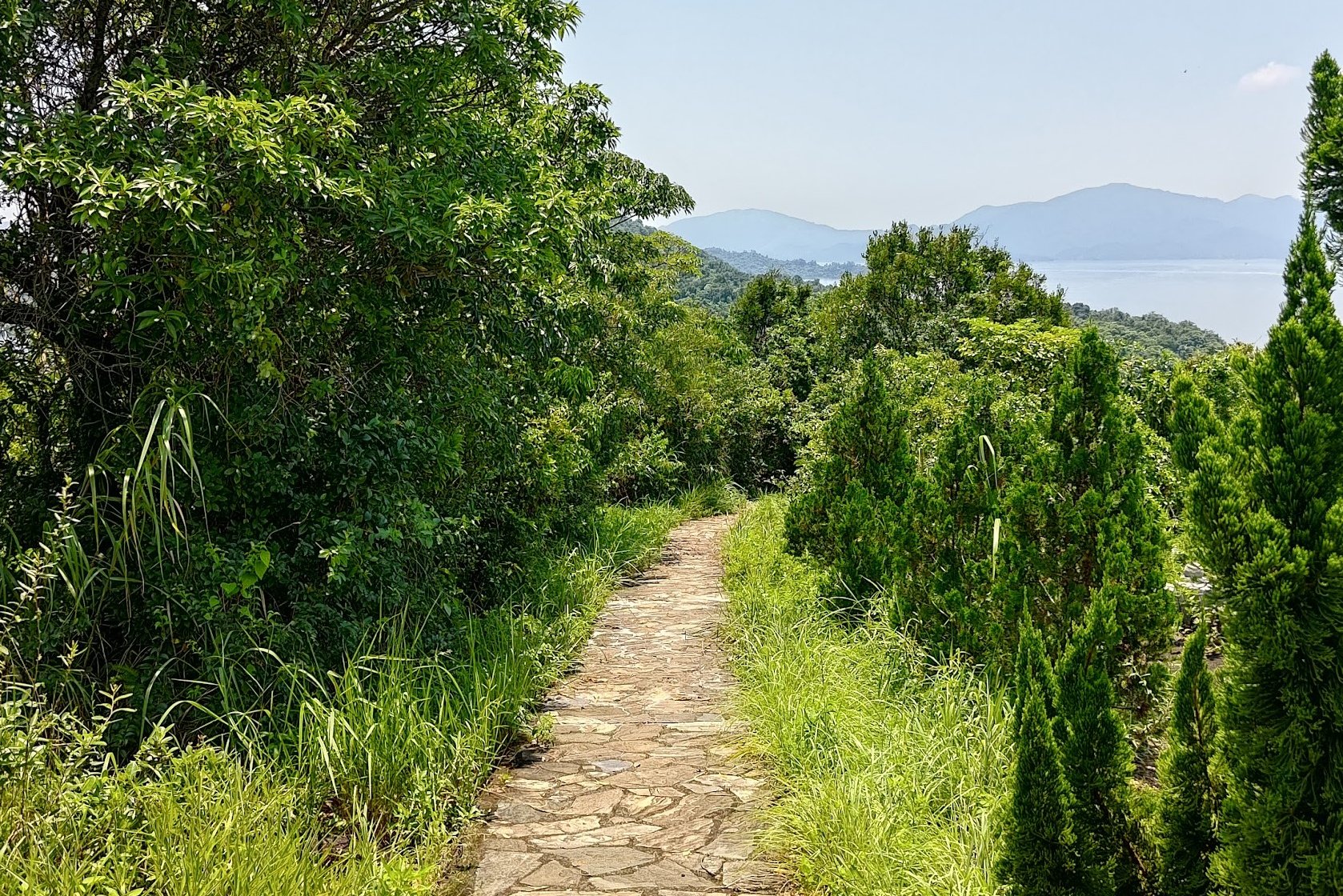
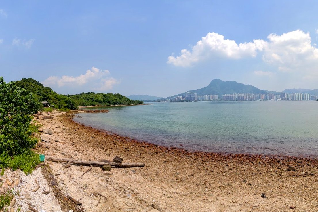
Ma Shi Chau Nature Trail

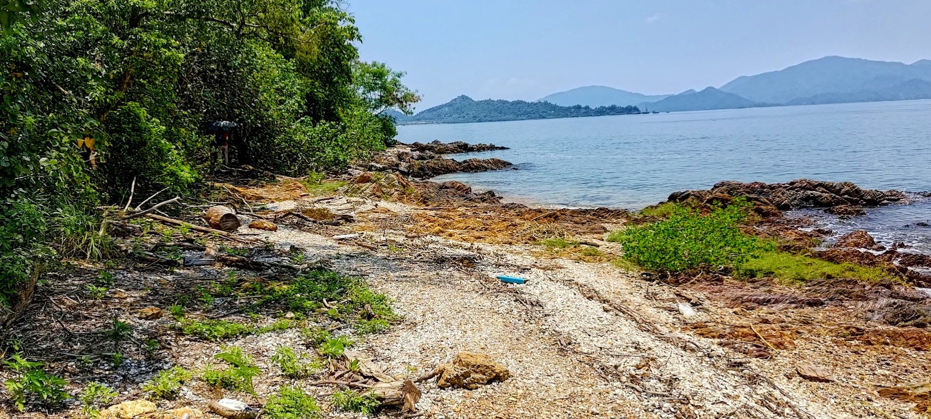
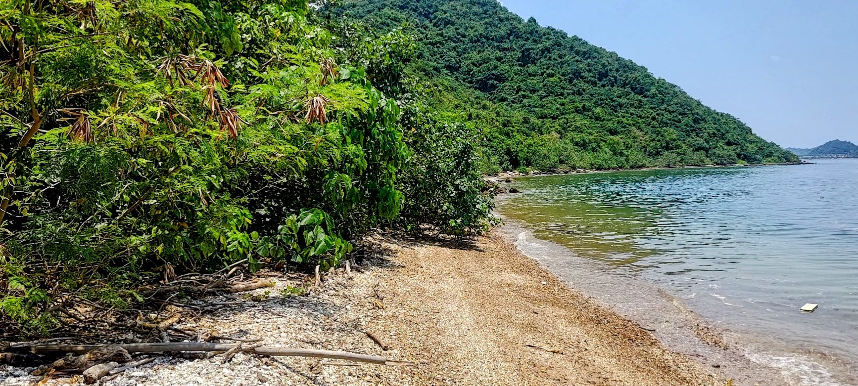
Getting to the tip of Ma Shi Chau from the tombolo (including a few minutes of getting lost and some coastal detours) took about an hour.
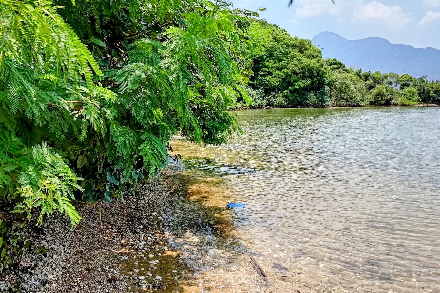
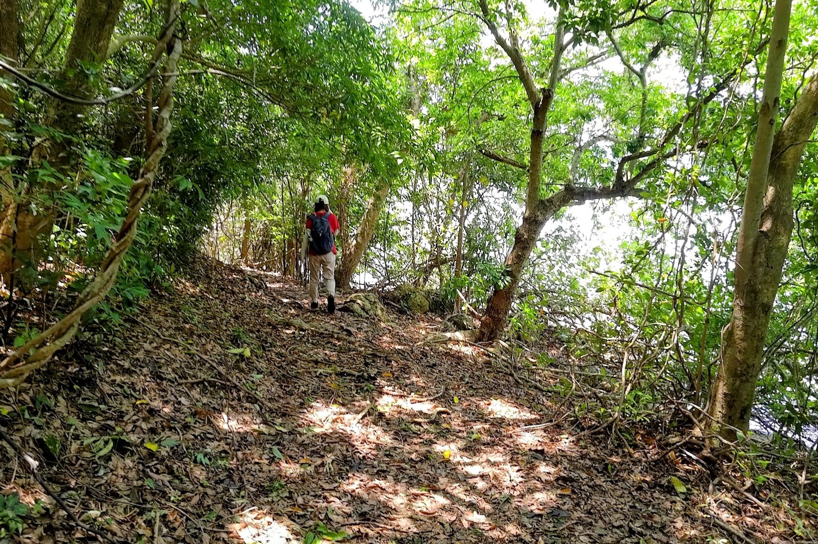
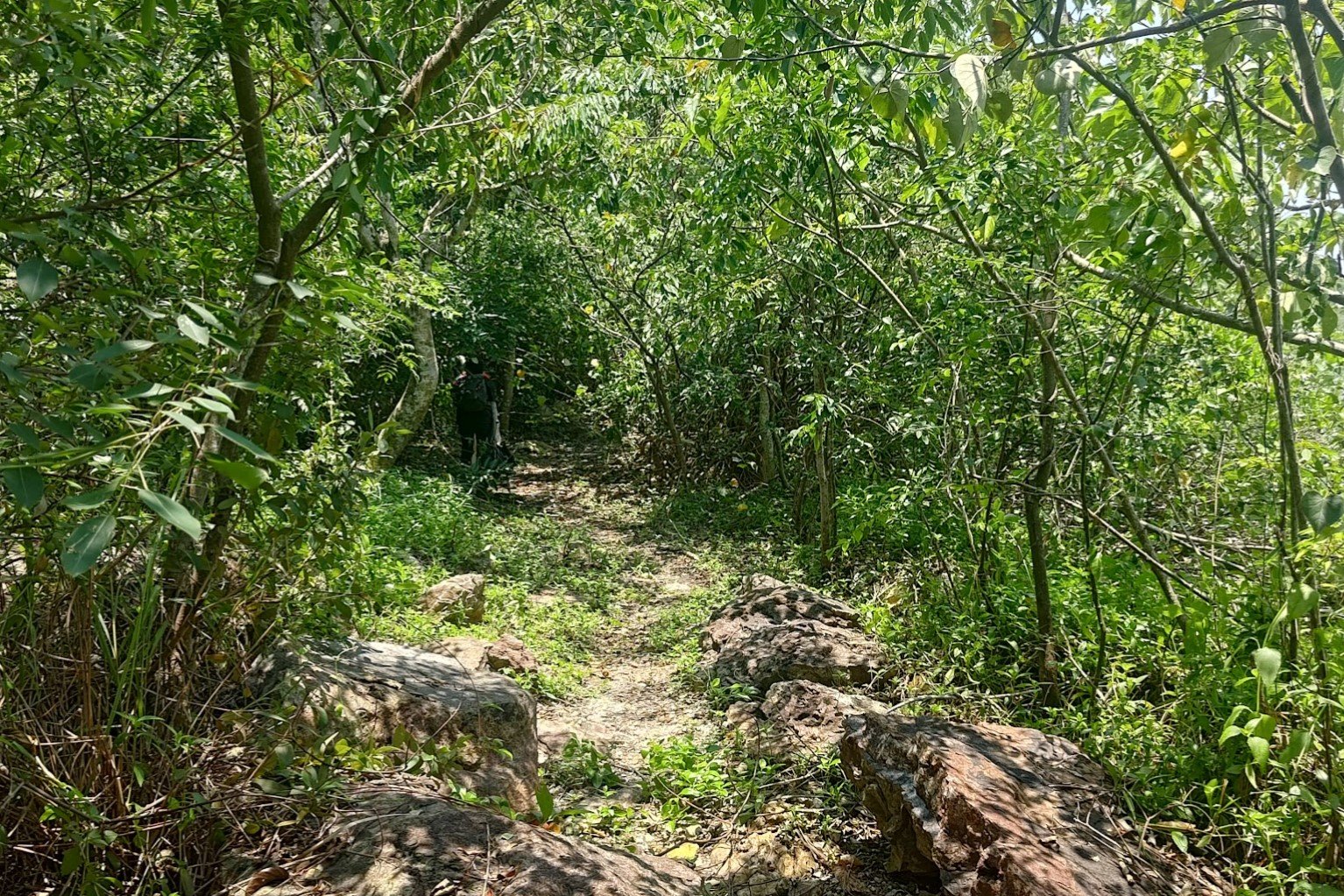
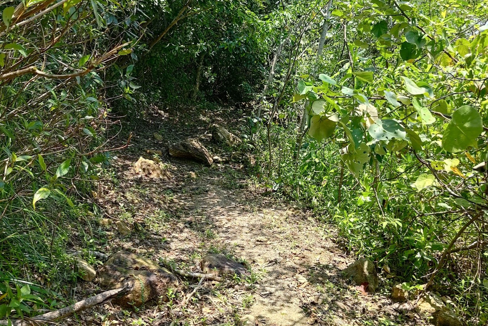
You'll be traversing the Ma Shi Chau Nature Trail for this section of the hike, and you'll drift between a shaded forest trail and vibrant coastal beaches.
AVOID OVERGROWN AREAS AT ALL COSTS. The trail should be clear and obvious at all times. If it isn't, backtrack until you find a clear path. This will save you a lot of headaches and potential injuries.
If you stick to the trail with no detours (as I did on the way back), it only took about 40 minutes back to the tombolo.
From there, you can take a boat back to Tai Mei Tuk, or you can retrace your steps back to Sam Mun Tsai New Village.
Getting Back
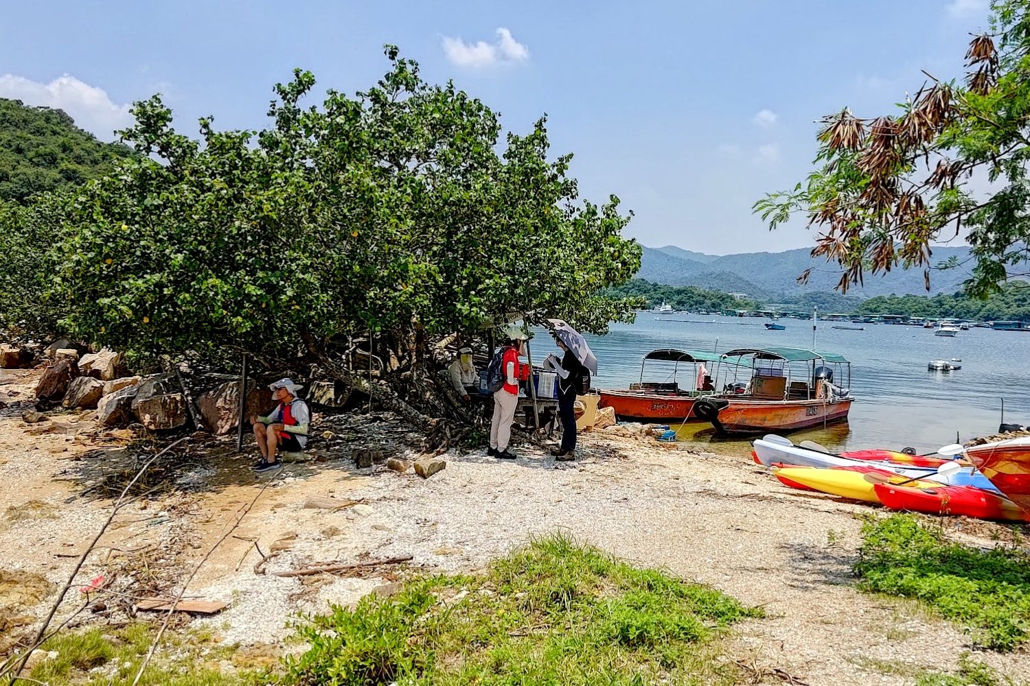
You can get a boat from the tombolo to different areas nearby. Tombolo aunty said that it was 150 HKD per person, but your prices may vary. I was also hiking on a weekend, so I am not certain if she will be there on a weekday. She takes CASH ONLY.
Alternatively, you can hike back to the start point of the hike and get either the 20K minibus or the 74K double-decker bus back to Tai Po Market MTR Station. The 74K takes substantially longer to get back.

