Hong Kong's 5 Toughest Hikes
Contents
- Hong Kong's 5 Toughest Hikes
- 1. Devil's Fist
- 2. West Dog's Teeth
- 3. Ma On Shan
- 4. Sharp Peak
- 5. Sunset Peak
Hong Kong's 5 Toughest Hikes
If you thrive on steep ascents, technical terrain, and the thrill of pushing your limits, this list is for you. These trails are not for the faint of heart—they demand strength, skill, and a healthy respect for the wild side of Hong Kong.
Expect relentless climbs, narrow ridges, and sections where your footing and focus are truly tested. These routes are best tackled with a group of fellow adventurers, so you can watch each other’s backs when the going gets tough. If you do set out solo, make sure someone knows your route and expected return—these trails don’t forgive carelessness.
The reward? Sweeping vistas and hidden corners of Hong Kong that few get to experience. Every summit offers a sense of accomplishment matched only by the scenery. (Well, except for Devil’s Fist—that one’s pure punishment from start to finish.)
Here's my list of the 5 Toughest hikes in Hong Kong in Order of Difficulty:
- Devil's Fist - Technical, 11-12 hours in length, no shade, overgrown
- West Dog's Teeth - Technical, no shade, narrow ridgeline, need to use hands to climb, steep
- Ma On Shan - Technical, narrow ridgeline, tricky descent, need to use hands to climb, steep
- Sharp Peak - Technical, no shade, steep, extremely slippery on the way down
- Sunset Peak - Lots of elevation, some overgrown sections, some technical areas
1. Devil's Fist
Essential Devil's Fist Hike Details
- District: New Territories
- Duration: 11-12 hours for Devil's Fist and Plover Cove, 6 hours for only Plover Cove
- Distance: 31-32km for Devil's Fist and Plover Cove, 18km for only Plover Cove
- Highest Elevation: 298 meters
- Difficulty: 6/5 for Devil's Fist (that’s not a typo. This hike breaks the scale because it’s so much harder than other 5/5 hikes), 4.5/5 for Plover Cove
- Facilities: None. Bring loads of water (I ran through 5 liters) and bring food as well
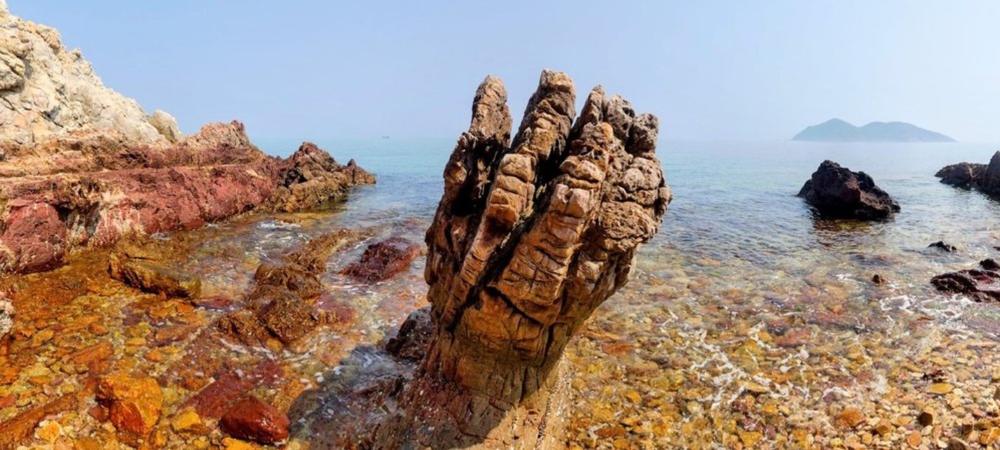
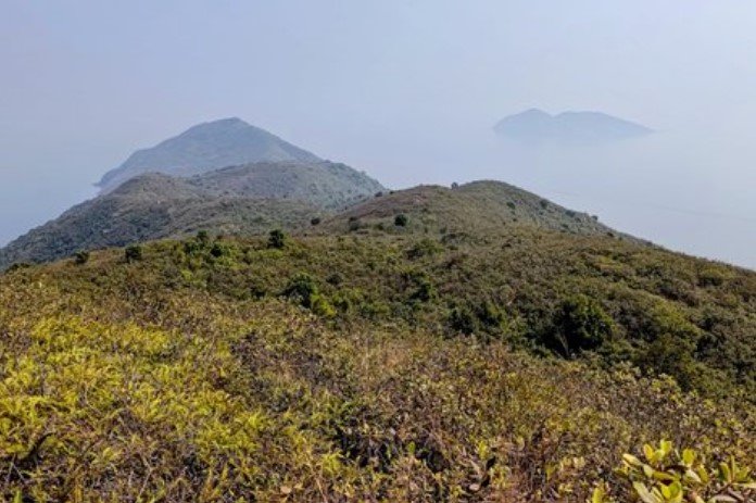
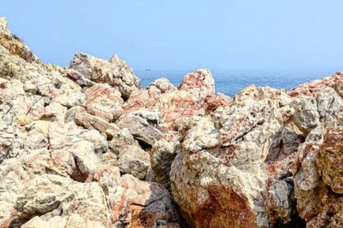
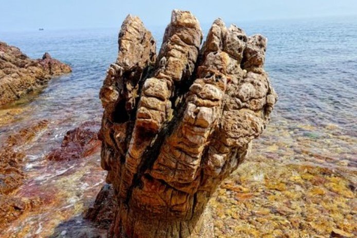
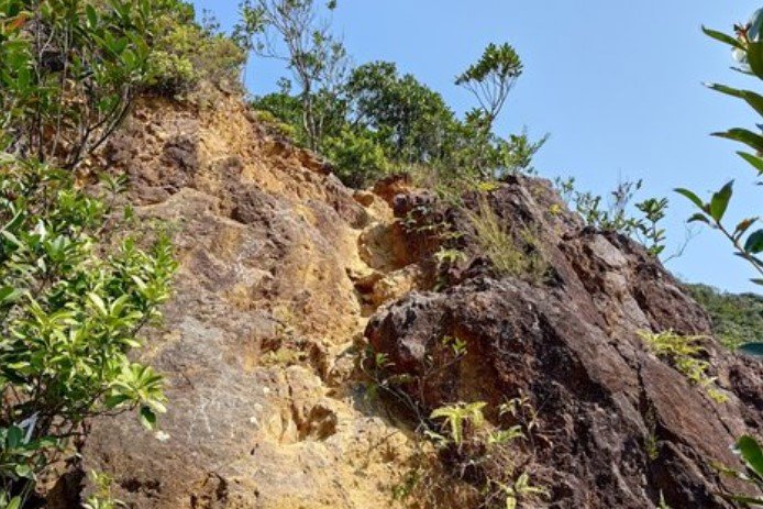
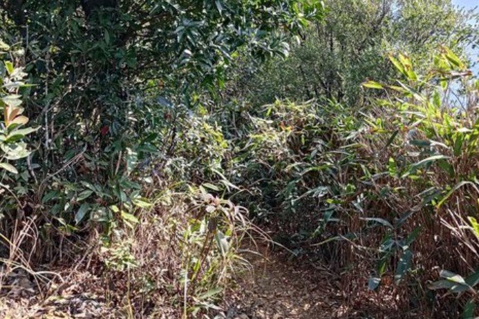
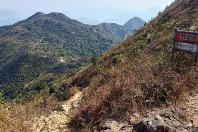
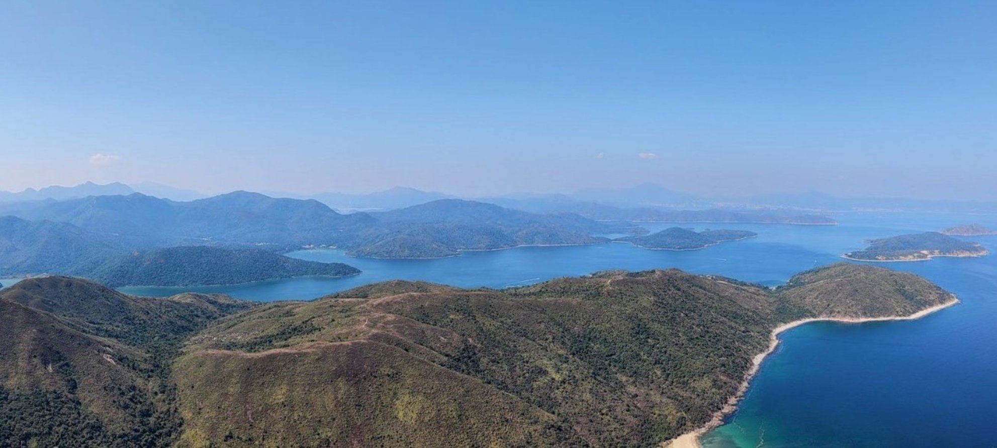
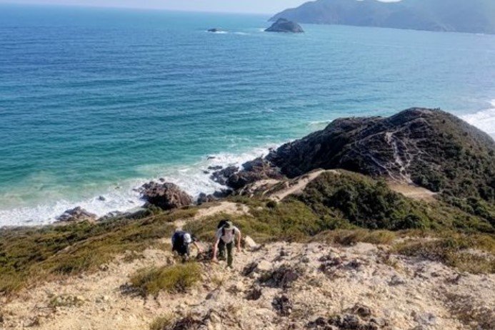
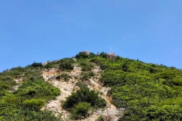
If you’re looking for a hike that tests every ounce of your stamina and patience, the Devil’s Fist, or Wong Chuk Kok Tsui (黃竹角咀), trail in Hong Kong might just be your ultimate challenge — but don’t say I didn’t warn you. After spending nearly 12 grueling hours on this 30-kilometer beast, I can say with certainty: this is a route I will never do again. The infamous Devil’s Fist rock itself is an impressive geological relic, dating back 400 million years, but the journey there? Honestly, it felt like a relentless slog with almost zero payoff.
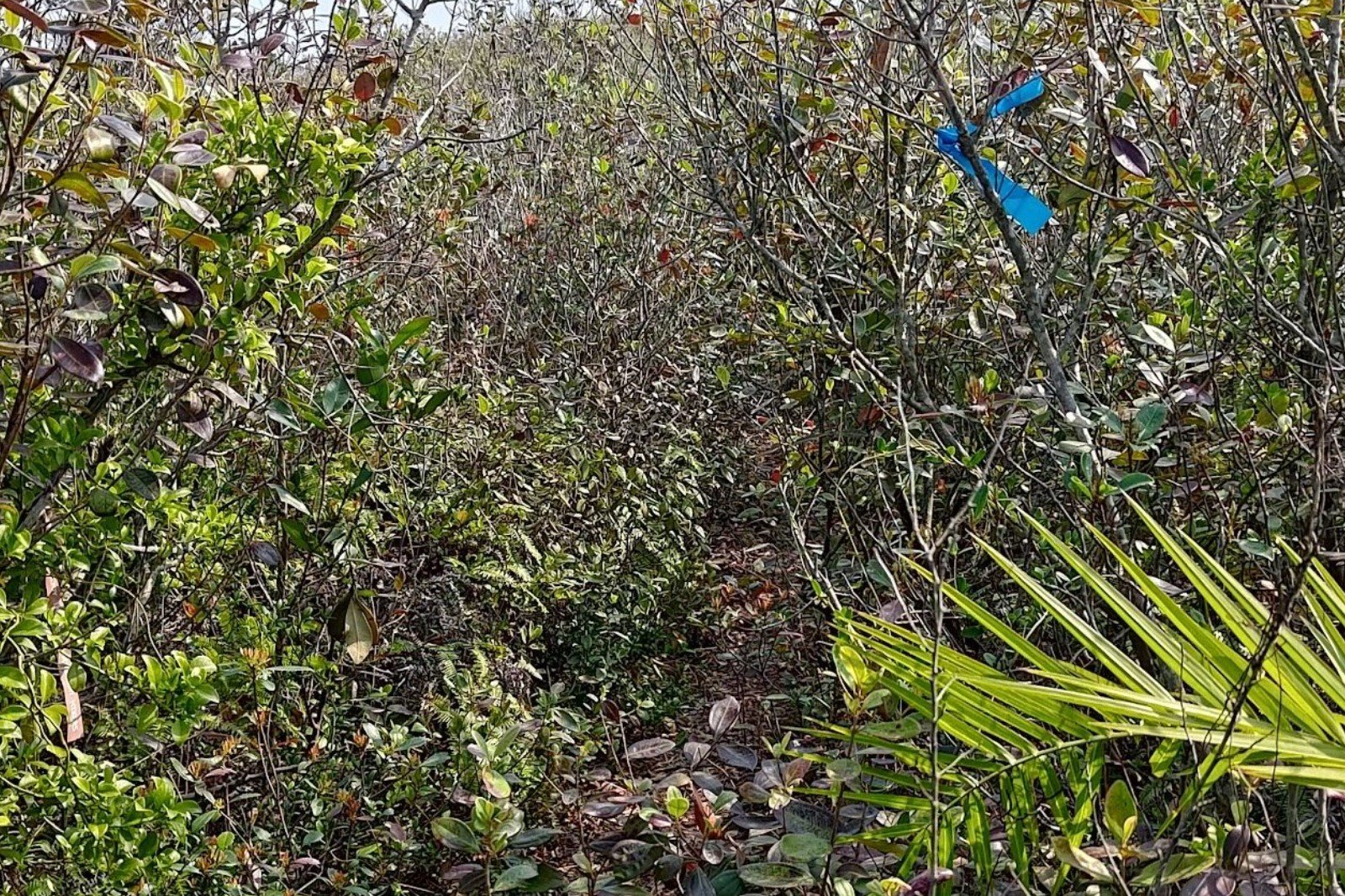
The hike is notorious among local hikers for its brutal difficulty. You’re not just covering a long distance with constant ups and downs; parts of the trail demand technical sure-footing, and the isolation means help is few and far between. Cellphone reception? Forget about it. The route can be split into three parts: a pleasant start from Wu Kau Tang to Luk Wu Tung, the punishing out-and-back to the Devil’s Fist itself—where thorny plants, slippery rocks, and coastal navigation make you question your life choices—and finally, the trek to Tai Mei Tuk, where clouds of relentless flies buzz around your face like tiny flying tormentors.
What makes this hike even more maddening is knowing you could skip the torture by simply taking a boat directly to the Devil’s Fist. Yes, a quick 10-minute boat ride can get you there without the bruises, scratches, and near-misses with loose rocks. If you do decide to brave the trail, pack plenty of water (I went through 5 liters), bring enough food, wear long pants to fend off the thorns, and start early—like catching a 6:40 am bus early. And whatever you do, don’t attempt this in summer. The exposed sections will roast you alive.
In short, the Devil’s Fist hike is a brutal test of endurance and grit, but the reward is... well, mostly the satisfaction of surviving it. Unless you’re a glutton for punishment or a hiking completionist, there are far better tough hikes in Hong Kong that offer stunning scenery without the endless torture. Consider yourself warned, there's a reason this is Hong Kong's toughest hike!
Devil's Fist Route Map and GPX File
*Click the box icon in the top right of the map below to load the blue route directly into your own Google Maps. You can then see your location relative to the trail in real time!
Devil's Fist Hiking Guide
You can find a full hiking guide below:

2. West Dog's Teeth
Essential West Dog's Teeth Hike Details
- District: Lantau
- Duration: 4 hours (at a fast pace with no breaks) expect to take 5 hours or longer at a gentler pace
- Distance: 9 km
- Highest Elevation: 934 meters (if you choose to climb to the top of Lantau Peak) about 150 meters less if you head down to Ngong Ping without climbing to Lantau Peak.
- Difficulty: 5/5
- Facilities: None
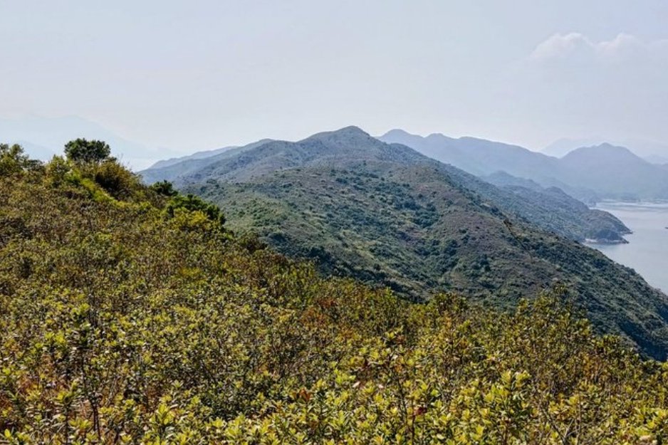
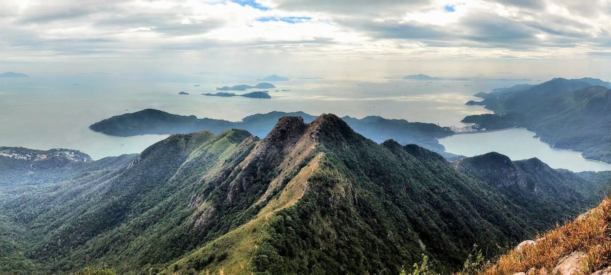
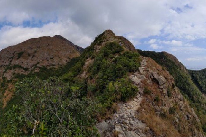
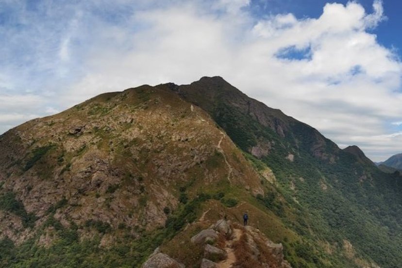
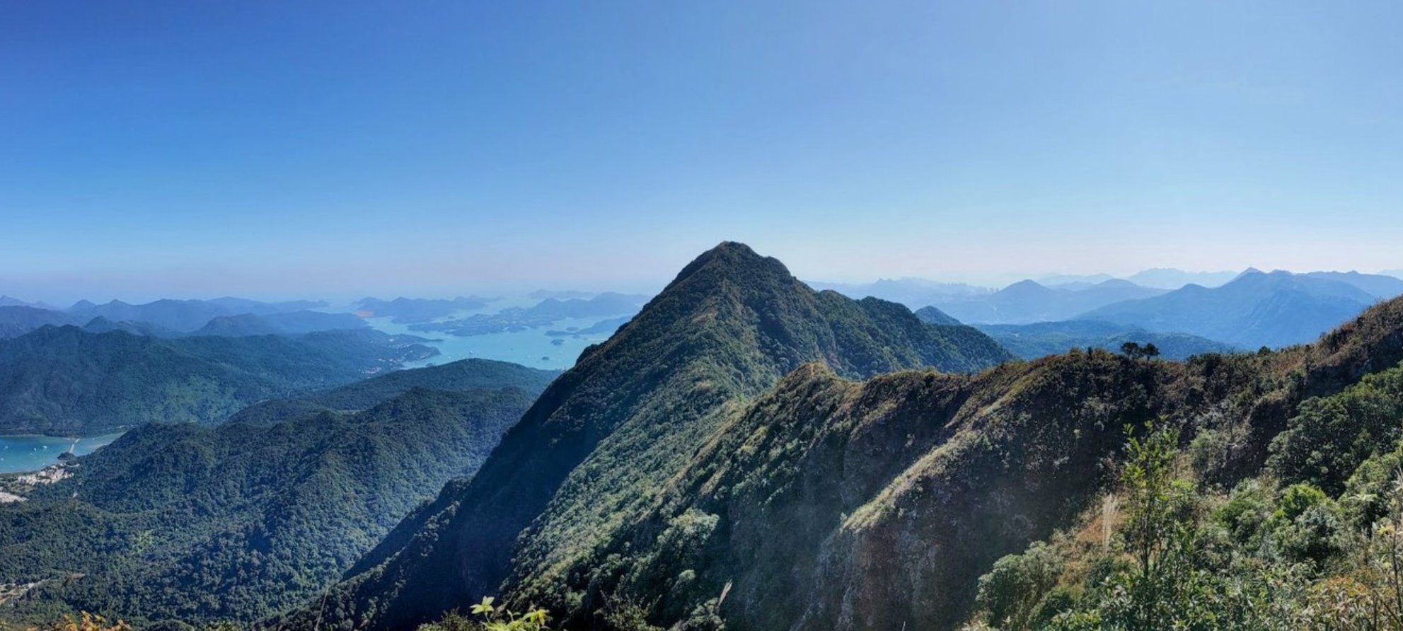
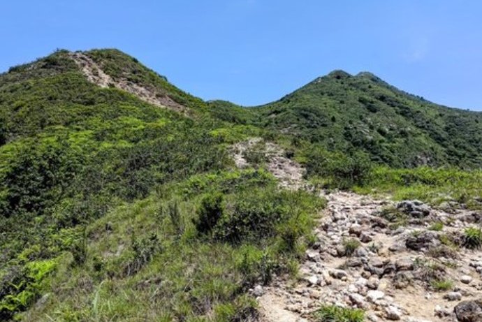
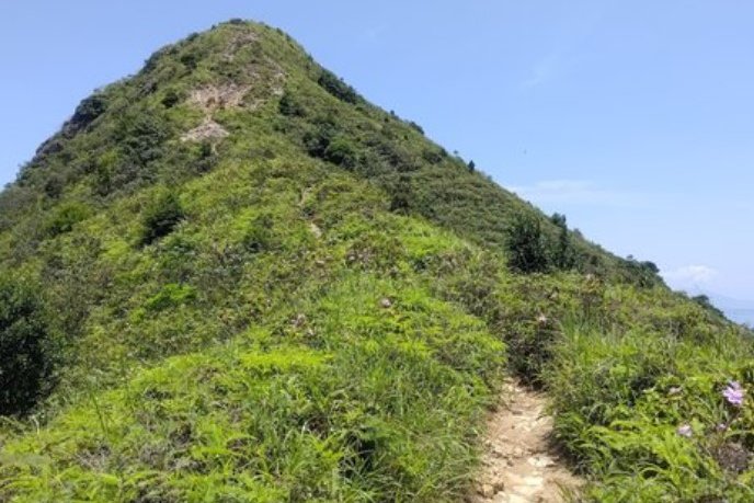
If you ask most Hong Kong hikers about the city’s toughest trail, West Dog’s Teeth (西狗牙 ) will almost certainly come up in the conversation. This jagged ridge on Lantau Island, named for its sharp, tooth-like peaks, is a serious test of grit and skill.
From the moment you leave the trailhead, you’re in for a relentless climb. Nearly the entire route features steep uphill sections where you’ll find yourself scrambling over rocks and using your hands to pull yourself up—gloves are a smart move if you want to keep your palms clean. Even on less vertical stretches, the narrow ridges require careful footwork, especially when the wind picks up and the exposure adds a little extra adrenaline to the mix.
Plan on spending around four hours if you’re moving quickly, but don’t be surprised if it takes longer—there are no shops or water stops along the way, so bring plenty of snacks and hydration. When you reach the summit of West Dog’s Teeth, you face a choice: descend toward the iconic Ngong Ping Big Buddha or push onward to the summit of Lantau Peak. The climb down from Lantau Peak is much gentler and ends conveniently at a bus stop that can whisk you back to the MTR or ferry, making for a satisfying finish to a demanding day.
In short, West Dog’s Teeth is a hike that blends technical scrambling with breathtaking views and a real sense of adventure. It’s tough, but safe if you’re prepared, and offers one of the most exciting ridge-line experiences in Hong Kong. Just remember to bring your gloves, plenty of water, and a spirit ready for a wild ride.
West Dog's Teeth Google Route Map and GPX
*Click the box icon in the top right of the map below to load the blue route directly into your own Google Maps. You can then see your location relative to the trail in real time!
West Dog's Teeth Hiking Guide
You can find a full hiking guide below:
3. Ma On Shan
Essential Ma On Shan Hike Details
- District: New Territories
- Duration: 4.5-6 hours (depending on how you reach the start point)
- Distance: 11-12 km
- Max Elevation: 702 meters
- Difficulty: 4.5/5
- Facilities: public toilet at BBQ area before the real hike begins
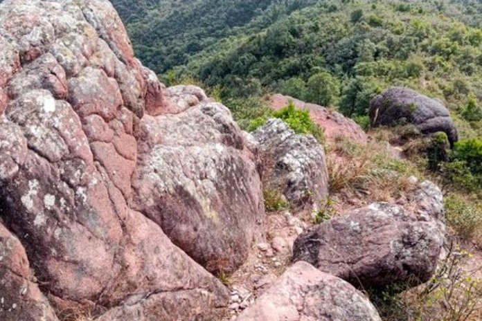
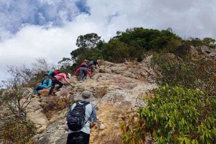
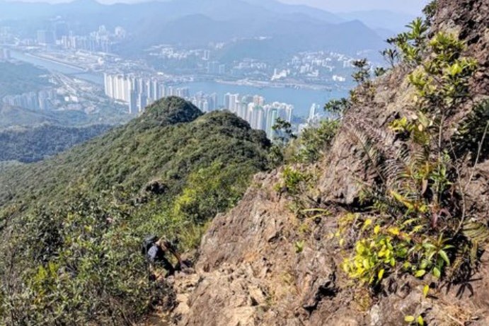
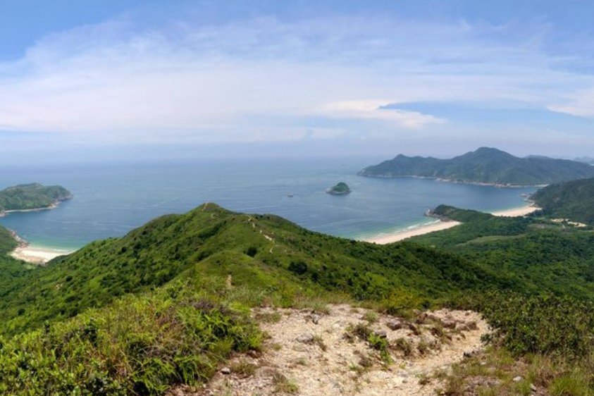
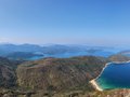
Ma On Shan (馬鞍山), or Horse Saddle Mountain, stands out as one of Hong Kong’s most demanding hikes. Much of the trail is steep and rocky, often forcing you to navigate without a defined path, choosing your own way upward. Be prepared to haul yourself up with your hands, and bringing gloves can save your skin from the rough, abrasive surfaces.
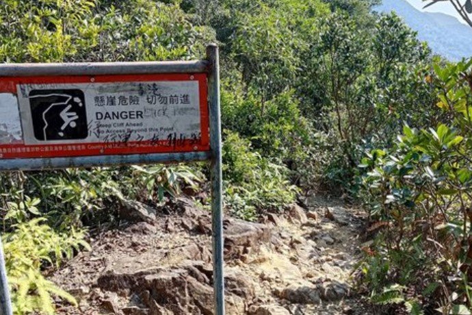
Right from the beginning, the ascent tests your endurance. The initial stretch is particularly steep and exposed, making it unsuitable for anyone uncomfortable with heights. The terrain requires constant attention, as footing can be tricky and the route isn’t always obvious. Warning signs along the way serve as reminders that this hike demands respect and caution—this is no easy trek for the faint-hearted.
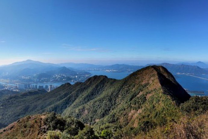
The effort, however, is met with incredible rewards. As you push through, you’ll be treated to sweeping views of rolling mountains, shimmering turquoise bays, and scattered villages that make every tough step worthwhile. Expect to spend at least four and a half hours on the trail if you take a taxi to the starting point, with additional time if you walk there.
Once you reach Sai Kung at the end, you’ll find plenty of options to refuel and relax after conquering one of the most physically challenging hikes in Hong Kong.
Ma On Shan Google Route Map and GPX
Ma On Shan Station to Ma On Shan Village GPX
*Click the box icon in the top right of the map below to load the blue route directly into your own Google Maps. You can then see your location relative to the trail in real time!
Ma On Shan Hiking Guide
You can find a full hiking guide below:
4. Sharp Peak
Essential Sharp Peak Hike Details
- District: Sai Kung, New Territories
- Duration: 3-7 hours depending on your start point
- Distance: 7km from Ham Tin Wan, 19km as part of MacLehose Stage 2 starting from Sai Wan Pavilion
- Highest Elevation: 468 meters
- Difficulty: 5/5 for the full 19km trail, 4.5/5 for just Sharp Peak
- Facilities: Food, drinks and toilet available at Ham Tin Wan
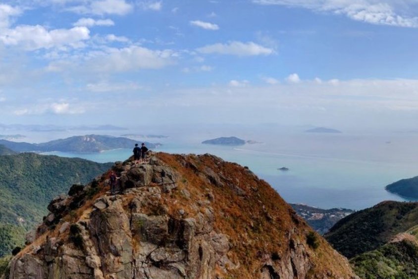
Sharp Peak, or Nam She Tsim (蚺蛇尖), is a hike that demands more than just stamina—it tests your balance, nerve, and sometimes your humility. While the elevation itself isn’t extreme, the trail’s loose sandy soil and scattered stones make footing precarious throughout. In fact, descending is often far trickier than climbing up, turning the return trip into a careful, sometimes comical scramble where sliding down on your backside isn’t just an option—it’s a necessity.
The steep sections require you to engage your whole body, using hands and feet to haul yourself upward. Additionally, this hike pairs with the Tai Long Wan trail (MacLehose Stage 2), meaning that if you add that entire distance into the mix, you'll potentially be hiking for a good 7 hours.
So why endure this tough, sometimes nerve-wracking trek? The answer lies in the reward: breathtaking, untouched views that few get to witness. Reaching Sharp Peak’s summit means standing on a vantage point that feels entirely your own, with panoramic vistas stretching over rugged coastline and sparkling waters.
*If you want to do Sharp Peak by itself, you can speedboat directly to Ham Tin Wan from Sai Kung Public Pier. Details in the hiking guide linked both above and below.
Sharp Peak Route Map and GPX
*Click the box icon in the top right of the map below to load the blue route directly into your own Google Maps. You can then see your location relative to the trail in real time!
Sharp Peak Hiking Guide
You can find a full hiking guide below:
5. Sunset Peak

Essential Sunset Peak Hike Details
- District: Lantau
- Duration: 4 hours in the summer and 3.5 hours in the winter (not including detours)
- Distance: 7.8km with no detours
- Highest Elevation: 869 meters
- Difficulty: 4.5/5
- Facilities: None. Stock up on food and water beforehand
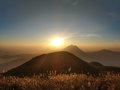
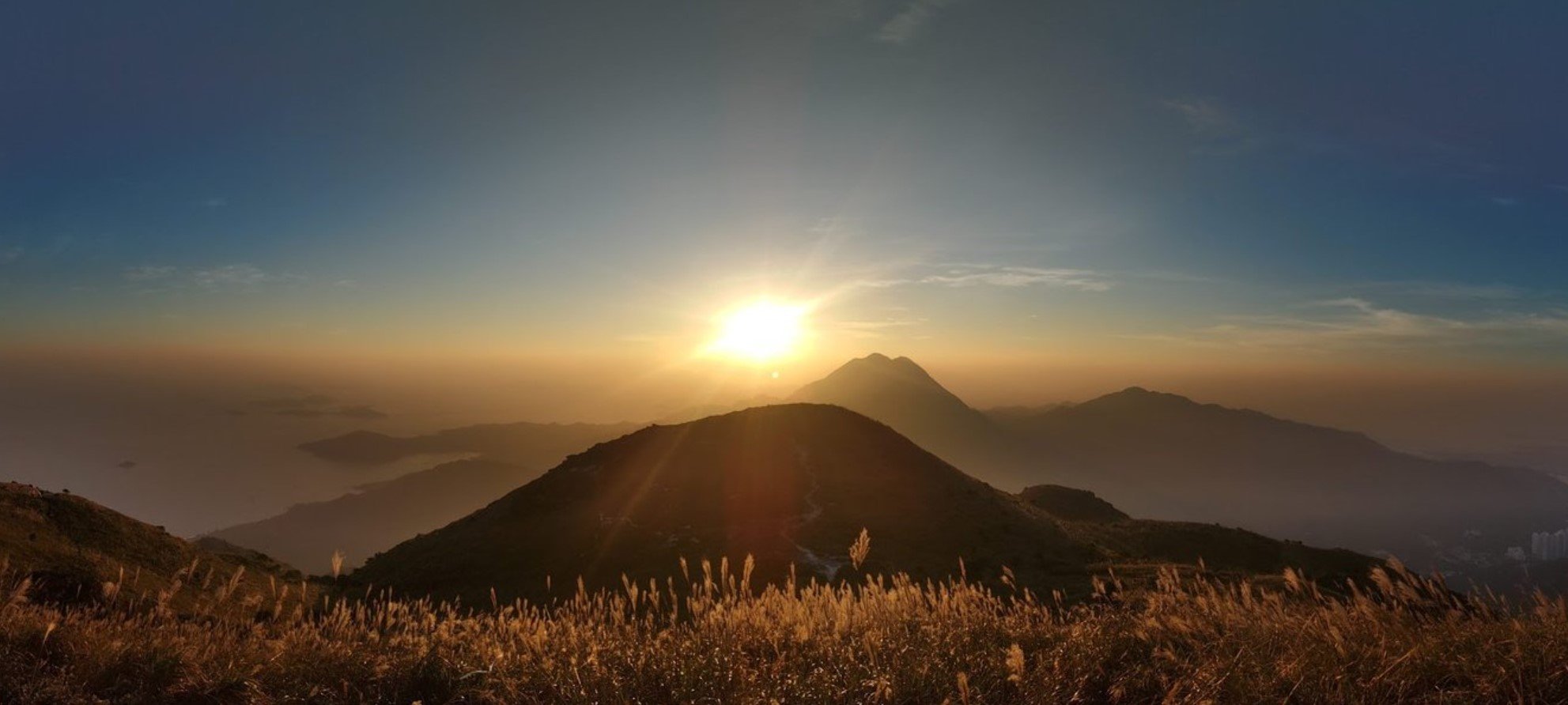
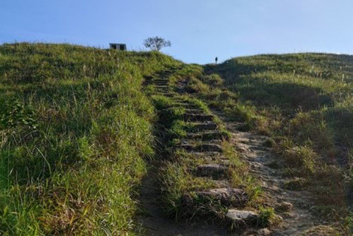
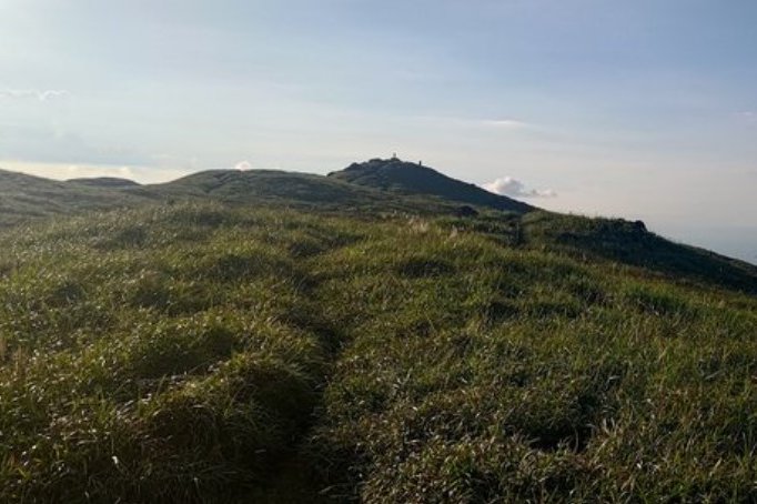
Sunset Peak (大東山) presents a significant challenge among Hong Kong's hikes, yet it offers perhaps the most spectacular views of both sunrise and sunset in the city. Imagine standing nearly 900 meters high, enveloped by a 360-degree panorama encompassing the sprawling cityscape, the airport, and the vast ocean—it's truly an awe-inspiring experience to summit Hong Kong's third-tallest mountain.
This ascent, while visually (and literally) breathtaking, is not for the novice hiker. The path to the summit is arduous, involving thousands of stone steps that demand considerable cardiovascular endurance. It's a climb that requires prior conditioning; tackling a few shorter peaks beforehand would be a wise preparation.
For those ready to conquer Sunset Peak, timing your visit is key. It's advisable to avoid public holidays when the mountain becomes heavily congested with tourists. While hiking during the summer months is particularly demanding due to the heat, it's also when you'll encounter the fewest crowds.
If your primary goal is to capture the most stunning visual experience, consider going around November. During this time, the silvergrass blooms fully, transforming the landscape into something akin to a magical scene from an epic fantasy.
Sunset Peak Route Map and GPX
*Click the box icon in the top right of the map below to load the blue route directly into your own Google Maps. You can then see your location relative to the trail in real time!
Sunset Peak Hiking Guide
You can find a full hiking guide below: