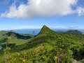
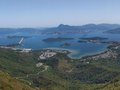
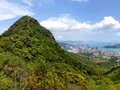
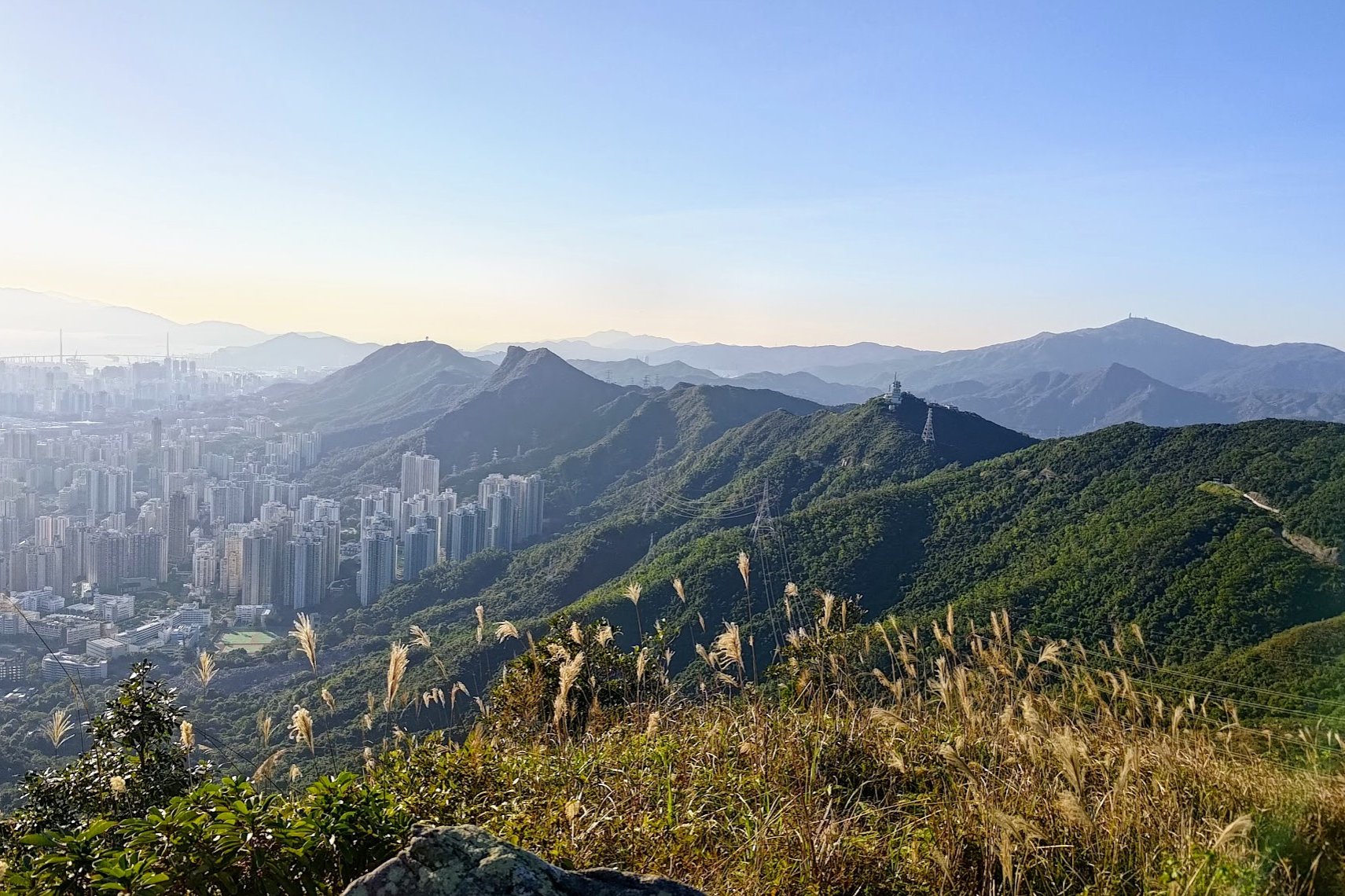
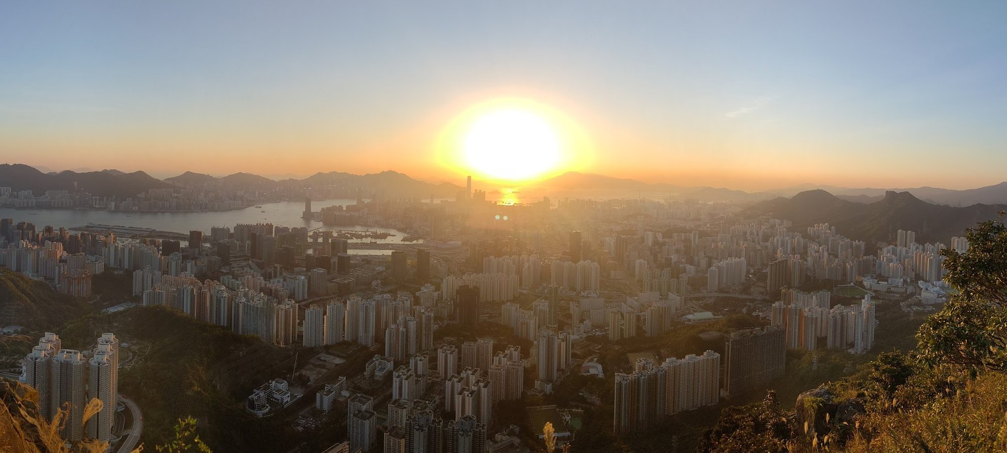
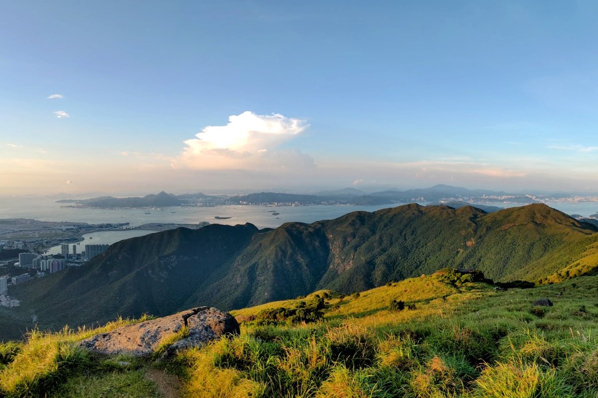
20 Hong Kong Hikes With the Best Views
Contents
- 20 Hong Kong Hikes with the Best Views
- 1. Ap Lei Pai (Mount Johnston) Hike
- 2. Castle Peak
- 3. Dragon's Back
- 4. High Junk Peak
- 5. Kai Shan
- 6. Lantau Peak
- 7. Lion Rock
- 8. Ma On Shan
- 9. Pat Sin Leng
- 10. Po Pin Chau
- 11. Po Toi
- 12. Red Incense Burner Summit
- 13. Robin's Nest
- 14. Suicide Cliff
- 15. Sunset Peak
- 16. Tai Long Wan
- 17. Tai Mo Shan
- 18. Tiu Tang Lung
- 19. Victoria Peak
- 20. West Dog's Teeth
20 Hong Kong Hikes with the Best Views
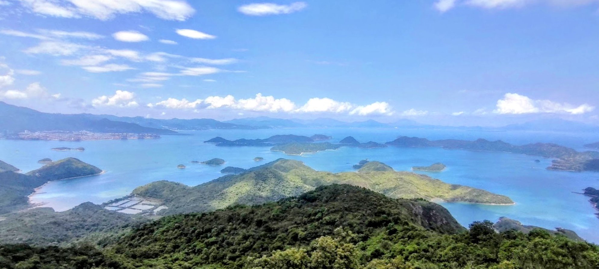
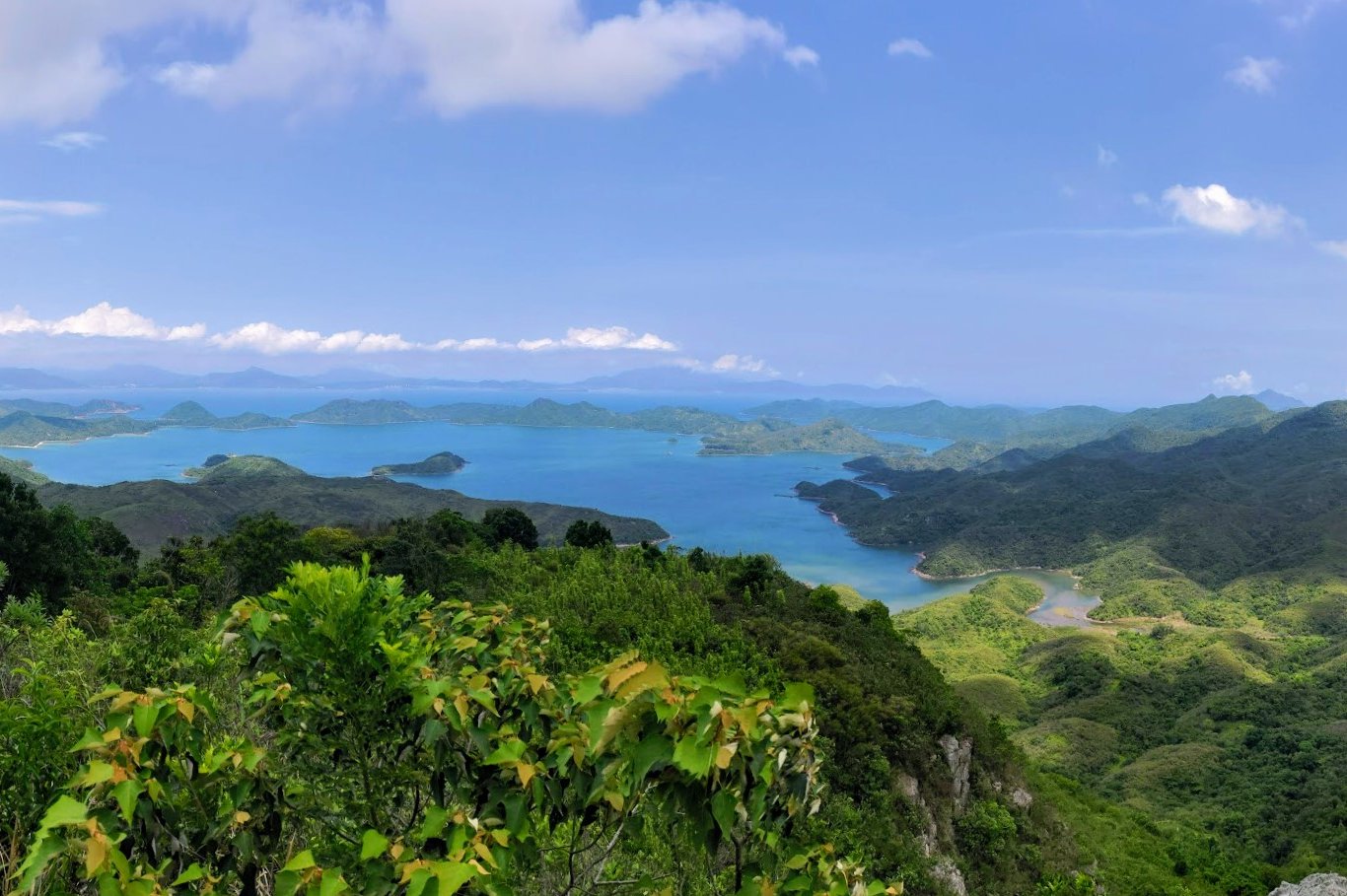
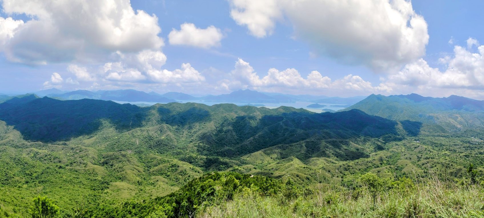
These 20 hikes bring together some of the most diverse and incredible views from all around Hong Kong; from gorgeous beaches, epic mountains, and even bustling cityscapes. Whether you're looking for a hike on Hong Kong Island, Kowloon, the New Territories, Lantau, or even outlying islands, this list has something for you.
Here's the list of the 20 Hong Kong hikes with the best views in alphabetical order (click on any hike for a detailed hiking guide):
1. Ap Lei Pai (Mount Johnston) Hike
Essential Ap Lei Pai (Mount Johnston) Hike Details
- District: Hong Kong Island
- Duration: 2.5-3 hours
- Distance: 4 km
- Highest Elevation: 198 meters
- Difficulty: 3.5/5
- Facilities: Toilets and convenience stores available at the start and end
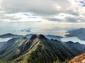
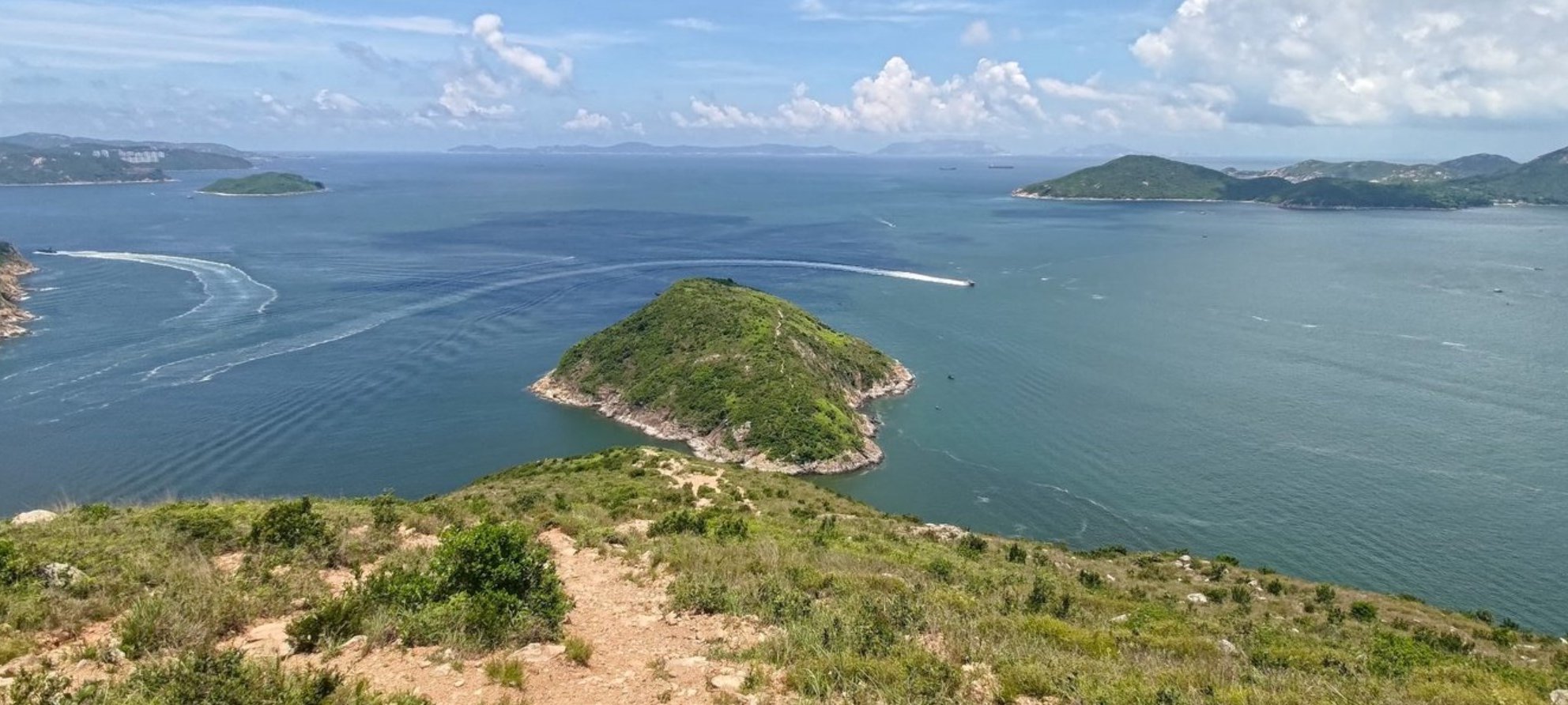
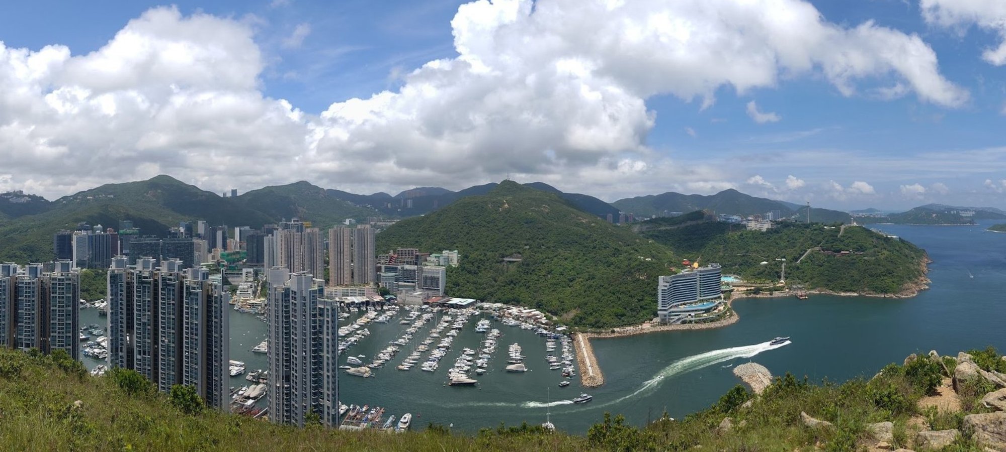
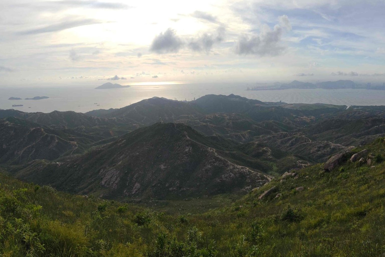
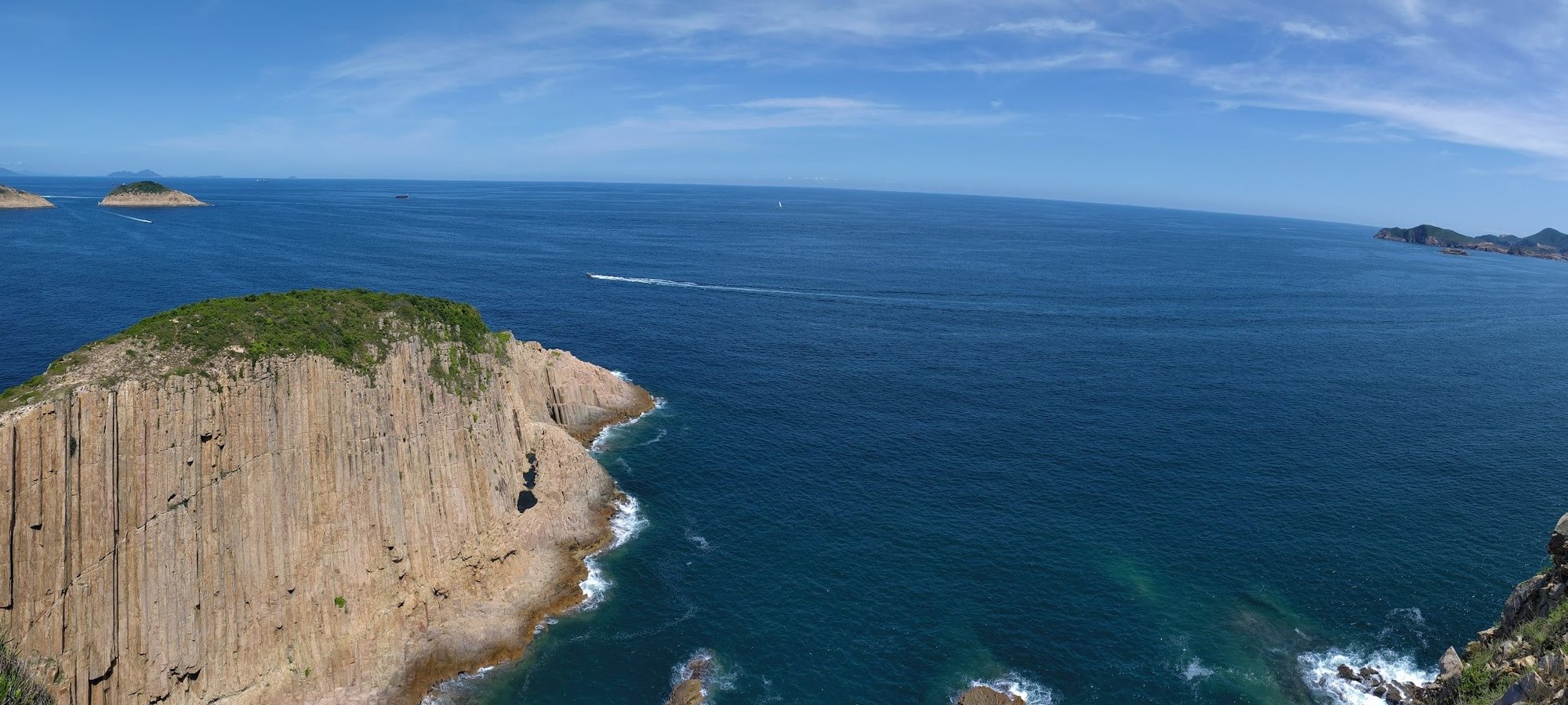
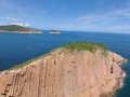
Hiking from Ap Lei Chau (Mount Johnston) to Ap Lei Paioffers a unique and exhilarating outdoor hiking experience just minutes from Hong Kong’s urban core. The 4 km trail, taking about 2.5 to 3 hours, features steep climbs and descents with challenging rocky terrain, making it ideal for intermediate to advanced hikers.
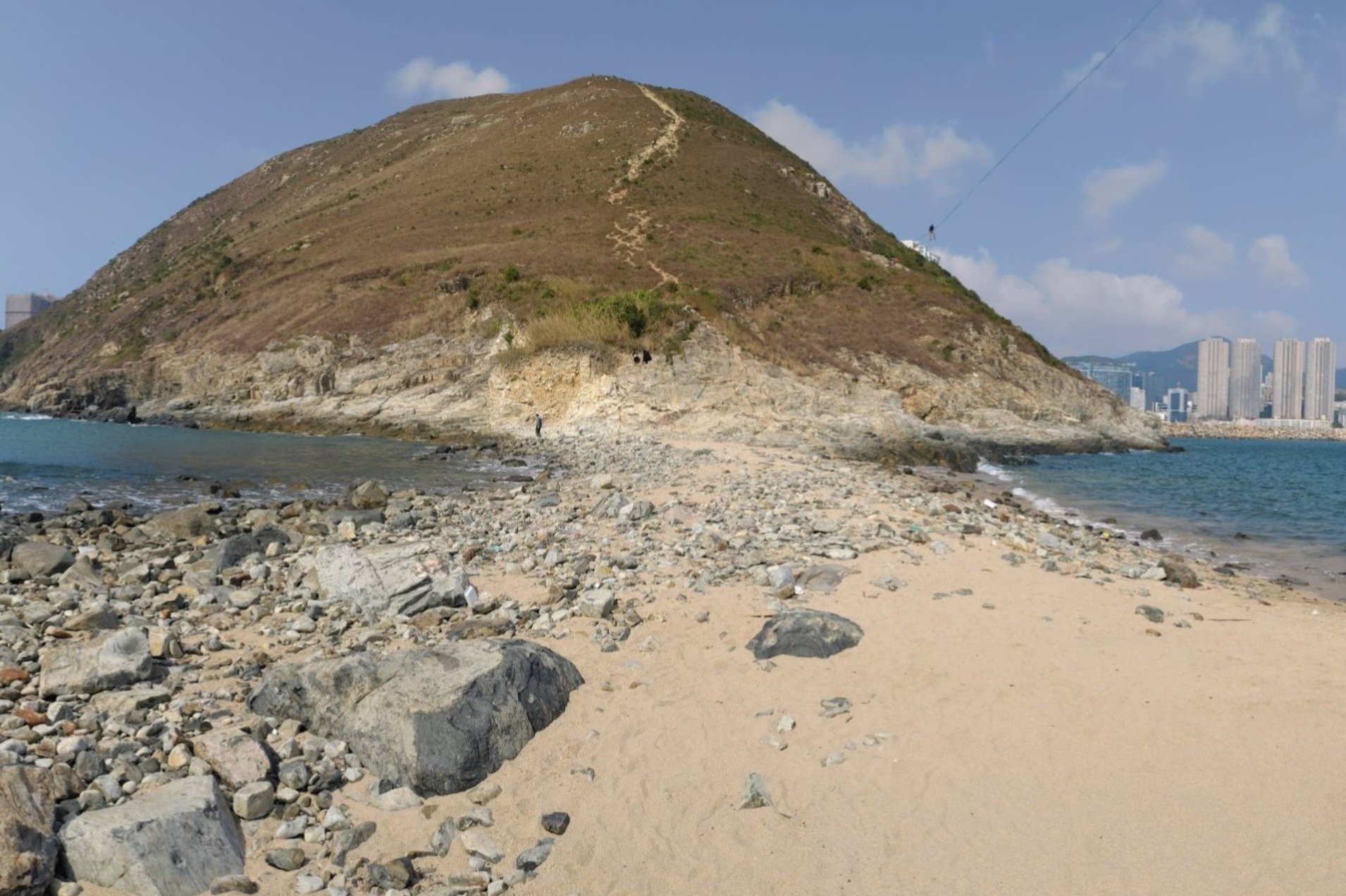
The standout highlights include a strenuous ascent to Mount Johnston’s 198-meter summit, where you’re rewarded with stunning 360-degree views of Hong Kong Island, Lamma Island, Ocean Park, and even Mainland China’s distant waters. After descending to a sandbar (though currently affected by some litter), the route continues with a tricky climb to Ap Lei Pai’s summit and its charming lighthouse, offering breathtaking coastal vistas of the South China Sea.
The hike’s blend of urban proximity, historical significance, rugged natural beauty, and panoramic ocean views makes it a memorable adventure for those seeking a challenging yet rewarding trek.
Ap Lei Pai (Mount Johnston) Google Route Map and GPX File
Ap Lei Chau to Ap Lei Pai Hike GPX File
*Click the box icon in the top right of the map below to load the blue route directly into your own Google Maps. You can then see your location relative to the trail in real time!
Ap Lei Pai (Mount Johnston) Hiking Guide
You can find a full hiking guide below:
2. Castle Peak
Essential Castle Peak Hike Details
- District: Tuen Mun (New Territories)
- Duration: 3 hours there and back
- Distance: 7-8km (assuming you return the same way)
- Highest Elevation: 583m
- Difficulty: 3.5/5
- Facilities: None. So, use the toilet and stock up on water and food beforehand.
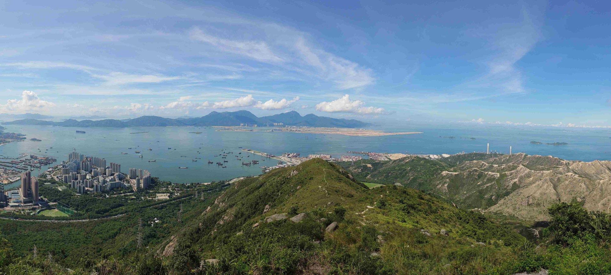
Castle Peak (Tsing Shan)is a rewarding 7-8 km hike in Tuen Mun, New Territories, famous for its steep, relentless stair climb up to 583 meters—the tallest of Hong Kong’s “Three Sharp Peaks.”
The route begins near Tuen Mun MTR and passes the historic Tsing Shan Monastery before ascending a concrete path and a series of yellow- and green-railed staircases. Along the way, hikers enjoy lush greenery, Buddhist shrines, and intriguing abandoned sites. The summit offers breathtaking panoramic views of Tuen Mun, Lantau Island, Shenzhen Bay, and the expansive Castle Peak Hinterlands used as a PLA firing range.
For those seeking extra adventure, an optional but challenging descent into the rugged hinterlands is possible. This hike is ideal for fitness enthusiasts craving a cardio workout combined with cultural landmarks and some of Hong Kong’s most underappreciated vistas.
Castle Peak Google Route Map and GPX
*Click the box icon in the top right of the map below to load the blue route directly into your own Google Maps. You can then see your location relative to the trail in real time!
Castle Peak Hiking Guide
You can find a full hiking guide below:
3. Dragon's Back
Essential Dragon's Back Hike Details
- District: Hong Kong Island
- Duration: Just under 2 hours back to To Tei Wan bus stop. Just under 2.5 hours to Big Wave Bay
- Distance: 5.8km back to To Tei Wan bus stop. 7.5km to Big Wave Bay
- Highest Elevation: 284 meters
- Difficulty: 1.5/5
- Facilities: Public toilets at the start point. Make sure to bring food and water.
Dragon’s Back is Hong Kong’s most famous and accessible hike, celebrated for its stunning coastal views and gentle terrain suitable for all ages and skill levels.
The 5.8 km trail on Hong Kong Island takes about 2 to 2.5 hours, featuring a mix of rocky steps, shaded bamboo groves, and open ridges with panoramic vistas of the South China Sea, Shek O, and Tai Tam Bay. The route’s highlight is the undulating Dragon’s Back ridge itself, culminating at Shek O Peak, where you’re rewarded with breathtaking 360-degree views.
The hike ends near the charming, laid-back beach village of Shek O, or at Big Wave Bay, making this the perfect Hong Kong hike for relaxing by the beach after your trek. Its easy accessibility by public transport, family-friendly difficulty, and spectacular ocean scenery make Dragon’s Back a must-do for both locals and visitors.
Dragon's Back Google Route Map and GPX
*Click the box icon in the top right of the map below to load the blue route directly into your own Google Maps. You can then see your location relative to the trail in real time!
Dragon's Back Hiking Guide
You can find a full hiking guide below:
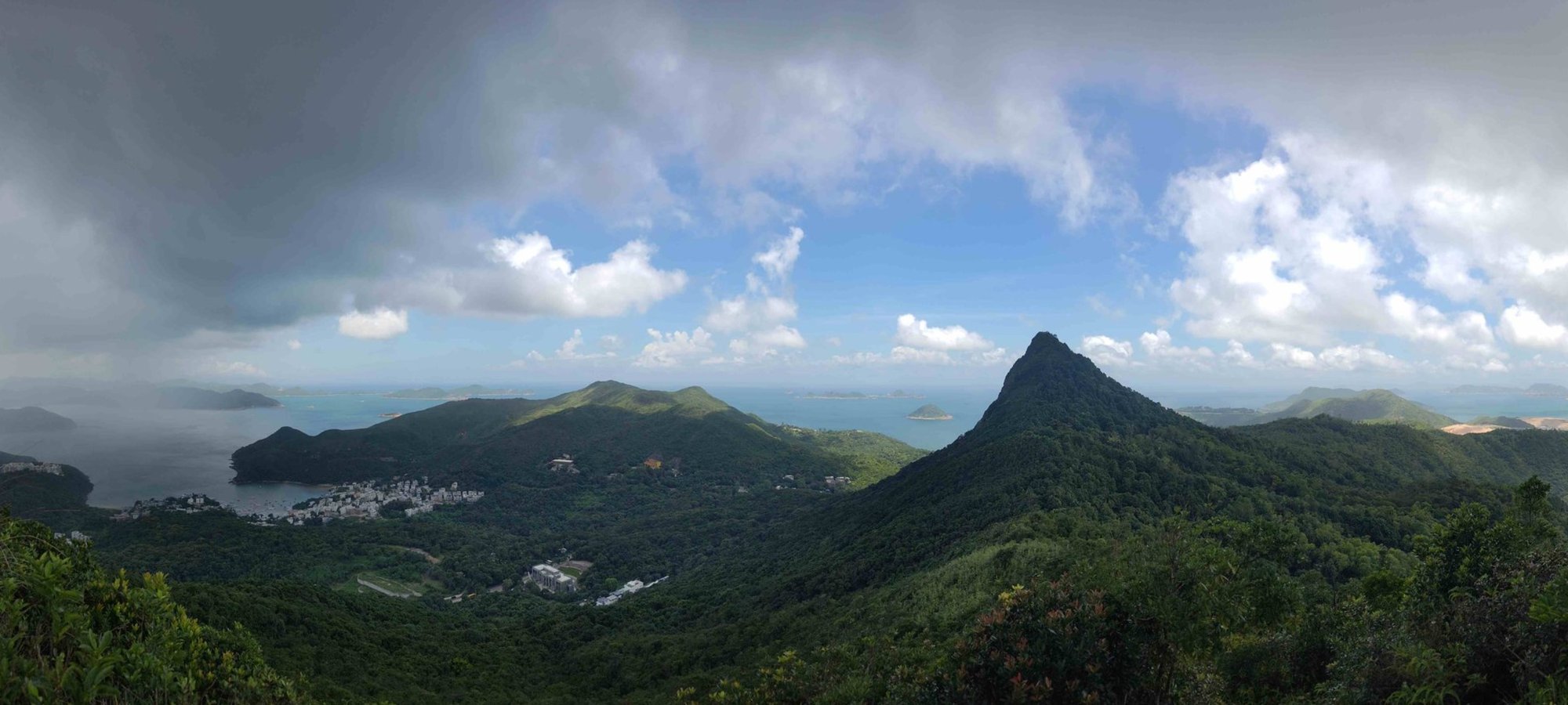
4. High Junk Peak
Essential High Junk Peak Hike Details
- District: Clear Water Bay (NT)
- Duration: Easy Route: 1 hour, Medium Route: 1.5-2 hours, Tough Route: 3-3.5 hours
- Distance: 4.5-6.7 km depending on which route you take
- Highest Elevation: 344 meters
- Difficulty: Easy Route: 1.5/5, Medium Route: 2.5/5, Hard Route: 3/5
- Facilities: No facilities on the hike. Bring drinks and food with you.
High Junk Peak offers three distinct hiking routes—easy, medium, and hard—catering to all skill levels while showcasing some of Hong Kong’s most stunning coastal and mountain views.
The easy route is a gentle, shaded loop around the mountain through bamboo forests, perfect for beginners and families. The medium route adds a rewarding summit climb to High Junk Peak’s 344-meter peak, where hikers are treated to spectacular 360-degree panoramas of Kowloon, Hong Kong Island, Clear Water Bay, Sai Kung, and the South China Sea. The hard route extends beyond the summit, ascending nearby Tin Ha Shan for even more breathtaking, unobstructed coastal views and a challenging workout.
With its iconic sharp peak silhouette, diverse scenery—from lush bamboo groves to rugged stone steps—and azure coastal vistas, this hike is a fantastic choice for anyone wanting a Hong Kong hike with diverse scenery that's just outside the city.
High Junk Peak Route Map and GPX
High Junk Peak Medium Route GPX
*Click the box icon in the top right of the map below to load the blue route directly into your own Google Maps. You can then see your location relative to the trail in real time!
High Junk Peak Hiking Guide
You can find a full hiking guide below:
5. Kai Shan

Essential Kai Shan Hike Details
- District: New Territories
- Duration: 1 hour and 15 minutes
- Distance: 3.6km
- Highest Elevation: 121 meters
- Difficulty: 1/5
- Facilities: None. Use the toilet and stock up on drinks beforehand
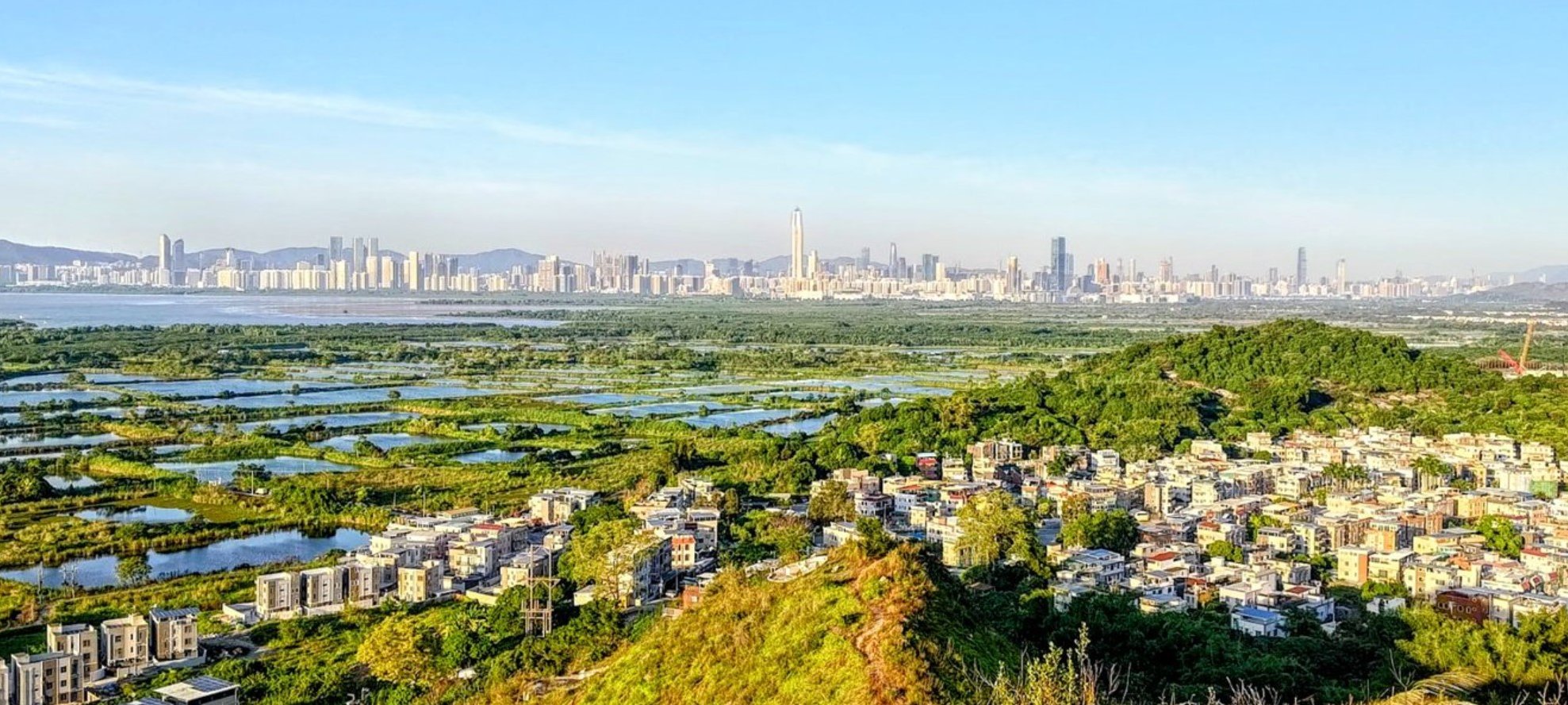
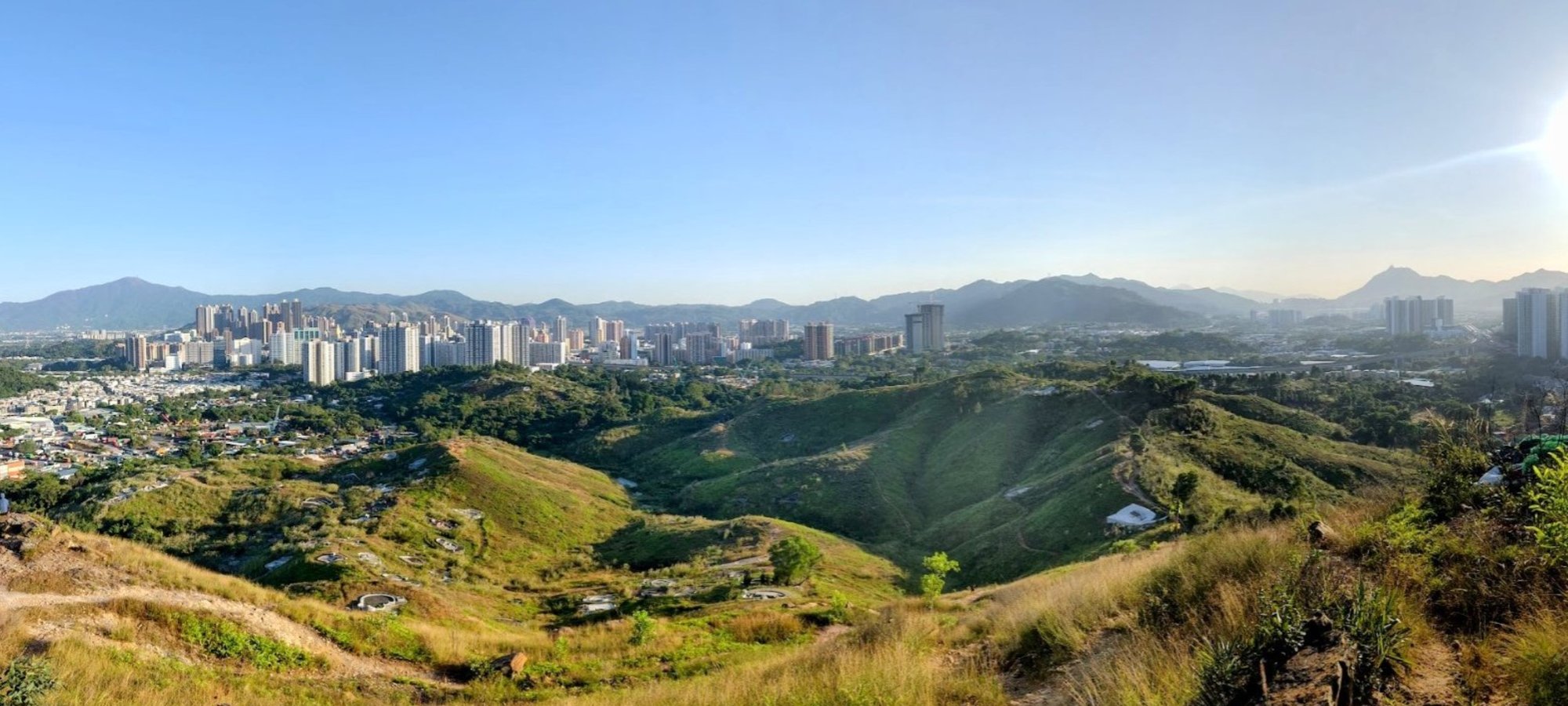
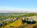
Kai Shan is an easy 3.6 km hike in Yuen Long, New Territories, taking about 1 hour and 15 minutes, perfect for a quick nature escape with unique cultural and scenic highlights.
The trail features gentle climbs to three small peaks, with the summit offering panoramic views of the nearby Fung Lok Wai, Nam Sang Wai, and Tai Sang Wai fish farms, framed by the striking Shenzhen skyline. Along the route, hikers can explore ancient rock paintings, a shrine dedicated to the Hindu god Shiva, and tombs linked to the historic Tang Clan, adding a rich cultural dimension to the experience.
The well-marked path starts near Tin Shui Wai MTR Station and ends near a village where you can catch a green minibus back to Long Ping MTR. This hike’s combination of easy terrain, fascinating heritage sites, and stunning fish farm vistas makes it an ideal choice for casual hikers and those interested in Hong Kong's rural scenery.
Kai Shan Hike Google Route Map and GPX
Kai Shan Hiking Route GPX File
*Click the box icon in the top right of the map below to load the blue route directly into your own Google Maps. You can then see your location relative to the trail in real time!
Kai Shan Hiking Guide
You can find a full hiking guide below:
6. Lantau Peak
Essential Lantau Peak Hike Details
- District: Lantau
- Duration: 2 hours 45 mins. Your timing may vary depending on your speed.
- Distance: 6.1 km
- Highest Elevation: 934 meters
- Difficulty: 4/5
- Facilities: None
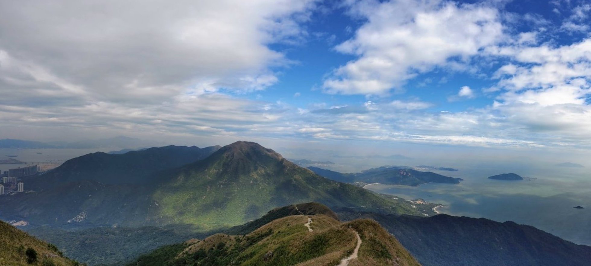
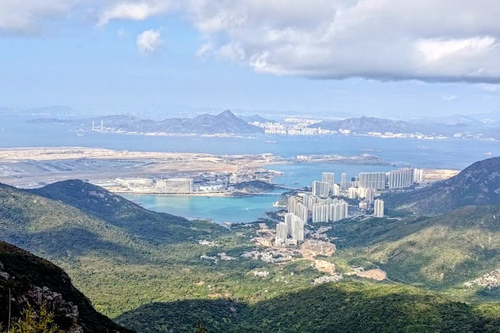
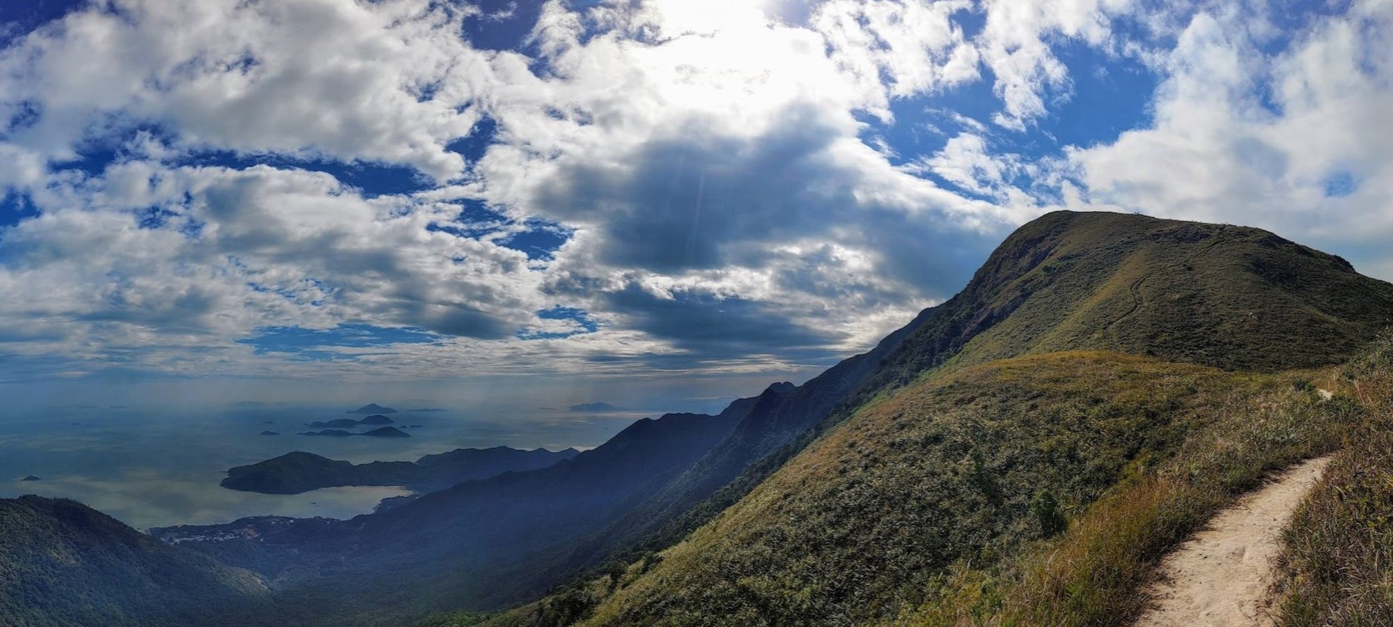
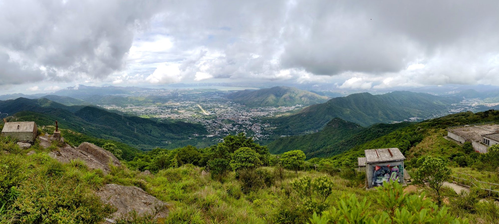
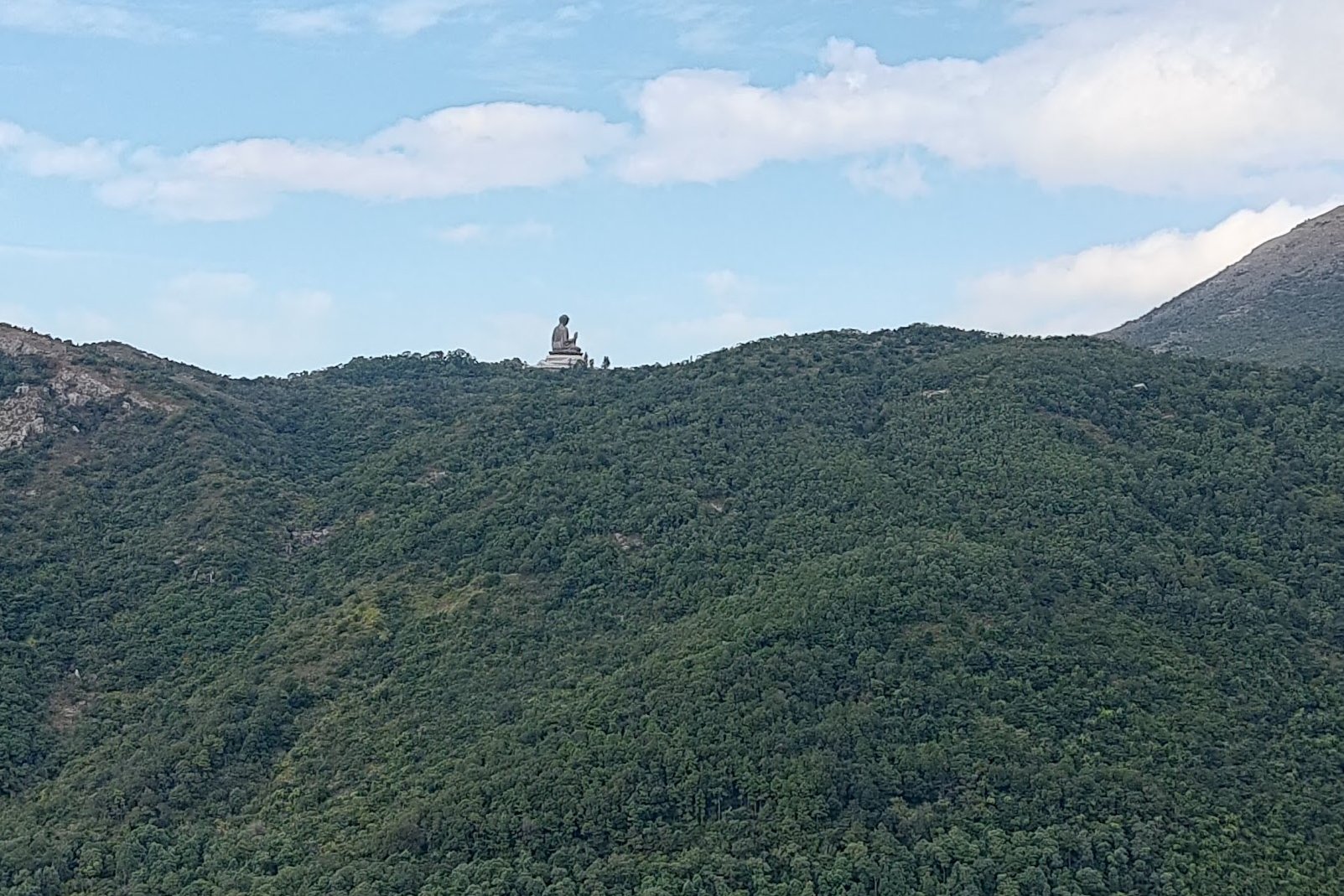
Lantau Peak, Hong Kong’s second tallest mountain at 934 meters, offers a challenging yet incredibly rewarding hike dominated by long stair climbs.
Starting from Pak Kung Au, the 6.1 km trail features a steep ascent on well-marked stairs, with minimal shade, making it a tough but straightforward route. The summit rewards hikers with stunning 360-degree panoramic views, including the airport, Sunset Peak, and the South China Sea.
After reaching the peak, the trail descends via another long staircase to Ngong Ping Village, home to the iconic Big Buddha and Po Lin Monastery, where you can rest and grab refreshments.
This hike is perfect for those seeking a strenuous workout paired with some of Hong Kong’s most breathtaking mountain and coastal vistas, capped off by a cultural and scenic finale at Ngong Ping.
Lantau Peak Google Route Map and GPX
*Click the box icon in the top right of the map below to load the blue route directly into your own Google Maps. You can then see your location relative to the trail in real time!
Lantau Peak Hiking Guide
You can find a full hiking guide below:
7. Lion Rock
Essential Lion Rock Hike Details
- District: Tai Wai (NT)
- Duration: (if returning to Tai Wai): 2-3 hours
- Distance: 7-8km round trip
- Elevation: 495 meters
- Difficulty: 3.5/5
- Facilities: Vending machine, public toilet at start point
The Lion Rock and Amah Rock hike from Tai Wai is a quieter, less crowded alternative to the usual routes, offering a rewarding 7-8 km round trip with about 2-3 hours of hiking.
Starting with a steep but shaded climb that I like to call the "Stairs of Suffering," the trail leads you past cultural highlights like the legendary Amah Rock—a striking 15-meter stone formation linked to a poignant folk tale—and offers stunning views of the Shatin district, Shing Mun River, and Ma On Shan.
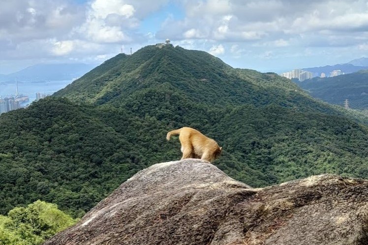
The hike culminates at Lion Rock’s 495-meter summit, where panoramic vistas of Kowloon, Hong Kong Island, and the New Territories await, along with chances to spot playful macaques.
This route’s blend of cultural lore, natural beauty, and urban skyline views makes it a gem for both locals and visitors seeking one of Hong Kong's most famous city views.
Lion Rock Google Route Map and GPX
Amah Rock and Lion Rock Hike GPX
*Click the box icon in the top right of the map below to load the blue route directly into your own Google Maps. You can then see your location relative to the trail in real time!
Lion Rock Hiking Guide
You can find a full hiking guide below:
8. Ma On Shan
Essential Ma On Shan Hike Details
- District: New Territories
- Duration: 4.5-6 hours (depending on how you reach the start point)
- Distance: 11-12 km
- Max Elevation: 702 meters
- Difficulty: 4.5/5
- Facilities: public toilet at BBQ area before the real hike begins
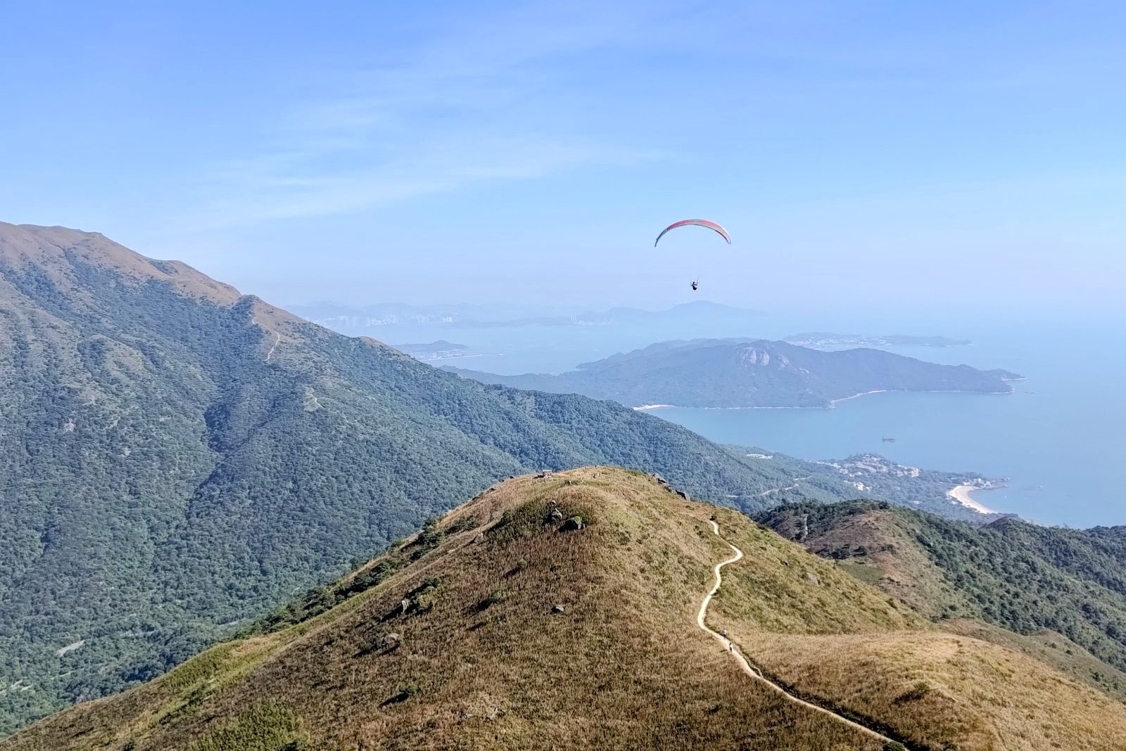
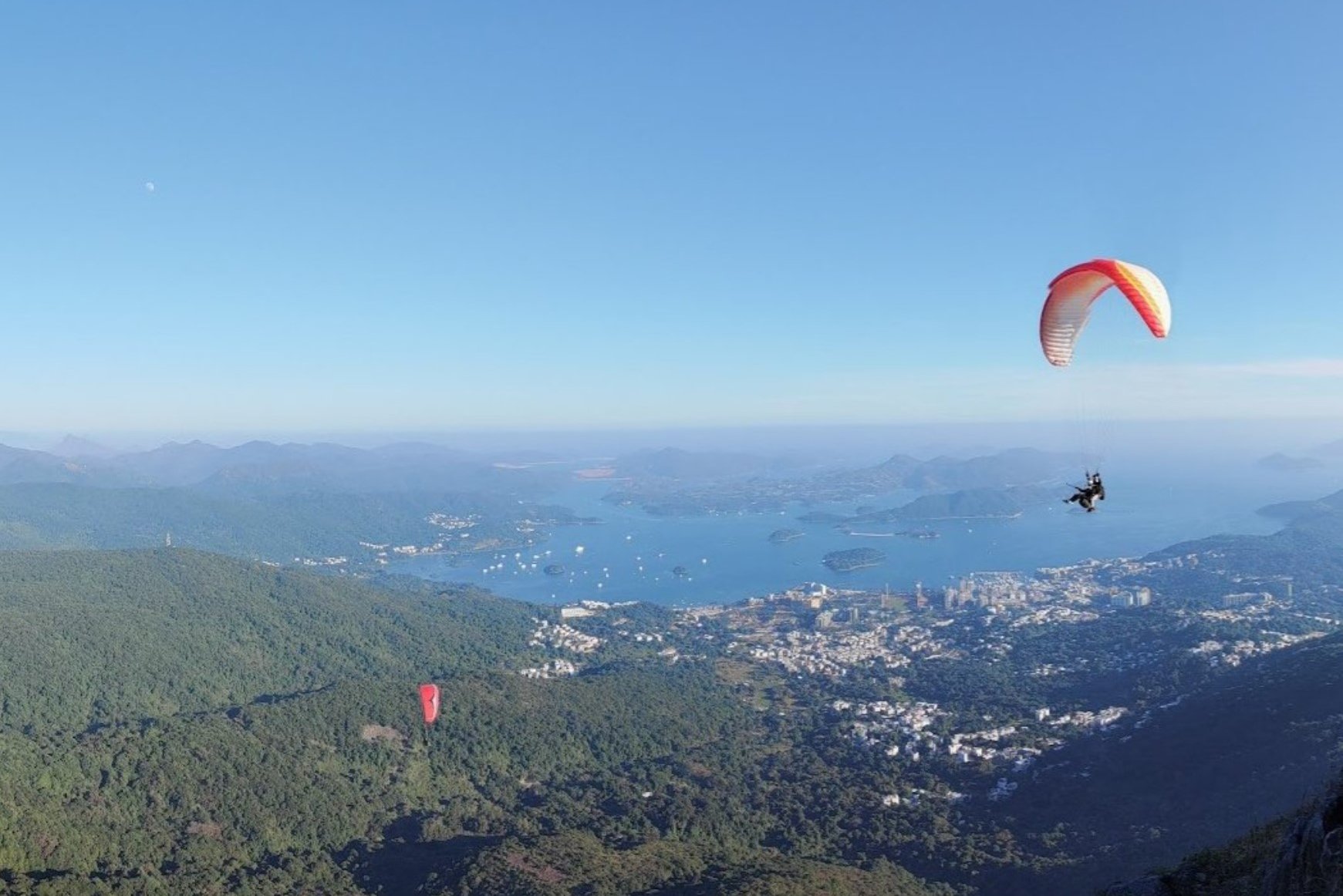
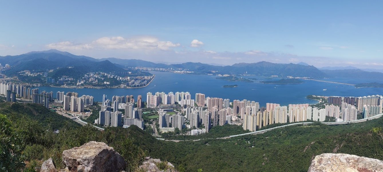
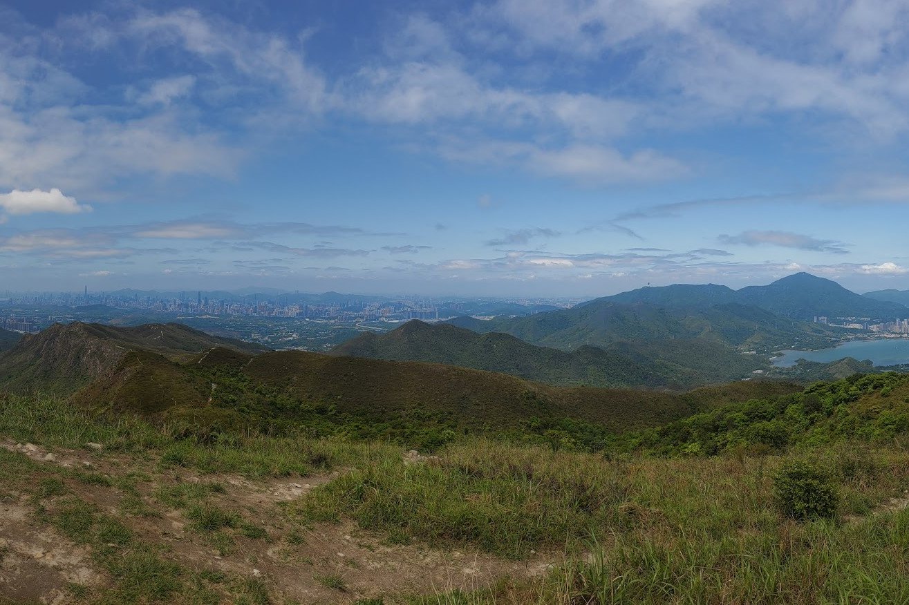
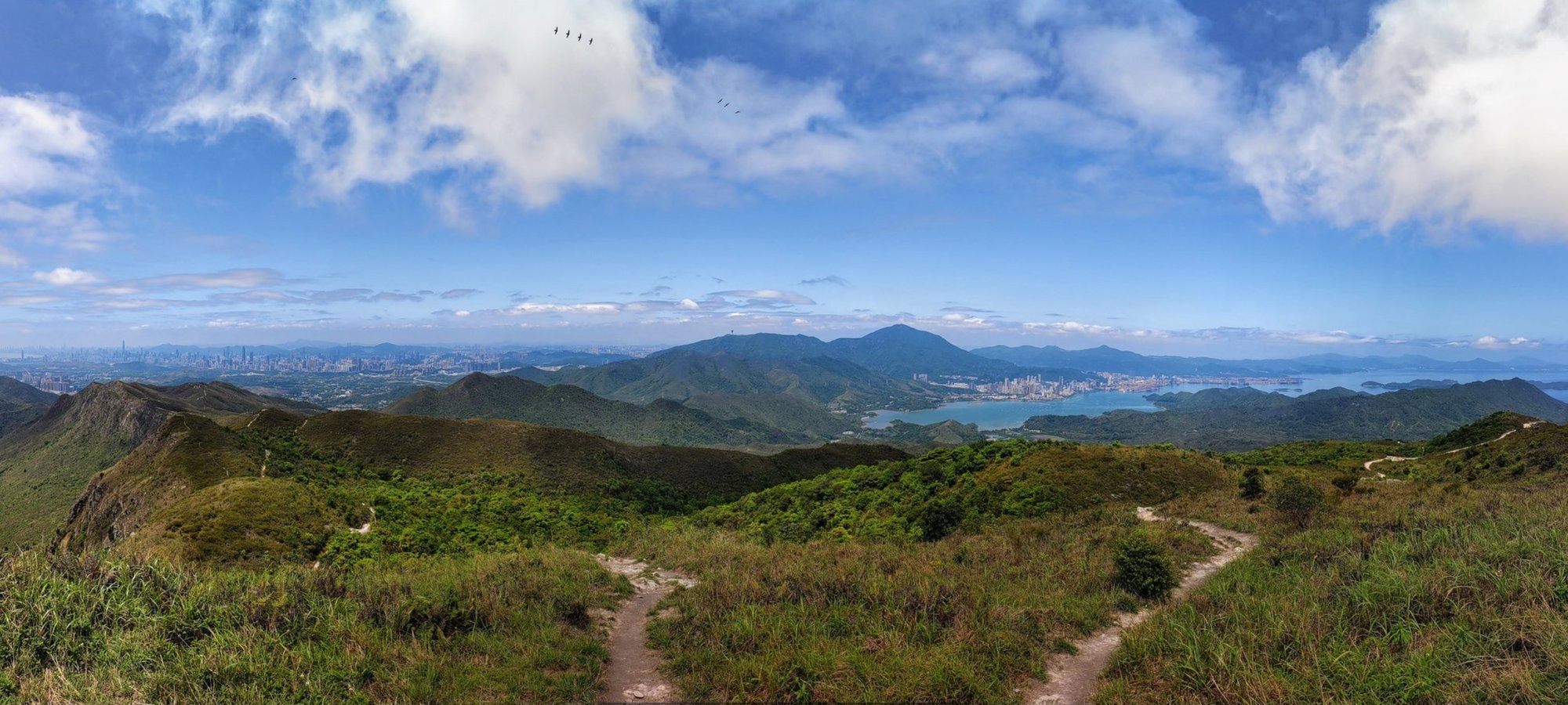
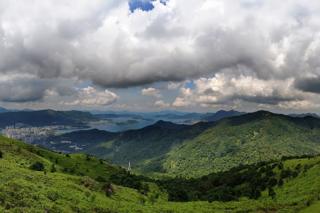
Ma On Shan, which I believe to be Hong Kong’s most dramatic ridge, is a challenging 11-12 km hike in the New Territories that takes 4.5 to 6 hours and demands good fitness and some scrambling skills.
Starting from the Ma On Shan Country Park BBQ Site, the trail features steep, rocky climbs where hikers often need to use their hands to facilitate the climb.
The highlight is the stunning U-shaped ridge, which offers breathtaking panoramic views of undulating mountains, turquoise waters, and vibrant villages, with paragliders frequently soaring nearby.
After traversing the ridge, the descent passes Pyramid Hill and the peaceful Ngong Ping Campsite before ending in Sai Kung, which is the perfect spot for post-hike refreshments.
This hike combines intense physical challenge with some of Hong Kong’s most spectacular natural scenery and rewarding vistas, making it a must for experienced hikers seeking adventure and beauty.
Ma On Shan Google Route Map and GPX
Ma On Shan Station to Ma On Shan Village GPX
I've included two start points in the map below (green pins). One is if you take the bus or a taxi to the start and one is if you decide to walk there from Ma On Shan MTR Station.
*Click the box icon in the top right of the map below to load the blue route directly into your own Google Maps. You can then see your location relative to the trail in real time!
Ma On Shan Hiking Guide
You can find a full hiking guide below:
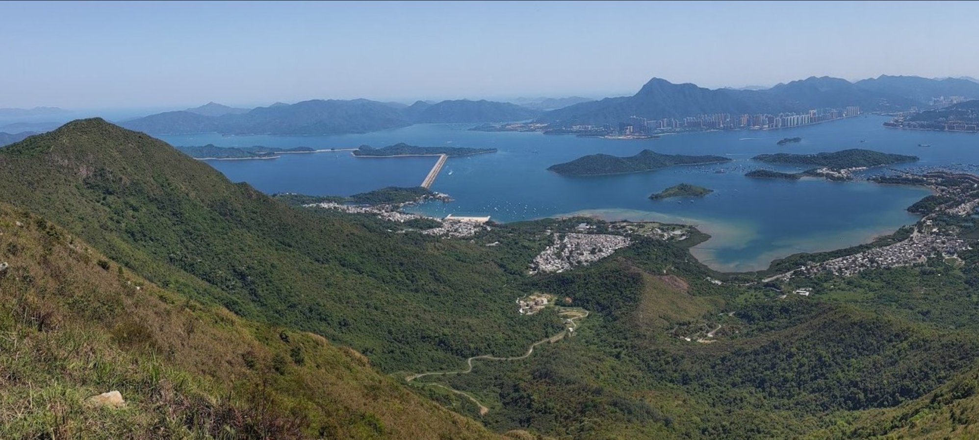
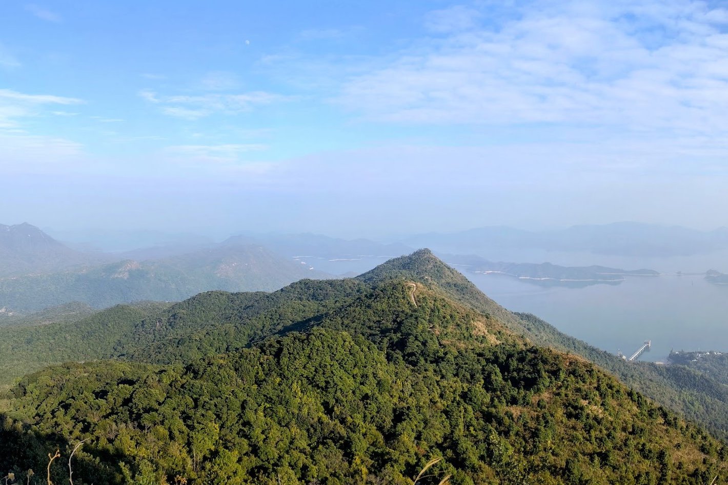
9. Pat Sin Leng
Essential Pat Sin Leng (Eight Immortals) Hike Details
- District: New Territories
- Duration: Between 4 hours and 15 minutes and 5+ hours depending on fitness, hiking speed and rest stops
- Distance: 12.2km - including the walk to Tai Mei Tuk
- Highest Elevation: 639 meters
- Difficulty: 4/5
- Facilities: Toilets available at the start. Make sure to stock up on liquids and food before arriving at the start point
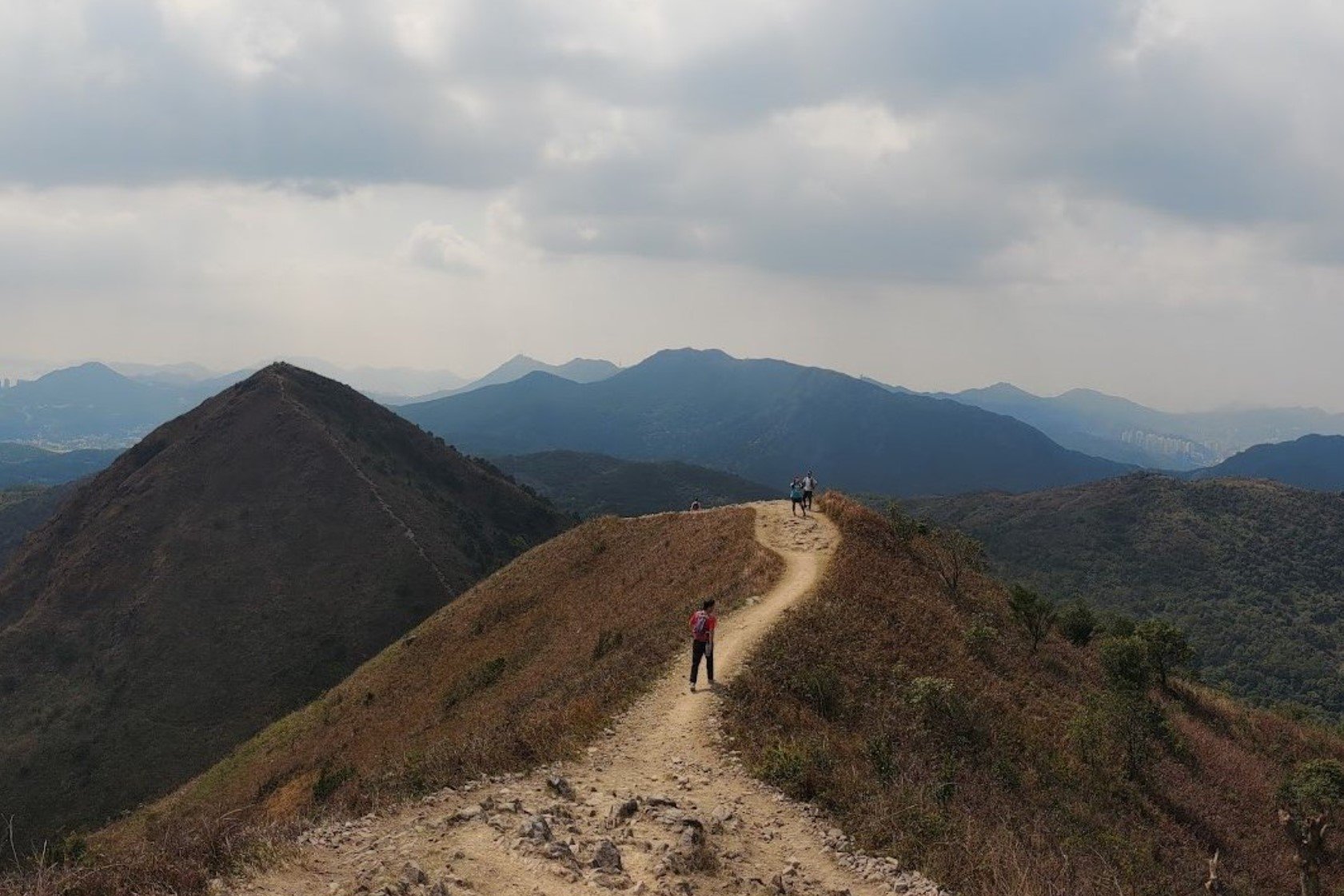
Pat Sin Leng, known as the Eight Immortals, is a legendary and challenging 12.2 km hike in Hong Kong’s New Territories that takes between 4 to 5+ hours depending on fitness and pace.
The trail begins at Hok Tau Wai Pavilion and features a tough initial climb up steep stone stairs, testing both fitness and mental stamina. Once past the ascent, hikers are rewarded with incredible scenery reminiscent of postcard landscapes—undulating green mountains, coastal views, and clear sights into Shenzhen, China. The route traverses eight peaks named after Taoist immortals from old legends, each with its own unique character and stunning viewpoints.
The hike concludes with a descent to Tai Mei Tuk, a bustling village where you can rest and find transport back to the city.
Combining rigorous climbs, mystical cultural significance, and spectacular panoramic vistas, Pat Sin Leng is one of Hong Kong's most legendary hikes!
Pat Sin Leng Google Route Map and GPX
*Click the box icon in the top right of the map below to load the blue route directly into your own Google Maps. You can then see your location relative to the trail in real time!
Pat Sin Leng Hiking Guide
You can find a full hiking guide below:
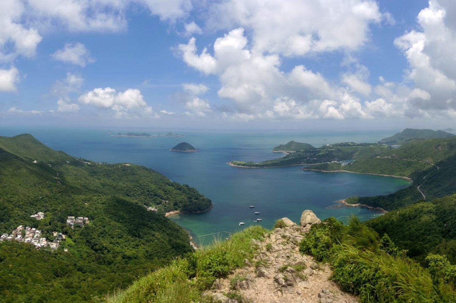
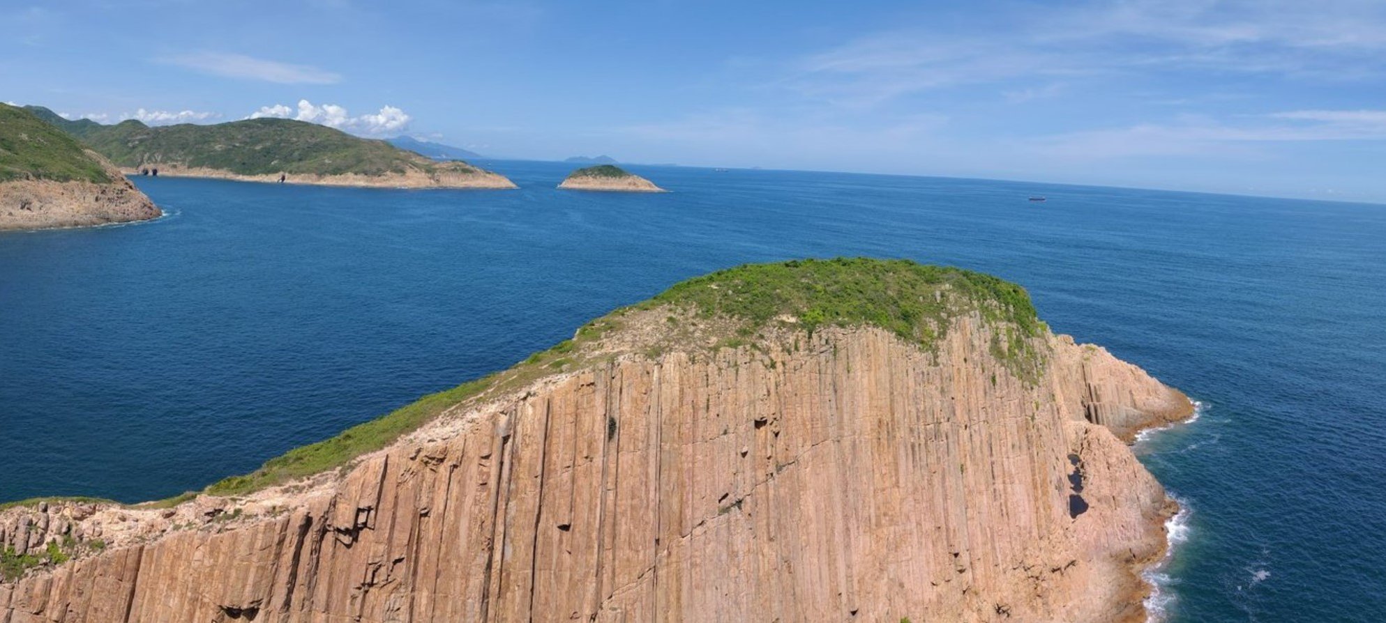
10. Po Pin Chau
Essential Po Pin Chau Hike Details
- District: New Territories
- Duration: 1.5 hours
- Distance: 3ish km
- Highest Elevation: 95 meters
- Difficulty: 1/5
- Facilities: None during the hike. Stock up on food and water and use the toilet beforehand
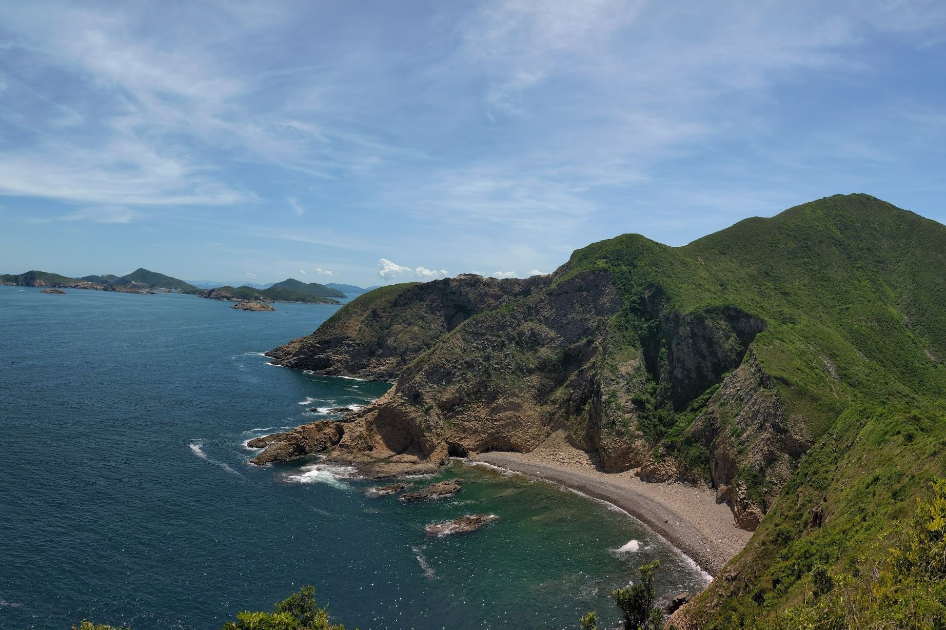
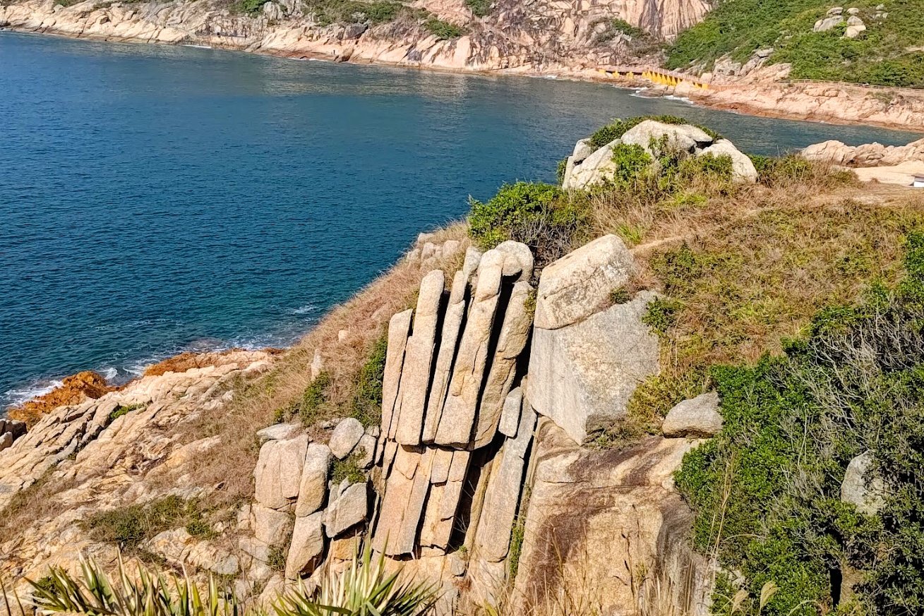
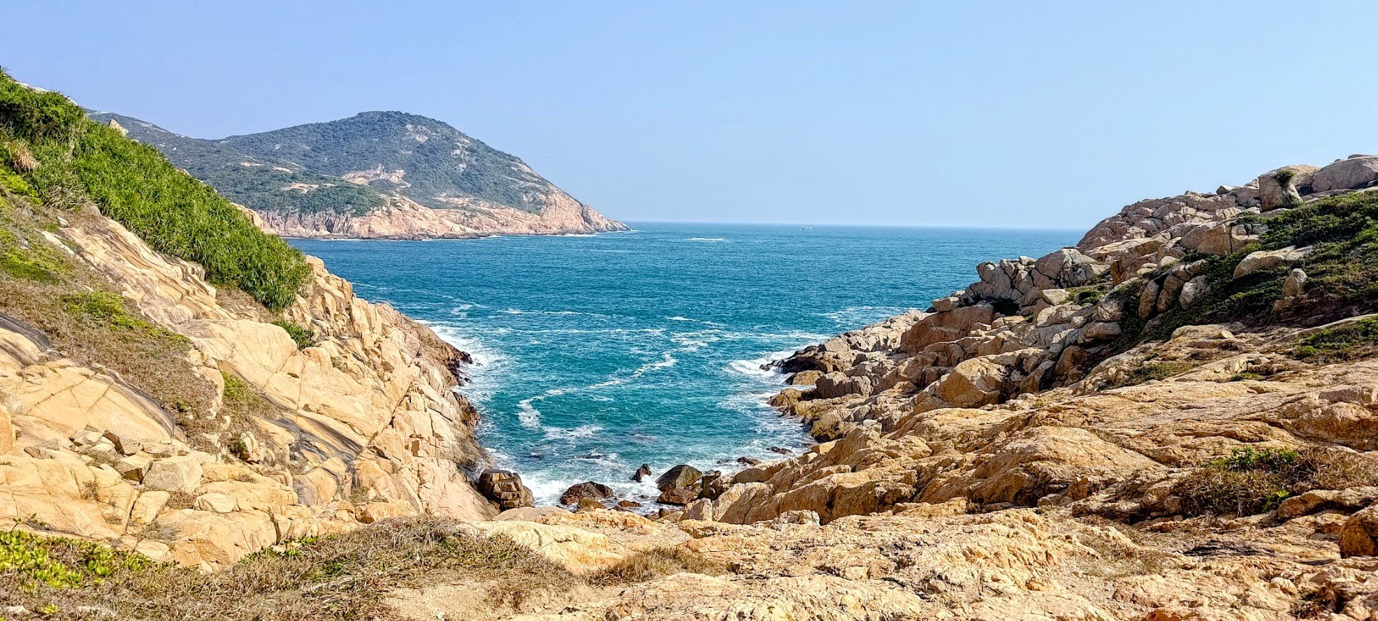
Po Pin Chau is a short, but visually stunning 3 km hike located at the very edge of Hong Kong’s Sai Kung Geopark. Starting from East Dam, the trail takes about 1.5 hours and features a mix of gentle ascents and some steep, technical sections that require careful footing.
Highlights include the Fa Shan viewpoint with panoramic views over High Island Reservoir and the South China Sea, a descent past a sadly littered "Trash Beach," and a dramatic climb to the iconic Po Pin Chau sea stack viewpoint, offering breathtaking coastal scenery.
The hike’s accessibility, combined with its spectacular ocean vistas and unique geological formations, makes it a must-visit for nature lovers and photographers.
To avoid crowds, weekdays are best, as weekends and holidays can get busy. For those seeking more adventure, the hike can be easily paired with the nearby High Island Reservoir trail for extended exploration.
Po Pin Chau Google Route Map and GPX
*Click the box icon in the top right of the map below to load the blue route directly into your own Google Maps. You can then see your location relative to the trail in real time!
Po Pin Chau Hiking Guide
You can find a full hiking guide below:
11. Po Toi
Essential Po Toi Hike Details
- District: New Territories
- Duration: 3 hours (for Route No. 3, which is the toughest route on the island)
- Distance: 8 km
- Highest Elevation: 150ish meters
- Difficulty: 3/5
- Facilities: There’s a public toilet where you get off the ferry and some shops to buy drinks
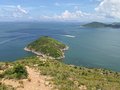
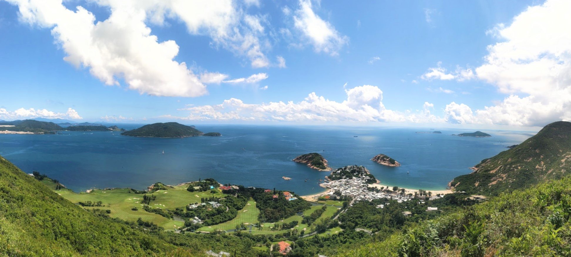
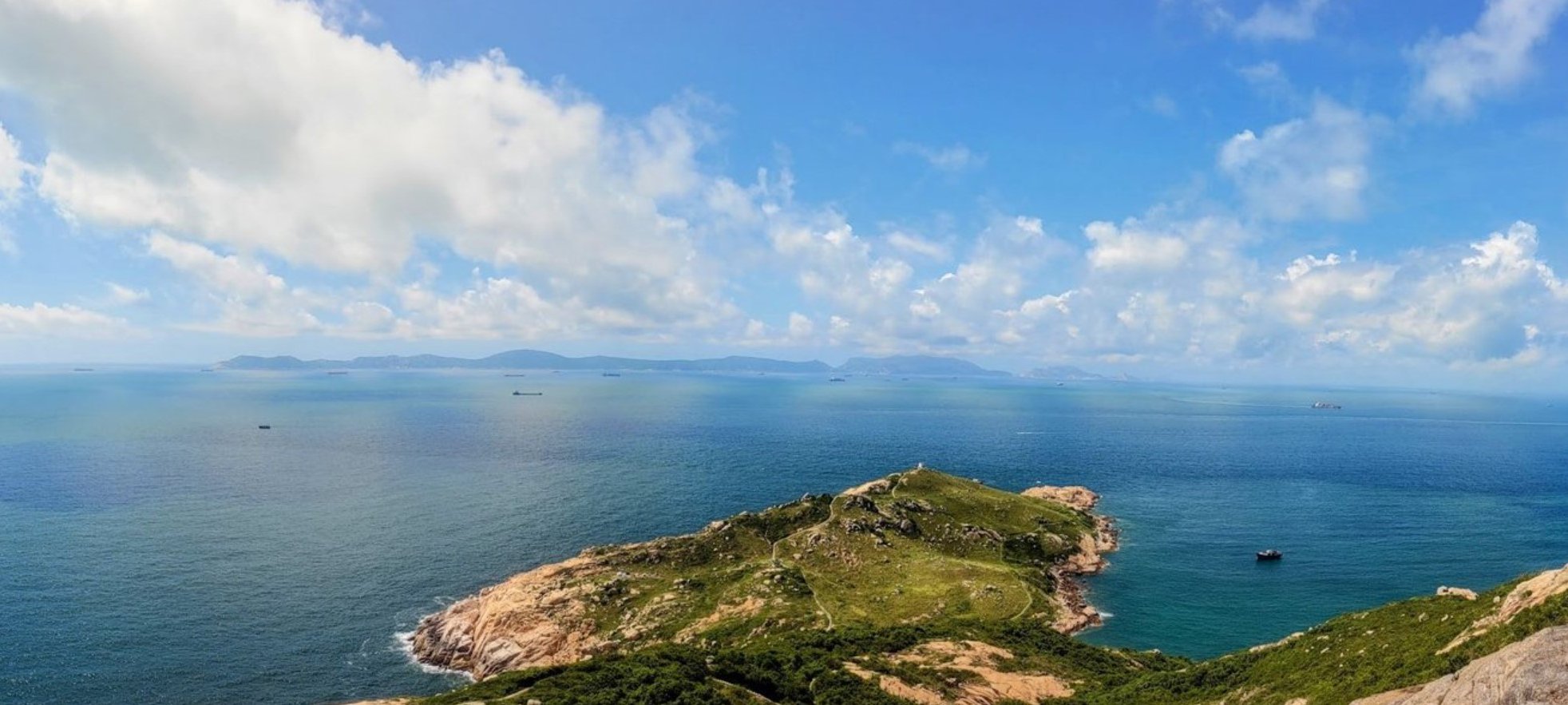
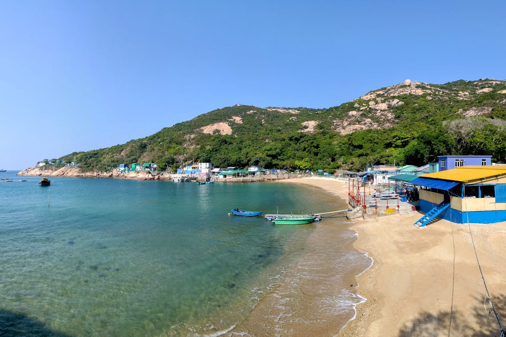
Po Toi Island’s Route No. 3 (the most rugged trail on the island) hike is an adventurous 8 km trek lasting about 3 hours that explores Hong Kong’s southernmost island. The hike is rich in folklore, history, and dramatic coastal scenery.
Accessible by ferry from Aberdeen or Stanley, Po Toi features rugged terrain with scenic highlights including an abandoned school, the historic Tin Hau Temple, ancient 3,000-year-old rock carvings, and unique rock formations resembling a snail, monk, and palm. The trail ascends to a pavilion with panoramic ocean views, then descends to Nam Kok Tsui Lighthouse—the southernmost active lighthouse in Hong Kong—before continuing along coastal cliffs and beaches.
Optional detours include visiting the eerie Mo’s Haunted Manor and Hong Kong's southernmost point. With its blend of cultural heritage, striking cliffside vistas, and a sense of remoteness, Po Toi offers a captivating and off-the-beaten-path hiking experience perfect for those seeking rugged beauty and island mystery.
Po Toi Google Route Map and GPX
*Click the box icon in the top right of the map below to load the blue route directly into your own Google Maps. You can then see your location relative to the trail in real time!
Po Toi Hiking Guide
You can find a full hiking guide below:
12. Red Incense Burner Summit


Essential Red Incense Burner Hill Hike Details
- District: Hong Kong Island
- Duration: 30 minutes round trip (with no breaks)
- Distance: 1.5ish km depending on the start point
- Highest Elevation: 230 meters
- Difficulty: 0.5/5
- Facilities: None. Stock up on water and use the toilet beforehand
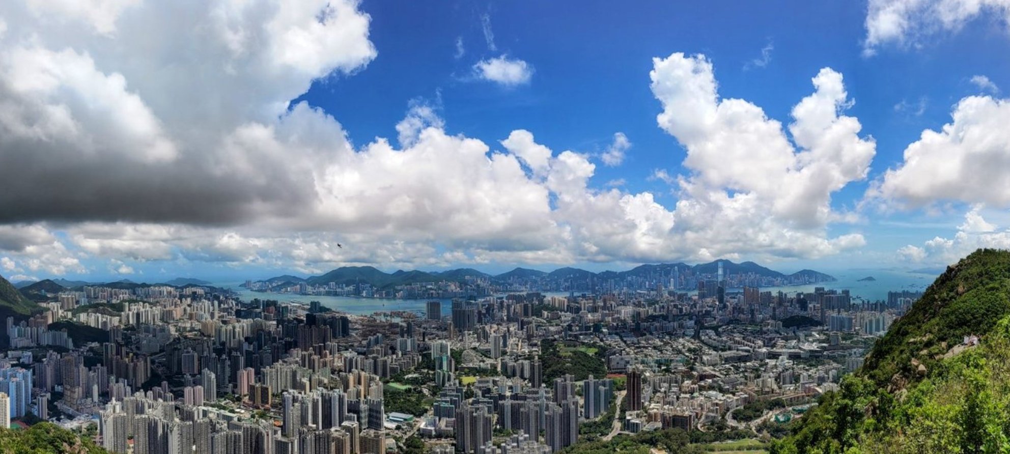
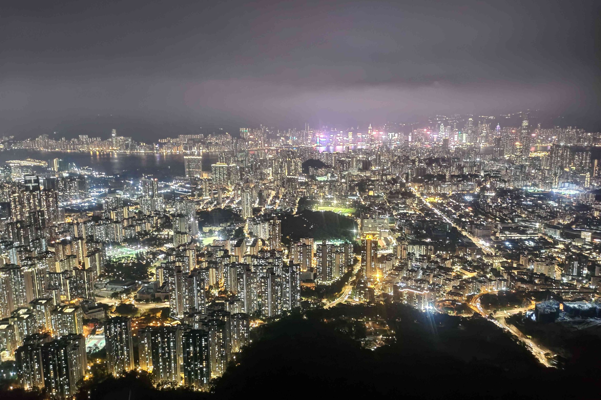
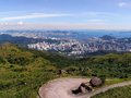
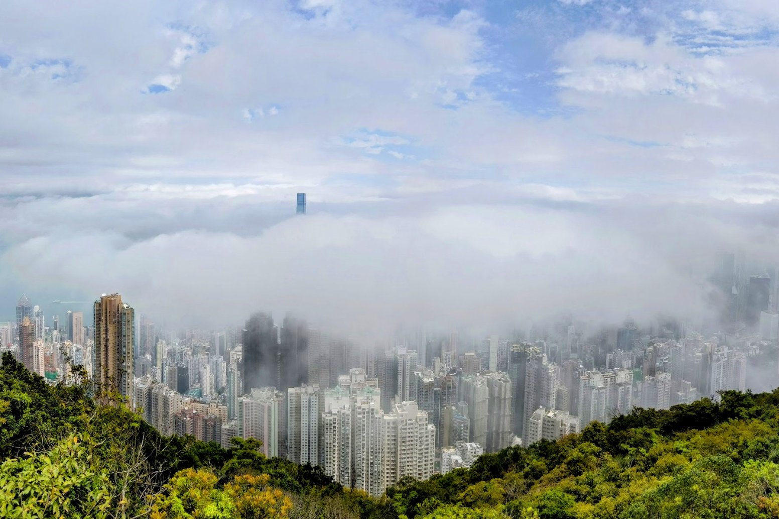
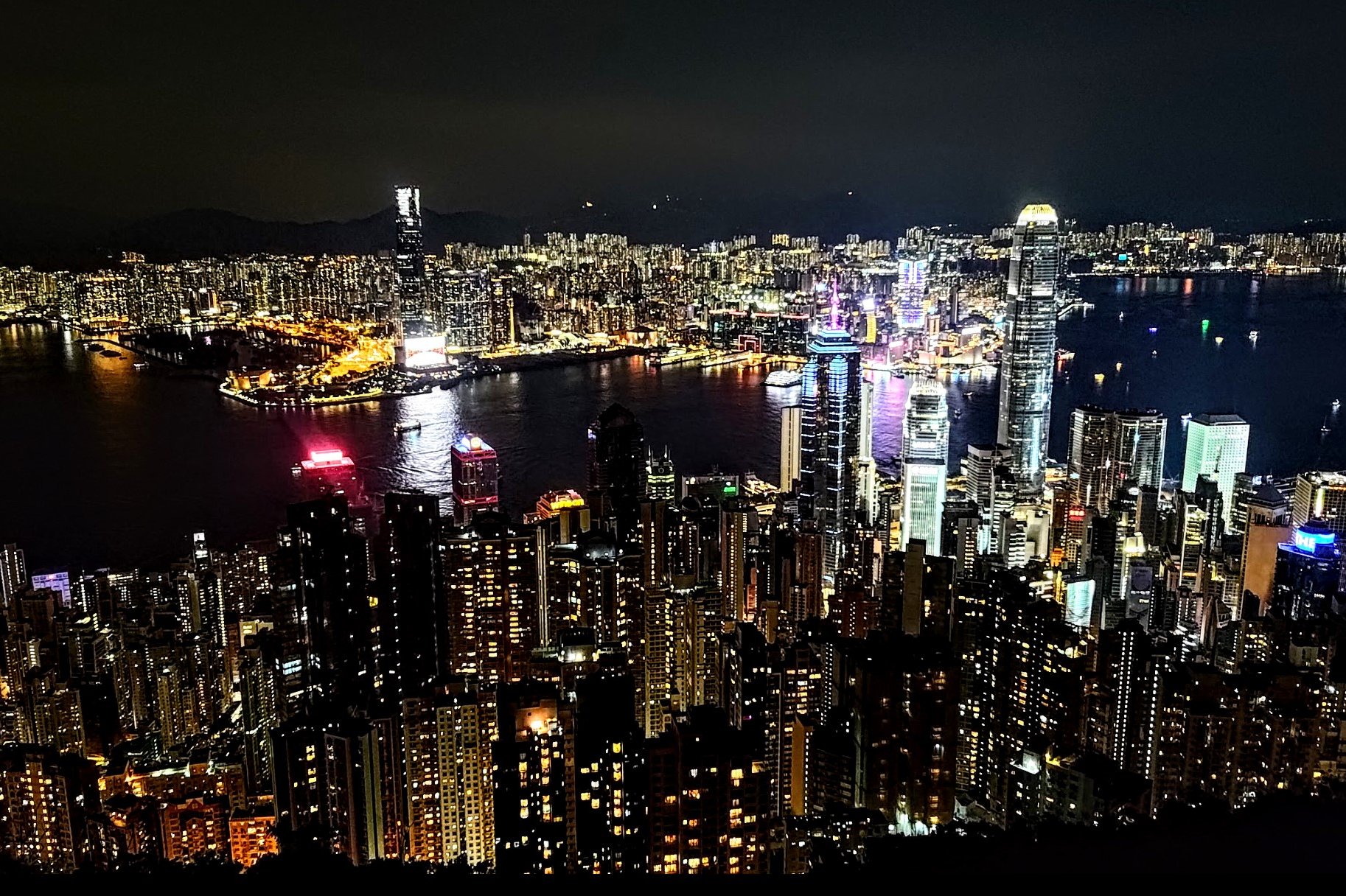
Red Incense Burner Summit (Hung Heung Lo Fung) is a short but rewarding hike on Hong Kong Island, reaching 228 meters and offering arguably some of the best 360-degree panoramic views of Hong Kong, including Victoria Harbour, Kowloon, and Hong Kong Island itself.
The hike takes about 15 to 30 minutes from the start point near St. Joan of Arc Secondary School or the Braemar Hill bus terminus, making it an ideal quick escape from the city. The trail includes a mix of concrete paths, natural earth trails, and a final short but slightly steep climb over boulders to the summit, requiring some careful footing.
Despite its brevity and moderate difficulty, the summit provides stunning vistas often considered comparable or even superior to Victoria Peak, with far fewer crowds, especially on weekdays. The area is also a popular spot for watching fireworks over the harbor. For those seeking quieter views, a short detour along Sir Cecil’s Ride leads to a less-frequented lookout point with equally impressive scenery.
The hike’s combination of accessibility and spectacular views make it a gem for both locals and visitors looking for a quick but unforgettable outdoor experience.
Red Incense Burner Summit Google Route Map and GPX
Red Incense Burner Summit Hike GPX File
*Click the box icon in the top right of the map below to load the blue route directly into your own Google Maps. You can then see your location relative to the trail in real time!
Red Incense Burner Summit Hiking Guide
You can find a full hiking guide below:

13. Robin's Nest
Essential Robin's Nest Hike Details
There are two start points to the Robin's Nest hike that converge after about 40-50 minutes of climbing. I recommend the safe route versus the wild route, but outline both ascents in this guide.
- District: New Territories
- Duration: 3.5 - 4 hours for the wild route (not recommended for beginners), 4.5+ hours for the safe route.
- Distance: 8.6km for the wild route, 10km for the safe route
- Highest Elevation: 474 meters
- Difficulty: 4.5/5 for the wild route, 4/5 for the safe route
- Facilities: None, so bring plenty of water and use the toilet beforehand
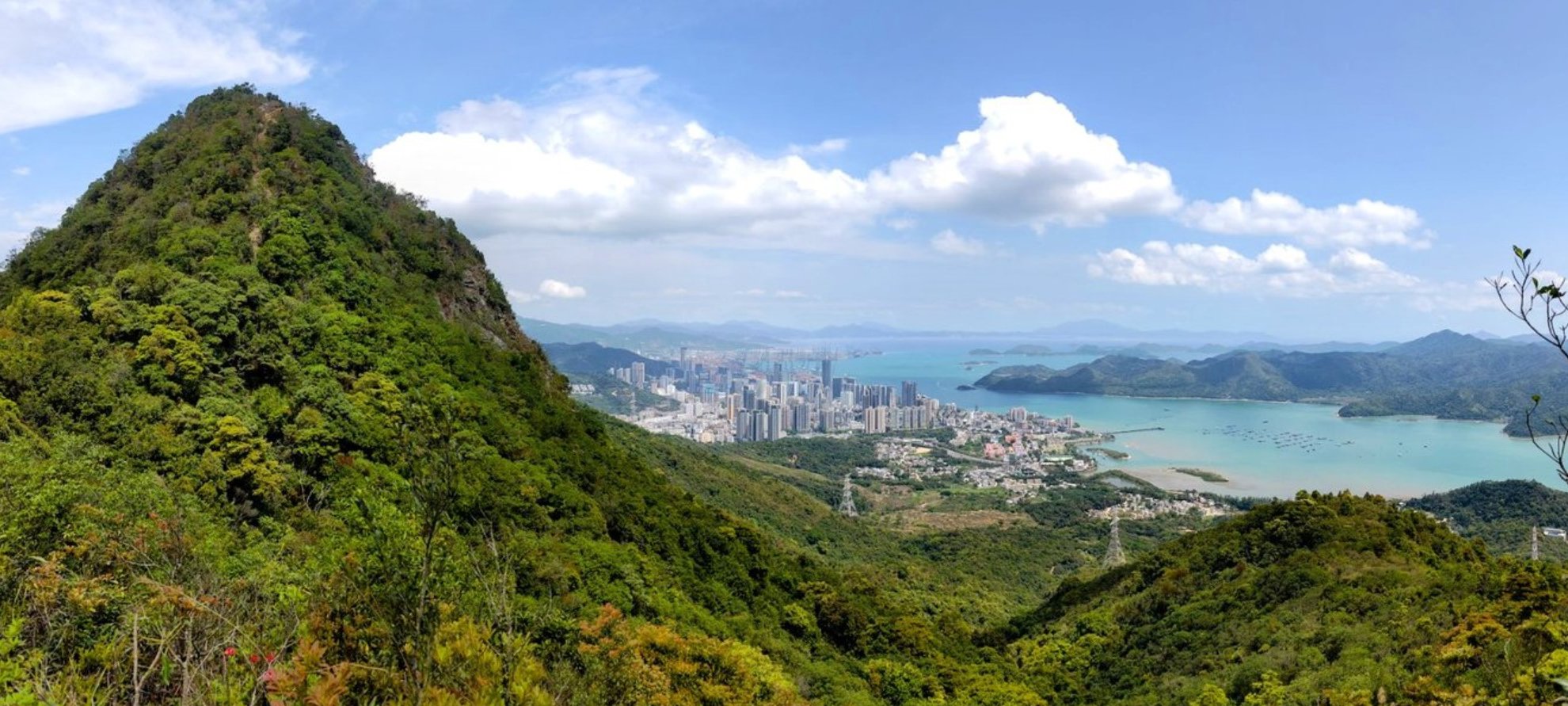
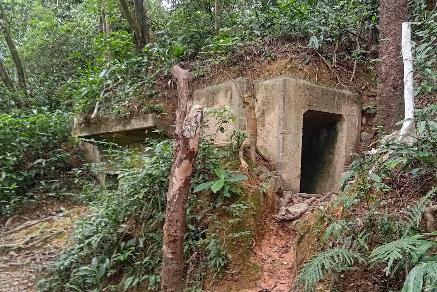
The Robin's Nest and Lin Ma Hang Caves hike is a unique adventure located in Hong Kong’s New Territories. It is officially part of the newly designated Robin's Nest Country Park, which opened to the public in March, 2024.
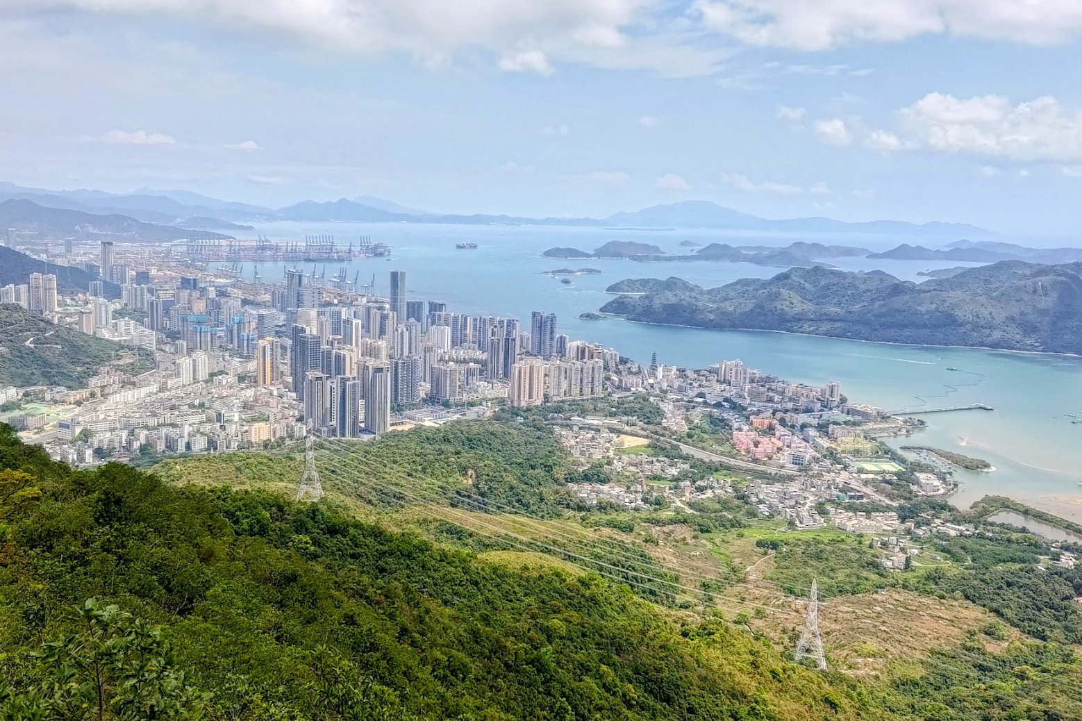
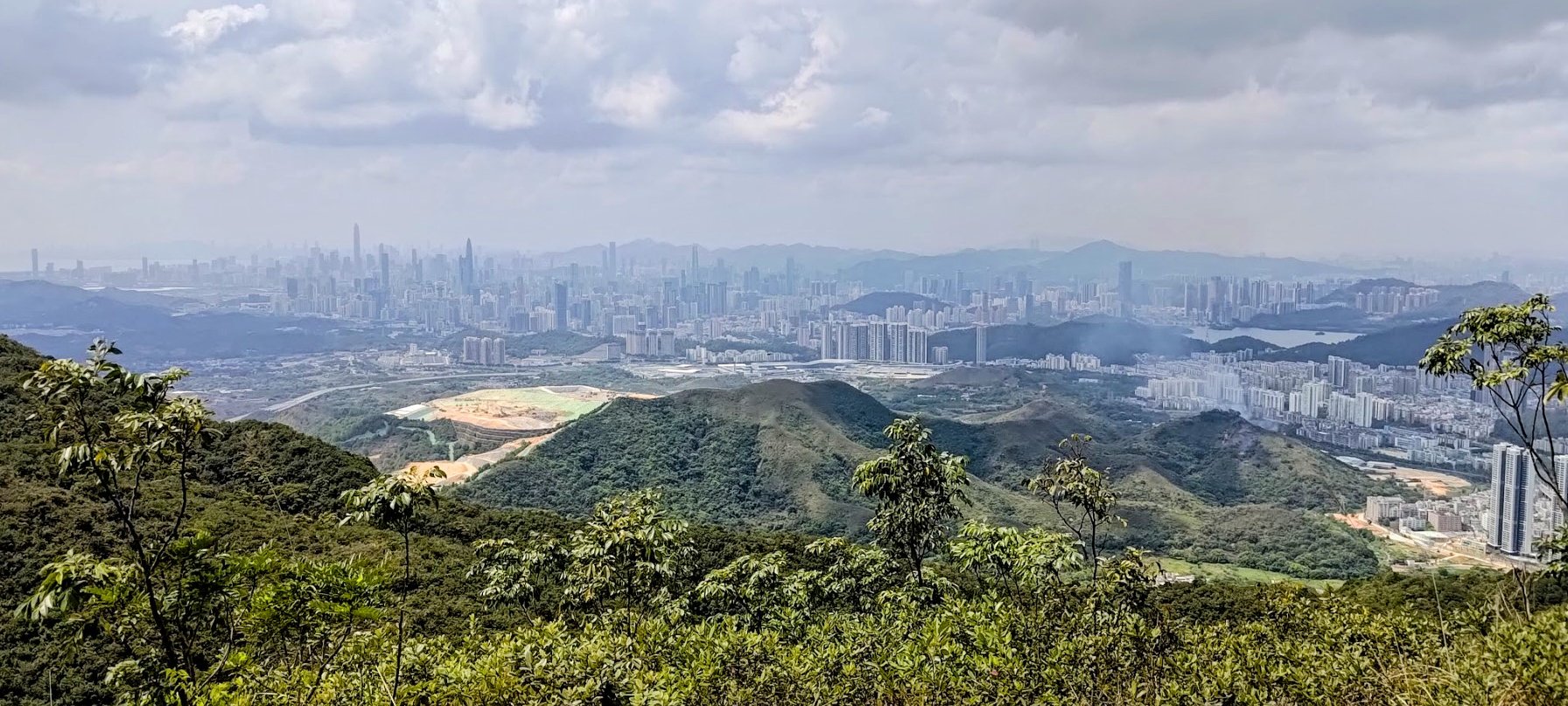
The hike offers two main routes: a safer, more accessible path featuring intriguing World War II relics and a wild, overgrown jungle route recommended only for experienced hikers. Both routes converge after about 40-50 minutes of steep climbing to a ridge with spectacular views—on one side, the green Starling Inlet and Hong Kong border villages, and on the other, the towering Shenzhen skyline in China.
The trail continues to Robin's Nest peak at 474 meters, marked by a trigonometrical point, before descending toward Lin Ma Hang Village. Along the descent, hikers can detour to the Lin Ma Hang Caves, a fascinating abandoned mining site known for its ecological significance as a bat habitat.
The hike is roughly 8.6 to 10 km long, taking 3.5 to 4.5+ hours depending on whether you opt for the safe or rugged route. The combination of rugged terrain, historical sites, panoramic views, and ending literally at the border between Hong Kong and Shenzhen, makes this hike a rare and compelling adventure for those seeking an adventure on the border of Hong Kong and China.
Robin's Nest Google Route Map and GPX
Robin's Nest and Lin Ma Hang Caves GPX File Safe Route
*Click the box icon in the top right of the map below to load the blue route directly into your own Google Maps. You can then see your location relative to the trail in real time!
Robin's Nest Hiking Guide
You can find a full hiking guide below:
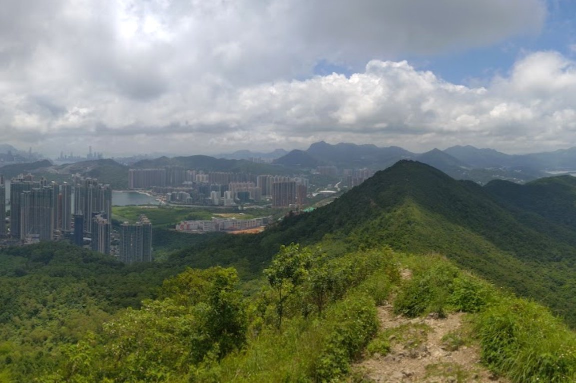
14. Suicide Cliff


Essential Suicide Cliff Hike Details
- District: Kowloon
- Duration: Around 4 - 4.5 hours
- Distance: 8.5 km
- Highest Elevation: 602 meters
- Difficulty: 4/5
- Facilities: Dodgy portable toilets on Kowloon Peak. It's best to use the toilet beforehand and don't forget to bring plenty of water along with snacks.
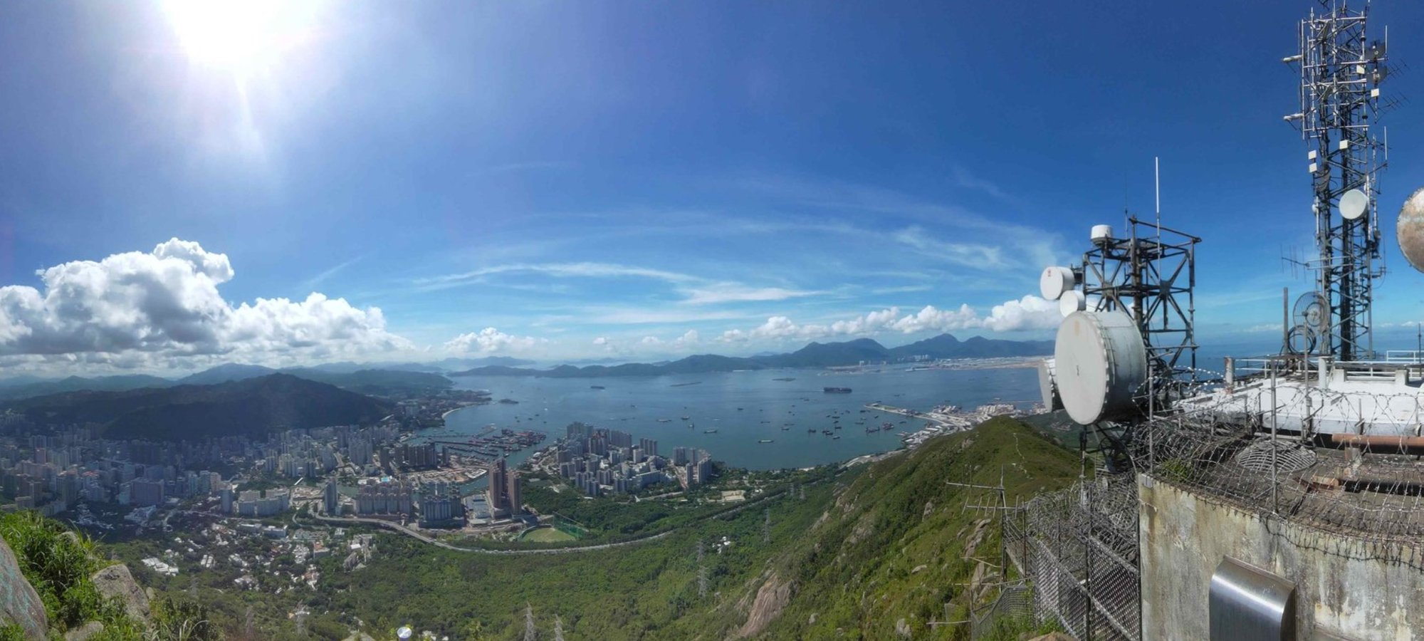
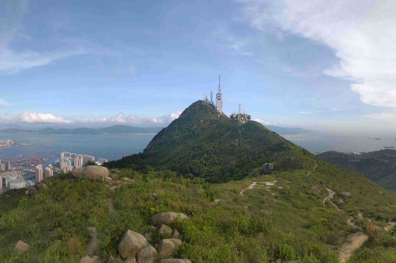
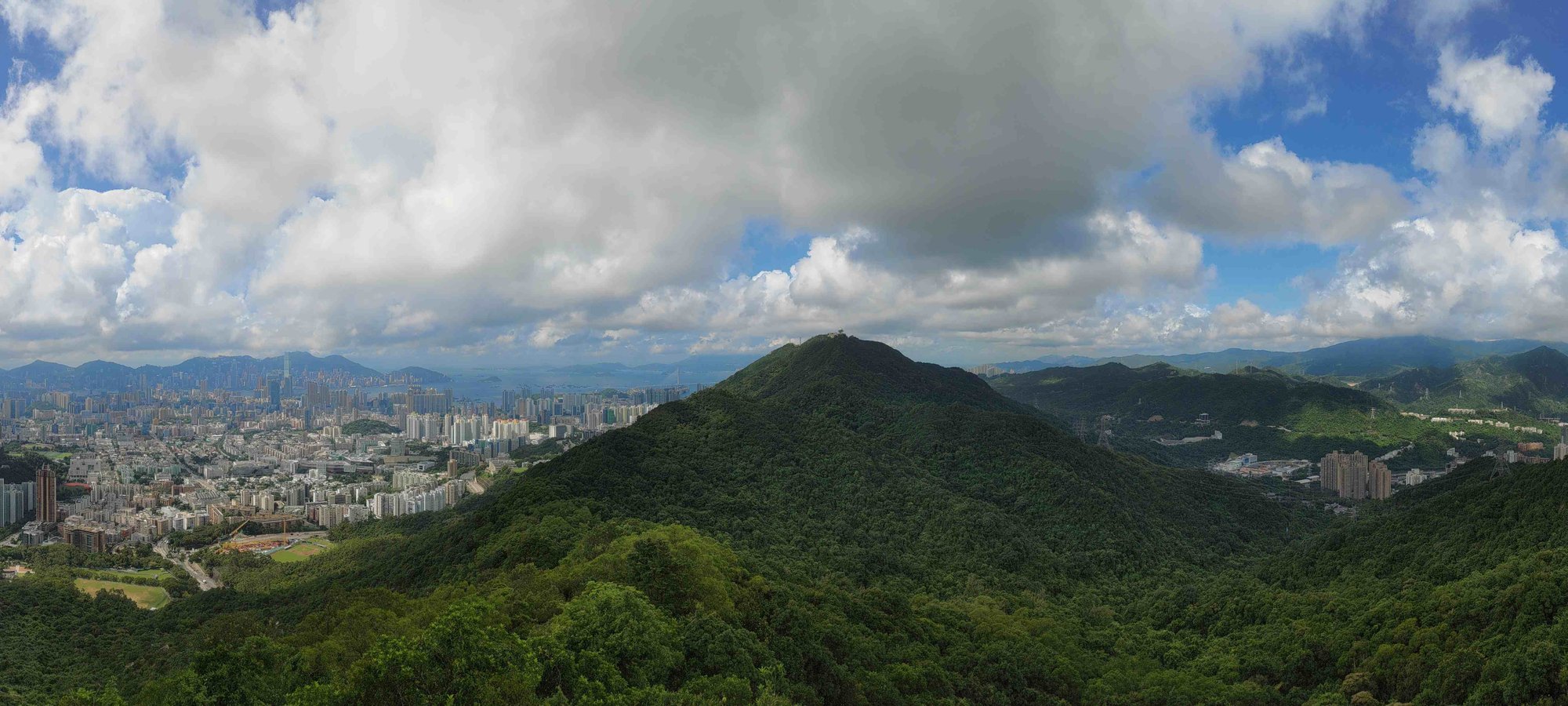
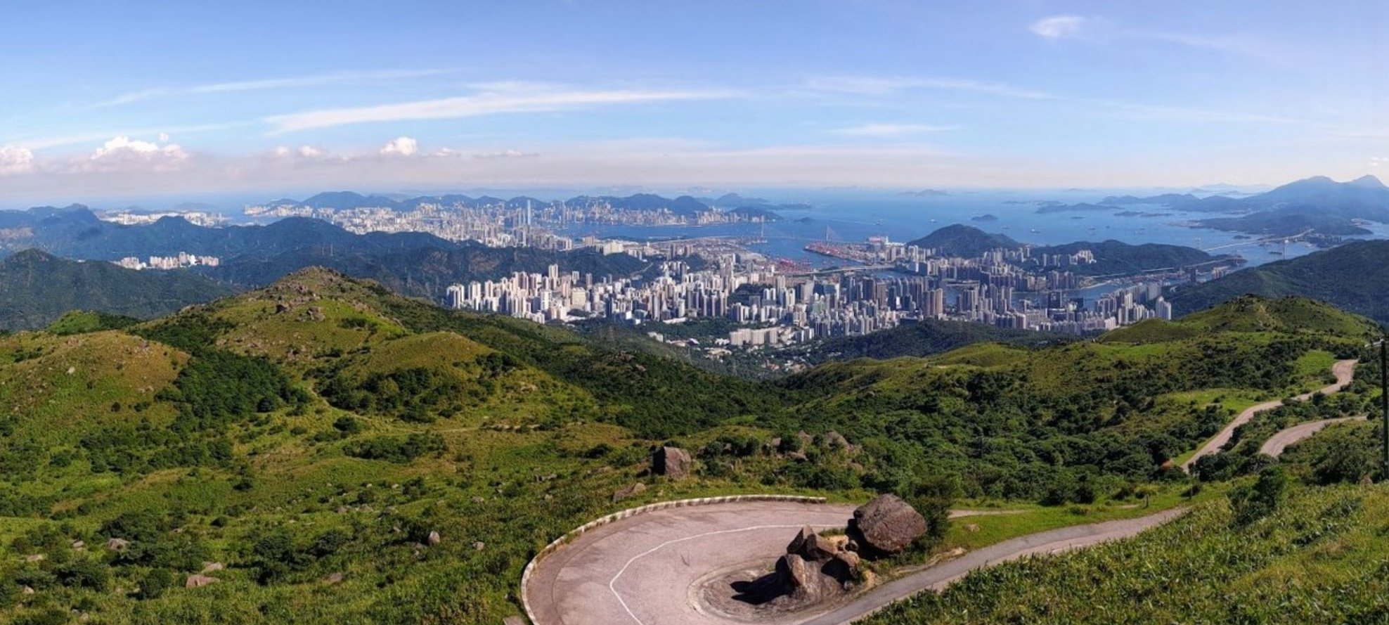
The Kowloon Peak and Suicide Cliff hike is a challenging 8.5 km journey in Kowloon that takes around 4 to 4.5 hours, offering some of Hong Kong’s most spectacular city and sunset views.
The hike begins with a steep climb via Jat’s Incline, a historic military road, leading to the Kowloon Peak Viewpoint where panoramic vistas stretch over Sai Kung, Lion Rock, Tai Mo Shan, and the urban skyline. From there, the trail undulates over several small peaks before reaching the famous Suicide Cliff—a rugged, narrow ledge perched dramatically above the city, known for its breathtaking yet intimidating photo spots.
The final approach to Suicide Cliff involves a steep, technical descent with loose gravel and slender ridges, requiring caution and good hiking experience. The sunset views from Suicide Cliff are particularly stunning, making it a favorite among photographers.
After enjoying the views, hikers can descend via a safer, less technical route back to Fei Ngo Shan Road, or wilder route that is only suitable for experienced hikers.
This hike combines physical challenge, historical interest, and some of Hong Kong’s most iconic urban and natural scenery, rewarding those who tackle it with unforgettable vistas of Hong Kong's dramatic urban landscape.
Suicide Cliff Google Route Map and GPX
Kowloon Peak and Suicide Cliff Hike GPX
*Click the box icon in the top right of the map below to load the blue route directly into your own Google Maps. You can then see your location relative to the trail in real time!
Suicide Cliff Hiking Guide
You can find a full hiking guide below:

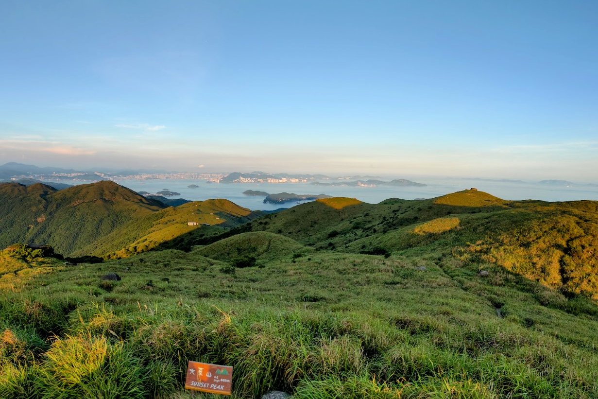
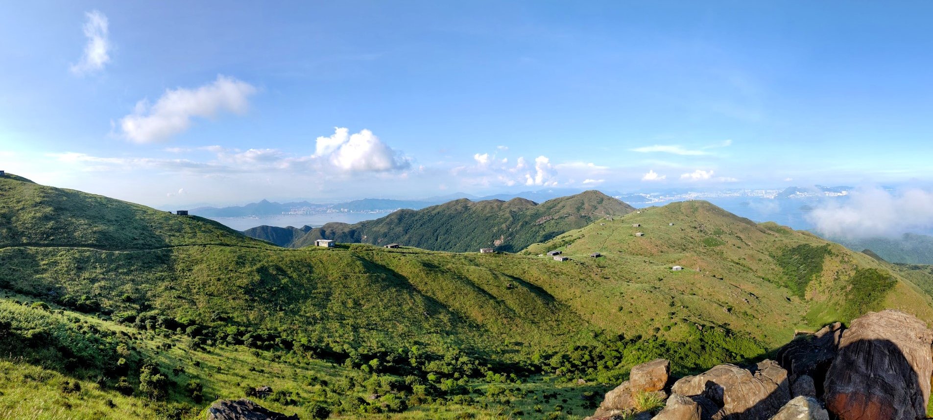
15. Sunset Peak

Essential Sunset Peak Hike Details
- District: Lantau
- Duration: 4 hours in the summer and 3.5 hours in the winter (not including detours)
- Distance: 7.8km with no detours
- Highest Elevation: 869 meters
- Difficulty: 4.5/5
- Facilities: None. Stock up on food and water beforehand
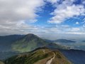
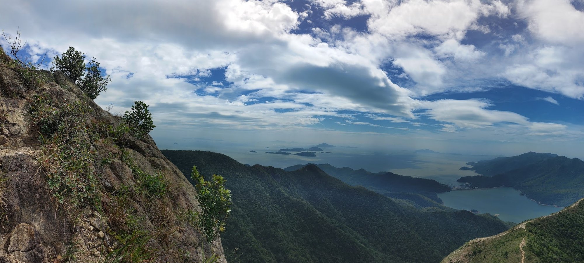
Sunset Peak, Hong Kong’s third-highest mountain at 869 meters, offers the city’s most spectacular and iconic sunset and sunrise viewpoints (in my opinion). The challenging 7.8 km hike typically takes 3.5 to 4 hours and features legions of stone steps that provide a rigorous cardio workout, making it suitable only for experienced hikers.
The best route starts from the Nam Shan Campsite, where a shaded tree walk leads to a helipad, followed by a steep hour-long climb to the first major viewpoint with panoramic vistas of the city, airport, and ocean. The trail then passes through a beautiful open grassy section marked by blooming silvergrass in autumn, and unique 1920s stone chalets built by local stonecutters. Optional detours include a climb to Lin Fa Shan and a rocky viewpoint near the summit.
The final ascent to the true summit rewards hikers with breathtaking 360-degree views, especially stunning at sunset with Lantau Peak silhouetted against the sky. The descent leads to Pak Kung Au, where buses connect back to Tung Chung.
The hike’s combination of dramatic elevation, diverse landscapes, historical chalets, and the best sunset views in Hong Kong makes it a must-do for for those looking for unforgettable Hong Kong views.
Sunset Peak Google Route Map and GPX
*Click the box icon in the top right of the map below to load the blue route directly into your own Google Maps. You can then see your location relative to the trail in real time!
Sunset Peak Hiking Guide
You can find a full hiking guide below:

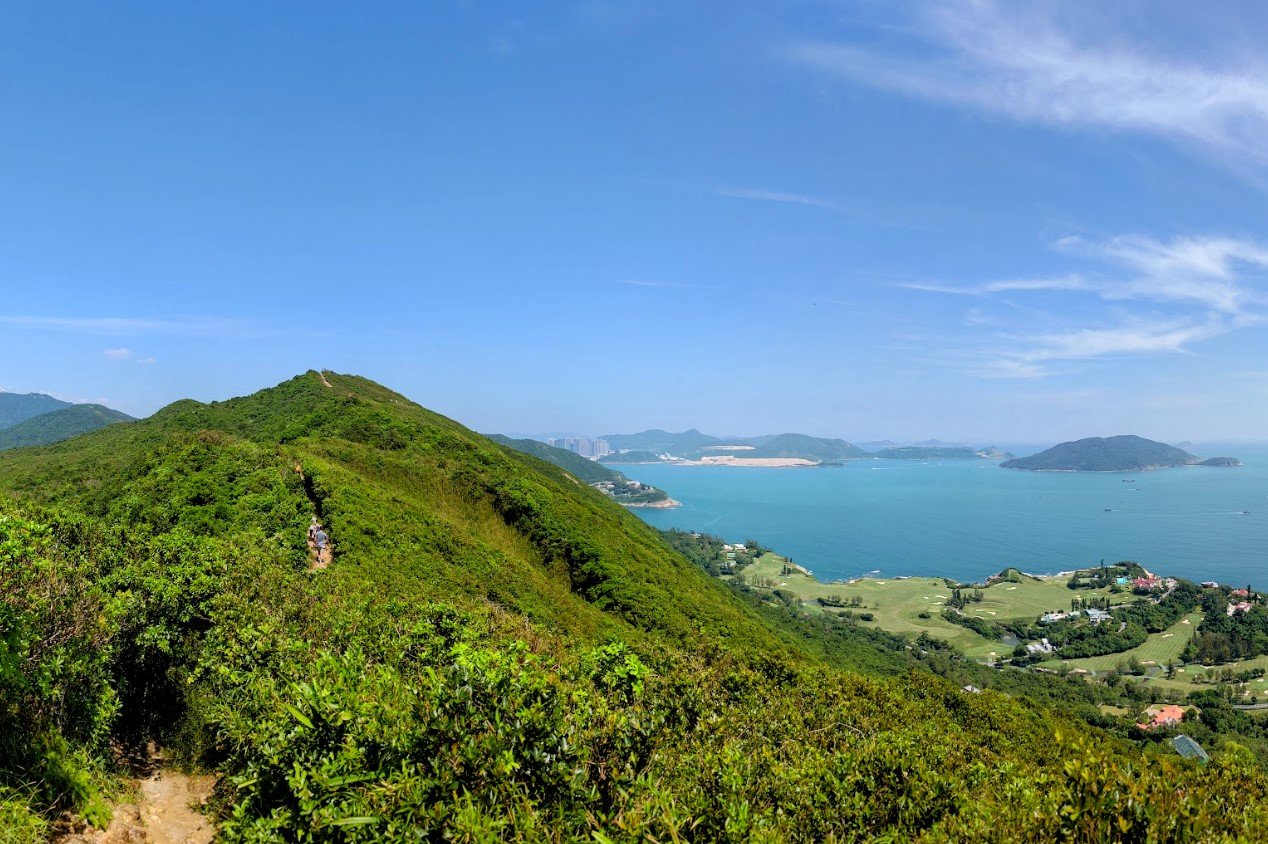
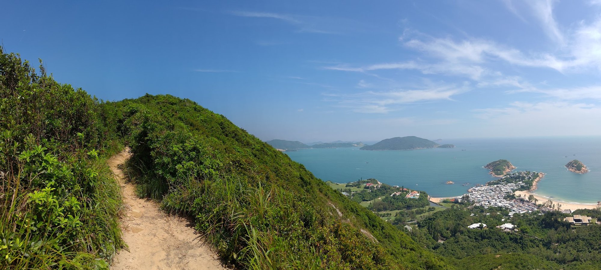
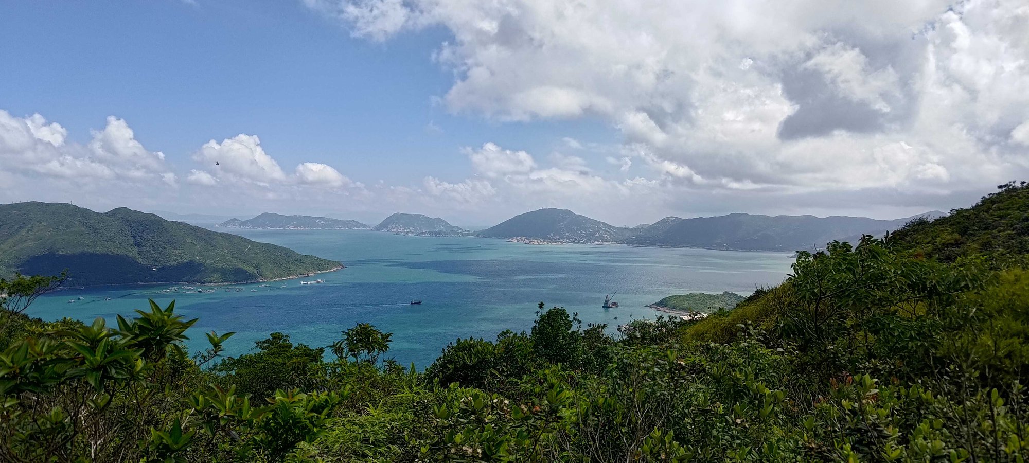
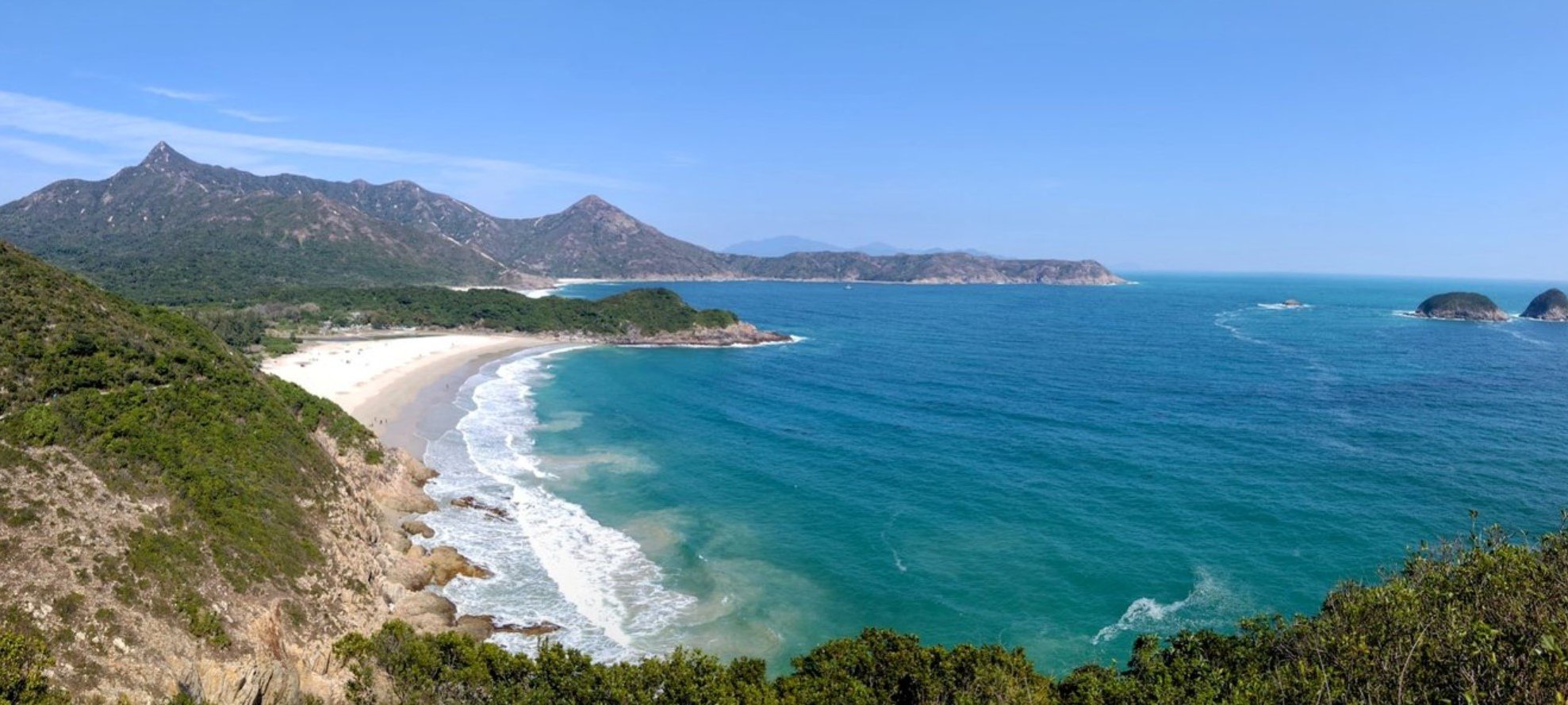
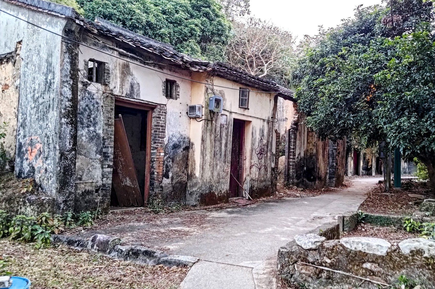
16. Tai Long Wan
Essential Tai Long Wan Hike Details
- District: Sai Kung, New Territories
- Duration: 4 hours. The hike will increase to 7 hours if you hike Sharp Peak as well
- Distance: 19km with Sharp Peak, 12km without Sharp Peak
- Highest Elevation: 180ish meters without Sharp Peak, 468 meters with Sharp Peak
- Difficulty: 3.5/5 without Sharp Peak, 5/5 with Sharp Peak
- Facilities: Food and drinks available at Ham Tin Wan, Chek Keng and Pak Tam Au. Public Toilet at Ham Tin Wan, Chek Keng and Pak Tam Au
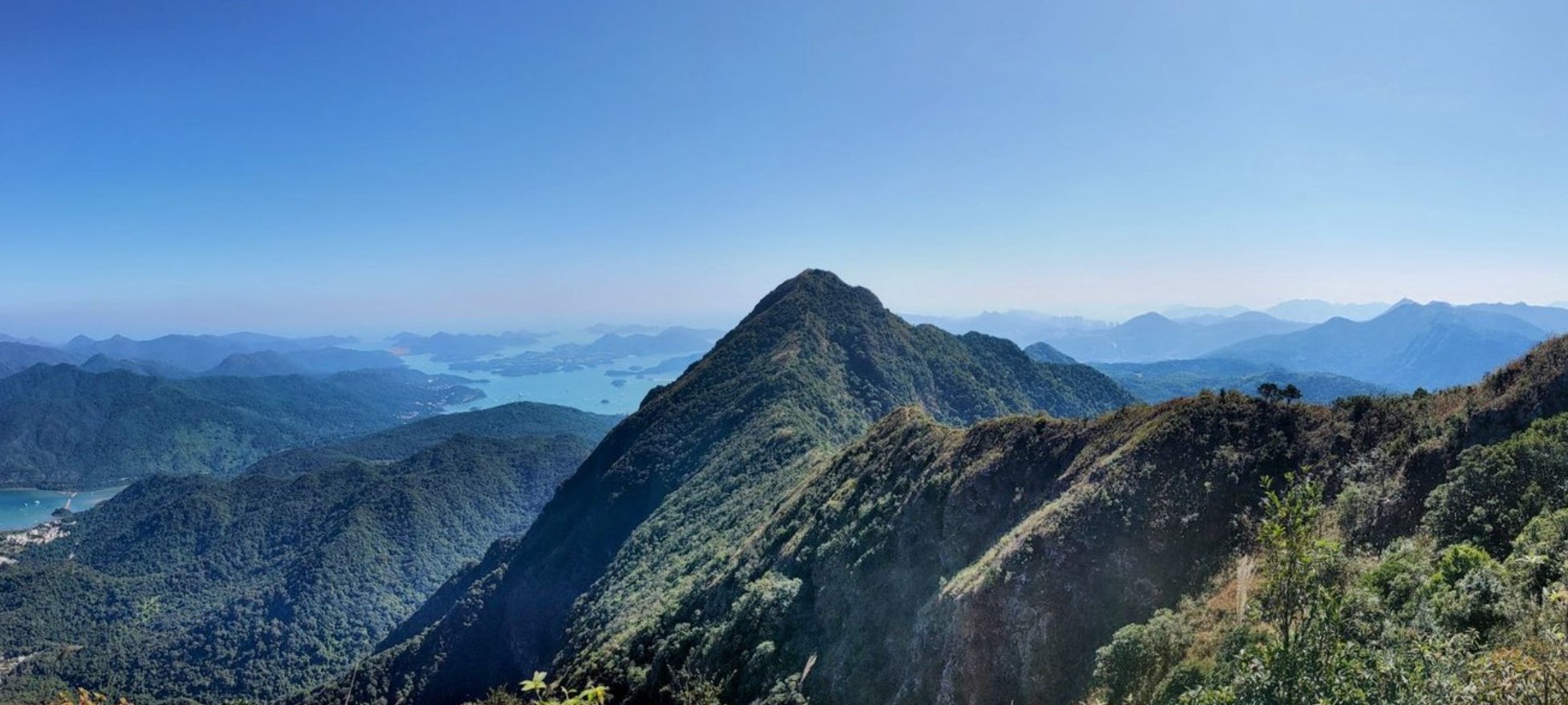
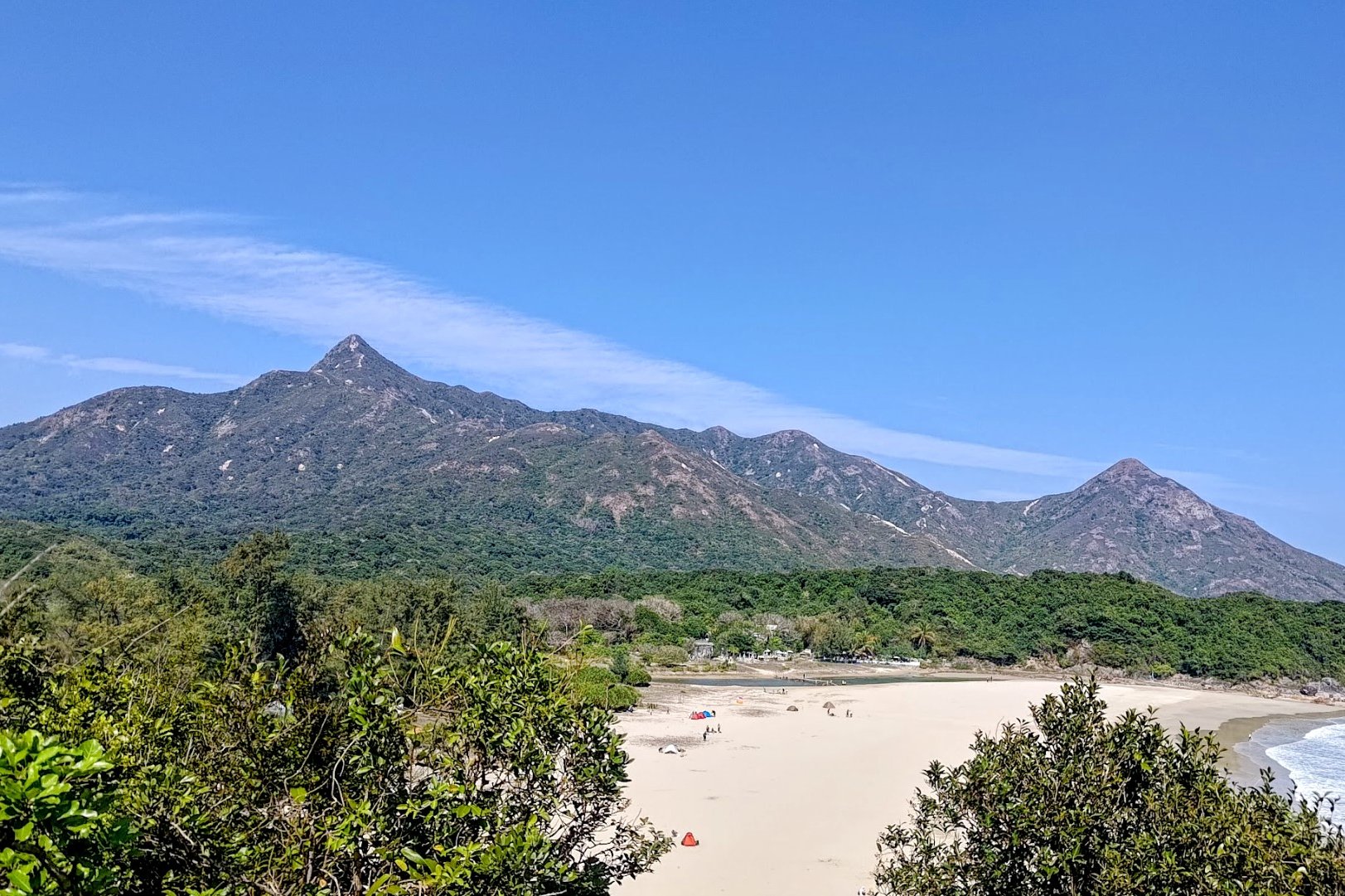
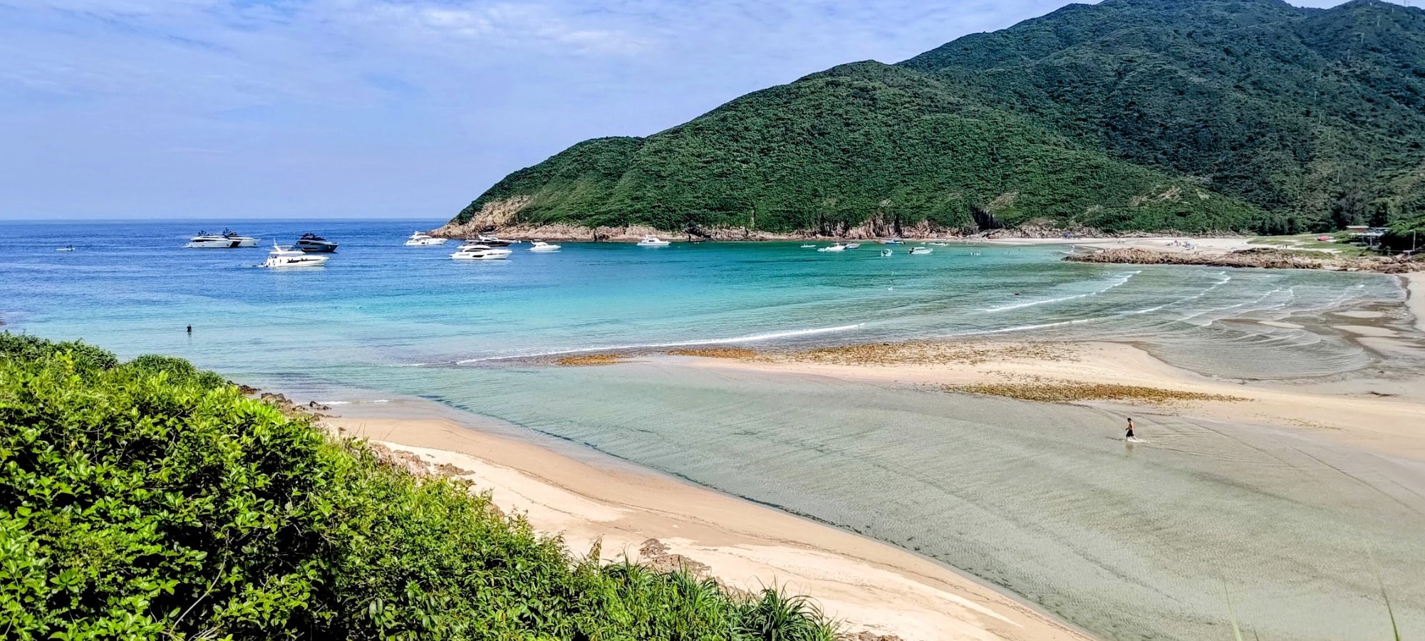
The Tai Long Wan hike in Sai Kung is a spectacular 12 km coastal trek that showcases three of Hong Kong’s most pristine and beautiful beaches—Sai Wan, Ham Tin Wan, and Tai Wan—set against stunning turquoise waters and lush green hills.
Starting from Sai Wan Pavilion, the mostly concrete path gently undulates through scenic villages, peaceful beaches, and dramatic coastal ridges, making it accessible to intermediate hikers. The highlight is Ham Tin Wan, offering arguably the best panoramic ocean views of the entire hike, with the iconic Sharp Peak rising in the distance for adventurous hikers seeking an extra challenge.
Along the way, you can explore an abandoned Hakka village at Chek Keng, and enjoy local food and amenities at beachside restaurants. This hike perfectly combines tranquil beach escapes, cultural history, and breathtaking natural scenery, making it a must-do for those wanting a refreshing break from the city and a true taste of Hong Kong’s wild coastline.
Tai Long Wan Google Route Map and GPX
*Click the box icon in the top right of the map below to load the blue route directly into your own Google Maps. You can then see your location relative to the trail in real time!
Tai Long Wan Hiking Guide
You can find a full hiking guide below:
17. Tai Mo Shan
Essential Tai Mo Shan and Ng Tung Chai Hike Details
- District: New Territories
- Duration: 3.5 - 4 hours (at a fast pace with no time added for swimming)
- Distance: 13km
- Highest Elevation: 957 meters
- Difficulty: 4.5/5
- Facilities: None until near the end of the hike, so bring plenty of water and use the toilet beforehand
The Tai Mo Shan hike via Ng Tung Chai Waterfalls is a challenging 13 km trek in the New Territories, typically taking 3.5 to 4 hours at a fast pace. The route features two distinct sections: the first is a shaded, forested climb past five stunning waterfalls—Bottom Fall, Middle Fall, an unnamed waterfall, Main Fall (the tallest), and Scatter Fall—offering scenic pools perfect for resting or swimming. This section involves many stone steps and requires good cardio fitness.
The second section is a steep, unshaded concrete road ascent to Tai Mo Shan’s 957-meter summit, Hong Kong’s highest peak, rewarding hikers with panoramic views across the city and surrounding landscapes. There is also an optional ascent up to Lead Mine Pass for some of the best views of the hike.
The descent follows Route Twisk, a long concrete road with expansive vistas but little shade, leading to a bus stop for easy return.
This combination of dramatic waterfalls, a strenuous peak climb, and sweeping summit views makes Tai Mo Shan a standout adventure for experienced hikers seeking both mountain views and cityscapes.
Tai Mo Shan Google Route Map and GPX
Tai Mo Shan and Ng Tung Chai Waterfalls Hike GPX
*Click the box icon in the top right of the map below to load the blue route directly into your own Google Maps. You can then see your location relative to the trail in real time!
Tai Mo Shan Hiking Guide
You can find a full hiking guide below:
18. Tiu Tang Lung

Essential Tiu Tang Lung Hike Details
- District: New Territories
- Duration: 3 hours 10 mins
- Distance: 8km
- Highest Elevation: 416 meters
- Difficulty: 3.5/5
- Facilities: Toilets at Wu Kau Tang Village. Bring drinks and food beforehand
The Tiu Tang Lung hike in the New Territories is a rugged and challenging 8 km loop starting from Wu Kau Tang Village, taking about 3 hours.
The ascent to the 416-meter summit is a tough path that quickly becomes steep, overgrown, and technical, requiring careful footing and some scrambling. Ascending up Tiu Tang Lung rewards hikers with spectacular panoramic views of the surrounding verdant mountains of Pat Sin Leng and the clear waters of Mirs Bay, including uninterrupted sights of Shenzhen across the water.
The descent is notably more difficult, especially the last 150 meters, which are steep, slippery, and treacherous with loose rocks and uneven terrain, making this hike suitable only for experienced hikers comfortable with off-trail navigation.
This hike is ideal for those seeking a physically demanding adventure with rewarding mountain and coastal views in a serene, less-traveled setting.
Tiu Tang Lung Google Route Map and GPX
*Click the box icon in the top right of the map below to load the blue route directly into your own Google Maps. You can then see your location relative to the trail in real time!
Tiu Tang Lung Hiking Guide
You can find a full hiking guide below:

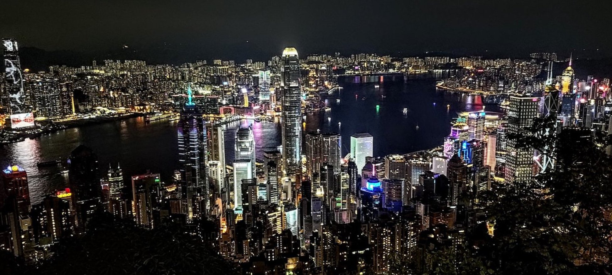
19. Victoria Peak
Essential Victoria Peak Hike Details
- District: Hong Kong Island
- Duration: 3.5 hours (from HKU station up to High West, to The Peak and back down to HKU Station). 1 hour 50 minutes without the return trip down from The Peak
- Distance: 11km (from HKU station up to High West, to The Peak and back down to HKU Station). 5.6km if you end at The Peak
- Highest Elevation: 494 meters
- Difficulty: 2.5/5
- Facilities: Toilets available on the Morning Trail. Shops, toilets, etc. all available at The Peak
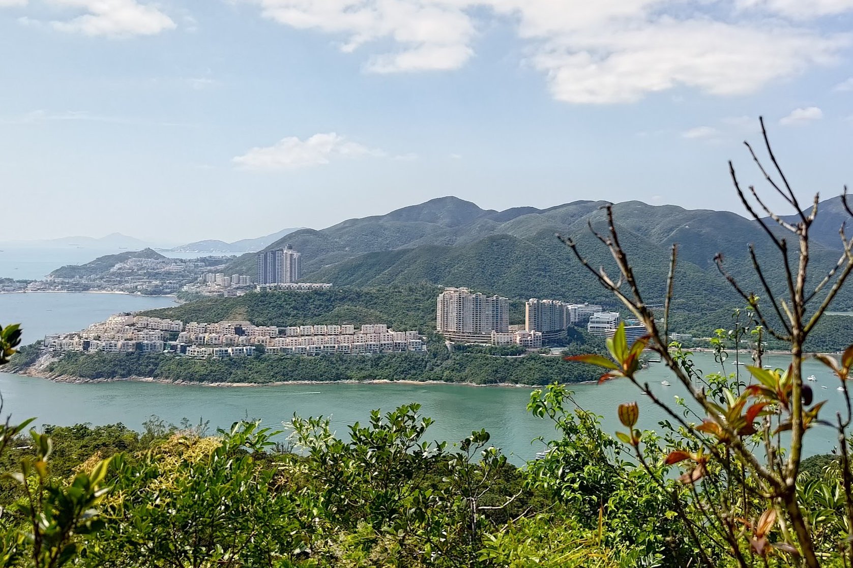
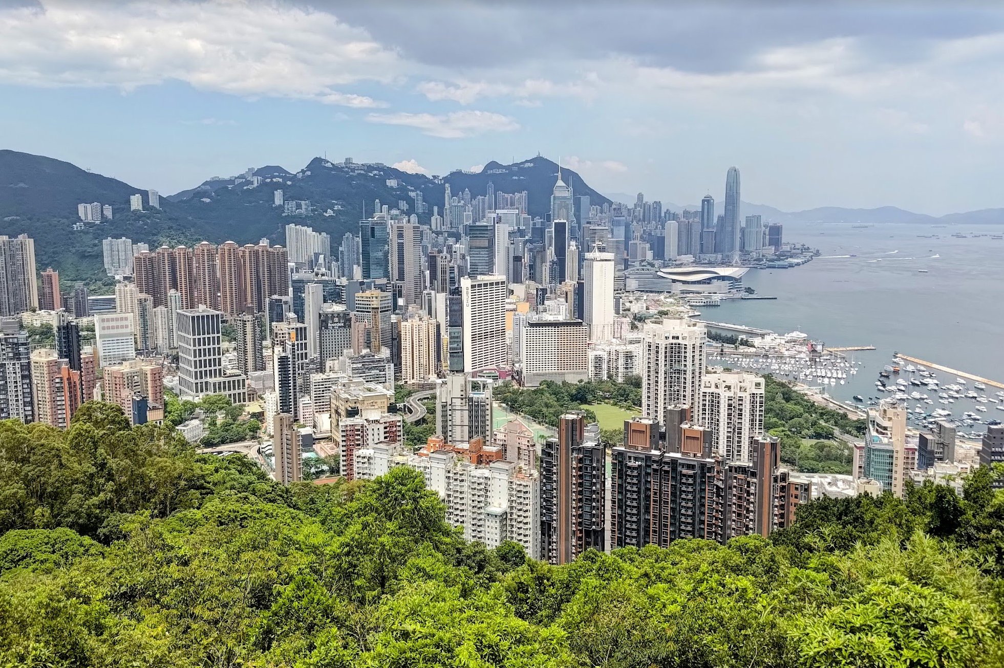
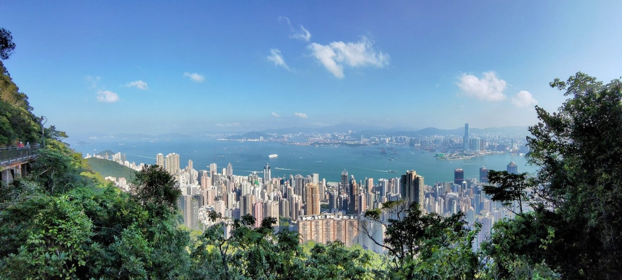
My favorite route up to Victoria Peak is an 11 km loop starting from HKU Station that encompasses High West, Lugard Road and Victoria Peak. It takes about 3.5 hours (round trip), offering a mix of city, ocean, and mountain views.
The hike begins with a steady uphill walk along the paved, vehicle-free Morning Trail (Hatton Road), passing historic sites like Pinewood Battery. From a pavilion at Harlech Road, you can choose to climb the steep staircase to High West’s 494-meter summit, which rewards hikers with breathtaking sunset views over the ocean.
Returning to the pavilion, the route continues gently to Victoria Peak, where you can enjoy iconic panoramic vistas of Hong Kong’s skyline. The descent follows Lugard Road, renowned for its spectacular, less-crowded city views, leading back to HKU.
The trail is well-maintained, safe, and even more epic at night, making it ideal for those seeking a manageable nighttime adventure with jaw-dropping city views.
Victoria Peak Google Route Map and GPX
I've split this hike into two separate parts since some people might want to end at The Peak.
HKU Station to High West and The Peak GPX
The Peak to the Best Viewpoint back to HKU GPX
In the Google Map below, the red line is the starting route from The University of Hong Kong (HKU) to High West and ending at The Peak.
The blue line continues from The Peak to the epic city viewpoint and shows the way back down to HKU (mostly the same as the way up).
*Please note that the sections of the below map that go through HKU are a bit wonky since my watch doesn't track moving indoors very well. You'll want to go through HKU and end up on University Drive. I will include detailed image instructions later in the guide.
*Click the box icon in the top right of the map below to load the blue route directly into your own Google Maps. You can then see your location relative to the trail in real time!
Victoria Peak Hiking Guide
You can find a full hiking guide below:

20. West Dog's Teeth

Essential West Dog's Teeth Hike Details
- District: Lantau
- Duration: 4 hours (at a fast pace with no breaks) expect to take 5 hours or longer at a gentler pace
- Distance: 9 km
- Highest Elevation: 934 meters (if you choose to climb to the top of Lantau Peak) about 150 meters less if you head down to Ngong Ping without climbing to Lantau Peak.
- Difficulty: 5/5
- Facilities: None
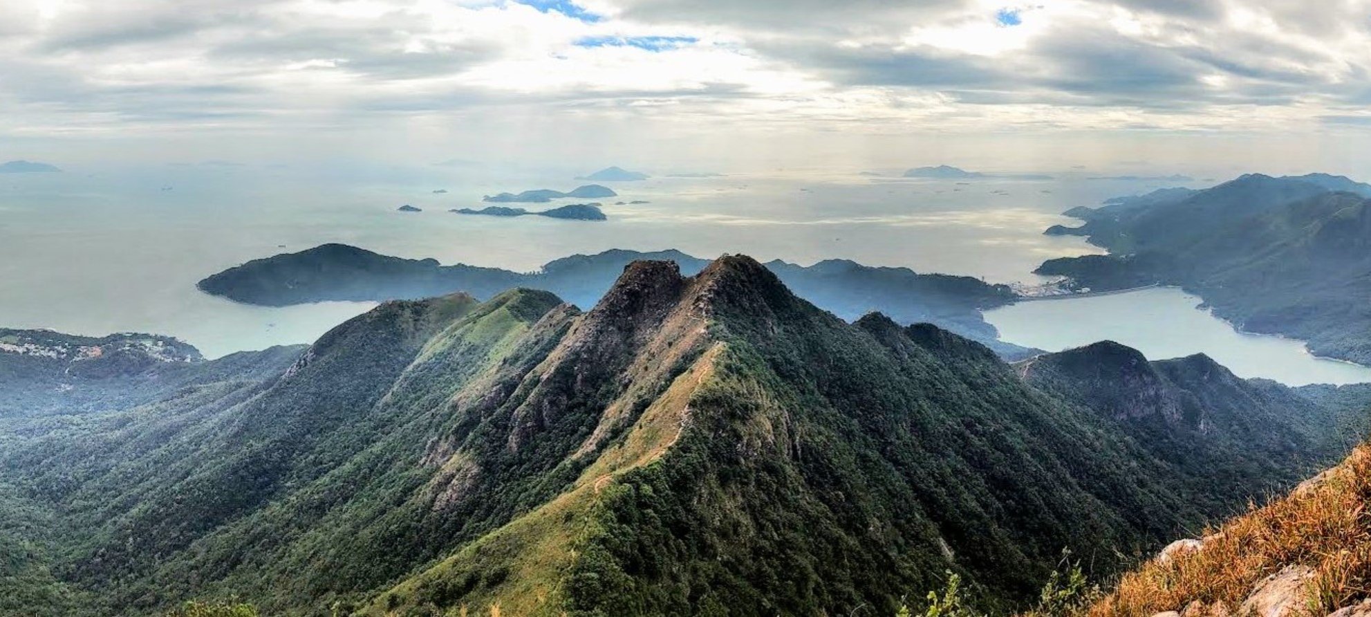
West Dog’s Teeth is considered one of the toughest and most exhilarating hikes in Hong Kong. The hike covers about 9 km with a steep elevation gain of over 400 meters in less than 1.5 km, featuring narrow, jagged ridges that resemble the jaws of a dog. This hike requires scrambling, climbing, and careful navigation over rocky and overgrown terrain.
Starting from Shek Pik Reservoir, the trail begins with a strenuous ascent through forested paths and steep staircases before reaching the infamous West Dog’s Teeth ridge, where hikers face technical, narrow sections with spectacular views of the South China Sea and Shek Pik Reservoir below.
After conquering the ridge, the route continues to Lantau Peak, Hong Kong’s second tallest mountain at 934 meters, which also features in this list of epic Hong Kong hikes with the best views.
For those fatigued, an early escape option leads down to Ngong Ping and the Big Buddha. The descent to Pak Kung Au is much gentler and quicker, passing scenic viewpoints and ending at a convenient bus stop. The hike demands excellent fitness, surefootedness, and no fear of heights, making it suitable only for experienced hikers seeking a challenging adventure highlighted by some of Hong Kong’s most dramatic mountain scenery.
West Dog's Teeth Google Route Map and GPX
*Click the box icon in the top right of the map below to load the blue route directly into your own Google Maps. You can then see your location relative to the trail in real time!
West Dog's Teeth Hiking Guide
You can find a full hiking guide below: