10 Best Hong Kong Island Hikes
Contents
- Hong Kong Island's 10 best hikes
- 1. Dragon's Back - Easy
- 2. Cape D'Aguilar - Easy
- 3. Red Incense Burner Summit - Easy
- 4. Peel Rise - Medium
- 5. Morning Trail, High West, and Victoria Peak - Medium
- 6. Quarry Bay to Tai Tam - Medium
- 7. Jardine's Lookout and Siu Ma Shan - Medium
- 8. City of Victoria Boundary Stones Hike - Hard
- 9. The Twins - Hard
- 10. Ap Lei Chau to Ap Lei Pai Hike (Mount Johnston) - Hard
Hong Kong Island's 10 best hikes
This list is obviously influenced by my personal preferences. I chose these hikes based on three main criteria:
- How epic and unique the scenery is
- Interesting scenery or historic landmarks during the hike
- How enjoyable the trail is (terrain, shade, variety of scenery, and effort-to-reward)
The 10 Hong Kong Island hikes below span breezy coastal walks, cardio-crushing stair marathons, and some of the city’s very best skyline lookouts. For directions, maps, detailed instructions and more, open the linked full guides for each hike.
Note: The hikes are not listed in any particular order.
Easy
Medium
- Peel Rise
- Morning Trail, High West, and Victoria Peak Hike
- Quarry Bay to Tai Tam
- Jardine's Lookout and Siu Ma Shan
Hard
Didn't find a hike you like? Use the website's search function to find even more trails on Hong Kong Island and beyond
1. Dragon's Back - Easy
Essential Dragon's Back Hike Details
- District: Hong Kong Island
- Duration: Just under 2 hours back to To Tei Wan bus stop. Just under 2.5 hours to Big Wave Bay
- Distance: 5.8km back to To Tei Wan bus stop. 7.5km to Big Wave Bay
- Highest Elevation: 284 meters
- Difficulty: 1.5/5
- Facilities: Public toilets at the start point. Make sure to bring food and water.
Recognized by CNN in 2022 as the world’s 8th best hiking trail, Dragon’s Back is widely regarded as one of Hong Kong’s most scenic and accessible hikes. Offering spectacular panoramic views of the South China Sea and the lush, rolling hills that surround it, this trail is a must-visit for nature enthusiasts and casual hikers alike.
One of Dragon’s Back’s greatest appeals is its accessibility—hikers of all ages and experience levels can enjoy this stunning route. To fully appreciate the tranquility of this stunning trail, consider visiting on a weekday, as weekends tend to attract large crowds.
As an added bonus, the journey concludes in Shek O, one of Hong Kong’s most charming and relaxed seaside neighborhoods.
Dragon's Back Google Route Map and GPX File
*Click the box icon in the top right of the map below to load the blue route directly into your own Google Maps. You can then see your location relative to the trail in real time!
Dragon's Back Hiking Guide
You can find a full hiking guide below:
2. Cape D'Aguilar - Easy
Essential Cape D'Aguilar Hike Details
- District: Hong Kong Island
- Duration: 3 hours (both ways without exploration)
- Distance: 8+km (8km there and back. More with exploration)
- Highest Elevation: 130ish meters
- Difficulty: 1/5
- Facilities: Toilets and convenience stores available at the MTR station and mid-way. Drinks vending machines at the beach area.
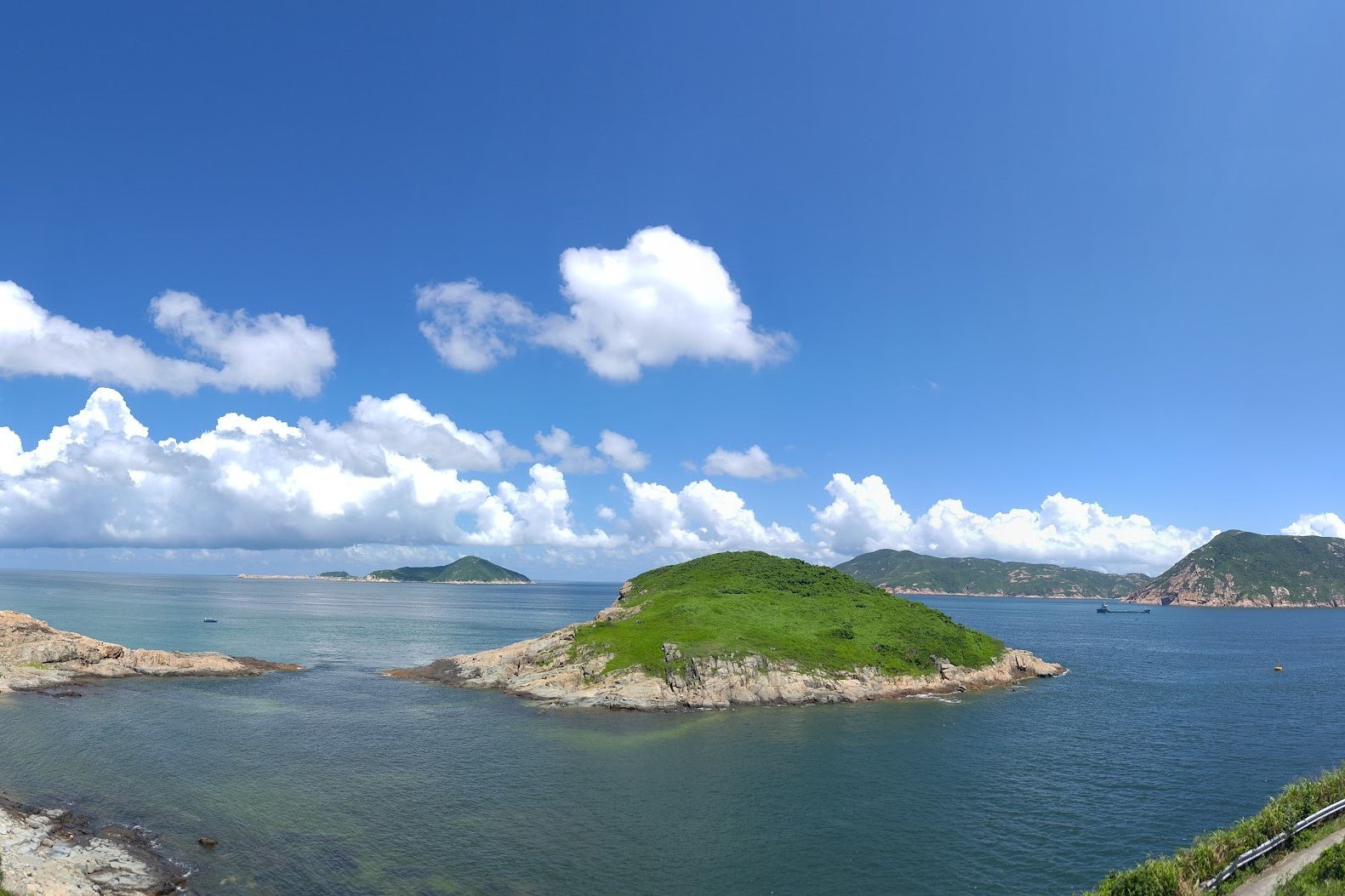
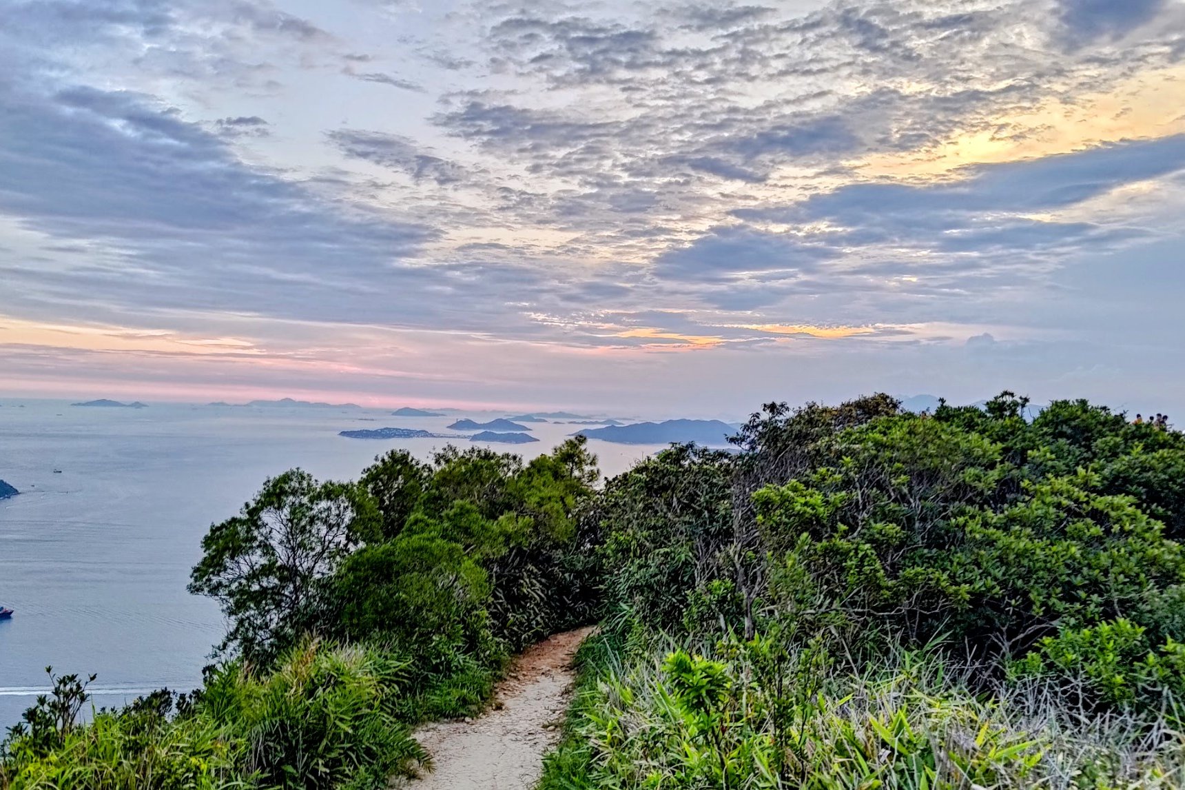
Cape D’Aguilar offers a captivating blend of natural beauty and historical intrigue, making it one of Hong Kong Island's top hiking destinations. This there-and-back trail showcases sparkling blue waters, lush green islands, and rugged brown coastlines that ignite the imagination.
Named after Major-General Sir George Charles D'Aguilar, who played a significant role during the British colonial era, the area is steeped in wartime history. Hikers can discover remnants of old military batteries that once defended Hong Kong, adding a unique layer of exploration to the experience.
As Hong Kong's only marine reserve, Cape D’Aguilar boasts vibrant marine life, with 16% of the region's species found here.
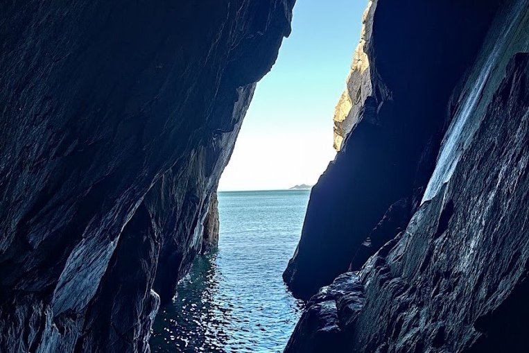
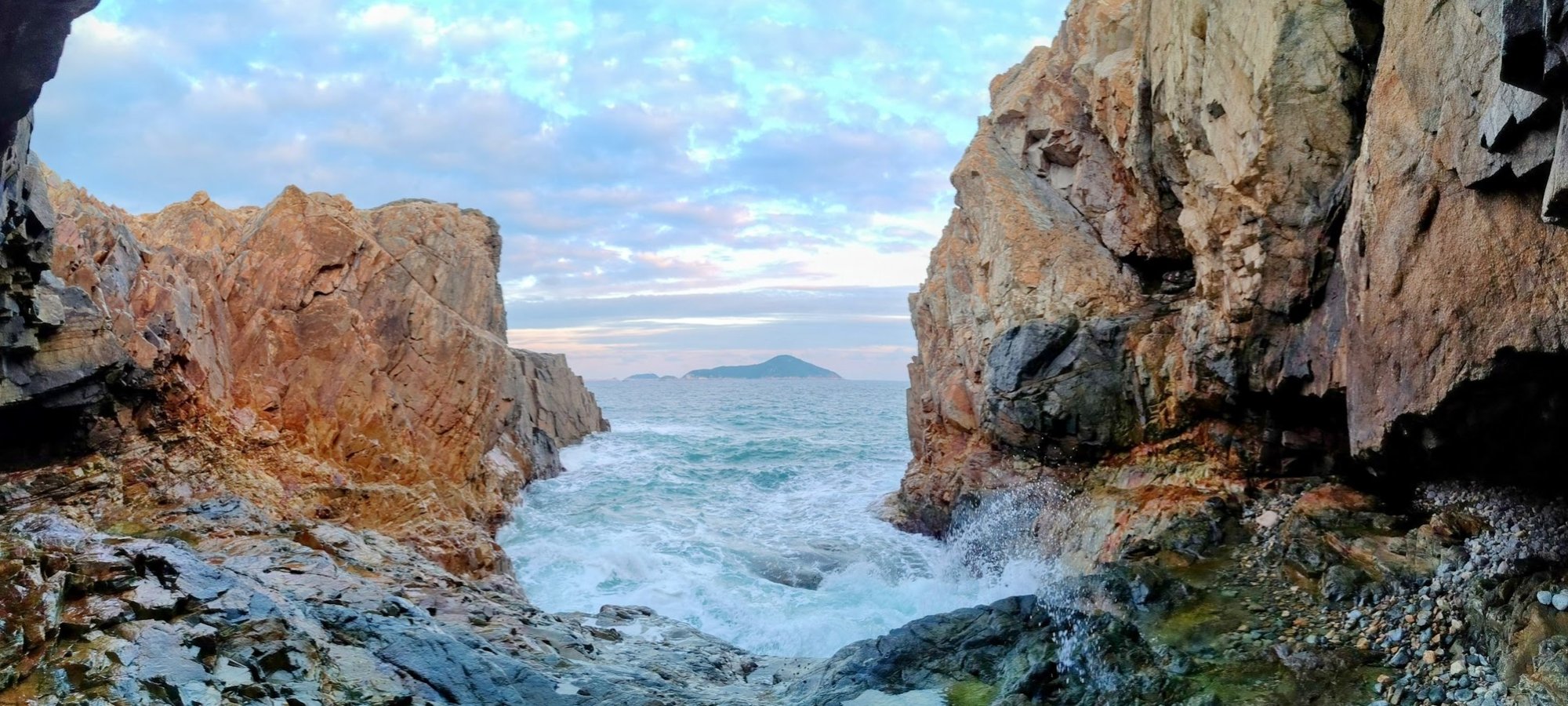
Adventure seekers will appreciate the hidden caves along the route, offering a delightful escape from the heat and a sense of discovery as you navigate the rocky coastline. Best of all, the trail is easy to follow, with a concrete path leading to stunning vistas of the South China Sea.
Smuggler's Ridge Google Route Map and GPX
Cape D'Aguilar Hike GPX File (One Way)
*Click the box icon in the top right of the map below to load the blue route directly into your own Google Maps. You can then see your location relative to the trail in real time!
Cape D'Aguilar Hiking Guide
You can find a full hiking guide below:
3. Red Incense Burner Summit - Easy


Essential Red Incense Burner Summit Hike Details
- District: Hong Kong Island
- Duration: 30 minutes round trip (with no breaks)
- Distance: 1.5ish km depending on the start point
- Highest Elevation: 230 meters
- Difficulty: 0.5/5
- Facilities: None. Stock up on water and use the toilet beforehand
Skip the Victoria Peak crowds and choose Red Incense Burner Summit instead. Getting to the start point is easy to reach by public transit or a short taxi ride from Central. The hike itself is short - about fifteen minutes of steady uphill walking to the summit - with only a brief scramble over a few boulders at the top.
The payoff is a striking, intimate panorama that often rivals Victoria Peak. Weekdays offer near-private viewpoints, while weekends can draw large crowds of sunset-seekers and photo enthusiasts.
What makes it one of Hong Kong Island’s best hikes is the way it feels hidden and adventurous, but still offers supreme accessibility and wicked views.
Red Incense Burner Summit Google Route Map and GPX
Red Incense Burner Hill Hike GPX File
*Click the box icon in the top right of the map below to load the blue route directly into your own Google Maps. You can then see your location relative to the trail in real time!
Red Incense Burner Summit Hiking Guide
You can find a full hiking guide below:

4. Peel Rise - Medium
Essential Peel Rise Hike Details
- District: Hong Kong Island
- Duration: 2 hours from Pok Fu Lam Reservoir, 3 hours 15 mins from Victoria Peak
- Distance: 7.5 km
- Highest Elevation: 340ish meters
- Difficulty: 2.5/5
- Facilities: Public toilet and a water filling station (free water if you have a bottle) at the start of the hike (just after the Pok Fu Lam Country Park sign).
Peel Rise is a great Hong Kong Island hike for a quick, rewarding nature escape close to the city. It starts from Pok Fu Lam Reservoir in Pok Fu Lam Country Park. The trail is easy to navigate because much of it is paved, making it beginner-friendly.
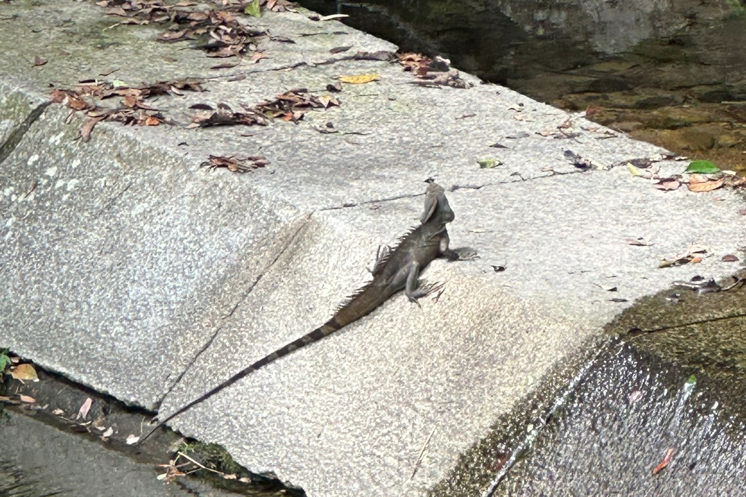
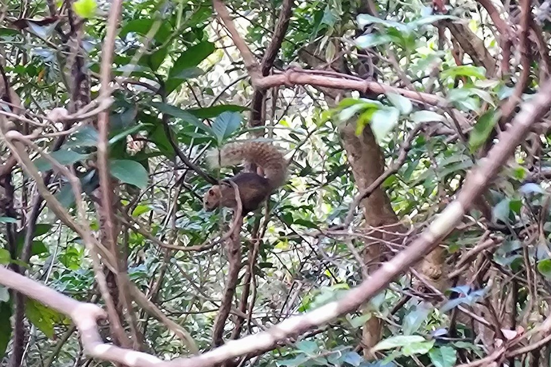
Generous tree cover and nearby water sources help keep the air cool, especially during hot summers. Along the way, you may spot wildlife such as butterflies, skinks, and water dragons, with a post-dusk chance to see banded kraits and wild boars for the more adventurous souls out there.
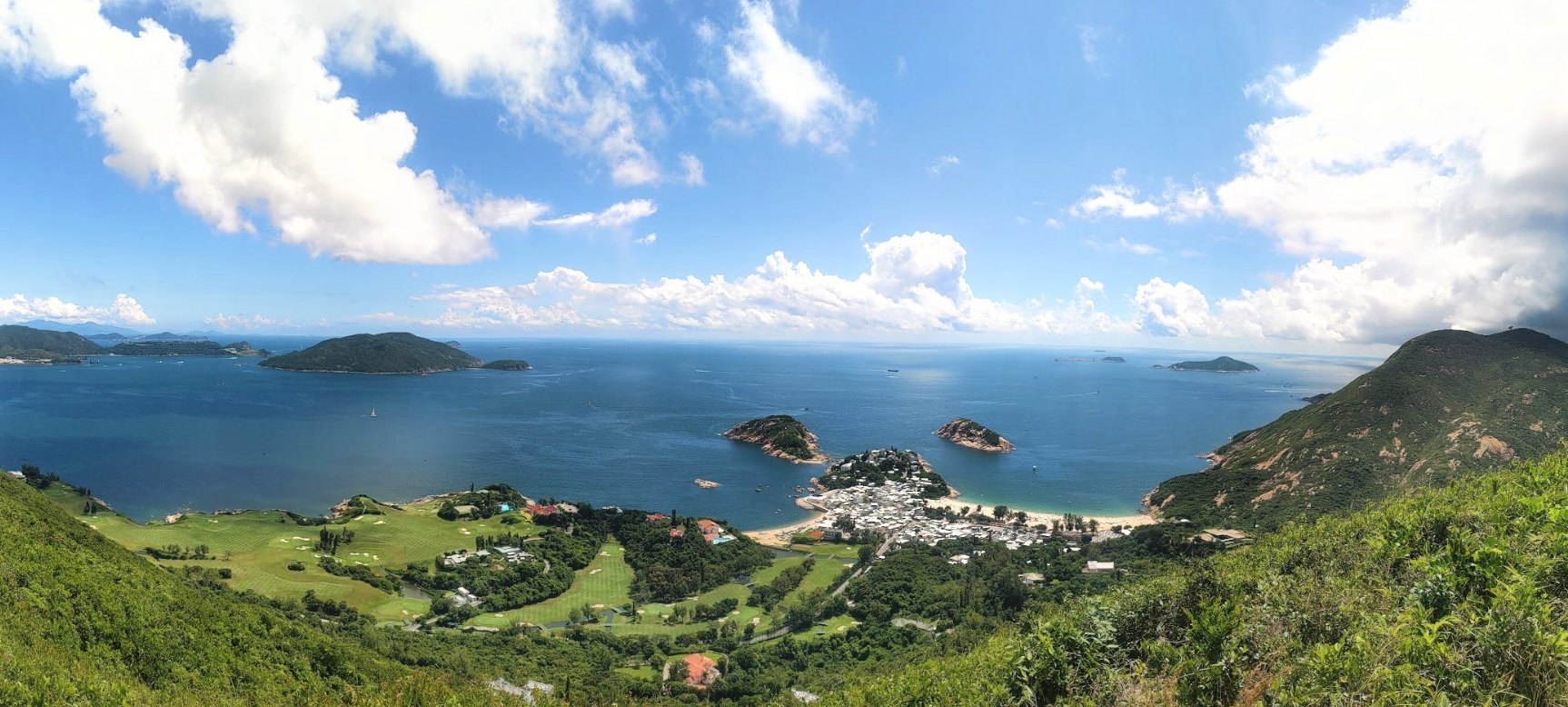
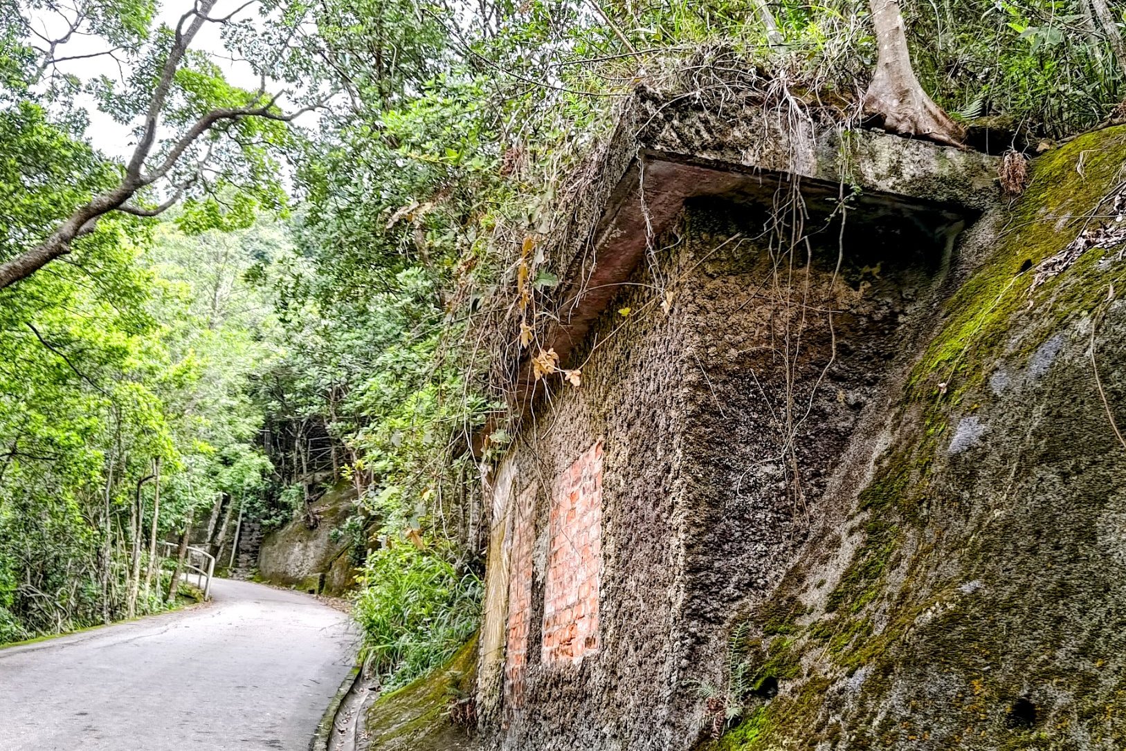
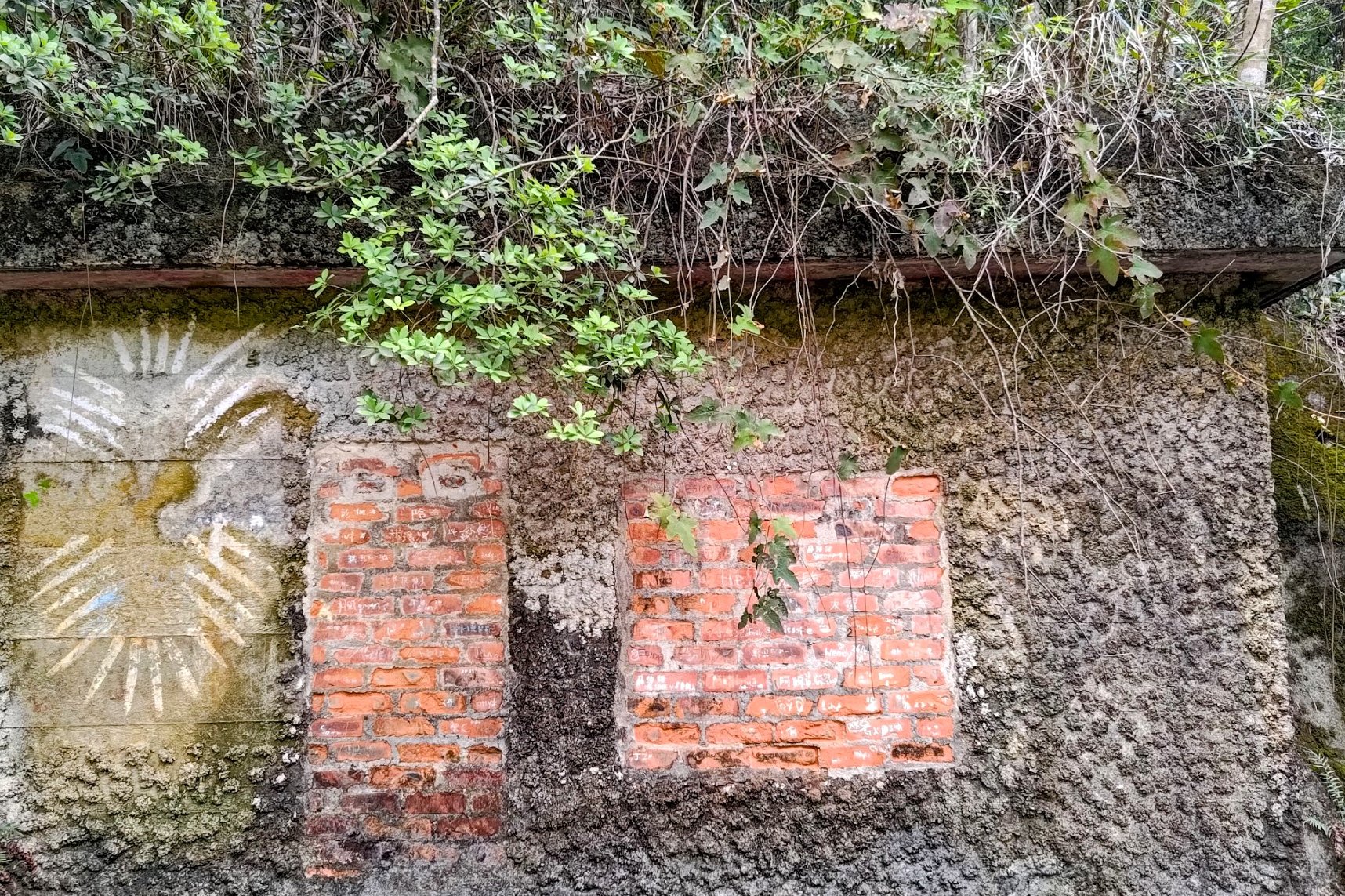
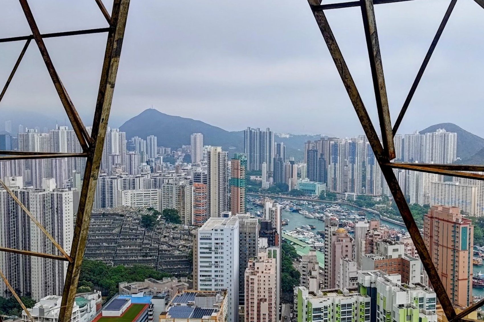
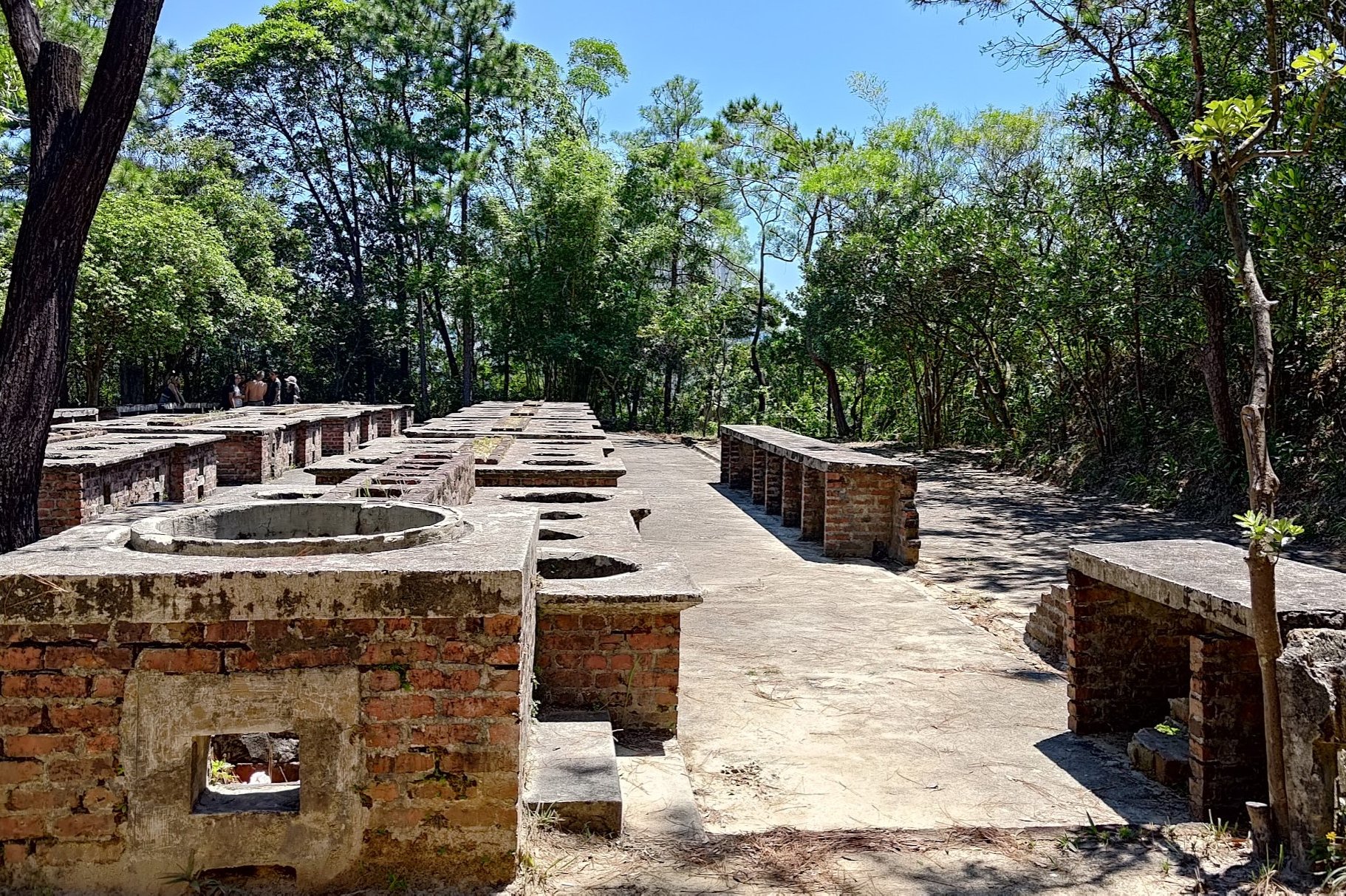
Near Pok Fu Lam Reservoir, you can explore WWII bunkers that hint at Hong Kong’s wartime past and local defense efforts. The hike culminates with a panoramic view over Aberdeen’s boat shelter, the South China Sea, and a sweeping look at Lamma Island.
Although classed as medium difficulty, this hike is suitable for beginners with a reasonable level of fitness, offering a rewarding balance of nature, history, and standout views in a relatively short ascent.
Peel Rise Route Map and GPX
Peel Rise from Pok Fu Lam Reservoir GPX
Peel Rise from Victoria Peak GPX
*Click the box icon in the top right of the map below to load the blue route directly into your own Google Maps. You can then see your location relative to the trail in real time!
Peel Rise Hiking Guide
You can find a full hiking guide below:

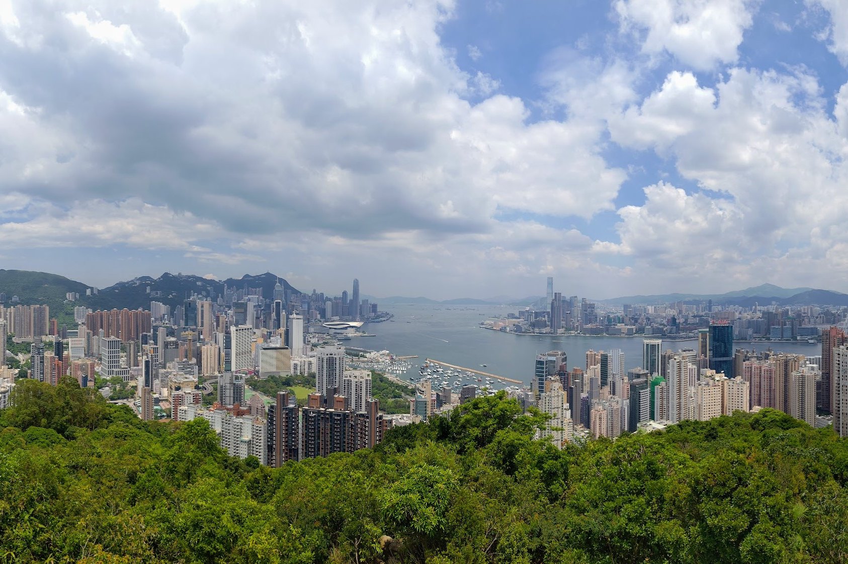
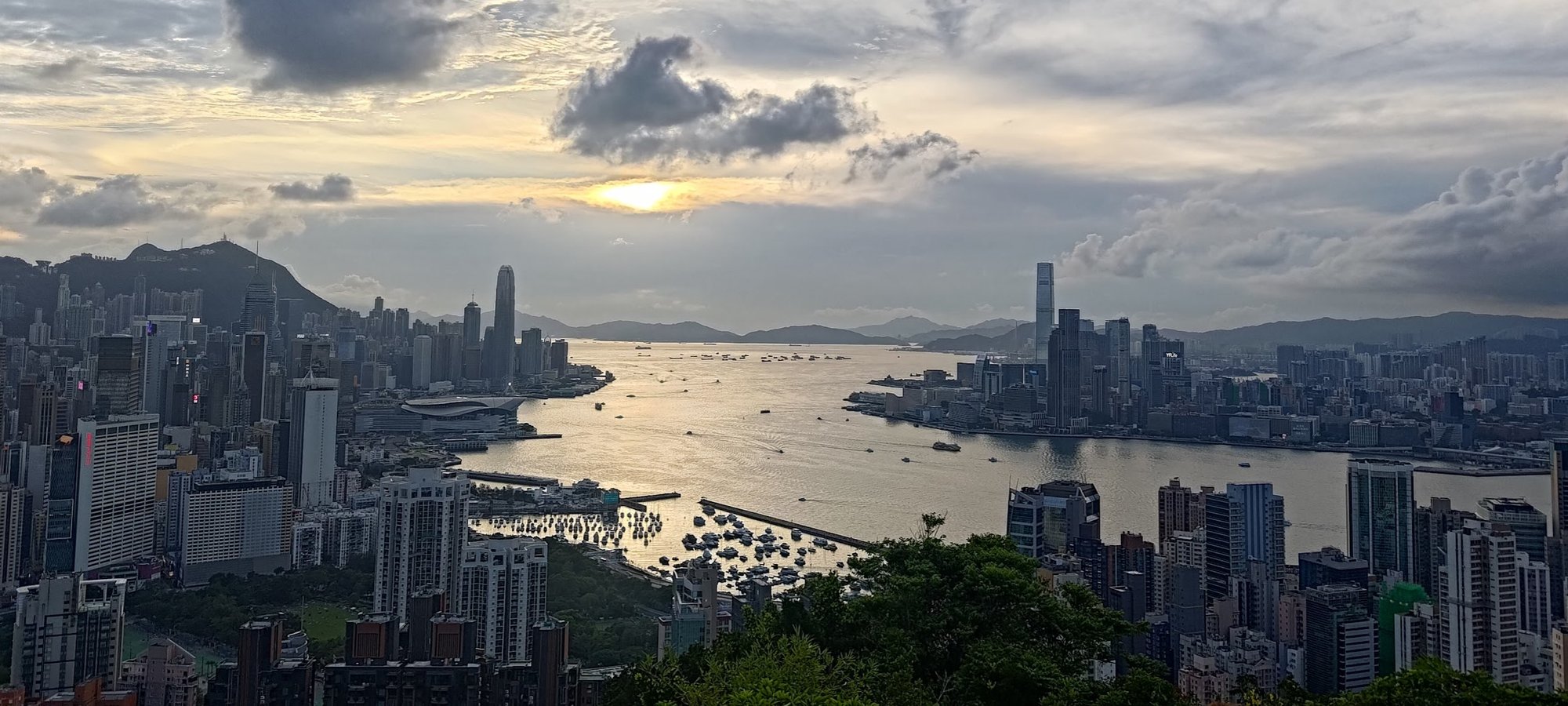
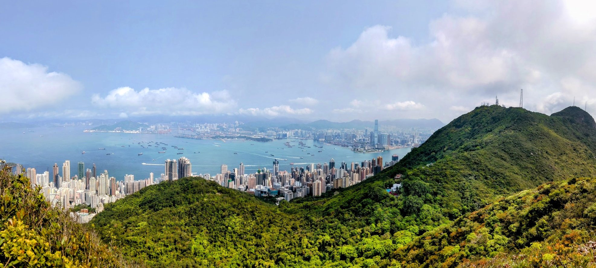
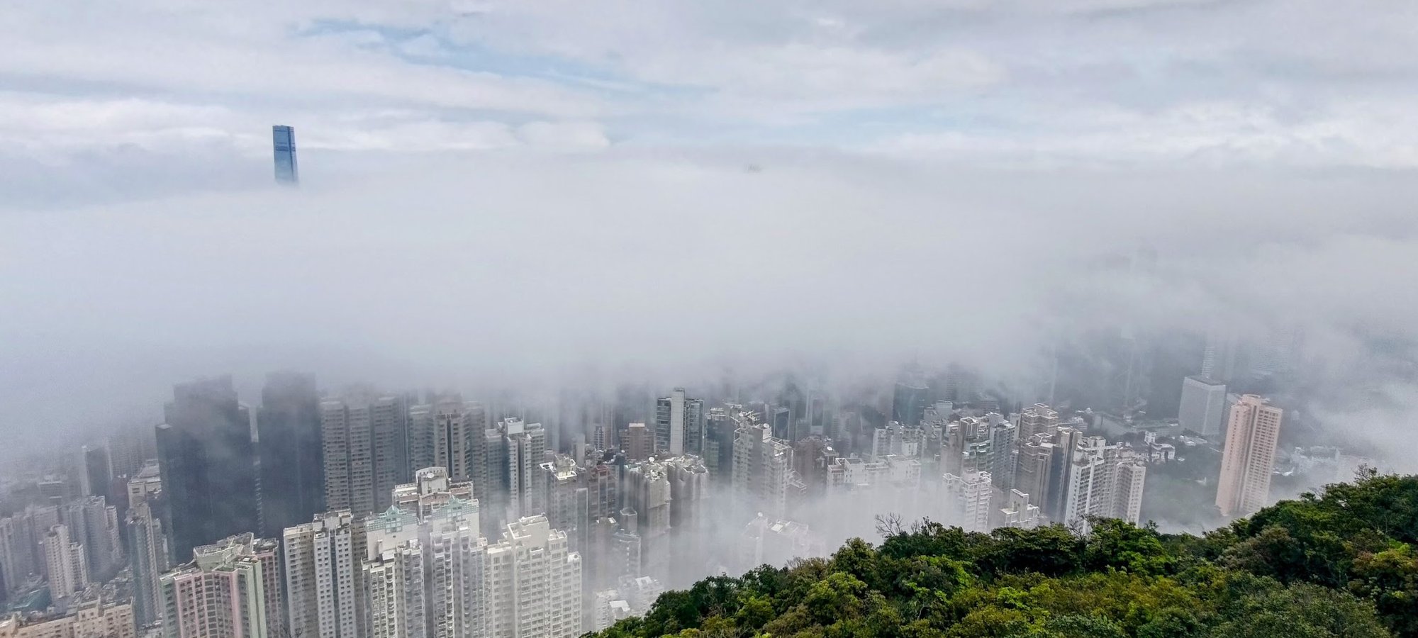
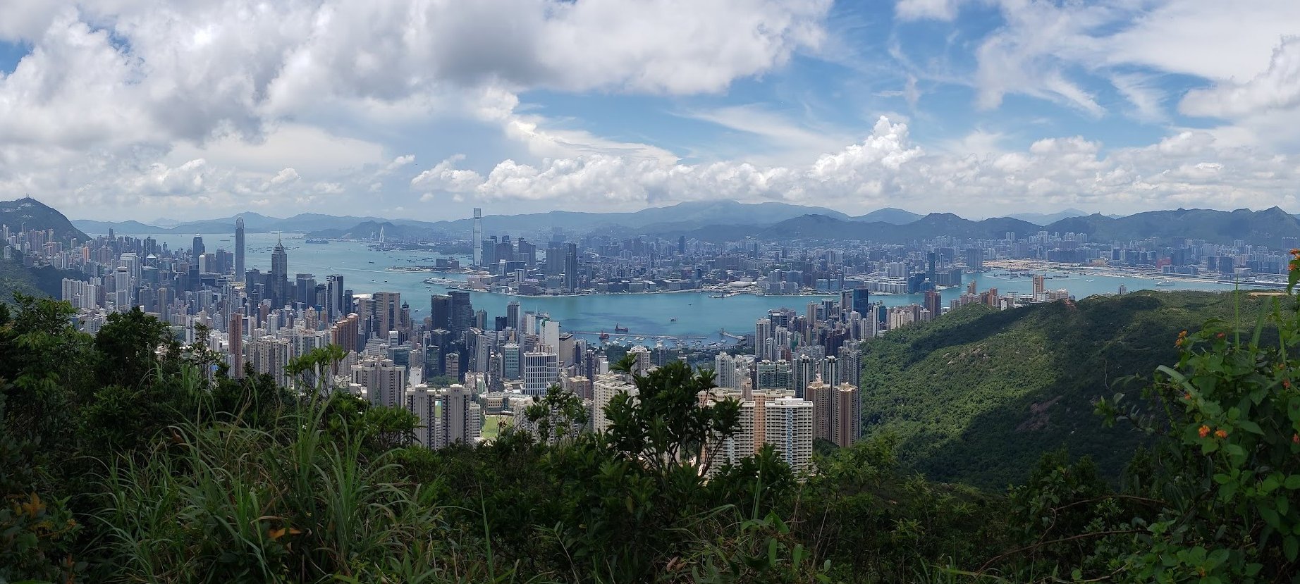
5. Morning Trail, High West, and Victoria Peak - Medium

Essential Morning Trail, High West, and Victoria Peak Hike Details
- District: Hong Kong Island
- Duration: 3.5 hours (from HKU station up to High West, to The Peak and back down to HKU Station). 1 hour 50 minutes without the return trip down from The Peak
- Distance: 11km (from HKU station up to High West, to The Peak and back down to HKU Station). 5.6km if you end at The Peak
- Highest Elevation: 494 meters
- Difficulty: 2.5/5
- Facilities: Toilets available on the Morning Trail. Shops, toilets all available at The Peak
This hike is super flexible, with several great ways to tackle it. The route I’ve laid out gives you the best views in a logical order, but the guide also shows fun tweaks so you can tailor the hike to what scenery you’re hoping to see.
It starts with a steep, quick climb, which gives your cardio a solid workout right off the bat. The ascent to High West can be a knee‑heavy challenge, so plan accordingly if you’re mindful of joints.
What I like about this particular hike the most is that it’s friendly and safe. The trail is well‑trafficked and feels welcoming even after dark, making it a great option if you want something a bit more challenging without feeling isolated.
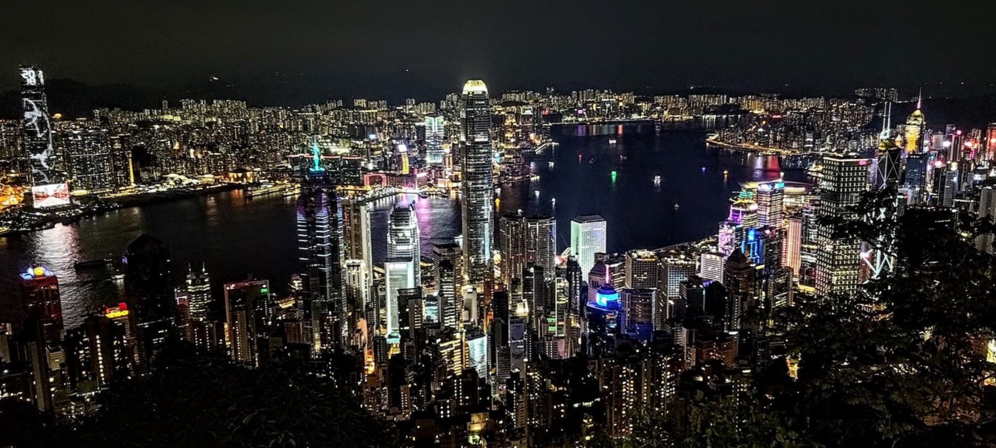
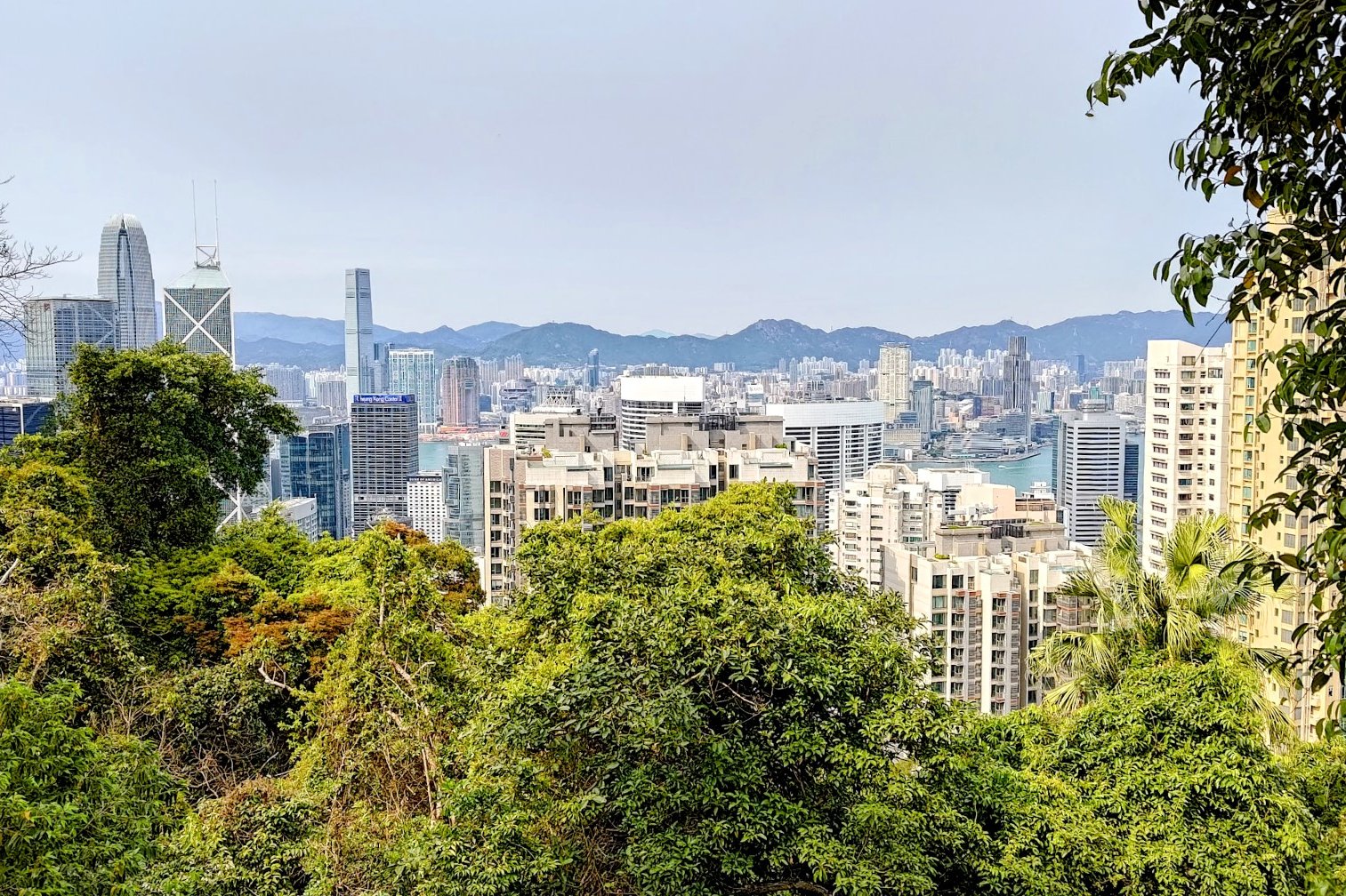
The payoff is worth it. If you time it so you reach High West about an hour before sunset, you’ll catch the sun dipping over the ocean—the views are absolutely stunning, and the staircase segments add a bit of dramatic flair to the climb.
Meanwhile, the views of the iconic Hong Kong Skyline from Lugard Road are postcard-worthy without the huge crowds at the Peak Tower.
Morning Trail, High West, and Victoria Peak Google Route Map and GPX
HKU Station to High West and The Peak GPX
The Peak to the Best Viewpoint back to HKU GPX
*Click the box icon in the top right of the map below to load the blue route directly into your own Google Maps. You can then see your location relative to the trail in real time!
Morning Trail, High West, and Victoria Peak Hiking Guide
You can find a full hiking guide below:

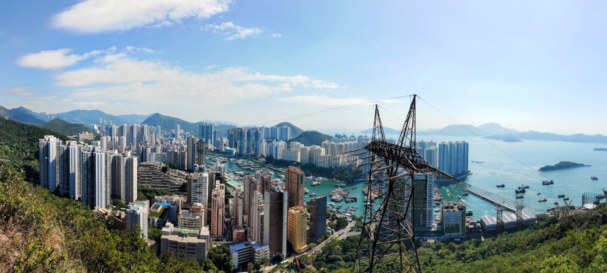
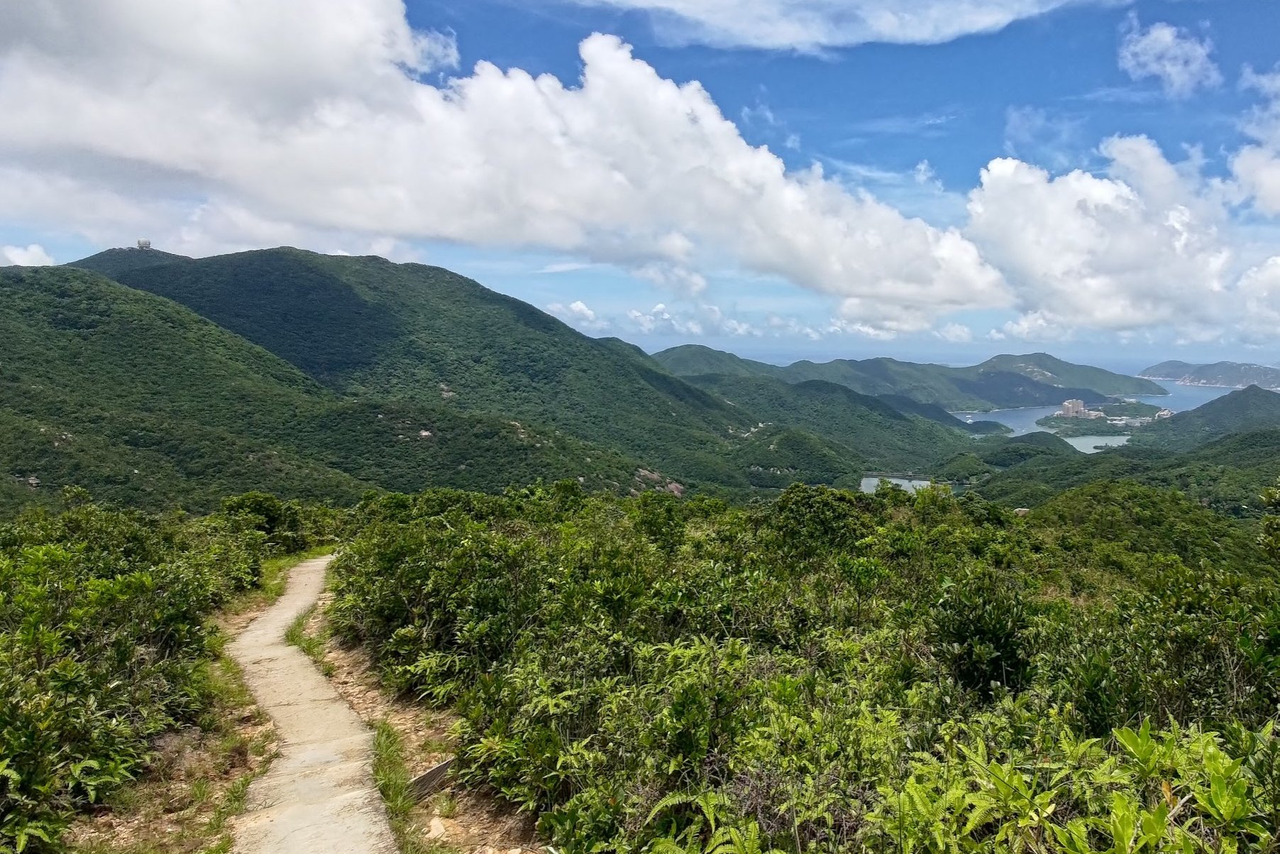
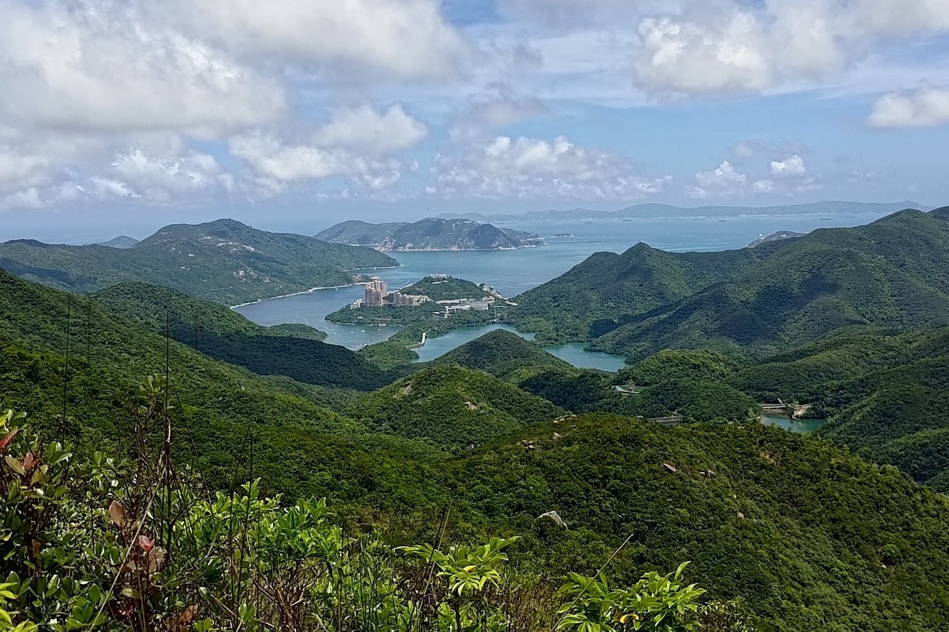
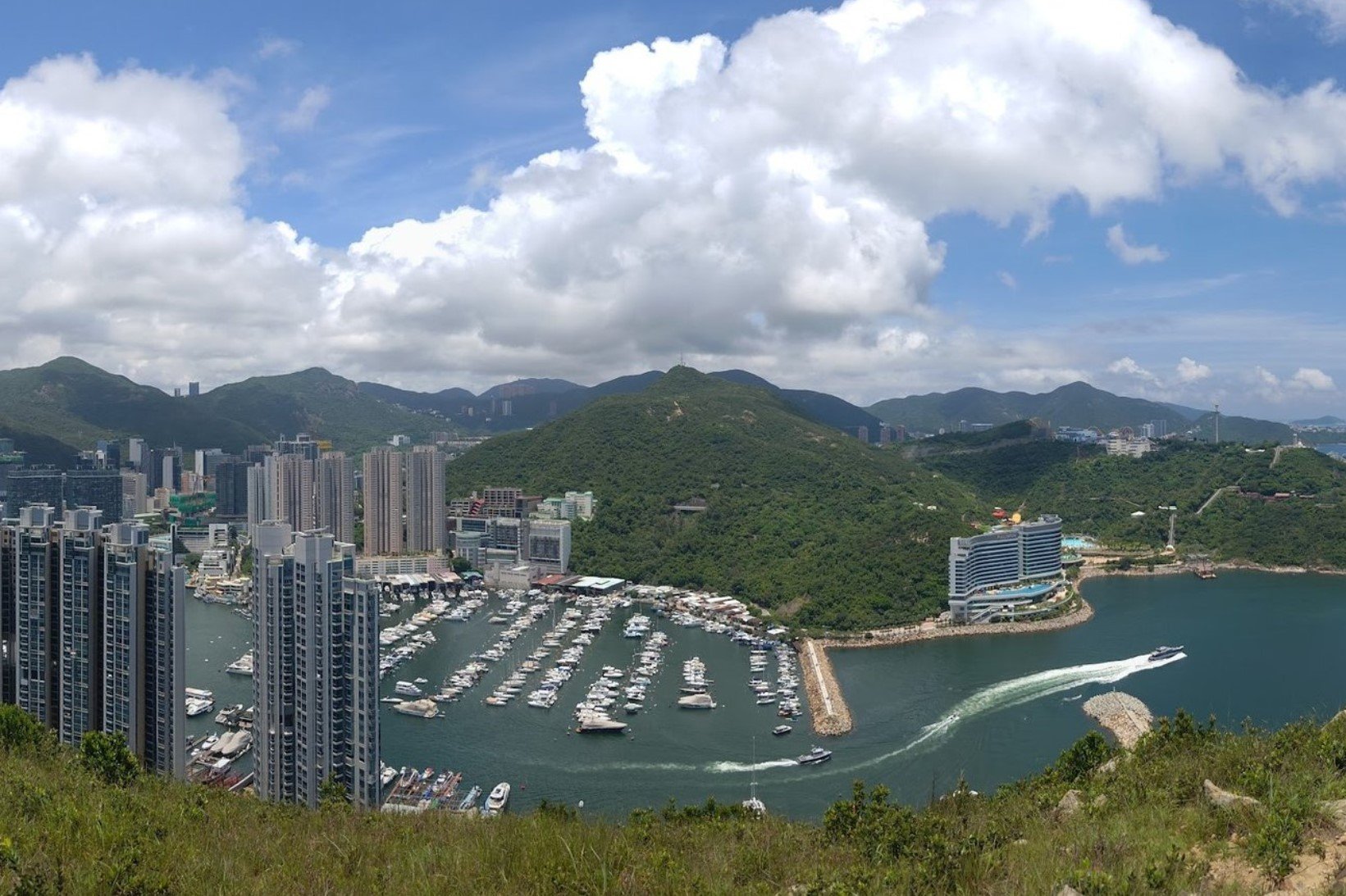
6. Quarry Bay to Tai Tam - Medium
Essential Quarry Bay to Tai Tam Reservoir Hike Details
- District: Hong Kong Island
- Duration: 3 hours (from Quarry Bay Station), 1 hour if you go to Tai Tam Reservoir directly
- Distance: 11km (with a few detours from Quarry Bay), 2-4km (if you go there directly by bus)
- Highest Elevation: 370ish meters
- Difficulty: 2.5/5 (from Quarry Bay Station), 1/5 (if you take the bus directly to the reservoir)
- Facilities: There are a few public toilets on the way up, but nowhere to buy water
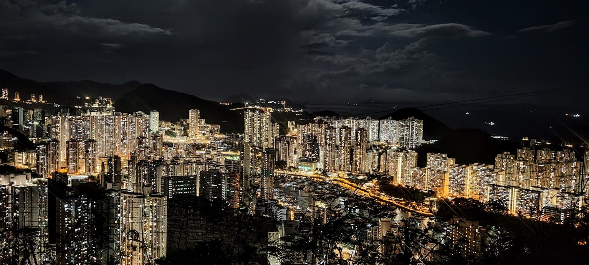
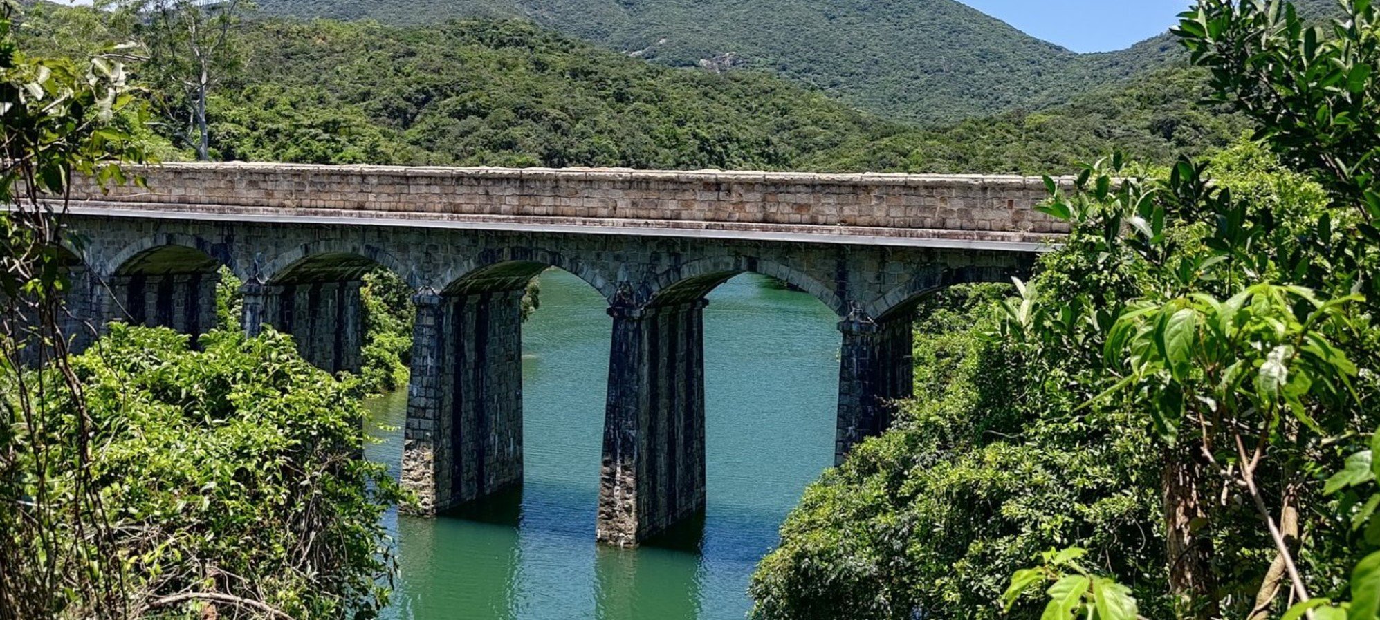
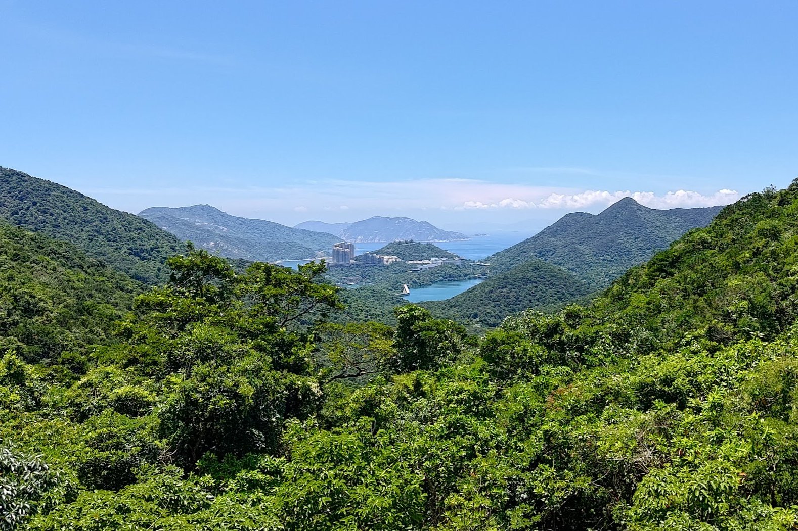
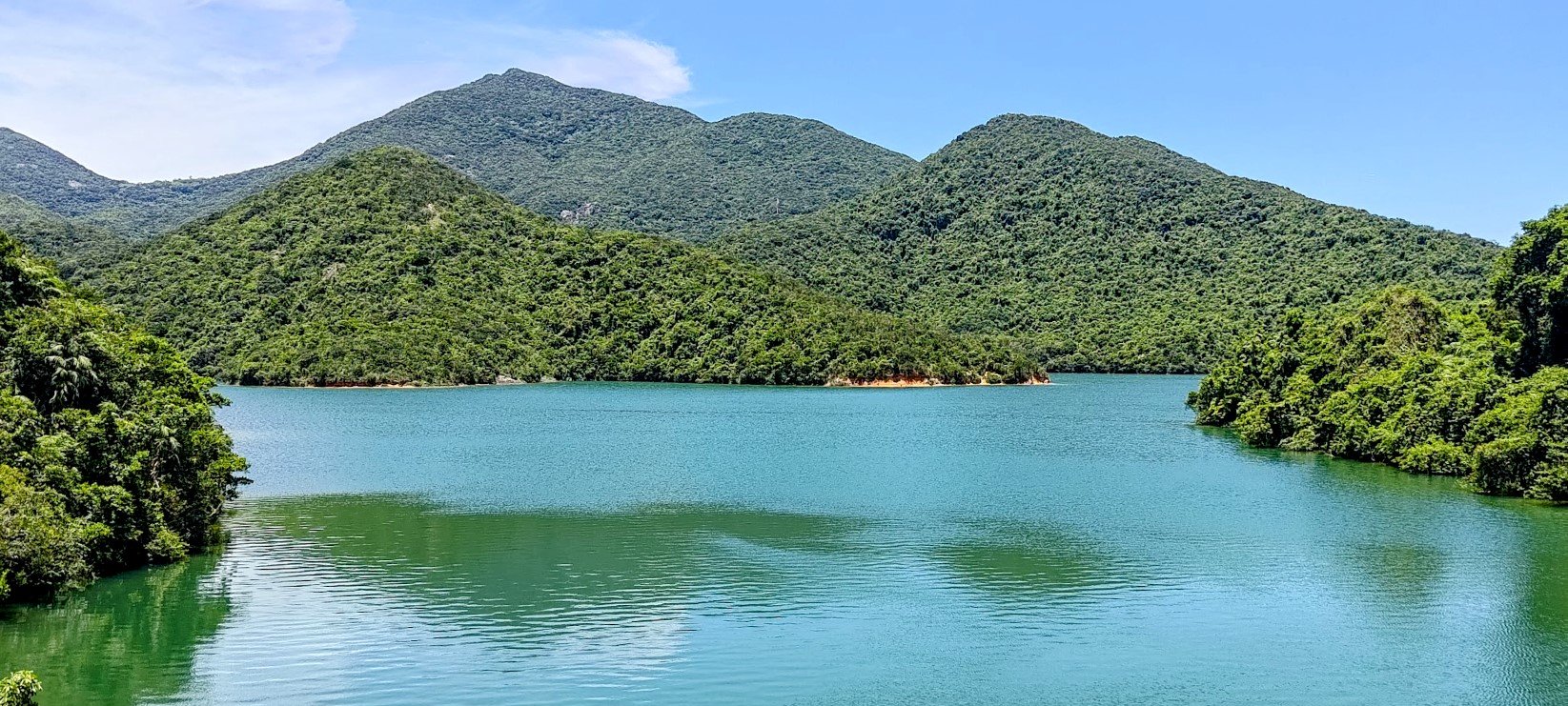
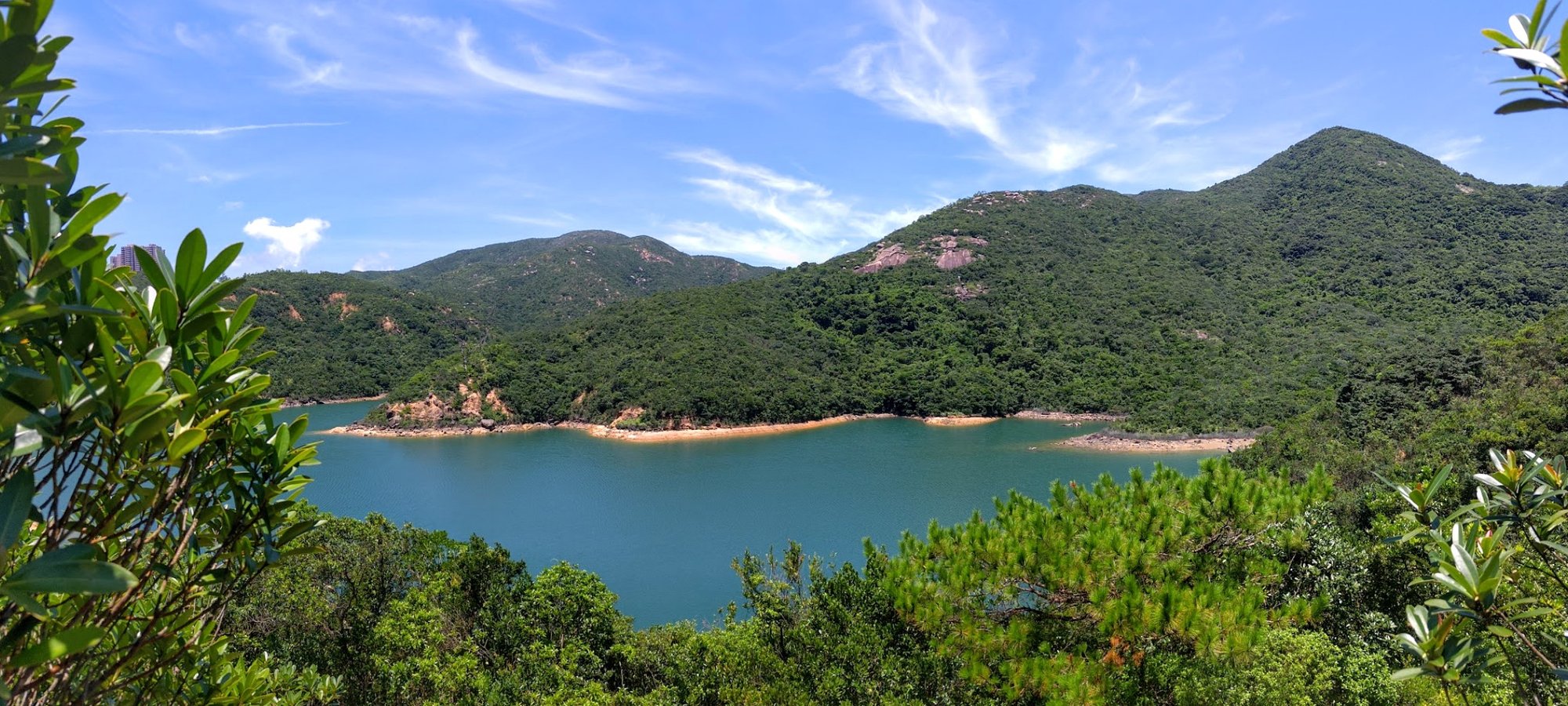
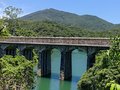
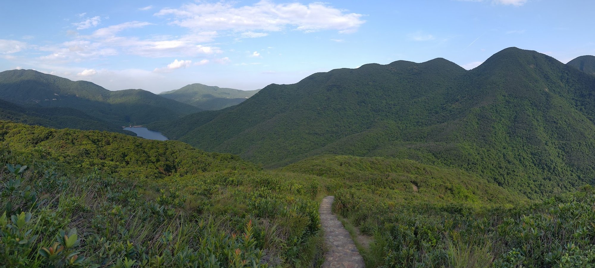
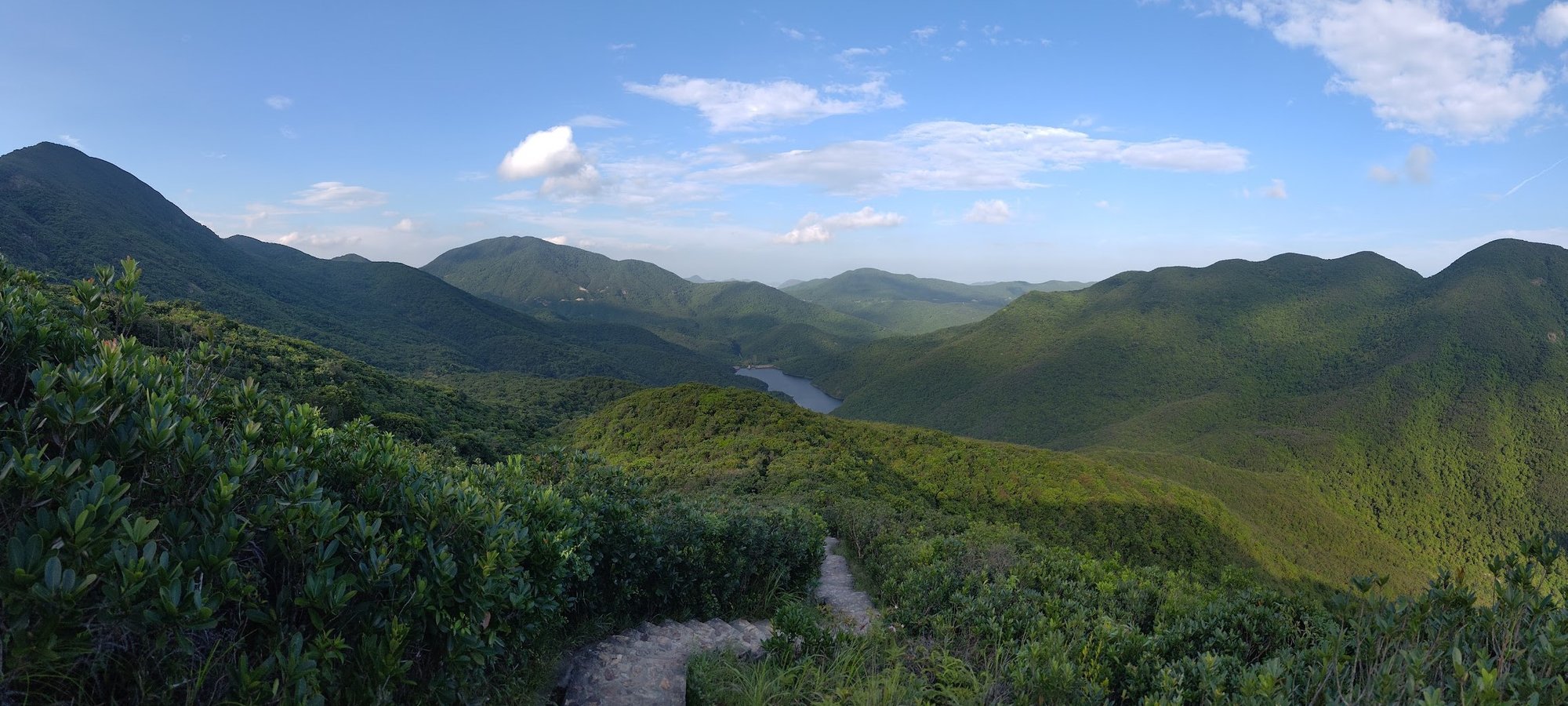
Quarry Bay to Tai Tam Reservoir is a great introduction hike for anyone curious about Hong Kong’s outdoor culture. It’s easily accessible on Hong Kong Island, starting just outside Quarry Bay MTR Station and climbing Mount Parker Road, with a few optional historical detours, before descending toward Tai Tam Reservoir. In a few hours, you’ll transition from urban sights to green mountains and then to blue waters, all in one route.
If you’d rather skip the uphill portion, you can take the number 14 bus from Sai Wan Ho MTR Station (Exit A) and alight at the Tai Tam Reservoir North stop. This turns the hike into a super-easy, peaceful walk around the reservoir (difficulty: 1/5) before returning to Tai Tam Road for the same bus back to the city.
As you go, take time to read the signs detailing the history of the bridges and the reservoir to appreciate their historical significance. Relaxing by the azure waters of the reservoir is genuinely relaxing, while also offering the chance to spot intriguing wildlife in the area.
Quarry Bay to Tai Tam Reservoir Google Route Map and GPX
Quarry Bay to Tai Tam Reservoir Hike GPX
*Click the box icon in the top right of the map below to load the blue route directly into your own Google Maps. You can then see your location relative to the trail in real time!
Quarry Bay to Tai Tam Reservoir Hiking Guide
You can find a full hiking guide below:
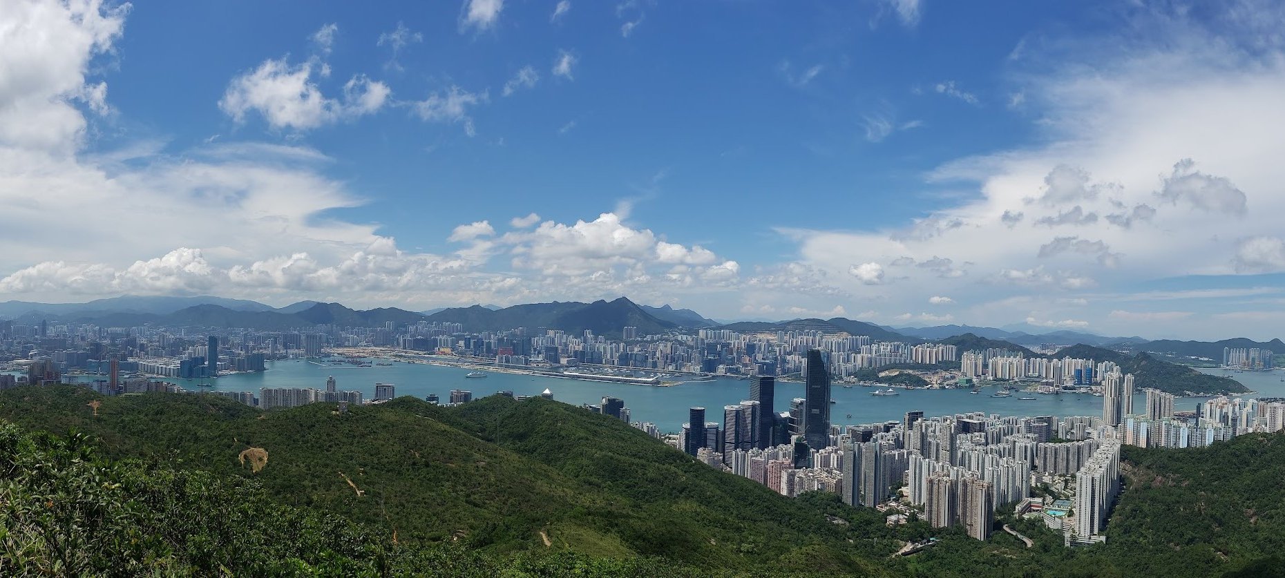
7. Jardine's Lookout and Siu Ma Shan - Medium
Essential Jardine's Lookout and Siu Ma Shan Hike Details
- District: Hong Kong Island
- Duration: 2-2.5 hours depending on the start point
- Distance: 6-7 km depending on the start point
- Highest Elevation: 424ish meters
- Difficulty: 2.5/5
- Facilities: Toilets at the start and a supermarket at Hong Kong Parkview
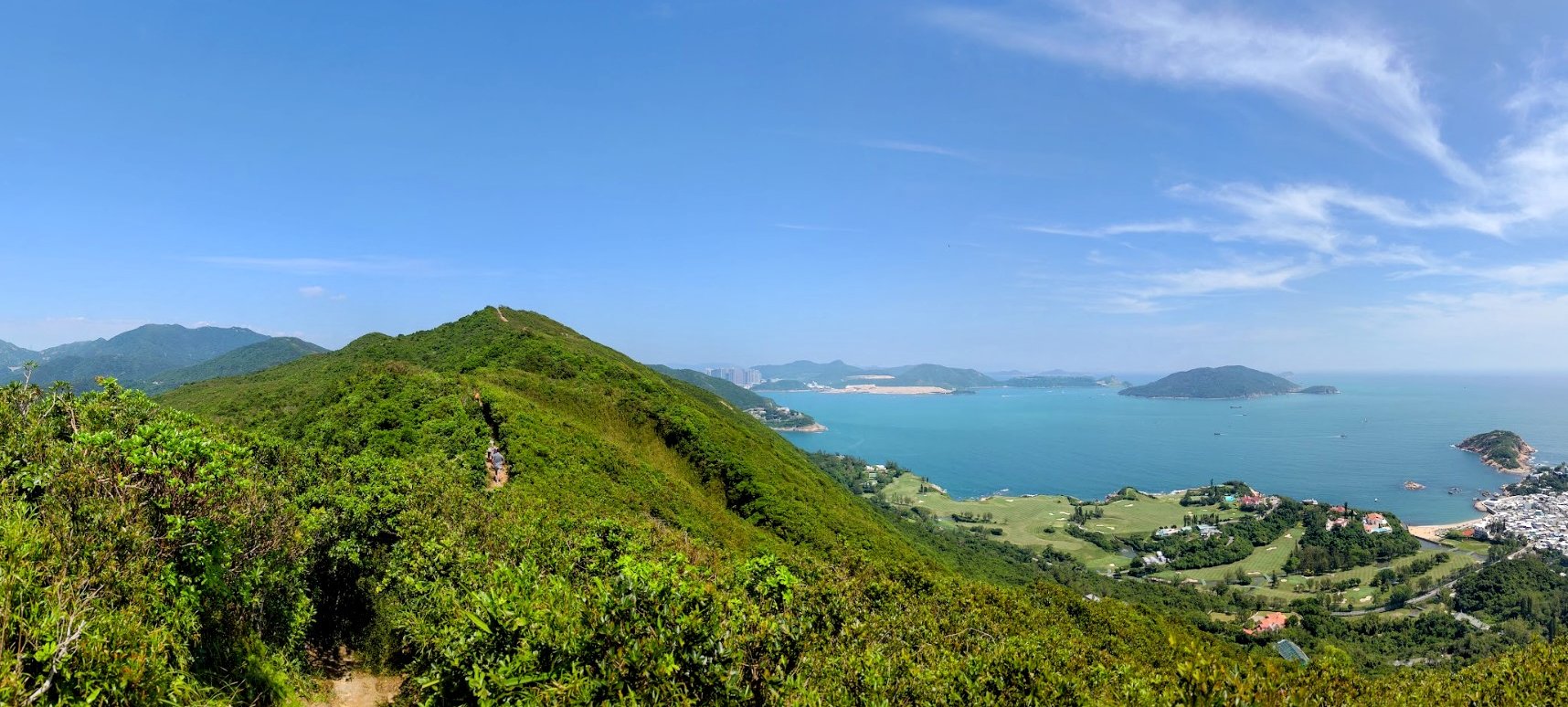
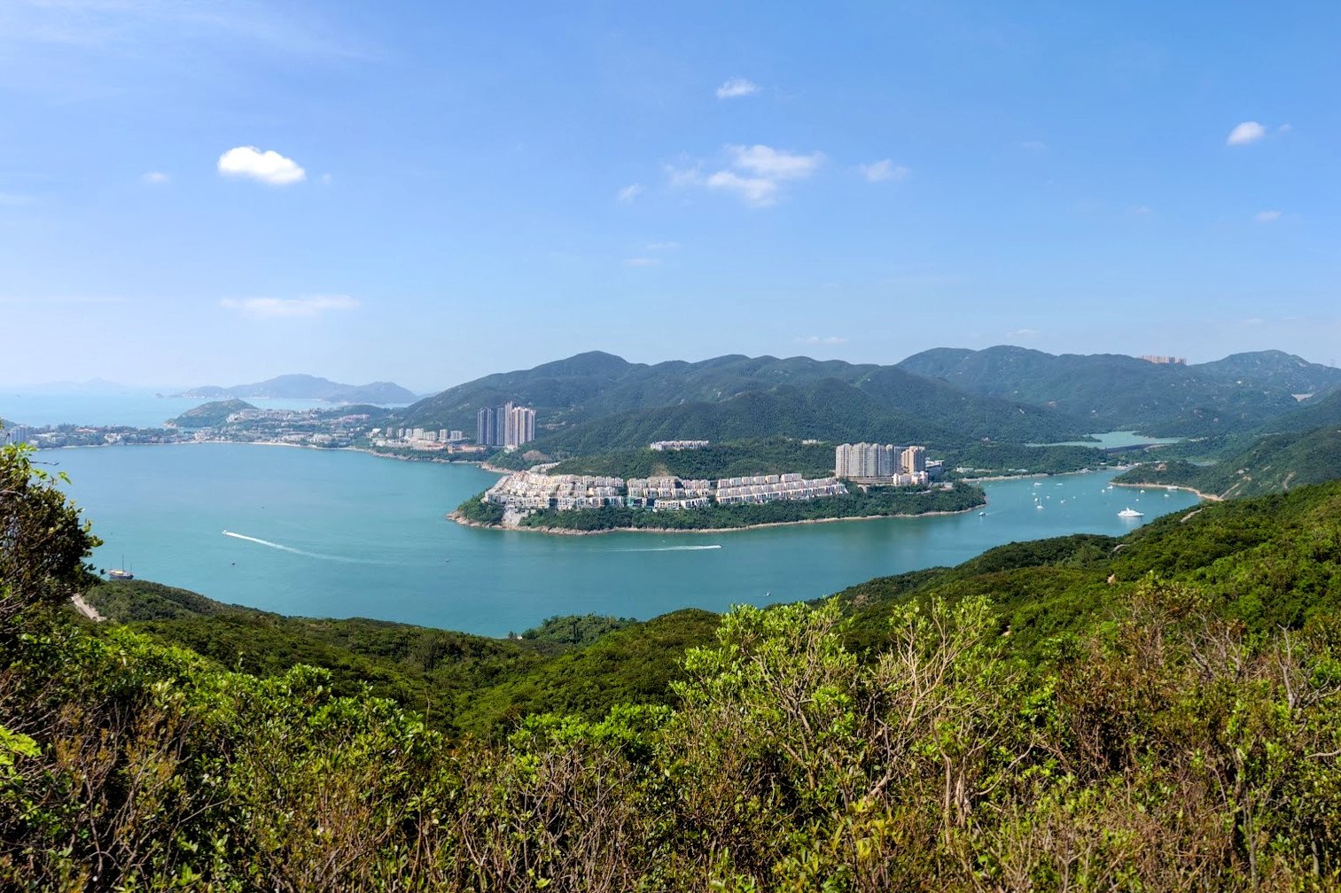
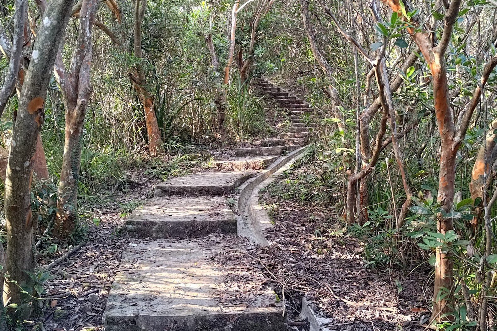
This is a medium-difficulty hike split by two steep uphill sections - Jardine's Lookout and Siu Ma Shan - that anyone with a reasonable level of fitness can tackle. Each uphill offers a unique city view that is usually not super crowded and definitely underrated! The path is mostly concrete, and the hike isn’t particularly long, making it accessible for a wide range of hikers.
It’s one of those trails I’ve returned to countless times because it offers a rare perspective on Hong Kong Island’s diverse landscapes. The city views are often the highlight, but the route also presents striking scenes of Tai Tam Reservoir and the verdant green mountains, like Mount Butler, that unfold ahead.
Witnessing such a clear contrast between Hong Kong’s frenetic city center, the lush green peaks, and the azure coastal waters makes this hike arguably far more intriguing than the typical tourist viewpoints at Victoria Peak.
Jardine's Lookout and Siu Ma Shan Google Route Map and GPX
Jardines_Lookout_and_Siu_Ma_Shan_GPX_File
*Click the box icon in the top right of the map below to load the blue route directly into your own Google Maps. You can then see your location relative to the trail in real time!
Jardine's Lookout and Siu Ma Shan Hiking Guide
You can find a full hiking guide below:
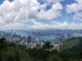
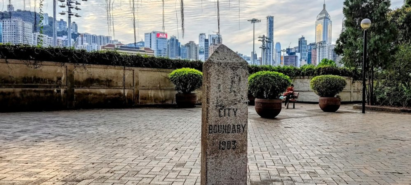
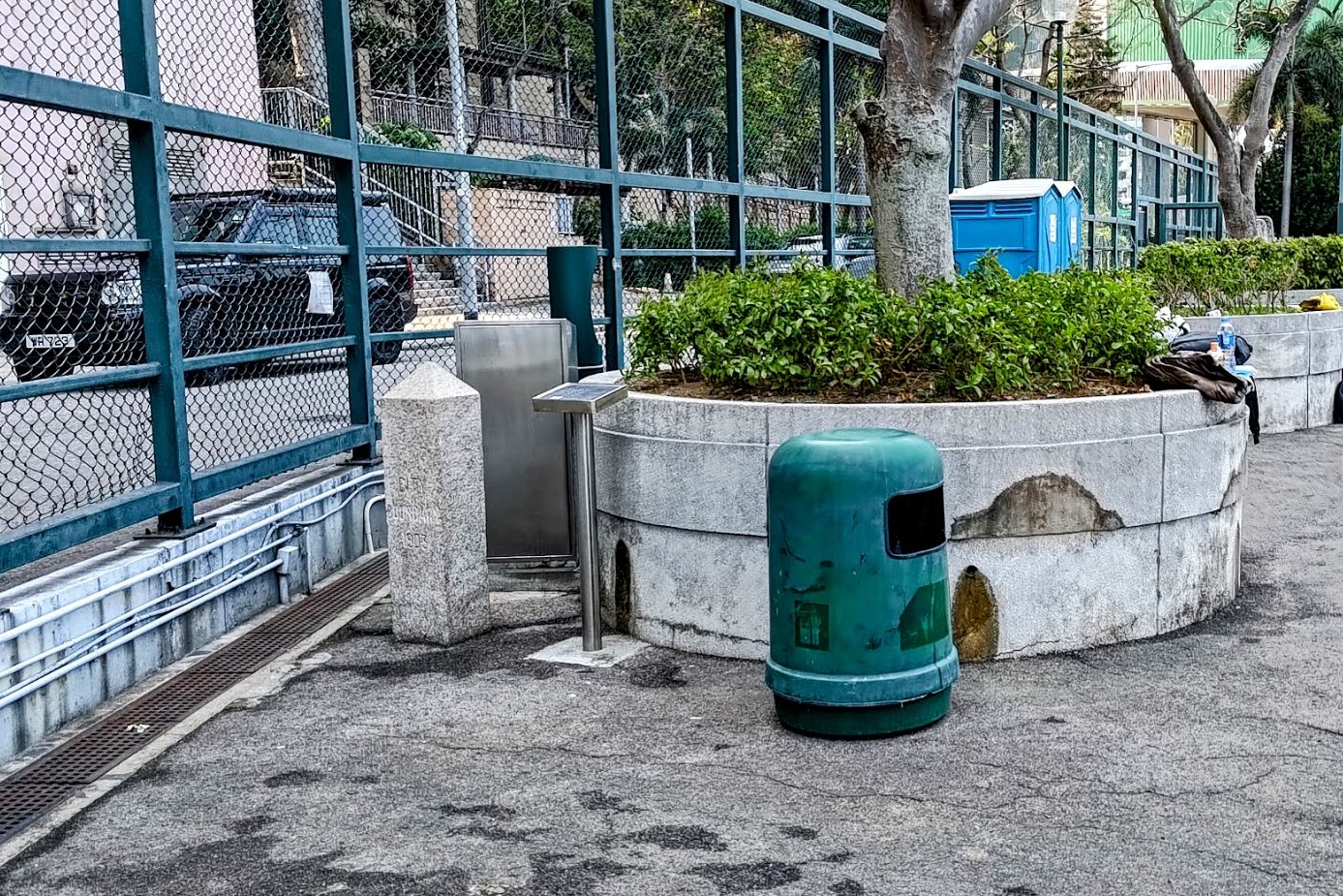
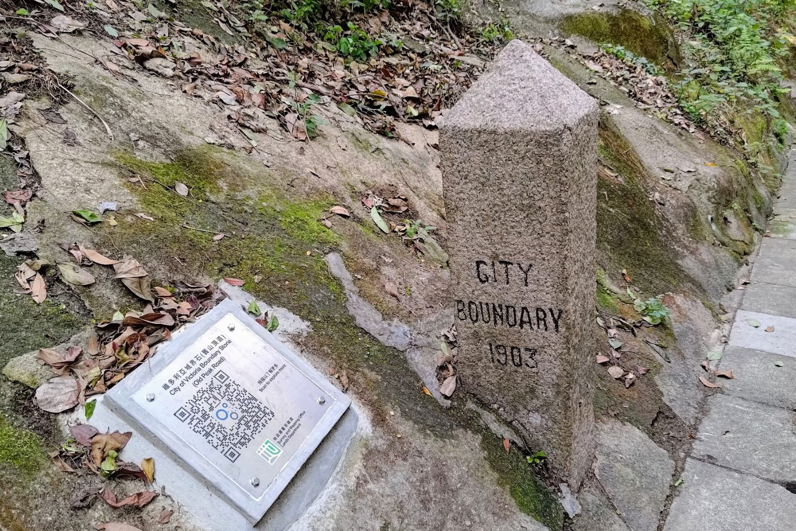
8. City of Victoria Boundary Stones Hike - Hard

Essential City of Victoria Boundary Stones Hike Details
- District: Hong Kong Island
- Duration: 5 and a half hours
- Distance: 21.5km
- Highest Elevation: 300 meters
- Difficulty: 3.5/5
- Facilities: Toilets and drinks machines at a few points throughout the trail
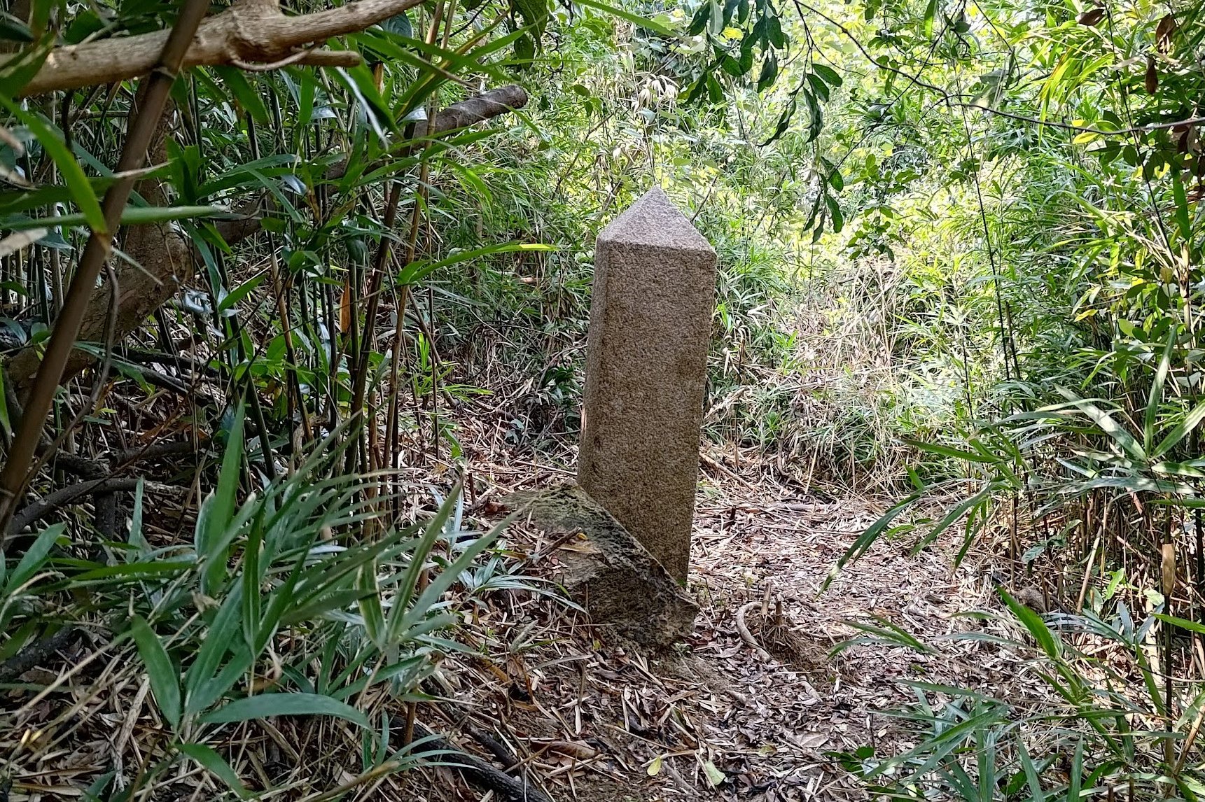
The boundary stones hike offers a rare chance to trace the historic boundary of the City of Victoria - Hong Kong’s first urban settlement - defined in 1843. It starts at the first boundary stone in Kennedy Town and ends at the ninth boundary stone in Happy Valley, following a mix of steep climbs and mostly paved roads.
For those seeking a deeper challenge, three recently rediscovered boundary stones (found in 2021) lie off the main path, hidden within dense vegetation. Reaching them requires off-trail navigation and bushwhacking - an undertaking best suited for experienced hikers. If you prefer a more accessible route, the clearly marked stones along the main trail still provide a vivid sense of the City of Victoria’s historic extent.
Regardless of the approach, you gain a unique perspective on a nearly forgotten chapter of Hong Kong’s history. Few have heard of the City of Victoria’s original boundaries, and even fewer have followed them on foot.
City of Victoria Boundary Stones Hike Google Route Map and GPX
City of Victoria Boundary Stones Hike GPX
*Click the box icon in the top right of the map below to load the blue route directly into your own Google Maps. You can then see your location relative to the trail in real time!
City of Victoria Boundary Stone Hike Hiking Guide
You can find a full hiking guide below:

9. The Twins - Hard
Essential Twins Hike Details
- District: Hong Kong Island
- Duration: 2 hours 15 mins from Stanley
- Distance: 5km
- Highest Elevation: 390ish meters
- Difficulty: 3.5/5
- Facilities: None on the trail, so stock up on water and use the toilet beforehand
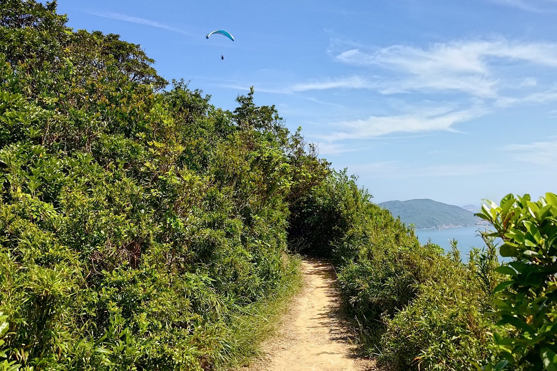
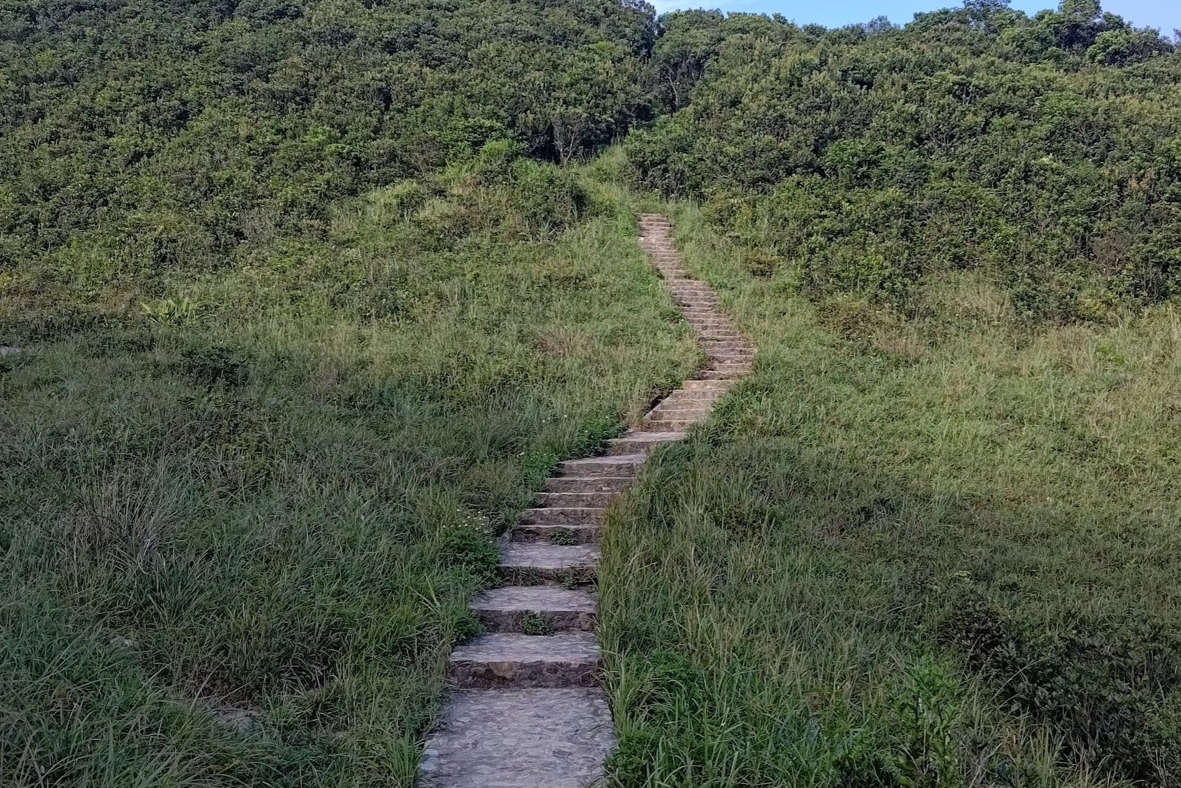
The Twins Hike (Stage 1 of the Wilson Trail) is famous for a very good reason. It features long, relentless staircases that are a cardio lover’s dream, while simultaneously being a nightmare for many hikers. You can start near Stanley or, if you prefer, begin near Hong Kong Parkview and do the trail in reverse. Whichever way you go, you’re in for three certainties: stairs, sweat, and stunning scenery.
The route is easy to follow with no real detours to complicate things. Remember to take plenty of breaks and stay hydrated, especially in the hot summer months.
As you climb, you’ll notice a delightful switch between coastal views, rolling green mountains, and impressive glass-skyscraper silhouettes in the distance. Whether you’re into ocean panoramas, lush landscapes, or urban drama, this hike delivers something that can take your breath away (literally and metaphorically).
Bottom line: the stairs steal the show, and they’re going to demand your lungs and legs a little, but the payoff is absolutely worth it.
The Twins Google Route Map and GPX
*Click the box icon in the top right of the map below to load the blue route directly into your own Google Maps. You can then see your location relative to the trail in real time!
The Twins Hiking Guide
You can find a full hiking guide below:

10. Ap Lei Chau to Ap Lei Pai Hike (Mount Johnston) - Hard
Essential Ap Lei Chau to Ap Lei Pai Hike Details
- District: Hong Kong Island
- Duration: 2.5-3 hours
- Distance: 4 km
- Highest Elevation: 198 meters
- Difficulty: 3.5/5
- Facilities: Toilets and convenience stores available at the start and end
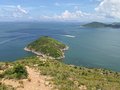
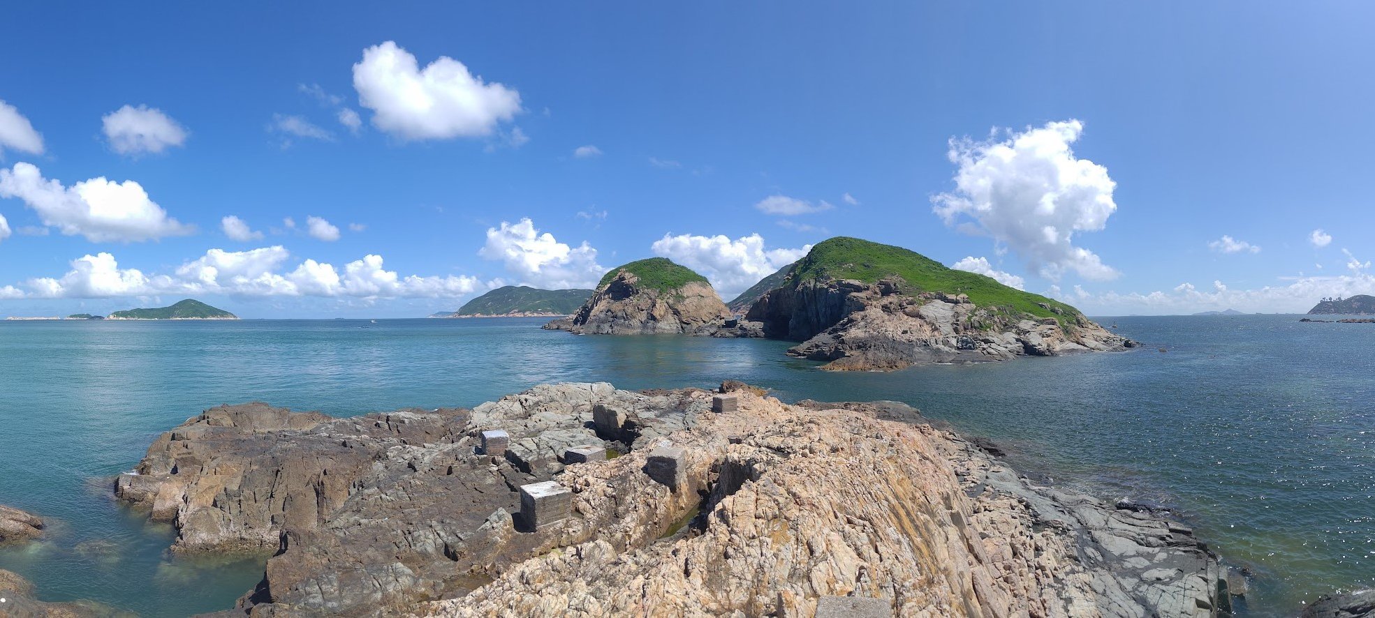
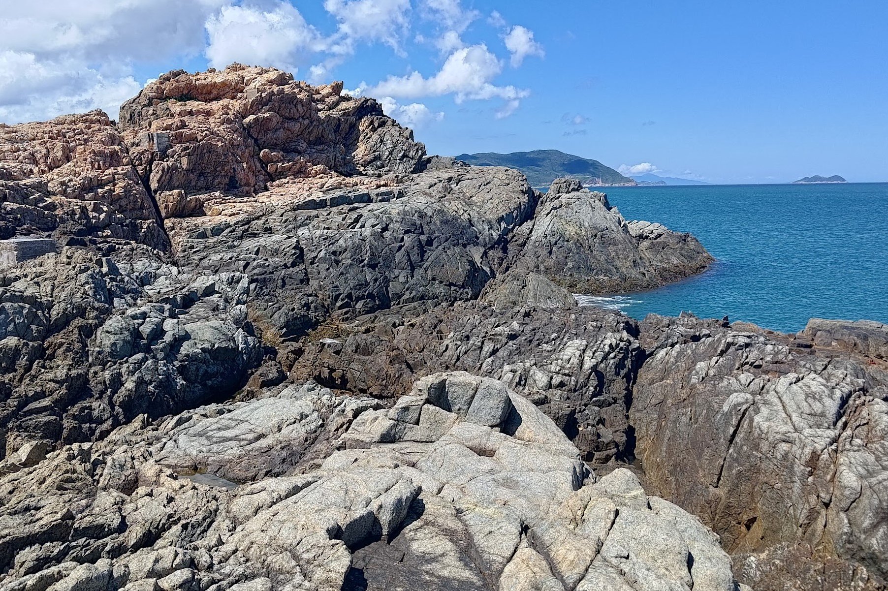
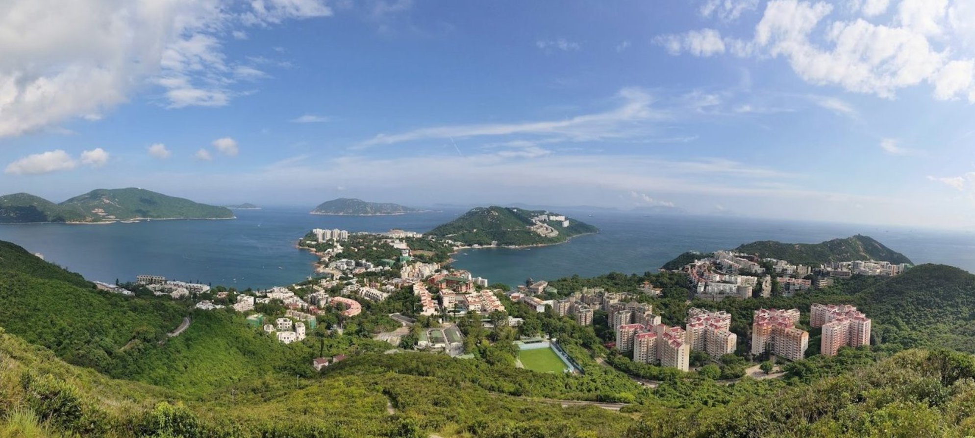
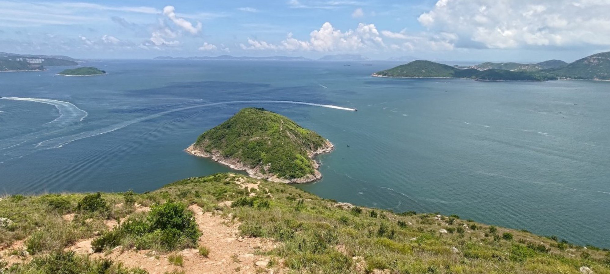
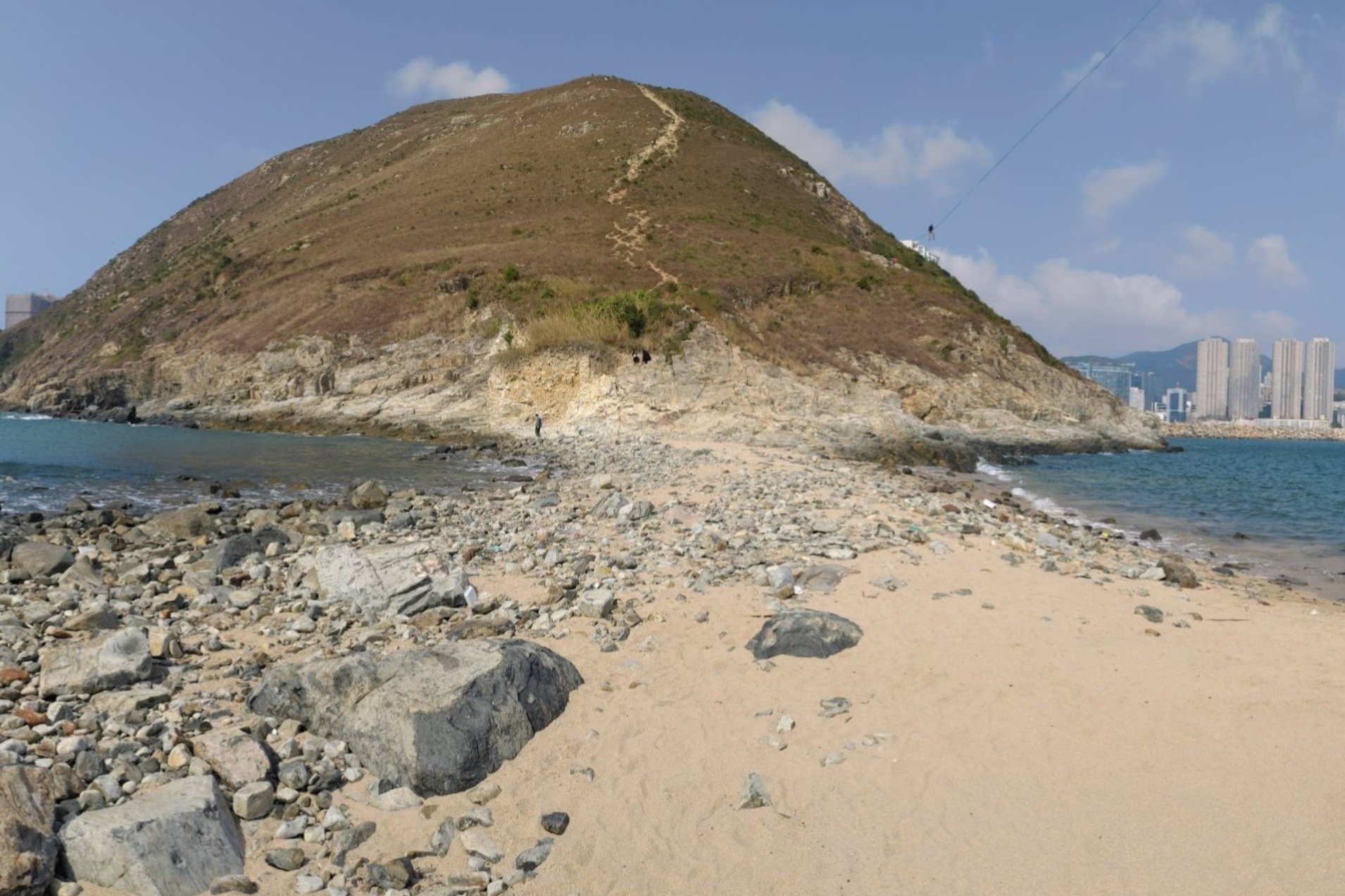
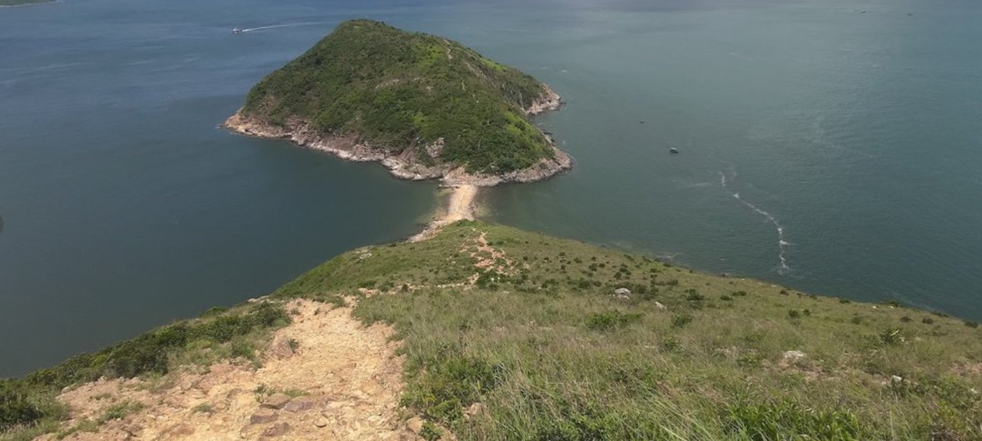
This hike from Ap Lei Chau (鴨脷洲) to Ap Lei Pai (鴨脷排) is one of Hong Kong’s most unique outdoor experiences, and it might be hard to find anything quite like it anywhere else. This is truly one of Hong Kong Island's most epic experiences!
At just 4 kilometers, it takes nearly three hours round trip because most of the route involves either steep climbs or tricky descents with few flat sections. The ascent and descent test both fitness and balance, and the terrain is often loose with rocks and debris that raise the risk of slips or twists. The hike is unshaded, so heat can be intense in summer.
This route isn’t beginners’ territory, but it’s very doable for those with intermediate to advanced hiking experience. If you’re a beginner who still wants a taste of this coastal ocean panorama, you can opt for Mount Johnston as a safer, shorter alternative—hiking to the first peak and back in about 45 minutes.
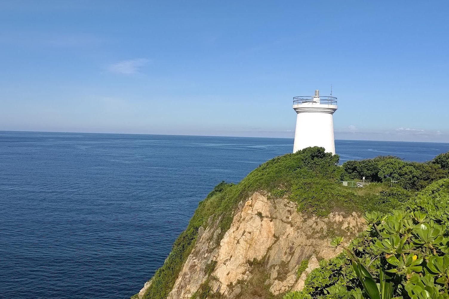
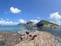
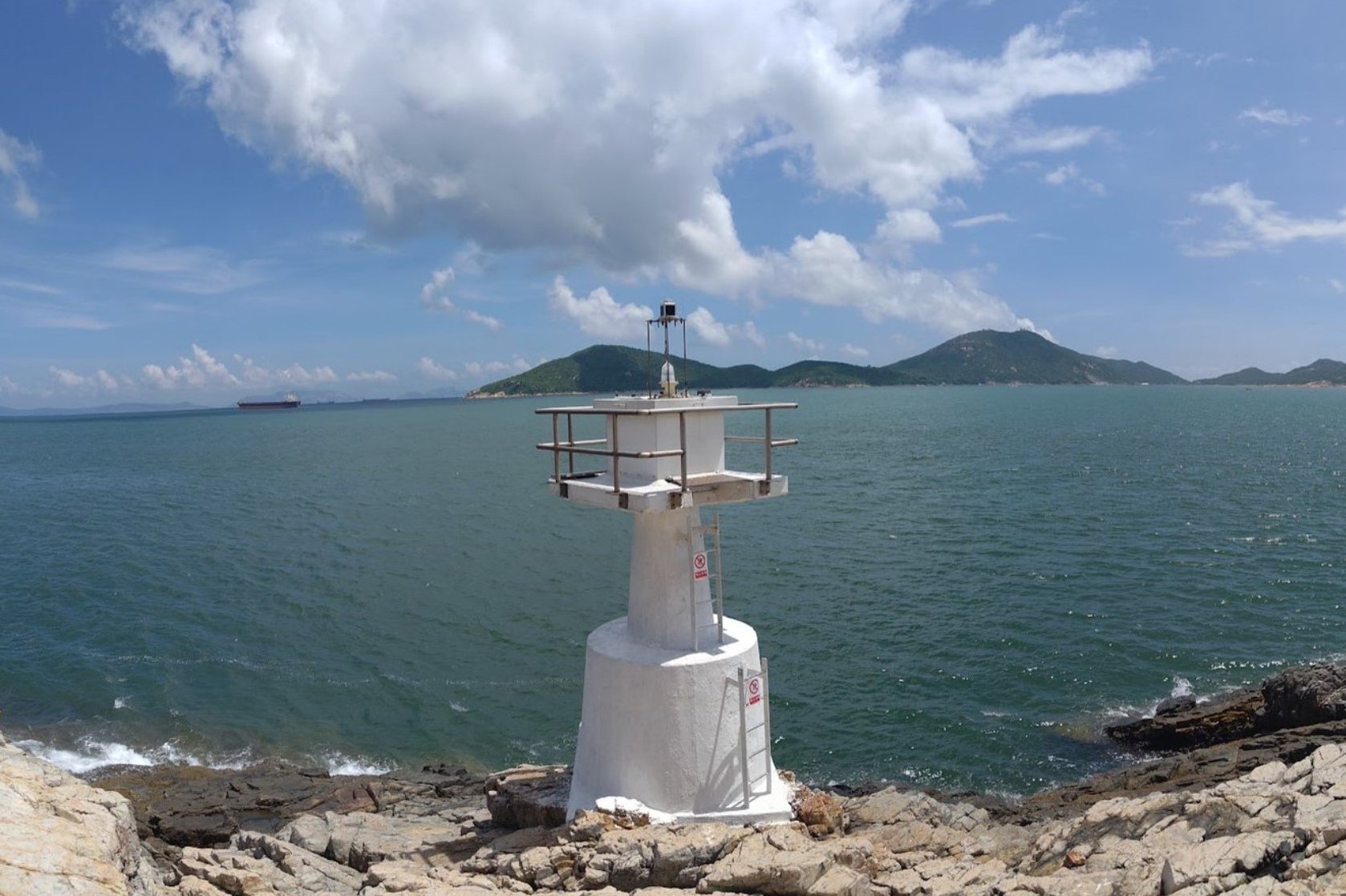
Those who opt to do this hike will experience city views, coastal waters, an incredible vista over Ap Lei Pai, a secret sandbar, and a little lighthouse at what feels like the very edge of Hong Kong Island!
Ap Lei Chau to Ap Lei Pai Google Route Map and GPX
Ap Lei Chau to Ap Lei Pai Hike GPX File
*Click the box icon in the top right of the map below to load the blue route directly into your own Google Maps. You can then see your location relative to the trail in real time!
Ap Lei Chau to Ap Lei Pai Hiking Guide
You can find a full hiking guide below: